Indiana University
Indiana University
IU
Skip to Content
Digital Collections
Toggle navigation
Digital
Collections
Switch language
English
Switch language
Deutsch
English
Español
Français
Italiano
Português do Brasil
中文
Login
Home
About
Contact
Search Digital Collections
Go
×
Search Constraints
Start Over
You searched for:
Date Created
1949
Remove constraint Date Created: 1949
« Previous |
1
-
10
of
145
|
Next »
Sort by relevance ▼
relevance ▼
recently updated
title ▲
title ▼
date created ▲
date created ▼
pages ▲
pages ▼
collection size ▲
collection size ▼
Number of results to display per page
10 per page
10
per page
20
per page
50
per page
100
per page
View results as:
List
Gallery
Masonry
Search Results
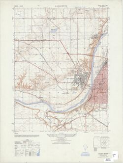
Lafayette : Indiana 1:25,000
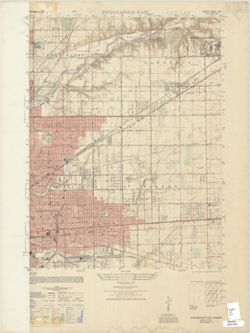
Indiana 1:25,000, Indianapolis East
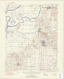
Indiana-Illinois Princeton quadrangle [1949 printing with minor corrections]
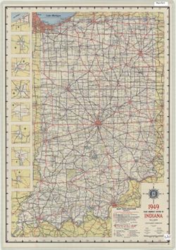
1949 state highway system of Indiana
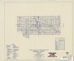
General highway and transportation map of Howard County, Indiana
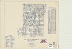
General highway and transportation map of Vigo County, Indiana
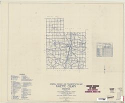
General highway and transportation map of Fayette County, Indiana
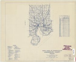
General highway and transportation map of Vanderburg County, Indiana
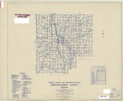
General highway and transportation map of Bartholomew County, Indiana
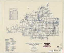
General highway and transportation map of Gibson County, Indiana
« Previous
Next »
1
2
3
4
5
…
14
15
Toggle facets
Limit your search
Type
Image
145
Creator
Indiana. State Highway Commission (1919-1953)
61
Montgomery, Pauline
5
Geological Survey (U.S.)
4
Dempsey, W. J.
2
Photographer: Blasingham, Emily Jane
2
Photographer: Kaschube, William L.
2
United States. Army Map Service
2
Goodlove, C. W.
1
H.M. Gousha Company
1
Hamlin, Guy R.
1
more
Creators
»
Subject
Topical Subject: Roads
62
Angel Mounds State Historic Site (Ind.)
51
Excavations (Archaeology)
48
Antiquities
5
Topical: Graves
5
Portraits, Group
4
Topical Subject: Lakes
4
Topical Subject: Geomagnetism
3
Topical: Photographs
3
Archaeology
2
more
Subjects
»
Publisher
State Highway Commission of Indiana
57
Geological Survey (U.S.)
4
Indiana. State Highway Commission (1919-1953)
4
United States. Army Map Service
2
H.M. Gousha Company
1
Indiana. State Highway Commission (1961-1981)
1
Seymour (Ind.). City Engineer
1
The Survey
1
Date Created
1949
[remove]
145
Pages
0-99 pages
145
Collections
Indiana Historic Maps
71
Glenn A. Black Laboratory of Archaeology Photographs
55
Robert Coughlan Photograph Collection
11
Pauline Montgomery Indiana Tombstone Photographs
5
Ralston Lantern Slides
1
Roy W. Howard Photograph Collection
1
Hoagy Carmichael Photograph Collection
1
State
deposited
145
Campus
IUB
133
IUK
11
IU Bloomington
1
County
Vanderburgh
52
Mississippi
1
New Madrid
1
Series
Groups
5
City
Salem
5
Wilson
1
Country
United States
60
France
2
Italy
1
State/Province
Indiana
58
Arkansas
1
Missouri
1
Holding Location
B-WELLS
71
B-IUMAA
55
B-ARCHIVES
5
B-LILLY
1
B-MEDIASCHOOL
1
Provenance
Part of United States. Army Map Service, Indiana 1:25,000.
2
Indiana state highway system
1
Part of Geological Survey (U.S.). Indiana 1:62,500.
1