
Search Constraints
You searched for:
Country
Германия (Восточная Пруссия) (Germany (East Prussia))
Remove constraint Country: Германия (Восточная Пруссия) (Germany (East Prussia))
Collections
Russian Military Topographic Map Collection
Remove constraint Collections: Russian Military Topographic Map Collection
« Previous |
1 - 100 of 239
|
Next »
Search Results
-
- Subject:
- Topical Subject: Maps, Geographic Subject: Grabnik, and Topical Subject: Soviet Union
- Publisher:
- Генеральный штаб Красной Армии
- Language:
- Russian
- Date Created:
- 1941
- Identifier:
- VAC9619-003864
- Genre:
- Military Maps and Topographic Maps
- Geographic Location:
- Coordinates: 53.833, 22.125, 53.917, 22.25
- Related URL:
- Catalog URL: https://iucat.iu.edu/catalog/14701157 and Download GeoTIFF: https://drive.google.com/file/d/1dqiIb0H3Fm4WqZc2KmBvWjKxfuivh1T0/view?usp=sharing
- Abstract:
- Modern area represented: Grabnik, Poland
- Call Number:
- G7063.K2 s25 .S6 sheet N-34-81-A-d
- City:
- Грабник (Grabnick)
- Copyright Holder:
- No Copyright - United States
- Country:
- Германия (Восточная Пруссия) (Germany (East Prussia))
- Physical Description:
- Scale: 1:25,000
- Persistent URL:
- http://purl.dlib.indiana.edu/iudl/images/VAC9619/VAC9619-003864
- Provenance:
- Army Map Service Library, OMAHA, Library of Congress Geography & Map Division
-
- Subject:
- Geographic Subject: Stare Juchy, Topical Subject: Soviet Union, and Topical Subject: Maps
- Publisher:
- Генеральный штаб Красной Армии
- Language:
- Russian
- Date Created:
- 1940
- Identifier:
- VAC9619-003863
- Genre:
- Topographic Maps and Military Maps
- Geographic Location:
- Coordinates: 53.917, 22.125, 54, 22.25
- Related URL:
- Download GeoTIFF: https://drive.google.com/file/d/12cnyPKgpZthYCmmj9nW5JXZbsH_4sU9Z/view?usp=sharing and Catalog URL: https://iucat.iu.edu/catalog/14701157
- Abstract:
- Modern area represented: Stare Juchy, Poland
- Call Number:
- G7063.K2 s25 .S6 sheet N-34-81-A-b
- City:
- Юха (Jucha)
- Copyright Holder:
- No Copyright - United States
- Country:
- Германия (Восточная Пруссия) (Germany (East Prussia))
- Physical Description:
- Scale: 1:25,000
- Persistent URL:
- http://purl.dlib.indiana.edu/iudl/images/VAC9619/VAC9619-003863
- Provenance:
- Army Map Service Library, OMAHA, Library of Congress Geography & Map Division
-
- Subject:
- Topical Subject: Soviet Union, Topical Subject: Maps, and Geographic Subject: Skomack Wielki
- Publisher:
- Генеральный штаб Красной Армии
- Language:
- Russian
- Date Created:
- 1940
- Identifier:
- VAC9619-003862
- Genre:
- Military Maps and Topographic Maps
- Geographic Location:
- Coordinates: 53.833, 22, 53.917, 22.125
- Related URL:
- Download GeoTIFF: https://drive.google.com/file/d/1q8gEM7NNijYQySvuZhs9PiqcGXxDDMvs/view?usp=sharing and Catalog URL: https://iucat.iu.edu/catalog/14701157
- Abstract:
- Modern area represented: Skomack Wielki, Poland
- Call Number:
- G7063.K2 s25 .S6 sheet N-34-81-A-c
- City:
- Скоматцко (Skomatzko)
- Copyright Holder:
- No Copyright - United States
- Country:
- Германия (Восточная Пруссия) (Germany (East Prussia))
- Physical Description:
- Scale: 1:25,000
- Persistent URL:
- http://purl.dlib.indiana.edu/iudl/images/VAC9619/VAC9619-003862
- Provenance:
- Army Map Service Library, OMAHA, Library of Congress Geography & Map Division
-
- Subject:
- Topical Subject: Soviet Union, Topical Subject: Maps, and Geographic Subject: Wydminy
- Publisher:
- Генеральный штаб Красной Армии
- Language:
- Russian
- Date Created:
- 1940
- Identifier:
- VAC9619-003861
- Genre:
- Topographic Maps and Military Maps
- Geographic Location:
- Coordinates: 53.917, 22, 54, 22.125
- Related URL:
- Catalog URL: https://iucat.iu.edu/catalog/14701157 and Download GeoTIFF: https://drive.google.com/file/d/1fxi4NEvJl9k-oai2W2C45LL8ErQrUgBW/view?usp=sharing
- Abstract:
- Modern area represented: Wydminy, Poland
- Call Number:
- G7063.K2 s25 .S6 sheet N-34-81-A-а
- City:
- Видминнен (Widminnen)
- Copyright Holder:
- No Copyright - United States
- Country:
- Германия (Восточная Пруссия) (Germany (East Prussia))
- Physical Description:
- Scale: 1:25,000
- Persistent URL:
- http://purl.dlib.indiana.edu/iudl/images/VAC9619/VAC9619-003861
- Provenance:
- Army Map Service Library, Library of Congress Geography & Map Division
-
- Subject:
- Topical Subject: Maps, Topical Subject: Soviet Union, and Geographic Subject: Rostki
- Publisher:
- Генеральный штаб Красной Армии
- Language:
- Russian
- Date Created:
- 1940
- Identifier:
- VAC9619-003860
- Genre:
- Military Maps and Topographic Maps
- Geographic Location:
- Coordinates: 53.667, 21.875, 53.75, 22
- Related URL:
- Catalog URL: https://iucat.iu.edu/catalog/14701157 and Download GeoTIFF: https://drive.google.com/file/d/1ZbsOReY_gJiiFND4OYgHPe5GP1y011i-/view?usp=sharing
- Abstract:
- Modern area represented: Rostki, Poland
- Call Number:
- G7063.K2 s25 .S6 sheet N-34-80-D-d
- City:
- Росткен (Rostken)
- Copyright Holder:
- No Copyright - United States
- Country:
- Германия (Восточная Пруссия) (Germany (East Prussia))
- Physical Description:
- Scale: 1:25,000
- Persistent URL:
- http://purl.dlib.indiana.edu/iudl/images/VAC9619/VAC9619-003860
- Provenance:
- Army Map Service Library, Library of Congress Geography & Map Division
-
- Subject:
- Geographic Subject: Zdory, Topical Subject: Maps, and Topical Subject: Soviet Union
- Publisher:
- Генеральный штаб Красной Армии
- Language:
- Russian
- Date Created:
- 1941
- Identifier:
- VAC9619-003859
- Genre:
- Military Maps and Topographic Maps
- Geographic Location:
- Coordinates: 53.667, 21.75, 53.75, 21.875
- Related URL:
- Download GeoTIFF: https://drive.google.com/file/d/158IB6S1p9WiJDU5Y1Y8WAm_0tt_taBKa/view?usp=sharing and Catalog URL: https://iucat.iu.edu/catalog/14701157
- Abstract:
- Modern area represented: Zdory, Poland
- Call Number:
- G7063.K2 s25 .S6 sheet N-34-80-D-c
- City:
- Здоррен (Sdorren)
- Copyright Holder:
- No Copyright - United States
- Country:
- Германия (Восточная Пруссия) (Germany (East Prussia))
- Physical Description:
- Scale: 1:25,000
- Persistent URL:
- http://purl.dlib.indiana.edu/iudl/images/VAC9619/VAC9619-003859
- Provenance:
- Army Map Service Library, OMAHA, Library of Congress Geography & Map Division
-
- Subject:
- Topical Subject: Maps, Geographic Subject: Orzysz, and Topical Subject: Soviet Union
- Publisher:
- Генеральный штаб Красной Армии
- Language:
- Russian
- Date Created:
- 1940
- Identifier:
- VAC9619-003858
- Genre:
- Topographic Maps and Military Maps
- Geographic Location:
- Coordinates: 53.75, 21.875, 53.833, 22
- Related URL:
- Catalog URL: https://iucat.iu.edu/catalog/14701157 and Download GeoTIFF: https://drive.google.com/file/d/12PE6RX05z8YGlzrGpbj7YcJ0nBkBp4GB/view?usp=sharing
- Abstract:
- Modern area represented: Orzysz, Poland
- Call Number:
- G7063.K2 s25 .S6 sheet N-34-80-D-b
- City:
- Арис (Arys)
- Copyright Holder:
- No Copyright - United States
- Country:
- Германия (Восточная Пруссия) (Germany (East Prussia))
- Physical Description:
- Scale: 1:25,000
- Persistent URL:
- http://purl.dlib.indiana.edu/iudl/images/VAC9619/VAC9619-003858
- Provenance:
- Army Map Service Library, OMAHA, Library of Congress Geography & Map Division
-
- Subject:
- Topical Subject: Soviet Union, Geographic Subject: Nowe Guty, and Topical Subject: Maps
- Publisher:
- Генеральный штаб Красной Армии
- Language:
- Russian
- Date Created:
- 1940
- Identifier:
- VAC9619-003857
- Genre:
- Military Maps and Topographic Maps
- Geographic Location:
- Coordinates: 53.75, 21.75, 53.833, 21.875
- Related URL:
- Download GeoTIFF: https://drive.google.com/file/d/1nohtqUhVA4hP49Mh0l7EVQ0FlO1TrBZ0/view?usp=sharing and Catalog URL: https://iucat.iu.edu/catalog/14701157
- Abstract:
- Modern area represented: Nowe Guty, Poland
- Call Number:
- G7063.K2 s25 .S6 sheet N-34-80-D-а
- City:
- Гуттен (Gutten)
- Copyright Holder:
- No Copyright - United States
- Country:
- Германия (Восточная Пруссия) (Germany (East Prussia))
- Physical Description:
- Scale: 1:25,000
- Persistent URL:
- http://purl.dlib.indiana.edu/iudl/images/VAC9619/VAC9619-003857
- Provenance:
- Army Map Service Library, OMAHA, Library of Congress Geography & Map Division
-
- Subject:
- Geographic Subject: Kończewo, Topical Subject: Soviet Union, and Topical Subject: Maps
- Publisher:
- Генеральный штаб Красной Армии
- Language:
- Russian
- Date Created:
- 1940
- Identifier:
- VAC9619-003856
- Genre:
- Topographic Maps and Military Maps
- Geographic Location:
- Coordinates: 53.667, 21.625, 53.75, 21.75
- Related URL:
- Download GeoTIFF: https://drive.google.com/file/d/10WYl3LeYylpld-D2biULY2h0Uh5DUgX2/view?usp=sharing and Catalog URL: https://iucat.iu.edu/catalog/14701157
- Abstract:
- Modern area represented: Kończewo, Poland
- Call Number:
- G7063.K2 s25 .S6 sheet N-34-80-C-d
- City:
- Концевен (Konzewen)
- Copyright Holder:
- No Copyright - United States
- Country:
- Германия (Восточная Пруссия) (Germany (East Prussia))
- Physical Description:
- Scale: 1:25,000
- Persistent URL:
- http://purl.dlib.indiana.edu/iudl/images/VAC9619/VAC9619-003856
- Provenance:
- Army Map Service Library, OMAHA, Library of Congress Geography & Map Division
-
- Subject:
- Topical Subject: Soviet Union, Topical Subject: Maps, and Geographic Subject: Miętkie
- Publisher:
- Генеральный штаб Красной Армии
- Language:
- Russian
- Date Created:
- 1941
- Identifier:
- VAC9619-003855
- Genre:
- Topographic Maps and Military Maps
- Geographic Location:
- Coordinates: 53.667, 21, 53.75, 21.125
- Related URL:
- Catalog URL: https://iucat.iu.edu/catalog/14701157 and Download GeoTIFF: https://drive.google.com/file/d/1Wi7I5u_8Rs7lmHpRzqUX9LxNvpBApDGN/view?usp=sharing
- Abstract:
- Modern area represented: Miętkie, Poland
- Call Number:
- G7063.K2 s25 .S6 sheet N-34-79-C-c
- City:
- Мингфен (Mingfen)
- Copyright Holder:
- No Copyright - United States
- Country:
- Германия (Восточная Пруссия) (Germany (East Prussia))
- Physical Description:
- Scale: 1:25,000
- Persistent URL:
- http://purl.dlib.indiana.edu/iudl/images/VAC9619/VAC9619-003855
- Provenance:
- Army Map Service Library, OMAHA, Library of Congress Geography & Map Division
-
- Subject:
- Topical Subject: Soviet Union, Topical Subject: Maps, and Geographic Subject: Widryny
- Publisher:
- Генеральный штаб Красной Армии
- Language:
- Russian
- Date Created:
- 1941
- Identifier:
- VAC9619-003854
- Genre:
- Topographic Maps and Military Maps
- Geographic Location:
- Coordinates: 53.917, 21.125, 54, 21.25
- Related URL:
- Download GeoTIFF: https://drive.google.com/file/d/16MtHrWOd-GHFfaWl9drrOq2XMzRE8eKm/view?usp=sharing and Catalog URL: https://iucat.iu.edu/catalog/14701157
- Abstract:
- Modern area represented: Widryny, Poland
- Call Number:
- G7063.K2 s25 .S6 sheet N-34-79-A-b
- City:
- Видриннен (Widrinnen)
- Copyright Holder:
- No Copyright - United States
- Country:
- Германия (Восточная Пруссия) (Germany (East Prussia))
- Physical Description:
- Scale: 1:25,000
- Persistent URL:
- http://purl.dlib.indiana.edu/iudl/images/VAC9619/VAC9619-003854
- Provenance:
- Army Map Service Library, Library of Congress Geography & Map Division
-
- Subject:
- Geographic Subject: Kabiny, Topical Subject: Maps, and Topical Subject: Soviet Union
- Publisher:
- Генеральный штаб Красной Армии
- Language:
- Russian
- Date Created:
- 1941
- Identifier:
- VAC9619-003853
- Genre:
- Topographic Maps and Military Maps
- Geographic Location:
- Coordinates: 53.917, 21, 54, 21.125
- Related URL:
- Download GeoTIFF: https://drive.google.com/file/d/1mY_djNT1PDLxaWoA9eMFaYEfRIuCknIY/view?usp=sharing and Catalog URL: https://iucat.iu.edu/catalog/14701157
- Abstract:
- Modern area represented: Kabiny, Poland
- Call Number:
- G7063.K2 s25 .S6 sheet N-34-79-A-а
- City:
- Кабинен (Kabienen)
- Copyright Holder:
- No Copyright - United States
- Country:
- Германия (Восточная Пруссия) (Germany (East Prussia))
- Physical Description:
- Scale: 1:25,000
- Persistent URL:
- http://purl.dlib.indiana.edu/iudl/images/VAC9619/VAC9619-003853
- Provenance:
- Army Map Service Library, Library of Congress Geography & Map Division
-
- Subject:
- Topical Subject: Soviet Union, Geographic Subject: Klewki, and Topical Subject: Maps
- Publisher:
- Генеральный штаб Красной Армии
- Language:
- Russian
- Date Created:
- 1941
- Identifier:
- VAC9619-003852
- Genre:
- Topographic Maps and Military Maps
- Geographic Location:
- Coordinates: 53.667, 20.5, 53.75, 20.625
- Related URL:
- Catalog URL: https://iucat.iu.edu/catalog/14701157 and Download GeoTIFF: https://drive.google.com/file/d/1UZOUulmfPwT51hSED3aArz2teyl9TZpM/view?usp=sharing
- Abstract:
- Modern area represented: Klewki, Poland
- Call Number:
- G7063.K2 s25 .S6 sheet N-34-78-C-c
- City:
- Клаукендорф (Klaukendorf)
- Copyright Holder:
- No Copyright - United States
- Country:
- Германия (Восточная Пруссия) (Germany (East Prussia))
- Physical Description:
- Scale: 1:25,000
- Persistent URL:
- http://purl.dlib.indiana.edu/iudl/images/VAC9619/VAC9619-003852
- Provenance:
- Army Map Service Library, OMAHA, Library of Congress Geography & Map Division
-
- Subject:
- Topical Subject: Soviet Union, Topical Subject: Maps, and Geographic Subject: Barczewo
- Publisher:
- Генеральный штаб Красной Армии
- Language:
- Russian
- Date Created:
- 1941
- Identifier:
- VAC9619-003851
- Genre:
- Military Maps and Topographic Maps
- Geographic Location:
- Coordinates: 53.75, 20.625, 53.833, 20.75
- Related URL:
- Catalog URL: https://iucat.iu.edu/catalog/14701157 and Download GeoTIFF: https://drive.google.com/file/d/1qZDnTeGOS2_kUhEoyXcdprDKgWIp0boO/view?usp=sharing
- Abstract:
- Modern area represented: Barczewo, Poland
- Call Number:
- G7063.K2 s25 .S6 sheet N-34-78-C-b
- City:
- Вартенбург (Wartenburg)
- Copyright Holder:
- No Copyright - United States
- Country:
- Германия (Восточная Пруссия) (Germany (East Prussia))
- Physical Description:
- Scale: 1:25,000
- Persistent URL:
- http://purl.dlib.indiana.edu/iudl/images/VAC9619/VAC9619-003851
- Provenance:
- Army Map Service Library, OMAHA, Library of Congress Geography & Map Division
-
- Subject:
- Topical Subject: Soviet Union, Topical Subject: Maps, and Geographic Subject: Klebark Wielki
- Publisher:
- Генеральный штаб Красной Армии
- Language:
- Russian
- Date Created:
- 1941
- Identifier:
- VAC9619-003850
- Genre:
- Topographic Maps and Military Maps
- Geographic Location:
- Coordinates: 53.75, 20.5, 53.833, 20.625
- Related URL:
- Catalog URL: https://iucat.iu.edu/catalog/14701157 and Download GeoTIFF: https://drive.google.com/file/d/1SKN4W4sw7LuNukzFteqWEUZXLrlmCpBv/view?usp=sharing
- Abstract:
- Modern area represented: Klebark Wielki, Poland
- Call Number:
- G7063.K2 s25 .S6 sheet N-34-78-C-а
- City:
- Гросс Клееберг (Gross Kleeberg)
- Copyright Holder:
- No Copyright - United States
- Country:
- Германия (Восточная Пруссия) (Germany (East Prussia))
- Physical Description:
- Scale: 1:25,000
- Persistent URL:
- http://purl.dlib.indiana.edu/iudl/images/VAC9619/VAC9619-003850
- Provenance:
- Army Map Service Library, OMAHA, Library of Congress Geography & Map Division
-
- Subject:
- Topical Subject: Soviet Union, Topical Subject: Maps, and Geographic Subject: Biskupiec
- Publisher:
- Генеральный штаб Красной Армии
- Language:
- Russian
- Date Created:
- 1941
- Identifier:
- VAC9619-003849
- Genre:
- Topographic Maps and Military Maps
- Geographic Location:
- Coordinates: 53.833, 20.875, 53.913, 21
- Related URL:
- Download GeoTIFF: https://drive.google.com/file/d/1lkchlLdgO50gEDXB1dQFZtZbb1kLWXVC/view?usp=sharing and Catalog URL: https://iucat.iu.edu/catalog/14701157
- Abstract:
- Modern area represented: Biskupiec, Poland
- Call Number:
- G7063.K2 s25 .S6 sheet N-34-78-B-d
- City:
- Бишофсбург (Bischofsburg)
- Copyright Holder:
- No Copyright - United States
- Country:
- Германия (Восточная Пруссия) (Germany (East Prussia))
- Physical Description:
- Scale: 1:25,000
- Persistent URL:
- http://purl.dlib.indiana.edu/iudl/images/VAC9619/VAC9619-003849
- Provenance:
- Army Map Service Library, OMAHA, Library of Congress Geography & Map Division
-
- Subject:
- Topical Subject: Maps, Topical Subject: Soviet Union, and Geographic Subject: Wipsowo
- Publisher:
- Генеральный штаб Красной Армии
- Language:
- Russian
- Date Created:
- 1940
- Identifier:
- VAC9619-003848
- Genre:
- Topographic Maps and Military Maps
- Geographic Location:
- Coordinates: 53.833, 20.75, 53.913, 20.875
- Related URL:
- Download GeoTIFF: https://drive.google.com/file/d/1JhRBqsg1tIs_iMj_4P7lUuGTmiI3bTuM/view?usp=sharing and Catalog URL: https://iucat.iu.edu/catalog/14701157
- Abstract:
- Modern area represented: Wipsowo, Poland
- Call Number:
- G7063.K2 s25 .S6 sheet N-34-78-B-c
- City:
- Випс (Wieps)
- Copyright Holder:
- No Copyright - United States
- Country:
- Германия (Восточная Пруссия) (Germany (East Prussia))
- Physical Description:
- Scale: 1:25,000
- Persistent URL:
- http://purl.dlib.indiana.edu/iudl/images/VAC9619/VAC9619-003848
- Provenance:
- Army Map Service Library, OMAHA, Library of Congress Geography & Map Division
-
- Subject:
- Topical Subject: Soviet Union, Topical Subject: Maps, and Geographic Subject: Kolno
- Publisher:
- Генеральный штаб Красной Армии
- Language:
- Russian
- Date Created:
- 1940
- Identifier:
- VAC9619-003847
- Genre:
- Military Maps and Topographic Maps
- Geographic Location:
- Coordinates: 53.913, 20.875, 54, 21
- Related URL:
- Download GeoTIFF: https://drive.google.com/file/d/1uStdeTNr1-57qca3X-EimLVaT_kNL9eV/view?usp=sharing and Catalog URL: https://iucat.iu.edu/catalog/14701157
- Abstract:
- Modern area represented: Kolno, Poland
- Call Number:
- G7063.K2 s25 .S6 sheet N-34-78-B-b
- City:
- Гросс Кёллен (Gross Köllen)
- Copyright Holder:
- No Copyright - United States
- Country:
- Германия (Восточная Пруссия) (Germany (East Prussia))
- Physical Description:
- Scale: 1:25,000
- Persistent URL:
- http://purl.dlib.indiana.edu/iudl/images/VAC9619/VAC9619-003847
- Provenance:
- Army Map Service Library, OMAHA, Library of Congress Geography & Map Division
-
- Subject:
- Topical Subject: Soviet Union, Topical Subject: Maps, and Geographic Subject: Miejska Wieś
- Publisher:
- Генеральный штаб Красной Армии
- Language:
- Russian
- Date Created:
- 1940
- Identifier:
- VAC9619-003846
- Genre:
- Topographic Maps and Military Maps
- Geographic Location:
- Coordinates: 53.913, 20.75, 54, 20.875
- Related URL:
- Catalog URL: https://iucat.iu.edu/catalog/14701157 and Download GeoTIFF: https://drive.google.com/file/d/1WqkOKwlyd7YOTSbtD8mkzjtOpQ3Qs4Dy/view?usp=sharing
- Abstract:
- Modern area represented: Miejska Wieś, Poland
- Call Number:
- G7063.K2 s25 .S6 sheet N-34-78-B-а
- City:
- Бюргерсдорф (Bürgerdorf)
- Copyright Holder:
- No Copyright - United States
- Country:
- Германия (Восточная Пруссия) (Germany (East Prussia))
- Physical Description:
- Scale: 1:25,000
- Persistent URL:
- http://purl.dlib.indiana.edu/iudl/images/VAC9619/VAC9619-003846
- Provenance:
- Army Map Service Library, OMAHA, Library of Congress Geography & Map Division
-
- Subject:
- Topical Subject: Maps, Topical Subject: Soviet Union, and Geographic Subject: Ruszajny
- Publisher:
- Генеральный штаб Красной Армии
- Language:
- Russian
- Date Created:
- 1941
- Identifier:
- VAC9619-003845
- Genre:
- Military Maps and Topographic Maps
- Geographic Location:
- Coordinates: 53.833, 20.625, 53.913, 20.75
- Related URL:
- Catalog URL: https://iucat.iu.edu/catalog/14701157 and Download GeoTIFF: https://drive.google.com/file/d/1UTwgGHVK2kIxV06XJJoGQznCwFNhZ9qB/view?usp=sharing
- Abstract:
- Modern area represented: Ruszajny, Poland
- Call Number:
- G7063.K2 s25 .S6 sheet N-34-78-A-d
- City:
- Ройшгаген (Reuschhagen)
- Copyright Holder:
- No Copyright - United States
- Country:
- Германия (Восточная Пруссия) (Germany (East Prussia))
- Physical Description:
- Scale: 1:25,000
- Persistent URL:
- http://purl.dlib.indiana.edu/iudl/images/VAC9619/VAC9619-003845
- Provenance:
- Army Map Service Library, OMAHA, Library of Congress Geography & Map Division
-
- Subject:
- Topical Subject: Maps, Topical Subject: Soviet Union, and Geographic Subject: Barczewko
- Publisher:
- Генеральный штаб Красной Армии
- Language:
- Russian
- Date Created:
- 1941
- Identifier:
- VAC9619-003844
- Genre:
- Topographic Maps and Military Maps
- Geographic Location:
- Coordinates: 53.833, 20.5, 53.913, 20.625
- Related URL:
- Catalog URL: https://iucat.iu.edu/catalog/14701157 and Download GeoTIFF: https://drive.google.com/file/d/1TOFj8Y7-YFpcDSj-mMadZFq5HPdDau76/view?usp=sharing
- Abstract:
- Modern area represented: Barczewko, Poland
- Call Number:
- G7063.K2 s25 .S6 sheet N-34-78-A-c
- City:
- Альт Вартенбург (Alt Wartenburg)
- Copyright Holder:
- No Copyright - United States
- Country:
- Германия (Восточная Пруссия) (Germany (East Prussia))
- Physical Description:
- Scale: 1:25,000
- Persistent URL:
- http://purl.dlib.indiana.edu/iudl/images/VAC9619/VAC9619-003844
- Provenance:
- Army Map Service Library, OMAHA, Library of Congress Geography & Map Division
-
- Subject:
- Topical Subject: Maps, Topical Subject: Soviet Union, and Geographic Subject: Jeziorany
- Publisher:
- Генеральный штаб Красной Армии
- Language:
- Russian
- Date Created:
- 1941
- Identifier:
- VAC9619-003843
- Genre:
- Topographic Maps and Military Maps
- Geographic Location:
- Coordinates: 53.913, 20.625, 54, 20.75
- Related URL:
- Download GeoTIFF: https://drive.google.com/file/d/1iKCMamwKh-aLSokB2xhy94EcsQkYixxe/view?usp=sharing and Catalog URL: https://iucat.iu.edu/catalog/14701157
- Abstract:
- Modern area represented: Jeziorany, Poland
- Call Number:
- G7063.K2 s25 .S6 sheet N-34-78-A-b
- City:
- Зеебург
- Copyright Holder:
- No Copyright - United States
- Country:
- Германия (Восточная Пруссия) (Germany (East Prussia))
- Physical Description:
- Scale: 1:25,000
- Persistent URL:
- http://purl.dlib.indiana.edu/iudl/images/VAC9619/VAC9619-003843
- Provenance:
- Army Map Service Library, Library of Congress Geography & Map Division
-
- Subject:
- Topical Subject: Soviet Union, Topical Subject: Maps, and Geographic Subject: Radostowo
- Publisher:
- Генеральный штаб Красной Армии
- Language:
- Russian
- Date Created:
- 1941
- Identifier:
- VAC9619-003842
- Genre:
- Topographic Maps and Military Maps
- Geographic Location:
- Coordinates: 53.913, 20.5, 54, 20.625
- Related URL:
- Download GeoTIFF: https://drive.google.com/file/d/1Q42WKZgyut7Vjb6FeV4hyfkdWhWOYAhI/view?usp=sharing and Catalog URL: https://iucat.iu.edu/catalog/14701157
- Abstract:
- Modern area represented: Radostowo, Poland
- Call Number:
- G7063.K2 s25 .S6 sheet N-34-78-A-а
- City:
- Фройденберг
- Copyright Holder:
- No Copyright - United States
- Country:
- Германия (Восточная Пруссия) (Germany (East Prussia))
- Physical Description:
- Scale: 1:25,000
- Persistent URL:
- http://purl.dlib.indiana.edu/iudl/images/VAC9619/VAC9619-003842
- Provenance:
- Army Map Service Library, Library of Congress Geography & Map Division
-
- Subject:
- Topical Subject: Maps, Topical Subject: Soviet Union, and Geographic Subject: Bartąg
- Publisher:
- Генеральный штаб Красной Армии
- Language:
- Russian
- Date Created:
- 1941
- Identifier:
- VAC9619-003841
- Genre:
- Topographic Maps and Military Maps
- Geographic Location:
- Coordinates: 53.667, 20.375, 53.75, 20.5
- Related URL:
- Catalog URL: https://iucat.iu.edu/catalog/14701157 and Download GeoTIFF: https://drive.google.com/file/d/1WqR5LD2-Xg0o_vwwCyYI4QcDwq26aY7c/view?usp=sharing
- Abstract:
- Modern area represented: Bartąg, Poland
- Call Number:
- G7063.K2 s25 .S6 sheet N-34-77-D-d
- City:
- Гросс Бертунг (Gross Bertung)
- Copyright Holder:
- No Copyright - United States
- Country:
- Германия (Восточная Пруссия) (Germany (East Prussia))
- Physical Description:
- Scale: 1:25,000
- Persistent URL:
- http://purl.dlib.indiana.edu/iudl/images/VAC9619/VAC9619-003841
- Provenance:
- Army Map Service Library, OMAHA, Library of Congress Geography & Map Division
-
- Subject:
- Topical Subject: Soviet Union, Geographic Subject: Olsztyn, and Topical Subject: Maps
- Publisher:
- Генеральный штаб Красной Армии
- Language:
- Russian
- Date Created:
- 1941
- Identifier:
- VAC9619-003840
- Genre:
- Military Maps and Topographic Maps
- Geographic Location:
- Coordinates: 53.75, 20.375, 53.833, 20.5
- Related URL:
- Download GeoTIFF: https://drive.google.com/file/d/1eiQatxKKcTScQSqeNlEXdMsyEWjSYOXi/view?usp=sharing and Catalog URL: https://iucat.iu.edu/catalog/14701157
- Abstract:
- Modern area represented: Olsztyn, Poland
- Call Number:
- G7063.K2 s25 .S6 sheet N-34-77-D-b
- City:
- Алленштайн (Allenstein)
- Copyright Holder:
- No Copyright - United States
- Country:
- Германия (Восточная Пруссия) (Germany (East Prussia))
- Physical Description:
- Scale: 1:25,000
- Persistent URL:
- http://purl.dlib.indiana.edu/iudl/images/VAC9619/VAC9619-003840
- Provenance:
- Army Map Service Library, Library of Congress Geography & Map Division
-
- Subject:
- Topical Subject: Soviet Union, Geographic Subject: Jonkowo, and Topical Subject: Maps
- Publisher:
- Генеральный штаб Красной Армии
- Language:
- Russian
- Date Created:
- 1941
- Identifier:
- VAC9619-003839
- Genre:
- Topographic Maps and Military Maps
- Geographic Location:
- Coordinates: 53.75, 20.25, 53.833, 20.375
- Related URL:
- Download GeoTIFF: https://drive.google.com/file/d/1g3sxaVqrYRrajuHqvWERy69v1uHLd7LC/view?usp=sharing and Catalog URL: https://iucat.iu.edu/catalog/14701157
- Abstract:
- Modern area represented: Jonkowo, Poland
- Call Number:
- G7063.K2 s25 .S6 sheet N-34-77-D-а
- City:
- Йокендорф (Jonkendorf)
- Copyright Holder:
- No Copyright - United States
- Country:
- Германия (Восточная Пруссия) (Germany (East Prussia))
- Physical Description:
- Scale: 1:25,000
- Persistent URL:
- http://purl.dlib.indiana.edu/iudl/images/VAC9619/VAC9619-003839
- Provenance:
- Army Map Service Library, OMAHA, Library of Congress Geography & Map Division
-
- Subject:
- Topical Subject: Soviet Union, Topical Subject: Maps, and Geographic Subject: Biesal
- Publisher:
- Генеральный штаб Красной Армии
- Language:
- Russian
- Date Created:
- 1941
- Identifier:
- VAC9619-003838
- Genre:
- Topographic Maps and Military Maps
- Geographic Location:
- Coordinates: 53.667, 20.125, 53.75, 20.25
- Related URL:
- Download GeoTIFF: https://drive.google.com/file/d/1vevnljNJ4E3HJI_kLkPJpL1_JMOzXOXj/view?usp=sharing and Catalog URL: https://iucat.iu.edu/catalog/14701157
- Abstract:
- Modern area represented: Biesal, Poland
- Call Number:
- G7063.K2 s25 .S6 sheet N-34-77-C-d
- City:
- Бисселен (Biessellen)
- Copyright Holder:
- No Copyright - United States
- Country:
- Германия (Восточная Пруссия) (Germany (East Prussia))
- Physical Description:
- Scale: 1:25,000
- Persistent URL:
- http://purl.dlib.indiana.edu/iudl/images/VAC9619/VAC9619-003838
- Provenance:
- Army Map Service Library, Library of Congress Geography & Map Division
-
- Subject:
- Topical Subject: Maps, Geographic Subject: Idzbark, and Topical Subject: Soviet Union
- Publisher:
- Генеральный штаб Красной Армии
- Language:
- Russian
- Date Created:
- 1941
- Identifier:
- VAC9619-003837
- Genre:
- Topographic Maps and Military Maps
- Geographic Location:
- Coordinates: 53.667, 20, 53.75, 20.125
- Related URL:
- Catalog URL: https://iucat.iu.edu/catalog/14701157 and Download GeoTIFF: https://drive.google.com/file/d/1PqpOrMFedfDTqX5QI2tgTTq0DyCXg94f/view?usp=sharing
- Abstract:
- Modern area represented: Idzbark, Poland
- Call Number:
- G7063.K2 s25 .S6 sheet N-34-77-C-c
- City:
- Гиршберг (Hirschberg)
- Copyright Holder:
- No Copyright - United States
- Country:
- Германия (Восточная Пруссия) (Germany (East Prussia))
- Physical Description:
- Scale: 1:25,000
- Persistent URL:
- http://purl.dlib.indiana.edu/iudl/images/VAC9619/VAC9619-003837
- Provenance:
- Army Map Service Library, OMAHA, Library of Congress Geography & Map Division
-
- Subject:
- Topical Subject: Maps, Topical Subject: Soviet Union, and Geographic Subject: Pelnik
- Publisher:
- Генеральный штаб Красной Армии
- Language:
- Russian
- Date Created:
- 1941
- Identifier:
- VAC9619-003836
- Genre:
- Military Maps and Topographic Maps
- Geographic Location:
- Coordinates: 53.75, 20.125, 53.833, 20.25
- Related URL:
- Catalog URL: https://iucat.iu.edu/catalog/14701157 and Download GeoTIFF: https://drive.google.com/file/d/1jVwRgwqIfZbjaehTVFLgP6JmD4mcSsws/view?usp=sharing
- Abstract:
- Modern area represented: Pelnik, Poland
- Call Number:
- G7063.K2 s25 .S6 sheet N-34-77-C-b
- City:
- Пульфник (Pulfnick)
- Copyright Holder:
- No Copyright - United States
- Country:
- Германия (Восточная Пруссия) (Germany (East Prussia))
- Physical Description:
- Scale: 1:25,000
- Persistent URL:
- http://purl.dlib.indiana.edu/iudl/images/VAC9619/VAC9619-003836
- Provenance:
- Army Map Service Library, OMAHA, Library of Congress Geography & Map Division
-
- Subject:
- Topical Subject: Maps, Geographic Subject: Łukta, and Topical Subject: Soviet Union
- Publisher:
- Генеральный штаб Красной Армии
- Language:
- Russian
- Date Created:
- 1941
- Identifier:
- VAC9619-003835
- Genre:
- Topographic Maps and Military Maps
- Geographic Location:
- Coordinates: 53.75, 20, 53.833, 20.125
- Related URL:
- Catalog URL: https://iucat.iu.edu/catalog/14701157 and Download GeoTIFF: https://drive.google.com/file/d/1RMQFiLGo82zBnmzUltma7v8vaWu1bK2W/view?usp=sharing
- Abstract:
- Modern area represented: Łukta, Poland
- Call Number:
- G7063.K2 s25 .S6 sheet N-34-77-C-а
- City:
- Локен (Locken)
- Copyright Holder:
- No Copyright - United States
- Country:
- Германия (Восточная Пруссия) (Germany (East Prussia))
- Physical Description:
- Scale: 1:25,000
- Persistent URL:
- http://purl.dlib.indiana.edu/iudl/images/VAC9619/VAC9619-003835
- Provenance:
- Army Map Service Library, OMAHA, Library of Congress Geography & Map Division
-
- Subject:
- Geographic Subject: Różynka, Topical Subject: Soviet Union, and Topical Subject: Maps
- Publisher:
- Генеральный штаб Красной Армии
- Language:
- Russian
- Date Created:
- 1941
- Identifier:
- VAC9619-003834
- Genre:
- Topographic Maps and Military Maps
- Geographic Location:
- Coordinates: 53.833, 20.25, 53.913, 20.375
- Related URL:
- Download GeoTIFF: https://drive.google.com/file/d/1BgSW2sflFOsJQmLhI8rRhRKt9tm4FlMt/view?usp=sharing and Catalog URL: https://iucat.iu.edu/catalog/14701157
- Abstract:
- Modern area represented: Różynka, Poland
- Call Number:
- G7063.K2 s25 .S6 sheet N-34-77-B-c
- City:
- Розенгарт (Rosengarth)
- Copyright Holder:
- No Copyright - United States
- Country:
- Германия (Восточная Пруссия) (Germany (East Prussia))
- Physical Description:
- Scale: 1:25,000
- Persistent URL:
- http://purl.dlib.indiana.edu/iudl/images/VAC9619/VAC9619-003834
- Provenance:
- Army Map Service Library, Library of Congress Geography & Map Division
-
- Subject:
- Topical Subject: Soviet Union, Topical Subject: Maps, and Geographic Subject: Dobre Miasto
- Publisher:
- Генеральный штаб Красной Армии
- Language:
- Russian
- Date Created:
- 1941
- Identifier:
- VAC9619-003833
- Genre:
- Topographic Maps and Military Maps
- Geographic Location:
- Coordinates: 53.913, 20.375, 54, 20.5
- Related URL:
- Catalog URL: https://iucat.iu.edu/catalog/14701157 and Download GeoTIFF: https://drive.google.com/file/d/1fxNTBBm9eAytXoa_Hrm21lZFfs-5kAEZ/view?usp=sharing
- Abstract:
- Modern area represented: Dobre Miasto, Poland
- Call Number:
- G7063.K2 s25 .S6 sheet N-34-77-B-b
- City:
- Гутштадт (Guttstadt)
- Copyright Holder:
- No Copyright - United States
- Country:
- Германия (Восточная Пруссия) (Germany (East Prussia))
- Physical Description:
- Scale: 1:25,000
- Persistent URL:
- http://purl.dlib.indiana.edu/iudl/images/VAC9619/VAC9619-003833
- Provenance:
- Army Map Service Library, OMAHA, Library of Congress Geography & Map Division
-
- Subject:
- Topical Subject: Soviet Union, Topical Subject: Maps, and Geographic Subject: Kwiecewo
- Publisher:
- Генеральный штаб Красной Армии
- Language:
- Russian
- Date Created:
- 1941
- Identifier:
- VAC9619-003832
- Genre:
- Topographic Maps and Military Maps
- Geographic Location:
- Coordinates: 53.913, 20.25, 54, 20.375
- Related URL:
- Download GeoTIFF: https://drive.google.com/file/d/1zq-my4eGpKTHWZJXLUZ9YhbekPdM9-Sk/view?usp=sharing and Catalog URL: https://iucat.iu.edu/catalog/14701157
- Abstract:
- Modern area represented: Kwiecewo, Poland
- Call Number:
- G7063.K2 s25 .S6 sheet N-34-77-B-а
- City:
- Квээтц (Queetz)
- Copyright Holder:
- No Copyright - United States
- Country:
- Германия (Восточная Пруссия) (Germany (East Prussia))
- Physical Description:
- Scale: 1:25,000
- Persistent URL:
- http://purl.dlib.indiana.edu/iudl/images/VAC9619/VAC9619-003832
- Provenance:
- Army Map Service Library, Library of Congress Geography & Map Division
-
- Subject:
- Topical Subject: Soviet Union, Topical Subject: Maps, and Geographic Subject: Skolity
- Publisher:
- Генеральный штаб Красной Армии
- Language:
- Russian
- Date Created:
- 1941
- Identifier:
- VAC9619-003831
- Genre:
- Military Maps and Topographic Maps
- Geographic Location:
- Coordinates: 53.833, 20.125, 53.913, 20.25
- Related URL:
- Download GeoTIFF: https://drive.google.com/file/d/1kk6sgr8oO5vzi-vTx6HX4LhQXRbXv6XM/view?usp=sharing and Catalog URL: https://iucat.iu.edu/catalog/14701157
- Abstract:
- Modern area represented: Skolity, Poland
- Call Number:
- G7063.K2 s25 .S6 sheet N-34-77-A-d
- City:
- Шлитт (Schlitt)
- Copyright Holder:
- No Copyright - United States
- Country:
- Германия (Восточная Пруссия) (Germany (East Prussia))
- Physical Description:
- Scale: 1:25,000
- Persistent URL:
- http://purl.dlib.indiana.edu/iudl/images/VAC9619/VAC9619-003831
- Provenance:
- Army Map Service Library, Library of Congress Geography & Map Division
-
- Subject:
- Geographic Subject: Świątki, Topical Subject: Maps, and Topical Subject: Soviet Union
- Publisher:
- Генеральный штаб Красной Армии
- Language:
- Russian
- Date Created:
- 1941
- Identifier:
- VAC9619-003830
- Genre:
- Topographic Maps and Military Maps
- Geographic Location:
- Coordinates: 53.913, 20.125, 54, 20.25
- Related URL:
- Download GeoTIFF: https://drive.google.com/file/d/1c5RP2wbgpUNF_jHPrfBFPAMkgr-OyofN/view?usp=sharing and Catalog URL: https://iucat.iu.edu/catalog/14701157
- Abstract:
- Modern area represented: Świątki, Poland
- Call Number:
- G7063.K2 s25 .S6 sheet N-34-77-A-b
- City:
- Гайлигенталь (Heiligenthal)
- Copyright Holder:
- No Copyright - United States
- Country:
- Германия (Восточная Пруссия) (Germany (East Prussia))
- Physical Description:
- Scale: 1:25,000
- Persistent URL:
- http://purl.dlib.indiana.edu/iudl/images/VAC9619/VAC9619-003830
- Provenance:
- Army Map Service Library, Library of Congress Geography & Map Division
-
- Subject:
- Topical Subject: Soviet Union, Topical Subject: Maps, and Geographic Subject: Ostróda
- Publisher:
- Генеральный штаб Красной Армии
- Language:
- Russian
- Date Created:
- 1941
- Identifier:
- VAC9619-003829
- Genre:
- Topographic Maps and Military Maps
- Geographic Location:
- Coordinates: 53.667, 19.875, 53.75, 20
- Related URL:
- Catalog URL: https://iucat.iu.edu/catalog/14701157 and Download GeoTIFF: https://drive.google.com/file/d/1Tg9H2arcre2rZtbfoCZ89T3Kh5Hlu150/view?usp=sharing
- Abstract:
- Modern area represented: Ostróda, Poland
- Call Number:
- G7063.K2 s25 .S6 sheet N-34-76-D-d
- City:
- Остероде (Osterode)
- Copyright Holder:
- No Copyright - United States
- Country:
- Германия (Восточная Пруссия) (Germany (East Prussia))
- Physical Description:
- Scale: 1:25,000
- Persistent URL:
- http://purl.dlib.indiana.edu/iudl/images/VAC9619/VAC9619-003829
- Provenance:
- Army Map Service Library, OMAHA, Library of Congress Geography & Map Division
-
- Subject:
- Topical Subject: Maps, Topical Subject: Soviet Union, and Geographic Subject: Liwa
- Publisher:
- Генеральный штаб Красной Армии
- Language:
- Russian
- Date Created:
- 1941
- Identifier:
- VAC9619-003828
- Genre:
- Topographic Maps and Military Maps
- Geographic Location:
- Coordinates: 53.667, 19.75, 53.75, 19.875
- Related URL:
- Download GeoTIFF: https://drive.google.com/file/d/1TAbLYjldKUciV0MCN_UTUgVYtusWkbpv/view?usp=sharing and Catalog URL: https://iucat.iu.edu/catalog/14701157
- Abstract:
- Modern area represented: Liwa, Poland
- Call Number:
- G7063.K2 s25 .S6 sheet N-34-76-D-c
- City:
- Биберсвальде (Bieberswalde)
- Copyright Holder:
- No Copyright - United States
- Country:
- Германия (Восточная Пруссия) (Germany (East Prussia))
- Physical Description:
- Scale: 1:25,000
- Persistent URL:
- http://purl.dlib.indiana.edu/iudl/images/VAC9619/VAC9619-003828
- Provenance:
- Army Map Service Library, OMAHA, Library of Congress Geography & Map Division
-
- Subject:
- Topical Subject: Maps, Topical Subject: Soviet Union, and Geographic Subject: Tarda
- Publisher:
- Генеральный штаб Красной Армии
- Language:
- Russian
- Date Created:
- 1941
- Identifier:
- VAC9619-003827
- Genre:
- Topographic Maps and Military Maps
- Geographic Location:
- Coordinates: 53.75, 19.875, 53.833, 20
- Related URL:
- Catalog URL: https://iucat.iu.edu/catalog/14701157 and Download GeoTIFF: https://drive.google.com/file/d/1jl4lb0tGIrYt6WstCnyjI61fpo0zA9Pt/view?usp=sharing
- Abstract:
- Modern area represented: Tarda, Poland
- Call Number:
- G7063.K2 s25 .S6 sheet N-34-76-D-b
- City:
- Тарден (Tharden)
- Copyright Holder:
- No Copyright - United States
- Country:
- Германия (Восточная Пруссия) (Germany (East Prussia))
- Physical Description:
- Scale: 1:25,000
- Persistent URL:
- http://purl.dlib.indiana.edu/iudl/images/VAC9619/VAC9619-003827
- Provenance:
- Army Map Service Library, OMAHA, Library of Congress Geography & Map Division
-
- Subject:
- Geographic Subject: Hańcza, Topical Subject: Soviet Union, and Topical Subject: Maps
- Publisher:
- Генеральный штаб Красной Армии
- Language:
- Russian
- Date Created:
- 1941
- Identifier:
- VAC9619-003820
- Genre:
- Military Maps and Topographic Maps
- Geographic Location:
- Coordinates: 54.25, 22.75, 54.333, 22.875
- Related URL:
- Download GeoTIFF: https://drive.google.com/file/d/1th8Iaf_12VIyaDIU0NaPb09nIh7q0PuH/view?usp=sharing and Catalog URL: https://iucat.iu.edu/catalog/14701157
- Abstract:
- Modern area represented: Hańcza, Poland
- Call Number:
- G7063.K2 s25 .S6 sheet N-34-70-B-а
- City:
- Ганьча (Hańcza)
- Copyright Holder:
- No Copyright - United States
- Country:
- Область государственных интересов Германии (Region of German state interest) and Германия (Восточная Пруссия) (Germany (East Prussia))
- Physical Description:
- Scale: 1:25,000
- Persistent URL:
- http://purl.dlib.indiana.edu/iudl/images/VAC9619/VAC9619-003820
- Provenance:
- Army Map Service Library, OMAHA, Library of Congress Geography & Map Division
-
- Subject:
- Geographic Subject: Filipów, Topical Subject: Maps, and Topical Subject: Soviet Union
- Publisher:
- Генеральный штаб Красной Армии
- Language:
- Russian
- Date Created:
- 1941
- Identifier:
- VAC9619-003819
- Genre:
- Military Maps and Topographic Maps
- Geographic Location:
- Coordinates: 54.167, 22.5, 54.25, 22.625
- Related URL:
- Catalog URL: https://iucat.iu.edu/catalog/14701157 and Download GeoTIFF: https://drive.google.com/file/d/1ILUQo4m31FibY21pBMZLAlj5SkpI7Y4W/view?usp=sharing
- Abstract:
- Modern area represented: Filipów, Poland
- Call Number:
- G7063.K2 s25 .S6 sheet N-34-70-A-c
- City:
- Филипув (Filipów)
- Copyright Holder:
- No Copyright - United States
- Country:
- Германия (Восточная Пруссия) (Germany (East Prussia)) and Область государственных интересов Германии (Region of German state interest)
- Physical Description:
- Scale: 1:25,000
- Persistent URL:
- http://purl.dlib.indiana.edu/iudl/images/VAC9619/VAC9619-003819
- Provenance:
- Army Map Service Library, Library of Congress Geography & Map Division
-
- Subject:
- Topical Subject: Maps, Geographic Subject: Dubeninki, and Topical Subject: Soviet Union
- Publisher:
- Генеральный штаб Красной Армии
- Language:
- Russian
- Date Created:
- 1941
- Identifier:
- VAC9619-003818
- Genre:
- Topographic Maps and Military Maps
- Geographic Location:
- Coordinates: 54.25, 22.5, 54.333, 22.625
- Related URL:
- Catalog URL: https://iucat.iu.edu/catalog/14701157 and Download GeoTIFF: https://drive.google.com/file/d/19AcnhuhWm1XPNSHbDJOLdHiW_ecq-eVm/view?usp=sharing
- Abstract:
- Modern area represented: Dubeninki, Poland
- Call Number:
- G7063.K2 s25 .S6 sheet N-34-70-A-а
- City:
- Дубенингкен (Dubeningken)
- Copyright Holder:
- No Copyright - United States
- Country:
- Область государственных интересов Германии (Region of German state interest) and Германия (Восточная Пруссия) (Germany (East Prussia))
- Physical Description:
- Scale: 1:25,000
- Persistent URL:
- http://purl.dlib.indiana.edu/iudl/images/VAC9619/VAC9619-003818
- Provenance:
- Army Map Service Library, OMAHA, Library of Congress Geography & Map Division
-
- Description:
- 1925
- Subject:
- Topical Subject: Maps, Topical Subject: Soviet Union, and Geographic Subject: Duły
- Publisher:
- Генеральный штаб Красной Армии
- Language:
- Russian
- Date Created:
- 1940
- Identifier:
- VAC9619-003817
- Genre:
- Topographic Maps and Military Maps
- Geographic Location:
- Coordinates: 54, 22.375, 54.083, 22.5
- Related URL:
- Catalog URL: https://iucat.iu.edu/catalog/14701157 and Download GeoTIFF: https://drive.google.com/file/d/1Y_1UZr1TTMr3K8D4GKgVMSZK1nZtsnSF/view?usp=sharing
- Abstract:
- Modern area represented: Duły, Poland
- Call Number:
- G7063.K2 s25 .S6 sheet N-34-69-D-d
- City:
- Дуллен (Dullen)
- Copyright Holder:
- No Copyright - United States
- Country:
- Германия (Восточная Пруссия) (Germany (East Prussia))
- Physical Description:
- Scale: 1:25,000
- Persistent URL:
- http://purl.dlib.indiana.edu/iudl/images/VAC9619/VAC9619-003817
- Provenance:
- Army Map Service Library, Library of Congress Geography & Map Division
-
- Subject:
- Topical Subject: Soviet Union, Topical Subject: Maps, and Geographic Subject: Dunajek
- Publisher:
- Генеральный штаб Красной Армии
- Language:
- Russian
- Date Created:
- 1941
- Identifier:
- VAC9619-003816
- Genre:
- Topographic Maps and Military Maps
- Geographic Location:
- Coordinates: 54, 22.25, 54.083, 22.375
- Related URL:
- Download GeoTIFF: https://drive.google.com/file/d/182IRaREw04jeZefLmlaU9qXh1KHE-RAQ/view?usp=sharing and Catalog URL: https://iucat.iu.edu/catalog/14701157
- Abstract:
- Modern area represented: Dunajek, Poland
- Call Number:
- G7063.K2 s25 .S6 sheet N-34-69-D-c
- City:
- Дунайкен (Duneiken)
- Copyright Holder:
- No Copyright - United States
- Country:
- Германия (Восточная Пруссия) (Germany (East Prussia))
- Physical Description:
- Scale: 1:25,000
- Persistent URL:
- http://purl.dlib.indiana.edu/iudl/images/VAC9619/VAC9619-003816
- Provenance:
- Army Map Service Library, Library of Congress Geography & Map Division
-
- Subject:
- Topical Subject: Soviet Union, Topical Subject: Maps, and Geographic Subject: Skocze
- Publisher:
- Генеральный штаб Красной Армии
- Language:
- Russian
- Date Created:
- 1940
- Identifier:
- VAC9619-003815
- Genre:
- Topographic Maps and Military Maps
- Geographic Location:
- Coordinates: 54.25, 22.125, 54.333, 22.25
- Related URL:
- Catalog URL: https://iucat.iu.edu/catalog/14701157 and Download GeoTIFF: https://drive.google.com/file/d/1ccC3Z_HJ_4W-axdqdzBrgM8g2-JDllgf/view?usp=sharing
- Abstract:
- Modern area represented: Skocze, Poland
- Call Number:
- G7063.K2 s25 .S6 sheet N-34-69-A-b
- City:
- Скетшен (Skötschen)
- Copyright Holder:
- No Copyright - United States
- Country:
- Германия (Восточная Пруссия) (Germany (East Prussia))
- Physical Description:
- Scale: 1:25,000
- Persistent URL:
- http://purl.dlib.indiana.edu/iudl/images/VAC9619/VAC9619-003815
- Provenance:
- Army Map Service Library, OMAHA, Library of Congress Geography & Map Division
-
- Subject:
- Geographic Subject: Galiny, Topical Subject: Soviet Union, and Topical Subject: Maps
- Publisher:
- Генеральный штаб Красной Армии
- Language:
- Russian
- Date Created:
- 1941
- Identifier:
- VAC9619-003814
- Genre:
- Military Maps and Topographic Maps
- Geographic Location:
- Coordinates: 54.083, 20.75, 54.1667, 20.875
- Related URL:
- Download GeoTIFF: https://drive.google.com/file/d/1uq3LcNUQMze4weSSvkbDPn_sSpKayldj/view?usp=sharing and Catalog URL: https://iucat.iu.edu/catalog/14701157
- Abstract:
- Modern area represented: Galiny, Poland
- Call Number:
- G7063.K2 s25 .S6 sheet N-34-66-D-а
- City:
- Галлинген (Gallingen)
- Copyright Holder:
- No Copyright - United States
- Country:
- Германия (Восточная Пруссия) (Germany (East Prussia))
- Physical Description:
- Scale: 1:25,000
- Persistent URL:
- http://purl.dlib.indiana.edu/iudl/images/VAC9619/VAC9619-003814
- Provenance:
- CIA Map Branch -- Received
-
- Subject:
- Geographic Subject: Żegoty, Topical Subject: Soviet Union, and Topical Subject: Maps
- Publisher:
- Генеральный штаб Красной Армии
- Language:
- Russian
- Date Created:
- 1941
- Identifier:
- VAC9619-003813
- Genre:
- Military Maps and Topographic Maps
- Geographic Location:
- Coordinates: 54, 20.625, 54.083, 20.75
- Related URL:
- Catalog URL: https://iucat.iu.edu/catalog/14701157 and Download GeoTIFF: https://drive.google.com/file/d/1kUJgKocZwo6uXi5BKVXnR6Bg0NzyhBgV/view?usp=sharing
- Abstract:
- Modern area represented: Żegoty, Poland
- Call Number:
- G7063.K2 s25 .S6 sheet N-34-66-C-d
- City:
- Зигфридсвальде (Siegfriedswalde)
- Copyright Holder:
- No Copyright - United States
- Country:
- Германия (Восточная Пруссия) (Germany (East Prussia))
- Physical Description:
- Scale: 1:25,000
- Persistent URL:
- http://purl.dlib.indiana.edu/iudl/images/VAC9619/VAC9619-003813
- Provenance:
- CIA Map Branch -- Received
-
- Subject:
- Topical Subject: Soviet Union, Geographic Subject: Kłębowo, and Topical Subject: Maps
- Publisher:
- Генеральный штаб Красной Армии
- Language:
- Russian
- Date Created:
- 1941
- Identifier:
- VAC9619-003812
- Genre:
- Topographic Maps and Military Maps
- Geographic Location:
- Coordinates: 54, 20.5, 54.083, 20.625
- Related URL:
- Download GeoTIFF: https://drive.google.com/file/d/1XgTFZHiM82btNnNy2kZm1YCq1_uyTWD2/view?usp=sharing and Catalog URL: https://iucat.iu.edu/catalog/14701157
- Abstract:
- Modern area represented: Kłębowo, Poland
- Call Number:
- G7063.K2 s25 .S6 sheet N-34-66-C-c
- City:
- Вернегиттен (Wernegitten)
- Copyright Holder:
- No Copyright - United States
- Country:
- Германия (Восточная Пруссия) (Germany (East Prussia))
- Physical Description:
- Scale: 1:25,000
- Persistent URL:
- http://purl.dlib.indiana.edu/iudl/images/VAC9619/VAC9619-003812
- Provenance:
- CIA Map Branch -- Received
-
- Subject:
- Topical Subject: Soviet Union, Topical Subject: Maps, and Geographic Subject: Rogóż
- Publisher:
- Генеральный штаб Красной Армии
- Language:
- Russian
- Date Created:
- 1941
- Identifier:
- VAC9619-003811
- Genre:
- Military Maps and Topographic Maps
- Geographic Location:
- Coordinates: 54.083, 20.625, 54.1667, 20.75
- Related URL:
- Catalog URL: https://iucat.iu.edu/catalog/14701157 and Download GeoTIFF: https://drive.google.com/file/d/1giUT-j1OySHQI7HrtDK2bCgEnjETFz6O/view?usp=sharing
- Abstract:
- Modern area represented: Rogóż, Poland
- Call Number:
- G7063.K2 s25 .S6 sheet N-34-66-C-b
- City:
- Роггенхаузен (Roggenhausen)
- Copyright Holder:
- No Copyright - United States
- Country:
- Германия (Восточная Пруссия) (Germany (East Prussia))
- Physical Description:
- Scale: 1:25,000
- Persistent URL:
- http://purl.dlib.indiana.edu/iudl/images/VAC9619/VAC9619-003811
- Provenance:
- M. I. Map Library
-
- Subject:
- Topical Subject: Maps, Topical Subject: Soviet Union, and Geographic Subject: Lidzbark Warmiński
- Publisher:
- Генеральный штаб Красной Армии
- Language:
- Russian
- Date Created:
- 1941
- Identifier:
- VAC9619-003810
- Genre:
- Topographic Maps and Military Maps
- Geographic Location:
- Coordinates: 54.083, 20.5, 54.1667, 20.625
- Related URL:
- Catalog URL: https://iucat.iu.edu/catalog/14701157 and Download GeoTIFF: https://drive.google.com/file/d/1sDYP-3i5fljh-WRIC1yz3K_huEByjd7c/view?usp=sharing
- Abstract:
- Modern area represented: Lidzbark Warmiński, Poland
- Call Number:
- G7063.K2 s25 .S6 sheet N-34-66-C-а
- City:
- Хайльсберг (Heilsberg)
- Copyright Holder:
- No Copyright - United States
- Country:
- Германия (Восточная Пруссия) (Germany (East Prussia))
- Physical Description:
- Scale: 1:25,000
- Persistent URL:
- http://purl.dlib.indiana.edu/iudl/images/VAC9619/VAC9619-003810
- Provenance:
- CIA Map Branch -- Received
-
- Subject:
- Topical Subject: Soviet Union, Geographic Subject: Wiatrowiec, and Topical Subject: Maps
- Publisher:
- Генеральный штаб Красной Армии
- Language:
- Russian
- Date Created:
- 1941
- Identifier:
- VAC9619-003809
- Genre:
- Topographic Maps and Military Maps
- Geographic Location:
- Coordinates: 54.167, 20.875, 54.25, 21
- Related URL:
- Download GeoTIFF: https://drive.google.com/file/d/1vOh3ptGYLgaG2TVRWOZ5aB1k8PU4GEkW/view?usp=sharing and Catalog URL: https://iucat.iu.edu/catalog/14701157
- Abstract:
- Modern area represented: Wiatrowiec, Poland
- Call Number:
- G7063.K2 s25 .S6 sheet N-34-66-B-d
- City:
- Вотеркайм (Wöterkeim)
- Copyright Holder:
- No Copyright - United States
- Country:
- Германия (Восточная Пруссия) (Germany (East Prussia))
- Physical Description:
- Scale: 1:25,000
- Persistent URL:
- http://purl.dlib.indiana.edu/iudl/images/VAC9619/VAC9619-003809
- Provenance:
- M. I. Map Library
-
- Subject:
- Geographic Subject: Bartoszyce, Topical Subject: Soviet Union, and Topical Subject: Maps
- Publisher:
- Генеральный штаб Красной Армии
- Language:
- Russian
- Date Created:
- 1941
- Identifier:
- VAC9619-003808
- Genre:
- Topographic Maps and Military Maps
- Geographic Location:
- Coordinates: 54.1667, 20.75, 54.25, 20.875
- Related URL:
- Download GeoTIFF: https://drive.google.com/file/d/1HARliuMFQGrNYsBG8UYObEUh49nofFAd/view?usp=sharing and Catalog URL: https://iucat.iu.edu/catalog/14701157
- Abstract:
- Modern area represented: Bartoszyce, Poland (South side of the city)
- Call Number:
- G7063.K2 s25 .S6 sheet N-34-66-B-c
- City:
- Бартенштайн (Bartenstein)
- Copyright Holder:
- No Copyright - United States
- Country:
- Германия (Восточная Пруссия) (Germany (East Prussia))
- Physical Description:
- Scale: 1:25,000
- Persistent URL:
- http://purl.dlib.indiana.edu/iudl/images/VAC9619/VAC9619-003808
- Provenance:
- M. I. Map Library
-
- Subject:
- Topical Subject: Soviet Union, Topical Subject: Maps, and Geographic Subject: Judyty
- Publisher:
- Генеральный штаб Красной Армии
- Language:
- Russian
- Date Created:
- 1941
- Identifier:
- VAC9619-003807
- Genre:
- Military Maps and Topographic Maps
- Geographic Location:
- Coordinates: 54.25, 20.875, 54.333, 21
- Related URL:
- Download GeoTIFF: https://drive.google.com/file/d/1XHWlJDGtBe2K9Gnt_ge1gwDKiWKZCgIK/view?usp=sharing and Catalog URL: https://iucat.iu.edu/catalog/14701157
- Abstract:
- Modern area represented: Judyty, Poland
- Call Number:
- G7063.K2 s25 .S6 sheet N-34-66-B-b
- City:
- Юдиттен (Juditten)
- Copyright Holder:
- No Copyright - United States
- Country:
- Германия (Восточная Пруссия) (Germany (East Prussia))
- Physical Description:
- Scale: 1:25,000
- Persistent URL:
- http://purl.dlib.indiana.edu/iudl/images/VAC9619/VAC9619-003807
- Provenance:
- M. I. Map Library
-
- Description:
- 1913
- Subject:
- Topical Subject: Soviet Union, Geographic Subject: Bartoszyce, and Topical Subject: Maps
- Publisher:
- Генеральный штаб Красной Армии
- Language:
- Russian
- Date Created:
- 1941
- Identifier:
- VAC9619-003806
- Genre:
- Military Maps and Topographic Maps
- Geographic Location:
- Coordinates: 54.25, 20.75, 54.333, 20.875
- Related URL:
- Download GeoTIFF: https://drive.google.com/file/d/1QzOGgwiENbaqrLhOT4VC2tvPpw3Rr0uG/view?usp=sharing and Catalog URL: https://iucat.iu.edu/catalog/14701157
- Abstract:
- Modern area represented: Bartoszyce, Poland (North side of the city)
- Call Number:
- G7063.K2 s25 .S6 sheet N-34-66-B-а
- City:
- Бартенштайн (Bartenstein)
- Copyright Holder:
- No Copyright - United States
- Country:
- Германия (Восточная Пруссия) (Germany (East Prussia))
- Physical Description:
- Scale: 1:25,000
- Persistent URL:
- http://purl.dlib.indiana.edu/iudl/images/VAC9619/VAC9619-003806
- Provenance:
- CIA Map Branch -- Received
-
- Subject:
- Topical Subject: Soviet Union, Geographic Subject: Rodnowo, and Topical Subject: Maps
- Publisher:
- Генеральный штаб Красной Армии
- Language:
- Russian
- Date Created:
- 1941
- Identifier:
- VAC9619-003805
- Genre:
- Topographic Maps and Military Maps
- Geographic Location:
- Coordinates: 54.167, 20.625, 54.25, 20.75
- Related URL:
- Catalog URL: https://iucat.iu.edu/catalog/14701157 and Download GeoTIFF: https://drive.google.com/file/d/16Hi8om-jODF3nfEOkWkWi5cVgvkVQ6WH/view?usp=sharing
- Abstract:
- Modern area represented: Rodnowo, Poland
- Call Number:
- G7063.K2 s25 .S6 sheet N-34-66-A-d
- City:
- Редденау (Reddenau)
- Copyright Holder:
- No Copyright - United States
- Country:
- Германия (Восточная Пруссия) (Germany (East Prussia))
- Physical Description:
- Scale: 1:25,000
- Persistent URL:
- http://purl.dlib.indiana.edu/iudl/images/VAC9619/VAC9619-003805
- Provenance:
- M. I. Map Library
-
- Subject:
- Topical Subject: Maps, Topical Subject: Soviet Union, and Geographic Subject: Piasty Wielkie
- Publisher:
- Генеральный штаб Красной Армии
- Language:
- Russian
- Date Created:
- 1941
- Identifier:
- VAC9619-003803
- Genre:
- Military Maps and Topographic Maps
- Geographic Location:
- Coordinates: 54.25, 20.5, 54.333, 20.625
- Related URL:
- Download GeoTIFF: https://drive.google.com/file/d/1FSOtOsv2Jn6MeknZzhKIDWNmtC1mn-ok/view?usp=sharing and Catalog URL: https://iucat.iu.edu/catalog/14701157
- Abstract:
- Modern area represented: Piasty Wielkie, Poland
- Call Number:
- G7063.K2 s25 .S6 sheet N-34-66-A-а
- City:
- Пайстен (Peisten)
- Copyright Holder:
- No Copyright - United States
- Country:
- Германия (Восточная Пруссия) (Germany (East Prussia))
- Physical Description:
- Scale: 1:25,000
- Persistent URL:
- http://purl.dlib.indiana.edu/iudl/images/VAC9619/VAC9619-003803
- Provenance:
- CIA Map Branch -- Received
-
- Subject:
- Topical Subject: Soviet Union, Topical Subject: Maps, and Geographic Subject: Smolajny
- Publisher:
- Генеральный штаб Красной Армии
- Language:
- Russian
- Date Created:
- 1941
- Identifier:
- VAC9619-003802
- Genre:
- Topographic Maps and Military Maps
- Geographic Location:
- Coordinates: 54, 20.375, 54.083, 20.5
- Related URL:
- Download GeoTIFF: https://drive.google.com/file/d/1tYsmv94v_ZjmWiabEMtA5NTbqaONylyp/view?usp=sharing and Catalog URL: https://iucat.iu.edu/catalog/14701157
- Abstract:
- Modern area represented: Smolajny, Poland
- Call Number:
- G7063.K2 s25 .S6 sheet N-34-65-D-d
- City:
- Шмолайнен (Schmolainen)
- Copyright Holder:
- No Copyright - United States
- Country:
- Германия (Восточная Пруссия) (Germany (East Prussia))
- Physical Description:
- Scale: 1:25,000
- Persistent URL:
- http://purl.dlib.indiana.edu/iudl/images/VAC9619/VAC9619-003802
- Provenance:
- CIA Map Branch -- Received
-
- Subject:
- Topical Subject: Soviet Union, Geographic Subject: Wojciechy, and Topical Subject: Maps
- Publisher:
- Генеральный штаб Красной Армии
- Language:
- Russian
- Date Created:
- 1941
- Identifier:
- VAC9619-003804
- Genre:
- Topographic Maps and Military Maps
- Geographic Location:
- Coordinates: 54.25, 20.625, 54.333, 20.75
- Related URL:
- Download GeoTIFF: https://drive.google.com/file/d/11bGNN0cqZMWe8n97Ikl2o5o10LId_8HK/view?usp=sharing and Catalog URL: https://iucat.iu.edu/catalog/14701157
- Abstract:
- Modern area represented: Wojciechy, Poland
- Call Number:
- G7063.K2 s25 .S6 sheet N-34-66-A-b
- City:
- Альбрехтсдорф (Albrechtsdorf)
- Copyright Holder:
- No Copyright - United States
- Country:
- Германия (Восточная Пруссия) (Germany (East Prussia))
- Physical Description:
- Scale: 1:25,000
- Persistent URL:
- http://purl.dlib.indiana.edu/iudl/images/VAC9619/VAC9619-003804
- Provenance:
- M. I. Map Library
-
- Subject:
- Geographic Subject: Łaniewo, Topical Subject: Soviet Union, and Topical Subject: Maps
- Publisher:
- Генеральный штаб Красной Армии
- Language:
- Russian
- Date Created:
- 1941
- Identifier:
- VAC9619-003801
- Genre:
- Military Maps and Topographic Maps
- Geographic Location:
- Coordinates: 54.083, 20.375, 54.167, 20.5
- Related URL:
- Catalog URL: https://iucat.iu.edu/catalog/14701157 and Download GeoTIFF: https://drive.google.com/file/d/1Y1AQFn4h1zCbMKWRyd9gdXqn5FPbV5ri/view?usp=sharing
- Abstract:
- Modern area represented: Łaniewo, Poland
- Call Number:
- G7063.K2 s25 .S6 sheet N-34-65-D-b
- City:
- Лаунау (Launau)
- Copyright Holder:
- No Copyright - United States
- Country:
- Германия (Восточная Пруссия) (Germany (East Prussia))
- Physical Description:
- Scale: 1:25,000
- Persistent URL:
- http://purl.dlib.indiana.edu/iudl/images/VAC9619/VAC9619-003801
- Provenance:
- CIA Map Branch -- Received
-
- Subject:
- Topical Subject: Soviet Union, Geographic Subject: Bażyny, and Topical Subject: Maps
- Publisher:
- Генеральный штаб Красной Армии
- Language:
- Russian
- Date Created:
- 1941
- Identifier:
- VAC9619-003800
- Genre:
- Military Maps and Topographic Maps
- Geographic Location:
- Coordinates: 54.083333, 20.0, 54.166667, 20.125
- Related URL:
- Download GeoTIFF: https://drive.google.com/file/d/1HC7czg75GZgT6SCM0YxTEbLEIvKXwdwW/view?usp=sharing and Catalog URL: https://iucat.iu.edu/catalog/14701157
- Abstract:
- Modern area represented: Bażyny, Poland
- Call Number:
- G7063.K2 s25 .S6 sheet N-34-65-C-а
- City:
- Базен (Basien)
- Copyright Holder:
- No Copyright - United States
- Country:
- Германия (Восточная Пруссия) (Germany (East Prussia))
- Physical Description:
- Scale: 1:25,000
- Persistent URL:
- http://purl.dlib.indiana.edu/iudl/images/VAC9619/VAC9619-003800
- Provenance:
- CIA Map Branch -- Received
-
- Subject:
- Topical Subject: Maps, Geographic Subject: Kandyty, and Topical Subject: Soviet Union
- Publisher:
- Генеральный штаб Красной Армии
- Language:
- Russian
- Date Created:
- 1941
- Identifier:
- VAC9619-003798
- Genre:
- Topographic Maps and Military Maps
- Geographic Location:
- Coordinates: 54.25, 20.25, 54.33333, 20.375
- Related URL:
- Catalog URL: https://iucat.iu.edu/catalog/14701157 and Download GeoTIFF: https://drive.google.com/file/d/1S1W6QXdcqP7_Eu54P4qBVINF6B8bCYEK/view?usp=sharing
- Abstract:
- Modern area represented: Kandyty, Poland
- Call Number:
- G7063.K2 s25 .S6 sheet N-34-65-B-а
- City:
- Кандиттен (Kanditten)
- Copyright Holder:
- No Copyright - United States
- Country:
- Германия (Восточная Пруссия) (Germany (East Prussia))
- Physical Description:
- Scale: 1:25,000
- Persistent URL:
- http://purl.dlib.indiana.edu/iudl/images/VAC9619/VAC9619-003798
- Provenance:
- M. I. Map Library
-
- Subject:
- Topical Subject: Soviet Union, Geographic Subject: Janikowo, and Topical Subject: Maps
- Publisher:
- Генеральный штаб Красной Армии
- Language:
- Russian
- Date Created:
- 1941
- Identifier:
- VAC9619-003799
- Genre:
- Military Maps and Topographic Maps
- Geographic Location:
- Coordinates: 54.166667, 20.375, 54.25, 20.5
- Related URL:
- Download GeoTIFF: https://drive.google.com/file/d/1Xsw9w_3pOgyqqB2i9TaLhREcbeMMsS7h/view?usp=sharing and Catalog URL: https://iucat.iu.edu/catalog/14701157
- Abstract:
- Modern area represented: Janikowo, Poland
- Call Number:
- G7063.K2 s25 .S6 sheet N-34-65-B-d
- City:
- Хансхаген (Hanshagen)
- Copyright Holder:
- No Copyright - United States
- Country:
- Германия (Восточная Пруссия) (Germany (East Prussia))
- Physical Description:
- Scale: 1:25,000
- Persistent URL:
- http://purl.dlib.indiana.edu/iudl/images/VAC9619/VAC9619-003799
- Provenance:
- M. I. Map Library
-
- Subject:
- Topical Subject: Soviet Union, Topical Subject: Maps, and Geographic Subject: Ząbrowiec
- Publisher:
- Генеральный штаб Красной Армии
- Language:
- Russian
- Date Created:
- 1941
- Identifier:
- VAC9619-003797
- Genre:
- Topographic Maps and Military Maps
- Geographic Location:
- Coordinates: 54.0, 19.875, 54.083333, 20.0
- Related URL:
- Download GeoTIFF: https://drive.google.com/file/d/1nub9sHE446K5kjM5zIXU4yACyWY9K6dq/view?usp=sharing and Catalog URL: https://iucat.iu.edu/catalog/14701157
- Abstract:
- Modern area represented: Ząbrowiec, Poland
- Call Number:
- G7063.K2 s25 .S6 sheet N-34-64-D-d
- City:
- Зоммерфельд (Sommerfeld)
- Copyright Holder:
- No Copyright - United States
- Country:
- Германия (Восточная Пруссия) (Germany (East Prussia))
- Physical Description:
- Scale: 1:25,000
- Persistent URL:
- http://purl.dlib.indiana.edu/iudl/images/VAC9619/VAC9619-003797
- Provenance:
- M. I. Map Library
-
- Subject:
- Topical Subject: Maps, Topical Subject: Soviet Union, and Geographic Subject: Dobry
- Publisher:
- Генеральный штаб Красной Армии
- Language:
- Russian
- Date Created:
- 1941
- Identifier:
- VAC9619-003796
- Genre:
- Topographic Maps and Military Maps
- Geographic Location:
- Coordinates: 54.083333, 19.875, 54.166667, 20.0
- Related URL:
- Catalog URL: https://iucat.iu.edu/catalog/14701157 and Download GeoTIFF: https://drive.google.com/file/d/12mswHo8LN9pNWBiX-zlGvKCdp4wm7bvZ/view?usp=sharing
- Abstract:
- Modern area represented: Dobry, Poland
- Call Number:
- G7063.K2 s25 .S6 sheet N-34-64-D-b
- City:
- Деберн (Döbern)
- Copyright Holder:
- No Copyright - United States
- Country:
- Германия (Восточная Пруссия) (Germany (East Prussia))
- Physical Description:
- Scale: 1:25,000
- Persistent URL:
- http://purl.dlib.indiana.edu/iudl/images/VAC9619/VAC9619-003796
- Provenance:
- CIA Map Branch -- Received
-
- Subject:
- Topical Subject: Maps, Topical Subject: Soviet Union, and Geographic Subject: Słobity
- Publisher:
- Генеральный штаб Красной Армии
- Language:
- Russian
- Date Created:
- 1941
- Identifier:
- VAC9619-003795
- Genre:
- Military Maps and Topographic Maps
- Geographic Location:
- Coordinates: 54.083333, 19.75, 54.166667, 19.875
- Related URL:
- Download GeoTIFF: https://drive.google.com/file/d/1wC6BkTBVCh1PKvinAe59WAy9VgPbh8fk/view?usp=sharing and Catalog URL: https://iucat.iu.edu/catalog/14701157
- Abstract:
- Modern area represented: Słobity, Poland
- Call Number:
- G7063.K2 s25 .S6 sheet N-34-64-D-а
- City:
- Шлобиттен (Schlobitten)
- Copyright Holder:
- No Copyright - United States
- Country:
- Германия (Восточная Пруссия) (Germany (East Prussia))
- Physical Description:
- Scale: 1:25,000
- Persistent URL:
- http://purl.dlib.indiana.edu/iudl/images/VAC9619/VAC9619-003795
- Provenance:
- M. I. Map Library
-
- Subject:
- Geographic Subject: Stegny, Topical Subject: Maps, and Topical Subject: Soviet Union
- Publisher:
- Генеральный штаб Красной Армии
- Language:
- Russian
- Date Created:
- 1941
- Identifier:
- VAC9619-003793
- Genre:
- Topographic Maps and Military Maps
- Geographic Location:
- Coordinates: 54.083333, 19.625, 54.166667, 19.75
- Related URL:
- Download GeoTIFF: https://drive.google.com/file/d/1RvAAMN_3Z1vv9PGObRxAZWE0wnLCm1EO/view?usp=sharing and Catalog URL: https://iucat.iu.edu/catalog/14701157
- Abstract:
- Modern area represented: Stegny, Poland
- Call Number:
- G7063.K2 s25 .S6 sheet N-34-31-C-b
- City:
- Штееген (Steegen)
- Copyright Holder:
- No Copyright - United States
- Country:
- Германия (Восточная Пруссия) (Germany (East Prussia))
- Physical Description:
- Scale: 1:25,000
- Persistent URL:
- http://purl.dlib.indiana.edu/iudl/images/VAC9619/VAC9619-003793
- Provenance:
- M. I. Map Library
-
- Subject:
- Topical Subject: Soviet Union, Topical Subject: Maps, and Geographic Subject: Stare Siedlisko
- Publisher:
- Генеральный штаб Красной Армии
- Language:
- Russian
- Date Created:
- 1941
- Identifier:
- VAC9619-003792
- Genre:
- Topographic Maps and Military Maps
- Geographic Location:
- Coordinates: 54.166667, 19.75, 54.25, 19.875
- Related URL:
- Download GeoTIFF: https://drive.google.com/file/d/1-NGFOGxtQ39d_ZGjH79l6Guy-5yjoHYB/view?usp=sharing and Catalog URL: https://iucat.iu.edu/catalog/14701157
- Abstract:
- Modern area represented: Stare Siedlisko, Poland
- Call Number:
- G7063.K2 s25 .S6 sheet N-34-64-B-c
- City:
- Эберсбах (Ebersbach)
- Copyright Holder:
- No Copyright - United States
- Country:
- Германия (Восточная Пруссия) (Germany (East Prussia))
- Physical Description:
- Scale: 1:25,000
- Persistent URL:
- http://purl.dlib.indiana.edu/iudl/images/VAC9619/VAC9619-003792
- Provenance:
- M. I. Map Library
-
- Subject:
- Topical Subject: Maps, Geographic Subject: Płoskinia, and Topical Subject: Soviet Union
- Publisher:
- Генеральный штаб Красной Армии
- Language:
- Russian
- Date Created:
- 1941
- Identifier:
- VAC9619-003791
- Genre:
- Topographic Maps and Military Maps
- Geographic Location:
- Coordinates: 54.25, 19.875, 54.33333, 20.0
- Related URL:
- Catalog URL: https://iucat.iu.edu/catalog/14701157 and Download GeoTIFF: https://drive.google.com/file/d/1B0v_VemQMp_OvJaX9-79W4SM902LAvI6/view?usp=sharing
- Abstract:
- Modern area represented: Płoskinia, Poland
- Call Number:
- G7063.K2 s25 .S6 sheet N-34-64-B-b
- City:
- Плясвих (Plasswich)
- Copyright Holder:
- No Copyright - United States
- Country:
- Германия (Восточная Пруссия) (Germany (East Prussia))
- Physical Description:
- Scale: 1:25,000
- Persistent URL:
- http://purl.dlib.indiana.edu/iudl/images/VAC9619/VAC9619-003791
- Provenance:
- CIA Map Branch -- Received
-
- Subject:
- Topical Subject: Maps, Topical Subject: Soviet Union, and Geographic Subject: Młynary
- Publisher:
- Генеральный штаб Красной Армии
- Language:
- Russian
- Date Created:
- 1941
- Identifier:
- VAC9619-003790
- Genre:
- Military Maps and Topographic Maps
- Geographic Location:
- Coordinates: 54.166667, 19.625, 54.25, 19.75
- Related URL:
- Catalog URL: https://iucat.iu.edu/catalog/14701157 and Download GeoTIFF: https://drive.google.com/file/d/1b1TWYqPW0FdmUOU1Q7PVRb9LBaodXuC2/view?usp=sharing
- Abstract:
- Modern area represented: Młynary, Poland
- Call Number:
- G7063.K2 s25 .S6 sheet N-34-64-A-d
- City:
- Мюльхаузен (Mühlhausen)
- Copyright Holder:
- No Copyright - United States
- Country:
- Германия (Восточная Пруссия) (Germany (East Prussia))
- Physical Description:
- Scale: 1:25,000
- Persistent URL:
- http://purl.dlib.indiana.edu/iudl/images/VAC9619/VAC9619-003790
- Provenance:
- CIA Map Branch -- Received
-
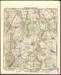
- Subject:
- Topical Subject: Soviet Union, Geographic Subject: Jędrychowo, and Topical Subject: Maps
- Publisher:
- Генеральный штаб Красной Армии
- Language:
- Russian
- Date Created:
- 1941
- Identifier:
- VAC9619-003789
- Genre:
- Military Maps and Topographic Maps
- Geographic Location:
- Coordinates: 54.25, 19.625, 54.33333, 19.75
- Related URL:
- Download GeoTIFF: https://drive.google.com/file/d/12tRfmZ0TTV4HL8IO2CEf_0KU-rZwC8Jk/view?usp=sharing and Catalog URL: https://iucat.iu.edu/catalog/14701157
- Abstract:
- Modern area represented: Jędrychowo, Poland
- Call Number:
- G7063.K2 s25 .S6 sheet N-34-64-A-b
- City:
- Генрихсдорф (Heinrichsdorf)
- Copyright Holder:
- No Copyright - United States
- Country:
- Германия (Восточная Пруссия) (Germany (East Prussia))
- Physical Description:
- Scale: 1:25,000
- Persistent URL:
- http://purl.dlib.indiana.edu/iudl/images/VAC9619/VAC9619-003789
- Provenance:
- M. I. Map Library
-
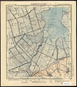
- Subject:
- Geographic Subject: Wiśniewo, Topical Subject: Maps, and Topical Subject: Soviet Union
- Publisher:
- Генеральный штаб Красной Армии
- Language:
- Russian
- Date Created:
- 1941
- Identifier:
- VAC9619-003788
- Genre:
- Military Maps and Topographic Maps
- Geographic Location:
- Coordinates: 54, 19.375, 54.083, 19.5
- Related URL:
- Download GeoTIFF: https://drive.google.com/file/d/16NZ1NRScSw4F_OGCO8IPtf9cCXYXCzmN/view?usp=sharing and Catalog URL: https://iucat.iu.edu/catalog/14701157
- Abstract:
- Modern area represented: Wiśniewo, Poland
- Call Number:
- G7063.K2 s25 .S6 sheet N-34-63-D-d
- City:
- Аугуствальде (Augustwalde)
- Copyright Holder:
- No Copyright - United States
- Country:
- Германия (Восточная Пруссия) (Germany (East Prussia))
- Physical Description:
- Scale: 1:25,000
- Persistent URL:
- http://purl.dlib.indiana.edu/iudl/images/VAC9619/VAC9619-003788
- Provenance:
- CIA Map Branch -- Received
-
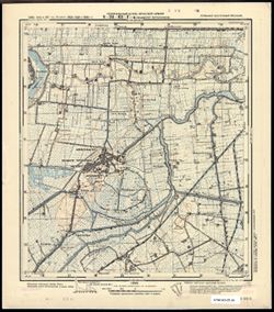
- Subject:
- Geographic Subject: Jegłownik, Topical Subject: Soviet Union, and Topical Subject: Maps
- Publisher:
- Генеральный штаб Красной Армии
- Language:
- Russian
- Date Created:
- 1941
- Identifier:
- VAC9619-003787
- Genre:
- Topographic Maps and Military Maps
- Geographic Location:
- Coordinates: 54.083, 19.25, 54.167, 19.375
- Related URL:
- Catalog URL: https://iucat.iu.edu/catalog/14701157 and Download GeoTIFF: https://drive.google.com/file/d/1XTpA_3nCRZRqD98Wkpfn-hlNk5YJnGoS/view?usp=sharing
- Abstract:
- Modern area represented: Jegłownik (former Fichthorst), Poland
- Call Number:
- G7063.K2 s25 .S6 sheet N-34-63-D-а
- City:
- Эльбингер Территориум
- Copyright Holder:
- No Copyright - United States
- Country:
- Германия (Восточная Пруссия) (Germany (East Prussia))
- Physical Description:
- Scale: 1:25,000
- Persistent URL:
- http://purl.dlib.indiana.edu/iudl/images/VAC9619/VAC9619-003787
- Provenance:
- CIA Map Branch -- Received
-
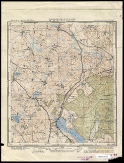
- Subject:
- Topical Subject: Maps, Geographic Subject: Kumiecie Małe, and Topical Subject: Soviet Union
- Publisher:
- Генеральный штаб Красной Армии
- Language:
- Russian
- Date Created:
- 1941
- Identifier:
- VAC9619-003778
- Genre:
- Topographic Maps and Military Maps
- Geographic Location:
- Coordinates: 54.33333, 22.25, 54.416667, 22.375
- Related URL:
- Catalog URL: https://iucat.iu.edu/catalog/14701157 and Download GeoTIFF: https://drive.google.com/file/d/1j12pjvPCePKzJkTpigHGtx5NAOBSbMzH/view?usp=sharing
- Abstract:
- Modern area represented: abandoned populated place. The nearest populated place is Kumiecie Małe (former Klein Kummetschen), Poland.
- Call Number:
- G7063.K2 s25 .S6 sheet N-34-57-D-c
- City:
- Ропонатшен (Roponatschen)
- Copyright Holder:
- No Copyright - United States
- Country:
- Германия (Восточная Пруссия) (Germany (East Prussia))
- Physical Description:
- Scale: 1:25,000
- Persistent URL:
- http://purl.dlib.indiana.edu/iudl/images/VAC9619/VAC9619-003778
- Provenance:
- CIA Map Library
-
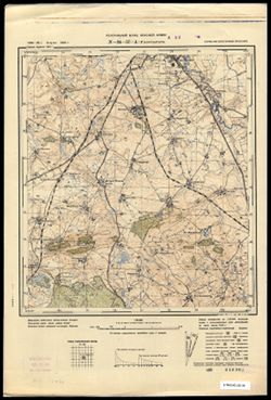
- Subject:
- Geographic Subject: Gusev, Topical Subject: Maps, and Topical Subject: Soviet Union
- Publisher:
- Генеральный штаб Красной Армии
- Language:
- Russian
- Date Created:
- 1940
- Identifier:
- VAC9619-003777
- Genre:
- Topographic Maps and Military Maps
- Geographic Location:
- Coordinates: 54.5, 22.125, 54.583333, 22.25
- Related URL:
- Catalog URL: https://iucat.iu.edu/catalog/14701157 and Download GeoTIFF: https://drive.google.com/file/d/1NiINW2Xz0KCnGUo8EkN-qSLfafA7z5eK/view?usp=sharing
- Abstract:
- Modern area represented: part of Gusev, Kaliningradskaya oblast, Russia
- Call Number:
- G7063.K2 s25 .S6 sheet N-34-57-A-d
- City:
- Норутшатшен (Norutschatschen)
- Copyright Holder:
- No Copyright - United States
- Country:
- Германия (Восточная Пруссия) (Germany (East Prussia))
- Physical Description:
- Scale: 1:25,000
- Persistent URL:
- http://purl.dlib.indiana.edu/iudl/images/VAC9619/VAC9619-003777
- Provenance:
- CIA Map Branch -- Received
-
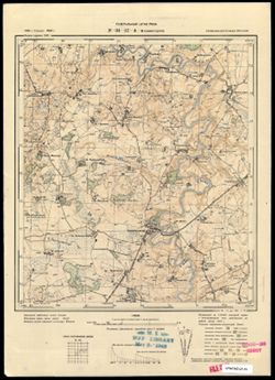
- Subject:
- Topical Subject: Soviet Union, Geographic Subject: Mayakovskoye, and Topical Subject: Maps
- Publisher:
- Генеральный штаб РККА
- Language:
- Russian
- Date Created:
- 1940
- Identifier:
- VAC9619-003776
- Genre:
- Topographic Maps and Military Maps
- Geographic Location:
- Coordinates: 54.5, 22.0, 54.58333, 22.125
- Related URL:
- Catalog URL: https://iucat.iu.edu/catalog/14701157 and Download GeoTIFF: https://drive.google.com/file/d/1yIZKl2QoPAjXXlQ6j78DHVFsjlH5n_bQ/view?usp=sharing
- Abstract:
- Modern area represented: Маяковское (Mayakovskoye), Kaliningradskaya oblast, Russia
- Call Number:
- G7063.K2 s25 .S6 sheet N-34-57-A-c
- City:
- Неммерсдорф (Nemmersdorf)
- Copyright Holder:
- No Copyright - United States
- Country:
- Германия (Восточная Пруссия) (Germany (East Prussia))
- Physical Description:
- Scale: 1:25,000
- Persistent URL:
- http://purl.dlib.indiana.edu/iudl/images/VAC9619/VAC9619-003776
- Provenance:
- M. I. Map Library
-
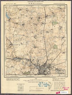
- Subject:
- Topical Subject: Maps, Topical Subject: Soviet Union, and Geographic Subject: Gusev
- Publisher:
- Генеральный штаб Красной Армии
- Language:
- Russian
- Date Created:
- 1940
- Identifier:
- VAC9619-003775
- Genre:
- Military Maps and Topographic Maps
- Geographic Location:
- Coordinates: 54.583333, 22.125, 54.66667, 22.25
- Related URL:
- Catalog URL: https://iucat.iu.edu/catalog/14701157 and Download GeoTIFF: https://drive.google.com/file/d/1hn10OTfJZJitvwnQ6N0qRDwjIUvnMo0w/view?usp=sharing
- Abstract:
- Modern area represented: Гусев (Gusev), Kaliningradskaya oblast, Russia
- Call Number:
- G7063.K2 s25 .S6 sheet N-34-57-A-b
- City:
- Гумбиннен (Gumbinnen)
- Copyright Holder:
- No Copyright - United States
- Country:
- Германия (Восточная Пруссия) (Germany (East Prussia))
- Physical Description:
- Scale: 1:25,000
- Persistent URL:
- http://purl.dlib.indiana.edu/iudl/images/VAC9619/VAC9619-003775
- Provenance:
- M. I. Map Library
-
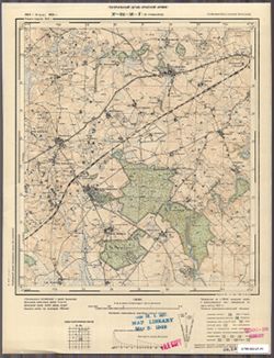
- Subject:
- Geographic Subject: L’vovskoye, Topical Subject: Maps, and Topical Subject: Soviet Union
- Publisher:
- Генеральный штаб Красной Армии
- Language:
- Russian
- Date Created:
- 1940
- Identifier:
- VAC9619-003774
- Genre:
- Topographic Maps and Military Maps
- Geographic Location:
- Coordinates: 54.33333, 21.875, 54.416667, 22.0
- Related URL:
- Download GeoTIFF: https://drive.google.com/file/d/12an_HxQIfh0ft86PjDpI4ROqoZxgOGFW/view?usp=sharing and Catalog URL: https://iucat.iu.edu/catalog/14701157
- Abstract:
- Modern area represented: Львовское (L’vovskoye), Kaliningradskaya oblast, Russia
- Call Number:
- G7063.K2 s25 .S6 sheet N-34-56-D-d
- City:
- Гудваллен (Gudwallen)
- Copyright Holder:
- No Copyright - United States
- Country:
- Германия (Восточная Пруссия) (Germany (East Prussia))
- Physical Description:
- Scale: 1:25,000
- Persistent URL:
- http://purl.dlib.indiana.edu/iudl/images/VAC9619/VAC9619-003774
- Provenance:
- M. I. Map Library
-
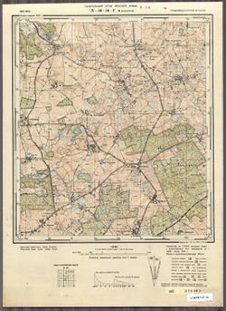
- Subject:
- Geographic Subject: Zaozernoye, Topical Subject: Maps, and Topical Subject: Soviet Union
- Publisher:
- Генеральный штаб Красной Армии
- Language:
- Russian
- Date Created:
- 1940
- Identifier:
- VAC9619-003773
- Genre:
- Military Maps and Topographic Maps
- Geographic Location:
- Coordinates: 54.33333, 21.75, 54.416667, 21.875
- Related URL:
- Catalog URL: https://iucat.iu.edu/catalog/14701157 and Download GeoTIFF: https://drive.google.com/file/d/1_-KY0WiD0y2Zy7akIVlDvZVmfepqE6Gq/view?usp=sharing
- Abstract:
- Modern area represented: Заозерное (Zaozernoye), Kaliningradskaya oblast, Russia
- Call Number:
- G7063.K2 s25 .S6 sheet N-34-56-D-c
- City:
- Коваррен (Kowarren)
- Copyright Holder:
- No Copyright - United States
- Country:
- Германия (Восточная Пруссия) (Germany (East Prussia))
- Physical Description:
- Scale: 1:25,000
- Persistent URL:
- http://purl.dlib.indiana.edu/iudl/images/VAC9619/VAC9619-003773
- Provenance:
- CIA Map Branch -- Received
-
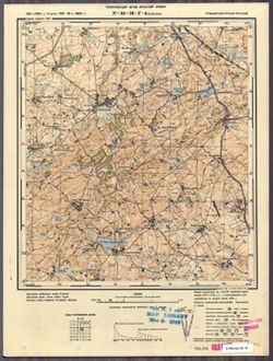
- Subject:
- Geographic Subject: Sadovoye, Topical Subject: Soviet Union, and Topical Subject: Maps
- Publisher:
- Генеральный штаб Красной Армии
- Language:
- Russian
- Date Created:
- 1940
- Identifier:
- VAC9619-003772
- Genre:
- Military Maps and Topographic Maps
- Geographic Location:
- Coordinates: 54.416667, 21.875, 54.5, 22.0
- Related URL:
- Catalog URL: https://iucat.iu.edu/catalog/14701157 and Download GeoTIFF: https://drive.google.com/file/d/1XZEYPE501MjrhLpnm3m9ccyC4L-Vgp1c/view?usp=sharing
- Abstract:
- Modern area represented: Садовое (Sadovoye), Kaliningradskaya oblast, Russia
- Call Number:
- G7063.K2 s25 .S6 sheet N-34-56-D-b
- City:
- Балетхен (Baletkhen)
- Copyright Holder:
- No Copyright - United States
- Country:
- Германия (Восточная Пруссия) (Germany (East Prussia))
- Physical Description:
- Scale: 1:25,000
- Persistent URL:
- http://purl.dlib.indiana.edu/iudl/images/VAC9619/VAC9619-003772
- Provenance:
- M. I. Map Library
-
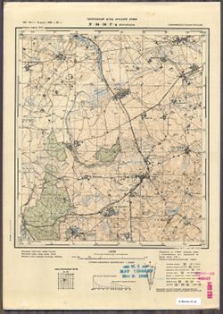
- Subject:
- Topical Subject: Maps, Geographic Subject: Yudino, and Topical Subject: Soviet Union
- Publisher:
- Генеральный штаб Красной Армии
- Language:
- Russian
- Date Created:
- 1940
- Identifier:
- VAC9619-003771
- Genre:
- Military Maps and Topographic Maps
- Geographic Location:
- Coordinates: 54.625, 21.75, 54.5, 21.875
- Related URL:
- Catalog URL: https://iucat.iu.edu/catalog/14701157 and Download GeoTIFF: https://drive.google.com/file/d/1HICKS0mJ8K-6du3h6Y7YHP-tA74L8hg5/view?usp=sharing
- Abstract:
- Modern area represented: Юдинo (Yudino), Kaliningradskaya oblast, Russia
- Call Number:
- G7063.K2 s25 .S6 sheet N-34-56-D-а
- City:
- Йургайтшен (Jurgaitschen)
- Copyright Holder:
- No Copyright - United States
- Country:
- Германия (Восточная Пруссия) (Germany (East Prussia))
- Physical Description:
- Scale: 1:25,000
- Persistent URL:
- http://purl.dlib.indiana.edu/iudl/images/VAC9619/VAC9619-003771
- Provenance:
- M. I. Map Library
-
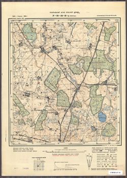
- Subject:
- Geographic Subject: Kamenka, Topical Subject: Maps, and Topical Subject: Soviet Union
- Publisher:
- Генеральный штаб Красной Армии
- Language:
- Russian
- Date Created:
- 1940
- Identifier:
- VAC9619-003770
- Genre:
- Topographic Maps and Military Maps
- Geographic Location:
- Coordinates: 54.33333, 21.5, 54.416667, 21.625
- Related URL:
- Catalog URL: https://iucat.iu.edu/catalog/14701157 and Download GeoTIFF: https://drive.google.com/file/d/1usUnzt3AGpv7Pz8LkjduEMpZKCa8qPp3/view?usp=sharing
- Abstract:
- Modern area represented: Каменка (Kamenka), Kaliningradskaya oblast, Russia
- Call Number:
- G7063.K2 s25 .S6 sheet N-34-56-C-c
- City:
- Пентлак (Pentlack)
- Copyright Holder:
- No Copyright - United States
- Country:
- Германия (Восточная Пруссия) (Germany (East Prussia))
- Physical Description:
- Scale: 1:25,000
- Persistent URL:
- http://purl.dlib.indiana.edu/iudl/images/VAC9619/VAC9619-003770
- Provenance:
- CIA Map Branch -- Received
-
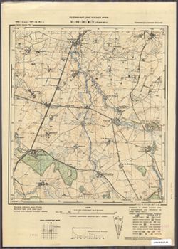
- Subject:
- Topical Subject: Maps, Topical Subject: Soviet Union, and Geographic Subject: Volodarovka
- Publisher:
- Генеральный штаб Красной Армии
- Language:
- Russian
- Date Created:
- 1940
- Identifier:
- VAC9619-003769
- Genre:
- Military Maps and Topographic Maps
- Geographic Location:
- Coordinates: 54.416667, 21.625, 54.5, 21.75
- Related URL:
- Catalog URL: https://iucat.iu.edu/catalog/14701157 and Download GeoTIFF: https://drive.google.com/file/d/1HsQVfue3DKYKEO1n4kswkseAKxcDnGMI/view?usp=sharing
- Abstract:
- Modern area represented: Володаровка (Volodarovka), Kaliningradskaya oblast, Russia
- Call Number:
- G7063.K2 s25 .S6 sheet N-34-56-C-b
- City:
- Йодлаукен (Jodlauken)
- Copyright Holder:
- No Copyright - United States
- Country:
- Германия (Восточная Пруссия) (Germany (East Prussia))
- Physical Description:
- Scale: 1:25,000
- Persistent URL:
- http://purl.dlib.indiana.edu/iudl/images/VAC9619/VAC9619-003769
- Provenance:
- CIA Map Branch -- Received
-
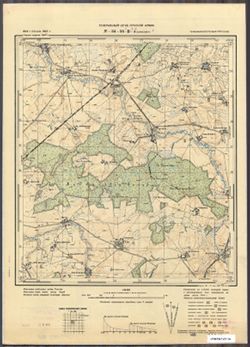
- Subject:
- Topical Subject: Soviet Union, Geographic Subject: Frunzenskoye, and Topical Subject: Maps
- Publisher:
- Генеральный штаб Красной Армии
- Language:
- Russian
- Date Created:
- 1940
- Identifier:
- VAC9619-003768
- Genre:
- Military Maps and Topographic Maps
- Geographic Location:
- Coordinates: 54.416667, 21.5, 54.5, 21.675
- Related URL:
- Download GeoTIFF: https://drive.google.com/file/d/18Fhcv4dOn1NqV5yAnoUHbnYugZv0g5HW/view?usp=sharing and Catalog URL: https://iucat.iu.edu/catalog/14701157
- Abstract:
- Modern area represented: Фрунзенское (Frunzenskoye), Kaliningradskaya oblast, Russia
- Call Number:
- G7063.K2 s25 .S6 sheet N-34-56-C-а
- Caption:
- Captured map
- City:
- Бокеллен (Bokellen)
- Copyright Holder:
- No Copyright - United States
- Country:
- Германия (Восточная Пруссия) (Germany (East Prussia))
- Physical Description:
- Scale: 1:25,000
- Persistent URL:
- http://purl.dlib.indiana.edu/iudl/images/VAC9619/VAC9619-003768
- Provenance:
- CIA Map Branch -- Received, Army Map Service Library
-
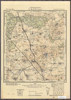
- Subject:
- Topical Subject: Maps, Geographic Subject: Krasnoyarskoye, and Topical Subject: Soviet Union
- Publisher:
- Генеральный штаб РККА
- Language:
- Russian
- Date Created:
- 1940
- Identifier:
- VAC9619-003767
- Genre:
- Military Maps and Topographic Maps
- Geographic Location:
- Coordinates: 54.5, 21.875, 54.583333, 22.0
- Related URL:
- Download GeoTIFF: https://drive.google.com/file/d/1gDoR4a09I9AGczRACMqkhG73rEy1xji5/view?usp=sharing and Catalog URL: https://iucat.iu.edu/catalog/14701157
- Abstract:
- Modern area represented: Красноярское (Krasnoyarskoye), Kaliningradskaya oblast, Russia
- Call Number:
- G7063.K2 s25 .S6 sheet N-34-56-B-d
- City:
- Зоденен (Sodehnen)
- Copyright Holder:
- No Copyright - United States
- Country:
- Германия (Восточная Пруссия) (Germany (East Prussia))
- Physical Description:
- Scale: 1:25,000
- Persistent URL:
- http://purl.dlib.indiana.edu/iudl/images/VAC9619/VAC9619-003767
- Provenance:
- CIA Map Branch -- Received
-
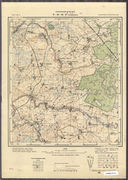
- Subject:
- Topical Subject: Maps, Geographic Subject: Tel’manovo, and Topical Subject: Soviet Union
- Publisher:
- Генеральный штаб РККА
- Language:
- Russian
- Date Created:
- 1940
- Identifier:
- VAC9619-003766
- Genre:
- Topographic Maps and Military Maps
- Geographic Location:
- Coordinates: 54.5, 21.75, 54.583333, 21.875
- Related URL:
- Download GeoTIFF: https://drive.google.com/file/d/1H2FNsPR9DJfa7zT2eb5RkZ5w1Ee7Q5n8/view?usp=sharing and Catalog URL: https://iucat.iu.edu/catalog/14701157
- Abstract:
- Modern area represented: Тельманово (Tel’manovo), Kaliningradskaya oblast, Russia
- Call Number:
- G7063.K2 s25 .S6 sheet N-34-56-B-c
- City:
- Дидлаккен (Didlacken)
- Copyright Holder:
- No Copyright - United States
- Country:
- Германия (Восточная Пруссия) (Germany (East Prussia))
- Physical Description:
- Scale: 1:25,000
- Persistent URL:
- http://purl.dlib.indiana.edu/iudl/images/VAC9619/VAC9619-003766
- Provenance:
- CIA Map Branch -- Received
-
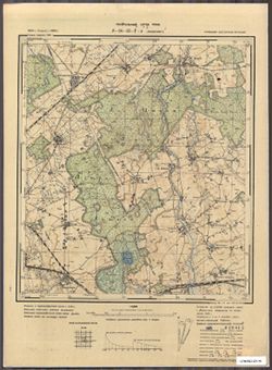
- Subject:
- Topical Subject: Maps, Topical Subject: Soviet Union, and Geographic Subject: Zverevo
- Publisher:
- Генеральный штаб РККА
- Language:
- Russian
- Date Created:
- 1940
- Identifier:
- VAC9619-003765
- Genre:
- Topographic Maps and Military Maps
- Geographic Location:
- Coordinates: 54.3333, 21.375, 54.416667, 21.5
- Related URL:
- Catalog URL: https://iucat.iu.edu/catalog/14701157 and Download GeoTIFF: https://drive.google.com/file/d/14zHhtIuohakc9cXzCiLjuN7aUHOgICfx/view?usp=sharing
- Abstract:
- Modern area represented: Зверево (Zverevo), Kaliningradskaya oblast, Russia
- Call Number:
- G7063.K2 s25 .S6 sheet N-34-55-D-d
- City:
- Вандлакен (Wandlacken)
- Copyright Holder:
- No Copyright - United States
- Country:
- Германия (Восточная Пруссия) (Germany (East Prussia))
- Physical Description:
- Scale: 1:25,000
- Persistent URL:
- http://purl.dlib.indiana.edu/iudl/images/VAC9619/VAC9619-003765
- Provenance:
- CIA Map Branch -- Received
-
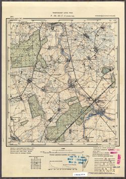
- Subject:
- Geographic Subject: Mozyr', Topical Subject: Soviet Union, and Topical Subject: Maps
- Publisher:
- Генеральный штаб РККА
- Language:
- Russian
- Date Created:
- 1940
- Identifier:
- VAC9619-003764
- Genre:
- Topographic Maps and Military Maps
- Geographic Location:
- Coordinates: 54.416667, 21.375, 54.5, 21.5
- Related URL:
- Download GeoTIFF: https://drive.google.com/file/d/1rzYJ4jELzYhA075PzqMO_6FAlPm9H3TG/view?usp=sharing and Catalog URL: https://iucat.iu.edu/catalog/14701157
- Abstract:
- Modern area represented: Мозырь (Mozyr'), Kaliningradskaya oblast, Russia
- Call Number:
- G7063.K2 s25 .S6 sheet N-34-55-D-b
- City:
- Клайн Гние (Klein Gnie)
- Copyright Holder:
- No Copyright - United States
- Country:
- Германия (Восточная Пруссия) (Germany (East Prussia))
- Physical Description:
- Scale: 1:25,000
- Persistent URL:
- http://purl.dlib.indiana.edu/iudl/images/VAC9619/VAC9619-003764
- Provenance:
- M. I. Map Library
-

- Subject:
- Topical Subject: Soviet Union, Topical Subject: Maps, and Geographic Subject: Novo-Biyskoye
- Publisher:
- Генеральный штаб РККА
- Language:
- Russian
- Date Created:
- 1940
- Identifier:
- VAC9619-003763
- Genre:
- Military Maps and Topographic Maps
- Geographic Location:
- Coordinates: 54.416667, 21.25, 54.5, 21.375
- Related URL:
- Download GeoTIFF: https://drive.google.com/file/d/12ADQ-KwvRsbz_NrkgrhOE6_uEKunq8Ac/view?usp=sharing and Catalog URL: https://iucat.iu.edu/catalog/14701157
- Abstract:
- Modern area represented: Ново-Бийское (Novo-Biyskoye), Kaliningradskaya oblast, Russia
- Call Number:
- G7063.K2 s25 .S6 sheet N-34-55-D-а
- Caption:
- Captured map
- City:
- Фридрихсвальде (Friedrichswalde)
- Copyright Holder:
- No Copyright - United States
- Country:
- Германия (Восточная Пруссия) (Germany (East Prussia))
- Physical Description:
- Scale: 1:25,000
- Persistent URL:
- http://purl.dlib.indiana.edu/iudl/images/VAC9619/VAC9619-003763
- Provenance:
- Army Map Service Library, OMAHA, Library of Congress Geography & Map Division
-
- Subject:
- Topical Subject: Maps, Topical Subject: Soviet Union, and Geographic Subject: Trostniki
- Publisher:
- Генеральный штаб РККА
- Language:
- Russian
- Date Created:
- 1940
- Identifier:
- VAC9619-003762
- Genre:
- Topographic Maps and Military Maps
- Geographic Location:
- Coordinates: 54.33333, 21.125, 54.416667, 21.25
- Related URL:
- Catalog URL: https://iucat.iu.edu/catalog/14701157 and Download GeoTIFF: https://drive.google.com/file/d/1wZcpkvnbScBw9T8OXj-MIwmDbLU_-QpN/view?usp=sharing
- Abstract:
- Modern area represented: Тростники (Trostniki), Kaliningradskaya oblast, Russia
- Call Number:
- G7063.K2 s25 .S6 sheet N-34-55-C-d
- City:
- Шакенхоф (Schakenhof)
- Copyright Holder:
- No Copyright - United States
- Country:
- Германия (Восточная Пруссия) (Germany (East Prussia))
- Physical Description:
- Scale: 1:25,000
- Persistent URL:
- http://purl.dlib.indiana.edu/iudl/images/VAC9619/VAC9619-003762
- Provenance:
- DMA Topographic Center, Army Map Service Library, Library of Congress Geography & Map Division
-
- Subject:
- Geographic Subject: Sevskoye, Topical Subject: Maps, and Topical Subject: Soviet Union
- Publisher:
- Генеральный штаб РККА
- Language:
- Russian
- Date Created:
- 1940
- Identifier:
- VAC9619-003761
- Genre:
- Military Maps and Topographic Maps
- Geographic Location:
- Coordinates: 54.33333, 21.0, 54.416667, 21.125
- Related URL:
- Download GeoTIFF: https://drive.google.com/file/d/1njT50SJERmJ9Vc0pRyiX8Kpf7mFuNjxz/view?usp=sharing and Catalog URL: https://iucat.iu.edu/catalog/14701157
- Abstract:
- Modern area represented: Севское (Sevskoye), Kaliningradskaya oblast, Russia
- Call Number:
- G7063.K2 s25 .S6 sheet N-34-55-C-c
- City:
- Бетхерсдорф (Böttchersdorf)
- Copyright Holder:
- No Copyright - United States
- Country:
- Германия (Восточная Пруссия) (Germany (East Prussia))
- Physical Description:
- Scale: 1:25,000
- Persistent URL:
- http://purl.dlib.indiana.edu/iudl/images/VAC9619/VAC9619-003761
- Provenance:
- Army Map Service Library, OMAHA, Library of Congress Geography & Map Division
-
- Subject:
- Geographic Subject: Druzhba, Topical Subject: Soviet Union, and Topical Subject: Maps
- Publisher:
- Генеральный штаб РККА
- Language:
- Russian
- Date Created:
- 1940
- Identifier:
- VAC9619-003760
- Genre:
- Topographic Maps and Military Maps
- Geographic Location:
- Coordinates: 54.416667, 21.125, 54.5, 21.25
- Related URL:
- Download GeoTIFF: https://drive.google.com/file/d/1kF3QzsNMbMtGYPuboXo-rLwyfW0_be0z/view?usp=sharing and Catalog URL: https://iucat.iu.edu/catalog/14701157
- Abstract:
- Modern area represented: Дружба (Druzhba), Kaliningradskaya oblast, Russia
- Call Number:
- G7063.K2 s25 .S6 sheet N-34-55-C-b
- City:
- Алленбург (Allenburg)
- Copyright Holder:
- No Copyright - United States
- Country:
- Германия (Восточная Пруссия) (Germany (East Prussia))
- Physical Description:
- Scale: 1:25,000
- Persistent URL:
- http://purl.dlib.indiana.edu/iudl/images/VAC9619/VAC9619-003760
- Provenance:
- DMA Topographic Center, Army Map Service Library, Library of Congress Geography & Map Division
-
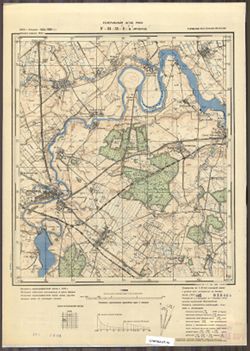
- Subject:
- Topical Subject: Soviet Union, Topical Subject: Maps, and Geographic Subject: Pravdinsk
- Publisher:
- Генеральный штаб РККА
- Language:
- Russian
- Date Created:
- 1940
- Identifier:
- VAC9619-003759
- Genre:
- Military Maps and Topographic Maps
- Geographic Location:
- Coordinates: 54.416667, 21.0, 54.5, 21.125
- Related URL:
- Download GeoTIFF: https://drive.google.com/file/d/1BdXL6ENsKTclSoQc5t0IDsx_3AT8F3V4/view?usp=sharing and Catalog URL: https://iucat.iu.edu/catalog/14701157
- Abstract:
- Modern area represented: Правдинск (Pravdinsk), Kaliningradskaya oblast, Russia
- Call Number:
- G7063.K2 s25 .S6 sheet N-34-55-C-а
- City:
- Фридланд (Friedland)
- Copyright Holder:
- No Copyright - United States
- Country:
- Германия (Восточная Пруссия) (Germany (East Prussia))
- Physical Description:
- Scale: 1:25,000
- Persistent URL:
- http://purl.dlib.indiana.edu/iudl/images/VAC9619/VAC9619-003759
- Provenance:
- CIA Map Branch -- Received
-
- Subject:
- Topical Subject: Maps, Geographic Subject: Urochishche Svetayevka, and Topical Subject: Soviet Union
- Publisher:
- Генеральный штаб РККА
- Language:
- Russian
- Date Created:
- 1940
- Identifier:
- VAC9619-003758
- Genre:
- Military Maps and Topographic Maps
- Geographic Location:
- Coordinates: 54.5, 21.375, 54.583333, 21.5
- Related URL:
- Catalog URL: https://iucat.iu.edu/catalog/14701157 and Download GeoTIFF: https://drive.google.com/file/d/1M1bDaCeNK4URsLgqX8Q07aHrkRjbDToX/view?usp=sharing
- Abstract:
- Modern area represented: Урочище Светаевка (Urochishche Svetayevka), Kaliningradskaya oblast, Russia
- Call Number:
- G7063.K2 s25 .S6 sheet N-34-55-B-d
- City:
- Гросс Эшенбрух (Gross Eschenbruch)
- Copyright Holder:
- No Copyright - United States
- Country:
- Германия (Восточная Пруссия) (Germany (East Prussia))
- Physical Description:
- Scale: 1:25,000
- Persistent URL:
- http://purl.dlib.indiana.edu/iudl/images/VAC9619/VAC9619-003758
- Provenance:
- DMA Topographic Center, Army Map Service Library, Library of Congress Geography & Map Division
-

- Subject:
- Geographic Subject: Sukhodol’ye, Topical Subject: Soviet Union, and Topical Subject: Maps
- Publisher:
- Генеральный штаб РККА
- Language:
- Russian
- Date Created:
- 1940
- Identifier:
- VAC9619-003757
- Genre:
- Topographic Maps and Military Maps
- Geographic Location:
- Coordinates: 54.5, 21.25, 54.583333, 21.375
- Related URL:
- Download GeoTIFF: https://drive.google.com/file/d/14jGcncKoDrk02oM3Vjf7feRtsNIx-vFJ/view?usp=sharing and Catalog URL: https://iucat.iu.edu/catalog/14701157
- Abstract:
- Modern area represented: Суходолье (Sukhodol’ye), Kaliningradskaya oblast, Russia
- Call Number:
- G7063.K2 s25 .S6 sheet N-34-55-B-c
- City:
- Клайн Нур (Klein Nuhr)
- Copyright Holder:
- No Copyright - United States
- Country:
- Германия (Восточная Пруссия) (Germany (East Prussia))
- Physical Description:
- Scale: 1:25,000
- Persistent URL:
- http://purl.dlib.indiana.edu/iudl/images/VAC9619/VAC9619-003757
- Provenance:
- Army Map Service Library, OMAHA, Library of Congress Geography & Map Division
-
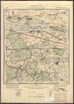
- Subject:
- Topical Subject: Soviet Union and Topical Subject: Maps
- Publisher:
- Генеральный штаб РККА
- Language:
- Russian
- Date Created:
- 1941
- Identifier:
- VAC9619-003756
- Genre:
- Topographic Maps and Military Maps
- Geographic Location:
- Coordinates: 54.583333, 21.375, 54.6667, 21.5
- Related URL:
- Download GeoTIFF: https://drive.google.com/file/d/1TJtylcUdeVuS58lQGKMmNkDsxT5MyGgY/view?usp=sharing and Catalog URL: https://iucat.iu.edu/catalog/14701157
- Abstract:
- Modern area represented: abandoned populated place between Pushkarevo and Mezhdurech’ye, Kaliningradskaya oblast, Russia
- Call Number:
- G7063.K2 s25 .S6 sheet N-34-55-B-b
- City:
- Гросс Йегерсдорф (Gross Jegersdorf)
- Copyright Holder:
- No Copyright - United States
- Country:
- Германия (Восточная Пруссия) (Germany (East Prussia))
- Physical Description:
- Scale: 1:25,000
- Persistent URL:
- http://purl.dlib.indiana.edu/iudl/images/VAC9619/VAC9619-003756
- Provenance:
- CIA Map Branch -- Received
-
- Subject:
- Topical Subject: Soviet Union, Geographic Subject: Pushkarevo, and Topical Subject: Maps
- Publisher:
- Генеральный штаб РККА
- Language:
- Russian
- Date Created:
- 1940
- Identifier:
- VAC9619-003755
- Genre:
- Topographic Maps and Military Maps
- Geographic Location:
- Coordinates: 54.583333, 21.25, 54.66667, 21.375
- Related URL:
- Catalog URL: https://iucat.iu.edu/catalog/14701157 and Download GeoTIFF: https://drive.google.com/file/d/1qr5bim-YtnPvFyD8-kJ1ZfXlK1vH1t45/view?usp=sharing
- Abstract:
- Modern area represented: Пушкарево (Pushkarevo), Kaliningradskaya oblast, Russia
- Call Number:
- G7063.K2 s25 .S6 sheet N-34-55-B-а
- City:
- Пушдорф (Puschdorf)
- Copyright Holder:
- No Copyright - United States
- Country:
- Германия (Восточная Пруссия) (Germany (East Prussia))
- Physical Description:
- Scale: 1:25,000
- Persistent URL:
- http://purl.dlib.indiana.edu/iudl/images/VAC9619/VAC9619-003755
- Provenance:
- Army Map Service Library, OMAHA, Library of Congress Geography & Map Division
-
- Subject:
- Topical Subject: Maps, Topical Subject: Soviet Union, and Geographic Subject: Fedotovo
- Publisher:
- Генеральный штаб РККА
- Language:
- Russian
- Date Created:
- 1940
- Identifier:
- VAC9619-003754
- Genre:
- Military Maps and Topographic Maps
- Geographic Location:
- Coordinates: 54.5, 21.125, 54.583333, 21.25
- Related URL:
- Download GeoTIFF: https://drive.google.com/file/d/1eCsOgFhFu1GWDUi4E3T13BPpC_cG3vZ9/view?usp=sharing and Catalog URL: https://iucat.iu.edu/catalog/14701157
- Abstract:
- Modern area represented: Федотово (Fedotovo), Kaliningradskaya oblast, Russia
- Call Number:
- G7063.K2 s25 .S6 sheet N-34-55-A-d
- Caption:
- Captured map
- City:
- Гросс Плауен (Gross Plauen)
- Copyright Holder:
- No Copyright - United States
- Country:
- Германия (Восточная Пруссия) (Germany (East Prussia))
- Physical Description:
- Scale: 1:25,000
- Persistent URL:
- http://purl.dlib.indiana.edu/iudl/images/VAC9619/VAC9619-003754
- Provenance:
- DMA Topographic Center, Army Map Service Library, Library of Congress Geography & Map Division
-

- Subject:
- Geographic Subject: Znamensk, Topical Subject: Soviet Union, and Topical Subject: Maps
- Publisher:
- Генеральный штаб РККА
- Language:
- Russian
- Date Created:
- 1940
- Identifier:
- VAC9619-003752
- Genre:
- Military Maps and Topographic Maps
- Geographic Location:
- Coordinates: 54.583333.21.125, 54.66667, 21.25
- Related URL:
- Catalog URL: https://iucat.iu.edu/catalog/14701157 and Download GeoTIFF: https://drive.google.com/file/d/1Z7tlYRGDlqOydlvt9TBgXz9ShcoNbKej/view?usp=sharing
- Abstract:
- Modern area represented: Знаменск (Znamensk), Kaliningradskaya oblast, Russia
- Call Number:
- G7063.K2 s25 .S6 sheet N-34-55-A-b
- Caption:
- Captured map
- City:
- Велау (Wehlau)
- Copyright Holder:
- No Copyright - United States
- Country:
- Германия (Восточная Пруссия) (Germany (East Prussia))
- Physical Description:
- Scale: 1:25,000
- Persistent URL:
- http://purl.dlib.indiana.edu/iudl/images/VAC9619/VAC9619-003752
- Provenance:
- DMA Topographic Center, Army Map Service Library, Library of Congress Geography & Map Division
-
- Subject:
- Geographic Subject: Urochishche Dem’yanovka, Topical Subject: Soviet Union, and Topical Subject: Maps
- Publisher:
- Генеральный штаб РККА
- Language:
- Russian
- Date Created:
- 1940
- Identifier:
- VAC9619-003753
- Genre:
- Topographic Maps and Military Maps
- Geographic Location:
- Coordinates: 54.5, 21.0, 54.583333, 21.125
- Related URL:
- Catalog URL: https://iucat.iu.edu/catalog/14701157 and Download GeoTIFF: https://drive.google.com/file/d/178IYZsBcS9Er_BJ-2oP2kVIj7Qvlasxp/view?usp=sharing
- Abstract:
- Modern area represented: Урочище Демьяновка (Urochishche Dem’yanovka), Kaliningradskaya oblast, Russia
- Call Number:
- G7063.K2 s25 .S6 sheet N-34-55-A-c
- Caption:
- Captured map
- City:
- Гросс Энгелау (Gross Engelau)
- Copyright Holder:
- No Copyright - United States
- Country:
- Германия (Восточная Пруссия) (Germany (East Prussia))
- Physical Description:
- Scale: 1:25,000
- Persistent URL:
- http://purl.dlib.indiana.edu/iudl/images/VAC9619/VAC9619-003753
- Provenance:
- DMA Topographic Center, Army Map Service Library, Library of Congress Geography & Map Division
-

- Subject:
- Geographic Subject: Gvardeysk, Topical Subject: Soviet Union, and Topical Subject: Maps
- Publisher:
- Генеральный штаб РККА
- Language:
- Russian
- Date Created:
- 1940
- Identifier:
- VAC9619-003751
- Genre:
- Topographic Maps and Military Maps
- Geographic Location:
- Coordinates: 54.58333, 21.0, 54.6667, 21.125
- Related URL:
- Download GeoTIFF: https://drive.google.com/file/d/1e74kGDF5qBgQZxesWsztwpgEImRgJpYi/view?usp=sharing and Catalog URL: https://iucat.iu.edu/catalog/14701157
- Abstract:
- Modern area represented: Гвардейск (Gvardeysk), Kaliningradskaya oblast, Russia
- Call Number:
- G7063.K2 s25 .S6 sheet N-34-55-A-а
- City:
- Тапиау (Tapiau)
- Copyright Holder:
- No Copyright - United States
- Country:
- Германия (Восточная Пруссия) (Germany (East Prussia))
- Physical Description:
- Scale: 1:25,000
- Persistent URL:
- http://purl.dlib.indiana.edu/iudl/images/VAC9619/VAC9619-003751
- Provenance:
- Army Map Service Library, OMAHA, Library of Congress Geography & Map Division
-
- Subject:
- Topical Subject: Maps, Geographic Subject: Shirokoye, and Topical Subject: Soviet Union
- Publisher:
- Генеральный штаб Красной Армии
- Language:
- Russian
- Date Created:
- 1941
- Identifier:
- VAC9619-003750
- Genre:
- Military Maps and Topographic Maps
- Geographic Location:
- Coordinates: 54.3333, 20.875, 54.416667, 21.0
- Related URL:
- Catalog URL: https://iucat.iu.edu/catalog/14701157 and Download GeoTIFF: https://drive.google.com/file/d/18out3_jiAPQT0wiuLpltnv5oEEZc65CV/view?usp=sharing
- Abstract:
- Modern area represented: Широкое (Shirokoye), Kaliningradskaya oblast, Russia
- Call Number:
- G7063.K2 s25 .S6 sheet N-34-54-D-d
- Caption:
- Captured map
- City:
- Шенбрух (Schönbruch)
- Copyright Holder:
- No Copyright - United States
- Country:
- Германия (Восточная Пруссия) (Germany (East Prussia))
- Physical Description:
- Scale: 1:25,000
- Persistent URL:
- http://purl.dlib.indiana.edu/iudl/images/VAC9619/VAC9619-003750
- Provenance:
- DMA Topographic Center, Army Map Service Library, Library of Congress Geography & Map Division

- « Previous
- Next »
- 1
- 2
- 3