
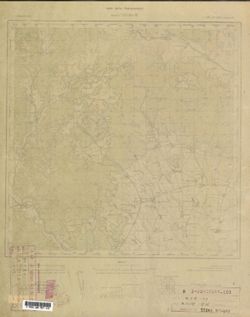
Search Constraints
You searched for:
Provenance
DMA Topographic Center, Army Map Service Library, OMAHA, Library of Congress Geography & Map Division
Remove constraint Provenance: DMA Topographic Center, Army Map Service Library, OMAHA, Library of Congress Geography & Map Division
« Previous |
1 - 100 of 904
|
Next »
Search Results
-
- Description:
- 1912
- Subject:
- Topical Subject: Soviet Union, Topical Subject: Maps, and Geographic Subject: Maku
- Publisher:
- Генеральный штаб Красной Армии
- Language:
- Russian
- Date Created:
- 1941
- Identifier:
- VAC9619-000117
- Genre:
- Military Maps and Topographic Maps
- Geographic Location:
- Coordinates: 39, 44.5, 39.3333, 45
- Related URL:
- Catalog URL: https://iucat.iu.edu/catalog/5020129 and Download GeoTIFF: https://drive.google.com/open?id=1yxUNfH1eBFr_XPjkGSrP0UxUjoeZAI1s
- Abstract:
- Modern area represented: Maku, West Azerbaijan province, Iran
- Call Number:
- G7000 s100 .S7 sheet J-38-30
- Caption:
- Для служебного пользования
- City:
- Маку (Maku)
- Copyright Holder:
- No Copyright - United States
- Country:
- Иран (Iran)
- Physical Description:
- Scale: 1:100,000
- Persistent URL:
- http://purl.dlib.indiana.edu/iudl/images/VAC9619/VAC9619-000117
- Provenance:
- DMA Topographic Center, Army Map Service Library, OMAHA, Library of Congress Geography & Map Division
-
- Description:
- 1910
- Subject:
- Topical Subject: Maps, Topical Subject: Soviet Union, and Geographic Subject: Culfa
- Publisher:
- Генеральный штаб Красной Армии
- Language:
- Russian
- Date Created:
- 1941
- Identifier:
- VAC9619-000702
- Genre:
- Topographic Maps and Military Maps
- Geographic Location:
- Coordinates: 38.6667, 45.5, 39, 46
- Related URL:
- Catalog URL: https://iucat.iu.edu/catalog/5020129 and Download GeoTIFF: https://drive.google.com/open?id=1ciMiII6qDnnJ6WZV49dwofar2Sm3RRBF
- Abstract:
- Modern area represented: Culfa, Nakhchivan Autonomous Republic, Azerbaijan
- Call Number:
- G7000 s100 .S7 sheet J-38-44
- Caption:
- Временное издание,Для служебного пользования
- City:
- Джульфа (Culfa)
- Copyright Holder:
- No Copyright - United States
- Country:
- Иран (Iran)
- State/Province:
- Нахичеванская АССР (Nakhichevan Autonomous Soviet Socialist Republic)
- Physical Description:
- Scale: 1:100,000
- Persistent URL:
- http://purl.dlib.indiana.edu/iudl/images/VAC9619/VAC9619-000702
- Provenance:
- DMA Topographic Center, Army Map Service Library, OMAHA, Library of Congress Geography & Map Division
-
- Description:
- 1909
- Subject:
- Topical Subject: Soviet Union, Geographic Subject: Shabestar, and Topical Subject: Maps
- Publisher:
- Генеральный штаб Красной Армии
- Language:
- Russian
- Date Created:
- 1941
- Identifier:
- VAC9619-001115
- Genre:
- Military Maps and Topographic Maps
- Geographic Location:
- Coordinates: 38, 45.5, 38.3333, 46
- Related URL:
- Catalog URL: https://iucat.iu.edu/catalog/5020129 and Download GeoTIFF: https://drive.google.com/open?id=1W80M4FLMU0wN1-htAcYwssKPeWQeg0hq
- Abstract:
- Modern area represented: Shabestar, East Azerbaijan, Iran
- Call Number:
- G7000 s100 .S7 sheet J-38-68
- Caption:
- Временное издание
- City:
- Чабиастар (Shabestar)
- Copyright Holder:
- No Copyright - United States
- Country:
- Иран (Iran)
- Physical Description:
- Scale: 1:100,000
- Persistent URL:
- http://purl.dlib.indiana.edu/iudl/images/VAC9619/VAC9619-001115
- Provenance:
- DMA Topographic Center, Army Map Service Library, OMAHA, Library of Congress Geography & Map Division
-
- Description:
- 1936
- Subject:
- Topical Subject: Maps, Geographic Subject: Prishibinskoye, and Topical Subject: Soviet Union
- Publisher:
- Генеральный штаб РККА
- Language:
- Russian
- Identifier:
- VAC9619-000736
- Genre:
- Military Maps and Topographic Maps
- Geographic Location:
- Coordinates: 39, 48.5, 39.3333, 49
- Related URL:
- Catalog URL: https://iucat.iu.edu/catalog/5020129 and Download GeoTIFF: https://drive.google.com/open?id=1IhJty8U_-2MfnSOJXZcZ-9fN7_Wm73mV
- Abstract:
- Modern area represented: Prishibinskoye, Jalilabad district, Azerbaijan
- Call Number:
- G7000 s100 .S7 sheet J-39-26
- Caption:
- Не подлежит оглашению
- City:
- Пришибинское (Prishibinskoye)
- Copyright Holder:
- No Copyright - United States
- Country:
- СССР (USSR)
- State/Province:
- Азербайджанская ССР (Azerbaijan Soviet Socialist Republic)
- Physical Description:
- Scale: 1:100,000
- Persistent URL:
- http://purl.dlib.indiana.edu/iudl/images/VAC9619/VAC9619-000736
- Provenance:
- DMA Topographic Center, Army Map Service Library, OMAHA, Library of Congress Geography & Map Division
-
- Description:
- 1937
- Subject:
- Topical Subject: Maps, Topical Subject: Soviet Union, and Geographic Subject: Lerik
- Publisher:
- Генеральный штаб РККА
- Language:
- Russian
- Identifier:
- VAC9619-000098
- Genre:
- Military Maps and Topographic Maps
- Geographic Location:
- Coordinates: 38.6667, 48.25, 38.8333, 48.5
- Related URL:
- Download GeoTIFF: https://drive.google.com/open?id=1WBQANgxRj92H6pvC1yxfnA1uTmmkQCoI and Catalog URL: http://iucat.iu.edu/catalog/5020131
- Abstract:
- Modern area represented: Lerik, Azerbaijan
- Call Number:
- G7000 s50 .S68 sheet J-39-37-D
- Caption:
- Не подлежит оглашению
- City:
- Лерик (Lerik)
- Copyright Holder:
- No Copyright - United States
- Country:
- СССР (USSR) and Иран (Iran)
- State/Province:
- Азербайджанская ССР (Azerbaijan Soviet Socialist Republic)
- Physical Description:
- Scale: 1:50,000
- Persistent URL:
- http://purl.dlib.indiana.edu/iudl/images/VAC9619/VAC9619-000098
- Provenance:
- DMA Topographic Center, Army Map Service Library, OMAHA, Library of Congress Geography & Map Division
-
- Description:
- 1937
- Subject:
- Topical Subject: Maps, Geographic Subject: Vilvan, and Topical Subject: Soviet Union
- Publisher:
- Генеральный штаб РККА
- Language:
- Russian
- Identifier:
- VAC9619-000097
- Genre:
- Topographic Maps and Military Maps
- Geographic Location:
- Coordinates: 38.6667, 48.5, 38.8333, 48.75
- Related URL:
- Download GeoTIFF: https://drive.google.com/open?id=1S0vc960VaWs7FzbQ5_nwV1wmz9VOZAIx and Catalog URL: http://iucat.iu.edu/catalog/5020131
- Abstract:
- Modern area represented: Vilvan, Azerbaijan
- Call Number:
- G7000 s50 .S68 sheet J-39-38-C
- Caption:
- Не подлежит оглашению
- City:
- Вильван (Vil'van)
- Copyright Holder:
- No Copyright - United States
- Country:
- СССР (USSR)
- State/Province:
- Азербайджанская ССР (Azerbaijan Soviet Socialist Republic)
- Physical Description:
- Scale: 1:50,000
- Persistent URL:
- http://purl.dlib.indiana.edu/iudl/images/VAC9619/VAC9619-000097
- Provenance:
- DMA Topographic Center, Army Map Service Library, OMAHA, Library of Congress Geography & Map Division
-
- Description:
- 1937
- Subject:
- Topical Subject: Maps, Geographic Subject: Astara, and Topical Subject: Soviet Union
- Publisher:
- Генеральный штаб РККА
- Language:
- Russian
- Identifier:
- VAC9619-000100
- Genre:
- Topographic Maps and Military Maps
- Geographic Location:
- Coordinates: 38.3333, 48.75, 38.5, 49
- Related URL:
- Download GeoTIFF: https://drive.google.com/open?id=1qMKTw-KI8YqOSxFNFB3JEqFapSBbd5NY and Catalog URL: http://iucat.iu.edu/catalog/5020131
- Abstract:
- Modern area represented: Astara, Azerbaijan
- Call Number:
- G7000 s50 .S68 sheet J-39-50-D
- Caption:
- Не подлежит оглашению
- City:
- Astara
- Copyright Holder:
- No Copyright - United States
- Country:
- СССР (USSR)
- State/Province:
- Азербайджанская ССР (Azerbaijan Soviet Socialist Republic)
- Physical Description:
- Scale: 1:50,000
- Persistent URL:
- http://purl.dlib.indiana.edu/iudl/images/VAC9619/VAC9619-000100
- Provenance:
- DMA Topographic Center, Army Map Service Library, OMAHA, Library of Congress Geography & Map Division
-
- Description:
- 1908
- Subject:
- Topical Subject: Soviet Union, Geographic Subject: Dzheguta, and Topical Subject: Maps
- Publisher:
- НКЗ СССР Сельхозаэросъемка
- Language:
- Russian
- Date Created:
- 1941
- Identifier:
- VAC9619-000718
- Genre:
- Topographic Maps and Military Maps
- Geographic Location:
- Coordinates: 43.6667, 42, 44, 42.5
- Related URL:
- Catalog URL: https://iucat.iu.edu/catalog/5020129 and Download GeoTIFF: https://drive.google.com/open?id=1kp0kGErywYJdw2pwrWDo3C-X9cu0C8Xk
- Abstract:
- Modern area represented: Dzheguta, Karachayevo-Cherkesiya Republic, Russia
- Call Number:
- G7000 s100 .S7 sheet K-38-1
- Caption:
- Временное издание,Для служебного пользования
- City:
- Джегутинский (Dzhegutinskiy)
- Copyright Holder:
- No Copyright - United States
- Country:
- СССР (USSR)
- State/Province:
- Орджоникидзевский край (Ordzhonikidze kray) and РСФСР (RSFSR)
- Physical Description:
- Scale: 1:100,000
- Persistent URL:
- http://purl.dlib.indiana.edu/iudl/images/VAC9619/VAC9619-000718
- Provenance:
- DMA Topographic Center, Army Map Service Library, OMAHA, Library of Congress Geography & Map Division
-

- Description:
- 1936
- Subject:
- Topical Subject: Maps, Geographic Subject: Charodinsky district, and Topical Subject: Soviet Union
- Publisher:
- Даг. Водхоз
- Language:
- Russian
- Identifier:
- VAC9619-000717
- Genre:
- Topographic Maps and Military Maps
- Geographic Location:
- Coordinates: 42, 46.5, 42.3333, 47
- Related URL:
- Download GeoTIFF: https://drive.google.com/open?id=1d3jgo21mJU2-OudzfCLm4uF5qmeIvdO9 and Catalog URL: https://iucat.iu.edu/catalog/5020129
- Abstract:
- Modern area represented: Charodinsky district, Republic of Dagestan, Russia
- Call Number:
- G7000 s100 .S7 sheet K-38-70
- Copyright Holder:
- No Copyright - United States
- Country:
- СССР (USSR)
- State/Province:
- Дагестанская АССР (Dagestan Autonomous Soviet Socialist Republic) and Чародинский район (Charodinsky district)
- Physical Description:
- Scale: 1:100,000
- Persistent URL:
- http://purl.dlib.indiana.edu/iudl/images/VAC9619/VAC9619-000717
- Provenance:
- DMA Topographic Center, Army Map Service Library, OMAHA, Library of Congress Geography & Map Division
-
- Description:
- 1936
- Subject:
- Topical Subject: Soviet Union, Topical Subject: Maps, and Geographic Subject: Balkhar
- Publisher:
- Даг. Водхоз
- Language:
- Russian
- Identifier:
- VAC9619-000746
- Genre:
- Topographic Maps and Military Maps
- Geographic Location:
- Coordinates: 42, 47, 42.3333, 47.5
- Related URL:
- Download GeoTIFF: https://drive.google.com/open?id=1nhuMrJ7zwaKN5-fUbTJBhVedcYf6rEDh and Catalog URL: https://iucat.iu.edu/catalog/5020129
- Abstract:
- Modern area represented: Balkhar, Republic of Dagestan, Russia
- Call Number:
- G7000 s100 .S7 sheet K-38-71
- Copyright Holder:
- No Copyright - United States
- Country:
- СССР (USSR)
- State/Province:
- Акущинский район (Akushinsky district), Лакский район (Laksky district), and Дагестанская АССР (Dagestan Autonomous Soviet Socialist Republic)
- Physical Description:
- Scale: 1:100,000
- Persistent URL:
- http://purl.dlib.indiana.edu/iudl/images/VAC9619/VAC9619-000746
- Provenance:
- DMA Topographic Center, Army Map Service Library, OMAHA, Library of Congress Geography & Map Division
-
- Description:
- 1936
- Subject:
- Topical Subject: Soviet Union, Topical Subject: Maps, and Geographic Subject: Rutulsky district
- Publisher:
- Даг. Водхоз
- Language:
- Russian
- Identifier:
- VAC9619-000819
- Genre:
- Topographic Maps and Military Maps
- Geographic Location:
- Coordinates: 41.3333, 47, 41.6667, 47.5
- Related URL:
- Download GeoTIFF: https://drive.google.com/open?id=1PiAsff5fOgXSzRwK5X1LM4OxLrqNxhbm and Catalog URL: https://iucat.iu.edu/catalog/5020129
- Abstract:
- Modern area represented: Rutulsky district, Republic of Dagestan, Russia
- Call Number:
- G7000 s100 .S7 sheet K-38-95
- Copyright Holder:
- No Copyright - United States
- Country:
- СССР (USSR)
- State/Province:
- Азербайджанская ССР (Azerbaijan Soviet Socialist Republic), Дагестанская АССР (Dagestan Autonomous Soviet Socialist Republic), and Рутульский район (Rutulsky...
- Physical Description:
- Scale: 1:100,000
- Persistent URL:
- http://purl.dlib.indiana.edu/iudl/images/VAC9619/VAC9619-000819
- Provenance:
- DMA Topographic Center, Army Map Service Library, OMAHA, Library of Congress Geography & Map Division
-

- Description:
- 1935
- Subject:
- Geographic Subject: Navahı, Topical Subject: Maps, and Topical Subject: Soviet Union
- Publisher:
- Управление военных топографов РККА
- Language:
- Russian
- Identifier:
- VAC9619-000106
- Genre:
- Topographic Maps and Military Maps
- Geographic Location:
- Coordinates: 40, 49, 40.1667, 49.25
- Related URL:
- Download GeoTIFF: https://drive.google.com/open?id=1_xvFg3nhaFPZqCW3dumjv79m9FX1OeE7 and Catalog URL: http://iucat.iu.edu/catalog/5020131
- Abstract:
- Modern area represented: Navahı, Azerbaijan
- Call Number:
- G7000 s50 .S68 sheet K-39-135-C
- Caption:
- Не подлежит оглашению
- City:
- Наваги (Navagi)
- Copyright Holder:
- No Copyright - United States
- Country:
- СССР (USSR)
- State/Province:
- Азербайджанская ССР (Azerbaijan Soviet Socialist Republic)
- Physical Description:
- Scale: 1:50,000
- Persistent URL:
- http://purl.dlib.indiana.edu/iudl/images/VAC9619/VAC9619-000106
- Provenance:
- DMA Topographic Center, Army Map Service Library, OMAHA, Library of Congress Geography & Map Division
-

- Description:
- 1928
- Subject:
- Topical Subject: Maps, Topical Subject: Soviet Union, and Geographic Subject: Sharapkhana
- Language:
- Russian
- Identifier:
- VAC9619-000800
- Genre:
- Topographic Maps and Military Maps
- Geographic Location:
- Coordinates: 41.6667, 69, 42, 69.5
- Related URL:
- Download GeoTIFF: https://drive.google.com/open?id=1j5UHu1aPu3VmPh-XlLoPJlRn72rf5TSn and Catalog URL: https://iucat.iu.edu/catalog/5020129
- Abstract:
- Modern area represented: Sharapkhana, Turkistan region, Kazakhstan
- Call Number:
- G7000 s100 .S7 sheet K-42-79
- Copyright Holder:
- No Copyright - United States
- Country:
- СССР (USSR)
- State/Province:
- Ташкентско-Казакский уезд (Tashkent-Kazakh uyezd), Сырдарьинская губерния (Syr Darya governorate), and Казахская Автономная Республика (Kazakh Autonomous Rep...
- Physical Description:
- Scale: 1:100,000
- Persistent URL:
- http://purl.dlib.indiana.edu/iudl/images/VAC9619/VAC9619-000800
- Provenance:
- DMA Topographic Center, Army Map Service Library, OMAHA, Library of Congress Geography & Map Division
-
- Description:
- 1928
- Subject:
- Topical Subject: Maps and Topical Subject: Soviet Union
- Language:
- Russian
- Identifier:
- VAC9619-000911
- Genre:
- Topographic Maps and Military Maps
- Geographic Location:
- Coordinates: 41.3333, 68, 41.6667, 68.5
- Related URL:
- Download GeoTIFF: https://drive.google.com/open?id=122zpLWfMd6_xTZlsQdTGduMqaEY4Oovv and Catalog URL: https://iucat.iu.edu/catalog/5020129
- Call Number:
- G7000 s100 .S7 sheet K-42-89
- Copyright Holder:
- No Copyright - United States
- Country:
- СССР (USSR)
- State/Province:
- Ташкентско-Казакский уезд (Tashkent-Kazakh uyezd), Казахская Автономная Республика (Kazakh Autonomous Republic), and Сырдарьинская губерния (Syr Darya govern...
- Physical Description:
- Scale: 1:100,000
- Persistent URL:
- http://purl.dlib.indiana.edu/iudl/images/VAC9619/VAC9619-000911
- Provenance:
- DMA Topographic Center, Army Map Service Library, OMAHA, Library of Congress Geography & Map Division
-
- Description:
- 1906
- Subject:
- Geographic Subject: Hunchun, Topical Subject: Soviet Union, and Topical Subject: Maps
- Publisher:
- Управление военных топографов РККА
- Language:
- Russian
- Date Created:
- 1933
- Identifier:
- VAC9619-000914
- Genre:
- Topographic Maps and Military Maps
- Geographic Location:
- Coordinates: 42.6667, 130, 43, 130.5
- Related URL:
- Download GeoTIFF: https://drive.google.com/open?id=14YXbAZgngEEXJeyyh0_6PJ45RyfdxAgg and Catalog URL: https://iucat.iu.edu/catalog/5020129
- Abstract:
- Modern area represented: Hunchun, Jilin province, China
- Call Number:
- G7000 s100 .S7 sheet K-52-45
- Caption:
- Не подлежит оглашению
- City:
- Хунчун (Hunchun)
- Copyright Holder:
- No Copyright - United States
- Country:
- СССР (USSR) and Корея (Korea)
- State/Province:
- Дальневосточный край (Far Eastern kray), Маньчжурия (Manchuria), and РСФСР (RSFSR)
- Physical Description:
- Scale: 1:100,000
- Persistent URL:
- http://purl.dlib.indiana.edu/iudl/images/VAC9619/VAC9619-000914
- Provenance:
- DMA Topographic Center, Army Map Service Library, OMAHA, Library of Congress Geography & Map Division
-
- Description:
- 1890
- Subject:
- Topical Subject: Soviet Union, Topical Subject: Maps, and Geographic Subject: Turda
- Publisher:
- Генеральный штаб РККА
- Language:
- Russian
- Date Created:
- 1892
- Identifier:
- VAC9619-001460
- Genre:
- Topographic Maps and Military Maps
- Geographic Location:
- Coordinates: 46.3333, 23.5, 46.6667, 24
- Related URL:
- Catalog URL: https://iucat.iu.edu/catalog/5020129 and Download GeoTIFF: https://drive.google.com/open?id=1AdXHNGR8ysvlhT9EGZhMVIvBCtdnX1DM
- Abstract:
- Modern area represented: Turda, Cluj county, Romania
- Call Number:
- G7000 s100 .S7 sheet L-34-60
- City:
- Турда (Turda)
- Copyright Holder:
- No Copyright - United States
- Country:
- Румыния (Romania)
- Physical Description:
- Scale: 1:100,000
- Persistent URL:
- http://purl.dlib.indiana.edu/iudl/images/VAC9619/VAC9619-001460
- Provenance:
- DMA Topographic Center, Army Map Service Library, OMAHA, Library of Congress Geography & Map Division
-
- Subject:
- Topical Subject: Soviet Union, Topical Subject: Maps, and Geographic Subject: Orleşti
- Publisher:
- Генеральный штаб РККА
- Language:
- Russian
- Identifier:
- VAC9619-001688
- Genre:
- Topographic Maps and Military Maps
- Geographic Location:
- Coordinates: 44.6667, 24, 45, 24.5
- Related URL:
- Catalog URL: https://iucat.iu.edu/catalog/5020129 and Download GeoTIFF: https://drive.google.com/open?id=1Kh6j4R-hvNAHawn2WfTDD30b72I7Z8dt
- Abstract:
- Modern area represented: Orleşti, Vâlcea county, Romania
- Call Number:
- G7000 s100 .S7 sheet L-35-109
- City:
- Орлешти (Orleşti)
- Copyright Holder:
- No Copyright - United States
- Country:
- Румыния (Romania)
- Physical Description:
- Scale: 1:100,000
- Persistent URL:
- http://purl.dlib.indiana.edu/iudl/images/VAC9619/VAC9619-001688
- Provenance:
- DMA Topographic Center, Army Map Service Library, OMAHA, Library of Congress Geography & Map Division
-
- Subject:
- Topical Subject: Soviet Union, Geographic Subject: Slatina, and Topical Subject: Maps
- Publisher:
- Генеральный штаб РККА
- Language:
- Russian
- Identifier:
- VAC9619-001771
- Genre:
- Military Maps and Topographic Maps
- Geographic Location:
- Coordinates: 44.3333, 24, 44.6667, 24.5
- Related URL:
- Download GeoTIFF: https://drive.google.com/open?id=1LpBoyeFGRJntKJGx2sTa9L30I9l_cfvs and Catalog URL: https://iucat.iu.edu/catalog/5020129
- Abstract:
- Modern area represented: Slatina, Olt county, Romania
- Call Number:
- G7000 s100 .S7 sheet L-35-121
- City:
- Слатина (Slatina)
- Copyright Holder:
- No Copyright - United States
- Country:
- Румыния (Romania)
- Physical Description:
- Scale: 1:100,000
- Persistent URL:
- http://purl.dlib.indiana.edu/iudl/images/VAC9619/VAC9619-001771
- Provenance:
- DMA Topographic Center, Army Map Service Library, OMAHA, Library of Congress Geography & Map Division
-
- Subject:
- Geographic Subject: Slobozia de Jos, Topical Subject: Maps, and Topical Subject: Soviet Union
- Publisher:
- Генеральный штаб РККА
- Language:
- Russian
- Identifier:
- VAC9619-001788
- Genre:
- Military Maps and Topographic Maps
- Geographic Location:
- Coordinates: 44.3333, 25, 44.6667, 25.5
- Related URL:
- Catalog URL: https://iucat.iu.edu/catalog/5020129 and Download GeoTIFF: https://drive.google.com/open?id=1TOumye6s-_1DsDti_67i_hYy5aOp2lUJ
- Abstract:
- Modern area represented: Slobozia de Jos, Argeş county, Romania
- Call Number:
- G7000 s100 .S7 sheet L-35-123
- City:
- Слобозия (Slobozia)
- Copyright Holder:
- No Copyright - United States
- Country:
- Румыния (Romania)
- Physical Description:
- Scale: 1:100,000
- Persistent URL:
- http://purl.dlib.indiana.edu/iudl/images/VAC9619/VAC9619-001788
- Provenance:
- DMA Topographic Center, Army Map Service Library, OMAHA, Library of Congress Geography & Map Division
-
- Description:
- 1891
- Subject:
- Topical Subject: Soviet Union, Topical Subject: Maps, and Geographic Subject: Bucharest
- Publisher:
- Генеральный штаб Красной Армии
- Language:
- Russian
- Date Created:
- 1940
- Identifier:
- VAC9619-001794
- Genre:
- Military Maps and Topographic Maps
- Geographic Location:
- Coordinates: 44.3333, 26, 44.6667, 26.5
- Related URL:
- Catalog URL: https://iucat.iu.edu/catalog/5020129 and Download GeoTIFF: https://drive.google.com/open?id=1Qp3MYlVquPkot6GrpfLeHpxTWY4p62PS
- Abstract:
- Modern area represented: Bucharest, Bucureşti county, Romania
- Call Number:
- G7000 s100 .S7 sheet L-35-125
- City:
- Бухарест (Bucharest)
- Copyright Holder:
- No Copyright - United States
- Country:
- Румыния (Romania)
- Physical Description:
- Scale: 1:100,000
- Persistent URL:
- http://purl.dlib.indiana.edu/iudl/images/VAC9619/VAC9619-001794
- Provenance:
- DMA Topographic Center, Army Map Service Library, OMAHA, Library of Congress Geography & Map Division
-
- Description:
- 1891
- Subject:
- Topical Subject: Maps, Geographic Subject: Dragomireşti, and Topical Subject: Soviet Union
- Publisher:
- Генеральный штаб РККА
- Language:
- Russian
- Date Created:
- 1894
- Identifier:
- VAC9619-001748
- Genre:
- Military Maps and Topographic Maps
- Geographic Location:
- Coordinates: 46.3333, 27, 46.6667, 27.5
- Related URL:
- Catalog URL: https://iucat.iu.edu/catalog/5020129 and Download GeoTIFF: https://drive.google.com/open?id=1wFqpotQXaQkK_nr3OeMvAnjOZariL8r4
- Abstract:
- Modern area represented: Dragomireşti, Vaslui county, Romania
- Call Number:
- G7000 s100 .S7 sheet L-35-55
- City:
- Драгомирешти (Dragomireşti)
- Copyright Holder:
- No Copyright - United States
- Country:
- Румыния (Romania)
- Physical Description:
- Scale: 1:100,000
- Persistent URL:
- http://purl.dlib.indiana.edu/iudl/images/VAC9619/VAC9619-001748
- Provenance:
- DMA Topographic Center, Army Map Service Library, OMAHA, Library of Congress Geography & Map Division
-
- Description:
- 1893
- Subject:
- Topical Subject: Soviet Union, Topical Subject: Maps, and Geographic Subject: Adjud
- Publisher:
- Генеральный штаб РККА
- Language:
- Russian
- Date Created:
- 1896
- Identifier:
- VAC9619-001602
- Genre:
- Topographic Maps and Military Maps
- Geographic Location:
- Coordinates: 46, 27, 46.3333, 27.5
- Related URL:
- Catalog URL: https://iucat.iu.edu/catalog/5020129 and Download GeoTIFF: https://drive.google.com/open?id=1D56jymB_bCQoeecca7VpmVUwX0ZswpuS
- Abstract:
- Modern area represented: Adjud, Vrancea county, Romania
- Call Number:
- G7000 s100 .S7 sheet L-35-67
- City:
- Аджуд Ноуа (Adjudu Nou)
- Copyright Holder:
- No Copyright - United States
- Country:
- Румыния (Romania)
- Physical Description:
- Scale: 1:100,000
- Persistent URL:
- http://purl.dlib.indiana.edu/iudl/images/VAC9619/VAC9619-001602
- Provenance:
- DMA Topographic Center, Army Map Service Library, OMAHA, Library of Congress Geography & Map Division
-
- Description:
- 1928
- Subject:
- Geographic Subject: Kuybyshevka, Topical Subject: Soviet Union, and Topical Subject: Maps
- Publisher:
- Генеральный штаб Красной Армии
- Language:
- Russian
- Date Created:
- 1941
- Identifier:
- VAC9619-001859
- Genre:
- Topographic Maps and Military Maps
- Geographic Location:
- Coordinates: 47.3333, 31.5, 47.6667, 32
- Related URL:
- Download GeoTIFF: https://drive.google.com/open?id=1vCLFl_8xuzcQNwylJ_TnIRppAiZjkAqE and Catalog URL: https://iucat.iu.edu/catalog/5020129
- Abstract:
- Modern area represented: Kuybyshevka, Mykolaiv oblast, Ukraine
- Call Number:
- G7000 s100 .S7 sheet L-36-16
- Caption:
- Для служебного пользования
- City:
- Больш. Солоное (Bolshoye Solonoye)
- Copyright Holder:
- No Copyright - United States
- Country:
- СССР (USSR)
- State/Province:
- Украинская ССР (Ukrainian Soviet Socialist Republic)
- Physical Description:
- Scale: 1:100,000
- Persistent URL:
- http://purl.dlib.indiana.edu/iudl/images/VAC9619/VAC9619-001859
- Provenance:
- DMA Topographic Center, Army Map Service Library, OMAHA, Library of Congress Geography & Map Division
-
- Description:
- 1929
- Subject:
- Topical Subject: Maps, Topical Subject: Soviet Union, and Geographic Subject: Ivanivka
- Publisher:
- Управление военных топографов РККА
- Language:
- Russian
- Identifier:
- VAC9619-000110
- Genre:
- Topographic Maps and Military Maps
- Geographic Location:
- Coordinates: 46.8333, 30.25, 47, 30.5
- Related URL:
- Download GeoTIFF: https://drive.google.com/open?id=1sNqiezUwVXZA-XqdRV2ZAzgcoG64w9q6 and Catalog URL: http://iucat.iu.edu/catalog/5020131
- Abstract:
- Modern area represented: Ivanivka, Odessa oblast, Ukraine
- Call Number:
- G7000 s50 .S68 sheet L-36-37-B
- Caption:
- Не подлежит оглашению
- City:
- Яновка (Yanovka)
- Copyright Holder:
- No Copyright - United States
- Country:
- СССР (USSR)
- State/Province:
- Одесская область (Odessa oblast) and Украинская ССР (Ukrainian Soviet Socialist Republic)
- Physical Description:
- Scale: 1:50,000
- Persistent URL:
- http://purl.dlib.indiana.edu/iudl/images/VAC9619/VAC9619-000110
- Provenance:
- DMA Topographic Center, Army Map Service Library, OMAHA, Library of Congress Geography & Map Division
-
- Description:
- 1923
- Subject:
- Topical Subject: Soviet Union, Topical Subject: Maps, and Geographic Subject: Muzykivka
- Publisher:
- Управление военных топографов
- Language:
- Russian
- Date Created:
- 1932
- Identifier:
- VAC9619-000112
- Genre:
- Topographic Maps and Military Maps
- Geographic Location:
- Coordinates: 46.6667, 32.5, 46.8333, 32.75
- Related URL:
- Download GeoTIFF: https://drive.google.com/open?id=1A5o-Kqp26rf9TRg8ozzR-mwjPqVtK8iH and Catalog URL: http://iucat.iu.edu/catalog/5020131
- Abstract:
- Modern area represented: Muzykivka, Kherson oblast, Ukraine
- Call Number:
- G7000 s50 .S68 sheet L-36-42-C
- Caption:
- Не подлежит оглашению,Секретно
- City:
- Музыковка (Muzykovka)
- Copyright Holder:
- No Copyright - United States
- Country:
- СССР (USSR)
- State/Province:
- Украинская ССР (Ukrainian Soviet Socialist Republic)
- Physical Description:
- Scale: 1:50,000
- Persistent URL:
- http://purl.dlib.indiana.edu/iudl/images/VAC9619/VAC9619-000112
- Provenance:
- DMA Topographic Center, Army Map Service Library, OMAHA, Library of Congress Geography & Map Division
-
- Description:
- 1923
- Subject:
- Topical Subject: Soviet Union, Geographic Subject: Halahanivka, and Topical Subject: Maps
- Publisher:
- Управление военных топографов
- Language:
- Russian
- Identifier:
- VAC9619-000108
- Genre:
- Military Maps and Topographic Maps
- Geographic Location:
- Coordinates: 46.8333, 32.75, 47, 33
- Related URL:
- Download GeoTIFF: https://drive.google.com/open?id=1mNm4_gSpjHB-umBgv_jThSslD7WlqXkV and Catalog URL: http://iucat.iu.edu/catalog/5020131
- Abstract:
- Modern area represented: Halahanivka, Mykolaiv oblast, Ukraine
- Call Number:
- G7000 s50 .S68 sheet L-36-42-A
- Caption:
- Не подлежит оглашению
- City:
- Галагановка (Galaganovka)
- Copyright Holder:
- No Copyright - United States
- Country:
- СССР (USSR)
- State/Province:
- Украинская ССР (Ukrainian Soviet Socialist Republic)
- Physical Description:
- Scale: 1:50,000
- Persistent URL:
- http://purl.dlib.indiana.edu/iudl/images/VAC9619/VAC9619-000108
- Provenance:
- DMA Topographic Center, Army Map Service Library, OMAHA, Library of Congress Geography & Map Division
-
- Description:
- 1923
- Subject:
- Topical Subject: Maps, Topical Subject: Soviet Union, and Geographic Subject: Tyahynka
- Publisher:
- Управление военных топографов
- Language:
- Russian
- Identifier:
- VAC9619-000113
- Genre:
- Military Maps and Topographic Maps
- Geographic Location:
- Coordinates: 46.6667, 33, 46.8333, 33.25
- Related URL:
- Catalog URL: http://iucat.iu.edu/catalog/5020131 and Download GeoTIFF: https://drive.google.com/open?id=1nHJ2Ca1LBDu7mZ_9F67eCDMX1DfAmG_G
- Abstract:
- Modern area represented: Tyahynka, Kherson oblast, Ukraine
- Call Number:
- G7000 s50 .S68 sheet L-36-43-C
- Caption:
- Не подлежит оглашению,Секретно
- City:
- Тягинка (Tyaginka)
- Copyright Holder:
- No Copyright - United States
- Country:
- СССР (USSR)
- State/Province:
- Украинская ССР (Ukrainian Soviet Socialist Republic)
- Physical Description:
- Scale: 1:50,000
- Persistent URL:
- http://purl.dlib.indiana.edu/iudl/images/VAC9619/VAC9619-000113
- Provenance:
- DMA Topographic Center, Army Map Service Library, OMAHA, Library of Congress Geography & Map Division
-
- Description:
- 1941
- Subject:
- Topical Subject: Maps, Geographic Subject: Nova Kakhovka, and Topical Subject: Soviet Union
- Publisher:
- Генеральный штаб Красной Армии
- Language:
- Russian
- Identifier:
- VAC9619-000114
- Genre:
- Topographic Maps and Military Maps
- Geographic Location:
- Coordinates: 46.6667, 33.25, 46.8333, 33.5
- Related URL:
- Download GeoTIFF: https://drive.google.com/open?id=16WBwJaw7r63n2qsx771Eg868PjIYwkC2 and Catalog URL: http://iucat.iu.edu/catalog/5020131
- Abstract:
- Modern area represented: Nova Kakhovka, Kherson oblast, Ukraine
- Call Number:
- G7000 s50 .S68 sheet L-36-43-D
- Caption:
- Для служебного пользования
- City:
- Каховка (Kakhovka)
- Copyright Holder:
- No Copyright - United States
- Country:
- СССР (USSR)
- State/Province:
- Украинская ССР (Ukrainian Soviet Socialist Republic) and Николаевская область (Mykolaiv oblast)
- Physical Description:
- Scale: 1:50,000
- Persistent URL:
- http://purl.dlib.indiana.edu/iudl/images/VAC9619/VAC9619-000114
- Provenance:
- DMA Topographic Center, Army Map Service Library, OMAHA, Library of Congress Geography & Map Division
-
- Subject:
- Geographic Subject: Lyubymivka, Topical Subject: Soviet Union, and Topical Subject: Maps
- Publisher:
- Генеральный штаб Красной Армии
- Language:
- Russian
- Date Created:
- 1941
- Identifier:
- VAC9619-000115
- Genre:
- Topographic Maps and Military Maps
- Geographic Location:
- Coordinates: 46.6667, 33.5, 46.8333, 33.75
- Related URL:
- Catalog URL: http://iucat.iu.edu/catalog/5020131 and Download GeoTIFF: https://drive.google.com/open?id=1JYqWPPmZeMhc09GlVj9LMj5qMBoeyPLC
- Abstract:
- Modern area represented: Lyubymivka, Kherson oblast, Ukraine
- Call Number:
- G7000 s50 .S68 sheet L-36-44-C
- Caption:
- Для служебного пользования
- City:
- Любимовка (Lyubimovka)
- Copyright Holder:
- No Copyright - United States
- Country:
- СССР (USSR)
- State/Province:
- Николаевская область (Mykolaiv oblast) and Украинская ССР (Ukrainian Soviet Socialist Republic)
- Physical Description:
- Scale: 1:50,000
- Persistent URL:
- http://purl.dlib.indiana.edu/iudl/images/VAC9619/VAC9619-000115
- Provenance:
- DMA Topographic Center, Army Map Service Library, OMAHA, Library of Congress Geography & Map Division
-
- Description:
- 1941
- Subject:
- Topical Subject: Soviet Union, Geographic Subject: Rubanivka, and Topical Subject: Maps
- Publisher:
- Генеральный штаб Красной Армии
- Language:
- Russian
- Identifier:
- VAC9619-000116
- Genre:
- Military Maps and Topographic Maps
- Geographic Location:
- Coordinates: 46.8333, 34, 47, 34.25
- Related URL:
- Catalog URL: http://iucat.iu.edu/catalog/5020131 and Download GeoTIFF: https://drive.google.com/open?id=1a8iQP2LjY_ZUUca8oOa2sktYzskRaclq
- Abstract:
- Modern area represented: Rubanivka, Kherson oblast, Ukraine
- Call Number:
- G7000 s50 .S68 sheet L-36-45-A
- Caption:
- Для служебного пользования
- City:
- Новая Рубановка (Novaya Rubanovka)
- Copyright Holder:
- No Copyright - United States
- Country:
- СССР (USSR)
- State/Province:
- Украинская ССР (Ukrainian Soviet Socialist Republic), Запорожская область (Zaporizhia oblast), and Николаевская область (Mykolaiv oblast)
- Physical Description:
- Scale: 1:50,000
- Persistent URL:
- http://purl.dlib.indiana.edu/iudl/images/VAC9619/VAC9619-000116
- Provenance:
- DMA Topographic Center, Army Map Service Library, OMAHA, Library of Congress Geography & Map Division
-
- Description:
- 1921
- Subject:
- Geographic Subject: Hladkivka, Topical Subject: Soviet Union, and Topical Subject: Maps
- Publisher:
- Управление военных топографов
- Language:
- Russian
- Identifier:
- VAC9619-000124
- Genre:
- Topographic Maps and Military Maps
- Geographic Location:
- Coordinates: 46.3333, 32.5, 46.5, 32.75
- Related URL:
- Download GeoTIFF: https://drive.google.com/open?id=1n2pHi_dvL9UJDtDch0M6nlGm2FUE007F and Catalog URL: http://iucat.iu.edu/catalog/5020131
- Abstract:
- Modern area represented: Hladkivka, Kherson oblast, Ukraine
- Call Number:
- G7000 s50 .S68 sheet L-36-54-C
- Caption:
- Не подлежит оглашению,Секретно
- City:
- Келегей (Kelegey)
- Copyright Holder:
- No Copyright - United States
- Country:
- СССР (USSR)
- State/Province:
- Украинская ССР (Ukrainian Soviet Socialist Republic)
- Physical Description:
- Scale: 1:50,000
- Persistent URL:
- http://purl.dlib.indiana.edu/iudl/images/VAC9619/VAC9619-000124
- Provenance:
- DMA Topographic Center, Army Map Service Library, OMAHA, Library of Congress Geography & Map Division
-
- Description:
- 1940
- Subject:
- Topical Subject: Maps, Topical Subject: Soviet Union, and Geographic Subject: Peredmistne
- Publisher:
- Генеральный штаб Красной Армии
- Language:
- Russian
- Date Created:
- 1942
- Identifier:
- VAC9619-000123
- Genre:
- Topographic Maps and Military Maps
- Geographic Location:
- Coordinates: 45.8333, 34.5, 46, 34.75
- Related URL:
- https://drive.google.com/open?id=10x2abEgI_sYvWJWaepRIpxG5c1jbwXZ_, Catalog URL: http://iucat.iu.edu/catalog/5020131, and Download GeoTIFF: https://drive.goo...
- Abstract:
- Modern area represented: Peredmistne, Republic of Crimea, Ukraine
- Call Number:
- G7000 s50 .S68 sheet L-36-82-A
- Caption:
- Для служебного пользования
- City:
- Тюп-Джанкой (Tyup-Dzhankoy)
- Copyright Holder:
- No Copyright - United States
- Country:
- СССР (USSR)
- State/Province:
- Запорожская область (Zaporizhia oblast), Украинская ССР (Ukrainian Soviet Socialist Republic), Крымская АССР (Crimean Autonomous Soviet Socialist Republic), ...
- Physical Description:
- Scale: 1:50,000
- Persistent URL:
- http://purl.dlib.indiana.edu/iudl/images/VAC9619/VAC9619-000123
- Provenance:
- DMA Topographic Center, Army Map Service Library, OMAHA, Library of Congress Geography & Map Division
-
- Description:
- 1931
- Subject:
- Topical Subject: Maps, Geographic Subject: Mingrelskaya, and Topical Subject: Soviet Union
- Publisher:
- Управление военных топографов РККА
- Language:
- Russian
- Date Created:
- 1935
- Identifier:
- VAC9619-000137
- Genre:
- Military Maps and Topographic Maps
- Geographic Location:
- Coordinates: 45, 38.25, 45.167, 38.5
- Related URL:
- Catalog URL: http://iucat.iu.edu/catalog/5020131 and Download GeoTIFF: https://drive.google.com/open?id=1bLzhcgUh8GhgTJT4RxBKFm6tUA0f-6nQ
- Abstract:
- Modern area represented: Mingrelskaya, Krasnodarskiy kray, Russia
- Call Number:
- G7000 s50 .S68 and zsheet L-37-101-D
- Caption:
- Не подлежит оглашению
- City:
- Мингрельская (Mingrelskaya)
- Copyright Holder:
- No Copyright - United States
- Country:
- СССР (USSR)
- State/Province:
- Азово-Черноморский край (Azov-Black Sea kray) and РСФСР (RSFSR)
- Physical Description:
- Scale: 1:50,000
- Persistent URL:
- http://purl.dlib.indiana.edu/iudl/images/VAC9619/VAC9619-000137
- Provenance:
- DMA Topographic Center, Army Map Service Library, OMAHA, Library of Congress Geography & Map Division
-
- Description:
- 1927
- Subject:
- Topical Subject: Soviet Union, Topical Subject: Maps, and Geographic Subject: Prymorsk
- Publisher:
- Генеральный штаб Красной Армии
- Language:
- Russian
- Date Created:
- 1941
- Identifier:
- VAC9619-002290
- Genre:
- Military Maps and Topographic Maps
- Geographic Location:
- Coordinates: 46.6667, 36, 47, 36.5
- Related URL:
- Catalog URL: https://iucat.iu.edu/catalog/5020129 and Download GeoTIFF: https://drive.google.com/file/d/1dLyyN-aVF5srfqnvyqxnRQA1uEDpqf19/view?usp=sharing
- Abstract:
- Modern area represented: Prymorsk, Ukraine
- Call Number:
- G7000 s100 .S7 sheet L-37-37
- Caption:
- Для служебного пользования
- City:
- Ногайск (Nogaysk)
- Copyright Holder:
- No Copyright - United States
- Country:
- СССР (USSR)
- State/Province:
- Запорожская область (Zaporizhia oblast) and Украинская ССР (Ukrainian Soviet Socialist Republic)
- Physical Description:
- Scale: 1:100,000
- Persistent URL:
- http://purl.dlib.indiana.edu/iudl/images/VAC9619/VAC9619-002290
- Provenance:
- DMA Topographic Center, Army Map Service Library, OMAHA, Library of Congress Geography & Map Division
-
- Description:
- 1935
- Subject:
- Geographic Subject: Aleksandrovka, Topical Subject: Maps, and Topical Subject: Soviet Union
- Publisher:
- Главное управление геодезии и картографии при СНК СССР
- Language:
- Russian
- Date Created:
- 1940
- Identifier:
- VAC9619-002294
- Genre:
- Military Maps and Topographic Maps
- Geographic Location:
- Coordinates: 46.6667, 39, 47, 39.5
- Related URL:
- Catalog URL: https://iucat.iu.edu/catalog/5020129 and Download GeoTIFF: https://drive.google.com/file/d/12RMoPzLmycgdNa_ZeRr0BYWXrRKFao9C/view?usp=sharing
- Abstract:
- Modern area represented: Aleksandrovka, Krasnodar kray, Russia
- Call Number:
- G7000 s100 .S7 sheet L-37-43
- Caption:
- Для служебного пользования
- City:
- Александровка (Aleksandrovka)
- Copyright Holder:
- No Copyright - United States
- Country:
- СССР (USSR)
- State/Province:
- Краснодарский край (Krasnodar kray), Ростовская область (Rostov oblast), and РСФСР (RSFSR)
- Physical Description:
- Scale: 1:100,000
- Persistent URL:
- http://purl.dlib.indiana.edu/iudl/images/VAC9619/VAC9619-002294
- Provenance:
- DMA Topographic Center, Army Map Service Library, OMAHA, Library of Congress Geography & Map Division
-
- Description:
- 1927
- Subject:
- Topical Subject: Maps, Geographic Subject: Samarskoe, and Topical Subject: Soviet Union
- Publisher:
- Генеральный штаб Красной Армии
- Language:
- Russian
- Date Created:
- 1941
- Identifier:
- VAC9619-002295
- Genre:
- Topographic Maps and Military Maps
- Geographic Location:
- Coordinates: 46.6667, 39.5, 47, 40
- Related URL:
- Download GeoTIFF: https://drive.google.com/file/d/1_26etJDL3qxqsjyI95YqndQ-0poVd8mx/view?usp=sharing and Catalog URL: https://iucat.iu.edu/catalog/5020129
- Abstract:
- Modern area represented: Samarskoe, Rostov oblast, Russia
- Call Number:
- G7000 s100 .S7 sheet L-37-44
- Caption:
- Для служебного пользования
- City:
- Самарское (Samarskoe)
- Copyright Holder:
- No Copyright - United States
- Country:
- СССР (USSR)
- State/Province:
- Ростовская область (Rostov oblast), Краснодарский край (Krasnodar kray), and РСФСР (RSFSR)
- Physical Description:
- Scale: 1:100,000
- Persistent URL:
- http://purl.dlib.indiana.edu/iudl/images/VAC9619/VAC9619-002295
- Provenance:
- DMA Topographic Center, Army Map Service Library, OMAHA, Library of Congress Geography & Map Division
-
- Description:
- 1938
- Subject:
- Geographic Subject: Peschanokopskoye, Topical Subject: Soviet Union, and Topical Subject: Maps
- Publisher:
- Генеральный штаб Красной Армии
- Language:
- Russian
- Date Created:
- 1941
- Identifier:
- VAC9619-002333
- Genre:
- Military Maps and Topographic Maps
- Geographic Location:
- Coordinates: 46, 41, 46.3333, 41.5
- Related URL:
- Catalog URL: https://iucat.iu.edu/catalog/5020129 and Download GeoTIFF: https://drive.google.com/file/d/1bF5BI7N4G0YfFoXHEryeEJgDavhsi17W/view?usp=sharing
- Abstract:
- Modern area represented: Peschanokopskoye, Russia
- Call Number:
- G7000 s100 .S7 sheet L-37-71
- Caption:
- Для служебного пользования
- City:
- Песчанокопское (Peschanokopskoye)
- Copyright Holder:
- No Copyright - United States
- Country:
- СССР (USSR)
- State/Province:
- Краснодарский край (Krasnodar kray), Ростовская область (Rostov oblast), and РСФСР (RSFSR)
- Physical Description:
- Scale: 1:100,000
- Persistent URL:
- http://purl.dlib.indiana.edu/iudl/images/VAC9619/VAC9619-002333
- Provenance:
- DMA Topographic Center, Army Map Service Library, OMAHA, Library of Congress Geography & Map Division
-
- Description:
- 1925
- Subject:
- Topical Subject: Maps, Topical Subject: Soviet Union, and Geographic Subject: Bashanta
- Publisher:
- Генеральный штаб Красной Армии
- Language:
- Russian
- Date Created:
- 1941
- Identifier:
- VAC9619-002334
- Genre:
- Military Maps and Topographic Maps
- Geographic Location:
- Coordinates: 46, 41.5, 46.3333, 42
- Related URL:
- Download GeoTIFF: https://drive.google.com/file/d/1c4w3O2bBtfbMg7FFvEDXgQN57hN4P1NU/view?usp=sharing and Catalog URL: https://iucat.iu.edu/catalog/5020129
- Abstract:
- Modern area represented: Bashanta, Stavropol kray, Russia
- Call Number:
- G7000 s100 .S7 sheet L-37-72
- Caption:
- Для служебного пользования
- City:
- Башанта (Bashanta)
- Copyright Holder:
- No Copyright - United States
- Country:
- СССР (USSR)
- State/Province:
- Ростовская область (Rostov oblast), Калмыцкая АССР (Kalmyk Autonomous Soviet Socialist Republic), and РСФСР (RSFSR)
- Physical Description:
- Scale: 1:100,000
- Persistent URL:
- http://purl.dlib.indiana.edu/iudl/images/VAC9619/VAC9619-002334
- Provenance:
- DMA Topographic Center, Army Map Service Library, OMAHA, Library of Congress Geography & Map Division
-
- Description:
- 1933
- Subject:
- Topical Subject: Soviet Union, Topical Subject: Maps, and Geographic Subject: Kerch
- Publisher:
- Генеральный штаб Красной Армии
- Language:
- Russian
- Date Created:
- 1941
- Identifier:
- VAC9619-002345
- Genre:
- Military Maps and Topographic Maps
- Geographic Location:
- Coordinates: 45.333, 36.5, 45.667, 37
- Related URL:
- Catalog URL: https://iucat.iu.edu/catalog/5020129 and Download GeoTIFF: https://drive.google.com/file/d/1R-oTgWEAOQMyWbiwyITjMMhuWylM_Asg/view?usp=sharing
- Abstract:
- Modern area represented: Kerch, Autonomous Republic of Crimea, Ukraine
- Call Number:
- G7000 s100 .S7 sheet L-37-86
- Caption:
- Секретно. Временное издание.
- City:
- Колонка (Kolonka)
- Copyright Holder:
- No Copyright - United States
- Country:
- СССР (USSR)
- State/Province:
- Крымская АССР (Crimean Autonomous Soviet Socialist Republic), Краснодарский край (Krasnodar kray), and РСФСР (RSFSR)
- Physical Description:
- Scale: 1:100,000
- Persistent URL:
- http://purl.dlib.indiana.edu/iudl/images/VAC9619/VAC9619-002345
- Provenance:
- DMA Topographic Center, Army Map Service Library, OMAHA, Library of Congress Geography & Map Division
-
- Description:
- 1936
- Subject:
- Geographic Subject: Izobilniy, Topical Subject: Soviet Union, and Topical Subject: Maps
- Publisher:
- Главное управление геодезии и картографии при СНК СССР
- Language:
- Russian
- Date Created:
- 1938
- Identifier:
- VAC9619-002356
- Genre:
- Topographic Maps and Military Maps
- Geographic Location:
- Coordinates: 45.333, 41.5, 45.667, 42
- Related URL:
- Download GeoTIFF: https://drive.google.com/file/d/1vdDX-ouvmvAv4ARds6nqUHvSLaTrcMQP/view?usp=sharing and Catalog URL: https://iucat.iu.edu/catalog/5020129
- Abstract:
- Modern area represented: Izobilniy, Stavropol kray, Russia
- Call Number:
- G7000 s100 .S7 sheet L-37-96
- Caption:
- Для служебного пользования
- City:
- Изобильное (Izobilnoe)
- Copyright Holder:
- No Copyright - United States
- Country:
- СССР (USSR)
- State/Province:
- РСФСР (RSFSR) and Орджоникидзевский край (Ordzhonikidze kray)
- Physical Description:
- Scale: 1:100,000
- Persistent URL:
- http://purl.dlib.indiana.edu/iudl/images/VAC9619/VAC9619-002356
- Provenance:
- DMA Topographic Center, Army Map Service Library, OMAHA, Library of Congress Geography & Map Division
-
- Description:
- 1933
- Subject:
- Geographic Subject: Marfovka, Topical Subject: Maps, and Topical Subject: Soviet Union
- Publisher:
- Генеральный штаб Красной Армии
- Language:
- Russian
- Date Created:
- 1941
- Identifier:
- VAC9619-002357
- Genre:
- Topographic Maps and Military Maps
- Geographic Location:
- Coordinates: 45, 36, 45.333, 36.5
- Related URL:
- Download GeoTIFF: https://drive.google.com/file/d/1hKpSFk-K4fu5BS1aNKraUirebYIlnwMd/view?usp=sharing and Catalog URL: https://iucat.iu.edu/catalog/5020129
- Abstract:
- Modern area represented: Marfovka, Autonomous Republic of Crimea, Ukraine
- Call Number:
- G7000 s100 .S7 sheet L-37-97
- Caption:
- Для служебного пользования
- City:
- Марфовка (Marfovka)
- Copyright Holder:
- No Copyright - United States
- Country:
- СССР (USSR)
- State/Province:
- РСФСР (RSFSR) and Крымская АССР (Crimean Autonomous Soviet Socialist Republic)
- Physical Description:
- Scale: 1:100,000
- Persistent URL:
- http://purl.dlib.indiana.edu/iudl/images/VAC9619/VAC9619-002357
- Provenance:
- DMA Topographic Center, Army Map Service Library, OMAHA, Library of Congress Geography & Map Division
-
- Subject:
- Geographic Subject: Kąkolewnica, Topical Subject: Maps, and Topical Subject: Soviet Union
- Publisher:
- Генеральный штаб Красной Армии
- Language:
- Russian
- Date Created:
- 1941
- Identifier:
- VAC9619-002630
- Genre:
- Topographic Maps and Military Maps
- Geographic Location:
- Coordinates: 51.833, 22.5, 52, 22.75
- Related URL:
- Download GeoTIFF: https://drive.google.com/file/d/1FILIrkmOHQz2itcJ6kjwwkWN0bocu87_/view?usp=sharing and Catalog URL: http://iucat.iu.edu/catalog/5020131
- Abstract:
- Modern area represented: Kąkolewnica, Poland
- Call Number:
- GM G7000 s50 .S68 sheet M-34-10-A
- City:
- Конколевница (Kąkolewnica)
- Copyright Holder:
- No Copyright - United States
- Country:
- Область государственных интересов Германии (Region of German state interest)
- Physical Description:
- Scale: 1:50,000
- Persistent URL:
- http://purl.dlib.indiana.edu/iudl/images/VAC9619/VAC9619-002630
- Provenance:
- DMA Topographic Center, Army Map Service Library, OMAHA, Library of Congress Geography & Map Division
-
- Subject:
- Topical Subject: Soviet Union, Geographic Subject: Kąkolewnica, and Topical Subject: Maps
- Publisher:
- Генеральный штаб Красной Армии
- Language:
- Russian
- Date Created:
- 1941
- Identifier:
- VAC9619-000153
- Genre:
- Topographic Maps and Military Maps
- Geographic Location:
- Coordinates: 51.8333, 22.5, 52, 22.75
- Related URL:
- Download GeoTIFF: https://drive.google.com/open?id=19CkkXHlE8nQuJ8AA3-Q69wmJr7QHjvmC and Catalog URL: http://iucat.iu.edu/catalog/5020131
- Abstract:
- Modern area represented: Kąkolewnica, Poland
- Call Number:
- G7000 s50 .S68 sheet M-34-10-A
- City:
- Конколевница (Kąkolewnica)
- Copyright Holder:
- No Copyright - United States
- Country:
- Область государственных интересов Германии (Region of German state interest)
- Physical Description:
- Scale: 1:50,000
- Persistent URL:
- http://purl.dlib.indiana.edu/iudl/images/VAC9619/VAC9619-000153
- Provenance:
- DMA Topographic Center, Army Map Service Library, OMAHA, Library of Congress Geography & Map Division
-
- Subject:
- Topical Subject: Maps, Geographic Subject: Radzyń Podlaski, and Topical Subject: Soviet Union
- Publisher:
- Генеральный штаб Красной Армии
- Language:
- Russian
- Date Created:
- 1941
- Identifier:
- VAC9619-002632
- Genre:
- Topographic Maps and Military Maps
- Geographic Location:
- Coordinates: 51.667, 22.5, 51.833, 22.75
- Related URL:
- Catalog URL: http://iucat.iu.edu/catalog/5020131 and Download GeoTIFF: https://drive.google.com/file/d/1eKvChcGxPitIgwFsgpgt3HkJhi__H6S_/view?usp=sharing
- Abstract:
- Modern area represented: Радзынь-Подляский (Radzyń Podlaski), Poland
- Call Number:
- GM G7000 s50 .S68 sheet M-34-10-C
- City:
- Радзынь Подляски (Radzyń Podlaski)
- Copyright Holder:
- No Copyright - United States
- Country:
- Область государственных интересов Германии (Region of German state interest)
- Physical Description:
- Scale: 1:50,000
- Persistent URL:
- http://purl.dlib.indiana.edu/iudl/images/VAC9619/VAC9619-002632
- Provenance:
- DMA Topographic Center, Army Map Service Library, OMAHA, Library of Congress Geography & Map Division
-
- Subject:
- Geographic Subject: Międzyrzec Podlaski, Topical Subject: Soviet Union, and Topical Subject: Maps
- Publisher:
- Генеральный штаб Красной Армии
- Language:
- Russian
- Date Created:
- 1941
- Identifier:
- VAC9619-000154
- Genre:
- Topographic Maps and Military Maps
- Geographic Location:
- Coordinates: 51.8333, 22.75, 52, 23
- Related URL:
- Catalog URL: http://iucat.iu.edu/catalog/5020131 and Download GeoTIFF: https://drive.google.com/open?id=1DfmAXejWi0hQPO8j6XhfiItgmFR5jeg3
- Abstract:
- Modern area represented: Międzyrzec Podlaski, Poland
- Call Number:
- G7000 s50 .S68 sheet M-34-10-B
- City:
- Мендзыжец (Międzyrzec)
- Copyright Holder:
- No Copyright - United States
- Country:
- Область государственных интересов Германии (Region of German state interest)
- Physical Description:
- Scale: 1:50,000
- Persistent URL:
- http://purl.dlib.indiana.edu/iudl/images/VAC9619/VAC9619-000154
- Provenance:
- DMA Topographic Center, Army Map Service Library, OMAHA, Library of Congress Geography & Map Division
-
- Subject:
- Topical Subject: Soviet Union, Topical Subject: Maps, and Geographic Subject: Radzyń Podlaski
- Publisher:
- Генеральный штаб Красной Армии
- Language:
- Russian
- Date Created:
- 1941
- Identifier:
- VAC9619-000155
- Genre:
- Military Maps and Topographic Maps
- Geographic Location:
- Coordinates: 51.6667, 22.5, 51.8333, 22.75
- Related URL:
- Download GeoTIFF: https://drive.google.com/open?id=1DO0EPZSfI30d6AHNCRtVlBRLXU-tVlfI and Catalog URL: http://iucat.iu.edu/catalog/5020131
- Abstract:
- Modern area represented: Radzyń Podlaski, Poland
- Call Number:
- G7000 s50 .S68 sheet M-34-10-C
- City:
- Радзынь (Radzyń)
- Copyright Holder:
- No Copyright - United States
- Country:
- Область государственных интересов Германии (Region of German state interest)
- Physical Description:
- Scale: 1:50,000
- Persistent URL:
- http://purl.dlib.indiana.edu/iudl/images/VAC9619/VAC9619-000155
- Provenance:
- DMA Topographic Center, Army Map Service Library, OMAHA, Library of Congress Geography & Map Division
-
- Subject:
- Geographic Subject: Wohyń, Topical Subject: Soviet Union, and Topical Subject: Maps
- Publisher:
- Генеральный штаб Красной Армии
- Language:
- Russian
- Date Created:
- 1941
- Identifier:
- VAC9619-002633
- Genre:
- Military Maps and Topographic Maps
- Geographic Location:
- Coordinates: 51.667, 22.75, 51.833, 23
- Related URL:
- Catalog URL: http://iucat.iu.edu/catalog/5020131 and Download GeoTIFF: https://drive.google.com/file/d/10tZQdaKok1oVwDpVD8i2ILhIrd7EE95n/view?usp=sharing
- Abstract:
- Modern area represented: Wohyń, Poland
- Call Number:
- GM G7000 s50 .S68 sheet M-34-10-D
- City:
- Вогынь (Wohyń)
- Copyright Holder:
- No Copyright - United States
- Country:
- Область государственных интересов Германии (Region of German state interest)
- Physical Description:
- Scale: 1:50,000
- Persistent URL:
- http://purl.dlib.indiana.edu/iudl/images/VAC9619/VAC9619-002633
- Provenance:
- DMA Topographic Center, Army Map Service Library, OMAHA, Library of Congress Geography & Map Division
-
- Subject:
- Topical Subject: Maps, Topical Subject: Soviet Union, and Geographic Subject: Wohyń
- Publisher:
- Генеральный штаб Красной Армии
- Language:
- Russian
- Date Created:
- 1941
- Identifier:
- VAC9619-000156
- Genre:
- Military Maps and Topographic Maps
- Geographic Location:
- Coordinates: 51.6667, 22.75, 51.8333, 23
- Related URL:
- Catalog URL: http://iucat.iu.edu/catalog/5020131 and Download GeoTIFF: https://drive.google.com/open?id=1GJdNhkouxSafYlZEg3Kna82YhT_uwOp7
- Abstract:
- Modern area represented: Wohyń, Poland
- Call Number:
- G7000 s50 .S68 sheet M-34-10-D
- City:
- Вогынь (Wohyń)
- Copyright Holder:
- No Copyright - United States
- Country:
- Область государственных интересов Германии (Region of German state interest)
- Physical Description:
- Scale: 1:50,000
- Persistent URL:
- http://purl.dlib.indiana.edu/iudl/images/VAC9619/VAC9619-000156
- Provenance:
- DMA Topographic Center, Army Map Service Library, OMAHA, Library of Congress Geography & Map Division
-
- Subject:
- Topical Subject: Maps, Topical Subject: Soviet Union, and Geographic Subject: Łomazy
- Publisher:
- Генеральный штаб Красной Армии
- Language:
- Russian
- Date Created:
- 1941
- Identifier:
- VAC9619-000157
- Genre:
- Topographic Maps and Military Maps
- Geographic Location:
- Coordinates: 51.8333, 23, 52, 23.25
- Related URL:
- Catalog URL: http://iucat.iu.edu/catalog/5020131 and Download GeoTIFF: https://drive.google.com/open?id=1RgMoSObim2ONZ9V7q6VYeFBoxQ2zK_y7
- Abstract:
- Modern area represented: Łomazy, Poland
- Call Number:
- G7000 s50 .S68 sheet M-34-11-A
- City:
- Ломазы (Łomazy)
- Copyright Holder:
- No Copyright - United States
- Country:
- Область государственных интересов Германии (Region of German state interest)
- Physical Description:
- Scale: 1:50,000
- Persistent URL:
- http://purl.dlib.indiana.edu/iudl/images/VAC9619/VAC9619-000157
- Provenance:
- DMA Topographic Center, Army Map Service Library, OMAHA, Library of Congress Geography & Map Division
-
- Subject:
- Geographic Subject: Łomazy, Topical Subject: Soviet Union, and Topical Subject: Maps
- Publisher:
- Генеральный штаб РККА
- Language:
- Russian
- Date Created:
- 1941
- Identifier:
- VAC9619-002634
- Genre:
- Topographic Maps and Military Maps
- Geographic Location:
- Coordinates: 51.833, 23, 52, 23.25
- Related URL:
- Catalog URL: http://iucat.iu.edu/catalog/5020131 and Download GeoTIFF: https://drive.google.com/file/d/1RbkoScJXhEaptPl4JEHZVYCnCX9rDzQX/view?usp=sharing
- Abstract:
- Modern area represented: Ломазы (Łomazy), Poland
- Call Number:
- GM G7000 s50 .S68 sheet M-34-11-A
- City:
- Ломазы (Łomazy)
- Copyright Holder:
- No Copyright - United States
- Country:
- Область государственных интересов Германии (Region of German state interest)
- Physical Description:
- Scale: 1:50,000
- Persistent URL:
- http://purl.dlib.indiana.edu/iudl/images/VAC9619/VAC9619-002634
- Provenance:
- DMA Topographic Center, Army Map Service Library, OMAHA, Library of Congress Geography & Map Division
-
- Subject:
- Topical Subject: Maps, Topical Subject: Soviet Union, and Geographic Subject: Holeszów
- Publisher:
- Генеральный штаб Красной Армии
- Language:
- Russian
- Date Created:
- 1941
- Identifier:
- VAC9619-002637
- Genre:
- Topographic Maps and Military Maps
- Geographic Location:
- Coordinates: 51.667, 23.25, 51.833, 23.5
- Related URL:
- Download GeoTIFF: https://drive.google.com/file/d/1i3ZkibMdOa8Ml_mse338jgWFNAv3twmg/view?usp=sharing and Catalog URL: http://iucat.iu.edu/catalog/5020131
- Abstract:
- Modern area represented: Голешув (Holeszów), Poland
- Call Number:
- GM G7000 s50 .S68 sheet M-34-11-D
- City:
- Голешув (Holeszów)
- Copyright Holder:
- No Copyright - United States
- Country:
- Область государственных интересов Германии (Region of German state interest)
- Physical Description:
- Scale: 1:50,000
- Persistent URL:
- http://purl.dlib.indiana.edu/iudl/images/VAC9619/VAC9619-002637
- Provenance:
- DMA Topographic Center, Army Map Service Library, OMAHA, Library of Congress Geography & Map Division
-
- Description:
- 1918
- Subject:
- Topical Subject: Maps, Topical Subject: Soviet Union, and Geographic Subject: Snina
- Publisher:
- Генеральный штаб РККА
- Language:
- Russian
- Date Created:
- 1925
- Identifier:
- VAC9619-003034
- Genre:
- Topographic Maps and Military Maps
- Geographic Location:
- Coordinates: 48.667, 22, 49, 22.5
- Related URL:
- Download GeoTIFF: https://drive.google.com/file/d/1eYLLQmDE0BEdDJTKHZCDTSblgzjcflBF/view?usp=sharing and Catalog URL: https://iucat.iu.edu/catalog/5020129
- Abstract:
- Modern area represented: Snina, Prešov region, Slovakia
- Call Number:
- G7000 s100 .S7 sheet M-34-117
- City:
- Снина (Snina)
- Copyright Holder:
- No Copyright - United States
- Country:
- Чехословакия (Czechoslovakia)
- Physical Description:
- Scale: 1:100,000
- Persistent URL:
- http://purl.dlib.indiana.edu/iudl/images/VAC9619/VAC9619-003034
- Provenance:
- DMA Topographic Center, Army Map Service Library, OMAHA, Library of Congress Geography & Map Division
-
- Description:
- 1915
- Subject:
- Topical Subject: Maps, Topical Subject: Soviet Union, and Geographic Subject: Dovhe
- Publisher:
- Генеральный штаб Красной Армии
- Language:
- Russian
- Date Created:
- 1938
- Identifier:
- VAC9619-003038
- Genre:
- Military Maps and Topographic Maps
- Geographic Location:
- Coordinates: 48.333, 23, 48.667, 23.5
- Related URL:
- Catalog URL: https://iucat.iu.edu/catalog/5020129 and Download GeoTIFF: https://drive.google.com/file/d/1Vah3w10ssNOu-oswhVk2lEej6k1722u8/view?usp=sharing
- Abstract:
- Modern area represented: Dovhe, Zakarpattia oblast, Ukraine
- Call Number:
- G7000 s100 .S7 sheet M-34-131
- City:
- Довге (Dovhe)
- Copyright Holder:
- No Copyright - United States
- Country:
- Карпатская Украина (Carpatho-Ukraine) and Венгрия (Hungary)
- Physical Description:
- Scale: 1:100,000
- Persistent URL:
- http://purl.dlib.indiana.edu/iudl/images/VAC9619/VAC9619-003038
- Provenance:
- DMA Topographic Center, Army Map Service Library, OMAHA, Library of Congress Geography & Map Division
-
- Description:
- 1924
- Subject:
- Topical Subject: Maps, Geographic Subject: Mizhhirya, and Topical Subject: Soviet Union
- Publisher:
- Генеральный штаб РККА
- Language:
- Russian
- Date Created:
- 1935
- Identifier:
- VAC9619-003039
- Genre:
- Topographic Maps and Military Maps
- Geographic Location:
- Coordinates: 48.333, 23.5, 48.667, 24
- Related URL:
- Catalog URL: https://iucat.iu.edu/catalog/5020129 and Download GeoTIFF: https://drive.google.com/file/d/1yVnWYBItNhx_XHqZ-7kSIPPBjMUlbt22/view?usp=sharing
- Abstract:
- Modern area represented: Mizhhirya, Zakarpattia oblast, Ukraine
- Call Number:
- G7000 s100 .S7 sheet M-34-132
- City:
- Волове (Volové)
- Copyright Holder:
- No Copyright - United States
- Country:
- Чехословакия (Czechoslovakia) and Польша (Poland)
- Physical Description:
- Scale: 1:100,000
- Persistent URL:
- http://purl.dlib.indiana.edu/iudl/images/VAC9619/VAC9619-003039
- Provenance:
- DMA Topographic Center, Army Map Service Library, OMAHA, Library of Congress Geography & Map Division
-
- Description:
- 1906
- Subject:
- Topical Subject: Maps, Topical Subject: Soviet Union, and Geographic Subject: Sárospatak
- Publisher:
- Генеральный штаб РККА
- Language:
- Russian
- Date Created:
- 1929
- Identifier:
- VAC9619-003040
- Genre:
- Topographic Maps and Military Maps
- Geographic Location:
- Coordinates: 48, 21.5, 48.333, 22
- Related URL:
- Catalog URL: https://iucat.iu.edu/catalog/5020129 and Download GeoTIFF: https://drive.google.com/file/d/1laj3DaHLLjRgi4B0A1p4PGRRtZkriz4h/view?usp=sharing
- Abstract:
- Modern area represented: Sárospatak, Borsod-Abaúj-Zemplén county, Hungary
- Call Number:
- G7000 s100 .S7 sheet M-34-140
- City:
- Шарош-Патак (Sáros-Patak)
- Copyright Holder:
- No Copyright - United States
- Country:
- Чехословакия (Czechoslovakia) and Венгрия (Hungary)
- Physical Description:
- Scale: 1:100,000
- Persistent URL:
- http://purl.dlib.indiana.edu/iudl/images/VAC9619/VAC9619-003040
- Provenance:
- DMA Topographic Center, Army Map Service Library, OMAHA, Library of Congress Geography & Map Division
-
- Description:
- 1908
- Subject:
- Topical Subject: Maps, Topical Subject: Soviet Union, and Geographic Subject: Vásárosnamény
- Publisher:
- Генеральный штаб РККА
- Language:
- Russian
- Date Created:
- 1931
- Identifier:
- VAC9619-003041
- Genre:
- Military Maps and Topographic Maps
- Geographic Location:
- Coordinates: 48, 22, 48.333, 22.5
- Related URL:
- Download GeoTIFF: https://drive.google.com/file/d/1fJ2L085r4a0gnyVd-c_Ch5Lf8tWqS7Dz/view?usp=sharing and Catalog URL: https://iucat.iu.edu/catalog/5020129
- Abstract:
- Modern area represented: Vásárosnamény, Szabolcs-Szatmár-Bereg county, Hungary
- Call Number:
- G7000 s100 .S7 sheet M-34-141
- City:
- Вашарошнамень (Vásárosnamény)
- Copyright Holder:
- No Copyright - United States
- Country:
- Чехословакия (Czechoslovakia) and Венгрия (Hungary)
- Physical Description:
- Scale: 1:100,000
- Persistent URL:
- http://purl.dlib.indiana.edu/iudl/images/VAC9619/VAC9619-003041
- Provenance:
- DMA Topographic Center, Army Map Service Library, OMAHA, Library of Congress Geography & Map Division
-
- Description:
- 1915
- Subject:
- Geographic Subject: Khust, Topical Subject: Soviet Union, and Topical Subject: Maps
- Publisher:
- Генеральный штаб РККА
- Language:
- Russian
- Date Created:
- 1932
- Identifier:
- VAC9619-003042
- Genre:
- Topographic Maps and Military Maps
- Geographic Location:
- Coordinates: 48, 23, 48.333, 23.5
- Related URL:
- Catalog URL: https://iucat.iu.edu/catalog/5020129 and Download GeoTIFF: https://drive.google.com/file/d/1oOJ3fxJipNAl-xnG49d5gosxky0tRQA9/view?usp=sharing
- Abstract:
- Modern area represented: Khust, Zakarpattia oblast, Ukraine
- Call Number:
- G7000 s100 .S7 sheet M-34-143
- City:
- Густе (Guste)
- Copyright Holder:
- No Copyright - United States
- Country:
- Чехословакия (Czechoslovakia) and Румыния (Romania)
- Physical Description:
- Scale: 1:100,000
- Persistent URL:
- http://purl.dlib.indiana.edu/iudl/images/VAC9619/VAC9619-003042
- Provenance:
- DMA Topographic Center, Army Map Service Library, OMAHA, Library of Congress Geography & Map Division
-
- Subject:
- Topical Subject: Maps, Geographic Subject: Leszkowice, and Topical Subject: Soviet Union
- Publisher:
- Генеральный штаб Красной Армии
- Language:
- Russian
- Date Created:
- 1941
- Identifier:
- VAC9619-000159
- Genre:
- Military Maps and Topographic Maps
- Geographic Location:
- Coordinates: 51.5, 22.5, 51.6667, 22.75
- Related URL:
- Download GeoTIFF: https://drive.google.com/open?id=1kdbe8EeC_WkzBlHaw3KJK9i5eBXSC9sK, https://drive.google.com/open?id=1n344jZB1PL74c6fw_plE6MFVNKGbpUk4, and...
- Abstract:
- Modern area represented: Leszkowice, Poland
- Call Number:
- G7000 s50 .S68 sheet M-34-22-A
- City:
- Лешковице (Leszkowice)
- Copyright Holder:
- No Copyright - United States
- Country:
- Область государственных интересов Германии (Region of German state interest)
- Physical Description:
- Scale: 1:50,000
- Persistent URL:
- http://purl.dlib.indiana.edu/iudl/images/VAC9619/VAC9619-000159
- Provenance:
- DMA Topographic Center, Army Map Service Library, OMAHA, Library of Congress Geography & Map Division
-

- Subject:
- Topical Subject: Soviet Union, Geographic Subject: Leszkowice, and Topical Subject: Maps
- Publisher:
- Генеральный штаб Красной Армии
- Language:
- Russian
- Date Created:
- 1941
- Identifier:
- VAC9619-002639
- Genre:
- Topographic Maps and Military Maps
- Geographic Location:
- Coordinates: 51.5, 22.5, 51.667, 22.75
- Related URL:
- Download GeoTIFF: https://drive.google.com/file/d/1zxluSGJ01FtlvAWFM_egGfRn0kedbyCP/view?usp=sharing and Catalog URL: http://iucat.iu.edu/catalog/5020131
- Abstract:
- Modern area represented: Лешковице (Leszkowice), Poland
- Call Number:
- GM G7000 s50 .S68 sheet M-34-22-A
- City:
- Лешковице (Leszkowice)
- Copyright Holder:
- No Copyright - United States
- Country:
- Область государственных интересов Германии (Region of German state interest)
- Physical Description:
- Scale: 1:50,000
- Persistent URL:
- http://purl.dlib.indiana.edu/iudl/images/VAC9619/VAC9619-002639
- Provenance:
- DMA Topographic Center, Army Map Service Library, OMAHA, Library of Congress Geography & Map Division
-
- Subject:
- Topical Subject: Soviet Union, Topical Subject: Maps, and Geographic Subject: Skarżysko-Kamienna
- Publisher:
- Генеральный штаб Красной Армии
- Language:
- Russian
- Date Created:
- 1941
- Identifier:
- VAC9619-000161
- Genre:
- Military Maps and Topographic Maps
- Geographic Location:
- Coordinates: 51, 20.75, 51.1667, 21
- Related URL:
- Catalog URL: http://iucat.iu.edu/catalog/5020131 and Download GeoTIFF: https://drive.google.com/open?id=1_FB7zj8hMaLngqxwWH7lqpU5uBIA_GAd
- Abstract:
- Modern area represented: Skarżysko-Kamienna, Poland
- Call Number:
- G7000 s50 .S68 sheet M-34-30-D
- City:
- Скаржиско-Каменна (Skarżysko-Kamienna)
- Copyright Holder:
- No Copyright - United States
- Country:
- Область государственных интересов Германии (Region of German state interest)
- Physical Description:
- Scale: 1:50,000
- Persistent URL:
- http://purl.dlib.indiana.edu/iudl/images/VAC9619/VAC9619-000161
- Provenance:
- DMA Topographic Center, Army Map Service Library, OMAHA, Library of Congress Geography & Map Division
-

- Subject:
- Topical Subject: Soviet Union, Geographic Subject: Lublin, and Topical Subject: Maps
- Publisher:
- Генеральный штаб Красной Армии
- Language:
- Russian
- Date Created:
- 1941
- Identifier:
- VAC9619-000162
- Genre:
- Military Maps and Topographic Maps
- Geographic Location:
- Coordinates: 51.1667, 22.5, 51.3333, 22.75
- Related URL:
- Download GeoTIFF: https://drive.google.com/open?id=19C3TNBCkaShILnoYvOKmwEOzZLKbIXmy and Catalog URL: http://iucat.iu.edu/catalog/5020131
- Abstract:
- Modern area represented: Lublin, Poland
- Call Number:
- G7000 s50 .S68 sheet M-34-34-A
- City:
- Люблин (Lublin)
- Copyright Holder:
- No Copyright - United States
- Country:
- Область государственных интересов Германии (Region of German state interest)
- Physical Description:
- Scale: 1:50,000
- Persistent URL:
- http://purl.dlib.indiana.edu/iudl/images/VAC9619/VAC9619-000162
- Provenance:
- DMA Topographic Center, Army Map Service Library, OMAHA, Library of Congress Geography & Map Division
-
- Subject:
- Topical Subject: Maps, Geographic Subject: Łęczna, and Topical Subject: Soviet Union
- Publisher:
- Генеральный штаб Красной Армии
- Language:
- Russian
- Date Created:
- 1941
- Identifier:
- VAC9619-000163
- Genre:
- Topographic Maps and Military Maps
- Geographic Location:
- Coordinates: 51.1667, 22.75, 51.3333, 23
- Related URL:
- Download GeoTIFF: https://drive.google.com/open?id=1BXpA6onel2hfz7ENXKIHzEd4_2mBaoi6 and Catalog URL: http://iucat.iu.edu/catalog/5020131
- Abstract:
- Modern area represented: Łęczna, Poland
- Call Number:
- G7000 s50 .S68 sheet M-34-34-Б
- City:
- Ленчна (Łęczna)
- Copyright Holder:
- No Copyright - United States
- Country:
- Область государственных интересов Германии (Region of German state interest)
- Physical Description:
- Scale: 1:50,000
- Persistent URL:
- http://purl.dlib.indiana.edu/iudl/images/VAC9619/VAC9619-000163
- Provenance:
- DMA Topographic Center, Army Map Service Library, OMAHA, Library of Congress Geography & Map Division
-
- Subject:
- Topical Subject: Soviet Union, Geographic Subject: Piaski, and Topical Subject: Maps
- Publisher:
- Генеральный штаб Красной Армии
- Language:
- Russian
- Date Created:
- 1941
- Identifier:
- VAC9619-000164
- Genre:
- Topographic Maps and Military Maps
- Geographic Location:
- Coordinates: 51, 22.75, 51.1667, 23
- Related URL:
- Download GeoTIFF: https://drive.google.com/open?id=12ArBsyPgbSdj2cQq5aN4JqQPb4V8Hi9A and Catalog URL: http://iucat.iu.edu/catalog/5020131
- Abstract:
- Modern area represented: Piaski, Poland
- Call Number:
- G7000 s50 .S68 sheet M-34-34-D
- City:
- Пяски (Piaski)
- Copyright Holder:
- No Copyright - United States
- Country:
- Область государственных интересов Германии (Region of German state interest)
- Physical Description:
- Scale: 1:50,000
- Persistent URL:
- http://purl.dlib.indiana.edu/iudl/images/VAC9619/VAC9619-000164
- Provenance:
- DMA Topographic Center, Army Map Service Library, OMAHA, Library of Congress Geography & Map Division
-
- Subject:
- Topical Subject: Maps, Topical Subject: Soviet Union, and Geographic Subject: Siedliszcze
- Publisher:
- Генеральный штаб Красной Армии
- Language:
- Russian
- Date Created:
- 1941
- Identifier:
- VAC9619-000165
- Genre:
- Topographic Maps and Military Maps
- Geographic Location:
- Coordinates: 51.1667, 23, 51.3333, 23.25
- Related URL:
- Download GeoTIFF: https://drive.google.com/open?id=1cX1PCboYRgaSreMOR_uffEEvYocQJ9so and Catalog URL: http://iucat.iu.edu/catalog/5020131
- Abstract:
- Modern area represented: Siedliszcze, Poland
- Call Number:
- G7000 s50 .S68 sheet M-34-35-A
- City:
- Седлище (Siedliszcze)
- Copyright Holder:
- No Copyright - United States
- Country:
- Область государственных интересов Германии (Region of German state interest)
- Physical Description:
- Scale: 1:50,000
- Persistent URL:
- http://purl.dlib.indiana.edu/iudl/images/VAC9619/VAC9619-000165
- Provenance:
- DMA Topographic Center, Army Map Service Library, OMAHA, Library of Congress Geography & Map Division
-
- Subject:
- Geographic Subject: Pawłów, Topical Subject: Maps, and Topical Subject: Soviet Union
- Publisher:
- Генеральный штаб Красной Армии
- Language:
- Russian
- Date Created:
- 1941
- Identifier:
- VAC9619-000167
- Genre:
- Topographic Maps and Military Maps
- Geographic Location:
- Coordinates: 51, 23, 51.1667, 23.25
- Related URL:
- Catalog URL: http://iucat.iu.edu/catalog/5020131 and Download GeoTIFF: https://drive.google.com/open?id=1F1DQN1AhqZjUh7rlfgqc1v5iu13dC6KX
- Abstract:
- Modern area represented: Pawłów, Poland
- Call Number:
- G7000 s50 .S68 sheet M-34-35-C
- City:
- Павлув (Pawłów)
- Copyright Holder:
- No Copyright - United States
- Country:
- Область государственных интересов Германии (Region of German state interest)
- Physical Description:
- Scale: 1:50,000
- Persistent URL:
- http://purl.dlib.indiana.edu/iudl/images/VAC9619/VAC9619-000167
- Provenance:
- DMA Topographic Center, Army Map Service Library, OMAHA, Library of Congress Geography & Map Division
-
- Subject:
- Topical Subject: Soviet Union, Topical Subject: Maps, and Geographic Subject: Sawin
- Publisher:
- Генеральный штаб Красной Армии
- Language:
- Russian
- Date Created:
- 1941
- Identifier:
- VAC9619-000166
- Genre:
- Military Maps and Topographic Maps
- Geographic Location:
- Coordinates: 51.1667, 23.25, 51.3333, 23.5
- Related URL:
- Catalog URL: http://iucat.iu.edu/catalog/5020131 and Download GeoTIFF: https://drive.google.com/open?id=1tPC0vO35vZwD0TeX9ExuIXuSK6oZrk0j
- Abstract:
- Modern area represented: Sawin, Poland
- Call Number:
- G7000 s50 .S68 sheet M-34-35-B
- City:
- Савин (Sawin)
- Copyright Holder:
- No Copyright - United States
- Country:
- Область государственных интересов Германии (Region of German state interest)
- Physical Description:
- Scale: 1:50,000
- Persistent URL:
- http://purl.dlib.indiana.edu/iudl/images/VAC9619/VAC9619-000166
- Provenance:
- DMA Topographic Center, Army Map Service Library, OMAHA, Library of Congress Geography & Map Division
-
- Subject:
- Topical Subject: Maps, Topical Subject: Soviet Union, and Geographic Subject: Strachosław
- Publisher:
- Генеральный штаб Красной Армии
- Language:
- Russian
- Date Created:
- 1941
- Identifier:
- VAC9619-000172
- Genre:
- Military Maps and Topographic Maps
- Geographic Location:
- Coordinates: 51, 23.5, 51.1667, 23.75
- Related URL:
- Download GeoTIFF: https://drive.google.com/open?id=15no3ZdujXmAp5FW_MG7qM7ip9PyrH3hW, https://drive.google.com/open?id=1Sux-uiWg1d8R0nwon756uaesHTRZRAxj, and...
- Abstract:
- Modern area represented: Strachosław, Poland
- Call Number:
- G7000 s50 .S68 sheet M-34-36-C
- City:
- Страхослав (Strachosław)
- Copyright Holder:
- No Copyright - United States
- Country:
- Область государственных интересов Германии (Region of German state interest)
- Physical Description:
- Scale: 1:50,000
- Persistent URL:
- http://purl.dlib.indiana.edu/iudl/images/VAC9619/VAC9619-000172
- Provenance:
- DMA Topographic Center, Army Map Service Library, OMAHA, Library of Congress Geography & Map Division
-
- Subject:
- Geographic Subject: Рівне (Rivne), Topical Subject: Maps, and Topical Subject: Soviet Union
- Publisher:
- Управление военных топографов РККА
- Language:
- Russian
- Identifier:
- VAC9619-000171
- Genre:
- Topographic Maps and Military Maps
- Geographic Location:
- Coordinates: 51.1667, 23.75, 51.3333, 24
- Related URL:
- Download GeoTIFF: https://drive.google.com/open?id=1n9lPW8npnqsPg0Z2PuZi0QWMjWwr3IB_ and Catalog URL: http://iucat.iu.edu/catalog/5020131
- Abstract:
- Modern area represented: Rivne, Ukraine
- Call Number:
- G7000 s50 .S68 sheet M-34-36-B
- City:
- Рувно (Równo)
- Copyright Holder:
- No Copyright - United States
- Country:
- Польша (Poland)
- Physical Description:
- Scale: 1:50,000
- Persistent URL:
- http://purl.dlib.indiana.edu/iudl/images/VAC9619/VAC9619-000171
- Provenance:
- DMA Topographic Center, Army Map Service Library, OMAHA, Library of Congress Geography & Map Division
-

- Subject:
- Topical Subject: Soviet Union, Geographic Subject: Hrubieszów, and Topical Subject: Maps
- Publisher:
- Управление военных топографов
- Language:
- Russian
- Identifier:
- VAC9619-000174
- Genre:
- Military Maps and Topographic Maps
- Geographic Location:
- Coordinates: 50.6667, 23.75, 50.8333, 24
- Related URL:
- Catalog URL: http://iucat.iu.edu/catalog/5020131 and Download GeoTIFF: https://drive.google.com/open?id=1Rqon8Ta_-JwXwSysOuoY7SwV0ce7Icoe
- Abstract:
- Modern area represented: Hrubieszów, Poland
- Call Number:
- G7000 s50 .S68 sheet M-34-48-D
- City:
- Грубешув (Hrubieszów)
- Copyright Holder:
- No Copyright - United States
- Country:
- Польша (Poland)
- Physical Description:
- Scale: 1:50,000
- Persistent URL:
- http://purl.dlib.indiana.edu/iudl/images/VAC9619/VAC9619-000174
- Provenance:
- DMA Topographic Center, Army Map Service Library, OMAHA, Library of Congress Geography & Map Division
-
- Subject:
- Topical Subject: Soviet Union, Topical Subject: Maps, and Geographic Subject: Mszczonów
- Publisher:
- Генеральный штаб Красной Армии
- Language:
- Russian
- Date Created:
- 1941
- Identifier:
- VAC9619-000138
- Genre:
- Topographic Maps and Military Maps
- Geographic Location:
- Coordinates: 51.8333, 20.5, 52, 20.75
- Related URL:
- Catalog URL: http://iucat.iu.edu/catalog/5020131 and Download GeoTIFF: https://drive.google.com/open?id=1FeXPGXpUlCmBLDmoNAAtQQSw3-f-0k_I
- Abstract:
- Modern area represented: Mszczonów, Poland
- Call Number:
- G7000 s50 .S68 sheet M-34-6-A
- City:
- Мщонув (Mszczonów)
- Copyright Holder:
- No Copyright - United States
- Country:
- Область государственных интересов Германии (Region of German state interest)
- Physical Description:
- Scale: 1:50,000
- Persistent URL:
- http://purl.dlib.indiana.edu/iudl/images/VAC9619/VAC9619-000138
- Provenance:
- DMA Topographic Center, Army Map Service Library, OMAHA, Library of Congress Geography & Map Division
-
- Subject:
- Topical Subject: Soviet Union, Topical Subject: Maps, and Geographic Subject: Grójec
- Publisher:
- Генеральный штаб Красной Армии
- Language:
- Russian
- Date Created:
- 1941
- Identifier:
- VAC9619-000139
- Genre:
- Topographic Maps and Military Maps
- Geographic Location:
- Coordinates: 51.8333, 20.75, 52, 21
- Related URL:
- Catalog URL: http://iucat.iu.edu/catalog/5020131 and Download GeoTIFF: https://drive.google.com/open?id=1JyP5o_4BpOFIlC0ZZIMB59fQv8xjXl6s
- Abstract:
- Modern area represented: Grójec, Poland
- Call Number:
- G7000 s50 .S68 sheet M-34-6-B
- City:
- Груйец (Grójec)
- Copyright Holder:
- No Copyright - United States
- Country:
- Область государственных интересов Германии (Region of German state interest)
- Physical Description:
- Scale: 1:50,000
- Persistent URL:
- http://purl.dlib.indiana.edu/iudl/images/VAC9619/VAC9619-000139
- Provenance:
- DMA Topographic Center, Army Map Service Library, OMAHA, Library of Congress Geography & Map Division
-
- Subject:
- Geographic Subject: Mogielnica, Topical Subject: Maps, and Topical Subject: Soviet Union
- Publisher:
- Генеральный штаб Красной Армии
- Language:
- Russian
- Date Created:
- 1941
- Identifier:
- VAC9619-000140
- Genre:
- Topographic Maps and Military Maps
- Geographic Location:
- Coordinates: 51.6667, 20.5, 51.8333, 20.75
- Related URL:
- Download GeoTIFF: https://drive.google.com/open?id=1VRbL13imZ6cZLG0cyJGo4a1SAHviiZCP and Catalog URL: http://iucat.iu.edu/catalog/5020131
- Abstract:
- Modern area represented: Mogielnica, Poland
- Call Number:
- G7000 s50 .S68 sheet M-34-6-C
- City:
- Могельница (Mogielnica)
- Copyright Holder:
- No Copyright - United States
- Country:
- Область государственных интересов Германии (Region of German state interest)
- Physical Description:
- Scale: 1:50,000
- Persistent URL:
- http://purl.dlib.indiana.edu/iudl/images/VAC9619/VAC9619-000140
- Provenance:
- DMA Topographic Center, Army Map Service Library, OMAHA, Library of Congress Geography & Map Division
-
- Subject:
- Geographic Subject: Góra Kalwaria, Topical Subject: Maps, and Topical Subject: Soviet Union
- Publisher:
- Генеральный штаб Красной Армии
- Language:
- Russian
- Date Created:
- 1941
- Identifier:
- VAC9619-000142
- Genre:
- Topographic Maps and Military Maps
- Geographic Location:
- Coordinates: 51.8333, 21, 52, 21.25
- Related URL:
- Download GeoTIFF: https://drive.google.com/open?id=1n-PFKPBtop5qLmJ5d-jYwxgWF45_GSEy and Catalog URL: http://iucat.iu.edu/catalog/5020131
- Abstract:
- Modern area represented: Góra Kalwaria, Poland
- Call Number:
- G7000 s50 .S68 sheet M-34-7-A
- City:
- Гура Кальвария (Góra Kalwaria)
- Copyright Holder:
- No Copyright - United States
- Country:
- Область государственных интересов Германии (Region of German state interest)
- Physical Description:
- Scale: 1:50,000
- Persistent URL:
- http://purl.dlib.indiana.edu/iudl/images/VAC9619/VAC9619-000142
- Provenance:
- DMA Topographic Center, Army Map Service Library, OMAHA, Library of Congress Geography & Map Division
-
- Subject:
- Topical Subject: Maps, Geographic Subject: Warka, and Topical Subject: Soviet Union
- Publisher:
- Генеральный штаб Красной Армии
- Language:
- Russian
- Date Created:
- 1941
- Identifier:
- VAC9619-000145
- Genre:
- Military Maps and Topographic Maps
- Geographic Location:
- Coordinates: 51.6667, 21, 51.8333, 21.25
- Related URL:
- Catalog URL: http://iucat.iu.edu/catalog/5020131 and Download GeoTIFF: https://drive.google.com/open?id=1JbKe7HXbq7AeR-LkRUAa5DoB5Ksiocn_
- Abstract:
- Modern area represented: Warka, Poland
- Call Number:
- G7000 s50 .S68 sheet M-34-7-C
- City:
- Варка (Warka)
- Copyright Holder:
- No Copyright - United States
- Country:
- Область государственных интересов Германии (Region of German state interest)
- Physical Description:
- Scale: 1:50,000
- Persistent URL:
- http://purl.dlib.indiana.edu/iudl/images/VAC9619/VAC9619-000145
- Provenance:
- DMA Topographic Center, Army Map Service Library, OMAHA, Library of Congress Geography & Map Division
-
- Subject:
- Topical Subject: Maps, Geographic Subject: Magnuszew, and Topical Subject: Soviet Union
- Publisher:
- Генеральный штаб Красной Армии
- Language:
- Russian
- Date Created:
- 1941
- Identifier:
- VAC9619-000147
- Genre:
- Military Maps and Topographic Maps
- Geographic Location:
- Coordinates: 51.6667, 21.25, 51.8333, 21.5
- Related URL:
- Download GeoTIFF: https://drive.google.com/open?id=1Cte1Ddv4E2azkPg6vpqzVtkhMnlK4-Gw and Catalog URL: http://iucat.iu.edu/catalog/5020131
- Abstract:
- Modern area represented: Magnuszew, Poland
- Call Number:
- G7000 s50 .S68 sheet M-34-7-D
- City:
- Магнушев (Magnuszew)
- Copyright Holder:
- No Copyright - United States
- Country:
- Область государственных интересов Германии (Region of German state interest)
- Physical Description:
- Scale: 1:50,000
- Persistent URL:
- http://purl.dlib.indiana.edu/iudl/images/VAC9619/VAC9619-000147
- Provenance:
- DMA Topographic Center, Army Map Service Library, OMAHA, Library of Congress Geography & Map Division
-
- Description:
- 1940
- Subject:
- Topical Subject: Soviet Union, Geographic Subject: Магерів (Maheriv), and Topical Subject: Maps
- Publisher:
- Генеральный штаб Красной Армии
- Language:
- Russian
- Date Created:
- 1943
- Identifier:
- VAC9619-000175
- Genre:
- Military Maps and Topographic Maps
- Geographic Location:
- Coordinates: 50, 23.5, 50.1667, 23.75
- Related URL:
- Catalog URL: http://iucat.iu.edu/catalog/5020131 and Download GeoTIFF: https://drive.google.com/open?id=1K_LqDFGIDwl-vZiviwCS58MrP1-rg-er
- Abstract:
- Modern area represented: Магерів (Maheriv), Lviv oblast, Ukraine
- Call Number:
- G7000 s50 .S68 sheet M-34-72-C
- Caption:
- Для служебного пользования
- City:
- Магерув (Mageruv)
- Copyright Holder:
- No Copyright - United States
- Country:
- СССР (USSR)
- State/Province:
- Украинская ССР (Ukrainian Soviet Socialist Republic) and Львовская область (Lviv oblast)
- Physical Description:
- Scale: 1:50,000
- Persistent URL:
- http://purl.dlib.indiana.edu/iudl/images/VAC9619/VAC9619-000175
- Provenance:
- DMA Topographic Center, Army Map Service Library, OMAHA, Library of Congress Geography & Map Division
-

- Subject:
- Topical Subject: Maps, Geographic Subject: Rzepiennik Biskupi, and Topical Subject: Soviet Union
- Publisher:
- Генеральный штаб Красной Армии
- Language:
- Russian
- Date Created:
- 1943
- Identifier:
- VAC9619-000176
- Genre:
- Topographic Maps and Military Maps
- Geographic Location:
- Coordinates: 49.6667, 21, 49.8333, 21.25
- Related URL:
- Download GeoTIFF: https://drive.google.com/open?id=1x-cowPv8k6V4uHcs-gvCEMWJId1wYPNp and Catalog URL: http://iucat.iu.edu/catalog/5020131
- Abstract:
- Modern area represented: Rzepiennik Biskupi, Poland
- Call Number:
- G7000 s50 .S68 sheet M-34-79-C
- City:
- Жепенник (Rzepiennik)
- Copyright Holder:
- No Copyright - United States
- Country:
- Польша (Poland)
- Physical Description:
- Scale: 1:50,000
- Persistent URL:
- http://purl.dlib.indiana.edu/iudl/images/VAC9619/VAC9619-000176
- Provenance:
- DMA Topographic Center, Army Map Service Library, OMAHA, Library of Congress Geography & Map Division
-
- Subject:
- Topical Subject: Maps, Topical Subject: Soviet Union, and Geographic Subject: Żelechów
- Publisher:
- Генеральный штаб Красной Армии
- Language:
- Russian
- Date Created:
- 1941
- Identifier:
- VAC9619-000148
- Genre:
- Topographic Maps and Military Maps
- Geographic Location:
- Coordinates: 51.6667, 21.75, 51.8333, 22
- Related URL:
- Download GeoTIFF: https://drive.google.com/open?id=1vF61DI2wuJiPyW85jY0RMnb1dubq2gjD and Catalog URL: http://iucat.iu.edu/catalog/5020131
- Abstract:
- Modern area represented: Żelechów, Poland
- Call Number:
- G7000 s50 .S68 sheet M-34-8-D
- City:
- Желехув (Żelechów)
- Copyright Holder:
- No Copyright - United States
- Country:
- Область государственных интересов Германии (Region of German state interest)
- Physical Description:
- Scale: 1:50,000
- Persistent URL:
- http://purl.dlib.indiana.edu/iudl/images/VAC9619/VAC9619-000148
- Provenance:
- DMA Topographic Center, Army Map Service Library, OMAHA, Library of Congress Geography & Map Division
-
- Subject:
- Geographic Subject: Błażowa, Topical Subject: Soviet Union, and Topical Subject: Maps
- Publisher:
- Генеральный штаб Красной Армии
- Language:
- Russian
- Date Created:
- 1943
- Identifier:
- VAC9619-000182
- Genre:
- Military Maps and Topographic Maps
- Geographic Location:
- Coordinates: 49.8333, 22, 50, 22.25
- Related URL:
- Download GeoTIFF: https://drive.google.com/open?id=182kuHggLU1gE86FjxDeGbiYTSiIYnqKb and Catalog URL: http://iucat.iu.edu/catalog/5020131
- Abstract:
- Modern area represented: Błażowa, Poland
- Call Number:
- G7000 s50 .S68 sheet M-34-81-A
- City:
- Блажова (Błażowa)
- Copyright Holder:
- No Copyright - United States
- Country:
- Польша (Poland)
- Physical Description:
- Scale: 1:50,000
- Persistent URL:
- http://purl.dlib.indiana.edu/iudl/images/VAC9619/VAC9619-000182
- Provenance:
- DMA Topographic Center, Army Map Service Library, OMAHA, Library of Congress Geography & Map Division
-
- Subject:
- Geographic Subject: Radymno, Topical Subject: Maps, and Topical Subject: Soviet Union
- Publisher:
- Генеральный штаб Красной Армии
- Language:
- Russian
- Date Created:
- 1943
- Identifier:
- VAC9619-000186
- Genre:
- Topographic Maps and Military Maps
- Geographic Location:
- Coordinates: 49.8333, 22.75, 50, 23
- Related URL:
- Download GeoTIFF: https://drive.google.com/open?id=1pqBU3q09-3jEad3cJnm_hpV3oPYNXXhm and Catalog URL: http://iucat.iu.edu/catalog/5020131
- Abstract:
- Modern area represented: Radymno, Poland
- Call Number:
- G7000 s50 .S68 sheet M-34-82-B
- Caption:
- Для служебного пользования
- City:
- Радымно (Radymno)
- Copyright Holder:
- No Copyright - United States
- Country:
- СССР (USSR) and Польша (Poland)
- State/Province:
- Украинская ССР (Ukrainian Soviet Socialist Republic), Дрогобычская область (Drohobych oblast), and Львовская область (Lviv oblast)
- Physical Description:
- Scale: 1:50,000
- Persistent URL:
- http://purl.dlib.indiana.edu/iudl/images/VAC9619/VAC9619-000186
- Provenance:
- DMA Topographic Center, Army Map Service Library, OMAHA, Library of Congress Geography & Map Division
-
- Description:
- 1928
- Subject:
- Geographic Subject: Jablunkov, Topical Subject: Soviet Union, and Topical Subject: Maps
- Publisher:
- Генеральный штаб РККА
- Language:
- Russian
- Date Created:
- 1932
- Identifier:
- VAC9619-003021
- Genre:
- Topographic Maps and Military Maps
- Geographic Location:
- Coordinates: 49.333, 18.5, 49.667, 19
- Related URL:
- Download GeoTIFF: https://drive.google.com/file/d/1r9qgCozS6EmDxVfuw5y918X_Xdu1snkj/view?usp=sharing and Catalog URL: https://iucat.iu.edu/catalog/5020129
- Abstract:
- Modern area represented: Jablunkov, Moravian-Silesian region, Czech Republic
- Call Number:
- G7000 s100 .S7 sheet M-34-86
- City:
- Яблунков (Jablunkov)
- Copyright Holder:
- No Copyright - United States
- Country:
- Чехословакия (Czechoslovakia) and Польша (Poland)
- Physical Description:
- Scale: 1:100,000
- Persistent URL:
- http://purl.dlib.indiana.edu/iudl/images/VAC9619/VAC9619-003021
- Provenance:
- DMA Topographic Center, Army Map Service Library, OMAHA, Library of Congress Geography & Map Division
-
- Subject:
- Geographic Subject: Stanin, Topical Subject: Soviet Union, and Topical Subject: Maps
- Publisher:
- Генеральный штаб Красной Армии
- Language:
- Russian
- Date Created:
- 1941
- Identifier:
- VAC9619-000149
- Genre:
- Military Maps and Topographic Maps
- Geographic Location:
- Coordinates: 51.8333, 22, 52, 22.25
- Related URL:
- Download GeoTIFF: https://drive.google.com/open?id=1KwDIG_y5qJ1ZdhiXD-EPvC2uUltKuYZ5 and Catalog URL: http://iucat.iu.edu/catalog/5020131
- Abstract:
- Modern area represented: Stanin, Poland
- Call Number:
- G7000 s50 .S68 sheet M-34-9-A
- City:
- Станин (Stanin)
- Copyright Holder:
- No Copyright - United States
- Country:
- Область государственных интересов Германии (Region of German state interest)
- Physical Description:
- Scale: 1:50,000
- Persistent URL:
- http://purl.dlib.indiana.edu/iudl/images/VAC9619/VAC9619-000149
- Provenance:
- DMA Topographic Center, Army Map Service Library, OMAHA, Library of Congress Geography & Map Division
-
- Subject:
- Topical Subject: Maps, Geographic Subject: Łuków, and Topical Subject: Soviet Union
- Publisher:
- Генеральный штаб Красной Армии
- Language:
- Russian
- Date Created:
- 1941
- Identifier:
- VAC9619-000150
- Genre:
- Topographic Maps and Military Maps
- Geographic Location:
- Coordinates: 51.8333, 22.25, 52, 22.5
- Related URL:
- Catalog URL: http://iucat.iu.edu/catalog/5020131 and Download GeoTIFF: https://drive.google.com/open?id=1sVY22nb7fS4CKXtxkjdjvtQnaxd4cO87
- Abstract:
- Modern area represented: Łuków, Poland
- Call Number:
- G7000 s50 .S68 sheet M-34-9-B
- City:
- Луков (Łuków)
- Copyright Holder:
- No Copyright - United States
- Country:
- Область государственных интересов Германии (Region of German state interest)
- Physical Description:
- Scale: 1:50,000
- Persistent URL:
- http://purl.dlib.indiana.edu/iudl/images/VAC9619/VAC9619-000150
- Provenance:
- DMA Topographic Center, Army Map Service Library, OMAHA, Library of Congress Geography & Map Division
-
- Subject:
- Topical Subject: Maps, Geographic Subject: Okrzeja, and Topical Subject: Soviet Union
- Publisher:
- Генеральный штаб Красной Армии
- Language:
- Russian
- Date Created:
- 1941
- Identifier:
- VAC9619-000151
- Genre:
- Topographic Maps and Military Maps
- Geographic Location:
- Coordinates: 51.6667, 22, 51.8333, 22.25
- Related URL:
- Catalog URL: http://iucat.iu.edu/catalog/5020131 and Download GeoTIFF: https://drive.google.com/open?id=1V9nAHHjmqyYmIwZvQR3lZZfnsP3KbSWZ
- Abstract:
- Modern area represented: Okrzeja, Poland
- Call Number:
- G7000 s50 .S68 sheet M-34-9-C
- City:
- Окшея (Okrzeja)
- Copyright Holder:
- No Copyright - United States
- Country:
- Область государственных интересов Германии (Region of German state interest)
- Physical Description:
- Scale: 1:50,000
- Persistent URL:
- http://purl.dlib.indiana.edu/iudl/images/VAC9619/VAC9619-000151
- Provenance:
- DMA Topographic Center, Army Map Service Library, OMAHA, Library of Congress Geography & Map Division
-
- Description:
- 1940
- Subject:
- Geographic Subject: Drohobych, Topical Subject: Maps, and Topical Subject: Soviet Union
- Publisher:
- Генеральный штаб Красной Армии
- Language:
- Russian
- Date Created:
- 1943
- Identifier:
- VAC9619-000188
- Genre:
- Military Maps and Topographic Maps
- Geographic Location:
- Coordinates: 49.3333, 23.5, 49.5, 23.75
- Related URL:
- Download GeoTIFF: https://drive.google.com/open?id=1MEqHst-PaDcmUBcopuEIqbJT1fLMiZ5i and Catalog URL: http://iucat.iu.edu/catalog/5020131
- Abstract:
- Modern area represented: Drohobych, Ukraine
- Call Number:
- G7000 s50 .S68 and zsheet M-34-96-C
- Caption:
- Для служебного пользования
- City:
- Дрогобыч (Drohobych)
- Copyright Holder:
- No Copyright - United States
- Country:
- СССР (USSR)
- State/Province:
- Дрогобычская область (Drohobych oblast) and Украинская ССР (Ukrainian Soviet Socialist Republic)
- Physical Description:
- Scale: 1:50,000
- Persistent URL:
- http://purl.dlib.indiana.edu/iudl/images/VAC9619/VAC9619-000188
- Provenance:
- DMA Topographic Center, Army Map Service Library, OMAHA, Library of Congress Geography & Map Division
-
- Description:
- 1887
- Subject:
- Topical Subject: Maps, Geographic Subject: Malaryta, and Topical Subject: Soviet Union
- Publisher:
- Генеральный штаб Красной Армии
- Language:
- Russian
- Date Created:
- 1938
- Identifier:
- VAC9619-003044
- Genre:
- Military Maps and Topographic Maps
- Geographic Location:
- Coordinates: 51.667, 24, 52, 24.5
- Related URL:
- Catalog URL: https://iucat.iu.edu/catalog/5020129 and Download GeoTIFF: https://drive.google.com/file/d/1S8NvMKAOIykvpvbNAoK7uWMBQslFwWZB/view?usp=sharing
- Abstract:
- Modern area represented: Malaryta, Brest oblast, Belarus
- Call Number:
- G7000 s100 .S7 sheet M-35-1
- City:
- Малорыта (Malaryta)
- Copyright Holder:
- No Copyright - United States
- Country:
- СССР (USSR)
- State/Province:
- Белорусская ССР (Byelorussian Soviet Socialist Republic), Волынская область (Volyn oblast), Украинская ССР (Ukrainian Soviet Socialist Republic), and Брестск...
- Physical Description:
- Scale: 1:100,000
- Persistent URL:
- http://purl.dlib.indiana.edu/iudl/images/VAC9619/VAC9619-003044
- Provenance:
- DMA Topographic Center, Army Map Service Library, OMAHA, Library of Congress Geography & Map Division
-
- Description:
- 1929
- Subject:
- Topical Subject: Soviet Union, Geographic Subject: Yelsk, and Topical Subject: Maps
- Publisher:
- Управление военных топографов РККА
- Language:
- Russian
- Date Created:
- 1931
- Identifier:
- VAC9619-003048
- Genre:
- Topographic Maps and Military Maps
- Geographic Location:
- Coordinates: 51.667, 29, 52, 29.5
- Related URL:
- Download GeoTIFF: https://drive.google.com/file/d/1ly2jIDqmS_8iOt2QwCBH2oYCvLx95adN/view?usp=sharing and Catalog URL: https://iucat.iu.edu/catalog/5020129
- Abstract:
- Modern area represented: Yelsk, Gomel oblast, Belarus
- Call Number:
- G7000 s100 .S7 sheet M-35-11
- Caption:
- Не подлежит оглашению
- City:
- Ельск (Yelsk)
- Copyright Holder:
- No Copyright - United States
- Country:
- СССР (USSR)
- State/Province:
- Белорусская ССР (Byelorussian Soviet Socialist Republic)
- Physical Description:
- Scale: 1:100,000
- Persistent URL:
- http://purl.dlib.indiana.edu/iudl/images/VAC9619/VAC9619-003048
- Provenance:
- DMA Topographic Center, Army Map Service Library, OMAHA, Library of Congress Geography & Map Division
-
- Description:
- 1910
- Subject:
- Geographic Subject: Sharhorod, Topical Subject: Soviet Union, and Topical Subject: Maps
- Publisher:
- Генеральный штаб Красной Армии
- Language:
- Russian
- Date Created:
- 1933
- Identifier:
- VAC9619-003243
- Genre:
- Topographic Maps and Military Maps
- Geographic Location:
- Coordinates: 48.667, 28, 49, 28.5
- Related URL:
- Catalog URL: https://iucat.iu.edu/catalog/5020129 and Download GeoTIFF: https://drive.google.com/file/d/1eXbG8jlG1VAmkShBED_fiZOoPN31kXP8/view?usp=sharing
- Abstract:
- Modern area represented: Sharhorod, Vinnytsia oblast, Ukraine
- Call Number:
- G7000 s100 .S7 sheet M-35-117
- Caption:
- Для служебного пользования
- City:
- Шаргород (Sharhorod)
- Copyright Holder:
- No Copyright - United States
- Country:
- СССР (USSR)
- State/Province:
- Украинская ССР (Ukrainian Soviet Socialist Republic) and Винницкая область (Vinnytsia oblast)
- Physical Description:
- Scale: 1:100,000
- Persistent URL:
- http://purl.dlib.indiana.edu/iudl/images/VAC9619/VAC9619-003243
- Provenance:
- DMA Topographic Center, Army Map Service Library, OMAHA, Library of Congress Geography & Map Division
-
- Description:
- 1891
- Subject:
- Topical Subject: Maps, Geographic Subject: Sniatyn, and Topical Subject: Soviet Union
- Publisher:
- Генеральный штаб РККА
- Language:
- Russian
- Date Created:
- 1923
- Identifier:
- VAC9619-003247
- Genre:
- Military Maps and Topographic Maps
- Geographic Location:
- Coordinates: 48.333, 25.5, 48.667, 26
- Related URL:
- Catalog URL: https://iucat.iu.edu/catalog/5020129 and Download GeoTIFF: https://drive.google.com/file/d/1g2iK5ceqGXu8MhDC9xhk8FnzL6UUHu_g/view?usp=sharing
- Abstract:
- Modern area represented: Sniatyn, Ivano-Frankivsk oblast, Ukraine
- Call Number:
- G7000 s100 .S7 sheet M-35-124
- City:
- Снятын (Sniatyn)
- Copyright Holder:
- No Copyright - United States
- Country:
- СССР (USSR) and Румыния (Romania)
- State/Province:
- Украинская ССР (Ukrainian Soviet Socialist Republic)
- Physical Description:
- Scale: 1:100,000
- Persistent URL:
- http://purl.dlib.indiana.edu/iudl/images/VAC9619/VAC9619-003247
- Provenance:
- DMA Topographic Center, Army Map Service Library, OMAHA, Library of Congress Geography & Map Division
-
- Description:
- 1891
- Subject:
- Topical Subject: Soviet Union, Geographic Subject: Nova Vyzhva, and Topical Subject: Maps
- Publisher:
- Генеральный штаб РККА
- Language:
- Russian
- Date Created:
- 1938
- Identifier:
- VAC9619-003049
- Genre:
- Military Maps and Topographic Maps
- Geographic Location:
- Coordinates: 51.333, 24, 51.667, 24.5
- Related URL:
- Catalog URL: https://iucat.iu.edu/catalog/5020129 and Download GeoTIFF: https://drive.google.com/file/d/1W2o9oT7WY5SqldSOwDUoKIQfVeQ6GSSo/view?usp=sharing
- Abstract:
- Modern area represented: Nova Vyzhva, Volyn oblast, Ukraine
- Call Number:
- G7000 s100 .S7 sheet M-35-13
- City:
- Нов. Выжва (Nova Vyzhva)
- Copyright Holder:
- No Copyright - United States
- Country:
- СССР (USSR)
- State/Province:
- Украинская ССР (Ukrainian Soviet Socialist Republic), Белорусская ССР (Byelorussian Soviet Socialist Republic), Брестская область (Brest oblast), and Волынск...
- Physical Description:
- Scale: 1:100,000
- Persistent URL:
- http://purl.dlib.indiana.edu/iudl/images/VAC9619/VAC9619-003049
- Provenance:
- DMA Topographic Center, Army Map Service Library, OMAHA, Library of Congress Geography & Map Division
-
- Description:
- 1891
- Subject:
- Topical Subject: Maps, Geographic Subject: Kamin-Kashyrskyi, and Topical Subject: Soviet Union
- Publisher:
- Генеральный штаб РККА
- Language:
- Russian
- Date Created:
- 1938
- Identifier:
- VAC9619-003050
- Genre:
- Military Maps and Topographic Maps
- Geographic Location:
- Coordinates: 51.333, 24.5, 51.667, 25
- Related URL:
- Catalog URL: https://iucat.iu.edu/catalog/5020129 and Download GeoTIFF: https://drive.google.com/file/d/148mLUgWN2szqoIuFWrEtnvj8b-JvY4jf/view?usp=sharing
- Abstract:
- Modern area represented: Kamin-Kashyrskyi, Volyn oblast, Ukraine
- Call Number:
- G7000 s100 .S7 sheet M-35-14
- City:
- Камень-Коширски (Kamin-Kashyrskyi)
- Copyright Holder:
- No Copyright - United States
- Country:
- СССР (USSR)
- State/Province:
- Украинская ССР (Ukrainian Soviet Socialist Republic) and Волынская область (Volyn oblast)
- Physical Description:
- Scale: 1:100,000
- Persistent URL:
- http://purl.dlib.indiana.edu/iudl/images/VAC9619/VAC9619-003050
- Provenance:
- DMA Topographic Center, Army Map Service Library, OMAHA, Library of Congress Geography & Map Division
-
- Description:
- 1909
- Subject:
- Topical Subject: Soviet Union, Topical Subject: Maps, and Geographic Subject: Volodymyrets
- Publisher:
- Генеральный штаб РККА
- Language:
- Russian
- Date Created:
- 1937
- Identifier:
- VAC9619-004220
- Genre:
- Military Maps and Topographic Maps
- Geographic Location:
- Coordinates: 51.333333, 26.0, 51.666667, 26.5
- Related URL:
- Download GeoTIFF: https://drive.google.com/file/d/1FJ4lP-wMk-_7FSfX6i9KmFPfGWL9v7qW/view?usp=sharing and Catalog URL: https://iucat.iu.edu/catalog/5020129
- Abstract:
- Modern area represented: Volodymyrets, Rivne oblast, Ukraine
- Call Number:
- G7000 s100 .S7 sheet M-35-17
- City:
- Влодзимежец (Vlodzimezhets)
- Copyright Holder:
- No Copyright - United States
- Country:
- СССР (USSR)
- State/Province:
- Ровенская область (Rivne oblast) and Украинская ССР (Ukrainian Soviet Socialist Republic)
- Physical Description:
- Scale: 1:100,000
- Persistent URL:
- http://purl.dlib.indiana.edu/iudl/images/VAC9619/VAC9619-004220
- Provenance:
- DMA Topographic Center, Army Map Service Library, OMAHA, Library of Congress Geography & Map Division
-
- Description:
- 1909
- Subject:
- Topical Subject: Soviet Union, Geographic Subject: Volodymyrets, and Topical Subject: Maps
- Publisher:
- Генеральный штаб РККА
- Language:
- Russian
- Date Created:
- 1937
- Identifier:
- VAC9619-003051
- Genre:
- Military Maps and Topographic Maps
- Geographic Location:
- Coordinates: 51.3333, 26.0, 51.6667, 26.5
- Related URL:
- Download GeoTIFF: https://drive.google.com/file/d/1NH6bl4WeI-J3G3u7P_nvNCaH4MWi3qRm/view?usp=sharing and Catalog URL: https://iucat.iu.edu/catalog/5020129
- Abstract:
- Modern area represented: Volodymyrets, Rivne oblast, Ukraine
- Call Number:
- G7000 s100 .S7 sheet M-35-17
- City:
- Влодзимежец (Volodymyrets)
- Copyright Holder:
- No Copyright - United States
- Country:
- СССР (USSR)
- State/Province:
- Украинская ССР (Ukrainian Soviet Socialist Republic) and Ровенская область (Rivne oblast)
- Physical Description:
- Scale: 1:100,000
- Persistent URL:
- http://purl.dlib.indiana.edu/iudl/images/VAC9619/VAC9619-003051
- Provenance:
- DMA Topographic Center, Army Map Service Library, OMAHA, Library of Congress Geography & Map Division
-
- Description:
- 1916
- Subject:
- Geographic Subject: Yurove, Topical Subject: Maps, and Topical Subject: Soviet Union
- Publisher:
- Генеральный штаб РККА
- Language:
- Russian
- Date Created:
- 1938
- Identifier:
- VAC9619-003052
- Genre:
- Topographic Maps and Military Maps
- Geographic Location:
- Coordinates: 51.333, 27.5, 51.667, 28
- Related URL:
- Catalog URL: https://iucat.iu.edu/catalog/5020129 and Download GeoTIFF: https://drive.google.com/file/d/1-oy_tglW6Q5zk4yBjiwIDUI0AvmpI7Ce/view?usp=sharing
- Abstract:
- Modern area represented: Yurove, Zhytomyr oblast, Ukraine
- Call Number:
- G7000 s100 .S7 sheet M-35-20
- Caption:
- Не подлежит оглашению
- City:
- Юрово (Yurovo)
- Copyright Holder:
- No Copyright - United States
- Country:
- СССР (USSR)
- State/Province:
- Полесская область (Polesia oblast), Белорусская ССР (Byelorussian Soviet Socialist Republic), Ровенская область (Rivne oblast), Житомирская область (Zhytomyr...
- Physical Description:
- Scale: 1:100,000
- Persistent URL:
- http://purl.dlib.indiana.edu/iudl/images/VAC9619/VAC9619-003052
- Provenance:
- DMA Topographic Center, Army Map Service Library, OMAHA, Library of Congress Geography & Map Division
-
- Description:
- 1931
- Subject:
- Topical Subject: Maps, Topical Subject: Soviet Union, and Geographic Subject: Vystupovychi
- Publisher:
- Генеральный штаб РККА
- Language:
- Russian
- Identifier:
- VAC9619-003053
- Genre:
- Topographic Maps and Military Maps
- Geographic Location:
- Coordinates: 51.333, 20, 51.667, 20.5
- Related URL:
- Catalog URL: https://iucat.iu.edu/catalog/5020129 and Download GeoTIFF: https://drive.google.com/file/d/1lyWnJWxZnef203G9KBIGyYQd7aYiD9x8/view?usp=sharing
- Abstract:
- Modern area represented: Vystupovychi, Zhytomyr oblast, Ukraine
- Call Number:
- G7000 s100 .S7 sheet M-35-23
- Caption:
- Не подлежит оглашению
- City:
- Выступовичи (Vystupovychi)
- Copyright Holder:
- No Copyright - United States
- Country:
- СССР (USSR)
- State/Province:
- Украинская ССР (Ukrainian Soviet Socialist Republic) and Белорусская ССР (Byelorussian Soviet Socialist Republic)
- Physical Description:
- Scale: 1:100,000
- Persistent URL:
- http://purl.dlib.indiana.edu/iudl/images/VAC9619/VAC9619-003053
- Provenance:
- DMA Topographic Center, Army Map Service Library, OMAHA, Library of Congress Geography & Map Division
-
- Description:
- 1931
- Subject:
- Topical Subject: Soviet Union, Topical Subject: Maps, and Geographic Subject: Tovstyy Lis
- Publisher:
- Генеральный штаб РККА
- Language:
- Russian
- Identifier:
- VAC9619-003109
- Genre:
- Topographic Maps and Military Maps
- Geographic Location:
- Coordinates: 51.333, 29.5, 51.667, 30
- Related URL:
- Download GeoTIFF: https://drive.google.com/file/d/1vZVXoMPd7x-2yVu8aMrmdzmHak7t6-UQ/view?usp=sharing and Catalog URL: https://iucat.iu.edu/catalog/5020129
- Abstract:
- Modern area represented: Tovstyy Lis, Ukraine
- Call Number:
- G7000 s100 .S7 sheet M-35-24
- Caption:
- Не подлежит оглашению
- City:
- Толстый Лес (Tolstyy Les)
- Copyright Holder:
- No Copyright - United States
- Country:
- СССР (USSR)
- State/Province:
- Украинская ССР (Ukrainian Soviet Socialist Republic), Белорусская ССР (Byelorussian Soviet Socialist Republic), and Киевская область (Kyiv oblast)
- Physical Description:
- Scale: 1:100,000
- Persistent URL:
- http://purl.dlib.indiana.edu/iudl/images/VAC9619/VAC9619-003109
- Provenance:
- DMA Topographic Center, Army Map Service Library, OMAHA, Library of Congress Geography & Map Division
-
- Description:
- 1931
- Subject:
- Geographic Subject: Denysovychi, Topical Subject: Maps, and Topical Subject: Soviet Union
- Publisher:
- Управление военных топографов
- Language:
- Russian
- Identifier:
- VAC9619-000191
- Genre:
- Topographic Maps and Military Maps
- Geographic Location:
- Coordinates: 51.333, 29.5, 51.5, 29.75
- Related URL:
- Catalog URL: http://iucat.iu.edu/catalog/5020131 and Download GeoTIFF: https://drive.google.com/open?id=1OHO2536LziDQohcfqTCZ2x6pDoc3y3uv
- Abstract:
- abandoned populated place (the residents were resettled as the result of the Chernobyl accident) and Modern area represented: Denysovychi, Ukraine
- Call Number:
- G7000 s50 .S68 and zsheet M-35-24-C
- Caption:
- Не подлежит оглашению
- City:
- Денисовичи (Denisovichi)
- Copyright Holder:
- No Copyright - United States
- Country:
- СССР (USSR)
- State/Province:
- Украинская ССР (Ukrainian Soviet Socialist Republic) and Белорусская ССР (Byelorussian Soviet Socialist Republic)
- Physical Description:
- Scale: 1:50,000
- Persistent URL:
- http://purl.dlib.indiana.edu/iudl/images/VAC9619/VAC9619-000191
- Provenance:
- DMA Topographic Center, Army Map Service Library, OMAHA, Library of Congress Geography & Map Division
-
- Description:
- 1931
- Subject:
- Topical Subject: Soviet Union, Geographic Subject: Tovstyi Lis, and Topical Subject: Maps
- Publisher:
- Управление военных топографов
- Language:
- Russian
- Identifier:
- VAC9619-000192
- Genre:
- Topographic Maps and Military Maps
- Geographic Location:
- Coordinates: 51.333, 29.75, 51.5, 30
- Related URL:
- Catalog URL: http://iucat.iu.edu/catalog/5020131 and Download GeoTIFF: https://drive.google.com/open?id=1VNYar89ax3ofZHmK7pMkpnfLwmpdP3ro
- Abstract:
- Modern area represented: Tovstyi Lis, Ukraine and an abandoned populated place (the residents were resettled as the result of the Chernobyl accident)
- Call Number:
- G7000 s50 .S68 sheet M-35-24-D
- Caption:
- Не подлежит оглашению
- City:
- Толстый Лес (Tolstyy Les)
- Copyright Holder:
- No Copyright - United States
- Country:
- СССР (USSR)
- State/Province:
- Белорусская ССР (Byelorussian Soviet Socialist Republic) and Украинская ССР (Ukrainian Soviet Socialist Republic)
- Physical Description:
- Scale: 1:50,000
- Persistent URL:
- http://purl.dlib.indiana.edu/iudl/images/VAC9619/VAC9619-000192
- Provenance:
- DMA Topographic Center, Army Map Service Library, OMAHA, Library of Congress Geography & Map Division
-
- Subject:
- Geographic Subject: Olesk, Topical Subject: Maps, and Topical Subject: Soviet Union
- Publisher:
- Управление военных топографов
- Language:
- Russian
- Identifier:
- VAC9619-000195
- Genre:
- Military Maps and Topographic Maps
- Geographic Location:
- Coordinates: 51, 24, 51.167, 24.25
- Related URL:
- Download GeoTIFF: https://drive.google.com/open?id=1udk-N6yyjnEEOLIhawWHpiIlU1eRXMZM and Catalog URL: http://iucat.iu.edu/catalog/5020131
- Abstract:
- Modern area represented: Olesk, Ukraine
- Call Number:
- G7000 s50 .S68 sheet M-35-25-C
- City:
- Олеск (Olesk)
- Copyright Holder:
- No Copyright - United States
- Country:
- Польша (Poland)
- Physical Description:
- Scale: 1:50,000
- Persistent URL:
- http://purl.dlib.indiana.edu/iudl/images/VAC9619/VAC9619-000195
- Provenance:
- DMA Topographic Center, Army Map Service Library, OMAHA, Library of Congress Geography & Map Division
-
- Subject:
- Topical Subject: Soviet Union, Topical Subject: Maps, and Geographic Subject: Bilyn
- Publisher:
- Управление военных топографов
- Language:
- Russian
- Identifier:
- VAC9619-000198
- Genre:
- Military Maps and Topographic Maps
- Geographic Location:
- Coordinates: 51.167, 24.75, 51.333, 25
- Related URL:
- Catalog URL: http://iucat.iu.edu/catalog/5020131 and Download GeoTIFF: https://drive.google.com/open?id=1NPJw42-LBQjT-6TlACBBtB4xZ6wVbAQF
- Abstract:
- Modern area represented: Bilyn, Volyn oblast, Ukraine
- Call Number:
- G7000 s50 .S68 sheet M-35-25-B
- City:
- Белин (Belin)
- Copyright Holder:
- No Copyright - United States
- Country:
- Польша (Poland)
- Physical Description:
- Scale: 1:50,000
- Persistent URL:
- http://purl.dlib.indiana.edu/iudl/images/VAC9619/VAC9619-000198
- Provenance:
- DMA Topographic Center, Army Map Service Library, OMAHA, Library of Congress Geography & Map Division
