
Search Constraints
You searched for:
Campus
IUB
Remove constraint Campus: IUB
Creator
Geological Survey (U.S.)
Remove constraint Creator: Geological Survey (U.S.)
Search Results
-
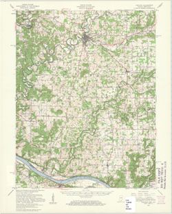
![Indiana Clay City quadrangle [1936 reprint]](https://iiif.uits.iu.edu/iiif/2/wd376z59h%2Ffiles%2Faa45c1aa-fb05-4809-a96b-7abd27014bc5/full/250,/0/default.jpg)
- Subject:
- Geographic Subject: Vigo County (Ind.), Geographic Subject: Putnam County (Ind.), Geographic Subject: Clay County (Ind.), and Geographic Subject: Owen County...
- Creator:
- Sadler, C. L., Marshall, R. B. (Robert Bradford), 1867-1949, Geological Survey (U.S.), and Herron, W. H. (William Harrison), 1865-
- Publisher:
- Geological Survey (U.S.)
- Date Created:
- 1936
- Identifier:
- VAC3073-M-01323
- Genre:
- Quadrangle maps, 15 minute topographic maps, and Topographic maps
- Geographic Location:
- Coordinates: W0871500 W0870000 N0393000 N0391500
- Related URL:
- Catalog URL: https://iucat.iu.edu/catalog/a18406394
- Abstract:
- Engraved July 1910 by U.S.G.S. , R. B. Marshall, chief geographer , W. H. Herron, geographer in charge , topography by C. L. Sadler , [and three others]. Rel...
- Call Number:
- G4090 s62 .G4 Clay City 1910 rep1936
- Caption:
- Imprint: [Washington, D.C.] : U.S. Geological Survey, 1936
- Physical Description:
- Scale: 1:62,500 and Dimensions: 45 x 42 cm or smaller
- Alternate Identifier:
- Title Control Number: a18406394
- Persistent URL:
- https://purl.dlib.indiana.edu/iudl/images/VAC3073/VAC3073-M-01323
- Provenance:
- Part of Geological Survey (U.S.). Indiana 1:62,500.
-
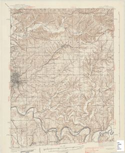
![Indiana-Kentucky Corydon quadrangle [1931 printing]](https://iiif.uits.iu.edu/iiif/2/vq280r404%2Ffiles%2F2b715af8-dded-4de4-a4e3-8e1c86dcc800/full/250,/0/default.jpg)
- Subject:
- Geographic Subject: Meade County (Ky.)
- Creator:
- Kentucky Geological Survey, Higginson, W. S. (William Smith Muir), 1894-1984, United States. Army, and Geological Survey (U.S.)
- Publisher:
- Geological Survey (U.S.)
- Date Created:
- 1931
- Identifier:
- VAC3073-M-01321
- Genre:
- 15 minute topographic maps, Topographic maps, and Quadrangle maps
- Geographic Location:
- Coordinates: W0861500 W0860000 N0381500 N0380000
- Related URL:
- Catalog URL: https://iucat.iu.edu/catalog/18406398
- Abstract:
- Topography by W.S. Higginson , Ohio River by Corps of Engineers, U.S. Army , control by U.S. Geological Survey and Corps of Engineers, U.S. Army. Filing titl...
- Call Number:
- G4090 s62 .G4 Corydon 1931
- Caption:
- Imprint: [Washington, D.C.] : Dept. of the Interior, U.S. Geological Survey, [1931]
- Physical Description:
- Scale: 1:62,500 and Dimensions: 45 x 42 cm or smaller
- Alternate Identifier:
- Title Control Number: a18406398
- Persistent URL:
- https://purl.dlib.indiana.edu/iudl/images/VAC3073/VAC3073-M-01321
- Provenance:
- Part of Geological Survey (U.S.). Indiana 1:62,500.
-
- Subject:
- Topical Subject: Physical geography and Geographic Subject: Corydon (Ind.)
- Creator:
- Geological Survey (U.S.)
- Publisher:
- Geological Survey (U.S.)
- Date Created:
- 1959
- Identifier:
- VAC3073-M-01319
- Genre:
- Quadrangle maps and Topographic maps
- Geographic Location:
- Coordinates: W0861500 W0860000 N0381500 N0380000
- Related URL:
- Catalog URL: https://iucat.iu.edu/catalog/2863930
- Abstract:
- Relief shown by contours and spot heights. Shows portions of Harrison County, Indiana, and Meade County, Kentucky. Compiled in 1956 from 1:25,000-scale maps ...
- Call Number:
- G4090 s62 .G4 Corydon 1950 rep1959
- Caption:
- Imprint: Washington, D.C. : United States, Department of the Interior, Geological Survey, 1959
- Physical Description:
- Scale: 1:62,500 and Dimensions: 45 x 36 cm
- Persistent URL:
- https://purl.dlib.indiana.edu/iudl/images/VAC3073/VAC3073-M-01319
- Provenance:
- USGS 15 minute series (topographic)
-
- Subject:
- Geographic Subject: Jackson County (Ind.), Geographic Subject: Lawrence County (Ind.), Geographic Subject: Washington County (Ind.), and Geographic Subject: ...
- Creator:
- Geological Survey (U.S.) and Kilmartin, J. O. (Jerome O'Farrell), 1900-1979
- Publisher:
- Geological Survey (U.S.)
- Date Created:
- 1937
- Identifier:
- VAC3073-M-01314
- Genre:
- Topographic maps, Quadrangle maps, and 15 minute topographic maps
- Geographic Location:
- Coordinates: W0863000 W0861500 N0390000 N0384500
- Related URL:
- Catalog URL: https://iucat.iu.edu/catalog/18408529
- Abstract:
- Topography by J. O. Kilmartin, Shirley Waggener, W. H. Austin, G. G. Martin, and C. W. Birdseye. Polyconic projection. Relief shown by contours and spot heig...
- Call Number:
- G4090 s62 .G4 Bedford 1937
- Caption:
- Imprint: Washington, D.C. : U.S. Dept. of the Interior, Geological Survey, 1937.
- Physical Description:
- Scale: 1:62,500 and Dimensions: 45 x 42 cm or smaller
- Alternate Identifier:
- Title Control Number: a18408529
- Persistent URL:
- https://purl.dlib.indiana.edu/iudl/images/VAC3073/VAC3073-M-01314
- Provenance:
- Part of Geological Survey (U.S.). Indiana 1:62,500.
-
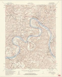
![Alton quadrangle, Indiana--Kentucky : 15 minute series (topographic) [Vegetation version]](https://iiif.uits.iu.edu/iiif/2/ng452m33b%2Ffiles%2F49c9606f-c7c7-4f10-807b-1b5949009698/full/250,/0/default.jpg)
- Subject:
- Geographic Subject: Crawford County (Ind.), Topical Subject: Vegetation mapping, Geographic Subject: Breckinridge County (Ky.), Geographic Subject: Meade Cou...
- Creator:
- Geological Survey (U.S.) and United States. Army Map Service
- Publisher:
- Geological Survey (U.S.)
- Date Created:
- 1959
- Identifier:
- VAC3073-M-01313
- Genre:
- Quadrangle maps, 15 minute topographic maps, and Topographic maps
- Geographic Location:
- Coordinates: W0863000 W0861500 N0381500 N0380000
- Related URL:
- Catalog URL: https://iucat.iu.edu/catalog/18406357
- Abstract:
- Mapped by the Geological Survey and the Army Map Service. Filing title: Alton, Ind.--Ky. Polyconic projection. Relief shown by contours and spot heights. Inc...
- Call Number:
- G4090 s62 .G4 Alton 1950 rep1959 V
- Caption:
- Imprint: Washington, D.C. : Interior--Geological Survey, 1959.
- Physical Description:
- Dimensions: 45 x 42 cm or smaller and Scale: 1:62,500
- Alternate Identifier:
- Title Control Number: a18406357
- Persistent URL:
- https://purl.dlib.indiana.edu/iudl/images/VAC3073/VAC3073-M-01313
- Provenance:
- Part of Geological Survey (U.S.). Indiana 1:62,500.
-
- Subject:
- Geographic Subject: Breckinridge County (Ky.), Geographic Subject: Perry County (Ind.), Geographic Subject: Harrison County (Ind.), Geographic Subject: Meade...
- Creator:
- United States. Army Map Service and Geological Survey (U.S.)
- Publisher:
- Geological Survey (U.S.)
- Date Created:
- 1959
- Identifier:
- VAC3073-M-01312
- Genre:
- Topographic maps, Quadrangle maps, and 15 minute topographic maps
- Geographic Location:
- Coordinates: W0863000 W0861500 N0381500 N0380000
- Related URL:
- Catalog URL: https://iucat.iu.edu/catalog/18406357
- Abstract:
- Mapped by the Geological Survey and the Army Map Service. Filing title: Alton, Ind.--Ky. Polyconic projection. Relief shown by contours and spot heights. Inc...
- Call Number:
- G4090 s62 .G4 Alton 1950 R1959
- Caption:
- Imprint: Washington, D.C. : Interior--Geological Survey, 1959.
- Physical Description:
- Scale: 1:62,500 and Dimensions: 45 x 42 cm or smaller
- Alternate Identifier:
- Title Control Number: a18406357
- Persistent URL:
- https://purl.dlib.indiana.edu/iudl/images/VAC3073/VAC3073-M-01312
- Provenance:
- Part of Geological Survey (U.S.). Indiana 1:62,500.
-
![Danville quadrangle, Illinois-Indiana : topographic sheet [1946 reprint]](https://iiif.uits.iu.edu/iiif/2/dz011t65f%2Ffiles%2F0d88511d-4915-434c-875f-219d4a99befe/full/250,/0/default.jpg)
- Subject:
- Geographic Subject: Danville Region (Ill.), Geographic Subject: Vermillion County (Ind.), and Geographic Subject: Vermilion County (Ill.)
- Creator:
- Lloyd, W. J. (Topographer), Illinois. Department of Registration and Education, Geological Survey (U.S.), Illinois State Geological Survey, Hawkins, Geo. T. ...
- Publisher:
- Geological Survey (U.S.)
- Date Created:
- 1946
- Identifier:
- VAC3073-M-01311
- Genre:
- 15 minute topographic maps, Quadrangle maps, and Topographic maps
- Geographic Location:
- Coordinates: W0874500 W0873000 N0401500 N0400000
- Related URL:
- Catalog URL: https://iucat.iu.edu/catalog/18409392
- Abstract:
- Jno. H. Renshawe, geographer in charge , control by U.S. Lake Survey and Geo. T. Hawkins , topography by W. J. Lloyd. Edition of Nov. 1900, reprinted 1946 wi...
- Call Number:
- G4090 s62 .G4 Danville 1900 R1946
- Caption:
- Imprint: [Washington, D.C.] : Geological Survey, [1946]
- Physical Description:
- Scale: 1:62,500 and Dimensions: 45 x 42 cm or smaller
- Alternate Identifier:
- Title Control Number: a18409392
- Persistent URL:
- https://purl.dlib.indiana.edu/iudl/images/VAC3073/VAC3073-M-01311
- Provenance:
- Part of Geological Survey (U.S.). Indiana 1:62,500.
-
![Indiana-Ohio, Winchester quadrangle [1918 printing]](https://iiif.uits.iu.edu/iiif/2/xw42pc314%2Ffiles%2F87f0e842-bedb-4ab3-a0e6-270a4e9f7c9a/full/250,/0/default.jpg)
- Subject:
- Geographic Subject: Darke County (Ohio), Geographic Subject: Randolph County (Ind.), and Geographic Subject: Wayne County (Ind.)
- Creator:
- Smith, Glenn S. (Glenn Shepard), Herron, W. H. (William Harrison), 1865-, Geological Survey (U.S.), Ohio. Division of Geological Survey, Harrison, R. L. (Top...
- Publisher:
- Geological Survey (U.S.)
- Date Created:
- 1918
- Identifier:
- VAC3073-M-01310
- Genre:
- 15 minute topographic maps, Quadrangle maps, and Topographic maps
- Geographic Location:
- Coordinates: W0850000 W0844500 N0401500 N0400000
- Related URL:
- Catalog URL: https://iucat.iu.edu/catalog/18416004
- Abstract:
- W.H. Herron, acting chief geogrpher , Glenn S. Smith, topographic engineer in charge , topography by R.L. Harrison and W.L. Miller , control by J.R. Ellis, J...
- Call Number:
- G4090 s62 .G4 Winchester 1918
- Caption:
- Imprint: [Washington, D.C.] : U.S. Geological Survey, [1918]
- Physical Description:
- Scale: 1:62,500 and Dimensions: 45 x 42 cm or smaller
- Alternate Identifier:
- Title Control Number: a18416004
- Persistent URL:
- https://purl.dlib.indiana.edu/iudl/images/VAC3073/VAC3073-M-01310
- Provenance:
- Part of Geological Survey (U.S.). Indiana 1:62,500.
-
![Indiana Velpen quadrangle [1903 printing]](https://iiif.uits.iu.edu/iiif/2/70796d46b%2Ffiles%2F57edc4e0-ddd1-4ff6-ab07-25dd93b93b50/full/250,/0/default.jpg)
- Subject:
- Geographic Subject: Dubois County (Ind.) and Geographic Subject: Pike County (Ind.)
- Creator:
- Geological Survey (U.S.), Renshawe, John H., Goodlove, C. W., and Hawkins, Geo. T. (George T.)
- Publisher:
- Geological Survey (U.S.)
- Date Created:
- 1903
- Identifier:
- VAC3073-M-01309
- Genre:
- 15 minute topographic maps, Quadrangle maps, and Topographic maps
- Geographic Location:
- Coordinates: W0871500 W0870000 N0383000 N0381500
- Related URL:
- Catalog URL: https://iucat.iu.edu/catalog/18415495
- Abstract:
- Jno. H. Renshawe, geographer in charge , control by Geo. T. Hawkins , topography by Chas. W. Goodlove , engraved Oct. 1902 by U.S.G.S. Edition of Feb. 1903. ...
- Call Number:
- G4090 s62 .G4 Velpen 1903
- Caption:
- Imprint: Washington, D.C. : U.S. Geological Survey, [1903]
- Physical Description:
- Scale: 1:62,500 and Dimensions: 45 x 42 cm or smaller
- Alternate Identifier:
- Title Control Number: a18415495
- Persistent URL:
- https://purl.dlib.indiana.edu/iudl/images/VAC3073/VAC3073-M-01309
- Provenance:
- Part of Geological Survey (U.S.). Indiana 1:62,500.
-
![Indiana (Lake County) Toleston quadrangle [sic] [1925 reprint]](https://iiif.uits.iu.edu/iiif/2/nv9366132%2Ffiles%2Fc74627e7-5593-47de-975f-832790864c3e/full/250,/0/default.jpg)
- Subject:
- Geographic Subject: Lake County (Ind.)
- Creator:
- Renshawe, John H., U.S. Lake Survey, McKinney, R. C. (Robert C.), and Geological Survey (U.S.)
- Publisher:
- Geological Survey (U.S.)
- Date Created:
- 1925
- Identifier:
- VAC3073-M-01308
- Genre:
- 15 minute topographic maps, Topographic maps, and Quadrangle maps
- Geographic Location:
- Coordinates: W0873000 W0871500 N0414500 N0413000
- Related URL:
- Catalog URL: https://iucat.iu.edu/catalog/18406229
- Abstract:
- United States, Department of the Interior, Geological Survey , Jno. H. Renshawe, geographer in charge , control by U.S. Lake Survey , topography by R. C. McK...
- Call Number:
- G4090 s62 .G4 Toleston 1900 R1925
- Caption:
- Imprint: Washington, D. C. : United States, Department of the Interior, Geological Survey, 1925
- Physical Description:
- Scale: 1:62,500 and Dimensions: 45 x 42 cm or smaller
- Alternate Identifier:
- Title Control Number: a18406229
- Persistent URL:
- https://purl.dlib.indiana.edu/iudl/images/VAC3073/VAC3073-M-01308
