
Search Constraints
You searched for:
Publisher
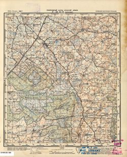
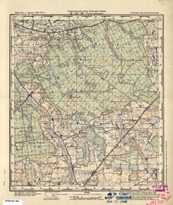
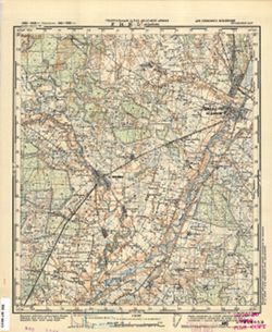
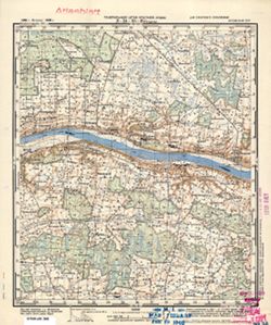
Генеральный штаб Красной Армии
Remove constraint Publisher: Генеральный штаб Красной Армии
Search Results
-
- Subject:
- Topical Subject: Maps, Geographic Subject: Vysokoye, and Topical Subject: Soviet Union
- Publisher:
- Генеральный штаб Красной Армии
- Language:
- Russian
- Date Created:
- 1941
- Identifier:
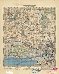
- VAC9619-000310
- Genre:
- Topographic Maps and Military Maps
- Geographic Location:
- Coordinates: 54.6667, 21.5, 54.8333, 21.75
- Related URL:
- Catalog URL: http://iucat.iu.edu/catalog/5020131 and Download GeoTIFF: https://drive.google.com/open?id=119U3JubQYo4LhGGnlxPWioaNZlAYeOpL
- Abstract:
- Modern area represented: Vysokoye, Kaliningrad oblast, Russia
- Call Number:
- G7000 s50 .S68 N-34-44-C
- City:
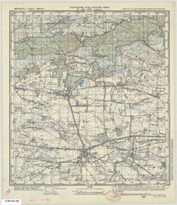
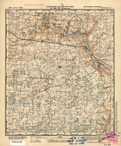
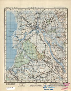
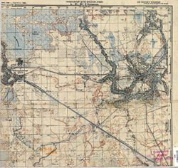
- Попелькен (Popelken)
- Copyright Holder:
- No Copyright - United States
- Country:
- Германия (Germany) and Восточная Пруссия (East Prussia)
- Physical Description:
- Scale: 1:50,000
- Persistent URL:
- http://purl.dlib.indiana.edu/iudl/images/VAC9619/VAC9619-000310
- Provenance:
- M. I. Map Library, Justus Perthes Kartensammlung, GS, RA, G000-30
-
- Subject:
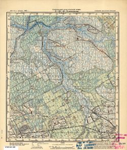
- Topical Subject: Soviet Union, Topical Subject: Maps, and Geographic Subject: Zhilino
- Publisher:
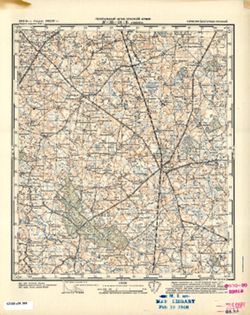
- Генеральный штаб Красной Армии
- Language:
- Russian
- Date Created:
- 1941
- Identifier:
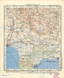
- VAC9619-000309
- Genre:
- Military Maps and Topographic Maps
- Geographic Location:
- Coordinates: 54.8333, 21.75, 55, 22
- Related URL:
- Download GeoTIFF: https://drive.google.com/open?id=1V9sqmHmIxS5zzH2m3TAh7VgON7QnP3El and Catalog URL: http://iucat.iu.edu/catalog/5020131
- Abstract:
- Modern area represented: Zhilino, Kaliningrad oblast, Russia
- Call Number:
- G7000 s50 .S68 N-34-44-B
- City:
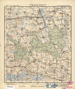
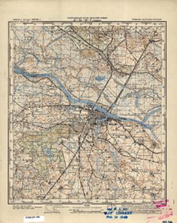
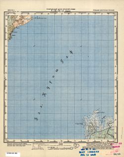
- Жиллен (Schillen)
- Copyright Holder:
- No Copyright - United States
- Country:
- Германия (Germany) and Восточная Пруссия (East Prussia)
- Physical Description:
- Scale: 1:50,000
- Persistent URL:
- http://purl.dlib.indiana.edu/iudl/images/VAC9619/VAC9619-000309
- Provenance:
- M. I. Map Library, G000-30, GS, RA
-
- Subject:
- Topical Subject: Soviet Union, Topical Subject: Maps, and Geographic Subject: Bolshakovo
- Publisher:
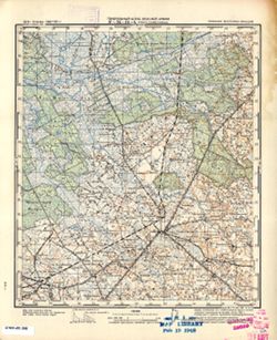
- Генеральный штаб Красной Армии
- Language:
- Russian
- Date Created:
- 1941
- Identifier:
- VAC9619-000308
- Genre:
- Military Maps and Topographic Maps
- Geographic Location:
- Coordinates: 54.8333, 21.5, 55, 21.75
- Related URL:
- Download GeoTIFF: https://drive.google.com/open?id=19PcjgAi9zxYa-pHquThpAofgnZdbJQoL and Catalog URL: http://iucat.iu.edu/catalog/5020131
- Abstract:
- Modern area represented: Bolshakovo, Kaliningrad oblast, Russia
- Call Number:
- G7000 s50 .S68 N-34-44-A
- City:
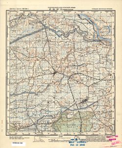
- Гросс Скайсгиррен (Gross Skaisgirren)
- Copyright Holder:
- No Copyright - United States
- Country:
- Германия (Germany) and Восточная Пруссия (East Prussia)
- Physical Description:
- Scale: 1:50,000
- Persistent URL:
- http://purl.dlib.indiana.edu/iudl/images/VAC9619/VAC9619-000308
- Provenance:
- M. I. Map Library, Justus Perthes Kartensammlung, GS, RA, G000-30
-
- Subject:
- Geographic Subject: Włochy, Topical Subject: Soviet Union, and Topical Subject: Maps
- Publisher:
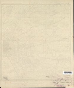
- Генеральный штаб Красной Армии
- Language:
- Russian
- Date Created:
- 1941
- Identifier:
- VAC9619-000307
- Genre:
- Military Maps and Topographic Maps
- Geographic Location:
- Coordinates: 52.167, 20.75, 52.333, 21
- Related URL:
- Catalog URL: http://iucat.iu.edu/catalog/5020131 and Download GeoTIFF: https://drive.google.com/open?id=14C8fA7ssMrS5fiNf1B-23TndSJGF1Gt_
- Abstract:
- Modern area represented: Włochy, Warszawa district, Poland
- Call Number:
- G7000 s50 .S68 sheet N-34-138-B
- Caption:
- Captured map
- City:
- Влохы (Włochy)
- Copyright Holder:
- No Copyright - United States
- Country:
- Область государственных интересов Германии (Region of German state interest)
- Physical Description:
- Scale: 1:50,000
- Persistent URL:
- http://purl.dlib.indiana.edu/iudl/images/VAC9619/VAC9619-000307
- Provenance:
- Army Map Service Library, OMAHA, Library of Congress Geography & Map Division
-
- Subject:
- Geographic Subject: Novaya Derevnya, Topical Subject: Soviet Union, and Topical Subject: Maps
- Publisher:
- Генеральный штаб Красной Армии
- Language:
- Russian
- Date Created:
- 1941
- Identifier:
- VAC9619-000306
- Genre:
- Topographic Maps and Military Maps
- Geographic Location:
- Coordinates: 54.6667, 21.25, 54.8333, 21.5
- Related URL:
- Download GeoTIFF: https://drive.google.com/open?id=1d7qhw4olwOaD4K9Ity-NnFDGdbmB07Tt and Catalog URL: http://iucat.iu.edu/catalog/5020131
- Abstract:
- Modern area represented: Novaya Derevnya, Kaliningrad oblast, Russia
- Call Number:
- G7000 s50 .S68 N-34-43-D
- City:
- Альт Гертлаукен (Alt Gertlauken)
- Copyright Holder:
- No Copyright - United States
- Country:
- Восточная Пруссия (East Prussia) and Германия (Germany)
- Physical Description:
- Scale: 1:50,000
- Persistent URL:
- http://purl.dlib.indiana.edu/iudl/images/VAC9619/VAC9619-000306
- Provenance:
- M. I. Map Library, G000-30, GS, RA
-
- Subject:
- Topical Subject: Soviet Union, Topical Subject: Maps, and Geographic Subject: Zelenovo
- Publisher:
- Генеральный штаб Красной Армии
- Language:
- Russian
- Date Created:
- 1941
- Identifier:
- VAC9619-000305
- Genre:
- Military Maps and Topographic Maps
- Geographic Location:
- Coordinates: 54.8333, 21.25, 55, 21.5
- Related URL:
- Download GeoTIFF: https://drive.google.com/open?id=1C0f1MsDe1rG8fTjXg3-lYybCcTgY7418 and Catalog URL: http://iucat.iu.edu/catalog/5020131
- Abstract:
- Modern area represented: Zelenovo, Kaliningrad oblast, Russia
- Call Number:
- G7000 s50 .S68 N-34-43-B
- City:
- Минхенвальде (Minchenwalde)
- Copyright Holder:
- No Copyright - United States
- Country:
- Восточная Пруссия (East Prussia) and Германия (Germany)
- Physical Description:
- Scale: 1:50,000
- Persistent URL:
- http://purl.dlib.indiana.edu/iudl/images/VAC9619/VAC9619-000305
- Provenance:
- M. I. Map Library, G000-30, GS, RA
-
- Subject:
- Topical Subject: Maps, Topical Subject: Soviet Union, and Geographic Subject: Slavinsk
- Publisher:
- Генеральный штаб Красной Армии
- Language:
- Russian
- Date Created:
- 1941
- Identifier:
- VAC9619-000304
- Genre:
- Military Maps and Topographic Maps
- Geographic Location:
- Coordinates: 54.6667, 21, 54.8333, 21.25
- Related URL:
- Download GeoTIFF: https://drive.google.com/open?id=1L6nBGN6V98B1x-oD0qhHsmAvVAXHFroi and Catalog URL: http://iucat.iu.edu/catalog/5020131
- Abstract:
- Modern area represented: Slavinsk, Kaliningrad oblast, Russia
- Call Number:
- G7000 s50 .S68 N-34-43-C
- City:
- Гольдбах (Goldbach)
- Copyright Holder:
- No Copyright - United States
- Country:
- Германия (Germany) and Восточная Пруссия (East Prussia)
- Physical Description:
- Scale: 1:50,000
- Persistent URL:
- http://purl.dlib.indiana.edu/iudl/images/VAC9619/VAC9619-000304
- Provenance:
- DMA Topographic Center, Army Map Service Library, OMAHA, Library of Congress Geography & Map Division
-
- Subject:
- Topical Subject: Maps, Geographic Subject: Węgrów, and Topical Subject: Soviet Union
- Publisher:
- Генеральный штаб Красной Армии
- Language:
- Russian
- Date Created:
- 1941
- Identifier:
- VAC9619-000301
- Genre:
- Topographic Maps and Military Maps
- Geographic Location:
- Coordinates: 52.333, 22, 52.5, 22.25
- Related URL:
- https://drive.google.com/open?id=1AstHWpyMNvTtx5Ctj4KwLBTAmsNWn4dd, Catalog URL: http://iucat.iu.edu/catalog/5020131, and Download GeoTIFF: https://drive.goo...
- Abstract:
- Modern area represented: Węgrów, Poland
- Call Number:
- G7000 s50 .S68 sheet N-34-129-C
- Caption:
- Captured map
- City:
- Венгров (Węgrów)
- Copyright Holder:
- No Copyright - United States
- Country:
- Область государственных интересов Германии (Region of German state interest)
- Physical Description:
- Scale: 1:50,000
- Persistent URL:
- http://purl.dlib.indiana.edu/iudl/images/VAC9619/VAC9619-000301
- Provenance:
- Army Map Service Library, OMAHA, Library of Congress Geography & Map Division
-
- Subject:
- Topical Subject: Soviet Union, Geographic Subject: Błonie, and Topical Subject: Maps
- Publisher:
- Генеральный штаб Красной Армии
- Language:
- Russian
- Date Created:
- 1941
- Identifier:
- VAC9619-000303
- Genre:
- Topographic Maps and Military Maps
- Geographic Location:
- 52.333333, 20.75 and Coordinates: 52.166667, 20.5
- Related URL:
- Catalog URL: http://iucat.iu.edu/catalog/5020131 and Download GeoTIFF: https://drive.google.com/open?id=1XwEqb4ehqkxPPWKuUY4F-702MJLZ32tH
- Abstract:
- Modern area represented: Błonie, Poland
- Call Number:
- G7000 s50 .S68 sheet N-34-138-A
- City:
- Блоне (Błonie)
- Copyright Holder:
- No Copyright - United States
- Country:
- Область государственных интересов Германии (Region of German state interest)
- Physical Description:
- Scale: 1:50,000
- Persistent URL:
- http://purl.dlib.indiana.edu/iudl/images/VAC9619/VAC9619-000303
- Provenance:
- Library of Congress Geography & Map Division
-
- Subject:
- Geographic Subject: Sokołów Podlaski, Topical Subject: Soviet Union, and Topical Subject: Maps
- Publisher:
- Генеральный штаб Красной Армии
- Language:
- Russian
- Date Created:
- 1941
- Identifier:
- VAC9619-000302
- Genre:
- Topographic Maps and Military Maps
- Geographic Location:
- Coordinates: 52.333, 22.25, 52.5.22.5
- Related URL:
- Download GeoTIFF: https://drive.google.com/open?id=1IQGL8qQCdXA5kVofXrVFcb5Qq0EEZVsx and Catalog URL: http://iucat.iu.edu/catalog/5020131
- Abstract:
- Modern area represented: Sokołów Podlaski, Poland
- Call Number:
- G7000 s50 .S68 sheet N-34-129-D
- Caption:
- Captured map
- City:
- Соколув Подляски (Sokołów Podlaski)
- Copyright Holder:
- No Copyright - United States
- Country:
- Область государственных интересов Германии (Region of German state interest)
- Physical Description:
- Scale: 1:50,000
- Persistent URL:
- http://purl.dlib.indiana.edu/iudl/images/VAC9619/VAC9619-000302
- Provenance:
- Army Map Service Library, OMAHA, Library of Congress Geography & Map Division
-
- Subject:
- Geographic Subject: Kosów Lacki, Topical Subject: Maps, and Topical Subject: Soviet Union
- Publisher:
- Генеральный штаб Красной Армии
- Language:
- Russian
- Date Created:
- 1941
- Identifier:
- VAC9619-000300
- Genre:
- Military Maps and Topographic Maps
- Geographic Location:
- Coordinates: 52.5, 22, 52.667, 22.25
- Related URL:
- Download GeoTIFF: https://drive.google.com/open?id=1RbDJ2uN84rX-cIfifoA_mSEM0R8L6Jgd and Catalog URL: http://iucat.iu.edu/catalog/5020131
- Abstract:
- Modern area represented: Kosów Lacki, Poland
- Call Number:
- G7000 s50 .S68 sheet N-34-129-A
- Caption:
- Captured map
- City:
- Коссув (Kosów)
- Copyright Holder:
- No Copyright - United States
- Country:
- Область государственных интересов Германии (Region of German state interest)
- Physical Description:
- Scale: 1:50,000
- Persistent URL:
- http://purl.dlib.indiana.edu/iudl/images/VAC9619/VAC9619-000300
- Provenance:
- Army Map Service Library, OMAHA, Library of Congress Geography & Map Division
-
- Subject:
- Topical Subject: Maps, Topical Subject: Soviet Union, and Geographic Subject: Veselovka
- Publisher:
- Генеральный штаб Красной Армии
- Language:
- Russian
- Date Created:
- 1941
- Identifier:
- VAC9619-000299
- Genre:
- Military Maps and Topographic Maps
- Geographic Location:
- Coordinates: 54.6667, 20.75, 54.8333, 21
- Related URL:
- Download GeoTIFF: https://drive.google.com/open?id=1Zhi0YHWIbRBoZq_SWfI-589-afYjPkOr and Catalog URL: http://iucat.iu.edu/catalog/5020131
- Abstract:
- Modern area represented: Veselovka, Kaliningrad oblast, Russia
- Call Number:
- G7000 s50 .S68 N-34-42-D
- City:
- Зилькайм (Sielkeim)
- Copyright Holder:
- No Copyright - United States
- Country:
- Германия (Germany) and Восточная Пруссия (East Prussia)
- Physical Description:
- Scale: 1:50,000
- Persistent URL:
- http://purl.dlib.indiana.edu/iudl/images/VAC9619/VAC9619-000299
- Provenance:
- M. I. Map Library, G000-30, GS, RA
-
- Subject:
- Topical Subject: Soviet Union, Geographic Subject: Liw, and Topical Subject: Maps
- Publisher:
- Генеральный штаб Красной Армии
- Language:
- Russian
- Date Created:
- 1941
- Identifier:
- VAC9619-000298
- Genre:
- Military Maps and Topographic Maps
- Geographic Location:
- Coordinates: 52.333, 21.75, 52.5, 22
- Related URL:
- Catalog URL: http://iucat.iu.edu/catalog/5020131 and Download GeoTIFF: https://drive.google.com/open?id=1tTJRJFHV-T1fp6A9J33XfIr0xLA9Crv7
- Abstract:
- Modern area represented: Liw, Poland
- Call Number:
- G7000 s50 .S68 sheet N-34-128-D
- Caption:
- Captured map
- City:
- Лив (Liw)
- Copyright Holder:
- No Copyright - United States
- Country:
- Область государственных интересов Германии (Region of German state interest)
- Physical Description:
- Scale: 1:50,000
- Persistent URL:
- http://purl.dlib.indiana.edu/iudl/images/VAC9619/VAC9619-000298
- Provenance:
- Army Map Service Library, OMAHA, Library of Congress Geography & Map Division
-
- Subject:
- Geographic Subject: Kaliningrad, Topical Subject: Maps, and Topical Subject: Soviet Union
- Publisher:
- Генеральный штаб Красной Армии
- Language:
- Russian
- Date Created:
- 1941
- Identifier:
- VAC9619-000297
- Genre:
- Military Maps and Topographic Maps
- Geographic Location:
- Coordinates: 54.6667, 20.5, 54.8333, 20.75
- Related URL:
- Catalog URL: http://iucat.iu.edu/catalog/5020131 and Download GeoTIFF: https://drive.google.com/open?id=1btVnqgKmtU5kyCL-jDRPPQZcpeq37hcm
- Abstract:
- Modern area represented: Kaliningrad, Kaliningrad oblast, Russia
- Call Number:
- G7000 s50 .S68 sheet N-34-42-C
- City:
- Кенигсберг (Königsberg)
- Copyright Holder:
- No Copyright - United States
- Country:
- Германия (Germany) and Восточная Пруссия (East Prussia)
- Physical Description:
- Scale: 1:50,000
- Persistent URL:
- http://purl.dlib.indiana.edu/iudl/images/VAC9619/VAC9619-000297
- Provenance:
- M. I. Map Library, Justus Perthes Kartensammlung, GS, RA, G000-30
-
- Subject:
- Topical Subject: Soviet Union, Geographic Subject: Slavyanskoye, and Topical Subject: Maps
- Publisher:
- Генеральный штаб Красной Армии
- Language:
- Russian
- Date Created:
- 1941
- Identifier:
- VAC9619-000296
- Genre:
- Military Maps and Topographic Maps
- Geographic Location:
- Coordinates: 54.8333, 20.75, 55, 21
- Related URL:
- Download GeoTIFF: https://drive.google.com/open?id=1JpCxQGs-ku7_aKK9QJ-Yi8d6ojOEGJ1Z and Catalog URL: http://iucat.iu.edu/catalog/5020131
- Abstract:
- Modern area represented: Slavyanskoye, Kaliningrad oblast, Russia
- Call Number:
- G7000 s50 .S68 sheet N-34-42-B
- City:
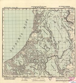
- Прониттен (Pronitten)
- Copyright Holder:
- No Copyright - United States
- Country:
- Восточная Пруссия (East Prussia) and Германия (Germany)
- Physical Description:
- Scale: 1:50,000
- Persistent URL:
- http://purl.dlib.indiana.edu/iudl/images/VAC9619/VAC9619-000296
- Provenance:
- M. I. Map Library, G000-30, GS, RA
-
- Subject:
- Geographic Subject: Khrabrovo, Topical Subject: Soviet Union, and Topical Subject: Maps
- Publisher:
- Генеральный штаб Красной Армии
- Language:
- Russian
- Date Created:
- 1941
- Identifier:
- VAC9619-000295
- Genre:
- Military Maps and Topographic Maps
- Geographic Location:
- Coordinates: 54.8333, 20.5, 55, 20.75
- Related URL:
- Download GeoTIFF: https://drive.google.com/open?id=1mE_Zq6yF1U73QesqonB6FpV86Gpr_nWN and Catalog URL: http://iucat.iu.edu/catalog/5020131
- Abstract:
- Modern area represented: Khrabrovo, Kaliningrad oblast, Russia
- Call Number:
- G7000 s50 .S68 sheet N-34-42-A
- City:
- Повунден (Powunden)
- Copyright Holder:
- No Copyright - United States
- Country:
- Германия (Germany) and Восточная Пруссия (East Prussia)
- Physical Description:
- Scale: 1:50,000
- Persistent URL:
- http://purl.dlib.indiana.edu/iudl/images/VAC9619/VAC9619-000295
- Provenance:
- M. I. Map Library, G000-30, GS, RA
-
- Subject:
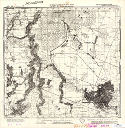
- Topical Subject: Maps, Topical Subject: Soviet Union, and Geographic Subject: Kaliningrad
- Publisher:
- Генеральный штаб Красной Армии
- Language:
- Russian
- Date Created:
- 1941
- Identifier:
- VAC9619-000294
- Genre:
- Military Maps and Topographic Maps
- Geographic Location:
- Coordinates: 54.6667, 20.25, 54.8333, 20.5
- Related URL:
- Catalog URL: http://iucat.iu.edu/catalog/5020131 and Download GeoTIFF: https://drive.google.com/open?id=1jqYxqQT4G1gKvSU5OFPEiZpq39xQ12-Y
- Abstract:
- Modern area represented: Kaliningrad, Kaliningrad oblast, Russia
- Call Number:
- G7000 s50 .S68 N-34-41-D
- City:
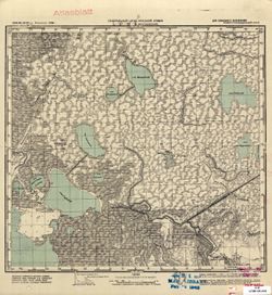
- Кенигсберг (Königsberg)
- Copyright Holder:
- No Copyright - United States
- Country:
- Германия (Germany) and Восточная Пруссия (East Prussia)
- Physical Description:
- Scale: 1:50,000
- Persistent URL:
- http://purl.dlib.indiana.edu/iudl/images/VAC9619/VAC9619-000294
- Provenance:
- M. I. Map Library, G000-30, GS, RA, Atlasblatt
-
- Subject:
- Geographic Subject: Jadów, Topical Subject: Maps, and Topical Subject: Soviet Union
- Publisher:
- Генеральный штаб Красной Армии
- Language:
- Russian
- Date Created:
- 1941
- Identifier:
- VAC9619-000293
- Genre:
- Topographic Maps and Military Maps
- Geographic Location:
- Coordinates: 52.333, 21.5, 52.5, 21.75
- Related URL:
- Download GeoTIFF: https://drive.google.com/open?id=1hiVAYx8ZS4EwSw7_0KGYsUZ270Lxmfee and Catalog URL: http://iucat.iu.edu/catalog/5020131
- Abstract:
- Modern area represented: Jadów, Poland
- Call Number:
- G7000 s50 .S68 sheet N-34-128-C
- Caption:
- Captured map
- City:
- Ядув (Jadów)
- Copyright Holder:
- No Copyright - United States
- Country:
- Область государственных интересов Германии (Region of German state interest)
- Physical Description:
- Scale: 1:50,000
- Persistent URL:
- http://purl.dlib.indiana.edu/iudl/images/VAC9619/VAC9619-000293
- Provenance:
- Army Map Service Library, OMAHA, Library of Congress Geography & Map Division
-
- Subject:
- Topical Subject: Maps, Geographic Subject: Primorsk, and Topical Subject: Soviet Union
- Publisher:
- Генеральный штаб Красной Армии
- Language:
- Russian
- Date Created:
- 1941
- Identifier:
- VAC9619-000291
- Genre:
- Military Maps and Topographic Maps
- Geographic Location:
- Coordinates: 54.6667, 20, 54.8333, 20.25
- Related URL:
- Download GeoTIFF: https://drive.google.com/open?id=1-vSWcXo4rU8w-4QM2K6e3812hKVVBkLb and Catalog URL: http://iucat.iu.edu/catalog/5020131
- Abstract:
- Modern area represented: Primorsk, Kaliningrad oblast, Russia
- Call Number:
- G7000 s50 .S68 sheet N-34-41-C
- City:
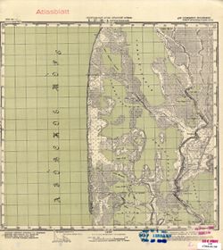
- Фишхаузен (Fischhausen)
- Copyright Holder:
- No Copyright - United States
- Country:
- Восточная Пруссия (East Prussia) and Германия (Germany)
- Physical Description:
- Scale: 1:50,000
- Persistent URL:
- http://purl.dlib.indiana.edu/iudl/images/VAC9619/VAC9619-000291
- Provenance:
- CIA Map Branch -- Received, G000-30
-
- Subject:
- Topical Subject: Soviet Union, Topical Subject: Maps, and Geographic Subject: Sadowne
- Publisher:
- Генеральный штаб Красной Армии
- Language:
- Russian
- Date Created:
- 1941
- Identifier:
- VAC9619-000292
- Genre:
- Military Maps and Topographic Maps
- Geographic Location:
- Coordinates: 52.5, 21.75, 52.667, 22
- Related URL:
- Download GeoTIFF: https://drive.google.com/open?id=1upHE4d4F4g2J4mTon84r0ep1eQcf5P-N and Catalog URL: http://iucat.iu.edu/catalog/5020131
- Abstract:
- Modern area represented: Sadowne, Poland
- Call Number:
- G7000 s50 .S68 sheet N-34-128-B
- Caption:
- Captured map
- City:
- Садовно (Sadowno)
- Copyright Holder:
- No Copyright - United States
- Country:
- Область государственных интересов Германии (Region of German state interest)
- Physical Description:
- Scale: 1:50,000
- Persistent URL:
- http://purl.dlib.indiana.edu/iudl/images/VAC9619/VAC9619-000292
- Provenance:
- Army Map Service Library, Library of Congress Geography & Map Division
-
- Subject:
- Geographic Subject: Zelenogradsk, Topical Subject: Soviet Union, and Topical Subject: Maps
- Publisher:
- Генеральный штаб Красной Армии
- Language:
- Russian
- Date Created:
- 1941
- Identifier:
- VAC9619-000290
- Genre:
- Topographic Maps and Military Maps
- Geographic Location:
- Coordinates: 54.8333, 20.25, 55, 20.5
- Related URL:
- Download GeoTIFF: https://drive.google.com/open?id=1PTSLgF5YplnCUoNgQq8oefcP84FKnDq3 and Catalog URL: http://iucat.iu.edu/catalog/5020131
- Abstract:
- Modern area represented: Zelenogradsk, Kaliningrad oblast, Russia
- Call Number:
- G7000 s50 .S68 N-34-41-B
- Caption:
- Captured map
- City:
- Гранц (Cranz)
- Copyright Holder:
- No Copyright - United States
- Country:
- Германия (Germany) and Восточная Пруссия (East Prussia)
- Physical Description:
- Scale: 1:50,000
- Persistent URL:
- http://purl.dlib.indiana.edu/iudl/images/VAC9619/VAC9619-000290
- Provenance:
- DMA Topographic Center, Army Map Service Library, OMAHA, Library of Congress Geography & Map Division
-
- Description:
- 1883
- Subject:
- Topical Subject: Soviet Union, Geographic Subject: Kamieńczyk, and Topical Subject: Maps
- Publisher:
- Генеральный штаб Красной Армии
- Language:
- Russian
- Date Created:
- 1941
- Identifier:
- VAC9619-000289
- Genre:
- Military Maps and Topographic Maps
- Geographic Location:
- Coordinates: 52.5, 21.5, 52.667, 21.75
- Related URL:
- Download GeoTIFF: https://drive.google.com/open?id=1Ao6js0s3o7l4v1VdwZ9fYWXZEVI9DpyJ and Catalog URL: http://iucat.iu.edu/catalog/5020131
- Abstract:
- Modern area represented: Kamieńczyk, Poland
- Call Number:
- G7000 s50 .S68 sheet N-34-128A
- Caption:
- Captured map
- City:
- Каменьчик (Kamieńczyk)
- Copyright Holder:
- No Copyright - United States
- State/Province:
- Область государственных интересов Германии (Region of German state interests)
- Physical Description:
- Scale: 1:50,000
- Persistent URL:
- http://purl.dlib.indiana.edu/iudl/images/VAC9619/VAC9619-000289
- Provenance:
- Army Map Service Library, Library of Congress Geography & Map Division
-
- Subject:
- Topical Subject: Maps, Topical Subject: Soviet Union, and Geographic Subject: Yantarnyy
- Publisher:
- Генеральный штаб Красной Армии
- Language:
- Russian
- Date Created:
- 1941
- Identifier:
- VAC9619-000288
- Genre:
- Topographic Maps and Military Maps
- Geographic Location:
- Coordinates: 54.8333, 19.75, 55, 20
- Related URL:
- Download GeoTIFF: https://drive.google.com/open?id=1Bzswq3lhSSbqy6pELm6FhVBf3P6HlDcJ and Catalog URL: http://iucat.iu.edu/catalog/5020131
- Abstract:
- Modern area represented: Yantarnyy, Kaliningrad oblast, Russia
- Call Number:
- G7000 s50 .S68 N-34-40-B
- City:
- Кракстепеллен (Kraxtepellen)
- Copyright Holder:
- No Copyright - United States
- Country:
- Германия (Germany) and Восточная Пруссия (East Prussia)
- Physical Description:
- Scale: 1:50,000
- Persistent URL:
- http://purl.dlib.indiana.edu/iudl/images/VAC9619/VAC9619-000288
- Provenance:
- M. I. Map Library, G000-30, GS, RA
-

- Subject:
- Topical Subject: Soviet Union, Geographic Subject: Babtai, and Topical Subject: Maps
- Publisher:
- Генеральный штаб Красной Армии
- Language:
- Russian
- Date Created:
- 1941
- Identifier:
- VAC9619-000287
- Genre:
- Topographic Maps and Military Maps
- Geographic Location:
- Coordinates: 55, 23.75, 55.1667, 24
- Related URL:
- Download GeoTIFF: https://drive.google.com/open?id=1cj9yEz51qAhJ4K5HCk38mh-U5uLggYh5 and Catalog URL: http://iucat.iu.edu/catalog/5020131
- Abstract:
- Modern area represented: Babtai, Lithuania
- Call Number:
- G7000 s50 .S68 N-34-36-D
- Caption:
- Для служебного пользования
- City:
- Бобты (Bobty)
- Copyright Holder:
- No Copyright - United States
- Country:
- СССР (USSR)
- State/Province:
- Литовская ССР (Lithuanian Soviet Socialist Republic)
- Physical Description:
- Scale: 1:50,000
- Persistent URL:
- http://purl.dlib.indiana.edu/iudl/images/VAC9619/VAC9619-000287
- Provenance:
- DMA Topographic Center, Army Map Service Library, OMAHA, Library of Congress Geography & Map Division
-
- Subject:
- Geographic Subject: Vilkija, Topical Subject: Soviet Union, and Topical Subject: Maps
- Publisher:
- Генеральный штаб Красной Армии
- Language:
- Russian
- Date Created:
- 1941
- Identifier:
- VAC9619-000286
- Genre:
- Topographic Maps and Military Maps
- Geographic Location:
- Coordinates: 55, 23.5, 55.1667, 23.75
- Related URL:
- Download GeoTIFF: https://drive.google.com/open?id=1RH4szRXF2kiGJPU2-nckAxpszHoGLS2N and Catalog URL: http://iucat.iu.edu/catalog/5020131
- Abstract:
- Modern area represented: Vilkija, Lithuania
- Call Number:
- G7000 s50 .S68 N-34-36-C
- Caption:
- Для служебного пользования
- City:
- Вильки (Vilki)
- Copyright Holder:
- No Copyright - United States
- Country:
- СССР (USSR)
- State/Province:
- Литовская ССР (Lithuanian Soviet Socialist Republic)
- Physical Description:
- Scale: 1:50,000
- Persistent URL:
- http://purl.dlib.indiana.edu/iudl/images/VAC9619/VAC9619-000286
- Provenance:
- DMA Topographic Center, Army Map Service Library, OMAHA, Library of Congress Geography & Map Division
-
- Subject:
- Topical Subject: Maps, Geographic Subject: Kėdainiai, and Topical Subject: Soviet Union
- Publisher:
- Генеральный штаб Красной Армии
- Language:
- Russian
- Date Created:
- 1941
- Identifier:
- VAC9619-000285
- Genre:
- Topographic Maps and Military Maps
- Geographic Location:
- Coordinates: 55.1667, 23.75, 55.3333, 24
- Related URL:
- Download GeoTIFF: https://drive.google.com/open?id=1uGlzXVd5V1MbMjl6rFakM6q19ovdnldY and Catalog URL: http://iucat.iu.edu/catalog/5020131
- Abstract:
- Modern area represented: Kėdainiai, Lithuania
- Call Number:
- G7000 s50 .S68 N-34-36-B
- Caption:
- Для служебного пользования
- City:
- Кедайняй (Kėdainiai)
- Copyright Holder:
- No Copyright - United States
- Country:
- СССР (USSR)
- State/Province:
- Литовская ССР (Lithuanian Soviet Socialist Republic)
- Physical Description:
- Scale: 1:50,000
- Persistent URL:
- http://purl.dlib.indiana.edu/iudl/images/VAC9619/VAC9619-000285
- Provenance:
- CIA Map Branch -- Received, G000-30, CIA Map Library
-
- Subject:
- Geographic Subject: Pelutava, Topical Subject: Soviet Union, and Topical Subject: Maps
- Publisher:
- Генеральный штаб Красной Армии
- Language:
- Russian
- Date Created:
- 1941
- Identifier:
- VAC9619-000284
- Genre:
- Military Maps and Topographic Maps
- Geographic Location:
- Coordinates: 55.1667, 23.5, 55.3333, 23.75
- Related URL:
- Download GeoTIFF: https://drive.google.com/open?id=1gPY8ZeP8E7c8W-aD4VZ7f8lRXVh3wsRI and Catalog URL: http://iucat.iu.edu/catalog/5020131
- Abstract:
- Modern area represented: Pelutava, Lithuania
- Call Number:
- G7000 s50 .S68 sheet N-34-36-A
- Caption:
- Для служебного пользования
- City:
- Пелутово (Pelutovo)
- Copyright Holder:
- No Copyright - United States
- Country:
- СССР (USSR)
- State/Province:
- Литовская ССР (Lithuanian Soviet Socialist Republic)
- Physical Description:
- Scale: 1:50,000
- Persistent URL:
- http://purl.dlib.indiana.edu/iudl/images/VAC9619/VAC9619-000284
- Provenance:
- DMA Topographic Center, Army Map Service Library, Library of Congress Geography & Map Division
-
- Subject:
- Geographic Subject: Seredžius, Topical Subject: Maps, and Topical Subject: Soviet Union
- Publisher:
- Генеральный штаб Красной Армии
- Language:
- Russian
- Date Created:
- 1941
- Identifier:
- VAC9619-000283
- Genre:
- Topographic Maps and Military Maps
- Geographic Location:
- Coordinates: 55, 23.25, 55.1667, 23.5
- Related URL:
- Download GeoTIFF: https://drive.google.com/open?id=1cqnpoW_Ue7x5yOhWZxm_PNF_g-VhYi5m and Catalog URL: http://iucat.iu.edu/catalog/5020131
- Abstract:
- Modern area represented: Seredžius, Lithuania
- Call Number:
- G7000 s50 .S68 N-34-35-D
- Caption:
- Для служебного пользования
- City:
- Средники
- Copyright Holder:
- No Copyright - United States
- Country:
- СССР (USSR)
- State/Province:
- Литовская ССР (Lithuanian Soviet Socialist Republic)
- Physical Description:
- Scale: 1:50,000
- Persistent URL:
- http://purl.dlib.indiana.edu/iudl/images/VAC9619/VAC9619-000283
- Provenance:
- DMA Topographic Center, Army Map Service Library, OMAHA, Library of Congress Geography & Map Division
-
- Subject:
- Geographic Subject: Raudonė, Topical Subject: Maps, and Topical Subject: Soviet Union
- Publisher:
- Генеральный штаб Красной Армии
- Language:
- Russian
- Date Created:
- 1941
- Identifier:
- VAC9619-000282
- Genre:
- Topographic Maps and Military Maps
- Geographic Location:
- Coordinates: 55, 23, 55.1667, 23.25
- Related URL:
- Catalog URL: http://iucat.iu.edu/catalog/5020131 and Download GeoTIFF: https://drive.google.com/open?id=1P-CXuLuZx2AgY8rW1OZVhCz_qKisvnvl
- Abstract:
- Modern area represented: Raudonė, Lithuania
- Call Number:
- G7000 s50 .S68 N-34-35-C
- Caption:
- Для служебного пользования
- City:
- Рауданы (Raudany)
- Copyright Holder:
- No Copyright - United States
- Country:
- СССР (USSR)
- State/Province:
- Литовская ССР (Lithuanian Soviet Socialist Republic)
- Physical Description:
- Scale: 1:50,000
- Persistent URL:
- http://purl.dlib.indiana.edu/iudl/images/VAC9619/VAC9619-000282
- Provenance:
- M. I. Map Library, G000-30, GS, RA, Atlasblatt
-
- Subject:
- Topical Subject: Maps, Topical Subject: Soviet Union, and Geographic Subject: Ariogala
- Publisher:
- Генеральный штаб Красной Армии
- Language:
- Russian
- Date Created:
- 1941
- Identifier:
- VAC9619-000281
- Genre:
- Military Maps and Topographic Maps
- Geographic Location:
- Coordinates: 55.1667, 23.25, 55.3333, 23.5
- Related URL:
- Download GeoTIFF: https://drive.google.com/open?id=1fT5kpcGPerFgkZJJcWRaEVcPzjsztRnE and Catalog URL: http://iucat.iu.edu/catalog/5020131
- Abstract:
- Modern area represented: Ariogala, Lithuania
- Call Number:
- G7000 s50 .S68 N-34-35-B
- Caption:
- Для служебного пользования
- City:
- Эйрагола (Eiragola)
- Copyright Holder:
- No Copyright - United States
- Country:
- СССР (USSR)
- State/Province:
- Литовская ССР (Lithuanian Soviet Socialist Republic)
- Physical Description:
- Scale: 1:50,000
- Persistent URL:
- http://purl.dlib.indiana.edu/iudl/images/VAC9619/VAC9619-000281
- Provenance:
- M. I. Map Library, G000-30, GS, RA, Atlasblatt
-
- Subject:
- Topical Subject: Soviet Union, Geographic Subject: Tłuszcz, and Topical Subject: Maps
- Publisher:
- Генеральный штаб Красной Армии
- Language:
- Russian
- Date Created:
- 1941
- Identifier:
- VAC9619-000280
- Genre:
- Military Maps and Topographic Maps
- Geographic Location:
- Coordinates: 52.333, 21.25, 52.5, 21.5
- Related URL:
- Catalog URL: http://iucat.iu.edu/catalog/5020131 and Download GeoTIFF: https://drive.google.com/open?id=18vCbBpU1qxQdLWjkLuUK1m4FdjzBvC5c
- Abstract:
- Modern area represented: Tłuszcz, Poland
- Call Number:
- G7000 s50 .S68 sheet N-34-127-D
- Caption:
- Captured map
- City:
- Тлущ (Tłuszcz)
- Copyright Holder:
- No Copyright - United States
- Country:
- Область государственных интересов Германии (Region of German state interest)
- Physical Description:
- Scale: 1:50,000
- Persistent URL:
- http://purl.dlib.indiana.edu/iudl/images/VAC9619/VAC9619-000280
- Provenance:
- Army Map Service Library, OMAHA, Library of Congress Geography & Map Division
-
- Subject:
- Topical Subject: Soviet Union, Geographic Subject: Sovetsk, and Topical Subject: Maps
- Publisher:
- Генеральный штаб Красной Армии
- Language:
- Russian
- Date Created:
- 1941
- Identifier:
- VAC9619-000279
- Genre:
- Military Maps and Topographic Maps
- Geographic Location:
- Coordinates: 55, 21.75, 55.1667, 22
- Related URL:
- Catalog URL: http://iucat.iu.edu/catalog/5020131 and Download GeoTIFF: https://drive.google.com/open?id=10msGf-2WGH6qG2aZewZxsY82hr5qTVtX
- Abstract:
- Modern area represented: Sovetsk, Kaliningrad oblast, Russia
- Call Number:
- G7000 s50 .S68 N-34-32-D
- City:
- Тильзит (Tilsit)
- Copyright Holder:
- No Copyright - United States
- Country:
- Восточная Пруссия (East Prussia) and Германия (Germany)
- Physical Description:
- Scale: 1:50,000
- Persistent URL:
- http://purl.dlib.indiana.edu/iudl/images/VAC9619/VAC9619-000279
- Provenance:
- M. I. Map Library, G000-30, GS, RA
-
- Subject:
- Geographic Subject: Slavsk, Topical Subject: Maps, and Topical Subject: Soviet Union
- Publisher:
- Генеральный штаб Красной Армии
- Language:
- Russian
- Identifier:
- VAC9619-000278
- Genre:
- Topographic Maps and Military Maps
- Geographic Location:
- Coordinates: 55, 21.5, 55.1667, 21.75
- Related URL:
- Download GeoTIFF: https://drive.google.com/open?id=1EQ1SS532FT_aNDBd-_owMRQJFQ4ZxegD and Catalog URL: http://iucat.iu.edu/catalog/5020131
- Abstract:
- Modern area represented: Slavsk, Kaliningrad oblast, Russia
- Call Number:
- G7000 s50 .S68 N-34-32-C
- City:
- Хайнрихсвальде (Heinrichswalde)
- Copyright Holder:
- No Copyright - United States
- Country:
- Германия (Germany) and Восточная Пруссия (East Prussia)
- Physical Description:
- Scale: 1:50,000
- Persistent URL:
- http://purl.dlib.indiana.edu/iudl/images/VAC9619/VAC9619-000278
- Provenance:
- M. I. Map Library, G000-30, GS, RA
-
- Subject:
- Geographic Subject: Rusnė, Topical Subject: Soviet Union, and Topical Subject: Maps
- Publisher:
- Генеральный штаб Красной Армии
- Language:
- Russian
- Date Created:
- 1941
- Identifier:
- VAC9619-000277
- Genre:
- Military Maps and Topographic Maps
- Geographic Location:
- Coordinates: 55.1667, 21.25, 55.3333, 21.5
- Related URL:
- Catalog URL: http://iucat.iu.edu/catalog/5020131 and Download GeoTIFF: https://drive.google.com/open?id=1-0wK4ydxvrMHC6AN5DQKgYy2wTQ0i62E
- Abstract:
- Modern area represented: Rusnė, Lithuania
- Call Number:
- G7000 s50 .S68 N-34-31-B
- City:
- Рус (Russ)
- Copyright Holder:
- No Copyright - United States
- Country:
- Германия (Germany) and Восточная Пруссия (East Prussia)
- Physical Description:
- Scale: 1:50,000
- Persistent URL:
- http://purl.dlib.indiana.edu/iudl/images/VAC9619/VAC9619-000277
- Provenance:
- M. I. Map Library, G000-30, GS, RA
-
- Subject:
- Geographic Subject: Girkalnis, Topical Subject: Soviet Union, and Topical Subject: Maps
- Publisher:
- Генеральный штаб Красной Армии
- Language:
- Russian
- Date Created:
- 1941
- Identifier:
- VAC9619-000276
- Genre:
- Military Maps and Topographic Maps
- Geographic Location:
- Coordinates: 55.1667, 23, 55.3333, 23.25
- Related URL:
- Download GeoTIFF: https://drive.google.com/open?id=11sOn-wAPsduIJTt0P7fOFpIQ_Ga6mcAg and Catalog URL: http://iucat.iu.edu/catalog/5020131
- Abstract:
- Modern area represented: Girkalnis, Lithuania
- Call Number:
- G7000 s50 .S68 N-34-35-A
- Caption:
- Для служебного пользования
- City:
- Гиртаколь (Girtakol')
- Copyright Holder:
- No Copyright - United States
- Country:
- СССР (USSR)
- State/Province:
- Литовская ССР (Lithuanian Soviet Socialist Republic)
- Physical Description:
- Scale: 1:50,000
- Persistent URL:
- http://purl.dlib.indiana.edu/iudl/images/VAC9619/VAC9619-000276
- Provenance:
- DMA Topographic Center, Army Map Service Library, OMAHA, Library of Congress Geography & Map Division
-
- Subject:
- Topical Subject: Soviet Union, Topical Subject: Maps, and Geographic Subject: Nida
- Publisher:
- Генеральный штаб Красной Армии
- Language:
- Russian
- Date Created:
- 1941
- Identifier:
- VAC9619-000275
- Genre:
- Topographic Maps and Military Maps
- Geographic Location:
- Coordinates: 55.1667, 21, 55.3333, 21.25
- Related URL:
- Catalog URL: http://iucat.iu.edu/catalog/5020131 and Download GeoTIFF: https://drive.google.com/open?id=1isXzZdbkF4WLKPcXk2ouE6tm3Tr4C70F
- Abstract:
- Modern area represented: Nida, Lithuania
- Call Number:
- G7000 s50 .S68 N-34-31-A
- City:
- Нидден (Nidden)
- Copyright Holder:
- No Copyright - United States
- Country:
- Германия (Germany) and Восточная Пруссия (East Prussia)
- Physical Description:
- Scale: 1:50,000
- Persistent URL:
- http://purl.dlib.indiana.edu/iudl/images/VAC9619/VAC9619-000275
- Provenance:
- M. I. Map Library, G000-30, GS, RA
-
- Subject:
- Geographic Subject: Rybachiy, Topical Subject: Soviet Union, and Topical Subject: Maps
- Publisher:
- Генеральный штаб Красной Армии
- Language:
- Russian
- Date Created:
- 1941
- Identifier:
- VAC9619-000274
- Genre:
- Military Maps and Topographic Maps
- Geographic Location:
- Coordinates: 55, 20.75, 55.1667, 21
- Related URL:
- Download GeoTIFF: https://drive.google.com/open?id=1wClCQ-kg03qcnrpw2ulR431KfdySqCAo and Catalog URL: http://iucat.iu.edu/catalog/5020131
- Abstract:
- Modern area represented: Rybachiy, Kaliningrad oblast, Russia
- Call Number:
- G7000 s50 .S68 N-34-30-D
- City:
- Росситтен (Rossitten)
- Copyright Holder:
- No Copyright - United States
- Country:
- Восточная Пруссия (East Prussia) and Германия (Germany)
- Physical Description:
- Scale: 1:50,000
- Persistent URL:
- http://purl.dlib.indiana.edu/iudl/images/VAC9619/VAC9619-000274
- Provenance:
- DMA Topographic Center, Army Map Service Library, OMAHA, Library of Congress Geography & Map Division
-
- Subject:
- Topical Subject: Maps, Geographic Subject: Lesnoy, and Topical Subject: Soviet Union
- Publisher:
- Генеральный штаб Красной Армии
- Language:
- Russian
- Date Created:
- 1941
- Identifier:
- VAC9619-000273
- Genre:
- Topographic Maps and Military Maps
- Geographic Location:
- Coordinates: 55, 20.5, 55.1667, 20.75
- Related URL:
- Download GeoTIFF: https://drive.google.com/open?id=1ko7o7ivtYxBPMicXN1w4P5MGyairzSbg and Catalog URL: http://iucat.iu.edu/catalog/5020131
- Abstract:
- Modern area represented: Lesnoy, Kaliningrad oblast, Russia
- Call Number:
- G7000 s50 .S68 N-34-30-C
- City:
- Заркау (Sarkau)
- Copyright Holder:
- No Copyright - United States
- Country:
- Германия (Germany) and Восточная Пруссия (East Prussia)
- Physical Description:
- Scale: 1:50,000
- Persistent URL:
- http://purl.dlib.indiana.edu/iudl/images/VAC9619/VAC9619-000273
- Provenance:
- DMA Topographic Center, Army Map Service Library, OMAHA, Library of Congress Geography & Map Division
-
- Subject:
- Topical Subject: Soviet Union, Geographic Subject: Morskoye, and Topical Subject: Maps
- Publisher:
- Генеральный штаб Красной Армии
- Language:
- Russian
- Date Created:
- 1941
- Identifier:
- VAC9619-000272
- Genre:
- Military Maps and Topographic Maps
- Geographic Location:
- Coordinates: 55.1667, 20.75, 55.3333, 21
- Related URL:
- Download GeoTIFF: https://drive.google.com/open?id=1hb0u-3Vi9GoKvQTowIXV7ETd3z_fHVa2 and Catalog URL: http://iucat.iu.edu/catalog/5020131
- Abstract:
- Modern area represented: Morskoye, Kaliningrad oblast, Russia
- Call Number:
- G7000 s50 .S68 N-34-30-B
- City:
- Пиллкоппен (Pillkoppen)
- Copyright Holder:
- No Copyright - United States
- Country:
- Восточная Пруссия (East Prussia) and Германия (Germany)
- Physical Description:
- Scale: 1:50,000
- Persistent URL:
- http://purl.dlib.indiana.edu/iudl/images/VAC9619/VAC9619-000272
- Provenance:
- DMA Topographic Center, Army Map Service Library, OMAHA, Library of Congress Geography & Map Division
-
- Subject:
- Topical Subject: Soviet Union, Geographic Subject: Radzymin, and Topical Subject: Maps
- Publisher:
- Генеральный штаб Красной Армии
- Language:
- Russian
- Date Created:
- 1941
- Identifier:
- VAC9619-000261
- Genre:
- Topographic Maps and Military Maps
- Geographic Location:
- Coordinates: 52.3333, 21, 52.5, 21.25
- Related URL:
- Download GeoTIFF: https://drive.google.com/open?id=1MGqJ3x9il9JlEmFwvpxgnBaQh9vtG1hD and Catalog URL: http://iucat.iu.edu/catalog/5020131
- Abstract:
- Modern area represented: Radzymin, Poland
- Call Number:
- G7000 s50 .S68 sheet N-34-127-C
- Caption:
- Captured map
- City:
- Радзымин (Radzymin)
- Copyright Holder:
- No Copyright - United States
- Country:
- Область государственных интересов Германии (Region of German state interest)
- Physical Description:
- Scale: 1:50,000
- Persistent URL:
- http://purl.dlib.indiana.edu/iudl/images/VAC9619/VAC9619-000261
- Provenance:
- Army Map Service Library, Library of Congress Geography & Map Division
-
- Subject:
- Topical Subject: Maps, Geographic Subject: Warka, and Topical Subject: Soviet Union
- Publisher:
- Генеральный штаб Красной Армии
- Language:
- Russian
- Date Created:
- 1941
- Identifier:
- VAC9619-000145
- Genre:
- Military Maps and Topographic Maps
- Geographic Location:
- Coordinates: 51.6667, 21, 51.8333, 21.25
- Related URL:
- Catalog URL: http://iucat.iu.edu/catalog/5020131 and Download GeoTIFF: https://drive.google.com/open?id=1JbKe7HXbq7AeR-LkRUAa5DoB5Ksiocn_
- Abstract:
- Modern area represented: Warka, Poland
- Call Number:
- G7000 s50 .S68 sheet M-34-7-C
- City:
- Варка (Warka)
- Copyright Holder:
- No Copyright - United States
- Country:
- Область государственных интересов Германии (Region of German state interest)
- Physical Description:
- Scale: 1:50,000
- Persistent URL:
- http://purl.dlib.indiana.edu/iudl/images/VAC9619/VAC9619-000145
- Provenance:
- DMA Topographic Center, Army Map Service Library, OMAHA, Library of Congress Geography & Map Division
-
- Subject:
- Topical Subject: Soviet Union, Geographic Subject: Osieck, and Topical Subject: Maps
- Publisher:
- Генеральный штаб Красной Армии
- Language:
- Russian
- Date Created:
- 1941
- Identifier:
- VAC9619-000144
- Genre:
- Military Maps and Topographic Maps
- Geographic Location:
- Coordinates: 51.8333, 21.25, 52, 21.5
- Related URL:
- Catalog URL: http://iucat.iu.edu/catalog/5020131 and Download GeoTIFF: https://drive.google.com/open?id=1JeLc3DstLtE1XRVTAu3JbLe7IViEK7PT
- Abstract:
- Modern area represented: Osieck, Poland
- Call Number:
- G7000 s50 .S68 sheet M-34-7-B
- City:
- Осецк (Osieck)
- Copyright Holder:
- No Copyright - United States
- Country:
- Область государственных интересов Германии (Region of German state interest)
- Physical Description:
- Scale: 1:50,000
- Persistent URL:
- http://purl.dlib.indiana.edu/iudl/images/VAC9619/VAC9619-000144
- Provenance:
- DMA Topographic Center, Army Map Service Library, OMAHA, CIA Map Branch -- Received
-
- Subject:
- Geographic Subject: Góra Kalwaria, Topical Subject: Maps, and Topical Subject: Soviet Union
- Publisher:
- Генеральный штаб Красной Армии
- Language:
- Russian
- Date Created:
- 1941
- Identifier:
- VAC9619-000142
- Genre:
- Topographic Maps and Military Maps
- Geographic Location:
- Coordinates: 51.8333, 21, 52, 21.25
- Related URL:
- Download GeoTIFF: https://drive.google.com/open?id=1n-PFKPBtop5qLmJ5d-jYwxgWF45_GSEy and Catalog URL: http://iucat.iu.edu/catalog/5020131
- Abstract:
- Modern area represented: Góra Kalwaria, Poland
- Call Number:
- G7000 s50 .S68 sheet M-34-7-A
- City:
- Гура Кальвария (Góra Kalwaria)
- Copyright Holder:
- No Copyright - United States
- Country:
- Область государственных интересов Германии (Region of German state interest)
- Physical Description:
- Scale: 1:50,000
- Persistent URL:
- http://purl.dlib.indiana.edu/iudl/images/VAC9619/VAC9619-000142
- Provenance:
- DMA Topographic Center, Army Map Service Library, OMAHA, Library of Congress Geography & Map Division
-
- Subject:
- Topical Subject: Maps, Geographic Subject: Goszczyn, and Topical Subject: Soviet Union
- Publisher:
- Генеральный штаб Красной Армии
- Language:
- Russian
- Date Created:
- 1941
- Identifier:
- VAC9619-000141
- Genre:
- Military Maps and Topographic Maps
- Geographic Location:
- Coordinates: 51.6667, 20.75, 51.8333, 21
- Related URL:
- Catalog URL: http://iucat.iu.edu/catalog/5020131 and Download GeoTIFF: https://drive.google.com/open?id=14eYD8KFaPpQPxRxZAOKR0iJs-BxtncXE
- Abstract:
- Modern area represented: Goszczyn, Poland
- Call Number:
- G7000 s50 .S68 sheet M-34-6-D
- City:
- Гощин (Goszczyn)
- Copyright Holder:
- No Copyright - United States
- Country:
- Область государственных интересов Германии (Region of German state interest)
- Physical Description:
- Scale: 1:50,000
- Persistent URL:
- http://purl.dlib.indiana.edu/iudl/images/VAC9619/VAC9619-000141
- Provenance:
- DMA Topographic Center, Army Map Service Library, OMAHA, Library of Congress Geography & Map Division
-
- Subject:
- Geographic Subject: Mogielnica, Topical Subject: Maps, and Topical Subject: Soviet Union
- Publisher:
- Генеральный штаб Красной Армии
- Language:
- Russian
- Date Created:
- 1941
- Identifier:
- VAC9619-000140
- Genre:
- Topographic Maps and Military Maps
- Geographic Location:
- Coordinates: 51.6667, 20.5, 51.8333, 20.75
- Related URL:
- Download GeoTIFF: https://drive.google.com/open?id=1VRbL13imZ6cZLG0cyJGo4a1SAHviiZCP and Catalog URL: http://iucat.iu.edu/catalog/5020131
- Abstract:
- Modern area represented: Mogielnica, Poland
- Call Number:
- G7000 s50 .S68 sheet M-34-6-C
- City:
- Могельница (Mogielnica)
- Copyright Holder:
- No Copyright - United States
- Country:
- Область государственных интересов Германии (Region of German state interest)
- Physical Description:
- Scale: 1:50,000
- Persistent URL:
- http://purl.dlib.indiana.edu/iudl/images/VAC9619/VAC9619-000140
- Provenance:
- DMA Topographic Center, Army Map Service Library, OMAHA, Library of Congress Geography & Map Division
-
- Subject:
- Topical Subject: Soviet Union, Topical Subject: Maps, and Geographic Subject: Grójec
- Publisher:
- Генеральный штаб Красной Армии
- Language:
- Russian
- Date Created:
- 1941
- Identifier:
- VAC9619-000139
- Genre:
- Topographic Maps and Military Maps
- Geographic Location:
- Coordinates: 51.8333, 20.75, 52, 21
- Related URL:
- Catalog URL: http://iucat.iu.edu/catalog/5020131 and Download GeoTIFF: https://drive.google.com/open?id=1JyP5o_4BpOFIlC0ZZIMB59fQv8xjXl6s
- Abstract:
- Modern area represented: Grójec, Poland
- Call Number:
- G7000 s50 .S68 sheet M-34-6-B
- City:
- Груйец (Grójec)
- Copyright Holder:
- No Copyright - United States
- Country:
- Область государственных интересов Германии (Region of German state interest)
- Physical Description:
- Scale: 1:50,000
- Persistent URL:
- http://purl.dlib.indiana.edu/iudl/images/VAC9619/VAC9619-000139
- Provenance:
- DMA Topographic Center, Army Map Service Library, OMAHA, Library of Congress Geography & Map Division
-
- Subject:
- Topical Subject: Soviet Union, Topical Subject: Maps, and Geographic Subject: Mszczonów
- Publisher:
- Генеральный штаб Красной Армии
- Language:
- Russian
- Date Created:
- 1941
- Identifier:
- VAC9619-000138
- Genre:
- Topographic Maps and Military Maps
- Geographic Location:
- Coordinates: 51.8333, 20.5, 52, 20.75
- Related URL:
- Catalog URL: http://iucat.iu.edu/catalog/5020131 and Download GeoTIFF: https://drive.google.com/open?id=1FeXPGXpUlCmBLDmoNAAtQQSw3-f-0k_I
- Abstract:
- Modern area represented: Mszczonów, Poland
- Call Number:
- G7000 s50 .S68 sheet M-34-6-A
- City:
- Мщонув (Mszczonów)
- Copyright Holder:
- No Copyright - United States
- Country:
- Область государственных интересов Германии (Region of German state interest)
- Physical Description:
- Scale: 1:50,000
- Persistent URL:
- http://purl.dlib.indiana.edu/iudl/images/VAC9619/VAC9619-000138
- Provenance:
- DMA Topographic Center, Army Map Service Library, OMAHA, Library of Congress Geography & Map Division
-
- Subject:
- Topical Subject: Maps, Topical Subject: Soviet Union, and Geographic Subject: Ivanovskaya
- Publisher:
- Генеральный штаб Красной Армии
- Language:
- Russian
- Date Created:
- 1941
- Identifier:
- VAC9619-000136
- Genre:
- Topographic Maps and Military Maps
- Geographic Location:
- Coordinates: 45.1667, 38.25, 45.3333, 38.5
- Related URL:
- Download GeoTIFF: https://drive.google.com/open?id=1PT7DJWKnoX18bFhDVpk--LmrcJbl114Z and Catalog URL: http://iucat.iu.edu/catalog/5020131
- Abstract:
- Modern area represented: Ivanovskaya, Krasnodar kray, Russia
- Call Number:
- G7000 s50 .S68 sheet L-37-101-B
- Caption:
- Для служебного пользования
- City:
- Ивановская (Ivanovskaya)
- Copyright Holder:
- No Copyright - United States
- Country:
- СССР (USSR)
- State/Province:
- РСФСР (RSFSR) and Краснодарский край (Krasnodar kray)
- Physical Description:
- Scale: 1:50,000
- Persistent URL:
- http://purl.dlib.indiana.edu/iudl/images/VAC9619/VAC9619-000136
- Provenance:
- DMA Topographic Center, Army Map Service Library, Library of Congress Geography & Map Division
-
- Subject:
- Topical Subject: Maps, Topical Subject: Soviet Union, and Geographic Subject: Poltavskaya
- Publisher:
- Генеральный штаб Красной Армии
- Language:
- Russian
- Date Created:
- 1941
- Identifier:
- VAC9619-000133
- Genre:
- Topographic Maps and Military Maps
- Geographic Location:
- Coordinates: 45.3333, 38, 45.5, 38.25
- Related URL:
- Download GeoTIFF: https://drive.google.com/open?id=1_yhmVD-n1GRbBfy2AXtxeuRz0-z2YVXw and Catalog URL: http://iucat.iu.edu/catalog/5020131
- Abstract:
- Modern area represented: Poltavskaya, Krasnodar kray, Russia
- Call Number:
- G7000 s50 .S68 sheet L-37-89-C
- Caption:
- Для служебного пользования
- City:
- Красноармейская (Krasnoarmeyskaya)
- Copyright Holder:
- No Copyright - United States
- Country:
- СССР (USSR)
- State/Province:
- Краснодарский край (Krasnodar kray) and РСФСР (RSFSR)
- Physical Description:
- Scale: 1:50,000
- Persistent URL:
- http://purl.dlib.indiana.edu/iudl/images/VAC9619/VAC9619-000133
- Provenance:
- CIA Map Library, Atlasblatt
-
- Subject:
- Topical Subject: Soviet Union, Geographic Subject: Petrovskaya, and Topical Subject: Maps
- Publisher:
- Генеральный штаб Красной Армии
- Language:
- Russian
- Date Created:
- 1941
- Identifier:
- VAC9619-000132
- Genre:
- Military Maps and Topographic Maps
- Geographic Location:
- Coordinates: 45.25, 37.75, 45.5, 38
- Related URL:
- Download GeoTIFF: https://drive.google.com/open?id=1b9vXAMVyirDWaVse-DMZ1scjXI3etyxs and Catalog URL: http://iucat.iu.edu/catalog/5020131
- Abstract:
- Modern area represented: Petrovskaya, Krasnodar kray, Russia
- Call Number:
- G7000 s50 .S68 sheet L-37-88-D
- Caption:
- Для служебного пользования
- City:
- Петровская (Petrovskaya)
- Copyright Holder:
- No Copyright - United States
- Country:
- СССР (USSR)
- State/Province:
- Краснодарский край (Krasnodar kray) and РСФСР (RSFSR)
- Physical Description:
- Scale: 1:50,000
- Persistent URL:
- http://purl.dlib.indiana.edu/iudl/images/VAC9619/VAC9619-000132
- Provenance:
- CIA Map Branch -- Received, G000-30
-
- Subject:
- Topical Subject: Soviet Union, Topical Subject: Maps, and Geographic Subject: Verkhniy
- Publisher:
- Генеральный штаб Красной Армии
- Language:
- Russian
- Identifier:
- VAC9619-000131
- Genre:
- Topographic Maps and Military Maps
- Geographic Location:
- Coordinates: 45.3333, 37.5, 45.5, 37.75
- Related URL:
- Download GeoTIFF: https://drive.google.com/open?id=1SmvRqOgL6Qn7FI89jOzJ5lYgG0QO0Enc and Catalog URL: http://iucat.iu.edu/catalog/5020131
- Abstract:
- Modern area represented: Verkhniy, Krasnodar kray, Russia
- Call Number:
- G7000 s50 .S68 sheet L-37-88-C
- Caption:
- Для служебного пользования
- City:
- Верхние (Verkhniye)
- Copyright Holder:
- No Copyright - United States
- Country:
- СССР (USSR)
- State/Province:
- РСФСР (RSFSR) and Краснодарский край (Krasnodar kray)
- Physical Description:
- Scale: 1:50,000
- Persistent URL:
- http://purl.dlib.indiana.edu/iudl/images/VAC9619/VAC9619-000131
- Provenance:
- CIA Map Branch -- Received, G000-30
-
- Subject:
- Geographic Subject: Mostovyanskiy, Topical Subject: Maps, and Topical Subject: Soviet Union
- Publisher:
- Генеральный штаб Красной Армии
- Language:
- Russian
- Identifier:
- VAC9619-000130
- Genre:
- Topographic Maps and Military Maps
- Geographic Location:
- Coordinates: 45.5, 37.75, 45.6667, 38
- Related URL:
- Download GeoTIFF: https://drive.google.com/open?id=1FxgopBJDFUxCW9M2khgArOVMc-r61voV and Catalog URL: http://iucat.iu.edu/catalog/5020131
- Abstract:
- Modern area represented: Mostovyanskiy, Krasnodar kray, Russia
- Call Number:
- G7000 s50 .S68 sheet L-37-88-B
- Caption:
- Для служебного пользования
- City:
- Мостовянский (Mostovyanskiy)
- Copyright Holder:
- No Copyright - United States
- Country:
- СССР (USSR)
- State/Province:
- Краснодарский край (Krasnodar kray) and РСФСР (RSFSR)
- Physical Description:
- Scale: 1:50,000
- Persistent URL:
- http://purl.dlib.indiana.edu/iudl/images/VAC9619/VAC9619-000130
- Provenance:
- M. I. Map Library, G000-30, Atlasblatt
-
- Subject:
- Topical Subject: Soviet Union, Topical Subject: Maps, and Geographic Subject: Chernoyerkovskaya
- Publisher:
- Генеральный штаб Красной Армии
- Language:
- Russian
- Date Created:
- 1941
- Identifier:
- VAC9619-000129
- Genre:
- Topographic Maps and Military Maps
- Geographic Location:
- Coordinates: 45.5, 37.5, 45.6667, 37.75
- Related URL:
- Download GeoTIFF: https://drive.google.com/open?id=1MUz-JDusllMZw5oBsLVrZJSCmB7fkXOy and Catalog URL: http://iucat.iu.edu/catalog/5020131
- Abstract:
- Modern area represented: Chernoyerkovskaya, Krasnodar kray, Russia
- Call Number:
- G7000 s50 .S68 sheet L-37-88-A
- Caption:
- Для служебного пользования
- City:
- Черноерковский (Chernoyerkovskiy)
- Copyright Holder:
- No Copyright - United States
- Country:
- СССР (USSR)
- State/Province:
- Краснодарский край (Krasnodar kray) and РСФСР (RSFSR)
- Physical Description:
- Scale: 1:50,000
- Persistent URL:
- http://purl.dlib.indiana.edu/iudl/images/VAC9619/VAC9619-000129
- Provenance:
- M. I. Map Library, G000-30, Atlasblatt
-
- Subject:
- Topical Subject: Soviet Union, Geographic Subject: Byeglitskaya Spit, and Topical Subject: Maps
- Publisher:
- Генеральный штаб Красной Армии
- Language:
- Russian
- Identifier:
- VAC9619-000126
- Genre:
- Topographic Maps and Military Maps
- Geographic Location:
- Coordinates: 47, 38.5, 47.1667, 38.75
- Related URL:
- Catalog URL: http://iucat.iu.edu/catalog/5020131 and Download GeoTIFF: https://drive.google.com/open?id=1v122mO_SmKQSM5zBex63FJBogjJZ8VRs
- Abstract:
- Modern area represented: Byeglitskaya Spit, Rostov oblast, Russia
- Call Number:
- G7000 s50 .S68 sheet L-37-30-B
- Caption:
- Для служебного пользования
- City:
- Хутора Беглицкая Коса (Khutora Byeglitskaya Kosa)
- Copyright Holder:
- No Copyright - United States
- Country:
- СССР (USSR)
- State/Province:
- РСФСР (RSFSR) and Ростовская область (Rostov oblast)
- Physical Description:
- Scale: 1:50,000
- Persistent URL:
- http://purl.dlib.indiana.edu/iudl/images/VAC9619/VAC9619-000126
- Provenance:
- DMA Topographic Center, Army Map Service Library, Library of Congress Geography & Map Division
-
- Description:
- 1940
- Subject:
- Geographic Subject: Arkhangelskaya, Topical Subject: Soviet Union, and Topical Subject: Maps
- Publisher:
- Генеральный штаб Красной Армии
- Language:
- Russian
- Date Created:
- 1942
- Identifier:
- VAC9619-000127
- Genre:
- Military Maps and Topographic Maps
- Geographic Location:
- Coordinates: 45.667, 40.25, 45.833, 40.5
- Related URL:
- Catalog URL: http://iucat.iu.edu/catalog/5020131 and Download GeoTIFF: https://drive.google.com/open?id=1GDZbtF58j6b2uyCwLieywbjdUdobJxb3
- Abstract:
- Modern area represented: Arkhangelskaya, Krasnodar kray, Russia
- Call Number:
- G7000 s50 .S68 sheet L-37-81-D
- Caption:
- Для служебного пользования
- City:
- Архангельская (Arkhangel'skaya)
- Copyright Holder:
- No Copyright - United States
- Country:
- СССР (USSR)
- State/Province:
- РСФСР (RSFSR) and Краснодарский край (Krasnodar kray)
- Physical Description:
- Scale: 1:50,000
- Persistent URL:
- http://purl.dlib.indiana.edu/iudl/images/VAC9619/VAC9619-000127
- Provenance:
- CIA Map Branch -- Received, G000-30
-
- Subject:
- Topical Subject: Maps, Topical Subject: Soviet Union, and Geographic Subject: Kirovske
- Publisher:
- Генеральный штаб Красной Армии
- Language:
- Russian
- Identifier:
- VAC9619-000125
- Genre:
- Military Maps and Topographic Maps
- Geographic Location:
- Coordinates: 45.5, 33, 45.6667, 33.25
- Related URL:
- Catalog URL: http://iucat.iu.edu/catalog/5020131 and Download GeoTIFF: https://drive.google.com/open?id=1AwKYN21EtvBVGa9TOHyWkObOF3Of-6ZK
- Abstract:
- Modern area represented: Kirovske, Republic of Crimea, Ukraine
- Call Number:
- G7000 s50 .S68 sheet L-36-91-A
- Caption:
- Для служебного пользования
- City:
- Совхоз Кирова (Sovkhoz Kirova)
- Copyright Holder:
- No Copyright - United States
- Country:
- СССР (USSR)
- State/Province:
- Украинская ССР (Ukrainian Soviet Socialist Republic) and Крымская АССР (Crimean Autonomous Soviet Socialist Republic)
- Physical Description:
- Scale: 1:50,000
- Persistent URL:
- http://purl.dlib.indiana.edu/iudl/images/VAC9619/VAC9619-000125
- Provenance:
- DMA Topographic Center, Army Map Service Library, Library of Congress Geography & Map Division
-
- Description:
- 1940
- Subject:
- Topical Subject: Maps, Topical Subject: Soviet Union, and Geographic Subject: Peredmistne
- Publisher:
- Генеральный штаб Красной Армии
- Language:
- Russian
- Date Created:
- 1942
- Identifier:
- VAC9619-000123
- Genre:
- Topographic Maps and Military Maps
- Geographic Location:
- Coordinates: 45.8333, 34.5, 46, 34.75
- Related URL:
- https://drive.google.com/open?id=10x2abEgI_sYvWJWaepRIpxG5c1jbwXZ_, Catalog URL: http://iucat.iu.edu/catalog/5020131, and Download GeoTIFF: https://drive.goo...
- Abstract:
- Modern area represented: Peredmistne, Republic of Crimea, Ukraine
- Call Number:
- G7000 s50 .S68 sheet L-36-82-A
- Caption:
- Для служебного пользования
- City:
- Тюп-Джанкой (Tyup-Dzhankoy)
- Copyright Holder:
- No Copyright - United States
- Country:
- СССР (USSR)
- State/Province:
- Запорожская область (Zaporizhia oblast), Украинская ССР (Ukrainian Soviet Socialist Republic), Крымская АССР (Crimean Autonomous Soviet Socialist Republic), ...
- Physical Description:
- Scale: 1:50,000
- Persistent URL:
- http://purl.dlib.indiana.edu/iudl/images/VAC9619/VAC9619-000123
- Provenance:
- DMA Topographic Center, Army Map Service Library, OMAHA, Library of Congress Geography & Map Division
-
- Description:
- 1936
- Subject:
- Topical Subject: Maps, Topical Subject: Soviet Union, and Geographic Subject: Kostyantynivka
- Publisher:
- Генеральный штаб Красной Армии
- Language:
- Russian
- Date Created:
- 1941
- Identifier:
- VAC9619-000119
- Genre:
- Military Maps and Topographic Maps
- Geographic Location:
- Coordinates: 46.6667, 35.25, 46.8333, 35.5
- Related URL:
- Catalog URL: http://iucat.iu.edu/catalog/5020131 and Download GeoTIFF: https://drive.google.com/open?id=1cvI6y3nWL3_S1WAgybfQljHxZY24g9Xw
- Abstract:
- Modern area represented: Kostyantynivka, Zaporizhia oblast, Ukraine
- Call Number:
- G7000 s50 .S68 sheet L-36-47-D
- Caption:
- Для служебного пользования
- City:
- Константиновка (Konstantinovka)
- Copyright Holder:
- No Copyright - United States
- Country:
- СССР (USSR)
- State/Province:
- Запорожская область (Zaporizhia oblast) and Украинская ССР (Ukrainian Soviet Socialist Republic)
- Physical Description:
- Scale: 1:50,000
- Persistent URL:
- http://purl.dlib.indiana.edu/iudl/images/VAC9619/VAC9619-000119
- Provenance:
- DMA Topographic Center, Army Map Service Library, Library of Congress Geography & Map Division
-
- Description:
- 1912
- Subject:
- Topical Subject: Soviet Union, Topical Subject: Maps, and Geographic Subject: Maku
- Publisher:
- Генеральный штаб Красной Армии
- Language:
- Russian
- Date Created:
- 1941
- Identifier:
- VAC9619-000117
- Genre:
- Military Maps and Topographic Maps
- Geographic Location:
- Coordinates: 39, 44.5, 39.3333, 45
- Related URL:
- Catalog URL: https://iucat.iu.edu/catalog/5020129 and Download GeoTIFF: https://drive.google.com/open?id=1yxUNfH1eBFr_XPjkGSrP0UxUjoeZAI1s
- Abstract:
- Modern area represented: Maku, West Azerbaijan province, Iran
- Call Number:
- G7000 s100 .S7 sheet J-38-30
- Caption:
- Для служебного пользования
- City:
- Маку (Maku)
- Copyright Holder:
- No Copyright - United States
- Country:
- Иран (Iran)
- Physical Description:
- Scale: 1:100,000
- Persistent URL:
- http://purl.dlib.indiana.edu/iudl/images/VAC9619/VAC9619-000117
- Provenance:
- DMA Topographic Center, Army Map Service Library, OMAHA, Library of Congress Geography & Map Division
-
- Description:
- 1941
- Subject:
- Topical Subject: Soviet Union, Geographic Subject: Rubanivka, and Topical Subject: Maps
- Publisher:
- Генеральный штаб Красной Армии
- Language:
- Russian
- Identifier:
- VAC9619-000116
- Genre:
- Military Maps and Topographic Maps
- Geographic Location:
- Coordinates: 46.8333, 34, 47, 34.25
- Related URL:
- Catalog URL: http://iucat.iu.edu/catalog/5020131 and Download GeoTIFF: https://drive.google.com/open?id=1a8iQP2LjY_ZUUca8oOa2sktYzskRaclq
- Abstract:
- Modern area represented: Rubanivka, Kherson oblast, Ukraine
- Call Number:
- G7000 s50 .S68 sheet L-36-45-A
- Caption:
- Для служебного пользования
- City:
- Новая Рубановка (Novaya Rubanovka)
- Copyright Holder:
- No Copyright - United States
- Country:
- СССР (USSR)
- State/Province:
- Украинская ССР (Ukrainian Soviet Socialist Republic), Запорожская область (Zaporizhia oblast), and Николаевская область (Mykolaiv oblast)
- Physical Description:
- Scale: 1:50,000
- Persistent URL:
- http://purl.dlib.indiana.edu/iudl/images/VAC9619/VAC9619-000116
- Provenance:
- DMA Topographic Center, Army Map Service Library, OMAHA, Library of Congress Geography & Map Division
-
- Subject:
- Geographic Subject: Lyubymivka, Topical Subject: Soviet Union, and Topical Subject: Maps
- Publisher:
- Генеральный штаб Красной Армии
- Language:
- Russian
- Date Created:
- 1941
- Identifier:
- VAC9619-000115
- Genre:
- Topographic Maps and Military Maps
- Geographic Location:
- Coordinates: 46.6667, 33.5, 46.8333, 33.75
- Related URL:
- Catalog URL: http://iucat.iu.edu/catalog/5020131 and Download GeoTIFF: https://drive.google.com/open?id=1JYqWPPmZeMhc09GlVj9LMj5qMBoeyPLC
- Abstract:
- Modern area represented: Lyubymivka, Kherson oblast, Ukraine
- Call Number:
- G7000 s50 .S68 sheet L-36-44-C
- Caption:
- Для служебного пользования
- City:
- Любимовка (Lyubimovka)
- Copyright Holder:
- No Copyright - United States
- Country:
- СССР (USSR)
- State/Province:
- Николаевская область (Mykolaiv oblast) and Украинская ССР (Ukrainian Soviet Socialist Republic)
- Physical Description:
- Scale: 1:50,000
- Persistent URL:
- http://purl.dlib.indiana.edu/iudl/images/VAC9619/VAC9619-000115
- Provenance:
- DMA Topographic Center, Army Map Service Library, OMAHA, Library of Congress Geography & Map Division
-
- Description:
- 1941
- Subject:
- Topical Subject: Maps, Geographic Subject: Nova Kakhovka, and Topical Subject: Soviet Union
- Publisher:
- Генеральный штаб Красной Армии
- Language:
- Russian
- Identifier:
- VAC9619-000114
- Genre:
- Topographic Maps and Military Maps
- Geographic Location:
- Coordinates: 46.6667, 33.25, 46.8333, 33.5
- Related URL:
- Download GeoTIFF: https://drive.google.com/open?id=16WBwJaw7r63n2qsx771Eg868PjIYwkC2 and Catalog URL: http://iucat.iu.edu/catalog/5020131
- Abstract:
- Modern area represented: Nova Kakhovka, Kherson oblast, Ukraine
- Call Number:
- G7000 s50 .S68 sheet L-36-43-D
- Caption:
- Для служебного пользования
- City:
- Каховка (Kakhovka)
- Copyright Holder:
- No Copyright - United States
- Country:
- СССР (USSR)
- State/Province:
- Украинская ССР (Ukrainian Soviet Socialist Republic) and Николаевская область (Mykolaiv oblast)
- Physical Description:
- Scale: 1:50,000
- Persistent URL:
- http://purl.dlib.indiana.edu/iudl/images/VAC9619/VAC9619-000114
- Provenance:
- DMA Topographic Center, Army Map Service Library, OMAHA, Library of Congress Geography & Map Division
-
- Subject:
- Topical Subject: Maps, Topical Subject: Soviet Union, and Geographic Subject: Julfa
- Publisher:
- Генеральный штаб Красной Армии
- Language:
- Russian
- Date Created:
- 1940
- Identifier:
- VAC9619-000089
- Genre:
- Topographic Maps and Military Maps
- Geographic Location:
- Coordinates: 38.8333, 45.5, 39, 45.75
- Related URL:
- Download GeoTIFF: https://drive.google.com/open?id=1fZhMoeilfY5E-PsoYnAeUMHJQW6GUmXx and Catalog URL: http://iucat.iu.edu/catalog/5020131
- Abstract:
- Modern area represented: Julfa, Azerbaijan
- Call Number:
- G7000 s50 .S68 sheet J-38-44-A
- Caption:
- Не подлежит оглашению
- City:
- Джульфа (Dzhulfa)
- Copyright Holder:
- No Copyright - United States
- Country:
- Иран (Iran) and СССР (USSR)
- State/Province:
- Нахичеванская АССР (Nakhichevan Autonomous Soviet Socialist Republic)
- Physical Description:
- Scale: 1:50,000
- Persistent URL:
- http://purl.dlib.indiana.edu/iudl/images/VAC9619/VAC9619-000089
- Provenance:
- CIA Map Library
-

- Subject:
- Topical Subject: Soviet Union, Topical Subject: Maps, and Geographic Subject: Wyszkow
- Publisher:
- Генеральный штаб Красной Армии
- Language:
- Russian
- Date Created:
- 1941
- Identifier:
- VAC9619-000250
- Genre:
- Topographic Maps and Military Maps
- Geographic Location:
- Coordinates: 52.5, 21.25, 52.6667, 21.5
- Related URL:
- Catalog URL: http://iucat.iu.edu/catalog/5020131 and Download GeoTIFF: https://drive.google.com/open?id=1tczOadg8-qG5G9XTkcv-qwueU5qRGTYH
- Abstract:
- Modern area represented: Wyszkow, Poland
- Call Number:
- G7000 s50 .S68 sheet N-34-127-B
- Caption:
- Captured map
- City:
- Вышкув (Wyszkow)
- Copyright Holder:
- No Copyright - United States
- Country:
- Область государственных интересов Германии (Region of German state interest)
- Physical Description:
- Scale: 1:50,000
- Persistent URL:
- http://purl.dlib.indiana.edu/iudl/images/VAC9619/VAC9619-000250
- Provenance:
- Army Map Service Library, Library of Congress Geography & Map Division
-
- Subject:
- Topical Subject: Maps, Geographic Subject: Serock, and Topical Subject: Soviet Union
- Publisher:
- Генеральный штаб Красной Армии
- Language:
- Russian
- Date Created:
- 1941
- Identifier:
- VAC9619-000249
- Genre:
- Topographic Maps and Military Maps
- Geographic Location:
- Coordinates: 52.5, 21, 52.6667, 21.25
- Related URL:
- Download GeoTIFF: https://drive.google.com/open?id=1zmaIapDKshRIbecCsXdRX8CDSofQi6bF and Catalog URL: http://iucat.iu.edu/catalog/5020131
- Abstract:
- Modern area represented: Serock, Poland
- Call Number:
- G7000 s50 .S68 sheet N-34-127-A
- Caption:
- Captured map
- City:
- Сероцк (Serock)
- Copyright Holder:
- No Copyright - United States
- Country:
- Область государственных интересов Германии (Region of German state interest)
- Physical Description:
- Scale: 1:50,000
- Persistent URL:
- http://purl.dlib.indiana.edu/iudl/images/VAC9619/VAC9619-000249
- Provenance:
- Army Map Service Library, OMAHA, Library of Congress Geography & Map Division
-
- Subject:
- Topical Subject: Soviet Union, Geographic Subject: Legionowo, and Topical Subject: Maps
- Publisher:
- Генеральный штаб Красной Армии
- Language:
- Russian
- Identifier:
- VAC9619-000243
- Genre:
- Topographic Maps and Military Maps
- Geographic Location:
- Coordinates: 52.3333, 20.75, 52.5, 21
- Related URL:
- Download GeoTIFF: https://drive.google.com/open?id=18Xr31oerKmE8VWH-vO9Bw72eCYdPZ7_R and Catalog URL: http://iucat.iu.edu/catalog/5020131
- Abstract:
- Modern area represented: Legionowo, Poland
- Call Number:
- G7000 s50 .S68 and zsheet N-34-126-D
- Caption:
- Captured map
- City:
- Яблонна-Легйоново (Jabłonna-Legionowo)
- Copyright Holder:
- No Copyright - United States
- Country:
- Область государственных интересов Германии (Region of German state interest)
- Physical Description:
- Scale: 1:50,000
- Persistent URL:
- http://purl.dlib.indiana.edu/iudl/images/VAC9619/VAC9619-000243
- Provenance:
- DMA Topographic Center, Army Map Service Library, OMAHA, Library of Congress Geography & Map Division
-

- Description:
- 1938
- Subject:
- Topical Subject: Soviet Union, Geographic Subject: Vesnyanka, and Topical Subject: Maps
- Publisher:
- Генеральный штаб Красной Армии
- Language:
- Russian
- Date Created:
- 1943
- Identifier:
- VAC9619-000240
- Genre:
- Topographic Maps and Military Maps
- Geographic Location:
- Coordinates: 49.667, 27.25, 49.833, 27.5
- Related URL:
- Download GeoTIFF: https://drive.google.com/open?id=1-Ai80C-v1HXb6G21Hopy4RbEUPrWv8Fa and Catalog URL: http://iucat.iu.edu/catalog/5020131
- Abstract:
- Modern area represented: Vesnyanka, Khmelnytskyi oblast, Ukraine
- Call Number:
- G7000 s50 .S68 sheet M-35-79-D
- Caption:
- Для служебного пользования
- City:
- Свинная (Svinnaya)
- Copyright Holder:
- No Copyright - United States
- Country:
- СССР (USSR)
- State/Province:
- Каменец-Подольская область (Kamianets-Podilskyi oblast) and Украинская ССР (Ukrainian Soviet Socialist Republic)
- Physical Description:
- Scale: 1:50,000
- Persistent URL:
- http://purl.dlib.indiana.edu/iudl/images/VAC9619/VAC9619-000240
- Provenance:
- M. I. Map Library, CIA Map Library, GS, RA, G000-30
-

- Description:
- 1938
- Subject:
- Topical Subject: Maps, Topical Subject: Soviet Union, and Geographic Subject: Starokostyantyniv
- Publisher:
- Генеральный штаб Красной Армии
- Language:
- Russian
- Date Created:
- 1943
- Identifier:
- VAC9619-000239
- Genre:
- Military Maps and Topographic Maps
- Geographic Location:
- Coordinates: 49.667, 27, 49.833, 27.25
- Related URL:
- Catalog URL: http://iucat.iu.edu/catalog/5020131 and Download GeoTIFF: https://drive.google.com/open?id=1mvfhz4xba0qVIvxlATm9K_a9pOH4Ex8D
- Abstract:
- Modern area represented: Starokostyantyniv, Khmelnytskyi oblast, Ukraine
- Call Number:
- G7000 s50 .S68 sheet M-35-79-C
- Caption:
- Для служебного пользования
- City:
- Старо-Константинов (Staro-Kostantinov)
- Copyright Holder:
- No Copyright - United States
- Country:
- СССР (USSR)
- State/Province:
- Каменец-Подольская область (Kamianets-Podilskyi oblast) and Украинская ССР (Ukrainian Soviet Socialist Republic)
- Physical Description:
- Scale: 1:50,000
- Persistent URL:
- http://purl.dlib.indiana.edu/iudl/images/VAC9619/VAC9619-000239
- Provenance:
- M. I. Map Library, CIA Map Library, GS, RA, G000-30
-

- Description:
- 1938
- Subject:
- Topical Subject: Soviet Union, Topical Subject: Maps, and Geographic Subject: Kustivtsi
- Publisher:
- Генеральный штаб Красной Армии
- Language:
- Russian
- Date Created:
- 1943
- Identifier:
- VAC9619-000238
- Genre:
- Military Maps and Topographic Maps
- Geographic Location:
- Coordinates: 49.833, 27.25, 50, 27.5
- Related URL:
- Catalog URL: http://iucat.iu.edu/catalog/5020131 and Download GeoTIFF: https://drive.google.com/open?id=1q8ovmT_ry9lOzHTXpxTIeCE_OOlUqi3F
- Abstract:
- Modern area represented: Kustivtsi, Khmelnytskyi oblast, Ukraine
- Call Number:
- G7000 s50 .S68 sheet M-35-79-B
- Caption:
- Для служебного пользования
- City:
- Кустовцы (Kustovtsy)
- Copyright Holder:
- No Copyright - United States
- Country:
- СССР (USSR)
- State/Province:
- Каменец-Подольская область (Kamianets-Podilskyi oblast) and Украинская ССР (Ukrainian Soviet Socialist Republic)
- Physical Description:
- Scale: 1:50,000
- Persistent URL:
- http://purl.dlib.indiana.edu/iudl/images/VAC9619/VAC9619-000238
- Provenance:
- M. I. Map Library, CIA Map Library, GS, RA, G000-30
-

- Description:
- 1938
- Subject:
- Topical Subject: Maps, Topical Subject: Soviet Union, and Geographic Subject: Hrytsiv
- Publisher:
- Генеральный штаб Красной Армии
- Language:
- Russian
- Date Created:
- 1943
- Identifier:
- VAC9619-000237
- Genre:
- Military Maps and Topographic Maps
- Geographic Location:
- Coordinates: 49.833, 27, 50, 27.25
- Related URL:
- Download GeoTIFF: https://drive.google.com/open?id=1t76bX3KXSvYcGuTJuWhEF9CmfDwbnm4_ and Catalog URL: http://iucat.iu.edu/catalog/5020131
- Abstract:
- Modern area represented: Hrytsiv, Khmelnytskyi oblast, Ukraine
- Call Number:
- G7000 s50 .S68 sheet M-35-79-A
- Caption:
- Для служебного пользования
- City:
- Грицев (Gritsev)
- Copyright Holder:
- No Copyright - United States
- Country:
- СССР (USSR)
- State/Province:
- Каменец-Подольская область (Kamianets-Podilskyi oblast) and Украинская ССР (Ukrainian Soviet Socialist Republic)
- Physical Description:
- Scale: 1:50,000
- Persistent URL:
- http://purl.dlib.indiana.edu/iudl/images/VAC9619/VAC9619-000237
- Provenance:
- M. I. Map Library, CIA Map Library, GS, RA, G000-30
-

- Description:
- 1938
- Subject:
- Geographic Subject: Kulchyny, Topical Subject: Soviet Union, and Topical Subject: Maps
- Publisher:
- Генеральный штаб Красной Армии
- Language:
- Russian
- Date Created:
- 1943
- Identifier:
- VAC9619-000236
- Genre:
- Military Maps and Topographic Maps
- Geographic Location:
- Coordinates: 49.667, 26.75.49.833, 27
- Related URL:
- Catalog URL: http://iucat.iu.edu/catalog/5020131 and Download GeoTIFF: https://drive.google.com/open?id=1AnyiZfN_YE2t8OqdqHKfgVjz7uBLJI8A
- Abstract:
- Modern area represented: Kulchyny, Khmelnytskyi oblast, Ukraine
- Call Number:
- G7000 s50 .S68 sheet M-35-78-D
- Caption:
- Для служебного пользования
- City:
- Кульчины (Kulchiny)
- Copyright Holder:
- No Copyright - United States
- Country:
- СССР (USSR)
- State/Province:
- Украинская ССР (Ukrainian Soviet Socialist Republic) and Каменец-Подольская область (Kamianets-Podilskyi oblast)
- Physical Description:
- Scale: 1:50,000
- Persistent URL:
- http://purl.dlib.indiana.edu/iudl/images/VAC9619/VAC9619-000236
- Provenance:
- M. I. Map Library, CIA Map Library, GS, RA, G000-30
-

- Description:
- 1938
- Subject:
- Geographic Subject: Velyki Zozulyntsi, Topical Subject: Maps, and Topical Subject: Soviet Union
- Publisher:
- Генеральный штаб Красной Армии
- Language:
- Russian
- Date Created:
- 1943
- Identifier:
- VAC9619-000235
- Genre:
- Military Maps and Topographic Maps
- Geographic Location:
- Coordinates: 49.667, 26.5, 49.833, 26.75
- Related URL:
- Catalog URL: http://iucat.iu.edu/catalog/5020131 and Download GeoTIFF: https://drive.google.com/open?id=12XhrKDJg7Qh1_LXahG664KE82ei_-ijH
- Abstract:
- Modern area represented: Velyki Zozulyntsi, Khmelnytskyi oblast, Ukraine
- Call Number:
- G7000 s50 .S68 sheet M-35-78-C
- Caption:
- Для служебного пользования
- City:
- Большие Зозулинцы (Bolshiye Zozulintsy)
- Copyright Holder:
- No Copyright - United States
- Country:
- СССР (USSR)
- State/Province:
- Украинская ССР (Ukrainian Soviet Socialist Republic) and Каменец-Подольская область (Kamianets-Podilskyi oblast)
- Physical Description:
- Scale: 1:50,000
- Persistent URL:
- http://purl.dlib.indiana.edu/iudl/images/VAC9619/VAC9619-000235
- Provenance:
- M. I. Map Library, CIA Map Library, GS, RA, G000-30
-

- Description:
- 1938
- Subject:
- Topical Subject: Soviet Union, Geographic Subject: Velyki Puzyrky, and Topical Subject: Maps
- Publisher:
- Генеральный штаб Красной Армии
- Language:
- Russian
- Date Created:
- 1943
- Identifier:
- VAC9619-000234
- Genre:
- Topographic Maps and Military Maps
- Geographic Location:
- Coordinates: 49.833, 26.75, 50, 27
- Related URL:
- Catalog URL: http://iucat.iu.edu/catalog/5020131 and Download GeoTIFF: https://drive.google.com/open?id=1LsHSRQTVLwlMhEaZg9LSNN3z83Psc5lb
- Abstract:
- Modern area represented: Velyki Puzyrky, Khmelnytskyi oblast, Ukraine
- Call Number:
- G7000 s50 .S68 sheet M-35-78-B
- Caption:
- Для служебного пользования
- City:
- Большие Пузырьки (Bolshiye Puzyrki)
- Copyright Holder:
- No Copyright - United States
- Country:
- СССР (USSR)
- State/Province:
- Каменец-Подольская область (Kamianets-Podilskyi oblast) and Украинская ССР (Ukrainian Soviet Socialist Republic)
- Physical Description:
- Scale: 1:50,000
- Persistent URL:
- http://purl.dlib.indiana.edu/iudl/images/VAC9619/VAC9619-000234
- Provenance:
- CIA Map Library, G000-30, GS, RA, M. I. Map Library
-

- Description:
- 1938
- Subject:
- Topical Subject: Soviet Union, Topical Subject: Maps, and Geographic Subject: Bilohorodka
- Publisher:
- Генеральный штаб Красной Армии
- Language:
- Russian
- Date Created:
- 1943
- Identifier:
- VAC9619-000233
- Genre:
- Military Maps and Topographic Maps
- Geographic Location:
- Coordinates: 49.833, 26.5, 50, 26.75
- Related URL:
- Catalog URL: http://iucat.iu.edu/catalog/5020131 and Download GeoTIFF: https://drive.google.com/open?id=1D9gP3cysExxi6HZLnaYkcDpM1uFNUDTN
- Abstract:
- Modern area represented: Bilohorodka, Khmelnytskyi oblast, Ukraine
- Call Number:
- G7000 s50 .S68 sheet M-35-78-A
- Caption:
- Для служебного пользования
- City:
- Белогородка (Belogorodka)
- Copyright Holder:
- No Copyright - United States
- Country:
- СССР (USSR)
- State/Province:
- Каменец-Подольская область (Kamianets-Podilskyi oblast) and Украинская ССР (Ukrainian Soviet Socialist Republic)
- Physical Description:
- Scale: 1:50,000
- Persistent URL:
- http://purl.dlib.indiana.edu/iudl/images/VAC9619/VAC9619-000233
- Provenance:
- M. I. Map Library, CIA Map Library, GS, RA, G000-30
-
- Description:
- 1940
- Subject:
- Geographic Subject: Топорів (Toporiv), Topical Subject: Soviet Union, and Topical Subject: Maps
- Publisher:
- Генеральный штаб Красной Армии
- Language:
- Russian
- Date Created:
- 1943
- Identifier:
- VAC9619-000232
- Genre:
- Military Maps and Topographic Maps
- Geographic Location:
- Coordinates: 50, 24.5, 50.167, 24.75
- Related URL:
- Catalog URL: http://iucat.iu.edu/catalog/5020131 and Download GeoTIFF: https://drive.google.com/open?id=11_H4F-_oZ1qMdG-z0p50WUkSaNk8GuQG
- Abstract:
- Modern area represented: Топорів (Toporiv), Lviv Oblast, Ukraine
- Call Number:
- G7000 s50 .S68 sheet M-35-62-C
- Caption:
- Для служебного пользования
- City:
- Топорув (Toporów)
- Copyright Holder:
- No Copyright - United States
- Country:
- СССР (USSR)
- State/Province:
- Львовская область (Lviv oblast) and Украинская ССР (Ukrainian Soviet Socialist Republic)
- Physical Description:
- Scale: 1:50,000
- Persistent URL:
- http://purl.dlib.indiana.edu/iudl/images/VAC9619/VAC9619-000232
- Provenance:
- DMA Topographic Center, Army Map Service Library, OMAHA, Library of Congress Geography & Map Division
-
- Description:
- 1940
- Subject:
- Geographic Subject: Hirske, Topical Subject: Soviet Union, and Topical Subject: Maps
- Publisher:
- Генеральный штаб Красной Армии
- Language:
- Russian
- Date Created:
- 1943
- Identifier:
- VAC9619-000189
- Genre:
- Military Maps and Topographic Maps
- Geographic Location:
- Coordinates: 49.3333, 23.75, 49.5, 24
- Related URL:
- Catalog URL: http://iucat.iu.edu/catalog/5020131 and Download GeoTIFF: https://drive.google.com/open?id=10lWgN5O-R7CViGknjll3h009WsLeDRcm
- Abstract:
- Modern area represented: Hirske, Ukraine
- Call Number:
- G7000 s50 .S68 sheet M-34-96-D
- Caption:
- Для служебного пользования
- City:
- Горуцко (Gorutsko)
- Copyright Holder:
- No Copyright - United States
- Country:
- СССР (USSR)
- State/Province:
- Дрогобычская область (Drohobych oblast) and Украинская ССР (Ukrainian Soviet Socialist Republic)
- Physical Description:
- Scale: 1:50,000
- Persistent URL:
- http://purl.dlib.indiana.edu/iudl/images/VAC9619/VAC9619-000189
- Provenance:
- DMA Topographic Center, Army Map Service Library, Library of Congress Geography & Map Division
-
- Description:
- 1940
- Subject:
- Geographic Subject: Drohobych, Topical Subject: Maps, and Topical Subject: Soviet Union
- Publisher:
- Генеральный штаб Красной Армии
- Language:
- Russian
- Date Created:
- 1943
- Identifier:
- VAC9619-000188
- Genre:
- Military Maps and Topographic Maps
- Geographic Location:
- Coordinates: 49.3333, 23.5, 49.5, 23.75
- Related URL:
- Download GeoTIFF: https://drive.google.com/open?id=1MEqHst-PaDcmUBcopuEIqbJT1fLMiZ5i and Catalog URL: http://iucat.iu.edu/catalog/5020131
- Abstract:
- Modern area represented: Drohobych, Ukraine
- Call Number:
- G7000 s50 .S68 and zsheet M-34-96-C
- Caption:
- Для служебного пользования
- City:
- Дрогобыч (Drohobych)
- Copyright Holder:
- No Copyright - United States
- Country:
- СССР (USSR)
- State/Province:
- Дрогобычская область (Drohobych oblast) and Украинская ССР (Ukrainian Soviet Socialist Republic)
- Physical Description:
- Scale: 1:50,000
- Persistent URL:
- http://purl.dlib.indiana.edu/iudl/images/VAC9619/VAC9619-000188
- Provenance:
- DMA Topographic Center, Army Map Service Library, OMAHA, Library of Congress Geography & Map Division
-
- Subject:
- Geographic Subject: Przemyśl, Topical Subject: Soviet Union, and Topical Subject: Maps
- Publisher:
- Генеральный штаб Красной Армии
- Language:
- Russian
- Identifier:
- VAC9619-000187
- Genre:
- Topographic Maps and Military Maps
- Geographic Location:
- Coordinates: 49.6667, 22.75, 49.8333, 23
- Related URL:
- Download GeoTIFF: https://drive.google.com/open?id=1pTVYAWxsTFQ1URShfsj5GL7qERL0u0Kz and Catalog URL: http://iucat.iu.edu/catalog/5020131
- Abstract:
- Modern area represented: Przemyśl, Poland
- Call Number:
- zsheet M-34-82-D and G7000 s50 .S68
- Caption:
- Для служебного пользования
- City:
- Перемышль (Peremyshl’)
- Copyright Holder:
- No Copyright - United States
- Country:
- СССР (USSR) and Польша (Poland)
- State/Province:
- Дрогобычская область (Drohobych oblast) and Украинская ССР (Ukrainian Soviet Socialist Republic)
- Physical Description:
- Scale: 1:50,000
- Persistent URL:
- http://purl.dlib.indiana.edu/iudl/images/VAC9619/VAC9619-000187
- Provenance:
- DMA Topographic Center, Army Map Service Library, Library of Congress Geography & Map Division
-
- Subject:
- Geographic Subject: Radymno, Topical Subject: Maps, and Topical Subject: Soviet Union
- Publisher:
- Генеральный штаб Красной Армии
- Language:
- Russian
- Date Created:
- 1943
- Identifier:
- VAC9619-000186
- Genre:
- Topographic Maps and Military Maps
- Geographic Location:
- Coordinates: 49.8333, 22.75, 50, 23
- Related URL:
- Download GeoTIFF: https://drive.google.com/open?id=1pqBU3q09-3jEad3cJnm_hpV3oPYNXXhm and Catalog URL: http://iucat.iu.edu/catalog/5020131
- Abstract:
- Modern area represented: Radymno, Poland
- Call Number:
- G7000 s50 .S68 sheet M-34-82-B
- Caption:
- Для служебного пользования
- City:
- Радымно (Radymno)
- Copyright Holder:
- No Copyright - United States
- Country:
- СССР (USSR) and Польша (Poland)
- State/Province:
- Украинская ССР (Ukrainian Soviet Socialist Republic), Дрогобычская область (Drohobych oblast), and Львовская область (Lviv oblast)
- Physical Description:
- Scale: 1:50,000
- Persistent URL:
- http://purl.dlib.indiana.edu/iudl/images/VAC9619/VAC9619-000186
- Provenance:
- DMA Topographic Center, Army Map Service Library, OMAHA, Library of Congress Geography & Map Division
-
- Subject:
- Topical Subject: Soviet Union, Topical Subject: Maps, and Geographic Subject: Rokietnica
- Publisher:
- Генеральный штаб Красной Армии
- Language:
- Russian
- Date Created:
- 1943
- Identifier:
- VAC9619-000185
- Genre:
- Military Maps and Topographic Maps
- Geographic Location:
- Coordinates: 49.8333, 22.5, 50, 22.75
- Related URL:
- Catalog URL: http://iucat.iu.edu/catalog/5020131 and Download GeoTIFF: https://drive.google.com/open?id=16n9m0aaaa60osaY_BJ5cwasgwGDeIByJ
- Abstract:
- Modern area represented: Rokietnica, Poland
- Call Number:
- G7000 s50 .S68 sheet M-34-82-A
- City:
- Рокетница (Rokietnica)
- Copyright Holder:
- No Copyright - United States
- Country:
- Польша (Poland)
- Physical Description:
- Scale: 1:50,000
- Persistent URL:
- http://purl.dlib.indiana.edu/iudl/images/VAC9619/VAC9619-000185
- Provenance:
- DMA Topographic Center, Army Map Service Library, Library of Congress Geography & Map Division
-

- Subject:
- Geographic Subject: Bircza, Topical Subject: Soviet Union, and Topical Subject: Maps
- Publisher:
- Генеральный штаб Красной Армии
- Language:
- Russian
- Date Created:
- 1943
- Identifier:
- VAC9619-000184
- Genre:
- Military Maps and Topographic Maps
- Geographic Location:
- Coordinates: 49.6667, 22.25, 49.8333, 22.5
- Related URL:
- Download GeoTIFF: https://drive.google.com/open?id=1KQ9mMl-4WzKNSWSqYRqtFgxKC7F8DwZe and Catalog URL: http://iucat.iu.edu/catalog/5020131
- Abstract:
- Modern area represented: Bircza, Poland
- Call Number:
- G7000 s50 .S68 sheet M-34-81-D
- Caption:
- Для служебного пользования
- City:
- Бирча
- Copyright Holder:
- No Copyright - United States
- Country:
- СССР (USSR) and Польша (Poland)
- State/Province:
- Украинская ССР (Ukrainian Soviet Socialist Republic) and Дрогобычская область (Drohobych oblast)
- Physical Description:
- Scale: 1:50,000
- Persistent URL:
- http://purl.dlib.indiana.edu/iudl/images/VAC9619/VAC9619-000184
- Provenance:
- DMA Topographic Center, Army Map Service Library, Library of Congress Geography & Map Division
-
- Subject:
- Topical Subject: Soviet Union, Geographic Subject: Dynów, and Topical Subject: Maps
- Publisher:
- Генеральный штаб Красной Армии
- Language:
- Russian
- Date Created:
- 1943
- Identifier:
- VAC9619-000183
- Genre:
- Military Maps and Topographic Maps
- Geographic Location:
- Coordinates: 49.6667, 22, 49.8333, 22.25
- Related URL:
- Download GeoTIFF: https://drive.google.com/open?id=1QEhZxZW6Eoytn5gTtbbuufDWKvYcjSuH and Catalog URL: http://iucat.iu.edu/catalog/5020131
- Abstract:
- Modern area represented: Dynów, Poland
- Call Number:
- G7000 s50 .S68 sheet M-34-81-C
- Caption:
- Для служебного пользования
- City:
- Дынув
- Copyright Holder:
- No Copyright - United States
- Country:
- СССР (USSR) and Польша (Poland)
- State/Province:
- Украинская ССР (Ukrainian Soviet Socialist Republic) and Дрогобычская область (Drohobych oblast)
- Physical Description:
- Scale: 1:50,000
- Persistent URL:
- http://purl.dlib.indiana.edu/iudl/images/VAC9619/VAC9619-000183
- Provenance:
- DMA Topographic Center, Army Map Service Library, Library of Congress Geography & Map Division
-
- Subject:
- Geographic Subject: Błażowa, Topical Subject: Soviet Union, and Topical Subject: Maps
- Publisher:
- Генеральный штаб Красной Армии
- Language:
- Russian
- Date Created:
- 1943
- Identifier:
- VAC9619-000182
- Genre:
- Military Maps and Topographic Maps
- Geographic Location:
- Coordinates: 49.8333, 22, 50, 22.25
- Related URL:
- Download GeoTIFF: https://drive.google.com/open?id=182kuHggLU1gE86FjxDeGbiYTSiIYnqKb and Catalog URL: http://iucat.iu.edu/catalog/5020131
- Abstract:
- Modern area represented: Błażowa, Poland
- Call Number:
- G7000 s50 .S68 sheet M-34-81-A
- City:
- Блажова (Błażowa)
- Copyright Holder:
- No Copyright - United States
- Country:
- Польша (Poland)
- Physical Description:
- Scale: 1:50,000
- Persistent URL:
- http://purl.dlib.indiana.edu/iudl/images/VAC9619/VAC9619-000182
- Provenance:
- DMA Topographic Center, Army Map Service Library, OMAHA, Library of Congress Geography & Map Division
-
- Subject:
- Topical Subject: Soviet Union, Geographic Subject: Strzyżów, and Topical Subject: Maps
- Publisher:
- Генеральный штаб Красной Армии
- Language:
- Russian
- Date Created:
- 1943
- Identifier:
- VAC9619-000181
- Genre:
- Topographic Maps and Military Maps
- Geographic Location:
- Coordinates: 49.8333, 21.75, 50, 22
- Related URL:
- Catalog URL: http://iucat.iu.edu/catalog/5020131 and Download GeoTIFF: https://drive.google.com/open?id=1IYl9syhOqlAjMnR_3WqBPuQfUHC40fJ1
- Abstract:
- Modern area represented: Strzyżów, Poland
- Call Number:
- G7000 s50 .S68 sheet M-34-80-B
- City:
- Стшижув (Strzyżów)
- Copyright Holder:
- No Copyright - United States
- Country:
- Польша (Poland)
- Physical Description:
- Scale: 1:50,000
- Persistent URL:
- http://purl.dlib.indiana.edu/iudl/images/VAC9619/VAC9619-000181
- Provenance:
- DMA Topographic Center, Army Map Service Library, Library of Congress Geography & Map Division
-
- Subject:
- Topical Subject: Maps, Topical Subject: Soviet Union, and Geographic Subject: Krosno
- Publisher:
- Генеральный штаб Красной Армии
- Language:
- Russian
- Date Created:
- 1943
- Identifier:
- VAC9619-000180
- Genre:
- Topographic Maps and Military Maps
- Geographic Location:
- Coordinates: 49.6667, 21.75, 49.8333, 22
- Related URL:
- Catalog URL: http://iucat.iu.edu/catalog/5020131 and Download GeoTIFF: https://drive.google.com/open?id=1i6y6k2A4-v2FgtsWT5txAUDDwEN1bHXq
- Abstract:
- Modern area represented: Krosno, Poland
- Call Number:
- G7000 s50 .S68 sheet M-34-80-D
- City:
- Кросно (Krosno)
- Copyright Holder:
- No Copyright - United States
- Country:
- Польша (Poland)
- Physical Description:
- Scale: 1:50,000
- Persistent URL:
- http://purl.dlib.indiana.edu/iudl/images/VAC9619/VAC9619-000180
- Provenance:
- DMA Topographic Center, Army Map Service Library, Library of Congress Geography & Map Division
-
- Subject:
- Topical Subject: Maps, Topical Subject: Soviet Union, and Geographic Subject: Frysztak
- Publisher:
- Генеральный штаб Красной Армии
- Language:
- Russian
- Date Created:
- 1943
- Identifier:
- VAC9619-000179
- Genre:
- Military Maps and Topographic Maps
- Geographic Location:
- Coordinates: 49.8333, 21.5, 50, 21.75
- Related URL:
- Download GeoTIFF: https://drive.google.com/open?id=16mENTIlZH45cJpi2Pr7YQ57b0HAKA-Rp and Catalog URL: http://iucat.iu.edu/catalog/5020131
- Abstract:
- Modern area represented: Frysztak, Poland
- Call Number:
- G7000 s50 .S68 sheet M-34-80-A
- City:
- Фрыштак (Frysztak)
- Copyright Holder:
- No Copyright - United States
- Country:
- Польша (Poland)
- Physical Description:
- Scale: 1:50,000
- Persistent URL:
- http://purl.dlib.indiana.edu/iudl/images/VAC9619/VAC9619-000179
- Provenance:
- DMA Topographic Center, Army Map Service Library, Library of Congress Geography & Map Division
-

- Subject:
- Topical Subject: Maps, Geographic Subject: Rzepiennik Biskupi, and Topical Subject: Soviet Union
- Publisher:
- Генеральный штаб Красной Армии
- Language:
- Russian
- Date Created:
- 1943
- Identifier:
- VAC9619-000176
- Genre:
- Topographic Maps and Military Maps
- Geographic Location:
- Coordinates: 49.6667, 21, 49.8333, 21.25
- Related URL:
- Download GeoTIFF: https://drive.google.com/open?id=1x-cowPv8k6V4uHcs-gvCEMWJId1wYPNp and Catalog URL: http://iucat.iu.edu/catalog/5020131
- Abstract:
- Modern area represented: Rzepiennik Biskupi, Poland
- Call Number:
- G7000 s50 .S68 sheet M-34-79-C
- City:
- Жепенник (Rzepiennik)
- Copyright Holder:
- No Copyright - United States
- Country:
- Польша (Poland)
- Physical Description:
- Scale: 1:50,000
- Persistent URL:
- http://purl.dlib.indiana.edu/iudl/images/VAC9619/VAC9619-000176
- Provenance:
- DMA Topographic Center, Army Map Service Library, OMAHA, Library of Congress Geography & Map Division
-
- Subject:
- Geographic Subject: Jasło, Topical Subject: Maps, and Topical Subject: Soviet Union
- Publisher:
- Генеральный штаб Красной Армии
- Language:
- Russian
- Date Created:
- 1943
- Identifier:
- VAC9619-000178
- Genre:
- Topographic Maps and Military Maps
- Geographic Location:
- Coordinates: 49.6667, 21.25, 49.8333, 21.5
- Related URL:
- Catalog URL: http://iucat.iu.edu/catalog/5020131 and Download GeoTIFF: https://drive.google.com/open?id=1HQRs0pK457yCY1tiMtx2foO5xTSlg9rk
- Abstract:
- Modern area represented: Jasło, Poland
- Call Number:
- G7000 s50 .S68 sheet M-34-79-D
- City:
- Ясло (Jasło)
- Copyright Holder:
- No Copyright - United States
- Country:
- Польша (Poland)
- Physical Description:
- Scale: 1:50,000
- Persistent URL:
- http://purl.dlib.indiana.edu/iudl/images/VAC9619/VAC9619-000178
- Provenance:
- DMA Topographic Center, Army Map Service Library, Library of Congress Geography & Map Division
-
- Description:
- 1940
- Subject:
- Topical Subject: Soviet Union, Geographic Subject: Магерів (Maheriv), and Topical Subject: Maps
- Publisher:
- Генеральный штаб Красной Армии
- Language:
- Russian
- Date Created:
- 1943
- Identifier:
- VAC9619-000175
- Genre:
- Military Maps and Topographic Maps
- Geographic Location:
- Coordinates: 50, 23.5, 50.1667, 23.75
- Related URL:
- Catalog URL: http://iucat.iu.edu/catalog/5020131 and Download GeoTIFF: https://drive.google.com/open?id=1K_LqDFGIDwl-vZiviwCS58MrP1-rg-er
- Abstract:
- Modern area represented: Магерів (Maheriv), Lviv oblast, Ukraine
- Call Number:
- G7000 s50 .S68 sheet M-34-72-C
- Caption:
- Для служебного пользования
- City:
- Магерув (Mageruv)
- Copyright Holder:
- No Copyright - United States
- Country:
- СССР (USSR)
- State/Province:
- Украинская ССР (Ukrainian Soviet Socialist Republic) and Львовская область (Lviv oblast)
- Physical Description:
- Scale: 1:50,000
- Persistent URL:
- http://purl.dlib.indiana.edu/iudl/images/VAC9619/VAC9619-000175
- Provenance:
- DMA Topographic Center, Army Map Service Library, OMAHA, Library of Congress Geography & Map Division
-
- Subject:
- Topical Subject: Maps, Topical Subject: Soviet Union, and Geographic Subject: Strachosław
- Publisher:
- Генеральный штаб Красной Армии
- Language:
- Russian
- Date Created:
- 1941
- Identifier:
- VAC9619-000172
- Genre:
- Military Maps and Topographic Maps
- Geographic Location:
- Coordinates: 51, 23.5, 51.1667, 23.75
- Related URL:
- Download GeoTIFF: https://drive.google.com/open?id=15no3ZdujXmAp5FW_MG7qM7ip9PyrH3hW, https://drive.google.com/open?id=1Sux-uiWg1d8R0nwon756uaesHTRZRAxj, and...
- Abstract:
- Modern area represented: Strachosław, Poland
- Call Number:
- G7000 s50 .S68 sheet M-34-36-C
- City:
- Страхослав (Strachosław)
- Copyright Holder:
- No Copyright - United States
- Country:
- Область государственных интересов Германии (Region of German state interest)
- Physical Description:
- Scale: 1:50,000
- Persistent URL:
- http://purl.dlib.indiana.edu/iudl/images/VAC9619/VAC9619-000172
- Provenance:
- DMA Topographic Center, Army Map Service Library, OMAHA, Library of Congress Geography & Map Division
-
- Subject:
- Geographic Subject: Chełm, Topical Subject: Maps, and Topical Subject: Soviet Union
- Publisher:
- Генеральный штаб Красной Армии
- Language:
- Russian
- Date Created:
- 1941
- Identifier:
- VAC9619-000170
- Genre:
- Military Maps and Topographic Maps
- Geographic Location:
- Coordinates: 51, 23.25, 51.1667, 23.5
- Related URL:
- https://drive.google.com/open?id=1rtBbj49BsLz8fiMDNVaszPXCc1cKxe3z, Download GeoTIFF: https://drive.google.com/open?id=1WpVWBg__MnJe9mG7QgTE3NiJKqyvGhaT, and...
- Abstract:
- Modern area represented: Chełm, Poland
- Call Number:
- G7000 s50 .S68 sheet M-34-35-D
- City:
- Холм (Chełm)
- Copyright Holder:
- No Copyright - United States
- Country:
- Область государственных интересов Германии (Region of German state interest)
- Physical Description:
- Scale: 1:50,000
- Persistent URL:
- http://purl.dlib.indiana.edu/iudl/images/VAC9619/VAC9619-000170
- Provenance:
- DMA Topographic Center, Army Map Service Library, OMAHA
-
- Description:
- 1912
- Subject:
- Topical Subject: Soviet Union and Topical Subject: Maps
- Publisher:
- Генеральный штаб Красной Армии
- Language:
- Russian
- Date Created:
- 1941
- Identifier:
- VAC9619-000169
- Genre:
- Topographic Maps and Military Maps
- Geographic Location:
- Coordinates: 38.6667, 44.5, 39, 45
- Related URL:
- Catalog URL: https://iucat.iu.edu/catalog/5020129 and Download GeoTIFF: https://drive.google.com/file/d/1FXM5g0j66ZiEmcLy926Au1ZaXEYYVLlY/view?usp=sharing
- Call Number:
- G7000 s100 .S7 sheet J-38-42
- Caption:
- Для служебного пользования
- City:
- Хыдырлы (Khydyrly)
- Copyright Holder:
- No Copyright - United States
- Country:
- Иран (Iran)
- Physical Description:
- Scale: 1:100,000
- Persistent URL:
- http://purl.dlib.indiana.edu/iudl/images/VAC9619/VAC9619-000169
- Provenance:
- Army Map Service Library, Library of Congress G & M Division, Geographic Names Branch
-
- Description:
- 1911
- Subject:
- Topical Subject: Maps, Geographic Subject: Nakhichivan, and Topical Subject: Soviet Union
- Publisher:
- Генеральный штаб Красной Армии
- Language:
- Russian
- Date Created:
- 1941
- Identifier:
- VAC9619-000168
- Genre:
- Topographic Maps and Military Maps
- Geographic Location:
- Coordinates: 39, 45, 39.3333, 45.5
- Related URL:
- Download GeoTIFF: https://drive.google.com/open?id=1h5_S_6_AlNlCJetMeL_sUoTO5Fdurz2q and Catalog URL: https://iucat.iu.edu/catalog/5020129
- Abstract:
- Modern area represented: Nakhichivan, Nakhchivan autonomous republic, Azerbaijan
- Call Number:
- G7000 s100 .S7 sheet J-38-31
- Caption:
- Для служебного пользования
- City:
- Нахичевань (Nakhichivan)
- Copyright Holder:
- No Copyright - United States
- Country:
- Иран (Iran)
- State/Province:
- Нахичеванская АССР (Nakhichevan Autonomous Soviet Socialist Republic)
- Physical Description:
- Scale: 1:100,000
- Persistent URL:
- http://purl.dlib.indiana.edu/iudl/images/VAC9619/VAC9619-000168
- Provenance:
- Army Map Service Library, Library of Congress G & M Division, Geographic Names Branch
-
- Subject:
- Geographic Subject: Pawłów, Topical Subject: Maps, and Topical Subject: Soviet Union
- Publisher:
- Генеральный штаб Красной Армии
- Language:
- Russian
- Date Created:
- 1941
- Identifier:
- VAC9619-000167
- Genre:
- Topographic Maps and Military Maps
- Geographic Location:
- Coordinates: 51, 23, 51.1667, 23.25
- Related URL:
- Catalog URL: http://iucat.iu.edu/catalog/5020131 and Download GeoTIFF: https://drive.google.com/open?id=1F1DQN1AhqZjUh7rlfgqc1v5iu13dC6KX
- Abstract:
- Modern area represented: Pawłów, Poland
- Call Number:
- G7000 s50 .S68 sheet M-34-35-C
- City:
- Павлув (Pawłów)
- Copyright Holder:
- No Copyright - United States
- Country:
- Область государственных интересов Германии (Region of German state interest)
- Physical Description:
- Scale: 1:50,000
- Persistent URL:
- http://purl.dlib.indiana.edu/iudl/images/VAC9619/VAC9619-000167
- Provenance:
- DMA Topographic Center, Army Map Service Library, OMAHA, Library of Congress Geography & Map Division
-
- Subject:
- Topical Subject: Soviet Union, Topical Subject: Maps, and Geographic Subject: Sawin
- Publisher:
- Генеральный штаб Красной Армии
- Language:
- Russian
- Date Created:
- 1941
- Identifier:
- VAC9619-000166
- Genre:
- Military Maps and Topographic Maps
- Geographic Location:
- Coordinates: 51.1667, 23.25, 51.3333, 23.5
- Related URL:
- Catalog URL: http://iucat.iu.edu/catalog/5020131 and Download GeoTIFF: https://drive.google.com/open?id=1tPC0vO35vZwD0TeX9ExuIXuSK6oZrk0j
- Abstract:
- Modern area represented: Sawin, Poland
- Call Number:
- G7000 s50 .S68 sheet M-34-35-B
- City:
- Савин (Sawin)
- Copyright Holder:
- No Copyright - United States
- Country:
- Область государственных интересов Германии (Region of German state interest)
- Physical Description:
- Scale: 1:50,000
- Persistent URL:
- http://purl.dlib.indiana.edu/iudl/images/VAC9619/VAC9619-000166
- Provenance:
- DMA Topographic Center, Army Map Service Library, OMAHA, Library of Congress Geography & Map Division
-
- Subject:
- Topical Subject: Maps, Topical Subject: Soviet Union, and Geographic Subject: Siedliszcze
- Publisher:
- Генеральный штаб Красной Армии
- Language:
- Russian
- Date Created:
- 1941
- Identifier:
- VAC9619-000165
- Genre:
- Topographic Maps and Military Maps
- Geographic Location:
- Coordinates: 51.1667, 23, 51.3333, 23.25
- Related URL:
- Download GeoTIFF: https://drive.google.com/open?id=1cX1PCboYRgaSreMOR_uffEEvYocQJ9so and Catalog URL: http://iucat.iu.edu/catalog/5020131
- Abstract:
- Modern area represented: Siedliszcze, Poland
- Call Number:
- G7000 s50 .S68 sheet M-34-35-A
- City:
- Седлище (Siedliszcze)
- Copyright Holder:
- No Copyright - United States
- Country:
- Область государственных интересов Германии (Region of German state interest)
- Physical Description:
- Scale: 1:50,000
- Persistent URL:
- http://purl.dlib.indiana.edu/iudl/images/VAC9619/VAC9619-000165
- Provenance:
- DMA Topographic Center, Army Map Service Library, OMAHA, Library of Congress Geography & Map Division
-
- Subject:
- Topical Subject: Soviet Union, Geographic Subject: Piaski, and Topical Subject: Maps
- Publisher:
- Генеральный штаб Красной Армии
- Language:
- Russian
- Date Created:
- 1941
- Identifier:
- VAC9619-000164
- Genre:
- Topographic Maps and Military Maps
- Geographic Location:
- Coordinates: 51, 22.75, 51.1667, 23
- Related URL:
- Download GeoTIFF: https://drive.google.com/open?id=12ArBsyPgbSdj2cQq5aN4JqQPb4V8Hi9A and Catalog URL: http://iucat.iu.edu/catalog/5020131
- Abstract:
- Modern area represented: Piaski, Poland
- Call Number:
- G7000 s50 .S68 sheet M-34-34-D
- City:
- Пяски (Piaski)
- Copyright Holder:
- No Copyright - United States
- Country:
- Область государственных интересов Германии (Region of German state interest)
- Physical Description:
- Scale: 1:50,000
- Persistent URL:
- http://purl.dlib.indiana.edu/iudl/images/VAC9619/VAC9619-000164
- Provenance:
- DMA Topographic Center, Army Map Service Library, OMAHA, Library of Congress Geography & Map Division
-
- Subject:
- Topical Subject: Soviet Union, Geographic Subject: Lublin, and Topical Subject: Maps
- Publisher:
- Генеральный штаб Красной Армии
- Language:
- Russian
- Date Created:
- 1941
- Identifier:
- VAC9619-000162
- Genre:
- Military Maps and Topographic Maps
- Geographic Location:
- Coordinates: 51.1667, 22.5, 51.3333, 22.75
- Related URL:
- Download GeoTIFF: https://drive.google.com/open?id=19C3TNBCkaShILnoYvOKmwEOzZLKbIXmy and Catalog URL: http://iucat.iu.edu/catalog/5020131
- Abstract:
- Modern area represented: Lublin, Poland
- Call Number:
- G7000 s50 .S68 sheet M-34-34-A
- City:
- Люблин (Lublin)
- Copyright Holder:
- No Copyright - United States
- Country:
- Область государственных интересов Германии (Region of German state interest)
- Physical Description:
- Scale: 1:50,000
- Persistent URL:
- http://purl.dlib.indiana.edu/iudl/images/VAC9619/VAC9619-000162
- Provenance:
- DMA Topographic Center, Army Map Service Library, OMAHA, Library of Congress Geography & Map Division
-
- Subject:
- Topical Subject: Maps, Geographic Subject: Łęczna, and Topical Subject: Soviet Union
- Publisher:
- Генеральный штаб Красной Армии
- Language:
- Russian
- Date Created:
- 1941
- Identifier:
- VAC9619-000163
- Genre:
- Topographic Maps and Military Maps
- Geographic Location:
- Coordinates: 51.1667, 22.75, 51.3333, 23
- Related URL:
- Download GeoTIFF: https://drive.google.com/open?id=1BXpA6onel2hfz7ENXKIHzEd4_2mBaoi6 and Catalog URL: http://iucat.iu.edu/catalog/5020131
- Abstract:
- Modern area represented: Łęczna, Poland
- Call Number:
- G7000 s50 .S68 sheet M-34-34-Б
- City:
- Ленчна (Łęczna)
- Copyright Holder:
- No Copyright - United States
- Country:
- Область государственных интересов Германии (Region of German state interest)
- Physical Description:
- Scale: 1:50,000
- Persistent URL:
- http://purl.dlib.indiana.edu/iudl/images/VAC9619/VAC9619-000163
- Provenance:
- DMA Topographic Center, Army Map Service Library, OMAHA, Library of Congress Geography & Map Division
-
- Subject:
- Topical Subject: Soviet Union, Topical Subject: Maps, and Geographic Subject: Skarżysko-Kamienna
- Publisher:
- Генеральный штаб Красной Армии
- Language:
- Russian
- Date Created:
- 1941
- Identifier:
- VAC9619-000161
- Genre:
- Military Maps and Topographic Maps
- Geographic Location:
- Coordinates: 51, 20.75, 51.1667, 21
- Related URL:
- Catalog URL: http://iucat.iu.edu/catalog/5020131 and Download GeoTIFF: https://drive.google.com/open?id=1_FB7zj8hMaLngqxwWH7lqpU5uBIA_GAd
- Abstract:
- Modern area represented: Skarżysko-Kamienna, Poland
- Call Number:
- G7000 s50 .S68 sheet M-34-30-D
- City:
- Скаржиско-Каменна (Skarżysko-Kamienna)
- Copyright Holder:
- No Copyright - United States
- Country:
- Область государственных интересов Германии (Region of German state interest)
- Physical Description:
- Scale: 1:50,000
- Persistent URL:
- http://purl.dlib.indiana.edu/iudl/images/VAC9619/VAC9619-000161
- Provenance:
- DMA Topographic Center, Army Map Service Library, OMAHA, Library of Congress Geography & Map Division
