Indiana University
Indiana University
IU
Skip to Content
Digital Collections
Toggle navigation
Digital
Collections
Switch language
English
Switch language
Deutsch
English
Español
Français
Italiano
Português do Brasil
中文
Login
Home
About
Contact
Search Digital Collections
Go
×
Search Constraints
Start Over
You searched for:
Date Created
1974
Remove constraint Date Created: 1974
Type
Image
Remove constraint Type: Image
« Previous |
1
-
10
of
16
|
Next »
Sort by relevance ▼
relevance ▼
recently updated
title ▲
title ▼
date created ▲
date created ▼
pages ▲
pages ▼
collection size ▲
collection size ▼
Number of results to display per page
10 per page
10
per page
20
per page
50
per page
100
per page
View results as:
List
Gallery
Masonry
Search Results
1.
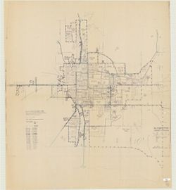
Bloomington, Monroe Co., Indiana
2.
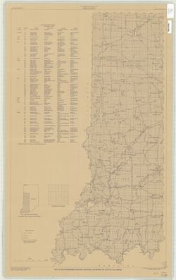
Map of Southwestern Indiana showing locations of active coal mines
3.
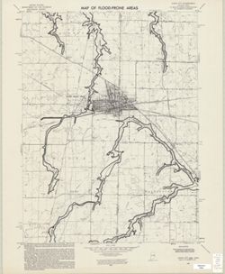
Map of flood-prone areas, Union City quadrangle, Indiana-Ohio : 7.5 minute series (topographic)
4.
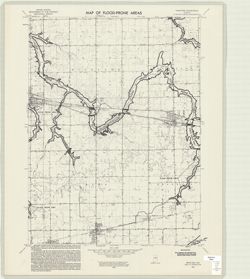
Map of flood-prone areas, Sweetser quadrangle, Indiana : 7.5 minute series (topographic)
5.
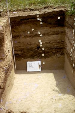
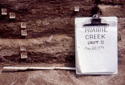
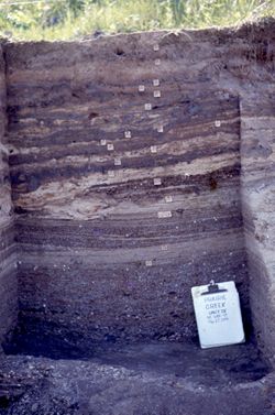
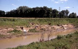
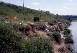
Prairie Creek Excavation
6.
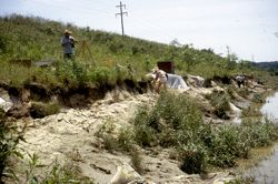
Prairie Creek Excavation
7.
Prairie Creek Excavation
8.
Prairie Creek Excavation
9.
Prairie Creek Excavation
10.
Prairie Creek Excavation
« Previous
Next »
1
2
Toggle facets
Limit your search
Type
Image
[remove]
16
Creator
Feingold, Richard
3
Geological Survey (U.S.)
2
Hutchison, Harold C. (Harold Christy), 1925-
1
United States. Bureau of the Census
1
United States. Federal Insurance Administration
1
Subject
Archaeological Sites—Indiana
8
Excavations (Archaeology)
4
Graduation ceremonies
3
Students
3
Topical Subject: Flood forecasting
2
Topical Subject: Floodplains
2
Topical Subject: Floods
2
Geographic Subject: Bloomington (Ind.)
1
Geographic Subject: Darke County (Ohio)
1
Geographic Subject: Grant County (Ind.)
1
more
Subjects
»
Publisher
Geological Survey (U.S.)
2
Indiana. Geological Survey
1
United States. Bureau of the Census
1
Date Created
1974
[remove]
16
Pages
0-99 pages
16
Collections
Glenn A. Black Laboratory of Archaeology Photographs
8
Indiana Historic Maps
4
Richard Feingold Photograph Collection
3
Robert Coughlan Photograph Collection
1
State
deposited
16
Campus
IUB
12
IUSB
3
IUK
1
County
Davies
8
City
Notre Dame
2
South Bend
1
Country
United States
11
State/Province
Indiana
11
Holding Location
B-IUMAA
8
B-WELLS
4
SBEND
3
Provenance
United States Department of the Interior, Geological Survey. Map of flood-prone areas : [Indiana]. Washington, D.C. : The Survey, 1969-.
2