
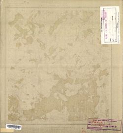
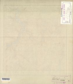
Search Constraints
You searched for:
Provenance
DMA Topographic Center, Army Map Service Library, OMAHA, Library of Congress Geography & Map Division
Remove constraint Provenance: DMA Topographic Center, Army Map Service Library, OMAHA, Library of Congress Geography & Map Division
« Previous |
1 - 100 of 904
|
Next »
Search Results
-
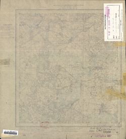
- Description:
- 1938
- Subject:
- Topical Subject: Soviet Union, Topical Subject: Maps, and Geographic Subject: Gorshkovo
- Publisher:
- Главное Управление Геодезии и Картографии при СНК СССР
- Language:
- Russian
- Date Created:
- 1941
- Identifier:
- VAC9619-001600
- Genre:
- Military Maps and Topographic Maps
- Geographic Location:
- Coordinates: 54.3333, 37.75, 54.5, 38
- Related URL:
- Download GeoTIFF: https://drive.google.com/open?id=1n5OJOuYUDbObh4psLn6H0cDRB7jPil10 and Catalog URL: http://iucat.iu.edu/catalog/5020131
- Abstract:
- Modern area represented: Gorshkovo, Tula oblast, Russia
- Call Number:
- G7000 s50 .S68 sheet N-37-52-Г
- City:
- Горшково (Gorshkovo)
- Copyright Holder:
- No Copyright - United States
- Country:
- СССР (USSR)
- State/Province:
- РСФСР (RSFSR) and Тульская область (Tula oblast)
- Physical Description:
- Scale: 1:50,000
- Persistent URL:
- http://purl.dlib.indiana.edu/iudl/images/VAC9619/VAC9619-001600
- Provenance:
- DMA Topographic Center, Army Map Service Library, OMAHA, Library of Congress Geography & Map Division
-
- Description:
- 1938
- Subject:
- Topical Subject: Maps, Geographic Subject: Laptevo, and Topical Subject: Soviet Union
- Publisher:
- Главное Управление Геодезии и Картографии при СНК СССР
- Language:
- Russian
- Date Created:
- 1941
- Identifier:
- VAC9619-001598
- Genre:
- Military Maps and Topographic Maps
- Geographic Location:
- Coordinates: 54.3333, 37.5, 54.5, 37.75
- Related URL:
- Download GeoTIFF: https://drive.google.com/open?id=1jVqSWj3avGDHX-ZeBo8XOwnk6HPHPUR3 and Catalog URL: http://iucat.iu.edu/catalog/5020131
- Abstract:
- Moder area represented: Laptevo, Tula oblast, Russia
- Call Number:
- G7000 s50 .S68 sheet N-37-52-B
- City:
- Лаптево (Laptevo)
- Copyright Holder:
- No Copyright - United States
- Country:
- СССР (USSR)
- State/Province:
- Тульская область (Tula oblast) and РСФСР (RSFSR)
- Physical Description:
- Scale: 1:50,000
- Persistent URL:
- http://purl.dlib.indiana.edu/iudl/images/VAC9619/VAC9619-001598
- Provenance:
- DMA Topographic Center, Army Map Service Library, OMAHA, Library of Congress Geography & Map Division
-
- Description:
- 1938
- Subject:
- Topical Subject: Maps, Geographic Subject: Mokraya Kor, and Topical Subject: Soviet Union
- Publisher:
- Главное Управление Геодезии и Картографии при СНК СССР
- Language:
- Russian
- Date Created:
- 1941
- Identifier:
- VAC9619-001597
- Genre:
- Military Maps and Topographic Maps
- Geographic Location:
- Coordinates: 54.5, 37.75, 54.6667, 38
- Related URL:
- Download GeoTIFF: https://drive.google.com/open?id=1gffQELAjTu3MBlbTHyYP8PMSKwWWqeE2 and Catalog URL: http://iucat.iu.edu/catalog/5020131
- Abstract:
- Modern area represented: Mokraya Kor, Tula oblast, Russia
- Call Number:
- G7000 s50 .S68 sheet N-37-52-B
- City:
- Мокрая Корь (Mokraya Kor)
- Copyright Holder:
- No Copyright - United States
- Country:
- СССР (USSR)
- State/Province:
- Тульская область (Tula oblast) and РСФСР (RSFSR)
- Physical Description:
- Scale: 1:50,000
- Persistent URL:
- http://purl.dlib.indiana.edu/iudl/images/VAC9619/VAC9619-001597
- Provenance:
- DMA Topographic Center, Army Map Service Library, OMAHA, Library of Congress Geography & Map Division
-
- Description:
- 1938
- Subject:
- Geographic Subject: Nikiforovo, Topical Subject: Maps, and Topical Subject: Soviet Union
- Publisher:
- Главное Управление Геодезии и Картографии при СНК СССР
- Language:
- Russian
- Date Created:
- 1941
- Identifier:
- VAC9619-001596
- Genre:
- Topographic Maps and Military Maps
- Geographic Location:
- Coordinates: 54.833, 37.5, 55, 37.75
- Related URL:
- Catalog URL: http://iucat.iu.edu/catalog/5020131 and Download GeoTIFF: https://drive.google.com/open?id=1El5NA8PIkjw7gec-UlLvip8MP0uFlYEF
- Abstract:
- Modern area represented: Nikiforovo, Moscow oblast, Russia
- Call Number:
- G7000 s50 .S68 sheet N-37-40-A
- City:
- Никифорово (Nikiforovo)
- Copyright Holder:
- No Copyright - United States
- Country:
- СССР (USSR)
- State/Province:
- РСФСР (RSFSR), Московская область (Moscow oblast), and Тульская область (Tula oblast)
- Physical Description:
- Scale: 1:50,000
- Persistent URL:
- http://purl.dlib.indiana.edu/iudl/images/VAC9619/VAC9619-001596
- Provenance:
- DMA Topographic Center, Army Map Service Library, OMAHA, Library of Congress Geography & Map Division
-
- Description:
- 1927
- Subject:
- Geographic Subject: Kurovskoye, Topical Subject: Soviet Union, and Topical Subject: Maps
- Publisher:
- Главный Геодезический Комитет
- Language:
- Russian
- Identifier:
- VAC9619-001592
- Genre:
- Topographic Maps and Military Maps
- Geographic Location:
- Coordinates: 55.5, 38.75, 55.6667, 39
- Related URL:
- Download GeoTIFF: https://drive.google.com/open?id=1PCPLpNhalxc-K3di2FF8ZgGX5bcUdweA and Catalog URL: http://iucat.iu.edu/catalog/5020131
- Abstract:
- Modern area represented: Kurovskoye, Moscow oblast, Russia
- Call Number:
- G7000 s50 .S68 sheet N-37-18-Б
- City:
- Куровская (Kurovskaya)
- Copyright Holder:
- No Copyright - United States
- Country:
- СССР (USSR)
- State/Province:
- Московская область (Moscow oblast) and РСФСР (RSFSR)
- Physical Description:
- Scale: 1:50,000
- Persistent URL:
- http://purl.dlib.indiana.edu/iudl/images/VAC9619/VAC9619-001592
- Provenance:
- DMA Topographic Center, Army Map Service Library, OMAHA, Library of Congress Geography & Map Division
-
- Description:
- 1938
- Subject:
- Geographic Subject: Vereya, Topical Subject: Soviet Union, and Topical Subject: Maps
- Publisher:
- Главное Управление Геодезии и Картографии при СНК СССР
- Language:
- Russian
- Date Created:
- 1941
- Identifier:
- VAC9619-001590
- Genre:
- Topographic Maps and Military Maps
- Geographic Location:
- Coordinates: 55.3333, 36, 55.5, 36.25
- Related URL:
- Download GeoTIFF: https://drive.google.com/open?id=1wBMla9XTlKS1xoCxrPqhKu9J0XdbhkEc and Catalog URL: http://iucat.iu.edu/catalog/5020131
- Abstract:
- Modern area represented: Vereya, Moscow oblast, Russia
- Call Number:
- G7000 s50 .S68 sheet N-37-13-C
- Copyright Holder:
- No Copyright - United States
- Country:
- СССР (USSR)
- State/Province:
- РСФСР (RSFSR) and Московская область (Moscow oblast)
- Physical Description:
- Scale: 1:50,000
- Persistent URL:
- http://purl.dlib.indiana.edu/iudl/images/VAC9619/VAC9619-001590
- Provenance:
- DMA Topographic Center, Army Map Service Library, OMAHA, Library of Congress Geography & Map Division
-
- Description:
- 1938
- Subject:
- Topical Subject: Maps, Topical Subject: Soviet Union, and Geographic Subject: Dorokhovo
- Publisher:
- Главное Управление Геодезии и Картографии при СНК СССР
- Language:
- Russian
- Date Created:
- 1941
- Identifier:
- VAC9619-001589
- Genre:
- Topographic Maps and Military Maps
- Geographic Location:
- Coordinates: 55.5, 36.25, 55.6667, 36.5
- Related URL:
- Catalog URL: http://iucat.iu.edu/catalog/5020131 and Download GeoTIFF: https://drive.google.com/open?id=1ae8VatKg7mKS3Ot_8Hz2EdxDA5_NzAMs
- Abstract:
- Modern area represented: Dorokhovo, Moscow oblast, Russia
- Call Number:
- G7000 s50 .S68 sheet N-37-13-Б
- City:
- Дорохово (Dorokhovo)
- Copyright Holder:
- No Copyright - United States
- Country:
- СССР (USSR)
- State/Province:
- РСФСР (RSFSR) and Московская область (Moscow oblast)
- Physical Description:
- Scale: 1:50,000
- Persistent URL:
- http://purl.dlib.indiana.edu/iudl/images/VAC9619/VAC9619-001589
- Provenance:
- DMA Topographic Center, Army Map Service Library, OMAHA, Library of Congress Geography & Map Division
-
- Description:
- 1922
- Subject:
- Topical Subject: Maps, Topical Subject: Soviet Union, and Geographic Subject: Orekhovo-Zuyevo
- Publisher:
- Геодезический комитет ВСНХ-СССР
- Language:
- Russian
- Date Created:
- 1925
- Identifier:
- VAC9619-001587
- Genre:
- Topographic Maps and Military Maps
- Geographic Location:
- Coordinates: 55.6667, 38.75, 55.8333, 39
- Related URL:
- Catalog URL: http://iucat.iu.edu/catalog/5020131 and Download GeoTIFF: https://drive.google.com/open?id=1YSoC4qULp6BdN-5c-DqfZ7rEYz_wNjk4
- Abstract:
- Modern area represented: Orekhovo-Zuyevo, Moscow oblast, Russia
- Call Number:
- G7000 s50 .S68 sheet N-37-6-Г
- City:
- Орехово-Зуево (Orekhovo-Zuyevo)
- Copyright Holder:
- No Copyright - United States
- Country:
- СССР (USSR)
- State/Province:
- Московская область (Moscow oblast) and РСФСР (RSFSR)
- Physical Description:
- Scale: 1:50,000
- Persistent URL:
- http://purl.dlib.indiana.edu/iudl/images/VAC9619/VAC9619-001587
- Provenance:
- DMA Topographic Center, Army Map Service Library, OMAHA, Library of Congress Geography & Map Division
-
- Description:
- 1922
- Subject:
- Geographic Subject: Pavlovskaya Sloboda, Topical Subject: Soviet Union, and Topical Subject: Maps
- Publisher:
- Главное геодезическое управление
- Language:
- Russian
- Date Created:
- 1925
- Identifier:
- VAC9619-001585
- Genre:
- Topographic Maps and Military Maps
- Geographic Location:
- Coordinates: 55.6667, 37, 55.8667, 37.25
- Related URL:
- Download GeoTIFF: https://drive.google.com/open?id=19y6_pc0fOC1JCk_Asjh7Xv3p2fRVcApN and Catalog URL: http://iucat.iu.edu/catalog/5020131
- Abstract:
- Modern area represented: Pavlovskaya Sloboda, Moscow oblast, Russia
- Call Number:
- G7000 s50 .S68 sheet N-37-3-C
- City:
- Павловская Слобода (Pavlovskaya Sloboda)
- Copyright Holder:
- No Copyright - United States
- Country:
- СССР (USSR)
- State/Province:
- Московская область (Moscow oblast) and РСФСР (RSFSR)
- Physical Description:
- Scale: 1:50,000
- Persistent URL:
- http://purl.dlib.indiana.edu/iudl/images/VAC9619/VAC9619-001585
- Provenance:
- DMA Topographic Center, Army Map Service Library, OMAHA, Library of Congress Geography & Map Division
-
- Description:
- 1940
- Subject:
- Geographic Subject: Kokorevka, Topical Subject: Soviet Union, and Topical Subject: Maps
- Publisher:
- Главное Управление Геодезии и Картографии при СНК СССР
- Language:
- Russian
- Date Created:
- 1941
- Identifier:
- VAC9619-001561
- Genre:
- Military Maps and Topographic Maps
- Geographic Location:
- Coordinates: 52.5, 34.25, 52.6667, 34.5
- Related URL:
- Catalog URL: http://iucat.iu.edu/catalog/5020131 and Download GeoTIFF: https://drive.google.com/open?id=1aCIFWOLZoer3DkKzSR6t75p6d6aOZN2J
- Abstract:
- Modern area represented: Kokorevka, Bryansk oblast, Russia
- Call Number:
- G7000 s50 .S68 sheet N-36-129-B
- City:
- Кокоревка (Kokorevka)
- Copyright Holder:
- No Copyright - United States
- Country:
- СССР (USSR)
- State/Province:
- Орловская область (Oryol oblast) and РСФСР (RSFSR)
- Physical Description:
- Scale: 1:50,000
- Persistent URL:
- http://purl.dlib.indiana.edu/iudl/images/VAC9619/VAC9619-001561
- Provenance:
- DMA Topographic Center, Army Map Service Library, OMAHA, Library of Congress Geography & Map Division
-
- Description:
- 1930
- Subject:
- Topical Subject: Soviet Union, Topical Subject: Maps, and Geographic Subject: Pervomayskoye
- Publisher:
- Генеральный штаб Красной Армии
- Language:
- Russian
- Date Created:
- 1934
- Identifier:
- VAC9619-001544
- Genre:
- Topographic Maps and Military Maps
- Geographic Location:
- Coordinates: 52.8667, 33.5, 53, 33.75
- Related URL:
- Download GeoTIFF: https://drive.google.com/open?id=1jvWuFAQ4n_nl6IkEGFq_87wHlKtMxVO5 and Catalog URL: http://iucat.iu.edu/catalog/5020131
- Abstract:
- Modern area represented: Pervomayskoye, Bryansk oblast, Russia
- Call Number:
- G7000 s50 .S68 sheet N-36-116-A
- City:
- Пьяный Рог (Pyany Rog)
- Copyright Holder:
- No Copyright - United States
- Country:
- СССР (USSR)
- State/Province:
- РСФСР (RSFSR) and Орловская область (Oryol oblast)
- Physical Description:
- Scale: 1:50,000
- Persistent URL:
- http://purl.dlib.indiana.edu/iudl/images/VAC9619/VAC9619-001544
- Provenance:
- DMA Topographic Center, Army Map Service Library, OMAHA, Library of Congress Geography & Map Division
-
- Description:
- 1931
- Subject:
- Topical Subject: Soviet Union, Topical Subject: Maps, and Geographic Subject: Korzhovka-Golubovka
- Publisher:
- Управление военных топографов
- Language:
- Russian
- Identifier:
- VAC9619-001539
- Genre:
- Topographic Maps and Military Maps
- Geographic Location:
- Coordinates: 52.6667, 32.25, 52.8667, 32.5
- Related URL:
- Catalog URL: http://iucat.iu.edu/catalog/5020131 and Download GeoTIFF: https://drive.google.com/open?id=1caz06yDhenOXRJOAcQZ0f7DQYtkJfycT
- Abstract:
- Modern area represented: Korzhovka-Golubovka, Bryansk oblast, Russia
- Call Number:
- G7000 s50 .S68 sheet N-36-113-D
- Caption:
- Временное издание,Не подлежит оглашению
- City:
- Коржовка-Голубовка (Korzhovka-Golubovka)
- Copyright Holder:
- No Copyright - United States
- Country:
- СССР (USSR)
- State/Province:
- РСФСР (RSFSR) and Западная область (Western oblast)
- Physical Description:
- Scale: 1:50,000
- Persistent URL:
- http://purl.dlib.indiana.edu/iudl/images/VAC9619/VAC9619-001539
- Provenance:
- DMA Topographic Center, Army Map Service Library, OMAHA, Library of Congress Geography & Map Division
-
- Description:
- 1923
- Subject:
- Topical Subject: Maps, Topical Subject: Soviet Union, and Geographic Subject: Neglyubka
- Publisher:
- Военно-топографическое управление
- Language:
- Russian
- Identifier:
- VAC9619-001537
- Genre:
- Military Maps and Topographic Maps
- Geographic Location:
- Coordinates: 52.6667, 31.5, 52.8667, 31.75
- Related URL:
- Catalog URL: http://iucat.iu.edu/catalog/5020131 and Download GeoTIFF: https://drive.google.com/open?id=19Zzi7_T_u2t3c_mQLJy93SKzIE78_JVV
- Abstract:
- Modern area represented: Neglyubka, Homyel oblast, Belarus
- Call Number:
- G7000 s50 .S68 sheet N-36-112-D
- Caption:
- Секретно
- City:
- Неглюбка (Neglyubka)
- Copyright Holder:
- No Copyright - United States
- Country:
- СССР (USSR)
- State/Province:
- РСФСР (RSFSR), Западная область (Western oblast), and Белорусская ССР (Byelorussian Soviet Socialist Republic)
- Physical Description:
- Scale: 1:50,000
- Persistent URL:
- http://purl.dlib.indiana.edu/iudl/images/VAC9619/VAC9619-001537
- Provenance:
- DMA Topographic Center, Army Map Service Library, OMAHA, Library of Congress Geography & Map Division
-

- Description:
- 1928
- Subject:
- Topical Subject: Soviet Union, Topical Subject: Maps, and Geographic Subject: Kazatskiye Bolsuny
- Publisher:
- Военно-топографическое управление
- Language:
- Russian
- Identifier:
- VAC9619-001534
- Genre:
- Topographic Maps and Military Maps
- Geographic Location:
- Coordinates: 52.8667, 31.25, 53, 32
- Related URL:
- Catalog URL: http://iucat.iu.edu/catalog/5020131 and Download GeoTIFF: https://drive.google.com/open?id=1HkKrlIrLrwWmSzMloRMTx-XUvXR4gx4D
- Abstract:
- Modern area represented: Kazatskiye Bolsuny, Homyel oblast, Belarus
- Call Number:
- G7000 s50 .S68 sheet N-36-111-B
- Caption:
- Секретно
- City:
- Казацкие Болсуны (Kazatskiye Bolsuny)
- Copyright Holder:
- No Copyright - United States
- Country:
- СССР (USSR)
- State/Province:
- Западная область (Western oblast), Белорусская ССР (Byelorussian Soviet Socialist Republic), and РСФСР (RSFSR)
- Physical Description:
- Scale: 1:50,000
- Persistent URL:
- http://purl.dlib.indiana.edu/iudl/images/VAC9619/VAC9619-001534
- Provenance:
- DMA Topographic Center, Army Map Service Library, OMAHA, Library of Congress Geography & Map Division
-
- Description:
- 1928
- Subject:
- Topical Subject: Soviet Union, Geographic Subject: Lokot, and Topical Subject: Maps
- Publisher:
- Управление военных топографов РККА
- Language:
- Russian
- Identifier:
- VAC9619-001533
- Genre:
- Military Maps and Topographic Maps
- Geographic Location:
- Coordinates: 52.8667, 31, 53, 31.25
- Related URL:
- Download GeoTIFF: https://drive.google.com/open?id=1GxpBUovSd_cHLsCzQK6TDAseshOXH1ab and Catalog URL: http://iucat.iu.edu/catalog/5020131
- Abstract:
- Modern area represented: Lokot, Bryansk oblast, Russia
- Call Number:
- G7000 s50 .S68 sheet N-36-111-A
- Caption:
- Не подлежит оглашению
- City:
- Локоть (Lokot)
- Copyright Holder:
- No Copyright - United States
- Country:
- СССР (USSR)
- State/Province:
- Белорусская ССР (Byelorussian Soviet Socialist Republic)
- Physical Description:
- Scale: 1:50,000
- Persistent URL:
- http://purl.dlib.indiana.edu/iudl/images/VAC9619/VAC9619-001533
- Provenance:
- DMA Topographic Center, Army Map Service Library, OMAHA, Library of Congress Geography & Map Division
-
- Description:
- 1928
- Subject:
- Geographic Subject: Prisno, Topical Subject: Soviet Union, and Topical Subject: Maps
- Publisher:
- Управление военных топографов
- Language:
- Russian
- Identifier:
- VAC9619-001528
- Genre:
- Topographic Maps and Military Maps
- Geographic Location:
- Coordinates: 52.6667, 30.75, 53, 31
- Related URL:
- Catalog URL: http://iucat.iu.edu/catalog/5020131 and Download GeoTIFF: https://drive.google.com/open?id=1FXKHO5tXHr9fKZjzS1o03TiZjtGCy1Nb
- Abstract:
- Modern area represented: Prisno, Homyel oblast, Belarus
- Call Number:
- G7000 s50 .S68 sheet N-36-110-D
- Caption:
- Не подлежит оглашению
- City:
- Присно (Prisno)
- Copyright Holder:
- No Copyright - United States
- Country:
- СССР (USSR)
- State/Province:
- Белорусская ССР (Byelorussian Soviet Socialist Republic)
- Physical Description:
- Scale: 1:50,000
- Persistent URL:
- http://purl.dlib.indiana.edu/iudl/images/VAC9619/VAC9619-001528
- Provenance:
- DMA Topographic Center, Army Map Service Library, OMAHA, Library of Congress Geography & Map Division
-
- Description:
- 1940
- Subject:
- Topical Subject: Maps, Geographic Subject: Alekhino, and Topical Subject: Soviet Union
- Publisher:
- Главное Управление Геодезии и Картографии при СНК СССР
- Language:
- Russian
- Date Created:
- 1941
- Identifier:
- VAC9619-001516
- Genre:
- Topographic Maps and Military Maps
- Geographic Location:
- Coordinates: 53.1667, 35, 53.3333, 35.25
- Related URL:
- Download GeoTIFF: https://drive.google.com/open?id=1Cq4nFCMIfKx6u7dZkeCdFvA3RIKV4c5Z and Catalog URL: http://iucat.iu.edu/catalog/5020131
- Abstract:
- Modern area represented: Alekhino, Oryol oblast, Russia
- Call Number:
- G7000 s50 .S68 sheet N-36-107-A
- City:
- Алехино (Alekhino)
- Copyright Holder:
- No Copyright - United States
- Country:
- СССР (USSR)
- State/Province:
- РСФСР (RSFSR) and Орловская область (Oryol oblast)
- Physical Description:
- Scale: 1:50,000
- Persistent URL:
- http://purl.dlib.indiana.edu/iudl/images/VAC9619/VAC9619-001516
- Provenance:
- DMA Topographic Center, Army Map Service Library, OMAHA, Library of Congress Geography & Map Division
-
- Description:
- 1930
- Subject:
- Topical Subject: Soviet Union, Topical Subject: Maps, and Geographic Subject: Verkhopolye
- Publisher:
- Генеральный штаб Красной Армии
- Language:
- Russian
- Date Created:
- 1934
- Identifier:
- VAC9619-001514
- Genre:
- Topographic Maps and Military Maps
- Geographic Location:
- Coordinates: 53, 34.5, 53.1667, 34.75
- Related URL:
- Catalog URL: http://iucat.iu.edu/catalog/5020131 and Download GeoTIFF: https://drive.google.com/open?id=1w15QboP6wPbee79SikaUleyski-x_Eeq
- Abstract:
- Modern area represented: Verkhopolye, Bryansk oblast, Russia
- Call Number:
- G7000 s50 .S68 sheet N-36-106-C
- City:
- Верхополье (Verkhopolye)
- Copyright Holder:
- No Copyright - United States
- Country:
- СССР (USSR)
- State/Province:
- Орловская область (Oryol oblast) and РСФСР (RSFSR)
- Physical Description:
- Scale: 1:50,000
- Persistent URL:
- http://purl.dlib.indiana.edu/iudl/images/VAC9619/VAC9619-001514
- Provenance:
- DMA Topographic Center, Army Map Service Library, OMAHA, Library of Congress Geography & Map Division
-
- Description:
- 1931
- Subject:
- Topical Subject: Soviet Union, Topical Subject: Maps, and Geographic Subject: Bolotnya
- Publisher:
- Управление военных топографов
- Language:
- Russian
- Identifier:
- VAC9619-001504
- Genre:
- Military Maps and Topographic Maps
- Geographic Location:
- Coordinates: 53.1667, 32.75, 53.3333, 33
- Related URL:
- Download GeoTIFF: https://drive.google.com/file/d/1DND7UENKh3QT4-FNIuxE4qh94CJeHGgb/view?usp=sharing and Catalog URL: http://iucat.iu.edu/catalog/5020131
- Abstract:
- Modern area represented: Bolotnya, Bryansk oblast, Russia
- Call Number:
- G7000 s50 .S68 sheet N-36-105-B
- Caption:
- Не подлежит оглашению
- City:
- Болотня (Bolotnya)
- Copyright Holder:
- No Copyright - United States
- Country:
- СССР (USSR)
- State/Province:
- РСФСР (RSFSR) and Западная область (Western oblast)
- Physical Description:
- Scale: 1:50,000
- Persistent URL:
- http://purl.dlib.indiana.edu/iudl/images/VAC9619/VAC9619-001504
- Provenance:
- DMA Topographic Center, Army Map Service Library, OMAHA, Library of Congress Geography & Map Division
-
- Description:
- 1928
- Subject:
- Topical Subject: Maps, Geographic Subject: Perelazy, and Topical Subject: Soviet Union
- Publisher:
- Военно-топографическое управление
- Language:
- Russian
- Identifier:
- VAC9619-001492
- Genre:
- Military Maps and Topographic Maps
- Geographic Location:
- Coordinates: 53, 31.25, 53.1667, 31.5
- Related URL:
- Download GeoTIFF: https://drive.google.com/open?id=1ENiuALuDhQhhmTPCP9izmCTMfCtZ8nYe and Catalog URL: http://iucat.iu.edu/catalog/5020131
- Abstract:
- Modern area represented: Perelazy, Bryansk oblast, Russia
- Call Number:
- G7000 s50 .S68 sheet N-36-99-D
- Caption:
- Секретно
- City:
- Перелазы (Perelazy)
- Copyright Holder:
- No Copyright - United States
- Country:
- СССР (USSR)
- State/Province:
- РСФСР (RSFSR), Западная область (Western oblast), and Белорусская ССР (Byelorussian Soviet Socialist Republic)
- Physical Description:
- Scale: 1:50,000
- Persistent URL:
- http://purl.dlib.indiana.edu/iudl/images/VAC9619/VAC9619-001492
- Provenance:
- DMA Topographic Center, Army Map Service Library, OMAHA, Library of Congress Geography & Map Division
-
- Description:
- 1928
- Subject:
- Topical Subject: Maps, Topical Subject: Soviet Union, and Geographic Subject: Sidorovichi
- Publisher:
- Управление военных топографов РККА
- Language:
- Russian
- Identifier:
- VAC9619-001491
- Genre:
- Topographic Maps and Military Maps
- Geographic Location:
- Coordinates: 53, 31, 53.1667, 31.25
- Related URL:
- Download GeoTIFF: https://drive.google.com/open?id=14CtH2oyA5T83uZvToRCwUrheXc4a-Sp8 and Catalog URL: http://iucat.iu.edu/catalog/5020131
- Abstract:
- Modern area represented: Sidorovichi, Homyel oblast, Belarus
- Call Number:
- G7000 s50 .S68 sheet N-36-99-C
- Caption:
- Не подлежит оглашению
- City:
- Сидоровичи (Sidorovichi)
- Copyright Holder:
- No Copyright - United States
- Country:
- СССР (USSR)
- State/Province:
- Белорусская ССР (Byelorussian Soviet Socialist Republic)
- Physical Description:
- Scale: 1:50,000
- Persistent URL:
- http://purl.dlib.indiana.edu/iudl/images/VAC9619/VAC9619-001491
- Provenance:
- DMA Topographic Center, Army Map Service Library, OMAHA, Library of Congress Geography & Map Division
-
- Description:
- 1928
- Subject:
- Topical Subject: Maps, Geographic Subject: Mkhinichi, and Topical Subject: Soviet Union
- Publisher:
- Военно-топографическое управление
- Language:
- Russian
- Identifier:
- VAC9619-001490
- Genre:
- Topographic Maps and Military Maps
- Geographic Location:
- Coordinates: 53.1667, 31.25, 53.3333, 31.5
- Related URL:
- Download GeoTIFF: https://drive.google.com/open?id=1jQtEydII-8vbaqeMq9G233ulXq_l2Mp- and Catalog URL: http://iucat.iu.edu/catalog/5020131
- Abstract:
- Modern area represented: Mkhinichi, Mogilev, Belarus
- Call Number:
- G7000 s50 .S68 sheet N-36-99-B
- Caption:
- Секретно
- City:
- Мхиничи (Mkhinichi)
- Copyright Holder:
- No Copyright - United States
- Country:
- СССР (USSR)
- State/Province:
- Белорусская ССР (Byelorussian Soviet Socialist Republic)
- Physical Description:
- Scale: 1:50,000
- Persistent URL:
- http://purl.dlib.indiana.edu/iudl/images/VAC9619/VAC9619-001490
- Provenance:
- DMA Topographic Center, Army Map Service Library, OMAHA, Library of Congress Geography & Map Division
-
- Description:
- 1928
- Subject:
- Geographic Subject: Karma, Topical Subject: Soviet Union, and Topical Subject: Maps
- Publisher:
- Управление военных топографов РККА
- Language:
- Russian
- Identifier:
- VAC9619-001488
- Genre:
- Military Maps and Topographic Maps
- Geographic Location:
- Coordinates: 53, 30.75, 53.1667, 31
- Related URL:
- Catalog URL: http://iucat.iu.edu/catalog/5020131 and Download GeoTIFF: https://drive.google.com/open?id=1auewxECG5RQCc2MxiN6jXOxm43MRlEyj
- Abstract:
- Modern area represented: Karma, Homyel oblast, Belarus
- Call Number:
- G7000 s50 .S68 sheet N-36-98-D
- Caption:
- Не подлежит оглашению
- City:
- Корма (Korma)
- Copyright Holder:
- No Copyright - United States
- Country:
- СССР (USSR)
- State/Province:
- Белорусская ССР (Byelorussian Soviet Socialist Republic)
- Physical Description:
- Scale: 1:50,000
- Persistent URL:
- http://purl.dlib.indiana.edu/iudl/images/VAC9619/VAC9619-001488
- Provenance:
- DMA Topographic Center, Army Map Service Library, OMAHA, Library of Congress Geography & Map Division
-
- Description:
- 1928
- Subject:
- Geographic Subject: Slavnya, Topical Subject: Maps, and Topical Subject: Soviet Union
- Publisher:
- Управление военных топографов
- Language:
- Russian
- Identifier:
- VAC9619-001487
- Genre:
- Military Maps and Topographic Maps
- Geographic Location:
- Coordinates: 53.1667, 30.75, 53.3333, 31
- Related URL:
- Download GeoTIFF: https://drive.google.com/open?id=1lVT-0rzh1ByHE3fXveb63ksjcTc8r32b and Catalog URL: http://iucat.iu.edu/catalog/5020131
- Abstract:
- Modern area represented: Slavnya, Mogilev, Belarus
- Call Number:
- G7000 s50 .S68 sheet N-36-98-B
- Caption:
- Не подлежит оглашению
- City:
- Славня (Slavnya)
- Copyright Holder:
- No Copyright - United States
- Country:
- СССР (USSR)
- State/Province:
- Белорусская ССР (Byelorussian Soviet Socialist Republic)
- Physical Description:
- Scale: 1:50,000
- Persistent URL:
- http://purl.dlib.indiana.edu/iudl/images/VAC9619/VAC9619-001487
- Provenance:
- DMA Topographic Center, Army Map Service Library, OMAHA, Library of Congress Geography & Map Division
-
- Description:
- 1936
- Subject:
- Geographic Subject: Gadilovichi, Topical Subject: Maps, and Topical Subject: Soviet Union
- Publisher:
- Управление военных топографов РККА
- Language:
- Russian
- Identifier:
- VAC9619-001485
- Genre:
- Topographic Maps and Military Maps
- Geographic Location:
- Coordinates: 53, 30.25, 53.1667, 30.5
- Related URL:
- Catalog URL: http://iucat.iu.edu/catalog/5020131 and Download GeoTIFF: https://drive.google.com/open?id=1brXddhg0G6bGWPjqapYFWje60ePNOC1r
- Abstract:
- Modern area represented: Gadilovichi, Homyel oblast, Belarus
- Call Number:
- G7000 s50 .S68 sheet N-36-97-D
- Caption:
- Не подлежит оглашению
- City:
- Гадиловичи (Gadilovichi)
- Copyright Holder:
- No Copyright - United States
- Country:
- СССР (USSR)
- State/Province:
- Белорусская ССР (Byelorussian Soviet Socialist Republic)
- Physical Description:
- Scale: 1:50,000
- Persistent URL:
- http://purl.dlib.indiana.edu/iudl/images/VAC9619/VAC9619-001485
- Provenance:
- DMA Topographic Center, Army Map Service Library, OMAHA, Library of Congress Geography & Map Division
-
- Description:
- 1936
- Subject:
- Topical Subject: Soviet Union, Geographic Subject: Zvonets, and Topical Subject: Maps
- Publisher:
- Управление военных топографов РККА
- Language:
- Russian
- Identifier:
- VAC9619-001482
- Genre:
- Military Maps and Topographic Maps
- Geographic Location:
- Coordinates: 53.1667, 30.25, 53.3333, 30.5
- Related URL:
- Download GeoTIFF: https://drive.google.com/open?id=1r2DMZh2mjVq3AyPIe8qc-uOASC2UD_rt and Catalog URL: http://iucat.iu.edu/catalog/5020131
- Abstract:
- Modern area represented: Zvonets, Homyel oblast, Belarus
- Call Number:
- G7000 s50 .S68 sheet N-36-97-B
- Caption:
- Не подлежит оглашению
- City:
- Звонец (Zvonets)
- Copyright Holder:
- No Copyright - United States
- Country:
- СССР (USSR)
- State/Province:
- Белорусская ССР (Byelorussian Soviet Socialist Republic)
- Physical Description:
- Scale: 1:50,000
- Persistent URL:
- http://purl.dlib.indiana.edu/iudl/images/VAC9619/VAC9619-001482
- Provenance:
- DMA Topographic Center, Army Map Service Library, OMAHA, Library of Congress Geography & Map Division
-
- Description:
- 1940
- Subject:
- Topical Subject: Maps, Geographic Subject: Lovat, and Topical Subject: Soviet Union
- Publisher:
- Главное Управление Геодезии и Картографии при СНК СССР
- Language:
- Russian
- Date Created:
- 1941
- Identifier:
- VAC9619-001469
- Genre:
- Topographic Maps and Military Maps
- Geographic Location:
- Coordinates: 53.5, 35, 53.6667, 35.25
- Related URL:
- Catalog URL: http://iucat.iu.edu/catalog/5020131 and Download GeoTIFF: https://drive.google.com/open?id=1CW7q_WmzCjxXip6vtnCVNXn4ufl3e4Yl
- Abstract:
- Modern area represented: Lovat, Kaluga, Russia
- Call Number:
- G7000 s50 .S68 sheet N-36-95-A
- Caption:
- Для служебного пользования
- City:
- Ловать (Lovat)
- Copyright Holder:
- No Copyright - United States
- Country:
- СССР (USSR)
- State/Province:
- Орловская область (Oryol oblast), РСФСР (RSFSR), and Смоленская область (Smolensk oblast)
- Physical Description:
- Scale: 1:50,000
- Persistent URL:
- http://purl.dlib.indiana.edu/iudl/images/VAC9619/VAC9619-001469
- Provenance:
- DMA Topographic Center, Army Map Service Library, OMAHA, Library of Congress Geography & Map Division
-
- Description:
- 1930
- Subject:
- Geographic Subject: Boyanovichi, Topical Subject: Maps, and Topical Subject: Soviet Union
- Publisher:
- Генеральный штаб РККА
- Language:
- Russian
- Identifier:
- VAC9619-001468
- Genre:
- Military Maps and Topographic Maps
- Geographic Location:
- Coordinates: 53.3333, 34.75, 53.5, 35
- Related URL:
- Catalog URL: http://iucat.iu.edu/catalog/5020131 and Download GeoTIFF: https://drive.google.com/open?id=1DREx2N3APY6G30YlAAt889SzguoUBH-8
- Abstract:
- Modern area represented: Boyanovichi, Kaluga, Russia
- Call Number:
- G7000 s50 .S68 sheet N-36-94-D
- City:
- Буяновичи (Boyanovichi)
- Copyright Holder:
- No Copyright - United States
- Country:
- СССР (USSR)
- State/Province:
- РСФСР (RSFSR) and Западная область (Western oblast)
- Physical Description:
- Scale: 1:50,000
- Persistent URL:
- http://purl.dlib.indiana.edu/iudl/images/VAC9619/VAC9619-001468
- Provenance:
- DMA Topographic Center, Army Map Service Library, OMAHA, Library of Congress Geography & Map Division
-
- Description:
- 1930
- Subject:
- Geographic Subject: Ogor, Topical Subject: Soviet Union, and Topical Subject: Maps
- Publisher:
- Генеральный штаб РККА
- Language:
- Russian
- Identifier:
- VAC9619-001467
- Genre:
- Military Maps and Topographic Maps
- Geographic Location:
- Coordinates: 53.3333, 34.5, 53.5, 34.75
- Related URL:
- Download GeoTIFF: https://drive.google.com/open?id=1z8Szky-2BN4VYpKe91aBjVJdTlFW2w8J and Catalog URL: http://iucat.iu.edu/catalog/5020131
- Abstract:
- Modern area represented: Ogor, Kaluga, Russia
- Call Number:
- G7000 s50 .S68 sheet N-36-94-C
- City:
- Огорь (Ogor)
- Copyright Holder:
- No Copyright - United States
- Country:
- СССР (USSR)
- State/Province:
- РСФСР (RSFSR) and Западная область (Western oblast)
- Physical Description:
- Scale: 1:50,000
- Persistent URL:
- http://purl.dlib.indiana.edu/iudl/images/VAC9619/VAC9619-001467
- Provenance:
- DMA Topographic Center, Army Map Service Library, OMAHA, Library of Congress Geography & Map Division
-
- Description:
- 1890
- Subject:
- Topical Subject: Soviet Union, Topical Subject: Maps, and Geographic Subject: Turda
- Publisher:
- Генеральный штаб РККА
- Language:
- Russian
- Date Created:
- 1892
- Identifier:
- VAC9619-001460
- Genre:
- Topographic Maps and Military Maps
- Geographic Location:
- Coordinates: 46.3333, 23.5, 46.6667, 24
- Related URL:
- Catalog URL: https://iucat.iu.edu/catalog/5020129 and Download GeoTIFF: https://drive.google.com/open?id=1AdXHNGR8ysvlhT9EGZhMVIvBCtdnX1DM
- Abstract:
- Modern area represented: Turda, Cluj county, Romania
- Call Number:
- G7000 s100 .S7 sheet L-34-60
- City:
- Турда (Turda)
- Copyright Holder:
- No Copyright - United States
- Country:
- Румыния (Romania)
- Physical Description:
- Scale: 1:100,000
- Persistent URL:
- http://purl.dlib.indiana.edu/iudl/images/VAC9619/VAC9619-001460
- Provenance:
- DMA Topographic Center, Army Map Service Library, OMAHA, Library of Congress Geography & Map Division
-
- Description:
- 1930
- Subject:
- Geographic Subject: Dorozhovo, Topical Subject: Soviet Union, and Topical Subject: Maps
- Publisher:
- Генеральный штаб РККА
- Language:
- Russian
- Identifier:
- VAC9619-001458
- Genre:
- Topographic Maps and Military Maps
- Geographic Location:
- Coordinates: 53.3333, 34, 53.5, 34.25
- Related URL:
- Catalog URL: http://iucat.iu.edu/catalog/5020131 and Download GeoTIFF: https://drive.google.com/open?id=1BYCAZEWtRh1BqxrBTrB9jFx29DVLXjx5
- Abstract:
- Modern area represented: Dorozhovo, Bryansk oblast, Russia
- Call Number:
- G7000 s50 .S68 sheet N-36-93-C
- City:
- Дорожова (Dorozhovo)
- Copyright Holder:
- No Copyright - United States
- Country:
- СССР (USSR)
- State/Province:
- Западная область (Western oblast) and РСФСР (RSFSR)
- Physical Description:
- Scale: 1:50,000
- Persistent URL:
- http://purl.dlib.indiana.edu/iudl/images/VAC9619/VAC9619-001458
- Provenance:
- DMA Topographic Center, Army Map Service Library, OMAHA, Library of Congress Geography & Map Division
-
- Description:
- 1930
- Subject:
- Topical Subject: Soviet Union, Geographic Subject: Zhukovka, and Topical Subject: Maps
- Publisher:
- Генеральный штаб Красной Армии
- Language:
- Russian
- Date Created:
- 1934
- Identifier:
- VAC9619-001455
- Genre:
- Military Maps and Topographic Maps
- Geographic Location:
- Coordinates: 53.5, 33.5, 53.6667, 33.75
- Related URL:
- Download GeoTIFF: https://drive.google.com/open?id=1weURfFxzgvSsS3ue5gXFoe6joJn-NS4S and Catalog URL: http://iucat.iu.edu/catalog/5020131
- Abstract:
- Modern area represented: Zhukovka, Bryansk oblast, Russia
- Call Number:
- GM G7000 S50 .S68 N-36-92-A
- City:
- Жуковка (Zhukovka)
- Copyright Holder:
- No Copyright - United States
- Country:
- СССР (USSR)
- State/Province:
- Орловская область (Oryol oblast) and РСФСР (RSFSR)
- Physical Description:
- Scale: 1:50,000
- Persistent URL:
- http://purl.dlib.indiana.edu/iudl/images/VAC9619/VAC9619-001455
- Provenance:
- DMA Topographic Center, Army Map Service Library, OMAHA, Library of Congress Geography & Map Division
-
- Description:
- 1930
- Subject:
- Geographic Subject: Serpeyevka, Topical Subject: Soviet Union, and Topical Subject: Maps
- Publisher:
- Генеральный штаб РККА
- Language:
- Russian
- Identifier:
- VAC9619-001452
- Genre:
- Military Maps and Topographic Maps
- Geographic Location:
- Coordinates: 53.5, 33.25, 53.6667, 33.5
- Related URL:
- Download GeoTIFF: https://drive.google.com/open?id=1ejEYV2Cow1OTFQg5CTLMZeEAvh5FlLew and Catalog URL: http://iucat.iu.edu/catalog/5020131
- Abstract:
- Modern area represented: Serpeyevka, Bryansk oblast, Russia
- Call Number:
- GM G7000 S50 .S68 N-36-91-Б
- Caption:
- Не подлежит оглашению
- City:
- Серпеевка (Serpeyevka)
- Copyright Holder:
- No Copyright - United States
- Country:
- СССР (USSR)
- State/Province:
- РСФСР (RSFSR) and Орловская область (Oryol oblast)
- Physical Description:
- Scale: 1:50,000
- Persistent URL:
- http://purl.dlib.indiana.edu/iudl/images/VAC9619/VAC9619-001452
- Provenance:
- DMA Topographic Center, Army Map Service Library, OMAHA, Library of Congress Geography & Map Division
-
- Description:
- 1930
- Subject:
- Geographic Subject: Dengubovka, Topical Subject: Soviet Union, and Topical Subject: Maps
- Publisher:
- Генеральный штаб РККА
- Language:
- Russian
- Identifier:
- VAC9619-001451
- Genre:
- Topographic Maps and Military Maps
- Geographic Location:
- Coordinates: 53.5, 33, 53.6667, 33.25
- Related URL:
- Download GeoTIFF: https://drive.google.com/open?id=1KATAyPHstxiTa8so6QD3XBg2HvD6rN1U and Catalog URL: http://iucat.iu.edu/catalog/5020131
- Abstract:
- Modern area represented: Dengubovka, Bryansk oblast, Russia
- Call Number:
- GM G7000 S50 .S68 N-36-91-A
- City:
- Деньгубовка (Dengubovka)
- Copyright Holder:
- No Copyright - United States
- Country:
- СССР (USSR)
- State/Province:
- Орловская область (Oryol oblast), РСФСР (RSFSR), and Смоленская область (Smolensk oblast)
- Physical Description:
- Scale: 1:50,000
- Persistent URL:
- http://purl.dlib.indiana.edu/iudl/images/VAC9619/VAC9619-001451
- Provenance:
- DMA Topographic Center, Army Map Service Library, OMAHA, Library of Congress Geography & Map Division
-
- Description:
- 1931
- Subject:
- Geographic Subject: Razrytoye, Topical Subject: Maps, and Topical Subject: Soviet Union
- Publisher:
- Управление военных топографов
- Language:
- Russian
- Identifier:
- VAC9619-001450
- Genre:
- Topographic Maps and Military Maps
- Geographic Location:
- Coordinates: 53.3333, 32.75, 53.5, 33
- Related URL:
- Download GeoTIFF: https://drive.google.com/open?id=1Ks2FByvEOj90pyqtFjIQtDkk--6HbR4S and Catalog URL: http://iucat.iu.edu/catalog/5020131
- Abstract:
- Modern area represented: Razrytoye, Bryansk oblast, Russia
- Call Number:
- GM G7000 S50 .S68 N-36-90-Г
- Caption:
- Не подлежит оглашению
- City:
- Разрытое (Razrytoye)
- Copyright Holder:
- No Copyright - United States
- Country:
- СССР (USSR)
- State/Province:
- Западная область (Western oblast), Белорусская ССР (Byelorussian Soviet Socialist Republic), and РСФСР (RSFSR)
- Physical Description:
- Scale: 1:50,000
- Persistent URL:
- http://purl.dlib.indiana.edu/iudl/images/VAC9619/VAC9619-001450
- Provenance:
- DMA Topographic Center, Army Map Service Library, OMAHA, Library of Congress Geography & Map Division
-
- Description:
- 1931
- Subject:
- Topical Subject: Maps, Topical Subject: Soviet Union, and Geographic Subject: Yershichi
- Publisher:
- Генеральный штаб Красной Армии
- Language:
- Russian
- Identifier:
- VAC9619-001448
- Genre:
- Military Maps and Topographic Maps
- Geographic Location:
- Coordinates: 53.5, 32.75, 53.6667, 33
- Related URL:
- Download GeoTIFF: https://drive.google.com/open?id=1Bl-SNPTfZQkf98UUKHhVOsJI1_LOzEdh and Catalog URL: http://iucat.iu.edu/catalog/5020131
- Abstract:
- Modern area represented: Yershichi, Smolensk oblast, Russia
- Call Number:
- GM G7000 S50 .S68 N-36-90-Б
- Caption:
- Для служебного пользования
- City:
- Ершичи (Yershichi)
- Copyright Holder:
- No Copyright - United States
- Country:
- СССР (USSR)
- State/Province:
- Западная область (Western oblast) and РСФСР (RSFSR)
- Physical Description:
- Scale: 1:50,000
- Persistent URL:
- http://purl.dlib.indiana.edu/iudl/images/VAC9619/VAC9619-001448
- Provenance:
- DMA Topographic Center, Army Map Service Library, OMAHA, Library of Congress Geography & Map Division
-
- Description:
- 1928
- Subject:
- Topical Subject: Maps, Topical Subject: Soviet Union, and Geographic Subject: Kastsyukovichy
- Publisher:
- Военно-топографическое управление
- Language:
- Russian
- Identifier:
- VAC9619-001446
- Genre:
- Military Maps and Topographic Maps
- Geographic Location:
- Coordinates: 53.3333, 32, 53.5, 32.25
- Related URL:
- Download GeoTIFF: https://drive.google.com/open?id=1y8M7TZKXw9-_Pt3C7uf1Khy5hyq_A2T7 and Catalog URL: http://iucat.iu.edu/catalog/5020131
- Abstract:
- Modern area represented: Kastsyukovichy, Mogilev oblast, Belarus
- Call Number:
- GM G7000 S50 .S68 N-36-89-В
- Caption:
- Не подлежит оглашению
- City:
- Костюковичи (Kastsyukovichy)
- Copyright Holder:
- No Copyright - United States
- Country:
- СССР (USSR)
- State/Province:
- Белорусская ССР (Byelorussian Soviet Socialist Republic)
- Physical Description:
- Scale: 1:50,000
- Persistent URL:
- http://purl.dlib.indiana.edu/iudl/images/VAC9619/VAC9619-001446
- Provenance:
- DMA Topographic Center, Army Map Service Library, OMAHA, Library of Congress Geography & Map Division
-
- Description:
- 1931
- Subject:
- Topical Subject: Maps, Topical Subject: Soviet Union, and Geographic Subject: Galichi
- Publisher:
- Управление военных топографов
- Language:
- Russian
- Identifier:
- VAC9619-001445
- Genre:
- Topographic Maps and Military Maps
- Geographic Location:
- Coordinates: 53.5, 32.25, 53.6667, 32.5
- Related URL:
- Download GeoTIFF: https://drive.google.com/open?id=1qTzU_Ok50JYyqehnESugCq4d044yE3ww and Catalog URL: http://iucat.iu.edu/catalog/5020131
- Abstract:
- Modern area represented: Galichi, Mogilev oblast, Belarus
- Call Number:
- GM G7000 S50 .S68 N-36-89-Б
- City:
- Галичи (Galichi)
- Copyright Holder:
- No Copyright - United States
- Country:
- СССР (USSR)
- State/Province:
- Белорусская ССР (Byelorussian Soviet Socialist Republic), РСФСР (RSFSR), and Западная область (Western oblast)
- Physical Description:
- Scale: 1:50,000
- Persistent URL:
- http://purl.dlib.indiana.edu/iudl/images/VAC9619/VAC9619-001445
- Provenance:
- DMA Topographic Center, Army Map Service Library, OMAHA, Library of Congress Geography & Map Division
-
- Description:
- 1928
- Subject:
- Geographic Subject: Chudyany, Topical Subject: Maps, and Topical Subject: Soviet Union
- Publisher:
- Военно-топографическое управление
- Language:
- Russian
- Identifier:
- VAC9619-001443
- Genre:
- Topographic Maps and Military Maps
- Geographic Location:
- Coordinates: 53.5, 31.5, 53.6667, 31.75
- Related URL:
- Download GeoTIFF: https://drive.google.com/open?id=1BDh37MbfN6oLQIbcvhF8LKn_lsq3vV26 and Catalog URL: http://iucat.iu.edu/catalog/5020131
- Abstract:
- Modern area represented: Chudyany, Mogilev oblast, Belarus
- Call Number:
- GM G7000 S50 .S68 N-36-88-A
- Caption:
- Секретно
- City:
- Чудяны (Chudyany)
- Copyright Holder:
- No Copyright - United States
- Country:
- СССР (USSR)
- State/Province:
- Могилевский округ (Mogilev district) and Белорусская ССР (Byelorussian Soviet Socialist Republic)
- Physical Description:
- Scale: 1:50,000
- Persistent URL:
- http://purl.dlib.indiana.edu/iudl/images/VAC9619/VAC9619-001443
- Provenance:
- DMA Topographic Center, Army Map Service Library, OMAHA, Library of Congress Geography & Map Division
-
- Description:
- 1928
- Subject:
- Geographic Subject: Krasovichi, Topical Subject: Maps, and Topical Subject: Soviet Union
- Publisher:
- Военно-топографическое управление
- Language:
- Russian
- Identifier:
- VAC9619-001444
- Genre:
- Topographic Maps and Military Maps
- Geographic Location:
- Coordinates: 53.3333, 31.75, 53.5, 32
- Related URL:
- Download GeoTIFF: https://drive.google.com/open?id=16wdhCLySlq6O-b-i46SaCD64-PG9_iC5 and Catalog URL: http://iucat.iu.edu/catalog/5020131
- Abstract:
- Modern area represented: Krasovichi, Mogilev oblast, Belarus
- Call Number:
- GM G7000 S50 .S68 N-36-88-Г
- Caption:
- Секретно
- City:
- Красовичи (Krasovichi)
- Copyright Holder:
- No Copyright - United States
- Country:
- СССР (USSR)
- State/Province:
- Белорусская ССР (Byelorussian Soviet Socialist Republic)
- Physical Description:
- Scale: 1:50,000
- Persistent URL:
- http://purl.dlib.indiana.edu/iudl/images/VAC9619/VAC9619-001444
- Provenance:
- DMA Topographic Center, Army Map Service Library, OMAHA, Library of Congress Geography & Map Division
-
- Description:
- 1928
- Subject:
- Topical Subject: Soviet Union, Topical Subject: Maps, and Geographic Subject: Pilnya
- Publisher:
- Военно-топографическое управление
- Language:
- Russian
- Identifier:
- VAC9619-001442
- Genre:
- Topographic Maps and Military Maps
- Geographic Location:
- Coordinates: 53.3333, 31.25, 53.5, 31.5
- Related URL:
- Catalog URL: http://iucat.iu.edu/catalog/5020131 and Download GeoTIFF: https://drive.google.com/open?id=1ApZZ9jn58zQO73qNJqeP4EKMwTAgZrn_
- Abstract:
- Modern area represented: Pilnya, Mogilev oblast, Belarus
- Call Number:
- GM G7000 S50 .S68 N-36-87-Г
- Caption:
- Секретно
- City:
- Пильня (Pilnya)
- Copyright Holder:
- No Copyright - United States
- Country:
- СССР (USSR)
- State/Province:
- Белорусская ССР (Byelorussian Soviet Socialist Republic)
- Physical Description:
- Scale: 1:50,000
- Persistent URL:
- http://purl.dlib.indiana.edu/iudl/images/VAC9619/VAC9619-001442
- Provenance:
- DMA Topographic Center, Army Map Service Library, OMAHA, Library of Congress Geography & Map Division
-
- Description:
- 1928
- Subject:
- Topical Subject: Soviet Union, Topical Subject: Maps, and Geographic Subject: Rahalina
- Publisher:
- Управление военных топографов
- Language:
- Russian
- Identifier:
- VAC9619-001440
- Genre:
- Topographic Maps and Military Maps
- Geographic Location:
- Coordinates: 53.5, 31, 53.6667, 31.25
- Related URL:
- Download GeoTIFF: https://drive.google.com/open?id=1X2ptppUfVbEjrZyZHhDN7LtsmRaYuxpW and Catalog URL: http://iucat.iu.edu/catalog/5020131
- Abstract:
- Modern area represented: Rahalina, Mogilev oblast, Belarus
- Call Number:
- GM G7000 S50 .S68 N-36-87-A
- Caption:
- Не подлежит оглашению
- City:
- Рогальня (Rogalnya)
- Copyright Holder:
- No Copyright - United States
- Country:
- СССР (USSR)
- State/Province:
- Белорусская ССР (Byelorussian Soviet Socialist Republic)
- Physical Description:
- Scale: 1:50,000
- Persistent URL:
- http://purl.dlib.indiana.edu/iudl/images/VAC9619/VAC9619-001440
- Provenance:
- DMA Topographic Center, Army Map Service Library, OMAHA, Library of Congress Geography & Map Division
-
- Description:
- 1928
- Subject:
- Topical Subject: Soviet Union, Geographic Subject: Rzhavka, and Topical Subject: Maps
- Publisher:
- Управление военных топографов РККА
- Language:
- Russian
- Identifier:
- VAC9619-001439
- Genre:
- Topographic Maps and Military Maps
- Geographic Location:
- Coordinates: 53.3333, 30.75, 53.5, 31
- Related URL:
- Catalog URL: http://iucat.iu.edu/catalog/5020131 and Download GeoTIFF: https://drive.google.com/open?id=1DuHwcD1ih1-jlT7sJcCQxgPSmL1eQ0r0
- Abstract:
- Modern area represented: Rzhavka, Belarus
- Call Number:
- GM G7000 S50 .S68 N-36-86-Г
- Caption:
- Не подлежит оглашению
- City:
- Ржавка (Rzhavka)
- Copyright Holder:
- No Copyright - United States
- Country:
- СССР (USSR)
- State/Province:
- Белорусская ССР (Byelorussian Soviet Socialist Republic)
- Physical Description:
- Scale: 1:50,000
- Persistent URL:
- http://purl.dlib.indiana.edu/iudl/images/VAC9619/VAC9619-001439
- Provenance:
- DMA Topographic Center, Army Map Service Library, OMAHA, Library of Congress Geography & Map Division
-
- Description:
- 1928
- Subject:
- Geographic Subject: Rabovichi, Topical Subject: Soviet Union, and Topical Subject: Maps
- Publisher:
- Управление военных топографов РККА
- Language:
- Russian
- Identifier:
- VAC9619-001437
- Genre:
- Military Maps and Topographic Maps
- Geographic Location:
- Coordinates: 53.5, 30.75, 53.6667, 31
- Related URL:
- Download GeoTIFF: https://drive.google.com/open?id=1kevSVzLgjqK9itw71fxkheyN5ntxB-L6 and Catalog URL: http://iucat.iu.edu/catalog/5020131
- Abstract:
- Modern area represented: Rabovichi, Mogilev oblast, Belarus
- Call Number:
- GM G7000 S50 .S68 N-36-86-Б
- Caption:
- Не подлежит оглашению
- City:
- Рабовичи (Rabovichi)
- Copyright Holder:
- No Copyright - United States
- Country:
- СССР (USSR)
- State/Province:
- Белорусская ССР (Byelorussian Soviet Socialist Republic)
- Physical Description:
- Scale: 1:50,000
- Persistent URL:
- http://purl.dlib.indiana.edu/iudl/images/VAC9619/VAC9619-001437
- Provenance:
- DMA Topographic Center, Army Map Service Library, OMAHA, Library of Congress Geography & Map Division
-
- Description:
- 1936
- Subject:
- Topical Subject: Soviet Union, Geographic Subject: Noviy Bykhov, and Topical Subject: Maps
- Publisher:
- Управление военных топографов РККА
- Language:
- Russian
- Identifier:
- VAC9619-001435
- Genre:
- Military Maps and Topographic Maps
- Geographic Location:
- Coordinates: 53.3333, 30.25, 53.5, 30.5
- Related URL:
- Download GeoTIFF: https://drive.google.com/open?id=1YpmLZJo4Y9OsYLwcwKsyHhgGnXMUDjYr and Catalog URL: http://iucat.iu.edu/catalog/5020131
- Abstract:
- Modern area represented: Noviy Bykhov, Mogilev oblasst, Belarus
- Call Number:
- GM G7000 S50 .S68 N-36-85-Г
- Caption:
- Не подлежит оглашению
- City:
- Нов.Быхов (Noviy Bykhov)
- Copyright Holder:
- No Copyright - United States
- Country:
- СССР (USSR)
- State/Province:
- Белорусская ССР (Byelorussian Soviet Socialist Republic)
- Physical Description:
- Scale: 1:50,000
- Persistent URL:
- http://purl.dlib.indiana.edu/iudl/images/VAC9619/VAC9619-001435
- Provenance:
- DMA Topographic Center, Army Map Service Library, OMAHA, Library of Congress Geography & Map Division
-
- Description:
- 1926
- Subject:
- Geographic Subject: Trilesino, Topical Subject: Soviet Union, and Topical Subject: Maps
- Publisher:
- Военно-топографическое управление
- Language:
- Russian
- Identifier:
- VAC9619-001436
- Genre:
- Military Maps and Topographic Maps
- Geographic Location:
- Coordinates: 53.5, 30.5, 53.6667, 30.75
- Related URL:
- Catalog URL: http://iucat.iu.edu/catalog/5020131 and Download GeoTIFF: https://drive.google.com/open?id=1ne5Gs3F9a7FqWUSyUZqclQ2QfQxic9Rc
- Abstract:
- Modern area represented: Trilesino, Mogilev oblast, Belarus
- Call Number:
- GM G7000 S50 .S68 N-36-86-A
- Caption:
- Секретно
- City:
- Трилесино (Trilesino)
- Copyright Holder:
- No Copyright - United States
- Country:
- СССР (USSR)
- State/Province:
- Белорусская ССР (Byelorussian Soviet Socialist Republic) and Могилевский округ (Mogilev district)
- Physical Description:
- Scale: 1:50,000
- Persistent URL:
- http://purl.dlib.indiana.edu/iudl/images/VAC9619/VAC9619-001436
- Provenance:
- DMA Topographic Center, Army Map Service Library, OMAHA, Library of Congress Geography & Map Division
-
- Description:
- 1936
- Subject:
- Geographic Subject: Ludchytsy, Topical Subject: Maps, and Topical Subject: Soviet Union
- Publisher:
- Управление военных топографов РККА
- Language:
- Russian
- Identifier:
- VAC9619-001434
- Genre:
- Military Maps and Topographic Maps
- Geographic Location:
- Coordinates: 53.3333, 30, 53.5, 30.25
- Related URL:
- Catalog URL: http://iucat.iu.edu/catalog/5020131 and Download GeoTIFF: https://drive.google.com/open?id=1bj1iFsVPR0DCUs139aNWM1VgtHomgrCh
- Abstract:
- Modern area represented: Ludchytsy, Mogilev oblast, Belarus
- Call Number:
- GM G7000 S50 .S68 N-36-85-C
- Caption:
- Не подлежит оглашению
- City:
- Лудчица (Ludchytsy)
- Copyright Holder:
- No Copyright - United States
- Country:
- СССР (USSR)
- State/Province:
- Белорусская ССР (Byelorussian Soviet Socialist Republic)
- Physical Description:
- Scale: 1:50,000
- Persistent URL:
- http://purl.dlib.indiana.edu/iudl/images/VAC9619/VAC9619-001434
- Provenance:
- DMA Topographic Center, Army Map Service Library, OMAHA, Library of Congress Geography & Map Division
-
- Description:
- 1936
- Subject:
- Topical Subject: Soviet Union, Topical Subject: Maps, and Geographic Subject: Bykhaw
- Publisher:
- Управление военных топографов
- Language:
- Russian
- Identifier:
- VAC9619-001433
- Genre:
- Military Maps and Topographic Maps
- Geographic Location:
- Coordinates: 53.5, 30.25, 53.6667, 30.5
- Related URL:
- Download GeoTIFF: https://drive.google.com/open?id=1hj66QADhILcwfpUEOSsjQLpFMou58WAj and Catalog URL: http://iucat.iu.edu/catalog/5020131
- Abstract:
- Modern area represented: Bykhaw, Mogilev oblast, Belarus
- Call Number:
- GM G7000 S50 .S68 N-36-85-Б
- Caption:
- Не подлежит оглашению
- City:
- Быхов (Bykhaw)
- Copyright Holder:
- No Copyright - United States
- Country:
- СССР (USSR)
- State/Province:
- Белорусская ССР (Byelorussian Soviet Socialist Republic)
- Physical Description:
- Scale: 1:50,000
- Persistent URL:
- http://purl.dlib.indiana.edu/iudl/images/VAC9619/VAC9619-001433
- Provenance:
- DMA Topographic Center, Army Map Service Library, OMAHA, Library of Congress Geography & Map Division
-
- Description:
- 1940
- Subject:
- Topical Subject: Soviet Union, Topical Subject: Maps, and Geographic Subject: Ulyanovo Pervoye
- Publisher:
- Главное Управление Геодезии и Картографии при СНК СССР
- Language:
- Russian
- Date Created:
- 1941
- Identifier:
- VAC9619-001430
- Genre:
- Military Maps and Topographic Maps
- Geographic Location:
- Coordinates: 53.6667, 35.5, 53.8667, 35.75
- Related URL:
- Download GeoTIFF: https://drive.google.com/open?id=1HStfzuna63UxK3qn1yGJwA7tEgvWsEXB and Catalog URL: http://iucat.iu.edu/catalog/5020131
- Abstract:
- Modern area represented: Ulyanovo Pervoye, Kaluga oblast, Russia
- Call Number:
- GM G7000 S50 .S68 N-36-84-В
- City:
- Ульяново 1-ое (Ulyanovo Pervoye)
- Copyright Holder:
- No Copyright - United States
- Country:
- СССР (USSR)
- State/Province:
- Смоленская область (Smolensk oblast), Орловская область (Oryol oblast), and РСФСР (RSFSR)
- Physical Description:
- Scale: 1:50,000
- Persistent URL:
- http://purl.dlib.indiana.edu/iudl/images/VAC9619/VAC9619-001430
- Provenance:
- DMA Topographic Center, Army Map Service Library, OMAHA, Library of Congress Geography & Map Division
-
- Description:
- 1936
- Subject:
- Topical Subject: Soviet Union, Topical Subject: Maps, and Geographic Subject: Mokroye
- Publisher:
- Управление военных топографов РККА
- Language:
- Russian
- Identifier:
- VAC9619-001432
- Genre:
- Topographic Maps and Military Maps
- Geographic Location:
- Coordinates: 53.5, 30, 53.6667, 30.25
- Related URL:
- Download GeoTIFF: https://drive.google.com/open?id=1zKP_AP6w61BUYEJWfVOfsyeYbLW1ZAZ- and Catalog URL: http://iucat.iu.edu/catalog/5020131
- Abstract:
- Modern area represented: Mokroye, Mogilev oblast, Belarus
- Call Number:
- GM G7000 S50 .S68 N-36-85-A
- Caption:
- Не подлежит оглашению
- City:
- Мокрое (Mokroye)
- Copyright Holder:
- No Copyright - United States
- Country:
- СССР (USSR)
- State/Province:
- Белорусская ССР (Byelorussian Soviet Socialist Republic)
- Physical Description:
- Scale: 1:50,000
- Persistent URL:
- http://purl.dlib.indiana.edu/iudl/images/VAC9619/VAC9619-001432
- Provenance:
- DMA Topographic Center, Army Map Service Library, OMAHA, Library of Congress Geography & Map Division
-
- Description:
- 1930
- Subject:
- Topical Subject: Maps, Geographic Subject: Slobodka, and Topical Subject: Soviet Union
- Publisher:
- Генеральный штаб Красной Армии
- Language:
- Russian
- Identifier:
- VAC9619-001422
- Genre:
- Military Maps and Topographic Maps
- Geographic Location:
- Coordinates: 53.833, 34.75, 54, 35
- Related URL:
- Download GeoTIFF: https://drive.google.com/open?id=1ibplItmCSV4IKnWbdaTGlQcY36HhnhPY and Catalog URL: http://iucat.iu.edu/catalog/5020131
- Abstract:
- Modern area represented: Slobodka, Kaluga oblast, Russia
- Call Number:
- GM G7000 S50 .S68 N-36-82-Б
- City:
- Слободка (Slobodka)
- Copyright Holder:
- No Copyright - United States
- Country:
- СССР (USSR)
- State/Province:
- РСФСР (RSFSR) and Западная область (Western oblast)
- Physical Description:
- Scale: 1:50,000
- Persistent URL:
- http://purl.dlib.indiana.edu/iudl/images/VAC9619/VAC9619-001422
- Provenance:
- DMA Topographic Center, Army Map Service Library, OMAHA, Library of Congress Geography & Map Division
-
- Description:
- 1930
- Subject:
- Topical Subject: Maps, Topical Subject: Soviet Union, and Geographic Subject: Ignatovka
- Publisher:
- Управление военных топографов
- Language:
- Russian
- Identifier:
- VAC9619-001421
- Genre:
- Military Maps and Topographic Maps
- Geographic Location:
- Coordinates: 53.833, 34.5, 54, 34.75
- Related URL:
- Catalog URL: http://iucat.iu.edu/catalog/5020131 and Download GeoTIFF: https://drive.google.com/open?id=1kehJGoSb46U_GsxDGDK6yDdgYo86sJiq
- Abstract:
- Modern area represented: Ignatovka, Kaluga oblast, Russia
- Call Number:
- GM G7000 S50 .S68 N-36-82-A
- City:
- Игнатовка (Ignatovka)
- Copyright Holder:
- No Copyright - United States
- Country:
- СССР (USSR)
- State/Province:
- РСФСР (RSFSR) and Западная область (Western oblast)
- Physical Description:
- Scale: 1:50,000
- Persistent URL:
- http://purl.dlib.indiana.edu/iudl/images/VAC9619/VAC9619-001421
- Provenance:
- DMA Topographic Center, Army Map Service Library, OMAHA, Library of Congress Geography & Map Division
-

- Description:
- 1930
- Subject:
- Topical Subject: Maps, Topical Subject: Soviet Union, and Geographic Subject: Sukreml
- Publisher:
- Генеральный штаб Красной Армии
- Language:
- Russian
- Identifier:
- VAC9619-001420
- Genre:
- Topographic Maps and Military Maps
- Geographic Location:
- Coordinates: 53.667, 34.25, 53.833, 34.5
- Related URL:
- Catalog URL: http://iucat.iu.edu/catalog/5020131 and Download GeoTIFF: https://drive.google.com/open?id=1gsbyY25Dl8kUgEhpHYFe8phG0chVou_F
- Abstract:
- Modern area represented: Sukreml, Kaluga oblast, Russia
- Call Number:
- GM G7000 S50 .S68 N-36-81-Г
- City:
- Сукремль (Sukreml)
- Copyright Holder:
- No Copyright - United States
- Country:
- СССР (USSR)
- State/Province:
- Орловская область (Oryol oblast) and РСФСР (RSFSR)
- Physical Description:
- Scale: 1:50,000
- Persistent URL:
- http://purl.dlib.indiana.edu/iudl/images/VAC9619/VAC9619-001420
- Provenance:
- DMA Topographic Center, Army Map Service Library, OMAHA, Library of Congress Geography & Map Division
-
- Description:
- 1924
- Subject:
- Topical Subject: Soviet Union, Geographic Subject: Krivoles, and Topical Subject: Maps
- Publisher:
- Военно-топографическое управление
- Language:
- Russian
- Identifier:
- VAC9619-001413
- Genre:
- Military Maps and Topographic Maps
- Geographic Location:
- Coordinates: 53.833, 32.5, 54, 32.75
- Related URL:
- Catalog URL: http://iucat.iu.edu/catalog/5020131 and Download GeoTIFF: https://drive.google.com/open?id=1G_o1rg9pqVL7KfGLi_tmCMD2EHLl0PBF
- Abstract:
- Modern area represented: Krivoles, Smolensk oblast, Russia
- Call Number:
- GM G7000 S50 .S68 N-36-78-A
- Caption:
- Не подлежит оглашению
- City:
- Криволес (Krivoles)
- Copyright Holder:
- No Copyright - United States
- Country:
- СССР (USSR)
- State/Province:
- РСФСР (RSFSR) and Западная область (Western oblast)
- Physical Description:
- Scale: 1:50,000
- Persistent URL:
- http://purl.dlib.indiana.edu/iudl/images/VAC9619/VAC9619-001413
- Provenance:
- DMA Topographic Center, Army Map Service Library, OMAHA, Library of Congress Geography & Map Division
-
- Description:
- 1939
- Subject:
- Geographic Subject: Poselki, Topical Subject: Soviet Union, and Topical Subject: Maps
- Publisher:
- Главное Управление Геодезии и Картографии при СНК СССР
- Language:
- Russian
- Date Created:
- 1941
- Identifier:
- VAC9619-001414
- Genre:
- Military Maps and Topographic Maps
- Geographic Location:
- Coordinates: 53.667, 32.5, 53.833, 32.75
- Related URL:
- Download GeoTIFF: https://drive.google.com/open?id=1c3GJ_0bjXNnIpRcn6VIinpO86PSbBgv2 and Catalog URL: http://iucat.iu.edu/catalog/5020131
- Abstract:
- Modern area represented: Poselki, Smolensk oblast, Russia
- Call Number:
- GM G7000 S50 .S68 N-36-78-B
- Copyright Holder:
- No Copyright - United States
- Country:
- СССР (USSR)
- State/Province:
- Смоленская область (Smolensk oblast), Могилевская область (Mogilev oblast), Белорусская ССР (Byelorussian Soviet Socialist Republic), and РСФСР (RSFSR)
- Physical Description:
- Scale: 1:50,000
- Persistent URL:
- http://purl.dlib.indiana.edu/iudl/images/VAC9619/VAC9619-001414
- Provenance:
- DMA Topographic Center, Army Map Service Library, OMAHA, Library of Congress Geography & Map Division
-
- Description:
- 1928
- Subject:
- Geographic Subject: Koroblëvo, Topical Subject: Maps, and Topical Subject: Soviet Union
- Publisher:
- Военно-топографическое управление
- Language:
- Russian
- Identifier:
- VAC9619-001411
- Genre:
- Topographic Maps and Military Maps
- Geographic Location:
- Coordinates: 53.6667, 32, 53.8333, 32.25
- Related URL:
- Catalog URL: http://iucat.iu.edu/catalog/5020131 and Download GeoTIFF: https://drive.google.com/open?id=1wQE5m4bzv_A5oMlH7hfDnovRECBmoRoI
- Abstract:
- Modern area represented: Koroblëvo, Smolensk oblast, Russia
- Call Number:
- GM G7000 S50 .S68 N-36-77-B
- Caption:
- Не подлежит оглашению
- City:
- Короблево (Koroblëvo)
- Copyright Holder:
- No Copyright - United States
- Country:
- СССР (USSR)
- State/Province:
- Западная область (Western oblast), РСФСР (RSFSR), and Белорусская ССР (Byelorussian Soviet Socialist Republic)
- Physical Description:
- Scale: 1:50,000
- Persistent URL:
- http://purl.dlib.indiana.edu/iudl/images/VAC9619/VAC9619-001411
- Provenance:
- DMA Topographic Center, Army Map Service Library, OMAHA, Library of Congress Geography & Map Division
-
- Description:
- 1928
- Subject:
- Topical Subject: Soviet Union, Topical Subject: Maps, and Geographic Subject: Gubinshchina
- Publisher:
- Управление военных топографов РККА
- Language:
- Russian
- Identifier:
- VAC9619-001405
- Genre:
- Military Maps and Topographic Maps
- Geographic Location:
- Coordinates: 53.667, 31.25, 53.833, 31.5
- Related URL:
- Download GeoTIFF: https://drive.google.com/open?id=1FfCYB1nIHIlZ1jVTEZ7WWXl6WsO3i5Nb and Catalog URL: http://iucat.iu.edu/catalog/5020131
- Abstract:
- Modern area represented: Gubinshchina, Mogilev oblast, Belarus
- Call Number:
- GM G7000 S50 .S68 N-36-75-Г
- Caption:
- Не подлежит оглашению
- City:
- Губенщина (Gubinshchina)
- Copyright Holder:
- No Copyright - United States
- Country:
- СССР (USSR)
- State/Province:
- Белорусская ССР (Byelorussian Soviet Socialist Republic)
- Physical Description:
- Scale: 1:50,000
- Persistent URL:
- http://purl.dlib.indiana.edu/iudl/images/VAC9619/VAC9619-001405
- Provenance:
- DMA Topographic Center, Army Map Service Library, OMAHA, Library of Congress Geography & Map Division
-
- Description:
- 1924
- Subject:
- Topical Subject: Maps, Topical Subject: Soviet Union, and Geographic Subject: Molyatichi
- Publisher:
- Военно-топографическое управление
- Language:
- Russian
- Date Created:
- 1930
- Identifier:
- VAC9619-001406
- Genre:
- Topographic Maps and Military Maps
- Geographic Location:
- Coordinates: 53.833, 31.5, 54, 31.75
- Related URL:
- Catalog URL: http://iucat.iu.edu/catalog/5020131 and Download GeoTIFF: https://drive.google.com/open?id=1mDv-xjRxQ9MN0tnibRm-9T4vbq1BeRhJ
- Abstract:
- Modern area represented: Molyatichi, Mogilev oblast, Belarus
- Call Number:
- GM G7000 S50 .S68 N-36-76-A
- Caption:
- Не подлежит оглашению
- City:
- Молятичи (Molyatichi)
- Copyright Holder:
- No Copyright - United States
- Country:
- СССР (USSR)
- State/Province:
- Белорусская ССР (Byelorussian Soviet Socialist Republic)
- Physical Description:
- Scale: 1:50,000
- Persistent URL:
- http://purl.dlib.indiana.edu/iudl/images/VAC9619/VAC9619-001406
- Provenance:
- DMA Topographic Center, Army Map Service Library, OMAHA, Library of Congress Geography & Map Division
-
- Description:
- 1928
- Subject:
- Topical Subject: Soviet Union, Geographic Subject: Riminka, and Topical Subject: Maps
- Publisher:
- Военно-топографическое управление
- Language:
- Russian
- Identifier:
- VAC9619-001404
- Genre:
- Military Maps and Topographic Maps
- Geographic Location:
- Coordinates: 53.667, 31, 53.833, 31.25
- Related URL:
- Download GeoTIFF: https://drive.google.com/open?id=1GPWuT8Lah4EvIdKqM-jFeE2azGVPUROC and Catalog URL: http://iucat.iu.edu/catalog/5020131
- Abstract:
- Modern area represented: Riminka, Mogilev oblast, Belarus
- Call Number:
- GM G7000 S50 .S68 N-36-75-B
- Caption:
- Секретно
- City:
- Рыминка (Riminka)
- Copyright Holder:
- No Copyright - United States
- Country:
- СССР (USSR)
- State/Province:
- Белорусская ССР (Byelorussian Soviet Socialist Republic)
- Physical Description:
- Scale: 1:50,000
- Persistent URL:
- http://purl.dlib.indiana.edu/iudl/images/VAC9619/VAC9619-001404
- Provenance:
- DMA Topographic Center, Army Map Service Library, OMAHA, Library of Congress Geography & Map Division
-
- Description:
- 1939
- Subject:
- Topical Subject: Maps, Topical Subject: Soviet Union, and Geographic Subject: Shchelkanovo
- Publisher:
- Главное Управление Геодезии и Картографии при СНК СССР
- Language:
- Russian
- Identifier:
- VAC9619-001357
- Genre:
- Topographic Maps and Military Maps
- Geographic Location:
- Coordinates: 54.5, 35.25, 54.667, 35.5
- Related URL:
- Catalog URL: http://iucat.iu.edu/catalog/5020131 and Download GeoTIFF: https://drive.google.com/open?id=1Eh4ZNNEnYXhEggZ8GdmcTXqOUtGyqF0l
- Abstract:
- Modern area represented: Shchelkanovo, Kaluga oblast, Russia
- Call Number:
- GM G7000 S50 .S68 N-36-59-Б
- Copyright Holder:
- No Copyright - United States
- Country:
- СССР (USSR)
- State/Province:
- РСФСР (RSFSR), Смоленская область (Smolensk oblast), and Тульская область (Tula oblast)
- Physical Description:
- Scale: 1:50,000
- Persistent URL:
- http://purl.dlib.indiana.edu/iudl/images/VAC9619/VAC9619-001357
- Provenance:
- DMA Topographic Center, Army Map Service Library, OMAHA, Library of Congress Geography & Map Division
-
- Description:
- 1939
- Subject:
- Geographic Subject: Terenino, Topical Subject: Soviet Union, and Topical Subject: Maps
- Publisher:
- Главное Управление Геодезии и Картографии при СНК СССР
- Language:
- Russian
- Date Created:
- 1941
- Identifier:
- VAC9619-001350
- Genre:
- Topographic Maps and Military Maps
- Geographic Location:
- Coordinates: 54.5, 33.5, 54.667, 33.75
- Related URL:
- Catalog URL: http://iucat.iu.edu/catalog/5020131 and Download GeoTIFF: https://drive.google.com/open?id=1GPvMyou5oj42VWinvVoNCIbxij3OxKXO
- Abstract:
- Modern area represented: Terenino, Smolensk oblast, Russia
- Call Number:
- GM G7000 S50 .S68 N-36-56-A
- Copyright Holder:
- No Copyright - United States
- Country:
- СССР (USSR)
- State/Province:
- Смоленская область (Smolensk oblast) and РСФСР (RSFSR)
- Physical Description:
- Scale: 1:50,000
- Persistent URL:
- http://purl.dlib.indiana.edu/iudl/images/VAC9619/VAC9619-001350
- Provenance:
- DMA Topographic Center, Army Map Service Library, OMAHA, Library of Congress Geography & Map Division
-
- Description:
- 1924
- Subject:
- Topical Subject: Maps, Topical Subject: Soviet Union, and Geographic Subject: Yelnya
- Publisher:
- Военно-топографическое управление
- Language:
- Russian
- Identifier:
- VAC9619-001346
- Genre:
- Military Maps and Topographic Maps
- Geographic Location:
- Coordinates: 54.5, 33, 54.667, 33.25
- Related URL:
- Catalog URL: http://iucat.iu.edu/catalog/5020131 and Download GeoTIFF: https://drive.google.com/file/d/18eBhpK8UVvRIO-Ur2ntlz7-Z5y01v0qs/view?usp=sharing
- Abstract:
- Modern area represented: Yelnya, Smolensk oblast, Russia
- Call Number:
- GM G7000 S50 .S68 N-36-55-A
- Caption:
- Секретно
- City:
- Ельня (Yelnya)
- Copyright Holder:
- No Copyright - United States
- Country:
- СССР (USSR)
- State/Province:
- Западная область (Western oblast) and РСФСР (RSFSR)
- Physical Description:
- Scale: 1:50,000
- Persistent URL:
- http://purl.dlib.indiana.edu/iudl/images/VAC9619/VAC9619-001346
- Provenance:
- DMA Topographic Center, Army Map Service Library, OMAHA, Library of Congress Geography & Map Division
-
- Description:
- 1924
- Subject:
- Topical Subject: Maps, Geographic Subject: Berdebyaki, and Topical Subject: Soviet Union
- Publisher:
- Генеральный штаб Красной Армии
- Language:
- Russian
- Identifier:
- VAC9619-001343
- Genre:
- Military Maps and Topographic Maps
- Geographic Location:
- Coordinates: 54.333, 32.5, 54.5, 32.75
- Related URL:
- Download GeoTIFF: https://drive.google.com/open?id=1wbQHX77EAN2QXSvOol7LV4dVscuKxIQc and Catalog URL: http://iucat.iu.edu/catalog/5020131
- Abstract:
- Modern area represented: Berdebyaki, Smolensk oblast, Russia
- Call Number:
- GM G7000 S50 .S68 N-36-54-B
- Copyright Holder:
- No Copyright - United States
- Country:
- СССР (USSR)
- State/Province:
- Смоленская губерния (Smolensk guberniya)
- Physical Description:
- Scale: 1:50,000
- Persistent URL:
- http://purl.dlib.indiana.edu/iudl/images/VAC9619/VAC9619-001343
- Provenance:
- DMA Topographic Center, Army Map Service Library, OMAHA, Library of Congress Geography & Map Division
-
- Description:
- 1924
- Subject:
- Topical Subject: Maps, Geographic Subject: Molokovo, and Topical Subject: Soviet Union
- Publisher:
- Генеральный штаб Красной Армии
- Language:
- Russian
- Date Created:
- 1926
- Identifier:
- VAC9619-001339
- Genre:
- Military Maps and Topographic Maps
- Geographic Location:
- Coordinates: 54.333, 32, 54.5, 32.25
- Related URL:
- Download GeoTIFF: https://drive.google.com/open?id=1v8ZESt8-7E0bW54BUsEES8PNQwN5GI48 and Catalog URL: http://iucat.iu.edu/catalog/5020131
- Abstract:
- Modern area represented: Molokovo, Smolensk oblast, Russia
- Call Number:
- GM G7000 S50 .S68 N-36-53-B
- City:
- Молоково (Molokovo)
- Copyright Holder:
- No Copyright - United States
- Country:
- СССР (USSR)
- State/Province:
- РСФСР (RSFSR) and Смоленская область (Smolensk oblast)
- Physical Description:
- Scale: 1:50,000
- Persistent URL:
- http://purl.dlib.indiana.edu/iudl/images/VAC9619/VAC9619-001339
- Provenance:
- DMA Topographic Center, Army Map Service Library, OMAHA, Library of Congress Geography & Map Division
-
- Description:
- 1924
- Subject:
- Topical Subject: Maps, Topical Subject: Soviet Union, and Geographic Subject: Oblyashovo
- Publisher:
- Управление военных топографов
- Language:
- Russian
- Date Created:
- 1927
- Identifier:
- VAC9619-001338
- Genre:
- Topographic Maps and Military Maps
- Geographic Location:
- Coordinates: 54.5, 32.25, 54.6667, 32.5
- Related URL:
- Download GeoTIFF: https://drive.google.com/open?id=1H6Hxky2RlANfSE5YyqaaWO1VkfLJ3qgH and Catalog URL: http://iucat.iu.edu/catalog/5020131
- Abstract:
- Modern area represented: Oblyashovo, Smolensk oblast, Russia
- Call Number:
- GM G7000 S50 .S68 N-36-53-Б
- Caption:
- Не подлежит оглашению
- City:
- Обляшово (Oblyashovo)
- Copyright Holder:
- No Copyright - United States
- Country:
- СССР (USSR)
- State/Province:
- Западная область (Western oblast) and РСФСР (RSFSR)
- Physical Description:
- Scale: 1:50,000
- Persistent URL:
- http://purl.dlib.indiana.edu/iudl/images/VAC9619/VAC9619-001338
- Provenance:
- DMA Topographic Center, Army Map Service Library, OMAHA, Library of Congress Geography & Map Division
-
- Description:
- 1924
- Subject:
- Topical Subject: Soviet Union and Topical Subject: Maps
- Publisher:
- Военно-топографическое управление
- Language:
- Russian
- Date Created:
- 1926
- Identifier:
- VAC9619-001337
- Genre:
- Military Maps and Topographic Maps
- Geographic Location:
- Coordinates: 54.5, 32, 54.6667, 32.15
- Related URL:
- Download GeoTIFF: https://drive.google.com/open?id=1ERecu3ByschbLmgeN4YJdNRvnQwifYrY and Catalog URL: http://iucat.iu.edu/catalog/5020131
- Abstract:
- Modern area represented: Smolensk oblast, Russia
- Call Number:
- GM G7000 S50 .S68 N-36-53-A
- Caption:
- Секретно
- City:
- Пузыревщина
- Copyright Holder:
- No Copyright - United States
- Country:
- СССР (USSR)
- State/Province:
- РСФСР (RSFSR) and Западная область (Western oblast)
- Physical Description:
- Scale: 1:50,000
- Persistent URL:
- http://purl.dlib.indiana.edu/iudl/images/VAC9619/VAC9619-001337
- Provenance:
- DMA Topographic Center, Army Map Service Library, OMAHA, Library of Congress Geography & Map Division
-
- Description:
- 1924
- Subject:
- Topical Subject: Soviet Union, Geographic Subject: Yurovo, and Topical Subject: Maps
- Publisher:
- Военно-топографическое управление
- Language:
- Russian
- Date Created:
- 1926
- Identifier:
- VAC9619-001334
- Genre:
- Topographic Maps and Military Maps
- Geographic Location:
- Coordinates: 54.5, 31.75, 54.6667, 32
- Related URL:
- Download GeoTIFF: https://drive.google.com/open?id=1cT-AJQZsvdc4qf3414mWZ0r2zmPs93Pd and Catalog URL: http://iucat.iu.edu/catalog/5020131
- Abstract:
- Modern area represented: Yurovo, Smolensk oblast, Russia
- Call Number:
- GM G7000 S50 .S68 N-36-52-Б
- Caption:
- Секретно
- City:
- Юрова (Yurovo)
- Copyright Holder:
- No Copyright - United States
- Country:
- СССР (USSR)
- State/Province:
- Западная область (Western oblast) and РСФСР (RSFSR)
- Physical Description:
- Scale: 1:50,000
- Persistent URL:
- http://purl.dlib.indiana.edu/iudl/images/VAC9619/VAC9619-001334
- Provenance:
- DMA Topographic Center, Army Map Service Library, OMAHA, Library of Congress Geography & Map Division
-
- Description:
- 1924
- Subject:
- Topical Subject: Maps, Geographic Subject: Gorodets, and Topical Subject: Soviet Union
- Publisher:
- Управление военных топографов
- Language:
- Russian
- Identifier:
- VAC9619-001332
- Genre:
- Topographic Maps and Military Maps
- Geographic Location:
- Coordinates: 54.3333, 31.25, 54.5, 31.5
- Related URL:
- Catalog URL: http://iucat.iu.edu/catalog/5020131 and Download GeoTIFF: https://drive.google.com/file/d/1Vkoo6gEhtlplQPLMCqy5w6_s0syy8isC/view?usp=sharing
- Abstract:
- Modern area represented: Gorodets, Mogilev oblast, Belarus
- Call Number:
- GM G7000 S50 .S68 N-36-51-Г
- Caption:
- Не подлежит оглашению
- City:
- Городец (Gorodets)
- Copyright Holder:
- No Copyright - United States
- Country:
- СССР (USSR)
- State/Province:
- Белорусская ССР (Byelorussian Soviet Socialist Republic), Западная область (Western oblast), and РСФСР (RSFSR)
- Physical Description:
- Scale: 1:50,000
- Persistent URL:
- http://purl.dlib.indiana.edu/iudl/images/VAC9619/VAC9619-001332
- Provenance:
- DMA Topographic Center, Army Map Service Library, OMAHA, Library of Congress Geography & Map Division
-
- Description:
- 1924
- Subject:
- Topical Subject: Soviet Union, Geographic Subject: Ozerishche, and Topical Subject: Maps
- Publisher:
- Управление военных топографов
- Language:
- Russian
- Identifier:
- VAC9619-001313
- Genre:
- Topographic Maps and Military Maps
- Geographic Location:
- Coordinates: 54.667, 33, 54.833, 33.25
- Related URL:
- Catalog URL: http://iucat.iu.edu/catalog/5020131 and Download GeoTIFF: https://drive.google.com/open?id=1tR64JdLGjbgypGJ19sItLrWk_fPb89fZ
- Abstract:
- Modern area represented: Ozerishche, Smolensk oblast, Russia
- Call Number:
- GM G7000 S50 .S68 N-36-43-C
- Caption:
- Не подлежит оглашению
- City:
- Озерище (Ozerishche)
- Copyright Holder:
- No Copyright - United States
- Country:
- СССР (USSR)
- State/Province:
- Западная область (Western oblast) and РСФСР (RSFSR)
- Physical Description:
- Scale: 1:50,000
- Persistent URL:
- http://purl.dlib.indiana.edu/iudl/images/VAC9619/VAC9619-001313
- Provenance:
- DMA Topographic Center, Army Map Service Library, OMAHA, Library of Congress Geography & Map Division
-
- Description:
- 1924
- Subject:
- Topical Subject: Soviet Union, Topical Subject: Maps, and Geographic Subject: Klemyatino
- Publisher:
- Военно-топографическое управление
- Language:
- Russian
- Identifier:
- VAC9619-001310
- Genre:
- Military Maps and Topographic Maps
- Geographic Location:
- Coordinates: 54.667, 32.75, 54.833, 33
- Related URL:
- Catalog URL: http://iucat.iu.edu/catalog/5020131 and Download GeoTIFF: https://drive.google.com/open?id=1_GQ1ezPewXtI-Cyoge3d6wxuomHbz0i-
- Abstract:
- Modern area represented: Klemyatino, Smolensk oblast, Russia
- Call Number:
- GM G7000 S50 .S68 N-36-42-D
- Caption:
- Секретно
- City:
- Клемятино (Klemyatino)
- Copyright Holder:
- No Copyright - United States
- Country:
- СССР (USSR)
- State/Province:
- Западная область (Western oblast) and РСФСР (RSFSR)
- Physical Description:
- Scale: 1:50,000
- Persistent URL:
- http://purl.dlib.indiana.edu/iudl/images/VAC9619/VAC9619-001310
- Provenance:
- DMA Topographic Center, Army Map Service Library, OMAHA, Library of Congress Geography & Map Division
-
- Description:
- 1924
- Subject:
- Topical Subject: Maps, Geographic Subject: Makeyevskaya, and Topical Subject: Soviet Union
- Publisher:
- Генеральный штаб РККА
- Language:
- Russian
- Identifier:
- VAC9619-001307
- Genre:
- Topographic Maps and Military Maps
- Geographic Location:
- Coordinates: 54.833, 32.5, 55, 32.75
- Related URL:
- Download GeoTIFF: https://drive.google.com/open?id=1DEFCkvmGHh4AH9ZIP62l6ti-aIoTcev5 and Catalog URL: http://iucat.iu.edu/catalog/5020131
- Abstract:
- Modern area represented: Makeyevskaya, Smolensk oblast, Russia
- Call Number:
- GM G7000 S50 .S68 N-36-42-A
- Caption:
- Не подлежит оглашению,Рассекречено
- City:
- Макеево (Makeyevo)
- Copyright Holder:
- No Copyright - United States
- Country:
- СССР (USSR)
- State/Province:
- Смоленская область (Smolensk oblast) and РСФСР (RSFSR)
- Physical Description:
- Scale: 1:50,000
- Persistent URL:
- http://purl.dlib.indiana.edu/iudl/images/VAC9619/VAC9619-001307
- Provenance:
- DMA Topographic Center, Army Map Service Library, OMAHA, Library of Congress Geography & Map Division
-
- Description:
- 1924
- Subject:
- Topical Subject: Maps, Topical Subject: Soviet Union, and Geographic Subject: Chelnovaya
- Publisher:
- Военно-топографическое управление
- Language:
- Russian
- Identifier:
- VAC9619-001308
- Genre:
- Military Maps and Topographic Maps
- Geographic Location:
- Coordinates: 54.833, 32.75, 55, 33
- Related URL:
- Download GeoTIFF: https://drive.google.com/open?id=1S1pJn-7QLilF5GD1aB7i3DBNXoAZldQ3 and Catalog URL: http://iucat.iu.edu/catalog/5020131
- Abstract:
- Modern area represented: Chelnovaya, Smolensk oblast, Russia
- Call Number:
- GM G7000 S50 .S68 N-36-42-B
- Caption:
- Секретно,Рассекречено
- City:
- Челновая (Chelnovaya)
- Copyright Holder:
- No Copyright - United States
- Country:
- СССР (USSR)
- State/Province:
- РСФСР (RSFSR) and Смоленская область (Smolensk oblast)
- Physical Description:
- Scale: 1:50,000
- Persistent URL:
- http://purl.dlib.indiana.edu/iudl/images/VAC9619/VAC9619-001308
- Provenance:
- DMA Topographic Center, Army Map Service Library, OMAHA, Library of Congress Geography & Map Division
-
- Description:
- 1924
- Subject:
- Geographic Subject: Lopino, Topical Subject: Soviet Union, and Topical Subject: Maps
- Publisher:
- Генеральный штаб РККА
- Language:
- Russian
- Date Created:
- 1926
- Identifier:
- VAC9619-001306
- Genre:
- Military Maps and Topographic Maps
- Geographic Location:
- Coordinates: 54.667, 32.25, 54.833, 32.5
- Related URL:
- Catalog URL: http://iucat.iu.edu/catalog/5020131 and Download GeoTIFF: https://drive.google.com/open?id=1pEE6xZF3LtciNaS5BRxj0Lo7I0ybCOOP
- Abstract:
- Modern area represented: Lopino, Smolensk oblast, Russia
- Call Number:
- GM G7000 S50 .S68 N-36-41-D
- City:
- Лопино (Lopino)
- Copyright Holder:
- No Copyright - United States
- Country:
- СССР (USSR)
- State/Province:
- Смоленская область (Smolensk oblast) and РСФСР (RSFSR)
- Physical Description:
- Scale: 1:50,000
- Persistent URL:
- http://purl.dlib.indiana.edu/iudl/images/VAC9619/VAC9619-001306
- Provenance:
- DMA Topographic Center, Army Map Service Library, OMAHA, Library of Congress Geography & Map Division
-
- Description:
- 1926
- Subject:
- Geographic Subject: Sopochevo, Topical Subject: Soviet Union, and Topical Subject: Maps
- Language:
- Russian
- Identifier:
- VAC9619-001305
- Genre:
- Military Maps and Topographic Maps
- Geographic Location:
- Coordinates: 54.833, 32.25, 55, 32.5
- Related URL:
- Catalog URL: http://iucat.iu.edu/catalog/5020131 and Download GeoTIFF: https://drive.google.com/open?id=158wWq9XAnxf8mX1khTtoUU6EAab133Bx
- Abstract:
- Modern area represented: Sopochevo, Smolensk oblast, Russia
- Call Number:
- GM G7000 S50 .S68 N-36-41-Б
- Copyright Holder:
- No Copyright - United States
- Country:
- СССР (USSR)
- State/Province:
- Смоленская губерния (Smolensk guberniya)
- Physical Description:
- Scale: 1:50,000
- Persistent URL:
- http://purl.dlib.indiana.edu/iudl/images/VAC9619/VAC9619-001305
- Provenance:
- DMA Topographic Center, Army Map Service Library, OMAHA, Library of Congress Geography & Map Division
-
- Description:
- 1924
- Subject:
- Topical Subject: Maps, Geographic Subject: Stabna, and Topical Subject: Soviet Union
- Publisher:
- Управление военных топографов
- Language:
- Russian
- Date Created:
- 1926
- Identifier:
- VAC9619-001304
- Genre:
- Topographic Maps and Military Maps
- Geographic Location:
- Coordinates: 54.833, 32, 55, 32.25
- Related URL:
- Download GeoTIFF: https://drive.google.com/open?id=1cVlm4rZePjmXHTgoHIO281vVZWqp5nF8 and Catalog URL: http://iucat.iu.edu/catalog/5020131
- Abstract:
- Modern area represented: Stabna, Smolensk oblast, Russia
- Call Number:
- GM G7000 S50 .S68 N-36-41-A
- Caption:
- Не подлежит оглашению
- City:
- Стабна (Stabna)
- Copyright Holder:
- No Copyright - United States
- Country:
- СССР (USSR)
- State/Province:
- Западная область (Western oblast) and РСФСР (RSFSR)
- Physical Description:
- Scale: 1:50,000
- Persistent URL:
- http://purl.dlib.indiana.edu/iudl/images/VAC9619/VAC9619-001304
- Provenance:
- DMA Topographic Center, Army Map Service Library, OMAHA, Library of Congress Geography & Map Division
-
- Description:
- 1924
- Subject:
- Topical Subject: Soviet Union, Geographic Subject: Demidovka, and Topical Subject: Maps
- Publisher:
- Военно-топографическое управление
- Language:
- Russian
- Date Created:
- 1926
- Identifier:
- VAC9619-001303
- Genre:
- Topographic Maps and Military Maps
- Geographic Location:
- Coordinates: 54.667, 31.75, 54.833, 32
- Related URL:
- Catalog URL: http://iucat.iu.edu/catalog/5020131 and Download GeoTIFF: https://drive.google.com/open?id=16NxtG5uYxmOsviT-Y8wBlghED-Krbp62
- Abstract:
- Modern area represented: Demidovka, Smolensk oblast, Russia
- Call Number:
- GM G7000 S50 .S68 N-36-40-Г
- Caption:
- Секретно
- City:
- Демидовка (Demidovka)
- Copyright Holder:
- No Copyright - United States
- Country:
- СССР (USSR)
- State/Province:
- РСФСР (RSFSR) and Западная область (Western oblast)
- Physical Description:
- Scale: 1:50,000
- Persistent URL:
- http://purl.dlib.indiana.edu/iudl/images/VAC9619/VAC9619-001303
- Provenance:
- DMA Topographic Center, Army Map Service Library, OMAHA, Library of Congress Geography & Map Division
-
- Description:
- 1924
- Subject:
- Geographic Subject: Katyn, Topical Subject: Soviet Union, and Topical Subject: Maps
- Publisher:
- Военно-топографическое управление
- Language:
- Russian
- Identifier:
- VAC9619-001302
- Genre:
- Military Maps and Topographic Maps
- Geographic Location:
- Coordinates: 54.667, 31.5, 54.833, 31.75
- Related URL:
- Catalog URL: http://iucat.iu.edu/catalog/5020131 and Download GeoTIFF: https://drive.google.com/open?id=1oUJgnSsfwkFPxxBMgVRpGaxG4pgXkiWw
- Abstract:
- Modern area represented: Katyn, Smolensk oblast, Russia
- Call Number:
- GM G7000 S50 .S68 N-36-40-B
- Caption:
- Секретно
- City:
- Катынь (Katyn)
- Copyright Holder:
- No Copyright - United States
- Country:
- СССР (USSR)
- State/Province:
- РСФСР (RSFSR) and Западная область (Western oblast)
- Physical Description:
- Scale: 1:50,000
- Persistent URL:
- http://purl.dlib.indiana.edu/iudl/images/VAC9619/VAC9619-001302
- Provenance:
- DMA Topographic Center, Army Map Service Library, OMAHA, Library of Congress Geography & Map Division
-
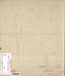
- Description:
- 1924
- Subject:
- Topical Subject: Soviet Union, Geographic Subject: Kasplya, and Topical Subject: Maps
- Publisher:
- Военно-топографическое управление
- Language:
- Russian
- Identifier:
- VAC9619-001301
- Genre:
- Military Maps and Topographic Maps
- Geographic Location:
- Coordinates: 54.833, 31.5, 55, 31.75
- Related URL:
- Download GeoTIFF: https://drive.google.com/open?id=1lAZI4z4oFloJIPZmvRnJNbgCGvaIGlyJ and Catalog URL: http://iucat.iu.edu/catalog/5020131
- Abstract:
- Modern area represented: Kasplya, Smolensk oblasst, Russia
- Call Number:
- GM G7000 S50 .S68 N-36-40-A
- Caption:
- Секретно
- City:
- Каспля (Kasplya)
- Copyright Holder:
- No Copyright - United States
- Country:
- СССР (USSR)
- State/Province:
- РСФСР (RSFSR) and Западная область (Western oblast)
- Physical Description:
- Scale: 1:50,000
- Persistent URL:
- http://purl.dlib.indiana.edu/iudl/images/VAC9619/VAC9619-001301
- Provenance:
- DMA Topographic Center, Army Map Service Library, OMAHA, Library of Congress Geography & Map Division
-
- Description:
- 1931
- Subject:
- Topical Subject: Maps, Geographic Subject: Yabluneve, and Topical Subject: Soviet Union
- Publisher:
- Управление военных топографов РККА
- Language:
- Russian
- Identifier:
- VAC9619-000995
- Genre:
- Military Maps and Topographic Maps
- Geographic Location:
- Coordinates: 49.833, 32.5, 50, 32.75
- Related URL:
- Catalog URL: http://iucat.iu.edu/catalog/5020131 and Download GeoTIFF: https://drive.google.com/open?id=1Y0U1rP6HMNXJRoGBOJE68UazBq6Cbota
- Abstract:
- Modern area represented: Яблуневе (Yabluneve), Poltava oblast, Ukraine
- Call Number:
- G7000 s50 .S68 sheet M-36-78-A
- Caption:
- Не подлежит оглашению
- City:
- Яблонево (Yablonevo)
- Copyright Holder:
- No Copyright - United States
- Country:
- СССР (USSR)
- State/Province:
- Украинская ССР (Ukrainian Soviet Socialist Republic) and Харьковская область (Kharkiv oblast)
- Physical Description:
- Scale: 1:50,000
- Persistent URL:
- http://purl.dlib.indiana.edu/iudl/images/VAC9619/VAC9619-000995
- Provenance:
- DMA Topographic Center, Army Map Service Library, OMAHA, Library of Congress Geography & Map Division
-
- Description:
- 1929
- Subject:
- Geographic Subject: Zhornokl'ovy, Topical Subject: Maps, and Topical Subject: Soviet Union
- Publisher:
- Управление военных топографов
- Language:
- Russian
- Date Created:
- 1932
- Identifier:
- VAC9619-000991
- Genre:
- Military Maps and Topographic Maps
- Geographic Location:
- Coordinates: 49.833, 31.75, 50, 32
- Related URL:
- Download GeoTIFF: https://drive.google.com/open?id=16Nggj2nwfnBGW6Q4EWeXn7a7Sap0bRb1 and Catalog URL: http://iucat.iu.edu/catalog/5020131
- Abstract:
- Modern area represented: Жорнокльови (Zhornokl'ovy), Cherkasy oblast, Ukraine
- Call Number:
- G7000 s50 .S68 sheet M-36-76-B
- Caption:
- Captured map, Рассекречено, and Не подлежит оглашению (crossed out)
- City:
- Жорноклевы (Zhornoklevy)
- Copyright Holder:
- No Copyright - United States
- Country:
- СССР (USSR)
- State/Province:
- Украинская ССР (Ukrainian Soviet Socialist Republic)
- Physical Description:
- Scale: 1:50,000
- Persistent URL:
- http://purl.dlib.indiana.edu/iudl/images/VAC9619/VAC9619-000991
- Provenance:
- DMA Topographic Center, Army Map Service Library, OMAHA, Library of Congress Geography & Map Division
-
- Description:
- 1929
- Subject:
- Geographic Subject: Hel'myaziv, Topical Subject: Soviet Union, and Topical Subject: Maps
- Publisher:
- Управление военных топографов
- Language:
- Russian
- Identifier:
- VAC9619-000992
- Genre:
- Military Maps and Topographic Maps
- Geographic Location:
- Coordinates: 49.667, 31.75, 49.833, 32
- Related URL:
- Catalog URL: http://iucat.iu.edu/catalog/5020131 and Download GeoTIFF: https://drive.google.com/open?id=10KwpleQWRvznxadNUiRFAxT_ND_u45Xu
- Abstract:
- Modern area represented: Гельмязів (Hel'myaziv), Cherkasy oblast, Ukraine
- Call Number:
- G7000 s50 .S68 sheet M-36-76-D
- Caption:
- Не подлежит оглашению (crossed out), Captured map, and Рассекречено
- City:
- Глемязово (Glemyazovo)
- Copyright Holder:
- No Copyright - United States
- Country:
- СССР (USSR)
- State/Province:
- Украинская ССР (Ukrainian Soviet Socialist Republic)
- Physical Description:
- Scale: 1:50,000
- Persistent URL:
- http://purl.dlib.indiana.edu/iudl/images/VAC9619/VAC9619-000992
- Provenance:
- DMA Topographic Center, Army Map Service Library, OMAHA, Library of Congress Geography & Map Division
-
- Description:
- 1924
- Subject:
- Topical Subject: Soviet Union, Geographic Subject: Trakhtemyriv, and Topical Subject: Maps
- Publisher:
- Управление военных топографов
- Language:
- Russian
- Identifier:
- VAC9619-000989
- Genre:
- Topographic Maps and Military Maps
- Geographic Location:
- Coordinates: 49.833, 31.25, 50, 31.5
- Related URL:
- Catalog URL: http://iucat.iu.edu/catalog/5020131 and Download GeoTIFF: https://drive.google.com/open?id=1zFZnIlQwNet5Y6qGxZ_YDo2x6r4AQQmR
- Abstract:
- Modern area represented: the place was flooded by the Kaniv Reservoir. The nearest populated place: Трахтемирів (Trakhtemyriv), Cherkasy oblast, Ukraine
- Call Number:
- G7000 s50 .S68 sheet M-36-74-C
- Caption:
- Не подлежит оглашению
- City:
- Вьюнище (V"yunishche)
- Copyright Holder:
- No Copyright - United States
- Country:
- СССР (USSR)
- State/Province:
- Украинская ССР (Ukrainian Soviet Socialist Republic)
- Physical Description:
- Scale: 1:50,000
- Persistent URL:
- http://purl.dlib.indiana.edu/iudl/images/VAC9619/VAC9619-000989
- Provenance:
- DMA Topographic Center, Army Map Service Library, OMAHA, Library of Congress Geography & Map Division
-
- Subject:
- Topical Subject: Soviet Union, Geographic Subject: Kaharlyk, and Topical Subject: Maps
- Publisher:
- Управление военных топографов РККА
- Language:
- Russian
- Identifier:
- VAC9619-000987
- Genre:
- Topographic Maps and Military Maps
- Geographic Location:
- Coordinates: 49.833, 30.75, 50, 31
- Related URL:
- Catalog URL: http://iucat.iu.edu/catalog/5020131 and Download GeoTIFF: https://drive.google.com/open?id=1j-kE_J-SY02vADijGiMpPrpwQivq-pDV
- Abstract:
- Modern area represented: Кагарлик (Kaharlyk), Kyiv oblast, Ukraine
- Call Number:
- G7000 s50 .S68 sheet M-36-61-G
- Caption:
- Не подлежит оглашению
- City:
- Кагарлык (Kagarlyk)
- Copyright Holder:
- No Copyright - United States
- Country:
- СССР (USSR)
- State/Province:
- Киевская область (Kyiv oblast) and Украинская ССР (Ukrainian Soviet Socialist Republic)
- Physical Description:
- Scale: 1:50,000
- Persistent URL:
- http://purl.dlib.indiana.edu/iudl/images/VAC9619/VAC9619-000987
- Provenance:
- DMA Topographic Center, Army Map Service Library, OMAHA, Library of Congress Geography & Map Division
-
- Description:
- 1923
- Subject:
- Geographic Subject: Rokytne, Topical Subject: Soviet Union, and Topical Subject: Maps
- Publisher:
- Управление военных топографов
- Language:
- Russian
- Date Created:
- 1932
- Identifier:
- VAC9619-000985
- Genre:
- Topographic Maps and Military Maps
- Geographic Location:
- Coordinates: 49.667, 30.25, 49.833, 30.5
- Related URL:
- Download GeoTIFF: https://drive.google.com/open?id=1iaJ6KvA1GY4Z2A2qK0P_HfIVJmnZmYhW and Catalog URL: http://iucat.iu.edu/catalog/5020131
- Abstract:
- Modern area represented: Рокитне (Rokytne), Kyiv oblast, Ukraine
- Call Number:
- G7000 s50 .S68 sheet M-36-73-D
- Caption:
- Не подлежит оглашению
- City:
- Рокитно (Rokitno)
- Copyright Holder:
- No Copyright - United States
- Country:
- СССР (USSR)
- State/Province:
- Украинская ССР (Ukrainian Soviet Socialist Republic) and Киевская область (Kyiv oblast)
- Physical Description:
- Scale: 1:50,000
- Persistent URL:
- http://purl.dlib.indiana.edu/iudl/images/VAC9619/VAC9619-000985
- Provenance:
- DMA Topographic Center, Army Map Service Library, OMAHA, Library of Congress Geography & Map Division
-
- Subject:
- Geographic Subject: Bila Tserkva, Topical Subject: Soviet Union, and Topical Subject: Maps
- Publisher:
- Управление военных топографов
- Language:
- Russian
- Identifier:
- VAC9619-000984
- Genre:
- Military Maps and Topographic Maps
- Geographic Location:
- Coordinates: 49.667, 30, 49.833, 30.25
- Related URL:
- Catalog URL: http://iucat.iu.edu/catalog/5020131 and Download GeoTIFF: https://drive.google.com/open?id=1ftWMaKNlKrCsqA46WkemYc8X5jERvvii
- Abstract:
- Modern area represented: Біла Церква (Bila Tserkva), Kyiv oblast, Ukraine
- Call Number:
- G7000 s50 .S68 sheet M-36-73-C
- Caption:
- Не подлежит оглашению
- City:
- Белая Церковь (Belaya Tserkov’)
- Copyright Holder:
- No Copyright - United States
- Country:
- СССР (USSR)
- State/Province:
- Украинская ССР (Ukrainian Soviet Socialist Republic) and Киевская область (Kyiv oblast)
- Physical Description:
- Scale: 1:50,000
- Persistent URL:
- http://purl.dlib.indiana.edu/iudl/images/VAC9619/VAC9619-000984
- Provenance:
- DMA Topographic Center, Army Map Service Library, OMAHA, Library of Congress Geography & Map Division
-
- Description:
- 1909
- Subject:
- Topical Subject: Maps, Topical Subject: Soviet Union, and Geographic Subject: Hrebinky
- Publisher:
- Управление военных топографов
- Language:
- Russian
- Identifier:
- VAC9619-000982
- Genre:
- Military Maps and Topographic Maps
- Geographic Location:
- Coordinates: 49.833, 30, 50, 30.25
- Related URL:
- Catalog URL: http://iucat.iu.edu/catalog/5020131 and Download GeoTIFF: https://drive.google.com/open?id=1PLrS_xE8qSkoooCJkj85y-lv1KJzTgih
- Abstract:
- Modern area represented: Гребінки (Hrebinky), Kyiv oblast, Ukraine
- Call Number:
- G7000 s50 .S68 sheet M-36-73-A
- Caption:
- Не подлежит оглашению
- City:
- Гребенки (Grebenki)
- Copyright Holder:
- No Copyright - United States
- Country:
- СССР (USSR)
- State/Province:
- Киевская область (Kyiv oblast) and Украинская ССР (Ukrainian Soviet Socialist Republic)
- Physical Description:
- Scale: 1:50,000
- Persistent URL:
- http://purl.dlib.indiana.edu/iudl/images/VAC9619/VAC9619-000982
- Provenance:
- DMA Topographic Center, Army Map Service Library, OMAHA, Library of Congress Geography & Map Division
-
- Description:
- 1931
- Subject:
- Topical Subject: Soviet Union, Topical Subject: Maps, and Geographic Subject: Komyshnya
- Publisher:
- Управление военных топографов РККА
- Language:
- Russian
- Identifier:
- VAC9619-000981
- Genre:
- Topographic Maps and Military Maps
- Geographic Location:
- Coordinates: 50.167, 33.5, 50.333, 33.75
- Related URL:
- Catalog URL: http://iucat.iu.edu/catalog/5020131 and Download GeoTIFF: https://drive.google.com/open?id=1EdkumY4aAZH5DM7GyxUVyTTDfdMIBHRF
- Abstract:
- Modern area represented: Комишня (Komyshnya), Poltava oblast, Ukraine
- Call Number:
- G7000 s50 .S68 sheet M-36-6-A
- Caption:
- Не подлежит оглашению
- City:
- Комышно (Komyshno)
- Copyright Holder:
- No Copyright - United States
- Country:
- СССР (USSR)
- State/Province:
- Харьковская область (Kharkiv oblast) and Украинская ССР (Ukrainian Soviet Socialist Republic)
- Physical Description:
- Scale: 1:50,000
- Persistent URL:
- http://purl.dlib.indiana.edu/iudl/images/VAC9619/VAC9619-000981
- Provenance:
- DMA Topographic Center, Army Map Service Library, OMAHA, Library of Congress Geography & Map Division
-
- Description:
- 1931
- Subject:
- Geographic Subject: Lubny, Topical Subject: Soviet Union, and Topical Subject: Maps
- Publisher:
- Управление военных топографов
- Language:
- Russian
- Identifier:
- VAC9619-000980
- Genre:
- Topographic Maps and Military Maps
- Geographic Location:
- Coordinates: 50, 33, 50.167, 33.25
- Related URL:
- Catalog URL: http://iucat.iu.edu/catalog/5020131 and Download GeoTIFF: https://drive.google.com/open?id=1VpTA7xVPHxQmymgXq7Sjuczk_KtdDeRx
- Abstract:
- Modern area represented: Лубни (Lubny), Poltava oblast, Ukraine
- Call Number:
- G7000 s50 .S68 sheet M-36-67-A
- Caption:
- Не подлежит оглашению
- City:
- Лубны (Lubny)
- Copyright Holder:
- No Copyright - United States
- Country:
- СССР (USSR)
- State/Province:
- Лубенский район (Lubensky district) and Украинская ССР (Ukrainian Soviet Socialist Republic)
- Physical Description:
- Scale: 1:50,000
- Persistent URL:
- http://purl.dlib.indiana.edu/iudl/images/VAC9619/VAC9619-000980
- Provenance:
- DMA Topographic Center, Army Map Service Library, OMAHA, Library of Congress Geography & Map Division
-
- Subject:
- Geographic Subject: Obukhiv, Topical Subject: Soviet Union, and Topical Subject: Maps
- Publisher:
- Управление военных топографов РККА
- Language:
- Russian
- Identifier:
- VAC9619-000974
- Genre:
- Topographic Maps and Military Maps
- Geographic Location:
- Coordinates: 50.0, 30.5, 50.16667, 30.75
- Related URL:
- Catalog URL: http://iucat.iu.edu/catalog/5020131 and Download GeoTIFF: https://drive.google.com/open?id=1rx5Y79bSm-lRlIZDJAYvSzJEywJteG9a
- Abstract:
- Modern area represented: Обухів (Obukhiv), Kyiv oblast, Ukraine
- Call Number:
- G7000 s50 .S68 sheet M-36-62-B
- Caption:
- Не подлежит оглашению
- City:
- Обухов (Obukhov)
- Copyright Holder:
- No Copyright - United States
- Country:
- СССР (USSR)
- State/Province:
- Киевская область (Kyiv oblast) and Украинская ССР (Ukrainian Soviet Socialist Republic)
- Physical Description:
- Scale: 1:50,000
- Persistent URL:
- http://purl.dlib.indiana.edu/iudl/images/VAC9619/VAC9619-000974
- Provenance:
- DMA Topographic Center, Army Map Service Library, OMAHA, Library of Congress Geography & Map Division
-
- Description:
- 1923
- Subject:
- Topical Subject: Maps, Geographic Subject: Voronkiv, and Topical Subject: Soviet Union
- Publisher:
- Управление военных топографов
- Language:
- Russian
- Identifier:
- VAC9619-000973
- Genre:
- Military Maps and Topographic Maps
- Geographic Location:
- Coordinates: 50.166667, 30.75, 50.333333, 31.0
- Related URL:
- Catalog URL: http://iucat.iu.edu/catalog/5020131 and Download GeoTIFF: https://drive.google.com/open?id=1Ifue5YSrX3JDshma4femEp2eD86KPf9X
- Abstract:
- Modern area represented: Voronkiv, Kyiv oblast, Ukraine
- Call Number:
- G7000 s50 .S68 sheet M-36-52-D
- Caption:
- Не подлежит оглашению
- City:
- Воронкив (Voronkiv)
- Copyright Holder:
- No Copyright - United States
- Country:
- СССР (USSR)
- State/Province:
- Украинская ССР (Ukrainian Soviet Socialist Republic) and Киевская область (Kyiv oblast)
- Physical Description:
- Scale: 1:50,000
- Persistent URL:
- http://purl.dlib.indiana.edu/iudl/images/VAC9619/VAC9619-000973
- Provenance:
- DMA Topographic Center, Army Map Service Library, OMAHA, Library of Congress Geography & Map Division
-
- Subject:
- Topical Subject: Soviet Union, Geographic Subject: Barakhty, and Topical Subject: Maps
- Publisher:
- Управление военных топографов РККА
- Language:
- Russian
- Identifier:
- VAC9619-000971
- Genre:
- Military Maps and Topographic Maps
- Geographic Location:
- Coordinates: 50.0, 30.25, 50.166667, 30.5
- Related URL:
- Download GeoTIFF: https://drive.google.com/open?id=1P1R6u7ZLUoz9PA2JjJ0ixJVBsTH8ZYQS and Catalog URL: http://iucat.iu.edu/catalog/5020131
- Abstract:
- Modern area represented: Barakhty, Cherkasy oblast, Ukraine
- Call Number:
- G7000 s50 .S68 sheet M-36-61-D
- Caption:
- Не подлежит оглашению
- City:
- Барахты (Barakhty)
- Copyright Holder:
- No Copyright - United States
- Country:
- СССР (USSR)
- State/Province:
- Киевская область (Kyiv oblast) and Украинская ССР (Ukrainian Soviet Socialist Republic)
- Physical Description:
- Scale: 1:50,000
- Persistent URL:
- http://purl.dlib.indiana.edu/iudl/images/VAC9619/VAC9619-000971
- Provenance:
- DMA Topographic Center, Army Map Service Library, OMAHA, Library of Congress Geography & Map Division
-

- Subject:
- Geographic Subject: Trostyanets, Topical Subject: Maps, and Topical Subject: Soviet Union
- Publisher:
- Генеральный штаб Красной Армии
- Language:
- Russian
- Date Created:
- 1941
- Identifier:
- VAC9619-000970
- Genre:
- Topographic Maps and Military Maps
- Geographic Location:
- Coordinates: 50.333333, 34.75, 50.5, 35.0
- Related URL:
- Catalog URL: http://iucat.iu.edu/catalog/5020131 and Download GeoTIFF: https://drive.google.com/open?id=1gc3NDRG7ImgHIVSQULYVrcANQDfApPkL
- Abstract:
- Modern area represented: Trostyanets, Sumy oblast, Ukraine
- Call Number:
- G7000 s50 .S68 sheet M-36-58-D
- Caption:
- Для служебного пользования
- City:
- Тростянец (Trostyanets)
- Copyright Holder:
- No Copyright - United States
- Country:
- СССР (USSR)
- State/Province:
- Украинская ССР (Ukrainian Soviet Socialist Republic) and Сумская область (Sumy oblast)
- Physical Description:
- Scale: 1:50,000
- Persistent URL:
- http://purl.dlib.indiana.edu/iudl/images/VAC9619/VAC9619-000970
- Provenance:
- DMA Topographic Center, Army Map Service Library, OMAHA, Library of Congress Geography & Map Division
-
- Subject:
- Topical Subject: Soviet Union, Geographic Subject: Byshkin, and Topical Subject: Maps
- Publisher:
- Генеральный штаб Красной Армии
- Language:
- Russian
- Identifier:
- VAC9619-000969
- Genre:
- Military Maps and Topographic Maps
- Geographic Location:
- Coordinates: 50.5, 34.5, 50.666667, 34.75
- Related URL:
- Download GeoTIFF: https://drive.google.com/open?id=1CaVr1wU5c0Wbye4EiV7w9MBvKySXEzxS and Catalog URL: http://iucat.iu.edu/catalog/5020131
- Abstract:
- Modern area represented: Byshkin, Sumy oblast, Ukraine
- Call Number:
- G7000 s50 .S68 sheet M-36-58-A
- Caption:
- Для служебного пользования
- City:
- Бишкинь (Bishkin)
- Copyright Holder:
- No Copyright - United States
- Country:
- СССР (USSR)
- State/Province:
- Сумская область (Sumy oblast) and Украинская ССР (Ukrainian Soviet Socialist Republic)
- Physical Description:
- Scale: 1:50,000
- Persistent URL:
- http://purl.dlib.indiana.edu/iudl/images/VAC9619/VAC9619-000969
- Provenance:
- DMA Topographic Center, Army Map Service Library, OMAHA, Library of Congress Geography & Map Division
-
- Description:
- 1928
- Subject:
- Geographic Subject: Nova Orzhytsya, Geographic Subject: Stara Orzhytsya, Topical Subject: Soviet Union, and Topical Subject: Maps
- Publisher:
- Управление военных топографов
- Language:
- Russian
- Identifier:
- VAC9619-000968
- Genre:
- Topographic Maps and Military Maps
- Geographic Location:
- Coordinates: 50.333333, 31.75, 32.0, 50.5
- Related URL:
- Download GeoTIFF: https://drive.google.com/open?id=18YuytFzviawqbRaK_nU5kYcVnM0n3WRq and Catalog URL: http://iucat.iu.edu/catalog/5020131
- Abstract:
- Modern area represented: Stara Orzhytsya and Nova Orzhytsya, Kyiv oblast, Ukraine
- Call Number:
- G7000 s50 .S68 sheet M-36-52-D
- Caption:
- Не подлежит оглашению
- City:
- Оржица (Orzhytsa)
- Copyright Holder:
- No Copyright - United States
- Country:
- СССР (USSR)
- State/Province:
- Украинская ССР (Ukrainian Soviet Socialist Republic)
- Physical Description:
- Scale: 1:50,000
- Persistent URL:
- http://purl.dlib.indiana.edu/iudl/images/VAC9619/VAC9619-000968
- Provenance:
- DMA Topographic Center, Army Map Service Library, OMAHA, Library of Congress Geography & Map Division
-
- Description:
- 1932
- Subject:
- Topical Subject: Soviet Union, Geographic Subject: Kyiv, and Topical Subject: Maps
- Publisher:
- Управление военных топографов
- Language:
- Russian
- Identifier:
- VAC9619-000962
- Genre:
- Military Maps and Topographic Maps
- Geographic Location:
- Coordinates: 50.333333, 30.25, 50.5, 30.5
- Related URL:
- Catalog URL: http://iucat.iu.edu/catalog/5020131 and Download GeoTIFF: https://drive.google.com/open?id=1MBGXQHYEX0qEopNwhqmuhyAJbT75MyLg
- Abstract:
- Modern area represented: Svyatoshyn, Kyiv, Ukraine
- Call Number:
- G7000 s50 .S68 sheet M-36-49-D
- Caption:
- Не подлежит оглашению
- City:
- Святошино (Svyatoshino)
- Copyright Holder:
- No Copyright - United States
- Country:
- СССР (USSR)
- State/Province:
- Украинская ССР (Ukrainian Soviet Socialist Republic) and Киевская область (Kyiv oblast)
- Physical Description:
- Scale: 1:50,000
- Persistent URL:
- http://purl.dlib.indiana.edu/iudl/images/VAC9619/VAC9619-000962
- Provenance:
- DMA Topographic Center, Army Map Service Library, OMAHA, Library of Congress Geography & Map Division
-
- Subject:
- Topical Subject: Soviet Union, Geographic Subject: Vilshana, and Topical Subject: Maps
- Publisher:
- Генеральный штаб Красной Армии
- Language:
- Russian
- Identifier:
- VAC9619-000958
- Genre:
- Military Maps and Topographic Maps
- Geographic Location:
- Coordinates: 50.666667, 34.0, 50.833333, 34.25
- Related URL:
- Download GeoTIFF: https://drive.google.com/open?id=170err1VYZTEPcmdT0jHPEnFBq7It5W8U and Catalog URL: http://iucat.iu.edu/catalog/5020131
- Abstract:
- Modern area represented: Vilshana, Sumy oblast, Ukraine
- Call Number:
- G7000 s50 .S68 sheet M-36-45-C
- Caption:
- Для служебного пользования
- City:
- Ольшана (Olshana)
- Copyright Holder:
- No Copyright - United States
- Country:
- СССР (USSR)
- State/Province:
- Украинская ССР (Ukrainian Soviet Socialist Republic) and Сумская область (Sumy oblast)
- Physical Description:
- Scale: 1:50,000
- Persistent URL:
- http://purl.dlib.indiana.edu/iudl/images/VAC9619/VAC9619-000958
- Provenance:
- DMA Topographic Center, Army Map Service Library, OMAHA, Library of Congress Geography & Map Division
-
- Description:
- 1932
- Subject:
- Geographic Subject: Novi Petrivtsi, Topical Subject: Maps, and Topical Subject: Soviet Union
- Publisher:
- Управление военных топографов
- Language:
- Russian
- Identifier:
- VAC9619-000961
- Genre:
- Topographic Maps and Military Maps
- Geographic Location:
- Coordinates: 50.5, 30.25, 50.666667, 30.5
- Related URL:
- Catalog URL: http://iucat.iu.edu/catalog/5020131 and Download GeoTIFF: https://drive.google.com/open?id=1P--zk87bO6gjnXtHUG5sg6lQJF2GQuly
- Abstract:
- Modern area represented: Novi Petrivtsi, Kyiv oblast, Ukraine
- Call Number:
- G7000 s50 .S68 sheet M-36-49-B
- Caption:
- Не подлежит оглашению
- City:
- Ново-Петровцы (Novo-Petrovtsy)
- Copyright Holder:
- No Copyright - United States
- Country:
- СССР (USSR)
- State/Province:
- Украинская ССР (Ukrainian Soviet Socialist Republic) and Киевская область (Kyiv oblast)
- Physical Description:
- Scale: 1:50,000
- Persistent URL:
- http://purl.dlib.indiana.edu/iudl/images/VAC9619/VAC9619-000961
- Provenance:
- DMA Topographic Center, Army Map Service Library, OMAHA, Library of Congress Geography & Map Division
-
- Subject:
- Geographic Subject: Mykulychi, Topical Subject: Soviet Union, and Topical Subject: Maps
- Publisher:
- Управление военных топографов РККА
- Language:
- Russian
- Identifier:
- VAC9619-000960
- Genre:
- Topographic Maps and Military Maps
- Geographic Location:
- Coordinates: 50.5, 30.0, 50.666667, 30.25
- Related URL:
- Catalog URL: http://iucat.iu.edu/catalog/5020131 and Download GeoTIFF: https://drive.google.com/open?id=1Jj1W-B5Ch9lO54afGKma4Hwxk_QNiZt9
- Abstract:
- Modern area represented: Mykulychi, Kyiv oblast, Ukraine
- Call Number:
- G7000 s50 .S68 sheet M-36-49-A
- Caption:
- Не подлежит оглашению
- City:
- Микуличи (Mikulichi)
- Copyright Holder:
- No Copyright - United States
- Country:
- СССР (USSR)
- State/Province:
- Украинская ССР (Ukrainian Soviet Socialist Republic) and Киевская область (Kyiv oblast)
- Physical Description:
- Scale: 1:50,000
- Persistent URL:
- http://purl.dlib.indiana.edu/iudl/images/VAC9619/VAC9619-000960
- Provenance:
- DMA Topographic Center, Army Map Service Library, OMAHA, Library of Congress Geography & Map Division
-

- Description:
- 1938
- Subject:
- Topical Subject: Maps, Geographic Subject: Tovste, and Topical Subject: Soviet Union
- Publisher:
- Генеральный штаб Красной Армии
- Language:
- Russian
- Date Created:
- 1941
- Identifier:
- VAC9619-000956
- Genre:
- Topographic Maps and Military Maps
- Geographic Location:
- Coordinates: 50.83333, 34.0, 51.0, 34.25
- Related URL:
- Download GeoTIFF: https://drive.google.com/open?id=18NrtybSlEFYo6Cbg2zvy_2BEv4G6o9PT and Catalog URL: http://iucat.iu.edu/catalog/5020131
- Abstract:
- Modern area represented: Tovste, Sumy oblast, Ukraine
- Call Number:
- G7000 s50 .S68 sheet M-36-45-A
- Caption:
- Для служебного пользования
- City:
- Толстое (Tolstoe)
- Copyright Holder:
- No Copyright - United States
- Country:
- СССР (USSR)
- State/Province:
- Украинская ССР (Ukrainian Soviet Socialist Republic) and Сумская область (Sumy oblast)
- Physical Description:
- Scale: 1:50,000
- Persistent URL:
- http://purl.dlib.indiana.edu/iudl/images/VAC9619/VAC9619-000956
- Provenance:
- DMA Topographic Center, Army Map Service Library, OMAHA, Library of Congress Geography & Map Division
-
- Description:
- 1931
- Subject:
- Topical Subject: Soviet Union, Geographic Subject: Terny, and Topical Subject: Maps
- Publisher:
- Управление военных топографов РККА
- Language:
- Russian
- Identifier:
- VAC9619-000954
- Genre:
- Topographic Maps and Military Maps
- Geographic Location:
- Coordinates: 50.83333, 33.75, 51.0, 34.0
- Related URL:
- Catalog URL: http://iucat.iu.edu/catalog/5020131 and Download GeoTIFF: https://drive.google.com/open?id=13OXcKvBOdgaCwqxa6E9aF935ZUS4bLKc
- Abstract:
- Modern area represented: Terny, Sumy oblast, Ukraine
- Call Number:
- G7000 s50 .S68 sheet M-36-44-B
- Caption:
- Не подлежит оглашению,Captured map
- City:
- Терны (Terny)
- Copyright Holder:
- No Copyright - United States
- Country:
- СССР (USSR)
- State/Province:
- Украинская ССР (Ukrainian Soviet Socialist Republic), Черниговская область (Chernihiv oblast), and Харьковская область (Kharkiv oblast)
- Physical Description:
- Scale: 1:50,000
- Persistent URL:
- http://purl.dlib.indiana.edu/iudl/images/VAC9619/VAC9619-000954
- Provenance:
- DMA Topographic Center, Army Map Service Library, OMAHA, Library of Congress Geography & Map Division
