
Search Constraints
You searched for:
Provenance
Part of Geological Survey (U.S.). Indiana 1:62,500.
Remove constraint Provenance: Part of Geological Survey (U.S.). Indiana 1:62,500.
Search Results
-
- Subject:
- Geographic Subject: Edwards County (Ill.), Geographic Subject: Gibson County (Ind.), Geographic Subject: Wabash County (Ill.), and Topical Subject: Vegetatio...
- Creator:
- Geological Survey (U.S.)
- Publisher:
- Geological Survey (U.S.)
- Date Created:
- 1963
- Identifier:
- VAC3073-M-01353
- Genre:
- 15 minute topographic maps, Quadrangle maps, and Topographic maps
- Geographic Location:
- Coordinates: W0880000 W0874500 N0383000 N0381500
- Related URL:
- Catalog URL: https://iucat.iu.edu/catalog/18412729
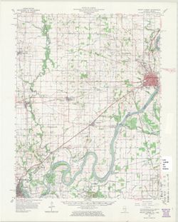
- Abstract:
- Mapped, edited, and published by the Geological Survey. Filing title: Mount Carmel, Ill.-Ind. Standard map series designation: AMS (Series) V763 3460 IV. Pol...
- Call Number:
- G4090 s62 .G4 Mount Carmel 1959 rep 1963 V
- Caption:
- Imprint: Washington, D.C. : The Survey, 1963.
- Physical Description:
- Dimensions: 45 x 42 cm or smaller and Scale: 1:62,500
- Alternate Identifier:
- Title Control Number: a18412729
- Persistent URL:
- https://purl.dlib.indiana.edu/iudl/images/VAC3073/VAC3073-M-01353
- Provenance:
- Part of Geological Survey (U.S.). Indiana 1:62,500.
-
![Michigan-Indiana Three Rivers quadrangle [1932 reprint]](https://iiif.uits.iu.edu/iiif/2/qb98nk04b%2Ffiles%2F296eac80-9a56-4522-add9-e4bc7783d601/full/250,/0/default.jpg)
- Subject:
- Geographic Subject: LaGrange County (Ind.), Geographic Subject: Saint Joseph County (Mich.), and Geographic Subject: Elkhart County (Ind.)
- Creator:
- Lee, L. L. (Luria Lyons), 1882-1962, Burney, H. E., U.S. Lake Survey, Herron, W. H. (William Harrison), 1865-, Geological Survey (U.S.), Marshall, R. B. (Rob...
- Publisher:
- Geological Survey (U.S.)
- Date Created:
- 1932
- Identifier:
- VAC3073-M-01396
- Genre:
- 15 minute topographic maps, Topographic maps, and Quadrangle maps
- Geographic Location:
- Coordinates: W0854500 W0853000 N0420000 N0414500
- Related URL:
- Catalog URL: https://iucat.iu.edu/catalog/18416001
- Abstract:
- R.B. Marshall, chief geographer , W.H. Herron, geographer in charge , topography by L.L. Lee and H.E. Burney , control by U.S. Lake Survey, J.R. Ellis, J.H. ...
- Call Number:
- G4090 s62 .G4 Three Rivers 1916 rep1932
- Caption:
- Imprint: Washington, D.C. : Dept. of the Interior, U.S. Geological Survey, 1932
- Physical Description:
- Scale: 1:62,500 and Dimensions: 45 x 42 cm or smaller
- Alternate Identifier:
- Title Control Number: a18416001
- Persistent URL:
- https://purl.dlib.indiana.edu/iudl/images/VAC3073/VAC3073-M-01396
- Provenance:
- Part of Geological Survey (U.S.). Indiana 1:62,500.
-
![Michigan-Indiana Three Oaks quadrangle [1930 printing]](https://iiif.uits.iu.edu/iiif/2/s1785q22x%2Ffiles%2Fdf050288-4fd9-4056-bb9e-e2b44d32511e/full/250,/0/default.jpg)
- Subject:
- Geographic Subject: Saint Joseph County (Ind.), Geographic Subject: Berrien County (Mich.), and Geographic Subject: LaPorte County (Ind.)
- Creator:
- Geological Survey (U.S.), Michigan. Geological Survey Division, Plushnick, A. W. (Andrew Winfield), 1898-1980, Gehres, W. S. (Wilmer Sherman), 1887-1963, and...
- Publisher:
- Geological Survey (U.S.)
- Date Created:
- 1930
- Identifier:
- VAC3073-M-01395
- Genre:
- Topographic maps, 15 minute topographic maps, and Quadrangle maps
- Geographic Location:
- Coordinates: W0865000 W0863000 N0420000 N0414500
- Related URL:
- Catalog URL: https://iucat.iu.edu/catalog/18413989
- Abstract:
- Topography by W.S. Gehres and A.W. Plushnick , culture and drainage in part compiled from aerial photographs taken by Air Corps, U.S. Army , control by U.S. ...
- Call Number:
- G4090 s62 .G4 Three Oaks 1930
- Caption:
- Imprint: Washington, D.C. : U.S. Geological Survey, [1930]
- Physical Description:
- Scale: 1:62,500 and Dimensions: 45 x 42 cm or smaller
- Alternate Identifier:
- Title Control Number: a18413989
- Persistent URL:
- https://purl.dlib.indiana.edu/iudl/images/VAC3073/VAC3073-M-01395
- Provenance:
- Part of Geological Survey (U.S.). Indiana 1:62,500.
-
- Subject:
- Geographic Subject: Berrien County (Mich.) and Geographic Subject: Saint Joseph County (Ind.)
- Creator:
- Gehres, W. S. (Wilmer Sherman), 1887-1963, Geological Survey (U.S.), Plushnick, A. W. (Andrew Winfield), 1898-1980, U.S. Lake Survey, Michigan. Geological Su...
- Publisher:
- Geological Survey (U.S.)
- Date Created:
- 1930
- Identifier:
- VAC3073-M-01363
- Genre:
- 15 minute topographic maps, Quadrangle maps, and Topographic maps
- Geographic Location:
- Coordinates: W0863000 W0861500 N0420000 N0414500
- Related URL:
- Catalog URL: https://iucat.iu.edu/catalog/18413855
- Abstract:
- Topography by W.S. Gehres and A.W. Plushnick. Filing title: Niles, Mich.-Ind. Edition of 1930. Polyconic projection. Relief shown by contours and spot height...
- Call Number:
- G4090 s62 .G4 Niles 1930
- Caption:
- Imprint: Washington, D.C. : Dept. of the Interior, U.S. Geological Survey, 1930
- Physical Description:
- Dimensions: 45 x 42 cm or smaller and Scale: 1:62,500
- Alternate Identifier:
- Title Control Number: a18413855
- Persistent URL:
- https://purl.dlib.indiana.edu/iudl/images/VAC3073/VAC3073-M-01363
- Provenance:
- Part of Geological Survey (U.S.). Indiana 1:62,500.
-
![Kosmosdale quadrangle, Kentucky-Indiana : 15 minute series (topographic) [1959 reprint with vegetation]](https://iiif.uits.iu.edu/iiif/2/mk61sm253%2Ffiles%2Fd8ce10eb-c8cf-4182-bd5a-13d2fee0e97a/full/250,/0/default.jpg)
- Subject:
- Geographic Subject: Floyd County (Ind.), Geographic Subject: Jefferson County (Ky.), Geographic Subject: Bullitt County (Ky.), Geographic Subject: Harrison C...
- Creator:
- United States. Army. Corps of Engineers and Geological Survey (U.S.)
- Publisher:
- Geological Survey (U.S.)
- Date Created:
- 1959
- Identifier:
- VAC3073-M-01348
- Genre:
- 15 minute topographic maps, Photogrammetric maps, Quadrangle maps, and Topographic maps
- Geographic Location:
- Coordinates: W0860000 W0854500 N0381500 N0380000
- Related URL:
- Catalog URL: https://iucat.iu.edu/catalog/18412709
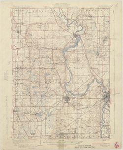
- Abstract:
- Mapped by the Geological Survey and the Army Map Service , published for civil use by the Geological Survey. Filing title: Kosmodale, Ky.-Ind. Polyconic proj...
- Call Number:
- G4090 s62 .G4 Kosmosdale 1950 rep 1959 V
- Caption:
- Imprint: Washington, D.C. : Interior--Geological Survey, 1959
- Physical Description:
- Scale: 1:62,500 and Dimensions: 45 x 42 cm or smaller
- Alternate Identifier:
- Title Control Number: a18412709
- Persistent URL:
- https://purl.dlib.indiana.edu/iudl/images/VAC3073/VAC3073-M-01348
- Provenance:
- Part of Geological Survey (U.S.). Indiana 1:62,500.
-
![Kentucky-Indiana Uniontown quadrangle [1941 reprint without vegetation]](https://iiif.uits.iu.edu/iiif/2/rx914s94d%2Ffiles%2Fb75fcf05-19c0-4df9-9bed-49261c5f07c0/full/250,/0/default.jpg)
- Subject:
- Geographic Subject: Henderson County (Ky.), Geographic Subject: Posey County (Ind.), and Geographic Subject: Union County (Ky.)
- Creator:
- Gehres, W. S. (Wilmer Sherman), 1887-1963, Goodlove, C. W., U.S. Coast and Geodetic Survey, Ellis, J. R. (Topographer), Geological Survey (U.S.), Herrington,...
- Publisher:
- Geological Survey (U.S.)
- Date Created:
- 1941
- Identifier:
- VAC3073-M-01403
- Genre:
- Quadrangle maps, Topographic maps, and 15 minute topographic maps
- Geographic Location:
- Coordinates: W0880000 W0874500 N0380000 N0374500
- Related URL:
- Catalog URL: https://iucat.iu.edu/catalog/18415442
- Abstract:
- R.B. Marshall, chief geographer , W.H. Herron, geographer in charge , topography by C.W. Goodlove, R.M. Herrington and W.S. Gehres , control by U.S. Coast an...
- Call Number:
- G4090 s62 .G4 Uniontown 1917 rep1941
- Caption:
- Imprint: [Washington, D.C.] : U.S. Geological Survey, 1941
- Physical Description:
- Dimensions: 45 x 42 cm or smaller and Scale: 1:62,500
- Alternate Identifier:
- Title Control Number: a18415442
- Persistent URL:
- https://purl.dlib.indiana.edu/iudl/images/VAC3073/VAC3073-M-01403
- Provenance:
- Part of Geological Survey (U.S.). Indiana 1:62,500.
-
![Kentucky-Indiana Uniontown quadrangle [1941 reprint without vegetation]](https://iiif.uits.iu.edu/iiif/2/4m90fx89j%2Ffiles%2Fc2e137b5-4791-4eaa-a234-4e491cea321e/full/250,/0/default.jpg)
- Subject:
- Geographic Subject: Henderson County (Ky.), Geographic Subject: Posey County (Ind.), and Geographic Subject: Union County (Ky.)
- Creator:
- Kentucky Geological Survey, Marshall, R. B. (Robert Bradford), 1867-1949, Herrington, R. M. (Russell McKee), 1890-1977, U.S. Coast and Geodetic Survey, Hawki...
- Publisher:
- Geological Survey (U.S.)
- Date Created:
- 1941
- Identifier:
- VAC3073-M-01336
- Genre:
- Quadrangle maps, Topographic maps, and 15 minute topographic maps
- Geographic Location:
- Coordinates: W0880000 W0874500 N0380000 N0374500
- Related URL:
- Catalog URL: https://iucat.iu.edu/catalog/18415442
- Abstract:
- R.B. Marshall, chief geographer , W.H. Herron, geographer in charge , topography by C.W. Goodlove, R.M. Herrington and W.S. Gehres , control by U.S. Coast an...
- Call Number:
- G4090 s62 .G4 Uniontown 1917 rep 1941
- Caption:
- Imprint: [Washington, D.C.] : U.S. Geological Survey, 1941.
- Physical Description:
- Dimensions: 45 x 42 cm or smaller and Scale: 1:62,500
- Alternate Identifier:
- Title Control Number: a18415442
- Persistent URL:
- https://purl.dlib.indiana.edu/iudl/images/VAC3073/VAC3073-M-01336
- Provenance:
- Part of Geological Survey (U.S.). Indiana 1:62,500.
-
![Kentucky-Indiana Uniontown quadrangle [1929 without vegetation]](https://iiif.uits.iu.edu/iiif/2/bn99b9304%2Ffiles%2F7d8bdd0e-d8b8-4f23-b50f-402956e1a45a/full/250,/0/default.jpg)
- Subject:
- Geographic Subject: Posey County (Ind.), Geographic Subject: Union County (Ky.), and Geographic Subject: Henderson County (Ky.)
- Creator:
- Herrington, R. M. (Russell McKee), 1890-1977, Ellis, J. R. (Topographer), Geological Survey (U.S.), Herron, W. H. (William Harrison), 1865-, Hawkins, Geo. T....
- Publisher:
- Geological Survey (U.S.)
- Date Created:
- 1929
- Identifier:
- VAC3073-M-01335
- Genre:
- 15 minute topographic maps, Quadrangle maps, and Topographic maps
- Geographic Location:
- Coordinates: W0880000 W0874500 N0380000 N0374500
- Related URL:
- Catalog URL: https://iucat.iu.edu/catalog/18415442
- Abstract:
- R.B. Marshall, chief geographer , W.H. Herron, geographer in charge , topography by C.W. Goodlove, R.M. Herrington and W.S. Gehres , control by U.S. Coast an...
- Call Number:
- G4090 s62 .G4 1917 rep1929
- Caption:
- Imprint: [Washington, D.C.] : U.S. Geological Survey, 1929
- Physical Description:
- Dimensions: 45 x 42 cm or smaller and Scale: 1:62,500
- Alternate Identifier:
- Title Control Number: a18415442
- Persistent URL:
- https://purl.dlib.indiana.edu/iudl/images/VAC3073/VAC3073-M-01335
- Provenance:
- Part of Geological Survey (U.S.). Indiana 1:62,500.
-
![Kentucky-Indiana Uniontown quadrangle [1917 printing with vegetation]](https://iiif.uits.iu.edu/iiif/2/q811mp029%2Ffiles%2Fff48018f-d5c5-47dc-915f-7a5f1bfd279c/full/250,/0/default.jpg)
- Subject:
- Geographic Subject: Posey County (Ind.), Geographic Subject: Union County (Ky.), Geographic Subject: Henderson County (Ky.), and Topical Subject: Vegetation ...
- Creator:
- U.S. Coast and Geodetic Survey, Goodlove, C. W., Geological Survey (U.S.), Herron, W. H. (William Harrison), 1865-, Marshall, R. B. (Robert Bradford), 1867-1...
- Publisher:
- Geological Survey (U.S.)
- Date Created:
- 1917
- Identifier:
- VAC3073-M-01402
- Genre:
- Topographic maps, 15 minute topographic maps, and Quadrangle maps
- Geographic Location:
- Coordinates: W0880000 W0874500 N0380000 N0374500
- Related URL:
- Catalog URL: https://iucat.iu.edu/catalog/18415442
- Abstract:
- R.B. Marshall, chief geographer , W.H. Herron, geographer in charge , topography by C.W. Goodlove, R.M. Herrington and W.S. Gehres , control by U.S. Coast an...
- Call Number:
- G4090 s62 .G4 Uniontown 1917
- Caption:
- Imprint: [Washington, D.C.] : U.S. Geological Survey, [1917]
- Physical Description:
- Dimensions: 45 x 42 cm or smaller and Scale: 1:62,500
- Alternate Identifier:
- Title Control Number: a18415442
- Persistent URL:
- https://purl.dlib.indiana.edu/iudl/images/VAC3073/VAC3073-M-01402
- Provenance:
- Part of Geological Survey (U.S.). Indiana 1:62,500.
-
![Kentucky-Indiana Uniontown quadrangle [1917 printing with vegetation]](https://iiif.uits.iu.edu/iiif/2/rn302438g%2Ffiles%2F5ec44016-9965-4124-88f0-d69485cb679f/full/250,/0/default.jpg)
- Subject:
- Topical Subject: Vegetation mapping, Geographic Subject: Henderson County (Ky.), Geographic Subject: Posey County (Ind.), and Geographic Subject: Union Count...
- Creator:
- Kentucky Geological Survey, U.S. Coast and Geodetic Survey, Herron, W. H. (William Harrison), 1865-, United States. Army. Corps of Engineers, Hawkins, Geo. T...
- Publisher:
- Geological Survey (U.S.)
- Date Created:
- 1917
- Identifier:
- VAC3073-M-01334
- Genre:
- Quadrangle maps, Topographic maps, and 15 minute topographic maps
- Geographic Location:
- Coordinates: W0880000 W0874500 N0380000 N0374500
- Related URL:
- Catalog URL: https://iucat.iu.edu/catalog/18415442
- Abstract:
- R.B. Marshall, chief geographer , W.H. Herron, geographer in charge , topography by C.W. Goodlove, R.M. Herrington and W.S. Gehres , control by U.S. Coast an...
- Call Number:
- G4090 s62 .G4 Uniontown 1917
- Caption:
- Imprint: [Washington, D.C.] : U.S. Geological Survey, [1917]
- Physical Description:
- Scale: 1:62,500 and Dimensions: 45 x 42 cm or smaller
- Alternate Identifier:
- Title Control Number: a18415442
- Persistent URL:
- https://purl.dlib.indiana.edu/iudl/images/VAC3073/VAC3073-M-01334
- Provenance:
- Part of Geological Survey (U.S.). Indiana 1:62,500.
