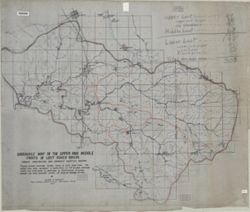
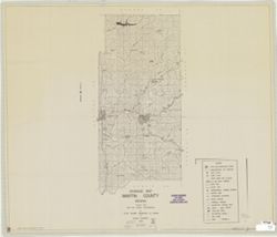
Geographic Subject: Lawrence County (Ind.), Geographic Subject: Lost River Watershed (Ind.), Topical Subject: Drainage, Geographic Subject: Lost River (Ind. ...
Creator:
Malott, Clyde A.
Publisher:
[publisher not identified]
Date Created:
1927
Identifier:
VAC3073-M-01239
Genre:
Manuscript maps and Thematic maps
Geographic Location:
Coordinates: W0864059 W0861220 N0384445 N0383053
Related URL:
Catalog URL: https://iucat.iu.edu/catalog/7745828
Abstract:
Pen, colored ink and colored pencils on drafting cloth. Includes table of drainage areas.
Call Number:
G4092.L8C315 1927 .M35
Caption:
Imprint: [Place of publication not identified] : [publisher not identified], 1927.
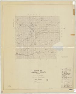
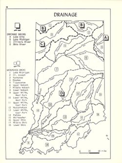
Shows drainage basins and watershed areas. Includes index. Detached from: An atlas of Indiana / by Robert C. Kingsbury , with contributions from John M. H...
Call Number:
G4091.C315 1970 .K56
Caption:
Imprint: Bloomington, Indiana : Department of Geography, Indiana University, [1970]
Physical Description:
Dimensions: 26 x 18 cm, on sheet 28 x 21 cm and Scale: Approximately 1:2,000,000
Alternate Identifier:
Title Control Number: a15939801 and Alternate ID: 317383IP
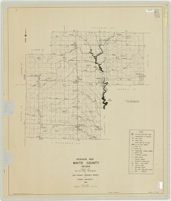
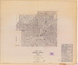
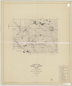
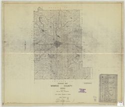
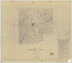
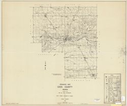
Blue line print. "Prepared under the supervision of: M. Parvis." "Report discrepancies found on this map to Joint Highway Research Project...
Call Number:
G4093.C3C3 1948 .J65
Caption:
Imprint: [West Lafayette, Ind.]: The Project, 1948.