
Search Constraints
You searched for:
State/Province
Украинская ССР (Ukrainian Soviet Socialist Republic)
Remove constraint State/Province: Украинская ССР (Ukrainian Soviet Socialist Republic)
Search Results
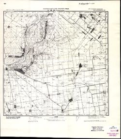
-
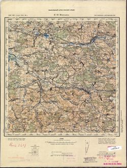
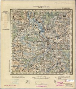
- Description:
- 1893
- Subject:
- Topical Subject: Maps, Topical Subject: Soviet Union, and Geographic Subject: Ozerna
- Publisher:
- Генеральный штаб РККА
- Language:
- Russian
- Date Created:
- 1923
- Identifier:
- VAC9619-003230
- Genre:
- Topographic Maps and Military Maps
- Geographic Location:
- Coordinates: 49.333, 25, 49.667, 25.5
- Related URL:
- Download GeoTIFF: https://drive.google.com/file/d/1_x9F34NdB3tdQLLYQJt_dk70uUP0om-Z/view?usp=sharing and Catalog URL: https://iucat.iu.edu/catalog/5020129
- Abstract:
- Modern area represented: Ozerna, Ternopil oblast, Ukraine
- Call Number:
- G7000 s100 .S7 sheet M-35-87
- City:
- Езерна (Ozerna)
- Copyright Holder:
- No Copyright - United States
- Country:
- СССР (USSR)
- State/Province:
- Украинская ССР (Ukrainian Soviet Socialist Republic) and Тернопольская область (Ternopil oblast)
- Physical Description:
- Scale: 1:100,000
- Persistent URL:
- http://purl.dlib.indiana.edu/iudl/images/VAC9619/VAC9619-003230
- Provenance:
- Army Map Service Library, Library of Congress G & M Division, Geographic Names Branch
-
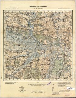
- Description:
- 1940
- Subject:
- Geographic Subject: Ozerna, Topical Subject: Soviet Union, and Topical Subject: Maps
- Publisher:
- Генеральный штаб Красной Армии
- Language:
- Russian
- Date Created:
- 1943
- Identifier:
- VAC9619-003229
- Genre:
- Topographic Maps and Military Maps
- Geographic Location:
- Coordinates: 49.333, 25, 49.667, 25.5
- Related URL:
- Catalog URL: https://iucat.iu.edu/catalog/5020129 and Download GeoTIFF: https://drive.google.com/file/d/1oIhAEtx39Pisvi07LTRsFECGV7AUA1t0/view?usp=sharing
- Abstract:
- Modern area represented: Ozerna, Ternopil oblast, Ukraine
- Call Number:
- G7000 s100 .S7 sheet M-35-87
- Caption:
- Для служебного пользования
- City:
- Езерна (Ozerna)
- Copyright Holder:
- No Copyright - United States
- Country:
- СССР (USSR)
- State/Province:
- Тернопольская область (Ternopil oblast) and Украинская ССР (Ukrainian Soviet Socialist Republic)
- Physical Description:
- Scale: 1:100,000
- Persistent URL:
- http://purl.dlib.indiana.edu/iudl/images/VAC9619/VAC9619-003229
- Provenance:
- DMA Topographic Center, Army Map Service Library, OMAHA
-
- Description:
- 1940
- Subject:
- Geographic Subject: Berezhany, Topical Subject: Soviet Union, and Topical Subject: Maps
- Publisher:
- Генеральный штаб Красной Армии
- Language:
- Russian
- Date Created:
- 1944
- Identifier:
- VAC9619-003228
- Genre:
- Topographic Maps and Military Maps
- Geographic Location:
- Coordinates: 49.333, 24.5, 49.667, 25
- Related URL:
- Catalog URL: https://iucat.iu.edu/catalog/5020129 and Download GeoTIFF: https://drive.google.com/file/d/1CMIu1hu-lpkcE8mXGG4F5QqmB7xnf-Xp/view?usp=sharing
- Abstract:
- Modern area represented: Berezhany, Ternopil oblast, Ukraine
- Call Number:
- G7000 s100 .S7 sheet M-35-86
- Caption:
- Для служебного пользования
- City:
- Бережаны (Berezhany)
- Copyright Holder:
- No Copyright - United States
- Country:
- СССР (USSR)
- State/Province:
- Тернопольская область (Ternopil oblast), Украинская ССР (Ukrainian Soviet Socialist Republic), Станиславская область (Stanislav oblast), and Львовская област...
- Physical Description:
- Scale: 1:100,000
- Persistent URL:
- http://purl.dlib.indiana.edu/iudl/images/VAC9619/VAC9619-003228
- Provenance:
- DMA Topographic Center, Army Map Service Library, OMAHA, Geographic Names Branch
-
- Description:
- 1940
- Subject:
- Geographic Subject: Khodoriv, Topical Subject: Maps, and Topical Subject: Soviet Union
- Publisher:
- Генеральный штаб Красной Армии
- Language:
- Russian
- Date Created:
- 1944
- Identifier:
- VAC9619-003227
- Genre:
- Military Maps and Topographic Maps
- Geographic Location:
- Coordinates: 49.333, 24, 49.667, 24.5
- Related URL:
- Catalog URL: https://iucat.iu.edu/catalog/5020129 and Download GeoTIFF: https://drive.google.com/file/d/1NeXmHpFasRTqpHvTnZ3D4dmAuW4M-QUA/view?usp=sharing
- Abstract:
- Modern area represented: Khodoriv, Lviv oblast, Ukraine
- Call Number:
- G7000 s100 .S7 sheet M-35-85
- Caption:
- Для служебного пользования
- City:
- Ходоров (Khodoriv)
- Copyright Holder:
- No Copyright - United States
- Country:
- СССР (USSR)
- State/Province:
- Львовская область (Lviv oblast), Станиславская область (Stanislav oblast), Украинская ССР (Ukrainian Soviet Socialist Republic), and Дрогобычская область (Dr...
- Physical Description:
- Scale: 1:100,000
- Persistent URL:
- http://purl.dlib.indiana.edu/iudl/images/VAC9619/VAC9619-003227
- Provenance:
- DMA Topographic Center, Army Map Service Library, OMAHA, Geographic Names Branch
-
- Description:
- 1908
- Subject:
- Topical Subject: Maps, Topical Subject: Soviet Union, and Geographic Subject: Skvyra
- Publisher:
- Управление военных топографов РККА
- Language:
- Russian
- Date Created:
- 1932
- Identifier:
- VAC9619-003226
- Genre:
- Military Maps and Topographic Maps
- Geographic Location:
- Coordinates: 49.667, 29.5, 50, 30
- Related URL:
- Catalog URL: https://iucat.iu.edu/catalog/5020129 and Download GeoTIFF: https://drive.google.com/file/d/1X6k4JhpLWztEqRQl3FXa53tln54PHEVO/view?usp=sharing
- Abstract:
- Modern area represented: Skvyra, Kiev oblast, Ukraine
- Call Number:
- G7000 s100 .S7 sheet M-35-84
- Caption:
- Не подлежит оглашению
- City:
- Сквира (Skvyra)
- Copyright Holder:
- No Copyright - United States
- Country:
- СССР (USSR)
- State/Province:
- Киевская область (Kyiv oblast) and Украинская ССР (Ukrainian Soviet Socialist Republic)
- Physical Description:
- Scale: 1:100,000
- Persistent URL:
- http://purl.dlib.indiana.edu/iudl/images/VAC9619/VAC9619-003226
- Provenance:
- DMA Topographic Center, Army Map Service Library, OMAHA
-
- Description:
- 1908
- Subject:
- Geographic Subject: Ivanopil, Topical Subject: Maps, and Topical Subject: Soviet Union
- Publisher:
- Генеральный штаб РККА
- Language:
- Russian
- Date Created:
- 1932
- Identifier:
- VAC9619-003225
- Genre:
- Topographic Maps and Military Maps
- Geographic Location:
- Coordinates: 49.667, 28, 50, 28.5
- Related URL:
- Download GeoTIFF: https://drive.google.com/file/d/13cB2CWX34igKnSOA3rnHUd15TRlKohbf/view?usp=sharing and Catalog URL: https://iucat.iu.edu/catalog/5020129
- Abstract:
- Modern area represented: Ivanopil, Zhytomyr oblast, Ukraine
- Call Number:
- G7000 s100 .S7 sheet M-35-81
- Caption:
- Не подлежит оглашению
- City:
- Янушпиль (Janushpil)
- Copyright Holder:
- No Copyright - United States
- Country:
- СССР (USSR)
- State/Province:
- Украинская ССР (Ukrainian Soviet Socialist Republic), Житомирская область (Zhytomyr oblast), and Винницкая область (Vinnytsia oblast)
- Physical Description:
- Scale: 1:100,000
- Persistent URL:
- http://purl.dlib.indiana.edu/iudl/images/VAC9619/VAC9619-003225
- Provenance:
- DMA Topographic Center, Army Map Service Library, OMAHA
-
- Description:
- 1903
- Subject:
- Topical Subject: Soviet Union, Geographic Subject: Starokostiantyniv, and Topical Subject: Maps
- Publisher:
- Генеральный штаб РККА
- Language:
- Russian
- Date Created:
- 1932
- Identifier:
- VAC9619-003224
- Genre:
- Military Maps and Topographic Maps
- Geographic Location:
- Coordinates: 49.667, 27, 50, 27.5
- Related URL:
- Download GeoTIFF: https://drive.google.com/file/d/1WZ-h8zC8CR1miztk7aJtZNqur3A6_XAm/view?usp=sharing and Catalog URL: https://iucat.iu.edu/catalog/5020129
- Abstract:
- Modern area represented: Starokostiantyniv, Khmelnytskyi oblast, Ukraine
- Call Number:
- G7000 s100 .S7 sheet M-35-79
- Caption:
- Не подлежит оглашению
- City:
- Старо-Константинов (Staro-Kostiantyniv)
- Copyright Holder:
- No Copyright - United States
- Country:
- СССР (USSR)
- State/Province:
- Каменец-Подольская область (Kamianets-Podilskyi oblast) and Украинская ССР (Ukrainian Soviet Socialist Republic)
- Physical Description:
- Scale: 1:100,000
- Persistent URL:
- http://purl.dlib.indiana.edu/iudl/images/VAC9619/VAC9619-003224
- Provenance:
- DMA Topographic Center, Army Map Service Library, OMAHA, Library of Congress Geography & Map Division
-
- Description:
- 1908
- Subject:
- Topical Subject: Soviet Union, Topical Subject: Maps, and Geographic Subject: Chudniv
- Publisher:
- Управление военных топографов РККА
- Language:
- Russian
- Date Created:
- 1932
- Identifier:
- VAC9619-003223
- Genre:
- Topographic Maps and Military Maps
- Geographic Location:
- Coordinates: 50, 28, 50.333, 28.5
- Related URL:
- Catalog URL: https://iucat.iu.edu/catalog/5020129 and Download GeoTIFF: https://drive.google.com/file/d/1SkZk5hQRmHL7hW9Yn3FqmEo2eW42Cg9c/view?usp=sharing
- Abstract:
- Modern area represented: Chudniv, Zhytomyr oblast, Ukraine
- Call Number:
- G7000 s100 .S7 sheet M-35-69
- Caption:
- Не подлежит оглашению
- City:
- Чуднов (Chudniv)
- Copyright Holder:
- No Copyright - United States
- Country:
- СССР (USSR)
- State/Province:
- Винницкая область (Vinnytsia oblast), Украинская ССР (Ukrainian Soviet Socialist Republic), and Киевская область (Kyiv oblast)
- Physical Description:
- Scale: 1:100,000
- Persistent URL:
- http://purl.dlib.indiana.edu/iudl/images/VAC9619/VAC9619-003223
- Provenance:
- DMA Topographic Center, Army Map Service Library, OMAHA, Library of Congress Geography & Map Division
-
- Description:
- 1909
- Subject:
- Topical Subject: Soviet Union, Geographic Subject: Rokytne, and Topical Subject: Maps
- Publisher:
- Генеральный штаб РККА
- Language:
- Russian
- Date Created:
- 1910
- Identifier:
- VAC9619-003110
- Genre:
- Topographic Maps and Military Maps
- Geographic Location:
- Coordinates: 51, 27, 51.333, 27.5
- Related URL:
- Download GeoTIFF: https://drive.google.com/file/d/15D76DyRFPEKsC74NMx-YBm89YPBAbzlF/view?usp=sharing and Catalog URL: https://iucat.iu.edu/catalog/5020129
- Abstract:
- Modern area represented: Rokytne, Rivne oblast, Ukraine
- Call Number:
- G7000 s100 .S7 sheet M-35-31
- Caption:
- Не подлежит оглашению
- City:
- Рокитно (Rokytne)
- Copyright Holder:
- No Copyright - United States
- Country:
- Польша (Poland) and СССР (USSR)
- State/Province:
- Украинская ССР (Ukrainian Soviet Socialist Republic) and Житомирская область (Zhytomyr oblast)
- Physical Description:
- Scale: 1:100,000
- Persistent URL:
- http://purl.dlib.indiana.edu/iudl/images/VAC9619/VAC9619-003110
- Provenance:
- DMA Topographic Center, Army Map Service Library, OMAHA, Library of Congress Geography & Map Division
-
- Description:
- 1931
- Subject:
- Topical Subject: Soviet Union, Topical Subject: Maps, and Geographic Subject: Tovstyy Lis
- Publisher:
- Генеральный штаб РККА
- Language:
- Russian
- Identifier:
- VAC9619-003109
- Genre:
- Topographic Maps and Military Maps
- Geographic Location:
- Coordinates: 51.333, 29.5, 51.667, 30
- Related URL:
- Download GeoTIFF: https://drive.google.com/file/d/1vZVXoMPd7x-2yVu8aMrmdzmHak7t6-UQ/view?usp=sharing and Catalog URL: https://iucat.iu.edu/catalog/5020129
- Abstract:
- Modern area represented: Tovstyy Lis, Ukraine
- Call Number:
- G7000 s100 .S7 sheet M-35-24
- Caption:
- Не подлежит оглашению
- City:
- Толстый Лес (Tolstyy Les)
- Copyright Holder:
- No Copyright - United States
- Country:
- СССР (USSR)
- State/Province:
- Украинская ССР (Ukrainian Soviet Socialist Republic), Белорусская ССР (Byelorussian Soviet Socialist Republic), and Киевская область (Kyiv oblast)
- Physical Description:
- Scale: 1:100,000
- Persistent URL:
- http://purl.dlib.indiana.edu/iudl/images/VAC9619/VAC9619-003109
- Provenance:
- DMA Topographic Center, Army Map Service Library, OMAHA, Library of Congress Geography & Map Division
-
- Description:
- 1932
- Subject:
- Topical Subject: Soviet Union, Topical Subject: Maps, and Geographic Subject: Bilokorovychi
- Publisher:
- Генеральный штаб РККА
- Language:
- Russian
- Date Created:
- 1938
- Identifier:
- VAC9619-003111
- Genre:
- Military Maps and Topographic Maps
- Geographic Location:
- Coordinates: 51, 28, 51.333, 28.5
- Related URL:
- Download GeoTIFF: https://drive.google.com/file/d/1xi43u-yrh_UjM7wqzuJCgqhb6aPc4Y7G/view?usp=sharing and Catalog URL: https://iucat.iu.edu/catalog/5020129
- Abstract:
- Modern area represented: Bilokorovychi, Ukraine
- Call Number:
- G7000 s100 .S7 sheet M-35-33
- Caption:
- Не подлежит оглашению
- City:
- Белокоровичи (Bilokorovychi)
- Copyright Holder:
- No Copyright - United States
- Country:
- СССР (USSR)
- State/Province:
- Житомирская область (Zhytomyr oblast) and Украинская ССР (Ukrainian Soviet Socialist Republic)
- Physical Description:
- Scale: 1:100,000
- Persistent URL:
- http://purl.dlib.indiana.edu/iudl/images/VAC9619/VAC9619-003111
- Provenance:
- DMA Topographic Center, Army Map Service Library, OMAHA, Library of Congress Geography & Map Division
-
- Description:
- 1932
- Subject:
- Geographic Subject: Ovruch, Topical Subject: Soviet Union, and Topical Subject: Maps
- Publisher:
- Генеральный штаб РККА
- Language:
- Russian
- Date Created:
- 1933
- Identifier:
- VAC9619-003112
- Genre:
- Military Maps and Topographic Maps
- Geographic Location:
- Coordinates: 51, 28.5, 51.333, 29
- Related URL:
- Catalog URL: https://iucat.iu.edu/catalog/5020129 and Download GeoTIFF: https://drive.google.com/file/d/1Ux4iL3wR3fHhjgZHVXpIrMLVmUdCl5KE/view?usp=sharing
- Abstract:
- Modern area represented: Ovruch, Ukraine
- Call Number:
- G7000 s100 .S7 sheet M-35-34
- Caption:
- Не подлежит оглашению
- City:
- Овруч (Ovruch)
- Copyright Holder:
- No Copyright - United States
- Country:
- СССР (USSR)
- State/Province:
- Украинская ССР (Ukrainian Soviet Socialist Republic) and Житомирская область (Zhytomyr oblast)
- Physical Description:
- Scale: 1:100,000
- Persistent URL:
- http://purl.dlib.indiana.edu/iudl/images/VAC9619/VAC9619-003112
- Provenance:
- DMA Topographic Center, Army Map Service Library, OMAHA, Library of Congress Geography & Map Division
-
- Description:
- 1931
- Subject:
- Topical Subject: Soviet Union, Geographic Subject: Narodychi, and Topical Subject: Maps
- Publisher:
- Генеральный штаб РККА
- Language:
- Russian
- Identifier:
- VAC9619-003113
- Genre:
- Topographic Maps and Military Maps
- Geographic Location:
- Coordinates: 51, 29, 51.333, 29.5
- Related URL:
- Download GeoTIFF: https://drive.google.com/file/d/1R6r7PVE4FRVtVB2SkSSwB2vzarPEKXmX/view?usp=sharing and Catalog URL: https://iucat.iu.edu/catalog/5020129
- Abstract:
- Modern area represented: Narodychi, Zhytomyr oblast, Ukraine
- Call Number:
- G7000 s100 .S7 sheet M-35-35
- Caption:
- Не подлежит оглашению
- City:
- Народичи (Narodychi)
- Copyright Holder:
- No Copyright - United States
- Country:
- СССР (USSR)
- State/Province:
- Киевская область (Kyiv oblast), Житомирская область (Zhytomyr oblast), and Украинская ССР (Ukrainian Soviet Socialist Republic)
- Physical Description:
- Scale: 1:100,000
- Persistent URL:
- http://purl.dlib.indiana.edu/iudl/images/VAC9619/VAC9619-003113
- Provenance:
- DMA Topographic Center, Army Map Service Library, OMAHA
-
- Description:
- 1931
- Subject:
- Topical Subject: Soviet Union, Topical Subject: Maps, and Geographic Subject: Krasylivka
- Publisher:
- Генеральный штаб РККА
- Language:
- Russian
- Identifier:
- VAC9619-003114
- Genre:
- Military Maps and Topographic Maps
- Geographic Location:
- Coordinates: 51, 29.5, 51.333, 30
- Related URL:
- Download GeoTIFF: https://drive.google.com/file/d/1r2wYpd42kwmLP1KDkAfHtYQgrl7Ie8BV/view?usp=sharing and Catalog URL: https://iucat.iu.edu/catalog/5020129
- Abstract:
- Modern area represented: Krasylivka, Kiev oblast, Ukraine
- Call Number:
- G7000 s100 .S7 sheet M-35-36
- Caption:
- Не подлежит оглашению
- City:
- Красиловка (Krasylivka)
- Copyright Holder:
- No Copyright - United States
- Country:
- СССР (USSR)
- State/Province:
- Украинская ССР (Ukrainian Soviet Socialist Republic) and Киевская область (Kyiv oblast)
- Physical Description:
- Scale: 1:100,000
- Persistent URL:
- http://purl.dlib.indiana.edu/iudl/images/VAC9619/VAC9619-003114
- Provenance:
- DMA Topographic Center, Army Map Service Library, OMAHA
-
- Description:
- 1888
- Subject:
- Topical Subject: Maps, Topical Subject: Soviet Union, and Geographic Subject: Kiselin
- Publisher:
- Генеральный штаб РККА
- Language:
- Russian
- Date Created:
- 1938
- Identifier:
- VAC9619-003115
- Genre:
- Topographic Maps and Military Maps
- Geographic Location:
- Coordinates: 50.667, 24.5, 51, 25
- Related URL:
- Download GeoTIFF: https://drive.google.com/file/d/1gSSRB--uNK0lsOcVeG-9ezcrgkwuseHe/view?usp=sharing and Catalog URL: https://iucat.iu.edu/catalog/5020129
- Abstract:
- Modern area represented: Kiselin, Volyn oblast, Ukraine
- Call Number:
- G7000 s100 .S7 sheet M-35-38
- City:
- Киселин (Kiselin)
- Copyright Holder:
- No Copyright - United States
- Country:
- СССР (USSR)
- State/Province:
- Волынская область (Volyn oblast) and Украинская ССР (Ukrainian Soviet Socialist Republic)
- Physical Description:
- Scale: 1:100,000
- Persistent URL:
- http://purl.dlib.indiana.edu/iudl/images/VAC9619/VAC9619-003115
- Provenance:
- DMA Topographic Center, Army Map Service Library, OMAHA
-
- Description:
- 1886
- Subject:
- Topical Subject: Maps, Topical Subject: Soviet Union, and Geographic Subject: Lutsk
- Publisher:
- Генеральный штаб РККА
- Language:
- Russian
- Date Created:
- 1938
- Identifier:
- VAC9619-003116
- Genre:
- Military Maps and Topographic Maps
- Related URL:
- Catalog URL: https://iucat.iu.edu/catalog/5020129
- Abstract:
- Modern area represented: Lutsk, Volyn oblast, Ukraine
- Call Number:
- G7000 s100 .S7 sheet M-35-39
- City:
- Луцк (Lutsk)
- Copyright Holder:
- No Copyright - United States
- Country:
- СССР (USSR)
- State/Province:
- Ровенская область (Rivne oblast), Волынская область (Volyn oblast), and Украинская ССР (Ukrainian Soviet Socialist Republic)
- Physical Description:
- Scale: 1:100,000
- Persistent URL:
- http://purl.dlib.indiana.edu/iudl/images/VAC9619/VAC9619-003116
- Provenance:
- DMA Topographic Center, Army Map Service Library, OMAHA
-
- Description:
- 1887
- Subject:
- Topical Subject: Maps, Geographic Subject: Olyka, and Topical Subject: Soviet Union
- Publisher:
- Генеральный штаб РККА
- Language:
- Russian
- Date Created:
- 1938
- Identifier:
- VAC9619-003117
- Genre:
- Topographic Maps and Military Maps
- Geographic Location:
- Coordinates: 50.667, 25.5, 51, 26
- Related URL:
- Download GeoTIFF: https://drive.google.com/file/d/1aVx7G9ZqIKrTmp23gRVFUVSgQkgqjkpu/view?usp=sharing and Catalog URL: https://iucat.iu.edu/catalog/5020129
- Abstract:
- Modern area represented: Olyka, Volyn oblast, Ukraine
- Call Number:
- G7000 s100 .S7 sheet M-35-40
- City:
- Олыка (Olyka)
- Copyright Holder:
- No Copyright - United States
- Country:
- СССР (USSR)
- State/Province:
- Украинская ССР (Ukrainian Soviet Socialist Republic), Ровенская область (Rivne oblast), and Волынская область (Volyn oblast)
- Physical Description:
- Scale: 1:100,000
- Persistent URL:
- http://purl.dlib.indiana.edu/iudl/images/VAC9619/VAC9619-003117
- Provenance:
- DMA Topographic Center, Army Map Service Library, OMAHA
-
- Description:
- 1932
- Subject:
- Topical Subject: Maps, Geographic Subject: Bondarivka, and Topical Subject: Soviet Union
- Publisher:
- Генеральный штаб РККА
- Language:
- Russian
- Date Created:
- 1940
- Identifier:
- VAC9619-003118
- Genre:
- Military Maps and Topographic Maps
- Geographic Location:
- Coordinates: 50.667, 28, 51, 28.5
- Related URL:
- Download GeoTIFF: https://drive.google.com/file/d/1K11mFVkk-iq0dafstl-xc8YcchJ2tvCC/view?usp=sharing and Catalog URL: https://iucat.iu.edu/catalog/5020129
- Abstract:
- Modern area represented: Bondarivka, Zhytomyr oblast, Ukraine
- Call Number:
- G7000 s100 .S7 sheet M-35-45
- Caption:
- Не подлежит оглашению
- City:
- Бондаревка (Bondarivka)
- Copyright Holder:
- No Copyright - United States
- Country:
- СССР (USSR)
- State/Province:
- Украинская ССР (Ukrainian Soviet Socialist Republic) and Житомирская область (Zhytomyr oblast)
- Physical Description:
- Scale: 1:100,000
- Persistent URL:
- http://purl.dlib.indiana.edu/iudl/images/VAC9619/VAC9619-003118
- Provenance:
- DMA Topographic Center, Army Map Service Library, OMAHA
-
- Description:
- 1913
- Subject:
- Topical Subject: Maps, Geographic Subject: Korosten, and Topical Subject: Soviet Union
- Publisher:
- Управление военных топографов РККА
- Language:
- Russian
- Date Created:
- 1933
- Identifier:
- VAC9619-003119
- Genre:
- Military Maps and Topographic Maps
- Geographic Location:
- Coordinates: 50.667, 28.5, 51, 29
- Related URL:
- Catalog URL: https://iucat.iu.edu/catalog/5020129 and Download GeoTIFF: https://drive.google.com/file/d/1r4KaIwlzKRcnmPHpmBYXDKSMN0LMEF56/view?usp=sharing
- Abstract:
- Modern area represented: Korosten, Zhytomyr oblast, Ukraine
- Call Number:
- G7000 s100 .S7 sheet M-35-46
- Caption:
- Не подлежит оглашению
- City:
- Коростень (Korosten)
- Copyright Holder:
- No Copyright - United States
- Country:
- СССР (USSR)
- State/Province:
- Украинская ССР (Ukrainian Soviet Socialist Republic) and Киевская область (Kyiv oblast)
- Physical Description:
- Scale: 1:100,000
- Persistent URL:
- http://purl.dlib.indiana.edu/iudl/images/VAC9619/VAC9619-003119
- Provenance:
- DMA Topographic Center, Army Map Service Library, OMAHA
-
- Description:
- 1932
- Subject:
- Topical Subject: Maps, Topical Subject: Soviet Union, and Geographic Subject: Pulyny
- Publisher:
- Генеральный штаб РККА
- Language:
- Russian
- Identifier:
- VAC9619-003122
- Genre:
- Topographic Maps and Military Maps
- Geographic Location:
- Coordinates: 50.333, 28, 50.667, 28.5
- Related URL:
- Catalog URL: https://iucat.iu.edu/catalog/5020129 and Download GeoTIFF: https://drive.google.com/file/d/1qy5SVlbRMC9ynvz_PgZ5xohTPMaOS--0/view?usp=sharing
- Abstract:
- Modern area represented: Pulyny, Zhytomyr oblast, Ukraine
- Call Number:
- G7000 s100 .S7 sheet M-35-57
- City:
- Червонноармейск (Chervonnoarmeysk)
- Copyright Holder:
- No Copyright - United States
- Country:
- СССР (USSR)
- State/Province:
- Украинская ССР (Ukrainian Soviet Socialist Republic) and Житомирская область (Zhytomyr oblast)
- Physical Description:
- Scale: 1:100,000
- Persistent URL:
- http://purl.dlib.indiana.edu/iudl/images/VAC9619/VAC9619-003122
- Provenance:
- DMA Topographic Center, Army Map Service Library, OMAHA, Library of Congress Geography & Map Division
-
- Description:
- 1913
- Subject:
- Geographic Subject: Ivankiv, Topical Subject: Soviet Union, and Topical Subject: Maps
- Publisher:
- Управление военных топографов РККА
- Language:
- Russian
- Date Created:
- 1933
- Identifier:
- VAC9619-003120
- Genre:
- Topographic Maps and Military Maps
- Geographic Location:
- Coordinates: 50.667, 29.5, 51, 30
- Related URL:
- Download GeoTIFF: https://drive.google.com/file/d/1Ra_HooqAngw0iRatiTrefjd7SIFeN4au/view?usp=sharing and Catalog URL: https://iucat.iu.edu/catalog/5020129
- Abstract:
- Modern area represented: Ivankiv, Kiev oblast, Ukraine
- Call Number:
- G7000 s100 .S7 sheet M-35-48
- Caption:
- Не подлежит оглашению
- City:
- Иванков (Ivankiv)
- Copyright Holder:
- No Copyright - United States
- Country:
- СССР (USSR)
- State/Province:
- Киевская область (Kyiv oblast) and Украинская ССР (Ukrainian Soviet Socialist Republic)
- Physical Description:
- Scale: 1:100,000
- Persistent URL:
- http://purl.dlib.indiana.edu/iudl/images/VAC9619/VAC9619-003120
- Provenance:
- DMA Topographic Center, Army Map Service Library, OMAHA
-
- Description:
- 1889
- Subject:
- Geographic Subject: Hannopil, Topical Subject: Maps, and Topical Subject: Soviet Union
- Publisher:
- Генеральный штаб РККА
- Language:
- Russian
- Date Created:
- 1938
- Identifier:
- VAC9619-003121
- Genre:
- Military Maps and Topographic Maps
- Geographic Location:
- Coordinates: 50.333, 26.5, 50.667, 27
- Related URL:
- Catalog URL: https://iucat.iu.edu/catalog/5020129 and Download GeoTIFF: https://drive.google.com/file/d/1k-QnedOJkOYVn9p7uAgvuEwWMZd5efq-/view?usp=sharing
- Abstract:
- Modern area represented: Hannopil, Khmelnytskyi oblast, Ukraine
- Call Number:
- G7000 s100 .S7 sheet M-35-54
- Caption:
- Не подлежит оглашению
- City:
- Аннополь (Annopol)
- Copyright Holder:
- No Copyright - United States
- Country:
- СССР (USSR)
- State/Province:
- Ровенская область (Rivne oblast), Каменец-Подольская область (Kamianets-Podilskyi oblast), and Украинская ССР (Ukrainian Soviet Socialist Republic)
- Physical Description:
- Scale: 1:100,000
- Persistent URL:
- http://purl.dlib.indiana.edu/iudl/images/VAC9619/VAC9619-003121
- Provenance:
- DMA Topographic Center, Army Map Service Library, OMAHA, Atlasblatt
-
- Description:
- 1913
- Subject:
- Topical Subject: Soviet Union, Topical Subject: Maps, and Geographic Subject: Makariv
- Publisher:
- Управление военных топографов РККА
- Language:
- Russian
- Date Created:
- 1933
- Identifier:
- VAC9619-003123
- Genre:
- Topographic Maps and Military Maps
- Geographic Location:
- Coordinates: 50.333, 29.5, 50.667, 30
- Related URL:
- Catalog URL: https://iucat.iu.edu/catalog/5020129 and Download GeoTIFF: https://drive.google.com/file/d/13LZmOOndyLlk6oJu1Lq5Rp9sPNueEMsP/view?usp=sharing
- Abstract:
- Modern area represented: Makariv, Kiev oblast, Ukraine
- Call Number:
- G7000 s100 .S7 sheet M-35-60
- Caption:
- Не подлежит оглашению
- City:
- Макаров (Makariv)
- Copyright Holder:
- No Copyright - United States
- Country:
- СССР (USSR)
- State/Province:
- Киевская область (Kyiv oblast) and Украинская ССР (Ukrainian Soviet Socialist Republic)
- Physical Description:
- Scale: 1:100,000
- Persistent URL:
- http://purl.dlib.indiana.edu/iudl/images/VAC9619/VAC9619-003123
- Provenance:
- DMA Topographic Center, Army Map Service Library, OMAHA, Library of Congress Geography & Map Division
-

- Description:
- 1932
- Subject:
- Topical Subject: Maps, Geographic Subject: Норинськ (Noryns’k), and Topical Subject: Soviet Union
- Publisher:
- Управление военных топографов
- Language:
- Russian
- Identifier:
- VAC9619-002919
- Genre:
- Topographic Maps and Military Maps
- Geographic Location:
- Coordinates: 51.167, 28.5, 51.333, 28.75
- Related URL:
- Catalog URL: http://iucat.iu.edu/catalog/5020131 and Download GeoTIFF: https://drive.google.com/file/d/13PS6S7tMgGyodhBlwoTux1o3yrljPpfl/view?usp=sharing
- Abstract:
- Modern area represented: Норинськ (Noryns’k), Zhytomyr Oblast, Ukraine
- Call Number:
- G7000 s50 .S68 sheet M-35-34-A
- Caption:
- Не подлежит оглашению
- City:
- Норинск (Norinsk)
- Copyright Holder:
- No Copyright - United States
- Country:
- СССР (USSR)
- State/Province:
- Киевская область (Kyiv oblast) and Украинская ССР (Ukrainian Soviet Socialist Republic)
- Physical Description:
- Scale: 1:50,000
- Persistent URL:
- http://purl.dlib.indiana.edu/iudl/images/VAC9619/VAC9619-002919
- Provenance:
- M. I. Map Library
-
- Description:
- 1940
- Subject:
- Geographic Subject: Yavoriv, Topical Subject: Soviet Union, and Topical Subject: Maps
- Publisher:
- Генеральный штаб Красной Армии
- Language:
- Russian
- Date Created:
- 1944
- Identifier:
- VAC9619-003017
- Genre:
- Topographic Maps and Military Maps
- Geographic Location:
- Coordinates: 49.667, 23, 50, 23.5
- Related URL:
- Catalog URL: https://iucat.iu.edu/catalog/5020129 and Download GeoTIFF: https://drive.google.com/file/d/1HD8uB8w-zuGEnlXBdd8WK2LuwWXZ_Ryt/view?usp=sharing
- Abstract:
- Modern area represented: Yavoriv, Lviv oblast, Ukraine
- Call Number:
- G7000 s100 .S7 sheet M-34-83
- Caption:
- Для служебного пользования
- City:
- Яворов (Yavoriv)
- Copyright Holder:
- No Copyright - United States
- Country:
- СССР (USSR)
- State/Province:
- Украинская ССР (Ukrainian Soviet Socialist Republic), Дрогобычская область (Drohobych oblast), and Львовская область (Lviv oblast)
- Physical Description:
- Scale: 1:100,000
- Persistent URL:
- http://purl.dlib.indiana.edu/iudl/images/VAC9619/VAC9619-003017
- Provenance:
- DMA Topographic Center, Army Map Service Library, OMAHA
-
- Description:
- 1896
- Subject:
- Topical Subject: Maps, Topical Subject: Soviet Union, and Geographic Subject: Mościska
- Publisher:
- Генеральный штаб Красной Армии
- Language:
- Russian
- Date Created:
- 1940
- Identifier:
- VAC9619-003018
- Genre:
- Military Maps and Topographic Maps
- Geographic Location:
- Coordinates: 49.667, 23, 50, 23.5
- Related URL:
- Download GeoTIFF: https://drive.google.com/file/d/1kY545RVscWvC3Hu8ZYE51ce4nlHz2vcF/view?usp=sharing and Catalog URL: https://iucat.iu.edu/catalog/5020129
- Abstract:
- Modern area represented: Mościska, Lviv oblast, Ukraine
- Call Number:
- G7000 s100 .S7 sheet M-34-83
- City:
- Мосьциска (Mościska)
- Copyright Holder:
- No Copyright - United States
- Country:
- СССР (USSR)
- State/Province:
- Дрогобычская область (Drohobych oblast), Львовская область (Lviv oblast), and Украинская ССР (Ukrainian Soviet Socialist Republic)
- Physical Description:
- Scale: 1:100,000
- Persistent URL:
- http://purl.dlib.indiana.edu/iudl/images/VAC9619/VAC9619-003018
- Provenance:
- Army Map Service Library, CIA Map Branch -- Received
-
- Description:
- 1874
- Subject:
- Topical Subject: Soviet Union, Topical Subject: Maps, and Geographic Subject: Horodok
- Publisher:
- Генеральный штаб Красной Армии
- Language:
- Russian
- Date Created:
- 1944
- Identifier:
- VAC9619-003019
- Genre:
- Military Maps and Topographic Maps
- Geographic Location:
- Coordinates: 49.667, 23.5, 50, 24
- Related URL:
- Catalog URL: https://iucat.iu.edu/catalog/5020129 and Download GeoTIFF: https://drive.google.com/file/d/1Zi3_SNdgW5DBQ3nBbEZsprfVc7U05mGs/view?usp=sharing
- Abstract:
- Modern area represented: Horodok, Lviv oblast, Ukraine
- Call Number:
- G7000 s100 .S7 sheet M-34-84
- Caption:
- Для служебного пользования
- City:
- Грудек Ягельоньски (Gródek Jagielloński)
- Copyright Holder:
- No Copyright - United States
- Country:
- СССР (USSR)
- State/Province:
- Львовская область (Lviv oblast) and Украинская ССР (Ukrainian Soviet Socialist Republic)
- Physical Description:
- Scale: 1:100,000
- Persistent URL:
- http://purl.dlib.indiana.edu/iudl/images/VAC9619/VAC9619-003019
- Provenance:
- DMA Topographic Center, Army Map Service Library, OMAHA
-
- Description:
- 1875
- Subject:
- Topical Subject: Soviet Union, Geographic Subject: Drohobych, and Topical Subject: Maps
- Publisher:
- Генеральный штаб Красной Армии
- Language:
- Russian
- Date Created:
- 1940
- Identifier:
- VAC9619-003027
- Genre:
- Military Maps and Topographic Maps
- Geographic Location:
- Coordinates: 49.333, 23.5, 49.667, 24
- Related URL:
- Catalog URL: https://iucat.iu.edu/catalog/5020129 and Download GeoTIFF: https://drive.google.com/file/d/10E4Z3oRj75pa2_d4MwidMWMnRE09xm2x/view?usp=sharing
- Abstract:
- Modern area represented: Drohobych, Lviv oblast, Ukraine
- Call Number:
- G7000 s100 .S7 sheet M-34-96
- City:
- Дрогобыч (Drohobych)
- Copyright Holder:
- No Copyright - United States
- Country:
- СССР (USSR)
- State/Province:
- Украинская ССР (Ukrainian Soviet Socialist Republic), Дрогобычская область (Drohobych oblast), and Львовская область (Lviv oblast)
- Physical Description:
- Scale: 1:100,000
- Persistent URL:
- http://purl.dlib.indiana.edu/iudl/images/VAC9619/VAC9619-003027
- Provenance:
- CIA Map Library
-
- Description:
- 1887
- Subject:
- Topical Subject: Maps, Geographic Subject: Malaryta, and Topical Subject: Soviet Union
- Publisher:
- Генеральный штаб Красной Армии
- Language:
- Russian
- Date Created:
- 1938
- Identifier:
- VAC9619-003044
- Genre:
- Military Maps and Topographic Maps
- Geographic Location:
- Coordinates: 51.667, 24, 52, 24.5
- Related URL:
- Catalog URL: https://iucat.iu.edu/catalog/5020129 and Download GeoTIFF: https://drive.google.com/file/d/1S8NvMKAOIykvpvbNAoK7uWMBQslFwWZB/view?usp=sharing
- Abstract:
- Modern area represented: Malaryta, Brest oblast, Belarus
- Call Number:
- G7000 s100 .S7 sheet M-35-1
- City:
- Малорыта (Malaryta)
- Copyright Holder:
- No Copyright - United States
- Country:
- СССР (USSR)
- State/Province:
- Белорусская ССР (Byelorussian Soviet Socialist Republic), Волынская область (Volyn oblast), Украинская ССР (Ukrainian Soviet Socialist Republic), and Брестск...
- Physical Description:
- Scale: 1:100,000
- Persistent URL:
- http://purl.dlib.indiana.edu/iudl/images/VAC9619/VAC9619-003044
- Provenance:
- DMA Topographic Center, Army Map Service Library, OMAHA, Library of Congress Geography & Map Division
-
- Description:
- 1899
- Subject:
- Topical Subject: Maps, Geographic Subject: Divin, and Topical Subject: Soviet Union
- Publisher:
- Генеральный штаб Красной Армии
- Language:
- Russian
- Date Created:
- 1938
- Identifier:
- VAC9619-003045
- Genre:
- Military Maps and Topographic Maps
- Geographic Location:
- Coordinates: 51.667, 24.5, 52, 25
- Related URL:
- Catalog URL: https://iucat.iu.edu/catalog/5020129 and Download GeoTIFF: https://drive.google.com/file/d/1kwuxEIyhZC6KtNwxUv0XBd3cHBvkR2O3/view?usp=sharing
- Abstract:
- Modern area represented: Divin, Brest oblast, Belarus
- Call Number:
- G7000 s100 .S7 sheet M-35-2
- City:
- Дывин (Divin)
- Copyright Holder:
- No Copyright - United States
- Country:
- СССР (USSR)
- State/Province:
- Украинская ССР (Ukrainian Soviet Socialist Republic), Брестская область (Brest oblast), Волынская область (Volyn oblast), and Белорусская ССР (Byelorussian S...
- Physical Description:
- Scale: 1:100,000
- Persistent URL:
- http://purl.dlib.indiana.edu/iudl/images/VAC9619/VAC9619-003045
- Provenance:
- DMA Topographic Center, Army Map Service Library, OMAHA, Library of Congress Geography & Map Division, Aeronautical Chart & Information Center
-
- Description:
- 1910
- Subject:
- Topical Subject: Soviet Union, Topical Subject: Maps, and Geographic Subject: Sernyky
- Publisher:
- Генеральный штаб Красной Армии
- Language:
- Russian
- Date Created:
- 1938
- Identifier:
- VAC9619-003046
- Genre:
- Military Maps and Topographic Maps
- Geographic Location:
- Coordinates: 51.667, 26, 52, 26.5
- Related URL:
- Catalog URL: https://iucat.iu.edu/catalog/5020129 and Download GeoTIFF: https://drive.google.com/file/d/1H9UQ5jmL2sxn7oKF5G4mXmAdfHP5hUmz/view?usp=sharing
- Abstract:
- Modern area represented: Sernyky, Rivne oblast, Ukraine
- Call Number:
- G7000 s100 .S7 sheet M-35-5
- City:
- Серники (Sernyky)
- Copyright Holder:
- No Copyright - United States
- Country:
- СССР (USSR)
- State/Province:
- Пинская область (Pinsk oblast), Белорусская ССР (Byelorussian Soviet Socialist Republic), Ровенская область (Rivne oblast), and Украинская ССР (Ukrainian Sov...
- Physical Description:
- Scale: 1:100,000
- Persistent URL:
- http://purl.dlib.indiana.edu/iudl/images/VAC9619/VAC9619-003046
- Provenance:
- DMA Topographic Center, Army Map Service Library, OMAHA, Library of Congress Geography & Map Division
-
- Description:
- 1910
- Subject:
- Geographic Subject: Stolin, Topical Subject: Maps, and Topical Subject: Soviet Union
- Publisher:
- Генеральный штаб Красной Армии
- Language:
- Russian
- Date Created:
- 1938
- Identifier:
- VAC9619-003047
- Genre:
- Topographic Maps and Military Maps
- Geographic Location:
- Coordinates: 51.667, 26.5, 52, 27
- Related URL:
- Catalog URL: https://iucat.iu.edu/catalog/5020129 and Download GeoTIFF: https://drive.google.com/file/d/1nMsS6EJ0nP-ZvW5_Q23N5TAeluKjPv9v/view?usp=sharing
- Abstract:
- Modern area represented: Stolin, Brest oblast, Belarus
- Call Number:
- G7000 s100 .S7 sheet M-35-6
- City:
- Столин (Stolin)
- Copyright Holder:
- No Copyright - United States
- Country:
- СССР (USSR)
- State/Province:
- Украинская ССР (Ukrainian Soviet Socialist Republic), Белорусская ССР (Byelorussian Soviet Socialist Republic), Пинская область (Pinsk oblast), and Ровенская...
- Physical Description:
- Scale: 1:100,000
- Persistent URL:
- http://purl.dlib.indiana.edu/iudl/images/VAC9619/VAC9619-003047
- Provenance:
- DMA Topographic Center, Army Map Service Library, OMAHA, Library of Congress Geography & Map Division
-
- Description:
- 1891
- Subject:
- Topical Subject: Soviet Union, Geographic Subject: Nova Vyzhva, and Topical Subject: Maps
- Publisher:
- Генеральный штаб РККА
- Language:
- Russian
- Date Created:
- 1938
- Identifier:
- VAC9619-003049
- Genre:
- Military Maps and Topographic Maps
- Geographic Location:
- Coordinates: 51.333, 24, 51.667, 24.5
- Related URL:
- Catalog URL: https://iucat.iu.edu/catalog/5020129 and Download GeoTIFF: https://drive.google.com/file/d/1W2o9oT7WY5SqldSOwDUoKIQfVeQ6GSSo/view?usp=sharing
- Abstract:
- Modern area represented: Nova Vyzhva, Volyn oblast, Ukraine
- Call Number:
- G7000 s100 .S7 sheet M-35-13
- City:
- Нов. Выжва (Nova Vyzhva)
- Copyright Holder:
- No Copyright - United States
- Country:
- СССР (USSR)
- State/Province:
- Украинская ССР (Ukrainian Soviet Socialist Republic), Белорусская ССР (Byelorussian Soviet Socialist Republic), Брестская область (Brest oblast), and Волынск...
- Physical Description:
- Scale: 1:100,000
- Persistent URL:
- http://purl.dlib.indiana.edu/iudl/images/VAC9619/VAC9619-003049
- Provenance:
- DMA Topographic Center, Army Map Service Library, OMAHA, Library of Congress Geography & Map Division
-
- Description:
- 1891
- Subject:
- Topical Subject: Maps, Geographic Subject: Kamin-Kashyrskyi, and Topical Subject: Soviet Union
- Publisher:
- Генеральный штаб РККА
- Language:
- Russian
- Date Created:
- 1938
- Identifier:
- VAC9619-003050
- Genre:
- Military Maps and Topographic Maps
- Geographic Location:
- Coordinates: 51.333, 24.5, 51.667, 25
- Related URL:
- Catalog URL: https://iucat.iu.edu/catalog/5020129 and Download GeoTIFF: https://drive.google.com/file/d/148mLUgWN2szqoIuFWrEtnvj8b-JvY4jf/view?usp=sharing
- Abstract:
- Modern area represented: Kamin-Kashyrskyi, Volyn oblast, Ukraine
- Call Number:
- G7000 s100 .S7 sheet M-35-14
- City:
- Камень-Коширски (Kamin-Kashyrskyi)
- Copyright Holder:
- No Copyright - United States
- Country:
- СССР (USSR)
- State/Province:
- Украинская ССР (Ukrainian Soviet Socialist Republic) and Волынская область (Volyn oblast)
- Physical Description:
- Scale: 1:100,000
- Persistent URL:
- http://purl.dlib.indiana.edu/iudl/images/VAC9619/VAC9619-003050
- Provenance:
- DMA Topographic Center, Army Map Service Library, OMAHA, Library of Congress Geography & Map Division
-
- Description:
- 1909
- Subject:
- Topical Subject: Soviet Union, Geographic Subject: Volodymyrets, and Topical Subject: Maps
- Publisher:
- Генеральный штаб РККА
- Language:
- Russian
- Date Created:
- 1937
- Identifier:
- VAC9619-003051
- Genre:
- Military Maps and Topographic Maps
- Geographic Location:
- Coordinates: 51.3333, 26.0, 51.6667, 26.5
- Related URL:
- Download GeoTIFF: https://drive.google.com/file/d/1NH6bl4WeI-J3G3u7P_nvNCaH4MWi3qRm/view?usp=sharing and Catalog URL: https://iucat.iu.edu/catalog/5020129
- Abstract:
- Modern area represented: Volodymyrets, Rivne oblast, Ukraine
- Call Number:
- G7000 s100 .S7 sheet M-35-17
- City:
- Влодзимежец (Volodymyrets)
- Copyright Holder:
- No Copyright - United States
- Country:
- СССР (USSR)
- State/Province:
- Украинская ССР (Ukrainian Soviet Socialist Republic) and Ровенская область (Rivne oblast)
- Physical Description:
- Scale: 1:100,000
- Persistent URL:
- http://purl.dlib.indiana.edu/iudl/images/VAC9619/VAC9619-003051
- Provenance:
- DMA Topographic Center, Army Map Service Library, OMAHA, Library of Congress Geography & Map Division
-
- Description:
- 1916
- Subject:
- Geographic Subject: Yurove, Topical Subject: Maps, and Topical Subject: Soviet Union
- Publisher:
- Генеральный штаб РККА
- Language:
- Russian
- Date Created:
- 1938
- Identifier:
- VAC9619-003052
- Genre:
- Topographic Maps and Military Maps
- Geographic Location:
- Coordinates: 51.333, 27.5, 51.667, 28
- Related URL:
- Catalog URL: https://iucat.iu.edu/catalog/5020129 and Download GeoTIFF: https://drive.google.com/file/d/1-oy_tglW6Q5zk4yBjiwIDUI0AvmpI7Ce/view?usp=sharing
- Abstract:
- Modern area represented: Yurove, Zhytomyr oblast, Ukraine
- Call Number:
- G7000 s100 .S7 sheet M-35-20
- Caption:
- Не подлежит оглашению
- City:
- Юрово (Yurovo)
- Copyright Holder:
- No Copyright - United States
- Country:
- СССР (USSR)
- State/Province:
- Полесская область (Polesia oblast), Белорусская ССР (Byelorussian Soviet Socialist Republic), Ровенская область (Rivne oblast), Житомирская область (Zhytomyr...
- Physical Description:
- Scale: 1:100,000
- Persistent URL:
- http://purl.dlib.indiana.edu/iudl/images/VAC9619/VAC9619-003052
- Provenance:
- DMA Topographic Center, Army Map Service Library, OMAHA, Library of Congress Geography & Map Division
-
- Description:
- 1931
- Subject:
- Topical Subject: Maps, Topical Subject: Soviet Union, and Geographic Subject: Vystupovychi
- Publisher:
- Генеральный штаб РККА
- Language:
- Russian
- Identifier:
- VAC9619-003053
- Genre:
- Topographic Maps and Military Maps
- Geographic Location:
- Coordinates: 51.333, 20, 51.667, 20.5
- Related URL:
- Catalog URL: https://iucat.iu.edu/catalog/5020129 and Download GeoTIFF: https://drive.google.com/file/d/1lyWnJWxZnef203G9KBIGyYQd7aYiD9x8/view?usp=sharing
- Abstract:
- Modern area represented: Vystupovychi, Zhytomyr oblast, Ukraine
- Call Number:
- G7000 s100 .S7 sheet M-35-23
- Caption:
- Не подлежит оглашению
- City:
- Выступовичи (Vystupovychi)
- Copyright Holder:
- No Copyright - United States
- Country:
- СССР (USSR)
- State/Province:
- Украинская ССР (Ukrainian Soviet Socialist Republic) and Белорусская ССР (Byelorussian Soviet Socialist Republic)
- Physical Description:
- Scale: 1:100,000
- Persistent URL:
- http://purl.dlib.indiana.edu/iudl/images/VAC9619/VAC9619-003053
- Provenance:
- DMA Topographic Center, Army Map Service Library, OMAHA, Library of Congress Geography & Map Division
-
- Description:
- 1896
- Subject:
- Geographic Subject: Lubaczów, Topical Subject: Maps, and Topical Subject: Soviet Union
- Publisher:
- Генеральный штаб Красной Армии
- Language:
- Russian
- Date Created:
- 1940
- Identifier:
- VAC9619-002869
- Genre:
- Military Maps and Topographic Maps
- Geographic Location:
- Coordinates: 50, 23, 50.333, 23.5
- Related URL:
- Catalog URL: https://iucat.iu.edu/catalog/5020129 and Download GeoTIFF: https://drive.google.com/file/d/1LrfPq8nyC_ARr2re7UK6PWr3HSY57xXQ/view?usp=sharing
- Abstract:
- Modern area represented: Lubaczów, Subcarpathian province, Poland
- Call Number:
- G7000 s100 .S7 sheet M-34-71
- City:
- Любачев (Lubaczów)
- Copyright Holder:
- No Copyright - United States
- Country:
- СССР (USSR)
- State/Province:
- Украинская ССР (Ukrainian Soviet Socialist Republic), Львовская область (Lviv oblast), and Область государственных интересов Германии (Region of German state...
- Physical Description:
- Scale: 1:100,000
- Persistent URL:
- http://purl.dlib.indiana.edu/iudl/images/VAC9619/VAC9619-002869
- Provenance:
- DMA Topographic Center, Army Map Service Library, Auswärtiges Amt. Geographischer Dienst
-
- Description:
- 1934
- Subject:
- Geographic Subject: Tomaszów Lubelski, Topical Subject: Soviet Union, and Topical Subject: Maps
- Publisher:
- Генеральный штаб Красной Армии
- Language:
- Russian
- Date Created:
- 1944
- Identifier:
- VAC9619-002859
- Genre:
- Military Maps and Topographic Maps
- Geographic Location:
- Coordinates: 50.333, 23, 50.667, 23.5
- Related URL:
- Catalog URL: https://iucat.iu.edu/catalog/5020129 and Download GeoTIFF: https://drive.google.com/file/d/1YII3rUEldUE3OnWxXVmL_97jykQAPc7O/view?usp=sharing
- Abstract:
- Modern area represented: Tomaszów Lubelski, Lublin province, Poland
- Call Number:
- G7000 s100 .S7 sheet M-34-59
- City:
- Томашув (Tomaszów)
- Copyright Holder:
- No Copyright - United States
- Country:
- СССР (USSR) and Польша (Poland)
- State/Province:
- Львовская область (Lviv oblast) and Украинская ССР (Ukrainian Soviet Socialist Republic)
- Physical Description:
- Scale: 1:100,000
- Persistent URL:
- http://purl.dlib.indiana.edu/iudl/images/VAC9619/VAC9619-002859
- Provenance:
- CIA Map Library
-
- Description:
- 1888
- Subject:
- Topical Subject: Soviet Union, Topical Subject: Maps, and Geographic Subject: Hrubieszów
- Publisher:
- Генеральный штаб Красной Армии
- Language:
- Russian
- Date Created:
- 1940
- Identifier:
- VAC9619-002828
- Genre:
- Topographic Maps and Military Maps
- Geographic Location:
- Coordinates: 50.667, 23.5, 51, 24
- Related URL:
- Catalog URL: https://iucat.iu.edu/catalog/5020129 and Download GeoTIFF: https://drive.google.com/file/d/1MtYYusftksd1g2h3UGfdgt847CDumZ60/view?usp=sharing
- Abstract:
- Modern area represented: Hrubieszów, Lublin province, Poland
- Call Number:
- G7000 s100 .S7 sheet M-34-48
- City:
- Грубешув (Hrubieszów)
- Copyright Holder:
- No Copyright - United States
- State/Province:
- Область государственных интересов Германии (Region of German state interests), Волынская область (Volyn oblast), and Украинская ССР (Ukrainian Soviet Sociali...
- Physical Description:
- Scale: 1:100,000
- Persistent URL:
- http://purl.dlib.indiana.edu/iudl/images/VAC9619/VAC9619-002828
- Provenance:
- DMA Topographic Center, Army Map Service Library, OMAHA
-
- Description:
- 1932
- Subject:
- Geographic Subject: Narayivka, Topical Subject: Maps, and Topical Subject: Soviet Union
- Publisher:
- Управление военных топографов
- Language:
- Russian
- Identifier:
- VAC9619-002642
- Genre:
- Military Maps and Topographic Maps
- Geographic Location:
- Coordinates: 50.75, 27.868056, 50.833333, 28
- Related URL:
- Catalog URL: http://iucat.iu.edu/catalog/5020131 and Download GeoTIFF: https://drive.google.com/file/d/1X-esDNu-5Lg-QDF4iBj4GKUVxNaEAGji/view?usp=sharing
- Abstract:
- Modern area represented: Narayivka, Zhytomyr oblast, Ukraine
- Call Number:
- G7000 s50 .S68 sheet M-35-44-Г-Ҕ
- Caption:
- Секретно
- City:
- Нараевка (Narayivka)
- Copyright Holder:
- No Copyright - United States
- Country:
- СССР (USSR)
- State/Province:
- Украинская ССР (Ukrainian Soviet Socialist Republic) and Киевская область (Kyiv oblast)
- Physical Description:
- Scale: 1:50,000
- Persistent URL:
- http://purl.dlib.indiana.edu/iudl/images/VAC9619/VAC9619-002642
- Provenance:
- M. I. Map Library, GS, RA, CIA Map Library
-
- Description:
- 1887
- Subject:
- Geographic Subject: Dubienka, Topical Subject: Soviet Union, and Topical Subject: Maps
- Publisher:
- Генеральный штаб Красной Армии
- Language:
- Russian
- Date Created:
- 1940
- Identifier:
- VAC9619-002783
- Genre:
- Topographic Maps and Military Maps
- Geographic Location:
- Coordinates: 51, 23.5, 51.333, 24
- Related URL:
- Catalog URL: https://iucat.iu.edu/catalog/5020129 and Download GeoTIFF: https://drive.google.com/file/d/15PI_PAoHjXuB6rKl-ywGbLkUrtJOCEKS/view?usp=sharing
- Abstract:
- Modern area represented: Dubienka, Lublin province, Poland
- Call Number:
- G7000 s100 .S7 sheet M-34-36
- City:
- Дубенка (Dubienka)
- Copyright Holder:
- No Copyright - United States
- Country:
- СССР (USSR)
- State/Province:
- Украинская ССР (Ukrainian Soviet Socialist Republic), Область государственных интересов Германии (Region of German state interests), and Волынская область (V...
- Physical Description:
- Scale: 1:100,000
- Persistent URL:
- http://purl.dlib.indiana.edu/iudl/images/VAC9619/VAC9619-002783
- Provenance:
- CIA Map Library, CIA Map Branch -- Received, FEM Austria
-
- Description:
- 1887
- Subject:
- Geographic Subject: Włodawa, Topical Subject: Soviet Union, and Topical Subject: Maps
- Publisher:
- Генеральный штаб Красной Армии
- Language:
- Russian
- Date Created:
- 1940
- Identifier:
- VAC9619-002762
- Genre:
- Topographic Maps and Military Maps
- Geographic Location:
- Coordinates: 51.333, 23.5, 51.667, 24
- Related URL:
- Download GeoTIFF: https://drive.google.com/file/d/1JDSewJzA527Bsgf8IU4mRbgUGxkzEMLY/view?usp=sharing and Catalog URL: https://iucat.iu.edu/catalog/5020129
- Abstract:
- Modern area represented: Włodawa, Lublin province, Poland
- Call Number:
- G7000 s100 .S7 sheet M-34-24
- City:
- Влодава (Włodawa)
- Copyright Holder:
- No Copyright - United States
- Country:
- СССР (USSR)
- State/Province:
- Волынская область (Volyn oblast), Белорусская ССР (Byelorussian Soviet Socialist Republic), Брестская область (Brest oblast), Украинская ССР (Ukrainian Sovie...
- Physical Description:
- Scale: 1:100,000
- Persistent URL:
- http://purl.dlib.indiana.edu/iudl/images/VAC9619/VAC9619-002762
- Provenance:
- DMA Topographic Center, Library of Congress Geography & Map Division, Army Map Service Library, OMAHA
-
- Description:
- 1928
- Subject:
- Geographic Subject: Naberezhne, Topical Subject: Maps, and Topical Subject: Soviet Union
- Publisher:
- Генеральный штаб Красной Армии
- Language:
- Russian
- Date Created:
- 1941
- Identifier:
- VAC9619-002319
- Genre:
- Topographic Maps and Military Maps
- Geographic Location:
- Coordinates: 46.3333, 36, 46.6667, 36.5
- Related URL:
- Download GeoTIFF: https://drive.google.com/file/d/1LALbtu5HV4PEM_o6ktjMqWB6laSYSf6V/view?usp=sharing and Catalog URL: https://iucat.iu.edu/catalog/5020129
- Abstract:
- Modern area represented: Naberezhne, Zaporizhia oblast, Ukraine
- Call Number:
- G7000 s100 .S7 sheet L-37-49
- Caption:
- Для служебного пользования
- City:
- Совхоз Вольный (Volniy State Farm)
- Copyright Holder:
- No Copyright - United States
- Country:
- СССР (USSR)
- State/Province:
- Украинская ССР (Ukrainian Soviet Socialist Republic)
- Physical Description:
- Scale: 1:100,000
- Persistent URL:
- http://purl.dlib.indiana.edu/iudl/images/VAC9619/VAC9619-002319
- Provenance:
- DMA Topographic Center, Army Map Service Library, OMAHA
-
- Description:
- 1927
- Subject:
- Topical Subject: Soviet Union, Topical Subject: Maps, and Geographic Subject: Yalta
- Publisher:
- Генеральный штаб Красной Армии
- Language:
- Russian
- Date Created:
- 1941
- Identifier:
- VAC9619-002292
- Genre:
- Topographic Maps and Military Maps
- Geographic Location:
- Coordinates: 46.6667, 37, 47, 37.5
- Related URL:
- Catalog URL: https://iucat.iu.edu/catalog/5020129 and Download GeoTIFF: https://drive.google.com/file/d/19PedEQGX0vn51WZcTAgn2QjDCaBotV87/view?usp=sharing
- Abstract:
- Modern area represented: Yalta, Donetsk oblast, Ukraine
- Call Number:
- G7000 s100 .S7 sheet L-37-39
- Caption:
- Для служебного пользования
- City:
- Ялта (Yalta)
- Copyright Holder:
- No Copyright - United States
- Country:
- СССР (USSR)
- State/Province:
- Украинская ССР (Ukrainian Soviet Socialist Republic)
- Physical Description:
- Scale: 1:100,000
- Persistent URL:
- http://purl.dlib.indiana.edu/iudl/images/VAC9619/VAC9619-002292
- Provenance:
- DMA Topographic Center, Army Map Service Library, Library of Congress Geography & Map Division, Heeresplankammer Auslandskartenarchiv, OMAHA, Atlasblatt
-
- Description:
- 1925
- Subject:
- Topical Subject: Maps, Topical Subject: Soviet Union, and Geographic Subject: Berdyansk
- Publisher:
- Генеральный штаб Красной Армии
- Language:
- Russian
- Date Created:
- 1941
- Identifier:
- VAC9619-002291
- Genre:
- Military Maps and Topographic Maps
- Geographic Location:
- Coordinates: 46.6667, 36.5, 47, 37
- Related URL:
- Catalog URL: https://iucat.iu.edu/catalog/5020129 and Download GeoTIFF: https://drive.google.com/file/d/1K1dhxKyGJ-Jt6JIxe-CvpYvS4qiZZwsk/view?usp=sharing
- Abstract:
- Modern area represented: Berdyansk, Zaporizhia oblast, Ukraine
- Call Number:
- G7000 s100 .S7 sheet L-37-38
- Caption:
- Для служебного пользования
- City:
- Осипенко (Osypenko)
- Copyright Holder:
- No Copyright - United States
- Country:
- СССР (USSR)
- State/Province:
- Украинская ССР (Ukrainian Soviet Socialist Republic)
- Physical Description:
- Scale: 1:100,000
- Persistent URL:
- http://purl.dlib.indiana.edu/iudl/images/VAC9619/VAC9619-002291
- Provenance:
- DMA Topographic Center, OMAHA
-
- Description:
- 1927
- Subject:
- Topical Subject: Soviet Union, Topical Subject: Maps, and Geographic Subject: Prymorsk
- Publisher:
- Генеральный штаб Красной Армии
- Language:
- Russian
- Date Created:
- 1941
- Identifier:
- VAC9619-002290
- Genre:
- Military Maps and Topographic Maps
- Geographic Location:
- Coordinates: 46.6667, 36, 47, 36.5
- Related URL:
- Catalog URL: https://iucat.iu.edu/catalog/5020129 and Download GeoTIFF: https://drive.google.com/file/d/1dLyyN-aVF5srfqnvyqxnRQA1uEDpqf19/view?usp=sharing
- Abstract:
- Modern area represented: Prymorsk, Ukraine
- Call Number:
- G7000 s100 .S7 sheet L-37-37
- Caption:
- Для служебного пользования
- City:
- Ногайск (Nogaysk)
- Copyright Holder:
- No Copyright - United States
- Country:
- СССР (USSR)
- State/Province:
- Запорожская область (Zaporizhia oblast) and Украинская ССР (Ukrainian Soviet Socialist Republic)
- Physical Description:
- Scale: 1:100,000
- Persistent URL:
- http://purl.dlib.indiana.edu/iudl/images/VAC9619/VAC9619-002290
- Provenance:
- DMA Topographic Center, Army Map Service Library, OMAHA, Library of Congress Geography & Map Division
-
- Description:
- 1927
- Subject:
- Topical Subject: Maps, Geographic Subject: Mariupol, and Topical Subject: Soviet Union
- Publisher:
- Генеральный штаб Красной Армии
- Language:
- Russian
- Date Created:
- 1941
- Identifier:
- VAC9619-002284
- Genre:
- Topographic Maps and Military Maps
- Geographic Location:
- Coordinates: 47, 37.5, 47.3333, 38
- Related URL:
- Catalog URL: https://iucat.iu.edu/catalog/5020129 and Download GeoTIFF: https://drive.google.com/file/d/1HjhkMdOs2wWf-N-aq-HGri1ohCmeVrI3/view?usp=sharing
- Abstract:
- Modern area represented: Mariupol, Donetsk oblast, Ukraine
- Call Number:
- G7000 s100 .S7 sheet L-37-28
- Caption:
- Для служебного пользования
- City:
- Мариуполь (Mariupol)
- Copyright Holder:
- No Copyright - United States
- Country:
- СССР (USSR)
- State/Province:
- Украинская ССР (Ukrainian Soviet Socialist Republic) and Сталинская область (Stalino oblast)
- Physical Description:
- Scale: 1:100,000
- Persistent URL:
- http://purl.dlib.indiana.edu/iudl/images/VAC9619/VAC9619-002284
- Provenance:
- DMA Topographic Center, Army Map Service Library, OMAHA
-
- Description:
- 1927
- Subject:
- Topical Subject: Maps, Geographic Subject: Andreyevka, and Topical Subject: Soviet Union
- Publisher:
- Генеральный штаб Красной Армии
- Language:
- Russian
- Date Created:
- 1941
- Identifier:
- VAC9619-002283
- Genre:
- Topographic Maps and Military Maps
- Geographic Location:
- Coordinates: 47, 36.5, 47.3333, 37
- Related URL:
- Download GeoTIFF: https://drive.google.com/file/d/1UF1XjcNneuyF1a5XhDK--2BjtXxrLfsl/view?usp=sharing and Catalog URL: https://iucat.iu.edu/catalog/5020129
- Abstract:
- Modern area represented: Andreyevka, Zaporizhia oblast, Ukraine
- Call Number:
- G7000 s100 .S7 sheet L-37-26
- Caption:
- Для служебного пользования
- City:
- Андреевка (Andreyevka)
- Copyright Holder:
- No Copyright - United States
- Country:
- СССР (USSR)
- State/Province:
- Украинская ССР (Ukrainian Soviet Socialist Republic)
- Physical Description:
- Scale: 1:100,000
- Persistent URL:
- http://purl.dlib.indiana.edu/iudl/images/VAC9619/VAC9619-002283
- Provenance:
- CIA Map Library
-
- Description:
- 1928
- Subject:
- Topical Subject: Maps, Topical Subject: Soviet Union, and Geographic Subject: Chernihivka
- Publisher:
- Генеральный штаб Красной Армии
- Language:
- Russian
- Date Created:
- 1941
- Identifier:
- VAC9619-002282
- Genre:
- Military Maps and Topographic Maps
- Geographic Location:
- Coordinates: 47, 36, 47.3333, 36.5
- Related URL:
- Download GeoTIFF: https://drive.google.com/file/d/1mo9Bpmz48kxlqvW7ySPLp9B3AAterdgn/view?usp=sharing and Catalog URL: https://iucat.iu.edu/catalog/5020129
- Abstract:
- Modern area represented: Chernihivka, Zaporizhia oblast, Ukraine
- Call Number:
- G7000 s100 .S7 sheet L-37-25
- Caption:
- Для служебного пользования
- City:
- Токмачанск (Tokmachansk)
- Copyright Holder:
- No Copyright - United States
- Country:
- СССР (USSR)
- State/Province:
- Украинская ССР (Ukrainian Soviet Socialist Republic)
- Physical Description:
- Scale: 1:100,000
- Persistent URL:
- http://purl.dlib.indiana.edu/iudl/images/VAC9619/VAC9619-002282
- Provenance:
- CIA Map Library
-
- Description:
- 1875
- Subject:
- Geographic Subject: Bilyayivka, Topical Subject: Maps, and Topical Subject: Soviet Union
- Publisher:
- Управление военных топографов
- Language:
- Russian
- Date Created:
- 1929
- Identifier:
- VAC9619-001892
- Genre:
- Military Maps and Topographic Maps
- Geographic Location:
- Coordinates: 46.3333, 30, 46.6667, 30.5
- Related URL:
- Download GeoTIFF: https://drive.google.com/open?id=128l4Slh3yMO_kvUnMAheCDMLIWdCBUHq and Catalog URL: https://iucat.iu.edu/catalog/5020129
- Abstract:
- Modern area represented: Bilyayivka, Odessa oblast, Ukraine
- Call Number:
- G7000 s100 .S7 sheet L-36-49
- Caption:
- Не подлежит оглашению,Временное издание
- City:
- Беляевка (Bilyayivka)
- Copyright Holder:
- No Copyright - United States
- Country:
- СССР (USSR)
- State/Province:
- Украинская ССР (Ukrainian Soviet Socialist Republic) and Бессарабия (Bessarabia)
- Physical Description:
- Scale: 1:100,000
- Persistent URL:
- http://purl.dlib.indiana.edu/iudl/images/VAC9619/VAC9619-001892
- Provenance:
- CIA Map Library, Atlasblatt
-
- Description:
- 1934
- Subject:
- Topical Subject: Maps, Topical Subject: Soviet Union, and Geographic Subject: Ivanivka
- Publisher:
- Генеральный штаб Красной Армии
- Language:
- Russian
- Date Created:
- 1941
- Identifier:
- VAC9619-001891
- Genre:
- Topographic Maps and Military Maps
- Geographic Location:
- Coordinates: 46.6667, 34.5, 47, 35
- Related URL:
- Download GeoTIFF: https://drive.google.com/open?id=14Er3699FOVffHRqDS10Xc_-qDDv9uQcf and Catalog URL: https://iucat.iu.edu/catalog/5020129
- Abstract:
- Modern area represented: Ivanivka, Zaporizhia oblast, Ukraine
- Call Number:
- G7000 s100 .S7 sheet L-36-46
- Caption:
- Для служебного пользования
- City:
- Ивановка (Ivanivka)
- Copyright Holder:
- No Copyright - United States
- Country:
- СССР (USSR)
- State/Province:
- Украинская ССР (Ukrainian Soviet Socialist Republic) and Запорожская область (Zaporizhia oblast)
- Physical Description:
- Scale: 1:100,000
- Persistent URL:
- http://purl.dlib.indiana.edu/iudl/images/VAC9619/VAC9619-001891
- Provenance:
- CIA Map Library
-
- Description:
- 1933
- Subject:
- Topical Subject: Maps, Geographic Subject: Nyzhni Sirohozy, and Topical Subject: Soviet Union
- Publisher:
- Генеральный штаб Красной Армии
- Language:
- Russian
- Date Created:
- 1941
- Identifier:
- VAC9619-001890
- Genre:
- Topographic Maps and Military Maps
- Geographic Location:
- Coordinates: 46.6667, 34, 47, 34.5
- Related URL:
- Download GeoTIFF: https://drive.google.com/open?id=1Z449zsz78QYAyHVx2ON5W62vEmhcjUFK and Catalog URL: https://iucat.iu.edu/catalog/5020129
- Abstract:
- Modern area represented: Nyzhni Sirohozy, Kherson oblast, Ukraine
- Call Number:
- G7000 s100 .S7 sheet L-36-45
- Caption:
- Для служебного пользования
- City:
- Ниж. Серогозы (Nyzhni Sirohozy)
- Copyright Holder:
- No Copyright - United States
- Country:
- СССР (USSR)
- State/Province:
- Запорожская область (Zaporizhia oblast), Николаевская область (Mykolaiv oblast), and Украинская ССР (Ukrainian Soviet Socialist Republic)
- Physical Description:
- Scale: 1:100,000
- Persistent URL:
- http://purl.dlib.indiana.edu/iudl/images/VAC9619/VAC9619-001890
- Provenance:
- CIA Map Library, Atlasblatt, Heeresplankammer Gruppe Archive Auslandskartenarchiv
-
- Description:
- 1928
- Subject:
- Geographic Subject: Kairy, Topical Subject: Maps, and Topical Subject: Soviet Union
- Publisher:
- Генеральный штаб Красной Армии
- Language:
- Russian
- Date Created:
- 1941
- Identifier:
- VAC9619-001889
- Genre:
- Topographic Maps and Military Maps
- Geographic Location:
- Coordinates: 46.6667, 33.5, 47, 34
- Related URL:
- Catalog URL: https://iucat.iu.edu/catalog/5020129 and Download GeoTIFF: https://drive.google.com/file/d/1osSsR-E4nP09v5-wiUbmEixGdIeS0X75/view?usp=sharing
- Abstract:
- Modern area represented: Kayiry, Kherson oblast, Ukraine
- Call Number:
- G7000 s100 .S7 sheet L-36-44
- Caption:
- Для служебного пользования
- City:
- Западные Каиры (Zapadnye Kairy)
- Copyright Holder:
- No Copyright - United States
- Country:
- СССР (USSR)
- State/Province:
- Николаевская область (Mykolaiv oblast) and Украинская ССР (Ukrainian Soviet Socialist Republic)
- Physical Description:
- Scale: 1:100,000
- Persistent URL:
- http://purl.dlib.indiana.edu/iudl/images/VAC9619/VAC9619-001889
- Provenance:
- CIA Map Library, Atlasblatt
-
- Description:
- 1928
- Subject:
- Topical Subject: Soviet Union, Geographic Subject: Kayiry, and Topical Subject: Maps
- Publisher:
- Генеральный штаб Красной Армии
- Language:
- Russian
- Date Created:
- 1941
- Identifier:
- VAC9619-001888
- Genre:
- Military Maps and Topographic Maps
- Geographic Location:
- Coordinates: 46.6667, 33.5, 47, 34
- Related URL:
- Catalog URL: https://iucat.iu.edu/catalog/5020129 and Download GeoTIFF: https://drive.google.com/open?id=1EnPED_7gkuLxMVwpf7GTxL4isK_VLnGr
- Abstract:
- Modern area represented: Kayiry, Kherson oblast, Ukraine
- Call Number:
- G7000 s100 .S7 sheet L-36-44
- Caption:
- Для служебного пользования
- City:
- Западные Каиры (Zapadnye Kairy)
- Copyright Holder:
- No Copyright - United States
- Country:
- СССР (USSR)
- State/Province:
- Украинская ССР (Ukrainian Soviet Socialist Republic) and Николаевская область (Mykolaiv oblast)
- Physical Description:
- Scale: 1:100,000
- Persistent URL:
- http://purl.dlib.indiana.edu/iudl/images/VAC9619/VAC9619-001888
- Provenance:
- DMA Topographic Center, Atlasblatt, OMAHA, Army Map Service Library
-
- Description:
- 1923
- Subject:
- Topical Subject: Soviet Union, Topical Subject: Maps, and Geographic Subject: Beryslav
- Publisher:
- Генеральный штаб Красной Армии
- Language:
- Russian
- Date Created:
- 1941
- Identifier:
- VAC9619-001887
- Genre:
- Topographic Maps and Military Maps
- Geographic Location:
- Coordinates: 46.6667, 33, 47, 33.5
- Related URL:
- Catalog URL: https://iucat.iu.edu/catalog/5020129 and Download GeoTIFF: https://drive.google.com/open?id=15CCT7KeDTW2OAhyErSFxC6JA8ziWovVn
- Abstract:
- Modern area represented: Beryslav, Kherson oblast, Ukraine
- Call Number:
- G7000 s100 .S7 sheet L-36-43
- Caption:
- Для служебного пользования
- City:
- Берислав (Beryslav)
- Copyright Holder:
- No Copyright - United States
- Country:
- СССР (USSR)
- State/Province:
- Николаевская область (Mykolaiv oblast) and Украинская ССР (Ukrainian Soviet Socialist Republic)
- Physical Description:
- Scale: 1:100,000
- Persistent URL:
- http://purl.dlib.indiana.edu/iudl/images/VAC9619/VAC9619-001887
- Provenance:
- DMA Topographic Center, Army Map Service Library, OMAHA
-
- Description:
- 1921
- Subject:
- Topical Subject: Soviet Union, Geographic Subject: Mykolayivske, and Topical Subject: Maps
- Publisher:
- Генеральный штаб Красной Армии
- Language:
- Russian
- Date Created:
- 1941
- Identifier:
- VAC9619-001886
- Genre:
- Topographic Maps and Military Maps
- Geographic Location:
- Coordinates: 46.6667, 32, 47, 32.5
- Related URL:
- Catalog URL: https://iucat.iu.edu/catalog/5020129 and Download GeoTIFF: https://drive.google.com/open?id=1QOMkNVvR-7h_AWdDYOEM-KIcapLVEo3_
- Abstract:
- Modern area represented: Mykolayivske, Mykolaiv oblast, Ukraine
- Call Number:
- G7000 s100 .S7 sheet L-36-41
- Caption:
- Для служебного пользования
- City:
- Николаев (Mykolayiv)
- Copyright Holder:
- No Copyright - United States
- Country:
- СССР (USSR)
- State/Province:
- Украинская ССР (Ukrainian Soviet Socialist Republic)
- Physical Description:
- Scale: 1:100,000
- Persistent URL:
- http://purl.dlib.indiana.edu/iudl/images/VAC9619/VAC9619-001886
- Provenance:
- DMA Topographic Center, Army Map Service Library, OMAHA
-
- Description:
- 1907
- Subject:
- Geographic Subject: Velyka Korenykha, Topical Subject: Maps, and Topical Subject: Soviet Union
- Publisher:
- Генеральный штаб Красной Армии
- Language:
- Russian
- Date Created:
- 1941
- Identifier:
- VAC9619-001885
- Genre:
- Topographic Maps and Military Maps
- Geographic Location:
- Coordinates: 46.6667, 31.5, 47, 32
- Related URL:
- Catalog URL: https://iucat.iu.edu/catalog/5020129 and Download GeoTIFF: https://drive.google.com/file/d/1QJqK6upnSULI9t8YF7AmAgEuNuDzIGlL/view?usp=sharing
- Abstract:
- Modern area represented: Velyka Korenykha, Mykolaiv oblast, Ukraine
- Call Number:
- G7000 s100 .S7 sheet L-36-40
- Caption:
- Временное издание,Для служебного пользования
- City:
- Бол. Корениха (Bolshaya Korenikha)
- Copyright Holder:
- No Copyright - United States
- Country:
- СССР (USSR)
- State/Province:
- Украинская ССР (Ukrainian Soviet Socialist Republic)
- Physical Description:
- Scale: 1:100,000
- Persistent URL:
- http://purl.dlib.indiana.edu/iudl/images/VAC9619/VAC9619-001885
- Provenance:
- DMA Topographic Center, Army Map Service Library, OMAHA
-
- Description:
- 1907
- Subject:
- Topical Subject: Maps, Geographic Subject: Velyka Korenykha, and Topical Subject: Soviet Union
- Publisher:
- Генеральный штаб Красной Армии
- Language:
- Russian
- Date Created:
- 1941
- Identifier:
- VAC9619-001884
- Genre:
- Military Maps and Topographic Maps
- Geographic Location:
- Coordinates: 46.6667, 31.5, 47, 32
- Related URL:
- Download GeoTIFF: https://drive.google.com/open?id=1fNdbJ2rMnjnma3fM8xJgn6ozu_NI6Aox and Catalog URL: https://iucat.iu.edu/catalog/5020129
- Abstract:
- Modern area represented: Velyka Korenykha, Mykolaiv oblast, Ukraine
- Call Number:
- G7000 s100 .S7 sheet L-36-40
- Caption:
- Для служебного пользования
- City:
- Бол. Корениха (Bolshaya Korenikha)
- Copyright Holder:
- No Copyright - United States
- Country:
- СССР (USSR)
- State/Province:
- Украинская ССР (Ukrainian Soviet Socialist Republic)
- Physical Description:
- Scale: 1:100,000
- Persistent URL:
- http://purl.dlib.indiana.edu/iudl/images/VAC9619/VAC9619-001884
- Provenance:
- CIA Map Library
-
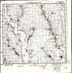
- Description:
- 1923
- Subject:
- Topical Subject: Soviet Union, Geographic Subject: Anatolyevka, and Topical Subject: Maps
- Publisher:
- Генеральный штаб Красной Армии
- Language:
- Russian
- Date Created:
- 1941
- Identifier:
- VAC9619-001883
- Genre:
- Topographic Maps and Military Maps
- Geographic Location:
- Coordinates: 46.6667, 31, 47, 31.5
- Related URL:
- Catalog URL: https://iucat.iu.edu/catalog/5020129 and Download GeoTIFF: https://drive.google.com/open?id=13VfyVaR-q2kWZN6Gos9K23WCuU0PKXNA
- Abstract:
- Modern area represented: Anatolyevka, Mykolaiv oblast, Ukraine
- Call Number:
- G7000 s100 .S7 sheet L-36-39
- Caption:
- Для служебного пользования
- City:
- Анатольевка (Anatolyevka)
- Copyright Holder:
- No Copyright - United States
- Country:
- СССР (USSR)
- State/Province:
- Украинская ССР (Ukrainian Soviet Socialist Republic)
- Physical Description:
- Scale: 1:100,000
- Persistent URL:
- http://purl.dlib.indiana.edu/iudl/images/VAC9619/VAC9619-001883
- Provenance:
- CIA Map Library, Atlasblatt, Library of Congress Geography & Map Division
-
- Description:
- 1929
- Subject:
- Geographic Subject: Velykyy Buyalyk, Topical Subject: Soviet Union, and Topical Subject: Maps
- Publisher:
- Генеральный штаб РККА
- Language:
- Russian
- Date Created:
- 1930
- Identifier:
- VAC9619-001882
- Genre:
- Military Maps and Topographic Maps
- Geographic Location:
- Coordinates: 46.6667, 30.5, 47, 31
- Related URL:
- Catalog URL: https://iucat.iu.edu/catalog/5020129 and Download GeoTIFF: https://drive.google.com/file/d/1D95GxNaBBveCQQS6T-FYUU94outwvOte/view?usp=sharing
- Abstract:
- Modern area represented: Velykyy Buyalyk, Odessa oblast, Ukraine
- Call Number:
- G7000 s100 .S7 sheet L-36-38
- Caption:
- Не подлежит оглашению
- City:
- Благоево (Blagoyevo)
- Copyright Holder:
- No Copyright - United States
- Country:
- СССР (USSR)
- State/Province:
- Украинская ССР (Ukrainian Soviet Socialist Republic) and Одесская область (Odessa oblast)
- Physical Description:
- Scale: 1:100,000
- Persistent URL:
- http://purl.dlib.indiana.edu/iudl/images/VAC9619/VAC9619-001882
- Provenance:
- DMA Topographic Center, Library of Congress G & M Division
-
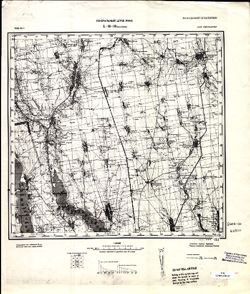
- Description:
- 1929
- Subject:
- Geographic Subject: Velykyy Buyalyk, Topical Subject: Soviet Union, and Topical Subject: Maps
- Publisher:
- Генеральный штаб РККА
- Language:
- Russian
- Date Created:
- 1930
- Identifier:
- VAC9619-001881
- Genre:
- Military Maps and Topographic Maps
- Geographic Location:
- Coordinates: 46.6667, 30.5, 47, 31
- Related URL:
- Catalog URL: https://iucat.iu.edu/catalog/5020129 and Download GeoTIFF: https://drive.google.com/open?id=1DslmoKrUzN-WwOZ2LD_ZXhe3N-y0oVCN
- Abstract:
- Modern area represented: Velykyy Buyalyk, Odessa oblast, Ukraine
- Call Number:
- G7000 s100 .S7 sheet L-36-38
- Caption:
- Не подлежит оглашению
- City:
- Благоево (Blagoyevo)
- Copyright Holder:
- No Copyright - United States
- Country:
- СССР (USSR)
- State/Province:
- Одесская область (Odessa oblast) and Украинская ССР (Ukrainian Soviet Socialist Republic)
- Physical Description:
- Scale: 1:100,000
- Persistent URL:
- http://purl.dlib.indiana.edu/iudl/images/VAC9619/VAC9619-001881
- Provenance:
- CIA Map Library
-
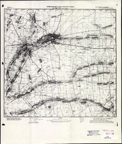
- Description:
- 1936
- Subject:
- Topical Subject: Soviet Union, Topical Subject: Maps, and Geographic Subject: Tokmak
- Publisher:
- Генеральный штаб Красной Армии
- Language:
- Russian
- Date Created:
- 1941
- Identifier:
- VAC9619-001879
- Genre:
- Topographic Maps and Military Maps
- Geographic Location:
- Coordinates: 47, 35.5, 47.3333, 36
- Related URL:
- Download GeoTIFF: https://drive.google.com/open?id=1OoowFREJfGMpfVna6ycm9h6wt5I1ph15 and Catalog URL: https://iucat.iu.edu/catalog/5020129
- Abstract:
- Modern area represented: Tokmak, Zaporizhia oblast, Ukraine
- Call Number:
- G7000 s100 .S7 sheet L-36-36
- Caption:
- Для служебного пользования
- City:
- Бол. Токмак (Bolshoy Tokmak)
- Copyright Holder:
- No Copyright - United States
- Country:
- СССР (USSR)
- State/Province:
- Запорожская область (Zaporizhia oblast) and Украинская ССР (Ukrainian Soviet Socialist Republic)
- Physical Description:
- Scale: 1:100,000
- Persistent URL:
- http://purl.dlib.indiana.edu/iudl/images/VAC9619/VAC9619-001879
- Provenance:
- CIA Map Library
-
- Description:
- 1941
- Subject:
- Topical Subject: Soviet Union, Geographic Subject: Velyka Bilozerka, and Topical Subject: Maps
- Publisher:
- Генеральный штаб Красной Армии
- Language:
- Russian
- Identifier:
- VAC9619-001878
- Genre:
- Topographic Maps and Military Maps
- Geographic Location:
- Coordinates: 47, 34.5, 47.3333, 35
- Related URL:
- Download GeoTIFF: https://drive.google.com/open?id=1U5NypAHkiQmS1MskZUKLL0Ys4QGu8NY_ and Catalog URL: https://iucat.iu.edu/catalog/5020129
- Abstract:
- Modern area represented: Velyka Bilozerka, Zaporizhia oblast, Ukraine
- Call Number:
- G7000 s100 .S7 sheet L-36-34
- Caption:
- Для служебного пользования
- City:
- Бол. Белозерка (Velyka Bilozerka)
- Copyright Holder:
- No Copyright - United States
- Country:
- СССР (USSR)
- State/Province:
- Запорожская область (Zaporizhia oblast) and Украинская ССР (Ukrainian Soviet Socialist Republic)
- Physical Description:
- Scale: 1:100,000
- Persistent URL:
- http://purl.dlib.indiana.edu/iudl/images/VAC9619/VAC9619-001878
- Provenance:
- DMA Topographic Center, Atlasblatt, Library of Congress Geography & Map Division, Army Map Service Library
-
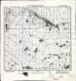
- Description:
- 1941
- Subject:
- Topical Subject: Maps, Topical Subject: Soviet Union, and Geographic Subject: Verkhniy Rohachyk
- Publisher:
- Генеральный штаб Красной Армии
- Language:
- Russian
- Identifier:
- VAC9619-001877
- Genre:
- Military Maps and Topographic Maps
- Geographic Location:
- Coordinates: 47, 34, 47.3333, 34.5
- Related URL:
- Catalog URL: https://iucat.iu.edu/catalog/5020129 and Download GeoTIFF: https://drive.google.com/open?id=1rk9dsqVxr5JAFLbcRoBZQk3GSDAepwK2
- Abstract:
- Modern area represented: Verkhniy Rohachyk, Kherson oblast, Ukraine
- Call Number:
- G7000 s100 .S7 sheet L-36-33
- Caption:
- Для служебного пользования
- City:
- Верх. Рогачик (Verkhniy Rohachyk)
- Copyright Holder:
- No Copyright - United States
- Country:
- СССР (USSR)
- State/Province:
- Украинская ССР (Ukrainian Soviet Socialist Republic), Николаевская область (Mykolaiv oblast), and Запорожская область (Zaporizhia oblast)
- Physical Description:
- Scale: 1:100,000
- Persistent URL:
- http://purl.dlib.indiana.edu/iudl/images/VAC9619/VAC9619-001877
- Provenance:
- CIA Map Library, Library of Congress Geography & Map Division
-
- Description:
- 1930
- Subject:
- Topical Subject: Maps, Topical Subject: Soviet Union, and Geographic Subject: Velyka Lepetykha
- Publisher:
- Генеральный штаб Красной Армии
- Language:
- Russian
- Date Created:
- 1942
- Identifier:
- VAC9619-001876
- Genre:
- Topographic Maps and Military Maps
- Geographic Location:
- Coordinates: 47, 33.5, 47.3333, 34
- Related URL:
- Catalog URL: https://iucat.iu.edu/catalog/5020129 and Download GeoTIFF: https://drive.google.com/open?id=1KEO4HekmlEItJ6LWmCEklRcW04fJsr0O
- Abstract:
- Modern area represented: Velyka Lepetykha, Kherson oblast, Ukraine
- Call Number:
- G7000 s100 .S7 sheet L-36-32
- Caption:
- Для служебного пользования
- City:
- Бол. Лепатиха (Bolshaya Lepatikha)
- Copyright Holder:
- No Copyright - United States
- Country:
- СССР (USSR)
- State/Province:
- Украинская ССР (Ukrainian Soviet Socialist Republic)
- Physical Description:
- Scale: 1:100,000
- Persistent URL:
- http://purl.dlib.indiana.edu/iudl/images/VAC9619/VAC9619-001876
- Provenance:
- DMA Topographic Center, Army Map Service Library, Library of Congress Geography & Map Division
-
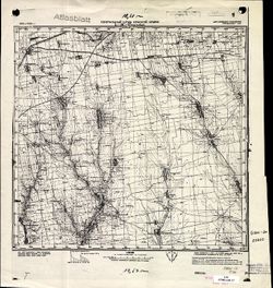
- Description:
- 1923
- Subject:
- Topical Subject: Maps, Topical Subject: Soviet Union, and Geographic Subject: Novosvetlovka
- Publisher:
- Генеральный штаб Красной Армии
- Language:
- Russian
- Date Created:
- 1941
- Identifier:
- VAC9619-001875
- Genre:
- Military Maps and Topographic Maps
- Geographic Location:
- Coordinates: 47, 31, 47.3333, 31.5
- Related URL:
- Catalog URL: https://iucat.iu.edu/catalog/5020129 and Download GeoTIFF: https://drive.google.com/open?id=1EbK0cGpvSMNX1svCUjtHP05b5fU5NuIV
- Abstract:
- Modern area represented: Novosvetlovka, Odessa oblast, Ukraine
- Call Number:
- G7000 s100 .S7 sheet L-36-27
- Caption:
- Для служебного пользования
- City:
- Колония Рорбах (Koloniya Rorbakh)
- Copyright Holder:
- No Copyright - United States
- Country:
- СССР (USSR)
- State/Province:
- Украинская ССР (Ukrainian Soviet Socialist Republic)
- Physical Description:
- Scale: 1:100,000
- Persistent URL:
- http://purl.dlib.indiana.edu/iudl/images/VAC9619/VAC9619-001875
- Provenance:
- CIA Map Library, Atlasblatt, Heeresplankammer Gruppe Archive Auslandskartenarchiv
-
- Description:
- 1929
- Subject:
- Topical Subject: Soviet Union, Geographic Subject: Berezivka, and Topical Subject: Maps
- Publisher:
- Управление военных топографов РККА
- Language:
- Russian
- Date Created:
- 1930
- Identifier:
- VAC9619-001874
- Genre:
- Topographic Maps and Military Maps
- Geographic Location:
- Coordinates: 47, 30.5, 47.3333, 31
- Related URL:
- Catalog URL: https://iucat.iu.edu/catalog/5020129 and Download GeoTIFF: https://drive.google.com/open?id=1tjPZZpubs6FnCKvxrgC4b9CZsV8yHLrS
- Abstract:
- Modern area represented: Berezivka, Odessa oblast, Ukraine
- Call Number:
- G7000 s100 .S7 sheet L-36-26
- Caption:
- Не подлежит оглашению
- City:
- Березовка (Berezivka)
- Copyright Holder:
- No Copyright - United States
- Country:
- СССР (USSR)
- State/Province:
- Одесская область (Odessa oblast) and Украинская ССР (Ukrainian Soviet Socialist Republic)
- Physical Description:
- Scale: 1:100,000
- Persistent URL:
- http://purl.dlib.indiana.edu/iudl/images/VAC9619/VAC9619-001874
- Provenance:
- DMA Topographic Center, Army Map Service Library, Library of Congress Geography & Map Division
-
- Description:
- 1929
- Subject:
- Geographic Subject: Petrovirivka, Topical Subject: Maps, and Topical Subject: Soviet Union
- Publisher:
- Управление военных топографов РККА
- Language:
- Russian
- Date Created:
- 1933
- Identifier:
- VAC9619-001872
- Genre:
- Military Maps and Topographic Maps
- Geographic Location:
- Coordinates: 47, 30, 47.3333, 30.5
- Related URL:
- Catalog URL: https://iucat.iu.edu/catalog/5020129 and Download GeoTIFF: https://drive.google.com/open?id=1Yp0PmoQ_FhFSY9xYe9Mdj5WFZQ1lZ9L8
- Abstract:
- Modern area represented: Petrovirivka, Odessa oblast, Ukraine
- Call Number:
- G7000 s100 .S7 sheet L-36-25
- Caption:
- Не подлежит оглашению
- City:
- Жовтнево (Zhovtnevo)
- Copyright Holder:
- No Copyright - United States
- Country:
- СССР (USSR)
- State/Province:
- Одесская область (Odessa oblast) and Украинская ССР (Ukrainian Soviet Socialist Republic)
- Physical Description:
- Scale: 1:100,000
- Persistent URL:
- http://purl.dlib.indiana.edu/iudl/images/VAC9619/VAC9619-001872
- Provenance:
- DMA Topographic Center, Atlasblatt, Library of Congress Geography & Map Division, Army Map Service Library
-
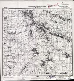
- Description:
- 1940
- Subject:
- Topical Subject: Maps, Topical Subject: Soviet Union, and Geographic Subject: Orikhiv
- Publisher:
- Генеральный штаб Красной Армии
- Language:
- Russian
- Date Created:
- 1941
- Identifier:
- VAC9619-001871
- Genre:
- Topographic Maps and Military Maps
- Geographic Location:
- Coordinates: 47.3333, 35.5, 47.6667, 36
- Related URL:
- Catalog URL: https://iucat.iu.edu/catalog/5020129 and Download GeoTIFF: https://drive.google.com/file/d/18UxavbRP7_3x1JZIEdsgnIP8bzhUcJ3v/view?usp=sharing
- Abstract:
- Modern area represented: Orikhiv, Zaporizhia oblast, Ukraine
- Call Number:
- G7000 s100 .S7 sheet L-36-24
- Caption:
- Для служебного пользования
- City:
- Орехов (Orikhiv)
- Copyright Holder:
- No Copyright - United States
- Country:
- СССР (USSR)
- State/Province:
- Запорожская область (Zaporizhia oblast) and Украинская ССР (Ukrainian Soviet Socialist Republic)
- Physical Description:
- Scale: 1:100,000
- Persistent URL:
- http://purl.dlib.indiana.edu/iudl/images/VAC9619/VAC9619-001871
- Provenance:
- Atlasblatt
-
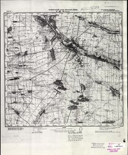
- Description:
- 1940
- Subject:
- Topical Subject: Soviet Union, Geographic Subject: Orikhiv, and Topical Subject: Maps
- Publisher:
- Генеральный штаб Красной Армии
- Language:
- Russian
- Date Created:
- 1941
- Identifier:
- VAC9619-001870
- Genre:
- Topographic Maps and Military Maps
- Geographic Location:
- Coordinates: 47.3333, 35.5, 47.6667, 36
- Related URL:
- Catalog URL: https://iucat.iu.edu/catalog/5020129 and Download GeoTIFF: https://drive.google.com/open?id=1AXZ-XrQdgFQXRG3b8AQpUU8UVELbTcb0
- Abstract:
- Modern area represented: Orikhiv, Zaporizhia oblast, Ukraine
- Call Number:
- G7000 s100 .S7 sheet L-36-24
- Caption:
- Для служебного пользования
- City:
- Орехов (Orikhiv)
- Copyright Holder:
- No Copyright - United States
- Country:
- СССР (USSR)
- State/Province:
- Запорожская область (Zaporizhia oblast) and Украинская ССР (Ukrainian Soviet Socialist Republic)
- Physical Description:
- Scale: 1:100,000
- Persistent URL:
- http://purl.dlib.indiana.edu/iudl/images/VAC9619/VAC9619-001870
- Provenance:
- CIA Map Library, Atlasblatt
-
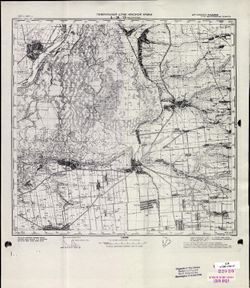
- Description:
- 1927
- Subject:
- Topical Subject: Soviet Union, Topical Subject: Maps, and Geographic Subject: Vasylivka
- Publisher:
- Генеральный штаб Красной Армии
- Language:
- Russian
- Date Created:
- 1941
- Identifier:
- VAC9619-001869
- Genre:
- Topographic Maps and Military Maps
- Geographic Location:
- Coordinates: 47.3333, 35, 47.6667, 35.5
- Related URL:
- Catalog URL: https://iucat.iu.edu/catalog/5020129 and Download GeoTIFF: https://drive.google.com/open?id=1Ts_iGjiK3duW8I4BKerAnFOxHoZvlOGy
- Abstract:
- Modern area represented: Vasylivka, Zaporizhia oblast, Ukraine
- Call Number:
- G7000 s100 .S7 sheet L-36-23
- Caption:
- Для служебного пользования
- City:
- Васильевка (Vasylivka)
- Copyright Holder:
- No Copyright - United States
- Country:
- СССР (USSR)
- State/Province:
- Запорожская область (Zaporizhia oblast) and Украинская ССР (Ukrainian Soviet Socialist Republic)
- Physical Description:
- Scale: 1:100,000
- Persistent URL:
- http://purl.dlib.indiana.edu/iudl/images/VAC9619/VAC9619-001869
- Provenance:
- CIA Map Library
-

- Description:
- 1926
- Subject:
- Geographic Subject: Balky, Topical Subject: Soviet Union, and Topical Subject: Maps
- Publisher:
- Генеральный штаб Красной Армии
- Language:
- Russian
- Date Created:
- 1941
- Identifier:
- VAC9619-001868
- Genre:
- Topographic Maps and Military Maps
- Geographic Location:
- Coordinates: 47.3333, 34.5, 47.6667, 35
- Related URL:
- Catalog URL: https://iucat.iu.edu/catalog/5020129 and Download GeoTIFF: https://drive.google.com/open?id=1V7PHm7Dg5ABV8yybrFeMKAmxM9f2EO27
- Abstract:
- Modern area represented: Balky, Zaporizhia oblast, Ukraine
- Call Number:
- G7000 s100 .S7 sheet L-36-22
- Caption:
- Для служебного пользования
- City:
- Балки (Balky)
- Copyright Holder:
- No Copyright - United States
- Country:
- СССР (USSR)
- State/Province:
- Украинская ССР (Ukrainian Soviet Socialist Republic)
- Physical Description:
- Scale: 1:100,000
- Persistent URL:
- http://purl.dlib.indiana.edu/iudl/images/VAC9619/VAC9619-001868
- Provenance:
- CIA Map Library
-
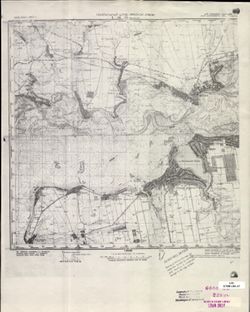
- Description:
- 1926
- Subject:
- Topical Subject: Soviet Union, Topical Subject: Maps, and Geographic Subject: Nikopol
- Publisher:
- Генеральный штаб Красной Армии
- Language:
- Russian
- Date Created:
- 1941
- Identifier:
- VAC9619-001867
- Genre:
- Military Maps and Topographic Maps
- Geographic Location:
- Coordinates: 47.3333, 34, 47.6667, 34.5
- Related URL:
- Download GeoTIFF: https://drive.google.com/open?id=1255dfmhEQnsVoMASiJgE0Wqbhh4ks-Bt and Catalog URL: https://iucat.iu.edu/catalog/5020129
- Abstract:
- Modern area represented: Nikopol, Dnipropetrovsk, Ukraine
- Call Number:
- G7000 s100 .S7 sheet L-36-21
- Caption:
- Для служебного пользования
- City:
- Никополь (Nikopol)
- Copyright Holder:
- No Copyright - United States
- Country:
- СССР (USSR)
- State/Province:
- Днепропетровская область (Dnipropetrovsk oblast) and Украинская ССР (Ukrainian Soviet Socialist Republic)
- Physical Description:
- Scale: 1:100,000
- Persistent URL:
- http://purl.dlib.indiana.edu/iudl/images/VAC9619/VAC9619-001867
- Provenance:
- CIA Map Library
-
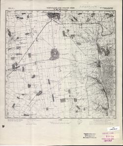
- Description:
- 1926
- Subject:
- Topical Subject: Soviet Union, Topical Subject: Maps, and Geographic Subject: Apostolove
- Publisher:
- Генеральный штаб Красной Армии
- Language:
- Russian
- Date Created:
- 1941
- Identifier:
- VAC9619-001866
- Genre:
- Military Maps and Topographic Maps
- Geographic Location:
- Coordinates: 47.3333, 33.5, 47.6667, 34
- Related URL:
- Catalog URL: https://iucat.iu.edu/catalog/5020129 and Download GeoTIFF: https://drive.google.com/file/d/19vU-7kd0gBkHRSMRDc-_C2Jsbp5EDO89/view?usp=sharing
- Abstract:
- Modern area represented: Apostolove, Dnipropetrovsk oblast, Ukraine
- Call Number:
- G7000 s100 .S7 sheet L-36-20
- Caption:
- Для служебного пользования
- City:
- Апостолово (Apostolovo)
- Copyright Holder:
- No Copyright - United States
- Country:
- СССР (USSR)
- State/Province:
- Украинская ССР (Ukrainian Soviet Socialist Republic)
- Physical Description:
- Scale: 1:100,000
- Persistent URL:
- http://purl.dlib.indiana.edu/iudl/images/VAC9619/VAC9619-001866
- Provenance:
- CIA Map Library, Atlasblatt
-
- Description:
- 1926
- Subject:
- Geographic Subject: Apostolove, Topical Subject: Maps, and Topical Subject: Soviet Union
- Publisher:
- Генеральный штаб Красной Армии
- Language:
- Russian
- Date Created:
- 1941
- Identifier:
- VAC9619-001865
- Genre:
- Military Maps and Topographic Maps
- Geographic Location:
- Coordinates: 47.3333, 33.5, 47.6667, 34
- Related URL:
- Download GeoTIFF: https://drive.google.com/open?id=1qtLlkH0o1EGtSackrnvXw4lLRu4x84Mn and Catalog URL: https://iucat.iu.edu/catalog/5020129
- Abstract:
- Modern area represented: Apostolove, Dnipropetrovsk oblast, Ukraine
- Call Number:
- G7000 s100 .S7 sheet L-36-20
- Caption:
- Для служебного пользования
- City:
- Апостолово (Apostolovo)
- Copyright Holder:
- No Copyright - United States
- Country:
- СССР (USSR)
- State/Province:
- Украинская ССР (Ukrainian Soviet Socialist Republic)
- Physical Description:
- Scale: 1:100,000
- Persistent URL:
- http://purl.dlib.indiana.edu/iudl/images/VAC9619/VAC9619-001865
- Provenance:
- DMA Topographic Center, Atlasblatt, Library of Congress Geography & Map Division, Army Map Service Library
-
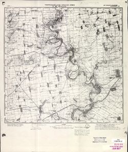
- Description:
- 1930
- Subject:
- Geographic Subject: Shesternya, Topical Subject: Soviet Union, and Topical Subject: Maps
- Publisher:
- Генеральный штаб Красной Армии
- Language:
- Russian
- Date Created:
- 1941
- Identifier:
- VAC9619-001864
- Genre:
- Topographic Maps and Military Maps
- Geographic Location:
- Coordinates: 47.3333, 33, 47.6667, 33.5
- Related URL:
- Download GeoTIFF: https://drive.google.com/open?id=10v6rNSmRqiUeQcnPF6pp5pnh6Csl7aE8 and Catalog URL: https://iucat.iu.edu/catalog/5020129
- Abstract:
- Modern area represented: Shesternya, Kherson oblast, Ukraine
- Call Number:
- G7000 s100 .S7 sheet L-36-19
- Caption:
- Для служебного пользования
- City:
- Шестерня (Shesternya)
- Copyright Holder:
- No Copyright - United States
- Country:
- СССР (USSR)
- State/Province:
- Украинская ССР (Ukrainian Soviet Socialist Republic)
- Physical Description:
- Scale: 1:100,000
- Persistent URL:
- http://purl.dlib.indiana.edu/iudl/images/VAC9619/VAC9619-001864
- Provenance:
- CIA Map Library, Atlasblatt
-
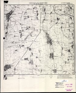
- Description:
- 1930
- Subject:
- Topical Subject: Maps, Geographic Subject: Novyy Buh, and Topical Subject: Soviet Union
- Publisher:
- Генеральный штаб Красной Армии
- Language:
- Russian
- Date Created:
- 1941
- Identifier:
- VAC9619-001863
- Genre:
- Military Maps and Topographic Maps
- Geographic Location:
- Coordinates: 47.6667, 32.5, 48, 33
- Related URL:
- Download GeoTIFF: https://drive.google.com/open?id=1T0wPHo0RpDwORrKZXGfpt1IyrZgBA6b4 and Catalog URL: https://iucat.iu.edu/catalog/5020129
- Abstract:
- Modern area represented: Novyy Buh, Mykolaiv, Ukraine
- Call Number:
- G7000 s100 .S7 sheet L-36-6
- Caption:
- Для служебного пользования
- City:
- Новый Буг (Novyy Buh)
- Copyright Holder:
- No Copyright - United States
- Country:
- СССР (USSR)
- State/Province:
- Украинская ССР (Ukrainian Soviet Socialist Republic)
- Physical Description:
- Scale: 1:100,000
- Persistent URL:
- http://purl.dlib.indiana.edu/iudl/images/VAC9619/VAC9619-001863
- Provenance:
- CIA Map Library
-
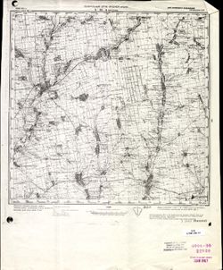
- Description:
- 1928
- Subject:
- Topical Subject: Maps, Geographic Subject: Bratske, and Topical Subject: Soviet Union
- Publisher:
- Генеральный штаб Красной Армии
- Language:
- Russian
- Date Created:
- 1941
- Identifier:
- VAC9619-001862
- Genre:
- Military Maps and Topographic Maps
- Geographic Location:
- Coordinates: 47.6667, 31.5, 48, 32
- Related URL:
- Catalog URL: https://iucat.iu.edu/catalog/5020129 and Download GeoTIFF: https://drive.google.com/open?id=1CRkSh7sskcbMSmRNTPMYkQvk89B_3WMF
- Abstract:
- Modern area represented: Bratske, Mykolaiv oblast, Ukraine
- Call Number:
- G7000 s100 .S7 sheet L-36-4
- Caption:
- Для служебного пользования
- City:
- Братское (Bratskoye)
- Copyright Holder:
- No Copyright - United States
- Country:
- СССР (USSR)
- State/Province:
- Украинская ССР (Ukrainian Soviet Socialist Republic)
- Physical Description:
- Scale: 1:100,000
- Persistent URL:
- http://purl.dlib.indiana.edu/iudl/images/VAC9619/VAC9619-001862
- Provenance:
- CIA Map Library
-
- Description:
- 1927
- Subject:
- Topical Subject: Soviet Union, Geographic Subject: Vradiyivka, and Topical Subject: Maps
- Publisher:
- Генеральный штаб РККА
- Language:
- Russian
- Date Created:
- 1932
- Identifier:
- VAC9619-001861
- Genre:
- Topographic Maps and Military Maps
- Geographic Location:
- Coordinates: 47.6667, 30.5, 48, 31
- Related URL:
- Catalog URL: https://iucat.iu.edu/catalog/5020129 and Download GeoTIFF: https://drive.google.com/open?id=1qq27-b3PwdUCvrlOONE9iPfRjsP8GlqJ
- Abstract:
- Modern area represented: Vradiyivka, Mykolaiv oblast, Ukraine
- Call Number:
- G7000 s100 .S7 sheet L-36-2
- Caption:
- Не подлежит оглашению
- City:
- М.Врадиевка (M.Vradiyivka)
- Copyright Holder:
- No Copyright - United States
- Country:
- СССР (USSR)
- State/Province:
- Украинская ССР (Ukrainian Soviet Socialist Republic) and Одесская область (Odessa oblast)
- Physical Description:
- Scale: 1:100,000
- Persistent URL:
- http://purl.dlib.indiana.edu/iudl/images/VAC9619/VAC9619-001861
- Provenance:
- CIA Map Library, Atlasblatt, Library of Congress Geography & Map Division
-
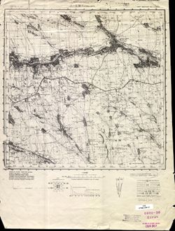
- Description:
- 1927
- Subject:
- Topical Subject: Soviet Union, Topical Subject: Maps, and Geographic Subject: Kryve Ozero
- Publisher:
- Генеральный штаб РККА
- Language:
- Russian
- Date Created:
- 1933
- Identifier:
- VAC9619-001860
- Genre:
- Topographic Maps and Military Maps
- Geographic Location:
- Coordinates: 47.6667, 30, 48, 30.5
- Related URL:
- Catalog URL: https://iucat.iu.edu/catalog/5020129 and Download GeoTIFF: https://drive.google.com/open?id=1hbij6lPaIDBZ6sv_u07NP2w2I0N9ow8M
- Abstract:
- Modern area represented: Kryve Ozero, Mykolaiv oblast, Ukraine
- Call Number:
- G7000 s100 .S7 sheet L-36-1
- Caption:
- Не подлежит оглашению
- City:
- Кривое Озеро (Kryve Ozero)
- Copyright Holder:
- No Copyright - United States
- Country:
- СССР (USSR)
- State/Province:
- Украинская ССР (Ukrainian Soviet Socialist Republic), Одесская область (Odessa oblast), and Молдавская АССР (Moldavian Autonomous Soviet Socialist Republic)
- Physical Description:
- Scale: 1:100,000
- Persistent URL:
- http://purl.dlib.indiana.edu/iudl/images/VAC9619/VAC9619-001860
- Provenance:
- CIA Map Library, Atlasblatt
-
- Description:
- 1928
- Subject:
- Geographic Subject: Kuybyshevka, Topical Subject: Soviet Union, and Topical Subject: Maps
- Publisher:
- Генеральный штаб Красной Армии
- Language:
- Russian
- Date Created:
- 1941
- Identifier:
- VAC9619-001859
- Genre:
- Topographic Maps and Military Maps
- Geographic Location:
- Coordinates: 47.3333, 31.5, 47.6667, 32
- Related URL:
- Download GeoTIFF: https://drive.google.com/open?id=1vCLFl_8xuzcQNwylJ_TnIRppAiZjkAqE and Catalog URL: https://iucat.iu.edu/catalog/5020129
- Abstract:
- Modern area represented: Kuybyshevka, Mykolaiv oblast, Ukraine
- Call Number:
- G7000 s100 .S7 sheet L-36-16
- Caption:
- Для служебного пользования
- City:
- Больш. Солоное (Bolshoye Solonoye)
- Copyright Holder:
- No Copyright - United States
- Country:
- СССР (USSR)
- State/Province:
- Украинская ССР (Ukrainian Soviet Socialist Republic)
- Physical Description:
- Scale: 1:100,000
- Persistent URL:
- http://purl.dlib.indiana.edu/iudl/images/VAC9619/VAC9619-001859
- Provenance:
- DMA Topographic Center, Army Map Service Library, OMAHA, Library of Congress Geography & Map Division
-
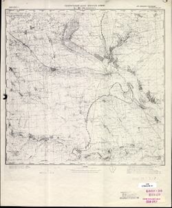
- Description:
- 1928
- Subject:
- Geographic Subject: Voznesensk, Topical Subject: Maps, and Topical Subject: Soviet Union
- Publisher:
- Генеральный штаб Красной Армии
- Language:
- Russian
- Date Created:
- 1941
- Identifier:
- VAC9619-001853
- Genre:
- Topographic Maps and Military Maps
- Geographic Location:
- Coordinates: 47.3333, 31, 47.6667, 31.5
- Related URL:
- Catalog URL: https://iucat.iu.edu/catalog/5020129 and Download GeoTIFF: https://drive.google.com/open?id=1bR3CKUW57AtZTkAsFZhGcwe6LzRifVDw
- Abstract:
- Modern area represented: Voznesensk, Mykolaiv oblast, Ukraine
- Call Number:
- G7000 s100 .S7 sheet L-36-15
- Caption:
- Для служебного пользования
- City:
- Вознесенск (Voznesensk)
- Copyright Holder:
- No Copyright - United States
- Country:
- СССР (USSR)
- State/Province:
- Украинская ССР (Ukrainian Soviet Socialist Republic)
- Physical Description:
- Scale: 1:100,000
- Persistent URL:
- http://purl.dlib.indiana.edu/iudl/images/VAC9619/VAC9619-001853
- Provenance:
- CIA Map Library
-
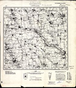
- Description:
- 1930
- Subject:
- Topical Subject: Maps, Topical Subject: Soviet Union, and Geographic Subject: Domanivka
- Publisher:
- Генеральный штаб РККА
- Language:
- Russian
- Identifier:
- VAC9619-001850
- Genre:
- Topographic Maps and Military Maps
- Geographic Location:
- Coordinates: 47.3333, 30.5, 47.6667, 31
- Related URL:
- Catalog URL: https://iucat.iu.edu/catalog/5020129 and Download GeoTIFF: https://drive.google.com/open?id=1AcnbiTYid9N8Ex6zlF-DTeWpotb40bPt
- Abstract:
- Modern area represented: Domanivka, Mykolaiv oblast, Ukraine
- Call Number:
- G7000 s100 .S7 sheet L-36-14
- Caption:
- Не подлежит оглашению
- City:
- М.Доманевка (Malaya Domanivka) and Одесская область (Odessa oblast)
- Copyright Holder:
- No Copyright - United States
- Country:
- СССР (USSR)
- State/Province:
- Украинская ССР (Ukrainian Soviet Socialist Republic)
- Physical Description:
- Scale: 1:100,000
- Persistent URL:
- http://purl.dlib.indiana.edu/iudl/images/VAC9619/VAC9619-001850
- Provenance:
- CIA Map Library, Atlasblatt
-
- Description:
- 1930
- Subject:
- Topical Subject: Maps, Topical Subject: Soviet Union, and Geographic Subject: Troitskoye
- Publisher:
- Генеральный штаб Красной Армии
- Language:
- Russian
- Identifier:
- VAC9619-001845
- Genre:
- Topographic Maps and Military Maps
- Geographic Location:
- Coordinates: 47.3333, 30, 47.6667, 30.5
- Related URL:
- Catalog URL: https://iucat.iu.edu/catalog/5020129 and Download GeoTIFF: https://drive.google.com/open?id=1aPVFpeU-lxBl0BEdaFYuWT8h_ZsEaGm9
- Abstract:
- Modern area represented: Troitskoye, Odessa oblast, Ukraine
- Call Number:
- G7000 s100 .S7 sheet L-36-13
- Caption:
- Не подлежит оглашению
- City:
- Троицкое (Troitskoye)
- Copyright Holder:
- No Copyright - United States
- Country:
- СССР (USSR)
- State/Province:
- АМССР (Moldavian Autonomous Soviet Socialist Republic), Одесская область (Odessa oblast), and Украинская ССР (Ukrainian Soviet Socialist Republic)
- Physical Description:
- Scale: 1:100,000
- Persistent URL:
- http://purl.dlib.indiana.edu/iudl/images/VAC9619/VAC9619-001845
- Provenance:
- DMA Topographic Center, Army Map Service Library, Atlasblatt, Library of Congress Geography & Map Division
-

- Description:
- 1939
- Subject:
- Topical Subject: Soviet Union, Geographic Subject: Komyshuvakha, and Topical Subject: Maps
- Publisher:
- Генеральный штаб Красной Армии
- Language:
- Russian
- Date Created:
- 1941
- Identifier:
- VAC9619-001844
- Genre:
- Military Maps and Topographic Maps
- Geographic Location:
- Coordinates: 47.6667, 35.5, 48, 36
- Related URL:
- Download GeoTIFF: https://drive.google.com/open?id=1IiavgxI6IZ79dkMzQI3jHmPsU86TTxOH and Catalog URL: https://iucat.iu.edu/catalog/5020129
- Abstract:
- Modern area represented: Komyshuvakha, Zaporizhia oblast, Ukraine
- Call Number:
- G7000 s100 .S7 sheet L-36-12
- Caption:
- Для служебного пользования
- City:
- Камышуваха (Komyshuvakha)
- Copyright Holder:
- No Copyright - United States
- Country:
- СССР (USSR)
- State/Province:
- Запорожская область (Zaporizhia oblast) and Украинская ССР (Ukrainian Soviet Socialist Republic)
- Physical Description:
- Scale: 1:100,000
- Persistent URL:
- http://purl.dlib.indiana.edu/iudl/images/VAC9619/VAC9619-001844
- Provenance:
- CIA Map Library
-
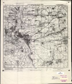
- Description:
- 1927
- Subject:
- Geographic Subject: Zaporizhia, Topical Subject: Soviet Union, and Topical Subject: Maps
- Publisher:
- Генеральный штаб Красной Армии
- Language:
- Russian
- Date Created:
- 1941
- Identifier:
- VAC9619-001831
- Genre:
- Topographic Maps and Military Maps
- Geographic Location:
- Coordinates: 47.6667, 35, 48, 35.5
- Related URL:
- Download GeoTIFF: https://drive.google.com/open?id=16w7gAgD3waAsgFnUeqhZv9WmeLo6ztJn and Catalog URL: https://iucat.iu.edu/catalog/5020129
- Abstract:
- Modern area represented: Zaporizhia, Zaporizhia oblast, Ukraine
- Call Number:
- G7000 s100 .S7 sheet L-36-11
- Caption:
- Для служебного пользования
- City:
- Запорожье (Zaporizhia)
- Copyright Holder:
- No Copyright - United States
- Country:
- СССР (USSR)
- State/Province:
- Украинская ССР (Ukrainian Soviet Socialist Republic) and Запорожская область (Zaporizhia oblast)
- Physical Description:
- Scale: 1:100,000
- Persistent URL:
- http://purl.dlib.indiana.edu/iudl/images/VAC9619/VAC9619-001831
- Provenance:
- CIA Map Library
-
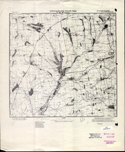
- Description:
- 1926
- Subject:
- Topical Subject: Maps, Geographic Subject: Tomakivka, and Topical Subject: Soviet Union
- Publisher:
- Генеральный штаб Красной Армии
- Language:
- Russian
- Date Created:
- 1941
- Identifier:
- VAC9619-001823
- Genre:
- Topographic Maps and Military Maps
- Geographic Location:
- Coordinates: 47.6667, 34.5, 48, 35
- Related URL:
- Download GeoTIFF: https://drive.google.com/file/d/14Nyu2PujbMSA_GYJjeQF3P2MPNH2zV-g/view?usp=sharing and Catalog URL: https://iucat.iu.edu/catalog/5020129
- Abstract:
- Modern area represented: Tomakivka, Dnipropetrovsk oblast, Ukraine
- Call Number:
- G7000 s100 .S7 sheet L-36-10
- Caption:
- Для служебного пользования
- City:
- Томаковка (Tomakivka)
- Copyright Holder:
- No Copyright - United States
- Country:
- СССР (USSR)
- State/Province:
- Запорожская область (Zaporizhia oblast) and Украинская ССР (Ukrainian Soviet Socialist Republic)
- Physical Description:
- Scale: 1:100,000
- Persistent URL:
- http://purl.dlib.indiana.edu/iudl/images/VAC9619/VAC9619-001823
- Provenance:
- CIA Map Library
-
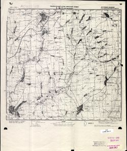
- Description:
- 1925
- Subject:
- Topical Subject: Maps, Geographic Subject: Mykolayivka, and Topical Subject: Soviet Union
- Publisher:
- Генеральный штаб Красной Армии
- Language:
- Russian
- Date Created:
- 1940
- Identifier:
- VAC9619-001822
- Genre:
- Topographic Maps and Military Maps
- Geographic Location:
- Coordinates: 47.6667, 34, 48, 34.5
- Related URL:
- Download GeoTIFF: https://drive.google.com/open?id=1U6J1cZ3jBto4nQW05mxJrvbDFQrg0G8o and Catalog URL: https://iucat.iu.edu/catalog/5020129
- Abstract:
- Modern area represented: Mykolayivka, Dnipropetrovsk oblast, Ukraine
- Call Number:
- G7000 s100 .S7 sheet L-36-9
- Caption:
- Для служебного пользования
- City:
- Ново-Николаевка (Novo-Nikolayevka)
- Copyright Holder:
- No Copyright - United States
- Country:
- СССР (USSR)
- State/Province:
- Украинская ССР (Ukrainian Soviet Socialist Republic) and Днепропетровская область (Dnipropetrovsk oblast)
- Physical Description:
- Scale: 1:100,000
- Persistent URL:
- http://purl.dlib.indiana.edu/iudl/images/VAC9619/VAC9619-001822
- Provenance:
- CIA Map Library, Atlasblatt
-
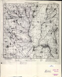
- Description:
- 1925
- Subject:
- Topical Subject: Maps, Topical Subject: Soviet Union, and Geographic Subject: Kamenka
- Publisher:
- Генеральный штаб Красной Армии
- Language:
- Russian
- Date Created:
- 1941
- Identifier:
- VAC9619-001813
- Genre:
- Topographic Maps and Military Maps
- Geographic Location:
- Coordinates: 47.6667, 33.5, 48, 34
- Related URL:
- Catalog URL: https://iucat.iu.edu/catalog/5020129 and Download GeoTIFF: https://drive.google.com/open?id=1Znt6fiuoSKmhSW96ISNtk6soCbJclKeG
- Abstract:
- Modern area represented: Kamenka, Dnipropetrovsk oblast, Ukraine
- Call Number:
- G7000 s100 .S7 sheet L-36-8
- Caption:
- Для служебного пользования
- City:
- Каменка (Kamenka)
- Copyright Holder:
- No Copyright - United States
- Country:
- СССР (USSR)
- State/Province:
- Украинская ССР (Ukrainian Soviet Socialist Republic)
- Physical Description:
- Scale: 1:100,000
- Persistent URL:
- http://purl.dlib.indiana.edu/iudl/images/VAC9619/VAC9619-001813
- Provenance:
- CIA Map Library
-
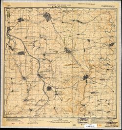
- Description:
- 1939
- Subject:
- Geographic Subject: Donetsk, Topical Subject: Soviet Union, Geographic Subject: Platonovka, and Topical Subject: Maps
- Publisher:
- Генеральный штаб Красной Армии
- Language:
- Russian
- Date Created:
- 1941
- Identifier:
- VAC9619-002002
- Genre:
- Topographic Maps and Military Maps
- Geographic Location:
- Coordinates: 47.3333, 37.5, 47.6667, 37.5
- Related URL:
- Catalog URL: https://iucat.iu.edu/catalog/5020129 and Download GeoTIFF: https://drive.google.com/open?id=1rcAVudLKQYH89ByRQ8FaN6st2evLxa46
- Abstract:
- Modern area represented: Платоновка (Platonovka), Donetsk, Ukraine
- Call Number:
- G7000 s100 .S7 sheet L-37-16
- Caption:
- Для cлужебного пользования
- City:
- Платоновка (Platonovka)
- Copyright Holder:
- No Copyright - United States
- Country:
- СССР (USSR)
- State/Province:
- Украинская ССР (Ukrainian Soviet Socialist Republic) and Сталинская область (Stalino oblast)
- Physical Description:
- Scale: 1:100,000
- Persistent URL:
- http://purl.dlib.indiana.edu/iudl/images/VAC9619/VAC9619-002002
- Provenance:
- Geographic Names Branch
-
- Description:
- 1931
- Subject:
- Topical Subject: Maps, Geographic Subject: Donetsk, Geographic Subject: Kalmiuske, and Topical Subject: Soviet Union
- Publisher:
- Генеральный штаб Красной Армии
- Language:
- Russian
- Date Created:
- 1942
- Identifier:
- VAC9619-002004
- Genre:
- Topographic Maps and Military Maps
- Geographic Location:
- Coordinates: 47.3333, 39, 47.6667, 39.5
- Related URL:
- Download GeoTIFF: https://drive.google.com/open?id=1NZxwosLYVa9EAJO1rvzTEoZMt-K31pfv and Catalog URL: https://iucat.iu.edu/catalog/5020129
- Abstract:
- Modern area represented: Кальміуське (Kalmiuske), Donetsk, Ukraine
- Call Number:
- G7000 s100 .S7 sheet L-37-17
- Caption:
- Для cлужебного пользования
- City:
- Каракубстрой (Karakubstroy)
- Copyright Holder:
- No Copyright - United States
- Country:
- СССР (USSR)
- State/Province:
- Украинская ССР (Ukrainian Soviet Socialist Republic), Сталинская область (Stalino oblast), Ростовская область (Rostov oblast), and РСФСР (RSFSR)
- Physical Description:
- Scale: 1:100,000
- Persistent URL:
- http://purl.dlib.indiana.edu/iudl/images/VAC9619/VAC9619-002004
- Provenance:
- DMA Topographic Center, Army Map Service Library, OMAHA
-
- Description:
- 1928
- Subject:
- Geographic Subject: Zaporizhia Oblast, Topical Subject: Maps, Geographic Subject: Bilmak, and Topical Subject: Soviet Union
- Publisher:
- Генеральный штаб Красной Армии
- Language:
- Russian
- Date Created:
- 1941
- Identifier:
- VAC9619-002001
- Genre:
- Topographic Maps and Military Maps
- Geographic Location:
- Coordinates: 47.3333, 36.5, 47.6667, 37
- Related URL:
- Download GeoTIFF: https://drive.google.com/open?id=1ySsSAOHIVCirkO-XklFYUt7jjSRE9JyW and Catalog URL: https://iucat.iu.edu/catalog/5020129
- Abstract:
- Modern area represented: Більмак (Bilmak), Zaporizhia Oblast, Ukraine
- Call Number:
- G7000 s100 .S7 sheet L-37-14
- Caption:
- Для cлужебного пользования
- City:
- Куйбышево (Kuybysheve)
- Copyright Holder:
- No Copyright - United States
- Country:
- СССР (USSR)
- State/Province:
- Украинская ССР (Ukrainian Soviet Socialist Republic), Запорожская область (Zaporizhia oblast), and Сталинская область (Stalino oblast)
- Physical Description:
- Scale: 1:100,000
- Persistent URL:
- http://purl.dlib.indiana.edu/iudl/images/VAC9619/VAC9619-002001
- Provenance:
- DMA Topographic Center, Army Map Service Library, OMAHA
-
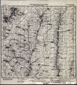
- Description:
- 1939
- Subject:
- Topical Subject: Soviet Union, Topical Subject: Maps, and Geographic Subject: Rozdolne
- Publisher:
- Генеральный штаб Красной Армии
- Language:
- Russian
- Date Created:
- 1941
- Identifier:
- VAC9619-002003
- Genre:
- Military Maps and Topographic Maps
- Geographic Location:
- Coordinates: 47.3333, 38, 47.6667, 38.5
- Related URL:
- Catalog URL: https://iucat.iu.edu/catalog/5020129 and Download GeoTIFF: https://drive.google.com/open?id=1cdFtj_43ppiv47dkF7XJ1JNspIgopc33
- Abstract:
- Modern area represented: Rozdolne, Donetsk oblast, Ukraine
- Call Number:
- G7000 s100 .S7 sheet L-37-17
- Caption:
- Для служебного пользования
- City:
- Большая Каракуба (Bolshaya Karakuba)
- Copyright Holder:
- No Copyright - United States
- Country:
- СССР (USSR)
- State/Province:
- РСФСР (RSFSR) and Украинская ССР (Ukrainian Soviet Socialist Republic)
- Physical Description:
- Scale: 1:100,000
- Persistent URL:
- http://purl.dlib.indiana.edu/iudl/images/VAC9619/VAC9619-002003
- Provenance:
- CIA Map Library
-
- Description:
- 1928
- Subject:
- Topical Subject: Maps, Geographic Subject: Polohy, Geographic Subject: Zaporizhia, and Topical Subject: Soviet Union
- Publisher:
- Генеральный штаб Красной Армии
- Language:
- Russian
- Date Created:
- 1941
- Identifier:
- VAC9619-002000
- Genre:
- Topographic Maps and Military Maps
- Geographic Location:
- Coordinates: 47.3333, 36, 47.6667, 36.5
- Related URL:
- Catalog URL: https://iucat.iu.edu/catalog/5020129 and Download GeoTIFF: https://drive.google.com/file/d/1uJ3-XGXJUXLAboX8-HQjitHwF2kaLFi8/view?usp=sharing
- Abstract:
- Modern area represented: Пологи (Polohy), Zaporizhia, Ukraine
- Call Number:
- G7000 s100 .S7 sheet L-37-13
- Caption:
- Для cлужебного пользования
- City:
- Пологи (Polohy)
- Copyright Holder:
- No Copyright - United States
- Country:
- СССР (USSR)
- State/Province:
- Запорожская область (Zaporizhia oblast) and Украинская ССР (Ukrainian Soviet Socialist Republic)
- Physical Description:
- Scale: 1:100,000
- Persistent URL:
- http://purl.dlib.indiana.edu/iudl/images/VAC9619/VAC9619-002000
- Provenance:
- DMA Topographic Center, Army Map Service Library, OMAHA
-
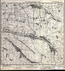
- Description:
- 1928
- Subject:
- Geographic Subject: Polohy, Topical Subject: Maps, and Topical Subject: Soviet Union
- Publisher:
- Генеральный штаб Красной Армии
- Language:
- Russian
- Date Created:
- 1941
- Identifier:
- VAC9619-001999
- Genre:
- Military Maps and Topographic Maps
- Geographic Location:
- Coordinates: 47.3333, 36, 47.6667, 36.5
- Related URL:
- Download GeoTIFF: https://drive.google.com/open?id=1e9fUTgvqBE4EgnDy0hWN7wxWDzLViFdf and Catalog URL: https://iucat.iu.edu/catalog/5020129
- Abstract:
- Modern area represented: Polohy, Zaporizhia Oblast, Ukraine
- Call Number:
- G7000 s100 .S7 sheet L-37-13
- Caption:
- Для служебного пользования
- City:
- Пологи (Pologi)
- Copyright Holder:
- No Copyright - United States
- Country:
- СССР (USSR)
- State/Province:
- Запорожская область (Zaporizhia oblast) and Украинская ССР (Ukrainian Soviet Socialist Republic)
- Physical Description:
- Scale: 1:100,000
- Persistent URL:
- http://purl.dlib.indiana.edu/iudl/images/VAC9619/VAC9619-001999
- Provenance:
- CIA Map Library
-
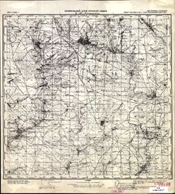
- Description:
- 1904
- Subject:
- Geographic Subject: Novoshakhtinsk, Topical Subject: Soviet Union, and Topical Subject: Maps
- Publisher:
- Генеральный штаб Красной Армии
- Language:
- Russian
- Date Created:
- 1941
- Identifier:
- VAC9619-001994
- Genre:
- Topographic Maps and Military Maps
- Geographic Location:
- Coordinates: 47.6667, 39.5, 48, 40
- Related URL:
- Download GeoTIFF: https://drive.google.com/open?id=1Z71FJW1PPTeU6Zq-xJa1RdMaUeG9VcpI and Catalog URL: https://iucat.iu.edu/catalog/5020129
- Abstract:
- Modern area represented: Novoshakhtinsk, Luhansk oblast, Ukraine
- Call Number:
- G7000 s100 .S7 sheet L-37-8
- Caption:
- Для служебного пользования
- City:
- Новошахтинск (Novoshakhtinsk)
- Copyright Holder:
- No Copyright - United States
- Country:
- СССР (USSR)
- State/Province:
- Ворошиловградская область (Voroshilovgrad oblast), Украинская ССР (Ukrainian Soviet Socialist Republic), Ростовская область (Rostov oblast), and РСФСР (RSFSR)
- Physical Description:
- Scale: 1:100,000
- Persistent URL:
- http://purl.dlib.indiana.edu/iudl/images/VAC9619/VAC9619-001994
- Provenance:
- CIA Map Library
-
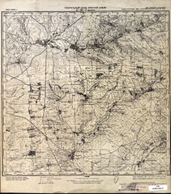
- Description:
- 1902
- Subject:
- Geographic Subject: Dyakove, Topical Subject: Maps, Topical Subject: Soviet Union, and Geographic Subject: Luhansk
- Publisher:
- Генеральный штаб Красной Армии
- Language:
- Russian
- Date Created:
- 1941
- Identifier:
- VAC9619-001993
- Genre:
- Topographic Maps and Military Maps
- Geographic Location:
- Coordinates: 47.6667, 39, 48, 39.5
- Related URL:
- Catalog URL: https://iucat.iu.edu/catalog/5020129 and Download GeoTIFF: https://drive.google.com/open?id=1sq_QopHU0Yotfn_WLpGDPw_5Td4Y2ko5
- Abstract:
- Modern area represented: Dyakove, Luhansk, Ukraine
- Call Number:
- G7000 s100 .S7 sheet L-37-7
- Caption:
- Для служебного пользования
- City:
- Дьяково (Diakovo)
- Copyright Holder:
- No Copyright - United States
- Country:
- СССР (USSR)
- State/Province:
- Украинская ССР (Ukrainian Soviet Socialist Republic), Ростовская область (Rostov oblast), РСФСР (RSFSR), and Ворошиловградская область (Voroshilovgrad oblast)
- Physical Description:
- Scale: 1:100,000
- Persistent URL:
- http://purl.dlib.indiana.edu/iudl/images/VAC9619/VAC9619-001993
- Provenance:
- CIA Map Library
-
- Description:
- 1939
- Subject:
- Geographic Subject: Rostov, Geographic Subject: Kuybyshevo, Topical Subject: Soviet Union, and Topical Subject: Maps
- Publisher:
- Генеральный штаб Красной Армии
- Language:
- Russian
- Date Created:
- 1941
- Identifier:
- VAC9619-001992
- Genre:
- Topographic Maps and Military Maps
- Geographic Location:
- Coordinates: 47.6667, 38.5, 48, 39
- Related URL:
- Catalog URL: https://iucat.iu.edu/catalog/5020129 and Download GeoTIFF: https://drive.google.com/open?id=1BEDbT8LJBcGKTIxNNAWxHLz71wfCVjwA
- Abstract:
- Modern area represented: Куйбышево (Kuybyshevo), Rostov, Russia
- Call Number:
- G7000 s100 .S7 sheet L-37-6
- Caption:
- Для cлужебного пользования
- City:
- Куйбышево (Kuĭbyshevo)
- Copyright Holder:
- No Copyright - United States
- Country:
- СССР (USSR)
- State/Province:
- Ворошиловградская область (Voroshilovgrad oblast) and Украинская ССР (Ukrainian Soviet Socialist Republic)
- Physical Description:
- Scale: 1:100,000
- Persistent URL:
- http://purl.dlib.indiana.edu/iudl/images/VAC9619/VAC9619-001992
- Provenance:
- DMA Topographic Center
-
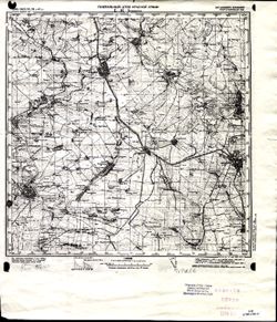
- Description:
- 1895
- Subject:
- Geographic Subject: Ilovays'k, Topical Subject: Soviet Union, and Topical Subject: Maps
- Publisher:
- Генеральный штаб Красной Армии
- Language:
- Russian
- Date Created:
- 1941
- Identifier:
- VAC9619-001991
- Genre:
- Military Maps and Topographic Maps
- Geographic Location:
- Coordinates: 47.6667, 38, 48, 38.5
- Related URL:
- Download GeoTIFF: https://drive.google.com/open?id=1kH7oS86WKdYFUSnKJLcOrEqzxFAZpxdS and Catalog URL: https://iucat.iu.edu/catalog/5020129
- Abstract:
- Modern area represented: Иловайск (Ilovays'k), Ukraine
- Call Number:
- G7000 s100 .S7 sheet L-37-5
- Caption:
- Для cлужебного пользования
- City:
- Иловайск (Ilovaĭsk)
- Copyright Holder:
- No Copyright - United States
- Country:
- СССР (USSR)
- State/Province:
- Украинская ССР (Ukrainian Soviet Socialist Republic) and Сталинская область (Stalino oblast)
- Physical Description:
- Scale: 1:100,000
- Persistent URL:
- http://purl.dlib.indiana.edu/iudl/images/VAC9619/VAC9619-001991
- Provenance:
- CIA Map Library
