
Search Constraints
You searched for:
Creator
U.S. Lake Survey
Remove constraint Creator: U.S. Lake Survey
Holding Location
B-WELLS
Remove constraint Holding Location: B-WELLS
Publisher
Geological Survey (U.S.)
Remove constraint Publisher: Geological Survey (U.S.)
« Previous |
1 - 10 of 14
|
Next »
Search Results
-
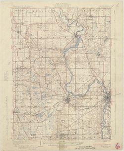
![Indiana (Lake County) Tolleston quadrangle [1951 reprint]](https://iiif.uits.iu.edu/iiif/2/5138kj62w%2Ffiles%2F25f007f8-26fd-4190-ae92-f540b90ff448/full/250,/0/default.jpg)
- Subject:
- Geographic Subject: Lake County (Ind.)
- Creator:
- Geological Survey (U.S.), McKinney, R. C. (Robert C.), Renshawe, John H., and U.S. Lake Survey
- Publisher:
- Geological Survey (U.S.)
- Date Created:
- 1951
- Identifier:
- VAC3073-M-01401
- Genre:
- Topographic maps, Quadrangle maps, and 15 minute topographic maps
- Geographic Location:
- Coordinates: W0873000 W0871500 N0414500 N0413000
- Related URL:
- Catalog URL: https://iucat.iu.edu/catalog/18406229
- Abstract:
- United States, Department of the Interior, Geological Survey , Jno. H. Renshawe, geographer in charge , control by U.S. Lake Survey , topography by R. C. McK...
- Call Number:
- G4090 s62 .G4 Toleston 1900 rep1951
- Caption:
- Imprint: Washington, D. C. : United States, Department of the Interior, Geological Survey, 1951
- Physical Description:
- Scale: 1:62,500 and Dimensions: 45 x 42 cm or smaller
- Alternate Identifier:
- Title Control Number: a18406229
- Persistent URL:
- https://purl.dlib.indiana.edu/iudl/images/VAC3073/VAC3073-M-01401
- Provenance:
- Part of Geological Survey (U.S.). Indiana 1:62,500.
-
![Indiana (Lake County) Tolleston quadrangle [1939 reprint]](https://iiif.uits.iu.edu/iiif/2/6108wd719%2Ffiles%2F57b5a9e6-6bbb-4ee3-8635-de3edfe763d1/full/250,/0/default.jpg)
- Subject:
- Geographic Subject: Lake County (Ind.)
- Creator:
- U.S. Lake Survey, McKinney, R. C. (Robert C.), Geological Survey (U.S.), and Renshawe, John H.
- Publisher:
- Geological Survey (U.S.)
- Date Created:
- 1939
- Identifier:
- VAC3073-M-01400
- Genre:
- Topographic maps, 15 minute topographic maps, and Quadrangle maps
- Geographic Location:
- Coordinates: W0873000 W0871500 N0414500 N0413000
- Related URL:
- Catalog URL: https://iucat.iu.edu/catalog/18406229
- Abstract:
- United States, Department of the Interior, Geological Survey , Jno. H. Renshawe, geographer in charge , control by U.S. Lake Survey , topography by R. C. McK...
- Call Number:
- G4090 s62 .G4 Toleston 1900 rep1939
- Caption:
- Imprint: Washington, D. C. : United States, Department of the Interior, Geological Survey, 1939
- Physical Description:
- Scale: 1:62,500 and Dimensions: 45 x 42 cm or smaller
- Alternate Identifier:
- Title Control Number: a18406229
- Persistent URL:
- https://purl.dlib.indiana.edu/iudl/images/VAC3073/VAC3073-M-01400
- Provenance:
- Part of Geological Survey (U.S.). Indiana 1:62,500.
-
![Indiana (Lake County) Toleston quadrangle [sic] [1916 reprint]](https://iiif.uits.iu.edu/iiif/2/jq086p521%2Ffiles%2Ffca34003-c067-4ace-a355-1b209c1a014f/full/250,/0/default.jpg)
- Subject:
- Geographic Subject: Lake County (Ind.)
- Creator:
- U.S. Lake Survey, Geological Survey (U.S.), Renshawe, John H., and McKinney, R. C. (Robert C.)
- Publisher:
- Geological Survey (U.S.)
- Date Created:
- 1916
- Identifier:
- VAC3073-M-01398
- Genre:
- Topographic maps, 15 minute topographic maps, and Quadrangle maps
- Geographic Location:
- Coordinates: W0873000 W0871500 N0414500 N0413000
- Related URL:
- Catalog URL: https://iucat.iu.edu/catalog/18406229
- Abstract:
- United States, Department of the Interior, Geological Survey , Jno. H. Renshawe, geographer in charge , control by U.S. Lake Survey , topography by R. C. McK...
- Call Number:
- G4090 s62 .G4 Toleston 1900 rep1916
- Caption:
- Imprint: Washington, D. C. : United States, Department of the Interior, Geological Survey, 1916.
- Physical Description:
- Dimensions: 45 x 42 cm and Scale: 1:62,500
- Alternate Identifier:
- Title Control Number: a18406229
- Persistent URL:
- https://purl.dlib.indiana.edu/iudl/images/VAC3073/VAC3073-M-01398
- Provenance:
- Part of Geological Survey (U.S.). Indiana 1:62,500.
-
![Indiana (Lake County) Toleston quadrangle [sic] [1925 reprint]](https://iiif.uits.iu.edu/iiif/2/zp38xh78d%2Ffiles%2F8ba2e12d-7f0d-46a9-9d81-b4cd2e27d2f2/full/250,/0/default.jpg)
- Subject:
- Geographic Subject: Lake County (Ind.)
- Creator:
- Geological Survey (U.S.), U.S. Lake Survey, Renshawe, John H., and McKinney, R. C. (Robert C.)
- Publisher:
- Geological Survey (U.S.)
- Date Created:
- 1925
- Identifier:
- VAC3073-M-01399
- Genre:
- Quadrangle maps, 15 minute topographic maps, and Topographic maps
- Geographic Location:
- Coordinates: W0873000 W0871500 N0414500 N0413000
- Related URL:
- Catalog URL: https://iucat.iu.edu/catalog/18406229
- Abstract:
- United States, Department of the Interior, Geological Survey , Jno. H. Renshawe, geographer in charge , control by U.S. Lake Survey , topography by R. C. McK...
- Call Number:
- G4090 s62 .G4 Toleston 1900 rep1925
- Caption:
- Imprint: Washington, D. C. : United States, Department of the Interior, Geological Survey, 1925
- Physical Description:
- Scale: 1:62,500 and Dimensions: 45 x 42 cm or smaller
- Alternate Identifier:
- Title Control Number: a18406229
- Persistent URL:
- https://purl.dlib.indiana.edu/iudl/images/VAC3073/VAC3073-M-01399
- Provenance:
- Part of Geological Survey (U.S.). Indiana 1:62,500.
-
![Indiana (Lake County) Toleston quadrangle [sic] [1909 reprint]](https://iiif.uits.iu.edu/iiif/2/kw52kc32n%2Ffiles%2F6730048e-8506-41de-a049-ea31d562429b/full/250,/0/default.jpg)
- Subject:
- Geographic Subject: Lake County (Ind.)
- Creator:
- McKinney, R. C. (Robert C.), Geological Survey (U.S.), Renshawe, John H., and U.S. Lake Survey
- Publisher:
- Geological Survey (U.S.)
- Date Created:
- 1909
- Identifier:
- VAC3073-M-01397
- Genre:
- Quadrangle maps, Topographic maps, and 15 minute topographic maps
- Geographic Location:
- Coordinates: W0873000 W0871500 N0414500 N0413000
- Related URL:
- Catalog URL: https://iucat.iu.edu/catalog/a18406229
- Abstract:
- United States, Department of the Interior, Geological Survey , Jno. H. Renshawe, geographer in charge , control by U.S. Lake Survey , topography by R. C. McK...
- Call Number:
- G4090 s62 .G4 Toleston 1900 rep1909
- Caption:
- Imprint: Washington, D. C. : United States, Department of the Interior, Geological Survey, 1909
- Physical Description:
- Dimensions: 45 x 42 cm or smaller and Scale: 1:62,500
- Alternate Identifier:
- Title Control Number: a18406229
- Persistent URL:
- https://purl.dlib.indiana.edu/iudl/images/VAC3073/VAC3073-M-01397
- Provenance:
- Part of Geological Survey (U.S.). Indiana 1:62,500.
-
![Michigan-Indiana Three Rivers quadrangle [1932 reprint]](https://iiif.uits.iu.edu/iiif/2/qb98nk04b%2Ffiles%2F296eac80-9a56-4522-add9-e4bc7783d601/full/250,/0/default.jpg)
- Subject:
- Geographic Subject: LaGrange County (Ind.), Geographic Subject: Saint Joseph County (Mich.), and Geographic Subject: Elkhart County (Ind.)
- Creator:
- Lee, L. L. (Luria Lyons), 1882-1962, Burney, H. E., U.S. Lake Survey, Herron, W. H. (William Harrison), 1865-, Geological Survey (U.S.), Marshall, R. B. (Rob...
- Publisher:
- Geological Survey (U.S.)
- Date Created:
- 1932
- Identifier:
- VAC3073-M-01396
- Genre:
- 15 minute topographic maps, Topographic maps, and Quadrangle maps
- Geographic Location:
- Coordinates: W0854500 W0853000 N0420000 N0414500
- Related URL:
- Catalog URL: https://iucat.iu.edu/catalog/18416001
- Abstract:
- R.B. Marshall, chief geographer , W.H. Herron, geographer in charge , topography by L.L. Lee and H.E. Burney , control by U.S. Lake Survey, J.R. Ellis, J.H. ...
- Call Number:
- G4090 s62 .G4 Three Rivers 1916 rep1932
- Caption:
- Imprint: Washington, D.C. : Dept. of the Interior, U.S. Geological Survey, 1932
- Physical Description:
- Scale: 1:62,500 and Dimensions: 45 x 42 cm or smaller
- Alternate Identifier:
- Title Control Number: a18416001
- Persistent URL:
- https://purl.dlib.indiana.edu/iudl/images/VAC3073/VAC3073-M-01396
- Provenance:
- Part of Geological Survey (U.S.). Indiana 1:62,500.
-
- Subject:
- Geographic Subject: Berrien County (Mich.) and Geographic Subject: Saint Joseph County (Ind.)
- Creator:
- Gehres, W. S. (Wilmer Sherman), 1887-1963, Geological Survey (U.S.), Plushnick, A. W. (Andrew Winfield), 1898-1980, U.S. Lake Survey, Michigan. Geological Su...
- Publisher:
- Geological Survey (U.S.)
- Date Created:
- 1930
- Identifier:
- VAC3073-M-01363
- Genre:
- 15 minute topographic maps, Quadrangle maps, and Topographic maps
- Geographic Location:
- Coordinates: W0863000 W0861500 N0420000 N0414500
- Related URL:
- Catalog URL: https://iucat.iu.edu/catalog/18413855
- Abstract:
- Topography by W.S. Gehres and A.W. Plushnick. Filing title: Niles, Mich.-Ind. Edition of 1930. Polyconic projection. Relief shown by contours and spot height...
- Call Number:
- G4090 s62 .G4 Niles 1930
- Caption:
- Imprint: Washington, D.C. : Dept. of the Interior, U.S. Geological Survey, 1930
- Physical Description:
- Dimensions: 45 x 42 cm or smaller and Scale: 1:62,500
- Alternate Identifier:
- Title Control Number: a18413855
- Persistent URL:
- https://purl.dlib.indiana.edu/iudl/images/VAC3073/VAC3073-M-01363
- Provenance:
- Part of Geological Survey (U.S.). Indiana 1:62,500.
-
- Subject:
- Geographic Subject: Lake County (Ind.), Geographic Subject: Newton County (Ind.), Geographic Subject: Kanakee County (Ill.), and Geographic Subject: Iroquois...
- Creator:
- Geological Survey (U.S.), U.S. Lake Survey, Illinois State Geological Survey, Jennings, J. H. (James H.), 1864-1927, and Illinois. Department of Registration...
- Publisher:
- Geological Survey (U.S.)
- Date Created:
- 1924
- Identifier:
- VAC3073-M-01350
- Genre:
- Quadrangle maps, Topographic maps, and 15 minute topographic maps
- Geographic Location:
- Coordinates: W0874500 W0873000 N0411500 N0410000
- Related URL:
- Catalog URL: https://iucat.iu.edu/catalog/18408408
- Abstract:
- Filing title: Momence, Ill.-Ind. Polyconic projection. Relief shown by contours and spot heights. Shows Kankakee County, Illinois, as well as small portions ...
- Call Number:
- G4090 s62 .G4 Momence 1924
- Caption:
- Imprint: [Urbana, Ill.] : Geological Survey Division, 1924 and Imprint: [Washington, D.C.] : U.S. Geological Survey
- Physical Description:
- Dimensions: 45 x 42 cm or smaller and Scale: 1:62,500
- Alternate Identifier:
- Title Control Number: a18408408
- Persistent URL:
- https://purl.dlib.indiana.edu/iudl/images/VAC3073/VAC3073-M-01350
- Provenance:
- Part of Geological Survey (U.S.). Indiana 1:62,500.
-
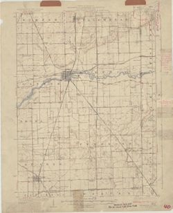
![Indiana (Lake County) Tolleston quadrangle [1951 reprint]](https://iiif.uits.iu.edu/iiif/2/3j334583d%2Ffiles%2Fa1776d9f-5e19-43ed-bce5-a48d4bae75b1/full/250,/0/default.jpg)
- Subject:
- Geographic Subject: Lake County (Ind.)
- Creator:
- McKinney, R. C. (Robert C.), Renshawe, John H., Geological Survey (U.S.), and U.S. Lake Survey
- Publisher:
- Geological Survey (U.S.)
- Date Created:
- 1951
- Identifier:
- VAC3073-M-01333
- Genre:
- Quadrangle maps, 15 minute topographic maps, and Topographic maps
- Geographic Location:
- Coordinates: W0873000 W0871500 N0414500 N0413000
- Related URL:
- Catalog URL: https://iucat.iu.edu/catalog/18406229
- Abstract:
- United States, Department of the Interior, Geological Survey , Jno. H. Renshawe, geographer in charge , control by U.S. Lake Survey , topography by R. C. McK...
- Call Number:
- G4090 s62 .G4 Toleston 1900 rep 1951
- Caption:
- Imprint: Washington, D. C. : United States, Department of the Interior, Geological Survey, 1951
- Physical Description:
- Scale: 1:62,500 and Dimensions: 45 x 42 cm or smaller
- Alternate Identifier:
- Title Control Number: a18406229
- Persistent URL:
- https://purl.dlib.indiana.edu/iudl/images/VAC3073/VAC3073-M-01333
- Provenance:
- Part of Geological Survey (U.S.). Indiana 1:62,500.
-
![Indiana (Lake County) Tolleston quadrangle [1939 reprint]](https://iiif.uits.iu.edu/iiif/2/cf95kf17p%2Ffiles%2F6cfc5093-ccb9-443c-8bd5-426984875407/full/250,/0/default.jpg)
- Subject:
- Geographic Subject: Lake County (Ind.)
- Creator:
- Renshawe, John H., McKinney, R. C. (Robert C.), U.S. Lake Survey, and Geological Survey (U.S.)
- Publisher:
- Geological Survey (U.S.)
- Date Created:
- 1939
- Identifier:
- VAC3073-M-01332
- Genre:
- 15 minute topographic maps, Quadrangle maps, and Topographic maps
- Geographic Location:
- Coordinates: W0873000 W0871500 N0414500 N0413000
- Related URL:
- Catalog URL: https://iucat.iu.edu/catalog/18406229
- Abstract:
- United States, Department of the Interior, Geological Survey , Jno. H. Renshawe, geographer in charge , control by U.S. Lake Survey , topography by R. C. McK...
- Call Number:
- G4090 s62 .G4 Toleston 1900 rep 1939
- Caption:
- Imprint: Washington, D. C. : United States, Department of the Interior, Geological Survey, 1939
- Physical Description:
- Dimensions: 45 x 42 cm or smaller and Scale: 1:62,500
- Alternate Identifier:
- Title Control Number: a18406229
- Persistent URL:
- https://purl.dlib.indiana.edu/iudl/images/VAC3073/VAC3073-M-01332
- Provenance:
- Part of Geological Survey (U.S.). Indiana 1:62,500.
