
Search Constraints
You searched for:
Provenance
DMA Topographic Center, Army Map Service Library, OMAHA, Library of Congress Geography & Map Division
Remove constraint Provenance: DMA Topographic Center, Army Map Service Library, OMAHA, Library of Congress Geography & Map Division
Search Results
-

- Description:
- 1938
- Subject:
- Geographic Subject: Ramen'ye, Topical Subject: Soviet Union, and Topical Subject: Maps
- Publisher:
- Главное управление геодезии и картографии при СНК СССР
- Language:
- Russian
- Date Created:
- 1941
- Identifier:
- VAC9619-003473
- Genre:
- Topographic Maps and Military Maps
- Geographic Location:
- Coordinates: 56.333, 34, 56.5, 34.25
- Related URL:
- Download GeoTIFF: https://drive.google.com/file/d/1qh-E-lgJptpwG6nUxUBiR_gBwnFCrbrW/view?usp=sharing and Catalog URL: http://iucat.iu.edu/catalog/5020131
- Abstract:
- Modern area represented: Раменье (Ramen'ye), Tverskaya oblast, Russia
- Call Number:
- G7000 s50 .S68 sheet O-36-129-C
- City:
- Раменье (Ramen'ye)
- Copyright Holder:
- No Copyright - United States
- Country:
- СССР (USSR)
- State/Province:
- Луковниковский район (Lukovnikovsky district), Калининская область (Kalinin oblast), Молодотудский район (Molodotudsky district), and Ржевский район (Rzhevsk...
- Physical Description:
- Scale: 1:50,000
- Persistent URL:
- http://purl.dlib.indiana.edu/iudl/images/VAC9619/VAC9619-003473
- Provenance:
- DMA Topographic Center, Army Map Service Library, OMAHA, Library of Congress Geography & Map Division
-
- Description:
- 1939
- Subject:
- Topical Subject: Soviet Union, Geographic Subject: Vysokoye, and Topical Subject: Maps
- Publisher:
- Главное управление геодезии и картографии при СНК СССР
- Language:
- Russian
- Date Created:
- 1941
- Identifier:
- VAC9619-003470
- Genre:
- Topographic Maps and Military Maps
- Geographic Location:
- Coordinates: 56.333, 32.75, 56.5, 33
- Related URL:
- Download GeoTIFF: https://drive.google.com/file/d/12E5i-f2khtKqePPSxPnAOJT4oAAmYPRD/view?usp=sharing and Catalog URL: http://iucat.iu.edu/catalog/5020131
- Abstract:
- Modern area represented: Высокое (Vysokoye), Tverskaya oblast, Russia
- Call Number:
- G7000 s50 .S68 sheet O-36-126-D
- City:
- Высокое (Vysokoye)
- Copyright Holder:
- No Copyright - United States
- Country:
- СССР (USSR)
- State/Province:
- Нелидовский район (Nelidovsky district), Ленинский район (Leninsky district), Молодотудский район (Molodotudsky district), and Калининская область (Kalinin o...
- Physical Description:
- Scale: 1:50,000
- Persistent URL:
- http://purl.dlib.indiana.edu/iudl/images/VAC9619/VAC9619-003470
- Provenance:
- DMA Topographic Center, Army Map Service Library, OMAHA, Library of Congress Geography & Map Division
-
- Description:
- 1938
- Subject:
- Topical Subject: Soviet Union, Geographic Subject: Tysyatskoye, and Topical Subject: Maps
- Publisher:
- Главное управление геодезии и картографии при СНК СССР
- Language:
- Russian
- Date Created:
- 1941
- Identifier:
- VAC9619-002848
- Genre:
- Topographic Maps and Military Maps
- Geographic Location:
- Coordinates: 57, 34.25, 57.167, 34.5
- Related URL:
- Download GeoTIFF: https://drive.google.com/file/d/18o3IQmUtRccKjPuKL9e4V3ItSU5attPq/view?usp=sharing and Catalog URL: http://iucat.iu.edu/catalog/5020131
- Abstract:
- Modern area represented: Тысяцкое (Tysyatskoye), Тверская область (Tverskaya oblast), Russia
- Call Number:
- GM G7000 s50 .S68 sheet O-36-105-D
- Caption:
- Для служебного пользования and Captured map
- City:
- Тысяцкое (Tysyatskoye)
- Copyright Holder:
- No Copyright - United States
- Country:
- СССР (USSR)
- State/Province:
- Есеновичский район (Yesenovichsky district), Каменский район (Kamensky district), Новоторжский район (Novotorzhsky district), and Калининская область (Kalini...
- Physical Description:
- Scale: 1:50,000
- Persistent URL:
- http://purl.dlib.indiana.edu/iudl/images/VAC9619/VAC9619-002848
- Provenance:
- DMA Topographic Center, Army Map Service Library, OMAHA, Library of Congress Geography & Map Division
-
- Description:
- 1881
- Subject:
- Topical Subject: Soviet Union, Topical Subject: Maps, and Geographic Subject: Czeremcha
- Publisher:
- Генеральный штаб Красной Армии
- Language:
- Russian
- Date Created:
- 1940
- Identifier:
- VAC9619-003993
- Genre:
- Military Maps and Topographic Maps
- Geographic Location:
- Coordinates: 52.333, 23, 52.667, 23.5
- Related URL:
- Download GeoTIFF: https://drive.google.com/file/d/1kPiXT7F_LZnyau0SUjehrYKXx17IX5X1/view?usp=sharing and Catalog URL: https://iucat.iu.edu/catalog/5020129
- Abstract:
- Modern area represented: Czeremcha, Podlaskie Voivodeship, Poland
- Call Number:
- G7000 s100 .S7 sheet N-34-131
- City:
- Черемха (Czeremcha)
- Copyright Holder:
- No Copyright - United States
- Country:
- СССР (USSR)
- State/Province:
- Область государственных интересов Германии (Region of German state interests), Белостокская область (Belastok oblast), Белорусская ССР (Byelorussian Soviet S...
- Physical Description:
- Scale: 1:100,000
- Persistent URL:
- http://purl.dlib.indiana.edu/iudl/images/VAC9619/VAC9619-003993
- Provenance:
- DMA Topographic Center, Army Map Service Library, OMAHA, Library of Congress Geography & Map Division
-
- Description:
- 1933
- Subject:
- Geographic Subject: Kosmynino, Topical Subject: Maps, and Topical Subject: Soviet Union
- Publisher:
- Центральное аэросъемочное производственное предприятие треста Аэрогеодезия
- Language:
- Russian
- Identifier:
- VAC9619-003520
- Genre:
- Military Maps and Topographic Maps
- Geographic Location:
- Coordinates: 57.5, 40.75, 57.667, 41
- Related URL:
- Download GeoTIFF: https://drive.google.com/file/d/1qR6BDVlq8CUzsCxPfiRsezxc0gx4jbsN/view?usp=sharing and Catalog URL: http://iucat.iu.edu/catalog/5020131
- Abstract:
- Modern area represented: Kosmynino, Kostroma oblast, Russia
- Call Number:
- GM G7000 s50 .S68 sheet O-37-94-B
- Caption:
- Не подлежит оглашению
- City:
- Косминино (Kosminino)
- Copyright Holder:
- No Copyright - United States
- Country:
- СССР (USSR)
- State/Province:
- Ивановская промышленная область (Ivanovo industrial oblast)
- Physical Description:
- Scale: 1:50,000
- Persistent URL:
- http://purl.dlib.indiana.edu/iudl/images/VAC9619/VAC9619-003520
- Provenance:
- DMA Topographic Center, Army Map Service Library, OMAHA, Library of Congress Geography & Map Division
-
- Subject:
- Geographic Subject: Opishnya, Topical Subject: Soviet Union, and Topical Subject: Maps
- Publisher:
- Генеральный штаб Красной Армии
- Language:
- Russian
- Identifier:
- VAC9619-001006
- Genre:
- Military Maps and Topographic Maps
- Geographic Location:
- Coordinates: 49.8333, 34.5, 50, 34.75
- Related URL:
- Catalog URL: http://iucat.iu.edu/catalog/5020131 and Download GeoTIFF: https://drive.google.com/open?id=1TZX2zU5zVWb5iJSas_9GbtDl2wdkWJR3
- Abstract:
- Modern area represented: Опішня (Opishnya), Poltava oblast, Ukraine
- Call Number:
- G7000 s50 .S68 sheet M-36-82-A
- Caption:
- Для служебного пользования
- City:
- Опошня (Oposhnya)
- Copyright Holder:
- No Copyright - United States
- Country:
- СССР (USSR)
- State/Province:
- Украинская ССР (Ukrainian Soviet Socialist Republic) and Полтавская область (Poltava oblast)
- Physical Description:
- Scale: 1:50,000
- Persistent URL:
- http://purl.dlib.indiana.edu/iudl/images/VAC9619/VAC9619-001006
- Provenance:
- DMA Topographic Center, Army Map Service Library, OMAHA, Library of Congress Geography & Map Division
-
- Description:
- 1937
- Subject:
- Topical Subject: Soviet Union, Topical Subject: Maps, and Geographic Subject: Yegoryevsk
- Publisher:
- Генеральный штаб Красной Армии
- Language:
- Russian
- Identifier:
- VAC9619-003081
- Genre:
- Military Maps and Topographic Maps
- Geographic Location:
- Coordinates: 55.333, 39, 55.667, 39.5
- Related URL:
- Download GeoTIFF: https://drive.google.com/file/d/1gSGOXwOwahHPWMXiuXF5ndk1eRHwg7mL/view?usp=sharing and Catalog URL: https://iucat.iu.edu/catalog/5020129
- Abstract:
- Modern area represented: Yegoryevsk, Moscow oblast, Russia
- Call Number:
- G7000 s100 .S7 sheet N-37-19
- Caption:
- Для служебного пользования
- City:
- Егорьевск (Yegoryevsk)
- Copyright Holder:
- No Copyright - United States
- Country:
- СССР (USSR)
- State/Province:
- РСФСР (RSFSR) and Московская область (Moscow oblast)
- Physical Description:
- Scale: 1:100,000
- Persistent URL:
- http://purl.dlib.indiana.edu/iudl/images/VAC9619/VAC9619-003081
- Provenance:
- DMA Topographic Center, Army Map Service Library, OMAHA, Library of Congress Geography & Map Division
-
- Description:
- 1931
- Subject:
- Topical Subject: Soviet Union, Geographic Subject: Romny, and Topical Subject: Maps
- Publisher:
- Генеральный штаб Красной Армии
- Language:
- Russian
- Date Created:
- 1941
- Identifier:
- VAC9619-003285
- Genre:
- Military Maps and Topographic Maps
- Geographic Location:
- Coordinates: 50.667, 33, 51, 33.5
- Related URL:
- Download GeoTIFF: https://drive.google.com/file/d/1FW6CWXi29eADIbfLr_jJTfo851suSqQs/view?usp=sharing and Catalog URL: https://iucat.iu.edu/catalog/5020129
- Abstract:
- Modern area represented: Romny, Sumy oblast, Ukraine
- Call Number:
- G7000 s100 .S7 sheet M-36-43
- City:
- Ромны (Romny)
- Copyright Holder:
- No Copyright - United States
- Country:
- СССР (USSR)
- State/Province:
- Черниговская область (Chernihiv oblast), Сумская область (Sumy oblast), and Украинская ССР (Ukrainian Soviet Socialist Republic)
- Physical Description:
- Scale: 1:100,000
- Persistent URL:
- http://purl.dlib.indiana.edu/iudl/images/VAC9619/VAC9619-003285
- Provenance:
- DMA Topographic Center, Army Map Service Library, OMAHA, Library of Congress Geography & Map Division
-
- Description:
- 1940
- Subject:
- Topical Subject: Maps, Geographic Subject: Khomutovo, and Topical Subject: Soviet Union
- Publisher:
- Главное Управление Геодезии и Картографии при СНК СССР
- Language:
- Russian
- Date Created:
- 1941
- Identifier:
- VAC9619-001628
- Genre:
- Military Maps and Topographic Maps
- Geographic Location:
- Coordinates: 52.833, 37.25, 53, 37.5
- Related URL:
- Download GeoTIFF: https://drive.google.com/open?id=1SIcg4a5irHJ_MFTIR7u4EicOX4Ws3Awe and Catalog URL: http://iucat.iu.edu/catalog/5020131
- Abstract:
- Modern area represented: Khomutovo, Oryol oblast, Russia
- Call Number:
- G7000 s50 .S68 sheet N-37-111-B
- Caption:
- Для служебного пользования
- City:
- Хомутово (Khomutovo)
- Copyright Holder:
- No Copyright - United States
- Country:
- СССР (USSR)
- State/Province:
- Орловская область (Oryol oblast) and РСФСР (RSFSR)
- Physical Description:
- Scale: 1:50,000
- Persistent URL:
- http://purl.dlib.indiana.edu/iudl/images/VAC9619/VAC9619-001628
- Provenance:
- DMA Topographic Center, Army Map Service Library, OMAHA, Library of Congress Geography & Map Division
-
- Subject:
- Topical Subject: Soviet Union, Topical Subject: Maps, and Geographic Subject: Fedorovskoye
- Publisher:
- Управление военных топографов
- Language:
- Russian
- Date Created:
- 1931
- Identifier:
- VAC9619-000031
- Genre:
- Topographic Maps and Military Maps
- Geographic Location:
- Coordinates: 59.5, 30.5, 59.6667, 30.75
- Related URL:
- Catalog URL: http://iucat.iu.edu/catalog/5020131 and Download GeoTIFF: https://drive.google.com/open?id=1cLSn16Q8KPWQftMST4_HFC_KJUUvTmp-
- Abstract:
- Modern area represented: Fedorovskoye, Leningrad oblast, Russia
- Call Number:
- G7000 s50 .S68 sheet O-36-14-A
- Caption:
- Не подлежит оглашению,Captured map
- City:
- Федоровский (Fedorovskiy)
- Copyright Holder:
- No Copyright - United States
- Country:
- СССР (USSR)
- State/Province:
- РСФСР (RSFSR) and Ленинградская область (Leningrad oblast)
- Physical Description:
- Scale: 1:50,000
- Persistent URL:
- http://purl.dlib.indiana.edu/iudl/images/VAC9619/VAC9619-000031
- Provenance:
- DMA Topographic Center, Army Map Service Library, OMAHA, Library of Congress Geography & Map Division
-
- Description:
- 1932
- Subject:
- Topical Subject: Soviet Union, Topical Subject: Maps, and Geographic Subject: Шаргород (Sharhorod)
- Publisher:
- Управление военных топографов
- Language:
- Russian
- Identifier:
- VAC9619-000881
- Genre:
- Topographic Maps and Military Maps
- Geographic Location:
- Coordinates: 48.6667, 28, 48.8333, 28.25
- Related URL:
- Catalog URL: http://iucat.iu.edu/catalog/5020131 and Download GeoTIFF: https://drive.google.com/open?id=1ygm0JEUYpVVJQessRLJVJKRdG5pstVeX
- Abstract:
- Modern area represented: Шаргород (Sharhorod), Vinnytsia Oblast, Ukraine
- Call Number:
- G7000 s50 .S68 sheet M-35-117-C
- Caption:
- Не подлежит оглашению
- City:
- Шаргород (Shargorod)
- Copyright Holder:
- No Copyright - United States
- Country:
- СССР (USSR)
- State/Province:
- Украинская ССР (Ukrainian Soviet Socialist Republic) and Винницкая область (Vinnytsia oblast)
- Physical Description:
- Scale: 1:50,000
- Persistent URL:
- http://purl.dlib.indiana.edu/iudl/images/VAC9619/VAC9619-000881
- Provenance:
- DMA Topographic Center, Army Map Service Library, OMAHA, Library of Congress Geography & Map Division
-
- Description:
- 1932
- Subject:
- Topical Subject: Soviet Union, Geographic Subject: Івча (Ivcha), and Topical Subject: Maps
- Publisher:
- Управление военных топографов
- Language:
- Russian
- Identifier:
- VAC9619-000874
- Genre:
- Topographic Maps and Military Maps
- Geographic Location:
- Coordinates: 49.3333, 28, 49.5, 28.25
- Related URL:
- Catalog URL: http://iucat.iu.edu/catalog/5020131 and Download GeoTIFF: https://drive.google.com/open?id=1YF-mtb4lGMe_qsgVpnb8P3STt24vWNxJ
- Abstract:
- Modern area represented: Івча (Ivcha), Vinnytsia Oblast, Ukraine
- Call Number:
- G7000 s50 .S68 sheet M-35-93-C
- Caption:
- Не подлежит оглашению
- City:
- Ивча (Ivcha)
- Copyright Holder:
- No Copyright - United States
- Country:
- СССР (USSR)
- State/Province:
- Украинская ССР (Ukrainian Soviet Socialist Republic) and Винницкая область (Vinnytsia oblast)
- Physical Description:
- Scale: 1:50,000
- Persistent URL:
- http://purl.dlib.indiana.edu/iudl/images/VAC9619/VAC9619-000874
- Provenance:
- DMA Topographic Center, Army Map Service Library, OMAHA, Library of Congress Geography & Map Division
-
- Subject:
- Geographic Subject: Orzysz, Topical Subject: Maps, and Topical Subject: Soviet Union
- Publisher:
- Генеральный штаб Красной Армии
- Language:
- Russian
- Date Created:
- 1941
- Identifier:
- VAC9619-000360
- Genre:
- Military Maps and Topographic Maps
- Geographic Location:
- Coordinates: 53.66667, 21.75, 53.83333, 22.0
- Related URL:
- Download GeoTIFF: https://drive.google.com/open?id=1quIH8WkLZVQZYEz_078ctuyofRyy58SG and Catalog URL: http://iucat.iu.edu/catalog/5020131
- Abstract:
- Modern area represented: Orzysz, Poland
- Call Number:
- G7000 s50 .S68 sheet N-34-80-D
- City:
- Арис (Arys)
- Copyright Holder:
- No Copyright - United States
- Country:
- Восточная Пруссия (East Prussia) and Германия (Germany)
- Physical Description:
- Scale: 1:50,000
- Persistent URL:
- http://purl.dlib.indiana.edu/iudl/images/VAC9619/VAC9619-000360
- Provenance:
- DMA Topographic Center, Army Map Service Library, OMAHA, Library of Congress Geography & Map Division
-
- Description:
- 1931
- Subject:
- Geographic Subject: Pyryatyn, Topical Subject: Soviet Union, and Topical Subject: Maps
- Publisher:
- Генеральный штаб Красной Армии
- Language:
- Russian
- Date Created:
- 1941
- Identifier:
- VAC9619-003295
- Genre:
- Military Maps and Topographic Maps
- Geographic Location:
- Coordinates: 50, 32.5, 50.333, 33
- Related URL:
- Catalog URL: https://iucat.iu.edu/catalog/5020129 and Download GeoTIFF: https://drive.google.com/file/d/1HdqPsI9WrCB8MDCw6W1C7HsKViFRcI5T/view?usp=sharing
- Abstract:
- Modern area represented: Pyryatyn, Poltava oblast, Ukraine
- Call Number:
- G7000 s100 .S7 sheet M-36-66
- City:
- Пирятин (Pyryatyn)
- Copyright Holder:
- No Copyright - United States
- Country:
- СССР (USSR)
- State/Province:
- Украинская ССР (Ukrainian Soviet Socialist Republic) and Полтавская область (Poltava oblast)
- Physical Description:
- Scale: 1:100,000
- Persistent URL:
- http://purl.dlib.indiana.edu/iudl/images/VAC9619/VAC9619-003295
- Provenance:
- DMA Topographic Center, Army Map Service Library, OMAHA, Library of Congress Geography & Map Division
-
- Description:
- 1932
- Subject:
- Geographic Subject: Belebelka, Topical Subject: Maps, and Topical Subject: Soviet Union
- Publisher:
- Управление военных топографов
- Language:
- Russian
- Identifier:
- VAC9619-000055
- Genre:
- Topographic Maps and Military Maps
- Geographic Location:
- Coordinates: 57.5, 30.75, 57.6667, 31
- Related URL:
- Catalog URL: http://iucat.iu.edu/catalog/5020131 and Download GeoTIFF: https://drive.google.com/open?id=1C6Cj-kxR2Y0hfswiLv4YWUg4X6cHeUB1
- Abstract:
- Modern area represented: Belebelka, Novgorod oblast, Russia
- Call Number:
- G7000 s50 .S68 sheet O-36-86-B
- Caption:
- Не подлежит оглашению,Captured map
- City:
- Белебелка (Belebelka)
- Copyright Holder:
- No Copyright - United States
- Country:
- СССР (USSR)
- State/Province:
- РСФСР (RSFSR) and Ленинградская область (Leningrad oblast)
- Physical Description:
- Scale: 1:50,000
- Persistent URL:
- http://purl.dlib.indiana.edu/iudl/images/VAC9619/VAC9619-000055
- Provenance:
- DMA Topographic Center, Army Map Service Library, OMAHA, Library of Congress Geography & Map Division
-
- Description:
- 1933
- Subject:
- Geographic Subject: Varlov Les, Topical Subject: Soviet Union, and Topical Subject: Maps
- Language:
- Russian
- Identifier:
- VAC9619-000063
- Genre:
- Topographic Maps and Military Maps
- Geographic Location:
- Coordinates: 61.333, 32.75, 61.5, 33
- Related URL:
- Catalog URL: http://iucat.iu.edu/catalog/5020131 and Download GeoTIFF: https://drive.google.com/open?id=1QiVpRDAsC5m1-nHNEI8rrJsyau1DNJ9-
- Abstract:
- Modern area represented: Varlov Les, Republic of Karelia, Russia
- Call Number:
- G7000 s50 .S68 sheet P-36-90-D
- City:
- Варлов Лес (Varlov Les)
- Copyright Holder:
- No Copyright - United States
- Country:
- СССР (USSR)
- State/Province:
- Карельская АССР (Karelian Autonomous Soviet Socialist Republic)
- Physical Description:
- Scale: 1:50,000
- Persistent URL:
- http://purl.dlib.indiana.edu/iudl/images/VAC9619/VAC9619-000063
- Provenance:
- DMA Topographic Center, Army Map Service Library, OMAHA, Library of Congress Geography & Map Division
-

- Description:
- 1911
- Subject:
- Topical Subject: Soviet Union, Geographic Subject: Чернівці (Chernivtsi), and Topical Subject: Maps
- Publisher:
- Управление военных топографов
- Language:
- Russian
- Identifier:
- VAC9619-000888
- Genre:
- Military Maps and Topographic Maps
- Geographic Location:
- Coordinates: 48.5, 28, 48.6667, 28.25
- Related URL:
- Catalog URL: http://iucat.iu.edu/catalog/5020131 and Download GeoTIFF: https://drive.google.com/open?id=1piLpOaQPkIKx8BrhgN2REZ8XSmZbK6Qn
- Abstract:
- Modern area represented: Чернівці (Chernivtsi), Vinnytsia Oblast, Ukraine
- Call Number:
- G7000 s50 .S68 sheet M-35-129-A
- Caption:
- Captured map and Не подлежит оглашению
- City:
- Черневцы (Chernevtsy)
- Copyright Holder:
- No Copyright - United States
- Country:
- СССР (USSR)
- State/Province:
- Винницкая область (Vinnytsia oblast) and Украинская ССР (Ukrainian Soviet Socialist Republic)
- Physical Description:
- Scale: 1:50,000
- Persistent URL:
- http://purl.dlib.indiana.edu/iudl/images/VAC9619/VAC9619-000888
- Provenance:
- DMA Topographic Center, Army Map Service Library, OMAHA, Library of Congress Geography & Map Division
-
- Description:
- 1938
- Subject:
- Topical Subject: Soviet Union, Topical Subject: Maps, and Geographic Subject: Bol’shoye Ploskoye
- Publisher:
- Главное управление геодезии и картографии при СНК СССР
- Language:
- Russian
- Date Created:
- 1941
- Identifier:
- VAC9619-002850
- Genre:
- Topographic Maps and Military Maps
- Geographic Location:
- Coordinates: 57.167, 35.25, 57.333, 35.5
- Related URL:
- Catalog URL: http://iucat.iu.edu/catalog/5020131 and Download GeoTIFF: https://drive.google.com/file/d/1QbTVGhpTcwzq68sfhurfKNa6ZaCBc5b9/view?usp=sharing
- Abstract:
- Modern area represented: Большое Плоское (Bol’shoye Ploskoye), Тверская область (Tverskaya oblast), Russia
- Call Number:
- GM G7000 s50 .S68 sheet O-36-107-B
- Caption:
- Captured map
- City:
- Большое Плоское (Bol’shoye Ploskoye)
- Copyright Holder:
- No Copyright - United States
- Country:
- СССР (USSR)
- State/Province:
- Новоторжский район (Novotorzhsky district), Лихославльский район (Likhoslavlsky district), and Калининская область (Kalinin oblast)
- Physical Description:
- Scale: 1:50,000
- Persistent URL:
- http://purl.dlib.indiana.edu/iudl/images/VAC9619/VAC9619-002850
- Provenance:
- DMA Topographic Center, Army Map Service Library, OMAHA, Library of Congress Geography & Map Division
-
- Description:
- 1937
- Subject:
- Topical Subject: Maps, Topical Subject: Soviet Union, and Geographic Subject: Proletariy
- Publisher:
- Главное управление государственной съемки и картографии НКВД СССР
- Language:
- Russian
- Identifier:
- VAC9619-003368
- Genre:
- Military Maps and Topographic Maps
- Geographic Location:
- Coordinates: 58.333, 31.5, 58.5, 31.75
- Related URL:
- Catalog URL: http://iucat.iu.edu/catalog/5020131 and Download GeoTIFF: https://drive.google.com/file/d/1HoQwgwLFHAlNPLb-BINjNfKyIBLypAFN/view?usp=sharing
- Abstract:
- Modern area represented: Пролетарий (Proletariy), Novgorodskaya oblast, Russia
- Call Number:
- G7000 s50 .S68 sheet O-36-52-C
- Caption:
- Captured map and Для служебного пользования
- City:
- Проолетарский (Proletarskiy)
- Copyright Holder:
- No Copyright - United States
- Country:
- СССР (USSR)
- State/Province:
- Новгородский район (Novgorod district), Ленинградская область (Leningrad oblast), and РСФСР (RSFSR)
- Physical Description:
- Scale: 1:50,000
- Persistent URL:
- http://purl.dlib.indiana.edu/iudl/images/VAC9619/VAC9619-003368
- Provenance:
- DMA Topographic Center, Army Map Service Library, OMAHA, Library of Congress Geography & Map Division
-
- Description:
- 1936
- Subject:
- Topical Subject: Maps, Geographic Subject: Zakhozha, and Topical Subject: Soviet Union
- Publisher:
- Главное управление государственной съемки и картографии НКВД СССР
- Language:
- Russian
- Identifier:
- VAC9619-003311
- Genre:
- Topographic Maps and Military Maps
- Geographic Location:
- Coordinates: 59.333, 33.25, 59.5, 33.5
- Related URL:
- Download GeoTIFF: https://drive.google.com/file/d/10xKMpdEyacPjuYafvI__E45cLN6-gRh8/view?usp=sharing and Catalog URL: http://iucat.iu.edu/catalog/5020131
- Abstract:
- Modern area represented: Zakhozha, Leningrad oblast, Russia
- Call Number:
- GM G7000 s50 .S68 sheet O-36-19-D
- Caption:
- Для служебного пользования
- Copyright Holder:
- No Copyright - United States
- Country:
- СССР (USSR)
- State/Province:
- Дрегельский район (Dregelsky district), РСФСР (RSFSR), Тихвинский район (Tikhvin district), and Ленинградская область (Leningrad oblast)
- Physical Description:
- Scale: 1:50,000
- Persistent URL:
- http://purl.dlib.indiana.edu/iudl/images/VAC9619/VAC9619-003311
- Provenance:
- DMA Topographic Center, Army Map Service Library, OMAHA, Library of Congress Geography & Map Division
-
- Description:
- 1932
- Subject:
- Geographic Subject: Ovruch, Topical Subject: Soviet Union, and Topical Subject: Maps
- Publisher:
- Генеральный штаб РККА
- Language:
- Russian
- Date Created:
- 1933
- Identifier:
- VAC9619-003112
- Genre:
- Military Maps and Topographic Maps
- Geographic Location:
- Coordinates: 51, 28.5, 51.333, 29
- Related URL:
- Catalog URL: https://iucat.iu.edu/catalog/5020129 and Download GeoTIFF: https://drive.google.com/file/d/1Ux4iL3wR3fHhjgZHVXpIrMLVmUdCl5KE/view?usp=sharing
- Abstract:
- Modern area represented: Ovruch, Ukraine
- Call Number:
- G7000 s100 .S7 sheet M-35-34
- Caption:
- Не подлежит оглашению
- City:
- Овруч (Ovruch)
- Copyright Holder:
- No Copyright - United States
- Country:
- СССР (USSR)
- State/Province:
- Украинская ССР (Ukrainian Soviet Socialist Republic) and Житомирская область (Zhytomyr oblast)
- Physical Description:
- Scale: 1:100,000
- Persistent URL:
- http://purl.dlib.indiana.edu/iudl/images/VAC9619/VAC9619-003112
- Provenance:
- DMA Topographic Center, Army Map Service Library, OMAHA, Library of Congress Geography & Map Division
-
- Description:
- 1934
- Subject:
- Topical Subject: Maps, Topical Subject: Soviet Union, and Geographic Subject: Syamozero
- Language:
- Russian
- Identifier:
- VAC9619-002964
- Genre:
- Military Maps and Topographic Maps
- Geographic Location:
- Coordinates: 61.833, 33.25, 62, 33.5
- Related URL:
- Download GeoTIFF: https://drive.google.com/file/d/11-d7d0GoeADTs2-jz6P_XFx6qncUf4DR/view?usp=sharing and Catalog URL: http://iucat.iu.edu/catalog/5020131
- Abstract:
- Modern area represented: Syamozero, Republic of Karelia, Russia
- Call Number:
- GM G7000 s50 .S68 sheet P-36-79-B
- City:
- Сямозеро (Syamozero)
- Copyright Holder:
- No Copyright - United States
- Country:
- СССР (USSR)
- State/Province:
- Карельская АССР (Karelian Autonomous Soviet Socialist Republic)
- Physical Description:
- Scale: 1:50,000
- Persistent URL:
- http://purl.dlib.indiana.edu/iudl/images/VAC9619/VAC9619-002964
- Provenance:
- DMA Topographic Center, Army Map Service Library, OMAHA, Library of Congress Geography & Map Division
-

- Description:
- 1939
- Subject:
- Topical Subject: Maps, Geographic Subject: Vyshegorod, and Topical Subject: Soviet Union
- Publisher:
- Главное управление геодезии и картографии при СНК СССР
- Language:
- Russian
- Date Created:
- 1941
- Identifier:
- VAC9619-002897
- Genre:
- Military Maps and Topographic Maps
- Geographic Location:
- Coordinates: 56.6667, 33.5, 56.8333, 33.75
- Related URL:
- Catalog URL: http://iucat.iu.edu/catalog/5020131 and Download GeoTIFF: https://drive.google.com/file/d/1Yz4ZBUF-IvzvEjei_et63zhO83cB3S2-/view?usp=sharing
- Abstract:
- Modern area represented: Вышегород (Vyshegorod), Tverskaya oblast, Russia
- Call Number:
- GM G7000 s50 .S68 sheet О-36-116-C
- Caption:
- Для служебного пользования
- City:
- Вышегород (Vyshegorod)
- Copyright Holder:
- No Copyright - United States
- Country:
- СССР (USSR)
- State/Province:
- Калининская область (Kalinin oblast) and Кировский район (Kirov district)
- Physical Description:
- Scale: 1:50,000
- Persistent URL:
- http://purl.dlib.indiana.edu/iudl/images/VAC9619/VAC9619-002897
- Provenance:
- DMA Topographic Center, Army Map Service Library, OMAHA, Library of Congress Geography & Map Division
-
- Description:
- 1936
- Subject:
- Topical Subject: Soviet Union, Topical Subject: Maps, and Geographic Subject: Khilino
- Publisher:
- Главное управление государственной съемки и картографии НКВД СССР
- Language:
- Russian
- Identifier:
- VAC9619-003333
- Genre:
- Military Maps and Topographic Maps
- Geographic Location:
- Coordinates: 59, 33, 59.167, 33.25
- Related URL:
- Download GeoTIFF: https://drive.google.com/file/d/1XQaTiCC0CG_eNUL1VAEp_ndEYAPm0eXP/view?usp=sharing and Catalog URL: http://iucat.iu.edu/catalog/5020131
- Abstract:
- Modern area represented: Хилино (Khilino), Novgorodskaya oblast, Russia
- Call Number:
- G7000 s50 .S68 sheet O-36-31-C
- Caption:
- Для служебного пользования
- City:
- Хилино (Khilino)
- Copyright Holder:
- No Copyright - United States
- Country:
- СССР (USSR)
- State/Province:
- Ленинградская область (Leningrad oblast), РСФСР (RSFSR), Дрегельский район (Dregelsky district), and Любытинский район (Lyubytinsky district)
- Physical Description:
- Scale: 1:50,000
- Persistent URL:
- http://purl.dlib.indiana.edu/iudl/images/VAC9619/VAC9619-003333
- Provenance:
- DMA Topographic Center, Army Map Service Library, OMAHA, Library of Congress Geography & Map Division
-
- Description:
- 1936
- Subject:
- Topical Subject: Maps, Topical Subject: Soviet Union, and Geographic Subject: Alytus
- Publisher:
- Генеральный штаб Красной Армии
- Language:
- Russian
- Date Created:
- 1940
- Identifier:
- VAC9619-004051
- Genre:
- Military Maps and Topographic Maps
- Geographic Location:
- Coordinates: 54.333, 24, 54.667, 24.5
- Related URL:
- Catalog URL: https://iucat.iu.edu/catalog/5020129 and Download GeoTIFF: https://drive.google.com/file/d/1SK5CcJX29MGKemDK61RBn0cUadvQKRN3/view?usp=sharing
- Abstract:
- Modern area represented: Alytus, Lithuania
- Call Number:
- G7000 s100 .S7 sheet N-35-49
- Caption:
- Не подлежит оглашению
- City:
- Алитус (Alytus)
- Copyright Holder:
- No Copyright - United States
- Country:
- СССР (USSR)
- State/Province:
- Литовская ССР (Lithuanian Soviet Socialist Republic)
- Physical Description:
- Scale: 1:100,000
- Persistent URL:
- http://purl.dlib.indiana.edu/iudl/images/VAC9619/VAC9619-004051
- Provenance:
- DMA Topographic Center, Army Map Service Library, OMAHA, Library of Congress Geography & Map Division
-
- Description:
- 1934
- Subject:
- Geographic Subject: Chaplinka, Topical Subject: Soviet Union, and Topical Subject: Maps
- Publisher:
- Генеральный штаб Красной Армии
- Language:
- Russian
- Date Created:
- 1942
- Identifier:
- VAC9619-001108
- Genre:
- Military Maps and Topographic Maps
- Geographic Location:
- Coordinates: 48.6667, 34.75, 48.8667, 35
- Related URL:
- Catalog URL: http://iucat.iu.edu/catalog/5020131 and Download GeoTIFF: https://drive.google.com/open?id=1IHM7B8nMtnqFFdL6WepZBUnK2XFMJiwv
- Abstract:
- Modern area represented: Chaplinka, Dnipropetrovsk oblast, Ukraine
- Call Number:
- G7000 s50 .S68 М-36-118-Г
- Caption:
- Для служебного пользования
- City:
- Чаплинка (Chaplinka)
- Copyright Holder:
- No Copyright - United States
- Country:
- СССР (USSR)
- State/Province:
- Украинская ССР (Ukrainian Soviet Socialist Republic) and Днепропетровская область (Dnipropetrovsk oblast)
- Physical Description:
- Scale: 1:50,000
- Persistent URL:
- http://purl.dlib.indiana.edu/iudl/images/VAC9619/VAC9619-001108
- Provenance:
- DMA Topographic Center, Army Map Service Library, OMAHA, Library of Congress Geography & Map Division
-
- Description:
- 1938
- Subject:
- Geographic Subject: Loknya, Topical Subject: Maps, and Topical Subject: Soviet Union
- Publisher:
- Генеральный штаб РККА
- Language:
- Russian
- Identifier:
- VAC9619-002194
- Genre:
- Military Maps and Topographic Maps
- Geographic Location:
- Coordinates: 56.6667, 30, 57, 30.5
- Related URL:
- Download GeoTIFF: https://drive.google.com/open?id=1SB416KwfxIGQEwekfYVmvJgtz9aHVxmc and Catalog URL: https://iucat.iu.edu/catalog/5020129
- Abstract:
- Modern area represented: Локня (Loknya), Pskovskaya oblast, Russia
- Call Number:
- G7000 s100 .S7 sheet O-36-109
- Caption:
- Captured map and Не подлежит оглашению
- City:
- Локня (Loknya)
- Copyright Holder:
- No Copyright - United States
- Country:
- СССР (USSR)
- State/Province:
- Калининская область (Kalinin oblast) and РСФСР (RSFSR)
- Physical Description:
- Scale: 1:100,000
- Persistent URL:
- http://purl.dlib.indiana.edu/iudl/images/VAC9619/VAC9619-002194
- Provenance:
- DMA Topographic Center, Army Map Service Library, OMAHA, Library of Congress Geography & Map Division
-
- Subject:
- Topical Subject: Maps, Geographic Subject: Magnuszew, and Topical Subject: Soviet Union
- Publisher:
- Генеральный штаб Красной Армии
- Language:
- Russian
- Date Created:
- 1941
- Identifier:
- VAC9619-000147
- Genre:
- Military Maps and Topographic Maps
- Geographic Location:
- Coordinates: 51.6667, 21.25, 51.8333, 21.5
- Related URL:
- Download GeoTIFF: https://drive.google.com/open?id=1Cte1Ddv4E2azkPg6vpqzVtkhMnlK4-Gw and Catalog URL: http://iucat.iu.edu/catalog/5020131
- Abstract:
- Modern area represented: Magnuszew, Poland
- Call Number:
- G7000 s50 .S68 sheet M-34-7-D
- City:
- Магнушев (Magnuszew)
- Copyright Holder:
- No Copyright - United States
- Country:
- Область государственных интересов Германии (Region of German state interest)
- Physical Description:
- Scale: 1:50,000
- Persistent URL:
- http://purl.dlib.indiana.edu/iudl/images/VAC9619/VAC9619-000147
- Provenance:
- DMA Topographic Center, Army Map Service Library, OMAHA, Library of Congress Geography & Map Division
-
- Description:
- 1940
- Subject:
- Geographic Subject: Lypivka, Topical Subject: Soviet Union, and Topical Subject: Maps
- Publisher:
- Генеральный штаб Красной Армии
- Language:
- Russian
- Date Created:
- 1943
- Identifier:
- VAC9619-000861
- Genre:
- Topographic Maps and Military Maps
- Geographic Location:
- Coordinates: 49.5, 24.5, 49.6667, 24.75
- Related URL:
- Catalog URL: http://iucat.iu.edu/catalog/5020131 and Download GeoTIFF: https://drive.google.com/open?id=1ej6f12IV_QxoID6Ct29cAOhFOBjx25jZ
- Abstract:
- Modern area represented: Lypivka, Ivano-Frankivsk oblast, Ukraine
- Call Number:
- G7000 s50 .S68 sheet M-35-86-A
- Caption:
- Для служебного пользования
- City:
- Фирлеюв (Firlejów)
- Copyright Holder:
- No Copyright - United States
- Country:
- СССР (USSR)
- State/Province:
- Украинская ССР (Ukrainian Soviet Socialist Republic), Львовская область (Lviv oblast), and Станиславская область (Stanislav oblast)
- Physical Description:
- Scale: 1:50,000
- Persistent URL:
- http://purl.dlib.indiana.edu/iudl/images/VAC9619/VAC9619-000861
- Provenance:
- DMA Topographic Center, Army Map Service Library, OMAHA, Library of Congress Geography & Map Division
-
- Subject:
- Topical Subject: Soviet Union, Geographic Subject: Samolva, and Topical Subject: Maps
- Publisher:
- Генеральный штаб РККА
- Language:
- Russian
- Identifier:
- VAC9619-002094
- Genre:
- Topographic Maps and Military Maps
- Geographic Location:
- Coordinates: 58, 27.5, 58.3333, 28
- Related URL:
- Catalog URL: https://iucat.iu.edu/catalog/5020129 and Download GeoTIFF: https://drive.google.com/open?id=1A0IwvNJM18m_EJFGMmbAI79CqeaCFfXV
- Abstract:
- Modern area represented: Самолва (Samolva), Псковская область (Pskovskaya oblast), Russia
- Call Number:
- G7000 s100 .S7 sheet O-35-68
- City:
- Самолва (Samolva)
- Copyright Holder:
- No Copyright - United States
- Country:
- СССР (USSR) and Эстония (Estonia)
- State/Province:
- РСФСР (RSFSR) and Ленинградская область (Leningrad oblast)
- Physical Description:
- Scale: 1:100,000
- Persistent URL:
- http://purl.dlib.indiana.edu/iudl/images/VAC9619/VAC9619-002094
- Provenance:
- DMA Topographic Center, Army Map Service Library, OMAHA, Library of Congress Geography & Map Division
-
- Description:
- 1934
- Subject:
- Geographic Subject: Verkhniye Vidany, Topical Subject: Maps, and Topical Subject: Soviet Union
- Language:
- Russian
- Identifier:
- VAC9619-002967
- Genre:
- Topographic Maps and Military Maps
- Geographic Location:
- Coordinates: 61.833, 33.75, 62, 34
- Related URL:
- Download GeoTIFF: https://drive.google.com/file/d/1_rpg4rCpsO41QT0XyEwYTuTgDo7IndgO/view?usp=sharing and Catalog URL: http://iucat.iu.edu/catalog/5020131
- Abstract:
- Modern area represented: Verkhniye Vidany, Republic of Karelia, Russia
- Call Number:
- GM G7000 s50 .S68 sheet P-36-80-B
- City:
- Верхние Виданы (Verkhniye Vidany)
- Copyright Holder:
- No Copyright - United States
- Country:
- СССР (USSR)
- State/Province:
- Карельская АССР (Karelian Autonomous Soviet Socialist Republic)
- Physical Description:
- Scale: 1:50,000
- Persistent URL:
- http://purl.dlib.indiana.edu/iudl/images/VAC9619/VAC9619-002967
- Provenance:
- DMA Topographic Center, Army Map Service Library, OMAHA, Library of Congress Geography & Map Division
-
- Description:
- 1891
- Subject:
- Topical Subject: Soviet Union, Geographic Subject: Nova Vyzhva, and Topical Subject: Maps
- Publisher:
- Генеральный штаб РККА
- Language:
- Russian
- Date Created:
- 1938
- Identifier:
- VAC9619-003049
- Genre:
- Military Maps and Topographic Maps
- Geographic Location:
- Coordinates: 51.333, 24, 51.667, 24.5
- Related URL:
- Catalog URL: https://iucat.iu.edu/catalog/5020129 and Download GeoTIFF: https://drive.google.com/file/d/1W2o9oT7WY5SqldSOwDUoKIQfVeQ6GSSo/view?usp=sharing
- Abstract:
- Modern area represented: Nova Vyzhva, Volyn oblast, Ukraine
- Call Number:
- G7000 s100 .S7 sheet M-35-13
- City:
- Нов. Выжва (Nova Vyzhva)
- Copyright Holder:
- No Copyright - United States
- Country:
- СССР (USSR)
- State/Province:
- Украинская ССР (Ukrainian Soviet Socialist Republic), Белорусская ССР (Byelorussian Soviet Socialist Republic), Брестская область (Brest oblast), and Волынск...
- Physical Description:
- Scale: 1:100,000
- Persistent URL:
- http://purl.dlib.indiana.edu/iudl/images/VAC9619/VAC9619-003049
- Provenance:
- DMA Topographic Center, Army Map Service Library, OMAHA, Library of Congress Geography & Map Division
-
- Description:
- 1926
- Subject:
- Topical Subject: Soviet Union, Topical Subject: Maps, and Geographic Subject: Zhizhitsa
- Publisher:
- Управление военных топографов
- Language:
- Russian
- Date Created:
- 1933
- Identifier:
- VAC9619-003490
- Genre:
- Topographic Maps and Military Maps
- Geographic Location:
- Coordinates: 56.167, 31.25, 56.333, 31.5
- Related URL:
- Download GeoTIFF: https://drive.google.com/file/d/1akHjhCoHjwS7M9NoqxD_Wge8T9N5pm0n/view?usp=sharing and Catalog URL: http://iucat.iu.edu/catalog/5020131
- Abstract:
- Modern area represented: Жижица (Zhizhitsa), Pskovskaya oblast, Russia
- Call Number:
- G7000 s50 .S68 sheet O-36-135-B
- Caption:
- Captured map and Не подлежит оглашению
- City:
- Жижица (Zhizhitsa)
- Copyright Holder:
- No Copyright - United States
- Country:
- СССР (USSR)
- State/Province:
- Западная область (Western oblast) and РСФСР (RSFSR)
- Physical Description:
- Scale: 1:50,000
- Persistent URL:
- http://purl.dlib.indiana.edu/iudl/images/VAC9619/VAC9619-003490
- Provenance:
- DMA Topographic Center, Army Map Service Library, OMAHA, Library of Congress Geography & Map Division
-
- Subject:
- Topical Subject: Maps, Topical Subject: Soviet Union, and Geographic Subject: Khislavichi
- Publisher:
- Генеральный штаб Красной Армии
- Language:
- Russian
- Date Created:
- 1941
- Identifier:
- VAC9619-001898
- Genre:
- Topographic Maps and Military Maps
- Geographic Location:
- Coordinates: 54, 32, 54.3333, 32.5
- Related URL:
- Catalog URL: https://iucat.iu.edu/catalog/5020129 and Download GeoTIFF: https://drive.google.com/open?id=1A29jVSJNQU1ecznFXfdvyLBlFx0RHOyA
- Abstract:
- Modern area represented: Khislavichi, Smolensk oblast, Russia
- Call Number:
- G7000 s100 .S7 sheet N-36-65
- Caption:
- Captured map
- City:
- Хиславичи (Khislavichi)
- Copyright Holder:
- No Copyright - United States
- Country:
- СССР (USSR)
- State/Province:
- РСФСР (RSFSR) and Смоленская область (Smolensk oblast)
- Physical Description:
- Scale: 1:100,000
- Persistent URL:
- http://purl.dlib.indiana.edu/iudl/images/VAC9619/VAC9619-001898
- Provenance:
- DMA Topographic Center, Army Map Service Library, OMAHA, Library of Congress Geography & Map Division
-
- Subject:
- Topical Subject: Soviet Union, Topical Subject: Maps, and Geographic Subject: Jõhvi
- Publisher:
- Генеральный штаб РККА
- Language:
- Russian
- Identifier:
- VAC9619-002013
- Genre:
- Military Maps and Topographic Maps
- Geographic Location:
- Coordinates: 59.3333, 27, 59.6667, 27.5
- Related URL:
- Catalog URL: https://iucat.iu.edu/catalog/5020129 and Download GeoTIFF: https://drive.google.com/open?id=1AmBLrSis8JNNFj8occ6bs9Mp-REOJZik
- Abstract:
- Modern area represented: Jõhvi, Estonia
- Call Number:
- G7000 s100 .S7 sheet O-35-19
- Caption:
- Не подлежит оглашению
- City:
- Иыхви (Jõhvi)
- Copyright Holder:
- No Copyright - United States
- Country:
- Эстония (Estonia)
- Physical Description:
- Scale: 1:100,000
- Persistent URL:
- http://purl.dlib.indiana.edu/iudl/images/VAC9619/VAC9619-002013
- Provenance:
- DMA Topographic Center, Army Map Service Library, OMAHA, Library of Congress Geography & Map Division
-
- Description:
- 1939
- Subject:
- Topical Subject: Maps, Geographic Subject: Knyazhevo, and Topical Subject: Soviet Union
- Publisher:
- Главное управление геодезии и картографии при СНК СССР
- Language:
- Russian
- Identifier:
- VAC9619-002836
- Genre:
- Topographic Maps and Military Maps
- Geographic Location:
- Coordinates: 57, 32, 57.167, 32.25
- Related URL:
- Catalog URL: http://iucat.iu.edu/catalog/5020131 and Download GeoTIFF: https://drive.google.com/file/d/17JYOw6NQgiVkkEQCZcLMCkEPuI8mWdmc/view?usp=sharing
- Abstract:
- Modern area represented: Княжево (Knyazhevo), Тверская область (Tverskaya oblast), Russia
- Call Number:
- GM G7000 s50 .S68 sheet O-36-101-C
- City:
- Княжево (Knyazhevo)
- Copyright Holder:
- No Copyright - United States
- Country:
- СССР (USSR)
- State/Province:
- Сережинский район (Serezhinsky district), Калининская область (Kalinin oblast), Пеновский район (Penovsky district), Ленинградская область (Leningrad oblast)...
- Physical Description:
- Scale: 1:50,000
- Persistent URL:
- http://purl.dlib.indiana.edu/iudl/images/VAC9619/VAC9619-002836
- Provenance:
- DMA Topographic Center, Army Map Service Library, OMAHA, Library of Congress Geography & Map Division
-
- Description:
- 1928
- Subject:
- Geographic Subject: Sofiyivka, Topical Subject: Soviet Union, and Topical Subject: Maps
- Publisher:
- Управление военных топографов
- Language:
- Russian
- Date Created:
- 1930
- Identifier:
- VAC9619-001173
- Genre:
- Military Maps and Topographic Maps
- Geographic Location:
- Coordinates: 48, 33.75, 48.167, 34
- Related URL:
- Catalog URL: http://iucat.iu.edu/catalog/5020131 and Download GeoTIFF: https://drive.google.com/open?id=1UdJem7hxk7-OgmO7T9ABhjCmspQaneoN
- Abstract:
- Modern area represented: Sofiyivka, Dnipropetrovsk oblast, Ukraine
- Call Number:
- GM G7000 S50 .S68 M-36-140-Г
- Caption:
- Не подлежит оглашению
- City:
- Софиевка (Sofiyivka)
- Copyright Holder:
- No Copyright - United States
- Country:
- СССР (USSR)
- State/Province:
- Украинская ССР (Ukrainian Soviet Socialist Republic)
- Physical Description:
- Scale: 1:50,000
- Persistent URL:
- http://purl.dlib.indiana.edu/iudl/images/VAC9619/VAC9619-001173
- Provenance:
- DMA Topographic Center, Army Map Service Library, OMAHA, Library of Congress Geography & Map Division
-
- Description:
- 1924
- Subject:
- Topical Subject: Soviet Union, Geographic Subject: Trakhtemyriv, and Topical Subject: Maps
- Publisher:
- Управление военных топографов
- Language:
- Russian
- Identifier:
- VAC9619-000989
- Genre:
- Topographic Maps and Military Maps
- Geographic Location:
- Coordinates: 49.833, 31.25, 50, 31.5
- Related URL:
- Catalog URL: http://iucat.iu.edu/catalog/5020131 and Download GeoTIFF: https://drive.google.com/open?id=1zFZnIlQwNet5Y6qGxZ_YDo2x6r4AQQmR
- Abstract:
- Modern area represented: the place was flooded by the Kaniv Reservoir. The nearest populated place: Трахтемирів (Trakhtemyriv), Cherkasy oblast, Ukraine
- Call Number:
- G7000 s50 .S68 sheet M-36-74-C
- Caption:
- Не подлежит оглашению
- City:
- Вьюнище (V"yunishche)
- Copyright Holder:
- No Copyright - United States
- Country:
- СССР (USSR)
- State/Province:
- Украинская ССР (Ukrainian Soviet Socialist Republic)
- Physical Description:
- Scale: 1:50,000
- Persistent URL:
- http://purl.dlib.indiana.edu/iudl/images/VAC9619/VAC9619-000989
- Provenance:
- DMA Topographic Center, Army Map Service Library, OMAHA, Library of Congress Geography & Map Division
-
- Description:
- 1933
- Subject:
- Geographic Subject: Marfovka, Topical Subject: Maps, and Topical Subject: Soviet Union
- Publisher:
- Генеральный штаб Красной Армии
- Language:
- Russian
- Date Created:
- 1941
- Identifier:
- VAC9619-002357
- Genre:
- Topographic Maps and Military Maps
- Geographic Location:
- Coordinates: 45, 36, 45.333, 36.5
- Related URL:
- Download GeoTIFF: https://drive.google.com/file/d/1hKpSFk-K4fu5BS1aNKraUirebYIlnwMd/view?usp=sharing and Catalog URL: https://iucat.iu.edu/catalog/5020129
- Abstract:
- Modern area represented: Marfovka, Autonomous Republic of Crimea, Ukraine
- Call Number:
- G7000 s100 .S7 sheet L-37-97
- Caption:
- Для служебного пользования
- City:
- Марфовка (Marfovka)
- Copyright Holder:
- No Copyright - United States
- Country:
- СССР (USSR)
- State/Province:
- РСФСР (RSFSR) and Крымская АССР (Crimean Autonomous Soviet Socialist Republic)
- Physical Description:
- Scale: 1:100,000
- Persistent URL:
- http://purl.dlib.indiana.edu/iudl/images/VAC9619/VAC9619-002357
- Provenance:
- DMA Topographic Center, Army Map Service Library, OMAHA, Library of Congress Geography & Map Division
-
- Description:
- 1928
- Subject:
- Geographic Subject: Losynivka, Topical Subject: Soviet Union, and Topical Subject: Maps
- Publisher:
- Управление военных топографов
- Language:
- Russian
- Identifier:
- VAC9619-000946
- Genre:
- Military Maps and Topographic Maps
- Geographic Location:
- Coordinates: 50.83333, 31.75, 51.0, 32.0
- Related URL:
- Catalog URL: http://iucat.iu.edu/catalog/5020131 and Download GeoTIFF: https://drive.google.com/open?id=1QGA3gx83cVFuugb-9ygYfZt9y_J23Jin
- Abstract:
- Modern area represented: Losynivka, Chernihiv oblast, Ukraine
- Call Number:
- G7000 s50 .S68 sheet M-36-40-B
- Caption:
- Не подлежит оглашению
- City:
- Лосиновка (Losinovka)
- Copyright Holder:
- No Copyright - United States
- Country:
- СССР (USSR)
- State/Province:
- Украинская ССР (Ukrainian Soviet Socialist Republic)
- Physical Description:
- Scale: 1:50,000
- Persistent URL:
- http://purl.dlib.indiana.edu/iudl/images/VAC9619/VAC9619-000946
- Provenance:
- DMA Topographic Center, Army Map Service Library, OMAHA, Library of Congress Geography & Map Division
-
- Description:
- 1916
- Subject:
- Topical Subject: Soviet Union, Topical Subject: Maps, and Geographic Subject: Vynohrad
- Publisher:
- Управление военных топографов РККА
- Language:
- Russian
- Date Created:
- 1929
- Identifier:
- VAC9619-001054
- Genre:
- Topographic Maps and Military Maps
- Geographic Location:
- Coordinates: 49.1667, 30.5, 49.3333, 30.75
- Related URL:
- Download GeoTIFF: https://drive.google.com/open?id=1hkvS-243RZQDVtW-yskkKGH9LIMgaEIg and Catalog URL: http://iucat.iu.edu/catalog/5020131
- Abstract:
- Modern area represented: Vynohrad, Cherkasy oblast, Ukraine
- Call Number:
- G7000 s50 .S68 М-36-98-А
- Caption:
- Не подлежит оглашению
- City:
- Виноград (Vynohrad)
- Copyright Holder:
- No Copyright - United States
- Country:
- СССР (USSR)
- State/Province:
- Украинская ССР (Ukrainian Soviet Socialist Republic) and Киевская область (Kyiv oblast)
- Physical Description:
- Scale: 1:50,000
- Persistent URL:
- http://purl.dlib.indiana.edu/iudl/images/VAC9619/VAC9619-001054
- Provenance:
- DMA Topographic Center, Army Map Service Library, OMAHA, Library of Congress Geography & Map Division
-
- Description:
- 1927
- Subject:
- Topical Subject: Maps, Topical Subject: Soviet Union, and Geographic Subject: Beresnevo
- Publisher:
- Военно-топографическое управление
- Language:
- Russian
- Identifier:
- VAC9619-001233
- Genre:
- Topographic Maps and Military Maps
- Geographic Location:
- Coordinates: 55.333, 32.25, 55.5, 32.5
- Related URL:
- Catalog URL: http://iucat.iu.edu/catalog/5020131 and Download GeoTIFF: https://drive.google.com/open?id=18cpgXoHmk1SFioC4RSSmRGMt-IIxdnex
- Abstract:
- Modern area represented: Beresnevo, Smolensk oblast, Russia
- Call Number:
- GM G7000 S50 .S68 N-36-17-D
- Caption:
- Секретно
- City:
- Береснево (Beresnevo)
- Copyright Holder:
- No Copyright - United States
- Country:
- СССР (USSR)
- State/Province:
- РСФСР (RSFSR) and Западная область (Western oblast)
- Physical Description:
- Scale: 1:50,000
- Persistent URL:
- http://purl.dlib.indiana.edu/iudl/images/VAC9619/VAC9619-001233
- Provenance:
- DMA Topographic Center, Army Map Service Library, OMAHA, Library of Congress Geography & Map Division
-
- Subject:
- Topical Subject: Soviet Union, Topical Subject: Maps, and Geographic Subject: Sawin
- Publisher:
- Генеральный штаб Красной Армии
- Language:
- Russian
- Date Created:
- 1941
- Identifier:
- VAC9619-000166
- Genre:
- Military Maps and Topographic Maps
- Geographic Location:
- Coordinates: 51.1667, 23.25, 51.3333, 23.5
- Related URL:
- Catalog URL: http://iucat.iu.edu/catalog/5020131 and Download GeoTIFF: https://drive.google.com/open?id=1tPC0vO35vZwD0TeX9ExuIXuSK6oZrk0j
- Abstract:
- Modern area represented: Sawin, Poland
- Call Number:
- G7000 s50 .S68 sheet M-34-35-B
- City:
- Савин (Sawin)
- Copyright Holder:
- No Copyright - United States
- Country:
- Область государственных интересов Германии (Region of German state interest)
- Physical Description:
- Scale: 1:50,000
- Persistent URL:
- http://purl.dlib.indiana.edu/iudl/images/VAC9619/VAC9619-000166
- Provenance:
- DMA Topographic Center, Army Map Service Library, OMAHA, Library of Congress Geography & Map Division
-
- Description:
- 1940
- Subject:
- Geographic Subject: Топорів (Toporiv), Topical Subject: Soviet Union, and Topical Subject: Maps
- Publisher:
- Генеральный штаб Красной Армии
- Language:
- Russian
- Date Created:
- 1943
- Identifier:
- VAC9619-000232
- Genre:
- Military Maps and Topographic Maps
- Geographic Location:
- Coordinates: 50, 24.5, 50.167, 24.75
- Related URL:
- Catalog URL: http://iucat.iu.edu/catalog/5020131 and Download GeoTIFF: https://drive.google.com/open?id=11_H4F-_oZ1qMdG-z0p50WUkSaNk8GuQG
- Abstract:
- Modern area represented: Топорів (Toporiv), Lviv Oblast, Ukraine
- Call Number:
- G7000 s50 .S68 sheet M-35-62-C
- Caption:
- Для служебного пользования
- City:
- Топорув (Toporów)
- Copyright Holder:
- No Copyright - United States
- Country:
- СССР (USSR)
- State/Province:
- Львовская область (Lviv oblast) and Украинская ССР (Ukrainian Soviet Socialist Republic)
- Physical Description:
- Scale: 1:50,000
- Persistent URL:
- http://purl.dlib.indiana.edu/iudl/images/VAC9619/VAC9619-000232
- Provenance:
- DMA Topographic Center, Army Map Service Library, OMAHA, Library of Congress Geography & Map Division
-
- Description:
- 1894
- Subject:
- Topical Subject: Soviet Union, Geographic Subject: Kražiai, and Topical Subject: Maps
- Publisher:
- Генеральный штаб РККА
- Language:
- Russian
- Identifier:
- VAC9619-000268
- Genre:
- Military Maps and Topographic Maps
- Geographic Location:
- Coordinates: 55.5, 22.5, 55.6667, 22.75
- Related URL:
- Download GeoTIFF: https://drive.google.com/open?id=1nVsk2AQcS6tfZck9cRMb9MqBAxenFb5P and Catalog URL: http://iucat.iu.edu/catalog/5020131
- Abstract:
- Modern area represented: Kražiai, Lithuania
- Call Number:
- G7000 s50 .S68 N-34-22-A
- City:
- Кражяй (Kražiai)
- Copyright Holder:
- No Copyright - United States
- Country:
- Литва (Lithuania)
- Physical Description:
- Scale: 1:50,000
- Persistent URL:
- http://purl.dlib.indiana.edu/iudl/images/VAC9619/VAC9619-000268
- Provenance:
- DMA Topographic Center, Army Map Service Library, OMAHA, Library of Congress Geography & Map Division
-
- Subject:
- Topical Subject: Maps, Topical Subject: Soviet Union, and Geographic Subject: Vainutas
- Publisher:
- Генеральный штаб РККА
- Language:
- Russian
- Identifier:
- VAC9619-000265
- Genre:
- Military Maps and Topographic Maps
- Geographic Location:
- Coordinates: 55.3333, 21.75, 55.5, 22
- Related URL:
- Catalog URL: http://iucat.iu.edu/catalog/5020131 and Download GeoTIFF: https://drive.google.com/open?id=1uVe25FcRyb-ciUgMcXf00SkSFLaTBAmn
- Abstract:
- Modern area represented: Vainutas, Lithuania
- Call Number:
- G7000 s50 .S68 N-34-20-D
- City:
- Вайнутас (Vainutas)
- Copyright Holder:
- No Copyright - United States
- Country:
- Литва (Lithuania)
- Physical Description:
- Scale: 1:50,000
- Persistent URL:
- http://purl.dlib.indiana.edu/iudl/images/VAC9619/VAC9619-000265
- Provenance:
- DMA Topographic Center, Army Map Service Library, OMAHA, Library of Congress Geography & Map Division
-
- Subject:
- Topical Subject: Maps, Topical Subject: Soviet Union, and Geographic Subject: Strachosław
- Publisher:
- Генеральный штаб Красной Армии
- Language:
- Russian
- Date Created:
- 1941
- Identifier:
- VAC9619-000172
- Genre:
- Military Maps and Topographic Maps
- Geographic Location:
- Coordinates: 51, 23.5, 51.1667, 23.75
- Related URL:
- Download GeoTIFF: https://drive.google.com/open?id=15no3ZdujXmAp5FW_MG7qM7ip9PyrH3hW, https://drive.google.com/open?id=1Sux-uiWg1d8R0nwon756uaesHTRZRAxj, and...
- Abstract:
- Modern area represented: Strachosław, Poland
- Call Number:
- G7000 s50 .S68 sheet M-34-36-C
- City:
- Страхослав (Strachosław)
- Copyright Holder:
- No Copyright - United States
- Country:
- Область государственных интересов Германии (Region of German state interest)
- Physical Description:
- Scale: 1:50,000
- Persistent URL:
- http://purl.dlib.indiana.edu/iudl/images/VAC9619/VAC9619-000172
- Provenance:
- DMA Topographic Center, Army Map Service Library, OMAHA, Library of Congress Geography & Map Division
-
- Subject:
- Geographic Subject: Velēna, Topical Subject: Maps, and Topical Subject: Soviet Union
- Publisher:
- Генеральный штаб РККА
- Language:
- Russian
- Identifier:
- VAC9619-003193
- Genre:
- Military Maps and Topographic Maps
- Geographic Location:
- Coordinates: 57, 26, 57.333, 26.5
- Related URL:
- Download GeoTIFF: https://drive.google.com/file/d/1tYGZXu6cIUJJVdjVqdT-w9j9shhe0Ysp/view?usp=sharing and Catalog URL: https://iucat.iu.edu/catalog/5020129
- Abstract:
- Modern area represented: Velēna, Russia
- Call Number:
- G7000 s100 .S7 sheet O-35-101
- Caption:
- Captured map
- City:
- Велэна (Velēna)
- Copyright Holder:
- No Copyright - United States
- Country:
- Латвия (Latvia)
- Physical Description:
- Scale: 1:100,000
- Persistent URL:
- http://purl.dlib.indiana.edu/iudl/images/VAC9619/VAC9619-003193
- Provenance:
- DMA Topographic Center, Army Map Service Library, OMAHA, Library of Congress Geography & Map Division
-
- Description:
- 1931
- Subject:
- Topical Subject: Soviet Union, Geographic Subject: Varva, and Topical Subject: Maps
- Publisher:
- Генеральный штаб Красной Армии
- Language:
- Russian
- Date Created:
- 1941
- Identifier:
- VAC9619-003288
- Genre:
- Topographic Maps and Military Maps
- Geographic Location:
- Coordinates: 50.333, 32.5, 50.667, 33
- Related URL:
- Catalog URL: https://iucat.iu.edu/catalog/5020129 and Download GeoTIFF: https://drive.google.com/file/d/1pUKue2pn01xmXAeW2Qd77ZzV9hkBaf5f/view?usp=sharing
- Abstract:
- Modern area represented: Varva, Chernihiv oblast, Ukraine
- Call Number:
- G7000 s100 .S7 sheet M-36-54
- City:
- Варва (Varva)
- Copyright Holder:
- No Copyright - United States
- Country:
- СССР (USSR)
- State/Province:
- Украинская ССР (Ukrainian Soviet Socialist Republic), Черниговская область (Chernihiv oblast), and Полтавская область (Poltava oblast)
- Physical Description:
- Scale: 1:100,000
- Persistent URL:
- http://purl.dlib.indiana.edu/iudl/images/VAC9619/VAC9619-003288
- Provenance:
- DMA Topographic Center, Army Map Service Library, OMAHA, Library of Congress Geography & Map Division
-
- Description:
- 1931
- Subject:
- Topical Subject: Maps, Topical Subject: Soviet Union, and Geographic Subject: Vystupovychi
- Publisher:
- Генеральный штаб РККА
- Language:
- Russian
- Identifier:
- VAC9619-003053
- Genre:
- Topographic Maps and Military Maps
- Geographic Location:
- Coordinates: 51.333, 20, 51.667, 20.5
- Related URL:
- Catalog URL: https://iucat.iu.edu/catalog/5020129 and Download GeoTIFF: https://drive.google.com/file/d/1lyWnJWxZnef203G9KBIGyYQd7aYiD9x8/view?usp=sharing
- Abstract:
- Modern area represented: Vystupovychi, Zhytomyr oblast, Ukraine
- Call Number:
- G7000 s100 .S7 sheet M-35-23
- Caption:
- Не подлежит оглашению
- City:
- Выступовичи (Vystupovychi)
- Copyright Holder:
- No Copyright - United States
- Country:
- СССР (USSR)
- State/Province:
- Украинская ССР (Ukrainian Soviet Socialist Republic) and Белорусская ССР (Byelorussian Soviet Socialist Republic)
- Physical Description:
- Scale: 1:100,000
- Persistent URL:
- http://purl.dlib.indiana.edu/iudl/images/VAC9619/VAC9619-003053
- Provenance:
- DMA Topographic Center, Army Map Service Library, OMAHA, Library of Congress Geography & Map Division
-
- Description:
- 1924
- Subject:
- Topical Subject: Soviet Union, Geographic Subject: Demidovka, and Topical Subject: Maps
- Publisher:
- Военно-топографическое управление
- Language:
- Russian
- Date Created:
- 1926
- Identifier:
- VAC9619-001303
- Genre:
- Topographic Maps and Military Maps
- Geographic Location:
- Coordinates: 54.667, 31.75, 54.833, 32
- Related URL:
- Catalog URL: http://iucat.iu.edu/catalog/5020131 and Download GeoTIFF: https://drive.google.com/open?id=16NxtG5uYxmOsviT-Y8wBlghED-Krbp62
- Abstract:
- Modern area represented: Demidovka, Smolensk oblast, Russia
- Call Number:
- GM G7000 S50 .S68 N-36-40-Г
- Caption:
- Секретно
- City:
- Демидовка (Demidovka)
- Copyright Holder:
- No Copyright - United States
- Country:
- СССР (USSR)
- State/Province:
- РСФСР (RSFSR) and Западная область (Western oblast)
- Physical Description:
- Scale: 1:50,000
- Persistent URL:
- http://purl.dlib.indiana.edu/iudl/images/VAC9619/VAC9619-001303
- Provenance:
- DMA Topographic Center, Army Map Service Library, OMAHA, Library of Congress Geography & Map Division
-
- Description:
- 1937
- Subject:
- Geographic Subject: Lokot, Topical Subject: Soviet Union, and Topical Subject: Maps
- Publisher:
- Генеральный штаб Красной Армии
- Language:
- Russian
- Date Created:
- 1941
- Identifier:
- VAC9619-004208
- Genre:
- Military Maps and Topographic Maps
- Geographic Location:
- Coordinates: 52.333, 34.5, 52.667, 35
- Related URL:
- Download GeoTIFF: https://drive.google.com/file/d/1dYlbw4GTkP_oEsATxRiDM_A91PnKgqrP/view?usp=sharing and Catalog URL: https://iucat.iu.edu/catalog/5020129
- Abstract:
- Modern area represented: Lokot, Bryansk oblast, Russia
- Call Number:
- G7000 s100 .S7 sheet N-36-130
- City:
- Локоть (Lokot)
- Copyright Holder:
- No Copyright - United States
- Country:
- СССР (USSR)
- State/Province:
- Курская область (Kursk oblast), Орловская область (Oryol oblast), and РСФСР (RSFSR)
- Physical Description:
- Scale: 1:100,000
- Persistent URL:
- http://purl.dlib.indiana.edu/iudl/images/VAC9619/VAC9619-004208
- Provenance:
- DMA Topographic Center, Army Map Service Library, OMAHA, Library of Congress Geography & Map Division
-
- Description:
- 1899
- Subject:
- Topical Subject: Maps, Geographic Subject: Kirikküla, and Topical Subject: Soviet Union
- Publisher:
- Генеральный штаб РККА
- Language:
- Russian
- Date Created:
- 1900
- Identifier:
- VAC9619-001672
- Genre:
- Topographic Maps and Military Maps
- Geographic Location:
- Coordinates: 59.167, 23.75, 59.333, 24
- Related URL:
- Download GeoTIFF: https://drive.google.com/open?id=1FeHDvNEhbbvTSoTX1FXZ8m3u2efMEdDi and Catalog URL: http://iucat.iu.edu/catalog/5020131
- Abstract:
- Modern area represented: Kirikküla, Harjumaa county, Estonia
- Call Number:
- G7000 s50 .S68 sheet O-34-36-Б
- City:
- Кириккюла (Kirikküla)
- Copyright Holder:
- No Copyright - United States
- Country:
- Эстония (Estonia)
- Physical Description:
- Scale: 1:50,000
- Persistent URL:
- http://purl.dlib.indiana.edu/iudl/images/VAC9619/VAC9619-001672
- Provenance:
- DMA Topographic Center, Army Map Service Library, OMAHA, Library of Congress Geography & Map Division
-
- Subject:
- Topical Subject: Soviet Union, Geographic Subject: Kilingi-Nõmme, and Topical Subject: Maps
- Publisher:
- Генеральный штаб РККА
- Language:
- Russian
- Identifier:
- VAC9619-002693
- Genre:
- Military Maps and Topographic Maps
- Geographic Location:
- Coordinates: 58, 24.75, 58.167, 25
- Related URL:
- Download GeoTIFF: https://drive.google.com/file/d/1mhXB3QKLXGCb0MmMQfpxjEn3Um0meISm/view?usp=sharing and Catalog URL: http://iucat.iu.edu/catalog/5020131
- Abstract:
- Modern area represented: Kilingi-Nõmme, Estonia
- Call Number:
- GM G7000 s50 .S68 sheet O-35-62-D
- City:
- Килинги-Нымме (Kilingi-Nõmme)
- Copyright Holder:
- No Copyright - United States
- Country:
- Эстония (Estonia) and Латвия (Latvia)
- Physical Description:
- Scale: 1:50,000
- Persistent URL:
- http://purl.dlib.indiana.edu/iudl/images/VAC9619/VAC9619-002693
- Provenance:
- DMA Topographic Center, Army Map Service Library, OMAHA, Library of Congress Geography & Map Division
-
- Description:
- 1941
- Subject:
- Topical Subject: Soviet Union, Geographic Subject: Rubanivka, and Topical Subject: Maps
- Publisher:
- Генеральный штаб Красной Армии
- Language:
- Russian
- Identifier:
- VAC9619-000116
- Genre:
- Military Maps and Topographic Maps
- Geographic Location:
- Coordinates: 46.8333, 34, 47, 34.25
- Related URL:
- Catalog URL: http://iucat.iu.edu/catalog/5020131 and Download GeoTIFF: https://drive.google.com/open?id=1a8iQP2LjY_ZUUca8oOa2sktYzskRaclq
- Abstract:
- Modern area represented: Rubanivka, Kherson oblast, Ukraine
- Call Number:
- G7000 s50 .S68 sheet L-36-45-A
- Caption:
- Для служебного пользования
- City:
- Новая Рубановка (Novaya Rubanovka)
- Copyright Holder:
- No Copyright - United States
- Country:
- СССР (USSR)
- State/Province:
- Украинская ССР (Ukrainian Soviet Socialist Republic), Запорожская область (Zaporizhia oblast), and Николаевская область (Mykolaiv oblast)
- Physical Description:
- Scale: 1:50,000
- Persistent URL:
- http://purl.dlib.indiana.edu/iudl/images/VAC9619/VAC9619-000116
- Provenance:
- DMA Topographic Center, Army Map Service Library, OMAHA, Library of Congress Geography & Map Division
-
- Subject:
- Geographic Subject: Vyazyn, Topical Subject: Soviet Union, and Topical Subject: Maps
- Publisher:
- Генеральный штаб РККА
- Language:
- Russian
- Identifier:
- VAC9619-000560
- Genre:
- Topographic Maps and Military Maps
- Geographic Location:
- Coordinates: 54.3333, 27, 54.5, 27.25
- Related URL:
- Catalog URL: http://iucat.iu.edu/catalog/5020131 and Download GeoTIFF: https://drive.google.com/open?id=1qSvFtVf2HO5VXfwqfAAb0XHDrwMCdwAU
- Abstract:
- Modern area represented: Vyazyn, Minsk oblast, Belarus
- Call Number:
- G7000 s50 .S68 sheet N-35-55-C
- City:
- Вязынь (Vyazyn)
- Copyright Holder:
- No Copyright - United States
- Country:
- Польша (Poland)
- Physical Description:
- Scale: 1:50,000
- Persistent URL:
- http://purl.dlib.indiana.edu/iudl/images/VAC9619/VAC9619-000560
- Provenance:
- DMA Topographic Center, Army Map Service Library, OMAHA, Library of Congress Geography & Map Division
-

- Description:
- 1939
- Subject:
- Geographic Subject: Felistovo, Topical Subject: Maps, and Topical Subject: Soviet Union
- Publisher:
- Главное управление геодезии и картографии при СНК СССР
- Language:
- Russian
- Date Created:
- 1941
- Identifier:
- VAC9619-002894
- Genre:
- Military Maps and Topographic Maps
- Geographic Location:
- Coordinates: 56.667, 33.25, 56.833, 33.5
- Related URL:
- Download GeoTIFF: https://drive.google.com/file/d/1e3n-bYV2JUuoXJS278EseNAJhPVS7Wyc/view?usp=sharing and Catalog URL: http://iucat.iu.edu/catalog/5020131
- Abstract:
- Modern area represented: Фелистово (Felistovo), Tverskaya oblast, Russia
- Call Number:
- GM G7000 s50 .S68 sheet O-36-115-D
- Caption:
- Для служебного пользования
- City:
- Фелистово (Felistovo)
- Copyright Holder:
- No Copyright - United States
- Country:
- СССР (USSR)
- State/Province:
- Кировский район (Kirov district) and Калининская область (Kalinin oblast)
- Physical Description:
- Scale: 1:50,000
- Persistent URL:
- http://purl.dlib.indiana.edu/iudl/images/VAC9619/VAC9619-002894
- Provenance:
- DMA Topographic Center, Army Map Service Library, OMAHA, Library of Congress Geography & Map Division
-
- Description:
- 1929
- Subject:
- Geographic Subject: Kropyvnytskyi, Topical Subject: Maps, and Topical Subject: Soviet Union
- Publisher:
- Генеральный штаб Красной Армии
- Language:
- Russian
- Date Created:
- 1941
- Identifier:
- VAC9619-003306
- Genre:
- Topographic Maps and Military Maps
- Geographic Location:
- Coordinates: 48.333, 32, 48.667, 32.5
- Related URL:
- Catalog URL: https://iucat.iu.edu/catalog/5020129 and Download GeoTIFF: https://drive.google.com/file/d/1k7iBK8ifYXHJbN_6qN3O3HAUfuq6W9FC/view?usp=sharing
- Abstract:
- Modern area represented: Kropyvnytskyi, Kirovohrad oblast, Ukraine
- Call Number:
- G7000 s100 .S7 sheet M-36-125
- Caption:
- Для служебного пользования
- City:
- Кировоград (Kirovohrad)
- Copyright Holder:
- No Copyright - United States
- Country:
- СССР (USSR)
- State/Province:
- Украинская ССР (Ukrainian Soviet Socialist Republic)
- Physical Description:
- Scale: 1:100,000
- Persistent URL:
- http://purl.dlib.indiana.edu/iudl/images/VAC9619/VAC9619-003306
- Provenance:
- DMA Topographic Center, Army Map Service Library, OMAHA, Library of Congress Geography & Map Division
-
- Subject:
- Topical Subject: Soviet Union, Geographic Subject: Vybranivka, and Topical Subject: Maps
- Publisher:
- Генеральный штаб Красной Армии
- Language:
- Russian
- Identifier:
- VAC9619-000853
- Genre:
- Military Maps and Topographic Maps
- Geographic Location:
- Coordinates: 49.5, 24, 49.6667, 24.25
- Related URL:
- Download GeoTIFF: https://drive.google.com/open?id=1jt8QcsHx3WEep8RkhlZFRNqzQu4A8kN1 and Catalog URL: http://iucat.iu.edu/catalog/5020131
- Abstract:
- Modern area represented: Vybranivka, Lviv oblast, Ukraine
- Call Number:
- G7000 s50 .S68 sheet M-35-85-A
- Caption:
- Для служебного пользования
- City:
- Выбранувка (Wybranówka)
- Copyright Holder:
- No Copyright - United States
- Country:
- СССР (USSR)
- State/Province:
- Львовская область (Lviv oblast), Украинская ССР (Ukrainian Soviet Socialist Republic), and Дрогобычская область (Drohobych oblast)
- Physical Description:
- Scale: 1:50,000
- Persistent URL:
- http://purl.dlib.indiana.edu/iudl/images/VAC9619/VAC9619-000853
- Provenance:
- DMA Topographic Center, Army Map Service Library, OMAHA, Library of Congress Geography & Map Division
-
- Description:
- 1926
- Subject:
- Topical Subject: Maps and Topical Subject: Soviet Union
- Publisher:
- Военно-топографическое управление
- Language:
- Russian
- Identifier:
- VAC9619-001269
- Genre:
- Topographic Maps and Military Maps
- Geographic Location:
- Coordinates: 55, 32.25, 55.1667, 32.5
- Related URL:
- Catalog URL: http://iucat.iu.edu/catalog/5020131 and Download GeoTIFF: https://drive.google.com/open?id=1t4OhII8iHo20yjaTax69QMCIzL9m4cu_
- Abstract:
- Modern area represented: Smolensk oblast, Russia
- Call Number:
- GM G7000 S50 .S68 N-36-29-Г
- Caption:
- Секретно
- City:
- Барсуки (Barsuki)
- Copyright Holder:
- No Copyright - United States
- Country:
- СССР (USSR)
- State/Province:
- РСФСР (RSFSR) and Западная область (Western oblast)
- Physical Description:
- Scale: 1:50,000
- Persistent URL:
- http://purl.dlib.indiana.edu/iudl/images/VAC9619/VAC9619-001269
- Provenance:
- DMA Topographic Center, Army Map Service Library, OMAHA, Library of Congress Geography & Map Division
-
- Description:
- 1932
- Subject:
- Topical Subject: Soviet Union, Geographic Subject: Lyubyn, and Topical Subject: Maps
- Publisher:
- Управление военных топографов
- Language:
- Russian
- Identifier:
- VAC9619-002906
- Genre:
- Military Maps and Topographic Maps
- Geographic Location:
- Coordinates: 58, 30.5, 58.167, 30.75
- Related URL:
- Download GeoTIFF: https://drive.google.com/file/d/128ujqRn1-NJT7mXO6X6FxWTV2RPADtWI/view?usp=sharing and Catalog URL: http://iucat.iu.edu/catalog/5020131
- Abstract:
- Modern area represented: Lyubyn, Leningrad oblast, Russia
- Call Number:
- GM G7000 s50 .S68 sheet O-36-62-С
- Caption:
- Не подлежит оглашению,Captured map
- City:
- Любынь (Lyubyn)
- Copyright Holder:
- No Copyright - United States
- Country:
- СССР (USSR)
- State/Province:
- Ленинградская область (Leningrad oblast) and РСФСР (RSFSR)
- Physical Description:
- Scale: 1:50,000
- Persistent URL:
- http://purl.dlib.indiana.edu/iudl/images/VAC9619/VAC9619-002906
- Provenance:
- DMA Topographic Center, Army Map Service Library, OMAHA, Library of Congress Geography & Map Division
-
- Description:
- 1913
- Subject:
- Topical Subject: Soviet Union, Geographic Subject: Katerynopil, and Topical Subject: Maps
- Publisher:
- Управление военных топографов РККА
- Language:
- Russian
- Date Created:
- 1929
- Identifier:
- VAC9619-001087
- Genre:
- Military Maps and Topographic Maps
- Geographic Location:
- Coordinates: 48.833, 30.75, 49, 31
- Related URL:
- Catalog URL: http://iucat.iu.edu/catalog/5020131 and Download GeoTIFF: https://drive.google.com/open?id=1uxixCBcNuzt9I_TxvTDMa0CJ7V1Ggctf
- Abstract:
- Modern area represented: Katerynopil, Cherkasy oblast, Ukraine
- Call Number:
- G7000 s50 .S68 М-36-110-Б
- Caption:
- Не подлежит оглашению
- City:
- Катеринополь (Katerynopil)
- Copyright Holder:
- No Copyright - United States
- Country:
- СССР (USSR)
- State/Province:
- Украинская ССР (Ukrainian Soviet Socialist Republic) and Киевская область (Kyiv oblast)
- Physical Description:
- Scale: 1:50,000
- Persistent URL:
- http://purl.dlib.indiana.edu/iudl/images/VAC9619/VAC9619-001087
- Provenance:
- DMA Topographic Center, Army Map Service Library, OMAHA, Library of Congress Geography & Map Division
-
- Description:
- 1910
- Subject:
- Topical Subject: Maps, Topical Subject: Soviet Union, and Geographic Subject: Culfa
- Publisher:
- Генеральный штаб Красной Армии
- Language:
- Russian
- Date Created:
- 1941
- Identifier:
- VAC9619-000702
- Genre:
- Topographic Maps and Military Maps
- Geographic Location:
- Coordinates: 38.6667, 45.5, 39, 46
- Related URL:
- Catalog URL: https://iucat.iu.edu/catalog/5020129 and Download GeoTIFF: https://drive.google.com/open?id=1ciMiII6qDnnJ6WZV49dwofar2Sm3RRBF
- Abstract:
- Modern area represented: Culfa, Nakhchivan Autonomous Republic, Azerbaijan
- Call Number:
- G7000 s100 .S7 sheet J-38-44
- Caption:
- Временное издание,Для служебного пользования
- City:
- Джульфа (Culfa)
- Copyright Holder:
- No Copyright - United States
- Country:
- Иран (Iran)
- State/Province:
- Нахичеванская АССР (Nakhichevan Autonomous Soviet Socialist Republic)
- Physical Description:
- Scale: 1:100,000
- Persistent URL:
- http://purl.dlib.indiana.edu/iudl/images/VAC9619/VAC9619-000702
- Provenance:
- DMA Topographic Center, Army Map Service Library, OMAHA, Library of Congress Geography & Map Division
-
- Subject:
- Geographic Subject: Roslavl', Topical Subject: Soviet Union, and Topical Subject: Maps
- Publisher:
- Генеральный штаб Красной Армии
- Language:
- Russian
- Date Created:
- 1941
- Identifier:
- VAC9619-001930
- Genre:
- Military Maps and Topographic Maps
- Geographic Location:
- Coordinates: 53.6667, 32.5, 54, 33
- Related URL:
- Catalog URL: https://iucat.iu.edu/catalog/5020129 and Download GeoTIFF: https://drive.google.com/open?id=1tYWxG1_1MmG_NdkAulJjjrUlZzPyeGXt
- Abstract:
- Modern area represented: Рославль (Roslavl'), Smolenskaya oblast, Russia
- Call Number:
- G7000 s100 .S7 sheet N-36-78
- Caption:
- Captured map
- City:
- Рославль (Roslavl')
- Copyright Holder:
- No Copyright - United States
- Country:
- СССР (USSR)
- State/Province:
- Могилевская область (Mogilev oblast), РСФСР (RSFSR), Белорусская ССР (Byelorussian Soviet Socialist Republic), and Смоленская область (Smolensk oblast)
- Physical Description:
- Scale: 1:100,000
- Persistent URL:
- http://purl.dlib.indiana.edu/iudl/images/VAC9619/VAC9619-001930
- Provenance:
- DMA Topographic Center, Army Map Service Library, OMAHA, Library of Congress Geography & Map Division
-
- Description:
- 1939
- Subject:
- Topical Subject: Soviet Union, Geographic Subject: Kiselevo, and Topical Subject: Maps
- Publisher:
- Генеральный штаб Красной Армии
- Language:
- Russian
- Date Created:
- 1941
- Identifier:
- VAC9619-002225
- Genre:
- Military Maps and Topographic Maps
- Geographic Location:
- Coordinates: 56.6667, 33.5, 57, 34
- Related URL:
- Catalog URL: https://iucat.iu.edu/catalog/5020129 and Download GeoTIFF: https://drive.google.com/file/d/1W49iWNBkV8fEmDE77ae37Rn3xeOnfgUI/view?usp=sharing
- Abstract:
- Modern area represented: Киселево (Kiselevo), Tverskaya oblast, Russia
- Call Number:
- G7000 s100 .S7 sheet O-36-116
- Caption:
- Captured map, Временное издание, and Для служебного пользования
- City:
- Киселево (Kiselevo)
- Copyright Holder:
- No Copyright - United States
- Country:
- СССР (USSR)
- State/Province:
- РСФСР (RSFSR) and Калининская область (Kalinin oblast)
- Physical Description:
- Scale: 1:100,000
- Persistent URL:
- http://purl.dlib.indiana.edu/iudl/images/VAC9619/VAC9619-002225
- Provenance:
- DMA Topographic Center, Army Map Service Library, OMAHA, Library of Congress Geography & Map Division
-
- Description:
- 1936
- Subject:
- Topical Subject: Soviet Union, Geographic Subject: Syanno, and Topical Subject: Maps
- Publisher:
- Генеральный штаб РККА
- Language:
- Russian
- Identifier:
- VAC9619-004050
- Genre:
- Military Maps and Topographic Maps
- Geographic Location:
- Coordinates: 54.667, 29.5, 55, 30
- Related URL:
- Catalog URL: https://iucat.iu.edu/catalog/5020129 and Download GeoTIFF: https://drive.google.com/file/d/1kUrEY0kgEoG7rChstLa8axRCQ8__FKrB/view?usp=sharing
- Abstract:
- Modern area represented: Syanno, Vitebsk oblast, Belarus
- Call Number:
- G7000 s100 .S7 sheet N-35-48
- Caption:
- Не подлежит оглашению
- City:
- Сенно (Syanno)
- Copyright Holder:
- No Copyright - United States
- Country:
- СССР (USSR)
- State/Province:
- Белорусская ССР (Byelorussian Soviet Socialist Republic)
- Physical Description:
- Scale: 1:100,000
- Persistent URL:
- http://purl.dlib.indiana.edu/iudl/images/VAC9619/VAC9619-004050
- Provenance:
- DMA Topographic Center, Army Map Service Library, OMAHA, Library of Congress Geography & Map Division
-
- Subject:
- Topical Subject: Maps, Topical Subject: Soviet Union, and Geographic Subject: Łomazy
- Publisher:
- Генеральный штаб Красной Армии
- Language:
- Russian
- Date Created:
- 1941
- Identifier:
- VAC9619-000157
- Genre:
- Topographic Maps and Military Maps
- Geographic Location:
- Coordinates: 51.8333, 23, 52, 23.25
- Related URL:
- Catalog URL: http://iucat.iu.edu/catalog/5020131 and Download GeoTIFF: https://drive.google.com/open?id=1RgMoSObim2ONZ9V7q6VYeFBoxQ2zK_y7
- Abstract:
- Modern area represented: Łomazy, Poland
- Call Number:
- G7000 s50 .S68 sheet M-34-11-A
- City:
- Ломазы (Łomazy)
- Copyright Holder:
- No Copyright - United States
- Country:
- Область государственных интересов Германии (Region of German state interest)
- Physical Description:
- Scale: 1:50,000
- Persistent URL:
- http://purl.dlib.indiana.edu/iudl/images/VAC9619/VAC9619-000157
- Provenance:
- DMA Topographic Center, Army Map Service Library, OMAHA, Library of Congress Geography & Map Division
-
- Subject:
- Topical Subject: Soviet Union, Topical Subject: Maps, and Geographic Subject: Swory
- Publisher:
- Генеральный штаб Красной Армии
- Language:
- Russian
- Date Created:
- 1941
- Identifier:
- VAC9619-000385
- Genre:
- Military Maps and Topographic Maps
- Geographic Location:
- Coordinates: 52, 22.75, 52.1667, 23
- Related URL:
- Catalog URL: http://iucat.iu.edu/catalog/5020131 and Download GeoTIFF: https://drive.google.com/open?id=1iNjieZDdXL0iSAoQGAtrxugHpn_AdCxr
- Abstract:
- Modern area represented: Swory, Poland
- Call Number:
- G7000 s50 .S68 sheet N-34-142-D
- Caption:
- Captured map
- City:
- Своры (Swory)
- Copyright Holder:
- No Copyright - United States
- Country:
- Область государственных интересов Германии (Region of German state interest)
- Physical Description:
- Scale: 1:50,000
- Persistent URL:
- http://purl.dlib.indiana.edu/iudl/images/VAC9619/VAC9619-000385
- Provenance:
- DMA Topographic Center, Army Map Service Library, OMAHA, Library of Congress Geography & Map Division
-
- Subject:
- Topical Subject: Maps, Geographic Subject: Panevėžys, and Topical Subject: Soviet Union
- Publisher:
- Управление военных топографов
- Language:
- Russian
- Identifier:
- VAC9619-000390
- Genre:
- Military Maps and Topographic Maps
- Geographic Location:
- Coordinates: 55.6667, 24.25, 55.8333, 24.5
- Related URL:
- Catalog URL: http://iucat.iu.edu/catalog/5020131 and Download GeoTIFF: https://drive.google.com/open?id=1kbtGH5uOo9C9HLNFCt_TdX1ml1Izto7-
- Abstract:
- Modern area represented: Panevėžys, Lithuania
- Call Number:
- G7000 s50 .S68 sheet N-35-1-D
- City:
- Поневеж (Ponevezh)
- Copyright Holder:
- No Copyright - United States
- Country:
- Литва (Lithuania)
- Physical Description:
- Scale: 1:50,000
- Persistent URL:
- http://purl.dlib.indiana.edu/iudl/images/VAC9619/VAC9619-000390
- Provenance:
- DMA Topographic Center, Army Map Service Library, OMAHA, Library of Congress Geography & Map Division
-
- Subject:
- Topical Subject: Maps, Topical Subject: Soviet Union, and Geographic Subject: Rimmu
- Publisher:
- Генеральный штаб РККА
- Language:
- Russian
- Identifier:
- VAC9619-002694
- Genre:
- Topographic Maps and Military Maps
- Geographic Location:
- Coordinates: 58.167, 25.25, 58.333, 25.5
- Related URL:
- Download GeoTIFF: https://drive.google.com/file/d/1Yc5NSLBao1lS4FuAWhKRIcNy9Yylomio/view?usp=sharing and Catalog URL: http://iucat.iu.edu/catalog/5020131
- Abstract:
- Modern area represented: Rimmu, Estonia
- Call Number:
- GM G7000 s50 .S68 sheet O-35-63-C
- City:
- Римму (Rimmu)
- Copyright Holder:
- No Copyright - United States
- Country:
- Эстония (Estonia)
- Physical Description:
- Scale: 1:50,000
- Persistent URL:
- http://purl.dlib.indiana.edu/iudl/images/VAC9619/VAC9619-002694
- Provenance:
- DMA Topographic Center, Army Map Service Library, OMAHA, Library of Congress Geography & Map Division
-
- Description:
- 1928
- Subject:
- Topical Subject: Soviet Union, Geographic Subject: Zhitkur, and Topical Subject: Maps
- Publisher:
- Генеральный штаб Красной Армии
- Language:
- Russian
- Date Created:
- 1942
- Identifier:
- VAC9619-003432
- Genre:
- Topographic Maps and Military Maps
- Geographic Location:
- Coordinates: 48.667, 46, 49, 46.5
- Related URL:
- Download GeoTIFF: https://drive.google.com/file/d/10XXUwJCtHnwqXdw2f29tipW879A-nsOm/view?usp=sharing and Catalog URL: https://iucat.iu.edu/catalog/5020129
- Abstract:
- Modern area represented: Zhitkur, Volgograd oblast, Russia
- Call Number:
- G7000 s100 .S7 sheet M-38-117
- Caption:
- Для служебного пользования
- City:
- Житкур (Zhitkur)
- Copyright Holder:
- No Copyright - United States
- Country:
- СССР (USSR)
- State/Province:
- Сталинградская область (Stalingrad oblast) and РСФСР (RSFSR)
- Physical Description:
- Scale: 1:100,000
- Persistent URL:
- http://purl.dlib.indiana.edu/iudl/images/VAC9619/VAC9619-003432
- Provenance:
- DMA Topographic Center, Army Map Service Library, OMAHA, Library of Congress Geography & Map Division
-
- Description:
- 1935
- Subject:
- Topical Subject: Soviet Union, Geographic Subject: Padar Stansiyası, and Topical Subject: Maps
- Publisher:
- Управление военных топографов РККА
- Language:
- Russian
- Identifier:
- VAC9619-000104
- Genre:
- Military Maps and Topographic Maps
- Geographic Location:
- Coordinates: 40.1667, 48.5, 40.3333, 48.75
- Related URL:
- Download GeoTIFF: https://drive.google.com/open?id=1n21dHqqJdL7QYKSKHUtzm6KUXtVnsM0z and Catalog URL: http://iucat.iu.edu/catalog/5020131
- Abstract:
- Modern area represented: Padar Stansiyası, Azerbaijan
- Call Number:
- G7000 s50 .S68 sheet K-39-134-A
- Caption:
- Не подлежит оглашению
- City:
- Станция Падар (Stantsiya Padar)
- Copyright Holder:
- No Copyright - United States
- Country:
- СССР (USSR)
- State/Province:
- Азербайджанская ССР (Azerbaijan Soviet Socialist Republic)
- Physical Description:
- Scale: 1:50,000
- Persistent URL:
- http://purl.dlib.indiana.edu/iudl/images/VAC9619/VAC9619-000104
- Provenance:
- DMA Topographic Center, Army Map Service Library, OMAHA, Library of Congress Geography & Map Division
-
- Subject:
- Topical Subject: Soviet Union, Topical Subject: Maps, and Geographic Subject: Tabina
- Publisher:
- Генеральный штаб РККА
- Language:
- Russian
- Identifier:
- VAC9619-002105
- Genre:
- Topographic Maps and Military Maps
- Geographic Location:
- Coordinates: 57.6667, 27, 58, 27.5
- Related URL:
- Download GeoTIFF: https://drive.google.com/open?id=1TS8M7uyMchJ0lRWDRFEZ_Z15OHAD-adu and Catalog URL: https://iucat.iu.edu/catalog/5020129
- Abstract:
- Modern area represented: Tabina, Estonia
- Call Number:
- G7000 s100 .S7 sheet O-35-79
- City:
- Табина (Tabina)
- Copyright Holder:
- No Copyright - United States
- Country:
- Эстония (Estonia)
- Physical Description:
- Scale: 1:100,000
- Persistent URL:
- http://purl.dlib.indiana.edu/iudl/images/VAC9619/VAC9619-002105
- Provenance:
- DMA Topographic Center, Army Map Service Library, OMAHA, Library of Congress Geography & Map Division
-
- Description:
- 1940
- Subject:
- Geographic Subject: Зборів (Zboriv), Topical Subject: Soviet Union, and Topical Subject: Maps
- Publisher:
- Генеральный штаб Красной Армии
- Language:
- Russian
- Date Created:
- 1943
- Identifier:
- VAC9619-000865
- Genre:
- Topographic Maps and Military Maps
- Geographic Location:
- Coordinates: 49.5, 25, 49.6667, 25.25
- Related URL:
- Download GeoTIFF: https://drive.google.com/open?id=13fD1e7tHpUMyXj4TivXqIviF7MYQzEX_ and Catalog URL: http://iucat.iu.edu/catalog/5020131
- Abstract:
- Modern area represented: Зборів (Zboriv), Ternopil Oblast, Ukraine
- Call Number:
- G7000 s50 .S68 sheet M-35-87-A
- Caption:
- Для служебного пользования
- City:
- Зборов (Zborov)
- Copyright Holder:
- No Copyright - United States
- Country:
- СССР (USSR)
- State/Province:
- Тарнопольская область (Tarnopolskaya oblast) and Украинская ССР (Ukrainian Soviet Socialist Republic)
- Physical Description:
- Scale: 1:50,000
- Persistent URL:
- http://purl.dlib.indiana.edu/iudl/images/VAC9619/VAC9619-000865
- Provenance:
- DMA Topographic Center, Army Map Service Library, OMAHA, Library of Congress Geography & Map Division
-
- Description:
- 1894
- Subject:
- Geographic Subject: Kaltinėnai, Topical Subject: Soviet Union, and Topical Subject: Maps
- Publisher:
- Генеральный штаб РККА
- Language:
- Russian
- Identifier:
- VAC9619-000267
- Genre:
- Topographic Maps and Military Maps
- Geographic Location:
- Coordinates: 55.5, 22.25, 55.6667, 22.5
- Related URL:
- Download GeoTIFF: https://drive.google.com/open?id=1n3KqX5Do0IT659Tkm8U65PdRTNFEVCJQ and Catalog URL: http://iucat.iu.edu/catalog/5020131
- Abstract:
- Modern area represented: Kaltinėnai, Lithuania
- Call Number:
- G7000 s50 .S68 N-34-21-B
- City:
- Калтиненай (Kaltinėnai)
- Copyright Holder:
- No Copyright - United States
- Country:
- Литва (Lithuania)
- Physical Description:
- Scale: 1:50,000
- Persistent URL:
- http://purl.dlib.indiana.edu/iudl/images/VAC9619/VAC9619-000267
- Provenance:
- DMA Topographic Center, Army Map Service Library, OMAHA, Library of Congress Geography & Map Division
-
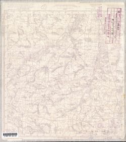
- Description:
- 1942
- Subject:
- Geographic Subject: Stegalovka, Topical Subject: Maps, and Topical Subject: Soviet Union
- Language:
- Russian
- Identifier:
- VAC9619-001630
- Genre:
- Topographic Maps and Military Maps
- Geographic Location:
- Coordinates: 52.333, 38.25, 52.5, 38.5
- Related URL:
- Catalog URL: http://iucat.iu.edu/catalog/5020131 and Download GeoTIFF: https://drive.google.com/open?id=1bzBY_dcucDx66m_r_X-4asjmdbz5atnP
- Abstract:
- Modern area represented: Stegalovka, Lipetsk oblast, Russia
- Call Number:
- G7000 s50 .S68 sheet N-37-125-D
- City:
- Стегаловка (Stegalovka)
- Copyright Holder:
- No Copyright - United States
- Country:
- СССР (USSR)
- Physical Description:
- Scale: 1:50,000
- Persistent URL:
- http://purl.dlib.indiana.edu/iudl/images/VAC9619/VAC9619-001630
- Provenance:
- DMA Topographic Center, Army Map Service Library, OMAHA, Library of Congress Geography & Map Division
-
- Subject:
- Topical Subject: Soviet Union, Topical Subject: Maps, and Geographic Subject: Leliūnai
- Publisher:
- Генеральный штаб РККА
- Language:
- Russian
- Identifier:
- VAC9619-000443
- Genre:
- Topographic Maps and Military Maps
- Geographic Location:
- Coordinates: 55.3333, 25.25, 55.5, 25.5
- Related URL:
- Catalog URL: http://iucat.iu.edu/catalog/5020131 and Download GeoTIFF: https://drive.google.com/open?id=16hIs-jM0kVkc8Rqfw5apE_1haLVWlfuE
- Abstract:
- Modern area represented: Leliūnai, Lithuania
- Call Number:
- G7000 s50 .S68 sheet N-35-15-D
- Caption:
- Captured map
- City:
- Лелюны (Lelyuny)
- Copyright Holder:
- No Copyright - United States
- Country:
- Литва (Lithuania)
- Physical Description:
- Scale: 1:50,000
- Persistent URL:
- http://purl.dlib.indiana.edu/iudl/images/VAC9619/VAC9619-000443
- Provenance:
- DMA Topographic Center, Army Map Service Library, OMAHA, Library of Congress Geography & Map Division
-
- Description:
- 1932
- Subject:
- Topical Subject: Soviet Union, Topical Subject: Maps, and Geographic Subject: Solov'yevo
- Publisher:
- Управление военных топографов
- Language:
- Russian
- Date Created:
- 1935
- Identifier:
- VAC9619-002914
- Genre:
- Topographic Maps and Military Maps
- Geographic Location:
- Coordinates: 57.667, 30.5, 57.833, 30.75
- Related URL:
- Catalog URL: http://iucat.iu.edu/catalog/5020131 and Download GeoTIFF: https://drive.google.com/file/d/1CLxRUBJnLOwI8Yau6rAVhpzupqZ-nCi6/view?usp=sharing
- Abstract:
- Modern area represented: Соловьево (Solov'yevo), Novgorodskaya oblast, Russia
- Call Number:
- GM G7000 s50 .S68 sheet O-36-74-С
- Caption:
- Не подлежит оглашению
- City:
- Соловьево (Solov'yevo)
- Copyright Holder:
- No Copyright - United States
- Country:
- СССР (USSR)
- State/Province:
- РСФСР (RSFSR) and Ленинградская область (Leningrad oblast)
- Physical Description:
- Scale: 1:50,000
- Persistent URL:
- http://purl.dlib.indiana.edu/iudl/images/VAC9619/VAC9619-002914
- Provenance:
- DMA Topographic Center, Army Map Service Library, OMAHA, Library of Congress Geography & Map Division
-
- Description:
- 1940
- Subject:
- Geographic Subject: Verkhniy Putimets, Topical Subject: Soviet Union, and Topical Subject: Maps
- Publisher:
- Главное Управление Геодезии и Картографии при СНК СССР
- Language:
- Russian
- Date Created:
- 1941
- Identifier:
- VAC9619-001626
- Genre:
- Topographic Maps and Military Maps
- Geographic Location:
- Coordinates: 52.667, 36, 52.833, 36.25
- Related URL:
- Download GeoTIFF: https://drive.google.com/open?id=1aVdwKqdSBEslZybbOLXcYgSdGSdInumP and Catalog URL: http://iucat.iu.edu/catalog/5020131
- Abstract:
- Modern area represented: Putimets, Oryol oblast, Russia
- Call Number:
- G7000 s50 .S68 sheet N-37-109-C
- City:
- Верх. Путимец (Verkhniy Putimets)
- Copyright Holder:
- No Copyright - United States
- Country:
- СССР (USSR)
- State/Province:
- Орловская область (Oryol oblast) and РСФСР (RSFSR)
- Physical Description:
- Scale: 1:50,000
- Persistent URL:
- http://purl.dlib.indiana.edu/iudl/images/VAC9619/VAC9619-001626
- Provenance:
- DMA Topographic Center, Army Map Service Library, OMAHA, Library of Congress Geography & Map Division
-
- Description:
- 1891
- Subject:
- Topical Subject: Soviet Union, Topical Subject: Maps, and Geographic Subject: Bucharest
- Publisher:
- Генеральный штаб Красной Армии
- Language:
- Russian
- Date Created:
- 1940
- Identifier:
- VAC9619-001794
- Genre:
- Military Maps and Topographic Maps
- Geographic Location:
- Coordinates: 44.3333, 26, 44.6667, 26.5
- Related URL:
- Catalog URL: https://iucat.iu.edu/catalog/5020129 and Download GeoTIFF: https://drive.google.com/open?id=1Qp3MYlVquPkot6GrpfLeHpxTWY4p62PS
- Abstract:
- Modern area represented: Bucharest, Bucureşti county, Romania
- Call Number:
- G7000 s100 .S7 sheet L-35-125
- City:
- Бухарест (Bucharest)
- Copyright Holder:
- No Copyright - United States
- Country:
- Румыния (Romania)
- Physical Description:
- Scale: 1:100,000
- Persistent URL:
- http://purl.dlib.indiana.edu/iudl/images/VAC9619/VAC9619-001794
- Provenance:
- DMA Topographic Center, Army Map Service Library, OMAHA, Library of Congress Geography & Map Division
-

- Description:
- 1939
- Subject:
- Topical Subject: Soviet Union, Topical Subject: Maps, and Geographic Subject: Kasnya
- Publisher:
- Главное Управление Геодезии и Картографии при СНК СССР
- Language:
- Russian
- Date Created:
- 1941
- Identifier:
- VAC9619-001247
- Genre:
- Topographic Maps and Military Maps
- Geographic Location:
- Coordinates: 55.333, 34.5, 55.5, 34.75
- Related URL:
- Catalog URL: http://iucat.iu.edu/catalog/5020131 and Download GeoTIFF: https://drive.google.com/open?id=1T4Z_0CTkyYasZceByk0mvDrmdirCipvA
- Abstract:
- Modern area represented: Kasnya, Smolensk oblast, Russia
- Call Number:
- GM G7000 S50 .S68 N-36-21-Г
- Copyright Holder:
- No Copyright - United States
- Country:
- СССР (USSR)
- State/Province:
- Смоленская область (Smolensk oblast) and РСФСР (RSFSR)
- Physical Description:
- Scale: 1:50,000
- Persistent URL:
- http://purl.dlib.indiana.edu/iudl/images/VAC9619/VAC9619-001247
- Provenance:
- DMA Topographic Center, Army Map Service Library, OMAHA, Library of Congress Geography & Map Division
-
- Description:
- 1932
- Subject:
- Topical Subject: Maps, Geographic Subject: Димер (Dymer), and Topical Subject: Soviet Union
- Publisher:
- Управление военных топографов
- Language:
- Russian
- Identifier:
- VAC9619-000939
- Genre:
- Military Maps and Topographic Maps
- Geographic Location:
- Coordinates: 50.667, 30.25, 50.833, 30.5
- Related URL:
- Download GeoTIFF: https://drive.google.com/open?id=1rkp2BlRtLtAK1U6GKvEsWrKyLAstC7QP and Catalog URL: http://iucat.iu.edu/catalog/5020131
- Abstract:
- Modern area represented: Димер (Dymer), Kyiv oblast, Ukraine
- Call Number:
- G7000 s50 .S68 sheet M-36-37-D
- Caption:
- Не подлежит оглашению
- City:
- Дымер (Dymer)
- Copyright Holder:
- No Copyright - United States
- Country:
- СССР (USSR)
- State/Province:
- Украинская ССР (Ukrainian Soviet Socialist Republic) and Киевская область (Kyiv oblast)
- Physical Description:
- Scale: 1:50,000
- Persistent URL:
- http://purl.dlib.indiana.edu/iudl/images/VAC9619/VAC9619-000939
- Provenance:
- DMA Topographic Center, Army Map Service Library, OMAHA, Library of Congress Geography & Map Division
-
- Subject:
- Topical Subject: Soviet Union, Topical Subject: Maps, and Geographic Subject: Darbėnai
- Publisher:
- Генеральный штаб РККА
- Language:
- Russian
- Identifier:
- VAC9619-003167
- Genre:
- Military Maps and Topographic Maps
- Geographic Location:
- Coordinates: 56, 21, 56.333, 21.5
- Related URL:
- Catalog URL: https://iucat.iu.edu/catalog/5020129 and Download GeoTIFF: https://drive.google.com/file/d/12uThn1g1D_EXHAmaqQwcLKCJBxmXkkom/view?usp=sharing
- Abstract:
- Modern area represented: Дарбенай (Darbėnai), Lithuania
- Call Number:
- G7000 s100 .S7 sheet O-34-138-139
- City:
- Дарбенай (Darbėnai)
- Copyright Holder:
- No Copyright - United States
- Country:
- Литва (Lithuania) and Латвия (Latvia)
- Physical Description:
- Scale: 1:100,000
- Persistent URL:
- http://purl.dlib.indiana.edu/iudl/images/VAC9619/VAC9619-003167
- Provenance:
- DMA Topographic Center, Army Map Service Library, OMAHA, Library of Congress Geography & Map Division
-
- Description:
- 1894
- Subject:
- Topical Subject: Soviet Union, Geographic Subject: Kvėdarna, and Topical Subject: Maps
- Publisher:
- Генеральный штаб РККА
- Language:
- Russian
- Identifier:
- VAC9619-000263
- Genre:
- Topographic Maps and Military Maps
- Geographic Location:
- Coordinates: 55.5, 21.75, 55.6667, 22
- Related URL:
- Catalog URL: http://iucat.iu.edu/catalog/5020131 and Download GeoTIFF: https://drive.google.com/open?id=1KvtpouJi5aLsm9PrNOhB33-BSHiMeVL3
- Abstract:
- Modern area represented: Kvėdarna, Lithuania
- Call Number:
- G7000 s50 .S68 N-34-20-B
- City:
- Кведарна (Kvėdarna)
- Copyright Holder:
- No Copyright - United States
- Country:
- Литва (Lithuania)
- Physical Description:
- Scale: 1:50,000
- Persistent URL:
- http://purl.dlib.indiana.edu/iudl/images/VAC9619/VAC9619-000263
- Provenance:
- DMA Topographic Center, Army Map Service Library, OMAHA, Library of Congress Geography & Map Division
-
- Subject:
- Topical Subject: Soviet Union, Geographic Subject: Lukiv, and Topical Subject: Maps
- Publisher:
- Управление военных топографов
- Language:
- Russian
- Identifier:
- VAC9619-000194
- Genre:
- Topographic Maps and Military Maps
- Geographic Location:
- Coordinates: 51.167, 24.25, 51.333, 24.5
- Related URL:
- Download GeoTIFF: https://drive.google.com/open?id=1J1o8A77d5lYnLL02eoR8T0fBgEZX6PbZ and Catalog URL: http://iucat.iu.edu/catalog/5020131
- Abstract:
- Modern area represented: Lukiv, Ukraine
- Call Number:
- G7000 s50 .S68 sheet M-35-25-B
- City:
- Мацеюв (Maciejów)
- Copyright Holder:
- No Copyright - United States
- Country:
- Польша (Poland)
- Physical Description:
- Scale: 1:50,000
- Persistent URL:
- http://purl.dlib.indiana.edu/iudl/images/VAC9619/VAC9619-000194
- Provenance:
- DMA Topographic Center, Army Map Service Library, OMAHA, Library of Congress Geography & Map Division
-
- Description:
- 1941
- Subject:
- Geographic Subject: Synelnykove, Topical Subject: Soviet Union, and Topical Subject: Maps
- Publisher:
- Генеральный штаб Красной Армии
- Language:
- Russian
- Identifier:
- VAC9619-003310
- Genre:
- Topographic Maps and Military Maps
- Geographic Location:
- Coordinates: 48, 35.5, 48.333, 36
- Related URL:
- Catalog URL: https://iucat.iu.edu/catalog/5020129 and Download GeoTIFF: https://drive.google.com/file/d/1o3AXqaK0LDUFGwalWrabNl_lHLmy0Hy5/view?usp=sharing
- Abstract:
- Modern area represented: Synelnykove, Dnipropetrovsk oblast, Ukraine
- Call Number:
- G7000 s100 .S7 sheet M-36-144
- Caption:
- Для служебного пользования
- City:
- Синельниково (Synelnykove)
- Copyright Holder:
- No Copyright - United States
- Country:
- СССР (USSR)
- State/Province:
- Украинская ССР (Ukrainian Soviet Socialist Republic), Запорожская область (Zaporizhia oblast), and Днепропетровская область (Dnipropetrovsk oblast)
- Physical Description:
- Scale: 1:100,000
- Persistent URL:
- http://purl.dlib.indiana.edu/iudl/images/VAC9619/VAC9619-003310
- Provenance:
- DMA Topographic Center, Army Map Service Library, OMAHA, Library of Congress Geography & Map Division
-
- Description:
- 1938
- Subject:
- Topical Subject: Soviet Union, Geographic Subject: Demyansk, and Topical Subject: Maps
- Publisher:
- Главное управление геодезии и картографии при СНК СССР
- Language:
- Russian
- Date Created:
- 1941
- Identifier:
- VAC9619-002186
- Genre:
- Topographic Maps and Military Maps
- Geographic Location:
- Coordinates: 57.3333, 32, 57.6667, 32.5
- Related URL:
- Catalog URL: https://iucat.iu.edu/catalog/5020129 and Download GeoTIFF: https://drive.google.com/open?id=1BZn8_6UHOHxS9rXqkXT9DxmFIAG4rdVd
- Abstract:
- Modern area represented: Демянск (Demyansk), Novgorodskaya oblast, Russia
- Call Number:
- G7000 s100 .S7 sheet O-36-89
- Caption:
- Для служебного пользования
- City:
- Демянск (Demyansk)
- Copyright Holder:
- No Copyright - United States
- Country:
- СССР (USSR)
- State/Province:
- Ленинградская область (Leningrad oblast) and РСФСР (RSFSR)
- Physical Description:
- Scale: 1:100,000
- Persistent URL:
- http://purl.dlib.indiana.edu/iudl/images/VAC9619/VAC9619-002186
- Provenance:
- DMA Topographic Center, Army Map Service Library, OMAHA, Library of Congress Geography & Map Division
-

- Description:
- 1927
- Subject:
- Geographic Subject: Volkovo, Topical Subject: Soviet Union, and Topical Subject: Maps
- Language:
- Russian
- Identifier:
- VAC9619-001238
- Genre:
- Topographic Maps and Military Maps
- Geographic Location:
- Coordinates: 55.5, 33, 55.667, 33.25
- Related URL:
- Download GeoTIFF: https://drive.google.com/open?id=10JZrhSyw3VlIWn83Hg-BOH7roDDUbsKH and Catalog URL: http://iucat.iu.edu/catalog/5020131
- Abstract:
- Modern area represented: Volkovo, Russia
- Call Number:
- GM G7000 S50 .S68 N-36-19-A
- City:
- Волково (Volkovo)
- Copyright Holder:
- No Copyright - United States
- Country:
- СССР (USSR)
- State/Province:
- Западная область (Western oblast) and РСФСР (RSFSR)
- Physical Description:
- Scale: 1:50,000
- Persistent URL:
- http://purl.dlib.indiana.edu/iudl/images/VAC9619/VAC9619-001238
- Provenance:
- DMA Topographic Center, Army Map Service Library, OMAHA, Library of Congress Geography & Map Division
-

- Description:
- 1939
- Subject:
- Geographic Subject: Zamoshye, Topical Subject: Soviet Union, and Topical Subject: Maps
- Publisher:
- Главное Управление Геодезии и Картографии при СНК СССР
- Language:
- Russian
- Date Created:
- 1941
- Identifier:
- VAC9619-001245
- Genre:
- Military Maps and Topographic Maps
- Geographic Location:
- Coordinates: 55.5, 34, 55.667, 34.25
- Related URL:
- Download GeoTIFF: https://drive.google.com/open?id=1g4GF5ZtfqSheiaGoV7iuraZb5GGKbrp8 and Catalog URL: http://iucat.iu.edu/catalog/5020131
- Abstract:
- Modern area represented: Zamoshye, Smolensk oblast, Russia
- Call Number:
- GM G7000 S50 .S68 N-36-21-A
- Copyright Holder:
- No Copyright - United States
- Country:
- СССР (USSR)
- State/Province:
- РСФСР (RSFSR) and Смоленская область (Smolensk oblast)
- Physical Description:
- Scale: 1:50,000
- Persistent URL:
- http://purl.dlib.indiana.edu/iudl/images/VAC9619/VAC9619-001245
- Provenance:
- DMA Topographic Center, Army Map Service Library, OMAHA, Library of Congress Geography & Map Division
-
- Subject:
- Topical Subject: Soviet Union, Geographic Subject: Spychowo, and Topical Subject: Maps
- Publisher:
- Генеральный штаб Красной Армии
- Language:
- Russian
- Date Created:
- 1941
- Identifier:
- VAC9619-000366
- Genre:
- Topographic Maps and Military Maps
- Geographic Location:
- Coordinates: 53.5, 31.25, 53.6667, 21.5
- Related URL:
- Download GeoTIFF: https://drive.google.com/open?id=1qNjA3RB4RaacgakVhP6dvQxEKhBfNvbo and Catalog URL: http://iucat.iu.edu/catalog/5020131
- Abstract:
- Modern area represented: Spychowo, Poland
- Call Number:
- G7000 s50 .S68 sheet N-34-91-B
- Caption:
- Captured map
- City:
- Пуппен (Puppen)
- Copyright Holder:
- No Copyright - United States
- Country:
- Германия (Germany) and Восточная Пруссия (East Prussia)
- Physical Description:
- Scale: 1:50,000
- Persistent URL:
- http://purl.dlib.indiana.edu/iudl/images/VAC9619/VAC9619-000366
- Provenance:
- DMA Topographic Center, Army Map Service Library, OMAHA, Library of Congress Geography & Map Division
-
- Subject:
- Geographic Subject: Biskupiec, Topical Subject: Soviet Union, and Topical Subject: Maps
- Publisher:
- Генеральный штаб Красной Армии
- Language:
- Russian
- Date Created:
- 1941
- Identifier:
- VAC9619-000356
- Genre:
- Topographic Maps and Military Maps
- Geographic Location:
- Coordinates: 53.83333, 20.75, 54.0, 21.0
- Related URL:
- Download GeoTIFF: https://drive.google.com/open?id=1DBPYnmIWIDWzPCZzhriD1LGjqvp8SUyY and Catalog URL: http://iucat.iu.edu/catalog/5020131
- Abstract:
- Modern area represented: Biskupiec, Poland
- Call Number:
- G7000 s50 .S68 sheet N-34-78-B
- City:
- Бишофсбург (Bischofsburg)
- Copyright Holder:
- No Copyright - United States
- Country:
- Восточная Пруссия (East Prussia) and Германия (Germany)
- Physical Description:
- Scale: 1:50,000
- Persistent URL:
- http://purl.dlib.indiana.edu/iudl/images/VAC9619/VAC9619-000356
- Provenance:
- DMA Topographic Center, Army Map Service Library, OMAHA, Library of Congress Geography & Map Division
-
- Description:
- 1933
- Subject:
- Topical Subject: Soviet Union, Topical Subject: Maps, and Geographic Subject: Kerch
- Publisher:
- Генеральный штаб Красной Армии
- Language:
- Russian
- Date Created:
- 1941
- Identifier:
- VAC9619-002345
- Genre:
- Military Maps and Topographic Maps
- Geographic Location:
- Coordinates: 45.333, 36.5, 45.667, 37
- Related URL:
- Catalog URL: https://iucat.iu.edu/catalog/5020129 and Download GeoTIFF: https://drive.google.com/file/d/1R-oTgWEAOQMyWbiwyITjMMhuWylM_Asg/view?usp=sharing
- Abstract:
- Modern area represented: Kerch, Autonomous Republic of Crimea, Ukraine
- Call Number:
- G7000 s100 .S7 sheet L-37-86
- Caption:
- Секретно. Временное издание.
- City:
- Колонка (Kolonka)
- Copyright Holder:
- No Copyright - United States
- Country:
- СССР (USSR)
- State/Province:
- Крымская АССР (Crimean Autonomous Soviet Socialist Republic), Краснодарский край (Krasnodar kray), and РСФСР (RSFSR)
- Physical Description:
- Scale: 1:100,000
- Persistent URL:
- http://purl.dlib.indiana.edu/iudl/images/VAC9619/VAC9619-002345
- Provenance:
- DMA Topographic Center, Army Map Service Library, OMAHA, Library of Congress Geography & Map Division
-
- Description:
- 1937
- Subject:
- Topical Subject: Soviet Union, Topical Subject: Maps, and Geographic Subject: Kunino
- Publisher:
- Главное управление государственной съемки и картографии НКВД СССР
- Language:
- Russian
- Identifier:
- VAC9619-000049
- Genre:
- Military Maps and Topographic Maps
- Geographic Location:
- Coordinates: 58.3333, 31.25, 58.5, 31.5
- Related URL:
- Catalog URL: http://iucat.iu.edu/catalog/5020131 and Download GeoTIFF: https://drive.google.com/open?id=16SW5j9ytBliEz0XXx8zciIcvzhTfXs83
- Abstract:
- Modern area represented: Kunino, Novgorod oblast, Russia
- Call Number:
- G7000 s50 .S68 sheet O-36-51-D
- Caption:
- Для служебного пользования,Captured map
- City:
- Кунино (Kunino)
- Copyright Holder:
- No Copyright - United States
- Country:
- СССР (USSR)
- State/Province:
- РСФСР (RSFSR), Новгородский район (Novgorod district), and Ленинградская область (Leningrad oblast)
- Physical Description:
- Scale: 1:50,000
- Persistent URL:
- http://purl.dlib.indiana.edu/iudl/images/VAC9619/VAC9619-000049
- Provenance:
- DMA Topographic Center, Army Map Service Library, OMAHA, Library of Congress Geography & Map Division
-
- Description:
- 1939
- Subject:
- Topical Subject: Soviet Union, Topical Subject: Maps, and Geographic Subject: Ostrov
- Publisher:
- Главное управление геодезии и картографии при СНК СССР
- Language:
- Russian
- Date Created:
- 1941
- Identifier:
- VAC9619-002957
- Genre:
- Military Maps and Topographic Maps
- Geographic Location:
- Coordinates: 60, 31.75, 60.167, 32
- Related URL:
- Catalog URL: http://iucat.iu.edu/catalog/5020131 and Download GeoTIFF: https://drive.google.com/file/d/17pBS93leK5HdBIyVCAHPECmK_QwD68KD/view?usp=sharing
- Abstract:
- Modern area represented: Ostrov, Russia
- Call Number:
- GM G7000 s50 .S68 sheet P-36-136-D
- Caption:
- Для служебного пользования
- City:
- Остров (Ostrov)
- Copyright Holder:
- No Copyright - United States
- Country:
- СССР (USSR)
- State/Province:
- Волховский район (Volkhov district), Мгинский район (Mginsky district), РСФСР (RSFSR), and Ленинградская область (Leningrad oblast)
- Physical Description:
- Scale: 1:50,000
- Persistent URL:
- http://purl.dlib.indiana.edu/iudl/images/VAC9619/VAC9619-002957
- Provenance:
- DMA Topographic Center, Army Map Service Library, OMAHA, Library of Congress Geography & Map Division
-
- Description:
- 1893
- Subject:
- Topical Subject: Maps, Topical Subject: Soviet Union, and Geographic Subject: Skaudvilė
- Publisher:
- Генеральный штаб РККА
- Language:
- Russian
- Identifier:
- VAC9619-000270
- Genre:
- Topographic Maps and Military Maps
- Geographic Location:
- Coordinates: 55.3333, 22.5, 55.5, 22.75
- Related URL:
- Download GeoTIFF: https://drive.google.com/open?id=1dty00_ZfDO5YH1VkYkvEiD_n_3aIMVKg and Catalog URL: http://iucat.iu.edu/catalog/5020131
- Abstract:
- Modern area represented: Skaudvilė, Lithuania
- Call Number:
- G7000 s50 .S68 N-34-22-C
- City:
- Скаудвиле (Skaudvilė)
- Copyright Holder:
- No Copyright - United States
- Country:
- Литва (Lithuania)
- Physical Description:
- Scale: 1:50,000
- Persistent URL:
- http://purl.dlib.indiana.edu/iudl/images/VAC9619/VAC9619-000270
- Provenance:
- DMA Topographic Center, Army Map Service Library, OMAHA, Library of Congress Geography & Map Division
-
- Description:
- 1939
- Subject:
- Topical Subject: Soviet Union, Topical Subject: Maps, and Geographic Subject: Sopkovo
- Publisher:
- Главное управление геодезии и картографии при СНК СССР
- Language:
- Russian
- Date Created:
- 1941
- Identifier:
- VAC9619-002844
- Genre:
- Topographic Maps and Military Maps
- Geographic Location:
- Coordinates: 57, 33.75, 57.167, 34
- Related URL:
- Catalog URL: http://iucat.iu.edu/catalog/5020131 and Download GeoTIFF: https://drive.google.com/file/d/18FH-llDMmXXbl0gZPsN4umcqhipvl5E2/view?usp=sharing
- Abstract:
- Modern area represented: Сопково (Sopkovo), Тверская область (Tverskaya oblast), Russia
- Call Number:
- GM G7000 s50 .S68 sheet O-36-104-D
- Caption:
- Для служебного пользования
- City:
- Сапково (Sapkovo)
- Copyright Holder:
- No Copyright - United States
- Country:
- СССР (USSR)
- State/Province:
- Калининская область (Kalinin oblast), Каменский район (Kamensky district), Есеновичский район (Yesenovichsky district), Кировский район (Kirov district), and...
- Physical Description:
- Scale: 1:50,000
- Persistent URL:
- http://purl.dlib.indiana.edu/iudl/images/VAC9619/VAC9619-002844
- Provenance:
- DMA Topographic Center, Army Map Service Library, OMAHA, Library of Congress Geography & Map Division
-
- Subject:
- Topical Subject: Soviet Union, Geographic Subject: Domnovo, and Topical Subject: Maps
- Publisher:
- Генеральный штаб Красной Армии
- Language:
- Russian
- Date Created:
- 1941
- Identifier:
- VAC9619-000333
- Genre:
- Topographic Maps and Military Maps
- Geographic Location:
- Coordinates: 54.3333, 20.75, 54.5, 21
- Related URL:
- Catalog URL: http://iucat.iu.edu/catalog/5020131 and Download GeoTIFF: https://drive.google.com/open?id=1zg6Rmm_fuNw0noNee5jq17_5Myp5fwTL
- Abstract:
- Modern area represented: Domnovo, Kaliningrad oblast, Russia
- Call Number:
- G7000 s50 .S68 sheet N-34-54-D
- City:
- Домнау (Domnau)
- Copyright Holder:
- No Copyright - United States
- Country:
- Восточная Пруссия (East Prussia) and Германия (Germany)
- Physical Description:
- Scale: 1:50,000
- Persistent URL:
- http://purl.dlib.indiana.edu/iudl/images/VAC9619/VAC9619-000333
- Provenance:
- DMA Topographic Center, Army Map Service Library, OMAHA, Library of Congress Geography & Map Division
-
- Subject:
- Geographic Subject: Daugailiai, Topical Subject: Soviet Union, and Topical Subject: Maps
- Publisher:
- Управление военных топографов
- Language:
- Russian
- Identifier:
- VAC9619-000445
- Genre:
- Military Maps and Topographic Maps
- Geographic Location:
- Coordinates: 55.5, 25.75, 55.6666, 26
- Related URL:
- Download GeoTIFF: https://drive.google.com/open?id=1Jas4YMEoqiidTaz--doGolQ2m546HUv0 and Catalog URL: http://iucat.iu.edu/catalog/5020131
- Abstract:
- Modern area represented: Daugailiai, Lithuania
- Call Number:
- G7000 s50 .S68 sheet N-35-16-B
- Caption:
- Captured map
- City:
- Довгели (Dovgeli)
- Copyright Holder:
- No Copyright - United States
- Country:
- Литва (Lithuania)
- Physical Description:
- Scale: 1:50,000
- Persistent URL:
- http://purl.dlib.indiana.edu/iudl/images/VAC9619/VAC9619-000445
- Provenance:
- DMA Topographic Center, Army Map Service Library, OMAHA, Library of Congress Geography & Map Division
-
- Subject:
- Topical Subject: Maps, Geographic Subject: Slabada, and Topical Subject: Soviet Union
- Publisher:
- Генеральный штаб РККА
- Language:
- Russian
- Identifier:
- VAC9619-000528
- Genre:
- Military Maps and Topographic Maps
- Geographic Location:
- Coordinates: 54.8333, 27, 55, 27.25
- Related URL:
- Catalog URL: http://iucat.iu.edu/catalog/5020131 and Download GeoTIFF: https://drive.google.com/open?id=1Vc5qSIDMOXLm8d6mJaKBuUQLdNzGn3rF
- Abstract:
- Modern area represented: Слабада (Slabada), Minsk Region, Belarus
- Call Number:
- G7000 s50 .S68 sheet N-35-43-A
- City:
- Слобода (Sloboda)
- Copyright Holder:
- No Copyright - United States
- Country:
- Польша (Poland)
- Physical Description:
- Scale: 1:50,000
- Persistent URL:
- http://purl.dlib.indiana.edu/iudl/images/VAC9619/VAC9619-000528
- Provenance:
- DMA Topographic Center, Army Map Service Library, OMAHA, Library of Congress Geography & Map Division
-
- Subject:
- Topical Subject: Maps, Geographic Subject: Kadzidło, and Topical Subject: Soviet Union
- Publisher:
- Генеральный штаб Красной Армии
- Language:
- Russian
- Date Created:
- 1941
- Identifier:
- VAC9619-000375
- Genre:
- Military Maps and Topographic Maps
- Geographic Location:
- Coordinates: 53.1667, 21.25, 53.3333, 21.5
- Related URL:
- Download GeoTIFF: https://drive.google.com/open?id=1j9TNkrVh9BXQBw6WeFoz2ySmuIR1j57S and Catalog URL: http://iucat.iu.edu/catalog/5020131
- Abstract:
- Modern area represented: Kadzidło, Poland
- Call Number:
- G7000 s50 .S68 sheet N-34-103-B
- Caption:
- Captured map
- City:
- Кадзидло (Kadzidło)
- Copyright Holder:
- No Copyright - United States
- Country:
- Область государственных интересов Германии (Region of German state interest)
- Physical Description:
- Scale: 1:50,000
- Persistent URL:
- http://purl.dlib.indiana.edu/iudl/images/VAC9619/VAC9619-000375
- Provenance:
- DMA Topographic Center, Army Map Service Library, OMAHA, Library of Congress Geography & Map Division
