
Search Constraints
You searched for:
Date Created
1942
Remove constraint Date Created: 1942
Holding Location
B-WELLS
Remove constraint Holding Location: B-WELLS
« Previous |
1 - 10 of 135
|
Next »
Search Results
-
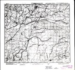
![Indiana Oolitic quadrangle : 15-minute series [1942 printing]](https://iiif.uits.iu.edu/iiif/2/7s75fh88q%2Ffiles%2Fe8a0e666-2e63-48ce-8d73-08ed262f4fa1/full/250,/0/default.jpg)
- Subject:
- Geographic Subject: Monroe County (Ind.), Geographic Subject: Greene County (Ind.), Geographic Subject: Lawrence County (Ind.), and Geographic Subject: Marti...
- Creator:
- Geological Survey (U.S.) and McKinley, W. K. (William Klett), 1891-1964
- Publisher:
- Geological Survey (U.S.)
- Date Created:
- 1942
- Identifier:
- VAC3073-M-01371
- Genre:
- Quadrangle maps, Topographic maps, and 15 minute topographic maps
- Geographic Location:
- Coordinates: W0864500 W0863000 N0390000 N0384500
- Related URL:
- Catalog URL: https://iucat.iu.edu/catalog/18413867
- Abstract:
- Topography by W.K. McKinley, W.F. Chenault, J.O. Kilmartin, G.F. Westinghouse, Shirley Waggener, W.H. Austin, A.G. Kirk, and K.R. Garmong. Culture and draina...
- Call Number:
- G4090 s62 .G4 Oolitic 1942
- Caption:
- Imprint: Washington, D.C. : U.S. Dept. of the Interior, Geological Survey, 1942
- Physical Description:
- Dimensions: 45 x 42 cm or smaller and Scale: 1:62,500
- Alternate Identifier:
- Title Control Number: a18413867
- Persistent URL:
- https://purl.dlib.indiana.edu/iudl/images/VAC3073/VAC3073-M-01371
- Provenance:
- Part of Geological Survey (U.S.). Indiana 1:62,500.
-
![Indiana-Illinois Princeton quadrangle [1942 print with corrections]](https://iiif.uits.iu.edu/iiif/2/9c67xs27g%2Ffiles%2F3b41e866-678d-4037-bcb6-7d00a8c69e5b/full/250,/0/default.jpg)
- Subject:
- Geographic Subject: Knox County (Ind.), Geographic Subject: Wabash County (Ill.), and Geographic Subject: Gibson County (Ind.)
- Creator:
- Geological Survey (U.S.), Goodlove, C. W., Hawkins, Geo. T. (George T.), and Renshawe, John H.
- Publisher:
- Geological Survey (U.S.)
- Date Created:
- 1942
- Identifier:
- VAC3073-M-01303
- Genre:
- Quadrangle maps, 15 minute topographic maps, and Topographic maps
- Geographic Location:
- Coordinates: W0874500 W0873000 N0383000 N0381500
- Related URL:
- Catalog URL: https://iucat.iu.edu/catalog/a18413584
- Abstract:
- Jno. H. Renshawe, geographer in charge , control by Geo. T. Hawkins , topography by Chas. W. Goodlove. Filing title: Princeton, Ind.-Ill. Edition of 1903, re...
- Call Number:
- G4090 s62 .G4 Princeton 1903 R1942
- Caption:
- Imprint: [Washington, D.C.] : U.S. Geological Survey, 1942
- Physical Description:
- Scale: 1:62,500 and Dimensions: 45 x 42 cm or smaller
- Alternate Identifier:
- Title Control Number: a18413585
- Persistent URL:
- https://purl.dlib.indiana.edu/iudl/images/VAC3073/VAC3073-M-01303
- Provenance:
- Part of Geological Survey (U.S.). Indiana 1:62,500.
-
![Indiana-Illinois Princeton quadrangle [1942 reprint with corrections]](https://iiif.uits.iu.edu/iiif/2/5425md989%2Ffiles%2Fb50408af-597e-49b1-b839-d9b52b097540/full/250,/0/default.jpg)
- Subject:
- Geographic Subject: Gibson County (Ind.) and Geographic Subject: Knox County (Ind.)
- Creator:
- Geological Survey (U.S.), Goodlove, C. W., Renshawe, John H., and Hawkins, Geo. T. (George T.)
- Publisher:
- Geological Survey (U.S.)
- Date Created:
- 1942
- Identifier:
- VAC3073-M-01385
- Genre:
- Quadrangle maps, Topographic maps, and 15 minute topographic maps
- Geographic Location:
- Coordinates: W0874500 W0873000 N0383000 N0381500
- Related URL:
- Catalog URL: https://iucat.iu.edu/catalog/18413585
- Abstract:
- Jno. H. Renshawe, geographer in charge , control by Geo. T. Hawkins , topography by Chas. W. Goodlove. Filing title: Princeton, Ind.-Ill. Edition of 1903, re...
- Call Number:
- Part of Geological Survey (U.S.). Indiana 1:62,500.
- Caption:
- Imprint: [Washington, D.C.] : U.S. Geological Survey, 1942.
- Physical Description:
- Dimensions: 45 x 42 cm or smaller and Scale: 1:62,500
- Alternate Identifier:
- Title Control Number: a18413585
- Persistent URL:
- https://purl.dlib.indiana.edu/iudl/images/VAC3073/VAC3073-M-01385
- Provenance:
- Part of Geological Survey (U.S.). Indiana 1:62,500.
-
![Indiana-Illinois, New Harmony quadrangle [1942 reprint without vegetation]](https://iiif.uits.iu.edu/iiif/2/7m01cp450%2Ffiles%2F687ca4a9-29c4-4fc4-88d4-234e6f47aa32/full/250,/0/default.jpg)
- Subject:
- Geographic Subject: Gibson County (Ind.), Geographic Subject: Posey County (Ind.), Geographic Subject: Wabash County (Ill.), and Geographic Subject: White Co...
- Creator:
- Goodlove, C. W., Renshawe, John H., Hawkins, Geo. T. (George T.), and Geological Survey (U.S.)
- Publisher:
- Geological Survey (U.S.)
- Date Created:
- 1942
- Identifier:
- VAC3073-M-01355
- Genre:
- 15 minute topographic maps, Quadrangle maps, and Topographic maps
- Geographic Location:
- Coordinates: W0880000 W0874500 N0381500 N0380000
- Related URL:
- Catalog URL: https://iucat.iu.edu/catalog/18412806
- Abstract:
- John. H. Renshawe, geographer in charge , control by Geo. T. Hawkins , topography by Chas. W. Goodlove , engraved April 1903 by U.S.G.S. Filing title: New Ha...
- Call Number:
- G4090 s62 .G4 New Harmony 1903 rep 1942
- Caption:
- Imprint: [Washington, D.C.] : U.S. Geological Survey, 1942
- Physical Description:
- Scale: 1:62,500 and Dimensions: 45 x 42 cm or smaller
- Alternate Identifier:
- Title Control Number: a18412806
- Persistent URL:
- https://purl.dlib.indiana.edu/iudl/images/VAC3073/VAC3073-M-01355
- Provenance:
- Part of Geological Survey (U.S.). Indiana 1:62,500.
-
- Description:
- 1903
- Subject:
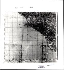
- Topical Subject: Maps, Geographic Subject: Moldovka, and Topical Subject: Soviet Union
- Language:
- Russian
- Date Created:
- 1942
- Identifier:
- VAC9619-000700
- Genre:
- Military Maps and Topographic Maps
- Geographic Location:
- Coordinates: 43.3333, 39.5, 43.66667, 40
- Related URL:
- Catalog URL: https://iucat.iu.edu/catalog/5020129 and Download GeoTIFF: https://drive.google.com/open?id=1r4wrudvCFo-1owLTiUHpZAG77_1FPzbC
- Abstract:
- Modern area represented: Moldovka, Krasnodar kray, Russia
- Call Number:
- G7000 s100 .S7 sheet K-37-20
- Copyright Holder:
- No Copyright - United States
- Country:
- СССР (USSR)
- Physical Description:
- Scale: 1:100,000
- Persistent URL:
- http://purl.dlib.indiana.edu/iudl/images/VAC9619/VAC9619-000700
- Provenance:
- Atlasblatt, G000-30
-
- Description:
- 1905
- Subject:
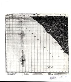
- Topical Subject: Maps, Topical Subject: Soviet Union, and Geographic Subject: Lazarevskoye
- Publisher:
- Генеральный штаб Красной Армии
- Language:
- Russian
- Date Created:
- 1942
- Identifier:
- VAC9619-000759
- Genre:
- Topographic Maps and Military Maps
- Geographic Location:
- Coordinates: 43.6667, 39, 44, 39.5
- Related URL:
- Catalog URL: https://iucat.iu.edu/catalog/5020129 and Download GeoTIFF: https://drive.google.com/open?id=1OcoSmUSM2ZO6HwjSl9T2sxJaHo8Fbzui
- Abstract:
- Modern area represented: Lazarevskoye, Krasnodar kray, Russia
- Call Number:
- G7000 s100 .S7 sheet K-37-7
- Caption:
- Для служебного пользования
- City:
- Лазаревская (Lazarevskoye)
- Copyright Holder:
- No Copyright - United States
- Country:
- СССР (USSR)
- State/Province:
- Краснодарская область (Krasnodar oblast) and РСФСР (RSFSR)
- Physical Description:
- Scale: 1:100,000
- Persistent URL:
- http://purl.dlib.indiana.edu/iudl/images/VAC9619/VAC9619-000759
- Provenance:
- CIA Map Library
-
- Description:
- 1886
- Subject:
- Topical Subject: Maps, Topical Subject: Soviet Union, and Geographic Subject: Zayukovo
- Publisher:
- Генеральный штаб Красной Армии
- Language:
- Russian
- Date Created:
- 1942
- Identifier:
- VAC9619-000768
- Genre:
- Military Maps and Topographic Maps
- Geographic Location:
- Coordinates: 43.3333, 43, 43.6667, 43.5
- Related URL:
- Download GeoTIFF: https://drive.google.com/open?id=1ZvJc3OHAg6vpcikjFr92BMG60irdKLJA and Catalog URL: https://iucat.iu.edu/catalog/5020129
- Abstract:
- Modern area represented: Zayukovo, Kabardino-Balkariya Republic, Russia
- Call Number:
- G7000 s100 .S7 sheet K-38-15
- Caption:
- Для служебного пользования
- City:
- Заюково (Zayukovo)
- Copyright Holder:
- No Copyright - United States
- Country:
- СССР (USSR)
- State/Province:
- РСФСР (RSFSR) and Кабардино-Балкарская АССР (Kabardino-Balkar Autonomous Soviet Socialist Republic)
- Physical Description:
- Scale: 1:100,000
- Persistent URL:
- http://purl.dlib.indiana.edu/iudl/images/VAC9619/VAC9619-000768
- Provenance:
- DMA Topographic Center, Army Map Service Library, Library of Congress Geography & Map Division
-
- Description:
- 1941
- Subject:
- Geographic Subject: Babayurt, Topical Subject: Maps, and Topical Subject: Soviet Union
- Publisher:
- Генеральный штаб Красной Армии
- Language:
- Russian
- Date Created:
- 1942
- Identifier:
- VAC9619-000784
- Genre:
- Topographic Maps and Military Maps
- Geographic Location:
- Coordinates: 43.3333, 46.5, 43.6667, 47
- Related URL:
- Download GeoTIFF: https://drive.google.com/open?id=1J0-KZD89YETRBJk8JXDeJgXjmkM-Bz0H and Catalog URL: https://iucat.iu.edu/catalog/5020129
- Abstract:
- Modern area represented: Babayurt, Dagestan republic, Russia
- Call Number:
- G7000 s100 .S7 sheet K-38-22
- Caption:
- Для служебного пользования
- City:
- Баба-Юрт (Baba-Yurt)
- Copyright Holder:
- No Copyright - United States
- Country:
- СССР (USSR)
- State/Province:
- Дагестанская АССР (Dagestan Autonomous Soviet Socialist Republic) and РСФСР (RSFSR)
- Physical Description:
- Scale: 1:100,000
- Persistent URL:
- http://purl.dlib.indiana.edu/iudl/images/VAC9619/VAC9619-000784
- Provenance:
- CIA Map Library, Atlasblatt
-
- Description:
- 1870
- Subject:
- Topical Subject: Soviet Union, Topical Subject: Maps, and Geographic Subject: Alagir
- Publisher:
- Генеральный штаб Красной Армии
- Language:
- Russian
- Date Created:
- 1942
- Identifier:
- VAC9619-000786
- Genre:
- Topographic Maps and Military Maps
- Geographic Location:
- Coordinates: 43, 44, 43.3333, 44.5
- Related URL:
- Download GeoTIFF: https://drive.google.com/open?id=1ipwxw4RfPnMQCVYN2bZCXjRGnhJRTiAZ and Catalog URL: https://iucat.iu.edu/catalog/5020129
- Abstract:
- Modern area represented: Alagir, North Ossetia – Alania republic, Russia
- Call Number:
- G7000 s100 .S7 sheet K-38-29
- Caption:
- Для служебного пользования
- City:
- Алагир (Alagir)
- Copyright Holder:
- No Copyright - United States
- Country:
- СССР (USSR)
- State/Province:
- Северо-Осетинская АССР (North Ossetian Autonomous Soviet Socialist Republic), Кабардино-Балкарская АССР (Kabardino-Balkar Autonomous Soviet Socialist Republi...
- Physical Description:
- Scale: 1:100,000
- Persistent URL:
- http://purl.dlib.indiana.edu/iudl/images/VAC9619/VAC9619-000786
- Provenance:
- Army Map Service Library, Geographic Names Branch, Library of Congress G & M Division
-
- Description:
- 1910
- Subject:
- Topical Subject: Soviet Union, Topical Subject: Maps, and Geographic Subject: Malka
- Publisher:
- Генеральный штаб Красной Армии
- Language:
- Russian
- Date Created:
- 1942
- Identifier:
- VAC9619-000774
- Genre:
- Topographic Maps and Military Maps
- Geographic Location:
- Coordinates: 43.6667, 43, 44, 43.5
- Related URL:
- Download GeoTIFF: https://drive.google.com/open?id=1SGbNvHRjKc5EerPHr8nhRF6X8xaL-QxT and Catalog URL: https://iucat.iu.edu/catalog/5020129
- Abstract:
- Modern area represented: Malka, Kabardino-Balkariya republic, Russia
- Call Number:
- G7000 s100 .S7 sheet K-38-3
- Caption:
- Для служебного пользования
- City:
- Малка (Malka)
- Copyright Holder:
- No Copyright - United States
- Country:
- СССР (USSR)
- State/Province:
- РСФСР (RSFSR), Кабардино-Балкарская АССР (Kabardino-Balkar Autonomous Soviet Socialist Republic), and Орджоникидзевский край (Ordzhonikidze kray)
- Physical Description:
- Scale: 1:100,000
- Persistent URL:
- http://purl.dlib.indiana.edu/iudl/images/VAC9619/VAC9619-000774
- Provenance:
- Army Map Service Library, Geographic Names Branch, Library of Congress G & M Division
