Indiana University
Indiana University
IU
Skip to Content
Digital Collections
Toggle navigation
Digital
Collections
Switch language
English
Switch language
Deutsch
English
Español
Français
Italiano
Português do Brasil
中文
Login
Home
About
Contact
Search Digital Collections
Go
×
Search Constraints
Start Over
You searched for:
Type
Image
Remove constraint Type: Image
Publisher
Indiana. Geological Survey
Remove constraint Publisher: Indiana. Geological Survey
« Previous |
1
-
10
of
77
|
Next »
Sort by relevance ▼
relevance ▼
recently updated
title ▲
title ▼
date created ▲
date created ▼
pages ▲
pages ▼
collection size ▲
collection size ▼
Number of results to display per page
10 per page
10
per page
20
per page
50
per page
100
per page
View results as:
List
Gallery
Masonry
Search Results
1.
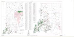
Map showing oil, gas, and gas storage fields in Indiana
2.
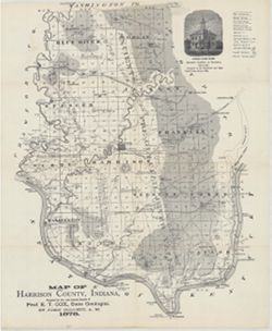
Map of Harrison County, Indiana
3.
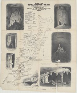
Map of Wyandotte Cave, in Crawford County, Indiana
4.
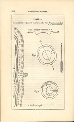
Ancient earthworks north from Cambridge City, Wayne County, Ind.
5.
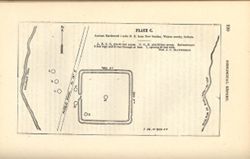
Ancient earthwork 1 mile N. E. from New Garden, Wayne County, Indiana
6.
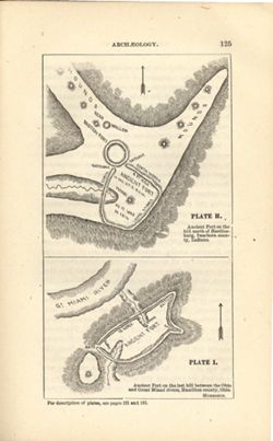
Ancient fort on the hill north of Hardinsburg, Dearborn County, Indiana , Ancient fort on the last hill between the Ohio and Great Miami rivers, Hamilton County, Ohio
7.
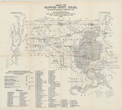
Map of Crawford County, Indiana : and reduced sketch of Wyandotte Cave
8.
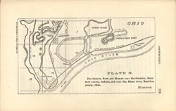
Pre-historic forts and mounds near Hardinsburg, Dearborn County, Indiana and near Big Miami River, Hamilton County, Ohio
9.
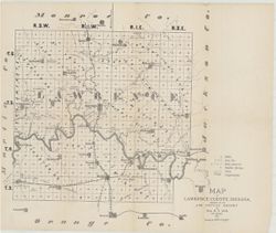
Map of Lawrence County, Indiana
10.
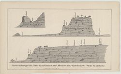
Sections through the stone fortification and mounds near Charleston, Clarke Co., Indiana
« Previous
Next »
1
2
3
4
5
…
7
8
Toggle facets
Limit your search
Type
Image
[remove]
77
Creator
Collett, John, 1828-1899
14
Cox, E. T. (Edward Travers), 1821-1907
12
Indiana. Geological Survey
11
Levette, G. M. (Gilbert M.)
9
Gray, Henry Hamilton, 1922-
5
Hutchison, Harold C. (Harold Christy), 1925-
5
Wayne, William J. (William John), 1922-
5
Borden, W. W. (William Wesley), 1823-1906
4
Illinois State Geological Survey
4
Keller, Stanley J.
4
more
Creators
»
Subject
Geographic Subject: Indiana
42
Topical Subject: IGS Annual Reports
32
Topical Subject: Geology
29
Topical Subject: Coal mines and mining
19
Topical Subject: Mines and mineral resources
18
Topical Subject: Geology, Stratigraphic
15
Geographic Subject: Illinois
8
Topical Subject: Coal
7
Topical Subject: Caves
5
Topical Subject: Geology, Economic
4
more
Subjects
»
Publisher
Indiana. Geological Survey
[remove]
77
Date Created
1879
7
1871
6
1875
5
1972
5
1869
4
1873
4
1874
4
1876
4
1970
4
1952
3
more
Date Createds
»
Pages
0-99 pages
77
Collections
Indiana Historic Maps
77
State
deposited
77
Campus
IUB
77
Holding Location
B-WELLS
77
Provenance
5th Annual Report (1873) / Indiana. Geological Survey.
8
8th, 9th, and 10th Annual Reports (1876, 1877, 1878) / Indiana. Geological Survey.
7
2nd Annual Report (1870) / Indiana. Geological Survey.
6
6th Annual Report (1874) / Indiana. Geological Survey.
5
1st Annual Report (1869) / Indiana. Geological Survey
4
7th Annual Report (1875) / Indiana. Geological Survey.
4
Indiana. Geological Survey. Regional geologic map , no. 3.
2
Appears in Atlas of mineral resources of Indiana / Indiana Geological Survey (1953)
1
Indiana. Geological Survey. Regional geologic map , no. 1.
1
Indiana. Geological Survey. Regional geologic map , no. 2.
1