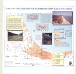
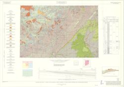
Geographic Subject: Porter County (Ind.), Geographic Subject: Indiana, Geographic Subject: Michigan, Lake, Coast (Ind.), Topical Subject: Lakes, Topical Subj...
Creator:
Thompson, Todd A. (Todd Alan), 1959-
Publisher:
Indiana. Geological Survey
Date Created:
2000
Identifier:
VAC3073-M-00193
Genre:
Thematic maps
Geographic Location:
Coordinates: W0873136 W0871307 N0414539 N0410943
Related URL:
Catalog URL: https://iucat.iu.edu/catalog/4898581
Abstract:
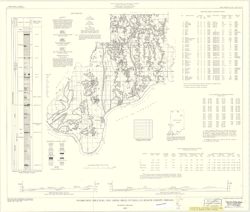
Includes illustrations, text, graphs showing "Lake-level fluctuations over the past 4,700 years" and a timeline showing historical events since 116...
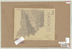
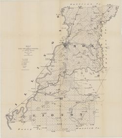
Topical Subject: Administrative and political divisions and Geographic Subject: Indiana
Creator:
Moran, W. H. (William H.)
Publisher:
Indiana. Geological Survey
Date Created:
1952
Identifier:
VAC3073-M-00215
Genre:
Maps
Geographic Location:
Coordinates: W0880500 W0844700 N0414500 N0374600
Related URL:
Catalog URL: https://iucat.iu.edu/catalog/1233088
Abstract:
"January 1952." Black line print. "Traced from Map of Indiana, edition of 1950, published by U.S. Geological Survey. Minor revisions and addit...
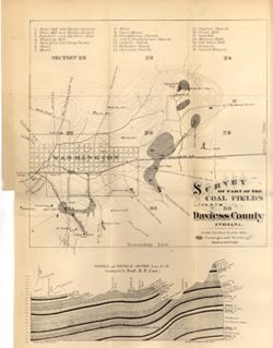
By Gerald H. Johnson and Stanley J. Keller. transverse Mercator projection. Regional geologic map , no. 8. Relief shown by profile. Includes columnar section...
Relief shown by contours and profile. Includes index and geological profile. Shows mills, factories, hotels, churches, halls, a brewery, and school houses. P...
Call Number:
G4093.D2H9 1871 .W7
Caption:
Imprint: [Indianapolis] : [Geological Survey of Indiana], [1871]
Physical Description:
Scale: Scale approximately 1:21,000. 3 in. equals 1 mile. Vertical scale approximately 1:925 and Dimensions: 36 x 28 cm
Alternate Identifier:
Alternate ID: 390721IP and Title Control Number: a18298907
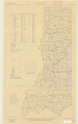
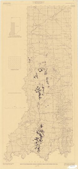
Geographic Subject: Spencer County (Ind.), Topical Subject: Coal mines and mining, and Topical Subject: Coal
Creator:
Hutchison, Harold C. (Harold Christy), 1925-
Publisher:
Indiana. Geological Survey
Date Created:
1959
Identifier:
VAC3073-M-00222
Genre:
Mine maps and Thematic maps
Geographic Location:
Coordinates: W0871600 W0844600 N0381200 N0374700
Related URL:
Catalog URL: https://iucat.iu.edu/catalog/5389271
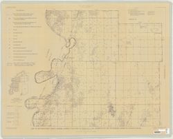
Abstract:
"Preliminary Coal Map no. 8". Includes 2 geologic cross sections, location map, geologic column, index of mines, tables, and diagram of township se...
Call Number:
G4093.S5H9 1959 .H8
Caption:
Imprint: Bloomington, Ind. : Indiana Department of Conservation, Geological Survey, 1959.