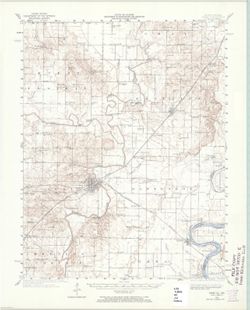
Topical Subject: Vegetation mapping, Geographic Subject: Saint Joseph County (Mich.), Geographic Subject: Cass County (Mich.), and Geographic Subject: Elkhar...
Creator:
Michigan. State Highway Department and Geological Survey (U.S.)
Publisher:
Geological Survey (U.S.)
Date Created:
1973
Identifier:
VAC3073-M-01507
Genre:
15 minute topographic maps, Quadrangle maps, and Topographic maps
Mapped, edited, and published by the Geological Survey. Filing title: Vandalia, Mich.-Ind. Standard map series designation: AMS (Series) V762 3867 IV. [Editi...
Geographic Subject: Crawford County (Ill.), Geographic Subject: Sullivan County (Ind.), Geographic Subject: Clark County (Ill.), and Topical Subject: Vegetat...
Creator:
Illinois State Geological Survey, Geological Survey (U.S.), and Indiana. Department of Conservation
Publisher:
Geological Survey (U.S.)
Date Created:
1969
Identifier:
VAC3073-M-01345
Genre:
15 minute topographic maps, Topographic maps, and Quadrangle maps
Mapped, edited, and published by the Geological Survey , control by USGS, USC & GS, and USCE. Filing title: Hutsonville, Ill.-Ind. Standard map series de...
Call Number:
G4090 s62 .G4 Hutsonville 1957 rep 1969 V
Caption:
Imprint: Urbana, Illinois : State Geological Survey, Imprint: Indianapolis, Ind. : Indiana Department of Conservation, [1958], Imprint: Washington, D.C. : In...
Physical Description:
Dimensions: 45 x 42 cm or smaller and Scale: 1:62,500
Geographic Subject: Lawrence County (Ind.), Geographic Subject: Greene County (Ind.), Topical Subject: Vegetation mapping, Geographic Subject: Monroe County ...
Creator:
McKinley, W. K. (William Klett), 1891-1964 and Geological Survey (U.S.)
Publisher:
Geological Survey (U.S.)
Date Created:
1968
Identifier:
VAC3073-M-01370
Genre:
Topographic maps, 15 minute topographic maps, and Quadrangle maps
Geographic Subject: Posey County (Ind.), Geographic Subject: White County (Ill.), Geographic Subject: Union County (Ky.), Geographic Subject: Gallatin County...
Creator:
Lloyd, W. J. (Topographer), Smith, L. Scott, Illinois State Geological Survey, Wilson, Herbert M. (Herbert Michael), 1860-1920, Ellis, J. R. (Topographer), C...
Publisher:
Geological Survey (U.S.)
Date Created:
1966
Identifier:
VAC3073-M-01357
Genre:
Quadrangle maps, Topographic maps, and 15 minute topographic maps
United States, Department of the Interior, Geological Survey , State of Illinois, Department of Registration and Education, Geological Survey Division , Stat...
Geographic Subject: Knox County (Ind.), Geographic Subject: Wabash County (Ill.), Topical Subject: Vegetation mapping, and Geographic Subject: Gibson County ...
Creator:
Geological Survey (U.S.), Illinois State Geological Survey, and United States. Army Map Service
Publisher:
Geological Survey (U.S.)
Date Created:
1965
Identifier:
VAC3073-M-01388
Genre:
15 minute topographic maps, Quadrangle maps, and Topographic maps
Mapped, edited and published by the Geological Survey , Illinois area mapped in cooperation with State of Illinois Geological Survey. Filing title: Princeton...
Geographic Subject: Gibson County (Ind.), Geographic Subject: Knox County (Ind.), Geographic Subject: Wabash County (Ill.), and Topical Subject: Vegetation m...
Creator:
Geological Survey (U.S.), United States. Army Map Service, and Illinois State Geological Survey
Publisher:
Geological Survey (U.S.)
Date Created:
1965
Identifier:
VAC3073-M-01504
Genre:
Topographic maps, 15 minute topographic maps, and Quadrangle maps
Mapped, edited and published by the Geological Survey , Illinois area mapped in cooperation with State of Illinois Geological Survey. Filing title: Princeton...
Mapped, edited and published by the Geological Survey , Illinois area mapped in cooperation with State of Illinois Geological Survey. Filing title: Princeton...
Topography by H. E. Simmons, J. C. Hilliard, A. T. Munson, E. W. Gouchenour, P. L. Sampson, A. W. Thomas, and F. W. Weber. ... Topography in Indiana from cha...
Call Number:
G4090 s62 .G4 Carmi 1940 rep1965
Caption:
Imprint: Washington, D.C. : The Survey, 1965.
Physical Description:
Scale: 1:62,500 and Dimensions: 45 x 42 cm or smaller
Geographic Subject: Gibson County (Ind.), Topical Subject: Vegetation mapping, Geographic Subject: Wabash County (Ill.), and Geographic Subject: Knox County ...
Creator:
Geological Survey (U.S.), United States. Army Map Service, and Illinois State Geological Survey
Publisher:
Geological Survey (U.S.)
Date Created:
1964
Identifier:
VAC3073-M-01387
Genre:
Quadrangle maps, 15 minute topographic maps, and Topographic maps
Mapped, edited and published by the Geological Survey , Illinois area mapped in cooperation with State of Illinois Geological Survey. Filing title: Princeton...
Geographic Subject: Knox County (Ind.), Geographic Subject: Gibson County (Ind.), Geographic Subject: Wabash County (Ill.), and Topical Subject: Vegetation m...
Creator:
Illinois State Geological Survey, Geological Survey (U.S.), and United States. Army Map Service
Publisher:
Geological Survey (U.S.)
Date Created:
1964
Identifier:
VAC3073-M-01386
Genre:
15 minute topographic maps, Topographic maps, and Quadrangle maps
Mapped, edited and published by the Geological Survey , Illinois area mapped in cooperation with State of Illinois Geological Survey. Filing title: Princeton...

![Vandalia quadrangle, Michigan-Indiana : 15 minute series (topographic) [1973 reprint with vegetation]](https://iiif.uits.iu.edu/iiif/2/0g355j55q%2Ffiles%2F59353208-0771-4acc-8e57-7c989a623800/full/250,/0/default.jpg)

![Hutsonville quadrangle, Illinois-Indiana : 15 minute series (topographic) [1969 reprint with vegetation]](https://iiif.uits.iu.edu/iiif/2/4x51jm59t%2Ffiles%2F360c0cc0-3a93-4f1f-b295-aecbc7c61661/full/250,/0/default.jpg)
![Indiana Oolitic quadrangle : 15-minute series [1968 reprint with vegetation]](https://iiif.uits.iu.edu/iiif/2/pz50hz89x%2Ffiles%2Fd3212cc7-1b0e-44f5-858a-94b51d9080b5/full/250,/0/default.jpg)
![Illinois-Indiana-Kentucky, New Haven quadrangle [1966 reprint with vegetation]](https://iiif.uits.iu.edu/iiif/2/k0699966z%2Ffiles%2F2ec905c7-1ce1-46fe-974b-b888b96b34a5/full/250,/0/default.jpg)
![Princeton quadrangle, Indiana-Illinois : 15 minute series (topographic) [1965 reprint with vegetation]](https://iiif.uits.iu.edu/iiif/2/sx61fr138%2Ffiles%2F603798b1-0337-482a-9bb7-934a41ad4b2b/full/250,/0/default.jpg)
![Princeton quadrangle, Indiana-Illinois : 15 minute series (topographic) [1965 reprint with vegetation]](https://iiif.uits.iu.edu/iiif/2/7m01cp47j%2Ffiles%2Fdc826735-24b7-4c3f-9d9b-87ad67efd7e8/full/250,/0/default.jpg)
![Princeton quadrangle, Indiana-Illinois : 15 minute series (topographic) [1965 printing without vegetation]](https://iiif.uits.iu.edu/iiif/2/70796d47m%2Ffiles%2Fedc5c6d4-9f41-4b7c-9447-a370bfe906e0/full/250,/0/default.jpg)
![Princeton quadrangle, Indiana-Illinois : 15 minute series (topographic) [1964 printing with vegetation]](https://iiif.uits.iu.edu/iiif/2/m900px89p%2Ffiles%2Fe957c77d-db8c-42d6-aef0-05abd0d3301b/full/250,/0/default.jpg)
![Princeton quadrangle, Indiana-Illinois : 15 minute series (topographic) [1964 printing with vegetation]](https://iiif.uits.iu.edu/iiif/2/ng452m35w%2Ffiles%2F49af6c65-fc22-44ea-8486-c7923f5afb8b/full/250,/0/default.jpg)