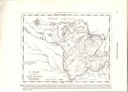
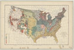
S. Hill. sc. Map dated 1796. Relief shown by hachures and pictorially. Prime meridians: Philadelphia & London. "The dotted Squares, are the Reservat...
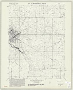
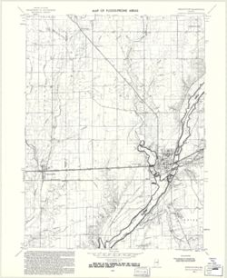
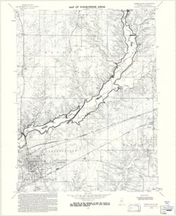
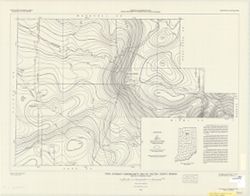
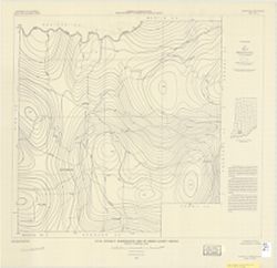
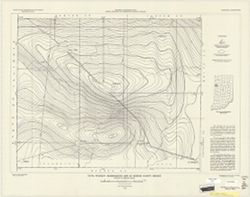
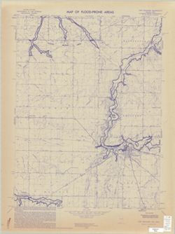
Polyconic projection. Relief shown by contours and spot heights. 7.5 U.S. topographic map with flood-prone areas designated north and northeast of Greencastl...
Call Number:
G4091.C32 s24 .G4 Greencastle 1970
Caption:
Imprint: Washington, D.C. : United States, Department of the Interior, Geological Survey, 1970.
Physical Description:
Dimensions: 58 x 45 cm and Scale: 1:24,000
Alternate Identifier:
Title Control Number: a18416317 and Alternate ID: CAW5372BB