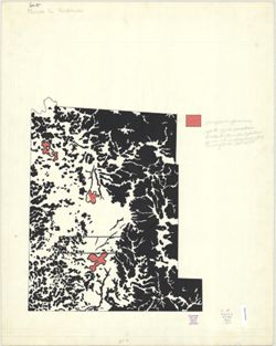
Geographic Subject: Greene County (Ind.), Topical Subject: Vegetation mapping, Geographic Subject: Martin County (Ind.), Geographic Subject: Monroe County (I...
创造者:
McKinley, W. K. (William Klett), 1891-1964 and Geological Survey (U.S.)
出版者:
Geological Survey (U.S.)
创建日期:
1960
识别码:
VAC3073-M-01372
Genre:
15 minute topographic maps, Quadrangle maps, and Topographic maps
Geographic Subject: Lawrence County (Ind.), Geographic Subject: Greene County (Ind.), Topical Subject: Vegetation mapping, Geographic Subject: Martin County ...
创造者:
McKinley, W. K. (William Klett), 1891-1964 and Geological Survey (U.S.)
出版者:
Geological Survey (U.S.)
创建日期:
1960
识别码:
VAC3073-M-01297
Genre:
15 minute topographic maps, Quadrangle maps, and Topographic maps
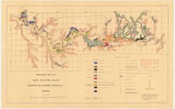
Geographic Subject: Monroe County (Ind.), Geographic Subject: Indiana, Geographic Subject: Brown County (Ind.), Topical Subject: Glaciology, Topical Subject:...
Relief shown by spot heights. Includes index map. Shows sediments by glacial epoch as well as recent alluvium and colluvium deposits and Meramecian and Osagi...
The geomorphology and geomorphic history of Bean Blossom Valley, Monroe and Brown Counties, Indiana / Alan R. Pratt. Thesis (A.M.)--Indiana University, 1960.
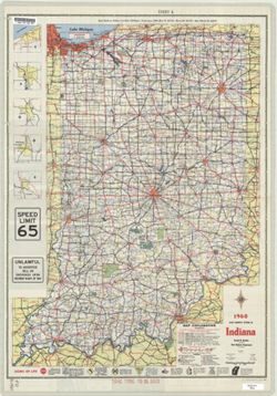
Panel title: 1960 Indiana official highway map. Includes 5 local route maps. Includes index, U.S. distance map, mileage chart, color illustrations, index and...
Call Number:
G4091.P2 1960 .I53
Caption:
Imprint: [Indianapolis] : State Highway Department of Indiana, [1960]
Physical Description:
Scale: Approximately 1:633,600 and Dimensions: 94 x 59 cm
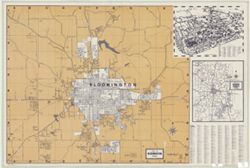
Title on wrapper: Bloomington, including Monroe County and Indiana University. Insets: Map of Monroe County, Indiana -- [Map of Indiana University]. ...
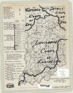
Geographic Subject: Indiana and Topical Subject: Rivers
创造者:
Indiana Waters Association
出版者:
Indiana Waters Association
创建日期:
1960
识别码:
VAC3073-M-00092
Genre:
Thematic maps
Geographic Location:
Coordinates: W0880500 W0844700 N0414500 N0374600
Related URL:
Catalog URL: https://iucat.iu.edu/catalog/7355175
Abstract:
Shows Corps of Engineers district boundaries drawn on a drainage map of Indiana and includes population density for each district. "1 1/2 million Hoosie...
Call Number:
G4091.C3 1960 .I53
Caption:
Imprint: Beech Grove, Ind.: Indiana Waters Association, [196?]
Physical Description:
Scale: Scale not given. and Dimensions: 27 x 17 cm

![Indiana Oolitic quadrangle : 15-minute series [1960 reprint with vegetation]](https://iiif.uits.iu.edu/iiif/2/r207vs27b%2Ffiles%2F9aee9db3-93e4-41e1-9ed6-b3a8d5c9e95c/full/250,/0/default.jpg)
![Indiana Oolitic quadrangle : 15-minute series [1960 reprint with vegetation]](https://iiif.uits.iu.edu/iiif/2/4m90fx888%2Ffiles%2F4b646387-592f-4982-b7bc-aaf89844fb82/full/250,/0/default.jpg)
![Van Buren Township, [Monroe County, Indiana]](https://iiif.uits.iu.edu/iiif/2/t148gk22c%2Ffiles%2F0702bb5b-5263-4741-9365-b7eacb14395d/full/250,/0/default.jpg)
![Geology [Monroe County, Ind.]](https://iiif.uits.iu.edu/iiif/2/qv33t0191%2Ffiles%2F7a237c59-b869-4ad6-928c-c058aa8367af/full/250,/0/default.jpg)