Indiana University
Indiana University
IU
Skip to Content
Hyrax
Toggle navigation
Hyrax
Sprache wechseln
Deutsch
Sprache wechseln
Deutsch
English
Español
Français
Italiano
Português do Brasil
中文
Anmeldung
Startseite
Impressum
Kontakt
Suche Hyrax
Suchen
×
Suchen
Neu anfangen
Sie suchten nach:
Herausgeber
Geological Survey (U.S.)
Filter Herausgeber: Geological Survey (U.S.) entfernen
« Voherige |
1
-
10
von
159
|
Nächste »
Ordnen nach collection size ▼
relevance ▼
recently updated
title ▲
title ▼
date created ▲
date created ▼
pages ▲
pages ▼
collection size ▲
collection size ▼
Anzahl der Ergebnisse, die pro Seite angezeigt werden
10 pro Seite
10
pro Seite
20
pro Seite
50
pro Seite
100
pro Seite
Ergebnisse ansehen als:
Liste
Gallery
Masonry
Suchergebnisse
1.
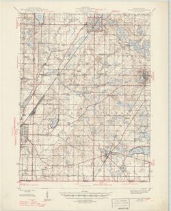
Illinois-Indiana-Kentucky, New Haven quadrangle [1966 reprint with vegetation]
2.
Indiana Oolitic quadrangle : 15-minute series [1960 reprint with vegetation]
3.
Illinois-Indiana-Kentucky, New Haven quadrangle [1939 reprint without vegetation]
4.
Kentucky-Indiana Cannelton quadrangle [1941 reprint]
5.
Cassopolis quadrangle, Michigan--Indiana : 15-minute series
6.
Indiana-Kentucky Owensboro quadrangle [1950 reprint]
7.
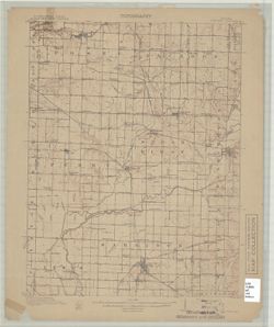
Indiana Clay City quadrangle
8.
Indiana Boonville quadrangle [1946 reprint]
9.
Indiana-Illinois, Vincennes quadrangle : topography [1946 reprint with corrections and without vegetation]
10.
Princeton quadrangle, Indiana-Illinois : 15 minute series (topographic) [1965 reprint with vegetation]
« Voherige
Nächste »
1
2
3
4
5
…
15
16
Toggle facets
Suche beschränken
Type
Image
159
Schöpfer
Geological Survey (U.S.)
131
Renshawe, John H.
45
Hawkins, Geo. T. (George T.)
37
Goodlove, C. W.
31
Herron, W. H. (William Harrison), 1865-
27
Marshall, R. B. (Robert Bradford), 1867-1949
24
Illinois State Geological Survey
20
McKinney, R. C. (Robert C.)
18
United States. Army. Corps of Engineers
18
U.S. Coast and Geodetic Survey
14
mehr
Schöpfers
»
Fach
Geographic Subject: Gibson County (Ind.)
35
Topical Subject: Vegetation mapping
30
Geographic Subject: Knox County (Ind.)
23
Geographic Subject: Wabash County (Ill.)
22
Geographic Subject: Posey County (Ind.)
20
Geographic Subject: Lake County (Ind.)
14
Geographic Subject: Monroe County (Ind.)
14
Geographic Subject: Spencer County (Ind.)
14
Geographic Subject: Vanderburgh County (Ind.)
13
Geographic Subject: Warrick County (Ind.)
13
mehr
Faches
»
Herausgeber
Geological Survey (U.S.)
[remove]
159
Date Created
1950
9
1903
7
1959
7
1970
7
1988
7
1925
6
1946
6
1964
6
1936
5
1939
5
mehr
Date Createds
»
Pages
0-99 pages
159
Collections
Indiana Historic Maps
159
State
deposited
159
Campus
IUB
159
Holding Location
B-WELLS
159
Provenance
Part of Geological Survey (U.S.). Indiana 1:62,500.
119
United States Department of the Interior, Geological Survey. Map of flood-prone areas : [Indiana]. Washington, D.C. : The Survey, 1969-.
12
The National gazetteer of the United States of America--Indiana, 1988 / U.S. Geological Survey.
6
Part of Geological Survey (U.S.). Indiana 1:125,000.
4
14th Annual Report (1884) / Indiana. Department of Geology and Natural History.
1
Map of Flood-Prone Areas: Middletown Quadrangle, Indiana.
1
Map of the Western parts of the Colony of Virginia as far as the Mississipi.
1
USGS 15 minute series (topographic)
1

![Illinois-Indiana-Kentucky, New Haven quadrangle [1966 reprint with vegetation]](https://iiif.uits.iu.edu/iiif/2/k0699966z%2Ffiles%2F2ec905c7-1ce1-46fe-974b-b888b96b34a5/full/250,/0/default.jpg)
![Indiana Oolitic quadrangle : 15-minute series [1960 reprint with vegetation]](https://iiif.uits.iu.edu/iiif/2/r207vs27b%2Ffiles%2F9aee9db3-93e4-41e1-9ed6-b3a8d5c9e95c/full/250,/0/default.jpg)
![Illinois-Indiana-Kentucky, New Haven quadrangle [1939 reprint without vegetation]](https://iiif.uits.iu.edu/iiif/2/qj72qc053%2Ffiles%2Fbde64e1d-6659-4d18-a8c8-db54ce923770/full/250,/0/default.jpg)
![Kentucky-Indiana Cannelton quadrangle [1941 reprint]](https://iiif.uits.iu.edu/iiif/2/8336j442q%2Ffiles%2F47a90ccc-f6f3-4558-aeaf-5356b28b815d/full/250,/0/default.jpg)
![Indiana-Kentucky Owensboro quadrangle [1950 reprint]](https://iiif.uits.iu.edu/iiif/2/dn39z555q%2Ffiles%2F89bb7d7d-8ace-46e8-8ef0-e69211350ab1/full/250,/0/default.jpg)
![Indiana Boonville quadrangle [1946 reprint]](https://iiif.uits.iu.edu/iiif/2/765384187%2Ffiles%2F7c9648cb-7d65-40a1-90c7-0327c2cdfaed/full/250,/0/default.jpg)
![Indiana-Illinois, Vincennes quadrangle : topography [1946 reprint with corrections and without vegetation]](https://iiif.uits.iu.edu/iiif/2/n009x521b%2Ffiles%2Fda21d6eb-ada6-4f1f-8c3c-8022f31eb1a9/full/250,/0/default.jpg)
![Princeton quadrangle, Indiana-Illinois : 15 minute series (topographic) [1965 reprint with vegetation]](https://iiif.uits.iu.edu/iiif/2/sx61fr138%2Ffiles%2F603798b1-0337-482a-9bb7-934a41ad4b2b/full/250,/0/default.jpg)