
Search Constraints
You searched for:
Campus
IUB
Remove constraint Campus: IUB
Pages
0-99 pages
Remove constraint Pages: 0-99 pages
Provenance
DMA Topographic Center, Army Map Service Library, OMAHA, Library of Congress Geography & Map Division
Remove constraint Provenance: DMA Topographic Center, Army Map Service Library, OMAHA, Library of Congress Geography & Map Division
Publisher
Управление военных топографов
Remove constraint Publisher: Управление военных топографов
« Previous |
1 - 100 of 140
|
Next »
Search Results
-
- Description:
- 1931
- Subject:
- Geographic Subject: Prigarovka, Topical Subject: Soviet Union, and Topical Subject: Maps
- Publisher:
- Управление военных топографов
- Language:
- Russian
- Date Created:
- 1932
- Identifier:
- VAC9619-001075
- Genre:
- Military Maps and Topographic Maps
- Geographic Location:
- Coordinates: 49, 33.75, 49.167, 34
- Related URL:
- Catalog URL: http://iucat.iu.edu/catalog/5020131 and Download GeoTIFF: https://drive.google.com/open?id=1f6wjuPrc3Ux9DrlosAXfFGB4gFxqmSmk
- Abstract:
- Modern area represented: Prigarovka, Poltava oblast, Ukraine
- Call Number:
- G7000 s50 .S68 М-36-104-Г
- Caption:
- Не подлежит оглашению
- City:
- Пригаривка (Prigarovka)
- Copyright Holder:
- No Copyright - United States
- Country:
- СССР (USSR)
- State/Province:
- Украинская ССР (Ukrainian Soviet Socialist Republic) and Харьковская область (Kharkiv oblast)
- Physical Description:
- Scale: 1:50,000
- Persistent URL:
- http://purl.dlib.indiana.edu/iudl/images/VAC9619/VAC9619-001075
- Provenance:
- DMA Topographic Center, Army Map Service Library, OMAHA, Library of Congress Geography & Map Division
-
- Description:
- 1891
- Subject:
- Topical Subject: Maps, Geographic Subject: St Petersburg, and Topical Subject: Soviet Union
- Publisher:
- Управление военных топографов
- Language:
- Russian
- Date Created:
- 1931
- Identifier:
- VAC9619-000897
- Genre:
- Military Maps and Topographic Maps
- Geographic Location:
- Coordinates: 59.8333, 30.25, 60, 30.5
- Related URL:
- Catalog URL: http://iucat.iu.edu/catalog/5020131 and Download GeoTIFF: https://drive.google.com/open?id=1FPa_YDmAVR2_-WZKluZAz2kowpTjWoSH
- Abstract:
- Modern area represented: St Petersburg, Russia
- Call Number:
- G7000 s50 .S68 sheet О-36-1-Б
- Caption:
- Не подлежит оглашению
- City:
- Ленинград (Leningrad)
- Copyright Holder:
- No Copyright - United States
- Country:
- СССР (USSR)
- State/Province:
- Ленинградская область (Leningrad oblast) and РСФСР (RSFSR)
- Physical Description:
- Scale: 1:50,000
- Persistent URL:
- http://purl.dlib.indiana.edu/iudl/images/VAC9619/VAC9619-000897
- Provenance:
- DMA Topographic Center, Army Map Service Library, OMAHA, Library of Congress Geography & Map Division
-
- Subject:
- Geographic Subject: Mlyniv, Topical Subject: Soviet Union, and Topical Subject: Maps
- Publisher:
- Управление военных топографов
- Language:
- Russian
- Date Created:
- 1937
- Identifier:
- VAC9619-000218
- Genre:
- Military Maps and Topographic Maps
- Geographic Location:
- Coordinates: 50.5, 25.5, 50.667, 25.75
- Related URL:
- Download GeoTIFF: https://drive.google.com/open?id=13uyKeOnyHt_42-Dl3iUUZgFJz7RZ1yEB and Catalog URL: http://iucat.iu.edu/catalog/5020131
- Abstract:
- Modern area represented: Mlyniv, Ukraine
- Call Number:
- G7000 s50 .S68 sheet M-35-52-A
- City:
- Млынув (Mlynuv)
- Copyright Holder:
- No Copyright - United States
- Country:
- Польша (Poland)
- Physical Description:
- Scale: 1:50,000
- Persistent URL:
- http://purl.dlib.indiana.edu/iudl/images/VAC9619/VAC9619-000218
- Provenance:
- DMA Topographic Center, Army Map Service Library, OMAHA, Library of Congress Geography & Map Division
-
- Description:
- 1932
- Subject:
- Topical Subject: Maps, Geographic Subject: Озаринці (Ozaryntsi), and Topical Subject: Soviet Union
- Publisher:
- Управление военных топографов
- Language:
- Russian
- Identifier:
- VAC9619-000885
- Genre:
- Topographic Maps and Military Maps
- Geographic Location:
- Coordinates: 48.5, 27.75, 48.6667, 28
- Related URL:
- Download GeoTIFF: https://drive.google.com/open?id=1clJyxxJUBFb2ek9BOTxSGPGM9AB6GFfx and Catalog URL: http://iucat.iu.edu/catalog/5020131
- Abstract:
- Modern area represented: Озаринці (Ozaryntsi), Vinnytsia Oblast, Ukraine
- Call Number:
- G7000 s50 .S68 sheet M-35-128-B
- Caption:
- Captured map and Не подлежит оглашению
- City:
- Озаринцы (Ozarintsy)
- Copyright Holder:
- No Copyright - United States
- Country:
- СССР (USSR)
- State/Province:
- Украинская ССР (Ukrainian Soviet Socialist Republic) and Винницкая область (Vinnytsia oblast)
- Physical Description:
- Scale: 1:50,000
- Persistent URL:
- http://purl.dlib.indiana.edu/iudl/images/VAC9619/VAC9619-000885
- Provenance:
- DMA Topographic Center, Army Map Service Library, OMAHA, Library of Congress Geography & Map Division
-
- Description:
- 1929
- Subject:
- Topical Subject: Soviet Union, Topical Subject: Maps, and Geographic Subject: Vasyutyntsi
- Publisher:
- Управление военных топографов
- Language:
- Russian
- Identifier:
- VAC9619-001034
- Genre:
- Topographic Maps and Military Maps
- Geographic Location:
- Coordinates: 49.3333, 32.25, 49.5, 32.5
- Related URL:
- Catalog URL: http://iucat.iu.edu/catalog/5020131 and Download GeoTIFF: https://drive.google.com/open?id=160E9TKQjJHKCc_oTkIq5sN78-OifQaYB
- Abstract:
- Modern area represented: Васютинці (Vasyutyntsi), Cherkasy oblast, Ukraine
- Call Number:
- G7000 s50 .S68 sheet M-36-89-D
- Caption:
- Не подлежит оглашению (crossed out) and Рассекречено
- City:
- Васютинцы (Vasyutintsy)
- Copyright Holder:
- No Copyright - United States
- Country:
- СССР (USSR)
- State/Province:
- Украинская ССР (Ukrainian Soviet Socialist Republic)
- Physical Description:
- Scale: 1:50,000
- Persistent URL:
- http://purl.dlib.indiana.edu/iudl/images/VAC9619/VAC9619-001034
- Provenance:
- DMA Topographic Center, Army Map Service Library, OMAHA, Library of Congress Geography & Map Division
-
- Description:
- 1931
- Subject:
- Geographic Subject: Радалівка, Topical Subject: Soviet Union, Geographic Subject: Radalivka, and Topical Subject: Maps
- Publisher:
- Управление военных топографов
- Language:
- Russian
- Identifier:
- VAC9619-001040
- Genre:
- Topographic Maps and Military Maps
- Geographic Location:
- Coordinates: 49.5, 33.25, 49.6667, 33.5
- Related URL:
- Download GeoTIFF: https://drive.google.com/open?id=1Enk3MnyFeez4uCvtZQPGS3OzXGkZjL06 and Catalog URL: http://iucat.iu.edu/catalog/5020131
- Abstract:
- Modern area represented: Радалівка (Radalivka), Poltava oblast, Ukraine
- Call Number:
- G7000 s50 .S68 sheet M-36-91-B
- Caption:
- Не подлежит оглашению
- City:
- Радоловка (Radolovka)
- Copyright Holder:
- No Copyright - United States
- Country:
- СССР (USSR)
- State/Province:
- Украинская ССР (Ukrainian Soviet Socialist Republic)
- Physical Description:
- Scale: 1:50,000
- Persistent URL:
- http://purl.dlib.indiana.edu/iudl/images/VAC9619/VAC9619-001040
- Provenance:
- DMA Topographic Center, Army Map Service Library, OMAHA, Library of Congress Geography & Map Division
-
- Description:
- 1928
- Subject:
- Geographic Subject: Борзна (Borzna), Topical Subject: Maps, and Topical Subject: Soviet Union
- Publisher:
- Управление военных топографов
- Language:
- Russian
- Identifier:
- VAC9619-000936
- Genre:
- Military Maps and Topographic Maps
- Geographic Location:
- Coordinates: 51.167, 32.25, 51.333, 32.5
- Related URL:
- Download GeoTIFF: https://drive.google.com/open?id=18xhNg6LcpIBkHFZKIxvC99q6RO41c9kY and Catalog URL: http://iucat.iu.edu/catalog/5020131
- Abstract:
- Modern area represented: Борзна (Borzna), Chernihiv oblast, Ukraine
- Call Number:
- G7000 s50 .S68 sheet M-36-27-B
- Caption:
- Не подлежит оглашению
- City:
- Борзна (Borzna)
- Copyright Holder:
- No Copyright - United States
- Country:
- СССР (USSR)
- State/Province:
- Украинская ССР (Ukrainian Soviet Socialist Republic)
- Physical Description:
- Scale: 1:50,000
- Persistent URL:
- http://purl.dlib.indiana.edu/iudl/images/VAC9619/VAC9619-000936
- Provenance:
- DMA Topographic Center, Army Map Service Library, OMAHA, Library of Congress Geography & Map Division
-
- Description:
- 1932
- Subject:
- Topical Subject: Soviet Union, Topical Subject: Maps, and Geographic Subject: Zapolye
- Publisher:
- Управление военных топографов
- Language:
- Russian
- Identifier:
- VAC9619-000056
- Genre:
- Topographic Maps and Military Maps
- Geographic Location:
- Coordinates: 57.3333, 30.5, 57.5, 30.75
- Related URL:
- Download GeoTIFF: https://drive.google.com/open?id=17_x28_Z_BDVfOkrBbY4QTkM7htZCIsu8 and Catalog URL: http://iucat.iu.edu/catalog/5020131
- Abstract:
- Modern area represented: Zapolye, Novgorod oblast, Russia
- Call Number:
- G7000 s50 .S68 sheet O-36-86-C
- Caption:
- Не подлежит оглашению
- City:
- Заполье (Zapolye)
- Copyright Holder:
- No Copyright - United States
- Country:
- СССР (USSR)
- State/Province:
- Ленинградская область (Leningrad oblast) and РСФСР (RSFSR)
- Physical Description:
- Scale: 1:50,000
- Persistent URL:
- http://purl.dlib.indiana.edu/iudl/images/VAC9619/VAC9619-000056
- Provenance:
- DMA Topographic Center, Army Map Service Library, OMAHA, Library of Congress Geography & Map Division
-
- Description:
- 1931
- Subject:
- Geographic Subject: Lyudzyanyevichy, Topical Subject: Soviet Union, and Topical Subject: Maps
- Publisher:
- Управление военных топографов
- Language:
- Russian
- Identifier:
- VAC9619-000805
- Genre:
- Military Maps and Topographic Maps
- Geographic Location:
- Coordinates: 52.167, 27.5, 52.333, 27.75
- Related URL:
- Download GeoTIFF: https://drive.google.com/open?id=1Iz6igjqfubylUvJDRkPnaNLvnw66JNjs and Catalog URL: http://iucat.iu.edu/catalog/5020131
- Abstract:
- Modern area represented: Lyudzyanyevichy, Homyel oblast, Belarus
- Call Number:
- G7000 s50 .s68 sheet N-35-140-A
- Caption:
- Не подлежит оглашению
- City:
- Люденевичи (Lyudenevichi)
- Copyright Holder:
- No Copyright - United States
- Country:
- Польша (Poland) and СССР (USSR)
- State/Province:
- Белорусская ССР (Byelorussian Soviet Socialist Republic)
- Physical Description:
- Scale: 1:50,000
- Persistent URL:
- http://purl.dlib.indiana.edu/iudl/images/VAC9619/VAC9619-000805
- Provenance:
- DMA Topographic Center, Army Map Service Library, OMAHA, Library of Congress Geography & Map Division
-
- Subject:
- Topical Subject: Maps, Topical Subject: Soviet Union, and Geographic Subject: Şıxzahırlı
- Publisher:
- Управление военных топографов
- Language:
- Russian
- Identifier:
- VAC9619-000102
- Genre:
- Topographic Maps and Military Maps
- Geographic Location:
- Coordinates: 40.3333, 49, 40.5, 49.25
- Related URL:
- Catalog URL: http://iucat.iu.edu/catalog/5020131 and Download GeoTIFF: https://drive.google.com/open?id=1whAXNIk9XmsAjVmpnbtT68C6DFI6K3M5
- Abstract:
- Modern area represented: Şıxzahırlı, Azerbaijan
- Call Number:
- G7000 s50 .S68 sheet K-39-123-C
- Caption:
- Не подлежит оглашению
- City:
- Ших-Загирли (Shikh-Zagirli)
- Copyright Holder:
- No Copyright - United States
- Country:
- СССР (USSR)
- State/Province:
- Азербайджанская ССР (Azerbaijan Soviet Socialist Republic)
- Physical Description:
- Scale: 1:50,000
- Persistent URL:
- http://purl.dlib.indiana.edu/iudl/images/VAC9619/VAC9619-000102
- Provenance:
- DMA Topographic Center, Army Map Service Library, OMAHA, Library of Congress Geography & Map Division
-
- Description:
- 1928
- Subject:
- Geographic Subject: Monastyryshche, Topical Subject: Soviet Union, and Topical Subject: Maps
- Publisher:
- Управление военных топографов
- Language:
- Russian
- Date Created:
- 1934
- Identifier:
- VAC9619-000950
- Genre:
- Topographic Maps and Military Maps
- Geographic Location:
- Coordinates: 50.66667, 32.0, 50.83333, 32.25
- Related URL:
- Download GeoTIFF: https://drive.google.com/open?id=1osXpm-MYY-r77zS8l33PrM8YxdBG8aOy and Catalog URL: http://iucat.iu.edu/catalog/5020131
- Abstract:
- Modern area represented: Monastyryshche, Chernihiv oblast, Ukraine
- Call Number:
- G7000 s50 .S68 sheet M-36-41-B
- Caption:
- Не подлежит оглашению
- City:
- Монастырище (Monastyrishche)
- Copyright Holder:
- No Copyright - United States
- Country:
- СССР (USSR)
- State/Province:
- Украинская ССР (Ukrainian Soviet Socialist Republic)
- Physical Description:
- Scale: 1:50,000
- Persistent URL:
- http://purl.dlib.indiana.edu/iudl/images/VAC9619/VAC9619-000950
- Provenance:
- DMA Topographic Center, Army Map Service Library, OMAHA, Library of Congress Geography & Map Division
-
- Description:
- 1931
- Subject:
- Topical Subject: Maps, Geographic Subject: Deriyivka, and Topical Subject: Soviet Union
- Publisher:
- Управление военных топографов
- Language:
- Russian
- Date Created:
- 1932
- Identifier:
- VAC9619-001096
- Genre:
- Topographic Maps and Military Maps
- Geographic Location:
- Coordinates: 48.833, 33.75, 49, 34
- Related URL:
- Catalog URL: http://iucat.iu.edu/catalog/5020131 and Download GeoTIFF: https://drive.google.com/open?id=1LN7i_LoBas4-BCPYShFOW-PILcYQ7657
- Abstract:
- Modern area represented: Deriyivka, Kirovohrad oblast, Ukraine
- Call Number:
- G7000 s50 .S68 М-36-116-Б
- Caption:
- Не подлежит оглашению
- City:
- Дериевка (Deriyivka)
- Copyright Holder:
- No Copyright - United States
- Country:
- СССР (USSR)
- State/Province:
- Киевская область (Kyiv oblast) and Украинская ССР (Ukrainian Soviet Socialist Republic)
- Physical Description:
- Scale: 1:50,000
- Persistent URL:
- http://purl.dlib.indiana.edu/iudl/images/VAC9619/VAC9619-001096
- Provenance:
- DMA Topographic Center, Army Map Service Library, OMAHA, Library of Congress Geography & Map Division
-
- Description:
- 1929
- Subject:
- Geographic Subject: Gradizhsk, Topical Subject: Maps, and Topical Subject: Soviet Union
- Publisher:
- Управление военных топографов
- Language:
- Russian
- Identifier:
- VAC9619-001068
- Genre:
- Topographic Maps and Military Maps
- Geographic Location:
- Coordinates: 49.1667, 33, 49.3333, 33.25
- Related URL:
- Catalog URL: http://iucat.iu.edu/catalog/5020131 and Download GeoTIFF: https://drive.google.com/open?id=1hNyCscjm1bobH1TzuIHo28gmdGxAQ5VV
- Abstract:
- Modern area represented: Gradizhsk, Poltava oblast, Ukraine
- Call Number:
- G7000 s50 .S68 М-36-103-А
- Caption:
- Не подлежит оглашению,Рассекречено
- City:
- М. Градижск (Gradizhsk)
- Copyright Holder:
- No Copyright - United States
- Country:
- СССР (USSR)
- State/Province:
- Украинская ССР (Ukrainian Soviet Socialist Republic)
- Physical Description:
- Scale: 1:50,000
- Persistent URL:
- http://purl.dlib.indiana.edu/iudl/images/VAC9619/VAC9619-001068
- Provenance:
- DMA Topographic Center, Army Map Service Library, OMAHA, Library of Congress Geography & Map Division
-
- Description:
- 1932
- Subject:
- Topical Subject: Maps, Geographic Subject: Vidzha, and Topical Subject: Soviet Union
- Publisher:
- Управление военных топографов
- Language:
- Russian
- Identifier:
- VAC9619-003524
- Genre:
- Military Maps and Topographic Maps
- Geographic Location:
- Coordinates: 57.66667, 31.0, 57.83333, 31.25
- Related URL:
- Download GeoTIFF: https://drive.google.com/file/d/1HLU6T17I6ZF-MnPAtxH0sQA-VXBqJxji/view?usp=sharing and Catalog URL: http://iucat.iu.edu/catalog/5020131
- Abstract:
- Modern area represented: Виджа (Vidzha), Novgorodskaya oblast, Russia
- Call Number:
- GM G7000 s50 .S68 sheet O-36-75-C
- Caption:
- Не подлежит оглашению and Captured map
- City:
- Виджа (Vidzha)
- Copyright Holder:
- No Copyright - United States
- Country:
- СССР (USSR)
- State/Province:
- Ленинградская область (Leningrad oblast) and РСФСР (RSFSR)
- Physical Description:
- Scale: 1:50,000
- Persistent URL:
- http://purl.dlib.indiana.edu/iudl/images/VAC9619/VAC9619-003524
- Provenance:
- DMA Topographic Center, Army Map Service Library, OMAHA, Library of Congress Geography & Map Division
-
- Subject:
- Topical Subject: Soviet Union, Topical Subject: Maps, and Geographic Subject: Fedorovskoye
- Publisher:
- Управление военных топографов
- Language:
- Russian
- Date Created:
- 1931
- Identifier:
- VAC9619-000031
- Genre:
- Topographic Maps and Military Maps
- Geographic Location:
- Coordinates: 59.5, 30.5, 59.6667, 30.75
- Related URL:
- Catalog URL: http://iucat.iu.edu/catalog/5020131 and Download GeoTIFF: https://drive.google.com/open?id=1cLSn16Q8KPWQftMST4_HFC_KJUUvTmp-
- Abstract:
- Modern area represented: Fedorovskoye, Leningrad oblast, Russia
- Call Number:
- G7000 s50 .S68 sheet O-36-14-A
- Caption:
- Не подлежит оглашению,Captured map
- City:
- Федоровский (Fedorovskiy)
- Copyright Holder:
- No Copyright - United States
- Country:
- СССР (USSR)
- State/Province:
- РСФСР (RSFSR) and Ленинградская область (Leningrad oblast)
- Physical Description:
- Scale: 1:50,000
- Persistent URL:
- http://purl.dlib.indiana.edu/iudl/images/VAC9619/VAC9619-000031
- Provenance:
- DMA Topographic Center, Army Map Service Library, OMAHA, Library of Congress Geography & Map Division
-
- Description:
- 1932
- Subject:
- Topical Subject: Soviet Union, Topical Subject: Maps, and Geographic Subject: Шаргород (Sharhorod)
- Publisher:
- Управление военных топографов
- Language:
- Russian
- Identifier:
- VAC9619-000881
- Genre:
- Topographic Maps and Military Maps
- Geographic Location:
- Coordinates: 48.6667, 28, 48.8333, 28.25
- Related URL:
- Catalog URL: http://iucat.iu.edu/catalog/5020131 and Download GeoTIFF: https://drive.google.com/open?id=1ygm0JEUYpVVJQessRLJVJKRdG5pstVeX
- Abstract:
- Modern area represented: Шаргород (Sharhorod), Vinnytsia Oblast, Ukraine
- Call Number:
- G7000 s50 .S68 sheet M-35-117-C
- Caption:
- Не подлежит оглашению
- City:
- Шаргород (Shargorod)
- Copyright Holder:
- No Copyright - United States
- Country:
- СССР (USSR)
- State/Province:
- Украинская ССР (Ukrainian Soviet Socialist Republic) and Винницкая область (Vinnytsia oblast)
- Physical Description:
- Scale: 1:50,000
- Persistent URL:
- http://purl.dlib.indiana.edu/iudl/images/VAC9619/VAC9619-000881
- Provenance:
- DMA Topographic Center, Army Map Service Library, OMAHA, Library of Congress Geography & Map Division
-
- Description:
- 1932
- Subject:
- Topical Subject: Soviet Union, Geographic Subject: Івча (Ivcha), and Topical Subject: Maps
- Publisher:
- Управление военных топографов
- Language:
- Russian
- Identifier:
- VAC9619-000874
- Genre:
- Topographic Maps and Military Maps
- Geographic Location:
- Coordinates: 49.3333, 28, 49.5, 28.25
- Related URL:
- Catalog URL: http://iucat.iu.edu/catalog/5020131 and Download GeoTIFF: https://drive.google.com/open?id=1YF-mtb4lGMe_qsgVpnb8P3STt24vWNxJ
- Abstract:
- Modern area represented: Івча (Ivcha), Vinnytsia Oblast, Ukraine
- Call Number:
- G7000 s50 .S68 sheet M-35-93-C
- Caption:
- Не подлежит оглашению
- City:
- Ивча (Ivcha)
- Copyright Holder:
- No Copyright - United States
- Country:
- СССР (USSR)
- State/Province:
- Украинская ССР (Ukrainian Soviet Socialist Republic) and Винницкая область (Vinnytsia oblast)
- Physical Description:
- Scale: 1:50,000
- Persistent URL:
- http://purl.dlib.indiana.edu/iudl/images/VAC9619/VAC9619-000874
- Provenance:
- DMA Topographic Center, Army Map Service Library, OMAHA, Library of Congress Geography & Map Division
-
- Description:
- 1932
- Subject:
- Geographic Subject: Belebelka, Topical Subject: Maps, and Topical Subject: Soviet Union
- Publisher:
- Управление военных топографов
- Language:
- Russian
- Identifier:
- VAC9619-000055
- Genre:
- Topographic Maps and Military Maps
- Geographic Location:
- Coordinates: 57.5, 30.75, 57.6667, 31
- Related URL:
- Catalog URL: http://iucat.iu.edu/catalog/5020131 and Download GeoTIFF: https://drive.google.com/open?id=1C6Cj-kxR2Y0hfswiLv4YWUg4X6cHeUB1
- Abstract:
- Modern area represented: Belebelka, Novgorod oblast, Russia
- Call Number:
- G7000 s50 .S68 sheet O-36-86-B
- Caption:
- Не подлежит оглашению,Captured map
- City:
- Белебелка (Belebelka)
- Copyright Holder:
- No Copyright - United States
- Country:
- СССР (USSR)
- State/Province:
- РСФСР (RSFSR) and Ленинградская область (Leningrad oblast)
- Physical Description:
- Scale: 1:50,000
- Persistent URL:
- http://purl.dlib.indiana.edu/iudl/images/VAC9619/VAC9619-000055
- Provenance:
- DMA Topographic Center, Army Map Service Library, OMAHA, Library of Congress Geography & Map Division
-
- Description:
- 1911
- Subject:
- Topical Subject: Soviet Union, Geographic Subject: Чернівці (Chernivtsi), and Topical Subject: Maps
- Publisher:
- Управление военных топографов
- Language:
- Russian
- Identifier:
- VAC9619-000888
- Genre:
- Military Maps and Topographic Maps
- Geographic Location:
- Coordinates: 48.5, 28, 48.6667, 28.25
- Related URL:
- Catalog URL: http://iucat.iu.edu/catalog/5020131 and Download GeoTIFF: https://drive.google.com/open?id=1piLpOaQPkIKx8BrhgN2REZ8XSmZbK6Qn
- Abstract:
- Modern area represented: Чернівці (Chernivtsi), Vinnytsia Oblast, Ukraine
- Call Number:
- G7000 s50 .S68 sheet M-35-129-A
- Caption:
- Captured map and Не подлежит оглашению
- City:
- Черневцы (Chernevtsy)
- Copyright Holder:
- No Copyright - United States
- Country:
- СССР (USSR)
- State/Province:
- Винницкая область (Vinnytsia oblast) and Украинская ССР (Ukrainian Soviet Socialist Republic)
- Physical Description:
- Scale: 1:50,000
- Persistent URL:
- http://purl.dlib.indiana.edu/iudl/images/VAC9619/VAC9619-000888
- Provenance:
- DMA Topographic Center, Army Map Service Library, OMAHA, Library of Congress Geography & Map Division
-
- Description:
- 1926
- Subject:
- Topical Subject: Soviet Union, Topical Subject: Maps, and Geographic Subject: Zhizhitsa
- Publisher:
- Управление военных топографов
- Language:
- Russian
- Date Created:
- 1933
- Identifier:
- VAC9619-003490
- Genre:
- Topographic Maps and Military Maps
- Geographic Location:
- Coordinates: 56.167, 31.25, 56.333, 31.5
- Related URL:
- Download GeoTIFF: https://drive.google.com/file/d/1akHjhCoHjwS7M9NoqxD_Wge8T9N5pm0n/view?usp=sharing and Catalog URL: http://iucat.iu.edu/catalog/5020131
- Abstract:
- Modern area represented: Жижица (Zhizhitsa), Pskovskaya oblast, Russia
- Call Number:
- G7000 s50 .S68 sheet O-36-135-B
- Caption:
- Captured map and Не подлежит оглашению
- City:
- Жижица (Zhizhitsa)
- Copyright Holder:
- No Copyright - United States
- Country:
- СССР (USSR)
- State/Province:
- Западная область (Western oblast) and РСФСР (RSFSR)
- Physical Description:
- Scale: 1:50,000
- Persistent URL:
- http://purl.dlib.indiana.edu/iudl/images/VAC9619/VAC9619-003490
- Provenance:
- DMA Topographic Center, Army Map Service Library, OMAHA, Library of Congress Geography & Map Division
-
- Description:
- 1928
- Subject:
- Geographic Subject: Sofiyivka, Topical Subject: Soviet Union, and Topical Subject: Maps
- Publisher:
- Управление военных топографов
- Language:
- Russian
- Date Created:
- 1930
- Identifier:
- VAC9619-001173
- Genre:
- Military Maps and Topographic Maps
- Geographic Location:
- Coordinates: 48, 33.75, 48.167, 34
- Related URL:
- Catalog URL: http://iucat.iu.edu/catalog/5020131 and Download GeoTIFF: https://drive.google.com/open?id=1UdJem7hxk7-OgmO7T9ABhjCmspQaneoN
- Abstract:
- Modern area represented: Sofiyivka, Dnipropetrovsk oblast, Ukraine
- Call Number:
- GM G7000 S50 .S68 M-36-140-Г
- Caption:
- Не подлежит оглашению
- City:
- Софиевка (Sofiyivka)
- Copyright Holder:
- No Copyright - United States
- Country:
- СССР (USSR)
- State/Province:
- Украинская ССР (Ukrainian Soviet Socialist Republic)
- Physical Description:
- Scale: 1:50,000
- Persistent URL:
- http://purl.dlib.indiana.edu/iudl/images/VAC9619/VAC9619-001173
- Provenance:
- DMA Topographic Center, Army Map Service Library, OMAHA, Library of Congress Geography & Map Division
-
- Description:
- 1924
- Subject:
- Topical Subject: Soviet Union, Geographic Subject: Trakhtemyriv, and Topical Subject: Maps
- Publisher:
- Управление военных топографов
- Language:
- Russian
- Identifier:
- VAC9619-000989
- Genre:
- Topographic Maps and Military Maps
- Geographic Location:
- Coordinates: 49.833, 31.25, 50, 31.5
- Related URL:
- Catalog URL: http://iucat.iu.edu/catalog/5020131 and Download GeoTIFF: https://drive.google.com/open?id=1zFZnIlQwNet5Y6qGxZ_YDo2x6r4AQQmR
- Abstract:
- Modern area represented: the place was flooded by the Kaniv Reservoir. The nearest populated place: Трахтемирів (Trakhtemyriv), Cherkasy oblast, Ukraine
- Call Number:
- G7000 s50 .S68 sheet M-36-74-C
- Caption:
- Не подлежит оглашению
- City:
- Вьюнище (V"yunishche)
- Copyright Holder:
- No Copyright - United States
- Country:
- СССР (USSR)
- State/Province:
- Украинская ССР (Ukrainian Soviet Socialist Republic)
- Physical Description:
- Scale: 1:50,000
- Persistent URL:
- http://purl.dlib.indiana.edu/iudl/images/VAC9619/VAC9619-000989
- Provenance:
- DMA Topographic Center, Army Map Service Library, OMAHA, Library of Congress Geography & Map Division
-
- Description:
- 1928
- Subject:
- Geographic Subject: Losynivka, Topical Subject: Soviet Union, and Topical Subject: Maps
- Publisher:
- Управление военных топографов
- Language:
- Russian
- Identifier:
- VAC9619-000946
- Genre:
- Military Maps and Topographic Maps
- Geographic Location:
- Coordinates: 50.83333, 31.75, 51.0, 32.0
- Related URL:
- Catalog URL: http://iucat.iu.edu/catalog/5020131 and Download GeoTIFF: https://drive.google.com/open?id=1QGA3gx83cVFuugb-9ygYfZt9y_J23Jin
- Abstract:
- Modern area represented: Losynivka, Chernihiv oblast, Ukraine
- Call Number:
- G7000 s50 .S68 sheet M-36-40-B
- Caption:
- Не подлежит оглашению
- City:
- Лосиновка (Losinovka)
- Copyright Holder:
- No Copyright - United States
- Country:
- СССР (USSR)
- State/Province:
- Украинская ССР (Ukrainian Soviet Socialist Republic)
- Physical Description:
- Scale: 1:50,000
- Persistent URL:
- http://purl.dlib.indiana.edu/iudl/images/VAC9619/VAC9619-000946
- Provenance:
- DMA Topographic Center, Army Map Service Library, OMAHA, Library of Congress Geography & Map Division
-
- Description:
- 1932
- Subject:
- Topical Subject: Soviet Union, Geographic Subject: Lyubyn, and Topical Subject: Maps
- Publisher:
- Управление военных топографов
- Language:
- Russian
- Identifier:
- VAC9619-002906
- Genre:
- Military Maps and Topographic Maps
- Geographic Location:
- Coordinates: 58, 30.5, 58.167, 30.75
- Related URL:
- Download GeoTIFF: https://drive.google.com/file/d/128ujqRn1-NJT7mXO6X6FxWTV2RPADtWI/view?usp=sharing and Catalog URL: http://iucat.iu.edu/catalog/5020131
- Abstract:
- Modern area represented: Lyubyn, Leningrad oblast, Russia
- Call Number:
- GM G7000 s50 .S68 sheet O-36-62-С
- Caption:
- Не подлежит оглашению,Captured map
- City:
- Любынь (Lyubyn)
- Copyright Holder:
- No Copyright - United States
- Country:
- СССР (USSR)
- State/Province:
- Ленинградская область (Leningrad oblast) and РСФСР (RSFSR)
- Physical Description:
- Scale: 1:50,000
- Persistent URL:
- http://purl.dlib.indiana.edu/iudl/images/VAC9619/VAC9619-002906
- Provenance:
- DMA Topographic Center, Army Map Service Library, OMAHA, Library of Congress Geography & Map Division
-
- Subject:
- Topical Subject: Maps, Geographic Subject: Panevėžys, and Topical Subject: Soviet Union
- Publisher:
- Управление военных топографов
- Language:
- Russian
- Identifier:
- VAC9619-000390
- Genre:
- Military Maps and Topographic Maps
- Geographic Location:
- Coordinates: 55.6667, 24.25, 55.8333, 24.5
- Related URL:
- Catalog URL: http://iucat.iu.edu/catalog/5020131 and Download GeoTIFF: https://drive.google.com/open?id=1kbtGH5uOo9C9HLNFCt_TdX1ml1Izto7-
- Abstract:
- Modern area represented: Panevėžys, Lithuania
- Call Number:
- G7000 s50 .S68 sheet N-35-1-D
- City:
- Поневеж (Ponevezh)
- Copyright Holder:
- No Copyright - United States
- Country:
- Литва (Lithuania)
- Physical Description:
- Scale: 1:50,000
- Persistent URL:
- http://purl.dlib.indiana.edu/iudl/images/VAC9619/VAC9619-000390
- Provenance:
- DMA Topographic Center, Army Map Service Library, OMAHA, Library of Congress Geography & Map Division
-
- Description:
- 1932
- Subject:
- Topical Subject: Soviet Union, Topical Subject: Maps, and Geographic Subject: Solov'yevo
- Publisher:
- Управление военных топографов
- Language:
- Russian
- Date Created:
- 1935
- Identifier:
- VAC9619-002914
- Genre:
- Topographic Maps and Military Maps
- Geographic Location:
- Coordinates: 57.667, 30.5, 57.833, 30.75
- Related URL:
- Catalog URL: http://iucat.iu.edu/catalog/5020131 and Download GeoTIFF: https://drive.google.com/file/d/1CLxRUBJnLOwI8Yau6rAVhpzupqZ-nCi6/view?usp=sharing
- Abstract:
- Modern area represented: Соловьево (Solov'yevo), Novgorodskaya oblast, Russia
- Call Number:
- GM G7000 s50 .S68 sheet O-36-74-С
- Caption:
- Не подлежит оглашению
- City:
- Соловьево (Solov'yevo)
- Copyright Holder:
- No Copyright - United States
- Country:
- СССР (USSR)
- State/Province:
- РСФСР (RSFSR) and Ленинградская область (Leningrad oblast)
- Physical Description:
- Scale: 1:50,000
- Persistent URL:
- http://purl.dlib.indiana.edu/iudl/images/VAC9619/VAC9619-002914
- Provenance:
- DMA Topographic Center, Army Map Service Library, OMAHA, Library of Congress Geography & Map Division
-
- Description:
- 1932
- Subject:
- Topical Subject: Maps, Geographic Subject: Димер (Dymer), and Topical Subject: Soviet Union
- Publisher:
- Управление военных топографов
- Language:
- Russian
- Identifier:
- VAC9619-000939
- Genre:
- Military Maps and Topographic Maps
- Geographic Location:
- Coordinates: 50.667, 30.25, 50.833, 30.5
- Related URL:
- Download GeoTIFF: https://drive.google.com/open?id=1rkp2BlRtLtAK1U6GKvEsWrKyLAstC7QP and Catalog URL: http://iucat.iu.edu/catalog/5020131
- Abstract:
- Modern area represented: Димер (Dymer), Kyiv oblast, Ukraine
- Call Number:
- G7000 s50 .S68 sheet M-36-37-D
- Caption:
- Не подлежит оглашению
- City:
- Дымер (Dymer)
- Copyright Holder:
- No Copyright - United States
- Country:
- СССР (USSR)
- State/Province:
- Украинская ССР (Ukrainian Soviet Socialist Republic) and Киевская область (Kyiv oblast)
- Physical Description:
- Scale: 1:50,000
- Persistent URL:
- http://purl.dlib.indiana.edu/iudl/images/VAC9619/VAC9619-000939
- Provenance:
- DMA Topographic Center, Army Map Service Library, OMAHA, Library of Congress Geography & Map Division
-
- Subject:
- Topical Subject: Soviet Union, Geographic Subject: Lukiv, and Topical Subject: Maps
- Publisher:
- Управление военных топографов
- Language:
- Russian
- Identifier:
- VAC9619-000194
- Genre:
- Topographic Maps and Military Maps
- Geographic Location:
- Coordinates: 51.167, 24.25, 51.333, 24.5
- Related URL:
- Download GeoTIFF: https://drive.google.com/open?id=1J1o8A77d5lYnLL02eoR8T0fBgEZX6PbZ and Catalog URL: http://iucat.iu.edu/catalog/5020131
- Abstract:
- Modern area represented: Lukiv, Ukraine
- Call Number:
- G7000 s50 .S68 sheet M-35-25-B
- City:
- Мацеюв (Maciejów)
- Copyright Holder:
- No Copyright - United States
- Country:
- Польша (Poland)
- Physical Description:
- Scale: 1:50,000
- Persistent URL:
- http://purl.dlib.indiana.edu/iudl/images/VAC9619/VAC9619-000194
- Provenance:
- DMA Topographic Center, Army Map Service Library, OMAHA, Library of Congress Geography & Map Division
-
- Subject:
- Geographic Subject: Daugailiai, Topical Subject: Soviet Union, and Topical Subject: Maps
- Publisher:
- Управление военных топографов
- Language:
- Russian
- Identifier:
- VAC9619-000445
- Genre:
- Military Maps and Topographic Maps
- Geographic Location:
- Coordinates: 55.5, 25.75, 55.6666, 26
- Related URL:
- Download GeoTIFF: https://drive.google.com/open?id=1Jas4YMEoqiidTaz--doGolQ2m546HUv0 and Catalog URL: http://iucat.iu.edu/catalog/5020131
- Abstract:
- Modern area represented: Daugailiai, Lithuania
- Call Number:
- G7000 s50 .S68 sheet N-35-16-B
- Caption:
- Captured map
- City:
- Довгели (Dovgeli)
- Copyright Holder:
- No Copyright - United States
- Country:
- Литва (Lithuania)
- Physical Description:
- Scale: 1:50,000
- Persistent URL:
- http://purl.dlib.indiana.edu/iudl/images/VAC9619/VAC9619-000445
- Provenance:
- DMA Topographic Center, Army Map Service Library, OMAHA, Library of Congress Geography & Map Division
-
- Description:
- 1931
- Subject:
- Geographic Subject: Denysovychi, Topical Subject: Maps, and Topical Subject: Soviet Union
- Publisher:
- Управление военных топографов
- Language:
- Russian
- Identifier:
- VAC9619-000191
- Genre:
- Topographic Maps and Military Maps
- Geographic Location:
- Coordinates: 51.333, 29.5, 51.5, 29.75
- Related URL:
- Catalog URL: http://iucat.iu.edu/catalog/5020131 and Download GeoTIFF: https://drive.google.com/open?id=1OHO2536LziDQohcfqTCZ2x6pDoc3y3uv
- Abstract:
- abandoned populated place (the residents were resettled as the result of the Chernobyl accident) and Modern area represented: Denysovychi, Ukraine
- Call Number:
- G7000 s50 .S68 and zsheet M-35-24-C
- Caption:
- Не подлежит оглашению
- City:
- Денисовичи (Denisovichi)
- Copyright Holder:
- No Copyright - United States
- Country:
- СССР (USSR)
- State/Province:
- Украинская ССР (Ukrainian Soviet Socialist Republic) and Белорусская ССР (Byelorussian Soviet Socialist Republic)
- Physical Description:
- Scale: 1:50,000
- Persistent URL:
- http://purl.dlib.indiana.edu/iudl/images/VAC9619/VAC9619-000191
- Provenance:
- DMA Topographic Center, Army Map Service Library, OMAHA, Library of Congress Geography & Map Division
-
- Description:
- 1923
- Subject:
- Topical Subject: Maps, Topical Subject: Soviet Union, and Geographic Subject: Tyahynka
- Publisher:
- Управление военных топографов
- Language:
- Russian
- Identifier:
- VAC9619-000113
- Genre:
- Military Maps and Topographic Maps
- Geographic Location:
- Coordinates: 46.6667, 33, 46.8333, 33.25
- Related URL:
- Catalog URL: http://iucat.iu.edu/catalog/5020131 and Download GeoTIFF: https://drive.google.com/open?id=1nHJ2Ca1LBDu7mZ_9F67eCDMX1DfAmG_G
- Abstract:
- Modern area represented: Tyahynka, Kherson oblast, Ukraine
- Call Number:
- G7000 s50 .S68 sheet L-36-43-C
- Caption:
- Не подлежит оглашению,Секретно
- City:
- Тягинка (Tyaginka)
- Copyright Holder:
- No Copyright - United States
- Country:
- СССР (USSR)
- State/Province:
- Украинская ССР (Ukrainian Soviet Socialist Republic)
- Physical Description:
- Scale: 1:50,000
- Persistent URL:
- http://purl.dlib.indiana.edu/iudl/images/VAC9619/VAC9619-000113
- Provenance:
- DMA Topographic Center, Army Map Service Library, OMAHA, Library of Congress Geography & Map Division
-
- Description:
- 1932
- Subject:
- Topical Subject: Maps, Topical Subject: Soviet Union, and Geographic Subject: Poddor'ye
- Publisher:
- Управление военных топографов
- Language:
- Russian
- Identifier:
- VAC9619-003533
- Genre:
- Military Maps and Topographic Maps
- Geographic Location:
- Coordinates: 57.3333, 31.0, 57.5, 31.25
- Related URL:
- Catalog URL: http://iucat.iu.edu/catalog/5020131 and Download GeoTIFF: https://drive.google.com/file/d/1iAyFR8ALMrmCoXPjaR-QZRBpVdP8BLku/view?usp=sharing
- Abstract:
- Modern area represented: Поддорье (Poddor'ye), Novgorodskaya oblast, Russia
- Call Number:
- GM G7000 s50 .S68 sheet O-36-87-C
- Caption:
- Не подлежит оглашению
- City:
- Поддорье (Poddor'ye)
- Copyright Holder:
- No Copyright - United States
- Country:
- СССР (USSR)
- State/Province:
- РСФСР (RSFSR) and Ленинградская область (Leningrad oblast)
- Physical Description:
- Scale: 1:50,000
- Persistent URL:
- http://purl.dlib.indiana.edu/iudl/images/VAC9619/VAC9619-003533
- Provenance:
- DMA Topographic Center, Army Map Service Library, OMAHA, Library of Congress Geography & Map Division
-
- Description:
- 1931
- Subject:
- Geographic Subject: Новошепеличі (Novoshepelychi), Topical Subject: Maps, and Topical Subject: Soviet Union
- Publisher:
- Управление военных топографов
- Language:
- Russian
- Identifier:
- VAC9619-000919
- Genre:
- Topographic Maps and Military Maps
- Geographic Location:
- Coordinates: 51.3333, 30, 51.5, 30.25
- Related URL:
- Catalog URL: http://iucat.iu.edu/catalog/5020131 and Download GeoTIFF: https://drive.google.com/open?id=1uTEQWRpIprvx9jp6GWK-vYSgij-bIyS4
- Abstract:
- Modern area represented: Новошепеличі (Novoshepelychi), Kyiv Oblast, Ukraine
- Call Number:
- G7000 s50 .S68 sheet M-36-13-C
- Caption:
- Не подлежит оглашению
- City:
- Новые Шепеличи
- Copyright Holder:
- No Copyright - United States
- Country:
- СССР (USSR)
- State/Province:
- Белорусская ССР (Byelorussian Soviet Socialist Republic) and Украинская ССР (Ukrainian Soviet Socialist Republic)
- Physical Description:
- Scale: 1:50,000
- Persistent URL:
- http://purl.dlib.indiana.edu/iudl/images/VAC9619/VAC9619-000919
- Provenance:
- DMA Topographic Center, Army Map Service Library, OMAHA, Library of Congress Geography & Map Division
-
- Subject:
- Topical Subject: Soviet Union, Geographic Subject: Voloyarvi, and Topical Subject: Maps
- Publisher:
- Управление военных топографов
- Language:
- Russian
- Identifier:
- VAC9619-002947
- Genre:
- Topographic Maps and Military Maps
- Geographic Location:
- Coordinates: 60.167, 30.75, 60.333, 31
- Related URL:
- Download GeoTIFF: https://drive.google.com/file/d/1z6dVMlW1nDP94cDiG4VGQkIxEfhFfKuF/view?usp=sharing and Catalog URL: http://iucat.iu.edu/catalog/5020131
- Abstract:
- Modern area represented: Voloyarvi, Leningrad oblast, Russia
- Call Number:
- G7000 s50 .S68 sheet P-36-134-B
- Caption:
- Не подлежит оглашению
- City:
- Волоярви (Voloyarvi)
- Copyright Holder:
- No Copyright - United States
- Country:
- СССР (USSR)
- State/Province:
- Ленинградская область (Leningrad oblast) and РСФСР (RSFSR)
- Physical Description:
- Scale: 1:50,000
- Persistent URL:
- http://purl.dlib.indiana.edu/iudl/images/VAC9619/VAC9619-002947
- Provenance:
- DMA Topographic Center, Army Map Service Library, OMAHA, Library of Congress Geography & Map Division
-
- Description:
- 1928
- Subject:
- Geographic Subject: Nova Orzhytsya, Geographic Subject: Stara Orzhytsya, Topical Subject: Soviet Union, and Topical Subject: Maps
- Publisher:
- Управление военных топографов
- Language:
- Russian
- Identifier:
- VAC9619-000968
- Genre:
- Topographic Maps and Military Maps
- Geographic Location:
- Coordinates: 50.333333, 31.75, 32.0, 50.5
- Related URL:
- Download GeoTIFF: https://drive.google.com/open?id=18YuytFzviawqbRaK_nU5kYcVnM0n3WRq and Catalog URL: http://iucat.iu.edu/catalog/5020131
- Abstract:
- Modern area represented: Stara Orzhytsya and Nova Orzhytsya, Kyiv oblast, Ukraine
- Call Number:
- G7000 s50 .S68 sheet M-36-52-D
- Caption:
- Не подлежит оглашению
- City:
- Оржица (Orzhytsa)
- Copyright Holder:
- No Copyright - United States
- Country:
- СССР (USSR)
- State/Province:
- Украинская ССР (Ukrainian Soviet Socialist Republic)
- Physical Description:
- Scale: 1:50,000
- Persistent URL:
- http://purl.dlib.indiana.edu/iudl/images/VAC9619/VAC9619-000968
- Provenance:
- DMA Topographic Center, Army Map Service Library, OMAHA, Library of Congress Geography & Map Division
-
- Description:
- 1928
- Subject:
- Topical Subject: Maps, Geographic Subject: Mala Vyska, and Topical Subject: Soviet Union
- Publisher:
- Управление военных топографов
- Language:
- Russian
- Identifier:
- VAC9619-001124
- Genre:
- Military Maps and Topographic Maps
- Geographic Location:
- Coordinates: 48.5, 31.5, 48.6667, 31.75
- Related URL:
- Catalog URL: http://iucat.iu.edu/catalog/5020131 and Download GeoTIFF: https://drive.google.com/open?id=1Kjt2cnHYUBaGkPS3gP0JhBtPqDeXbEqW
- Abstract:
- Modern area represented: Mala Vyska, Kirovohrad oblast, Ukraine
- Call Number:
- G7000 s50 .S68 M-36-124-A
- Caption:
- Не подлежит оглашению
- City:
- Малая Виска (Mala Vyska)
- Copyright Holder:
- No Copyright - United States
- Country:
- СССР (USSR)
- State/Province:
- Украинская ССР (Ukrainian Soviet Socialist Republic) and Одесская область (Odessa oblast)
- Physical Description:
- Scale: 1:50,000
- Persistent URL:
- http://purl.dlib.indiana.edu/iudl/images/VAC9619/VAC9619-001124
- Provenance:
- DMA Topographic Center, Army Map Service Library, OMAHA, Library of Congress Geography & Map Division
-
- Subject:
- Topical Subject: Maps, Geographic Subject: Kurkliai, and Topical Subject: Soviet Union
- Publisher:
- Управление военных топографов
- Language:
- Russian
- Identifier:
- VAC9619-000442
- Genre:
- Military Maps and Topographic Maps
- Geographic Location:
- Coordinates: 55.3333, 25, 55.5, 25.25
- Related URL:
- Download GeoTIFF: https://drive.google.com/open?id=1-vLi00KCTdz7JXvAXBsH5SUelOkmCf8R and Catalog URL: http://iucat.iu.edu/catalog/5020131
- Abstract:
- Modern area represented: Kurkliai, Lithuania
- Call Number:
- G7000 s50 .S68 sheet N-35-15-C
- Caption:
- Captured map
- City:
- Куркли (Kurkli)
- Copyright Holder:
- No Copyright - United States
- Country:
- Литва (Lithuania)
- Physical Description:
- Scale: 1:50,000
- Persistent URL:
- http://purl.dlib.indiana.edu/iudl/images/VAC9619/VAC9619-000442
- Provenance:
- DMA Topographic Center, Army Map Service Library, OMAHA, Library of Congress Geography & Map Division
-
- Description:
- 1932
- Subject:
- Topical Subject: Soviet Union, Topical Subject: Maps, and Geographic Subject: Morino
- Publisher:
- Управление военных топографов
- Language:
- Russian
- Identifier:
- VAC9619-002912
- Genre:
- Topographic Maps and Military Maps
- Geographic Location:
- Coordinates: 57.833, 30.25, 58, 30.5
- Related URL:
- Catalog URL: http://iucat.iu.edu/catalog/5020131 and Download GeoTIFF: https://drive.google.com/file/d/1VqyMek8uZ3cLp6KmwAyeZXulTuWrpsir/view?usp=sharing
- Abstract:
- Modern area represented: Морино (Morino), Pskovskaya oblast, Russia
- Call Number:
- GM G7000 s50 .S68 sheet O-36-73-В
- Caption:
- Не подлежит оглашению and Captured map
- City:
- Морино (Morino)
- Copyright Holder:
- No Copyright - United States
- Country:
- СССР (USSR)
- State/Province:
- Ленинградская область (Leningrad oblast) and РСФСР (RSFSR)
- Physical Description:
- Scale: 1:50,000
- Persistent URL:
- http://purl.dlib.indiana.edu/iudl/images/VAC9619/VAC9619-002912
- Provenance:
- DMA Topographic Center, Army Map Service Library, OMAHA, Library of Congress Geography & Map Division
-
- Description:
- 1908
- Subject:
- Topical Subject: Soviet Union, Geographic Subject: Самгородок (Samhorodok), and Topical Subject: Maps
- Publisher:
- Управление военных топографов
- Language:
- Russian
- Date Created:
- 1932
- Identifier:
- VAC9619-000875
- Genre:
- Military Maps and Topographic Maps
- Geographic Location:
- Coordinates: 49.5, 29.5, 49.6667, 29.75
- Related URL:
- Download GeoTIFF: https://drive.google.com/open?id=1NBFIdlNJHt_rVne16ak9-2u6xwuWTpCz and Catalog URL: http://iucat.iu.edu/catalog/5020131
- Abstract:
- Modern area represented: Самгородок (Samhorodok), Kyiv Oblast, Ukraine
- Call Number:
- G7000 s50 .S68 sheet M-35-96-A
- Caption:
- Не подлежит оглашению
- City:
- Самгородок (Samgorodok)
- Copyright Holder:
- No Copyright - United States
- Country:
- СССР (USSR)
- State/Province:
- Киевская область (Kyiv oblast) and Украинская ССР (Ukrainian Soviet Socialist Republic)
- Physical Description:
- Scale: 1:50,000
- Persistent URL:
- http://purl.dlib.indiana.edu/iudl/images/VAC9619/VAC9619-000875
- Provenance:
- DMA Topographic Center, Army Map Service Library, OMAHA, Library of Congress Geography & Map Division
-
- Description:
- 1900
- Subject:
- Topical Subject: Maps, Geographic Subject: Taguküla, and Topical Subject: Soviet Union
- Publisher:
- Управление военных топографов
- Language:
- Russian
- Identifier:
- VAC9619-001681
- Genre:
- Military Maps and Topographic Maps
- Geographic Location:
- Coordinates: 58.667, 22.75, 58.833, 23
- Related URL:
- Download GeoTIFF: https://drive.google.com/open?id=1QVnr3b8BsWhzK2l2UpVzdM5L4ozhsD1T and Catalog URL: http://iucat.iu.edu/catalog/5020131
- Abstract:
- Modern area represented: Taguküla, Hiiumaa county, Estonia
- Call Number:
- G7000 s50 .S68 sheet O-34-46-D
- City:
- Тагокюля (Taguküla)
- Copyright Holder:
- No Copyright - United States
- Country:
- Эстония (Estonia)
- Physical Description:
- Scale: 1:50,000
- Persistent URL:
- http://purl.dlib.indiana.edu/iudl/images/VAC9619/VAC9619-001681
- Provenance:
- DMA Topographic Center, Army Map Service Library, OMAHA, Library of Congress Geography & Map Division
-
- Subject:
- Topical Subject: Maps, Geographic Subject: Saint Petersburg, and Topical Subject: Soviet Union
- Publisher:
- Управление военных топографов
- Language:
- Russian
- Identifier:
- VAC9619-002997
- Genre:
- Military Maps and Topographic Maps
- Geographic Location:
- Coordinates: 59.833, 30.25, 60, 30.5
- Related URL:
- Catalog URL: http://iucat.iu.edu/catalog/5020131 and Download GeoTIFF: https://drive.google.com/file/d/1avlGmzVYE2tjZy1D6-flHLgSCn5JkLXF/view?usp=sharing
- Abstract:
- Modern area represented: Санкт-Петербург (Saint Petersburg), Russia
- Call Number:
- GM G7000 s50 .S68 sheet O-36-1-B
- Caption:
- Не подлежит оглашению
- City:
- Ленинград (Leningrad)
- Copyright Holder:
- No Copyright - United States
- Country:
- СССР (USSR)
- State/Province:
- РСФСР (RSFSR) and Ленинградская область (Leningrad oblast)
- Physical Description:
- Scale: 1:50,000
- Persistent URL:
- http://purl.dlib.indiana.edu/iudl/images/VAC9619/VAC9619-002997
- Provenance:
- DMA Topographic Center, Army Map Service Library, OMAHA, Library of Congress Geography & Map Division
-
- Description:
- 1892
- Subject:
- Topical Subject: Soviet Union, Topical Subject: Maps, and Geographic Subject: Volosovo
- Publisher:
- Управление военных топографов
- Language:
- Russian
- Date Created:
- 1930
- Identifier:
- VAC9619-000019
- Genre:
- Topographic Maps and Military Maps
- Geographic Location:
- Coordinates: 59.333, 29.25, 59.5, 29.5
- Related URL:
- Download GeoTIFF: https://drive.google.com/open?id=1ZbSL9v0FbbPo2FyPamVki4NrKim682Dz and Catalog URL: http://iucat.iu.edu/catalog/5020131
- Abstract:
- Modern area represented: Volosovo, Leningrad oblast, Russia
- Call Number:
- G7000 s50 .S68 and zsheet O-35-23-Г
- Caption:
- Не подлежит оглашению
- City:
- Волосово (Volosovo)
- Copyright Holder:
- No Copyright - United States
- Country:
- СССР (USSR)
- State/Province:
- Ленинградская область (Leningrad oblast) and РСФСР (RSFSR)
- Physical Description:
- Scale: 1:50,000
- Persistent URL:
- http://purl.dlib.indiana.edu/iudl/images/VAC9619/VAC9619-000019
- Provenance:
- DMA Topographic Center, Army Map Service Library, OMAHA, Library of Congress Geography & Map Division
-
- Subject:
- Topical Subject: Maps, Geographic Subject: Suvėnai, and Topical Subject: Soviet Union
- Publisher:
- Управление военных топографов
- Language:
- Russian
- Identifier:
- VAC9619-000399
- Genre:
- Military Maps and Topographic Maps
- Geographic Location:
- Coordinates: 55.833, 26, 56, 26.25
- Related URL:
- Download GeoTIFF: https://drive.google.com/open?id=1STcQqCD1BNRh1ef95dugxyZxiWoGN5Ma and Catalog URL: http://iucat.iu.edu/catalog/5020131
- Abstract:
- Modern area represented: Suvėnai, Utena county, Zarasai district, Lithuania
- Call Number:
- G7000 s50 .S68 sheet N-35-5-A
- City:
- Савяны (Savyany)
- Copyright Holder:
- No Copyright - United States
- Country:
- Латвия (Latvia) and Литва (Lithuania)
- Physical Description:
- Scale: 1:50,000
- Persistent URL:
- http://purl.dlib.indiana.edu/iudl/images/VAC9619/VAC9619-000399
- Provenance:
- DMA Topographic Center, Army Map Service Library, OMAHA, Library of Congress Geography & Map Division
-
- Description:
- 1894
- Subject:
- Topical Subject: Soviet Union, Topical Subject: Maps, and Geographic Subject: Vaivara Parish
- Publisher:
- Управление военных топографов
- Language:
- Russian
- Date Created:
- 1939
- Identifier:
- VAC9619-001807
- Genre:
- Military Maps and Topographic Maps
- Geographic Location:
- Coordinates: 59.333, 27.75, 59.5, 28
- Related URL:
- Catalog URL: http://iucat.iu.edu/catalog/5020131 and Download GeoTIFF: https://drive.google.com/open?id=1xZRkvws2fTzTf7QBQ5p6dQ2m53SU1f7c
- Abstract:
- Modern area represented: Vaivara Parish, Ida-Viru county, Estonia
- Call Number:
- G7000 s50 .S68 sheet O-35-20-D
- City:
- Вайвара (Vaivara)
- Copyright Holder:
- No Copyright - United States
- Country:
- Эстония (Estonia)
- Physical Description:
- Scale: 1:50,000
- Persistent URL:
- http://purl.dlib.indiana.edu/iudl/images/VAC9619/VAC9619-001807
- Provenance:
- DMA Topographic Center, Army Map Service Library, OMAHA, Library of Congress Geography & Map Division
-
- Description:
- 1929
- Subject:
- Geographic Subject: Pancheve, Topical Subject: Soviet Union, and Topical Subject: Maps
- Publisher:
- Управление военных топографов
- Language:
- Russian
- Identifier:
- VAC9619-001089
- Genre:
- Topographic Maps and Military Maps
- Geographic Location:
- Coordinates: 48.667, 31.75, 48.833, 32
- Related URL:
- Catalog URL: http://iucat.iu.edu/catalog/5020131 and Download GeoTIFF: https://drive.google.com/open?id=1ocXT35jK64PNznjS-NCrpPlcENJTzt5D
- Abstract:
- Modern area represented: Pancheve, Kirovohrad oblast, Ukraine
- Call Number:
- G7000 s50 .S68 М-36-112-Г
- Caption:
- Не подлежит оглашению
- City:
- Панчево (Pancheve)
- Copyright Holder:
- No Copyright - United States
- Country:
- СССР (USSR)
- State/Province:
- Украинская ССР (Ukrainian Soviet Socialist Republic)
- Physical Description:
- Scale: 1:50,000
- Persistent URL:
- http://purl.dlib.indiana.edu/iudl/images/VAC9619/VAC9619-001089
- Provenance:
- DMA Topographic Center, Army Map Service Library, OMAHA, Library of Congress Geography & Map Division
-
- Subject:
- Topical Subject: Soviet Union, Geographic Subject: Troyanivka, and Topical Subject: Maps
- Publisher:
- Управление военных топографов
- Language:
- Russian
- Identifier:
- VAC9619-000241
- Genre:
- Military Maps and Topographic Maps
- Geographic Location:
- Coordinates: 51.167, 25.25, 51.333, 25.5
- Related URL:
- Download GeoTIFF: https://drive.google.com/open?id=11cY4KaFJsp5dq6sBUlIyeW5VlW4fy_SA and Catalog URL: http://iucat.iu.edu/catalog/5020131
- Abstract:
- Modern area represented: Troyanivka, Volyn oblast, Ukraine
- Call Number:
- G7000 s50 .S68 sheet M-35-27-B
- City:
- Троянувка (Trojanówka)
- Copyright Holder:
- No Copyright - United States
- Country:
- Польша (Poland)
- Physical Description:
- Scale: 1:50,000
- Persistent URL:
- http://purl.dlib.indiana.edu/iudl/images/VAC9619/VAC9619-000241
- Provenance:
- DMA Topographic Center, Army Map Service Library, OMAHA, Library of Congress Geography & Map Division
-
- Subject:
- Topical Subject: Maps, Geographic Subject: Khittolovo, and Topical Subject: Soviet Union
- Publisher:
- Управление военных топографов
- Language:
- Russian
- Identifier:
- VAC9619-002945
- Genre:
- Topographic Maps and Military Maps
- Geographic Location:
- Coordinates: 60.167, 30.5, 60.333, 30.75
- Related URL:
- Catalog URL: http://iucat.iu.edu/catalog/5020131 and Download GeoTIFF: https://drive.google.com/file/d/1vPiIhN4zg6WzBSf8FecxDK7KZKZGyTpt/view?usp=sharing
- Abstract:
- Modern area represented: Khittolovo, Leningrad oblast, Russia
- Call Number:
- G7000 s50 .S68 sheet P-36-134-A
- Caption:
- Не подлежит оглашению
- City:
- Хиттолово (Khittolovo)
- Copyright Holder:
- No Copyright - United States
- Country:
- СССР (USSR)
- State/Province:
- РСФСР (RSFSR) and Ленинградская область (Leningrad oblast)
- Physical Description:
- Scale: 1:50,000
- Persistent URL:
- http://purl.dlib.indiana.edu/iudl/images/VAC9619/VAC9619-002945
- Provenance:
- DMA Topographic Center, Army Map Service Library, OMAHA, Library of Congress Geography & Map Division
-
- Description:
- 1929
- Subject:
- Geographic Subject: Zhornokl'ovy, Topical Subject: Maps, and Topical Subject: Soviet Union
- Publisher:
- Управление военных топографов
- Language:
- Russian
- Date Created:
- 1932
- Identifier:
- VAC9619-000991
- Genre:
- Military Maps and Topographic Maps
- Geographic Location:
- Coordinates: 49.833, 31.75, 50, 32
- Related URL:
- Download GeoTIFF: https://drive.google.com/open?id=16Nggj2nwfnBGW6Q4EWeXn7a7Sap0bRb1 and Catalog URL: http://iucat.iu.edu/catalog/5020131
- Abstract:
- Modern area represented: Жорнокльови (Zhornokl'ovy), Cherkasy oblast, Ukraine
- Call Number:
- G7000 s50 .S68 sheet M-36-76-B
- Caption:
- Captured map, Рассекречено, and Не подлежит оглашению (crossed out)
- City:
- Жорноклевы (Zhornoklevy)
- Copyright Holder:
- No Copyright - United States
- Country:
- СССР (USSR)
- State/Province:
- Украинская ССР (Ukrainian Soviet Socialist Republic)
- Physical Description:
- Scale: 1:50,000
- Persistent URL:
- http://purl.dlib.indiana.edu/iudl/images/VAC9619/VAC9619-000991
- Provenance:
- DMA Topographic Center, Army Map Service Library, OMAHA, Library of Congress Geography & Map Division
-
- Subject:
- Geographic Subject: Bila Tserkva, Topical Subject: Soviet Union, and Topical Subject: Maps
- Publisher:
- Управление военных топографов
- Language:
- Russian
- Identifier:
- VAC9619-000984
- Genre:
- Military Maps and Topographic Maps
- Geographic Location:
- Coordinates: 49.667, 30, 49.833, 30.25
- Related URL:
- Catalog URL: http://iucat.iu.edu/catalog/5020131 and Download GeoTIFF: https://drive.google.com/open?id=1ftWMaKNlKrCsqA46WkemYc8X5jERvvii
- Abstract:
- Modern area represented: Біла Церква (Bila Tserkva), Kyiv oblast, Ukraine
- Call Number:
- G7000 s50 .S68 sheet M-36-73-C
- Caption:
- Не подлежит оглашению
- City:
- Белая Церковь (Belaya Tserkov’)
- Copyright Holder:
- No Copyright - United States
- Country:
- СССР (USSR)
- State/Province:
- Украинская ССР (Ukrainian Soviet Socialist Republic) and Киевская область (Kyiv oblast)
- Physical Description:
- Scale: 1:50,000
- Persistent URL:
- http://purl.dlib.indiana.edu/iudl/images/VAC9619/VAC9619-000984
- Provenance:
- DMA Topographic Center, Army Map Service Library, OMAHA, Library of Congress Geography & Map Division
-
- Description:
- 1931
- Subject:
- Geographic Subject: Lubny, Topical Subject: Soviet Union, and Topical Subject: Maps
- Publisher:
- Управление военных топографов
- Language:
- Russian
- Identifier:
- VAC9619-000980
- Genre:
- Topographic Maps and Military Maps
- Geographic Location:
- Coordinates: 50, 33, 50.167, 33.25
- Related URL:
- Catalog URL: http://iucat.iu.edu/catalog/5020131 and Download GeoTIFF: https://drive.google.com/open?id=1VpTA7xVPHxQmymgXq7Sjuczk_KtdDeRx
- Abstract:
- Modern area represented: Лубни (Lubny), Poltava oblast, Ukraine
- Call Number:
- G7000 s50 .S68 sheet M-36-67-A
- Caption:
- Не подлежит оглашению
- City:
- Лубны (Lubny)
- Copyright Holder:
- No Copyright - United States
- Country:
- СССР (USSR)
- State/Province:
- Лубенский район (Lubensky district) and Украинская ССР (Ukrainian Soviet Socialist Republic)
- Physical Description:
- Scale: 1:50,000
- Persistent URL:
- http://purl.dlib.indiana.edu/iudl/images/VAC9619/VAC9619-000980
- Provenance:
- DMA Topographic Center, Army Map Service Library, OMAHA, Library of Congress Geography & Map Division
-

- Description:
- 1913
- Subject:
- Topical Subject: Maps, Geographic Subject: Lishchynivka, and Topical Subject: Soviet Union
- Publisher:
- Управление военных топографов
- Language:
- Russian
- Date Created:
- 1932
- Identifier:
- VAC9619-001085
- Genre:
- Military Maps and Topographic Maps
- Geographic Location:
- Coordinates: 48.833, 30, 49, 30.25
- Related URL:
- Download GeoTIFF: https://drive.google.com/open?id=1k46AZBd1szSC6Pg88oP_2c41-TvvVgr4 and Catalog URL: http://iucat.iu.edu/catalog/5020131
- Abstract:
- Modern area represented: Lishchynivka, Cherkasy oblast, Ukraine
- Call Number:
- G7000 s50 .S68 М-36-109-А
- Caption:
- Не подлежит оглашению
- City:
- Лещинивка (Lishchynivka)
- Copyright Holder:
- No Copyright - United States
- Country:
- СССР (USSR)
- State/Province:
- Киевская область (Kyiv oblast) and Украинская ССР (Ukrainian Soviet Socialist Republic)
- Physical Description:
- Scale: 1:50,000
- Persistent URL:
- http://purl.dlib.indiana.edu/iudl/images/VAC9619/VAC9619-001085
- Provenance:
- DMA Topographic Center, Army Map Service Library, OMAHA, Library of Congress Geography & Map Division
-
- Description:
- 1931
- Subject:
- Topical Subject: Soviet Union, Geographic Subject: Гомельская область, Geographic Subject: Радзін (Radzin), and Topical Subject: Maps
- Publisher:
- Управление военных топографов
- Language:
- Russian
- Identifier:
- VAC9619-000910
- Genre:
- Military Maps and Topographic Maps
- Geographic Location:
- Coordinates: 51.5, 30, 51.6667, 30.25
- Related URL:
- Download GeoTIFF: https://drive.google.com/open?id=1TgFldpUtWlWDkfXucgyQ22RniXwyiEfR and Catalog URL: http://iucat.iu.edu/catalog/5020131
- Abstract:
- Modern area represented: Радзін (Radzin), Homyel' Oblast, Belarus
- Call Number:
- G7000 s50 .S68 sheet M-36-13-A
- Caption:
- Не подлежит оглашению
- City:
- Старый Радин (Staryy Radin)
- Copyright Holder:
- No Copyright - United States
- Country:
- СССР (USSR)
- State/Province:
- Белорусская ССР (Byelorussian Soviet Socialist Republic) and Украинская ССР (Ukrainian Soviet Socialist Republic)
- Physical Description:
- Scale: 1:50,000
- Persistent URL:
- http://purl.dlib.indiana.edu/iudl/images/VAC9619/VAC9619-000910
- Provenance:
- DMA Topographic Center, Army Map Service Library, OMAHA, Library of Congress Geography & Map Division
-
- Description:
- 1932
- Subject:
- Topical Subject: Maps, Topical Subject: Soviet Union, and Geographic Subject: Belebelka
- Publisher:
- Управление военных топографов
- Language:
- Russian
- Date Created:
- 1935
- Identifier:
- VAC9619-003529
- Genre:
- Military Maps and Topographic Maps
- Geographic Location:
- Coordinates: 57.5, 30.75, 57.6667, 31.0
- Related URL:
- Download GeoTIFF: https://drive.google.com/file/d/1MsF7NM8_S3piH2IIQADcekLjZ5KjdXss/view?usp=sharing and Catalog URL: http://iucat.iu.edu/catalog/5020131
- Abstract:
- Modern area represented: Белебелка (Belebelka), Novgorodskaya oblast, Russia
- Call Number:
- GM G7000 s50 .S68 sheet O-36-86-B
- Caption:
- Captured map and Не подлежит оглашению
- City:
- Белебелка (Belebelka)
- Copyright Holder:
- No Copyright - United States
- Country:
- СССР (USSR)
- State/Province:
- РСФСР (RSFSR) and Ленинградская область (Leningrad oblast)
- Physical Description:
- Scale: 1:50,000
- Persistent URL:
- http://purl.dlib.indiana.edu/iudl/images/VAC9619/VAC9619-003529
- Provenance:
- DMA Topographic Center, Army Map Service Library, OMAHA, Library of Congress Geography & Map Division
-
- Description:
- 1927
- Subject:
- Topical Subject: Maps, Topical Subject: Soviet Union, and Geographic Subject: Holovanivsk
- Publisher:
- Управление военных топографов
- Language:
- Russian
- Identifier:
- VAC9619-001114
- Genre:
- Military Maps and Topographic Maps
- Geographic Location:
- Coordinates: 48.3333, 30.25, 48.5, 30.5
- Related URL:
- Download GeoTIFF: https://drive.google.com/open?id=1PjsKDto_gVFLELD-lk8-hRZqfHpSoGcR and Catalog URL: http://iucat.iu.edu/catalog/5020131
- Abstract:
- Modern area represented: Holovanivsk, Kirovohrad oblast, Ukraine
- Call Number:
- G7000 s50 .S68 М-36-121-Г
- Caption:
- Не подлежит оглашению
- City:
- М. Голованевск (Holovanivsk)
- Copyright Holder:
- No Copyright - United States
- Country:
- СССР (USSR)
- State/Province:
- Украинская ССР (Ukrainian Soviet Socialist Republic), Киевская область (Kyiv oblast), and Одесская область (Odessa oblast)
- Physical Description:
- Scale: 1:50,000
- Persistent URL:
- http://purl.dlib.indiana.edu/iudl/images/VAC9619/VAC9619-001114
- Provenance:
- DMA Topographic Center, Army Map Service Library, OMAHA, Library of Congress Geography & Map Division
-
- Subject:
- Geographic Subject: Mustalovo, Topical Subject: Maps, and Topical Subject: Soviet Union
- Publisher:
- Управление военных топографов
- Language:
- Russian
- Identifier:
- VAC9619-002938
- Genre:
- Topographic Maps and Military Maps
- Geographic Location:
- Coordinates: 60.333, 30, 60.5, 30.25
- Related URL:
- Catalog URL: http://iucat.iu.edu/catalog/5020131 and Download GeoTIFF: https://drive.google.com/file/d/1AFVjd15LfogaEX296JNqPh6ai3_6LpHe/view?usp=sharing
- Abstract:
- Modern area represented: Mustalovo, Leningrad oblast, Russia
- Call Number:
- G7000 s50 .S68 sheet P-36-121-C
- Caption:
- Не подлежит оглашению,Временное издание
- City:
- Мусталово (Mustalovo)
- Copyright Holder:
- No Copyright - United States
- Country:
- СССР (USSR) and Финляндия (Finland)
- State/Province:
- РСФСР (RSFSR) and Ленинградская область (Leningrad oblast)
- Physical Description:
- Scale: 1:50,000
- Persistent URL:
- http://purl.dlib.indiana.edu/iudl/images/VAC9619/VAC9619-002938
- Provenance:
- DMA Topographic Center, Army Map Service Library, OMAHA, Library of Congress Geography & Map Division
-
- Description:
- 1900
- Subject:
- Topical Subject: Soviet Union, Geographic Subject: Hullo, and Topical Subject: Maps
- Publisher:
- Управление военных топографов
- Language:
- Russian
- Identifier:
- VAC9619-001682
- Genre:
- Topographic Maps and Military Maps
- Geographic Location:
- Coordinates: 58.833, 23, 59, 23.25
- Related URL:
- Catalog URL: http://iucat.iu.edu/catalog/5020131 and Download GeoTIFF: https://drive.google.com/open?id=1ebGUjpldcRVD4V1gB1XojKdR9UICUJ9b
- Abstract:
- Modern area represented: Hullo, Lääne county, Estonia
- Call Number:
- G7000 s50 .S68 sheet O-34-47-A
- City:
- Хулло (Hullo)
- Copyright Holder:
- No Copyright - United States
- Country:
- Эстония (Estonia)
- Physical Description:
- Scale: 1:50,000
- Persistent URL:
- http://purl.dlib.indiana.edu/iudl/images/VAC9619/VAC9619-001682
- Provenance:
- DMA Topographic Center, Army Map Service Library, OMAHA, Library of Congress Geography & Map Division
-
- Description:
- 1932
- Subject:
- Topical Subject: Soviet Union, Geographic Subject: Psizha, and Topical Subject: Maps
- Publisher:
- Управление военных топографов
- Language:
- Russian
- Identifier:
- VAC9619-000052
- Genre:
- Topographic Maps and Military Maps
- Geographic Location:
- Coordinates: 58, 30.75, 58.1667, 31
- Related URL:
- Download GeoTIFF: https://drive.google.com/open?id=1tcGRyXevTuhTxqOaIEwaf3_FusCMsQaS and Catalog URL: http://iucat.iu.edu/catalog/5020131
- Abstract:
- Modern area represented: Psizha, Novgorod oblast, Russia
- Call Number:
- G7000 s50 .S68 sheet O-36-62-D
- Caption:
- Не подлежит оглашению,Captured map
- City:
- Псижа (Psizha)
- Copyright Holder:
- No Copyright - United States
- Country:
- СССР (USSR)
- State/Province:
- РСФСР (RSFSR) and Ленинградская область (Leningrad oblast)
- Physical Description:
- Scale: 1:50,000
- Persistent URL:
- http://purl.dlib.indiana.edu/iudl/images/VAC9619/VAC9619-000052
- Provenance:
- DMA Topographic Center, Army Map Service Library, OMAHA, Library of Congress Geography & Map Division
-
- Description:
- 1928
- Subject:
- Topical Subject: Soviet Union, Geographic Subject: Hmyryanka, and Topical Subject: Maps
- Publisher:
- Управление военных топографов
- Language:
- Russian
- Identifier:
- VAC9619-000951
- Genre:
- Military Maps and Topographic Maps
- Geographic Location:
- Coordinates: 50.666667, 32.25, 50.83333, 32.5
- Related URL:
- Download GeoTIFF: https://drive.google.com/open?id=1l9cjlRf1Dx9w_KXGeADtrhQ1RWeoxfDg and Catalog URL: http://iucat.iu.edu/catalog/5020131
- Abstract:
- Modern area represented: Hmyryanka, Chernihiv oblast, Ukraine
- Call Number:
- zsheet M-36-41-D and G7000 s50 .S68
- Caption:
- Не подлежит оглашению
- City:
- Гмырянка (Gmyryanka)
- Copyright Holder:
- No Copyright - United States
- Country:
- СССР (USSR)
- State/Province:
- Украинская ССР (Ukrainian Soviet Socialist Republic)
- Physical Description:
- Scale: 1:50,000
- Persistent URL:
- http://purl.dlib.indiana.edu/iudl/images/VAC9619/VAC9619-000951
- Provenance:
- DMA Topographic Center, Army Map Service Library, OMAHA, Library of Congress Geography & Map Division
-
- Description:
- 1932
- Subject:
- Topical Subject: Soviet Union, Topical Subject: Maps, and Geographic Subject: Zapol'ye
- Publisher:
- Управление военных топографов
- Language:
- Russian
- Date Created:
- 1935
- Identifier:
- VAC9619-003530
- Genre:
- Topographic Maps and Military Maps
- Geographic Location:
- Coordinates: 57.3333, 30.5, 57.5, 30.75
- Related URL:
- Download GeoTIFF: https://drive.google.com/file/d/1abqgMUIx4YwMEuwFrohfNLhOCdIr0eph/view?usp=sharing and Catalog URL: http://iucat.iu.edu/catalog/5020131
- Abstract:
- Modern area represented: Заполье (Zapol'ye), Novgorodskaya oblast, Russia
- Call Number:
- GM G7000 s50 .S68 sheet O-36-86-C
- Caption:
- Для служебного пользования and Captured map
- City:
- Заполье (Zapol'ye)
- Copyright Holder:
- No Copyright - United States
- Country:
- СССР (USSR)
- State/Province:
- РСФСР (RSFSR) and Ленинградская область (Leningrad oblast)
- Physical Description:
- Scale: 1:50,000
- Persistent URL:
- http://purl.dlib.indiana.edu/iudl/images/VAC9619/VAC9619-003530
- Provenance:
- DMA Topographic Center, Army Map Service Library, OMAHA, Library of Congress Geography & Map Division
-
- Subject:
- Topical Subject: Maps, Geographic Subject: Dolsk, and Topical Subject: Soviet Union
- Publisher:
- Управление военных топографов
- Language:
- Russian
- Identifier:
- VAC9619-000196
- Genre:
- Topographic Maps and Military Maps
- Geographic Location:
- Coordinates: 51, 24.25, 51.167, 24.5
- Related URL:
- Download GeoTIFF: https://drive.google.com/open?id=1yZHaR50nEgUuXdrWyJ9ckkqI-ZDqY74M and Catalog URL: http://iucat.iu.edu/catalog/5020131
- Abstract:
- Modern area represented: Dolsk, Ukraine
- Call Number:
- G7000 s50 .S68 sheet M-35-25-D
- City:
- Дольск (Dolsk)
- Copyright Holder:
- No Copyright - United States
- Country:
- Польша (Poland)
- Physical Description:
- Scale: 1:50,000
- Persistent URL:
- http://purl.dlib.indiana.edu/iudl/images/VAC9619/VAC9619-000196
- Provenance:
- DMA Topographic Center, Army Map Service Library, OMAHA, Library of Congress Geography & Map Division
-
- Description:
- 1928
- Subject:
- Topical Subject: Maps, Topical Subject: Soviet Union, and Geographic Subject: Zlynka
- Publisher:
- Управление военных топографов
- Language:
- Russian
- Identifier:
- VAC9619-001126
- Genre:
- Military Maps and Topographic Maps
- Geographic Location:
- Coordinates: 48.333, 31.5, 48.5, 31.75
- Related URL:
- Download GeoTIFF: https://drive.google.com/open?id=19voGTT0Gi3f5N0RAPT3iFvF-3O-lLkvr and Catalog URL: http://iucat.iu.edu/catalog/5020131
- Abstract:
- Modern area represented: Zlynka, Kirovohrad oblast, Ukraine
- Call Number:
- G7000 s50 .S68 M-36-124-C
- Caption:
- Не подлежит оглашению
- Copyright Holder:
- No Copyright - United States
- Country:
- СССР (USSR)
- State/Province:
- Украинская ССР (Ukrainian Soviet Socialist Republic)
- Physical Description:
- Scale: 1:50,000
- Persistent URL:
- http://purl.dlib.indiana.edu/iudl/images/VAC9619/VAC9619-001126
- Provenance:
- DMA Topographic Center, Army Map Service Library, OMAHA, Library of Congress Geography & Map Division
-
- Description:
- 1923
- Subject:
- Topical Subject: Soviet Union, Geographic Subject: Lavrovo, and Topical Subject: Maps
- Publisher:
- Управление военных топографов
- Language:
- Russian
- Identifier:
- VAC9619-002999
- Genre:
- Topographic Maps and Military Maps
- Geographic Location:
- Coordinates: 59.833, 31.5, 60, 31.75
- Related URL:
- Download GeoTIFF: https://drive.google.com/file/d/1rrBU5wmncF3sHbo5ePfXWlU-vjZ9M7ag/view?usp=sharing and Catalog URL: http://iucat.iu.edu/catalog/5020131
- Abstract:
- Modern area represented: Лаврово (Lavrovo), Leningradskaya oblast, Russia
- Call Number:
- GM G7000 s50 .S68 sheet O-36-4-A
- Caption:
- Не подлежит оглашению and Captured map
- City:
- Лаврова (Lavrova)
- Copyright Holder:
- No Copyright - United States
- Country:
- СССР (USSR)
- State/Province:
- Ленинградская область (Leningrad oblast) and РСФСР (RSFSR)
- Physical Description:
- Scale: 1:50,000
- Persistent URL:
- http://purl.dlib.indiana.edu/iudl/images/VAC9619/VAC9619-002999
- Provenance:
- DMA Topographic Center, Army Map Service Library, OMAHA, Library of Congress Geography & Map Division
-
- Description:
- 1926
- Subject:
- Geographic Subject: Toropets, Topical Subject: Soviet Union, and Topical Subject: Maps
- Publisher:
- Управление военных топографов
- Language:
- Russian
- Identifier:
- VAC9619-003464
- Genre:
- Military Maps and Topographic Maps
- Related URL:
- Catalog URL: http://iucat.iu.edu/catalog/5020131
- Abstract:
- Modern area represented: Toropets, Russia
- Call Number:
- GM G7000 s50 .S68 sheet O-36-124-A&C
- Caption:
- Не подлежит оглашению
- City:
- Торопец (Toropets)
- Copyright Holder:
- No Copyright - United States
- Country:
- СССР (USSR)
- Physical Description:
- Scale: 1:50,000
- Persistent URL:
- http://purl.dlib.indiana.edu/iudl/images/VAC9619/VAC9619-003464
- Provenance:
- DMA Topographic Center, Army Map Service Library, OMAHA, Library of Congress Geography & Map Division
-
- Subject:
- Topical Subject: Soviet Union, Geographic Subject: Utena, and Topical Subject: Maps
- Publisher:
- Управление военных топографов
- Language:
- Russian
- Identifier:
- VAC9619-000446
- Genre:
- Military Maps and Topographic Maps
- Geographic Location:
- Coordinates: 55.3333, 25.5, 55.5, 25.75
- Related URL:
- Catalog URL: http://iucat.iu.edu/catalog/5020131 and Download GeoTIFF: https://drive.google.com/open?id=1MQUeJHqAlrsw8bJ1pl3P6d6W74mNadT_
- Abstract:
- Modern area represented: Utena, Lithuania
- Call Number:
- G7000 s50 .S68 sheet N-35-16-C
- City:
- Уцяна (Utsyana)
- Copyright Holder:
- No Copyright - United States
- Country:
- Литва (Lithuania)
- Physical Description:
- Scale: 1:50,000
- Persistent URL:
- http://purl.dlib.indiana.edu/iudl/images/VAC9619/VAC9619-000446
- Provenance:
- DMA Topographic Center, Army Map Service Library, OMAHA, Library of Congress Geography & Map Division
-
- Subject:
- Topical Subject: Maps, Topical Subject: Soviet Union, and Geographic Subject: Vsevolozhsk
- Publisher:
- Управление военных топографов
- Language:
- Russian
- Identifier:
- VAC9619-002948
- Genre:
- Military Maps and Topographic Maps
- Geographic Location:
- Coordinates: 60, 30.5, 60.167, 30.75
- Related URL:
- Catalog URL: http://iucat.iu.edu/catalog/5020131 and Download GeoTIFF: https://drive.google.com/file/d/1PVntuQlolUSH4VWQSurTQqUr4xHo6UvH/view?usp=sharing
- Abstract:
- Modern area represented: Всеволожск (Vsevolozhsk), Leningradskaya oblast, Russia
- Call Number:
- GM G7000 s50 .S68 sheet P-36-134-C
- Caption:
- Не подлежит оглашению
- City:
- Всеволожский (Vsevolozhskiy)
- Copyright Holder:
- No Copyright - United States
- Country:
- СССР (USSR)
- State/Province:
- Ленинградская область (Leningrad oblast) and РСФСР (RSFSR)
- Physical Description:
- Scale: 1:50,000
- Persistent URL:
- http://purl.dlib.indiana.edu/iudl/images/VAC9619/VAC9619-002948
- Provenance:
- DMA Topographic Center, Army Map Service Library, OMAHA, Library of Congress Geography & Map Division
-
- Description:
- 1900
- Subject:
- Geographic Subject: Mudaste, Topical Subject: Soviet Union, and Topical Subject: Maps
- Publisher:
- Управление военных топографов
- Language:
- Russian
- Identifier:
- VAC9619-001669
- Genre:
- Military Maps and Topographic Maps
- Geographic Location:
- Coordinates: 59.0, 22.46667, 59.16667, 22.75
- Related URL:
- Catalog URL: http://iucat.iu.edu/catalog/5020131 and Download GeoTIFF: https://drive.google.com/open?id=1mkWWCJN280tpCEulOiH9ktdRNE8wtYqx
- Abstract:
- Modern area represented: Mudaste, Hiiumaa county, Estonia
- Call Number:
- G7000 s50 .S68 sheet O-34-34-B
- City:
- Мудасте (Mudaste)
- Copyright Holder:
- No Copyright - United States
- Country:
- Эстония (Estonia)
- Physical Description:
- Scale: 1:50,000
- Persistent URL:
- http://purl.dlib.indiana.edu/iudl/images/VAC9619/VAC9619-001669
- Provenance:
- DMA Topographic Center, Army Map Service Library, OMAHA, Library of Congress Geography & Map Division
-
- Description:
- 1932
- Subject:
- Topical Subject: Maps, Topical Subject: Soviet Union, and Geographic Subject: Ровжі (Rovzhi)
- Publisher:
- Управление военных топографов
- Language:
- Russian
- Identifier:
- VAC9619-000940
- Genre:
- Topographic Maps and Military Maps
- Geographic Location:
- Coordinates: 50.833, 30.5, 51, 30.75
- Related URL:
- Download GeoTIFF: https://drive.google.com/open?id=16bl70u8wdbvOxIjsxiH8dcqTtqq5GROB and Catalog URL: http://iucat.iu.edu/catalog/5020131
- Abstract:
- Modern area represented: the place was flooded by the Kyiv Reservoir. The nearest populated place: Ровжі (Rovzhi), Kyiv oblast, Ukraine
- Call Number:
- G7000 s100 .S7 sheet M-36-38-A
- Caption:
- Не подлежит оглашению
- City:
- Чернин (Chernin)
- Copyright Holder:
- No Copyright - United States
- Country:
- СССР (USSR)
- State/Province:
- Киевская область (Kyiv oblast) and Украинская ССР (Ukrainian Soviet Socialist Republic)
- Physical Description:
- Scale: 1:50,000
- Persistent URL:
- http://purl.dlib.indiana.edu/iudl/images/VAC9619/VAC9619-000940
- Provenance:
- DMA Topographic Center, Army Map Service Library, OMAHA, Library of Congress Geography & Map Division
-
- Description:
- 1929
- Subject:
- Topical Subject: Maps, Geographic Subject: Шаповалівка (Shapovalivka), and Topical Subject: Soviet Union
- Publisher:
- Управление военных топографов
- Language:
- Russian
- Identifier:
- VAC9619-000937
- Genre:
- Military Maps and Topographic Maps
- Geographic Location:
- Coordinates: 51.167, 32.5, 51.333, 32.75
- Related URL:
- Catalog URL: http://iucat.iu.edu/catalog/5020131 and Download GeoTIFF: https://drive.google.com/open?id=1bxcsbuPZO9fuMphLMGz2F1BDDpiMW6t8
- Abstract:
- Modern area represented: Шаповалівка (Shapovalivka), Chernihiv oblast, Ukraine
- Call Number:
- G7000 s50 .S68 sheet M-36-30-A
- Caption:
- Captured map and Не подлежит оглашению
- City:
- Шаповаловка (Shapovalovka)
- Copyright Holder:
- No Copyright - United States
- Country:
- СССР (USSR)
- State/Province:
- Украинская ССР (Ukrainian Soviet Socialist Republic)
- Physical Description:
- Scale: 1:50,000
- Persistent URL:
- http://purl.dlib.indiana.edu/iudl/images/VAC9619/VAC9619-000937
- Provenance:
- DMA Topographic Center, Army Map Service Library, OMAHA, Library of Congress Geography & Map Division
-
- Subject:
- Topical Subject: Soviet Union, Topical Subject: Maps, and Geographic Subject: Шпиків (Shpykiv)
- Publisher:
- Управление военных топографов
- Language:
- Russian
- Identifier:
- VAC9619-000883
- Genre:
- Military Maps and Topographic Maps
- Geographic Location:
- Coordinates: 48.6667, 28.5, 48.8333, 28.75
- Related URL:
- Download GeoTIFF: https://drive.google.com/open?id=1e9d4l6HndtNXqPJAVy8se6L0EtRjhtDu and Catalog URL: http://iucat.iu.edu/catalog/5020131
- Abstract:
- Modern area represented: Шпиків (Shpykiv), Vinnytsia Oblast, Ukraine
- Call Number:
- G7000 s50 .S68 sheet M-35-118-C
- Caption:
- Не подлежит оглашению
- City:
- Шпиков (Shpikov)
- Copyright Holder:
- No Copyright - United States
- Country:
- СССР (USSR)
- State/Province:
- Украинская ССР (Ukrainian Soviet Socialist Republic) and Винницкая область (Vinnytsia oblast)
- Physical Description:
- Scale: 1:50,000
- Persistent URL:
- http://purl.dlib.indiana.edu/iudl/images/VAC9619/VAC9619-000883
- Provenance:
- DMA Topographic Center, Army Map Service Library, OMAHA, Library of Congress Geography & Map Division
-
- Description:
- 1923
- Subject:
- Geographic Subject: Rudnya, Topical Subject: Maps, and Topical Subject: Soviet Union
- Publisher:
- Управление военных топографов
- Language:
- Russian
- Identifier:
- VAC9619-001297
- Genre:
- Topographic Maps and Military Maps
- Geographic Location:
- Coordinates: 54.833, 31, 55, 31.25
- Related URL:
- Download GeoTIFF: https://drive.google.com/open?id=1n_YwhOhaKG1AHq6vAQwNlb0JV0odSIfQ and Catalog URL: http://iucat.iu.edu/catalog/5020131
- Abstract:
- Modern area represented: Rudnya, Smolensk oblast, Russia
- Call Number:
- GM G7000 S50 .S68 N-36-39-A
- Caption:
- Не подлежит оглашению
- City:
- Рудня (Rudnya)
- Copyright Holder:
- No Copyright - United States
- Country:
- СССР (USSR)
- State/Province:
- РСФСР (RSFSR) and Западная область (Western oblast)
- Physical Description:
- Scale: 1:50,000
- Persistent URL:
- http://purl.dlib.indiana.edu/iudl/images/VAC9619/VAC9619-001297
- Provenance:
- DMA Topographic Center, Army Map Service Library, OMAHA, Library of Congress Geography & Map Division
-
- Subject:
- Topical Subject: Maps, Topical Subject: Soviet Union, and Geographic Subject: Nikulyasy
- Publisher:
- Управление военных топографов
- Language:
- Russian
- Identifier:
- VAC9619-002943
- Genre:
- Military Maps and Topographic Maps
- Geographic Location:
- Coordinates: 60.333, 30.75, 60.5, 31
- Related URL:
- Download GeoTIFF: https://drive.google.com/file/d/10TxAaCJC5pg13BWtd2o1LyZJ9n00X-VE/view?usp=sharing and Catalog URL: http://iucat.iu.edu/catalog/5020131
- Abstract:
- Modern area represented: Nikulyasy, Leningrad oblast, Russia
- Call Number:
- G7000 s50 .S68 sheet P-36-122-D
- Caption:
- Не подлежит оглашению,Временное издание
- City:
- Никулясы (Nikulyasy)
- Copyright Holder:
- No Copyright - United States
- Country:
- СССР (USSR)
- State/Province:
- Ленинградская область (Leningrad oblast) and РСФСР (RSFSR)
- Physical Description:
- Scale: 1:50,000
- Persistent URL:
- http://purl.dlib.indiana.edu/iudl/images/VAC9619/VAC9619-002943
- Provenance:
- DMA Topographic Center, Army Map Service Library, OMAHA, Library of Congress Geography & Map Division
-
- Subject:
- Topical Subject: Soviet Union, Geographic Subject: Yushkiv Rih, and Topical Subject: Maps
- Publisher:
- Управление военных топографов
- Language:
- Russian
- Identifier:
- VAC9619-001021
- Genre:
- Military Maps and Topographic Maps
- Geographic Location:
- Coordinates: 49.3333, 30.25, 49.5, 30.5
- Related URL:
- Download GeoTIFF: https://drive.google.com/open?id=1y7dyq-N1ieHBa75qR7Hc_lEhThiO0_HW and Catalog URL: http://iucat.iu.edu/catalog/5020131
- Abstract:
- Modern area represented: Юшків Ріг (Yushkiv Rih), Kyiv oblast, Ukraine
- Call Number:
- G7000 s50 .S68 sheet M-36-85-D
- Caption:
- Не подлежит оглашению
- City:
- Петривське (Petrivs’ke)
- Copyright Holder:
- No Copyright - United States
- Country:
- СССР (USSR)
- State/Province:
- Киевская область (Kyiv oblast) and Украинская ССР (Ukrainian Soviet Socialist Republic)
- Physical Description:
- Scale: 1:50,000
- Persistent URL:
- http://purl.dlib.indiana.edu/iudl/images/VAC9619/VAC9619-001021
- Provenance:
- DMA Topographic Center, Army Map Service Library, OMAHA, Library of Congress Geography & Map Division
-
- Description:
- 1932
- Subject:
- Topical Subject: Soviet Union, Geographic Subject: Rakhlitsy, and Topical Subject: Maps
- Publisher:
- Управление военных топографов
- Language:
- Russian
- Identifier:
- VAC9619-003532
- Genre:
- Topographic Maps and Military Maps
- Geographic Location:
- Coordinates: 57.5, 31.25, 57.6667, 31.5
- Related URL:
- Download GeoTIFF: https://drive.google.com/file/d/1o_K2Up3S5K7jhomjmsZpP78iQtThrVry/view?usp=sharing and Catalog URL: http://iucat.iu.edu/catalog/5020131
- Abstract:
- Modern area represented: Рахлицы (Rakhlitsy), Novgorodskaya oblast, Russia
- Call Number:
- GM G7000 s50 .S68 sheet O-36-87-B
- Caption:
- Не подлежит оглашению
- City:
- Рахлицы (Rakhlitsy)
- Copyright Holder:
- No Copyright - United States
- Country:
- СССР (USSR)
- State/Province:
- Ленинградская область (Leningrad oblast) and РСФСР (RSFSR)
- Physical Description:
- Scale: 1:50,000
- Persistent URL:
- http://purl.dlib.indiana.edu/iudl/images/VAC9619/VAC9619-003532
- Provenance:
- DMA Topographic Center, Army Map Service Library, OMAHA, Library of Congress Geography & Map Division
-
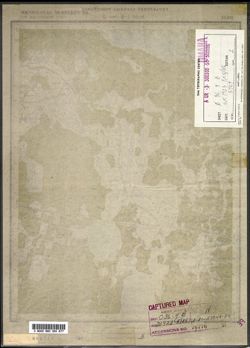
- Description:
- 1923
- Subject:
- Geographic Subject: Gorka, Topical Subject: Maps, and Topical Subject: Soviet Union
- Publisher:
- Управление военных топографов
- Language:
- Russian
- Identifier:
- VAC9619-003000
- Genre:
- Topographic Maps and Military Maps
- Geographic Location:
- Coordinates: 59.833, 31.75, 60, 32
- Related URL:
- Catalog URL: http://iucat.iu.edu/catalog/5020131 and Download GeoTIFF: https://drive.google.com/file/d/13pDGy8cPSlRmvEc1Zg_5m49Mb6gwQ7bJ/view?usp=sharing
- Call Number:
- GM G7000 s50 .S68 sheet O-36-4-B
- Caption:
- Не подлежит оглашению and Captured map
- City:
- Горка (Gorka)
- Copyright Holder:
- No Copyright - United States
- Country:
- СССР (USSR)
- State/Province:
- Ленинградская область (Leningrad oblast) and РСФСР (RSFSR)
- Physical Description:
- Scale: 1:50,000
- Persistent URL:
- http://purl.dlib.indiana.edu/iudl/images/VAC9619/VAC9619-003000
- Provenance:
- DMA Topographic Center, Army Map Service Library, OMAHA, Library of Congress Geography & Map Division
-
- Subject:
- Topical Subject: Maps, Geographic Subject: Torhovytsya, and Topical Subject: Soviet Union
- Publisher:
- Управление военных топографов
- Language:
- Russian
- Identifier:
- VAC9619-000216
- Genre:
- Military Maps and Topographic Maps
- Geographic Location:
- Coordinates: 50.5, 25.25, 50.667, 25.5
- Related URL:
- Catalog URL: http://iucat.iu.edu/catalog/5020131 and Download GeoTIFF: https://drive.google.com/open?id=1yhgNrEHBw1rF1kRgCcvAYwWZ65EgkpiV
- Abstract:
- Modern area represented: Torhovytsya, Rivne oblast, Ukraine
- Call Number:
- G7000 s50 .S68 sheet M-35-51-B
- City:
- Тарговица (Targowica)
- Copyright Holder:
- No Copyright - United States
- Country:
- Польша (Poland)
- Physical Description:
- Scale: 1:50,000
- Persistent URL:
- http://purl.dlib.indiana.edu/iudl/images/VAC9619/VAC9619-000216
- Provenance:
- DMA Topographic Center, Army Map Service Library, OMAHA, Library of Congress Geography & Map Division
-
- Description:
- 1888
- Subject:
- Geographic Subject: Voyskovitsy, Topical Subject: Maps, and Topical Subject: Soviet Union
- Publisher:
- Управление военных топографов
- Language:
- Russian
- Date Created:
- 1931
- Identifier:
- VAC9619-001815
- Genre:
- Topographic Maps and Military Maps
- Geographic Location:
- Coordinates: 59.5, 29.75, 59.667, 30
- Related URL:
- Download GeoTIFF: https://drive.google.com/open?id=1SgkC34g9WUciNky8m09YCW5gMVy5ZYtm and Catalog URL: http://iucat.iu.edu/catalog/5020131
- Abstract:
- Modern area represented: Voyskovitsy, Leningrad oblast, Russia
- Call Number:
- G7000 s50 .S68 sheet O-35-24-B
- Caption:
- Не подлежит оглашению
- City:
- Ст. Войсковицы (Voyskovitsy)
- Copyright Holder:
- No Copyright - United States
- Country:
- СССР (USSR)
- State/Province:
- РСФСР (RSFSR) and Ленинградская область (Leningrad oblast)
- Physical Description:
- Scale: 1:50,000
- Persistent URL:
- http://purl.dlib.indiana.edu/iudl/images/VAC9619/VAC9619-001815
- Provenance:
- DMA Topographic Center, Army Map Service Library, OMAHA, Library of Congress Geography & Map Division
-
- Subject:
- Topical Subject: Maps, Geographic Subject: Джурин (Dzhuryn), and Topical Subject: Soviet Union
- Publisher:
- Управление военных топографов
- Language:
- Russian
- Identifier:
- VAC9619-000882
- Genre:
- Topographic Maps and Military Maps
- Geographic Location:
- Coordinates: 48.6667, 28.25, 48.8333, 28.5
- Related URL:
- Download GeoTIFF: https://drive.google.com/open?id=13yPyN2esBfwsg-I9xVUP_ry01VHpDYhv and Catalog URL: http://iucat.iu.edu/catalog/5020131
- Abstract:
- Modern area represented: Джурин (Dzhuryn), Vinnytsia Oblast, Ukraine
- Call Number:
- G7000 s50 .S68 sheet M-35-117-D
- Caption:
- Captured map and Не подлежит оглашению
- City:
- Джурин (Dzhurin)
- Copyright Holder:
- No Copyright - United States
- Country:
- СССР (USSR)
- State/Province:
- Винницкая область (Vinnytsia oblast) and Украинская ССР (Ukrainian Soviet Socialist Republic)
- Physical Description:
- Scale: 1:50,000
- Persistent URL:
- http://purl.dlib.indiana.edu/iudl/images/VAC9619/VAC9619-000882
- Provenance:
- DMA Topographic Center, Army Map Service Library, OMAHA, Library of Congress Geography & Map Division
-
- Subject:
- Topical Subject: Soviet Union, Geographic Subject: Turiysk, and Topical Subject: Maps
- Publisher:
- Управление военных топографов
- Language:
- Russian
- Identifier:
- VAC9619-000199
- Genre:
- Military Maps and Topographic Maps
- Geographic Location:
- Coordinates: 51, 24.5, 51.167, 24.75
- Related URL:
- Catalog URL: http://iucat.iu.edu/catalog/5020131 and Download GeoTIFF: https://drive.google.com/open?id=1UKTMtGIUYrwrz65qY6vPYba9PpucQrTs
- Abstract:
- Modern area represented: Turiysk, Ukraine
- Call Number:
- G7000 s50 .S68 sheet M-35-26-B
- City:
- Тужиск (Turzysk)
- Copyright Holder:
- No Copyright - United States
- Country:
- Польша (Poland)
- Physical Description:
- Scale: 1:50,000
- Persistent URL:
- http://purl.dlib.indiana.edu/iudl/images/VAC9619/VAC9619-000199
- Provenance:
- DMA Topographic Center, Army Map Service Library, OMAHA, Library of Congress Geography & Map Division
-
- Description:
- 1932
- Subject:
- Geographic Subject: Solovyevo, Topical Subject: Soviet Union, and Topical Subject: Maps
- Publisher:
- Управление военных топографов
- Language:
- Russian
- Identifier:
- VAC9619-000053
- Genre:
- Topographic Maps and Military Maps
- Geographic Location:
- Coordinates: 57.6667, 30.5, 57.8333, 30.75
- Related URL:
- Catalog URL: http://iucat.iu.edu/catalog/5020131 and Download GeoTIFF: https://drive.google.com/open?id=1Ip1HPazYo6lYzKLVx841vLwwLJeWXDfQ
- Abstract:
- Modern area represented: Solovyevo, Novgorod oblast, Russia
- Call Number:
- G7000 s50 .S68 sheet O-36-74-C
- Caption:
- Не подлежит оглашению
- City:
- Соловьево (Solovyevo)
- Copyright Holder:
- No Copyright - United States
- Country:
- СССР (USSR)
- State/Province:
- РСФСР (RSFSR) and Ленинградская область (Leningrad oblast)
- Physical Description:
- Scale: 1:50,000
- Persistent URL:
- http://purl.dlib.indiana.edu/iudl/images/VAC9619/VAC9619-000053
- Provenance:
- DMA Topographic Center, Army Map Service Library, OMAHA, Library of Congress Geography & Map Division
-
- Subject:
- Topical Subject: Maps, Geographic Subject: Антонівка (Antonivka), and Topical Subject: Soviet Union
- Publisher:
- Управление военных топографов
- Language:
- Russian
- Identifier:
- VAC9619-000889
- Genre:
- Topographic Maps and Military Maps
- Geographic Location:
- Coordinates: 48.5, 28.25, 48.6667, 28.5
- Related URL:
- Download GeoTIFF: https://drive.google.com/open?id=1QAgesxxiAb5qDbuc1CrSuXMKruiH2z0t and Catalog URL: http://iucat.iu.edu/catalog/5020131
- Abstract:
- Modern area represented: Антонівка (Antonivka), Vinnytsia Oblast, Ukraine
- Call Number:
- G7000 s50 .S68 sheet M-35-129-B
- Caption:
- Не подлежит оглашению and Captured map
- City:
- Антонивка (Antonivka)
- Copyright Holder:
- No Copyright - United States
- Country:
- СССР (USSR)
- State/Province:
- Украинская ССР (Ukrainian Soviet Socialist Republic) and Винницкая область (Vinnytsia oblast)
- Physical Description:
- Scale: 1:50,000
- Persistent URL:
- http://purl.dlib.indiana.edu/iudl/images/VAC9619/VAC9619-000889
- Provenance:
- DMA Topographic Center, Army Map Service Library, OMAHA, Library of Congress Geography & Map Division
-
- Description:
- 1921
- Subject:
- Geographic Subject: Hladkivka, Topical Subject: Soviet Union, and Topical Subject: Maps
- Publisher:
- Управление военных топографов
- Language:
- Russian
- Identifier:
- VAC9619-000124
- Genre:
- Topographic Maps and Military Maps
- Geographic Location:
- Coordinates: 46.3333, 32.5, 46.5, 32.75
- Related URL:
- Download GeoTIFF: https://drive.google.com/open?id=1n2pHi_dvL9UJDtDch0M6nlGm2FUE007F and Catalog URL: http://iucat.iu.edu/catalog/5020131
- Abstract:
- Modern area represented: Hladkivka, Kherson oblast, Ukraine
- Call Number:
- G7000 s50 .S68 sheet L-36-54-C
- Caption:
- Не подлежит оглашению,Секретно
- City:
- Келегей (Kelegey)
- Copyright Holder:
- No Copyright - United States
- Country:
- СССР (USSR)
- State/Province:
- Украинская ССР (Ukrainian Soviet Socialist Republic)
- Physical Description:
- Scale: 1:50,000
- Persistent URL:
- http://purl.dlib.indiana.edu/iudl/images/VAC9619/VAC9619-000124
- Provenance:
- DMA Topographic Center, Army Map Service Library, OMAHA, Library of Congress Geography & Map Division
-
- Description:
- 1932
- Subject:
- Geographic Subject: Nagovo, Topical Subject: Soviet Union, and Topical Subject: Maps
- Publisher:
- Управление военных топографов
- Language:
- Russian
- Identifier:
- VAC9619-002909
- Genre:
- Military Maps and Topographic Maps
- Geographic Location:
- Coordinates: 58, 31, 58.167, 31.25
- Related URL:
- Catalog URL: http://iucat.iu.edu/catalog/5020131 and Download GeoTIFF: https://drive.google.com/file/d/1HraeuZYKsUXJ9iCd0LI2YbXVf0zOekO9/view?usp=sharing
- Abstract:
- Modern area represented: Нагово (Nagovo), Novgorodskaya oblast, Russia
- Call Number:
- GM G7000 s50 .S68 sheet O-36-63-С
- Caption:
- Не подлежит оглашению and Captured map
- City:
- Нагово (Nagovo)
- Copyright Holder:
- No Copyright - United States
- Country:
- СССР (USSR)
- State/Province:
- Ленинградская область (Leningrad oblast) and РСФСР (RSFSR)
- Physical Description:
- Scale: 1:50,000
- Persistent URL:
- http://purl.dlib.indiana.edu/iudl/images/VAC9619/VAC9619-002909
- Provenance:
- DMA Topographic Center, Army Map Service Library, OMAHA, Library of Congress Geography & Map Division
-
- Description:
- 1928
- Subject:
- Topical Subject: Maps, Topical Subject: Soviet Union, and Geographic Subject: Козелець (Kozelets)
- Publisher:
- Управление военных топографов
- Language:
- Russian
- Identifier:
- VAC9619-000943
- Genre:
- Topographic Maps and Military Maps
- Geographic Location:
- Coordinates: 50.833, 31, 51, 31.25
- Related URL:
- Catalog URL: http://iucat.iu.edu/catalog/5020131 and Download GeoTIFF: https://drive.google.com/open?id=1OWe3ECx_K8tz0IOOTjKXw6InefwMPZIq
- Abstract:
- Modern area represented: Козелець (Kozelets), Chernihiv oblast, Ukraine
- Call Number:
- G7000 s50 .S68 sheet M-36-39-A
- Caption:
- Не подлежит оглашению
- City:
- Козелец (Kozelets)
- Copyright Holder:
- No Copyright - United States
- Country:
- СССР (USSR)
- State/Province:
- Украинская ССР (Ukrainian Soviet Socialist Republic)
- Physical Description:
- Scale: 1:50,000
- Persistent URL:
- http://purl.dlib.indiana.edu/iudl/images/VAC9619/VAC9619-000943
- Provenance:
- DMA Topographic Center, Army Map Service Library, OMAHA, Library of Congress Geography & Map Division
-
- Description:
- 1928
- Subject:
- Geographic Subject: Ichnya, Topical Subject: Maps, and Topical Subject: Soviet Union
- Publisher:
- Управление военных топографов
- Language:
- Russian
- Identifier:
- VAC9619-000948
- Genre:
- Topographic Maps and Military Maps
- Geographic Location:
- Coordinates: 50.83333, 32.25, 51.0, 32.5
- Related URL:
- Catalog URL: http://iucat.iu.edu/catalog/5020131 and Download GeoTIFF: https://drive.google.com/open?id=1av1-e5Xd1qF9u5jO2a2eUDzplbQEzXOM
- Abstract:
- Modern area represented: Ichnya, Chernihiv oblast, Ukraine
- Call Number:
- G7000 s50 .S68 sheet M-36-41-B
- Caption:
- Не подлежит оглашению
- City:
- Ичня (Ichnya)
- Copyright Holder:
- No Copyright - United States
- Country:
- СССР (USSR)
- State/Province:
- Украинская ССР (Ukrainian Soviet Socialist Republic)
- Physical Description:
- Scale: 1:50,000
- Persistent URL:
- http://purl.dlib.indiana.edu/iudl/images/VAC9619/VAC9619-000948
- Provenance:
- DMA Topographic Center, Army Map Service Library, OMAHA, Library of Congress Geography & Map Division
-
- Description:
- 1923
- Subject:
- Topical Subject: Soviet Union, Geographic Subject: Halahanivka, and Topical Subject: Maps
- Publisher:
- Управление военных топографов
- Language:
- Russian
- Identifier:
- VAC9619-000108
- Genre:
- Military Maps and Topographic Maps
- Geographic Location:
- Coordinates: 46.8333, 32.75, 47, 33
- Related URL:
- Download GeoTIFF: https://drive.google.com/open?id=1mNm4_gSpjHB-umBgv_jThSslD7WlqXkV and Catalog URL: http://iucat.iu.edu/catalog/5020131
- Abstract:
- Modern area represented: Halahanivka, Mykolaiv oblast, Ukraine
- Call Number:
- G7000 s50 .S68 sheet L-36-42-A
- Caption:
- Не подлежит оглашению
- City:
- Галагановка (Galaganovka)
- Copyright Holder:
- No Copyright - United States
- Country:
- СССР (USSR)
- State/Province:
- Украинская ССР (Ukrainian Soviet Socialist Republic)
- Physical Description:
- Scale: 1:50,000
- Persistent URL:
- http://purl.dlib.indiana.edu/iudl/images/VAC9619/VAC9619-000108
- Provenance:
- DMA Topographic Center, Army Map Service Library, OMAHA, Library of Congress Geography & Map Division
-
- Description:
- 1932
- Subject:
- Topical Subject: Soviet Union, Topical Subject: Maps, and Geographic Subject: Rakhlitsy
- Publisher:
- Управление военных топографов
- Language:
- Russian
- Identifier:
- VAC9619-000058
- Genre:
- Military Maps and Topographic Maps
- Geographic Location:
- Coordinates: 57.5, 31.25, 57.6667, 31.5
- Related URL:
- Catalog URL: http://iucat.iu.edu/catalog/5020131 and Download GeoTIFF: https://drive.google.com/open?id=1gFvH37OvUPB8JJNlVW7oqBMW0RBOgpl8
- Abstract:
- Modern area represented: Rakhlitsy, Novgorod oblast, Russia
- Call Number:
- G7000 s50 .S68 sheet O-36-87-B
- Caption:
- Не подлежит оглашению
- City:
- Рахлицы (Rakhlitsy)
- Copyright Holder:
- No Copyright - United States
- Country:
- СССР (USSR)
- State/Province:
- Ленинградская область (Leningrad oblast) and РСФСР (RSFSR)
- Physical Description:
- Scale: 1:50,000
- Persistent URL:
- http://purl.dlib.indiana.edu/iudl/images/VAC9619/VAC9619-000058
- Provenance:
- DMA Topographic Center, Army Map Service Library, OMAHA, Library of Congress Geography & Map Division
-
- Description:
- 1909
- Subject:
- Topical Subject: Maps, Topical Subject: Soviet Union, and Geographic Subject: Hrebinky
- Publisher:
- Управление военных топографов
- Language:
- Russian
- Identifier:
- VAC9619-000982
- Genre:
- Military Maps and Topographic Maps
- Geographic Location:
- Coordinates: 49.833, 30, 50, 30.25
- Related URL:
- Catalog URL: http://iucat.iu.edu/catalog/5020131 and Download GeoTIFF: https://drive.google.com/open?id=1PLrS_xE8qSkoooCJkj85y-lv1KJzTgih
- Abstract:
- Modern area represented: Гребінки (Hrebinky), Kyiv oblast, Ukraine
- Call Number:
- G7000 s50 .S68 sheet M-36-73-A
- Caption:
- Не подлежит оглашению
- City:
- Гребенки (Grebenki)
- Copyright Holder:
- No Copyright - United States
- Country:
- СССР (USSR)
- State/Province:
- Киевская область (Kyiv oblast) and Украинская ССР (Ukrainian Soviet Socialist Republic)
- Physical Description:
- Scale: 1:50,000
- Persistent URL:
- http://purl.dlib.indiana.edu/iudl/images/VAC9619/VAC9619-000982
- Provenance:
- DMA Topographic Center, Army Map Service Library, OMAHA, Library of Congress Geography & Map Division
-
- Description:
- 1923
- Subject:
- Geographic Subject: Rokytne, Topical Subject: Soviet Union, and Topical Subject: Maps
- Publisher:
- Управление военных топографов
- Language:
- Russian
- Date Created:
- 1932
- Identifier:
- VAC9619-000985
- Genre:
- Topographic Maps and Military Maps
- Geographic Location:
- Coordinates: 49.667, 30.25, 49.833, 30.5
- Related URL:
- Download GeoTIFF: https://drive.google.com/open?id=1iaJ6KvA1GY4Z2A2qK0P_HfIVJmnZmYhW and Catalog URL: http://iucat.iu.edu/catalog/5020131
- Abstract:
- Modern area represented: Рокитне (Rokytne), Kyiv oblast, Ukraine
- Call Number:
- G7000 s50 .S68 sheet M-36-73-D
- Caption:
- Не подлежит оглашению
- City:
- Рокитно (Rokitno)
- Copyright Holder:
- No Copyright - United States
- Country:
- СССР (USSR)
- State/Province:
- Украинская ССР (Ukrainian Soviet Socialist Republic) and Киевская область (Kyiv oblast)
- Physical Description:
- Scale: 1:50,000
- Persistent URL:
- http://purl.dlib.indiana.edu/iudl/images/VAC9619/VAC9619-000985
- Provenance:
- DMA Topographic Center, Army Map Service Library, OMAHA, Library of Congress Geography & Map Division
-
- Description:
- 1928
- Subject:
- Topical Subject: Soviet Union, Geographic Subject: Saksahan, and Topical Subject: Maps
- Publisher:
- Управление военных топографов
- Language:
- Russian
- Date Created:
- 1930
- Identifier:
- VAC9619-001171
- Genre:
- Topographic Maps and Military Maps
- Geographic Location:
- Coordinates: 48.167, 33.75, 48.333, 34
- Related URL:
- Catalog URL: http://iucat.iu.edu/catalog/5020131 and Download GeoTIFF: https://drive.google.com/open?id=1XwmC1trmuNFjg2YlEoWoYD9RCdmTSVy2
- Abstract:
- Modern area represented: Saksahan, Dnipropetrovsk oblast, Ukraine
- Call Number:
- GM G7000 S50 .S68 M-36-140-Б
- Caption:
- Не подлежит оглашению
- City:
- Саксагань (Saksahan)
- Copyright Holder:
- No Copyright - United States
- Country:
- СССР (USSR)
- State/Province:
- Украинская ССР (Ukrainian Soviet Socialist Republic)
- Physical Description:
- Scale: 1:50,000
- Persistent URL:
- http://purl.dlib.indiana.edu/iudl/images/VAC9619/VAC9619-001171
- Provenance:
- DMA Topographic Center, Army Map Service Library, OMAHA, Library of Congress Geography & Map Division
-
- Description:
- 1924
- Subject:
- Topical Subject: Maps, Geographic Subject: Stabna, and Topical Subject: Soviet Union
- Publisher:
- Управление военных топографов
- Language:
- Russian
- Date Created:
- 1926
- Identifier:
- VAC9619-001304
- Genre:
- Topographic Maps and Military Maps
- Geographic Location:
- Coordinates: 54.833, 32, 55, 32.25
- Related URL:
- Download GeoTIFF: https://drive.google.com/open?id=1cVlm4rZePjmXHTgoHIO281vVZWqp5nF8 and Catalog URL: http://iucat.iu.edu/catalog/5020131
- Abstract:
- Modern area represented: Stabna, Smolensk oblast, Russia
- Call Number:
- GM G7000 S50 .S68 N-36-41-A
- Caption:
- Не подлежит оглашению
- City:
- Стабна (Stabna)
- Copyright Holder:
- No Copyright - United States
- Country:
- СССР (USSR)
- State/Province:
- Западная область (Western oblast) and РСФСР (RSFSR)
- Physical Description:
- Scale: 1:50,000
- Persistent URL:
- http://purl.dlib.indiana.edu/iudl/images/VAC9619/VAC9619-001304
- Provenance:
- DMA Topographic Center, Army Map Service Library, OMAHA, Library of Congress Geography & Map Division
-
- Description:
- 1924
- Subject:
- Topical Subject: Soviet Union, Geographic Subject: Остер (Oster), and Topical Subject: Maps
- Publisher:
- Управление военных топографов
- Language:
- Russian
- Date Created:
- 1932
- Identifier:
- VAC9619-000942
- Genre:
- Topographic Maps and Military Maps
- Geographic Location:
- Coordinates: 50.833, 30.75, 51, 31
- Related URL:
- Download GeoTIFF: https://drive.google.com/open?id=11GQzIsGUFzpSJcPMQzAjvEbiIarAoUrD and Catalog URL: http://iucat.iu.edu/catalog/5020131
- Abstract:
- Modern area represented: Остер (Oster), Chernihiv oblast, Ukraine
- Call Number:
- G7000 s50 .S68 sheet M-36-38-B
- Caption:
- Не подлежит оглашению
- City:
- Остер (Oster)
- Copyright Holder:
- No Copyright - United States
- Country:
- СССР (USSR)
- State/Province:
- Киевская область (Kyiv oblast) and Украинская ССР (Ukrainian Soviet Socialist Republic)
- Physical Description:
- Scale: 1:50,000
- Persistent URL:
- http://purl.dlib.indiana.edu/iudl/images/VAC9619/VAC9619-000942
- Provenance:
- DMA Topographic Center, Army Map Service Library, OMAHA, Library of Congress Geography & Map Division
-
- Description:
- 1928
- Subject:
- Topical Subject: Soviet Union, Topical Subject: Maps, and Geographic Subject: Комарівка (Komarivka)
- Publisher:
- Управление военных топографов
- Language:
- Russian
- Identifier:
- VAC9619-000935
- Genre:
- Military Maps and Topographic Maps
- Geographic Location:
- Coordinates: 51.167, 32, 51.333, 32.25
- Related URL:
- Catalog URL: http://iucat.iu.edu/catalog/5020131 and Download GeoTIFF: https://drive.google.com/open?id=1qe-bUPrLMFXn0ax-XCLECJ-fBKSyq8d3
- Abstract:
- Modern area represented: Комарівка (Komarivka), Chernihiv oblast, Ukraine
- Call Number:
- G7000 s50 .S68 sheet M-36-29-A
- Caption:
- Не подлежит оглашению
- City:
- Комаровка (Komarovka)
- Copyright Holder:
- No Copyright - United States
- Country:
- СССР (USSR)
- State/Province:
- Украинская ССР (Ukrainian Soviet Socialist Republic)
- Physical Description:
- Scale: 1:50,000
- Persistent URL:
- http://purl.dlib.indiana.edu/iudl/images/VAC9619/VAC9619-000935
- Provenance:
- DMA Topographic Center, Army Map Service Library, OMAHA, Library of Congress Geography & Map Division
-
- Description:
- 1924
- Subject:
- Topical Subject: Maps, Geographic Subject: Gorodets, and Topical Subject: Soviet Union
- Publisher:
- Управление военных топографов
- Language:
- Russian
- Identifier:
- VAC9619-001332
- Genre:
- Topographic Maps and Military Maps
- Geographic Location:
- Coordinates: 54.3333, 31.25, 54.5, 31.5
- Related URL:
- Catalog URL: http://iucat.iu.edu/catalog/5020131 and Download GeoTIFF: https://drive.google.com/file/d/1Vkoo6gEhtlplQPLMCqy5w6_s0syy8isC/view?usp=sharing
- Abstract:
- Modern area represented: Gorodets, Mogilev oblast, Belarus
- Call Number:
- GM G7000 S50 .S68 N-36-51-Г
- Caption:
- Не подлежит оглашению
- City:
- Городец (Gorodets)
- Copyright Holder:
- No Copyright - United States
- Country:
- СССР (USSR)
- State/Province:
- Белорусская ССР (Byelorussian Soviet Socialist Republic), Западная область (Western oblast), and РСФСР (RSFSR)
- Physical Description:
- Scale: 1:50,000
- Persistent URL:
- http://purl.dlib.indiana.edu/iudl/images/VAC9619/VAC9619-001332
- Provenance:
- DMA Topographic Center, Army Map Service Library, OMAHA, Library of Congress Geography & Map Division
-
- Description:
- 1931
- Subject:
- Topical Subject: Maps, Topical Subject: Soviet Union, and Geographic Subject: Galichi
- Publisher:
- Управление военных топографов
- Language:
- Russian
- Identifier:
- VAC9619-001445
- Genre:
- Topographic Maps and Military Maps
- Geographic Location:
- Coordinates: 53.5, 32.25, 53.6667, 32.5
- Related URL:
- Download GeoTIFF: https://drive.google.com/open?id=1qTzU_Ok50JYyqehnESugCq4d044yE3ww and Catalog URL: http://iucat.iu.edu/catalog/5020131
- Abstract:
- Modern area represented: Galichi, Mogilev oblast, Belarus
- Call Number:
- GM G7000 S50 .S68 N-36-89-Б
- City:
- Галичи (Galichi)
- Copyright Holder:
- No Copyright - United States
- Country:
- СССР (USSR)
- State/Province:
- Белорусская ССР (Byelorussian Soviet Socialist Republic), РСФСР (RSFSR), and Западная область (Western oblast)
- Physical Description:
- Scale: 1:50,000
- Persistent URL:
- http://purl.dlib.indiana.edu/iudl/images/VAC9619/VAC9619-001445
- Provenance:
- DMA Topographic Center, Army Map Service Library, OMAHA, Library of Congress Geography & Map Division
-
- Description:
- 1931
- Subject:
- Topical Subject: Soviet Union, Geographic Subject: Tovstyi Lis, and Topical Subject: Maps
- Publisher:
- Управление военных топографов
- Language:
- Russian
- Identifier:
- VAC9619-000192
- Genre:
- Topographic Maps and Military Maps
- Geographic Location:
- Coordinates: 51.333, 29.75, 51.5, 30
- Related URL:
- Catalog URL: http://iucat.iu.edu/catalog/5020131 and Download GeoTIFF: https://drive.google.com/open?id=1VNYar89ax3ofZHmK7pMkpnfLwmpdP3ro
- Abstract:
- Modern area represented: Tovstyi Lis, Ukraine and an abandoned populated place (the residents were resettled as the result of the Chernobyl accident)
- Call Number:
- G7000 s50 .S68 sheet M-35-24-D
- Caption:
- Не подлежит оглашению
- City:
- Толстый Лес (Tolstyy Les)
- Copyright Holder:
- No Copyright - United States
- Country:
- СССР (USSR)
- State/Province:
- Белорусская ССР (Byelorussian Soviet Socialist Republic) and Украинская ССР (Ukrainian Soviet Socialist Republic)
- Physical Description:
- Scale: 1:50,000
- Persistent URL:
- http://purl.dlib.indiana.edu/iudl/images/VAC9619/VAC9619-000192
- Provenance:
- DMA Topographic Center, Army Map Service Library, OMAHA, Library of Congress Geography & Map Division
-
- Description:
- 1929
- Subject:
- Geographic Subject: Hel'myaziv, Topical Subject: Soviet Union, and Topical Subject: Maps
- Publisher:
- Управление военных топографов
- Language:
- Russian
- Identifier:
- VAC9619-000992
- Genre:
- Military Maps and Topographic Maps
- Geographic Location:
- Coordinates: 49.667, 31.75, 49.833, 32
- Related URL:
- Catalog URL: http://iucat.iu.edu/catalog/5020131 and Download GeoTIFF: https://drive.google.com/open?id=10KwpleQWRvznxadNUiRFAxT_ND_u45Xu
- Abstract:
- Modern area represented: Гельмязів (Hel'myaziv), Cherkasy oblast, Ukraine
- Call Number:
- G7000 s50 .S68 sheet M-36-76-D
- Caption:
- Не подлежит оглашению (crossed out), Captured map, and Рассекречено
- City:
- Глемязово (Glemyazovo)
- Copyright Holder:
- No Copyright - United States
- Country:
- СССР (USSR)
- State/Province:
- Украинская ССР (Ukrainian Soviet Socialist Republic)
- Physical Description:
- Scale: 1:50,000
- Persistent URL:
- http://purl.dlib.indiana.edu/iudl/images/VAC9619/VAC9619-000992
- Provenance:
- DMA Topographic Center, Army Map Service Library, OMAHA, Library of Congress Geography & Map Division
-
- Subject:
- Topical Subject: Soviet Union, Geographic Subject: Gruzdovo, and Topical Subject: Maps
- Publisher:
- Управление военных топографов
- Language:
- Russian
- Identifier:
- VAC9619-003489
- Genre:
- Military Maps and Topographic Maps
- Geographic Location:
- Coordinates: 56.167, 31, 56.333, 31.25
- Related URL:
- Catalog URL: http://iucat.iu.edu/catalog/5020131 and Download GeoTIFF: https://drive.google.com/file/d/1CMigDyHomt0Hpi1G7k_zN6Skk154K5Hw/view?usp=sharing
- Abstract:
- Modern area represented: Груздово (Gruzdovo), Pskovskaya oblast, Russia
- Call Number:
- G7000 s50 .S68 sheet O-36-135-A
- Caption:
- Не подлежит оглашению
- City:
- Груздово (Gruzdovo)
- Copyright Holder:
- No Copyright - United States
- Country:
- СССР (USSR)
- State/Province:
- Западная область (Western oblast) and РСФСР (RSFSR)
- Physical Description:
- Scale: 1:50,000
- Persistent URL:
- http://purl.dlib.indiana.edu/iudl/images/VAC9619/VAC9619-003489
- Provenance:
- DMA Topographic Center, Army Map Service Library, OMAHA, Library of Congress Geography & Map Division
-
- Description:
- 1928
- Subject:
- Geographic Subject: Prisno, Topical Subject: Soviet Union, and Topical Subject: Maps
- Publisher:
- Управление военных топографов
- Language:
- Russian
- Identifier:
- VAC9619-001528
- Genre:
- Topographic Maps and Military Maps
- Geographic Location:
- Coordinates: 52.6667, 30.75, 53, 31
- Related URL:
- Catalog URL: http://iucat.iu.edu/catalog/5020131 and Download GeoTIFF: https://drive.google.com/open?id=1FXKHO5tXHr9fKZjzS1o03TiZjtGCy1Nb
- Abstract:
- Modern area represented: Prisno, Homyel oblast, Belarus
- Call Number:
- G7000 s50 .S68 sheet N-36-110-D
- Caption:
- Не подлежит оглашению
- City:
- Присно (Prisno)
- Copyright Holder:
- No Copyright - United States
- Country:
- СССР (USSR)
- State/Province:
- Белорусская ССР (Byelorussian Soviet Socialist Republic)
- Physical Description:
- Scale: 1:50,000
- Persistent URL:
- http://purl.dlib.indiana.edu/iudl/images/VAC9619/VAC9619-001528
- Provenance:
- DMA Topographic Center, Army Map Service Library, OMAHA, Library of Congress Geography & Map Division
-
- Description:
- 1931
- Subject:
- Topical Subject: Soviet Union, Topical Subject: Maps, and Geographic Subject: Korzhovka-Golubovka
- Publisher:
- Управление военных топографов
- Language:
- Russian
- Identifier:
- VAC9619-001539
- Genre:
- Topographic Maps and Military Maps
- Geographic Location:
- Coordinates: 52.6667, 32.25, 52.8667, 32.5
- Related URL:
- Catalog URL: http://iucat.iu.edu/catalog/5020131 and Download GeoTIFF: https://drive.google.com/open?id=1caz06yDhenOXRJOAcQZ0f7DQYtkJfycT
- Abstract:
- Modern area represented: Korzhovka-Golubovka, Bryansk oblast, Russia
- Call Number:
- G7000 s50 .S68 sheet N-36-113-D
- Caption:
- Временное издание,Не подлежит оглашению
- City:
- Коржовка-Голубовка (Korzhovka-Golubovka)
- Copyright Holder:
- No Copyright - United States
- Country:
- СССР (USSR)
- State/Province:
- РСФСР (RSFSR) and Западная область (Western oblast)
- Physical Description:
- Scale: 1:50,000
- Persistent URL:
- http://purl.dlib.indiana.edu/iudl/images/VAC9619/VAC9619-001539
- Provenance:
- DMA Topographic Center, Army Map Service Library, OMAHA, Library of Congress Geography & Map Division
-
- Description:
- 1925
- Subject:
- Topical Subject: Maps, Geographic Subject: Dobromysl, and Topical Subject: Soviet Union
- Publisher:
- Управление военных топографов
- Language:
- Russian
- Identifier:
- VAC9619-001294
- Genre:
- Military Maps and Topographic Maps
- Geographic Location:
- Coordinates: 54.833, 30.5, 55, 30.75
- Related URL:
- Download GeoTIFF: https://drive.google.com/open?id=1K8lRJoXwkP1JTKpxvIfvEfoOjxIqUPj7 and Catalog URL: http://iucat.iu.edu/catalog/5020131
- Abstract:
- Modern area represented: Dobromysl, Vitebsk oblast, Belarus
- Call Number:
- GM G7000 S50 .S68 N-36-38-A
- Caption:
- Не подлежит оглашению
- City:
- Добромысль (Dobromysl)
- Copyright Holder:
- No Copyright - United States
- Country:
- СССР (USSR)
- State/Province:
- Белорусская ССР (Byelorussian Soviet Socialist Republic)
- Physical Description:
- Scale: 1:50,000
- Persistent URL:
- http://purl.dlib.indiana.edu/iudl/images/VAC9619/VAC9619-001294
- Provenance:
- DMA Topographic Center, Army Map Service Library, OMAHA, Library of Congress Geography & Map Division
