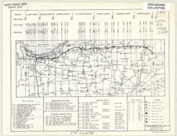
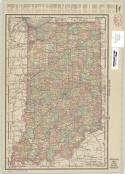
Indiana. Toll Road Division. Engineering Department
Publisher:
[Dept.]
Date Created:
1983
Identifier:
VAC3073-M-00833
Genre:
Road maps
Geographic Location:
Coordinates: W0873400 W0844500 N0414700 N0410100
Related URL:
Catalog URL: https://iucat.iu.edu/catalog/1204963
Abstract:
Includes index to toll plazas, maintenance buildings, auxiliary storage areas, service areas, and fuel supply. Shows facilities and county lines by milepost.
Call Number:
G4091 .P2 1983 .I53
Caption:
Imprint: [Granger, Ind.] : [Dept.], 1983.
Physical Description:
Dimensions: 10 x 25 cm, on sheet 22 x 28 cm and Scale: Scale not given.
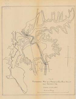
Includes generalized columnar section, "Sectionized township," and index of producers of clay and clay products. "Base modified from U.S. Geol...
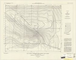
Geographic Subject: Owen County (Ind.), Geographic Subject: Eel River Valley (Ind. : Valley), Topical Subject: IGS Annual Reports, and Topical Subject: Valleys
Publisher:
Indiana. Department of Geology and Natural Resources
Relief shown by contours. Contour interval 20 feet. Shows upper falls dam and proposed lower falls dams now located within the Cataract Falls State Recreatio...
Call Number:
G4092.O8C2 1910 .T6
Caption:
Imprint: [Indianapolis] : [Wm. B. Burford], [1911] and Imprint: [Indianapolis] : [Indiana Department of Geology and Natural Resources], [1911]
Physical Description:
Scale: Approximately 1:7,650 and Dimensions: 31 x 25 cm
Alternate Identifier:
Title Control Number: a18418393 and Alternate ID: 390726IP
Topical Subject: Roads and Geographic Subject: Indiana
Creator:
H.M. Gousha Company
Publisher:
H.M. Gousha Company
Date Created:
1950
Identifier:
VAC3073-M-00825
Genre:
Road maps
Geographic Location:
Coordinates: W0880500 W0844700 N0414500 N0374600
Related URL:
Catalog URL: https://iucat.iu.edu/catalog/5272424
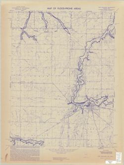
Abstract:
Includes index to counties, cities and towns. Text, ill., Transcontinental mileage chart, and ancillary maps of Indianapolis, Indiana, and Standard Oil Co...
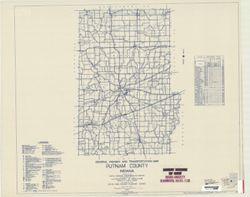
Geographic Subject: Putnam County (Ind.) and Topical Subject: Roads
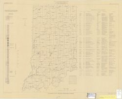
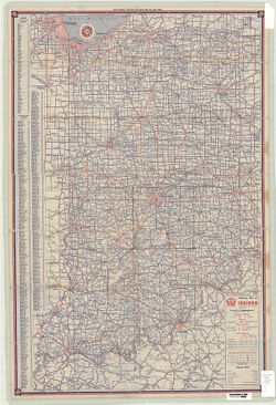
Creator:
Indiana. State Highway Commission (1919-1953)
Publisher:
State Highway Commission of Indiana
Date Created:
1949
Identifier:
VAC3073-M-00821
Genre:
Road maps
Geographic Location:
Coordinates: W0870100 W0863800 N0395200 N0392800
Related URL:
Catalog URL: https://iucat.iu.edu/catalog/5708470
Abstract:
Blueline. "State roads revised to January 1, 1949." "1937." "Data obtained from State-wide Highway Planning Survey." Includes ...
Call Number:
G4093.P8 P2 1949 .I53
Caption:
Imprint: [Indianapolis?] : State Highway Commission of Indiana, 1949.