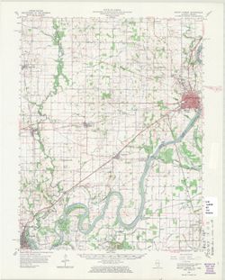
Geographic Subject: Posey County (Ind.), Geographic Subject: White County (Ill.), and Geographic Subject: Gallatin County (Ill.)
Creator:
Lloyd, W. J. (Topographer), Kentucky Geological Survey, Smith, L. Scott, Ellis, J. R. (Topographer), Cooke, Chas. E. (Charles E.), Illinois State Geological ...
Publisher:
Geological Survey (U.S.)
Date Created:
1920
Identifier:
VAC3073-M-01358
Genre:
Topographic maps, 15 minute topographic maps, and Quadrangle maps
H. M. Wilson, chief geographer , Chas. E. Cooke, in charge of section , topography by W. J. Lloyd and L. Scott Smith , control by J. R. Ellis , engraved Aug....
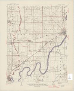
Geographic Subject: Posey County (Ind.), Geographic Subject: White County (Ill.), Geographic Subject: Union County (Ky.), Geographic Subject: Gallatin County...
Creator:
Lloyd, W. J. (Topographer), Smith, L. Scott, Illinois State Geological Survey, Wilson, Herbert M. (Herbert Michael), 1860-1920, Ellis, J. R. (Topographer), C...
Publisher:
Geological Survey (U.S.)
Date Created:
1966
Identifier:
VAC3073-M-01357
Genre:
Quadrangle maps, Topographic maps, and 15 minute topographic maps
United States, Department of the Interior, Geological Survey , State of Illinois, Department of Registration and Education, Geological Survey Division , Stat...
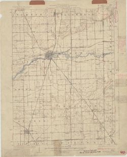
Topical Subject: Vegetation mapping, Geographic Subject: Gibson County (Ind.), Geographic Subject: Posey County (Ind.), and Geographic Subject: White County ...
Creator:
Geological Survey (U.S.) and Illinois State Geological Survey
Publisher:
Geological Survey (U.S.)
Date Created:
1963
Identifier:
VAC3073-M-01356
Genre:
Topographic maps, Quadrangle maps, and 15 minute topographic maps
Mapped, edited, and published by the Geological Survey , Illinois area mapped in cooperation with State of Illinois Geological Survey. Filing title: New Harm...
Geographic Subject: Gibson County (Ind.), Geographic Subject: Posey County (Ind.), Geographic Subject: Wabash County (Ill.), and Geographic Subject: White Co...
Creator:
Goodlove, C. W., Renshawe, John H., Hawkins, Geo. T. (George T.), and Geological Survey (U.S.)
Publisher:
Geological Survey (U.S.)
Date Created:
1942
Identifier:
VAC3073-M-01355
Genre:
15 minute topographic maps, Quadrangle maps, and Topographic maps
John. H. Renshawe, geographer in charge , control by Geo. T. Hawkins , topography by Chas. W. Goodlove , engraved April 1903 by U.S.G.S. Filing title: New Ha...
Call Number:
G4090 s62 .G4 New Harmony 1903 rep 1942
Caption:
Imprint: [Washington, D.C.] : U.S. Geological Survey, 1942
Physical Description:
Scale: 1:62,500 and Dimensions: 45 x 42 cm or smaller
Geographic Subject: Edwards County (Ill.), Geographic Subject: Gibson County (Ind.), Geographic Subject: Wabash County (Ill.), and Topical Subject: Vegetatio...
Creator:
Geological Survey (U.S.)
Publisher:
Geological Survey (U.S.)
Date Created:
1963
Identifier:
VAC3073-M-01353
Genre:
15 minute topographic maps, Quadrangle maps, and Topographic maps
Mapped, edited, and published by the Geological Survey. Filing title: Mount Carmel, Ill.-Ind. Standard map series designation: AMS (Series) V763 3460 IV. Pol...
Call Number:
G4090 s62 .G4 Mount Carmel 1959 rep 1963 V
Caption:
Imprint: Washington, D.C. : The Survey, 1963.
Physical Description:
Dimensions: 45 x 42 cm or smaller and Scale: 1:62,500
Geographic Subject: White County (Ill.), Geographic Subject: Wabash County (Ill.), Geographic Subject: Posey County (Ind.), and Geographic Subject: Gibson Co...
Creator:
Renshawe, John H., Goodlove, C. W., Geological Survey (U.S.), and Hawkins, Geo. T. (George T.)
Publisher:
Geological Survey (U.S.)
Date Created:
1925
Identifier:
VAC3073-M-01354
Genre:
Topographic maps, 15 minute topographic maps, and Quadrangle maps
John. H. Renshawe, geographer in charge , control by Geo. T. Hawkins , topography by Chas. W. Goodlove , engraved April 1903 by U.S.G.S. Filing title: New Ha...
Call Number:
G4090 s62 .G4 1903 rep 1925
Caption:
Imprint: [Washington, D.C.] : U.S. Geological Survey, 1925
Physical Description:
Scale: 1:62,500 and Dimensions: 45 x 42 cm or smaller
Filing title: Mount Carmel, Ill.-Ind. Edition of 1904, reprinted 1946 with corrections. Polyconic projection. Relief shown by contours and spot heights. Cont...
Call Number:
G4090 s62 .G4 Mount Carmel 1904 rep 1946
Caption:
Imprint: [Washington, D.C.] : U.S. Geological Survey, 1946
Physical Description:
Scale: 1:62,500 and Dimensions: 45 x 42 cm or smaller
Geographic Subject: Floyd County (Ind.), Geographic Subject: Jefferson County (Ky.), Geographic Subject: Bullitt County (Ky.), Geographic Subject: Harrison C...
Creator:
United States. Army. Corps of Engineers and Geological Survey (U.S.)
Mapped by the Geological Survey and the Army Map Service , published for civil use by the Geological Survey. Filing title: Kosmodale, Ky.-Ind. Polyconic proj...
Geographic Subject: Lake County (Ind.), Geographic Subject: Newton County (Ind.), Geographic Subject: Kanakee County (Ill.), and Geographic Subject: Iroquois...
Creator:
Geological Survey (U.S.), U.S. Lake Survey, Illinois State Geological Survey, Jennings, J. H. (James H.), 1864-1927, and Illinois. Department of Registration...
Publisher:
Geological Survey (U.S.)
Date Created:
1924
Identifier:
VAC3073-M-01350
Genre:
Quadrangle maps, Topographic maps, and 15 minute topographic maps
Filing title: Momence, Ill.-Ind. Polyconic projection. Relief shown by contours and spot heights. Shows Kankakee County, Illinois, as well as small portions ...
Call Number:
G4090 s62 .G4 Momence 1924
Caption:
Imprint: [Urbana, Ill.] : Geological Survey Division, 1924 and Imprint: [Washington, D.C.] : U.S. Geological Survey
Physical Description:
Dimensions: 45 x 42 cm or smaller and Scale: 1:62,500
Geographic Subject: Bullitt County (Ky.), Geographic Subject: Floyd County (Ind.), Geographic Subject: Jefferson County (Ind.), and Geographic Subject: Harri...
Creator:
Marshall, R. B. (Robert Bradford), 1867-1949, Graff, Fred, Jr., Clarkson, C. D. S., Geological Survey (U.S.), U.S. Coast and Geodetic Survey, Herron, W. H. (...
Publisher:
Geological Survey (U.S.)
Date Created:
1942
Identifier:
VAC3073-M-01347
Genre:
Quadrangle maps, 15 minute topographic maps, and Topographic maps
R.B. Marshall, chief geographer , W.H. Herron, geographer in charge , topography by C.D.S. Clarkson and Fred Graff, Jr., and the City of Louisville. Filing t...
Call Number:
G4090 s62 .G4 Kosmosdale 1912 rep 1942
Caption:
Imprint: Washington, D.C. : U.S. Geological Survey, 1942
Physical Description:
Dimensions: 45 x 42 cm or smaller and Scale: 1:62,500

![Illinois-Indiana-Kentucky, New Haven quadrangle : topography [1920 reprint without vegetation]](https://iiif.uits.iu.edu/iiif/2/pz50hz88n%2Ffiles%2Ff9ee1b77-e188-458e-ba78-5dd112ba1556/full/250,/0/default.jpg)
![Illinois-Indiana-Kentucky, New Haven quadrangle [1966 reprint with vegetation]](https://iiif.uits.iu.edu/iiif/2/k0699966z%2Ffiles%2F2ec905c7-1ce1-46fe-974b-b888b96b34a5/full/250,/0/default.jpg)
![New Harmony quadrangle, Indiana--Illinois, 1959 : 15 minute series (topographic) [1963 reprint with vegetation]](https://iiif.uits.iu.edu/iiif/2/n296z235w%2Ffiles%2Faf8714ac-51b2-4e50-bb3a-3e3e07d338a7/full/250,/0/default.jpg)
![Indiana-Illinois, New Harmony quadrangle [1942 reprint without vegetation]](https://iiif.uits.iu.edu/iiif/2/7m01cp450%2Ffiles%2F687ca4a9-29c4-4fc4-88d4-234e6f47aa32/full/250,/0/default.jpg)
![Indiana-Illinois, New Harmony quadrangle [1925 reprint without vegetation]](https://iiif.uits.iu.edu/iiif/2/s4656k46j%2Ffiles%2F298a4b2a-341d-4dde-b5f8-f3216aba32b4/full/250,/0/default.jpg)
![Kosmosdale quadrangle, Kentucky-Indiana : 15 minute series (topographic) [1959 reprint with vegetation]](https://iiif.uits.iu.edu/iiif/2/mk61sm253%2Ffiles%2Fd8ce10eb-c8cf-4182-bd5a-13d2fee0e97a/full/250,/0/default.jpg)
![Kentucky-Indiana Kosmosdale quadrangle [1942 reprint]](https://iiif.uits.iu.edu/iiif/2/st74dt26w%2Ffiles%2F407269b9-644e-4f10-824a-6faa7578cf29/full/250,/0/default.jpg)
