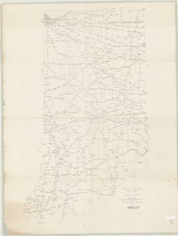
Blue line. Title supplied by cataloger. Covers an area from the Michigan state line on the north, Fort Wayne on the south, Atwood, Ind. on the west a...
Call Number:
G4090 1934 .M35
Caption:
Imprint: [Place of publication not identified] : [publisher not identified], [1934]
Physical Description:
Dimensions: 68 x 81 cm and Scale: Scale not given.
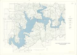
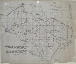
Geographic Subject: Lawrence County (Ind.), Geographic Subject: Lost River Watershed (Ind.), Topical Subject: Drainage, Geographic Subject: Lost River (Ind. ...
Creator:
Malott, Clyde A.
Publisher:
[publisher not identified]
Date Created:
1927
Identifier:
VAC3073-M-01239
Genre:
Manuscript maps and Thematic maps
Geographic Location:
Coordinates: W0864059 W0861220 N0384445 N0383053
Related URL:
Catalog URL: https://iucat.iu.edu/catalog/7745828
Abstract:
Pen, colored ink and colored pencils on drafting cloth. Includes table of drainage areas.
Call Number:
G4092.L8C315 1927 .M35
Caption:
Imprint: [Place of publication not identified] : [publisher not identified], 1927.


![[Northeastern Indiana lake district]](https://iiif.uits.iu.edu/iiif/2/cz30qw21c%2Ffiles%2F3493d108-c2f1-4bc6-aa3b-be11a048abf3/full/250,/0/default.jpg)
![Road map of Monroe County, Indiana [cartographic material] : adopted January 20, 1966](https://iiif.uits.iu.edu/iiif/2/cn69n8374%2Ffiles%2F6cca8b9b-6d94-4804-b65e-3ae6e2fa6cb3/full/250,/0/default.jpg)