Topical Subject: Geology and Geographic Subject: Indiana
Creator:
Patton, John B. (John Barratt), 1915-
Publisher:
Indiana. Geological Survey
Date Created:
1956
Identifier:
VAC3073-M-00212
Genre:
Geological maps
Geographic Location:
Coordinates: W0880000 W0844500 N0414500 N0375200
Related URL:
Catalog URL: https://iucat.iu.edu/catalog/5888483
Abstract:
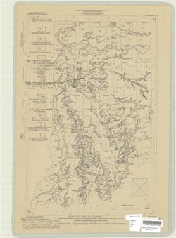
"Base from Map of Indiana, 1950 edition, published by the U.S. Geological Survey. Minor revisions and additions made from Indiana Department of Conserva...
Schneider, Allan F. (Allan Frank), 1926-, Gooding, Ansel Miller, Forsyth, Jane L. (Jane Louise), 1921-, Gray, Henry Hamilton, 1922-, and Indiana. Geological ...
Publisher:
Indiana. Geological Survey
Date Created:
1972
Identifier:
VAC3073-M-01245
Genre:
Geological maps, Geological cross-sections, and Quadrangle maps
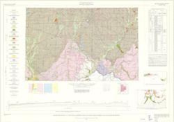
By Henry H. Gray, Jane L. Forsyth, Allan F. Schneider, and Ansel M. Gooding. Transverse Mercator projection. "Base map modified from Army Map Service, M...
Keller, Stanley J., Indiana. Geological Survey, Illinois State Geological Survey, Johnson, Gerald H., Wayne, William J. (William John), 1922-, and Atherton, ...
Publisher:
Indiana. Geological Survey
Date Created:
1962
Identifier:
VAC3073-M-01248
Genre:
Geological maps, Quadrangle maps, and Geological cross-sections
By William J. Wayne, Gerald H. Johnson, and Stanley J. Keller. Indiana Geological Survey in cooperation with Illinois State Geological Survey. Base modified ...
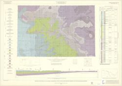
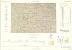
By Gerald H. Johnson and Stanley J. Keller. transverse Mercator projection. Regional geologic map , no. 8. Relief shown by profile. Includes columnar section...
Indiana. Geological Survey, Bleuer, N. K. (Ned Kermit), 1943-, Lineback, Jerry A. (Jerry Alvin), Hill, John R,, Gray, Henry Hamilton, 1922-, and Illinois Sta...
Publisher:
Indiana. Geological Survey
Date Created:
1979
Identifier:
VAC3073-M-01251
Genre:
Quadrangle maps, Geological maps, and Geological cross-sections
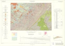
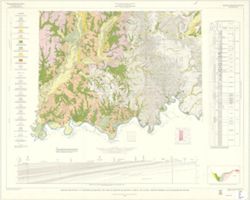
Indianapolis sheet. 1979 edition. Transverse Mercator projection. Geology compiled by H. H. Gray (Indiana) and J. A. Lineback (Illinois) from published and o...
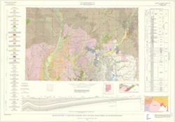
By Henry H. Gray. Compiled by H. H. Gray and A. M. Burger. Drafted by J. R. Tolen. Base map modified from Army Map Service Map NJ16-6, 1964. Transverse Merca...
By Ann M. Burger, Jane L. Forsyth, Robert S. Nicoll, and William J. Wayne , Indiana Geological Survey, Dept. of Natural Resources. Transverse Mercator projec...
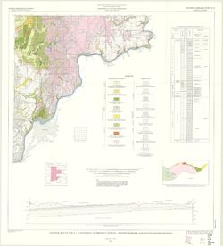
By Henry H. Gray, William J. Wayne, and Charles E. Wier , Indiana Geological Survey, in cooperation with Illinois State Geological Survey. Transverse Mercato...
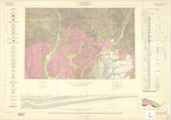
Call Number:
G4091.C5 s250 .I5 Vincennes
Caption:
Imprint: [Bloomington, Ind.] : The Survey, 1970
Physical Description:
Dimensions: 76 x 102 cm and Scale: 1:250,000. Vertical scale approximately 1:11,500
Gray, Henry Hamilton, 1922-, Wier, Charles E. (Charles Eugene), 1921-, Indiana. Geological Survey, Wayne, William J. (William John), 1922-, and Illinois Stat...
Publisher:
Indiana. Geological Survey
Date Created:
1970
Identifier:
VAC3073-M-01257
Genre:
Quadrangle maps, Geological maps, and Geological cross-sections
By Henry H. Gray, William J. Wayne, and Charles E. Wier , Indiana Geological Survey, in cooperation with Illinois State Geological Survey. Transverse Mercato...
By Charles E. Wier and Henry H. Gray. Geology by H.H. Gray [and others]. Drafted by R. E. Judah and W. H. Moran. Base modified from Army Map Service map NJ 1...