Geographic Subject: Johnson County (Ind.), Geographic Subject: Bartholomew County (Ind.), Geographic Subject: Brown County (Ind.), and Topical Subject: Veget...
Creator:
Geological Survey (U.S.) and United States. Army. Corps of Engineers
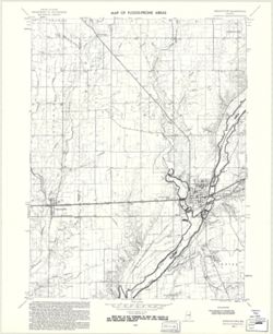
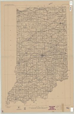
Filing title: Franklin, Ind. Mapped, edited, and published by Geological Survey. Edition of 1950. Polyconic projection. Relief shown by contours and spot hei...
Topography by H. E. Simmons, J. C. Hilliard, A. T. Munson, E. W. Gouchenour, P. L. Sampson, A. W. Thomas, and F. W. Weber. ... Topography in Indiana from cha...
Call Number:
G4090 s62 .G4 Carmi 1943 V
Caption:
Imprint: [Washington, D.C.] : U.S. Geological Survey, [1943].
Physical Description:
Scale: 1:62,500 and Dimensions: 45 x 42 cm or smaller
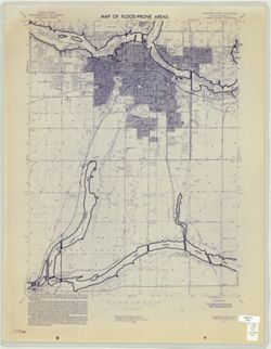
Geographic Subject: Lawrence County (Ind.), Geographic Subject: Greene County (Ind.), Topical Subject: Vegetation mapping, Geographic Subject: Martin County ...
Creator:
McKinley, W. K. (William Klett), 1891-1964 and Geological Survey (U.S.)
Publisher:
Geological Survey (U.S.)
Date Created:
1960
Identifier:
VAC3073-M-01297
Genre:
15 minute topographic maps, Quadrangle maps, and Topographic maps
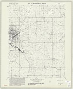
Mapped by the Geological Survey and the Army Map Service. Filing title: Alton, Ind.--Ky. Polyconic projection. Relief shown by contours and spot heights. Inc...
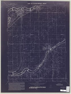
Geographic Subject: Madison County (Ind.), Topical Subject: Floodplains, Geographic Subject: Anderson Region (Ind.), Topical Subject: Floods, and Topical Sub...
Creator:
Geological Survey (U.S.)
Publisher:
Geological Survey (U.S.)
Date Created:
1973
Identifier:
VAC3073-M-01007
Genre:
Topographic maps, Quadrangle maps, and 7.5 minute topographic maps
Filing title: Anderson South, Ind. Relief shown by contours and spot heights. Contour interval 10 feet. Includes quadrangle location map. Flood prone areas a...

![Franklin Quadrangle Indiana : 15 minute series (topographic) [1964 reprint with vegetation]](https://iiif.uits.iu.edu/iiif/2/73667641k%2Ffiles%2F027698b1-090b-4a4d-a44a-17bb6da9d222/full/250,/0/default.jpg)
![Edinburg Quadrangle Indiana : 15 minute series (topographic) [1950 printing without vegetation]](https://iiif.uits.iu.edu/iiif/2/3b592c294%2Ffiles%2F06928e89-6508-4c49-a4ff-7f390a205f57/full/250,/0/default.jpg)
![Illinois-Indiana, Carmi quadrangle : 15-minute series [Vegetation version]](https://iiif.uits.iu.edu/iiif/2/05742t84z%2Ffiles%2Fe2026c3b-8fbe-4027-b8c6-30e90057113a/full/250,/0/default.jpg)
![Indiana Oolitic quadrangle : 15-minute series [1960 reprint with vegetation]](https://iiif.uits.iu.edu/iiif/2/4m90fx888%2Ffiles%2F4b646387-592f-4982-b7bc-aaf89844fb82/full/250,/0/default.jpg)
![Alton quadrangle, Indiana--Kentucky : 15 minute series (topographic) [Vegetation version]](https://iiif.uits.iu.edu/iiif/2/ng452m33b%2Ffiles%2F49c9606f-c7c7-4f10-807b-1b5949009698/full/250,/0/default.jpg)