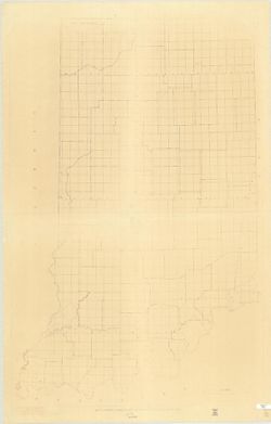
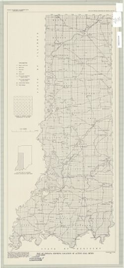
Topical Subject: Administrative and political divisions and Geographic Subject: Indiana
Creator:
Moran, W. H. (William H.)
Publisher:
Indiana. Geological Survey
Date Created:
1951
Identifier:
VAC3073-M-00001
Genre:
Maps
Geographic Location:
Coordinates: W0880500 W0844700 N0414500 N0374600
Related URL:
Catalog URL: https://iucat.iu.edu/catalog/1233513
Abstract:
Photocopy, 118 x 77 cm "November, 1951." "Traced from compilation proof sheets of new base map of Indiana, prepared by the U.S. Geological Sur...
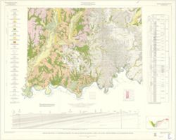
Gray, Henry Hamilton, 1922-, Wier, Charles E. (Charles Eugene), 1921-, Indiana. Geological Survey, Wayne, William J. (William John), 1922-, and Illinois Stat...
Publisher:
Indiana. Geological Survey
Date Created:
1970
Identifier:
VAC3073-M-01257
Genre:
Quadrangle maps, Geological maps, and Geological cross-sections
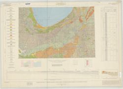
By Henry H. Gray, William J. Wayne, and Charles E. Wier , Indiana Geological Survey, in cooperation with Illinois State Geological Survey. Transverse Mercato...
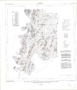
Topical Subject: Geology, Economic, Topical Subject: Mines and mineral resources, Geographic Subject: Sullivan County (Ind.), and Topical Subject: IGS Annual...
Creator:
Levette, G. M. (Gilbert M.), Collett, John, 1828-1899, and Cox, E. T. (Edward Travers), 1821-1907
Drawn by G.M. Levette, for the second annual report of Prof. E.T. Cox, state geologist , geology by John Collett. "Braden & Burford, Lith., Indianap...
Call Number:
G4093.S8H1 1870 .L4
Caption:
Imprint: Indianapolis, Ind. : Geological Survey of Indiana, [1871]
Physical Description:
Scale: Approximately 1:85,000 and Dimensions: on sheet 82 x 64 cm
Alternate Identifier:
Title Control Number: a18283359 and Alternate ID: 390721IP
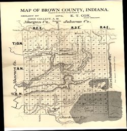
Topical Subject: IGS Annual Reports, Geographic Subject: Brown County (Ind.), Topical Subject: Geology, and Topical Subject: Mines and mineral resources
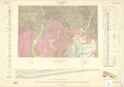
Prepared for the sixth annual report of E.T. Cox, State Geologist , geology by John Collett, 1874. Relief shown by hachures. Shows cities and towns, railroad...
Call Number:
G4093.B7C5 1874 .C6
Caption:
Imprint: [Indianapolis] : [Sentinel Company, printers], [1875] and Imprint: [Indianapolis] : [Geological Survey of Indiana], [1875]
Physical Description:
Scale: Approximately 1:120,000 and Dimensions: on sheet 39 x 35 cm
Alternate Identifier:
Alternate ID: 390723IP and Title Control Number: a18318678
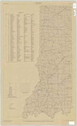
Topical Subject: Coal mines and mining and Geographic Subject: Indiana
Creator:
Hutchison, Harold C. (Harold Christy), 1925-
Publisher:
Indiana. Geological Survey
Date Created:
1975
Identifier:
VAC3073-M-00704
Genre:
Mine maps
Geographic Location:
Coordinates: W0872723 W0862628 N0403749 N0374618
Related URL:
Catalog URL: https://iucat.iu.edu/catalog/5050615
Abstract:
Blue line print. "Base modified from Indiana Department of Conservation, Geological Survey, Base map of portion of western Indiana, 1951." Includes...
By Allan F. Schneider and Stanley J. Keller. Transverse Mercator projection. "Indiana Geological Survey in cooperation with Illinois State Geological Su...
By Charles E. Wier and Henry H. Gray. Geology by H.H. Gray [and others]. Drafted by R. E. Judah and W. H. Moran. Base modified from Army Map Service map NJ 1...