
Search Constraints
« Previous |
1 - 10 of 30
|
Next »
Search Results
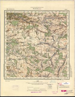
-
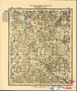
- Description:
- 1910
- Subject:
- Geographic Subject: Bagrationovsk, Topical Subject: Maps, and Topical Subject: Soviet Union
- Publisher:
- Генеральный штаб РККА
- Language:
- Russian
- Date Created:
- 1911
- Identifier:
- VAC9619-003923
- Genre:
- Topographic Maps and Military Maps
- Geographic Location:
- Coordinates: 54.333, 20.5, 54.667, 21
- Related URL:
- Download GeoTIFF: https://drive.google.com/file/d/1zzTjtSJBd0-vtEOOrbD7lCfPXq6yRUkE/view?usp=sharing and Catalog URL: https://iucat.iu.edu/catalog/5020129
- Abstract:
- Modern area represented: Bagrationovsk, Kaliningrad oblast, Russia
- Call Number:
- G7000 s100 .S7 sheet N-34-54
- City:
- Пр. Айлау (Preußisch Eylau)
- Copyright Holder:
- No Copyright - United States
- State/Province:
- Кенигсбергская провинция (Königsberg province) and Восточная Пруссия (East Prussia)
- Physical Description:
- Scale: 1:100,000
- Persistent URL:
- http://purl.dlib.indiana.edu/iudl/images/VAC9619/VAC9619-003923
- Provenance:
- DMA Topographic Center, Army Map Service Library, OMAHA
-
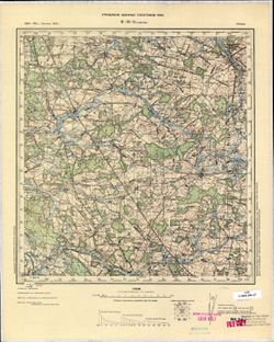
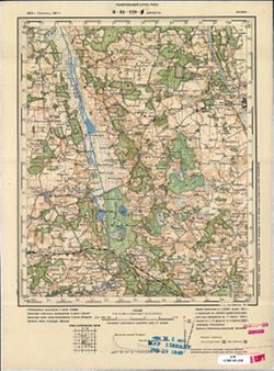
- Description:
- 1886
- Subject:
- Geographic Subject: Bełżyce, Topical Subject: Maps, and Topical Subject: Soviet Union
- Publisher:
- Генеральный штаб РККА
- Language:
- Russian
- Date Created:
- 1911
- Identifier:
- VAC9619-002778
- Genre:
- Topographic Maps and Military Maps
- Geographic Location:
- Coordinates: 51, 22, 51.333, 22.5
- Related URL:
- Catalog URL: https://iucat.iu.edu/catalog/5020129 and Download GeoTIFF: https://drive.google.com/file/d/1PN7pautKuAnzJ9ZVxUqNYrK5VIvqN02-/view?usp=sharing
- Abstract:
- Modern area represented: Bełżyce, Lublin province, Poland
- Call Number:
- G7000 s100 .S7 sheet M-34-33
- City:
- Бэлжицэ (Bełżyce)
- Copyright Holder:
- No Copyright - United States
- Country:
- Польша (Poland)
- Physical Description:
- Scale: 1:100,000
- Persistent URL:
- http://purl.dlib.indiana.edu/iudl/images/VAC9619/VAC9619-002778
- Provenance:
- CIA Map Library, Justus Perthes Kartensammlung
-
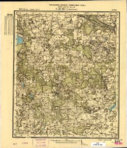
- Description:
- 1884
- Subject:
- Geographic Subject: Garwolin, Topical Subject: Maps, and Topical Subject: Soviet Union
- Publisher:
- Управление военных топографов РККА
- Language:
- Russian
- Date Created:
- 1911
- Identifier:
- VAC9619-002734
- Genre:
- Topographic Maps and Military Maps
- Geographic Location:
- Coordinates: 51.667, 21.5, 52, 22
- Related URL:
- Catalog URL: https://iucat.iu.edu/catalog/5020129 and Download GeoTIFF: https://drive.google.com/file/d/1O6NBDeRI7ydg09tm-zOfLmSsczootWdF/view?usp=sharing
- Abstract:
- Modern area represented: Garwolin, Mazovia province, Poland
- Call Number:
- G7000 s100 .S7 sheet M-34-8
- City:
- Гарволин (Garwolin)
- Copyright Holder:
- No Copyright - United States
- Country:
- Польша (Poland)
- Physical Description:
- Scale: 1:100,000
- Persistent URL:
- http://purl.dlib.indiana.edu/iudl/images/VAC9619/VAC9619-002734
- Provenance:
- CIA Map Library
-
- Description:
- 1873
- Subject:
- Topical Subject: Maps, Geographic Subject: Latvia, and Topical Subject: Soviet Union
- Publisher:
- Управление военных топографов РККА
- Language:
- Russian
- Date Created:
- 1911
- Identifier:
- VAC9619-001742
- Genre:
- Topographic Maps and Military Maps
- Geographic Location:
- Coordinates: 56.5, 23, 56.667, 23.25
- Related URL:
- Catalog URL: http://iucat.iu.edu/catalog/5020131 and Download GeoTIFF: https://drive.google.com/open?id=1YMeeAM99JchcvN2yFK5eKaTZIf34nzsP
- Abstract:
- Modern area represented: Latvia
- Call Number:
- G7000 s50 .S68 sheet 34-131-A
- City:
- Яунсэсавас (Jaunszsavas)
- Copyright Holder:
- No Copyright - United States
- Country:
- Латвия (Latvia)
- Physical Description:
- Scale: 1:50,000
- Persistent URL:
- http://purl.dlib.indiana.edu/iudl/images/VAC9619/VAC9619-001742
- Provenance:
- CIA Map Branch -- Received
-
- Description:
- 1875
- Subject:
- Topical Subject: Soviet Union and Topical Subject: Maps
- Publisher:
- Управление военных топографов
- Language:
- Russian
- Date Created:
- 1911
- Identifier:
- VAC9619-001740
- Genre:
- Military Maps and Topographic Maps
- Geographic Location:
- Coordinates: 56.5, 22.5, 56.667, 22.75
- Related URL:
- Download GeoTIFF: https://drive.google.com/open?id=1Z1rEnkXehm2Gj6jfQ-UvprOe3lnX8lCe and Catalog URL: http://iucat.iu.edu/catalog/5020131
- Call Number:
- G7000 s50 .S68 sheet O-34-130-A
- City:
- Таурукални (Towrukalni)
- Copyright Holder:
- No Copyright - United States
- Country:
- Латвия (Latvia)
- Physical Description:
- Scale: 1:50,000
- Persistent URL:
- http://purl.dlib.indiana.edu/iudl/images/VAC9619/VAC9619-001740
- Provenance:
- M. I. Map Library, G000-30, GS, RA
-
- Description:
- 1874
- Subject:
- Topical Subject: Maps, Geographic Subject: Džūkste, and Topical Subject: Soviet Union
- Publisher:
- Генеральный штаб РККА
- Language:
- Russian
- Date Created:
- 1911
- Identifier:
- VAC9619-001733
- Genre:
- Military Maps and Topographic Maps
- Geographic Location:
- Coordinates: 56.667, 23, 56.833, 23.25
- Related URL:
- Catalog URL: http://iucat.iu.edu/catalog/5020131 and Download GeoTIFF: https://drive.google.com/open?id=1xPq5unp5CSc2HErWIX1XRVOHu4vx7bp3
- Abstract:
- Modern area represented: Džūkste, Latvia
- Call Number:
- G7000 s50 .S68 sheet O-34-119-C
- City:
- Джукстэ (Džūkste)
- Copyright Holder:
- No Copyright - United States
- Country:
- Латвия (Latvia)
- Physical Description:
- Scale: 1:50,000
- Persistent URL:
- http://purl.dlib.indiana.edu/iudl/images/VAC9619/VAC9619-001733
- Provenance:
- M. I. Map Library
-
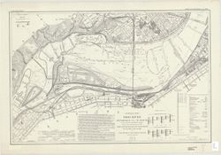
- Subject:
- Topical Subject: Rivers, Geographic Subject: Ohio River, and Topical Subject: Navigation
- Creator:
- United States. Army. Corps of Engineers
- Publisher:
- U.S. Lake Survey
- Date Created:
- 1911
- Identifier:
- VAC3073-M-01499
- Genre:
- Nautical charts
- Geographic Location:
- Coordinates: W0891200 W0800000 N0404300 N0365700
- Related URL:
- Catalog URL: https://iucat.iu.edu/catalog/10895418
- Abstract:
- Some charts have imprint: Fort Belvoir, Va.: 30th Engineers by reproduction plant, 1943, or Washington, D.C.: Engineer reproduction plant, U.S. Army, 1929.
- Call Number:
- G3707.O5 1911 .U55
- Caption:
- Imprint: Detroit, Michigan : U.S. Lake Survey Office, 1911-1914.
- Physical Description:
- Scale: 1:7,200 and Dimensions: size varies
- Persistent URL:
- https://purl.dlib.indiana.edu/iudl/images/VAC3073/VAC3073-M-01499
-
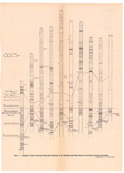
- Subject:
- Geographic Subject: Indiana, Topical Subject: Mines and mineral resources, Topical Subject: IGS Annual Reports, Topical Subject: Geology, Stratigraphic--Penn...
- Creator:
- Blatchley, Raymond S. (Raymond Sillliman)
- Publisher:
- Indiana. Department of Geology and Natural Resources
- Date Created:
- 1911
- Identifier:
- VAC3073-M-01084
- Genre:
- Geological cross-sections
- Geographic Location:
- Coordinates: W0880500 W0844700 N0414500 N0374600
- Related URL:
- Catalog URL: https://iucat.iu.edu/catalog/18418391
- Abstract:
- Title from caption. At head of title: "Plate I." Compiled by R.S. Blatchley. 10 sections on one sheet. Geologic columns showing stratigraphic layer...
- Call Number:
- G4091.C57 1910 .B53
- Caption:
- Imprint: [Indianapolis] : [Indiana Department of Geology and Natural Resources], [1911] and Imprint: [Indianapolis] : [Wm. B. Burford], [1911]
- Physical Description:
- Scale: Scale not given. Vertical scale approximately 1:2,100 and Dimensions: on sheet 37 x 26 cm
- Alternate Identifier:
- Title Control Number: a18418391 and Alternate ID: 390726IP
- Persistent URL:
- https://purl.dlib.indiana.edu/iudl/images/VAC3073/VAC3073-M-01084
- Provenance:
- 35th Annual Report (1910) / Indiana. Department of Geology and Natural Resources.
-
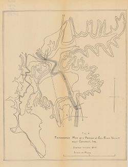
- Subject:
- Geographic Subject: Owen County (Ind.), Geographic Subject: Eel River Valley (Ind. : Valley), Topical Subject: IGS Annual Reports, and Topical Subject: Valleys
- Publisher:
- Indiana. Department of Geology and Natural Resources
- Date Created:
- 1911
- Identifier:
- VAC3073-M-00830
- Genre:
- Topographic maps
- Geographic Location:
- Coordinates: W0865003 W0864726 N0392725 N0392513
- Related URL:
- Catalog URL: https://iucat.iu.edu/catalog/18418393
- Abstract:
- Relief shown by contours. Contour interval 20 feet. Shows upper falls dam and proposed lower falls dams now located within the Cataract Falls State Recreatio...
- Call Number:
- G4092.O8C2 1910 .T6
- Caption:
- Imprint: [Indianapolis] : [Wm. B. Burford], [1911] and Imprint: [Indianapolis] : [Indiana Department of Geology and Natural Resources], [1911]
- Physical Description:
- Scale: Approximately 1:7,650 and Dimensions: 31 x 25 cm
- Alternate Identifier:
- Title Control Number: a18418393 and Alternate ID: 390726IP
- Persistent URL:
- https://purl.dlib.indiana.edu/iudl/images/VAC3073/VAC3073-M-00830
- Provenance:
- 35th Annual Report (1910) / Indiana. Department of Geology and Natural Resources.
-
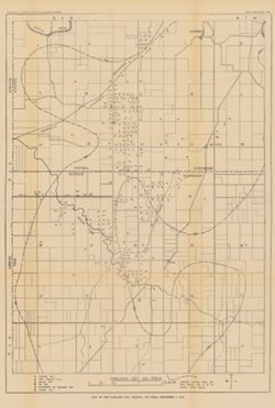
- Subject:
- Geographic Subject: Pike County (Ind.), Geographic Subject: Oakland City (Ind.), Geographic Subject: Gibson County (Ind.), Topical Subject: Gas wells, Topica...
- Publisher:
- Indiana. Department of Geology and Natural Resources
- Date Created:
- 1911
- Identifier:
- VAC3073-M-00671
- Genre:
- Geological maps
- Geographic Location:
- Coordinates: W0872300 W0871300 N0382200 N0381200
- Related URL:
- Catalog URL: https://iucat.iu.edu/catalog/18307759
- Abstract:
- Shows oil and gas wells. "Structure contours above sea level showing coal V or its position before erosion."--Legend. Detached from: The Oakland...
- Call Number:
- G4094.O2H8 1910 .M3
- Caption:
- Imprint: [Indianapolis] : [Indiana Dept. of Geology and Natural Resources], [1911]
- Physical Description:
- Scale: Approximately 1:21,500 and Dimensions: 57 x 40 cm
- Alternate Identifier:
- Title Control Number: a18307759 and Alternate ID: 390726IP
- Persistent URL:
- https://purl.dlib.indiana.edu/iudl/images/VAC3073/VAC3073-M-00671
- Provenance:
- 35th Annual Report (1910) / Indiana. Department of Geology and Natural Resources.

- « Previous
- Next »
- 1
- 2
- 3