
Search Constraints
You searched for:
Provenance
Army Map Service Library, OMAHA, Library of Congress Geography & Map Division
Remove constraint Provenance: Army Map Service Library, OMAHA, Library of Congress Geography & Map Division
Search Results
-

- Subject:
- Topical Subject: Soviet Union, Geographic Subject: Zarasai, and Topical Subject: Maps
- Publisher:
- Управление военных топографов
- Language:
- Russian
- Date Created:
- 1931
- Identifier:
- VAC9619-000401
- Genre:
- Military Maps and Topographic Maps
- Geographic Location:
- Coordinates: 55.667, 26, 55.833, 26.25
- Related URL:
- Catalog URL: http://iucat.iu.edu/catalog/5020131 and Download GeoTIFF: https://drive.google.com/open?id=15qAUErdyJ7fb_ELG4IgoI3gxwnYVLlQT
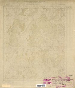
- Abstract:
- Modern area represented: Zarasai, Lithuania
- Call Number:
- G7000 s50 .S68 sheet N-35-5-C
- City:
- Зарасай (Zarasai)
- Copyright Holder:
- No Copyright - United States
- Country:
- Литва (Lithuania) and Латвия (Latvia)
- Physical Description:
- Scale: 1:50,000
- Persistent URL:
- http://purl.dlib.indiana.edu/iudl/images/VAC9619/VAC9619-000401
- Provenance:
- Army Map Service Library, OMAHA, Library of Congress Geography & Map Division
-
- Subject:
- Geographic Subject: Ilūkste, Topical Subject: Soviet Union, and Topical Subject: Maps
- Publisher:
- Управление военных топографов РККА
- Language:
- Russian
- Identifier:
- VAC9619-000400
- Genre:
- Military Maps and Topographic Maps
- Geographic Location:
- Coordinates: 55.833, 26.25, 56, 26.5
- Related URL:
- Catalog URL: http://iucat.iu.edu/catalog/5020131 and Download GeoTIFF: https://drive.google.com/open?id=12qIjQwgiMa_JxcrCbCWazfnDqDGEOmx4
- Abstract:
- Modern area represented: Ilūkste, Latvia
- Call Number:
- G7000 s50 .S68 sheet N-35-5-B
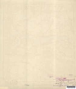
- Caption:
- Captured map
- City:
- Иллукст (Illukst)
- Copyright Holder:
- No Copyright - United States
- Country:
- Латвия (Latvia)
- Physical Description:
- Scale: 1:50,000
- Persistent URL:
- http://purl.dlib.indiana.edu/iudl/images/VAC9619/VAC9619-000400
- Provenance:
- Army Map Service Library, OMAHA, Library of Congress Geography & Map Division
-

- Subject:
- Topical Subject: Maps, Geographic Subject: Dusetos, and Topical Subject: Soviet Union
- Publisher:
- Управление военных топографов
- Language:
- Russian
- Identifier:
- VAC9619-000398
- Genre:
- Topographic Maps and Military Maps
- Geographic Location:
- Coordinates: 55.667, 25.75, 55.833, 26
- Related URL:
- Catalog URL: http://iucat.iu.edu/catalog/5020131 and Download GeoTIFF: https://drive.google.com/open?id=1wT-OBmfXMwJX6MoO9qvDpphR75bN9bKT
- Abstract:
- Modern area represented: Dusetos, Lithuania
- Call Number:
- G7000 s50 .S68 sheet N-35-4-D
- City:
- Дусяты (Dusyaty)
- Copyright Holder:
- No Copyright - United States
- Country:
- Литва (Lithuania)
- Physical Description:
- Scale: 1:50,000
- Persistent URL:
- http://purl.dlib.indiana.edu/iudl/images/VAC9619/VAC9619-000398
- Provenance:
- Army Map Service Library, OMAHA, Library of Congress Geography & Map Division
-

- Description:
- 1901
- Subject:
- Topical Subject: Maps, Topical Subject: Soviet Union, and Geographic Subject: Kamajai
- Publisher:
- Управление военных топографов
- Language:
- Russian
- Identifier:
- VAC9619-000397
- Genre:
- Topographic Maps and Military Maps
- Geographic Location:
- Coordinates: 55.667, 25.5, 55.833, 25.75
- Related URL:
- Catalog URL: http://iucat.iu.edu/catalog/5020131 and Download GeoTIFF: https://drive.google.com/open?id=1bsGqU7RACnULVismBQTvb8sh2m22_6Z-
- Abstract:
- Modern area represented: Kamajai, Lithuania
- Call Number:
- G7000 s50 .S68 sheet N-35-4-C
- City:
- Комаи (Komai)
- Copyright Holder:
- No Copyright - United States
- Country:
- Литва (Lithuania)
- Physical Description:
- Scale: 1:50,000
- Persistent URL:
- http://purl.dlib.indiana.edu/iudl/images/VAC9619/VAC9619-000397
- Provenance:
- Army Map Service Library, OMAHA, Library of Congress Geography & Map Division
-

- Subject:
- Topical Subject: Maps, Geographic Subject: Obeliai, and Topical Subject: Soviet Union
- Publisher:
- Управление военных топографов
- Language:
- Russian
- Identifier:
- VAC9619-000396
- Genre:
- Military Maps and Topographic Maps
- Geographic Location:
- Coordinates: 55.833, 25.75, 56, 26
- Related URL:
- Download GeoTIFF: https://drive.google.com/open?id=19vw0vJlN-7eyWZsytf-gLRnPQKrRpMwE and Catalog URL: http://iucat.iu.edu/catalog/5020131
- Abstract:
- Modern area represented: Obeliai, Lithuania
- Call Number:
- G7000 s50 .S68 sheet N-35-4-B
- City:
- Абели (Abeli)
- Copyright Holder:
- No Copyright - United States
- Country:
- Литва (Lithuania) and Латвия (Latvia)
- Physical Description:
- Scale: 1:50,000
- Persistent URL:
- http://purl.dlib.indiana.edu/iudl/images/VAC9619/VAC9619-000396
- Provenance:
- Army Map Service Library, OMAHA, Library of Congress Geography & Map Division
-

- Subject:
- Topical Subject: Maps, Topical Subject: Soviet Union, and Geographic Subject: Svėdasai
- Publisher:
- Управление военных топографов
- Language:
- Russian
- Identifier:
- VAC9619-000395
- Genre:
- Topographic Maps and Military Maps
- Geographic Location:
- Coordinates: 55.667, 25.25, 55.833, 25.5
- Related URL:
- Catalog URL: http://iucat.iu.edu/catalog/5020131 and Download GeoTIFF: https://drive.google.com/open?id=12cSqiQAxz63altkLQd5_ZCFLz0zeu2Fz
- Abstract:
- Modern area represented: Svėdasai, Lithuania
- Call Number:
- G7000 s50 .S68 sheet N-35-3-D
- City:
- Свядосцы (Świadoście)
- Copyright Holder:
- No Copyright - United States
- Country:
- Литва (Lithuania)
- Physical Description:
- Scale: 1:50,000
- Persistent URL:
- http://purl.dlib.indiana.edu/iudl/images/VAC9619/VAC9619-000395
- Provenance:
- Army Map Service Library, OMAHA, Library of Congress Geography & Map Division
-
- Subject:
- Geographic Subject: Panemunėlis, Topical Subject: Maps, and Topical Subject: Soviet Union
- Publisher:
- Управление военных топографов
- Language:
- Russian
- Date Created:
- 1901
- Identifier:
- VAC9619-000394
- Genre:
- Topographic Maps and Military Maps
- Geographic Location:
- Coordinates: 55.833, 25.25, 56, 25.5
- Related URL:
- Catalog URL: http://iucat.iu.edu/catalog/5020131 and Download GeoTIFF: https://drive.google.com/open?id=18y4MJcwog3nQACJn9ht5hoLuXSjdvCqz
- Abstract:
- Modern area represented: Panemunėlis, Lithuania
- Call Number:
- G7000 s50 .S68 sheet N-35-3-B
- City:
- Понемунок (Poniemunek)
- Copyright Holder:
- No Copyright - United States
- Country:
- Литва (Lithuania)
- Physical Description:
- Scale: 1:50,000
- Persistent URL:
- http://purl.dlib.indiana.edu/iudl/images/VAC9619/VAC9619-000394
- Provenance:
- Army Map Service Library, OMAHA, Library of Congress Geography & Map Division
-
- Description:
- 1900
- Subject:
- Geographic Subject: Skapiškis, Topical Subject: Soviet Union, and Topical Subject: Maps
- Publisher:
- Управление военных топографов
- Language:
- Russian
- Identifier:
- VAC9619-000393
- Genre:
- Topographic Maps and Military Maps
- Geographic Location:
- Coordinates: 55.833, 25, 56, 25.25
- Related URL:
- Catalog URL: http://iucat.iu.edu/catalog/5020131 and Download GeoTIFF: https://drive.google.com/open?id=1zrPA0i7bEmVRz75e97mHbOKP2XVnrGpV
- Abstract:
- Modern area represented: Skapiškis, Lithuania
- Call Number:
- G7000 s50 .S68 sheet N-35-3-A
- City:
- Скопишки (Skopishki)
- Copyright Holder:
- No Copyright - United States
- Country:
- Литва (Lithuania)
- Physical Description:
- Scale: 1:50,000
- Persistent URL:
- http://purl.dlib.indiana.edu/iudl/images/VAC9619/VAC9619-000393
- Provenance:
- Army Map Service Library, OMAHA, Library of Congress Geography & Map Division
-

- Subject:
- Geographic Subject: Biała Podlaska, Topical Subject: Soviet Union, and Topical Subject: Maps
- Publisher:
- Генеральный штаб Красной Армии
- Language:
- Russian
- Date Created:
- 1941
- Identifier:
- VAC9619-000386
- Genre:
- Topographic Maps and Military Maps
- Geographic Location:
- Coordinates: 52, 23, 52.1667, 23.25
- Related URL:
- Catalog URL: http://iucat.iu.edu/catalog/5020131 and Download GeoTIFF: https://drive.google.com/open?id=1j9Jb2zoApXKgz_weAAHXPhklR1FYCcmb
- Abstract:
- Modern area represented: Biała Podlaska, Poland
- Call Number:
- G7000 s50 .S68 sheet N-34-143-C
- City:
- Бяла Подляска (Biała Podlaska)
- Copyright Holder:
- No Copyright - United States
- Country:
- Область государственных интересов Германии (Region of German state interest)
- Physical Description:
- Scale: 1:50,000
- Persistent URL:
- http://purl.dlib.indiana.edu/iudl/images/VAC9619/VAC9619-000386
- Provenance:
- Army Map Service Library, OMAHA, Library of Congress Geography & Map Division
-
- Subject:
- Topical Subject: Maps, Topical Subject: Soviet Union, and Geographic Subject: Mokobody
- Publisher:
- Генеральный штаб Красной Армии
- Language:
- Russian
- Date Created:
- 1941
- Identifier:
- VAC9619-000381
- Genre:
- Topographic Maps and Military Maps
- Geographic Location:
- Coordinates: 52.1667, 22, 52.3333, 22.25
- Related URL:
- Catalog URL: http://iucat.iu.edu/catalog/5020131 and Download GeoTIFF: https://drive.google.com/open?id=1ouJ804ACOTOR3T2kEqiiASXr2R4REZAh
- Abstract:
- Modern area represented: Mokobody, Poland
- Call Number:
- G7000 s50 .S68 sheet N-34-141-A
- Caption:
- Captured map
- City:
- Мокободы (Mokobody)
- Copyright Holder:
- No Copyright - United States
- Country:
- Область государственных интересов Германии (Region of German state interest)
- Physical Description:
- Scale: 1:50,000
- Persistent URL:
- http://purl.dlib.indiana.edu/iudl/images/VAC9619/VAC9619-000381
- Provenance:
- Army Map Service Library, OMAHA, Library of Congress Geography & Map Division
-
- Subject:
- Geographic Subject: Pruszyn, Topical Subject: Maps, and Topical Subject: Soviet Union
- Publisher:
- Генеральный штаб Красной Армии
- Language:
- Russian
- Date Created:
- 1941
- Identifier:
- VAC9619-000382
- Genre:
- Military Maps and Topographic Maps
- Geographic Location:
- Coordinates: 52.1667, 22.25, 52.3333, 22.5
- Related URL:
- Download GeoTIFF: https://drive.google.com/open?id=15b5hrAJ9da_wcemnEC0AhFb8-lwLrq4y and Catalog URL: http://iucat.iu.edu/catalog/5020131
- Abstract:
- Modern area represented: Pruszyn, Poland
- Call Number:
- G7000 s50 .S68 sheet N-34-141-B
- Caption:
- Captured map
- City:
- Прушин (Pruszyn)
- Copyright Holder:
- No Copyright - United States
- Country:
- Область государственных интересов Германии (Region of German state interest)
- Physical Description:
- Scale: 1:50,000
- Persistent URL:
- http://purl.dlib.indiana.edu/iudl/images/VAC9619/VAC9619-000382
- Provenance:
- Army Map Service Library, OMAHA, Library of Congress Geography & Map Division
-
- Subject:
- Topical Subject: Maps, Topical Subject: Soviet Union, and Geographic Subject: Gołymin-Ośrodek
- Publisher:
- Генеральный штаб Красной Армии
- Language:
- Russian
- Date Created:
- 1941
- Identifier:
- VAC9619-000380
- Genre:
- Topographic Maps and Military Maps
- Geographic Location:
- Coordinates: 52.6667, 20.75, 52.8333, 21
- Related URL:
- Download GeoTIFF: https://drive.google.com/open?id=1TK2aF8RMGAbdEVm4XuSX3vzj2tJntdbW and Catalog URL: http://iucat.iu.edu/catalog/5020131
- Abstract:
- Modern area represented: Gołymin-Ośrodek, Poland
- Call Number:
- G7000 s50 .S68 sheet N-114-D
- Caption:
- Captured map
- City:
- Голымин Стары
- Copyright Holder:
- No Copyright - United States
- Country:
- Область государственных интересов Германии (Region of German state interest)
- Physical Description:
- Scale: 1:50,000
- Persistent URL:
- http://purl.dlib.indiana.edu/iudl/images/VAC9619/VAC9619-000380
- Provenance:
- Army Map Service Library, OMAHA, Library of Congress Geography & Map Division
-
- Subject:
- Topical Subject: Maps, Geographic Subject: Ciechanów, and Topical Subject: Soviet Union
- Publisher:
- Генеральный штаб Красной Армии
- Language:
- Russian
- Date Created:
- 1941
- Identifier:
- VAC9619-000378
- Genre:
- Military Maps and Topographic Maps
- Geographic Location:
- Coordinates: 52.8333, 20.5, 53, 20.75
- Related URL:
- Download GeoTIFF: https://drive.google.com/open?id=19NZpMB0LLhTETWhRYs6IvVgTW8lNhNOq and Catalog URL: http://iucat.iu.edu/catalog/5020131
- Abstract:
- Modern area represented: Ciechanów, Poland
- Call Number:
- G7000 s50 .S68 sheet N-34-114-A
- Caption:
- Captured map
- City:
- Цеханув
- Copyright Holder:
- No Copyright - United States
- Country:
- Область государственных интересов Германии (Region of German state interest)
- Physical Description:
- Scale: 1:50,000
- Persistent URL:
- http://purl.dlib.indiana.edu/iudl/images/VAC9619/VAC9619-000378
- Provenance:
- Army Map Service Library, OMAHA, Library of Congress Geography & Map Division
-
- Subject:
- Topical Subject: Soviet Union, Geographic Subject: Bogate, and Topical Subject: Maps
- Publisher:
- Генеральный штаб Красной Армии
- Language:
- Russian
- Date Created:
- 1941
- Identifier:
- VAC9619-000379
- Genre:
- Topographic Maps and Military Maps
- Geographic Location:
- Coordinates: 52.8333, 20.75, 53, 21
- Related URL:
- Download GeoTIFF: https://drive.google.com/open?id=1OYtTAtvkxii-vu8ffUIJ7Tr13jXX4SK3 and Catalog URL: http://iucat.iu.edu/catalog/5020131
- Abstract:
- Modern area represented: Bogate, Poland
- Call Number:
- G7000 s50 .S68 sheet N-34-114-B
- Caption:
- Captured map
- City:
- Богате (Bogate)
- Copyright Holder:
- No Copyright - United States
- Country:
- Область государственных интересов Германии (Region of German state interest)
- Physical Description:
- Scale: 1:50,000
- Persistent URL:
- http://purl.dlib.indiana.edu/iudl/images/VAC9619/VAC9619-000379
- Provenance:
- Army Map Service Library, OMAHA, Library of Congress Geography & Map Division
-
- Subject:
- Topical Subject: Soviet Union, Geographic Subject: Różan, and Topical Subject: Maps
- Publisher:
- Генеральный штаб Красной Армии
- Language:
- Russian
- Date Created:
- 1941
- Identifier:
- VAC9619-000373
- Genre:
- Military Maps and Topographic Maps
- Geographic Location:
- Coordinates: 52.8333, 21.25, 53, 21.5
- Related URL:
- Catalog URL: http://iucat.iu.edu/catalog/5020131 and Download GeoTIFF: https://drive.google.com/open?id=1JKYAMQraaYyBFcArKBpbqCb1sNSqgNAQ
- Abstract:
- Modern area represented: Różan, Poland
- Call Number:
- G7000 s50 .S68 sheet N-34-115-B
- Caption:
- Captured map
- City:
- Рожан (Różan)
- Copyright Holder:
- No Copyright - United States
- Country:
- Область государственных интересов Германии (Region of German state interest)
- Physical Description:
- Scale: 1:50,000
- Persistent URL:
- http://purl.dlib.indiana.edu/iudl/images/VAC9619/VAC9619-000373
- Provenance:
- Army Map Service Library, OMAHA, Library of Congress Geography & Map Division
-
- Subject:
- Geographic Subject: Maków Mazowiecki, Topical Subject: Maps, and Topical Subject: Soviet Union
- Publisher:
- Генеральный штаб Красной Армии
- Language:
- Russian
- Date Created:
- 1941
- Identifier:
- VAC9619-000363
- Genre:
- Topographic Maps and Military Maps
- Geographic Location:
- Coordinates: 52.8333, 21, 53, 21.25
- Related URL:
- Download GeoTIFF: https://drive.google.com/open?id=1UttvJpJWpIyx_fyNwX6e794CJbRv2oKu and Catalog URL: http://iucat.iu.edu/catalog/5020131
- Abstract:
- Modern area represented: Maków Mazowiecki, Poland
- Call Number:
- G7000 s50 .S68 sheet N-34-115-A
- Caption:
- Captured map
- City:
- Макув (Maków)
- Copyright Holder:
- No Copyright - United States
- Country:
- Область государственных интересов Германии (Region of German state interest)
- Physical Description:
- Scale: 1:50,000
- Persistent URL:
- http://purl.dlib.indiana.edu/iudl/images/VAC9619/VAC9619-000363
- Provenance:
- Army Map Service Library, OMAHA, Library of Congress Geography & Map Division
-

- Subject:
- Geographic Subject: Nasielsk, Topical Subject: Soviet Union, and Topical Subject: Maps
- Publisher:
- Генеральный штаб Красной Армии
- Language:
- Russian
- Date Created:
- 1941
- Identifier:
- VAC9619-000350
- Genre:
- Military Maps and Topographic Maps
- Geographic Location:
- Coordinates: 52.5, 20.75, 52.666667, 21.0
- Related URL:
- Download GeoTIFF: https://drive.google.com/open?id=1j4KIcDQOqpPMkMy-n2Pr6cSGIWrGggEl and Catalog URL: http://iucat.iu.edu/catalog/5020131
- Abstract:
- Modern area represented: Nasielsk, Poland
- Call Number:
- G7000 s50 .S68 sheet N-34-126-B
- Caption:
- Captured map
- City:
- Насельск (Nasielsk)
- Copyright Holder:
- No Copyright - United States
- Country:
- Область государственных интересов Германии (Region of German state interest)
- Physical Description:
- Scale: 1:50,000
- Persistent URL:
- http://purl.dlib.indiana.edu/iudl/images/VAC9619/VAC9619-000350
- Provenance:
- Army Map Service Library, OMAHA, Library of Congress Geography & Map Division
-
- Subject:
- Geographic Subject: Nowe Miasto, Topical Subject: Soviet Union, and Topical Subject: Maps
- Publisher:
- Генеральный штаб Красной Армии
- Language:
- Russian
- Date Created:
- 1941
- Identifier:
- VAC9619-000342
- Genre:
- Topographic Maps and Military Maps
- Geographic Location:
- Coordinates: 52.5, 20.5, 52.6667, 20.75
- Related URL:
- Catalog URL: http://iucat.iu.edu/catalog/5020131 and Download GeoTIFF: https://drive.google.com/open?id=1ouJacKa7i_4QxBSo2r2IGNaMv3GUrRS9
- Abstract:
- Modern area represented: Nowe Miasto, Poland
- Call Number:
- G7000 s50 .S68 sheet N-34-126-A
- Caption:
- Captured map
- City:
- Нове-Място (Nowe Miasto)
- Copyright Holder:
- No Copyright - United States
- Country:
- Область государственных интересов Германии (Region of German state interest)
- Physical Description:
- Scale: 1:50,000
- Persistent URL:
- http://purl.dlib.indiana.edu/iudl/images/VAC9619/VAC9619-000342
- Provenance:
- Army Map Service Library, OMAHA, Library of Congress Geography & Map Division
-
- Subject:
- Geographic Subject: Latowicz, Topical Subject: Soviet Union, and Topical Subject: Maps
- Publisher:
- Генеральный штаб Красной Армии
- Language:
- Russian
- Date Created:
- 1941
- Identifier:
- VAC9619-000340
- Genre:
- Topographic Maps and Military Maps
- Geographic Location:
- Coordinates: 52.0, 21.75, 52.166667, 22.0
- Related URL:
- Download GeoTIFF: https://drive.google.com/open?id=1ifVCloGvj7k8gskS3r87hxY43z_qtROX and Catalog URL: http://iucat.iu.edu/catalog/5020131
- Abstract:
- Modern area represented: Latowicz, Poland
- Call Number:
- G7000 s50 .S68 sheet N-34-140-D
- Caption:
- Captured map
- City:
- Лятович (Latowicz)
- Copyright Holder:
- No Copyright - United States
- Country:
- Область государственных интересов Германии (Region of German state interest)
- Physical Description:
- Scale: 1:50,000
- Persistent URL:
- http://purl.dlib.indiana.edu/iudl/images/VAC9619/VAC9619-000340
- Provenance:
- Army Map Service Library, OMAHA, Library of Congress Geography & Map Division
-
- Subject:
- Geographic Subject: Cegłów, Topical Subject: Soviet Union, and Topical Subject: Maps
- Publisher:
- Генеральный штаб Красной Армии
- Language:
- Russian
- Date Created:
- 1941
- Identifier:
- VAC9619-000336
- Genre:
- Military Maps and Topographic Maps
- Geographic Location:
- Coordinates: 52, 21.5, 52.167, 21.75
- Related URL:
- Download GeoTIFF: https://drive.google.com/open?id=1EwlXwAYp5zAgkg8DJ__OMlHFwctYLxzf and Catalog URL: http://iucat.iu.edu/catalog/5020131
- Abstract:
- Modern area represented: Cegłów, Poland
- Call Number:
- G7000 s50 .S68 sheet N-34-140-C
- Caption:
- Captured map
- City:
- Цеглув (Cegłów)
- Copyright Holder:
- No Copyright - United States
- Country:
- Область государственных интересов Германии (Region of German state interest)
- Physical Description:
- Scale: 1:50,000
- Persistent URL:
- http://purl.dlib.indiana.edu/iudl/images/VAC9619/VAC9619-000336
- Provenance:
- Army Map Service Library, OMAHA, Library of Congress Geography & Map Division
-

- Subject:
- Topical Subject: Soviet Union, Topical Subject: Maps, and Geographic Subject: Kałuszyn
- Publisher:
- Генеральный штаб Красной Армии
- Language:
- Russian
- Date Created:
- 1941
- Identifier:
- VAC9619-000335
- Genre:
- Military Maps and Topographic Maps
- Geographic Location:
- Coordinates: 52.166667, 21.75, 52.333333, 22.0
- Related URL:
- Download GeoTIFF: https://drive.google.com/open?id=1Sb-EziIgk9d7S9DVnzeYYee0wU_oK9Q9 and Catalog URL: http://iucat.iu.edu/catalog/5020131
- Abstract:
- Modern area represented: Kałuszyn, Poland
- Call Number:
- G7000 s50 .S68 sheet N-34-140-B
- Caption:
- Captured map
- City:
- Калушин (Kałuszyn)
- Copyright Holder:
- No Copyright - United States
- Country:
- Область государственных интересов Германии (Region of German state interest)
- Physical Description:
- Scale: 1:50,000
- Persistent URL:
- http://purl.dlib.indiana.edu/iudl/images/VAC9619/VAC9619-000335
- Provenance:
- Army Map Service Library, OMAHA, Library of Congress Geography & Map Division
-
- Subject:
- Geographic Subject: Otwock, Topical Subject: Maps, and Topical Subject: Soviet Union
- Publisher:
- Генеральный штаб Красной Армии
- Language:
- Russian
- Date Created:
- 1941
- Identifier:
- VAC9619-000334
- Genre:
- Military Maps and Topographic Maps
- Geographic Location:
- Coordinates: 52.0, 21.25, 52.166667, 21.5
- Related URL:
- Download GeoTIFF: https://drive.google.com/open?id=1tzxGHRI-6ocIi24fLP8Jt-gY1ypldrg9 and Catalog URL: http://iucat.iu.edu/catalog/5020131
- Abstract:
- Modern area represented: Otwock, Poland
- Call Number:
- G7000 s50 .S68 sheet N-34-139-D
- Caption:
- Captured map
- City:
- Отвоцк (Otwock)
- Copyright Holder:
- No Copyright - United States
- Country:
- Область государственных интересов Германии (Region of German state interest)
- Physical Description:
- Scale: 1:50,000
- Persistent URL:
- http://purl.dlib.indiana.edu/iudl/images/VAC9619/VAC9619-000334
- Provenance:
- Army Map Service Library, OMAHA, Library of Congress Geography & Map Division
-
- Subject:
- Topical Subject: Soviet Union, Geographic Subject: Okuniew, and Topical Subject: Maps
- Publisher:
- Генеральный штаб Красной Армии
- Language:
- Russian
- Date Created:
- 1941
- Identifier:
- VAC9619-000328
- Genre:
- Military Maps and Topographic Maps
- Geographic Location:
- Coordinates: 52.166667, 21.25, 52.333333, 21.5
- Related URL:
- Catalog URL: http://iucat.iu.edu/catalog/5020131 and Download GeoTIFF: https://drive.google.com/open?id=1Eb2daHA4eMeqlCMLjI2TOtyftg5RuEM5
- Abstract:
- Modern area represented: Okuniew, Poland
- Call Number:
- G7000 s50 .S68 sheet N-34-139-B
- Caption:
- Captured map
- City:
- Окунев (Okuniew)
- Copyright Holder:
- No Copyright - United States
- Country:
- Область государственных интересов Германии (Region of German state interest)
- Physical Description:
- Scale: 1:50,000
- Persistent URL:
- http://purl.dlib.indiana.edu/iudl/images/VAC9619/VAC9619-000328
- Provenance:
- Army Map Service Library, OMAHA, Library of Congress Geography & Map Division
-
- Subject:
- Geographic Subject: Pruszków, Topical Subject: Soviet Union, and Topical Subject: Maps
- Publisher:
- Генеральный штаб Красной Армии
- Language:
- Russian
- Date Created:
- 1941
- Identifier:
- VAC9619-000319
- Genre:
- Military Maps and Topographic Maps
- Geographic Location:
- Coordinates: 52.0, 20.75, 52.166667, 21.0
- Related URL:
- Catalog URL: http://iucat.iu.edu/catalog/5020131 and Download GeoTIFF: https://drive.google.com/open?id=1RhrUOPS54pH5r4qpvpPZid2tgwjiqAKe
- Abstract:
- Modern area represented: Pruszków, Poland
- Call Number:
- G7000 s50 .S68 sheet N-34-138-D
- Caption:
- Captured map
- City:
- Прушкув (Pruszków)
- Copyright Holder:
- No Copyright - United States
- Country:
- Область государственных интересов Германии (Region of German state interest)
- Physical Description:
- Scale: 1:50,000
- Persistent URL:
- http://purl.dlib.indiana.edu/iudl/images/VAC9619/VAC9619-000319
- Provenance:
- Army Map Service Library, OMAHA, Library of Congress Geography & Map Division
-
- Subject:
- Geographic Subject: Włochy, Topical Subject: Soviet Union, and Topical Subject: Maps
- Publisher:
- Генеральный штаб Красной Армии
- Language:
- Russian
- Date Created:
- 1941
- Identifier:
- VAC9619-000307
- Genre:
- Military Maps and Topographic Maps
- Geographic Location:
- Coordinates: 52.167, 20.75, 52.333, 21
- Related URL:
- Catalog URL: http://iucat.iu.edu/catalog/5020131 and Download GeoTIFF: https://drive.google.com/open?id=14C8fA7ssMrS5fiNf1B-23TndSJGF1Gt_
- Abstract:
- Modern area represented: Włochy, Warszawa district, Poland
- Call Number:
- G7000 s50 .S68 sheet N-34-138-B
- Caption:
- Captured map
- City:
- Влохы (Włochy)
- Copyright Holder:
- No Copyright - United States
- Country:
- Область государственных интересов Германии (Region of German state interest)
- Physical Description:
- Scale: 1:50,000
- Persistent URL:
- http://purl.dlib.indiana.edu/iudl/images/VAC9619/VAC9619-000307
- Provenance:
- Army Map Service Library, OMAHA, Library of Congress Geography & Map Division
-
- Subject:
- Topical Subject: Maps, Geographic Subject: Węgrów, and Topical Subject: Soviet Union
- Publisher:
- Генеральный штаб Красной Армии
- Language:
- Russian
- Date Created:
- 1941
- Identifier:
- VAC9619-000301
- Genre:
- Topographic Maps and Military Maps
- Geographic Location:
- Coordinates: 52.333, 22, 52.5, 22.25
- Related URL:
- https://drive.google.com/open?id=1AstHWpyMNvTtx5Ctj4KwLBTAmsNWn4dd, Catalog URL: http://iucat.iu.edu/catalog/5020131, and Download GeoTIFF: https://drive.goo...
- Abstract:
- Modern area represented: Węgrów, Poland
- Call Number:
- G7000 s50 .S68 sheet N-34-129-C
- Caption:
- Captured map
- City:
- Венгров (Węgrów)
- Copyright Holder:
- No Copyright - United States
- Country:
- Область государственных интересов Германии (Region of German state interest)
- Physical Description:
- Scale: 1:50,000
- Persistent URL:
- http://purl.dlib.indiana.edu/iudl/images/VAC9619/VAC9619-000301
- Provenance:
- Army Map Service Library, OMAHA, Library of Congress Geography & Map Division
-
- Subject:
- Geographic Subject: Sokołów Podlaski, Topical Subject: Soviet Union, and Topical Subject: Maps
- Publisher:
- Генеральный штаб Красной Армии
- Language:
- Russian
- Date Created:
- 1941
- Identifier:
- VAC9619-000302
- Genre:
- Topographic Maps and Military Maps
- Geographic Location:
- Coordinates: 52.333, 22.25, 52.5.22.5
- Related URL:
- Download GeoTIFF: https://drive.google.com/open?id=1IQGL8qQCdXA5kVofXrVFcb5Qq0EEZVsx and Catalog URL: http://iucat.iu.edu/catalog/5020131
- Abstract:
- Modern area represented: Sokołów Podlaski, Poland
- Call Number:
- G7000 s50 .S68 sheet N-34-129-D
- Caption:
- Captured map
- City:
- Соколув Подляски (Sokołów Podlaski)
- Copyright Holder:
- No Copyright - United States
- Country:
- Область государственных интересов Германии (Region of German state interest)
- Physical Description:
- Scale: 1:50,000
- Persistent URL:
- http://purl.dlib.indiana.edu/iudl/images/VAC9619/VAC9619-000302
- Provenance:
- Army Map Service Library, OMAHA, Library of Congress Geography & Map Division
-
- Subject:
- Geographic Subject: Kosów Lacki, Topical Subject: Maps, and Topical Subject: Soviet Union
- Publisher:
- Генеральный штаб Красной Армии
- Language:
- Russian
- Date Created:
- 1941
- Identifier:
- VAC9619-000300
- Genre:
- Military Maps and Topographic Maps
- Geographic Location:
- Coordinates: 52.5, 22, 52.667, 22.25
- Related URL:
- Download GeoTIFF: https://drive.google.com/open?id=1RbDJ2uN84rX-cIfifoA_mSEM0R8L6Jgd and Catalog URL: http://iucat.iu.edu/catalog/5020131
- Abstract:
- Modern area represented: Kosów Lacki, Poland
- Call Number:
- G7000 s50 .S68 sheet N-34-129-A
- Caption:
- Captured map
- City:
- Коссув (Kosów)
- Copyright Holder:
- No Copyright - United States
- Country:
- Область государственных интересов Германии (Region of German state interest)
- Physical Description:
- Scale: 1:50,000
- Persistent URL:
- http://purl.dlib.indiana.edu/iudl/images/VAC9619/VAC9619-000300
- Provenance:
- Army Map Service Library, OMAHA, Library of Congress Geography & Map Division
-
- Subject:
- Topical Subject: Soviet Union, Geographic Subject: Liw, and Topical Subject: Maps
- Publisher:
- Генеральный штаб Красной Армии
- Language:
- Russian
- Date Created:
- 1941
- Identifier:
- VAC9619-000298
- Genre:
- Military Maps and Topographic Maps
- Geographic Location:
- Coordinates: 52.333, 21.75, 52.5, 22
- Related URL:
- Catalog URL: http://iucat.iu.edu/catalog/5020131 and Download GeoTIFF: https://drive.google.com/open?id=1tTJRJFHV-T1fp6A9J33XfIr0xLA9Crv7
- Abstract:
- Modern area represented: Liw, Poland
- Call Number:
- G7000 s50 .S68 sheet N-34-128-D
- Caption:
- Captured map
- City:
- Лив (Liw)
- Copyright Holder:
- No Copyright - United States
- Country:
- Область государственных интересов Германии (Region of German state interest)
- Physical Description:
- Scale: 1:50,000
- Persistent URL:
- http://purl.dlib.indiana.edu/iudl/images/VAC9619/VAC9619-000298
- Provenance:
- Army Map Service Library, OMAHA, Library of Congress Geography & Map Division
-
- Subject:
- Geographic Subject: Jadów, Topical Subject: Maps, and Topical Subject: Soviet Union
- Publisher:
- Генеральный штаб Красной Армии
- Language:
- Russian
- Date Created:
- 1941
- Identifier:
- VAC9619-000293
- Genre:
- Topographic Maps and Military Maps
- Geographic Location:
- Coordinates: 52.333, 21.5, 52.5, 21.75
- Related URL:
- Download GeoTIFF: https://drive.google.com/open?id=1hiVAYx8ZS4EwSw7_0KGYsUZ270Lxmfee and Catalog URL: http://iucat.iu.edu/catalog/5020131
- Abstract:
- Modern area represented: Jadów, Poland
- Call Number:
- G7000 s50 .S68 sheet N-34-128-C
- Caption:
- Captured map
- City:
- Ядув (Jadów)
- Copyright Holder:
- No Copyright - United States
- Country:
- Область государственных интересов Германии (Region of German state interest)
- Physical Description:
- Scale: 1:50,000
- Persistent URL:
- http://purl.dlib.indiana.edu/iudl/images/VAC9619/VAC9619-000293
- Provenance:
- Army Map Service Library, OMAHA, Library of Congress Geography & Map Division
-
- Subject:
- Topical Subject: Soviet Union, Geographic Subject: Tłuszcz, and Topical Subject: Maps
- Publisher:
- Генеральный штаб Красной Армии
- Language:
- Russian
- Date Created:
- 1941
- Identifier:
- VAC9619-000280
- Genre:
- Military Maps and Topographic Maps
- Geographic Location:
- Coordinates: 52.333, 21.25, 52.5, 21.5
- Related URL:
- Catalog URL: http://iucat.iu.edu/catalog/5020131 and Download GeoTIFF: https://drive.google.com/open?id=18vCbBpU1qxQdLWjkLuUK1m4FdjzBvC5c
- Abstract:
- Modern area represented: Tłuszcz, Poland
- Call Number:
- G7000 s50 .S68 sheet N-34-127-D
- Caption:
- Captured map
- City:
- Тлущ (Tłuszcz)
- Copyright Holder:
- No Copyright - United States
- Country:
- Область государственных интересов Германии (Region of German state interest)
- Physical Description:
- Scale: 1:50,000
- Persistent URL:
- http://purl.dlib.indiana.edu/iudl/images/VAC9619/VAC9619-000280
- Provenance:
- Army Map Service Library, OMAHA, Library of Congress Geography & Map Division
-
- Subject:
- Topical Subject: Maps, Geographic Subject: Serock, and Topical Subject: Soviet Union
- Publisher:
- Генеральный штаб Красной Армии
- Language:
- Russian
- Date Created:
- 1941
- Identifier:
- VAC9619-000249
- Genre:
- Topographic Maps and Military Maps
- Geographic Location:
- Coordinates: 52.5, 21, 52.6667, 21.25
- Related URL:
- Download GeoTIFF: https://drive.google.com/open?id=1zmaIapDKshRIbecCsXdRX8CDSofQi6bF and Catalog URL: http://iucat.iu.edu/catalog/5020131
- Abstract:
- Modern area represented: Serock, Poland
- Call Number:
- G7000 s50 .S68 sheet N-34-127-A
- Caption:
- Captured map
- City:
- Сероцк (Serock)
- Copyright Holder:
- No Copyright - United States
- Country:
- Область государственных интересов Германии (Region of German state interest)
- Physical Description:
- Scale: 1:50,000
- Persistent URL:
- http://purl.dlib.indiana.edu/iudl/images/VAC9619/VAC9619-000249
- Provenance:
- Army Map Service Library, OMAHA, Library of Congress Geography & Map Division
-
- Subject:
- Topical Subject: Soviet Union, Topical Subject: Maps, and Geographic Subject: Nowy Dwór Mazowiecki
- Publisher:
- Генеральный штаб Красной Армии
- Language:
- Russian
- Date Created:
- 1941
- Identifier:
- VAC9619-000146
- Genre:
- Military Maps and Topographic Maps
- Geographic Location:
- Coordinates: 52.3333, 20.5, 52.5, 20.6667
- Related URL:
- Download GeoTIFF: https://drive.google.com/open?id=1jjJwHRaXBPCIZUG-msLmfYa5McZJk4Zs and Catalog URL: http://iucat.iu.edu/catalog/5020131
- Abstract:
- Modern area represented: Nowy Dwór Mazowiecki, Poland
- Call Number:
- G7000 s50 .S68 sheet N-34-126-C
- Caption:
- Captured map
- City:
- Модлин (Modlin)
- Copyright Holder:
- No Copyright - United States
- Country:
- Область государственных интересов Германии (Region of German state interest)
- Physical Description:
- Scale: 1:50,000
- Persistent URL:
- http://purl.dlib.indiana.edu/iudl/images/VAC9619/VAC9619-000146
- Provenance:
- Army Map Service Library, OMAHA, Library of Congress Geography & Map Division
-

- Description:
- 1932
- Subject:
- Geographic Subject: Goyki, Topical Subject: Soviet Union, and Topical Subject: Maps
- Publisher:
- Управление военных топографов
- Language:
- Russian
- Identifier:
- VAC9619-000057
- Genre:
- Military Maps and Topographic Maps
- Geographic Location:
- Coordinates: 57.3333, 30.75, 57.5, 31
- Related URL:
- Download GeoTIFF: https://drive.google.com/open?id=1uPHbwDpz3QA4iUnsVAiM-DSIPN3bmQAN and Catalog URL: http://iucat.iu.edu/catalog/5020131
- Abstract:
- Modern area represented: Goyki, Novgorod oblast, Russia
- Call Number:
- G7000 s50 .S68 sheet O-36-86-D
- Caption:
- Не подлежит оглашению
- City:
- Гойки (Goyki)
- Copyright Holder:
- No Copyright - United States
- Country:
- СССР (USSR)
- State/Province:
- РСФСР (RSFSR) and Ленинградская область (Leningrad oblast)
- Physical Description:
- Scale: 1:50,000
- Persistent URL:
- http://purl.dlib.indiana.edu/iudl/images/VAC9619/VAC9619-000057
- Provenance:
- Army Map Service Library, OMAHA, Library of Congress Geography & Map Division
-
- Description:
- 1932
- Subject:
- Geographic Subject: Soltsy, Topical Subject: Maps, and Topical Subject: Soviet Union
- Publisher:
- Управление военных топографов
- Language:
- Russian
- Identifier:
- VAC9619-000050
- Genre:
- Military Maps and Topographic Maps
- Geographic Location:
- Coordinates: 58, 30.25, 58.1667, 30.5
- Related URL:
- Download GeoTIFF: https://drive.google.com/open?id=1aCY_0sUJK5QGDTJ4vTdtMjEjlQPQo3PE and Catalog URL: http://iucat.iu.edu/catalog/5020131
- Abstract:
- Modern area represented: Soltsy, Novgorod oblast, Russia
- Call Number:
- G7000 s50 .S68 sheet O-36-61-D
- Caption:
- Не подлежит оглашению
- City:
- Сольцы (Soltsy)
- Copyright Holder:
- No Copyright - United States
- Country:
- СССР (USSR)
- State/Province:
- Ленинградская область (Leningrad oblast) and РСФСР (RSFSR)
- Physical Description:
- Scale: 1:50,000
- Persistent URL:
- http://purl.dlib.indiana.edu/iudl/images/VAC9619/VAC9619-000050
- Provenance:
- Army Map Service Library, OMAHA, Library of Congress Geography & Map Division
-
- Description:
- 1932
- Subject:
- Topical Subject: Soviet Union, Geographic Subject: Veliky Novgorod, and Topical Subject: Maps
- Publisher:
- Управление военных топографов РККА
- Language:
- Russian
- Identifier:
- VAC9619-000047
- Genre:
- Topographic Maps and Military Maps
- Geographic Location:
- Coordinates: 58.5, 31.25, 58.6667, 31.5
- Related URL:
- Download GeoTIFF: https://drive.google.com/open?id=1cRxd5k5Bef2UXHMEyeJHhVslovNMHpFf and Catalog URL: http://iucat.iu.edu/catalog/5020131
- Abstract:
- Modern area represented: Veliky Novgorod, Novgorod oblast, Russia
- Call Number:
- G7000 s50 .S68 sheet O-36-51-B
- Caption:
- Не подлежит оглашению,Captured map
- City:
- Новгород (Novgorod)
- Copyright Holder:
- No Copyright - United States
- Country:
- СССР (USSR)
- State/Province:
- РСФСР (RSFSR) and Ленинградская область (Leningrad oblast)
- Physical Description:
- Scale: 1:50,000
- Persistent URL:
- http://purl.dlib.indiana.edu/iudl/images/VAC9619/VAC9619-000047
- Provenance:
- Army Map Service Library, OMAHA, Library of Congress Geography & Map Division
-
- Description:
- 1928
- Subject:
- Geographic Subject: Vyazhishchi, Topical Subject: Maps, and Topical Subject: Soviet Union
- Publisher:
- Управление военных топографов
- Language:
- Russian
- Identifier:
- VAC9619-000046
- Genre:
- Topographic Maps and Military Maps
- Geographic Location:
- Coordinates: 58.5, 31, 58.6667, 31.25
- Related URL:
- Download GeoTIFF: https://drive.google.com/open?id=1fTO8da-CzgfqJ7FJX9cFxL8pxyFtmEZO and Catalog URL: http://iucat.iu.edu/catalog/5020131
- Abstract:
- Modern area represented: Vyazhishchi, Novgorod oblast, Russia
- Call Number:
- G7000 s50 .S68 sheet O-36-51-A
- Caption:
- Не подлежит оглашению,Captured map
- City:
- Вяжищи (Vyazhishchi)
- Copyright Holder:
- No Copyright - United States
- Country:
- СССР (USSR)
- State/Province:
- РСФСР (RSFSR) and Ленинградская область (Leningrad oblast)
- Physical Description:
- Scale: 1:50,000
- Persistent URL:
- http://purl.dlib.indiana.edu/iudl/images/VAC9619/VAC9619-000046
- Provenance:
- Army Map Service Library, OMAHA, Library of Congress Geography & Map Division
-

- Description:
- 1937
- Subject:
- Geographic Subject: Gummolovo and Topical Subject: Soviet Union
- Publisher:
- Главное управление государственной съемки и картографии НКВД СССР
- Language:
- Russian
- Date Created:
- 1941
- Identifier:
- VAC9619-000040
- Genre:
- Military Maps and Topographic Maps
- Geographic Location:
- Coordinates: 59.1667, 30.75, 59.3333, 31
- Related URL:
- Catalog URL: http://iucat.iu.edu/catalog/5020131 and Download GeoTIFF: https://drive.google.com/open?id=1Thglq8S3ntpZfPmHWFNFQ1QHmQpoR5Lu
- Abstract:
- Modern area represented: Gummolovo, Russia
- Call Number:
- G7000 s50 .S68 sheet O-36-26-B
- Caption:
- Для служебного пользования
- City:
- Гуммолово (Gummolovo)
- Copyright Holder:
- No Copyright - United States
- Country:
- СССР (USSR)
- State/Province:
- Ленинградская область (Leningrad oblast), Тосненский район (Tosnensky district), and РСФСР (RSFSR)
- Physical Description:
- Scale: 1:50,000
- Persistent URL:
- http://purl.dlib.indiana.edu/iudl/images/VAC9619/VAC9619-000040
- Provenance:
- Army Map Service Library, OMAHA, Library of Congress Geography & Map Division
-
- Description:
- 1939
- Subject:
- Topical Subject: Maps, Topical Subject: Soviet Union, and Geographic Subject: Konechki
- Publisher:
- Главное управление геодезии и картографии при СНК СССР
- Language:
- Russian
- Date Created:
- 1941
- Identifier:
- VAC9619-000039
- Genre:
- Topographic Maps and Military Maps
- Geographic Location:
- Coordinates: 59.1667, 30.5, 59.3333, 30.75
- Related URL:
- Download GeoTIFF: https://drive.google.com/open?id=1uFmKSznFMTDRpqtx6S9Qzwgseet02wel and Catalog URL: http://iucat.iu.edu/catalog/5020131
- Abstract:
- Modern area represented: Konechki, Russia
- Call Number:
- G7000 s50 .S68 sheet O-36-26-A
- Caption:
- Для служебного пользования
- City:
- Конечки (Konechki)
- Copyright Holder:
- No Copyright - United States
- Country:
- СССР (USSR)
- State/Province:
- Тосненский район (Tosnensky district), Оредежский район (Oredezhsky district), РСФСР (RSFSR), and Ленинградская область (Leningrad oblast)
- Physical Description:
- Scale: 1:50,000
- Persistent URL:
- http://purl.dlib.indiana.edu/iudl/images/VAC9619/VAC9619-000039
- Provenance:
- Army Map Service Library, OMAHA, Library of Congress Geography & Map Division
-

- Description:
- 1939
- Subject:
- Topical Subject: Maps, Topical Subject: Soviet Union, and Geographic Subject: Nenikyul
- Publisher:
- Главное управление геодезии и картографии при СНК СССР
- Language:
- Russian
- Date Created:
- 1941
- Identifier:
- VAC9619-000033
- Genre:
- Military Maps and Topographic Maps
- Geographic Location:
- Coordinates: 59.3333, 30.5, 59.5, 30.75
- Related URL:
- Download GeoTIFF: https://drive.google.com/open?id=1fzM4KJdQgLjgoSrc_T1claIyyEVQCLRB and Catalog URL: http://iucat.iu.edu/catalog/5020131
- Abstract:
- Modern area represented: Nenikyul, Russia
- Call Number:
- G7000 s50 .S68 sheet O-36-14-C
- Caption:
- Для служебного пользования,Captured map
- City:
- Неникюль (Nenikyul)
- Copyright Holder:
- No Copyright - United States
- Country:
- СССР (USSR)
- State/Province:
- Ленинградская область (Leningrad oblast) and РСФСР (RSFSR)
- Physical Description:
- Scale: 1:50,000
- Persistent URL:
- http://purl.dlib.indiana.edu/iudl/images/VAC9619/VAC9619-000033
- Provenance:
- Army Map Service Library, OMAHA, Library of Congress Geography & Map Division
-
- Subject:
- Geographic Subject: Tosno, Topical Subject: Soviet Union, and Topical Subject: Maps
- Publisher:
- Управление военных топографов
- Language:
- Russian
- Identifier:
- VAC9619-000032
- Genre:
- Military Maps and Topographic Maps
- Geographic Location:
- Coordinates: 59.5, 30.75, 59.6667, 31
- Related URL:
- Download GeoTIFF: https://drive.google.com/open?id=1KasYTJFBj4aMCqxjh4ZYJzfQGHY3uXfO and Catalog URL: http://iucat.iu.edu/catalog/5020131
- Abstract:
- Modern area represented: Tosno, Russia
- Call Number:
- G7000 s50 .S68 sheet O-36-14-B
- Caption:
- Не подлежит оглашению
- City:
- Тосно (Tosno)
- Copyright Holder:
- No Copyright - United States
- Country:
- СССР (USSR)
- State/Province:
- РСФСР (RSFSR) and Ленинградская область (Leningrad oblast)
- Physical Description:
- Scale: 1:50,000
- Persistent URL:
- http://purl.dlib.indiana.edu/iudl/images/VAC9619/VAC9619-000032
- Provenance:
- Army Map Service Library, OMAHA, Library of Congress Geography & Map Division
-
- Description:
- 1937
- Subject:
- Topical Subject: Soviet Union, Geographic Subject: Plyussa, and Topical Subject: Maps
- Publisher:
- Генеральный штаб РККА
- Language:
- Russian
- Identifier:
- VAC9619-000030
- Genre:
- Topographic Maps and Military Maps
- Geographic Location:
- Coordinates: 58.333, 29.25, 58.5, 29.5
- Related URL:
- Catalog URL: http://iucat.iu.edu/catalog/5020131 and Download GeoTIFF: https://drive.google.com/open?id=1OP_m9uayq_QWeJiS3O7i54yLcEGmsrUr
- Abstract:
- Modern area represented: Plyussa, Pskov oblast, Russia
- Call Number:
- G7000 s50 .S68 sheet O-35-59-D
- Caption:
- Не подлежит оглашению,Captured map
- City:
- Плюсса (Plyussa)
- Copyright Holder:
- No Copyright - United States
- Country:
- СССР (USSR)
- State/Province:
- РСФСР (RSFSR) and Ленинградская область (Leningrad oblast)
- Physical Description:
- Scale: 1:50,000
- Persistent URL:
- http://purl.dlib.indiana.edu/iudl/images/VAC9619/VAC9619-000030
- Provenance:
- Army Map Service Library, OMAHA, Library of Congress Geography & Map Division
-
- Description:
- 1937
- Subject:
- Topical Subject: Maps, Topical Subject: Soviet Union, and Geographic Subject: Dolzhitsy
- Publisher:
- Генеральный штаб РККА
- Language:
- Russian
- Identifier:
- VAC9619-000027
- Genre:
- Military Maps and Topographic Maps
- Geographic Location:
- Coordinates: 58.5, 29, 58.667, 29.25
- Related URL:
- Catalog URL: http://iucat.iu.edu/catalog/5020131 and Download GeoTIFF: https://drive.google.com/open?id=10fkY_IzWPE4foVziQtxJCqTpnprUP6I7
- Abstract:
- Modern area represented: Liady, Pskov oblast, Russia
- Call Number:
- G7000 s50 .S68 sheet O-35-59-A
- Caption:
- Не подлежит оглашению,Captured map
- City:
- Должицы (Dolzhitsy)
- Copyright Holder:
- No Copyright - United States
- Country:
- СССР (USSR)
- State/Province:
- РСФСР (RSFSR) and Ленинградская область (Leningrad oblast)
- Physical Description:
- Scale: 1:50,000
- Persistent URL:
- http://purl.dlib.indiana.edu/iudl/images/VAC9619/VAC9619-000027
- Provenance:
- Army Map Service Library, OMAHA, Library of Congress Geography & Map Division
-
- Description:
- 1937
- Subject:
- Topical Subject: Soviet Union, Topical Subject: Maps, and Geographic Subject: Posolodino
- Publisher:
- Генеральный штаб РККА
- Language:
- Russian
- Identifier:
- VAC9619-000029
- Genre:
- Military Maps and Topographic Maps
- Geographic Location:
- Coordinates: 58.333, 29, 58.5, 29.25
- Related URL:
- Catalog URL: http://iucat.iu.edu/catalog/5020131 and Download GeoTIFF: https://drive.google.com/open?id=1KX-D3-Efo-wsa_yFqst4s51QHHuYyltl
- Abstract:
- Modern area represented: Posolodino, Pskov oblast, Russia
- Call Number:
- G7000 s50 .S68 sheet O-35-59-C
- Caption:
- Не подлежит оглашению,Captured map
- City:
- Посолодино (Posolodino)
- Copyright Holder:
- No Copyright - United States
- Country:
- СССР (USSR)
- State/Province:
- РСФСР (RSFSR) and Ленинградская область (Leningrad oblast)
- Physical Description:
- Scale: 1:50,000
- Persistent URL:
- http://purl.dlib.indiana.edu/iudl/images/VAC9619/VAC9619-000029
- Provenance:
- Army Map Service Library, OMAHA, Library of Congress Geography & Map Division
-
- Description:
- 1936
- Subject:
- Topical Subject: Soviet Union, Geographic Subject: Zhitkovitsy, and Topical Subject: Maps
- Publisher:
- Управление военных топографов РККА
- Language:
- Russian
- Identifier:
- VAC9619-000024
- Genre:
- Military Maps and Topographic Maps
- Geographic Location:
- Coordinates: 58.667, 28.75, 58.833, 29
- Related URL:
- Catalog URL: http://iucat.iu.edu/catalog/5020131 and Download GeoTIFF: https://drive.google.com/open?id=1gAuIgkJWW_VNrb5GinG0F75CBMhYwjCr
- Abstract:
- Modern area represented: Zhitkovitsy, Russia
- Call Number:
- G7000 s50 .S68 sheet O-35-46-D
- Caption:
- Не подлежит оглашению ,Captured map,Duplicate
- City:
- Житковичи (Zhitkovitsy)
- Copyright Holder:
- No Copyright - United States
- Country:
- СССР (USSR)
- State/Province:
- РСФСР (RSFSR) and Ленинградская область (Leningrad oblast)
- Physical Description:
- Scale: 1:50,000
- Persistent URL:
- http://purl.dlib.indiana.edu/iudl/images/VAC9619/VAC9619-000024
- Provenance:
- Army Map Service Library, OMAHA, Library of Congress Geography & Map Division
-
- Description:
- 1914
- Subject:
- Topical Subject: Maps, Topical Subject: Soviet Union, and Geographic Subject: Korino
- Publisher:
- Управление военных топографов
- Language:
- Russian
- Date Created:
- 1926
- Identifier:
- VAC9619-000023
- Genre:
- Topographic Maps and Military Maps
- Geographic Location:
- Coordinates: 59, 28.5, 59.167, 28.75
- Related URL:
- Download GeoTIFF: https://drive.google.com/open?id=1V12sxxFLiIxpViKcwXqXAlmjknRU3QVb and Catalog URL: http://iucat.iu.edu/catalog/5020131
- Abstract:
- Modern area represented: Korino, Russia
- Call Number:
- G7000 s50 .S68 sheet O-35-34-C
- Caption:
- Не подлежит оглашению,Captured map
- City:
- Корино (Korino)
- Copyright Holder:
- No Copyright - United States
- Country:
- СССР (USSR)
- State/Province:
- РСФСР (RSFSR) and Ленинградская область (Leningrad oblast)
- Physical Description:
- Scale: 1:50,000
- Persistent URL:
- http://purl.dlib.indiana.edu/iudl/images/VAC9619/VAC9619-000023
- Provenance:
- Army Map Service Library, OMAHA, Library of Congress Geography & Map Division
-
- Description:
- 1924
- Subject:
- Topical Subject: Maps, Geographic Subject: Omut, and Topical Subject: Soviet Union
- Publisher:
- Управление военных топографов РККА
- Language:
- Russian
- Date Created:
- 1936
- Identifier:
- VAC9619-000020
- Genre:
- Military Maps and Topographic Maps
- Geographic Location:
- Coordinates: 59, 27.75, 59.167, 28
- Related URL:
- Download GeoTIFF: https://drive.google.com/open?id=1x6coF_bFqa5VyWZ_JSrewAbtpu4RSn_0 and Catalog URL: http://iucat.iu.edu/catalog/5020131
- Abstract:
- Modern area represented: Omut, Russia
- Call Number:
- G7000 s50 .S68 sheet O-35-32-D
- Caption:
- Секретно,Captured map
- City:
- Омути (Omut)
- Copyright Holder:
- No Copyright - United States
- Country:
- СССР (USSR) and Эстония (Estonia)
- State/Province:
- РСФСР (RSFSR) and Ленинградская область (Leningrad oblast)
- Physical Description:
- Scale: 1:50,000
- Persistent URL:
- http://purl.dlib.indiana.edu/iudl/images/VAC9619/VAC9619-000020
- Provenance:
- Army Map Service Library, OMAHA, Library of Congress Geography & Map Division
-
- Description:
- 1939
- Subject:
- Geographic Subject: Polyana and Topical Subject: Soviet Union
- Publisher:
- Главное управление геодезии и картографии при СНК СССР
- Language:
- Russian
- Date Created:
- 1939
- Identifier:
- VAC9619-000007
- Genre:
- Topographic Maps and Military Maps
- Geographic Location:
- Coordinates: 59.6667, 31.25, 59.8333, 31.5
- Related URL:
- Catalog URL: http://iucat.iu.edu/catalog/5020131 and Download GeoTIFF: https://drive.google.com/open?id=1QhVDxDghHww023dj3SHGuFISgFPnOpeM
- Abstract:
- Modern area represented: Polyana, Russia
- Call Number:
- G7000 s50 .S68 sheet O-36-3-D
- City:
- Поляна (Polyana)
- Copyright Holder:
- No Copyright - United States
- Country:
- СССР (USSR)
- State/Province:
- Ленинградская область (Leningrad oblast), Мгинский район (Mginsky district), and РСФСР (RSFSR)
- Physical Description:
- Scale: 1:50,000
- Persistent URL:
- http://purl.dlib.indiana.edu/iudl/images/VAC9619/VAC9619-000007
- Provenance:
- Army Map Service Library, OMAHA, Library of Congress Geography & Map Division
-
- Description:
- 1939
- Subject:
- Topical Subject: Maps, Geographic Subject: Kolpino, and Topical Subject: Soviet Union
- Publisher:
- Генеральный штаб Красной Армии
- Language:
- Russian
- Date Created:
- 1941
- Identifier:
- VAC9619-000005
- Genre:
- Topographic Maps and Military Maps
- Geographic Location:
- Coordinates: 59.6667, 30.5, 59.8333, 30.75
- Related URL:
- Download GeoTIFF: https://drive.google.com/open?id=1kGu3hZQppIl96eGP8w6F_llnnTJlbJhM and Catalog URL: http://iucat.iu.edu/catalog/5020131
- Abstract:
- Modern area represented: Kolpino, Russia
- Call Number:
- G7000 s50 .S68 sheet O-36-2-C
- Caption:
- Секретно,Captured map
- City:
- Колпино (Kolpino)
- Copyright Holder:
- No Copyright - United States
- Country:
- СССР (USSR)
- State/Province:
- РСФСР (RSFSR) and Ленинградская область (Leningrad oblast)
- Physical Description:
- Scale: 1:50,000
- Persistent URL:
- http://purl.dlib.indiana.edu/iudl/images/VAC9619/VAC9619-000005
- Provenance:
- Army Map Service Library, OMAHA, Library of Congress Geography & Map Division
-

- Description:
- 1939
- Subject:
- Topical Subject: Soviet Union, Topical Subject: Maps, and Geographic Subject: Pushkin
- Publisher:
- Генеральный штаб Красной Армии
- Language:
- Russian
- Date Created:
- 1941
- Identifier:
- VAC9619-000004
- Genre:
- Military Maps and Topographic Maps
- Geographic Location:
- Coordinates: 59.6667, 30.25, 59.8333, 30.5
- Related URL:
- Catalog URL: http://iucat.iu.edu/catalog/5020131 and Download GeoTIFF: https://drive.google.com/open?id=1xwf8d0kvCigjOtqFgrlqyY6TvkRzyFLT
- Abstract:
- Modern area represented: Pushkin, Russia
- Call Number:
- G7000 s50 .S68 sheet O-36-1-D
- Caption:
- Секретно
- City:
- Пушкин (Pushkin)
- Copyright Holder:
- No Copyright - United States
- Country:
- СССР (USSR)
- State/Province:
- РСФСР (RSFSR) and Ленинградская область (Leningrad oblast)
- Physical Description:
- Scale: 1:50,000
- Persistent URL:
- http://purl.dlib.indiana.edu/iudl/images/VAC9619/VAC9619-000004
- Provenance:
- Army Map Service Library, OMAHA, Library of Congress Geography & Map Division
