
Search Constraints
You searched for:
Provenance
Part of Geological Survey (U.S.). Indiana 1:62,500.
Remove constraint Provenance: Part of Geological Survey (U.S.). Indiana 1:62,500.
Search Results
-
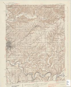
![Indiana, 15 minute series (topographic), Vincennes quadrangle. [1934 reprint without vegetation]](https://iiif.uits.iu.edu/iiif/2/h702rb42n%2Ffiles%2Ff1e13118-9dbf-4ee1-a0ac-56cd2eb3a880/full/250,/0/default.jpg)
- Subject:
- Geographic Subject: Gibson County (Ind.), Geographic Subject: Knox County (Ind.), Geographic Subject: Lawrence County (Ill.), and Geographic Subject: Wabash ...
- Creator:
- Tweedy, Frank, 1854-1937, U.S. Coast and Geodetic Survey, Herron, W. H. (William Harrison), 1865-, United States. Army. Corps of Engineers, Geological Survey...
- Publisher:
- Geological Survey (U.S.)
- Date Created:
- 1934
- Identifier:
- VAC3073-M-01409
- Genre:
- Topographic maps, Quadrangle maps, and 15 minute topographic maps
- Geographic Location:
- Coordinates: W0874500 W0873000 N0384500 N0383000
- Related URL:
- Catalog URL: https://iucat.iu.edu/catalog/18415508
- Abstract:
- R.B. Marshall, chief geographer , W.H. Herron, geographer in charge , topography by Frank Tweedy, C.L. Sadler, Chas. Hartmann, Jr., L.L. Lee, W.S. Gehres, an...
- Call Number:
- G4090 s62 .G4 Vincennes 1915 rep1934
- Caption:
- Imprint: [Washington, D.C.] : U.S. Geological Survey, 1934
- Physical Description:
- Scale: 1:62,500 and Dimensions: 45 x 42 cm or smaller
- Alternate Identifier:
- Title Control Number: a18415508
- Persistent URL:
- https://purl.dlib.indiana.edu/iudl/images/VAC3073/VAC3073-M-01409
- Provenance:
- Part of Geological Survey (U.S.). Indiana 1:62,500.
-
![Indiana Clay City quadrangle [1936 reprint]](https://iiif.uits.iu.edu/iiif/2/wd376z59h%2Ffiles%2Faa45c1aa-fb05-4809-a96b-7abd27014bc5/full/250,/0/default.jpg)
- Subject:
- Geographic Subject: Vigo County (Ind.), Geographic Subject: Putnam County (Ind.), Geographic Subject: Clay County (Ind.), and Geographic Subject: Owen County...
- Creator:
- Sadler, C. L., Marshall, R. B. (Robert Bradford), 1867-1949, Geological Survey (U.S.), and Herron, W. H. (William Harrison), 1865-
- Publisher:
- Geological Survey (U.S.)
- Date Created:
- 1936
- Identifier:
- VAC3073-M-01323
- Genre:
- Quadrangle maps, 15 minute topographic maps, and Topographic maps
- Geographic Location:
- Coordinates: W0871500 W0870000 N0393000 N0391500
- Related URL:
- Catalog URL: https://iucat.iu.edu/catalog/a18406394
- Abstract:
- Engraved July 1910 by U.S.G.S. , R. B. Marshall, chief geographer , W. H. Herron, geographer in charge , topography by C. L. Sadler , [and three others]. Rel...
- Call Number:
- G4090 s62 .G4 Clay City 1910 rep1936
- Caption:
- Imprint: [Washington, D.C.] : U.S. Geological Survey, 1936
- Physical Description:
- Scale: 1:62,500 and Dimensions: 45 x 42 cm or smaller
- Alternate Identifier:
- Title Control Number: a18406394
- Persistent URL:
- https://purl.dlib.indiana.edu/iudl/images/VAC3073/VAC3073-M-01323
- Provenance:
- Part of Geological Survey (U.S.). Indiana 1:62,500.
-
![Indiana Degonia Springs quadrangle [1936 reprint]](https://iiif.uits.iu.edu/iiif/2/x346f640t%2Ffiles%2F0b272452-2a1a-4415-897a-e57e4a8c1f70/full/250,/0/default.jpg)
- Subject:
- Geographic Subject: Warrick County (Ind.), Geographic Subject: Dubois County (Ind.), Geographic Subject: Spencer County (Ind.), and Geographic Subject: Pike ...
- Creator:
- Renshawe, John H., Goodlove, C. W., Geological Survey (U.S.), and Hawkins, Geo. T. (George T.)
- Publisher:
- Geological Survey (U.S.)
- Date Created:
- 1936
- Identifier:
- VAC3073-M-01293
- Genre:
- 15 minute topographic maps, Topographic maps, and Quadrangle maps
- Geographic Location:
- Coordinates: W0871500 W0870000 N0381500 N0380000
- Related URL:
- Catalog URL: https://iucat.iu.edu/catalog/18408290
- Abstract:
- Engraved Oct. 1902 by U.S.G.S. , Jno. Renshawe, geographer in charge , control by Geo. T. Hawkins , topography by Chas. W. Goodlove. Filing title: Degonia Sp...
- Call Number:
- G4090 s62 .G4 Degonia Springs 1902 rep1936
- Caption:
- Imprint: [Washington, D.C.] : U.S. Geological Survey, 1936
- Physical Description:
- Scale: 1:62,500 and Dimensions: 45 x 42 cm or smaller
- Alternate Identifier:
- Title Control Number: a18408290
- Persistent URL:
- https://purl.dlib.indiana.edu/iudl/images/VAC3073/VAC3073-M-01293
- Provenance:
- Part of Geological Survey (U.S.). Indiana 1:62,500.
-
![Indiana Velpen quadrangle [1936 reprint]](https://iiif.uits.iu.edu/iiif/2/z316r503r%2Ffiles%2Fff5fa112-3598-4f96-a57d-5bd5fcb23db6/full/250,/0/default.jpg)
- Subject:
- Geographic Subject: Pike County (Ind.) and Geographic Subject: Dubois County (Ind.)
- Creator:
- Goodlove, C. W., Hawkins, Geo. T. (George T.), and Geological Survey (U.S.)
- Publisher:
- Geological Survey (U.S.)
- Date Created:
- 1936
- Identifier:
- VAC3073-M-01408
- Genre:
- 15 minute topographic maps, Quadrangle maps, and Topographic maps
- Geographic Location:
- Coordinates: W0871500 W0870000 N0383000 N0381500
- Related URL:
- Catalog URL: https://iucat.iu.edu/catalog/18415495
- Abstract:
- Jno. H. Renshawe, geographer in charge , control by Geo. T. Hawkins , topography by Chas. W. Goodlove , engraved Oct. 1902 by U.S.G.S. Polyconic projectio...
- Call Number:
- G4093.P4C5 1900 .G4
- Caption:
- Imprint: Washington, D.C. : U.S. Geological Survey, [1903]
- Physical Description:
- Dimensions: 45 x 42 cm or smaller and Scale: 1:62,500
- Alternate Identifier:
- Title Control Number: a18415495
- Persistent URL:
- https://purl.dlib.indiana.edu/iudl/images/VAC3073/VAC3073-M-01408
- Provenance:
- Part of Geological Survey (U.S.). Indiana 1:62,500.
-
![Indiana St. Meinrad quadrangle [1936 reprint]](https://iiif.uits.iu.edu/iiif/2/db78vg83w%2Ffiles%2Faed1f382-144b-48a5-81c6-0511f0a3ccf0/full/250,/0/default.jpg)
- Subject:
- Geographic Subject: Spencer County (Ind.), Geographic Subject: Dubois County (Ind.), and Geographic Subject: Perry County (Ind.)
- Creator:
- Goodlove, C. W., Renshawe, John H., Hawkins, Geo. T. (George T.), and Geological Survey (U.S.)
- Publisher:
- Geological Survey (U.S.)
- Date Created:
- 1936
- Identifier:
- VAC3073-M-01393
- Genre:
- Quadrangle maps, 15 minute topographic maps, and Topographic maps
- Geographic Location:
- Coordinates: W0870000 W0864500 N0381500 N0380000
- Related URL:
- Catalog URL: https://iucat.iu.edu/catalog/18413973
- Abstract:
- Jno. H. Renshawe, geographer in charge , control by Geo. T. Hawkins , topography by Chas. W. Goodlove , engraved Jan. 1903 by U.S.G.S. Edition of 1903. Poly...
- Call Number:
- G4090 s62 .G4 St. Meinrad 1903 rep1936
- Caption:
- Imprint: Washington, D.C. : U.S. Geological Survey, 1936
- Physical Description:
- Scale: 1:62,500 and Dimensions: 45 x 42 cm or smaller
- Alternate Identifier:
- Title Control Number: a18413973
- Persistent URL:
- https://purl.dlib.indiana.edu/iudl/images/VAC3073/VAC3073-M-01393
- Provenance:
- Part of Geological Survey (U.S.). Indiana 1:62,500.
-
- Subject:
- Geographic Subject: Jackson County (Ind.), Geographic Subject: Lawrence County (Ind.), Geographic Subject: Washington County (Ind.), and Geographic Subject: ...
- Creator:
- Geological Survey (U.S.) and Kilmartin, J. O. (Jerome O'Farrell), 1900-1979
- Publisher:
- Geological Survey (U.S.)
- Date Created:
- 1937
- Identifier:
- VAC3073-M-01314
- Genre:
- Topographic maps, Quadrangle maps, and 15 minute topographic maps
- Geographic Location:
- Coordinates: W0863000 W0861500 N0390000 N0384500
- Related URL:
- Catalog URL: https://iucat.iu.edu/catalog/18408529
- Abstract:
- Topography by J. O. Kilmartin, Shirley Waggener, W. H. Austin, G. G. Martin, and C. W. Birdseye. Polyconic projection. Relief shown by contours and spot heig...
- Call Number:
- G4090 s62 .G4 Bedford 1937
- Caption:
- Imprint: Washington, D.C. : U.S. Dept. of the Interior, Geological Survey, 1937.
- Physical Description:
- Scale: 1:62,500 and Dimensions: 45 x 42 cm or smaller
- Alternate Identifier:
- Title Control Number: a18408529
- Persistent URL:
- https://purl.dlib.indiana.edu/iudl/images/VAC3073/VAC3073-M-01314
- Provenance:
- Part of Geological Survey (U.S.). Indiana 1:62,500.
-
![Illinois-Indiana-Kentucky, New Haven quadrangle [1939 reprint without vegetation]](https://iiif.uits.iu.edu/iiif/2/qj72qc053%2Ffiles%2Fbde64e1d-6659-4d18-a8c8-db54ce923770/full/250,/0/default.jpg)
- Subject:
- Geographic Subject: Union County (Ky.), Geographic Subject: Gallatin County (Ill.), Geographic Subject: White County (Ill.), and Geographic Subject: Posey Co...
- Creator:
- Geological Survey (U.S.)
- Publisher:
- Geological Survey (U.S.)
- Date Created:
- 1939
- Identifier:
- VAC3073-M-01359
- Genre:
- Quadrangle maps, Topographic maps, and 15 minute topographic maps
- Geographic Location:
- Coordinates: W0881500 W0880000 N0380000 N0374500
- Related URL:
- Catalog URL: https://iucat.iu.edu/catalog/18413859
- Abstract:
- United States, Department of the Interior, Geological Survey , State of Illinois, Department of Registration and Education, Geological Survey Division , Stat...
- Call Number:
- G4090 s62 .G4 New Haven 1906 rep 1939
- Caption:
- Imprint: [Washington, D.C.] : U.S. Geological Survey, [1939]
- Physical Description:
- Dimensions: 45 x 42 cm or smaller and Scale: 1:62,500
- Alternate Identifier:
- Title Control Number: a18413859
- Persistent URL:
- https://purl.dlib.indiana.edu/iudl/images/VAC3073/VAC3073-M-01359
- Provenance:
- Part of Geological Survey (U.S.). Indiana 1:62,500.
-
![Indiana-Kentucky Owensboro quadrangle [1939 reprint]](https://iiif.uits.iu.edu/iiif/2/vh53xz17f%2Ffiles%2F2a5358ca-9489-45f4-bdc4-1efa562d3cd9/full/250,/0/default.jpg)
- Subject:
- Geographic Subject: Spencer County (Ind.), Geographic Subject: Warrick County (Ind.), and Geographic Subject: Daviess County (Ky.)
- Creator:
- Renshawe, John H., Geological Survey (U.S.), Hawkins, Geo. T. (George T.), and Cooke, Chas. E. (Charles E.)
- Publisher:
- Geological Survey (U.S.)
- Date Created:
- 1939
- Identifier:
- VAC3073-M-01375
- Genre:
- Quadrangle maps, Topographic maps, and 15 minute topographic maps
- Geographic Location:
- Coordinates: W0871500 W0870000 N0380000 N0374500
- Related URL:
- Catalog URL: https://iucat.iu.edu/catalog/18413576
- Abstract:
- John H. Renshaw, geographer in charge , control by George T. Hawkins , topography by Chas. E. Cooke. Filing title: Owensboro, Ind.-Ky. Edition of Nov. 1901. ...
- Call Number:
- G4090 s62 .G4 Owensboro 1901 rep 1939
- Caption:
- Imprint: Washington, D.C. : U.S. Geological Survey, 1939
- Physical Description:
- Dimensions: 45 x 42 cm or smaller and Scale: 1:62,500
- Alternate Identifier:
- Title Control Number: a18413576
- Persistent URL:
- https://purl.dlib.indiana.edu/iudl/images/VAC3073/VAC3073-M-01375
- Provenance:
- Part of Geological Survey (U.S.). Indiana 1:62,500.
-
![Illinois-Indiana, Watseka quadrangle [1939 printing]](https://iiif.uits.iu.edu/iiif/2/s4656k49c%2Ffiles%2F4facd9e8-e703-4a71-992c-b586d52778ed/full/250,/0/default.jpg)
- Subject:
- Geographic Subject: Iroquois County (Ill.) and Geographic Subject: Newton County (Ind.)
- Creator:
- Schultz, J. T. (Jack Thurman), 1899-1972 and Geological Survey (U.S.)
- Publisher:
- Geological Survey (U.S.)
- Date Created:
- 1939
- Identifier:
- VAC3073-M-01413
- Genre:
- Quadrangle maps, 15 minute topographic maps, and Topographic maps
- Geographic Location:
- Coordinates: W0874500 W0873000 N0410000 N0404500
- Related URL:
- Catalog URL: https://iucat.iu.edu/catalog/18416003
- Abstract:
- Topography by J.T. Schultz, R.G. Shirley, T.B. McNeill, and H. McDermith. Filing title: Watseka, Ill.-Ind. Polyconic projection. Relief shown by contours and...
- Call Number:
- G4090 s62 .G4 Wateska 1939
- Caption:
- Imprint: [Washington, D.C.] : Geological Survey, [1939]
- Physical Description:
- Dimensions: 45 x 42 cm or smaller and Scale: 1:62,500
- Alternate Identifier:
- Title Control Number: a18416003
- Persistent URL:
- https://purl.dlib.indiana.edu/iudl/images/VAC3073/VAC3073-M-01413
- Provenance:
- Part of Geological Survey (U.S.). Indiana 1:62,500.
-
![Indiana (Lake County) Tolleston quadrangle [1939 reprint]](https://iiif.uits.iu.edu/iiif/2/6108wd719%2Ffiles%2F57b5a9e6-6bbb-4ee3-8635-de3edfe763d1/full/250,/0/default.jpg)
- Subject:
- Geographic Subject: Lake County (Ind.)
- Creator:
- U.S. Lake Survey, McKinney, R. C. (Robert C.), Geological Survey (U.S.), and Renshawe, John H.
- Publisher:
- Geological Survey (U.S.)
- Date Created:
- 1939
- Identifier:
- VAC3073-M-01400
- Genre:
- Topographic maps, 15 minute topographic maps, and Quadrangle maps
- Geographic Location:
- Coordinates: W0873000 W0871500 N0414500 N0413000
- Related URL:
- Catalog URL: https://iucat.iu.edu/catalog/18406229
- Abstract:
- United States, Department of the Interior, Geological Survey , Jno. H. Renshawe, geographer in charge , control by U.S. Lake Survey , topography by R. C. McK...
- Call Number:
- G4090 s62 .G4 Toleston 1900 rep1939
- Caption:
- Imprint: Washington, D. C. : United States, Department of the Interior, Geological Survey, 1939
- Physical Description:
- Scale: 1:62,500 and Dimensions: 45 x 42 cm or smaller
- Alternate Identifier:
- Title Control Number: a18406229
- Persistent URL:
- https://purl.dlib.indiana.edu/iudl/images/VAC3073/VAC3073-M-01400
- Provenance:
- Part of Geological Survey (U.S.). Indiana 1:62,500.
