
Search Constraints
You searched for:
Provenance
Part of Geological Survey (U.S.). Indiana 1:62,500.
Remove constraint Provenance: Part of Geological Survey (U.S.). Indiana 1:62,500.
Search Results
-
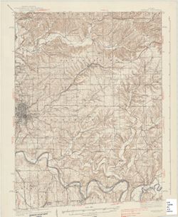
![Indiana Degonia Springs quadrangle [1936 reprint]](https://iiif.uits.iu.edu/iiif/2/x346f640t%2Ffiles%2F0b272452-2a1a-4415-897a-e57e4a8c1f70/full/250,/0/default.jpg)
- Subject:
- Geographic Subject: Warrick County (Ind.), Geographic Subject: Dubois County (Ind.), Geographic Subject: Spencer County (Ind.), and Geographic Subject: Pike ...
- Creator:
- Renshawe, John H., Goodlove, C. W., Geological Survey (U.S.), and Hawkins, Geo. T. (George T.)
- Publisher:
- Geological Survey (U.S.)
- Date Created:
- 1936
- Identifier:
- VAC3073-M-01293
- Genre:
- 15 minute topographic maps, Topographic maps, and Quadrangle maps
- Geographic Location:
- Coordinates: W0871500 W0870000 N0381500 N0380000
- Related URL:
- Catalog URL: https://iucat.iu.edu/catalog/18408290
- Abstract:
- Engraved Oct. 1902 by U.S.G.S. , Jno. Renshawe, geographer in charge , control by Geo. T. Hawkins , topography by Chas. W. Goodlove. Filing title: Degonia Sp...
- Call Number:
- G4090 s62 .G4 Degonia Springs 1902 rep1936
- Caption:
- Imprint: [Washington, D.C.] : U.S. Geological Survey, 1936
- Physical Description:
- Scale: 1:62,500 and Dimensions: 45 x 42 cm or smaller
- Alternate Identifier:
- Title Control Number: a18408290
- Persistent URL:
- https://purl.dlib.indiana.edu/iudl/images/VAC3073/VAC3073-M-01293
- Provenance:
- Part of Geological Survey (U.S.). Indiana 1:62,500.
-
- Subject:
- Geographic Subject: Jackson County (Ind.), Geographic Subject: Lawrence County (Ind.), Geographic Subject: Washington County (Ind.), and Geographic Subject: ...
- Creator:
- Geological Survey (U.S.) and Kilmartin, J. O. (Jerome O'Farrell), 1900-1979
- Publisher:
- Geological Survey (U.S.)
- Date Created:
- 1937
- Identifier:
- VAC3073-M-01314
- Genre:
- Topographic maps, Quadrangle maps, and 15 minute topographic maps
- Geographic Location:
- Coordinates: W0863000 W0861500 N0390000 N0384500
- Related URL:
- Catalog URL: https://iucat.iu.edu/catalog/18408529
- Abstract:
- Topography by J. O. Kilmartin, Shirley Waggener, W. H. Austin, G. G. Martin, and C. W. Birdseye. Polyconic projection. Relief shown by contours and spot heig...
- Call Number:
- G4090 s62 .G4 Bedford 1937
- Caption:
- Imprint: Washington, D.C. : U.S. Dept. of the Interior, Geological Survey, 1937.
- Physical Description:
- Scale: 1:62,500 and Dimensions: 45 x 42 cm or smaller
- Alternate Identifier:
- Title Control Number: a18408529
- Persistent URL:
- https://purl.dlib.indiana.edu/iudl/images/VAC3073/VAC3073-M-01314
- Provenance:
- Part of Geological Survey (U.S.). Indiana 1:62,500.
-
![Indiana-Kentucky Corydon quadrangle [1931 printing]](https://iiif.uits.iu.edu/iiif/2/vq280r404%2Ffiles%2F2b715af8-dded-4de4-a4e3-8e1c86dcc800/full/250,/0/default.jpg)
- Subject:
- Geographic Subject: Meade County (Ky.)
- Creator:
- Kentucky Geological Survey, Higginson, W. S. (William Smith Muir), 1894-1984, United States. Army, and Geological Survey (U.S.)
- Publisher:
- Geological Survey (U.S.)
- Date Created:
- 1931
- Identifier:
- VAC3073-M-01321
- Genre:
- 15 minute topographic maps, Topographic maps, and Quadrangle maps
- Geographic Location:
- Coordinates: W0861500 W0860000 N0381500 N0380000
- Related URL:
- Catalog URL: https://iucat.iu.edu/catalog/18406398
- Abstract:
- Topography by W.S. Higginson , Ohio River by Corps of Engineers, U.S. Army , control by U.S. Geological Survey and Corps of Engineers, U.S. Army. Filing titl...
- Call Number:
- G4090 s62 .G4 Corydon 1931
- Caption:
- Imprint: [Washington, D.C.] : Dept. of the Interior, U.S. Geological Survey, [1931]
- Physical Description:
- Scale: 1:62,500 and Dimensions: 45 x 42 cm or smaller
- Alternate Identifier:
- Title Control Number: a18406398
- Persistent URL:
- https://purl.dlib.indiana.edu/iudl/images/VAC3073/VAC3073-M-01321
- Provenance:
- Part of Geological Survey (U.S.). Indiana 1:62,500.
-
![Indiana Haubstadt quadrangle [1903 printing]](https://iiif.uits.iu.edu/iiif/2/mw22w891g%2Ffiles%2F3f2a82be-5754-4703-989d-ede2f3a3b596/full/250,/0/default.jpg)
- Subject:
- Geographic Subject: Posey County (Ind.), Geographic Subject: Gibson County (Ind.), and Geographic Subject: Vanderburgh County (Ind.)
- Creator:
- Renshawe, John H., Goodlove, C. W., Hawkins, Geo. T. (George T.), and Geological Survey (U.S.)
- Publisher:
- Geological Survey (U.S.)
- Date Created:
- 1903
- Identifier:
- VAC3073-M-01342
- Genre:
- Quadrangle maps, 15 minute topographic maps, and Topographic maps
- Geographic Location:
- Coordinates: W0874500 W0873000 N0381500 N0380000
- Related URL:
- Catalog URL: https://iucat.iu.edu/catalog/18408287
- Abstract:
- Engraved Mar. 1903 by U.S.G.S. , Jno. H. Renshawe, geographer in charge , control by Geo. T. Hawkins , topography by Chas. W. Goodlove. Relief shown by conto...
- Call Number:
- G4090 s62 .G4 Haubstadt 1903
- Caption:
- Imprint: [Washington, D.C.] : U.S. Geological Survey, 1903
- Physical Description:
- Dimensions: 45 x 42 cm or smaller and Scale: 1:62,500
- Alternate Identifier:
- Title Control Number: a18408287
- Persistent URL:
- https://purl.dlib.indiana.edu/iudl/images/VAC3073/VAC3073-M-01342
- Provenance:
- Part of Geological Survey (U.S.). Indiana 1:62,500.
-
![Hutsonville quadrangle, Illinois-Indiana : 15 minute series (topographic) [1957 printing with vegetation]](https://iiif.uits.iu.edu/iiif/2/3j334584p%2Ffiles%2F2e66aa9a-552c-48aa-af5a-e5cdae6d7b8f/full/250,/0/default.jpg)
- Subject:
- Geographic Subject: Crawford County (Ill.), Geographic Subject: Sullivan County (Ind.), Topical Subject: Vegetation mapping, and Geographic Subject: Clark Co...
- Creator:
- Geological Survey (U.S.), Indiana. Department of Conservation, and Illinois State Geological Survey
- Publisher:
- Geological Survey (U.S.)
- Date Created:
- 1957
- Identifier:
- VAC3073-M-01346
- Genre:
- 15 minute topographic maps, Topographic maps, and Quadrangle maps
- Geographic Location:
- Coordinates: W0874500 W0873000 N0391500 N0390000
- Related URL:
- Catalog URL: https://iucat.iu.edu/catalog/18408296
- Abstract:
- Mapped, edited, and published by the Geological Survey , control by USGS, USC & GS, and USCE. Filing title: Hutsonville, Ill.-Ind. Standard map series de...
- Call Number:
- G4090 s62 .G4 Hutsonville 1957
- Caption:
- Imprint: Indianapolis, Ind. : Indiana Department of Conservation, [1958], Imprint: Washington, D.C. : for sale by U.S. Geological Survey, Imprint: Urbana, Il...
- Physical Description:
- Dimensions: 45 x 42 cm or smaller and Scale: 1:62,500
- Alternate Identifier:
- Title Control Number: a18408296
- Persistent URL:
- https://purl.dlib.indiana.edu/iudl/images/VAC3073/VAC3073-M-01346
- Provenance:
- Part of Geological Survey (U.S.). Indiana 1:62,500.
-
![Princeton quadrangle, Indiana-Illinois : 15 minute series (topographic) [1964 printing with vegetation]](https://iiif.uits.iu.edu/iiif/2/m900px89p%2Ffiles%2Fe957c77d-db8c-42d6-aef0-05abd0d3301b/full/250,/0/default.jpg)
- Subject:
- Geographic Subject: Gibson County (Ind.), Topical Subject: Vegetation mapping, Geographic Subject: Wabash County (Ill.), and Geographic Subject: Knox County ...
- Creator:
- Geological Survey (U.S.), United States. Army Map Service, and Illinois State Geological Survey
- Publisher:
- Geological Survey (U.S.)
- Date Created:
- 1964
- Identifier:
- VAC3073-M-01387
- Genre:
- Quadrangle maps, 15 minute topographic maps, and Topographic maps
- Geographic Location:
- Coordinates: W0874500 W0873000 N0383000 N0381500
- Related URL:
- Catalog URL: https://iucat.iu.edu/catalog/18413928
- Abstract:
- Mapped, edited and published by the Geological Survey , Illinois area mapped in cooperation with State of Illinois Geological Survey. Filing title: Princeton...
- Call Number:
- G4090 s62 .G4 1959 rep1964 V
- Caption:
- Imprint: Washington, D.C. : Interior--U.S. Geological Survey, 1964
- Physical Description:
- Dimensions: 45 x 42 cm or smaller and Scale: 1:62,500
- Alternate Identifier:
- Title Control Number: a18413928
- Persistent URL:
- https://purl.dlib.indiana.edu/iudl/images/VAC3073/VAC3073-M-01387
- Provenance:
- Part of Geological Survey (U.S.). Indiana 1:62,500.
-
![Indiana-Illinois, Vincennes quadrangle : topography [1958 reprint with vegetation]](https://iiif.uits.iu.edu/iiif/2/bv73d371v%2Ffiles%2Fd8eeacfe-4380-4ba5-814d-cbf9ec40a053/full/250,/0/default.jpg)
- Subject:
- Geographic Subject: Wabash County (Ill.), Topical Subject: Vegetation mapping, Geographic Subject: Lawrence County (Ill.), Geographic Subject: Gibson County ...
- Creator:
- Geological Survey (U.S.)
- Publisher:
- Geological Survey (U.S.)
- Date Created:
- 1958
- Identifier:
- VAC3073-M-01412
- Genre:
- Quadrangle maps, Topographic maps, and 15 minute topographic maps
- Geographic Location:
- Coordinates: W0874500 W0873000 N0384500 N0383000
- Related URL:
- Catalog URL: https://iucat.iu.edu/catalog/18415517
- Abstract:
- R.B. Marshall, chief geographer , W.H. Herron, geographer in charge , topography by Frank Tweedy, C.L. Sadler, Chas. Hartmann, Jr., L.L. Lee, W.S. Gehres, an...
- Call Number:
- G4090 s62 .G4 Vincennes 1944 rep1958 V
- Caption:
- Imprint: [Washington, D.C.] : U.S. Geological Survey, 1958
- Physical Description:
- Dimensions: 45 x 42 cm or smaller and Scale: 1:62,500
- Alternate Identifier:
- Title Control Number: a18415517
- Persistent URL:
- https://purl.dlib.indiana.edu/iudl/images/VAC3073/VAC3073-M-01412
- Provenance:
- Part of Geological Survey (U.S.). Indiana 1:62,500.
-
![Indiana-Ohio, Winchester Quadrangle [1958 reprint]](https://iiif.uits.iu.edu/iiif/2/6t054k339%2Ffiles%2F32b26c9a-d997-4a33-91af-06b933ded058/full/250,/0/default.jpg)
- Subject:
- Geographic Subject: Darke County (Ohio), Geographic Subject: Wayne County (Ind.), and Geographic Subject: Randolph County (Ind.)
- Creator:
- Smith, Glenn S. (Glenn Shepard), Miller, W. L. (Topographer), Geological Survey (U.S.), Ellis, J. R. (Topographer), Ohio. Division of Geological Survey, Harr...
- Publisher:
- Geological Survey (U.S.)
- Date Created:
- 1958
- Identifier:
- VAC3073-M-01415
- Genre:
- Topographic maps, Quadrangle maps, and 15 minute topographic maps
- Geographic Location:
- Coordinates: W0850000 W0844500 N0401500 N0400000
- Related URL:
- Catalog URL: https://iucat.iu.edu/catalog/18416004
- Abstract:
- W.H. Herron, acting chief geogrpher , Glenn S. Smith, topographic engineer in charge , topography by R.L. Harrison and W.L. Miller , control by J.R. Ellis, J...
- Call Number:
- G4090 s62 .G4 Winchester 1916 rep1958
- Caption:
- Imprint: [Washington, D.C.] : U.S. Geological Survey, 1958
- Physical Description:
- Scale: 1:62,500 and Dimensions: 45 x 42 cm or smaller
- Alternate Identifier:
- Title Control Number: a18416004
- Persistent URL:
- https://purl.dlib.indiana.edu/iudl/images/VAC3073/VAC3073-M-01415
- Provenance:
- Part of Geological Survey (U.S.). Indiana 1:62,500.
-
![Indiana-Ohio, Winchester quadrangle [1918 printing]](https://iiif.uits.iu.edu/iiif/2/qv33t053b%2Ffiles%2F7be0c967-f78e-4d33-9858-3a9858958bdd/full/250,/0/default.jpg)
- Subject:
- Geographic Subject: Wayne County (Ind.), Geographic Subject: Randolph County (Ind.), and Geographic Subject: Darke County (Ohio)
- Creator:
- Geological Survey (U.S.), Harrison, R. L. (Topographer), Herron, W. H. (William Harrison), 1865-, Miller, W. L. (Topographer), Ellis, J. R. (Topographer), Sm...
- Publisher:
- Geological Survey (U.S.)
- Identifier:
- VAC3073-M-01414
- Genre:
- Topographic maps, Quadrangle maps, and 15 minute topographic maps
- Geographic Location:
- Coordinates: W0850000 W0844500 N0401500 N0400000
- Related URL:
- Catalog URL: https://iucat.iu.edu/catalog/18416004
- Abstract:
- W.H. Herron, acting chief geogrpher , Glenn S. Smith, topographic engineer in charge , topography by R.L. Harrison and W.L. Miller , control by J.R. Ellis, J...
- Call Number:
- G4090 s62 .G4 Winchester
- Caption:
- Imprint: [Washington, D.C.] : U.S. Geological Survey, [1918]
- Physical Description:
- Dimensions: 45 x 42 cm or smaller and Scale: 1:62,500
- Alternate Identifier:
- Title Control Number: a18416004
- Persistent URL:
- https://purl.dlib.indiana.edu/iudl/images/VAC3073/VAC3073-M-01414
- Provenance:
- Part of Geological Survey (U.S.). Indiana 1:62,500.
-
![Indiana St. Meinrad quadrangle [1903 printing]](https://iiif.uits.iu.edu/iiif/2/nk323h76c%2Ffiles%2Fe917d3f1-9cbd-4705-9a9a-2617f0dbde44/full/250,/0/default.jpg)
- Subject:
- Geographic Subject: Perry County (Ind.), Geographic Subject: Dubois County (Ind.), and Geographic Subject: Spencer County (Ind.)
- Creator:
- Goodlove, C. W., Renshawe, John H., Hawkins, Geo. T. (George T.), and Geological Survey (U.S.)
- Publisher:
- Geological Survey (U.S.)
- Date Created:
- 1903
- Identifier:
- VAC3073-M-01392
- Genre:
- Quadrangle maps, Topographic maps, and 15 minute topographic maps
- Geographic Location:
- Coordinates: W0870000 W0864500 N0381500 N0380000
- Related URL:
- Catalog URL: https://iucat.iu.edu/catalog/18413973
- Abstract:
- Jno. H. Renshawe, geographer in charge , control by Geo. T. Hawkins , topography by Chas. W. Goodlove , engraved Jan. 1903 by U.S.G.S. Edition of 1903. Poly...
- Call Number:
- G4090 s62 .G4 St. Meinrad 1903
- Caption:
- Imprint: Washington, D.C. : U.S. Geological Survey, 1903
- Physical Description:
- Dimensions: 45 x 42 cm or smaller and Scale: 1:62,500
- Alternate Identifier:
- Title Control Number: a18413973
- Persistent URL:
- https://purl.dlib.indiana.edu/iudl/images/VAC3073/VAC3073-M-01392
- Provenance:
- Part of Geological Survey (U.S.). Indiana 1:62,500.
