
Search Constraints
You searched for:
Creator
Indiana. State Highway Commission (1919-1953)
Remove constraint Creator: Indiana. State Highway Commission (1919-1953)
1 - 85 of 85
Search Results
-
- Subject:
- Geographic Subject: Indiana and Topical Subject: Roads
- Creator:
- Indiana. State Highway Commission (1919-1953)
- Publisher:
- Indiana. State Highway Commission (1919-1953)
- Date Created:
- 1949
- Identifier:
- VAC3073-M-01236
- Genre:
- Road maps
- Geographic Location:
- Coordinates: W0880500 W0844700 N0414500 N0374600
- Related URL:
- Catalog URL: https://iucat.iu.edu/catalog/18406077
- Abstract:
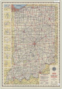
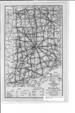
- Panel title: 1949 Indiana official highway map. Relief shown by spot heights. Includes 8 local route maps. Index, distance chart, distance map of the United ...
- Call Number:
- G1403 .S7 1949
- Caption:
- Imprint: [Indianapolis] : State Highway Commission, [1949]
- Physical Description:
- Dimensions: 94 x 59 cm and Scale: Approximately 1:633,600
- Alternate Identifier:
- Title Control Number: a18406077
- Persistent URL:
- https://purl.dlib.indiana.edu/iudl/images/VAC3073/VAC3073-M-01236
- Provenance:
- Indiana state highway system
-
- Subject:
- Geographic Subject: Indiana and Topical Subject: Roads
- Creator:
- Indiana. State Highway Commission (1919-1953)
- Publisher:
- Indiana. State Highway Commission (1919-1953)
- Date Created:
- 1952
- Identifier:
- VAC3073-M-01222
- Genre:
- Road maps
- Geographic Location:
- Coordinates: W0880500 W0844700 N0414500 N0374600
- Related URL:
- Catalog URL: https://iucat.iu.edu/catalog/18406078
- Abstract:
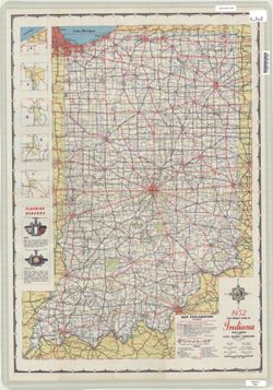
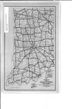
- Panel title: 1952 Indiana official highway map. Relief shown by spot heights. Includes text, color illustrations, and 5 local route maps. Index, distance cha...
- Call Number:
- G1403 .S7 1952
- Caption:
- Imprint: [Indianapolis] : State Highway Commission, [1952]
- Physical Description:
- Dimensions: 94 x 59 cm and Scale: Approximately 1:633,600
- Alternate Identifier:
- Title Control Number: a18406078
- Persistent URL:
- https://purl.dlib.indiana.edu/iudl/images/VAC3073/VAC3073-M-01222
- Provenance:
- Indiana state highway system
-
- Subject:
- Topical Subject: Roads and Geographic Subject: Orange County (Ind.)
- Creator:
- Indiana. State Highway Commission (1919-1953)
- Publisher:
- State Highway Commission of Indiana
- Date Created:
- 1953
- Identifier:
- VAC3073-M-01199
- Genre:
- Road maps
- Geographic Location:
- Coordinates: W0864100 W0861800 N0384100 N0382400
- Related URL:
- Catalog URL: https://iucat.iu.edu/catalog/5805928
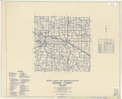
- Abstract:
- Blueline. "State roads revised to July 1, 1953." "1937." "Data obtained from State-wide Highway Planning Survey." "Include...
- Call Number:
- G4093.O6P2 1953 .I53
- Caption:
- Imprint: [Indianapolis?] : State Highway Commission of Indiana, 1953
- Physical Description:
- Scale: 1:63,360
- Persistent URL:
- https://purl.dlib.indiana.edu/iudl/images/VAC3073/VAC3073-M-01199
-
- Subject:
- Topical Subject: Trucks--Routes, Geographic Subject: Indiana, Northwest, Topical Subject: Traffic surveys, Geographic Subject: Chicago Region (Ill.), Geograp...
- Creator:
- Indiana. State Highway Commission (1919-1953) and Chicago Regional Planning Association
- Publisher:
- Indiana. Legislative Bureau
- Date Created:
- 1932
- Identifier:
- VAC3073-M-01055
- Genre:
- Statistical maps and Road maps
- Geographic Location:
- Coordinates: W0874204 W0862904 N0414539 N0411158
- Related URL:
- Catalog URL: https://iucat.iu.edu/catalog/18422835
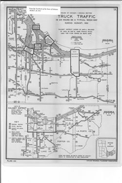
- Abstract:
- 2 maps on one sheet. Shows truck traffic flow in the Calumet and greater Chicago Regions as well as the 1930 population of the cities and towns in the Calume...
- Call Number:
- G4102.C33P22 1931 .C4
- Caption:
- Imprint: [Indianapolis] : [Wm. B. Burford, contractor for state printing and binding], [1932] and Imprint: [Indianapolis] : [The Legislative Bureau], [1932]
- Physical Description:
- Scale: Approximately 1:50,000-1:115,000 and Dimensions: on sheet 40 x 30 cm
- Alternate Identifier:
- Title Control Number: a18422835 and Alternate ID: 397754IP
- Persistent URL:
- https://purl.dlib.indiana.edu/iudl/images/VAC3073/VAC3073-M-01055
- Provenance:
- Year book of the state of Indiana (1931)
-
- Subject:
- Geographic Subject: Indiana and Topical Subject: Traffic surveys
- Creator:
- Indiana. State Highway Commission (1919-1953)
- Publisher:
- Indiana. Legislative Bureau
- Date Created:
- 1932
- Identifier:
- VAC3073-M-01054
- Genre:
- Road maps and Statistical maps
- Geographic Location:
- Coordinates: W0873100 W0844800 N0414500 N0392100
- Related URL:
- Catalog URL: https://iucat.iu.edu/catalog/18422724
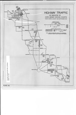
- Abstract:
- Shows traffic in 24 hours on a typical week day, Sunday, and Labor Day. "Plate XIII." Detached from: Report of the Indiana State Highway Commiss...
- Call Number:
- G4091.P21 1931 .H5
- Caption:
- Imprint: [Indianapolis] : [Wm. B. Burford, contractor for state printing and binding], [1932] and Imprint: [Indianapolis] : [The Legislative Bureau], [1932]
- Physical Description:
- Dimensions: on sheet 40 x 30 cm and Scale: Scale not given.
- Alternate Identifier:
- Title Control Number: a18422724 and Alternate ID: 397754IP
- Persistent URL:
- https://purl.dlib.indiana.edu/iudl/images/VAC3073/VAC3073-M-01054
- Provenance:
- Year book of the state of Indiana (1931)
-
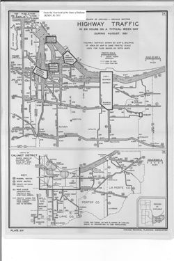
- Subject:
- Geographic Subject: Calumet Region (Ill. and Ind.), Geographic Subject: Indiana, Northwest, Topical Subject: Traffic surveys, Topical Subject: Metropolitan a...
- Creator:
- Indiana. State Highway Commission (1919-1953) and Chicago Regional Planning Association
- Publisher:
- Indiana. Legislative Bureau
- Date Created:
- 1932
- Identifier:
- VAC3073-M-01053
- Genre:
- Road maps and Statistical maps
- Geographic Location:
- Coordinates: W0874204 W0862904 N0414539 N0411158
- Related URL:
- Catalog URL: https://iucat.iu.edu/catalog/18422708
- Abstract:
- 2 maps on one sheet. Shows traffic flow in the Calumet and greater Chicago Regions as well as the 1930 population of the cities and towns in the Calumet Regi...
- Call Number:
- G4102.C33P21 1931 .C4
- Caption:
- Imprint: [Indianapolis] : [Wm. B. Burford, contractor for state printing and binding], [1932] and Imprint: [Indianapolis] : [The Legislative Bureau], [1932]
- Physical Description:
- Dimensions: on sheet 40 x 30 cm and Scale: Approximately 1:50,000-1:115,000
- Alternate Identifier:
- Title Control Number: a18422708 and Alternate ID: 397754IP
- Persistent URL:
- https://purl.dlib.indiana.edu/iudl/images/VAC3073/VAC3073-M-01053
- Provenance:
- Year book of the state of Indiana (1931)
-
![State highways in the federal aid system as of September 30, 1931 [Indiana]](https://iiif.uits.iu.edu/iiif/2/sf269861n%2Ffiles%2F76f20d74-1e0f-4901-83eb-f2dbe49e6f3b/full/250,/0/default.jpg)
- Subject:
- Geographic Subject: Indiana, Topical Subject: Roads, and Topical Subject: Federal aid to transportation
- Creator:
- Indiana. State Highway Commission (1919-1953)
- Publisher:
- Indiana. Legislative Bureau
- Date Created:
- 1932
- Identifier:
- VAC3073-M-01048
- Genre:
- Road maps
- Geographic Location:
- Coordinates: W0880500 W0844700 N0414500 N0374600
- Related URL:
- Catalog URL: https://iucat.iu.edu/catalog/18422833
- Abstract:
- Detached from: Report of the Indiana State Highway Commission for the fiscal year ending September 30, 1931 / State Highway Commission. In Year book of the S...
- Call Number:
- G4091.P2 1931 .S7
- Caption:
- Imprint: [Indianapolis] : [Wm. B. Burford, contractor for state printing and binding], [1932] and Imprint: [Indianapolis] : [The Legislative Bureau], [1932]
- Physical Description:
- Scale: Scale not given. and Dimensions: 34 x 23 cm, on sheet 35 x 25 cm
- Alternate Identifier:
- Alternate ID: 397754IP and Title Control Number: a18422833
- Persistent URL:
- https://purl.dlib.indiana.edu/iudl/images/VAC3073/VAC3073-M-01048
- Provenance:
- Year book of the state of Indiana (1931)
-
![State highway system of Indiana [1932]](https://iiif.uits.iu.edu/iiif/2/7h14bt114%2Ffiles%2F6d61eaca-5c86-4d06-b214-7a3e8f654b70/full/250,/0/default.jpg)
- Subject:
- Geographic Subject: Indiana, Topical Subject: Road materials, and Topical Subject: Roads
- Creator:
- Indiana. State Highway Commission (1919-1953)
- Publisher:
- Indiana. Legislative Bureau
- Date Created:
- 1933
- Identifier:
- VAC3073-M-01044
- Genre:
- Road maps
- Geographic Location:
- Coordinates: W0880500 W0844700 N0414500 N0374600
- Related URL:
- Catalog URL: https://iucat.iu.edu/catalog/18422897
- Abstract:
- Shows roads by surface and composition type as well as standard Indiana road signs and the locations of state parks, state owned property, bodies of water, p...
- Call Number:
- G4091.P2 1932 .I5
- Caption:
- Imprint: [Indianapolis] : [Wm. B. Burford, contractor for state printing and binding], [1933] and Imprint: [Indianapolis] : [The Legislative Bureau], [1933]
- Physical Description:
- Dimensions: 41 x 27, on sheet 44 x 29 cm and Scale: Approximately 1:1,200,000
- Alternate Identifier:
- Alternate ID: 397754IP and Title Control Number: a18422897
- Persistent URL:
- https://purl.dlib.indiana.edu/iudl/images/VAC3073/VAC3073-M-01044
- Provenance:
- Year book of the state of Indiana (1932)
-
![State Highway System of Indiana [1931]](https://iiif.uits.iu.edu/iiif/2/37721h103%2Ffiles%2Ffa05ffc3-ea08-47a1-a0e9-3fd32b013a08/full/250,/0/default.jpg)
- Subject:
- Topical Subject: Roads, Geographic Subject: Indiana, and Topical Subject: Road materials
- Creator:
- Indiana. State Highway Commission (1919-1953)
- Publisher:
- Indiana. Legislative Bureau
- Date Created:
- 1932
- Identifier:
- VAC3073-M-01043
- Genre:
- Road maps
- Geographic Location:
- Coordinates: W0880500 W0844700 N0414500 N0374600
- Related URL:
- Catalog URL: https://iucat.iu.edu/catalog/18422777
- Abstract:
- Shows roads by surface and composition type as well as standard Indiana road signs and the locations of state parks, state owned property, bodies of water, p...
- Call Number:
- G4091.P2 1931 .I5
- Caption:
- Imprint: [Indianapolis] : [The Legislative Bureau], [1932] and Imprint: [Indianapolis] : [Wm. B. Burford, contractor for state printing and binding], [1932]
- Physical Description:
- Dimensions: 41 x 27 cm, on sheet 44 x 29 cm and Scale: Approximately 1:1,250,000
- Alternate Identifier:
- Title Control Number: a18422777 and Alternate ID: 397754IP
- Persistent URL:
- https://purl.dlib.indiana.edu/iudl/images/VAC3073/VAC3073-M-01043
- Provenance:
- Year book of the state of Indiana (1931)
-
![State Highway System of Indiana [1930]](https://iiif.uits.iu.edu/iiif/2/vm40zt77x%2Ffiles%2F4203141a-930a-421f-920d-fb7afd4bb3ed/full/250,/0/default.jpg)
- Subject:
- Topical Subject: Roads, Topical Subject: Road materials, and Geographic Subject: Indiana
- Creator:
- Indiana. State Highway Commission (1919-1953)
- Publisher:
- Indiana. Legislative Bureau
- Date Created:
- 1931
- Identifier:
- VAC3073-M-01042
- Genre:
- Road maps
- Geographic Location:
- Coordinates: W0880500 W0844700 N0414500 N0374600
- Related URL:
- Catalog URL: https://iucat.iu.edu/catalog/18422890
- Abstract:
- Shows roads by surface and composition type as well as standard Indiana road signs and the locations of state parks, state owned property, bodies of water, p...
- Call Number:
- G4091.P2 1930 .I5
- Caption:
- Imprint: [Indianapolis] : [Wm. B. Burford, contractor for state printing and binding], [1931] and Imprint: [Indianapolis] : [The Legislative Bureau], [1931]
- Physical Description:
- Dimensions: 33 x 23, on sheet 37 x 27 cm and Scale: Approximately 1:1,600,000
- Alternate Identifier:
- Alternate ID: 397754IP and Title Control Number: a18422890
- Persistent URL:
- https://purl.dlib.indiana.edu/iudl/images/VAC3073/VAC3073-M-01042
- Provenance:
- Year book of the state of Indiana (1931)
-
- Subject:
- Topical Subject: Road materials, Geographic Subject: Indiana, Topical Subject: Roads, and Topical Subject: Administrative and political divisions
- Creator:
- Indiana. State Highway Commission (1919-1953)
- Publisher:
- Indiana. Legislative Bureau
- Date Created:
- 1930
- Identifier:
- VAC3073-M-01041
- Genre:
- Road maps
- Geographic Location:
- Coordinates: W0880500 W0844700 N0414500 N0374600
- Related URL:
- Catalog URL: https://iucat.iu.edu/catalog/18455618
- Abstract:
- Caption title: Sub-district & road section map. Shows roads by surface and composition type as well as official highway markers, boundaries and headquart...
- Call Number:
- G4091.P2 1929 .I5
- Caption:
- Imprint: [Indianapolis] : [Wm. B. Burford, contractor for state printing and binding], [1930] and Imprint: [Indianapolis] : [The Legislative Bureau], [1930]
- Physical Description:
- Scale: Approximately 1:1,370,000 and Dimensions: 38 x 23 cm, on sheet 43 x 26 cm
- Alternate Identifier:
- Alternate ID: 397754IP and Title Control Number: a18455618
- Persistent URL:
- https://purl.dlib.indiana.edu/iudl/images/VAC3073/VAC3073-M-01041
- Provenance:
- State Highway System of Indiana.
-
- Subject:
- Geographic Subject: Indiana, Topical Subject: Administrative and political divisions, Topical Subject: Roads, and Topical Subject: Road materials
- Creator:
- Indiana. State Highway Commission (1919-1953)
- Publisher:
- Indiana. Legislative Bureau
- Date Created:
- 1929
- Identifier:
- VAC3073-M-01040
- Genre:
- Road maps
- Geographic Location:
- Coordinates: W0880500 W0844700 N0414500 N0374600
- Related URL:
- Catalog URL: https://iucat.iu.edu/catalog/18455614
- Abstract:
- Caption title: Sub-district & road section map. Shows roads by surface and composition type as well as official highway markers, boundaries and headquart...
- Call Number:
- G4091.P2 1928 .I5
- Caption:
- Imprint: [Indianapolis] : [Wm. B. Burford, contractor for state printing and binding], [1929] and Imprint: [Indianapolis] : [The Legislative Bureau], [1929]
- Physical Description:
- Scale: Approximately 1:1,370,000 and Dimensions: 36 x 23 cm, on sheet 41 x 26 cm
- Alternate Identifier:
- Title Control Number: a18455614 and Alternate ID: 397754IP
- Persistent URL:
- https://purl.dlib.indiana.edu/iudl/images/VAC3073/VAC3073-M-01040
- Provenance:
- Year book of the state of Indiana (1928)
-
- Subject:
- Topical Subject: Administrative and political divisions, Topical Subject: Roads, Topical Subject: Road materials, and Geographic Subject: Indiana
- Creator:
- Indiana. State Highway Commission (1919-1953) and Bodine, H. D. (Harry D.), 1894-1942
- Publisher:
- Indiana. Legislative Bureau
- Date Created:
- 1928
- Identifier:
- VAC3073-M-01039
- Genre:
- Road maps
- Geographic Location:
- Coordinates: W0880500 W0844700 N0414500 N0374600
- Related URL:
- Catalog URL: https://iucat.iu.edu/catalog/18455609
- Abstract:
- Shows roads by surface and composition type as well as official highway markers, boundaries and headquarters for districts and sub-districts, and constructio...
- Call Number:
- G4091.P2 1927 .I5
- Caption:
- Imprint: [Indianapolis] : [Wm. B. Burford, contractor for state printing and binding], [1928] and Imprint: [Indianapolis] : [The Legislative Bureau], [1928]
- Physical Description:
- Scale: Approximately 1:1,370,000 and Dimensions: 36 x 23 cm, on sheet 41 x 26 cm
- Alternate Identifier:
- Alternate ID: 397754IP and Title Control Number: a18455609
- Persistent URL:
- https://purl.dlib.indiana.edu/iudl/images/VAC3073/VAC3073-M-01039
- Provenance:
- Year book of the state of Indiana (1927)
-
- Subject:
- Topical Subject: Roads, Geographic Subject: Indiana, Topical Subject: Administrative and political divisions, and Topical Subject: Road materials
- Creator:
- Indiana. State Highway Commission (1919-1953)
- Publisher:
- Indiana. Legislative Reference Bureau
- Date Created:
- 1923
- Identifier:
- VAC3073-M-01037
- Genre:
- Thematic maps and Road maps
- Geographic Location:
- Coordinates: W0880700 W0844500 N0414500 N0375200
- Related URL:
- Catalog URL: https://iucat.iu.edu/catalog/15733507
- Abstract:
- Shows brick, concrete and bituminous surfaced roads, stone and gravel roads, and earth roads, as well as hard surfaced roads and stone and gravel roads under...
- Call Number:
- G4091.P2 1923 .I5
- Caption:
- Imprint: [Indianapolis] : [Wm. B. Burford], [1924]
- Physical Description:
- Dimensions: 36 x 22 cm and Scale: Approximately 1:1,330,560
- Alternate Identifier:
- Alternate ID: 397754IP and Title Control Number: a15733507
- Persistent URL:
- https://purl.dlib.indiana.edu/iudl/images/VAC3073/VAC3073-M-01037
- Provenance:
- Year book of the state of Indiana (1923)
-
![State highway system of Indiana [1924]](https://iiif.uits.iu.edu/iiif/2/cc08jj98p%2Ffiles%2F60667ab8-b573-4e3f-8700-1616072ff131/full/250,/0/default.jpg)
- Subject:
- Topical Subject: Administrative and political divisions, Geographic Subject: Indiana, Topical Subject: Roads, and Topical Subject: Road materials
- Creator:
- Bodine, H. D. (Harry D.), 1894-1942 and Indiana. State Highway Commission (1919-1953)
- Publisher:
- Indiana. Legislative Bureau
- Date Created:
- 1925
- Identifier:
- VAC3073-M-01038
- Genre:
- Road maps
- Geographic Location:
- Coordinates: W0880500 W0844700 N0414500 N0374600
- Related URL:
- Catalog URL: https://iucat.iu.edu/catalog/18455610
- Abstract:
- Shows roads by general material type as well as boundaries and headquarters for districts and sub-districts. "H. D. Bodine - Sep. 28 '25." D...
- Call Number:
- G4091.P2 1924 .I5
- Caption:
- Imprint: [Indianapolis] : [The Legislative Bureau], [1925] and Imprint: [Indianapolis] : [Wm. B. Burford, contractor for state printing and binding], [1925]
- Physical Description:
- Scale: Approximately 1:1,370,000 and Dimensions: 35 x 22 cm, on sheet 40 x 25 cm
- Alternate Identifier:
- Alternate ID: 397754IP and Title Control Number: a18455610
- Persistent URL:
- https://purl.dlib.indiana.edu/iudl/images/VAC3073/VAC3073-M-01038
- Provenance:
- Year book of the state of Indiana (1925)
-
- Subject:
- Topical Subject: Trucks--Routes, Topical Subject: Roads, and Geographic Subject: Indiana
- Creator:
- L.H. Wright, D. C. Jenkins, Haines Egbert, Lewis Taylor, Wm. S. Moore and Indiana. State Highway Commission (1919-1953)
- Publisher:
- Indiana. State Highway Commission
- Date Created:
- 1918
- Identifier:
- VAC3073-M-01036
- Genre:
- Road maps
- Geographic Location:
- Coordinates: W0880500 W0844700 N0414500 N0374600
- Related URL:
- Catalog URL: https://iucat.iu.edu/catalog/18422936
- Abstract:
- Appears in Report of State Highway Commission. In Year book of the state of Indiana for the year 1917. Indianapolis : Wm. B. Burford, contractor for state pr...
- Call Number:
- JK5631 .I6 1917
- Caption:
- Imprint: [Indianapolis] : [Wm. B. Burford, contractor for state printing and binding], [1918]
- Physical Description:
- Scale: Approximately 1:2,600,000 and Dimensions: on sheet 15 x 25 cm
- Alternate Identifier:
- Alternate ID: 397754IP and Title Control Number: a18422936
- Persistent URL:
- https://purl.dlib.indiana.edu/iudl/images/VAC3073/VAC3073-M-01036
- Provenance:
- Year book of the state of Indiana (1917)
-
![State highway system of Indiana : [1931 construction program]](https://iiif.uits.iu.edu/iiif/2/q524ks71g%2Ffiles%2Fc6019e35-4de2-4274-8558-ff96d913a736/full/250,/0/default.jpg)
- Subject:
- Geographic Subject: Indiana, Topical Subject: Roads, and Topical Subject: Road materials
- Creator:
- Indiana. State Highway Commission (1919-1953)
- Publisher:
- Indiana. Legislative Bureau
- Date Created:
- 1932
- Identifier:
- VAC3073-M-01033
- Genre:
- Road maps
- Geographic Location:
- Coordinates: W0880500 W0844700 N0414500 N0374600
- Related URL:
- Catalog URL: https://iucat.iu.edu/catalog/18422882
- Abstract:
- Shows road surface and composition types as well as paving and grading work performed under the 1931 construction program. Additional title information from ...
- Call Number:
- G4091.P2 1931 .I53
- Caption:
- Imprint: [Indianapolis] : [Wm. B. Burford, contractor for state printing and binding], [1932] and Imprint: [Indianapolis] : [The Legislative Bureau], [1932]
- Physical Description:
- Scale: Approximately 1:1,280,000 and Dimensions: 42 x 27 cm, on sheet 44 x 29 cm
- Alternate Identifier:
- Alternate ID: 397754IP and Title Control Number: a18422882
- Persistent URL:
- https://purl.dlib.indiana.edu/iudl/images/VAC3073/VAC3073-M-01033
- Provenance:
- Year book of the state of Indiana (1931)
-
- Subject:
- Geographic Subject: Howard County (Ind.) and Topical Subject: Roads
- Creator:
- Indiana. State Highway Commission (1919-1953)
- Publisher:
- State Highway Commission of Indiana
- Date Created:
- 1949
- Identifier:
- VAC3073-M-01000
- Genre:
- Road maps
- Geographic Location:
- Coordinates: W0862200 W0855200 N0403400 N0402200
- Related URL:
- Catalog URL: https://iucat.iu.edu/catalog/5732724
- Abstract:
- Blueline. "State roads revised to January 1, 1949.: "Data obtained from State-wide Highway Planning Survey." Includes chart "Culture in u...
- Call Number:
- G4093.H7P2 1949 .I53
- Caption:
- Imprint: [Indianapolis?] : State Highway Commission of Indiana, 1949.
- Physical Description:
- Scale: 1:130,000 and Dimensions: 44 x 52 cm
- Alternate Identifier:
- Title Control Number: a5362136
- Persistent URL:
- https://purl.dlib.indiana.edu/iudl/images/VAC3073/VAC3073-M-01000
-

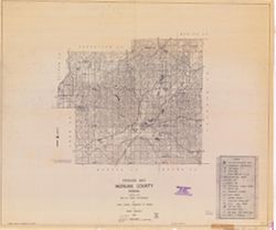
- Subject:
- Geographic Subject: Monroe County (Ind.) and Topical Subject: Roads
- Creator:
- Indiana. State Highway Commission (1919-1953)
- Publisher:
- Indiana. State Highway Commission (1919-1953)
- Date Created:
- 1937
- Identifier:
- VAC3073-M-00994
- Genre:
- Road maps
- Geographic Location:
- Coordinates: W0864100 W0861900 N0392100 N0390000
- Related URL:
- Catalog URL: https://iucat.iu.edu/catalog/5706988
- Abstract:
- Blueline. "1937." "53." "Corrected to January 1, 1937." Includes location map and chart of "Culture in unincorporated plac...
- Call Number:
- G4093.M7P2 1937 .I52
- Caption:
- Imprint: [Indianapolis] : State Highway Commission of Indiana, 1937.
- Physical Description:
- Scale: 1:130,000
- Persistent URL:
- https://purl.dlib.indiana.edu/iudl/images/VAC3073/VAC3073-M-00994
-
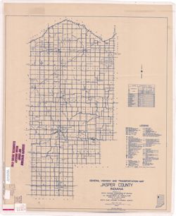
- Subject:
- Topical Subject: Roads and Geographic Subject: Jasper County (Ind.)
- Creator:
- Indiana. State Highway Commission (1919-1953)
- Publisher:
- Indiana. State Highway Commission (1919-1953)
- Date Created:
- 1937
- Identifier:
- VAC3073-M-00993
- Genre:
- Road maps
- Geographic Location:
- Coordinates: W0871700 W0865600 N0411700 N0404400
- Related URL:
- Catalog URL: https://iucat.iu.edu/catalog/5362493
- Abstract:
- Blue line print. "Corrected to January 1, 1937." "Data obtained from State-wide Highway Planning Survey." Includes chart "Culture in...
- Call Number:
- G4093.J3P2 1937 .I53
- Caption:
- Imprint: [Indianapolis?] : The Commission, 1937.
- Physical Description:
- Scale: 1:63,360 and Dimensions: 105 x 88 cm
- Alternate Identifier:
- Title Control Number: a5362493
- Persistent URL:
- https://purl.dlib.indiana.edu/iudl/images/VAC3073/VAC3073-M-00993
-
- Subject:
- Geographic Subject: Vigo County (Ind.) and Topical Subject: Roads
- Creator:
- Indiana. State Highway Commission (1919-1953)
- Publisher:
- State Highway Commission of Indiana
- Date Created:
- 1949
- Identifier:
- VAC3073-M-00973
- Genre:
- Road maps
- Geographic Location:
- Coordinates: W0873800 W0871300 N0393700 N0391600
- Related URL:
- Catalog URL: https://iucat.iu.edu/catalog/5737359
- Abstract:
- Blueline. "State roads revised January 1, 1949." "1937." "84." "Data obtained from State-wide Highway Planning Survey.&quo...
- Call Number:
- G4093.V5 P2 1949 .I53
- Caption:
- Imprint: [Indianapolis?] : State Highway Commission of Indiana, [1949?]
- Physical Description:
- Dimensions: 44 x 52 cm and Scale: 1:130,000
- Alternate Identifier:
- Title Control Number: a5737359
- Persistent URL:
- https://purl.dlib.indiana.edu/iudl/images/VAC3073/VAC3073-M-00973
-
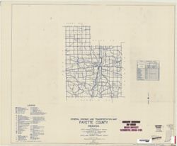
- Subject:
- Geographic Subject: Fayette County (Ind.) and Topical Subject: Roads
- Creator:
- Indiana. State Highway Commission (1919-1953)
- Publisher:
- State Highway Commission of Indiana
- Date Created:
- 1949
- Identifier:
- VAC3073-M-00960
- Genre:
- Road maps
- Geographic Location:
- Coordinates: W0851800 W0850200 N0394700 N0393200
- Related URL:
- Catalog URL: https://iucat.iu.edu/catalog/5704581
- Abstract:
- Blueline. "State roads revised to January 1, 1949." "Data obtained from State-wide Highway Planning Survey." Includes chart "Culture...
- Call Number:
- G4093.F3P2 1949 .I53
- Caption:
- Imprint: [Indianapolis?] : State Highway Commission of Indiana. 1949.
- Physical Description:
- Scale: 1:130,000 and Dimensions: 44 x 52 cm
- Alternate Identifier:
- Title Control Number: a5704581
- Persistent URL:
- https://purl.dlib.indiana.edu/iudl/images/VAC3073/VAC3073-M-00960
-
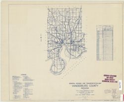
- Subject:
- Topical Subject: Roads and Geographic Subject: Vanderburgh County (Ind.)
- Creator:
- Indiana. State Highway Commission (1919-1953)
- Publisher:
- State Highway Commission of Indiana
- Date Created:
- 1949
- Identifier:
- VAC3073-M-00957
- Genre:
- Road maps
- Geographic Location:
- Coordinates: W0874200 W0872700 N0381000 N0375000
- Related URL:
- Catalog URL: https://iucat.iu.edu/catalog/5410094
- Abstract:
- Blueline. "State roads revised to January 1949." "Data obtained from State-wide Highway Planning Survey". "1937." "82."
- Call Number:
- G4093.V3 P2 1949 .I53
- Caption:
- Imprint: [Indianapolis?] : State Highway Commission of Indiana, [1949?]
- Physical Description:
- Scale: 1:130,000 and Dimensions: 44 x 52 cm
- Alternate Identifier:
- Title Control Number: a5410094
- Persistent URL:
- https://purl.dlib.indiana.edu/iudl/images/VAC3073/VAC3073-M-00957
-
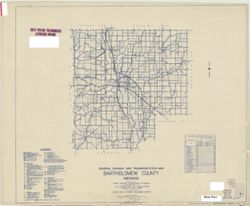
- Subject:
- Topical Subject: Roads and Geographic Subject: Bartholomew County (Ind.)
- Creator:
- Indiana. State Highway Commission (1919-1953)
- Publisher:
- Indiana. State Highway Commission (1919-1953)
- Date Created:
- 1949
- Identifier:
- VAC3073-M-00950
- Genre:
- Road maps
- Geographic Location:
- Coordinates: W0860500 W0844100 N0392100 N0390200
- Related URL:
- Catalog URL: https://iucat.iu.edu/catalog/5359878
- Abstract:
- Blue line print. "State roads revised January 1, 1949." "1937." "Data obtained from State-wide Highway Planning Survey." "...
- Call Number:
- G4093.B3P2 1949 .I53
- Caption:
- Imprint: [Indianapolis?] : State Highway Commission of Indiana, 1949.
- Physical Description:
- Dimensions: 91 x 107 cm and Scale: 1:63,360
- Alternate Identifier:
- Title Control Number: a5359878
- Persistent URL:
- https://purl.dlib.indiana.edu/iudl/images/VAC3073/VAC3073-M-00950
-
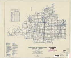
- Subject:
- Geographic Subject: Gibson County (Ind.) and Topical Subject: Roads
- Creator:
- Indiana. State Highway Commission (1919-1953)
- Publisher:
- Indiana. State Highway Commission (1961-1981)
- Date Created:
- 1949
- Identifier:
- VAC3073-M-00935
- Genre:
- Road maps
- Geographic Location:
- Coordinates: W0875900 W0871900 N0383200 N0381000
- Related URL:
- Catalog URL: https://iucat.iu.edu/catalog/5705940
- Abstract:
- Blueline. "State roads revised to January 1, 1949." "1937." "Data obtained from Statewide Highway Planning Survey." Includes lo...
- Call Number:
- G4093.G5P2 1949 .I53
- Caption:
- Imprint: [Indianapolis?] : State Highway Commission of Indiana, 1949.
- Physical Description:
- Dimensions: 44 x 52 cm and Scale: 1:130,000
- Alternate Identifier:
- Title Control Number: a9530630
- Persistent URL:
- https://purl.dlib.indiana.edu/iudl/images/VAC3073/VAC3073-M-00935
-
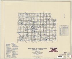
- Subject:
- Topical Subject: Roads and Geographic Subject: Clinton County (Ind.)
- Creator:
- Indiana. State Highway Commission (1919-1953)
- Publisher:
- State Highway Commission of Indiana
- Date Created:
- 1949
- Identifier:
- VAC3073-M-00934
- Genre:
- Road maps
- Geographic Location:
- Coordinates: W0864200 W0861500 N0402600 N0401100
- Related URL:
- Catalog URL: https://iucat.iu.edu/catalog/5703404
- Abstract:
- Blueline. "State roads revised to January 1, 1949." "1937." "Data obtained from State-wide Highway Planning Survey." "12.&...
- Call Number:
- G4093.C6P2 1949 .I53
- Caption:
- Imprint: [Indianapolis?] : State Highway Commission of Indiana, [1949?]
- Physical Description:
- Dimensions: 43 x 52 cm and Scale: 1:130,000
- Alternate Identifier:
- Title Control Number: a5703404
- Persistent URL:
- https://purl.dlib.indiana.edu/iudl/images/VAC3073/VAC3073-M-00934
-
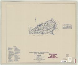
- Subject:
- Topical Subject: Roads and Geographic Subject: Ohio County (Ind.)
- Creator:
- Indiana. State Highway Commission (1919-1953)
- Publisher:
- State Highway Commission of Indiana
- Date Created:
- 1949
- Identifier:
- VAC3073-M-00928
- Genre:
- Road maps
- Geographic Location:
- Coordinates: W0850800 W0845000 N0390200 N0385400
- Related URL:
- Catalog URL: https://iucat.iu.edu/catalog/5708035
- Abstract:
- Blueline. "State roads revised to January 1, 1949." "1927." "Data obtained from State-wide Highway Planning Survey." Includes ...
- Call Number:
- G4093.O3 P2 1949 .I53
- Caption:
- Imprint: [Indianapolis?] : State Highway Commission of Indiana, 1949.
- Physical Description:
- Scale: 1:130,000 and Dimensions: 44 x 52 cm
- Alternate Identifier:
- Title Control Number: a5708035
- Persistent URL:
- https://purl.dlib.indiana.edu/iudl/images/VAC3073/VAC3073-M-00928
-
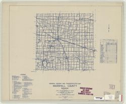
- Subject:
- Topical Subject: Roads and Geographic Subject: Marshall County (Ind.)
- Creator:
- Indiana. State Highway Commission (1919-1953)
- Publisher:
- State Highway Commission of Indiana
- Date Created:
- 1949
- Identifier:
- VAC3073-M-00910
- Genre:
- Road maps
- Geographic Location:
- Coordinates: W0862800 W0860300 N0412900 N0411000
- Related URL:
- Catalog URL: https://iucat.iu.edu/catalog/5706696
- Abstract:
- Blueline. "State roads revised to January 1, 1949." "1937." "Data obtained from State-wide Highway Planning Survey." Includes l...
- Call Number:
- G4093.M4 P2 1949 .I53
- Caption:
- Imprint: [Indianapolis?] : State Highway Commission of Indiana, 1949.
- Physical Description:
- Dimensions: 44 x 52 cm and Scale: 1:130,000
- Alternate Identifier:
- Title Control Number: a5706696
- Persistent URL:
- https://purl.dlib.indiana.edu/iudl/images/VAC3073/VAC3073-M-00910
-
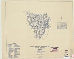
- Subject:
- Geographic Subject: Floyd County (Ind.) and Topical Subject: Roads
- Creator:
- Indiana. State Highway Commission (1919-1953)
- Publisher:
- State Highway Commission of Indiana
- Date Created:
- 1949
- Identifier:
- VAC3073-M-00907
- Genre:
- Road maps
- Geographic Location:
- Coordinates: W0860200 W0854600 N0382500 N0381100
- Related URL:
- Catalog URL: https://iucat.iu.edu/catalog/5705891
- Abstract:
- Blueline. "State road revised to January 1, 1949." "Data obtained from Statewide Highway Planning Survey." Includes chart "Culture i...
- Call Number:
- G4093.F5P2 1949 .I53
- Caption:
- Imprint: [Indianapolis?] : State Highway Commission of Indiana, [1949?]
- Physical Description:
- Scale: 1:130,000 and Dimensions: 44 x 52 cm
- Alternate Identifier:
- Title Control Number: a5705891
- Persistent URL:
- https://purl.dlib.indiana.edu/iudl/images/VAC3073/VAC3073-M-00907
-
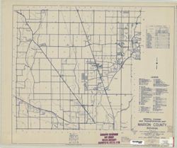
- Subject:
- Topical Subject: Roads and Geographic Subject: Marion County (Ind.)
- Creator:
- Indiana. State Highway Commission (1919-1953)
- Publisher:
- State Highway Commission of Indiana
- Date Created:
- 1949
- Identifier:
- VAC3073-M-00885
- Genre:
- Road maps
- Geographic Location:
- Coordinates: W0862000 W0855700 N0395600 N0393800
- Related URL:
- Catalog URL: https://iucat.iu.edu/catalog/5745742
- Abstract:
- Blueline. "1937." "State revised to January 1, 1949."
- Call Number:
- G4093.M3 P2 1949 .I53 Suppl. sheet 49A
- Caption:
- Imprint: [Indianapolis?] : State Highway Commission of Indiana, [1949]
- Physical Description:
- Dimensions: 52 x 44 cm and Scale: 1:130,000
- Alternate Identifier:
- Title Control Number: a5745742
- Persistent URL:
- https://purl.dlib.indiana.edu/iudl/images/VAC3073/VAC3073-M-00885
-
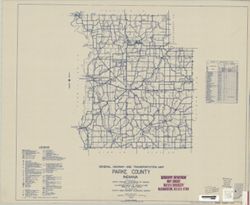
- Subject:
- Topical Subject: Roads and Geographic Subject: Parke County (Ind.)
- Creator:
- Indiana. State Highway Commission (1919-1953)
- Publisher:
- State Highway Commission of Indiana
- Date Created:
- 1949
- Identifier:
- VAC3073-M-00881
- Genre:
- Road maps
- Geographic Location:
- Coordinates: W0872600 W0870100 N0395700 N0393700
- Related URL:
- Catalog URL: https://iucat.iu.edu/catalog/5708068
- Abstract:
- Blueline. "State roads revised to January 1, 1949." "1937." "Data obtained from State-wide Highway Planning Survey." Includes ...
- Call Number:
- G4093.P2 P2 1949 .I53
- Caption:
- Imprint: [Indianapolis?] : State Highway Commission of Indiana, 1949.
- Physical Description:
- Scale: 1:130,000 and Dimensions: 44 x 52 cm
- Alternate Identifier:
- Title Control Number: a5708068
- Persistent URL:
- https://purl.dlib.indiana.edu/iudl/images/VAC3073/VAC3073-M-00881
-
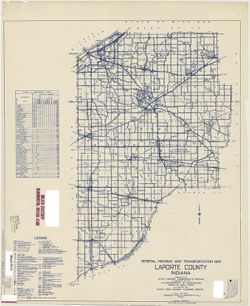
- Subject:
- Geographic Subject: LaPorte County (Ind.) and Topical Subject: Roads
- Creator:
- Indiana. State Highway Commission (1919-1953)
- Publisher:
- State Highway Commission of Indiana
- Date Created:
- 1949
- Identifier:
- VAC3073-M-00875
- Genre:
- Road maps
- Geographic Location:
- Coordinates: W0865600 W0862900 N0414600 N0411400
- Related URL:
- Catalog URL: https://iucat.iu.edu/catalog/5706494
- Abstract:
- Blueline. "State roads revised to January 1, 1949." "1937." "Data obtained from State-wide Highway Planning Agency Survey." Inc...
- Call Number:
- G4093.L15 P2 1949 .I53
- Caption:
- Imprint: [Indianapolis?] : State Highway Commission of Indiana, 1949.
- Physical Description:
- Scale: 1:130,000 and Dimensions: 52 x 44 cm
- Alternate Identifier:
- Title Control Number: a5706494
- Persistent URL:
- https://purl.dlib.indiana.edu/iudl/images/VAC3073/VAC3073-M-00875
-
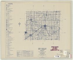
- Subject:
- Topical Subject: Roads and Geographic Subject: Jay County (Ind.)
- Creator:
- Indiana. State Highway Commission (1919-1953)
- Publisher:
- Indiana. State Highway Commission (1919-1953)
- Date Created:
- 1949
- Identifier:
- VAC3073-M-00871
- Genre:
- Road maps
- Geographic Location:
- Coordinates: W0851300 W0844800 N0403400 N0401900
- Related URL:
- Catalog URL: https://iucat.iu.edu/catalog/5706369
- Abstract:
- Blueline. "State roads revised to January 1, 1949." "1942." "Data obtained from State-wide Highway Planning Agency." Includes l...
- Call Number:
- G4093 .J4P2 1949 .I53
- Caption:
- Imprint: [Indianapolis?] : State Highway Commission of Indiana, 1949.
- Physical Description:
- Dimensions: 52 x 44 cm and Scale: 1:130,000
- Persistent URL:
- https://purl.dlib.indiana.edu/iudl/images/VAC3073/VAC3073-M-00871
-
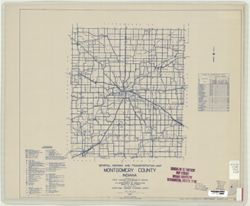
- Subject:
- Topical Subject: Roads and Geographic Subject: Montgomery County (Ind.)
- Creator:
- Indiana. State Highway Commission (1919-1953)
- Publisher:
- State Highway Commission of Indiana
- Date Created:
- 1949
- Identifier:
- VAC3073-M-00847
- Genre:
- Road maps
- Geographic Location:
- Coordinates: W0870600 W0864200 N0401300 N0395200
- Related URL:
- Catalog URL: https://iucat.iu.edu/catalog/5707440
- Abstract:
- Blueline. "State roads revised to January 1, 1949." "1937." "Data obtained from State-wide Highway Planning Agency Survey." Inc...
- Call Number:
- G4093.M8 P2 1949 .I53
- Caption:
- Imprint: [Indianapolis?] : State Highway Commission of Indiana, 1949.
- Physical Description:
- Dimensions: 52 x 44 cm and Scale: 1:130,000
- Alternate Identifier:
- Title Control Number: a5707440
- Persistent URL:
- https://purl.dlib.indiana.edu/iudl/images/VAC3073/VAC3073-M-00847
-
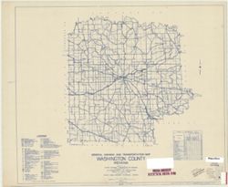
- Subject:
- Geographic Subject: Washington County (Ind.) and Topical Subject: Roads
- Creator:
- Indiana. State Highway Commission (1919-1953)
- Publisher:
- State Highway Commission of Indiana
- Date Created:
- 1949
- Identifier:
- VAC3073-M-00841
- Genre:
- Road maps
- Geographic Location:
- Coordinates: W0861900 W0855100 N0384700 N0382500
- Related URL:
- Catalog URL: https://iucat.iu.edu/catalog/5741674
- Abstract:
- Blueline. "State roads revised to January 1, 1949." "1937." "88." "Data obtained from State-wide Highway Planning Survey.&...
- Call Number:
- G4093.W5 P2 1949 .I53
- Caption:
- Imprint: [Indianapolis?] : State Highway Commission of Indiana, [1949?]
- Physical Description:
- Scale: 1:130,000 and Dimensions: 44 x 52 cm
- Alternate Identifier:
- Title Control Number: a5741674
- Persistent URL:
- https://purl.dlib.indiana.edu/iudl/images/VAC3073/VAC3073-M-00841
-
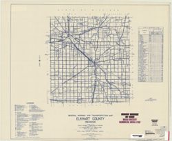
- Subject:
- Topical Subject: Roads and Geographic Subject: Elkhart County (Ind.)
- Creator:
- Indiana. State Highway Commission (1919-1953)
- Publisher:
- State Highway Commission of Indiana
- Date Created:
- 1949
- Identifier:
- VAC3073-M-00837
- Genre:
- Road maps
- Geographic Location:
- Coordinates: W0860300 W0854000 N0414600 N0412600
- Related URL:
- Catalog URL: https://iucat.iu.edu/catalog/5704380
- Abstract:
- Blueline. "State roads revised to January 1, 1949." "Data obtained from State-wide Highway Planning Agency." Includes chart "Cultur...
- Call Number:
- G4093.E4P2 1949 .I53
- Caption:
- Imprint: [Indianapolis?] : State Highway Commission of Indiana, 1949.
- Physical Description:
- Dimensions: 44 x 52 cm and Scale: 1:130,000
- Alternate Identifier:
- Title Control Number: a5704380
- Persistent URL:
- https://purl.dlib.indiana.edu/iudl/images/VAC3073/VAC3073-M-00837
-
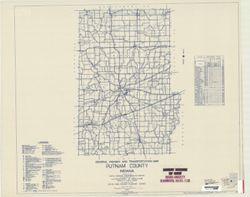
- Subject:
- Geographic Subject: Putnam County (Ind.) and Topical Subject: Roads
- Creator:
- Indiana. State Highway Commission (1919-1953)
- Publisher:
- State Highway Commission of Indiana
- Date Created:
- 1949
- Identifier:
- VAC3073-M-00821
- Genre:
- Road maps
- Geographic Location:
- Coordinates: W0870100 W0863800 N0395200 N0392800
- Related URL:
- Catalog URL: https://iucat.iu.edu/catalog/5708470
- Abstract:
- Blueline. "State roads revised to January 1, 1949." "1937." "Data obtained from State-wide Highway Planning Survey." Includes ...
- Call Number:
- G4093.P8 P2 1949 .I53
- Caption:
- Imprint: [Indianapolis?] : State Highway Commission of Indiana, 1949.
- Physical Description:
- Dimensions: 44 x 52 cm and Scale: 1:130,000
- Alternate Identifier:
- Title Control Number: a5708470
- Persistent URL:
- https://purl.dlib.indiana.edu/iudl/images/VAC3073/VAC3073-M-00821
-
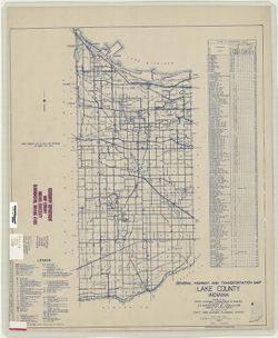
- Subject:
- Geographic Subject: Lake County (Ind.) and Topical Subject: Roads
- Creator:
- Indiana. State Highway Commission (1919-1953)
- Publisher:
- State Highway Commission of Indiana
- Date Created:
- 1949
- Identifier:
- VAC3073-M-00816
- Genre:
- Road maps
- Geographic Location:
- Coordinates: W0873200 W0871300 N0414200 N0411000
- Related URL:
- Catalog URL: https://iucat.iu.edu/catalog/5706601
- Abstract:
- Blueline. "State roads revised to January 1, 1949." "1937." "Data obtained from State-wide Highway Planning Survey." Includes l...
- Call Number:
- G4093.L3 P2 1949 .I53
- Caption:
- Imprint: [Indianapolis?] : State Highway Commission of Indiana, 1949.
- Physical Description:
- Dimensions: 52 x 44 cm and Scale: 1:130,000
- Alternate Identifier:
- Title Control Number: a5706601
- Persistent URL:
- https://purl.dlib.indiana.edu/iudl/images/VAC3073/VAC3073-M-00816
-
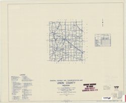
- Subject:
- Geographic Subject: Union County (Ind.) and Topical Subject: Roads
- Creator:
- Indiana. State Highway Commission (1919-1953)
- Publisher:
- State Highway Commission of Indiana
- Date Created:
- 1949
- Identifier:
- VAC3073-M-00769
- Genre:
- Road maps
- Geographic Location:
- Coordinates: W0850200 W0844900 N0394400 N0393100
- Related URL:
- Catalog URL: https://iucat.iu.edu/catalog/5736739
- Abstract:
- Blueline. "State roads revised January 1, 1949." "1937." "81." "Data obtained from State-wide Highway Planning Survey.&quo...
- Call Number:
- G4093.U5 P2 1949 .I53
- Caption:
- Imprint: [Indianapolis?] : State Highway Commission of Indiana, 1949.
- Physical Description:
- Dimensions: 44 x 52 cm and Scale: 1:130,000
- Alternate Identifier:
- Title Control Number: a5736739
- Persistent URL:
- https://purl.dlib.indiana.edu/iudl/images/VAC3073/VAC3073-M-00769
-

- Subject:
- Topical Subject: Roads and Geographic Subject: Adams County (Ind.)
- Creator:
- Indiana. State Highway Commission (1919-1953)
- Publisher:
- Indiana. State Highway Commission (1919-1953)
- Date Created:
- 1941
- Identifier:
- VAC3073-M-00767
- Genre:
- Road maps
- Geographic Location:
- Coordinates: W0850400 W0844800 N0405500 N0403400
- Related URL:
- Catalog URL: https://iucat.iu.edu/catalog/5726499
- Abstract:
- Blue line print. "Corrected to May 1, 1941." "Data obtained from State-wide Highway Planning Survey." Includes location map and charts &q...
- Call Number:
- G4093.A2P2 1949 .I53
- Caption:
- Imprint: [Indianapolis?] : The Commission, 1941.
- Physical Description:
- Scale: 1:63,360 and Dimensions: 89 x 104 cm
- Alternate Identifier:
- Title Control Number: a5359424
- Persistent URL:
- https://purl.dlib.indiana.edu/iudl/images/VAC3073/VAC3073-M-00767
-
- Subject:
- Geographic Subject: Morgan County (Ind.) and Topical Subject: Drainage
- Creator:
- Indiana. State Highway Commission (1919-1953)
- Publisher:
- State Highway Commission of Indiana
- Date Created:
- 1949
- Identifier:
- VAC3073-M-00757
- Genre:
- Thematic maps
- Geographic Location:
- Coordinates: W0864100 W0861500 N0393800 N0392000
- Related URL:
- Catalog URL: https://iucat.iu.edu/catalog/9434871
- Abstract:
- Blueline. "Prepared under the direction of: M. Parvis."
- Call Number:
- G4093.M9 C3 1949 .I53
- Caption:
- Imprint: [West Lafayette, Ind.] : Indiana State Highway Commission, 1949.
- Physical Description:
- Dimensions: 88 x 104 cm and Scale: 1:63,360
- Alternate Identifier:
- Title Control Number: a9434871
- Persistent URL:
- https://purl.dlib.indiana.edu/iudl/images/VAC3073/VAC3073-M-00757
-
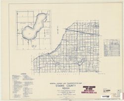
- Subject:
- Geographic Subject: Starke County (Ind.), Geographic Subject: Bass Lake (Starke County, Ind. : Lake), Topical Subject: Roads, and Topical Subject: Lakes
- Creator:
- Indiana. State Highway Commission (1919-1953)
- Publisher:
- State Highway Commission of Indiana
- Date Created:
- 1949
- Identifier:
- VAC3073-M-00737
- Genre:
- Road maps
- Geographic Location:
- Coordinates: W0865600 W0862800 N0412600 N0411000
- Related URL:
- Catalog URL: https://iucat.iu.edu/catalog/5733211
- Abstract:
- Blueline. "State roads revised January 1, 1949." "1937." "75." Data obtained from "State-wide Highway Planning Survey.&quo...
- Call Number:
- G4093.S6 P2 1949 .I53
- Caption:
- Imprint: [Indianapolis?] : State Highway Commission of Indiana, [1949?]
- Physical Description:
- Scale: 1:130,000 and Dimensions: 44 x 52 cm
- Alternate Identifier:
- Title Control Number: a5733211
- Persistent URL:
- https://purl.dlib.indiana.edu/iudl/images/VAC3073/VAC3073-M-00737
-
- Subject:
- Geographic Subject: Allen County (Ind.) and Topical Subject: Roads
- Creator:
- Indiana. State Highway Commission (1919-1953)
- Publisher:
- State Highway Commission of Indiana
- Date Created:
- 1949
- Identifier:
- VAC3073-M-00722
- Genre:
- Road maps
- Geographic Location:
- Coordinates: W0852000 W0844800 N0411600 N0405500
- Related URL:
- Catalog URL: https://iucat.iu.edu/catalog/5728757
- Abstract:
- Blueline print. "State roads revised to January 1, 1949." "Service discontinued on Indiana Service Corporation between Peru & Ft. Wayne Se...
- Call Number:
- G4093.A4P2 1949 .I53
- Caption:
- Imprint: [Indianapolis?] : State Highway Commission of Indiana, 1949.
- Physical Description:
- Scale: 1:63,360 and Dimensions: 45 x 52 cm
- Alternate Identifier:
- Title Control Number: a5728757
- Persistent URL:
- https://purl.dlib.indiana.edu/iudl/images/VAC3073/VAC3073-M-00722
-
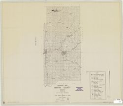
- Subject:
- Geographic Subject: Martin County (Ind.) and Topical Subject: Drainage
- Creator:
- Indiana. State Highway Commission (1919-1953)
- Publisher:
- State Highway Commission of Indiana
- Date Created:
- 1948
- Identifier:
- VAC3073-M-00720
- Genre:
- Thematic maps
- Geographic Location:
- Coordinates: W0865500 W0864100 N0385400 N0383000
- Related URL:
- Catalog URL: https://iucat.iu.edu/catalog/6948872
- Abstract:
- Blueline. "Prepared under the supervision of: M. Parvis."
- Call Number:
- G4093.M5C3 1940 .I5
- Caption:
- Imprint: [West Lafayette, Ind.?] : Indiana State Highway Commission, 1948.
- Physical Description:
- Dimensions: 88 x 104 cm and Scale: 1:65,000
- Alternate Identifier:
- Title Control Number: a6948872
- Persistent URL:
- https://purl.dlib.indiana.edu/iudl/images/VAC3073/VAC3073-M-00720
-
- Subject:
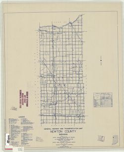
- Geographic Subject: Newton County (Ind.) and Topical Subject: Roads
- Creator:
- Indiana. State Highway Commission (1919-1953)
- Publisher:
- State Highway Commission of Indiana
- Date Created:
- 1949
- Identifier:
- VAC3073-M-00719
- Genre:
- Road maps
- Geographic Location:
- Coordinates: W0873200 W0871600 N0411400 N0404400
- Related URL:
- Catalog URL: https://iucat.iu.edu/catalog/5707499
- Abstract:
- Blueline. "State roads revised to January 1, 1949." "1937." "Data obtained from State-wide Highway Planning Survey." Includes l...
- Call Number:
- G4093.N4 P2 1949 .I53
- Caption:
- Imprint: [Indianapolis?] : State Highway Commission of Indiana, 1949.
- Physical Description:
- Dimensions: 52 x 44 cm and Scale: 1:130,000
- Alternate Identifier:
- Title Control Number: a5707499
- Persistent URL:
- https://purl.dlib.indiana.edu/iudl/images/VAC3073/VAC3073-M-00719
-
- Subject:
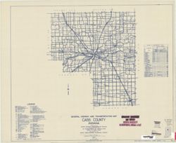
- Topical Subject: Roads and Geographic Subject: Cass County (Ind.)
- Creator:
- Indiana. State Highway Commission (1919-1953)
- Publisher:
- State Highway Commission of Indiana
- Date Created:
- 1949
- Identifier:
- VAC3073-M-00716
- Genre:
- Road maps
- Geographic Location:
- Coordinates: W0863500 W0861000 N0405500 N0403400
- Related URL:
- Catalog URL: https://iucat.iu.edu/catalog/5703190
- Abstract:
- Blueline. "State roads revised to January 1, 1949." "1937." "Data obtained from "Statewide Highway Planning Survey." "...
- Call Number:
- G4093.C3P2 1949 .I53
- Caption:
- Imprint: [Indianapolis?] : State Highway Commission of Indiana, [1949?]
- Physical Description:
- Scale: 1:130,000 and Dimensions: 43 x 52 cm
- Alternate Identifier:
- Title Control Number: a5703190
- Persistent URL:
- https://purl.dlib.indiana.edu/iudl/images/VAC3073/VAC3073-M-00716
-
- Subject:
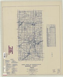
- Topical Subject: Roads and Geographic Subject: Madison County (Ind.)
- Creator:
- Indiana. State Highway Commission (1919-1953)
- Publisher:
- State Highway Commission of Indiana
- Date Created:
- 1949
- Identifier:
- VAC3073-M-00703
- Genre:
- Road maps
- Geographic Location:
- Coordinates: W0855200 W0853500 N0402300 N0395700
- Related URL:
- Catalog URL: https://iucat.iu.edu/catalog/5706658
- Abstract:
- Blueline. "State roads revised to January 1, 1949." "1937." "Data obtained from State-wide Highway Planning Survey." Includes l...
- Call Number:
- G4093.M2 P2 1949 .I53
- Caption:
- Imprint: [Indianapolis?] : State Highway Commission of Indiana, 1949.
- Physical Description:
- Scale: 1:130,000 and Dimensions: 52 x 44 cm
- Alternate Identifier:
- Title Control Number: a5706658
- Persistent URL:
- https://purl.dlib.indiana.edu/iudl/images/VAC3073/VAC3073-M-00703
-
- Subject:
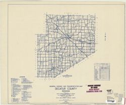
- Geographic Subject: Decatur County (Ind.) and Topical Subject: Roads
- Creator:
- Indiana. State Highway Commission (1919-1953)
- Publisher:
- State Highway Commission of Indiana
- Date Created:
- 1949
- Identifier:
- VAC3073-M-00697
- Genre:
- Road maps
- Geographic Location:
- Coordinates: W0854100 W0851800 N0392700 N0390800
- Related URL:
- Catalog URL: https://iucat.iu.edu/catalog/5704035
- Abstract:
- Blueline. "State roads revised to January 1, 1949." "Data obtained from Statewide Highway Planning Survey." Includes chart "Culture ...
- Call Number:
- G4093.D4P2 1949 .I53
- Caption:
- Imprint: [Indianapolis?] : State Highway Commission of Indiana. 1949.
- Physical Description:
- Dimensions: 44 x 52 cm and Scale: 1:130,000
- Alternate Identifier:
- Title Control Number: a5704035
- Persistent URL:
- https://purl.dlib.indiana.edu/iudl/images/VAC3073/VAC3073-M-00697
-
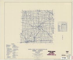
- Subject:
- Topical Subject: Roads and Geographic Subject: Henry County (Ind.)
- Creator:
- Indiana. State Highway Commission (1919-1953)
- Publisher:
- State Highway Commission of Indiana
- Date Created:
- 1949
- Identifier:
- VAC3073-M-00688
- Genre:
- Road maps
- Geographic Location:
- Coordinates: W0853600 W0852500 N0400500 N0394700
- Related URL:
- Catalog URL: https://iucat.iu.edu/catalog/5706069
- Abstract:
- Blueline. "State roads revised to January 1, 1949." "Data obtained from Statewide Highway Planning Survey." Includes chart "Culture ...
- Call Number:
- G4093.H6P2 1949 .I53
- Caption:
- Imprint: [Indianapolis?] : State Highway Commission of Indiana, 1949.
- Physical Description:
- Scale: 1:130,000 and Dimensions: 89 x 105 cm
- Alternate Identifier:
- Title Control Number: a5706069
- Persistent URL:
- https://purl.dlib.indiana.edu/iudl/images/VAC3073/VAC3073-M-00688
-
- Subject:
- Topical Subject: Roads and Geographic Subject: Blackford County (Ind.)
- Creator:
- Indiana. State Highway Commission (1919-1953)
- Publisher:
- State Highway Commission of Indiana
- Date Created:
- 1949
- Identifier:
- VAC3073-M-00684
- Genre:
- Road maps
- Geographic Location:
- Coordinates: W0852700 W0851200 N0403400 N0402300
- Related URL:
- Catalog URL: https://iucat.iu.edu/catalog/5703096
- Abstract:
- Blueline. "State roads revised to January 1, 1949." "1937." "Data obtained from "Statewide Highway Planning Survey." "...
- Call Number:
- G4093.B5P2 1949 .I53
- Caption:
- Imprint: [Indianapolis?] : State Highway Commission of Indiana, [1949?]
- Physical Description:
- Scale: 1:130,000 and Dimensions: 44 x 52 cm
- Alternate Identifier:
- Title Control Number: a5703096
- Persistent URL:
- https://purl.dlib.indiana.edu/iudl/images/VAC3073/VAC3073-M-00684
-
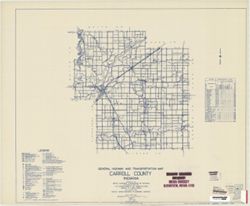
- Subject:
- Geographic Subject: Carroll County (Ind.) and Topical Subject: Roads
- Creator:
- Indiana. State Highway Commission (1919-1953)
- Publisher:
- State Highway Commission of Indiana
- Date Created:
- 1949
- Identifier:
- VAC3073-M-00665
- Genre:
- Road maps
- Geographic Location:
- Coordinates: W0864600 W0862200 N0404400 N0402600
- Related URL:
- Catalog URL: https://iucat.iu.edu/catalog/5703142
- Abstract:
- Blueline. "State roads revised to January 1, 1949." "1937." "Data obtained from "Statewide Highway Planning Survey." "...
- Call Number:
- G4093.C2P2 1949 .I53
- Caption:
- Imprint: [Indianapolis?] : State Highway Commission of Indiana, [1949?]
- Physical Description:
- Scale: 1:130,000 and Dimensions: 44 x 52 cm
- Alternate Identifier:
- Title Control Number: a5703142
- Persistent URL:
- https://purl.dlib.indiana.edu/iudl/images/VAC3073/VAC3073-M-00665
-
- Subject:
- Geographic Subject: De Kalb County (Ind.) and Topical Subject: Roads
- Creator:
- Indiana. State Highway Commission (1919-1953)
- Publisher:
- Indiana. State Highway Commission (1919-1953)
- Date Created:
- 1949
- Identifier:
- VAC3073-M-00643
- Genre:
- Road maps
- Geographic Location:
- Coordinates: W0851200 W0844800 N0413200 N0411600
- Related URL:
- Catalog URL: https://iucat.iu.edu/catalog/5361316
- Abstract:
- Blue line print. "State roads rev. to Jan. 1949." "Data obtained from Statewide Highway Planning Survey." Includes chart "Culture in...
- Call Number:
- G4093.D25 P2 1949 .I53
- Caption:
- Imprint: [Indianapolis?] : The Commission, [1949?]
- Physical Description:
- Scale: 1:63,360 and Dimensions: 88 x 105 cm
- Alternate Identifier:
- Title Control Number: a5361316
- Persistent URL:
- https://purl.dlib.indiana.edu/iudl/images/VAC3073/VAC3073-M-00643
-
- Subject:
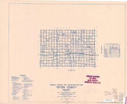
- Topical Subject: Roads and Geographic Subject: Tipton County (Ind.)
- Creator:
- Indiana. State Highway Commission (1919-1953)
- Publisher:
- State Highway Commission of Indiana
- Date Created:
- 1949
- Identifier:
- VAC3073-M-00621
- Genre:
- Road maps
- Geographic Location:
- Coordinates: W0861500 W0855200 N0402500 N0401300
- Related URL:
- Catalog URL: https://iucat.iu.edu/catalog/5736432
- Abstract:
- Blueline. "State roads revised January 1, 1949." "1937." "80." "Data obtained from "State-wide Highway Planning Surve...
- Call Number:
- G4093.T5 P2 1949 .I53
- Caption:
- Imprint: [Indianapolis?] : State Highway Commission of Indiana, [1949?]
- Physical Description:
- Scale: 1:130,000 and Dimensions: 44 x 52 cm
- Alternate Identifier:
- Title Control Number: a5736432
- Persistent URL:
- https://purl.dlib.indiana.edu/iudl/images/VAC3073/VAC3073-M-00621
-
- Subject:
- Geographic Subject: Spencer County (Ind.) and Topical Subject: Roads
- Creator:
- Indiana. State Highway Commission (1919-1953)
- Publisher:
- State Highway Commission of Indiana
- Date Created:
- 1937
- Identifier:
- VAC3073-M-00610
- Genre:
- Road maps
- Geographic Location:
- Coordinates: W0871600 W0864600 N0381200 N0374700
- Related URL:
- Catalog URL: https://iucat.iu.edu/catalog/6795141
- Abstract:
- Blackline. "Corrected to January 1, 1937." "1937." "Data obtained from "Statewide Highway Planning Survey." Includes locat...
- Call Number:
- G4093.S5 P2 1937 .I53
- Caption:
- Imprint: [Indianapolis?] : State Highway Commission of Indiana, {1937]
- Physical Description:
- Scale: 1:95,000 and Dimensions: 59 x 71 cm
- Alternate Identifier:
- Title Control Number: a6795141
- Persistent URL:
- https://purl.dlib.indiana.edu/iudl/images/VAC3073/VAC3073-M-00610
-
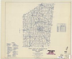
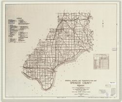
- Subject:
- Geographic Subject: Ripley County (Ind.) and Topical Subject: Roads
- Creator:
- Indiana. State Highway Commission (1919-1953)
- Publisher:
- State Highway Commission of Indiana
- Date Created:
- 1949
- Identifier:
- VAC3073-M-00601
- Genre:
- Road maps
- Geographic Location:
- Coordinates: W0852700 W0850400 N0391900 N0385500
- Related URL:
- Catalog URL: https://iucat.iu.edu/catalog/5824281
- Abstract:
- Blueline. "State road revised to January 1, 1949." "Data obtained from Statewide Highway Planning Survey." Includes chart "Culture i...
- Call Number:
- G4093.R5 P2 1949 .I535
- Caption:
- Imprint: [Indianapolis?] : State Highway Commission of Indiana, 1949.
- Physical Description:
- Scale: 1:63,360 and Dimensions: 92 x 105 cm
- Alternate Identifier:
- Title Control Number: a5824281
- Persistent URL:
- https://purl.dlib.indiana.edu/iudl/images/VAC3073/VAC3073-M-00601
-
- Subject:
- Geographic Subject: Posey County (Ind.) and Topical Subject: Roads
- Creator:
- Indiana. State Highway Commission (1919-1953)
- Publisher:
- State Highway Commission of Indiana
- Date Created:
- 1949
- Identifier:
- VAC3073-M-00597
- Genre:
- Road maps
- Geographic Location:
- Coordinates: W0880600 W0874100 N0381400 N0374600
- Related URL:
- Catalog URL: https://iucat.iu.edu/catalog/5708369
- Abstract:
- Blueline. "State roads revised to January 1, 1949." "1937." "Data obtained from State-wide Highway Planning Survey." Includes l...
- Call Number:
- G4093.P6 P2 1949 .I53
- Caption:
- Imprint: [Indianapolis?] : State Highway Commission of Indiana, 1949.
- Physical Description:
- Scale: 1:130,000 and Dimensions: 44 x 52 cm
- Alternate Identifier:
- Title Control Number: a5708369
- Persistent URL:
- https://purl.dlib.indiana.edu/iudl/images/VAC3073/VAC3073-M-00597
-
- Subject:
- Topical Subject: Roads and Geographic Subject: Dearborn County (Ind.)
- Creator:
- Indiana. State Highway Commission (1919-1953)
- Publisher:
- State Highway Commission of Indiana
- Date Created:
- 1949
- Identifier:
- VAC3073-M-00595
- Genre:
- Road maps
- Geographic Location:
- Coordinates: W0850800 W0844900 N0391900 N0384200
- Related URL:
- Catalog URL: https://iucat.iu.edu/catalog/5703652
- Abstract:
- Blueline. "State road revised to January 1, 1949." "Data obtained from Statewide Highway Planning Survey." Includes chart "Culture i...
- Call Number:
- G4093.D3P2 1949 .I53
- Caption:
- Imprint: [Indianapolis?] : State Highway Commission of Indiana, [1949?]
- Physical Description:
- Scale: 1:130,000 and Dimensions: 44 x 52 cm
- Alternate Identifier:
- Title Control Number: a5703652
- Persistent URL:
- https://purl.dlib.indiana.edu/iudl/images/VAC3073/VAC3073-M-00595
-
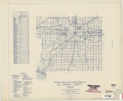
- Subject:
- Topical Subject: Roads and Geographic Subject: Saint Joseph County (Ind.)
- Creator:
- Indiana. State Highway Commission (1919-1953)
- Publisher:
- State Highway Commission of Indiana
- Date Created:
- 1949
- Identifier:
- VAC3073-M-00592
- Genre:
- Road maps
- Geographic Location:
- Coordinates: W0863100 W0860300 N0414600 N0412600
- Related URL:
- Catalog URL: https://iucat.iu.edu/catalog/5733158
- Abstract:
- Blueline. "State roads revised January 1, 1949." "1937." "71." "Data obtained from "State-wide Highway Planning Surve...
- Call Number:
- G4093.S2P2 1949 .I53
- Caption:
- Imprint: [Indianapolis?] : State Highway Commission of Indiana, [1949?]
- Physical Description:
- Scale: 1:130,000 and Dimensions: 44 x 52 cm
- Alternate Identifier:
- Title Control Number: a5733158
- Persistent URL:
- https://purl.dlib.indiana.edu/iudl/images/VAC3073/VAC3073-M-00592
-
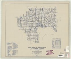
- Subject:
- Geographic Subject: Jefferson County (Ind.) and Topical Subject: Roads
- Creator:
- Indiana. State Highway Commission (1919-1953)
- Publisher:
- State Highway Commission of Indiana
- Date Created:
- 1949
- Identifier:
- VAC3073-M-00590
- Genre:
- Road maps
- Geographic Location:
- Coordinates: W0854100 W0851200 N0385500 N0383500
- Related URL:
- Catalog URL: https://iucat.iu.edu/catalog/5706350
- Abstract:
- Blueline. "State roads revised to January 1, 1949." "1937." "Data obtained from Statewide Highway Planning Survey." Includes lo...
- Call Number:
- G4093.J5P2 1949 .I53
- Caption:
- Imprint: [Indianapolis?] : State Highway Commission of Indiana, 1949.
- Physical Description:
- Dimensions: 44 x 52 cm and Scale: 1:130,000
- Alternate Identifier:
- Title Control Number: a5706350
- Persistent URL:
- https://purl.dlib.indiana.edu/iudl/images/VAC3073/VAC3073-M-00590
-
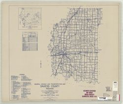
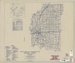
- Subject:
- Geographic Subject: Daviess County (Ind.) and Topical Subject: Roads
- Creator:
- Indiana. State Highway Commission (1919-1953)
- Publisher:
- State Highway Commission of Indiana
- Date Created:
- 1949
- Identifier:
- VAC3073-M-00587
- Genre:
- Road maps
- Geographic Location:
- Coordinates: W0871700 W0865400 N0385500 N0383000
- Related URL:
- Catalog URL: https://iucat.iu.edu/catalog/5703596
- Abstract:
- Blueline. "State roads revised to January 1, 1949." "1937." "Data obtained from Statewide Highway Planning Survey." "14.&q...
- Call Number:
- G4093.D2P2 1949 .I53
- Caption:
- Imprint: [Indianapolis?] : State Highway Commission of Indiana, [1949?]
- Physical Description:
- Scale: 1:130,000 and Dimensions: 44 x 52 cm
- Alternate Identifier:
- Title Control Number: a5703596
- Persistent URL:
- https://purl.dlib.indiana.edu/iudl/images/VAC3073/VAC3073-M-00587
-
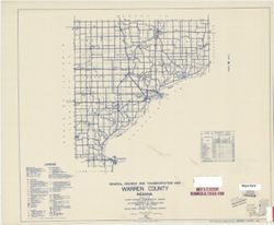
- Subject:
- Geographic Subject: Warren County (Ind.) and Topical Subject: Roads
- Creator:
- Indiana. State Highway Commission (1919-1953)
- Publisher:
- State Highway Commission of Indiana
- Date Created:
- 1949
- Identifier:
- VAC3073-M-00586
- Genre:
- Road maps
- Geographic Location:
- Coordinates: W0873200 W0870600 N0402800 N0400700
- Related URL:
- Catalog URL: https://iucat.iu.edu/catalog/5741429
- Abstract:
- Blueline. "State roads revised to January 1, 1949." "1937." "86." "Data obtained from "State-wide Highway Planning Su...
- Call Number:
- G4093.W3 P2 1949 .I53
- Caption:
- Imprint: [Indianapolis?] : State Highway Commission of Indiana, [1949?]
- Physical Description:
- Scale: 1:130,000 and Dimensions: 44 x 52 cm
- Alternate Identifier:
- Title Control Number: a5741429
- Persistent URL:
- https://purl.dlib.indiana.edu/iudl/images/VAC3073/VAC3073-M-00586
-
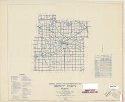
- Subject:
- Geographic Subject: Whitley County (Ind.) and Topical Subject: Roads
- Creator:
- Indiana. State Highway Commission (1919-1953)
- Publisher:
- State Highway Commission of Indiana
- Date Created:
- 1949
- Identifier:
- VAC3073-M-00575
- Genre:
- Road maps
- Geographic Location:
- Coordinates: W0854100 W0851900 N0411800 N0410000
- Related URL:
- Catalog URL: https://iucat.iu.edu/catalog/5742917
- Abstract:
- Blueline. "State roads revised to January 1,1949." "1937." "92." "Data obtained from State-wide Highway Planning Agency.&q...
- Call Number:
- G4093.W9 P2 1949 .I53
- Caption:
- Imprint: [Indianapolis?] : State Highway Commission of Indiana, [1949?]
- Physical Description:
- Dimensions: 44 x 52 cm and Scale: 1:130,000
- Alternate Identifier:
- Title Control Number: a5742917
- Persistent URL:
- https://purl.dlib.indiana.edu/iudl/images/VAC3073/VAC3073-M-00575
-
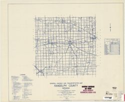
- Subject:
- Topical Subject: Roads and Geographic Subject: Randolph County (Ind.)
- Creator:
- Indiana. State Highway Commission (1919-1953)
- Publisher:
- State Highway Commission of Indiana
- Date Created:
- 1949
- Identifier:
- VAC3073-M-00563
- Genre:
- Road maps
- Geographic Location:
- Coordinates: W0851300 W0844900 N0401900 N0400000
- Related URL:
- Catalog URL: https://iucat.iu.edu/catalog/5708597
- Abstract:
- Blueline. "State roads revised to January 1, 1949.: "1937." Data obtained from State-wide Highway Planning Agency." Includes location ma...
- Call Number:
- G4093.R3 P2 1949 .I53
- Caption:
- Imprint: [Indianapolis?] : State Highway Commission of Indiana, 1949.
- Physical Description:
- Scale: 1:130,000 and Dimensions: 44 x 52 cm
- Alternate Identifier:
- Title Control Number: a5708597
- Persistent URL:
- https://purl.dlib.indiana.edu/iudl/images/VAC3073/VAC3073-M-00563
-
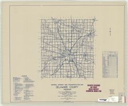
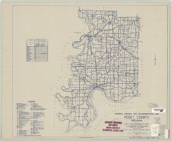
- Subject:
- Geographic Subject: Delaware County (Ind.) and Topical Subject: Roads
- Creator:
- Indiana. State Highway Commission (1919-1953)
- Publisher:
- Indiana. State Highway Commission (1919-1953)
- Date Created:
- 1937
- Identifier:
- VAC3073-M-00364
- Genre:
- Road maps
- Geographic Location:
- Coordinates: W0853500 W0851300 N0402300 N0400500
- Related URL:
- Catalog URL: https://iucat.iu.edu/catalog/5361381
- Abstract:
- Blue line print. "Corrected to January 1, 1937." "Data obtained from Statewide Highway Planning Survey." Includes chart "Culture...
- Call Number:
- G4093.D6P2 1937 .I53
- Caption:
- Imprint: [Indianapolis?] : The Commission, 1937.
- Physical Description:
- Scale: 1:63,360 and Dimensions: 88 x 105 cm
- Alternate Identifier:
- Title Control Number: a5361381
- Persistent URL:
- https://purl.dlib.indiana.edu/iudl/images/VAC3073/VAC3073-M-00364
-
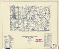
- Subject:
- Topical Subject: Roads and Geographic Subject: Greene County (Ind.)
- Creator:
- Indiana. State Highway Commission (1919-1953)
- Publisher:
- Indiana. State Highway Commission (1919-1953)
- Date Created:
- 1953
- Identifier:
- VAC3073-M-00342
- Genre:
- Road maps
- Geographic Location:
- Coordinates: W0871400 W0864100 N0391000 N0385400
- Related URL:
- Catalog URL: www.iucat.iu.edu/catalog/5729005
- Abstract:
- blueline. "State roads revised to January 1, 1953." "Data obtained from State-wide Highway Planning Survey." Includes chart "Culture...
- Call Number:
- G4093.G7P2 1953 .I53
- Caption:
- Imprint: [Indianapolis?] : State Highway Commission of Indiana, 1949.
- Physical Description:
- Dimensions: 44 x 51 cm and Scale: Approximately 1:130,000
- Persistent URL:
- https://purl.dlib.indiana.edu/iudl/images/VAC3073/VAC3073-M-00342
-
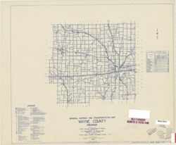
- Subject:
- Topical Subject: Roads and Geographic Subject: Wayne County (Ind.)
- Creator:
- Indiana. State Highway Commission (1919-1953)
- Publisher:
- State Highway Commission of Indiana
- Date Created:
- 1949
- Identifier:
- VAC3073-M-00322
- Genre:
- Road maps
- Geographic Location:
- Coordinates: W0851300 W0844900 N0400000 N0394300
- Related URL:
- Catalog URL: https://iucat.iu.edu/catalog/5742912
- Abstract:
- Blueline. "State roads revised to January 1, 1949." "1937." "89." "Data obtained from "State-wide Highway Planning Su...
- Call Number:
- G4093.W6 P2 1949 .I53
- Caption:
- Imprint: [Indianapolis?] : State Highway Commission of Indiana, [1949?]
- Physical Description:
- Scale: 1:130,000 and Dimensions: 44 x 52 cm
- Alternate Identifier:
- Title Control Number: a5742912
- Persistent URL:
- https://purl.dlib.indiana.edu/iudl/images/VAC3073/VAC3073-M-00322
-
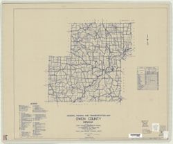
- Subject:
- Topical Subject: Roads and Geographic Subject: Owen County (Ind.)
- Creator:
- Indiana. State Highway Commission (1919-1953)
- Publisher:
- State Highway Commission of Indiana
- Date Created:
- 1949
- Identifier:
- VAC3073-M-00310
- Genre:
- Road maps
- Geographic Location:
- Coordinates: W0870300 W0863800 N0392800 N0391000
- Related URL:
- Catalog URL: https://iucat.iu.edu/catalog/5707900
- Abstract:
- Blueline. "State roads revised to January 1, 1949." "1937." "Data obtained from State-wide Highway Planning Survey." Includes l...
- Call Number:
- G4093.O8 P2 1949 .I53
- Caption:
- Imprint: [Indianapolis?] : State Highway Commission of Indiana, 1949.
- Physical Description:
- Dimensions: 44 x 52 cm and Scale: 1:130,000
- Alternate Identifier:
- Title Control Number: a5707900
- Persistent URL:
- https://purl.dlib.indiana.edu/iudl/images/VAC3073/VAC3073-M-00310
-
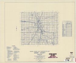
- Subject:
- Geographic Subject: Grant County (Ind.) and Topical Subject: Roads
- Creator:
- Indiana. State Highway Commission (1919-1953)
- Publisher:
- State Highway Commission of Indiana
- Date Created:
- 1949
- Identifier:
- VAC3073-M-00309
- Genre:
- Road maps
- Geographic Location:
- Coordinates: W0855200 W0852700 N0403900 N0402300
- Related URL:
- Catalog URL: https://iucat.iu.edu/catalog/5706036
- Abstract:
- Blueline. "State roads revised to January 1, 1949." "1937." "Data obtained from Statewide Highway Planning Survey." Includes lo...
- Call Number:
- G4093.G6P2 1949 .I53
- Caption:
- Imprint: [Indianapolis?] : State Highway Commission of Indiana, 1949.
- Physical Description:
- Scale: 1:130,000 and Dimensions: 44 x 52 cm
- Alternate Identifier:
- Title Control Number: a5706036
- Persistent URL:
- https://purl.dlib.indiana.edu/iudl/images/VAC3073/VAC3073-M-00309
-
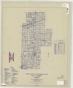
- Subject:
- Topical Subject: Roads and Geographic Subject: Clay County (Ind.)
- Creator:
- Indiana. State Highway Commission (1919-1953)
- Publisher:
- State Highway Commission of Indiana
- Date Created:
- 1949
- Identifier:
- VAC3073-M-00302
- Genre:
- Road maps
- Geographic Location:
- Coordinates: W0871400 W0865700 N0393700 N0391000
- Related URL:
- Catalog URL: https://iucat.iu.edu/catalog/5703366
- Abstract:
- Blueline. "State roads revised to January 1, 1949." "1937." "Data obtained from "Statewide Highway Planning Survey." Inclu...
- Call Number:
- G4093.C5P2 1949 .I53
- Caption:
- Imprint: [Indianapolis?] : State Highway Commission of Indiana, 1949.
- Physical Description:
- Scale: 1:130,000 and Dimensions: 52 x 44 cm
- Alternate Identifier:
- Title Control Number: a5703366
- Persistent URL:
- https://purl.dlib.indiana.edu/iudl/images/VAC3073/VAC3073-M-00302
-
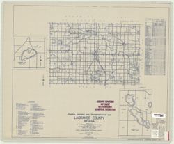
- Subject:
- Geographic Subject: LaGrange County (Ind.), Topical Subject: Roads, Geographic Subject: Big Long Lake (Ind.), Topical Subject: Lakes, Geographic Subject: Ada...
- Creator:
- Indiana. State Highway Commission (1919-1953)
- Publisher:
- State Highway Commission of Indiana
- Date Created:
- 1949
- Identifier:
- VAC3073-M-00298
- Genre:
- Road maps
- Geographic Location:
- Coordinates: W0853900 W0851200 N0414600 N0413200
- Related URL:
- Catalog URL: https://iucat.iu.edu/catalog/5706409
- Abstract:
- Blueline. "State roads revised to January 1, 1949." "1937." "Data obtained from State-wide Highway Planning Survey." Includes l...
- Call Number:
- G4093.L2 P2 1949 .I53
- Caption:
- Imprint: [Indianapolis?] : State Highway Commission of Indiana, 1949.
- Physical Description:
- Scale: 1:130,000 and Dimensions: 44 x 52 cm
- Alternate Identifier:
- Title Control Number: a5706409
- Persistent URL:
- https://purl.dlib.indiana.edu/iudl/images/VAC3073/VAC3073-M-00298
-
- Subject:
- Geographic Subject: Sylvan Lake (Ind.), Topical Subject: Roads, Topical Subject: Lakes, and Geographic Subject: Noble County (Ind.)
- Creator:
- Indiana. State Highway Commission (1919-1953)
- Publisher:
- State Highway Commission of Indiana
- Date Created:
- 1949
- Identifier:
- VAC3073-M-00264
- Genre:
- Road maps
- Geographic Location:
- Coordinates: W0853900 W0851200 N0413400 N0411600
- Related URL:
- Catalog URL: https://iucat.iu.edu/catalog/5707671
- Abstract:
- Blueline. "State roads revised to January 1, 1949." "1937." "Data obtained from State-wide Highway Planning Survey." Includes l...
- Call Number:
- G4093.N6 P2 1949 .I53
- Caption:
- Imprint: [Indianapolis?] : State Highway Commission of Indiana, 1949.
- Physical Description:
- Dimensions: 44 x 52 cm and Scale: 1:130,000
- Alternate Identifier:
- Title Control Number: a5707671
- Persistent URL:
- https://purl.dlib.indiana.edu/iudl/images/VAC3073/VAC3073-M-00264
-
- Subject:
- Geographic Subject: Wells County (Ind.) and Topical Subject: Roads
- Creator:
- Indiana. State Highway Commission (1919-1953)
- Publisher:
- State Highway Commission of Indiana
- Date Created:
- 1949
- Identifier:
- VAC3073-M-00263
- Genre:
- Road maps
- Geographic Location:
- Coordinates: W0852700 W0850400 N0405500 N0403400
- Related URL:
- Catalog URL: https://iucat.iu.edu/catalog/5742913
- Abstract:
- Blueline. "State roads revised to January 1, 1949." "1937." "90." "Data obtained from "State-wide Highway Planning Su...
- Call Number:
- G4093.W7 P2 1949 .I53
- Caption:
- Imprint: [Indianapolis] : State Highway Commission of Indiana, [1949?]
- Physical Description:
- Dimensions: 44 x 52 cm and Scale: 1:130,000
- Alternate Identifier:
- Title Control Number: a5742913
- Persistent URL:
- https://purl.dlib.indiana.edu/iudl/images/VAC3073/VAC3073-M-00263
-
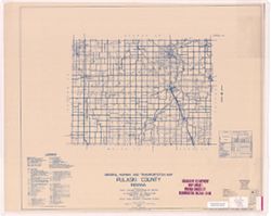
- Subject:
- Geographic Subject: Pulaski County (Ind.) and Topical Subject: Roads
- Creator:
- Indiana. State Highway Commission (1919-1953)
- Publisher:
- State Highway Commission of Indiana
- Date Created:
- 1949
- Identifier:
- VAC3073-M-00259
- Genre:
- Road maps
- Geographic Location:
- Coordinates: W0865600 W0862800 N0411000 N0405500
- Related URL:
- Catalog URL: https://iucat.iu.edu/catalog/5708400
- Abstract:
- Blueline. "State roads revised to January 1, 1949." "1937." "Data obtained from State-wide Highway Planning Survey." Includes l...
- Call Number:
- G4093.P7 P2 1949 .I53
- Caption:
- Imprint: [Indianapolis?] : State Highway Commission of Indiana, 1949.
- Physical Description:
- Dimensions: 44 x 52 cm and Scale: 1:130,000
- Alternate Identifier:
- Title Control Number: a5708400
- Persistent URL:
- https://purl.dlib.indiana.edu/iudl/images/VAC3073/VAC3073-M-00259
-
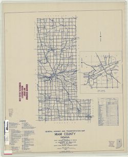
- Subject:
- Geographic Subject: Miami County (Ind.) and Topical Subject: Roads
- Creator:
- Indiana. State Highway Commission (1919-1953)
- Publisher:
- State Highway Commission of Indiana
- Date Created:
- 1949
- Identifier:
- VAC3073-M-00253
- Genre:
- Road maps
- Geographic Location:
- Coordinates: W0861000 W0855200 N0410000 N0402200
- Related URL:
- Catalog URL: https://iucat.iu.edu/catalog/5706943
- Abstract:
- Blueline. "State roads revised to January 1, 1949." "1937." "Data obtained from State-wide Highway Planning Survey." Includes l...
- Call Number:
- G4093.M6 P2 1949 .I53
- Caption:
- Imprint: [Indianapolis?] : State Highway Commission of Indiana, 1949.
- Physical Description:
- Scale: 1:130,000 and Dimensions: 52 x 44 cm
- Alternate Identifier:
- Title Control Number: a5706943
- Persistent URL:
- https://purl.dlib.indiana.edu/iudl/images/VAC3073/VAC3073-M-00253
-
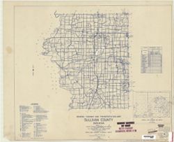
- Subject:
- Topical Subject: Roads and Geographic Subject: Sullivan County (Ind.)
- Creator:
- Indiana. State Highway Commission (1919-1953)
- Publisher:
- State Highway Commission of Indiana
- Date Created:
- 1949
- Identifier:
- VAC3073-M-00197
- Genre:
- Road maps
- Geographic Location:
- Coordinates: W0874000 W0871400 N0391600 N0385400
- Related URL:
- Catalog URL: https://iucat.iu.edu/catalog/5732959
- Abstract:
- Blueline. "State roads revised January 1, 1949." "1937." "77." "Data obtained from "State-wide Highway Planning Surve...
- Call Number:
- G4093.S8 P2 1949 .I53
- Caption:
- Imprint: [Indianapolis?] : State Highway Commission of Indiana, [1949?]
- Physical Description:
- Dimensions: 44 x 52 cm and Scale: 1:130,000
- Alternate Identifier:
- Title Control Number: a5732959
- Persistent URL:
- https://purl.dlib.indiana.edu/iudl/images/VAC3073/VAC3073-M-00197
-
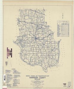
- Subject:
- Topical Subject: Roads and Geographic Subject: Harrison County (Ind.)
- Creator:
- Indiana. State Highway Commission (1919-1953)
- Publisher:
- State Highway Commission of Indiana
- Date Created:
- 1949
- Identifier:
- VAC3073-M-00181
- Genre:
- Road maps
- Geographic Location:
- Coordinates: W0862000 W0855400 N0382500 N0375700
- Related URL:
- Catalog URL: https://iucat.iu.edu/catalog/5732780
- Abstract:
- Blueline. "State roads revised to January 1, 1949." "Data obtained from State-wide Highway Planning Survey." Includes chart "Culture...
- Call Number:
- G4093.H4P2 1949 .I53
- Caption:
- Imprint: [Indianapolis?] : State Highway Commission of Indiana, 1949.
- Physical Description:
- Scale: 1:130,000 and Dimensions: 105 x 88 cm
- Alternate Identifier:
- Title Control Number: a5732780
- Persistent URL:
- https://purl.dlib.indiana.edu/iudl/images/VAC3073/VAC3073-M-00181
-
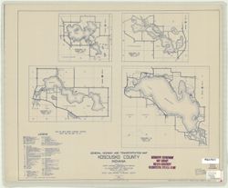
- Subject:
- Topical Subject: Roads and Geographic Subject: Kosciusko County (Ind.)
- Creator:
- Indiana. State Highway Commission (1919-1953)
- Publisher:
- State Highway Commission of Indiana
- Date Created:
- 1949
- Identifier:
- VAC3073-M-00156
- Genre:
- Road maps
- Geographic Location:
- Coordinates: W0860500 W0854000 N0412600 N0410300
- Related URL:
- Catalog URL: https://iucat.iu.edu/catalog/5742935
- Abstract:
- "State roads revised to January 1, 1949." "1937." "Data obtained from State-wide Highway Planning Survey. Includes location map and ...
- Call Number:
- G4093.K6 P2 1949 .I53 Suppl. Sheet
- Caption:
- Imprint: [Indianapolis?] : State Highway Commission of Indiana, 1949.
- Physical Description:
- Scale: 1:130,000 and Dimensions: 52 x 44 cm + supplementary sheet (4 maps on 1 sheet, sheet 44 x 52 cm)
- Alternate Identifier:
- Title Control Number: a5742935
- Persistent URL:
- https://purl.dlib.indiana.edu/iudl/images/VAC3073/VAC3073-M-00156
-
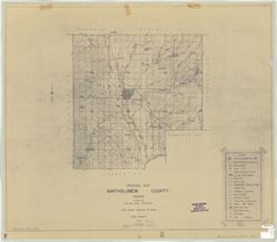
- Subject:
- Geographic Subject: Bartholomew County (Ind.) and Topical Subject: Drainage
- Creator:
- Indiana. State Highway Commission (1919-1953)
- Publisher:
- State Highway Commission of Indiana
- Date Created:
- 1937
- Identifier:
- VAC3073-M-00152
- Genre:
- Thematic maps
- Geographic Location:
- Coordinates: W0860500 W0854100 N0392100 N0390200
- Related URL:
- Catalog URL: https://iucat.iu.edu/catalog/6290879
- Abstract:
- Blueline. "Prepared under the supervision of: M. Parvis.
- Call Number:
- G4093.B3C3 1937 .I5
- Caption:
- Imprint: [West Lafayette, Ind.?]: Indiana State Highway Commission, 1947.
- Physical Description:
- Dimensions: 87 x 104 cm and Scale: 1:63,000
- Alternate Identifier:
- Title Control Number: a6290879
- Persistent URL:
- https://purl.dlib.indiana.edu/iudl/images/VAC3073/VAC3073-M-00152
-
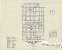
- Subject:
- Topical Subject: Roads and Geographic Subject: Wabash County (Ind.)
- Creator:
- Indiana. State Highway Commission (1919-1953)
- Publisher:
- State Highway Commission of Indiana
- Date Created:
- 1949
- Identifier:
- VAC3073-M-00150
- Genre:
- Road maps
- Geographic Location:
- Coordinates: W0855700 W0853800 N0410300 N0403900
- Related URL:
- Catalog URL: https://iucat.iu.edu/catalog/5741268
- Abstract:
- Blueline. "State roads revised to January 1, 1949." "1937." "85". "Data obtained from "State-wide Highway Planning Su...
- Call Number:
- G4093.W2 P2 1949 .I53
- Caption:
- Imprint: [Indianapolis?] : State Highway Commission of Indiana, [1949?]
- Physical Description:
- Dimensions: 44 x 52 cm and Scale: 1:130,000
- Alternate Identifier:
- Title Control Number: a5741268
- Persistent URL:
- https://purl.dlib.indiana.edu/iudl/images/VAC3073/VAC3073-M-00150
-
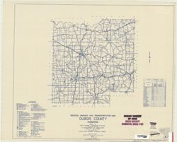
- Subject:
- Topical Subject: Roads and Geographic Subject: Dubois County (Ind.)
- Creator:
- Indiana. State Highway Commission (1919-1953)
- Publisher:
- State Highway Commission of Indiana
- Date Created:
- 1949
- Identifier:
- VAC3073-M-00142
- Genre:
- Road maps
- Geographic Location:
- Coordinates: W0870400 W0864100 N0383200 N0381200
- Related URL:
- Catalog URL: https://iucat.iu.edu/catalog/5704129
- Abstract:
- Blueline. "State roads revised to January 1, 1949." "1937." "Data obtained from Statewide Highway Planning Survey". Includes lo...
- Call Number:
- G4093.D8P2 1949 .I53
- Caption:
- Imprint: [Indianapolis?] : State Highway Commission of Indiana, 1949.
- Physical Description:
- Scale: 1:130,000 and Dimensions: 44 x 52 cm
- Alternate Identifier:
- Title Control Number: a5704129
- Persistent URL:
- https://purl.dlib.indiana.edu/iudl/images/VAC3073/VAC3073-M-00142
-
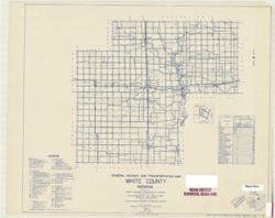
- Subject:
- Geographic Subject: White County (Ind.) and Topical Subject: Roads
- Creator:
- Indiana. State Highway Commission (1919-1953)
- Publisher:
- State Highway Commission of Indiana
- Date Created:
- 1949
- Identifier:
- VAC3073-M-00138
- Genre:
- Road maps
- Geographic Location:
- Coordinates: W0871600 W0863500 N0405500 N0403400
- Related URL:
- Catalog URL: https://iucat.iu.edu/catalog/5742915
- Abstract:
- Blueline. "State roads revised to January 1, 1949". "1937". "91". "Data obtained from "State-wide Highway Planning Su...
- Call Number:
- G4093.W8 P2 1949 .I53
- Caption:
- Imprint: [Indianapolis, IN:] State Highway Commission of Indiana. 1949.
- Physical Description:
- Dimensions: 44 x 52 cm and Scale: 1:130,000
- Alternate Identifier:
- Title Control Number: a5742915
- Persistent URL:
- https://purl.dlib.indiana.edu/iudl/images/VAC3073/VAC3073-M-00138
-
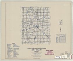
- Subject:
- Geographic Subject: Rush County (Ind.) and Topical Subject: Roads
- Creator:
- Indiana. State Highway Commission (1919-1953)
- Publisher:
- State Highway Commission of Indiana
- Date Created:
- 1949
- Identifier:
- VAC3073-M-00120
- Genre:
- Road maps
- Geographic Location:
- Coordinates: W0853800 W0851800 N0394700 N0392700
- Related URL:
- Catalog URL: https://iucat.iu.edu/catalog/5709025
- Abstract:
- Blueline. "State roads revised to January 1, 1949." "1937". "Data obtained from "Statewide Highway Planning Survey". Inclu...
- Call Number:
- G4093.R8 P2 1949 .I53
- Caption:
- Imprint: [Indianapolis?] : State Highway Commission of Indiana. 1949.
- Physical Description:
- Scale: 1:130,000 and Dimensions: 44 x 52 cm
- Alternate Identifier:
- Title Control Number: a5709025
- Persistent URL:
- https://purl.dlib.indiana.edu/iudl/images/VAC3073/VAC3073-M-00120
-
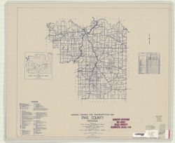
- Subject:
- Topical Subject: Roads and Geographic Subject: Pike County (Ind.)
- Creator:
- Indiana. State Highway Commission (1919-1953)
- Publisher:
- State Highway Commission of Indiana
- Date Created:
- 1949
- Identifier:
- VAC3073-M-00054
- Genre:
- Road maps
- Geographic Location:
- Coordinates: W0871827 W0870424 N0383044 N0381351
- Related URL:
- Catalog URL: https://iucat.iu.edu/catalog/5708211
- Abstract:
- Blueline. "State roads revised to January 1, 1949." "1937". "Data obtained from State-wide Highway Planning Survey". Includes...
- Call Number:
- G4093.P4 P2 1949 .I53
- Caption:
- Imprint: [Indianapolis, IN:] : State Highway Commission of Indiana, 1949.
- Physical Description:
- Dimensions: 44 x 52 cm and Scale: Approximately 1:130,000
- Alternate Identifier:
- Title Control Number: a5708211
- Persistent URL:
- https://purl.dlib.indiana.edu/iudl/images/VAC3073/VAC3073-M-00054
-
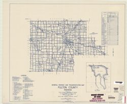
- Subject:
- Topical Subject: Roads, Geographic Subject: Lake Manitou (Ind.), Geographic Subject: Fulton County (Ind.), and Topical Subject: Lakes
- Creator:
- Indiana. State Highway Commission (1919-1953)
- Publisher:
- State Highway Commission of Indiana
- Date Created:
- 1949
- Identifier:
- VAC3073-M-00031
- Genre:
- Road maps
- Geographic Location:
- Coordinates: W0862800 W0855700 N0411000 N0405500
- Related URL:
- Catalog URL: https://iucat.iu.edu/catalog/5705922
- Abstract:
- Blueline. "State road revised to January 1, 1949." "Data obtained from Statewide Highway Planning Survey." Includes chart, "Culture ...
- Call Number:
- G4093.F8P2 1949 .I53
- Caption:
- Imprint: [Indianapolis, IN] : State Highway Commission of Indiana, 1949.
- Physical Description:
- Dimensions: 44 x 52 cm and Scale: 1:130,000
- Alternate Identifier:
- Title Control Number: a5705922
- Persistent URL:
- https://purl.dlib.indiana.edu/iudl/images/VAC3073/VAC3073-M-00031
-
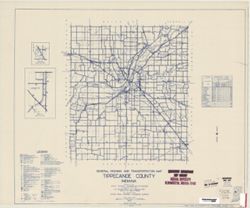
- Subject:
- Geographic Subject: Tippecanoe County (Ind.) and Topical Subject: Roads
- Creator:
- Indiana. State Highway Commission (1919-1953)
- Publisher:
- State Highway Commission of Indiana
- Date Created:
- 1949
- Identifier:
- VAC3073-M-00022
- Genre:
- Road maps
- Geographic Location:
- Coordinates: W0870600 W0864200 N0403400 N0401300
- Related URL:
- Catalog URL: https://iucat.iu.edu/catalog/5736302
- Abstract:
- Blueline. "State roads revised January 1, 1949." "1937" "79" "Data obtained from 'State-wide Highway Planning Survey&#...
- Call Number:
- G4093.T4 P2 1949 .I53
- Caption:
- Imprint: Indianapolis? : State Highway Commission of Indiana, 1949.
- Physical Description:
- Scale: 1:130,000 and Dimensions: 44 x 52 cm
- Alternate Identifier:
- Title Control Number: a5736302
- Persistent URL:
- https://purl.dlib.indiana.edu/iudl/images/VAC3073/VAC3073-M-00022
