
Search Constraints
You searched for:
Campus
IUB
Remove constraint Campus: IUB
Date Created
1941
Remove constraint Date Created: 1941
Holding Location
B-WELLS
Remove constraint Holding Location: B-WELLS
Pages
0-99 pages
Remove constraint Pages: 0-99 pages
« Previous |
1 - 100 of 1,083
|
Next »
Search Results
-
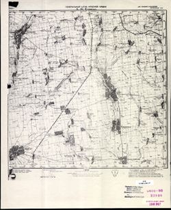
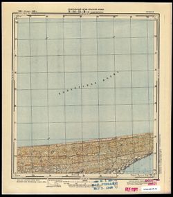
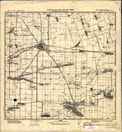
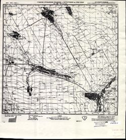
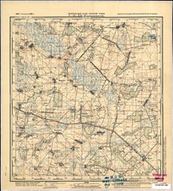
![Kentucky-Indiana Cannelton quadrangle [1941 reprint]](https://iiif.uits.iu.edu/iiif/2/8336j442q%2Ffiles%2F47a90ccc-f6f3-4558-aeaf-5356b28b815d/full/250,/0/default.jpg)
- Subject:
- Geographic Subject: Breckinridge County (Ky.) and Geographic Subject: Hancock County (Ind.)
- Creator:
- United States. Army. Corps of Engineers, Tull, L. E. (Lawrence Emerson), 1894-1987, Higginson, W. S. (William Smith Muir), 1894-1984, and Runyan, R. H.
- Publisher:
- Geological Survey (U.S.)
- Date Created:
- 1941
- Identifier:
- VAC3073-M-01326
- Genre:
- Quadrangle maps, Topographic maps, and 15 minute topographic maps
- Geographic Location:
- Coordinates: W0864500 W0863000 N0380000 N0374500
- Related URL:
- Catalog URL: https://iucat.iu.edu/catalog/18415999
- Abstract:
- Topography by R.H. Runyan, W.S. Higginson, and L.E. Tull , Ohio River by Corps of Engineers, U.S. Army. Polyconic projection. Relief shown by contours and sp...
- Call Number:
- G4090 s62 .G4 Cannelton 1934 rep1941
- Caption:
- Imprint: Washington, D.C. : Dept. of the Interior, U.S. Geological Survey, 1941
- Physical Description:
- Dimensions: 45 x 42 cm or smaller and Scale: 1:62,500
- Alternate Identifier:
- Title Control Number: a18415999
- Persistent URL:
- https://purl.dlib.indiana.edu/iudl/images/VAC3073/VAC3073-M-01326
- Provenance:
- Part of Geological Survey (U.S.). Indiana 1:62,500.
-
![Jackson County [Indiana] land use map [map] : preliminary](https://iiif.uits.iu.edu/iiif/2/b27750001%2Ffiles%2F79afb54a-ede0-4189-97ab-813c27a4f6d8/full/250,/0/default.jpg)
- Subject:
- Geographic Subject: Jackson County (Ind.) and Topical Subject: Land use
- Creator:
- Jackson County (Ind.). Land Use Planning Committee
- Publisher:
- Jackson County (Ind.). Land Use Planning Committee
- Date Created:
- 1941
- Identifier:
- VAC3073-M-00813
- Genre:
- Thematic maps
- Geographic Location:
- Coordinates: W0861905 W0854742 N0390416 N0384330
- Related URL:
- Catalog URL: https://iucat.iu.edu/catalog/4989649
- Abstract:
- Includes chart showing type of land use, acreage, and recommended use.
- Call Number:
- G4093.J2 G4 1941 .J33
- Caption:
- Imprint: [Brownstown, Ind.?] : The Committee, [between 1941-1946?]
- Physical Description:
- Dimensions: 21 x 24 cm, on sheet 39 x 28 cm and Scale: Scale not given.
- Alternate Identifier:
- Title Control Number: a4989649
- Persistent URL:
- https://purl.dlib.indiana.edu/iudl/images/VAC3073/VAC3073-M-00813
-
![Gibson County [Indiana] preliminary land use map](https://iiif.uits.iu.edu/iiif/2/f7624g240%2Ffiles%2F91ddcfae-bfc8-40ae-a801-4b23f126742f/full/250,/0/default.jpg)
- Subject:
- Topical Subject: Land use and Geographic Subject: Gibson County (Ind.)
- Creator:
- Gibson County (Ind.). Land Use Planning Committee
- Publisher:
- United States. Bureau of Agricultural Economics
- Date Created:
- 1941
- Identifier:
- VAC3073-M-00705
- Genre:
- Thematic maps
- Geographic Location:
- Coordinates: W0875917 W0871856 N0383200 N0380955
- Related URL:
- Catalog URL: https://iucat.iu.edu/catalog/5126313
- Abstract:
- "Color reproduction by Bureau of Agricultural Economics, U.S.D.A." "7-31-41". Includes chart showing type of land use, acreage, and recom...
- Call Number:
- G4093.G5G4 1941 .G53
- Caption:
- Imprint: [Washington, D.C.?] : U.S. Bureau of Agricultural Economics, [1941]
- Physical Description:
- Dimensions: 18 x 26 cm, on sheet 38 x 28 cm and Scale: Scale not given.
- Alternate Identifier:
- Title Control Number: a5126313
- Persistent URL:
- https://purl.dlib.indiana.edu/iudl/images/VAC3073/VAC3073-M-00705
-
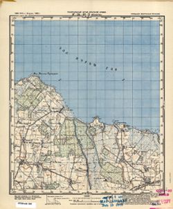
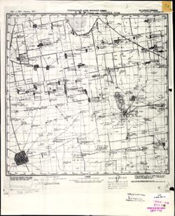
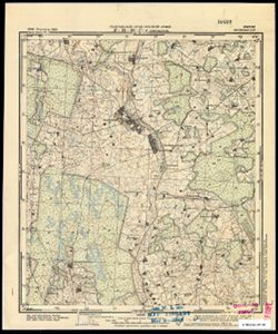
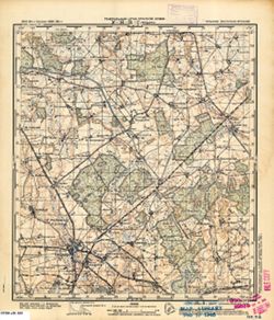
![Kentucky-Indiana Uniontown quadrangle [1941 reprint without vegetation]](https://iiif.uits.iu.edu/iiif/2/rx914s94d%2Ffiles%2Fb75fcf05-19c0-4df9-9bed-49261c5f07c0/full/250,/0/default.jpg)
- Subject:
- Geographic Subject: Henderson County (Ky.), Geographic Subject: Posey County (Ind.), and Geographic Subject: Union County (Ky.)
- Creator:
- Gehres, W. S. (Wilmer Sherman), 1887-1963, Goodlove, C. W., U.S. Coast and Geodetic Survey, Ellis, J. R. (Topographer), Geological Survey (U.S.), Herrington,...
- Publisher:
- Geological Survey (U.S.)
- Date Created:
- 1941
- Identifier:
- VAC3073-M-01403
- Genre:
- Quadrangle maps, Topographic maps, and 15 minute topographic maps
- Geographic Location:
- Coordinates: W0880000 W0874500 N0380000 N0374500
- Related URL:
- Catalog URL: https://iucat.iu.edu/catalog/18415442
- Abstract:
- R.B. Marshall, chief geographer , W.H. Herron, geographer in charge , topography by C.W. Goodlove, R.M. Herrington and W.S. Gehres , control by U.S. Coast an...
- Call Number:
- G4090 s62 .G4 Uniontown 1917 rep1941
- Caption:
- Imprint: [Washington, D.C.] : U.S. Geological Survey, 1941
- Physical Description:
- Dimensions: 45 x 42 cm or smaller and Scale: 1:62,500
- Alternate Identifier:
- Title Control Number: a18415442
- Persistent URL:
- https://purl.dlib.indiana.edu/iudl/images/VAC3073/VAC3073-M-01403
- Provenance:
- Part of Geological Survey (U.S.). Indiana 1:62,500.
-
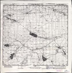
![Kentucky-Indiana Uniontown quadrangle [1941 reprint without vegetation]](https://iiif.uits.iu.edu/iiif/2/4m90fx89j%2Ffiles%2Fc2e137b5-4791-4eaa-a234-4e491cea321e/full/250,/0/default.jpg)
- Subject:
- Geographic Subject: Henderson County (Ky.), Geographic Subject: Posey County (Ind.), and Geographic Subject: Union County (Ky.)
- Creator:
- Kentucky Geological Survey, Marshall, R. B. (Robert Bradford), 1867-1949, Herrington, R. M. (Russell McKee), 1890-1977, U.S. Coast and Geodetic Survey, Hawki...
- Publisher:
- Geological Survey (U.S.)
- Date Created:
- 1941
- Identifier:
- VAC3073-M-01336
- Genre:
- Quadrangle maps, Topographic maps, and 15 minute topographic maps
- Geographic Location:
- Coordinates: W0880000 W0874500 N0380000 N0374500
- Related URL:
- Catalog URL: https://iucat.iu.edu/catalog/18415442
- Abstract:
- R.B. Marshall, chief geographer , W.H. Herron, geographer in charge , topography by C.W. Goodlove, R.M. Herrington and W.S. Gehres , control by U.S. Coast an...
- Call Number:
- G4090 s62 .G4 Uniontown 1917 rep 1941
- Caption:
- Imprint: [Washington, D.C.] : U.S. Geological Survey, 1941.
- Physical Description:
- Dimensions: 45 x 42 cm or smaller and Scale: 1:62,500
- Alternate Identifier:
- Title Control Number: a18415442
- Persistent URL:
- https://purl.dlib.indiana.edu/iudl/images/VAC3073/VAC3073-M-01336
- Provenance:
- Part of Geological Survey (U.S.). Indiana 1:62,500.
-
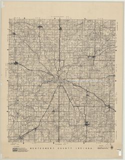
- Subject:
- Topical Subject: Landowners, Topical Subject: Real property, and Geographic Subject: Montgomery County (Ind.)
- Creator:
- Donica, Roy E.
- Publisher:
- Roy E. Donica and Karl M. Laurimore
- Date Created:
- 1941
- Identifier:
- VAC3073-M-00217
- Genre:
- Cadastral maps
- Geographic Location:
- Coordinates: W0870600 W0864200 N0401300 N0395200
- Related URL:
- Catalog URL: https://iucat.iu.edu/catalog/5383100
- Abstract:
- Cadastral map showing landowners. "1940-1941."
- Call Number:
- G4093.M8 G46 1941 .D66
- Caption:
- Imprint: [Crawfordsville, Ind.] : Roy E. Donica and Karl M. Laurimore, [1941].
- Physical Description:
- Dimensions: 125 x 125 cm and Scale: 1:31,680
- Alternate Identifier:
- Title Control Number: a5383100
- Persistent URL:
- https://purl.dlib.indiana.edu/iudl/images/VAC3073/VAC3073-M-00217
-
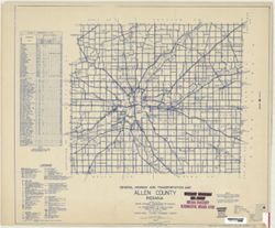
- Subject:
- Topical Subject: Roads and Geographic Subject: Adams County (Ind.)
- Creator:
- Indiana. State Highway Commission (1919-1953)
- Publisher:
- Indiana. State Highway Commission (1919-1953)
- Date Created:
- 1941
- Identifier:
- VAC3073-M-00767
- Genre:
- Road maps
- Geographic Location:
- Coordinates: W0850400 W0844800 N0405500 N0403400
- Related URL:
- Catalog URL: https://iucat.iu.edu/catalog/5726499
- Abstract:
- Blue line print. "Corrected to May 1, 1941." "Data obtained from State-wide Highway Planning Survey." Includes location map and charts &q...
- Call Number:
- G4093.A2P2 1949 .I53
- Caption:
- Imprint: [Indianapolis?] : The Commission, 1941.
- Physical Description:
- Scale: 1:63,360 and Dimensions: 89 x 104 cm
- Alternate Identifier:
- Title Control Number: a5359424
- Persistent URL:
- https://purl.dlib.indiana.edu/iudl/images/VAC3073/VAC3073-M-00767
-
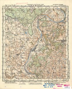
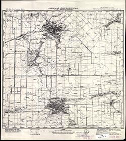
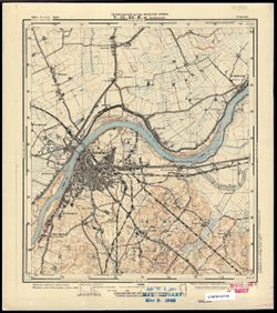
![Kentucky-Indiana Prospect quadrangle [1941 reprint]](https://iiif.uits.iu.edu/iiif/2/n583zx80k%2Ffiles%2F0de7baa2-b556-4bc2-a198-4e9c9c77a358/full/250,/0/default.jpg)
- Subject:
- Geographic Subject: Oldham County (Ky.) and Geographic Subject: Jefferson County (Ky.)
- Creator:
- Smith, L. Scott, Ellis, J. R. (Topographer), Cooke, Chas. E. (Charles E.), Kentucky Geological Survey, Marshall, R. B. (Robert Bradford), 1867-1949, Herron, ...
- Publisher:
- Geological Survey (U.S.)
- Date Created:
- 1941
- Identifier:
- VAC3073-M-01389
- Genre:
- Topographic maps, Quadrangle maps, and 15 minute topographic maps
- Geographic Location:
- Coordinates: W0854500 W0853000 N0383000 N0381500
- Related URL:
- Catalog URL: https://iucat.iu.edu/catalog/18413939
- Abstract:
- R.B. Marshall, chief geographer , W.H. Herron, geographer in charge , topography by Chas. E. Cooke and L. Scott Smith , control by J.R. Ellis, C.H. Semper, a...
- Call Number:
- G4090 s62 .G4 Prospect 1912 rep1941
- Caption:
- Imprint: [Washington, D.C.] : U.S. Geological Survey, 1941
- Physical Description:
- Scale: 1:62,500 and Dimensions: 45 x 42 cm or smaller
- Alternate Identifier:
- Title Control Number: a18413939
- Persistent URL:
- https://purl.dlib.indiana.edu/iudl/images/VAC3073/VAC3073-M-01389
- Provenance:
- Part of Geological Survey (U.S.). Indiana 1:62,500.
-
![Bartholomew County [Indiana] preliminary land use map](https://iiif.uits.iu.edu/iiif/2/05742t46j%2Ffiles%2Fd91da533-b380-4311-a36b-84729f4dd8f8/full/250,/0/default.jpg)
- Subject:
- Topical Subject: Land use and Geographic Subject: Bartholomew County (Ind.)
- Creator:
- Bartholomew County (Ind.). Land Use Planning Committee
- Publisher:
- Bartholomew County (Ind.). Land Use Planning Committee
- Date Created:
- 1941
- Identifier:
- VAC3073-M-00100
- Genre:
- Maps
- Geographic Location:
- Coordinates: W0860009 W0854554 N0391818 N0390254
- Related URL:
- Catalog URL: https://iucat.iu.edu/catalog/4989660
- Abstract:
- Includes chart showing type of land use, acreage, and recommended use.
- Call Number:
- G4093.B3G4 1941 .B37
- Caption:
- Imprint: [Columbus, Ind.?] : The Committee, [between 1941-1946?]
- Physical Description:
- Scale: Scale not given. and Dimensions: 20 x 21 cm, on sheet 39 x 28 cm
- Alternate Identifier:
- Title Control Number: a4989660
- Persistent URL:
- https://purl.dlib.indiana.edu/iudl/images/VAC3073/VAC3073-M-00100
-
![Lawrence County [Indiana] land use map : preliminary](https://iiif.uits.iu.edu/iiif/2/3f4638283%2Ffiles%2F6794596b-a04d-4274-a4e6-028f8527881c/full/250,/0/default.jpg)
- Subject:
- Geographic Subject: Lawrence County (Ind.) and Topical Subject: Land use
- Creator:
- Lawrence County (Ind.). Land Use Planning Committee
- Publisher:
- Lawrence County (Ind.). Land Use Planning Committee
- Date Created:
- 1941
- Identifier:
- VAC3073-M-00787
- Genre:
- Thematic maps
- Geographic Location:
- Coordinates: W0864102 W0861631 N0385932 N0384111
- Related URL:
- Catalog URL: https://iucat.iu.edu/catalog/4989673
- Abstract:
- Includes chart, with some figures corrected by hand, showing type of land use, acreage, and recommended use.
- Call Number:
- G4093 .L5 G4 1941 .L39
- Caption:
- Imprint: [Bedford, Ind.?] : The Committee, [between 1941-1946?]
- Physical Description:
- Scale: Scale not given. and Dimensions: 23 x 23 cm, on sheet 39 x 28 cm
- Alternate Identifier:
- Title Control Number: a4989673
- Persistent URL:
- https://purl.dlib.indiana.edu/iudl/images/VAC3073/VAC3073-M-00787
-
- Subject:
- Geographic Subject: Indiana and Topical Subject: Administrative and political divisions
- Creator:
- United States. Bureau of the Census
- Publisher:
- United States. Government Printing Office
- Date Created:
- 1941
- Identifier:
- VAC3073-M-00814
- Genre:
- Thematic maps
- Geographic Location:
- Coordinates: W0880700 W0844500 N0414500 N0375200
- Related URL:
- Catalog URL: https://iucat.iu.edu/catalog/2252913
- Abstract:
- "Geo. M-12-40."
- Call Number:
- G4091 .F7 1940 .U5
- Caption:
- Imprint: Washington, D.C. : U.S.G.P.O., 1940.
- Physical Description:
- Dimensions: 94 x 61 cm and Scale: 1:500,000
- Alternate Identifier:
- Title Control Number: BGX8682BB
- Persistent URL:
- https://purl.dlib.indiana.edu/iudl/images/VAC3073/VAC3073-M-00814
-

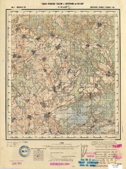
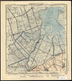
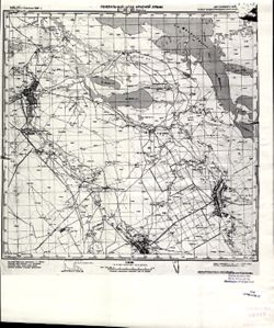
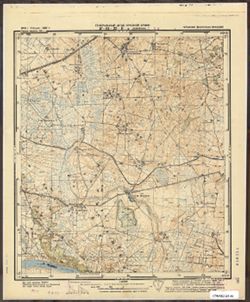
- Description:
- 1926
- Subject:
- Geographic Subject: Balky, Topical Subject: Soviet Union, and Topical Subject: Maps
- Publisher:
- Генеральный штаб Красной Армии
- Language:
- Russian
- Date Created:
- 1941
- Identifier:
- VAC9619-001868
- Genre:
- Topographic Maps and Military Maps
- Geographic Location:
- Coordinates: 47.3333, 34.5, 47.6667, 35
- Related URL:
- Catalog URL: https://iucat.iu.edu/catalog/5020129 and Download GeoTIFF: https://drive.google.com/open?id=1V7PHm7Dg5ABV8yybrFeMKAmxM9f2EO27
- Abstract:
- Modern area represented: Balky, Zaporizhia oblast, Ukraine
- Call Number:
- G7000 s100 .S7 sheet L-36-22
- Caption:
- Для служебного пользования
- City:
- Балки (Balky)
- Copyright Holder:
- No Copyright - United States
- Country:
- СССР (USSR)
- State/Province:
- Украинская ССР (Ukrainian Soviet Socialist Republic)
- Physical Description:
- Scale: 1:100,000
- Persistent URL:
- http://purl.dlib.indiana.edu/iudl/images/VAC9619/VAC9619-001868
- Provenance:
- CIA Map Library
-
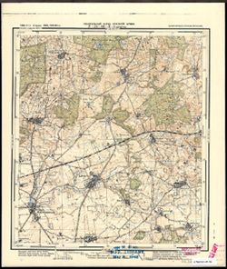
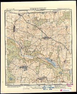
- Subject:
- Topical Subject: Soviet Union, Geographic Subject: Iskrovo, and Topical Subject: Maps
- Publisher:
- Генеральный штаб Красной Армии
- Language:
- Russian
- Date Created:
- 1941
- Identifier:
- VAC9619-003679
- Genre:
- Military Maps and Topographic Maps
- Geographic Location:
- Coordinates: 54.75, 21.375, 54.833, 21.5
- Related URL:
- Download GeoTIFF: https://drive.google.com/file/d/1yu7MH4jFLldg0pLFCOFpgBlt6_SbUA89/view?usp=sharing and Catalog URL: https://iucat.iu.edu/catalog/14701157
- Abstract:
- Modern area represented: part of Искрово (Iskrovo), Kaliningradskaya oblast, Russia
- Call Number:
- G7063.K2 s25 .S6 sheet N-34-43-D-b
- City:
- Паннауген
- Copyright Holder:
- No Copyright - United States
- Country:
- Германия (Восточная Пруссия) (Germany (East Prussia))
- Physical Description:
- Scale: 1:25,000
- Persistent URL:
- http://purl.dlib.indiana.edu/iudl/images/VAC9619/VAC9619-003679
- Provenance:
- CIA Map Branch -- Received
-
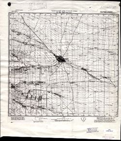
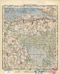
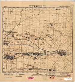
- Description:
- 1939
- Subject:
- Geographic Subject: Lushchikovo, Topical Subject: Soviet Union, and Topical Subject: Maps
- Publisher:
- Главное Управление Геодезии и Картографии при СНК СССР
- Language:
- Russian
- Date Created:
- 1941
- Identifier:
- VAC9619-001316
- Genre:
- Topographic Maps and Military Maps
- Geographic Location:
- Coordinates: 54.667, 33.5, 54.833, 33.75
- Related URL:
- Download GeoTIFF: https://drive.google.com/open?id=1QqwkbeqMxBP_h4g_YQjctsz1Sdi9nkJC and Catalog URL: http://iucat.iu.edu/catalog/5020131
- Abstract:
- Modern area represented: Lushchikovo, Smolensk oblast, Russia
- Call Number:
- GM G7000 S50 .S68 N-36-44-C
- Copyright Holder:
- No Copyright - United States
- Country:
- СССР (USSR)
- State/Province:
- РСФСР (RSFSR) and Смоленская область (Smolensk oblast)
- Physical Description:
- Scale: 1:50,000
- Persistent URL:
- http://purl.dlib.indiana.edu/iudl/images/VAC9619/VAC9619-001316
- Provenance:
- M. I. Map Library, G000-30, CIA Map Library
-
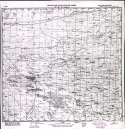
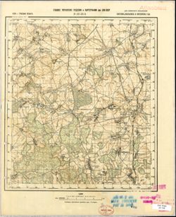
- Subject:
- Geographic Subject: Stegny, Topical Subject: Maps, and Topical Subject: Soviet Union
- Publisher:
- Генеральный штаб Красной Армии
- Language:
- Russian
- Date Created:
- 1941
- Identifier:
- VAC9619-003793
- Genre:
- Topographic Maps and Military Maps
- Geographic Location:
- Coordinates: 54.083333, 19.625, 54.166667, 19.75
- Related URL:
- Download GeoTIFF: https://drive.google.com/file/d/1RvAAMN_3Z1vv9PGObRxAZWE0wnLCm1EO/view?usp=sharing and Catalog URL: https://iucat.iu.edu/catalog/14701157
- Abstract:
- Modern area represented: Stegny, Poland
- Call Number:
- G7063.K2 s25 .S6 sheet N-34-31-C-b
- City:
- Штееген (Steegen)
- Copyright Holder:
- No Copyright - United States
- Country:
- Германия (Восточная Пруссия) (Germany (East Prussia))
- Physical Description:
- Scale: 1:25,000
- Persistent URL:
- http://purl.dlib.indiana.edu/iudl/images/VAC9619/VAC9619-003793
- Provenance:
- M. I. Map Library
-
- Description:
- 1923
- Subject:
- Topical Subject: Maps, Geographic Subject: Sablinskoye, and Topical Subject: Soviet Union
- Publisher:
- Генеральный штаб Красной Армии
- Language:
- Russian
- Date Created:
- 1941
- Identifier:
- VAC9619-002211
- Genre:
- Military Maps and Topographic Maps
- Geographic Location:
- Coordinates: 44.3333, 43, 44.6667, 43.5
- Related URL:
- Download GeoTIFF: https://drive.google.com/file/d/1XKS7KWbAoJw_Y2_4sVaI_8kbt1mQSdlP/view?usp=sharing and Catalog URL: https://iucat.iu.edu/catalog/5020129
- Abstract:
- Modern area represented: Sablinskoye, Stavropol kray, Russia
- Call Number:
- G7000 s100 .S7 sheet L-38-123
- Caption:
- Для служебного пользования
- City:
- Саблинское (Sablinskoye)
- Copyright Holder:
- No Copyright - United States
- Country:
- СССР (USSR)
- State/Province:
- Орджоникидзевский край (Ordzhonikidze kray) and РСФСР (RSFSR)
- Physical Description:
- Scale: 1:100,000
- Persistent URL:
- http://purl.dlib.indiana.edu/iudl/images/VAC9619/VAC9619-002211
- Provenance:
- CIA Map Library, Heeresplankammer Gruppe Archive Auslandskartenarchiv
-
- Description:
- 1940
- Subject:
- Geographic Subject: Lineynoye, Topical Subject: Maps, and Topical Subject: Soviet Union
- Publisher:
- Генеральный штаб Красной Армии
- Language:
- Russian
- Date Created:
- 1941
- Identifier:
- VAC9619-002072
- Genre:
- Military Maps and Topographic Maps
- Geographic Location:
- Coordinates: 46, 47, 46.3333, 47.5
- Related URL:
- Catalog URL: https://iucat.iu.edu/catalog/5020129 and Download GeoTIFF: https://drive.google.com/open?id=1MibNB9hpyceu8pM7sN1fkg1uvRwQitcf
- Abstract:
- Modern area represented: Lineynoye, Astrakhan oblast, Russia
- Call Number:
- G7000 s100 .S7 sheet L-38-71
- Caption:
- Для служебного пользования
- City:
- Линейное (Lineynoye)
- Copyright Holder:
- No Copyright - United States
- Country:
- СССР (USSR)
- State/Province:
- Калмыцкая АССР (Kalmyk Autonomous Soviet Socialist Republic), РСФСР (RSFSR), and Сталинградская область (Stalingrad oblast)
- Physical Description:
- Scale: 1:100,000
- Persistent URL:
- http://purl.dlib.indiana.edu/iudl/images/VAC9619/VAC9619-002072
- Provenance:
- CIA Map Library
-
- Description:
- 1930
- Subject:
- Topical Subject: Maps, Geographic Subject: Novyy Buh, and Topical Subject: Soviet Union
- Publisher:
- Генеральный штаб Красной Армии
- Language:
- Russian
- Date Created:
- 1941
- Identifier:
- VAC9619-001863
- Genre:
- Military Maps and Topographic Maps
- Geographic Location:
- Coordinates: 47.6667, 32.5, 48, 33
- Related URL:
- Download GeoTIFF: https://drive.google.com/open?id=1T0wPHo0RpDwORrKZXGfpt1IyrZgBA6b4 and Catalog URL: https://iucat.iu.edu/catalog/5020129
- Abstract:
- Modern area represented: Novyy Buh, Mykolaiv, Ukraine
- Call Number:
- G7000 s100 .S7 sheet L-36-6
- Caption:
- Для служебного пользования
- City:
- Новый Буг (Novyy Buh)
- Copyright Holder:
- No Copyright - United States
- Country:
- СССР (USSR)
- State/Province:
- Украинская ССР (Ukrainian Soviet Socialist Republic)
- Physical Description:
- Scale: 1:100,000
- Persistent URL:
- http://purl.dlib.indiana.edu/iudl/images/VAC9619/VAC9619-001863
- Provenance:
- CIA Map Library
-
- Description:
- 1939
- Subject:
- Geographic Subject: Il’yushino, Topical Subject: Maps, and Topical Subject: Soviet Union
- Publisher:
- Главное управление геодезии и картографии при СНК СССР
- Language:
- Russian
- Date Created:
- 1941
- Identifier:
- VAC9619-003468
- Genre:
- Military Maps and Topographic Maps
- Geographic Location:
- Coordinates: 56.333, 32.5, 56.5, 32.75
- Related URL:
- Catalog URL: http://iucat.iu.edu/catalog/5020131 and Download GeoTIFF: https://drive.google.com/file/d/1gFCKXL3LEEV_HoW5baG2udOZMvB2T_-c/view?usp=sharing
- Abstract:
- Modern area represented: Ильюшино (Il’yushino), Tverskaya oblast, Russia
- Call Number:
- G7000 s50 .S68 sheet O-36-126-C
- City:
- Ильюшино (Il’yushino)
- Copyright Holder:
- No Copyright - United States
- Country:
- СССР (USSR)
- State/Province:
- Нелидовский район (Nelidovsky district), Калининская область (Kalinin oblast), and Ленинский район (Leninsky district)
- Physical Description:
- Scale: 1:50,000
- Persistent URL:
- http://purl.dlib.indiana.edu/iudl/images/VAC9619/VAC9619-003468
- Provenance:
- M. I. Map Library, Library of Congress Geography & Map Division
-
- Subject:
- Geographic Subject: Darsūniškis, Topical Subject: Soviet Union, and Topical Subject: Maps
- Publisher:
- Генеральный штаб Красной Армии
- Language:
- Russian
- Date Created:
- 1941
- Identifier:
- VAC9619-000522
- Genre:
- Military Maps and Topographic Maps
- Geographic Location:
- Coordinates: 54.6667, 24, 54.8333, 24.25
- Related URL:
- Catalog URL: http://iucat.iu.edu/catalog/5020131 and Download GeoTIFF: https://drive.google.com/open?id=1J1xb-H1oQhiom6Du9L0ftYYMyrI-1Img
- Abstract:
- Modern area represented: Darsūniškis, Lithuania
- Call Number:
- G7000 s50 .S68 sheet N-35-37-C
- Caption:
- Для служебного пользования
- City:
- Дорсунишки (Dorsunishki)
- Copyright Holder:
- No Copyright - United States
- Country:
- СССР (USSR)
- State/Province:
- Литовская ССР (Lithuanian Soviet Socialist Republic)
- Physical Description:
- Scale: 1:50,000
- Persistent URL:
- http://purl.dlib.indiana.edu/iudl/images/VAC9619/VAC9619-000522
- Provenance:
- M. I. Map Library
-
- Subject:
- Topical Subject: Maps, Topical Subject: Soviet Union, and Geographic Subject: Przebrno
- Publisher:
- Генеральный штаб Красной Армии
- Language:
- Russian
- Date Created:
- 1941
- Identifier:
- VAC9619-003726
- Genre:
- Military Maps and Topographic Maps
- Geographic Location:
- Coordinates: 54.333, 19.25, 54.417, 19.375
- Related URL:
- Download GeoTIFF: https://drive.google.com/file/d/1CLV6-QjLkr3uyiNtmTa1PIy0iQBKYM80/view?usp=sharing and Catalog URL: https://iucat.iu.edu/catalog/14701157
- Abstract:
- Modern area represented: Przebrno, part of the town of Krynica Morska, Poland
- Call Number:
- G7063.K2 s25 .S6 sheet N-34-51-D-c
- City:
- Преббернау (Pröbbernau)
- Copyright Holder:
- No Copyright - United States
- Country:
- Германия (Germany)
- Physical Description:
- Scale: 1:25,000
- Persistent URL:
- http://purl.dlib.indiana.edu/iudl/images/VAC9619/VAC9619-003726
- Provenance:
- M. I. Map Library
-
- Subject:
- Geographic Subject: Kąty Rybackie, Topical Subject: Soviet Union, and Topical Subject: Maps
- Publisher:
- Генеральный штаб Красной Армии
- Language:
- Russian
- Date Created:
- 1941
- Identifier:
- VAC9619-003725
- Genre:
- Topographic Maps and Military Maps
- Geographic Location:
- Coordinates: 54.333, 19.125, 54.417, 19.25
- Related URL:
- Download GeoTIFF: https://drive.google.com/file/d/1nthUYSIAKdjoclMMA8ArWuM2ha_r6Ch6/view?usp=sharing and Catalog URL: https://iucat.iu.edu/catalog/14701157
- Abstract:
- Modern area represented: Kąty Rybackie, Poland
- Call Number:
- G7063.K2 s25 .S6 sheet N-34-51-C-d
- City:
- Боденвинкель (Bodenwinkel)
- Copyright Holder:
- No Copyright - United States
- Country:
- Германия (Germany)
- Physical Description:
- Scale: 1:25,000
- Persistent URL:
- http://purl.dlib.indiana.edu/iudl/images/VAC9619/VAC9619-003725
- Provenance:
- M. I. Map Library
-

- Subject:
- Topical Subject: Soviet Union, Topical Subject: Maps, and Geographic Subject: Zapyškis
- Publisher:
- Генеральный штаб Красной Армии
- Language:
- Russian
- Date Created:
- 1941
- Identifier:
- VAC9619-003722
- Genre:
- Topographic Maps and Military Maps
- Geographic Location:
- Coordinates: 54.913, 23.625, 55, 23.75
- Related URL:
- Catalog URL: https://iucat.iu.edu/catalog/14701157 and Download GeoTIFF: https://drive.google.com/file/d/1PAMqLanXnzAq1f9dj7s_PUqP_lpBr_F1/view?usp=sharing
- Abstract:
- Modern area represented: Zapyškis, Lithuania
- Call Number:
- G7063.K2 s25 .S6 sheet N-34-48-A-b
- Caption:
- Секретно
- City:
- Сапежишки (Sapezhishki)
- Copyright Holder:
- No Copyright - United States
- Country:
- СССР (USSR)
- State/Province:
- Литовская ССР (Lithuanian Soviet Socialist Republic)
- Physical Description:
- Scale: 1:25,000
- Persistent URL:
- http://purl.dlib.indiana.edu/iudl/images/VAC9619/VAC9619-003722
- Provenance:
- M. I. Map Library, CIA Map Library
-
- Description:
- 1932
- Subject:
- Topical Subject: Soviet Union, Topical Subject: Maps, and Geographic Subject: Veselyy
- Publisher:
- Генеральный штаб Красной Армии
- Language:
- Russian
- Date Created:
- 1941
- Identifier:
- VAC9619-002288
- Genre:
- Topographic Maps and Military Maps
- Geographic Location:
- Coordinates: 47, 40.5, 47.3333, 41
- Related URL:
- Download GeoTIFF: https://drive.google.com/file/d/1x_6moHatJsnMhQhHzqjSPuO0h_az_FsS/view?usp=sharing and Catalog URL: https://iucat.iu.edu/catalog/5020129
- Abstract:
- Modern area represented: Veselyy, Russia
- Call Number:
- G7000 s100 .S7 sheet L-37-34
- Caption:
- Для служебного пользования
- City:
- Веселый (Veselyy)
- Copyright Holder:
- No Copyright - United States
- Country:
- СССР (USSR)
- State/Province:
- Ростовская область (Rostov oblast) and РСФСР (RSFSR)
- Physical Description:
- Scale: 1:100,000
- Persistent URL:
- http://purl.dlib.indiana.edu/iudl/images/VAC9619/VAC9619-002288
- Provenance:
- CIA Map Library
-
- Subject:
- Topical Subject: Soviet Union, Geographic Subject: Slavyanskoye, and Topical Subject: Maps
- Publisher:
- Генеральный штаб Красной Армии
- Language:
- Russian
- Date Created:
- 1941
- Identifier:
- VAC9619-000296
- Genre:
- Military Maps and Topographic Maps
- Geographic Location:
- Coordinates: 54.8333, 20.75, 55, 21
- Related URL:
- Download GeoTIFF: https://drive.google.com/open?id=1JpCxQGs-ku7_aKK9QJ-Yi8d6ojOEGJ1Z and Catalog URL: http://iucat.iu.edu/catalog/5020131
- Abstract:
- Modern area represented: Slavyanskoye, Kaliningrad oblast, Russia
- Call Number:
- G7000 s50 .S68 sheet N-34-42-B
- City:
- Прониттен (Pronitten)
- Copyright Holder:
- No Copyright - United States
- Country:
- Восточная Пруссия (East Prussia) and Германия (Germany)
- Physical Description:
- Scale: 1:50,000
- Persistent URL:
- http://purl.dlib.indiana.edu/iudl/images/VAC9619/VAC9619-000296
- Provenance:
- M. I. Map Library, G000-30, GS, RA
-
- Description:
- 1928
- Subject:
- Geographic Subject: Manychskoye, Topical Subject: Soviet Union, and Topical Subject: Maps
- Publisher:
- Генеральный штаб Красной Армии
- Language:
- Russian
- Date Created:
- 1941
- Identifier:
- VAC9619-002063
- Genre:
- Topographic Maps and Military Maps
- Geographic Location:
- Coordinates: 46, 43, 46.3333, 43.5
- Related URL:
- Download GeoTIFF: https://drive.google.com/open?id=1n-R1bSl6LZW_J3pMeBtQTM79GYtOIJNr and Catalog URL: https://iucat.iu.edu/catalog/5020129
- Abstract:
- Modern area represented: Manychskoye, Stavropol kray, Russia
- Call Number:
- G7000 s100 .S7 sheet L-38-63
- Caption:
- Для служебного пользования
- City:
- Киста (Kista)
- Copyright Holder:
- No Copyright - United States
- Country:
- СССР (USSR)
- State/Province:
- Орджоникидзевский край (Ordzhonikidze kray), Калмыцкая АССР (Kalmyk Autonomous Soviet Socialist Republic), РСФСР (RSFSR), and Ростовская область (Rostov oblast)
- Physical Description:
- Scale: 1:100,000
- Persistent URL:
- http://purl.dlib.indiana.edu/iudl/images/VAC9619/VAC9619-002063
- Provenance:
- CIA Map Library
-
- Subject:
- Topical Subject: Maps, Topical Subject: Soviet Union, and Geographic Subject: Muniškiai
- Publisher:
- Генеральный штаб Красной Армии
- Language:
- Russian
- Date Created:
- 1941
- Identifier:
- VAC9619-003634
- Genre:
- Military Maps and Topographic Maps
- Geographic Location:
- Coordinates: 55, 23.75, 55.083, 23.875
- Related URL:
- Download GeoTIFF: https://drive.google.com/file/d/1RSHjF8sA7nONXJFs4vMmAN6eP3uezOJd/view?usp=sharing and Catalog URL: https://iucat.iu.edu/catalog/14701157
- Abstract:
- Modern area represented: Muniškiai, Lithuania
- Call Number:
- G7063.K2 s25 .S6 sheet N-34-36-D-c
- Caption:
- Секретно
- City:
- Мунишканцы (Munishkantsy)
- Copyright Holder:
- No Copyright - United States
- Country:
- СССР (USSR)
- State/Province:
- Литовская ССР (Lithuanian Soviet Socialist Republic)
- Physical Description:
- Scale: 1:25,000
- Persistent URL:
- http://purl.dlib.indiana.edu/iudl/images/VAC9619/VAC9619-003634
- Provenance:
- M. I. Map Library
-
- Subject:
- Topical Subject: Soviet Union, Topical Subject: Maps, and Geographic Subject: Novaya Derevnya
- Publisher:
- Генеральный штаб Красной Армии
- Language:
- Russian
- Date Created:
- 1941
- Identifier:
- VAC9619-003678
- Genre:
- Military Maps and Topographic Maps
- Geographic Location:
- Coordinates: 54.75, 21.25, 54.833, 21.375
- Related URL:
- Catalog URL: https://iucat.iu.edu/catalog/14701157 and Download GeoTIFF: https://drive.google.com/file/d/1U7avOM14qw5dWSGMG3AEw1GOyD8z68Hk/view?usp=sharing
- Abstract:
- Modern area represented: part of Новая Деревня (Novaya Derevnya), Kaliningradskaya oblast, Russia
- Call Number:
- G7063.K2 s25 .S6 sheet N-34-43-D-а
- City:
- Альт Гертлаукен (Al’t Gertlauken)
- Copyright Holder:
- No Copyright - United States
- Country:
- Германия (Восточная Пруссия) (Germany (East Prussia))
- Physical Description:
- Scale: 1:25,000
- Persistent URL:
- http://purl.dlib.indiana.edu/iudl/images/VAC9619/VAC9619-003678
- Provenance:
- M. I. Map Library
-
- Subject:
- Topical Subject: Maps, Topical Subject: Soviet Union, and Geographic Subject: Yasnoye
- Publisher:
- Генеральный штаб Красной Армии
- Language:
- Russian
- Date Created:
- 1941
- Identifier:
- VAC9619-003603
- Genre:
- Topographic Maps and Military Maps
- Geographic Location:
- Coordinates: 55.167, 21.5, 55.25, 21.625
- Related URL:
- Download GeoTIFF: https://drive.google.com/file/d/1mN5NdriMOpVPw3f77-YKlWI7E37I_SUW/view?usp=sharing and Catalog URL: https://iucat.iu.edu/catalog/14701157
- Abstract:
- Modern area represented: Ясное (Yasnoye), Kaliningradskaya oblast, Russia
- Call Number:
- G7063.K2 s25 .S6 sheet N-34-32-A-c
- City:
- Каукемен (Kaukemen)
- Copyright Holder:
- No Copyright - United States
- Country:
- Германия (Восточная Пруссия) (Germany (East Prussia))
- Physical Description:
- Scale: 1:25,000
- Persistent URL:
- http://purl.dlib.indiana.edu/iudl/images/VAC9619/VAC9619-003603
- Provenance:
- M. I. Map Library
-
- Description:
- 1940
- Subject:
- Geographic Subject: Nezamayevskaya, Topical Subject: Soviet Union, and Topical Subject: Maps
- Publisher:
- Генеральный штаб Красной Армии
- Language:
- Russian
- Date Created:
- 1941
- Identifier:
- VAC9619-002331
- Genre:
- Military Maps and Topographic Maps
- Geographic Location:
- Coordinates: 46, 40, 46.3333, 40.5
- Related URL:
- Catalog URL: https://iucat.iu.edu/catalog/5020129 and Download GeoTIFF: https://drive.google.com/file/d/1KWYrAI3qHrR_O6WF5vmeSjmXKm7q3Sio/view?usp=sharing
- Abstract:
- Modern area represented: Nezamayevskaya, Russia
- Call Number:
- G7000 s100 .S7 sheet L-37-69
- Caption:
- Для служебного пользования
- City:
- Незамаевская (Nezamayevskaya)
- Copyright Holder:
- No Copyright - United States
- Country:
- СССР (USSR)
- State/Province:
- Ростовская область (Rostov oblast), РСФСР (RSFSR), and Краснодарский край (Krasnodar kray)
- Physical Description:
- Scale: 1:100,000
- Persistent URL:
- http://purl.dlib.indiana.edu/iudl/images/VAC9619/VAC9619-002331
- Provenance:
- CIA Map Library
-
- Description:
- 1925
- Subject:
- Topical Subject: Maps, Topical Subject: Soviet Union, and Geographic Subject: Yegorlykskaya
- Publisher:
- Генеральный штаб Красной Армии
- Language:
- Russian
- Date Created:
- 1941
- Identifier:
- VAC9619-002324
- Genre:
- Topographic Maps and Military Maps
- Geographic Location:
- Coordinates: 46.3333, 40.5, 46.6667, 41
- Related URL:
- Download GeoTIFF: https://drive.google.com/file/d/1Vno5pFrXmYsLk7cNSrTkoNPk8hjwCPIL/view?usp=sharing and Catalog URL: https://iucat.iu.edu/catalog/5020129
- Abstract:
- Modern area represented: Yegorlykskaya, Russia
- Call Number:
- G7000 s100 .S7 sheet L-37-58
- Caption:
- Для служебного пользования
- City:
- Егорлыкская (Yegorlykskaya)
- Copyright Holder:
- No Copyright - United States
- Country:
- СССР (USSR)
- State/Province:
- РСФСР (RSFSR) and Ростовская область (Rostov oblast)
- Physical Description:
- Scale: 1:100,000
- Persistent URL:
- http://purl.dlib.indiana.edu/iudl/images/VAC9619/VAC9619-002324
- Provenance:
- DMA Topographic Center, Library of Congress Geography & Map Division
-
- Subject:
- Geographic Subject: Galiny, Topical Subject: Soviet Union, and Topical Subject: Maps
- Publisher:
- Генеральный штаб Красной Армии
- Language:
- Russian
- Date Created:
- 1941
- Identifier:
- VAC9619-003814
- Genre:
- Military Maps and Topographic Maps
- Geographic Location:
- Coordinates: 54.083, 20.75, 54.1667, 20.875
- Related URL:
- Download GeoTIFF: https://drive.google.com/file/d/1uq3LcNUQMze4weSSvkbDPn_sSpKayldj/view?usp=sharing and Catalog URL: https://iucat.iu.edu/catalog/14701157
- Abstract:
- Modern area represented: Galiny, Poland
- Call Number:
- G7063.K2 s25 .S6 sheet N-34-66-D-а
- City:
- Галлинген (Gallingen)
- Copyright Holder:
- No Copyright - United States
- Country:
- Германия (Восточная Пруссия) (Germany (East Prussia))
- Physical Description:
- Scale: 1:25,000
- Persistent URL:
- http://purl.dlib.indiana.edu/iudl/images/VAC9619/VAC9619-003814
- Provenance:
- CIA Map Branch -- Received
-
- Subject:
- Topical Subject: Soviet Union, Geographic Subject: Wiatrowiec, and Topical Subject: Maps
- Publisher:
- Генеральный штаб Красной Армии
- Language:
- Russian
- Date Created:
- 1941
- Identifier:
- VAC9619-003809
- Genre:
- Topographic Maps and Military Maps
- Geographic Location:
- Coordinates: 54.167, 20.875, 54.25, 21
- Related URL:
- Download GeoTIFF: https://drive.google.com/file/d/1vOh3ptGYLgaG2TVRWOZ5aB1k8PU4GEkW/view?usp=sharing and Catalog URL: https://iucat.iu.edu/catalog/14701157
- Abstract:
- Modern area represented: Wiatrowiec, Poland
- Call Number:
- G7063.K2 s25 .S6 sheet N-34-66-B-d
- City:
- Вотеркайм (Wöterkeim)
- Copyright Holder:
- No Copyright - United States
- Country:
- Германия (Восточная Пруссия) (Germany (East Prussia))
- Physical Description:
- Scale: 1:25,000
- Persistent URL:
- http://purl.dlib.indiana.edu/iudl/images/VAC9619/VAC9619-003809
- Provenance:
- M. I. Map Library
-
- Description:
- 1921
- Subject:
- Topical Subject: Maps, Geographic Subject: Askania-Nova, and Topical Subject: Soviet Union
- Publisher:
- Генеральный штаб Красной Армии
- Language:
- Russian
- Date Created:
- 1941
- Identifier:
- VAC9619-001908
- Genre:
- Topographic Maps and Military Maps
- Geographic Location:
- Coordinates: 46.3333, 33.5, 46.6667, 34
- Related URL:
- Download GeoTIFF: https://drive.google.com/open?id=1X2zli5lz_FZwB19KYsJ72lmGfakR0GSR and Catalog URL: https://iucat.iu.edu/catalog/5020129
- Abstract:
- Modern area represented: Askania-Nova, Kherson oblast, Ukraine
- Call Number:
- G7000 s100 .S7 sheet L-36-56
- Caption:
- Для служебного пользования
- City:
- Аскания Нова (Askania-Nova)
- Copyright Holder:
- No Copyright - United States
- Country:
- СССР (USSR)
- State/Province:
- Запорожская область (Zaporizhia oblast), Украинская ССР (Ukrainian Soviet Socialist Republic), and Николаевская область (Mykolaiv oblast)
- Physical Description:
- Scale: 1:100,000
- Persistent URL:
- http://purl.dlib.indiana.edu/iudl/images/VAC9619/VAC9619-001908
- Provenance:
- CIA Map Library, Army Map Service Library
-
- Description:
- 1939
- Subject:
- Geographic Subject: Donetsk, Topical Subject: Soviet Union, Geographic Subject: Platonovka, and Topical Subject: Maps
- Publisher:
- Генеральный штаб Красной Армии
- Language:
- Russian
- Date Created:
- 1941
- Identifier:
- VAC9619-002002
- Genre:
- Topographic Maps and Military Maps
- Geographic Location:
- Coordinates: 47.3333, 37.5, 47.6667, 37.5
- Related URL:
- Catalog URL: https://iucat.iu.edu/catalog/5020129 and Download GeoTIFF: https://drive.google.com/open?id=1rcAVudLKQYH89ByRQ8FaN6st2evLxa46
- Abstract:
- Modern area represented: Платоновка (Platonovka), Donetsk, Ukraine
- Call Number:
- G7000 s100 .S7 sheet L-37-16
- Caption:
- Для cлужебного пользования
- City:
- Платоновка (Platonovka)
- Copyright Holder:
- No Copyright - United States
- Country:
- СССР (USSR)
- State/Province:
- Украинская ССР (Ukrainian Soviet Socialist Republic) and Сталинская область (Stalino oblast)
- Physical Description:
- Scale: 1:100,000
- Persistent URL:
- http://purl.dlib.indiana.edu/iudl/images/VAC9619/VAC9619-002002
- Provenance:
- Geographic Names Branch
-
- Subject:
- Geographic Subject: Zarechnoye, Topical Subject: Soviet Union, and Topical Subject: Maps
- Publisher:
- Генеральный штаб Красной Армии
- Language:
- Russian
- Date Created:
- 1941
- Identifier:
- VAC9619-003715
- Genre:
- Military Maps and Topographic Maps
- Geographic Location:
- Coordinates: 54.913, 22.5, 55, 22.625
- Related URL:
- Download GeoTIFF: https://drive.google.com/file/d/10eG9i42MpkClt--V5t-j-ytSukxmz6k4/view?usp=sharing and Catalog URL: https://iucat.iu.edu/catalog/14701157
- Abstract:
- Modern area represented: Заречное (Zarechnoye), Kaliningradskaya oblast, Russia
- Call Number:
- G7063.K2 s25 .S6 sheet N-34-46-A-а
- City:
- Тульпенингкен (Tulpeningen)
- Copyright Holder:
- No Copyright - United States
- Country:
- Германия (Восточная Пруссия) (Germany (East Prussia))
- Physical Description:
- Scale: 1:25,000
- Persistent URL:
- http://purl.dlib.indiana.edu/iudl/images/VAC9619/VAC9619-003715
- Provenance:
- M. I. Map Library
-
- Description:
- 1926
- Subject:
- Topical Subject: Maps, Geographic Subject: Salsk, and Topical Subject: Soviet Union
- Publisher:
- Генеральный штаб Красной Армии
- Language:
- Russian
- Date Created:
- 1941
- Identifier:
- VAC9619-002326
- Genre:
- Military Maps and Topographic Maps
- Geographic Location:
- Coordinates: 46.3333, 41.5, 46.6667, 42
- Related URL:
- Catalog URL: https://iucat.iu.edu/catalog/5020129 and Download GeoTIFF: https://drive.google.com/file/d/1PArZEQhSATe1EKVgUDFtZ3ICldn22WR5/view?usp=sharing
- Abstract:
- Modern area represented: Salsk, Russia
- Call Number:
- G7000 s100 .S7 sheet L-37-60
- Caption:
- Для служебного пользования
- City:
- Сальск (Salsk)
- Copyright Holder:
- No Copyright - United States
- Country:
- СССР (USSR)
- State/Province:
- Ростовская область (Rostov oblast) and РСФСР (RSFSR)
- Physical Description:
- Scale: 1:100,000
- Persistent URL:
- http://purl.dlib.indiana.edu/iudl/images/VAC9619/VAC9619-002326
- Provenance:
- CIA Map Library, Heeresplankammer Gruppe Archive Auslandskartenarchiv
-
- Description:
- 1928
- Subject:
- Geographic Subject: Kairy, Topical Subject: Maps, and Topical Subject: Soviet Union
- Publisher:
- Генеральный штаб Красной Армии
- Language:
- Russian
- Date Created:
- 1941
- Identifier:
- VAC9619-001889
- Genre:
- Topographic Maps and Military Maps
- Geographic Location:
- Coordinates: 46.6667, 33.5, 47, 34
- Related URL:
- Catalog URL: https://iucat.iu.edu/catalog/5020129 and Download GeoTIFF: https://drive.google.com/file/d/1osSsR-E4nP09v5-wiUbmEixGdIeS0X75/view?usp=sharing
- Abstract:
- Modern area represented: Kayiry, Kherson oblast, Ukraine
- Call Number:
- G7000 s100 .S7 sheet L-36-44
- Caption:
- Для служебного пользования
- City:
- Западные Каиры (Zapadnye Kairy)
- Copyright Holder:
- No Copyright - United States
- Country:
- СССР (USSR)
- State/Province:
- Николаевская область (Mykolaiv oblast) and Украинская ССР (Ukrainian Soviet Socialist Republic)
- Physical Description:
- Scale: 1:100,000
- Persistent URL:
- http://purl.dlib.indiana.edu/iudl/images/VAC9619/VAC9619-001889
- Provenance:
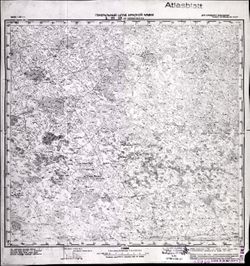
- CIA Map Library, Atlasblatt
-
- Subject:
- Geographic Subject: Wiśniewo, Topical Subject: Maps, and Topical Subject: Soviet Union
- Publisher:
- Генеральный штаб Красной Армии
- Language:
- Russian
- Date Created:
- 1941
- Identifier:
- VAC9619-003788
- Genre:
- Military Maps and Topographic Maps
- Geographic Location:
- Coordinates: 54, 19.375, 54.083, 19.5
- Related URL:
- Download GeoTIFF: https://drive.google.com/file/d/16NZ1NRScSw4F_OGCO8IPtf9cCXYXCzmN/view?usp=sharing and Catalog URL: https://iucat.iu.edu/catalog/14701157
- Abstract:
- Modern area represented: Wiśniewo, Poland
- Call Number:
- G7063.K2 s25 .S6 sheet N-34-63-D-d
- City:
- Аугуствальде (Augustwalde)
- Copyright Holder:
- No Copyright - United States
- Country:
- Германия (Восточная Пруссия) (Germany (East Prussia))
- Physical Description:
- Scale: 1:25,000
- Persistent URL:
- http://purl.dlib.indiana.edu/iudl/images/VAC9619/VAC9619-003788
- Provenance:
- CIA Map Branch -- Received
-
- Subject:
- Topical Subject: Soviet Union, Geographic Subject: Ozerki, and Topical Subject: Maps
- Publisher:
- Генеральный штаб Красной Армии
- Language:
- Russian
- Date Created:
- 1941
- Identifier:
- VAC9619-000331
- Genre:
- Military Maps and Topographic Maps
- Geographic Location:
- Coordinates: 54.5, 20.75, 54.6667, 21
- Related URL:
- Download GeoTIFF: https://drive.google.com/open?id=1gu-gk3Pnq4vtKj6SG7s0T3i7dK87sgqq and Catalog URL: http://iucat.iu.edu/catalog/5020131
- Abstract:
- Modern area represented: Ozerki, Kaliningrad oblast, Russia
- Call Number:
- G7000 s50 .S68 sheet N-34-54-B
- City:
- Гросс Линденау (Gross Lindenau)
- Copyright Holder:
- No Copyright - United States
- Country:
- Германия (Germany) and Восточная Пруссия (East Prussia)
- Physical Description:
- Scale: 1:50,000
- Persistent URL:
- http://purl.dlib.indiana.edu/iudl/images/VAC9619/VAC9619-000331
- Provenance:
- M. I. Map Library, Justus Perthes Kartensammlung, GS, RA, G000-30
-

- Description:
- 1896
- Subject:
- Topical Subject: Maps, Topical Subject: Soviet Union, and Geographic Subject: Sary-Bash
- Publisher:
- Генеральный штаб Красной Армии
- Language:
- Russian
- Date Created:
- 1941
- Identifier:
- VAC9619-001949
- Genre:
- Topographic Maps and Military Maps
- Geographic Location:
- Coordinates: 45.3333, 33.5, 45.6667, 34
- Related URL:
- Catalog URL: https://iucat.iu.edu/catalog/5020129 and Download GeoTIFF: https://drive.google.com/open?id=198a1c5n1y2mIiNpDyuHqRfuTZjmRL7j9
- Abstract:
- Modern area represented: Сары-Баш (Sary-Bash), Republic of Crimea, Ukraine
- Call Number:
- G7000 s100 .S7 sheet L-36-92
- Caption:
- Для cлужебного пользования
- City:
- Сары-Баш (Sary-Bash)
- Copyright Holder:
- No Copyright - United States
- Country:
- СССР (USSR)
- State/Province:
- РСФСР (RSFSR) and Крымская АССР (Crimean Autonomous Soviet Socialist Republic)
- Physical Description:
- Scale: 1:100,000
- Persistent URL:
- http://purl.dlib.indiana.edu/iudl/images/VAC9619/VAC9619-001949
- Provenance:
- CIA Map Library
-
- Description:
- 1892
- Subject:
- Geographic Subject: Lekėčiai, Topical Subject: Maps, and Topical Subject: Soviet Union
- Publisher:
- Генеральный штаб Красной Армии
- Language:
- Russian
- Date Created:
- 1941
- Identifier:
- VAC9619-000318
- Genre:
- Military Maps and Topographic Maps
- Geographic Location:
- Coordinates: 54.833, 23.25, 55, 23.5
- Related URL:
- Download GeoTIFF: https://drive.google.com/open?id=1uD2NV_CJJeCP6VSUswot-xA8Gb1MFvuq and Catalog URL: http://iucat.iu.edu/catalog/5020131
- Abstract:
- Modern area represented: Lekėčiai, Marijampolė county, Lithuania
- Call Number:
- G7000 s50 .S68 N-34-47-B
- Caption:
- Для служебного пользования
- City:
- Лекайце (Lekėčiai)
- Copyright Holder:
- No Copyright - United States
- Country:
- СССР (USSR)
- State/Province:
- Литовская ССР (Lithuanian Soviet Socialist Republic)
- Physical Description:
- Scale: 1:50,000
- Persistent URL:
- http://purl.dlib.indiana.edu/iudl/images/VAC9619/VAC9619-000318
- Provenance:
- CIA Map Branch -- Received, G000-30
-
- Description:
- 1933
- Subject:
- Geographic Subject: Hromivka, Topical Subject: Soviet Union, and Topical Subject: Maps
- Publisher:
- Генеральный штаб Красной Армии
- Language:
- Russian
- Date Created:
- 1941
- Identifier:
- VAC9619-001923
- Genre:
- Topographic Maps and Military Maps
- Geographic Location:
- Coordinates: 46, 34, 46.3333, 34.5
- Related URL:
- Download GeoTIFF: https://drive.google.com/open?id=1sOMPSRT5vHzGSJy5FqPqnkWmkwqYR5YH and Catalog URL: https://iucat.iu.edu/catalog/5020129
- Abstract:
- Modern area represented: Hromivka, Kherson oblast, Ukraine
- Call Number:
- G7000 s100 .S7 sheet L-36-69
- Caption:
- Для служебного пользования
- City:
- Громовка (Gromovka)
- Copyright Holder:
- No Copyright - United States
- Country:
- СССР (USSR)
- State/Province:
- Украинская ССР (Ukrainian Soviet Socialist Republic), Крымская АССР (Crimean Autonomous Soviet Socialist Republic), Запорожская область (Zaporizhia oblast), ...
- Physical Description:
- Scale: 1:100,000
- Persistent URL:
- http://purl.dlib.indiana.edu/iudl/images/VAC9619/VAC9619-001923
- Provenance:
- CIA Map Library
-
- Description:
- 1930
- Subject:
- Geographic Subject: Ipatovo, Topical Subject: Soviet Union, and Topical Subject: Maps
- Publisher:
- Главное управление геодезии и картографии при СНК СССР
- Language:
- Russian
- Date Created:
- 1941
- Identifier:
- VAC9619-002075
- Genre:
- Topographic Maps and Military Maps
- Geographic Location:
- Coordinates: 45.6667, 42.5, 46, 43
- Related URL:
- Download GeoTIFF: https://drive.google.com/open?id=1uYm7E4Ln86KvT-Fc9-5nOxrUsVGDIYGe and Catalog URL: https://iucat.iu.edu/catalog/5020129
- Abstract:
- Modern area represented: Ipatovo, Stavropol kray, Russia
- Call Number:
- G7000 s100 .S7 sheet L-38-74
- Caption:
- Для служебного пользования
- City:
- Ипатово (Ipatovo)
- Copyright Holder:
- No Copyright - United States
- Country:
- СССР (USSR)
- State/Province:
- Калмыцкая АССР (Kalmyk Autonomous Soviet Socialist Republic), РСФСР (RSFSR), and Орджоникидзевский край (Ordzhonikidze kray)
- Physical Description:
- Scale: 1:100,000
- Persistent URL:
- http://purl.dlib.indiana.edu/iudl/images/VAC9619/VAC9619-002075
- Provenance:
- CIA Map Library
-
- Subject:
- Topical Subject: Soviet Union, Topical Subject: Maps, and Geographic Subject: Didieji Ibėnai
- Publisher:
- Генеральный штаб Красной Армии
- Language:
- Russian
- Date Created:
- 1941
- Identifier:
- VAC9619-003635
- Genre:
- Military Maps and Topographic Maps
- Geographic Location:
- Coordinates: 55, 23.875, 55.083, 24
- Related URL:
- Catalog URL: https://iucat.iu.edu/catalog/14701157 and Download GeoTIFF: https://drive.google.com/file/d/1tupUHbpChdC5mnOsJmV22NSUxvuLLwGp/view?usp=sharing
- Abstract:
- Modern area represented: Didieji Ibėnai, Lithuania
- Call Number:
- G7063.K2 s25 .S6 sheet N-34-36-D-d
- Caption:
- Секретно
- City:
- Никольская (Nikol’skaya)
- Copyright Holder:
- No Copyright - United States
- Country:
- СССР (USSR)
- State/Province:
- Литовская ССР (Lithuanian Soviet Socialist Republic)
- Physical Description:
- Scale: 1:25,000
- Persistent URL:
- http://purl.dlib.indiana.edu/iudl/images/VAC9619/VAC9619-003635
- Provenance:
- M. I. Map Library
-
- Description:
- 1929
- Subject:
- Geographic Subject: Novopokrovskaya, Topical Subject: Soviet Union, and Topical Subject: Maps
- Publisher:
- Генеральный штаб Красной Армии
- Language:
- Russian
- Date Created:
- 1941
- Identifier:
- VAC9619-002341
- Genre:
- Topographic Maps and Military Maps
- Geographic Location:
- Coordinates: 45.667, 40.5, 46, 41
- Related URL:
- Download GeoTIFF: https://drive.google.com/file/d/19fDUMprNtMR3Orl_Toiy1MMll60YY-HW/view?usp=sharing and Catalog URL: https://iucat.iu.edu/catalog/5020129
- Abstract:
- Modern area represented: Novopokrovskaya, Krasnodar kray, Russia
- Call Number:
- G7000 s100 .S7 sheet L-37-82
- Caption:
- Для служебного пользования
- City:
- Ново-Покровская (Novo-Pokrovskaya)
- Copyright Holder:
- No Copyright - United States
- Country:
- СССР (USSR)
- State/Province:
- Орджоникидзевский край (Ordzhonikidze kray), Краснодарский край (Krasnodar kray), and РСФСР (RSFSR)
- Physical Description:
- Scale: 1:100,000
- Persistent URL:
- http://purl.dlib.indiana.edu/iudl/images/VAC9619/VAC9619-002341
- Provenance:
- CIA Map Library
-
- Subject:
- Topical Subject: Soviet Union, Geographic Subject: Kłębowo, and Topical Subject: Maps
- Publisher:
- Генеральный штаб Красной Армии
- Language:
- Russian
- Date Created:
- 1941
- Identifier:
- VAC9619-003812
- Genre:
- Topographic Maps and Military Maps
- Geographic Location:
- Coordinates: 54, 20.5, 54.083, 20.625
- Related URL:
- Download GeoTIFF: https://drive.google.com/file/d/1XgTFZHiM82btNnNy2kZm1YCq1_uyTWD2/view?usp=sharing and Catalog URL: https://iucat.iu.edu/catalog/14701157
- Abstract:
- Modern area represented: Kłębowo, Poland
- Call Number:
- G7063.K2 s25 .S6 sheet N-34-66-C-c
- City:
- Вернегиттен (Wernegitten)
- Copyright Holder:
- No Copyright - United States
- Country:
- Германия (Восточная Пруссия) (Germany (East Prussia))
- Physical Description:
- Scale: 1:25,000
- Persistent URL:
- http://purl.dlib.indiana.edu/iudl/images/VAC9619/VAC9619-003812
- Provenance:
- CIA Map Branch -- Received
-
- Description:
- 1925
- Subject:
- Topical Subject: Maps, Topical Subject: Soviet Union, and Geographic Subject: Yashalta
- Publisher:
- Генеральный штаб Красной Армии
- Language:
- Russian
- Date Created:
- 1941
- Identifier:
- VAC9619-002062
- Genre:
- Topographic Maps and Military Maps
- Geographic Location:
- Coordinates: 46, 42.5, 46.3333, 43
- Related URL:
- Download GeoTIFF: https://drive.google.com/open?id=13hdTwWFTIa4e_VQbXW0xtm2cwCRcE5or and Catalog URL: https://iucat.iu.edu/catalog/5020129
- Abstract:
- Modern area represented: Yashalta, Kalmykiya Republic, Russia
- Call Number:
- G7000 s100 .S7 sheet L-38-62
- Caption:
- Для служебного пользования
- City:
- Яшалта (Yashalta)
- Copyright Holder:
- No Copyright - United States
- Country:
- СССР (USSR)
- State/Province:
- РСФСР (RSFSR) and Орджоникидзевский край (Ordzhonikidze kray)
- Physical Description:
- Scale: 1:100,000
- Persistent URL:
- http://purl.dlib.indiana.edu/iudl/images/VAC9619/VAC9619-002062
- Provenance:
- CIA Map Library
-
- Subject:
- Topical Subject: Maps, Geographic Subject: Kėdainiai, and Topical Subject: Soviet Union
- Publisher:
- Генеральный штаб Красной Армии
- Language:
- Russian
- Date Created:
- 1941
- Identifier:
- VAC9619-000285
- Genre:
- Topographic Maps and Military Maps
- Geographic Location:
- Coordinates: 55.1667, 23.75, 55.3333, 24
- Related URL:
- Download GeoTIFF: https://drive.google.com/open?id=1uGlzXVd5V1MbMjl6rFakM6q19ovdnldY and Catalog URL: http://iucat.iu.edu/catalog/5020131
- Abstract:
- Modern area represented: Kėdainiai, Lithuania
- Call Number:
- G7000 s50 .S68 N-34-36-B
- Caption:
- Для служебного пользования
- City:
- Кедайняй (Kėdainiai)
- Copyright Holder:
- No Copyright - United States
- Country:
- СССР (USSR)
- State/Province:
- Литовская ССР (Lithuanian Soviet Socialist Republic)
- Physical Description:
- Scale: 1:50,000
- Persistent URL:
- http://purl.dlib.indiana.edu/iudl/images/VAC9619/VAC9619-000285
- Provenance:
- CIA Map Branch -- Received, G000-30, CIA Map Library
-
- Subject:
- Topical Subject: Maps, Geographic Subject: Warszawa, and Topical Subject: Soviet Union
- Publisher:
- Генеральный штаб Красной Армии
- Language:
- Russian
- Date Created:
- 1941
- Identifier:
- VAC9619-000325
- Genre:
- Military Maps and Topographic Maps
- Related URL:
- Catalog URL: http://iucat.iu.edu/catalog/5020131
- Abstract:
- Modern area represented: Warszawa, Poland
- Call Number:
- G7000 s50 .S68 sheet N-34-139-A
- City:
- Варшава (Warszawa)
- Copyright Holder:
- No Copyright - United States
- Country:
- Область государственных интересов Германии (Region of German state interest)
- Physical Description:
- Scale: 1:50,000
- Persistent URL:
- http://purl.dlib.indiana.edu/iudl/images/VAC9619/VAC9619-000325
- Provenance:
- CIA Map Library
-
- Description:
- 1936
- Subject:
- Topical Subject: Maps, Geographic Subject: Svetlograd, and Topical Subject: Soviet Union
- Publisher:
- Главное управление геодезии и картографии при СНК СССР
- Language:
- Russian
- Date Created:
- 1941
- Identifier:
- VAC9619-002169
- Genre:
- Military Maps and Topographic Maps
- Geographic Location:
- Coordinates: 45, 42.5, 45.33333, 43
- Related URL:
- Catalog URL: https://iucat.iu.edu/catalog/5020129 and Download GeoTIFF: https://drive.google.com/open?id=1uFPKdptgUTl0ZXnLCivKm0m4gwI7N7YD
- Abstract:
- Modern area represented: Svetlograd, Stavropol kray, Russia
- Call Number:
- G7000 s100 .S7 sheet L-38-98
- Caption:
- Для служебного пользования
- City:
- Петровское (Petrovskoye)
- Copyright Holder:
- No Copyright - United States
- Country:
- СССР (USSR)
- State/Province:
- Орджоникидзевский край (Ordzhonikidze kray) and РСФСР (RSFSR)
- Physical Description:
- Scale: 1:100,000
- Persistent URL:
- http://purl.dlib.indiana.edu/iudl/images/VAC9619/VAC9619-002169
- Provenance:
- CIA Map Library
-
- Subject:
- Topical Subject: Maps, Geographic Subject: Krzesk-Królowa Niwa, and Topical Subject: Soviet Union
- Publisher:
- Генеральный штаб Красной Армии
- Language:
- Russian
- Date Created:
- 1941
- Identifier:
- VAC9619-000384
- Genre:
- Military Maps and Topographic Maps
- Geographic Location:
- Coordinates: 52, 22.5, 52.1667, 22.75
- Related URL:
- Download GeoTIFF: https://drive.google.com/open?id=1KYJIh1i1xu4izSRnuaaX2KkyP1Uky8SL and Catalog URL: http://iucat.iu.edu/catalog/5020131
- Abstract:
- Modern area represented: Krzesk-Królowa Niwa, Poland
- Call Number:
- G7000 s50 .S68 sheet N-34-142-C
- City:
- Кшеск-Крулева Нива (Krzesk-Królowa Niwa)
- Copyright Holder:
- No Copyright - United States
- Country:
- Область государственных интересов Германии (Region of German state interest)
- Physical Description:
- Scale: 1:50,000
- Persistent URL:
- http://purl.dlib.indiana.edu/iudl/images/VAC9619/VAC9619-000384
- Provenance:
- M. I. Map Library, G000-30
-
- Subject:
- Geographic Subject: Zheleznodorozhnyy, Topical Subject: Maps, and Topical Subject: Soviet Union
- Publisher:
- Генеральный штаб Красной Армии
- Language:
- Russian
- Date Created:
- 1941
- Identifier:
- VAC9619-000341
- Genre:
- Topographic Maps and Military Maps
- Geographic Location:
- Coordinates: 54.33333, 21.25, 54.5, 21.5
- Related URL:
- Catalog URL: http://iucat.iu.edu/catalog/5020131 and Download GeoTIFF: https://drive.google.com/open?id=1LimnLvW5ElDVv2vPTyB4hYr0k2GCR5Fr
- Abstract:
- Modern area represented: Zheleznodorozhnyy, Kaliningrad oblast, Russia
- Call Number:
- zsheet N-34-55-D and G7000 s50 .S68
- City:
- Гердауен (Gerdauen)
- Copyright Holder:
- No Copyright - United States
- Country:
- Восточная Пруссия (East Prussia) and Германия (Germany)
- Physical Description:
- Scale: 1:50,000
- Persistent URL:
- http://purl.dlib.indiana.edu/iudl/images/VAC9619/VAC9619-000341
- Provenance:
- M. I. Map Library, Justus Perthes Kartensammlung, GS, RA, G000-30
-
- Description:
- 1927
- Subject:
- Geographic Subject: Kazgulak, Topical Subject: Maps, and Topical Subject: Soviet Union
- Publisher:
- Генеральный штаб Красной Армии
- Language:
- Russian
- Date Created:
- 1941
- Identifier:
- VAC9619-002162
- Genre:
- Military Maps and Topographic Maps
- Geographic Location:
- Coordinates: 45.3333, 43, 45.6667, 43.5
- Related URL:
- Catalog URL: https://iucat.iu.edu/catalog/5020129 and Download GeoTIFF: https://drive.google.com/file/d/1yZXGqBnQYcp1i3-Vmzd0UDBDT9RL_MRV/view?usp=sharing
- Abstract:
- Modern area represented: Kazgulak, Stavropol kray, Russia
- Call Number:
- G7000 s100 .S7 sheet L-38-87
- Caption:
- Для служебного пользования
- City:
- Казгулак (Kazgulak)
- Copyright Holder:
- No Copyright - United States
- Country:
- СССР (USSR)
- State/Province:
- РСФСР (RSFSR) and Орджоникидзевский край (Ordzhonikidze kray)
- Physical Description:
- Scale: 1:100,000
- Persistent URL:
- http://purl.dlib.indiana.edu/iudl/images/VAC9619/VAC9619-002162
- Provenance:
- CIA Map Library, Heeresplankammer Gruppe Archive Auslandskartenarchiv
-
- Subject:
- Geographic Subject: Malbork, Topical Subject: Maps, and Topical Subject: Soviet Union
- Publisher:
- Генеральный штаб Красной Армии
- Language:
- Russian
- Date Created:
- 1941
- Identifier:
- VAC9619-003786
- Genre:
- Military Maps and Topographic Maps
- Geographic Location:
- Coordinates: 54, 19, 54.083, 19.125
- Related URL:
- Download GeoTIFF: https://drive.google.com/file/d/1Xzrws6cS9eLG23FZwKy0nV4LiGJBCcRv/view?usp=sharing and Catalog URL: https://iucat.iu.edu/catalog/14701157
- Abstract:
- Modern area represented: Malbork, Poland
- Call Number:
- G7063.K2 s25 .S6 sheet N-34-63-C-c
- City:
- Мариенбург
- Copyright Holder:
- No Copyright - United States
- Country:
- Германия (Germany)
- Physical Description:
- Scale: 1:25,000
- Persistent URL:
- http://purl.dlib.indiana.edu/iudl/images/VAC9619/VAC9619-003786
- Provenance:
- M. I. Map Library
-
- Description:
- 1938
- Subject:
- Topical Subject: Maps, Geographic Subject: Kalmykiya Republic, and Topical Subject: Soviet Union
- Publisher:
- Генеральный штаб Красной Армии
- Language:
- Russian
- Date Created:
- 1941
- Identifier:
- VAC9619-002059
- Genre:
- Military Maps and Topographic Maps
- Geographic Location:
- Coordinates: 46.3333, 47, 46.6667, 47.5
- Related URL:
- Download GeoTIFF: https://drive.google.com/open?id=1gQRsPFmbY6YrgUnfdgJfB1Zuug-PSFXO and Catalog URL: https://iucat.iu.edu/catalog/5020129
- Abstract:
- Modern area represented: Kalmykiya Republic, Russia
- Call Number:
- G7000 s100 .S7 sheet L-38-59
- Caption:
- Для служебного пользования
- City:
- Ур. Южная Мухта (Urochishche Yuzhnaya Mukhta)
- Copyright Holder:
- No Copyright - United States
- Country:
- СССР (USSR)
- State/Province:
- РСФСР (RSFSR) and Калмыцкая АССР (Kalmyk Autonomous Soviet Socialist Republic)
- Physical Description:
- Scale: 1:100,000
- Persistent URL:
- http://purl.dlib.indiana.edu/iudl/images/VAC9619/VAC9619-002059
- Provenance:
- CIA Map Library, Atlasblatt
-
- Description:
- 1926
- Subject:
- Topical Subject: Soviet Union, Topical Subject: Maps, and Geographic Subject: Apostolove
- Publisher:
- Генеральный штаб Красной Армии
- Language:
- Russian
- Date Created:
- 1941
- Identifier:
- VAC9619-001866
- Genre:
- Military Maps and Topographic Maps
- Geographic Location:
- Coordinates: 47.3333, 33.5, 47.6667, 34
- Related URL:
- Catalog URL: https://iucat.iu.edu/catalog/5020129 and Download GeoTIFF: https://drive.google.com/file/d/19vU-7kd0gBkHRSMRDc-_C2Jsbp5EDO89/view?usp=sharing
- Abstract:
- Modern area represented: Apostolove, Dnipropetrovsk oblast, Ukraine
- Call Number:
- G7000 s100 .S7 sheet L-36-20
- Caption:
- Для служебного пользования
- City:
- Апостолово (Apostolovo)
- Copyright Holder:
- No Copyright - United States
- Country:
- СССР (USSR)
- State/Province:
- Украинская ССР (Ukrainian Soviet Socialist Republic)
- Physical Description:
- Scale: 1:100,000
- Persistent URL:
- http://purl.dlib.indiana.edu/iudl/images/VAC9619/VAC9619-001866
- Provenance:
- CIA Map Library, Atlasblatt
-
- Subject:
- Topical Subject: Maps, Geographic Subject: Usėnai, and Topical Subject: Soviet Union
- Publisher:
- Генеральный штаб Красной Армии
- Language:
- Russian
- Date Created:
- 1941
- Identifier:
- VAC9619-003604
- Genre:
- Military Maps and Topographic Maps
- Geographic Location:
- Coordinates: 55.167, 21.625, 55.25, 21.75
- Related URL:
- Download GeoTIFF: https://drive.google.com/file/d/1ILW9UdHMeTHllNX08KgFPtp4sluLbiD6/view?usp=sharing and Catalog URL: https://iucat.iu.edu/catalog/14701157
- Abstract:
- Modern area represented: Usėnai, Lithuania
- Call Number:
- G7063.K2 s25 .S6 sheet N-34-32-A-d
- City:
- Мэдевальд (Mädewald)
- Copyright Holder:
- No Copyright - United States
- Country:
- Германия (Восточная Пруссия) (Germany (East Prussia))
- Physical Description:
- Scale: 1:25,000
- Persistent URL:
- http://purl.dlib.indiana.edu/iudl/images/VAC9619/VAC9619-003604
- Provenance:
- M. I. Map Library
-
- Description:
- 1903
- Subject:
- Geographic Subject: Dzhankoi, Topical Subject: Soviet Union, and Topical Subject: Maps
- Publisher:
- Генеральный штаб Красной Армии
- Language:
- Russian
- Date Created:
- 1941
- Identifier:
- VAC9619-001943
- Genre:
- Topographic Maps and Military Maps
- Geographic Location:
- Coordinates: 45.6667, 34, 46, 34.5
- Related URL:
- Download GeoTIFF: https://drive.google.com/open?id=1Uezem1DTHm_K_ar57W6lultAdVkJlsj1 and Catalog URL: https://iucat.iu.edu/catalog/5020129
- Abstract:
- Modern area represented: Dzhankoi, Republic of Crimea, Ukraine
- Call Number:
- G7000 s100 .S7 sheet L-36-81
- Caption:
- Для cлужебного пользования
- City:
- Джанкой (Dzhankoi)
- Copyright Holder:
- No Copyright - United States
- Country:
- СССР (USSR)
- State/Province:
- Крымская АССР (Crimean Autonomous Soviet Socialist Republic), РСФСР (RSFSR), and Украинская ССР (Ukrainian Soviet Socialist Republic)
- Physical Description:
- Scale: 1:100,000
- Persistent URL:
- http://purl.dlib.indiana.edu/iudl/images/VAC9619/VAC9619-001943
- Provenance:
- G000-30
-
- Subject:
- Topical Subject: Soviet Union, Geographic Subject: Lumpėnai, and Topical Subject: Maps
- Publisher:
- Генеральный штаб Красной Армии
- Language:
- Russian
- Date Created:
- 1941
- Identifier:
- VAC9619-003616
- Genre:
- Military Maps and Topographic Maps
- Geographic Location:
- Coordinates: 55.083, 22, 55.167, 22.125
- Related URL:
- Download GeoTIFF: https://drive.google.com/file/d/1H-qzINzofk5ibSFHQiNxqSBuohJdWXGO/view?usp=sharing and Catalog URL: https://iucat.iu.edu/catalog/14701157
- Abstract:
- Modern area represented: Lumpėnai, Lithuania
- Call Number:
- G7063.K2 s25 .S6 sheet N-34-33-C-a
- City:
- Ломпёнен (Lompenen)
- Copyright Holder:
- No Copyright - United States
- Country:
- Германия (Восточная Пруссия) (Germany (East Prussia))
- Physical Description:
- Scale: 1:25,000
- Persistent URL:
- http://purl.dlib.indiana.edu/iudl/images/VAC9619/VAC9619-003616
- Provenance:
- CIA Map Branch -- Received
-
- Subject:
- Topical Subject: Soviet Union, Topical Subject: Maps, and Geographic Subject: Ząbrowiec
- Publisher:
- Генеральный штаб Красной Армии
- Language:
- Russian
- Date Created:
- 1941
- Identifier:
- VAC9619-003797
- Genre:
- Topographic Maps and Military Maps
- Geographic Location:
- Coordinates: 54.0, 19.875, 54.083333, 20.0
- Related URL:
- Download GeoTIFF: https://drive.google.com/file/d/1nub9sHE446K5kjM5zIXU4yACyWY9K6dq/view?usp=sharing and Catalog URL: https://iucat.iu.edu/catalog/14701157
- Abstract:
- Modern area represented: Ząbrowiec, Poland
- Call Number:
- G7063.K2 s25 .S6 sheet N-34-64-D-d
- City:
- Зоммерфельд (Sommerfeld)
- Copyright Holder:
- No Copyright - United States
- Country:
- Германия (Восточная Пруссия) (Germany (East Prussia))
- Physical Description:
- Scale: 1:25,000
- Persistent URL:
- http://purl.dlib.indiana.edu/iudl/images/VAC9619/VAC9619-003797
- Provenance:
- M. I. Map Library
-
- Description:
- 1936
- Subject:
- Topical Subject: Soviet Union, Topical Subject: Maps, and Geographic Subject: Blagodarnyy
- Publisher:
- Генеральный штаб Красной Армии
- Language:
- Russian
- Date Created:
- 1941
- Identifier:
- VAC9619-002170
- Genre:
- Topographic Maps and Military Maps
- Geographic Location:
- Coordinates: 45, 43, 45.3333, 43.5
- Related URL:
- Catalog URL: https://iucat.iu.edu/catalog/5020129 and Download GeoTIFF: https://drive.google.com/open?id=1r7eJXaOyMSAYEak-ZAIZXnWNk3LkYbbW
- Abstract:
- Modern area represented: Blagodarnyy, Stavropol kray, Russia
- Call Number:
- G7000 s100 .S7 sheet L-38-99
- Caption:
- Для служебного пользования
- City:
- Благодарное (Blagodarnoye)
- Copyright Holder:
- No Copyright - United States
- Country:
- СССР (USSR)
- State/Province:
- Орджоникидзевский край (Ordzhonikidze kray) and РСФСР (RSFSR)
- Physical Description:
- Scale: 1:100,000
- Persistent URL:
- http://purl.dlib.indiana.edu/iudl/images/VAC9619/VAC9619-002170
- Provenance:
- CIA Map Library, CIA Map Branch -- Received
-
- Description:
- 1939
- Subject:
- Topical Subject: Maps, Geographic Subject: Stomna, and Topical Subject: Soviet Union
- Publisher:
- Главное Управление Геодезии и Картографии при СНК СССР
- Language:
- Russian
- Date Created:
- 1941
- Identifier:
- VAC9619-001603
- Genre:
- Topographic Maps and Military Maps
- Geographic Location:
- Coordinates: 54.5, 38, 54.6667, 38.25
- Related URL:
- Catalog URL: http://iucat.iu.edu/catalog/5020131 and Download GeoTIFF: https://drive.google.com/open?id=1fs2-EGb5ger0tLjvx8GzSczBiLrnBpJ-
- Abstract:
- Modern area represented: Stomna, Tula oblast, Russia
- Call Number:
- G7000 s50 .S68 sheet N-37-53-A
- Caption:
- Для служебного пользования
- Copyright Holder:
- No Copyright - United States
- Country:
- СССР (USSR)
- State/Province:
- Тульская область (Tula oblast) and РСФСР (RSFSR)
- Physical Description:
- Scale: 1:50,000
- Persistent URL:
- http://purl.dlib.indiana.edu/iudl/images/VAC9619/VAC9619-001603
- Provenance:
- M. I. Map Library, Atlasblatt, Library of Congress Geography & Map Division
-
- Subject:
- Topical Subject: Maps, Geographic Subject: Kandyty, and Topical Subject: Soviet Union
- Publisher:
- Генеральный штаб Красной Армии
- Language:
- Russian
- Date Created:
- 1941
- Identifier:
- VAC9619-003798
- Genre:
- Topographic Maps and Military Maps
- Geographic Location:
- Coordinates: 54.25, 20.25, 54.33333, 20.375
- Related URL:
- Catalog URL: https://iucat.iu.edu/catalog/14701157 and Download GeoTIFF: https://drive.google.com/file/d/1S1W6QXdcqP7_Eu54P4qBVINF6B8bCYEK/view?usp=sharing
- Abstract:
- Modern area represented: Kandyty, Poland
- Call Number:
- G7063.K2 s25 .S6 sheet N-34-65-B-а
- City:
- Кандиттен (Kanditten)
- Copyright Holder:
- No Copyright - United States
- Country:
- Германия (Восточная Пруссия) (Germany (East Prussia))
- Physical Description:
- Scale: 1:25,000
- Persistent URL:
- http://purl.dlib.indiana.edu/iudl/images/VAC9619/VAC9619-003798
- Provenance:
- M. I. Map Library
-
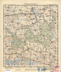
- Subject:
- Topical Subject: Maps, Topical Subject: Soviet Union, and Geographic Subject: Veselovka
- Publisher:
- Генеральный штаб Красной Армии
- Language:
- Russian
- Date Created:
- 1941
- Identifier:
- VAC9619-000299
- Genre:
- Military Maps and Topographic Maps
- Geographic Location:
- Coordinates: 54.6667, 20.75, 54.8333, 21
- Related URL:
- Download GeoTIFF: https://drive.google.com/open?id=1Zhi0YHWIbRBoZq_SWfI-589-afYjPkOr and Catalog URL: http://iucat.iu.edu/catalog/5020131
- Abstract:
- Modern area represented: Veselovka, Kaliningrad oblast, Russia
- Call Number:
- G7000 s50 .S68 N-34-42-D
- City:
- Зилькайм (Sielkeim)
- Copyright Holder:
- No Copyright - United States
- Country:
- Германия (Germany) and Восточная Пруссия (East Prussia)
- Physical Description:
- Scale: 1:50,000
- Persistent URL:
- http://purl.dlib.indiana.edu/iudl/images/VAC9619/VAC9619-000299
- Provenance:
- M. I. Map Library, G000-30, GS, RA
-
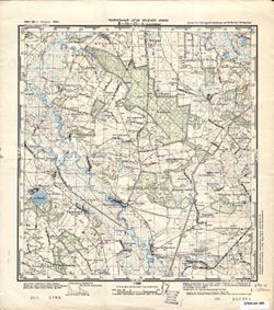
- Subject:
- Topical Subject: Maps, Topical Subject: Soviet Union, and Geographic Subject: Leszkowice
- Publisher:
- Генеральный штаб РККА
- Language:
- Russian
- Date Created:
- 1941
- Identifier:
- VAC9619-002638
- Genre:
- Topographic Maps and Military Maps
- Geographic Location:
- Coordinates: 51.5, 22.5, 51.667, 22.75
- Related URL:
- Catalog URL: http://iucat.iu.edu/catalog/5020131 and Download GeoTIFF: https://drive.google.com/file/d/1-ru48E4UYDJBvNku10aWjihr3PA6Tj6i/view?usp=sharing
- Abstract:
- Modern area represented: Leszkowice, Poland
- Call Number:
- GM G7000 s50 .S68 sheet M-34-22-A
- City:
- Лешковице (Leszkowice)
- Copyright Holder:
- No Copyright - United States
- Country:
- Область государственных интересов Германии (Region of German state interest)
- Physical Description:
- Scale: 1:50,000
- Persistent URL:
- http://purl.dlib.indiana.edu/iudl/images/VAC9619/VAC9619-002638
-
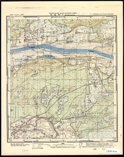
- Subject:
- Geographic Subject: Nikol’skoye, Topical Subject: Maps, and Topical Subject: Soviet Union
- Publisher:
- Генеральный штаб Красной Армии
- Language:
- Russian
- Date Created:
- 1941
- Identifier:
- VAC9619-003620
- Genre:
- Topographic Maps and Military Maps
- Geographic Location:
- Coordinates: 55, 22.25, 55.085, 22.375
- Related URL:
- Download GeoTIFF: https://drive.google.com/file/d/1RCiWalJv_0lzFatAUvHYnfCBTUbYJRms/view?usp=sharing and Catalog URL: https://iucat.iu.edu/catalog/14701157
- Abstract:
- Modern area represented: Никольское (Nikol’skoye), Kaliningradskaya oblast, Russia
- Call Number:
- G7063.K2 s25 .S6 sheet N-34-33-D-c
- City:
- Гиверлаукен (Giewerlauken)
- Copyright Holder:
- No Copyright - United States
- Country:
- Германия (Восточная Пруссия) (Germany (East Prussia))
- Physical Description:
- Scale: 1:25,000
- Persistent URL:
- http://purl.dlib.indiana.edu/iudl/images/VAC9619/VAC9619-003620
- Provenance:
- CIA Map Branch -- Received
-
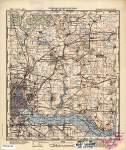
- Subject:
- Geographic Subject: Kaliningrad, Topical Subject: Maps, and Topical Subject: Soviet Union
- Publisher:
- Генеральный штаб Красной Армии
- Language:
- Russian
- Date Created:
- 1941
- Identifier:
- VAC9619-000297
- Genre:
- Military Maps and Topographic Maps
- Geographic Location:
- Coordinates: 54.6667, 20.5, 54.8333, 20.75
- Related URL:
- Catalog URL: http://iucat.iu.edu/catalog/5020131 and Download GeoTIFF: https://drive.google.com/open?id=1btVnqgKmtU5kyCL-jDRPPQZcpeq37hcm
- Abstract:
- Modern area represented: Kaliningrad, Kaliningrad oblast, Russia
- Call Number:
- G7000 s50 .S68 sheet N-34-42-C
- City:
- Кенигсберг (Königsberg)
- Copyright Holder:
- No Copyright - United States
- Country:
- Германия (Germany) and Восточная Пруссия (East Prussia)
- Physical Description:
- Scale: 1:50,000
- Persistent URL:
- http://purl.dlib.indiana.edu/iudl/images/VAC9619/VAC9619-000297
- Provenance:
- M. I. Map Library, Justus Perthes Kartensammlung, GS, RA, G000-30
-
- Description:
- 1921
- Subject:
- Geographic Subject: Svobodnyy Port, Topical Subject: Maps, and Topical Subject: Soviet Union
- Publisher:
- Генеральный штаб Красной Армии
- Language:
- Russian
- Date Created:
- 1941
- Identifier:
- VAC9619-001917
- Genre:
- Military Maps and Topographic Maps
- Geographic Location:
- Coordinates: 46, 31.5, 46.3333, 32
- Related URL:
- Download GeoTIFF: https://drive.google.com/open?id=1Sb_dGRMg0HfrO5ItVnTYcnwkLVx7criG and Catalog URL: https://iucat.iu.edu/catalog/5020129
- Abstract:
- Modern area represented: Svobodnyy Port, Kherson oblast, Ukraine
- Call Number:
- G7000 s100 .S7 sheet L-36-64
- Caption:
- Для служебного пользования
- City:
- Свободный Порт (Svobodnyy Port)
- Copyright Holder:
- No Copyright - United States
- Country:
- СССР (USSR)
- State/Province:
- Украинская ССР (Ukrainian Soviet Socialist Republic)
- Physical Description:
- Scale: 1:100,000
- Persistent URL:
- http://purl.dlib.indiana.edu/iudl/images/VAC9619/VAC9619-001917
- Provenance:
- CIA Map Library
-
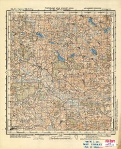
- Subject:
- Geographic Subject: Stakliškės, Topical Subject: Maps, and Topical Subject: Soviet Union
- Publisher:
- Генеральный штаб Красной Армии
- Language:
- Russian
- Date Created:
- 1941
- Identifier:
- VAC9619-000552
- Genre:
- Topographic Maps and Military Maps
- Geographic Location:
- Coordinates: 54.5, 24.25, 54.6667, 24.5
- Related URL:
- Download GeoTIFF: https://drive.google.com/open?id=1Uu5INmX2y68iS1_x_UVwGE04tBzhJEJP and Catalog URL: http://iucat.iu.edu/catalog/5020131
- Abstract:
- Modern area represented: Stakliškės, Lithuania
- Call Number:
- G7000 s50 .S68 sheet N-35-49-A
- Caption:
- Для служебного пользования
- City:
- Стоклишки (Stoklishki)
- Copyright Holder:
- No Copyright - United States
- Country:
- СССР (USSR)
- State/Province:
- Литовская ССР (Lithuanian Soviet Socialist Republic)
- Physical Description:
- Scale: 1:50,000
- Persistent URL:
- http://purl.dlib.indiana.edu/iudl/images/VAC9619/VAC9619-000552
- Provenance:
- M. I. Map Library, G000-30, GS, RA
-
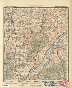
- Subject:
- Geographic Subject: Kalinovka, Topical Subject: Maps, and Topical Subject: Soviet Union
- Publisher:
- Генеральный штаб Красной Армии
- Language:
- Russian
- Date Created:
- 1941
- Identifier:
- VAC9619-000312
- Genre:
- Topographic Maps and Military Maps
- Geographic Location:
- Coordinates: 54.6667, 21.75, 54.8333, 22
- Related URL:
- Catalog URL: http://iucat.iu.edu/catalog/5020131 and Download GeoTIFF: https://drive.google.com/open?id=1MVcycZ9gygP2C3SjxCpkdnV7LVBklztH
- Abstract:
- Modern area represented: Kalinovka, Kaliningrad oblast, Russia
- Call Number:
- G7000 s50 .S68 N-34-44-D
- City:
- Ауловенен (Aulovenen)
- Copyright Holder:
- No Copyright - United States
- Country:
- Германия (Germany) and Восточная Пруссия (East Prussia)
- Physical Description:
- Scale: 1:50,000
- Persistent URL:
- http://purl.dlib.indiana.edu/iudl/images/VAC9619/VAC9619-000312
- Provenance:
- M. I. Map Library, G000-30, GS, RA
-
- Description:
- 1939
- Subject:
- Topical Subject: Soviet Union, Topical Subject: Maps, and Geographic Subject: Izdeshkovo
- Publisher:
- Главное Управление Геодезии и Картографии при СНК СССР
- Language:
- Russian
- Date Created:
- 1941
- Identifier:
- VAC9619-001279
- Genre:
- Topographic Maps and Military Maps
- Geographic Location:
- Coordinates: 55, 33.5, 55.1667, 33.75
- Related URL:
- Catalog URL: http://iucat.iu.edu/catalog/5020131 and Download GeoTIFF: https://drive.google.com/open?id=1faYxK24tGSL97hddlLxmt0CZjGIxZEcN
- Abstract:
- Modern area represented: Izdeshkovo, Smolensk oblast, Russia
- Call Number:
- GM G7000 S50 .S68 N-36-32-B
- Copyright Holder:
- No Copyright - United States
- Country:
- СССР (USSR)
- State/Province:
- РСФСР (RSFSR) and Смоленская область (Smolensk oblast)
- Physical Description:
- Scale: 1:50,000
- Persistent URL:
- http://purl.dlib.indiana.edu/iudl/images/VAC9619/VAC9619-001279
- Provenance:
- M. I. Map Library, G000-30, CIA Map Library
-
- Subject:
- Topical Subject: Soviet Union, Topical Subject: Maps, and Geographic Subject: Bolshakovo
- Publisher:
- Генеральный штаб Красной Армии
- Language:
- Russian
- Date Created:
- 1941
- Identifier:
- VAC9619-000308
- Genre:
- Military Maps and Topographic Maps
- Geographic Location:
- Coordinates: 54.8333, 21.5, 55, 21.75
- Related URL:
- Download GeoTIFF: https://drive.google.com/open?id=19PcjgAi9zxYa-pHquThpAofgnZdbJQoL and Catalog URL: http://iucat.iu.edu/catalog/5020131
- Abstract:
- Modern area represented: Bolshakovo, Kaliningrad oblast, Russia
- Call Number:
- G7000 s50 .S68 N-34-44-A
- City:
- Гросс Скайсгиррен (Gross Skaisgirren)
- Copyright Holder:
- No Copyright - United States
- Country:
- Германия (Germany) and Восточная Пруссия (East Prussia)
- Physical Description:
- Scale: 1:50,000
- Persistent URL:
- http://purl.dlib.indiana.edu/iudl/images/VAC9619/VAC9619-000308
- Provenance:
- M. I. Map Library, Justus Perthes Kartensammlung, GS, RA, G000-30
-
- Description:
- 1921
- Subject:
- Topical Subject: Maps, Topical Subject: Soviet Union, and Geographic Subject: Dolmativka
- Publisher:
- Генеральный штаб Красной Армии
- Language:
- Russian
- Date Created:
- 1941
- Identifier:
- VAC9619-001918
- Genre:
- Topographic Maps and Military Maps
- Geographic Location:
- Coordinates: 46, 32, 46.3333, 32.5
- Related URL:
- Download GeoTIFF: https://drive.google.com/open?id=1Sq-sWBnP30l2i0xJ6VXjO7JpXmW85bcn and Catalog URL: https://iucat.iu.edu/catalog/5020129
- Abstract:
- Modern area represented: Dolmativka, Kherson oblast, Ukraine
- Call Number:
- G7000 s100 .S7 sheet L-36-65
- Caption:
- Для служебного пользования
- City:
- Долматовка (Dolmativka)
- Copyright Holder:
- No Copyright - United States
- Country:
- СССР (USSR)
- State/Province:
- Украинская ССР (Ukrainian Soviet Socialist Republic)
- Physical Description:
- Scale: 1:100,000
- Persistent URL:
- http://purl.dlib.indiana.edu/iudl/images/VAC9619/VAC9619-001918
- Provenance:
- CIA Map Library, Library of Congress Geography & Map Division
-
- Subject:
- Topical Subject: Maps, Geographic Subject: Zapovedniki, and Topical Subject: Soviet Union
- Publisher:
- Генеральный штаб Красной Армии
- Language:
- Russian
- Date Created:
- 1941
- Identifier:
- VAC9619-003673
- Genre:
- Military Maps and Topographic Maps
- Geographic Location:
- Coordinates: 54.833, 21.25, 54.913, 21.375
- Related URL:
- Catalog URL: https://iucat.iu.edu/catalog/14701157 and Download GeoTIFF: https://drive.google.com/file/d/1ws3NOY_-v6h9pH8mZP7Nj84w53Em5B8d/view?usp=sharing
- Abstract:
- Modern area represented: Заповедники (Zapovedniki), Kaliningradskaya oblast, Russia
- Call Number:
- G7063.K2 s25 .S6 sheet N-34-43-B-c
- City:
- Люкноен (Lucknojen)
- Copyright Holder:
- No Copyright - United States
- Country:
- Германия (Восточная Пруссия) (Germany (East Prussia))
- Physical Description:
- Scale: 1:25,000
- Persistent URL:
- http://purl.dlib.indiana.edu/iudl/images/VAC9619/VAC9619-003673
- Provenance:
- CIA Map Branch -- Received
-
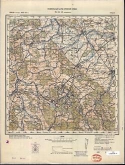
- Description:
- 1881
- Subject:
- Topical Subject: Maps, Geographic Subject: Wałbrzych, and Topical Subject: Soviet Union
- Publisher:
- Генеральный штаб Красной Армии
- Language:
- Russian
- Date Created:
- 1941
- Identifier:
- VAC9619-002612
- Genre:
- Topographic Maps and Military Maps
- Geographic Location:
- Coordinates: 50.66667, 16.0, 51.0, 16.5
- Related URL:
- Download GeoTIFF: https://drive.google.com/file/d/1kFsiMhki6AQE-SCAeAGcI3MVKvGeIKR4/view?usp=sharing and Catalog URL: https://iucat.iu.edu/catalog/5020129
- Abstract:
- Modern area represented: Wałbrzych, Lower Silesian province, Poland
- Call Number:
- G7000 s100 .S7 sheet M-33-45
- City:
- Вальденбург (Waldenburg)
- Copyright Holder:
- No Copyright - United States
- Country:
- Германия (Germany)
- Physical Description:
- Scale: 1:100,000
- Persistent URL:
- http://purl.dlib.indiana.edu/iudl/images/VAC9619/VAC9619-002612
- Provenance:
- DMA Topographic Center, Army Map Service Library, Library of Congress Geography & Map Division
-
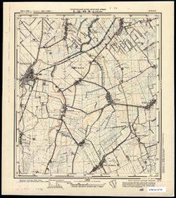
- Subject:
- Topical Subject: Soviet Union, Geographic Subject: Nowy Staw, and Topical Subject: Maps
- Publisher:
- Генеральный штаб Красной Армии
- Language:
- Russian
- Date Created:
- 1941
- Identifier:
- VAC9619-003784
- Genre:
- Topographic Maps and Military Maps
- Geographic Location:
- Coordinates: 54.083, 19, 54.167, 19.125
- Related URL:
- Download GeoTIFF: https://drive.google.com/file/d/1Sq9fVMvDmaoAlre3-zP3AuGktROnmii9/view?usp=sharing and Catalog URL: https://iucat.iu.edu/catalog/14701157
- Abstract:
- Modern area represented: Nowy Staw, Poland
- Call Number:
- G7063.K2 s25 .S6 sheet N-34-63-C-а
- City:
- Нойтайх (Neuteich)
- Copyright Holder:
- No Copyright - United States
- Country:
- Германия (Germany)
- Physical Description:
- Scale: 1:25,000
- Persistent URL:
- http://purl.dlib.indiana.edu/iudl/images/VAC9619/VAC9619-003784
- Provenance:
- CIA Map Branch -- Received
-
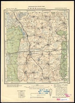
- Subject:
- Topical Subject: Maps, Geographic Subject: Gremyachye, and Topical Subject: Soviet Union
- Publisher:
- Генеральный штаб Красной Армии
- Language:
- Russian
- Date Created:
- 1941
- Identifier:
- VAC9619-003694
- Genre:
- Military Maps and Topographic Maps
- Geographic Location:
- Coordinates: 54.667, 21.625, 54.75, 21.75
- Related URL:
- Catalog URL: https://iucat.iu.edu/catalog/14701157 and Download GeoTIFF: https://drive.google.com/file/d/1KT2GrHhSTHNWfNPmFbtHfwPNejcPiMKa/view?usp=sharing
- Abstract:
- Modern area represented: Gremyachye, Kaliningrad oblast, Russia
- Call Number:
- G7063.K2 s25 .S6 sheet N-34-44-C-d
- City:
- Гросс Бершкаллен (Gross Berschkallen)
- Copyright Holder:
- No Copyright - United States
- Country:
- Восточная Пруссия (East Prussia) and Германия (Germany)
- Physical Description:
- Scale: 1:25,000
- Persistent URL:
- http://purl.dlib.indiana.edu/iudl/images/VAC9619/VAC9619-003694
- Provenance:
- M. I. Map Library, G000-30
-
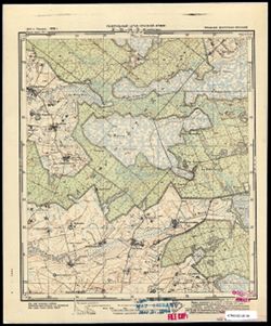
- Subject:
- Geographic Subject: Zhavoronkovo, Topical Subject: Soviet Union, and Topical Subject: Maps
- Publisher:
- Генеральный штаб Красной Армии
- Language:
- Russian
- Date Created:
- 1941
- Identifier:
- VAC9619-003693
- Genre:
- Military Maps and Topographic Maps
- Geographic Location:
- Coordinates: 54.667, 21.5, 54.75, 21.625
- Related URL:
- Catalog URL: https://iucat.iu.edu/catalog/14701157 and Download GeoTIFF: https://drive.google.com/file/d/1i7SF1HsBPrb0Xz9onIUpt1lUQCrBxhmm/view?usp=sharing
- Abstract:
- Modern area represented: Жаворонково (Zhavoronkovo), Kaliningradskaya oblast, Russia
- Call Number:
- G7063.K2 s25 .S6 sheet N-34-44-C-c
- City:
- Вирбельн (Wirbeln)
- Copyright Holder:
- No Copyright - United States
- Country:
- Германия (Восточная Пруссия) (Germany (East Prussia))
- Physical Description:
- Scale: 1:25,000
- Persistent URL:
- http://purl.dlib.indiana.edu/iudl/images/VAC9619/VAC9619-003693
- Provenance:
- M. I. Map Library
-
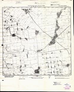
- Description:
- 1933
- Subject:
- Topical Subject: Maps, Geographic Subject: Nyzhni Sirohozy, and Topical Subject: Soviet Union
- Publisher:
- Генеральный штаб Красной Армии
- Language:
- Russian
- Date Created:
- 1941
- Identifier:
- VAC9619-001890
- Genre:
- Topographic Maps and Military Maps
- Geographic Location:
- Coordinates: 46.6667, 34, 47, 34.5
- Related URL:
- Download GeoTIFF: https://drive.google.com/open?id=1Z449zsz78QYAyHVx2ON5W62vEmhcjUFK and Catalog URL: https://iucat.iu.edu/catalog/5020129
- Abstract:
- Modern area represented: Nyzhni Sirohozy, Kherson oblast, Ukraine
- Call Number:
- G7000 s100 .S7 sheet L-36-45
- Caption:
- Для служебного пользования
- City:
- Ниж. Серогозы (Nyzhni Sirohozy)
- Copyright Holder:
- No Copyright - United States
- Country:
- СССР (USSR)
- State/Province:
- Запорожская область (Zaporizhia oblast), Николаевская область (Mykolaiv oblast), and Украинская ССР (Ukrainian Soviet Socialist Republic)
- Physical Description:
- Scale: 1:100,000
- Persistent URL:
- http://purl.dlib.indiana.edu/iudl/images/VAC9619/VAC9619-001890
- Provenance:
- CIA Map Library, Atlasblatt, Heeresplankammer Gruppe Archive Auslandskartenarchiv
-
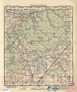
- Subject:
- Geographic Subject: Novaya Derevnya, Topical Subject: Soviet Union, and Topical Subject: Maps
- Publisher:
- Генеральный штаб Красной Армии
- Language:
- Russian
- Date Created:
- 1941
- Identifier:
- VAC9619-000306
- Genre:
- Topographic Maps and Military Maps
- Geographic Location:
- Coordinates: 54.6667, 21.25, 54.8333, 21.5
- Related URL:
- Download GeoTIFF: https://drive.google.com/open?id=1d7qhw4olwOaD4K9Ity-NnFDGdbmB07Tt and Catalog URL: http://iucat.iu.edu/catalog/5020131
- Abstract:
- Modern area represented: Novaya Derevnya, Kaliningrad oblast, Russia
- Call Number:
- G7000 s50 .S68 N-34-43-D
- City:
- Альт Гертлаукен (Alt Gertlauken)
- Copyright Holder:
- No Copyright - United States
- Country:
- Восточная Пруссия (East Prussia) and Германия (Germany)
- Physical Description:
- Scale: 1:50,000
- Persistent URL:
- http://purl.dlib.indiana.edu/iudl/images/VAC9619/VAC9619-000306
- Provenance:
- M. I. Map Library, G000-30, GS, RA
-
- Description:
- 1938
- Subject:
- Topical Subject: Maps, Geographic Subject: Pavlikovo, and Topical Subject: Soviet Union
- Publisher:
- Главное управление геодезии и картографии при СНК СССР
- Language:
- Russian
- Date Created:
- 1941
- Identifier:
- VAC9619-003472
- Genre:
- Topographic Maps and Military Maps
- Geographic Location:
- Coordinates: 56.5, 34.25, 56.667, 34.5
- Related URL:
- Download GeoTIFF: https://drive.google.com/file/d/1cM86uH12YBkYFhQNZjwCtN7j02FCIzUX/view?usp=sharing and Catalog URL: http://iucat.iu.edu/catalog/5020131
- Abstract:
- Modern area represented: Павликово (Pavlikovo), Tverskaya oblast, Russia
- Call Number:
- G7000 s50 .S68 sheet O-36-129-B
- City:
- Павликово (Pavlikovo)
- Copyright Holder:
- No Copyright - United States
- Country:
- СССР (USSR)
- State/Province:
- Луковниковский район (Lukovnikovsky district) and Калининская область (Kalinin oblast)
- Physical Description:
- Scale: 1:50,000
- Persistent URL:
- http://purl.dlib.indiana.edu/iudl/images/VAC9619/VAC9619-003472
- Provenance:
- M. I. Map Library, Library of Congress Geography & Map Division
-
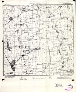
- Description:
- 1934
- Subject:
- Topical Subject: Maps, Topical Subject: Soviet Union, and Geographic Subject: Ivanivka
- Publisher:
- Генеральный штаб Красной Армии
- Language:
- Russian
- Date Created:
- 1941
- Identifier:
- VAC9619-001891
- Genre:
- Topographic Maps and Military Maps
- Geographic Location:
- Coordinates: 46.6667, 34.5, 47, 35
- Related URL:
- Download GeoTIFF: https://drive.google.com/open?id=14Er3699FOVffHRqDS10Xc_-qDDv9uQcf and Catalog URL: https://iucat.iu.edu/catalog/5020129
- Abstract:
- Modern area represented: Ivanivka, Zaporizhia oblast, Ukraine
- Call Number:
- G7000 s100 .S7 sheet L-36-46
- Caption:
- Для служебного пользования
- City:
- Ивановка (Ivanivka)
- Copyright Holder:
- No Copyright - United States
- Country:
- СССР (USSR)
- State/Province:
- Украинская ССР (Ukrainian Soviet Socialist Republic) and Запорожская область (Zaporizhia oblast)
- Physical Description:
- Scale: 1:100,000
- Persistent URL:
- http://purl.dlib.indiana.edu/iudl/images/VAC9619/VAC9619-001891
- Provenance:
- CIA Map Library
-
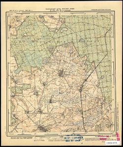
- Subject:
- Topical Subject: Maps, Geographic Subject: Soldatovo, and Topical Subject: Soviet Union
- Publisher:
- Генеральный штаб Красной Армии
- Language:
- Russian
- Date Created:
- 1941
- Identifier:
- VAC9619-003677
- Genre:
- Topographic Maps and Military Maps
- Geographic Location:
- Coordinates: 54.667, 21.125, 54.75, 21.25
- Related URL:
- Download GeoTIFF: https://drive.google.com/file/d/10gu0Oy_k3czoJLMC7tZ6T3pnWCdUUhef/view?usp=sharing and Catalog URL: https://iucat.iu.edu/catalog/14701157
- Abstract:
- Modern area represented: part of Солдатово (Soldatovo), Kaliningradskaya oblast, Russia
- Call Number:
- G7063.K2 s25 .S6 sheet N-34-43-C-d
- City:
- Грюнхайн (Grünhayn)
- Copyright Holder:
- No Copyright - United States
- Country:
- Германия (Восточная Пруссия) (Germany (East Prussia))
- Physical Description:
- Scale: 1:25,000
- Persistent URL:
- http://purl.dlib.indiana.edu/iudl/images/VAC9619/VAC9619-003677
- Provenance:
- M. I. Map Library
-
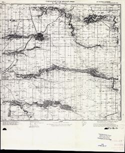
- Description:
- 1940
- Subject:
- Topical Subject: Soviet Union, Topical Subject: Maps, and Geographic Subject: Vyselki
- Publisher:
- Генеральный штаб Красной Армии
- Language:
- Russian
- Date Created:
- 1941
- Identifier:
- VAC9619-002352
- Genre:
- Topographic Maps and Military Maps
- Geographic Location:
- Coordinates: 45.333, 39.5, 45.667, 40
- Related URL:
- Download GeoTIFF: https://drive.google.com/file/d/1FvtRCQ_lqYSm5lBe4sGeetoWyTjpXu2N/view?usp=sharing and Catalog URL: https://iucat.iu.edu/catalog/5020129
- Abstract:
- Modern area represented: Vyselki, Russia
- Call Number:
- G7000 s100 .S7 sheet L-37-92
- Caption:
- Для служебного пользования
- City:
- Выселки (Vyselki)
- Copyright Holder:
- No Copyright - United States
- Country:
- СССР (USSR)
- State/Province:
- Краснодарский край (Krasnodar kray) and РСФСР (RSFSR)
- Physical Description:
- Scale: 1:100,000
- Persistent URL:
- http://purl.dlib.indiana.edu/iudl/images/VAC9619/VAC9619-002352
- Provenance:
- CIA Map Library
-
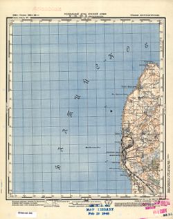
- Subject:
- Topical Subject: Maps, Topical Subject: Soviet Union, and Geographic Subject: Yantarnyy
- Publisher:
- Генеральный штаб Красной Армии
- Language:
- Russian
- Date Created:
- 1941
- Identifier:
- VAC9619-000288
- Genre:
- Topographic Maps and Military Maps
- Geographic Location:
- Coordinates: 54.8333, 19.75, 55, 20
- Related URL:
- Download GeoTIFF: https://drive.google.com/open?id=1Bzswq3lhSSbqy6pELm6FhVBf3P6HlDcJ and Catalog URL: http://iucat.iu.edu/catalog/5020131
- Abstract:
- Modern area represented: Yantarnyy, Kaliningrad oblast, Russia
- Call Number:
- G7000 s50 .S68 N-34-40-B
- City:
- Кракстепеллен (Kraxtepellen)
- Copyright Holder:
- No Copyright - United States
- Country:
- Германия (Germany) and Восточная Пруссия (East Prussia)
- Physical Description:
- Scale: 1:50,000
- Persistent URL:
- http://purl.dlib.indiana.edu/iudl/images/VAC9619/VAC9619-000288
- Provenance:
- M. I. Map Library, G000-30, GS, RA
-
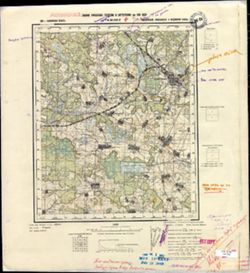
- Description:
- 1938
- Subject:
- Geographic Subject: Likhoslavl', Topical Subject: Soviet Union, and Topical Subject: Maps
- Publisher:
- Главное управление геодезии и картографии при СНК СССР
- Language:
- Russian
- Date Created:
- 1941
- Identifier:
- VAC9619-002852
- Genre:
- Military Maps and Topographic Maps
- Geographic Location:
- Coordinates: 57, 35.25, 57.167, 35.5
- Related URL:
- Download GeoTIFF: https://drive.google.com/file/d/1_1d7nZrOWqXaKo7w86AM92cd9KGEpK5Y/view?usp=sharing and Catalog URL: http://iucat.iu.edu/catalog/5020131
- Abstract:
- Modern area represented: Лихославль (Likhoslavl'), Тверская область (Tverskaya oblast), Russia
- Call Number:
- GM G7000 s50 .S68 sheet O-36-107-D
- City:
- Лихославль (Likhoslavl')
- Copyright Holder:
- No Copyright - United States
- Country:
- СССР (USSR)
- State/Province:
- Новоторжский район (Novotorzhsky district), Лихославльский район (Likhoslavlsky district), Калининская область (Kalinin oblast), and Медновский район (Mednov...
- Physical Description:
- Scale: 1:50,000
- Persistent URL:
- http://purl.dlib.indiana.edu/iudl/images/VAC9619/VAC9619-002852
- Provenance:
- M. I. Map Library
-
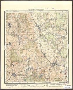
- Subject:
- Topical Subject: Maps, Topical Subject: Soviet Union, and Geographic Subject: Młynary
- Publisher:
- Генеральный штаб Красной Армии
- Language:
- Russian
- Date Created:
- 1941
- Identifier:
- VAC9619-003790
- Genre:
- Military Maps and Topographic Maps
- Geographic Location:
- Coordinates: 54.166667, 19.625, 54.25, 19.75
- Related URL:
- Catalog URL: https://iucat.iu.edu/catalog/14701157 and Download GeoTIFF: https://drive.google.com/file/d/1b1TWYqPW0FdmUOU1Q7PVRb9LBaodXuC2/view?usp=sharing
- Abstract:
- Modern area represented: Młynary, Poland
- Call Number:
- G7063.K2 s25 .S6 sheet N-34-64-A-d
- City:
- Мюльхаузен (Mühlhausen)
- Copyright Holder:
- No Copyright - United States
- Country:
- Германия (Восточная Пруссия) (Germany (East Prussia))
- Physical Description:
- Scale: 1:25,000
- Persistent URL:
- http://purl.dlib.indiana.edu/iudl/images/VAC9619/VAC9619-003790
- Provenance:
- CIA Map Branch -- Received
-
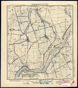
- Subject:
- Topical Subject: Maps, Topical Subject: Soviet Union, and Geographic Subject: Myszewo
- Publisher:
- Генеральный штаб Красной Армии
- Language:
- Russian
- Date Created:
- 1941
- Identifier:
- VAC9619-003785
- Genre:
- Topographic Maps and Military Maps
- Geographic Location:
- Coordinates: 54.083, 19.125, 54.167, 19.25
- Related URL:
- Catalog URL: https://iucat.iu.edu/catalog/14701157 and Download GeoTIFF: https://drive.google.com/file/d/1XadLTRStSNFshiBzZCO9r5wCAhaLTYqy/view?usp=sharing
- Abstract:
- Modern area represented: Myszewo, Poland
- Call Number:
- G7063.K2 s25 .S6 sheet N-34-63-C-b
- City:
- Гросс Маусдорф (Gross Mausdorf)
- Copyright Holder:
- No Copyright - United States
- Country:
- Германия (Germany)
- Physical Description:
- Scale: 1:25,000
- Persistent URL:
- http://purl.dlib.indiana.edu/iudl/images/VAC9619/VAC9619-003785
- Provenance:
- M. I. Map Library
-
- Description:
- 1936
- Subject:
- Geographic Subject: Oktyabrskoye, Topical Subject: Maps, and Topical Subject: Soviet Union
- Publisher:
- Главное управление геодезии и картографии при СНК СССР
- Language:
- Russian
- Date Created:
- 1941
- Identifier:
- VAC9619-002160
- Genre:
- Military Maps and Topographic Maps
- Geographic Location:
- Coordinates: 45.3333, 42.5, 45.6667, 43
- Related URL:
- Catalog URL: https://iucat.iu.edu/catalog/5020129 and Download GeoTIFF: https://drive.google.com/open?id=1WkVt36FFEsQFL0DIUFDkyXz9u-WMgFlz
- Abstract:
- Modern area represented: Oktyabrskoye, Stavropol kray, Russia
- Call Number:
- G7000 s100 .S7 sheet L-38-86
- Caption:
- Для служебного пользования
- City:
- Книгинское (Kniginskoye)
- Copyright Holder:
- No Copyright - United States
- Country:
- СССР (USSR)
- State/Province:
- Орджоникидзевский край (Ordzhonikidze kray) and РСФСР (RSFSR)
- Physical Description:
- Scale: 1:100,000
- Persistent URL:
- http://purl.dlib.indiana.edu/iudl/images/VAC9619/VAC9619-002160
- Provenance:
- CIA Map Library
-
- Description:
- 1938
- Subject:
- Topical Subject: Maps, Topical Subject: Soviet Union, and Geographic Subject: Polomenitsy
- Publisher:
- Главное управление геодезии и картографии при СНК СССР
- Language:
- Russian
- Date Created:
- 1941
- Identifier:
- VAC9619-002904
- Genre:
- Military Maps and Topographic Maps
- Geographic Location:
- Coordinates: 56.667, 35, 56.833, 35.25
- Related URL:
- Catalog URL: http://iucat.iu.edu/catalog/5020131 and Download GeoTIFF: https://drive.google.com/file/d/1_WPD2YySqDnn5ZOBE2eLEB6FMHHGimLb/view?usp=sharing
- Abstract:
- Modern area represented: Поломеницы (Polomenitsy), Tverskaya oblast, Russia
- Call Number:
- GM G7000 s50 .S68 sheet O-36-119-C
- City:
- Поломеницы (Polomenitsy)
- Copyright Holder:
- No Copyright - United States
- Country:
- СССР (USSR)
- State/Province:
- Емельяновский район (Yemelyanovsky district), Высоковский район (Vysokovsky district), Медновский район (Mednovsky district), and Калининская область (Kalini...
- Physical Description:
- Scale: 1:50,000
- Persistent URL:
- http://purl.dlib.indiana.edu/iudl/images/VAC9619/VAC9619-002904
- Provenance:
- M. I. Map Library
-
- Description:
- 1907
- Subject:
- Topical Subject: Soviet Union, Geographic Subject: Perekischkjul, and Topical Subject: Maps
- Publisher:
- Генеральный штаб Красной Армии
- Language:
- Russian
- Date Created:
- 1941
- Identifier:
- VAC9619-000892
- Genre:
- Military Maps and Topographic Maps
- Geographic Location:
- Coordinates: 40.3333, 49, 40.6667, 49.5
- Related URL:
- Download GeoTIFF: https://drive.google.com/open?id=1YAs8jfBXsWsytsvHAupvINf6BPXNHt5c and Catalog URL: https://iucat.iu.edu/catalog/5020129
- Abstract:
- Modern area represented: Perekischkjul, Abşeron district, Azerbaijan
- Call Number:
- G7000 s100 .S7 sheet K-39-123
- Caption:
- Для служебного пользования
- City:
- Перекишкюль (Perekischkjul)
- Copyright Holder:
- No Copyright - United States
- Country:
- СССР (USSR)
- State/Province:
- Азербайджанская ССР (Azerbaijan Soviet Socialist Republic)
- Physical Description:
- Scale: 1:100,000
- Persistent URL:
- http://purl.dlib.indiana.edu/iudl/images/VAC9619/VAC9619-000892
- Provenance:
- CIA Map Library, Library of Congress Geography & Map Division, Heeresplankammer Gruppe Archive Auslandskartenarchiv, Atlasblatt
-
- Subject:
- Topical Subject: Soviet Union, Geographic Subject: Igliauka, and Topical Subject: Maps
- Publisher:
- Генеральный штаб Красной Армии
- Language:
- Russian
- Date Created:
- 1941
- Identifier:
- VAC9619-000346
- Genre:
- Military Maps and Topographic Maps
- Geographic Location:
- Coordinates: 54.5, 23.5, 54.66667, 23.75
- Related URL:
- Catalog URL: http://iucat.iu.edu/catalog/5020131 and Download GeoTIFF: https://drive.google.com/open?id=1b5vGD9lQPw6ExOK3n20eFh53CdRGpTOC
- Abstract:
- Modern area represented: Igliauka, Lithuania
- Call Number:
- G7000 s50 .S68 sheet N-34-60-A
- Caption:
- Для служебного пользования
- City:
- Иглювка (Iglyuvka)
- Copyright Holder:
- No Copyright - United States
- Country:
- СССР (USSR)
- State/Province:
- Литовская ССР (Lithuanian Soviet Socialist Republic)
- Physical Description:
- Scale: 1:50,000
- Persistent URL:
- http://purl.dlib.indiana.edu/iudl/images/VAC9619/VAC9619-000346
- Provenance:
- Library of Congress Geography & Map Division
-
- Subject:
- Topical Subject: Soviet Union, Geographic Subject: Janikowo, and Topical Subject: Maps
- Publisher:
- Генеральный штаб Красной Армии
- Language:
- Russian
- Date Created:
- 1941
- Identifier:
- VAC9619-003799
- Genre:
- Military Maps and Topographic Maps
- Geographic Location:
- Coordinates: 54.166667, 20.375, 54.25, 20.5
- Related URL:
- Download GeoTIFF: https://drive.google.com/file/d/1Xsw9w_3pOgyqqB2i9TaLhREcbeMMsS7h/view?usp=sharing and Catalog URL: https://iucat.iu.edu/catalog/14701157
- Abstract:
- Modern area represented: Janikowo, Poland
- Call Number:
- G7063.K2 s25 .S6 sheet N-34-65-B-d
- City:
- Хансхаген (Hanshagen)
- Copyright Holder:
- No Copyright - United States
- Country:
- Германия (Восточная Пруссия) (Germany (East Prussia))
- Physical Description:
- Scale: 1:25,000
- Persistent URL:
- http://purl.dlib.indiana.edu/iudl/images/VAC9619/VAC9619-003799
- Provenance:
- M. I. Map Library
-
- Description:
- 1927
- Subject:
- Topical Subject: Maps, Geographic Subject: Andreyevka, and Topical Subject: Soviet Union
- Publisher:
- Генеральный штаб Красной Армии
- Language:
- Russian
- Date Created:
- 1941
- Identifier:
- VAC9619-002283
- Genre:
- Topographic Maps and Military Maps
- Geographic Location:
- Coordinates: 47, 36.5, 47.3333, 37
- Related URL:
- Download GeoTIFF: https://drive.google.com/file/d/1UF1XjcNneuyF1a5XhDK--2BjtXxrLfsl/view?usp=sharing and Catalog URL: https://iucat.iu.edu/catalog/5020129
- Abstract:
- Modern area represented: Andreyevka, Zaporizhia oblast, Ukraine
- Call Number:
- G7000 s100 .S7 sheet L-37-26
- Caption:
- Для служебного пользования
- City:
- Андреевка (Andreyevka)
- Copyright Holder:
- No Copyright - United States
- Country:
- СССР (USSR)
- State/Province:
- Украинская ССР (Ukrainian Soviet Socialist Republic)
- Physical Description:
- Scale: 1:100,000
- Persistent URL:
- http://purl.dlib.indiana.edu/iudl/images/VAC9619/VAC9619-002283
- Provenance:
- CIA Map Library
-
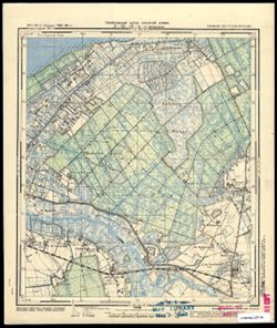
- Subject:
- Geographic Subject: Lomonosovka, Topical Subject: Maps, and Topical Subject: Soviet Union
- Publisher:
- Генеральный штаб Красной Армии
- Language:
- Russian
- Date Created:
- 1941
- Identifier:
- VAC9619-003672
- Genre:
- Topographic Maps and Military Maps
- Geographic Location:
- Coordinates: 54.833, 21.125, 54.913, 21.25
- Related URL:
- Catalog URL: https://iucat.iu.edu/catalog/14701157 and Download GeoTIFF: https://drive.google.com/file/d/1KbemoLtvF_QNGS2me7BY7LTnpuylU4jM/view?usp=sharing
- Abstract:
- Modern area represented: Ломоносовка (Lomonosovka), Kaliningradskaya oblast, Russia
- Call Number:
- G7063.K2 s25 .S6 sheet N-34-43-A-d
- City:
- Пермауэрн (Permauern)
- Copyright Holder:
- No Copyright - United States
- Country:
- Германия (Восточная Пруссия) (Germany (East Prussia))
- Physical Description:
- Scale: 1:25,000
- Persistent URL:
- http://purl.dlib.indiana.edu/iudl/images/VAC9619/VAC9619-003672
- Provenance:
- M. I. Map Library
-
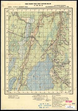
- Description:
- 1936
- Subject:
- Topical Subject: Maps, Topical Subject: Soviet Union, and Geographic Subject: Glad'
- Publisher:
- Главное управление государственной съемки и картографии НКВД СССР
- Language:
- Russian
- Date Created:
- 1941
- Identifier:
- VAC9619-003326
- Genre:
- Military Maps and Topographic Maps
- Geographic Location:
- Coordinates: 59, 32, 59.167, 32.25
- Related URL:
- Catalog URL: http://iucat.iu.edu/catalog/5020131 and Download GeoTIFF: https://drive.google.com/file/d/1uQeqSrfffRYdboAdTqPVTHEerJ_HHoQF/view?usp=sharing
- Abstract:
- Modern area represented: Гладь (Glad'), Novgorodskaya oblast, Russia
- Call Number:
- G7000 s50 .S68 sheet O-36-29-C
- Caption:
- Для служебного пользования
- City:
- Гладь (Glad')
- Copyright Holder:
- No Copyright - United States
- Country:
- СССР (USSR)
- State/Province:
- Чудовский район (Chudovsky district), Маловишерский район (Malovishersky district), РСФСР (RSFSR), and Ленинградская область (Leningrad oblast)
- Physical Description:
- Scale: 1:50,000
- Persistent URL:
- http://purl.dlib.indiana.edu/iudl/images/VAC9619/VAC9619-003326
- Provenance:
- M. I. Map Library
-
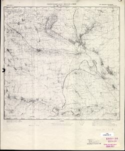
- Description:
- 1928
- Subject:
- Geographic Subject: Voznesensk, Topical Subject: Maps, and Topical Subject: Soviet Union
- Publisher:
- Генеральный штаб Красной Армии
- Language:
- Russian
- Date Created:
- 1941
- Identifier:
- VAC9619-001853
- Genre:
- Topographic Maps and Military Maps
- Geographic Location:
- Coordinates: 47.3333, 31, 47.6667, 31.5
- Related URL:
- Catalog URL: https://iucat.iu.edu/catalog/5020129 and Download GeoTIFF: https://drive.google.com/open?id=1bR3CKUW57AtZTkAsFZhGcwe6LzRifVDw
- Abstract:
- Modern area represented: Voznesensk, Mykolaiv oblast, Ukraine
- Call Number:
- G7000 s100 .S7 sheet L-36-15
- Caption:
- Для служебного пользования
- City:
- Вознесенск (Voznesensk)
- Copyright Holder:
- No Copyright - United States
- Country:
- СССР (USSR)
- State/Province:
- Украинская ССР (Ukrainian Soviet Socialist Republic)
- Physical Description:
- Scale: 1:100,000
- Persistent URL:
- http://purl.dlib.indiana.edu/iudl/images/VAC9619/VAC9619-001853
- Provenance:
- CIA Map Library
-
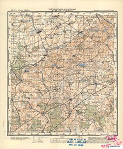
- Subject:
- Topical Subject: Maps, Topical Subject: Soviet Union, and Geographic Subject: Judino
- Publisher:
- Генеральный штаб Красной Армии
- Language:
- Russian
- Date Created:
- 1941
- Identifier:
- VAC9619-000343
- Genre:
- Military Maps and Topographic Maps
- Geographic Location:
- Coordinates: 54.33333, 21.75, 54.5, 22.0
- Related URL:
- Catalog URL: http://iucat.iu.edu/catalog/5020131 and Download GeoTIFF: https://drive.google.com/open?id=10KWkMdR8i6HpfdJ26dLbE1cxEuP4LLRO
- Abstract:
- Modern area represented: Judino, Kaliningrad oblast, Russia
- Call Number:
- G7000 s50 .S68 sheet N-34-56-D
- City:
- Йургайтшен (Jurgaitschen)
- Copyright Holder:
- No Copyright - United States
- Country:
- Германия (Germany) and Восточная Пруссия (East Prussia)
- Physical Description:
- Scale: 1:50,000
- Persistent URL:
- http://purl.dlib.indiana.edu/iudl/images/VAC9619/VAC9619-000343
- Provenance:
- M. I. Map Library, G000-30, GS, RA
-
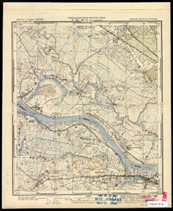
- Subject:
- Topical Subject: Soviet Union and Topical Subject: Maps
- Publisher:
- Генеральный штаб Красной Армии
- Language:
- Russian
- Date Created:
- 1941
- Identifier:
- VAC9619-003610
- Genre:
- Topographic Maps and Military Maps
- Geographic Location:
- Coordinates: 55.083, 21.75, 55.167, 21.875
- Related URL:
- Catalog URL: https://iucat.iu.edu/catalog/14701157 and Download GeoTIFF: https://drive.google.com/file/d/1R9_sJzyUDMnr8lrmdZvvsQeJpRJJRUid/view?usp=sharing
- Abstract:
- Modern area represented: part of Советск (Sovetsk) (?), Kaliningradskaya oblast, Russia
- Call Number:
- G7063.K2 s25 .S6 sheet N-34-32-D-a
- City:
- Штолбек
- Copyright Holder:
- No Copyright - United States
- Country:
- Германия (Восточная Пруссия) (Germany (East Prussia))
- Physical Description:
- Scale: 1:25,000
- Persistent URL:
- http://purl.dlib.indiana.edu/iudl/images/VAC9619/VAC9619-003610
- Provenance:
- M. I. Map Library
