Search Constraints

You searched for: Holding Location B-WELLS Remove constraint Holding Location: B-WELLS Subject Geographic Subject: Indiana Remove constraint Subject: Geographic Subject: Indiana
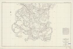
Search Results

  • Rand, McNally & Co.'s sectional map of Indiana.
  • Wabash River and Valley from Terre Haute, Ind. to mouth, in 13 charts, 1914
  • Chart of the Indiana coal field : to accompany the supplementary report on the coal of Indiana, by George H. Ashley
  • State of Indiana
  • Topographic map of Indiana
  • Scarborough's map of Indiana, showing counties, townships, congressional townships and sections, cities, villages, post-offices, railroads and stations and interurban electric railways. Competely indexed and accompanied by statistical diagrams and special maps
  • New sectional and township map of Indiana
  • [Northeastern Indiana lake district]
  • Railroad distance & township map of Indiana
  • Colton's Indiana