
Search Constraints
You searched for:
Creator
Goodlove, C. W.
Remove constraint Creator: Goodlove, C. W.
Publisher
Geological Survey (U.S.)
Remove constraint Publisher: Geological Survey (U.S.)
Search Results
-
![Indiana Haubstadt quadrangle [1903 printing]](https://iiif.uits.iu.edu/iiif/2/mw22w891g%2Ffiles%2F3f2a82be-5754-4703-989d-ede2f3a3b596/full/250,/0/default.jpg)
- Subject:
- Geographic Subject: Posey County (Ind.), Geographic Subject: Gibson County (Ind.), and Geographic Subject: Vanderburgh County (Ind.)
- Creator:
- Renshawe, John H., Goodlove, C. W., Hawkins, Geo. T. (George T.), and Geological Survey (U.S.)
- Publisher:
- Geological Survey (U.S.)
- Date Created:
- 1903
- Identifier:
- VAC3073-M-01342
- Genre:
- Quadrangle maps, 15 minute topographic maps, and Topographic maps
- Geographic Location:
- Coordinates: W0874500 W0873000 N0381500 N0380000
- Related URL:
- Catalog URL: https://iucat.iu.edu/catalog/18408287
- Abstract:
- Engraved Mar. 1903 by U.S.G.S. , Jno. H. Renshawe, geographer in charge , control by Geo. T. Hawkins , topography by Chas. W. Goodlove. Relief shown by conto...
- Call Number:
- G4090 s62 .G4 Haubstadt 1903
- Caption:
- Imprint: [Washington, D.C.] : U.S. Geological Survey, 1903
- Physical Description:
- Dimensions: 45 x 42 cm or smaller and Scale: 1:62,500
- Alternate Identifier:
- Title Control Number: a18408287
- Persistent URL:
- https://purl.dlib.indiana.edu/iudl/images/VAC3073/VAC3073-M-01342
- Provenance:
- Part of Geological Survey (U.S.). Indiana 1:62,500.
-
![Kentucky-Indiana Uniontown quadrangle [1941 reprint without vegetation]](https://iiif.uits.iu.edu/iiif/2/4m90fx89j%2Ffiles%2Fc2e137b5-4791-4eaa-a234-4e491cea321e/full/250,/0/default.jpg)
- Subject:
- Geographic Subject: Henderson County (Ky.), Geographic Subject: Posey County (Ind.), and Geographic Subject: Union County (Ky.)
- Creator:
- Kentucky Geological Survey, Marshall, R. B. (Robert Bradford), 1867-1949, Herrington, R. M. (Russell McKee), 1890-1977, U.S. Coast and Geodetic Survey, Hawki...
- Publisher:
- Geological Survey (U.S.)
- Date Created:
- 1941
- Identifier:
- VAC3073-M-01336
- Genre:
- Quadrangle maps, Topographic maps, and 15 minute topographic maps
- Geographic Location:
- Coordinates: W0880000 W0874500 N0380000 N0374500
- Related URL:
- Catalog URL: https://iucat.iu.edu/catalog/18415442
- Abstract:
- R.B. Marshall, chief geographer , W.H. Herron, geographer in charge , topography by C.W. Goodlove, R.M. Herrington and W.S. Gehres , control by U.S. Coast an...
- Call Number:
- G4090 s62 .G4 Uniontown 1917 rep 1941
- Caption:
- Imprint: [Washington, D.C.] : U.S. Geological Survey, 1941.
- Physical Description:
- Dimensions: 45 x 42 cm or smaller and Scale: 1:62,500
- Alternate Identifier:
- Title Control Number: a18415442
- Persistent URL:
- https://purl.dlib.indiana.edu/iudl/images/VAC3073/VAC3073-M-01336
- Provenance:
- Part of Geological Survey (U.S.). Indiana 1:62,500.
-
![Kentucky-Indiana Uniontown quadrangle [1917 printing with vegetation]](https://iiif.uits.iu.edu/iiif/2/rn302438g%2Ffiles%2F5ec44016-9965-4124-88f0-d69485cb679f/full/250,/0/default.jpg)
- Subject:
- Topical Subject: Vegetation mapping, Geographic Subject: Henderson County (Ky.), Geographic Subject: Posey County (Ind.), and Geographic Subject: Union Count...
- Creator:
- Kentucky Geological Survey, U.S. Coast and Geodetic Survey, Herron, W. H. (William Harrison), 1865-, United States. Army. Corps of Engineers, Hawkins, Geo. T...
- Publisher:
- Geological Survey (U.S.)
- Date Created:
- 1917
- Identifier:
- VAC3073-M-01334
- Genre:
- Quadrangle maps, Topographic maps, and 15 minute topographic maps
- Geographic Location:
- Coordinates: W0880000 W0874500 N0380000 N0374500
- Related URL:
- Catalog URL: https://iucat.iu.edu/catalog/18415442
- Abstract:
- R.B. Marshall, chief geographer , W.H. Herron, geographer in charge , topography by C.W. Goodlove, R.M. Herrington and W.S. Gehres , control by U.S. Coast an...
- Call Number:
- G4090 s62 .G4 Uniontown 1917
- Caption:
- Imprint: [Washington, D.C.] : U.S. Geological Survey, [1917]
- Physical Description:
- Scale: 1:62,500 and Dimensions: 45 x 42 cm or smaller
- Alternate Identifier:
- Title Control Number: a18415442
- Persistent URL:
- https://purl.dlib.indiana.edu/iudl/images/VAC3073/VAC3073-M-01334
- Provenance:
- Part of Geological Survey (U.S.). Indiana 1:62,500.
-
![Kentucky-Indiana Uniontown quadrangle [1929 without vegetation]](https://iiif.uits.iu.edu/iiif/2/bn99b9304%2Ffiles%2F7d8bdd0e-d8b8-4f23-b50f-402956e1a45a/full/250,/0/default.jpg)
- Subject:
- Geographic Subject: Posey County (Ind.), Geographic Subject: Union County (Ky.), and Geographic Subject: Henderson County (Ky.)
- Creator:
- Herrington, R. M. (Russell McKee), 1890-1977, Ellis, J. R. (Topographer), Geological Survey (U.S.), Herron, W. H. (William Harrison), 1865-, Hawkins, Geo. T....
- Publisher:
- Geological Survey (U.S.)
- Date Created:
- 1929
- Identifier:
- VAC3073-M-01335
- Genre:
- 15 minute topographic maps, Quadrangle maps, and Topographic maps
- Geographic Location:
- Coordinates: W0880000 W0874500 N0380000 N0374500
- Related URL:
- Catalog URL: https://iucat.iu.edu/catalog/18415442
- Abstract:
- R.B. Marshall, chief geographer , W.H. Herron, geographer in charge , topography by C.W. Goodlove, R.M. Herrington and W.S. Gehres , control by U.S. Coast an...
- Call Number:
- G4090 s62 .G4 1917 rep1929
- Caption:
- Imprint: [Washington, D.C.] : U.S. Geological Survey, 1929
- Physical Description:
- Dimensions: 45 x 42 cm or smaller and Scale: 1:62,500
- Alternate Identifier:
- Title Control Number: a18415442
- Persistent URL:
- https://purl.dlib.indiana.edu/iudl/images/VAC3073/VAC3073-M-01335
- Provenance:
- Part of Geological Survey (U.S.). Indiana 1:62,500.
-
![Indiana Velpen quadrangle [1903 printing]](https://iiif.uits.iu.edu/iiif/2/70796d46b%2Ffiles%2F57edc4e0-ddd1-4ff6-ab07-25dd93b93b50/full/250,/0/default.jpg)
- Subject:
- Geographic Subject: Dubois County (Ind.) and Geographic Subject: Pike County (Ind.)
- Creator:
- Geological Survey (U.S.), Renshawe, John H., Goodlove, C. W., and Hawkins, Geo. T. (George T.)
- Publisher:
- Geological Survey (U.S.)
- Date Created:
- 1903
- Identifier:
- VAC3073-M-01309
- Genre:
- 15 minute topographic maps, Quadrangle maps, and Topographic maps
- Geographic Location:
- Coordinates: W0871500 W0870000 N0383000 N0381500
- Related URL:
- Catalog URL: https://iucat.iu.edu/catalog/18415495
- Abstract:
- Jno. H. Renshawe, geographer in charge , control by Geo. T. Hawkins , topography by Chas. W. Goodlove , engraved Oct. 1902 by U.S.G.S. Edition of Feb. 1903. ...
- Call Number:
- G4090 s62 .G4 Velpen 1903
- Caption:
- Imprint: Washington, D.C. : U.S. Geological Survey, [1903]
- Physical Description:
- Scale: 1:62,500 and Dimensions: 45 x 42 cm or smaller
- Alternate Identifier:
- Title Control Number: a18415495
- Persistent URL:
- https://purl.dlib.indiana.edu/iudl/images/VAC3073/VAC3073-M-01309
- Provenance:
- Part of Geological Survey (U.S.). Indiana 1:62,500.
-
![Indiana St. Meinrad quadrangle [1903 printing]](https://iiif.uits.iu.edu/iiif/2/9s1629486%2Ffiles%2Fc57731db-f713-427e-8c16-3f38d7e6a078/full/250,/0/default.jpg)
- Subject:
- Geographic Subject: Dubois County (Ind.), Geographic Subject: Spencer County (Ind.), and Geographic Subject: Perry County (Ind.)
- Creator:
- Goodlove, C. W., Renshawe, John H., Geological Survey (U.S.), and Hawkins, Geo. T. (George T.)
- Publisher:
- Geological Survey (U.S.)
- Date Created:
- 1903
- Identifier:
- VAC3073-M-01305
- Genre:
- Quadrangle maps, 15 minute topographic maps, and Topographic maps
- Geographic Location:
- Coordinates: W0870000 W0864500 N0381500 N0380000
- Related URL:
- Catalog URL: https://iucat.iu.edu/catalog/18413973
- Abstract:
- Jno. H. Renshawe, geographer in charge , control by Geo. T. Hawkins , topography by Chas. W. Goodlove , engraved Jan. 1903 by U.S.G.S. Edition of 1903. Poly...
- Call Number:
- G4090 s62 .G4 St. Meinrad 1903
- Caption:
- Imprint: Washington, D.C. : U.S. Geological Survey, 1903
- Physical Description:
- Dimensions: 45 x 42 cm or smaller and Scale: 1:62,500
- Alternate Identifier:
- Title Control Number: a18413973
- Persistent URL:
- https://purl.dlib.indiana.edu/iudl/images/VAC3073/VAC3073-M-01305
- Provenance:
- Part of Geological Survey (U.S.). Indiana 1:62,500.
-
![Indiana-Illinois Princeton quadrangle [1942 print with corrections]](https://iiif.uits.iu.edu/iiif/2/9c67xs27g%2Ffiles%2F3b41e866-678d-4037-bcb6-7d00a8c69e5b/full/250,/0/default.jpg)
- Subject:
- Geographic Subject: Knox County (Ind.), Geographic Subject: Wabash County (Ill.), and Geographic Subject: Gibson County (Ind.)
- Creator:
- Geological Survey (U.S.), Goodlove, C. W., Hawkins, Geo. T. (George T.), and Renshawe, John H.
- Publisher:
- Geological Survey (U.S.)
- Date Created:
- 1942
- Identifier:
- VAC3073-M-01303
- Genre:
- Quadrangle maps, 15 minute topographic maps, and Topographic maps
- Geographic Location:
- Coordinates: W0874500 W0873000 N0383000 N0381500
- Related URL:
- Catalog URL: https://iucat.iu.edu/catalog/a18413584
- Abstract:
- Jno. H. Renshawe, geographer in charge , control by Geo. T. Hawkins , topography by Chas. W. Goodlove. Filing title: Princeton, Ind.-Ill. Edition of 1903, re...
- Call Number:
- G4090 s62 .G4 Princeton 1903 R1942
- Caption:
- Imprint: [Washington, D.C.] : U.S. Geological Survey, 1942
- Physical Description:
- Scale: 1:62,500 and Dimensions: 45 x 42 cm or smaller
- Alternate Identifier:
- Title Control Number: a18413585
- Persistent URL:
- https://purl.dlib.indiana.edu/iudl/images/VAC3073/VAC3073-M-01303
- Provenance:
- Part of Geological Survey (U.S.). Indiana 1:62,500.
-
![Indiana-Illinois Princeton quadrangle [1922 reprint without vegetation]](https://iiif.uits.iu.edu/iiif/2/6h441w77c%2Ffiles%2F986f1cc4-da3e-4f00-892e-f811ead944f8/full/250,/0/default.jpg)
- Subject:
- Geographic Subject: Gibson County (Ind.), Geographic Subject: Knox County (Ind.), and Geographic Subject: Wabash County (Ill.)
- Creator:
- Renshawe, John H., Hawkins, Geo. T. (George T.), Geological Survey (U.S.), and Goodlove, C. W.
- Publisher:
- Geological Survey (U.S.)
- Identifier:
- VAC3073-M-01302
- Genre:
- 15 minute topographic maps, Quadrangle maps, and Topographic maps
- Geographic Location:
- Coordinates: W0874500 W0873000 N0383000 N0381500
- Related URL:
- Catalog URL: https://iucat.iu.edu/catalog/a18413584
- Abstract:
- Jno. H. Renshawe, geographer in charge , control by Geo. T. Hawkins , topography by Chas. W. Goodlove. Filing title: Princeton, Ind.-Ill. Edition of 1903. Re...
- Call Number:
- G4090 s62 .G4 Princeton 1903 R1922
- Caption:
- Imprint: Washington, D.C. : U.S. Geological Survey, 1922
- Physical Description:
- Dimensions: 45 x 42 cm or smaller and Scale: 1:62,500
- Alternate Identifier:
- Title Control Number: a18413584
- Persistent URL:
- https://purl.dlib.indiana.edu/iudl/images/VAC3073/VAC3073-M-01302
- Provenance:
- Part of Geological Survey (U.S.). Indiana 1:62,500.
-
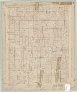
- Subject:
- Geographic Subject: Spencer County (Ind.), Geographic Subject: Dubois County (Ind.), Geographic Subject: Warrick County (Ind.), and Geographic Subject: Pike ...
- Creator:
- Renshawe, John H., Geological Survey (U.S.), Hawkins, Geo. T. (George T.), and Goodlove, C. W.
- Publisher:
- Geological Survey (U.S.)
- Date Created:
- 1902
- Identifier:
- VAC3073-M-01301
- Genre:
- 15 minute topographic maps, Topographic maps, and Quadrangle maps
- Geographic Location:
- Coordinates: W0871500 W0870000 N0381500 N0380000
- Related URL:
- Catalog URL: https://iucat.iu.edu/catalog/18408290
- Abstract:
- Engraved Oct. 1902 by U.S.G.S. , Jno. Renshawe, geographer in charge , control by Geo. T. Hawkins , topography by Chas. W. Goodlove. Filing title: Degonia Sp...
- Call Number:
- G4090 s62 .G4 Degonia Springs 1902
- Caption:
- Imprint: Washington, D.C. : The Survey, 1902
- Physical Description:
- Dimensions: 45 x 42 cm or smaller and Scale: 1:62,500
- Alternate Identifier:
- Title Control Number: a18408290
- Persistent URL:
- https://purl.dlib.indiana.edu/iudl/images/VAC3073/VAC3073-M-01301
- Provenance:
- Part of Geological Survey (U.S.). Indiana 1:62,500.
-
![Indiana-Illinois Princeton quadrangle [1918 reprint without vegetation]](https://iiif.uits.iu.edu/iiif/2/4j03f204d%2Ffiles%2Ff6858e73-7524-45b9-95f0-84b35f918de9/full/250,/0/default.jpg)
- Subject:
- Geographic Subject: Gibson County (Ind.), Geographic Subject: Knox County (Ind.), and Geographic Subject: Wabash County (Ill.)
- Creator:
- Goodlove, C. W., Hawkins, Geo. T. (George T.), Renshawe, John H., and Geological Survey (U.S.)
- Publisher:
- Geological Survey (U.S.)
- Date Created:
- 1918
- Identifier:
- VAC3073-M-01300
- Genre:
- Quadrangle maps, Topographic maps, and 15 minute topographic maps
- Geographic Location:
- Coordinates: W0874500 W0873000 N0383000 N0381500
- Related URL:
- Catalog URL: https://iucat.iu.edu/catalog/18413584
- Abstract:
- Jno. H. Renshawe, geographer in charge , control by Geo. T. Hawkins , topography by Chas. W. Goodlove. Filing title: Princeton, Ind.-Ill. Edition of 1903. Re...
- Call Number:
- G4090 s62 .G4 Princeton 1903 R1918
- Caption:
- Imprint: Washington, D.C. : U.S. Geological Survey, 1918
- Physical Description:
- Dimensions: 45 x 42 cm or smaller and Scale: 1:62,500
- Alternate Identifier:
- Title Control Number: a18413584
- Persistent URL:
- https://purl.dlib.indiana.edu/iudl/images/VAC3073/VAC3073-M-01300
- Provenance:
- Part of Geological Survey (U.S.). Indiana 1:62,500.

- « Previous
- Next »
- 1
- 2
- 3
- 4