
Search Constraints
You searched for:
State/Province
Белорусская ССР (Byelorussian Soviet Socialist Republic)
Remove constraint State/Province: Белорусская ССР (Byelorussian Soviet Socialist Republic)
« Previous |
1 - 100 of 596
|
Next »
Search Results
-
- Description:
- 1923
- Subject:
- Geographic Subject: Kazatskiye Bolsuny, Topical Subject: Maps, and Topical Subject: Soviet Union
- Publisher:
- Генеральный штаб Красной Армии
- Language:
- Russian
- Date Created:
- 1941
- Identifier:
- VAC9619-001986
- Genre:
- Military Maps and Topographic Maps
- Geographic Location:
- Coordinates: 52.6667, 31, 53, 31.5
- Related URL:
- Catalog URL: https://iucat.iu.edu/catalog/5020129 and Download GeoTIFF: https://drive.google.com/open?id=1NGZ48urLJWivl2Kfpc8aCV_5puUGsbqS
- Abstract:
- Modern area represented: Kazatskiye Bolsuny, Homyel voblasc, Belarus
- Call Number:
- G7000 s100 .S7 sheet N-36-111
- Caption:
- Для служебного пользования
- City:
- Казацкие Болсуны (Kazatskiye Bolsuny)
- Copyright Holder:
- No Copyright - United States
- Country:
- СССР (USSR)
- State/Province:
- РСФСР (RSFSR), Орловская область (Oryol oblast), Белорусская ССР (Byelorussian Soviet Socialist Republic), and Гомельская область (Homyel oblast)
- Physical Description:
- Scale: 1:100,000
- Persistent URL:
- http://purl.dlib.indiana.edu/iudl/images/VAC9619/VAC9619-001986
- Provenance:
- DMA Topographic Center, Army Map Service Library, Geographic Names Branch, Atlasblatt, OMAHA
-

- Description:
- 1924
- Subject:
- Geographic Subject: Mstsislaw, Topical Subject: Maps, and Topical Subject: Soviet Union
- Publisher:
- Генеральный штаб Красной Армии
- Language:
- Russian
- Date Created:
- 1941
- Identifier:
- VAC9619-001897
- Genre:
- Topographic Maps and Military Maps
- Geographic Location:
- Coordinates: 54, 31.5, 54.3333, 32
- Related URL:
- Download GeoTIFF: https://drive.google.com/open?id=1cQOJFMLkO5dpaGIkGEO-kIOTaYAKr-az and Catalog URL: https://iucat.iu.edu/catalog/5020129
- Abstract:
- Modern are represented: Мсціслаў (Mstsislaw), Mogilev Region, Belarus
- Call Number:
- G7000 s100 .S7 sheet N-36-64
- Caption:
- Для служебного пользования
- City:
- Мстиславль (Mstsislaw)
- Copyright Holder:
- No Copyright - United States
- Country:
- СССР (USSR)
- State/Province:
- Белорусская ССР (Byelorussian Soviet Socialist Republic), Могилевская область (Mogilev oblast), РСФСР (RSFSR), and Смоленская область (Smolensk oblast)
- Physical Description:
- Scale: 1:100,000
- Persistent URL:
- http://purl.dlib.indiana.edu/iudl/images/VAC9619/VAC9619-001897
- Provenance:
- DMA Topographic Center, Army Map Service Library, Library of Congress Geography & Map Division
-
- Subject:
- Geographic Subject: Roslavl', Topical Subject: Soviet Union, and Topical Subject: Maps
- Publisher:
- Генеральный штаб Красной Армии
- Language:
- Russian
- Date Created:
- 1941
- Identifier:
- VAC9619-001930
- Genre:
- Military Maps and Topographic Maps
- Geographic Location:
- Coordinates: 53.6667, 32.5, 54, 33
- Related URL:
- Catalog URL: https://iucat.iu.edu/catalog/5020129 and Download GeoTIFF: https://drive.google.com/open?id=1tYWxG1_1MmG_NdkAulJjjrUlZzPyeGXt
- Abstract:
- Modern area represented: Рославль (Roslavl'), Smolenskaya oblast, Russia
- Call Number:
- G7000 s100 .S7 sheet N-36-78
- Caption:
- Captured map
- City:
- Рославль (Roslavl')
- Copyright Holder:
- No Copyright - United States
- Country:
- СССР (USSR)
- State/Province:
- Могилевская область (Mogilev oblast), РСФСР (RSFSR), Белорусская ССР (Byelorussian Soviet Socialist Republic), and Смоленская область (Smolensk oblast)
- Physical Description:
- Scale: 1:100,000
- Persistent URL:
- http://purl.dlib.indiana.edu/iudl/images/VAC9619/VAC9619-001930
- Provenance:
- DMA Topographic Center, Army Map Service Library, OMAHA, Library of Congress Geography & Map Division
-
- Description:
- 1928
- Subject:
- Topical Subject: Maps, Geographic Subject: Klimavichy, and Topical Subject: Soviet Union
- Publisher:
- Генеральный штаб Красной Армии
- Language:
- Russian
- Date Created:
- 1941
- Identifier:
- VAC9619-001935
- Genre:
- Topographic Maps and Military Maps
- Geographic Location:
- Coordinates: 53.3333, 31.5, 53.6667, 32
- Related URL:
- Catalog URL: https://iucat.iu.edu/catalog/5020129 and Download GeoTIFF: https://drive.google.com/open?id=1aTYar7PS9fSRgL4-zL3oGs-zuFQ3y2mY
- Abstract:
- Modern area represented: Клімавічы (Klimavichy), Mogilev district, Belarus
- Call Number:
- G7000 s100 .S7 sheet N-36-88
- City:
- Климовичи (Klimavichy)
- Copyright Holder:
- No Copyright - United States
- Country:
- СССР (USSR)
- State/Province:
- Могилевская область (Mogilev oblast) and Белорусская ССР (Byelorussian Soviet Socialist Republic)
- Physical Description:
- Scale: 1:100,000
- Persistent URL:
- http://purl.dlib.indiana.edu/iudl/images/VAC9619/VAC9619-001935
- Provenance:
- DMA Topographic Center, Army Map Service Library, Library of Congress Geography & Map Division, Geographic Names Branch
-
- Description:
- 1930
- Subject:
- Topical Subject: Maps, Geographic Subject: Mglin, and Topical Subject: Soviet Union
- Publisher:
- Генеральный штаб Красной Армии
- Language:
- Russian
- Date Created:
- 1941
- Identifier:
- VAC9619-001978
- Genre:
- Military Maps and Topographic Maps
- Geographic Location:
- Coordinates: 53, 32.5, 53.3333, 33
- Related URL:
- Catalog URL: https://iucat.iu.edu/catalog/5020129 and Download GeoTIFF: https://drive.google.com/open?id=1yXi3ZMKV0YFCuSmi5zNywQY9TCVVcd61
- Abstract:
- Modern area represented: Mglin, Bryansk oblast, Russia
- Call Number:
- G7000 s100 .S7 sheet N-36-102
- City:
- Мглин (Mglin)
- Copyright Holder:
- No Copyright - United States
- Country:
- СССР (USSR)
- State/Province:
- Белорусская ССР (Byelorussian Soviet Socialist Republic), РСФСР (RSFSR), Орловская область (Oryol oblast), and Могилевская область (Mogilev oblast)
- Physical Description:
- Scale: 1:100,000
- Persistent URL:
- http://purl.dlib.indiana.edu/iudl/images/VAC9619/VAC9619-001978
- Provenance:
- DMA Topographic Center, Army Map Service Library, OMAHA, Atlasblatt, Library of Congress Geography & Map Division
-
- Description:
- 1929
- Subject:
- Topical Subject: Soviet Union, Topical Subject: Maps, and Geographic Subject: Kolpyta
- Publisher:
- Генеральный штаб Красной Армии
- Language:
- Russian
- Date Created:
- 1941
- Identifier:
- VAC9619-003264
- Genre:
- Topographic Maps and Military Maps
- Geographic Location:
- Coordinates: 51.333, 30.5, 51.667, 31
- Related URL:
- Download GeoTIFF: https://drive.google.com/file/d/1cL08hadD7DN7oxpKr2WVT0UmORBrZC4q/view?usp=sharing and Catalog URL: https://iucat.iu.edu/catalog/5020129
- Abstract:
- Modern area represented: Kolpyta, Chernihiv oblast, Ukraine
- Call Number:
- G7000 s100 .S7 sheet M-36-14
- Caption:
- Для служебного пользования
- City:
- Колпыта (Kolpyta)
- Copyright Holder:
- No Copyright - United States
- Country:
- СССР (USSR)
- State/Province:
- Белорусская ССР (Byelorussian Soviet Socialist Republic) and Украинская ССР (Ukrainian Soviet Socialist Republic)
- Physical Description:
- Scale: 1:100,000
- Persistent URL:
- http://purl.dlib.indiana.edu/iudl/images/VAC9619/VAC9619-003264
- Provenance:
- DMA Topographic Center, Army Map Service Library, OMAHA, Auswärtiges Amt. Geographischer Dienst
-
- Description:
- 1923
- Subject:
- Geographic Subject: Krasnyy, Topical Subject: Soviet Union, and Topical Subject: Maps
- Publisher:
- Генеральный штаб Красной Армии
- Language:
- Russian
- Date Created:
- 1941
- Identifier:
- VAC9619-004190
- Genre:
- Topographic Maps and Military Maps
- Geographic Location:
- Coordinates: 54.333, 31, 54.667, 31.5
- Related URL:
- Download GeoTIFF: https://drive.google.com/file/d/1Bh0gQboH4s3cm82rITN2Jl30xckewjkF/view?usp=sharing and Catalog URL: https://iucat.iu.edu/catalog/5020129
- Abstract:
- Modern area represented: Krasnyy, Smolensk oblast, Russia
- Call Number:
- G7000 s100 .S7 sheet N-36-51
- City:
- Красный (Krasnyy)
- Copyright Holder:
- No Copyright - United States
- Country:
- СССР (USSR)
- State/Province:
- Белорусская ССР (Byelorussian Soviet Socialist Republic), Витебская область (Vitebsk oblast), Могилевская область (Mogilev oblast), РСФСР (RSFSR), and Смолен...
- Physical Description:
- Scale: 1:100,000
- Persistent URL:
- http://purl.dlib.indiana.edu/iudl/images/VAC9619/VAC9619-004190
- Provenance:
- DMA Topographic Center, Army Map Service Library, OMAHA
-
- Description:
- 1931
- Subject:
- Topical Subject: Maps, Topical Subject: Soviet Union, and Geographic Subject: Khotsimsk
- Publisher:
- Генеральный штаб Красной Армии
- Language:
- Russian
- Date Created:
- 1941
- Identifier:
- VAC9619-001937
- Genre:
- Topographic Maps and Military Maps
- Geographic Location:
- Coordinates: 53.3333, 32.5, 53.6667, 33
- Related URL:
- Catalog URL: https://iucat.iu.edu/catalog/5020129 and Download GeoTIFF: https://drive.google.com/open?id=1ZS128aTIWIj2T-V2a8GCE9BsBAJiJGgB
- Abstract:
- Modern area represented: Хоцімск (Khotsimsk), Mogilev district, Belarus
- Call Number:
- G7000 s100 .S7 sheet N-36-90
- City:
- Хотимск (Khotimsk)
- Copyright Holder:
- No Copyright - United States
- Country:
- СССР (USSR)
- State/Province:
- РСФСР (RSFSR), Могилевская область (Mogilev oblast), Белорусская ССР (Byelorussian Soviet Socialist Republic), Орловская область (Oryol oblast), and Смоленск...
- Physical Description:
- Scale: 1:100,000
- Persistent URL:
- http://purl.dlib.indiana.edu/iudl/images/VAC9619/VAC9619-001937
- Provenance:
- DMA Topographic Center, Army Map Service Library, OMAHA, Library of Congress Geography & Map Division
-
- Subject:
- Geographic Subject: Kastsyukovichy, Topical Subject: Soviet Union, and Topical Subject: Maps
- Publisher:
- Генеральный штаб Красной Армии
- Language:
- Russian
- Date Created:
- 1941
- Identifier:
- VAC9619-001936
- Genre:
- Military Maps and Topographic Maps
- Geographic Location:
- Coordinates: 53.3333, 32, 53.6667, 32.5
- Related URL:
- Catalog URL: https://iucat.iu.edu/catalog/5020129 and Download GeoTIFF: https://drive.google.com/open?id=17diw8XEAG5Pvf2BuHqhMeKVNoc3ttEnL
- Abstract:
- Modern area represented: Касцюковічы (Kastsyukovichy), Mogilev district, Belarus
- Call Number:
- G7000 s100 .S7 sheet N-36-89
- City:
- Костюковичи (Kostyukovichi)
- Copyright Holder:
- No Copyright - United States
- Country:
- СССР (USSR)
- State/Province:
- РСФСР (RSFSR), Могилевская область (Mogilev oblast), Смоленская область (Smolensk oblast), and Белорусская ССР (Byelorussian Soviet Socialist Republic)
- Physical Description:
- Scale: 1:100,000
- Persistent URL:
- http://purl.dlib.indiana.edu/iudl/images/VAC9619/VAC9619-001936
- Provenance:
- DMA Topographic Center, Army Map Service Library
-

- Subject:
- Geographic Subject: Petrovichi, Topical Subject: Maps, and Topical Subject: Soviet Union
- Publisher:
- Генеральный штаб Красной Армии
- Language:
- Russian
- Date Created:
- 1941
- Identifier:
- VAC9619-001929
- Genre:
- Military Maps and Topographic Maps
- Geographic Location:
- Coordinates: 53.6667, 32, 54, 32.5
- Related URL:
- Catalog URL: https://iucat.iu.edu/catalog/5020129 and Download GeoTIFF: https://drive.google.com/open?id=1NuowuNe-KGOnHC6tMTsbjUOOiOYh8Zx_
- Abstract:
- Modern area represented: Петровичи (Petrovichi), Smolenskaya oblast, Russia
- Call Number:
- G7000 s100 .S7 sheet N-36-77
- City:
- Петровичи (Petrovichi)
- Copyright Holder:
- No Copyright - United States
- Country:
- СССР (USSR)
- State/Province:
- РСФСР (RSFSR), Белорусская ССР (Byelorussian Soviet Socialist Republic), Смоленская область (Smolensk oblast), and Могилевская область (Mogilev oblast)
- Physical Description:
- Scale: 1:100,000
- Persistent URL:
- http://purl.dlib.indiana.edu/iudl/images/VAC9619/VAC9619-001929
- Provenance:
- Army Map Service Library, Library of Congress G & M Division
-
- Description:
- 1928
- Subject:
- Geographic Subject: Cherykaw, Topical Subject: Soviet Union, and Topical Subject: Maps
- Publisher:
- Генеральный штаб Красной Армии
- Language:
- Russian
- Date Created:
- 1941
- Identifier:
- VAC9619-001934
- Genre:
- Topographic Maps and Military Maps
- Geographic Location:
- Coordinates: 53.3333, 31, 53.6667, 31.5
- Related URL:
- Catalog URL: https://iucat.iu.edu/catalog/5020129 and Download GeoTIFF: https://drive.google.com/open?id=1f41Rx_QTG3ojI2_D3pw5RJaswuqLX9xw
- Abstract:
- Modern area represented: Чэрыкаў (Cherykaw), Mogilev district, Belarus
- Call Number:
- G7000 s100 .S7 sheet N-36-87
- Caption:
- Для служебного пользования and Captured map
- City:
- Чериков (Cherykaw)
- Copyright Holder:
- No Copyright - United States
- Country:
- СССР (USSR)
- State/Province:
- Белорусская ССР (Byelorussian Soviet Socialist Republic) and Могилевская область (Mogilev oblast)
- Physical Description:
- Scale: 1:100,000
- Persistent URL:
- http://purl.dlib.indiana.edu/iudl/images/VAC9619/VAC9619-001934
- Provenance:
- DMA Topographic Center, Army Map Service Library, OMAHA, Library of Congress Geography & Map Division
-
- Description:
- 1923
- Subject:
- Topical Subject: Maps, Topical Subject: Soviet Union, and Geographic Subject: Rudnya
- Publisher:
- Генеральный штаб Красной Армии
- Language:
- Russian
- Date Created:
- 1941
- Identifier:
- VAC9619-004178
- Genre:
- Topographic Maps and Military Maps
- Geographic Location:
- Coordinates: 54.667, 31, 55, 31.5
- Related URL:
- Catalog URL: https://iucat.iu.edu/catalog/5020129 and Download GeoTIFF: https://drive.google.com/file/d/1obgx9kp0NmbLEuxcDlUB8bivoziwbRcl/view?usp=sharing
- Abstract:
- Modern area represented: Rudnya, Smolensk oblast, Russia
- Call Number:
- G7000 s100 .S7 sheet N-36-39
- City:
- Рудня (Rudnya)
- Copyright Holder:
- No Copyright - United States
- Country:
- СССР (USSR)
- State/Province:
- Белорусская ССР (Byelorussian Soviet Socialist Republic), Витебская область (Vitebsk oblast), Смоленская область (Smolensk oblast), and РСФСР (RSFSR)
- Physical Description:
- Scale: 1:100,000
- Persistent URL:
- http://purl.dlib.indiana.edu/iudl/images/VAC9619/VAC9619-004178
- Provenance:
- DMA Topographic Center, Auswärtiges Amt. Geographischer Dienst, OMAHA, Army Map Service Library
-
- Description:
- 1939
- Subject:
- Geographic Subject: Poselki, Topical Subject: Soviet Union, and Topical Subject: Maps
- Publisher:
- Главное Управление Геодезии и Картографии при СНК СССР
- Language:
- Russian
- Date Created:
- 1941
- Identifier:
- VAC9619-001414
- Genre:
- Military Maps and Topographic Maps
- Geographic Location:
- Coordinates: 53.667, 32.5, 53.833, 32.75
- Related URL:
- Download GeoTIFF: https://drive.google.com/open?id=1c3GJ_0bjXNnIpRcn6VIinpO86PSbBgv2 and Catalog URL: http://iucat.iu.edu/catalog/5020131
- Abstract:
- Modern area represented: Poselki, Smolensk oblast, Russia
- Call Number:
- GM G7000 S50 .S68 N-36-78-B
- Copyright Holder:
- No Copyright - United States
- Country:
- СССР (USSR)
- State/Province:
- Смоленская область (Smolensk oblast), Могилевская область (Mogilev oblast), Белорусская ССР (Byelorussian Soviet Socialist Republic), and РСФСР (RSFSR)
- Physical Description:
- Scale: 1:50,000
- Persistent URL:
- http://purl.dlib.indiana.edu/iudl/images/VAC9619/VAC9619-001414
- Provenance:
- DMA Topographic Center, Army Map Service Library, OMAHA, Library of Congress Geography & Map Division
-
- Description:
- 1926
- Subject:
- Geographic Subject: Surazh, Topical Subject: Maps, and Topical Subject: Soviet Union
- Publisher:
- Генеральный штаб Красной Армии
- Language:
- Russian
- Date Created:
- 1941
- Identifier:
- VAC9619-004154
- Genre:
- Military Maps and Topographic Maps
- Geographic Location:
- Coordinates: 55.333, 30.5, 55.667, 31
- Related URL:
- Catalog URL: https://iucat.iu.edu/catalog/5020129 and Download GeoTIFF: https://drive.google.com/file/d/1m_vZJCQc1phOGKx4B_EjsN3KiJZsddUD/view?usp=sharing
- Abstract:
- Modern area represented: Surazh, Vitebsk oblast, Belarus
- Call Number:
- G7000 s100 .S7 sheet N-36-14
- Caption:
- Для служебного пользования
- City:
- Сураж-Витебский (Surazh-Vitebskiy)
- Copyright Holder:
- No Copyright - United States
- Country:
- СССР (USSR)
- State/Province:
- Витебская область (Vitebsk oblast), РСФСР (RSFSR), Белорусская ССР (Byelorussian Soviet Socialist Republic), and Смоленская область (Smolensk oblast)
- Physical Description:
- Scale: 1:100,000
- Persistent URL:
- http://purl.dlib.indiana.edu/iudl/images/VAC9619/VAC9619-004154
- Provenance:
- DMA Topographic Center, Army Map Service Library, OMAHA
-

- Description:
- 1923
- Subject:
- Topical Subject: Maps, Topical Subject: Soviet Union, and Geographic Subject: Ogorodnya
- Publisher:
- Генеральный штаб Красной Армии
- Language:
- Russian
- Date Created:
- 1941
- Identifier:
- VAC9619-004213
- Genre:
- Topographic Maps and Military Maps
- Geographic Location:
- Coordinates: 52, 31.5, 52.333, 32
- Related URL:
- Download GeoTIFF: https://drive.google.com/file/d/1MuU_oyIyusePmX5IlnPsAE4zUOKWaE3e/view?usp=sharing and Catalog URL: https://iucat.iu.edu/catalog/5020129
- Abstract:
- Modern area represented: Ogorodnya, Homyel voblasc, Belarus
- Call Number:
- G7000 s100 .S7 sheet N-36-136
- City:
- Огородня-Гомельская (Ogorodnya-Gomelskaya)
- Copyright Holder:
- No Copyright - United States
- Country:
- СССР (USSR)
- State/Province:
- Орловская область (Oryol oblast), Украинская ССР (Ukrainian Soviet Socialist Republic), Белорусская ССР (Byelorussian Soviet Socialist Republic), Черниговска...
- Physical Description:
- Scale: 1:100,000
- Persistent URL:
- http://purl.dlib.indiana.edu/iudl/images/VAC9619/VAC9619-004213
- Provenance:
- DMA Topographic Center, Army Map Service Library
-
- Description:
- 1921
- Subject:
- Topical Subject: Maps, Topical Subject: Soviet Union, and Geographic Subject: Lyëzna
- Publisher:
- Генеральный штаб Красной Армии
- Language:
- Russian
- Date Created:
- 1941
- Identifier:
- VAC9619-004165
- Genre:
- Military Maps and Topographic Maps
- Geographic Location:
- Coordinates: 55, 30.5, 55.333, 31
- Related URL:
- Download GeoTIFF: https://drive.google.com/file/d/1GaUCWxez1l1gKfLdcmzpyfaFV1uW76Pr/view?usp=sharing and Catalog URL: https://iucat.iu.edu/catalog/5020129
- Abstract:
- Modern area represented: Lyëzna, Vitebsk oblast, Belarus
- Call Number:
- G7000 s100 .S7 sheet N-36-26
- City:
- Лиозно (Lyëzna)
- Copyright Holder:
- No Copyright - United States
- Country:
- СССР (USSR)
- State/Province:
- РСФСР (RSFSR), Смоленская область (Smolensk oblast), Белорусская ССР (Byelorussian Soviet Socialist Republic), and Витебская область (Vitebsk oblast)
- Physical Description:
- Scale: 1:100,000
- Persistent URL:
- http://purl.dlib.indiana.edu/iudl/images/VAC9619/VAC9619-004165
- Provenance:
- DMA Topographic Center, Auswärtiges Amt. Geographischer Dienst, OMAHA, Army Map Service Library
-
- Description:
- 1924
- Subject:
- Topical Subject: Maps, Topical Subject: Soviet Union, and Geographic Subject: Sorokoshichi
- Publisher:
- Генеральный штаб Красной Армии
- Language:
- Russian
- Date Created:
- 1941
- Identifier:
- VAC9619-003271
- Genre:
- Topographic Maps and Military Maps
- Geographic Location:
- Coordinates: 51, 30.5, 51.333, 31
- Related URL:
- Download GeoTIFF: https://drive.google.com/file/d/1KxaQ7Xoh_2tWdxEvMRNheFDM8vAmtddO/view?usp=sharing and Catalog URL: https://iucat.iu.edu/catalog/5020129
- Abstract:
- Modern area represented: Sorokoshichi, Chernihiv oblast, Ukraine
- Call Number:
- G7000 s100 .S7 sheet M-36-26
- Caption:
- Для служебного пользования
- City:
- Сорокошичи (Sorokoshichi)
- Copyright Holder:
- No Copyright - United States
- Country:
- СССР (USSR)
- State/Province:
- Полесская область (Polesia oblast), Белорусская ССР (Byelorussian Soviet Socialist Republic), Украинская ССР (Ukrainian Soviet Socialist Republic), and Черни...
- Physical Description:
- Scale: 1:100,000
- Persistent URL:
- http://purl.dlib.indiana.edu/iudl/images/VAC9619/VAC9619-003271
- Provenance:
- DMA Topographic Center, Army Map Service Library
-
- Description:
- 1928
- Subject:
- Topical Subject: Maps, Topical Subject: Soviet Union, and Geographic Subject: Krasnapollye
- Publisher:
- Генеральный штаб Красной Армии
- Language:
- Russian
- Date Created:
- 1941
- Identifier:
- VAC9619-001975
- Genre:
- Topographic Maps and Military Maps
- Geographic Location:
- Coordinates: 53, 31, 53.3333, 31.5
- Related URL:
- Catalog URL: https://iucat.iu.edu/catalog/5020129 and Download GeoTIFF: https://drive.google.com/open?id=1Z5dBUoWQLQ-zZh5EGMm6plrHEkU-C9l6
- Abstract:
- Modern area represented: Краснаполле (Krasnapollye), Mogilev district, Belarus
- Call Number:
- G7000 s100 .S7 sheet N-36-99
- Caption:
- Для служебного пользования
- City:
- Краснополье (Krasnopol’ye)
- Copyright Holder:
- No Copyright - United States
- Country:
- СССР (USSR)
- State/Province:
- РСФСР (RSFSR), Орловская область (Oryol oblast), Гомельская область (Homyel oblast), Белорусская ССР (Byelorussian Soviet Socialist Republic), and Могилевска...
- Physical Description:
- Scale: 1:100,000
- Persistent URL:
- http://purl.dlib.indiana.edu/iudl/images/VAC9619/VAC9619-001975
- Provenance:
- DMA Topographic Center, Army Map Service Library, Library of Congress Geography & Map Division
-
- Description:
- 1928
- Subject:
- Topical Subject: Maps, Geographic Subject: Samotevichi, and Topical Subject: Soviet Union
- Publisher:
- Генеральный штаб Красной Армии
- Language:
- Russian
- Date Created:
- 1941
- Identifier:
- VAC9619-001976
- Genre:
- Topographic Maps and Military Maps
- Geographic Location:
- Coordinates: 53, 31.5, 53.333, 32
- Related URL:
- Download GeoTIFF: https://drive.google.com/open?id=1yb-VAsnWkk3QAGNi7Yx3eHuO0AekwOSE and Catalog URL: https://iucat.iu.edu/catalog/5020129
- Abstract:
- Modern area represented: Samotevichi, Mogilev oblast, Belarus
- Call Number:
- G7000 s100 .S7 sheet N-36-100
- City:
- Самотевичи (Samotevichi)
- Copyright Holder:
- No Copyright - United States
- Country:
- СССР (USSR)
- State/Province:
- Орловская область (Oryol oblast), Белорусская ССР (Byelorussian Soviet Socialist Republic), РСФСР (RSFSR), and Могилевская область (Mogilev oblast)
- Physical Description:
- Scale: 1:100,000
- Persistent URL:
- http://purl.dlib.indiana.edu/iudl/images/VAC9619/VAC9619-001976
- Provenance:
- DMA Topographic Center, Army Map Service Library, OMAHA, Atlasblatt, Library of Congress Geography & Map Division
-
- Description:
- 1929
- Subject:
- Topical Subject: Maps, Geographic Subject: Loyew, and Topical Subject: Soviet Union
- Publisher:
- Генеральный штаб Красной Армии
- Language:
- Russian
- Date Created:
- 1941
- Identifier:
- VAC9619-003254
- Genre:
- Topographic Maps and Military Maps
- Geographic Location:
- Coordinates: 51.667, 30.5, 52, 31
- Related URL:
- Catalog URL: https://iucat.iu.edu/catalog/5020129 and Download GeoTIFF: https://drive.google.com/file/d/1pts7bgzSOMFuWGK1hGOGVJSjwKFOPf_0/view?usp=sharing
- Abstract:
- Modern area represented: Loyew, Gomel oblast, Belarus
- Call Number:
- G7000 s100 .S7 sheet M-36-2
- Caption:
- Для служебного пользования
- City:
- Лоев (Loyew)
- Copyright Holder:
- No Copyright - United States
- Country:
- СССР (USSR)
- State/Province:
- Полесская область (Polesia oblast), Гомельская область (Homyel oblast), Украинская ССР (Ukrainian Soviet Socialist Republic), Белорусская ССР (Byelorussian S...
- Physical Description:
- Scale: 1:100,000
- Persistent URL:
- http://purl.dlib.indiana.edu/iudl/images/VAC9619/VAC9619-003254
- Provenance:
- DMA Topographic Center, Army Map Service Library, OMAHA
-
- Description:
- 1921
- Subject:
- Topical Subject: Maps, Topical Subject: Soviet Union, and Geographic Subject: Dobromysl
- Publisher:
- Генеральный штаб Красной Армии
- Language:
- Russian
- Date Created:
- 1941
- Identifier:
- VAC9619-004177
- Genre:
- Military Maps and Topographic Maps
- Geographic Location:
- Coordinates: 54.667, 30.5, 55, 31
- Related URL:
- Download GeoTIFF: https://drive.google.com/file/d/1DxT6VlnyyuTqvLN7VwBKptND_sMxXGKn/view?usp=sharing and Catalog URL: https://iucat.iu.edu/catalog/5020129
- Abstract:
- Modern area represented: Dobromysl, Vitebsk oblast, Belarus
- Call Number:
- G7000 s100 .S7 sheet N-36-38
- City:
- Добромысль (Dobromysl)
- Copyright Holder:
- No Copyright - United States
- Country:
- СССР (USSR)
- State/Province:
- Белорусская ССР (Byelorussian Soviet Socialist Republic), Смоленская область (Smolensk oblast), РСФСР (RSFSR), and Витебская область (Vitebsk oblast)
- Physical Description:
- Scale: 1:100,000
- Persistent URL:
- http://purl.dlib.indiana.edu/iudl/images/VAC9619/VAC9619-004177
- Provenance:
- DMA Topographic Center, Army Map Service Library, OMAHA
-
- Description:
- 1923
- Subject:
- Topical Subject: Maps, Geographic Subject: Novozybkov, and Topical Subject: Soviet Union
- Publisher:
- Генеральный штаб Красной Армии
- Language:
- Russian
- Date Created:
- 1941
- Identifier:
- VAC9619-004203
- Genre:
- Military Maps and Topographic Maps
- Geographic Location:
- Coordinates: 52.333, 31.5, 52.667, 32
- Related URL:
- Catalog URL: https://iucat.iu.edu/catalog/5020129 and Download GeoTIFF: https://drive.google.com/file/d/1Dyd0R2R0NM4gBih6KS0eejQ8jJoggkwx/view?usp=sharing
- Abstract:
- Modern area represented: Novozybkov, Bryansk oblast, Russia
- Call Number:
- G7000 s100 .S7 sheet N-36-124
- City:
- Новозыбков (Novozybkov)
- Copyright Holder:
- No Copyright - United States
- Country:
- СССР (USSR)
- State/Province:
- РСФСР (RSFSR), Орловская область (Oryol oblast), Белорусская ССР (Byelorussian Soviet Socialist Republic), and Гомельская область (Homyel oblast)
- Physical Description:
- Scale: 1:100,000
- Persistent URL:
- http://purl.dlib.indiana.edu/iudl/images/VAC9619/VAC9619-004203
- Provenance:
- DMA Topographic Center, Auswärtiges Amt. Geographischer Dienst, OMAHA, Army Map Service Library
-

- Description:
- 1928
- Subject:
- Geographic Subject: Surazh, Topical Subject: Soviet Union, and Topical Subject: Maps
- Publisher:
- Генеральный штаб Красной Армии
- Language:
- Russian
- Date Created:
- 1941
- Identifier:
- VAC9619-001977
- Genre:
- Topographic Maps and Military Maps
- Geographic Location:
- Coordinates: 53, 32, 53.3333, 32.5
- Related URL:
- Catalog URL: https://iucat.iu.edu/catalog/5020129 and Download GeoTIFF: https://drive.google.com/open?id=1beMyaj-VgbNaVBKPEMNn15PuoGtx7M9s
- Abstract:
- Modern area represented: Surazh, Bryansk oblast, Russia
- Call Number:
- G7000 s100 .S7 sheet N-36-101
- City:
- Сураж (Surazh)
- Copyright Holder:
- No Copyright - United States
- Country:
- СССР (USSR)
- State/Province:
- Могилевская область (Mogilev oblast), Белорусская ССР (Byelorussian Soviet Socialist Republic), РСФСР (RSFSR), and Орловская область (Oryol oblast)
- Physical Description:
- Scale: 1:100,000
- Persistent URL:
- http://purl.dlib.indiana.edu/iudl/images/VAC9619/VAC9619-001977
- Provenance:
- DMA Topographic Center, Army Map Service Library
-
- Subject:
- Topical Subject: Maps, Topical Subject: Soviet Union, and Geographic Subject: Krychaw
- Publisher:
- Генеральный штаб Красной Армии
- Language:
- Russian
- Date Created:
- 1941
- Identifier:
- VAC9619-001928
- Genre:
- Topographic Maps and Military Maps
- Geographic Location:
- Coordinates: 53.6667, 31.5, 54, 32
- Related URL:
- Download GeoTIFF: https://drive.google.com/open?id=1JxzD9LsR7YqYsS-HBjIMui0OfPZN3WDA and Catalog URL: https://iucat.iu.edu/catalog/5020129
- Abstract:
- Modern area represented: Крычаў (Krychaw), Mogilev district, Belarus
- Call Number:
- G7000 s100 .S7 sheet N-36-76
- Caption:
- Captured map
- City:
- Кричев (Krichev)
- Copyright Holder:
- No Copyright - United States
- Country:
- СССР (USSR)
- State/Province:
- Белорусская ССР (Byelorussian Soviet Socialist Republic), Смоленская область (Smolensk oblast), РСФСР (RSFSR), and Могилевская область (Mogilev oblast)
- Physical Description:
- Scale: 1:100,000
- Persistent URL:
- http://purl.dlib.indiana.edu/iudl/images/VAC9619/VAC9619-001928
- Provenance:
- DMA Topographic Center, Army Map Service Library
-

- Description:
- 1890
- Subject:
- Topical Subject: Soviet Union, Topical Subject: Maps, and Geographic Subject: Slonim
- Publisher:
- Генеральный штаб Красной Армии
- Language:
- Russian
- Date Created:
- 1940
- Identifier:
- VAC9619-004100
- Genre:
- Military Maps and Topographic Maps
- Geographic Location:
- Coordinates: 53, 25, 53.333, 25.5
- Related URL:
- Download GeoTIFF: https://drive.google.com/file/d/11uIlcuAi2jRjN2zbDtSfPdBrUot13QKy/view?usp=sharing and Catalog URL: https://iucat.iu.edu/catalog/5020129
- Abstract:
- Modern area represented: Slonim, Belarus
- Call Number:
- G7000 s100 .S7 sheet N-35-99
- City:
- Слоним (Slonim)
- Copyright Holder:
- No Copyright - United States
- Country:
- СССР (USSR)
- State/Province:
- Белорусская ССР (Byelorussian Soviet Socialist Republic) and Барановичская область (Baranavichy oblast)
- Physical Description:
- Scale: 1:100,000
- Persistent URL:
- http://purl.dlib.indiana.edu/iudl/images/VAC9619/VAC9619-004100
- Provenance:
- DMA Topographic Center, Army Map Service Library
-
- Description:
- 1895
- Subject:
- Topical Subject: Soviet Union, Topical Subject: Maps, and Geographic Subject: Novaya Mysh
- Publisher:
- Генеральный штаб Красной Армии
- Language:
- Russian
- Date Created:
- 1940
- Identifier:
- VAC9619-004101
- Genre:
- Military Maps and Topographic Maps
- Geographic Location:
- Coordinates: 53, 25.5, 53.333, 26
- Related URL:
- Download GeoTIFF: https://drive.google.com/file/d/1_U9Fewzw-xMN9DAHx9Kbxa5wSIBHdFy_/view?usp=sharing and Catalog URL: https://iucat.iu.edu/catalog/5020129
- Abstract:
- Modern area represented: Novaya Mysh, Brest oblast, Belarus
- Call Number:
- G7000 s100 .S7 sheet N-35-100
- City:
- Новая Мышь (Novaya Mysh)
- Copyright Holder:
- No Copyright - United States
- Country:
- СССР (USSR)
- State/Province:
- Барановичская область (Baranavichy oblast) and Белорусская ССР (Byelorussian Soviet Socialist Republic)
- Physical Description:
- Scale: 1:100,000
- Persistent URL:
- http://purl.dlib.indiana.edu/iudl/images/VAC9619/VAC9619-004101
- Provenance:
- DMA Topographic Center, Army Map Service Library, OMAHA, Atlasblatt
-
- Description:
- 1886
- Subject:
- Topical Subject: Maps, Geographic Subject: Bialystok, and Topical Subject: Soviet Union
- Publisher:
- Генеральный штаб РККА
- Language:
- Russian
- Date Created:
- 1940
- Identifier:
- VAC9619-003972
- Genre:
- Topographic Maps and Military Maps
- Geographic Location:
- Coordinates: 53, 23, 53.333, 23.5
- Related URL:
- Catalog URL: https://iucat.iu.edu/catalog/5020129 and Download GeoTIFF: https://drive.google.com/file/d/1or9XENpi_EE2ArngZQ57HYq1cIvvkkug/view?usp=sharing
- Abstract:
- Modern area represented: Bialystok, Podlaskie Voivodeship, Poland
- Call Number:
- G7000 s100 .S7 sheet N-34-107
- City:
- Белосток (Bialystok)
- Copyright Holder:
- No Copyright - United States
- Country:
- СССР (USSR)
- State/Province:
- Белостокская область (Belastok oblast) and Белорусская ССР (Byelorussian Soviet Socialist Republic)
- Physical Description:
- Scale: 1:100,000
- Persistent URL:
- http://purl.dlib.indiana.edu/iudl/images/VAC9619/VAC9619-003972
- Provenance:
- DMA Topographic Center, Army Map Service Library, Auswärtiges Amt. Geographischer Dienst
-
- Description:
- 1881
- Subject:
- Topical Subject: Soviet Union, Topical Subject: Maps, and Geographic Subject: Czeremcha
- Publisher:
- Генеральный штаб Красной Армии
- Language:
- Russian
- Date Created:
- 1940
- Identifier:
- VAC9619-003993
- Genre:
- Military Maps and Topographic Maps
- Geographic Location:
- Coordinates: 52.333, 23, 52.667, 23.5
- Related URL:
- Download GeoTIFF: https://drive.google.com/file/d/1kPiXT7F_LZnyau0SUjehrYKXx17IX5X1/view?usp=sharing and Catalog URL: https://iucat.iu.edu/catalog/5020129
- Abstract:
- Modern area represented: Czeremcha, Podlaskie Voivodeship, Poland
- Call Number:
- G7000 s100 .S7 sheet N-34-131
- City:
- Черемха (Czeremcha)
- Copyright Holder:
- No Copyright - United States
- Country:
- СССР (USSR)
- State/Province:
- Область государственных интересов Германии (Region of German state interests), Белостокская область (Belastok oblast), Белорусская ССР (Byelorussian Soviet S...
- Physical Description:
- Scale: 1:100,000
- Persistent URL:
- http://purl.dlib.indiana.edu/iudl/images/VAC9619/VAC9619-003993
- Provenance:
- DMA Topographic Center, Army Map Service Library, OMAHA, Library of Congress Geography & Map Division
-

- Description:
- 1891
- Subject:
- Topical Subject: Soviet Union, Topical Subject: Maps, and Geographic Subject: Lentvaris
- Publisher:
- Генеральный штаб Красной Армии
- Language:
- Russian
- Date Created:
- 1940
- Identifier:
- VAC9619-004053
- Genre:
- Military Maps and Topographic Maps
- Geographic Location:
- Coordinates: 54.333, 25, 54.667, 25.5
- Related URL:
- Catalog URL: https://iucat.iu.edu/catalog/5020129 and Download GeoTIFF: https://drive.google.com/file/d/1pGDy3t6VgddIj8je6N5NWJd-o0jXgLYB/view?usp=sharing
- Abstract:
- Modern area represented: Lentvaris, Lithuania
- Call Number:
- G7000 s100 .S7 sheet N-35-51
- City:
- Ландворово (Landwarów)
- Copyright Holder:
- No Copyright - United States
- Country:
- СССР (USSR)
- State/Province:
- Белорусская ССР (Byelorussian Soviet Socialist Republic), Барановичская область (Baranavichy oblast), and Литовская ССР (Lithuanian Soviet Socialist Republic)
- Physical Description:
- Scale: 1:100,000
- Persistent URL:
- http://purl.dlib.indiana.edu/iudl/images/VAC9619/VAC9619-004053
- Provenance:
- DMA Topographic Center, Army Map Service Library
-
- Description:
- 1881
- Subject:
- Topical Subject: Soviet Union, Topical Subject: Maps, and Geographic Subject: Bielsk Podlaski
- Publisher:
- Генеральный штаб Красной Армии
- Language:
- Russian
- Date Created:
- 1940
- Identifier:
- VAC9619-003984
- Genre:
- Topographic Maps and Military Maps
- Geographic Location:
- Coordinates: 52.66667, 23.0, 53.0, 23.5
- Related URL:
- Download GeoTIFF: https://drive.google.com/file/d/1A86JaHQlP2KHS39WU0mYi8KFpIIv5SCy/view?usp=sharing and Catalog URL: https://iucat.iu.edu/catalog/5020129
- Abstract:
- Modern area represented: Bielsk Podlaski, Podlaskie Voivodeship, Poland
- Call Number:
- G7000 s100 .S7 sheet N-34-119
- City:
- Бельск (Bielsk)
- Copyright Holder:
- No Copyright - United States
- Country:
- СССР (USSR)
- State/Province:
- Белостокская область (Belastok oblast) and Белорусская ССР (Byelorussian Soviet Socialist Republic)
- Physical Description:
- Scale: 1:100,000
- Persistent URL:
- http://purl.dlib.indiana.edu/iudl/images/VAC9619/VAC9619-003984
- Provenance:
- DMA Topographic Center, Army Map Service Library, OMAHA
-
- Description:
- 1894
- Subject:
- Geographic Subject: Lida, Topical Subject: Maps, and Topical Subject: Soviet Union
- Publisher:
- Генеральный штаб Красной Армии
- Language:
- Russian
- Date Created:
- 1940
- Identifier:
- VAC9619-004075
- Genre:
- Topographic Maps and Military Maps
- Geographic Location:
- Coordinates: 53.667, 25, 54, 25.5
- Related URL:
- Download GeoTIFF: https://drive.google.com/file/d/1YZNgXinCxjSqdCq4D3APhuYB8EeukWnY/view?usp=sharing and Catalog URL: https://iucat.iu.edu/catalog/5020129
- Abstract:
- Modern area represented: Lida, Hrodna oblast, Belarus
- Call Number:
- G7000 s100 .S7 sheet N-35-75
- Caption:
- Для служебного пользования
- City:
- Лида (Lida)
- Copyright Holder:
- No Copyright - United States
- Country:
- СССР (USSR)
- State/Province:
- Барановичская область (Baranavichy oblast) and Белорусская ССР (Byelorussian Soviet Socialist Republic)
- Physical Description:
- Scale: 1:100,000
- Persistent URL:
- http://purl.dlib.indiana.edu/iudl/images/VAC9619/VAC9619-004075
- Provenance:
- DMA Topographic Center, Army Map Service Library, OMAHA
-
- Description:
- 1892
- Subject:
- Geographic Subject: Voranava, Topical Subject: Soviet Union, and Topical Subject: Maps
- Publisher:
- Генеральный штаб Красной Армии
- Language:
- Russian
- Date Created:
- 1940
- Identifier:
- VAC9619-004064
- Genre:
- Military Maps and Topographic Maps
- Geographic Location:
- Coordinates: 54, 25, 54.333, 25.5
- Related URL:
- Download GeoTIFF: https://drive.google.com/file/d/1tO5prjgODdaiMEwbAiBmjjqkgV1IWgi7/view?usp=sharing and Catalog URL: https://iucat.iu.edu/catalog/5020129
- Abstract:
- Modern area represented: Voranava, Hrodno oblast, Belarus
- Call Number:
- G7000 s100 .S7 sheet N-35-63
- Caption:
- Для служебного пользования
- City:
- Вороново (Voranava)
- Copyright Holder:
- No Copyright - United States
- Country:
- СССР (USSR)
- State/Province:
- Барановичская область (Baranavichy oblast), Литовская ССР (Lithuanian Soviet Socialist Republic), and Белорусская ССР (Byelorussian Soviet Socialist Republic)
- Physical Description:
- Scale: 1:100,000
- Persistent URL:
- http://purl.dlib.indiana.edu/iudl/images/VAC9619/VAC9619-004064
- Provenance:
- DMA Topographic Center, Army Map Service Library, Atlasblatt
-
- Description:
- 1891
- Subject:
- Topical Subject: Maps, Topical Subject: Soviet Union, and Geographic Subject: Orany
- Publisher:
- Генеральный штаб Красной Армии
- Language:
- Russian
- Date Created:
- 1940
- Identifier:
- VAC9619-004063
- Genre:
- Topographic Maps and Military Maps
- Geographic Location:
- Coordinates: 54, 24.5, 54.333, 25
- Related URL:
- Download GeoTIFF: https://drive.google.com/file/d/1ueDvLRNXYOxiG0_D2EP25yRdynUO5q7f/view?usp=sharing and Catalog URL: https://iucat.iu.edu/catalog/5020129
- Abstract:
- Modern area represented: Orany, Hrodno oblast, Belarus
- Call Number:
- G7000 s100 .S7 sheet N-35-62
- City:
- Ораны (Orany)
- Copyright Holder:
- No Copyright - United States
- Country:
- СССР (USSR)
- State/Province:
- Белостокская область (Belastok oblast), Барановичская область (Baranavichy oblast), Литовская ССР (Lithuanian Soviet Socialist Republic), and Белорусская ССР...
- Physical Description:
- Scale: 1:100,000
- Persistent URL:
- http://purl.dlib.indiana.edu/iudl/images/VAC9619/VAC9619-004063
- Provenance:
- DMA Topographic Center, Army Map Service Library, OMAHA
-
- Description:
- 1899
- Subject:
- Geographic Subject: Yuratsishki, Topical Subject: Soviet Union, and Topical Subject: Maps
- Publisher:
- Генеральный штаб Красной Армии
- Language:
- Russian
- Date Created:
- 1940
- Identifier:
- VAC9619-004065
- Genre:
- Topographic Maps and Military Maps
- Geographic Location:
- Coordinates: 54, 25.5, 54.333, 26
- Related URL:
- Download GeoTIFF: https://drive.google.com/file/d/1S208tYzBNgJlOJ0Z-RWb-phjImadfveI/view?usp=sharing and Catalog URL: https://iucat.iu.edu/catalog/5020129
- Abstract:
- Modern area represented: Yuratsishki, Hrodna oblast, Belarus
- Call Number:
- G7000 s100 .S7 sheet N-35-64
- Caption:
- Для служебного пользования
- City:
- Юратишки (Yuratsishki)
- Copyright Holder:
- No Copyright - United States
- Country:
- СССР (USSR)
- State/Province:
- Барановичская область (Baranavichy oblast), Вилейская область (Vileyka oblast), and Белорусская ССР (Byelorussian Soviet Socialist Republic)
- Physical Description:
- Scale: 1:100,000
- Persistent URL:
- http://purl.dlib.indiana.edu/iudl/images/VAC9619/VAC9619-004065
- Provenance:
- DMA Topographic Center, Army Map Service Library
-
- Description:
- 1882
- Subject:
- Topical Subject: Soviet Union, Topical Subject: Maps, and Geographic Subject: Bryansk
- Publisher:
- Генеральный штаб Красной Армии
- Language:
- Russian
- Date Created:
- 1940
- Identifier:
- VAC9619-003983
- Genre:
- Topographic Maps and Military Maps
- Geographic Location:
- Coordinates: 52.667, 22.5, 53, 23
- Related URL:
- Download GeoTIFF: https://drive.google.com/file/d/1d-KsCLLwSwqHxGTlKKdBLXt2E_IuOjLa/view?usp=sharing and Catalog URL: https://iucat.iu.edu/catalog/5020129
- Abstract:
- Modern area represented: Bryansk, Bryansk Oblast, Russia
- Call Number:
- G7000 s100 .S7 sheet N-34-118
- City:
- Брянск (Bryansk)
- Copyright Holder:
- No Copyright - United States
- Country:
- СССР (USSR)
- State/Province:
- Белостокская область (Belastok oblast) and Белорусская ССР (Byelorussian Soviet Socialist Republic)
- Physical Description:
- Scale: 1:100,000
- Persistent URL:
- http://purl.dlib.indiana.edu/iudl/images/VAC9619/VAC9619-003983
- Provenance:
- Army Map Service Library
-
- Description:
- 1896
- Subject:
- Topical Subject: Soviet Union, Geographic Subject: Pabradė, and Topical Subject: Maps
- Publisher:
- Генеральный штаб Красной Армии
- Language:
- Russian
- Date Created:
- 1940
- Identifier:
- VAC9619-004042
- Genre:
- Military Maps and Topographic Maps
- Geographic Location:
- Coordinates: 54.667, 25.5, 55, 26
- Related URL:
- Catalog URL: https://iucat.iu.edu/catalog/5020129 and Download GeoTIFF: https://drive.google.com/file/d/1YFsfTU9po10RXE5Yt1qzruLaxNk6ivoW/view?usp=sharing
- Abstract:
- Modern area represented: Pabradė, Lithuania
- Call Number:
- G7000 s100 .S7 sheet N-35-40
- Caption:
- Для служебного пользования
- City:
- Подбродзе (Podbrodze)
- Copyright Holder:
- No Copyright - United States
- Country:
- СССР (USSR)
- State/Province:
- Белорусская ССР (Byelorussian Soviet Socialist Republic), Литовская ССР (Lithuanian Soviet Socialist Republic), and Вилейская область (Vileyka oblast)
- Physical Description:
- Scale: 1:100,000
- Persistent URL:
- http://purl.dlib.indiana.edu/iudl/images/VAC9619/VAC9619-004042
- Provenance:
- DMA Topographic Center, Army Map Service Library
-
- Description:
- 1887
- Subject:
- Geographic Subject: Hrodna, Topical Subject: Maps, and Topical Subject: Soviet Union
- Publisher:
- Генеральный штаб Красной Армии
- Language:
- Russian
- Date Created:
- 1940
- Identifier:
- VAC9619-003951
- Genre:
- Military Maps and Topographic Maps
- Geographic Location:
- Coordinates: 53.667, 23.5, 54, 24
- Related URL:
- Catalog URL: https://iucat.iu.edu/catalog/5020129 and Download GeoTIFF: https://drive.google.com/file/d/1Q0SLKUQs7aR9zNvsI0f3_8RChxYhjDkq/view?usp=sharing
- Abstract:
- Modern area represented: Hrodna, Grodno Region, Belarus
- Call Number:
- G7000 s100 .S7 sheet N-34-84
- Caption:
- Для служебного пользования
- City:
- Гродно (Grodno)
- Copyright Holder:
- No Copyright - United States
- Country:
- СССР (USSR)
- State/Province:
- Область государственных интересов Германии (Region of German state interests), Белорусская ССР (Byelorussian Soviet Socialist Republic), and Литовская ССР (L...
- Physical Description:
- Scale: 1:100,000
- Persistent URL:
- http://purl.dlib.indiana.edu/iudl/images/VAC9619/VAC9619-003951
- Provenance:
- DMA Topographic Center, Army Map Service Library, Geographic Names Branch, OMAHA
-
- Description:
- 1880
- Subject:
- Topical Subject: Maps, Geographic Subject: Sokołów Podlaski, and Topical Subject: Soviet Union
- Publisher:
- Генеральный штаб Красной Армии
- Language:
- Russian
- Date Created:
- 1940
- Identifier:
- VAC9619-003992
- Genre:
- Military Maps and Topographic Maps
- Geographic Location:
- Coordinates: 52.333, 22, 52.667, 22.5
- Related URL:
- Catalog URL: https://iucat.iu.edu/catalog/5020129 and Download GeoTIFF: https://drive.google.com/file/d/1eg1SS4A5CPTFCQ-PH7OFuwFOY22LVuuO/view?usp=sharing
- Abstract:
- Modern area represented: Sokołów Podlaski, Masovian Voivodeship, Poland
- Call Number:
- G7000 s100 .S7 sheet N-34-129
- City:
- Соколув Подляски (Sokołów Podlaski)
- Copyright Holder:
- No Copyright - United States
- Country:
- СССР (USSR)
- State/Province:
- Белорусская ССР (Byelorussian Soviet Socialist Republic), Область государственных интересов Германии (Region of German state interests), and Белостокская обл...
- Physical Description:
- Scale: 1:100,000
- Persistent URL:
- http://purl.dlib.indiana.edu/iudl/images/VAC9619/VAC9619-003992
- Provenance:
- DMA Topographic Center, Army Map Service Library, OMAHA, Library of Congress Geography & Map Division
-
- Description:
- 1887
- Subject:
- Geographic Subject: Włodawa, Topical Subject: Soviet Union, and Topical Subject: Maps
- Publisher:
- Генеральный штаб Красной Армии
- Language:
- Russian
- Date Created:
- 1940
- Identifier:
- VAC9619-002762
- Genre:
- Topographic Maps and Military Maps
- Geographic Location:
- Coordinates: 51.333, 23.5, 51.667, 24
- Related URL:
- Download GeoTIFF: https://drive.google.com/file/d/1JDSewJzA527Bsgf8IU4mRbgUGxkzEMLY/view?usp=sharing and Catalog URL: https://iucat.iu.edu/catalog/5020129
- Abstract:
- Modern area represented: Włodawa, Lublin province, Poland
- Call Number:
- G7000 s100 .S7 sheet M-34-24
- City:
- Влодава (Włodawa)
- Copyright Holder:
- No Copyright - United States
- Country:
- СССР (USSR)
- State/Province:
- Волынская область (Volyn oblast), Белорусская ССР (Byelorussian Soviet Socialist Republic), Брестская область (Brest oblast), Украинская ССР (Ukrainian Sovie...
- Physical Description:
- Scale: 1:100,000
- Persistent URL:
- http://purl.dlib.indiana.edu/iudl/images/VAC9619/VAC9619-002762
- Provenance:
- DMA Topographic Center, Library of Congress Geography & Map Division, Army Map Service Library, OMAHA
-
- Description:
- 1904
- Subject:
- Topical Subject: Soviet Union, Topical Subject: Maps, and Geographic Subject: Mir
- Publisher:
- Генеральный штаб Красной Армии
- Language:
- Russian
- Date Created:
- 1940
- Identifier:
- VAC9619-004089
- Genre:
- Military Maps and Topographic Maps
- Geographic Location:
- Coordinates: 53.333, 26, 53.667, 26.5
- Related URL:
- Download GeoTIFF: https://drive.google.com/file/d/1IqdirPEFEljuf_gSU-f64zYWD7vozRrY/view?usp=sharing and Catalog URL: https://iucat.iu.edu/catalog/5020129
- Abstract:
- Modern area represented: Mir, Hrodno oblast, Belarus
- Call Number:
- G7000 s100 .S7 sheet N-35-89
- City:
- Мир (Mir)
- Copyright Holder:
- No Copyright - United States
- Country:
- СССР (USSR)
- State/Province:
- Барановичская область (Baranavichy oblast) and Белорусская ССР (Byelorussian Soviet Socialist Republic)
- Physical Description:
- Scale: 1:100,000
- Persistent URL:
- http://purl.dlib.indiana.edu/iudl/images/VAC9619/VAC9619-004089
- Provenance:
- DMA Topographic Center, Army Map Service Library, OMAHA
-
- Description:
- 1896
- Subject:
- Geographic Subject: Ashmyany, Topical Subject: Soviet Union, and Topical Subject: Maps
- Publisher:
- Генеральный штаб Красной Армии
- Language:
- Russian
- Date Created:
- 1940
- Identifier:
- VAC9619-004054
- Genre:
- Military Maps and Topographic Maps
- Geographic Location:
- Coordinates: 54.333, 25.5, 54.667, 26
- Related URL:
- Catalog URL: https://iucat.iu.edu/catalog/5020129 and Download GeoTIFF: https://drive.google.com/file/d/1VKQrpZUJwdq1ZfSwfhpiT5_kAXvkbyQM/view?usp=sharing
- Abstract:
- Modern area represented: Ashmyany, Hrodna oblast, Belarus
- Call Number:
- G7000 s100 .S7 sheet N-35-52
- City:
- Ошмяны (Ashmyany)
- Copyright Holder:
- No Copyright - United States
- Country:
- СССР (USSR)
- State/Province:
- Литовская ССР (Lithuanian Soviet Socialist Republic) and Белорусская ССР (Byelorussian Soviet Socialist Republic)
- Physical Description:
- Scale: 1:100,000
- Persistent URL:
- http://purl.dlib.indiana.edu/iudl/images/VAC9619/VAC9619-004054
- Provenance:
- DMA Topographic Center, Army Map Service Library
-
- Description:
- 1903
- Subject:
- Geographic Subject: Smarhon, Topical Subject: Maps, and Topical Subject: Soviet Union
- Publisher:
- Генеральный штаб Красной Армии
- Language:
- Russian
- Date Created:
- 1940
- Identifier:
- VAC9619-004055
- Genre:
- Topographic Maps and Military Maps
- Geographic Location:
- Coordinates: 54.333, 26, 54.667, 26.5
- Related URL:
- Download GeoTIFF: https://drive.google.com/file/d/1Hyh1FTHPh2WfcSA6rFTZ67hecvz2-9cA/view?usp=sharing and Catalog URL: https://iucat.iu.edu/catalog/5020129
- Abstract:
- Modern area represented: Smarhon, Hrodna oblast, Belarus
- Call Number:
- G7000 s100 .S7 sheet N-35-53
- City:
- Сморгонь (Smarhon)
- Copyright Holder:
- No Copyright - United States
- Country:
- СССР (USSR)
- State/Province:
- Белорусская ССР (Byelorussian Soviet Socialist Republic) and Вилейская область (Vileyka oblast)
- Physical Description:
- Scale: 1:100,000
- Persistent URL:
- http://purl.dlib.indiana.edu/iudl/images/VAC9619/VAC9619-004055
- Provenance:
- DMA Topographic Center, Army Map Service Library
-
- Description:
- 1890
- Subject:
- Geographic Subject: Druskininkai, Topical Subject: Soviet Union, and Topical Subject: Maps
- Publisher:
- Генеральный штаб Красной Армии
- Language:
- Russian
- Date Created:
- 1940
- Identifier:
- VAC9619-003940
- Genre:
- Topographic Maps and Military Maps
- Geographic Location:
- Coordinates: 54, 23.5, 54.333, 24
- Related URL:
- Catalog URL: https://iucat.iu.edu/catalog/5020129 and Download GeoTIFF: https://drive.google.com/file/d/1fVmLCB9FxdoaO03vgdau2SmN2DopTPfv/view?usp=sharing
- Abstract:
- Modern area represented: Druskininkai, Alytus, Lithuania
- Call Number:
- G7000 s100 .S7 sheet N-34-72
- Caption:
- Для служебного пользования
- City:
- Друскеники (Druskininkai)
- Copyright Holder:
- No Copyright - United States
- Country:
- СССР (USSR)
- State/Province:
- Белорусская ССР (Byelorussian Soviet Socialist Republic), Литовская ССР (Lithuanian Soviet Socialist Republic), and Область государственных интересов Германи...
- Physical Description:
- Scale: 1:100,000
- Persistent URL:
- http://purl.dlib.indiana.edu/iudl/images/VAC9619/VAC9619-003940
- Provenance:
- DMA Topographic Center, Army Map Service Library
-
- Description:
- 1894
- Subject:
- Topical Subject: Maps, Geographic Subject: Dzyatlava, and Topical Subject: Soviet Union
- Publisher:
- Генеральный штаб Красной Армии
- Language:
- Russian
- Date Created:
- 1940
- Identifier:
- VAC9619-004087
- Genre:
- Military Maps and Topographic Maps
- Geographic Location:
- Coordinates: 53.333, 25, 53.667, 25.5
- Related URL:
- Download GeoTIFF: https://drive.google.com/file/d/1R4fN1fQ68Fr59gyLskpSc5NOiUCt8rNT/view?usp=sharing and Catalog URL: https://iucat.iu.edu/catalog/5020129
- Abstract:
- Modern area represented: Dzyatlava, Hrodno oblast, Belarus
- Call Number:
- G7000 s100 .S7 sheet N-35-87
- City:
- Дятлово (Dzyatlava)
- Copyright Holder:
- No Copyright - United States
- Country:
- СССР (USSR)
- State/Province:
- Белорусская ССР (Byelorussian Soviet Socialist Republic) and Барановичская область (Baranavichy oblast)
- Physical Description:
- Scale: 1:100,000
- Persistent URL:
- http://purl.dlib.indiana.edu/iudl/images/VAC9619/VAC9619-004087
- Provenance:
- DMA Topographic Center, Army Map Service Library, Geographic Names Branch
-

- Description:
- 1892
- Subject:
- Topical Subject: Maps, Topical Subject: Soviet Union, and Geographic Subject: Masty
- Publisher:
- Генеральный штаб Красной Армии
- Language:
- Russian
- Date Created:
- 1940
- Identifier:
- VAC9619-004086
- Genre:
- Military Maps and Topographic Maps
- Geographic Location:
- Coordinates: 53.333, 24.5, 53.667, 25
- Related URL:
- Catalog URL: https://iucat.iu.edu/catalog/5020129 and Download GeoTIFF: https://drive.google.com/file/d/1oNc9X6dj_CufOGM3qycfol_3ZNvgto8i/view?usp=sharing
- Abstract:
- Modern area represented: Masty, Hrodno oblast, Belarus
- Call Number:
- G7000 s100 .S7 sheet N-35-86
- City:
- Мосты (Masty)
- Copyright Holder:
- No Copyright - United States
- Country:
- СССР (USSR)
- State/Province:
- Белорусская ССР (Byelorussian Soviet Socialist Republic), Барановичская область (Baranavichy oblast), and Белостокская область (Belastok oblast)
- Physical Description:
- Scale: 1:100,000
- Persistent URL:
- http://purl.dlib.indiana.edu/iudl/images/VAC9619/VAC9619-004086
- Provenance:
- DMA Topographic Center, Army Map Service Library
-
- Description:
- 1904
- Subject:
- Geographic Subject: Vileyka, Topical Subject: Soviet Union, and Topical Subject: Maps
- Publisher:
- Генеральный штаб Красной Армии
- Language:
- Russian
- Date Created:
- 1940
- Identifier:
- VAC9619-004056
- Genre:
- Military Maps and Topographic Maps
- Geographic Location:
- Coordinates: 54.333, 26.5, 54.667, 27
- Related URL:
- Download GeoTIFF: https://drive.google.com/file/d/1kyEkVOJvt8AXa5spmn7Jfn3fOLgVscJy/view?usp=sharing and Catalog URL: https://iucat.iu.edu/catalog/5020129
- Abstract:
- Modern area represented: Vileyka, Belarus
- Call Number:
- G7000 s100 .S7 sheet N-35-54
- City:
- Вилейка (Vileyka)
- Copyright Holder:
- No Copyright - United States
- Country:
- СССР (USSR)
- State/Province:
- Вилейская область (Vileyka oblast) and Белорусская ССР (Byelorussian Soviet Socialist Republic)
- Physical Description:
- Scale: 1:100,000
- Persistent URL:
- http://purl.dlib.indiana.edu/iudl/images/VAC9619/VAC9619-004056
- Provenance:
- DMA Topographic Center, Army Map Service Library
-
- Description:
- 1880
- Subject:
- Topical Subject: Soviet Union, Topical Subject: Maps, and Geographic Subject: Ostrow Mazowiecka
- Publisher:
- Генеральный штаб Красной Армии
- Language:
- Russian
- Date Created:
- 1940
- Identifier:
- VAC9619-003982
- Genre:
- Topographic Maps and Military Maps
- Geographic Location:
- Coordinates: 52.667, 21.5, 53, 22
- Related URL:
- Catalog URL: https://iucat.iu.edu/catalog/5020129 and Download GeoTIFF: https://drive.google.com/file/d/1HCGHGN4Ns_z7w6hyB17RSdg5Y_1WmW0a/view?usp=sharing
- Abstract:
- Modern area represented: Ostrow Mazowiecka, Masovian Voivodeship, Poland
- Call Number:
- G7000 s100 .S7 sheet N-34-116
- City:
- Острув-Мазовецки (Ostrow Mazowiecka)
- Copyright Holder:
- No Copyright - United States
- Country:
- СССР (USSR)
- State/Province:
- Область государственных интересов Германии (Region of German state interests), Белостокская область (Belastok oblast), and Белорусская ССР (Byelorussian Sovi...
- Physical Description:
- Scale: 1:100,000
- Persistent URL:
- http://purl.dlib.indiana.edu/iudl/images/VAC9619/VAC9619-003982
- Provenance:
- DMA Topographic Center, Army Map Service Library
-
- Description:
- 1881
- Subject:
- Topical Subject: Maps, Topical Subject: Soviet Union, and Geographic Subject: Łosice
- Publisher:
- Генеральный штаб Красной Армии
- Language:
- Russian
- Date Created:
- 1940
- Identifier:
- VAC9619-004002
- Genre:
- Topographic Maps and Military Maps
- Geographic Location:
- Coordinates: 52, 22.5, 52.333, 23
- Related URL:
- Download GeoTIFF: https://drive.google.com/file/d/1zYaAEPRJ-leR-doRIEcXZp08rByULP4n/view?usp=sharing and Catalog URL: https://iucat.iu.edu/catalog/5020129
- Abstract:
- Modern area represented: Łosice, Masovian Voivodeship, Poland
- Call Number:
- G7000 s100 .S7 sheet N-34-142
- City:
- Лосице (Łosice)
- Copyright Holder:
- No Copyright - United States
- Country:
- СССР (USSR)
- State/Province:
- Область государственных интересов Германии (Region of German state interests), Белорусская ССР (Byelorussian Soviet Socialist Republic), and Белостокская обл...
- Physical Description:
- Scale: 1:100,000
- Persistent URL:
- http://purl.dlib.indiana.edu/iudl/images/VAC9619/VAC9619-004002
- Provenance:
- Army Map Service Library
-
- Description:
- 1895
- Subject:
- Geographic Subject: Iwye, Topical Subject: Maps, and Topical Subject: Soviet Union
- Publisher:
- Генеральный штаб Красной Армии
- Language:
- Russian
- Date Created:
- 1940
- Identifier:
- VAC9619-004076
- Genre:
- Military Maps and Topographic Maps
- Geographic Location:
- Coordinates: 53.667, 25.5, 54, 26
- Related URL:
- Catalog URL: https://iucat.iu.edu/catalog/5020129 and Download GeoTIFF: https://drive.google.com/file/d/1G4MfiOwTeZxQfzWrh5hqvsXJETzv3E6p/view?usp=sharing
- Abstract:
- Modern area represented: Iwye, Hrodna oblast, Belarus
- Call Number:
- G7000 s100 .S7 sheet N-35-76
- City:
- Ивье (Iwye)
- Copyright Holder:
- No Copyright - United States
- Country:
- СССР (USSR)
- State/Province:
- Барановичская область (Baranavichy oblast) and Белорусская ССР (Byelorussian Soviet Socialist Republic)
- Physical Description:
- Scale: 1:100,000
- Persistent URL:
- http://purl.dlib.indiana.edu/iudl/images/VAC9619/VAC9619-004076
- Provenance:
- DMA Topographic Center, Army Map Service Library, OMAHA
-
- Description:
- 1902
- Subject:
- Topical Subject: Maps, Topical Subject: Soviet Union, and Geographic Subject: Kanstantsinava
- Publisher:
- Генеральный штаб Красной Армии
- Language:
- Russian
- Date Created:
- 1940
- Identifier:
- VAC9619-004043
- Genre:
- Military Maps and Topographic Maps
- Geographic Location:
- Coordinates: 54.667, 26, 55, 26.5
- Related URL:
- Download GeoTIFF: https://drive.google.com/file/d/1fERWEWK0tAjQ0A3TwarxKhNxb2zUh5xs/view?usp=sharing and Catalog URL: https://iucat.iu.edu/catalog/5020129
- Abstract:
- Modern area represented: Kanstantsinava, Belarus
- Call Number:
- G7000 s100 .S7 sheet N-35-41
- Caption:
- Для служебного пользования
- City:
- Константинов (Konstantinov)
- Copyright Holder:
- No Copyright - United States
- Country:
- СССР (USSR)
- State/Province:
- Литовская ССР (Lithuanian Soviet Socialist Republic), Вилейская область (Vileyka oblast), and Белорусская ССР (Byelorussian Soviet Socialist Republic)
- Physical Description:
- Scale: 1:100,000
- Persistent URL:
- http://purl.dlib.indiana.edu/iudl/images/VAC9619/VAC9619-004043
- Provenance:
- DMA Topographic Center, Army Map Service Library
-
- Description:
- 1895
- Subject:
- Geographic Subject: Navahrudak, Topical Subject: Maps, and Topical Subject: Soviet Union
- Publisher:
- Генеральный штаб Красной Армии
- Language:
- Russian
- Date Created:
- 1940
- Identifier:
- VAC9619-004088
- Genre:
- Topographic Maps and Military Maps
- Geographic Location:
- Coordinates: 53.333, 25.5, 53.667, 26
- Related URL:
- Download GeoTIFF: https://drive.google.com/file/d/1qAq_GKY0hluStmOv-dbiHLbB1_dKvhe7/view?usp=sharing and Catalog URL: https://iucat.iu.edu/catalog/5020129
- Abstract:
- Modern area represented: Navahrudak, Hrodno oblast, Belarus
- Call Number:
- G7000 s100 .S7 sheet N-35-88
- City:
- Новогрудок (Navahrudak)
- Copyright Holder:
- No Copyright - United States
- Country:
- СССР (USSR)
- State/Province:
- Белорусская ССР (Byelorussian Soviet Socialist Republic) and Барановичская область (Baranavichy oblast)
- Physical Description:
- Scale: 1:100,000
- Persistent URL:
- http://purl.dlib.indiana.edu/iudl/images/VAC9619/VAC9619-004088
- Provenance:
- DMA Topographic Center, Army Map Service Library, OMAHA, Geographic Names Branch
-
- Description:
- 1885
- Subject:
- Topical Subject: Soviet Union, Geographic Subject: Hajnówka, and Topical Subject: Maps
- Publisher:
- Генеральный штаб РККА
- Language:
- Russian
- Date Created:
- 1940
- Identifier:
- VAC9619-003987
- Genre:
- Topographic Maps and Military Maps
- Geographic Location:
- Coordinates: 52.66667, 23.5, 53.0, 24.0
- Related URL:
- Download GeoTIFF: https://drive.google.com/file/d/1SE_vreXO5YSGYtCvywREYMoZmtRzogV1/view?usp=sharing and Catalog URL: https://iucat.iu.edu/catalog/5020129
- Abstract:
- Modern area represented: Hajnówka, Poland
- Call Number:
- G7000 s100 .S7 sheet N-34-120
- City:
- Гайнувка (Hajnówka)
- Copyright Holder:
- No Copyright - United States
- Country:
- СССР (USSR)
- State/Province:
- Белостокская область (Belastok oblast) and Белорусская ССР (Byelorussian Soviet Socialist Republic)
- Physical Description:
- Scale: 1:100,000
- Persistent URL:
- http://purl.dlib.indiana.edu/iudl/images/VAC9619/VAC9619-003987
- Provenance:
- DMA Topographic Center, Army Map Service Library, OMAHA
-
- Description:
- 1936
- Subject:
- Geographic Subject: Byerazino, Topical Subject: Maps, and Topical Subject: Soviet Union
- Publisher:
- Генеральный штаб Красной Армии
- Language:
- Russian
- Date Created:
- 1939
- Identifier:
- VAC9619-004082
- Genre:
- Military Maps and Topographic Maps
- Geographic Location:
- Coordinates: 53.667, 28.5, 54, 29
- Related URL:
- Catalog URL: https://iucat.iu.edu/catalog/5020129 and Download GeoTIFF: https://drive.google.com/file/d/1N0dzHoCX3MK_EVHX5qxuHNCcjlfdvEZS/view?usp=sharing
- Abstract:
- Modern area represented: Byerazino, Belarus
- Call Number:
- G7000 s100 .S7 sheet N-35-82
- Caption:
- Не подлежит оглашению
- City:
- Березино (Byerazino)
- Copyright Holder:
- No Copyright - United States
- Country:
- СССР (USSR)
- State/Province:
- Минская область (Minsk oblast), Белорусская ССР (Byelorussian Soviet Socialist Republic), and Могилевская область (Mogilev oblast)
- Physical Description:
- Scale: 1:100,000
- Persistent URL:
- http://purl.dlib.indiana.edu/iudl/images/VAC9619/VAC9619-004082
- Provenance:
- DMA Topographic Center, Army Map Service Library, OMAHA
-
- Description:
- 1933
- Subject:
- Topical Subject: Soviet Union, Geographic Subject: Borisov, and Topical Subject: Maps
- Publisher:
- Генеральный штаб Красной Армии
- Language:
- Russian
- Date Created:
- 1939
- Identifier:
- VAC9619-004071
- Genre:
- Topographic Maps and Military Maps
- Geographic Location:
- Coordinates: 54, 28.5, 54.333, 29
- Related URL:
- Catalog URL: https://iucat.iu.edu/catalog/5020129 and Download GeoTIFF: https://drive.google.com/file/d/1riZVe5IYd1h6kM5y8PhipS0RQDnITdQo/view?usp=sharing
- Abstract:
- Modern area represented: Borisov, Belarus
- Call Number:
- G7000 s100 .S7 sheet N-35-70
- Caption:
- Не подлежит оглашению
- City:
- Борисов (Borisov)
- Copyright Holder:
- No Copyright - United States
- Country:
- СССР (USSR)
- State/Province:
- Минская область (Minsk oblast), Могилевская область (Mogilev oblast), and Белорусская ССР (Byelorussian Soviet Socialist Republic)
- Physical Description:
- Scale: 1:100,000
- Persistent URL:
- http://purl.dlib.indiana.edu/iudl/images/VAC9619/VAC9619-004071
- Provenance:
- DMA Topographic Center, Army Map Service Library, OMAHA
-
- Description:
- 1933
- Subject:
- Topical Subject: Soviet Union, Geographic Subject: Lahoysk, and Topical Subject: Maps
- Publisher:
- Генеральный штаб Красной Армии
- Language:
- Russian
- Date Created:
- 1939
- Identifier:
- VAC9619-004069
- Genre:
- Military Maps and Topographic Maps
- Geographic Location:
- Coordinates: 54, 27.5, 54.333, 28
- Related URL:
- Download GeoTIFF: https://drive.google.com/file/d/1pQHx_eIm34lW5JoEwsODj09bfUSr0S9R/view?usp=sharing and Catalog URL: https://iucat.iu.edu/catalog/5020129
- Abstract:
- Modern area represented: Lahoysk, Belarus
- Call Number:
- G7000 s100 .S7 sheet N-35-68
- Caption:
- Не подлежит оглашению
- City:
- Логойск (Lahoysk)
- Copyright Holder:
- No Copyright - United States
- Country:
- СССР (USSR)
- State/Province:
- Белорусская ССР (Byelorussian Soviet Socialist Republic) and Минская область (Minsk oblast)
- Physical Description:
- Scale: 1:100,000
- Persistent URL:
- http://purl.dlib.indiana.edu/iudl/images/VAC9619/VAC9619-004069
- Provenance:
- DMA Topographic Center, Army Map Service Library, OMAHA
-
- Description:
- 1896
- Subject:
- Topical Subject: Soviet Union, Geographic Subject: Baranovichi, and Topical Subject: Maps
- Publisher:
- Генеральный штаб Красной Армии
- Language:
- Russian
- Date Created:
- 1939
- Identifier:
- VAC9619-004102
- Genre:
- Topographic Maps and Military Maps
- Geographic Location:
- Coordinates: 53, 26, 53.333, 26.5
- Related URL:
- Download GeoTIFF: https://drive.google.com/file/d/1dqxA-1_0S1J6uBYxlrI-RBAv_akNskfp/view?usp=sharing and Catalog URL: https://iucat.iu.edu/catalog/5020129
- Abstract:
- Modern area represented: Baranovichi, Brest oblast, Belarus
- Call Number:
- G7000 s100 .S7 sheet N-35-101
- City:
- Барановичи (Baranovichi)
- Copyright Holder:
- No Copyright - United States
- Country:
- СССР (USSR)
- State/Province:
- Барановичская область (Baranavichy oblast) and Белорусская ССР (Byelorussian Soviet Socialist Republic)
- Physical Description:
- Scale: 1:100,000
- Persistent URL:
- http://purl.dlib.indiana.edu/iudl/images/VAC9619/VAC9619-004102
- Provenance:
- DMA Topographic Center, Army Map Service Library
-
- Description:
- 1896
- Subject:
- Topical Subject: Maps, Geographic Subject: Baranovichi, and Topical Subject: Soviet Union
- Publisher:
- Генеральный штаб Красной Армии
- Language:
- Russian
- Date Created:
- 1939
- Identifier:
- VAC9619-004103
- Genre:
- Military Maps and Topographic Maps
- Geographic Location:
- Coordinates: 53, 26, 53.333, 26.5
- Related URL:
- Download GeoTIFF: https://drive.google.com/file/d/1exlg8C0VIyeXby7IELKR95Qs31WsEX4x/view?usp=sharing and Catalog URL: https://iucat.iu.edu/catalog/5020129
- Abstract:
- Modern area represented: Baranovichi, Brest oblast, Belarus
- Call Number:
- G7000 s100 .S7 sheet N-35-101
- City:
- Барановичи (Baranovichi)
- Copyright Holder:
- No Copyright - United States
- Country:
- СССР (USSR)
- State/Province:
- Барановичская область (Baranavichy oblast) and Белорусская ССР (Byelorussian Soviet Socialist Republic)
- Physical Description:
- Scale: 1:100,000
- Persistent URL:
- http://purl.dlib.indiana.edu/iudl/images/VAC9619/VAC9619-004103
- Provenance:
- DMA Topographic Center, Army Map Service Library, OMAHA
-
- Description:
- 1911
- Subject:
- Topical Subject: Maps, Geographic Subject: Luninyets, and Topical Subject: Soviet Union
- Publisher:
- Генеральный штаб Красной Армии
- Language:
- Russian
- Date Created:
- 1939
- Identifier:
- VAC9619-004138
- Genre:
- Military Maps and Topographic Maps
- Geographic Location:
- Coordinates: 52.0, 26.5, 52.3333, 27.0
- Related URL:
- Download GeoTIFF: https://drive.google.com/file/d/1lRQDsSGn1kveRYCISaJlFKcXSgFkcudv/view?usp=sharing and Catalog URL: https://iucat.iu.edu/catalog/5020129
- Abstract:
- Modern area represented: Luninyets, Brest oblast, Belarus
- Call Number:
- G7000 s100 .S7 sheet N-35-138
- City:
- Лунинец (Luninyets)
- Copyright Holder:
- No Copyright - United States
- Country:
- СССР (USSR)
- State/Province:
- Пинская область (Pinsk oblast) and Белорусская ССР (Byelorussian Soviet Socialist Republic)
- Physical Description:
- Scale: 1:100,000
- Persistent URL:
- http://purl.dlib.indiana.edu/iudl/images/VAC9619/VAC9619-004138
- Provenance:
- DMA Topographic Center, Army Map Service Library, OMAHA
-
- Description:
- 1904
- Subject:
- Geographic Subject: Nyasvizh, Topical Subject: Maps, and Topical Subject: Soviet Union
- Publisher:
- Генеральный штаб Красной Армии
- Language:
- Russian
- Date Created:
- 1939
- Identifier:
- VAC9619-004104
- Genre:
- Military Maps and Topographic Maps
- Geographic Location:
- Coordinates: 53, 26.5, 53.333, 27
- Related URL:
- Catalog URL: https://iucat.iu.edu/catalog/5020129 and Download GeoTIFF: https://drive.google.com/file/d/1iVGLaaDi1V71Oi2xwXJAJ1Vh0mrkpzUh/view?usp=sharing
- Abstract:
- Modern area represented: Nyasvizh, Minsk oblast, Belarus
- Call Number:
- G7000 s100 .S7 sheet N-35-102
- Caption:
- Не подлежит оглашению
- City:
- Несьвеж (Nyasvizh)
- Copyright Holder:
- No Copyright - United States
- Country:
- СССР (USSR)
- State/Province:
- Барановичская область (Baranavichy oblast), Минская область (Minsk oblast), and Белорусская ССР (Byelorussian Soviet Socialist Republic)
- Physical Description:
- Scale: 1:100,000
- Persistent URL:
- http://purl.dlib.indiana.edu/iudl/images/VAC9619/VAC9619-004104
- Provenance:
- DMA Topographic Center, Army Map Service Library, OMAHA
-
- Description:
- 1933
- Subject:
- Topical Subject: Soviet Union, Geographic Subject: Smalyavichy, and Topical Subject: Maps
- Publisher:
- Генеральный штаб РККА
- Language:
- Russian
- Date Created:
- 1938
- Identifier:
- VAC9619-004070
- Genre:
- Military Maps and Topographic Maps
- Geographic Location:
- Coordinates: 54, 28, 54.333, 28.5
- Related URL:
- Download GeoTIFF: https://drive.google.com/file/d/16asgNlbQYtBgJbOA_pcaodVVP64XsP-b/view?usp=sharing and Catalog URL: https://iucat.iu.edu/catalog/5020129
- Abstract:
- Modern area represented: Smalyavichy, Belarus
- Call Number:
- G7000 s100 .S7 sheet N-35-69
- Caption:
- Не подлежит оглашению
- City:
- Смолевичи (Smalyavichy)
- Copyright Holder:
- No Copyright - United States
- Country:
- СССР (USSR)
- State/Province:
- Минская область (Minsk oblast) and Белорусская ССР (Byelorussian Soviet Socialist Republic)
- Physical Description:
- Scale: 1:100,000
- Persistent URL:
- http://purl.dlib.indiana.edu/iudl/images/VAC9619/VAC9619-004070
- Provenance:
- DMA Topographic Center, Army Map Service Library, OMAHA
-
- Description:
- 1903
- Subject:
- Topical Subject: Soviet Union, Topical Subject: Maps, and Geographic Subject: Hantsavichy
- Publisher:
- Генеральный штаб Красной Армии
- Language:
- Russian
- Date Created:
- 1938
- Identifier:
- VAC9619-004117
- Genre:
- Topographic Maps and Military Maps
- Geographic Location:
- Coordinates: 52.667, 26, 53, 26.5
- Related URL:
- Download GeoTIFF: https://drive.google.com/file/d/15tK3o5PIrWM_k3EumLzrSPC-XVorngzB/view?usp=sharing and Catalog URL: https://iucat.iu.edu/catalog/5020129
- Abstract:
- Modern area represented: Hantsavichy, Brest oblast, Belarus
- Call Number:
- G7000 s100 .S7 sheet N-35-113
- City:
- Ганцевиче (Hantsavichy)
- Copyright Holder:
- No Copyright - United States
- Country:
- СССР (USSR)
- State/Province:
- Белорусская ССР (Byelorussian Soviet Socialist Republic), Барановичская область (Baranavichy oblast), and Пинская область (Pinsk oblast)
- Physical Description:
- Scale: 1:100,000
- Persistent URL:
- http://purl.dlib.indiana.edu/iudl/images/VAC9619/VAC9619-004117
- Provenance:
- DMA Topographic Center, OMAHA, Geographic Names Branch, Army Map Service Library
-
- Description:
- 1910
- Subject:
- Topical Subject: Soviet Union, Topical Subject: Maps, and Geographic Subject: Sernyky
- Publisher:
- Генеральный штаб Красной Армии
- Language:
- Russian
- Date Created:
- 1938
- Identifier:
- VAC9619-003046
- Genre:
- Military Maps and Topographic Maps
- Geographic Location:
- Coordinates: 51.667, 26, 52, 26.5
- Related URL:
- Catalog URL: https://iucat.iu.edu/catalog/5020129 and Download GeoTIFF: https://drive.google.com/file/d/1H9UQ5jmL2sxn7oKF5G4mXmAdfHP5hUmz/view?usp=sharing
- Abstract:
- Modern area represented: Sernyky, Rivne oblast, Ukraine
- Call Number:
- G7000 s100 .S7 sheet M-35-5
- City:
- Серники (Sernyky)
- Copyright Holder:
- No Copyright - United States
- Country:
- СССР (USSR)
- State/Province:
- Пинская область (Pinsk oblast), Белорусская ССР (Byelorussian Soviet Socialist Republic), Ровенская область (Rivne oblast), and Украинская ССР (Ukrainian Sov...
- Physical Description:
- Scale: 1:100,000
- Persistent URL:
- http://purl.dlib.indiana.edu/iudl/images/VAC9619/VAC9619-003046
- Provenance:
- DMA Topographic Center, Army Map Service Library, OMAHA, Library of Congress Geography & Map Division
-
- Description:
- 1936
- Subject:
- Topical Subject: Soviet Union, Geographic Subject: Vitebsk, and Topical Subject: Maps
- Publisher:
- Генеральный штаб Красной Армии
- Language:
- Russian
- Date Created:
- 1938
- Identifier:
- VAC9619-004164
- Genre:
- Topographic Maps and Military Maps
- Geographic Location:
- Coordinates: 55, 30, 55.333, 30.5
- Related URL:
- Download GeoTIFF: https://drive.google.com/file/d/17jTFV6nSSo5JfPA_QwdnfFodsl_Dxfjo/view?usp=sharing and Catalog URL: https://iucat.iu.edu/catalog/5020129
- Abstract:
- Modern area represented: Vitebsk, Vitebsk oblast, Belarus
- Call Number:
- G7000 s100 .S7 sheet N-36-25
- City:
- Витебск (Vitebsk)
- Copyright Holder:
- No Copyright - United States
- Country:
- СССР (USSR)
- State/Province:
- Витебская область (Vitebsk oblast) and Белорусская ССР (Byelorussian Soviet Socialist Republic)
- Physical Description:
- Scale: 1:100,000
- Persistent URL:
- http://purl.dlib.indiana.edu/iudl/images/VAC9619/VAC9619-004164
- Provenance:
- DMA Topographic Center, Auswärtiges Amt. Geographischer Dienst, OMAHA, Army Map Service Library
-
- Description:
- 1891
- Subject:
- Topical Subject: Soviet Union, Geographic Subject: Nova Vyzhva, and Topical Subject: Maps
- Publisher:
- Генеральный штаб РККА
- Language:
- Russian
- Date Created:
- 1938
- Identifier:
- VAC9619-003049
- Genre:
- Military Maps and Topographic Maps
- Geographic Location:
- Coordinates: 51.333, 24, 51.667, 24.5
- Related URL:
- Catalog URL: https://iucat.iu.edu/catalog/5020129 and Download GeoTIFF: https://drive.google.com/file/d/1W2o9oT7WY5SqldSOwDUoKIQfVeQ6GSSo/view?usp=sharing
- Abstract:
- Modern area represented: Nova Vyzhva, Volyn oblast, Ukraine
- Call Number:
- G7000 s100 .S7 sheet M-35-13
- City:
- Нов. Выжва (Nova Vyzhva)
- Copyright Holder:
- No Copyright - United States
- Country:
- СССР (USSR)
- State/Province:
- Украинская ССР (Ukrainian Soviet Socialist Republic), Белорусская ССР (Byelorussian Soviet Socialist Republic), Брестская область (Brest oblast), and Волынск...
- Physical Description:
- Scale: 1:100,000
- Persistent URL:
- http://purl.dlib.indiana.edu/iudl/images/VAC9619/VAC9619-003049
- Provenance:
- DMA Topographic Center, Army Map Service Library, OMAHA, Library of Congress Geography & Map Division
-
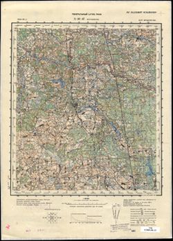
- Description:
- 1936
- Subject:
- Topical Subject: Soviet Union, Topical Subject: Maps, and Geographic Subject: Bogushëvsk
- Publisher:
- Генеральный штаб РККА
- Language:
- Russian
- Date Created:
- 1938
- Identifier:
- VAC9619-004176
- Genre:
- Topographic Maps and Military Maps
- Geographic Location:
- Coordinates: 54.667, 30, 55, 30.5
- Related URL:
- Catalog URL: https://iucat.iu.edu/catalog/5020129 and Download GeoTIFF: https://drive.google.com/file/d/1iS8-uU5-0W33Qvxrg_F5oj_sXo4MR9e0/view?usp=sharing
- Abstract:
- Modern area represented: Bogushëvsk, Vitebsk oblast, Belarus
- Call Number:
- G7000 s100 .S7 sheet N-36-37
- Caption:
- Не подлежит оглашению
- City:
- Богушевское (Bogushëvskoe)
- Copyright Holder:
- No Copyright - United States
- Country:
- СССР (USSR)
- State/Province:
- Витебская область (Vitebsk oblast) and Белорусская ССР (Byelorussian Soviet Socialist Republic)
- Physical Description:
- Scale: 1:100,000
- Persistent URL:
- http://purl.dlib.indiana.edu/iudl/images/VAC9619/VAC9619-004176
-
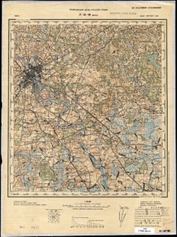
- Description:
- 1933
- Subject:
- Topical Subject: Maps, Topical Subject: Soviet Union, and Geographic Subject: Minsk
- Publisher:
- Генеральный штаб Красной Армии
- Language:
- Russian
- Date Created:
- 1938
- Identifier:
- VAC9619-004080
- Genre:
- Military Maps and Topographic Maps
- Geographic Location:
- Coordinates: 53.667, 27.5, 54, 28
- Related URL:
- Catalog URL: https://iucat.iu.edu/catalog/5020129 and Download GeoTIFF: https://drive.google.com/file/d/1YVJLOpfn04m2mPNRRdppW9VRjMR7iLjc/view?usp=sharing
- Abstract:
- Modern area represented: Minsk, Belarus
- Call Number:
- G7000 s100 .S7 sheet N-35-80
- Caption:
- Не подлежит оглашению
- City:
- Минск (Minsk)
- Copyright Holder:
- No Copyright - United States
- Country:
- СССР (USSR)
- State/Province:
- Белорусская ССР (Byelorussian Soviet Socialist Republic) and Минская область (Minsk oblast)
- Physical Description:
- Scale: 1:100,000
- Persistent URL:
- http://purl.dlib.indiana.edu/iudl/images/VAC9619/VAC9619-004080
- Provenance:
- Geographic Names Branch
-
- Subject:
- Geographic Subject: Verkhnyadzvinsk, Topical Subject: Maps, and Topical Subject: Soviet Union
- Publisher:
- Генеральный штаб РККА
- Language:
- Russian
- Date Created:
- 1938
- Identifier:
- VAC9619-000414
- Genre:
- Military Maps and Topographic Maps
- Geographic Location:
- Coordinates: 55.667, 27.75, 55.833, 28
- Related URL:
- Download GeoTIFF: https://drive.google.com/open?id=1nhSEGmNN_-S1SjE5mKM5YH8Q4bTQcw4P and Catalog URL: http://iucat.iu.edu/catalog/5020131
- Abstract:
- Modern area represented: Verkhnyadzvinsk, Vitebsk oblast, Belarus
- Call Number:
- G7000 s50 .S68 sheet N-35-8-D
- Caption:
- Не подлежит оглашению
- City:
- Дрисса (Drissa)
- Copyright Holder:
- No Copyright - United States
- Country:
- Польша (Poland) and СССР (USSR)
- State/Province:
- Витебская область (Vitebsk oblast) and Белорусская ССР (Byelorussian Soviet Socialist Republic)
- Physical Description:
- Scale: 1:50,000
- Persistent URL:
- http://purl.dlib.indiana.edu/iudl/images/VAC9619/VAC9619-000414
- Provenance:
- Army Map Service Library, OMAHA, Library of Congress Geography & Map Division
-
- Description:
- 1899
- Subject:
- Topical Subject: Maps, Geographic Subject: Divin, and Topical Subject: Soviet Union
- Publisher:
- Генеральный штаб Красной Армии
- Language:
- Russian
- Date Created:
- 1938
- Identifier:
- VAC9619-003045
- Genre:
- Military Maps and Topographic Maps
- Geographic Location:
- Coordinates: 51.667, 24.5, 52, 25
- Related URL:
- Catalog URL: https://iucat.iu.edu/catalog/5020129 and Download GeoTIFF: https://drive.google.com/file/d/1kwuxEIyhZC6KtNwxUv0XBd3cHBvkR2O3/view?usp=sharing
- Abstract:
- Modern area represented: Divin, Brest oblast, Belarus
- Call Number:
- G7000 s100 .S7 sheet M-35-2
- City:
- Дывин (Divin)
- Copyright Holder:
- No Copyright - United States
- Country:
- СССР (USSR)
- State/Province:
- Украинская ССР (Ukrainian Soviet Socialist Republic), Брестская область (Brest oblast), Волынская область (Volyn oblast), and Белорусская ССР (Byelorussian S...
- Physical Description:
- Scale: 1:100,000
- Persistent URL:
- http://purl.dlib.indiana.edu/iudl/images/VAC9619/VAC9619-003045
- Provenance:
- DMA Topographic Center, Army Map Service Library, OMAHA, Library of Congress Geography & Map Division, Aeronautical Chart & Information Center
-
- Description:
- 1901
- Subject:
- Geographic Subject: Byten, Topical Subject: Soviet Union, and Topical Subject: Maps
- Publisher:
- Генеральный штаб Красной Армии
- Language:
- Russian
- Date Created:
- 1938
- Identifier:
- VAC9619-004116
- Genre:
- Military Maps and Topographic Maps
- Geographic Location:
- Coordinates: 52.667, 25.5, 53, 26
- Related URL:
- Download GeoTIFF: https://drive.google.com/file/d/1mOCPn5dPpZNg5wucSWx_Hg2IP99Db7uE/view?usp=sharing and Catalog URL: https://iucat.iu.edu/catalog/5020129
- Abstract:
- Modern area represented: Byten, Brest oblast, Belarus
- Call Number:
- G7000 s100 .S7 sheet N-35-112
- City:
- Бытень (Byten)
- Copyright Holder:
- No Copyright - United States
- Country:
- СССР (USSR)
- State/Province:
- Белорусская ССР (Byelorussian Soviet Socialist Republic), Барановичская область (Baranavichy oblast), and Пинская область (Pinsk oblast)
- Physical Description:
- Scale: 1:100,000
- Persistent URL:
- http://purl.dlib.indiana.edu/iudl/images/VAC9619/VAC9619-004116
- Provenance:
- DMA Topographic Center, Army Map Service Library, OMAHA
-
- Description:
- 1916
- Subject:
- Topical Subject: Maps, Topical Subject: Soviet Union, and Geographic Subject: Begoml
- Publisher:
- Генеральный штаб РККА
- Language:
- Russian
- Date Created:
- 1938
- Identifier:
- VAC9619-004047
- Genre:
- Topographic Maps and Military Maps
- Geographic Location:
- Coordinates: 54.667, 28, 55, 28.5
- Related URL:
- Download GeoTIFF: https://drive.google.com/file/d/12qLpINPHxSbofvtzPjJ-jSJMr9DHeQEA/view?usp=sharing and Catalog URL: https://iucat.iu.edu/catalog/5020129
- Abstract:
- Modern area represented: Begoml, Vitebsk oblast, Belarus
- Call Number:
- G7000 s100 .S7 sheet N-35-45
- Caption:
- Не подлежит оглашению
- City:
- Бегомль (Begoml)
- Copyright Holder:
- No Copyright - United States
- Country:
- СССР (USSR)
- State/Province:
- Минская область (Minsk oblast), Белорусская ССР (Byelorussian Soviet Socialist Republic), Витебская область (Vitebsk oblast), and Вилейская область (Vileyka ...
- Physical Description:
- Scale: 1:100,000
- Persistent URL:
- http://purl.dlib.indiana.edu/iudl/images/VAC9619/VAC9619-004047
- Provenance:
- DMA Topographic Center, Army Map Service Library, Library of Congress Geography & Map Division
-
- Description:
- 1887
- Subject:
- Topical Subject: Maps, Geographic Subject: Malaryta, and Topical Subject: Soviet Union
- Publisher:
- Генеральный штаб Красной Армии
- Language:
- Russian
- Date Created:
- 1938
- Identifier:
- VAC9619-003044
- Genre:
- Military Maps and Topographic Maps
- Geographic Location:
- Coordinates: 51.667, 24, 52, 24.5
- Related URL:
- Catalog URL: https://iucat.iu.edu/catalog/5020129 and Download GeoTIFF: https://drive.google.com/file/d/1S8NvMKAOIykvpvbNAoK7uWMBQslFwWZB/view?usp=sharing
- Abstract:
- Modern area represented: Malaryta, Brest oblast, Belarus
- Call Number:
- G7000 s100 .S7 sheet M-35-1
- City:
- Малорыта (Malaryta)
- Copyright Holder:
- No Copyright - United States
- Country:
- СССР (USSR)
- State/Province:
- Белорусская ССР (Byelorussian Soviet Socialist Republic), Волынская область (Volyn oblast), Украинская ССР (Ukrainian Soviet Socialist Republic), and Брестск...
- Physical Description:
- Scale: 1:100,000
- Persistent URL:
- http://purl.dlib.indiana.edu/iudl/images/VAC9619/VAC9619-003044
- Provenance:
- DMA Topographic Center, Army Map Service Library, OMAHA, Library of Congress Geography & Map Division
-
- Description:
- 1937
- Subject:
- Geographic Subject: Mezha, Topical Subject: Soviet Union, and Topical Subject: Maps
- Publisher:
- Генеральный штаб РККА
- Language:
- Russian
- Date Created:
- 1938
- Identifier:
- VAC9619-004146
- Genre:
- Topographic Maps and Military Maps
- Geographic Location:
- Coordinates: 55.667, 30, 56, 30.5
- Related URL:
- Download GeoTIFF: https://drive.google.com/file/d/1Z80Upxi8vcMagHwiWr3iAR2KODpabbk9/view?usp=sharing and Catalog URL: https://iucat.iu.edu/catalog/5020129
- Abstract:
- Modern area represented: Mezha, Russia
- Call Number:
- G7000 s100 .S7 sheet N-36-1
- Caption:
- Не подлежит оглашению
- City:
- Межа (Mezha)
- Copyright Holder:
- No Copyright - United States
- Country:
- СССР (USSR)
- State/Province:
- Белорусская ССР (Byelorussian Soviet Socialist Republic), Калининская область (Kalinin oblast), Смоленская область (Smolensk oblast), РСФСР (RSFSR), and Вите...
- Physical Description:
- Scale: 1:100,000
- Persistent URL:
- http://purl.dlib.indiana.edu/iudl/images/VAC9619/VAC9619-004146
- Provenance:
- DMA Topographic Center, Army Map Service Library, OMAHA
-
- Description:
- 1916
- Subject:
- Geographic Subject: Yurove, Topical Subject: Maps, and Topical Subject: Soviet Union
- Publisher:
- Генеральный штаб РККА
- Language:
- Russian
- Date Created:
- 1938
- Identifier:
- VAC9619-003052
- Genre:
- Topographic Maps and Military Maps
- Geographic Location:
- Coordinates: 51.333, 27.5, 51.667, 28
- Related URL:
- Catalog URL: https://iucat.iu.edu/catalog/5020129 and Download GeoTIFF: https://drive.google.com/file/d/1-oy_tglW6Q5zk4yBjiwIDUI0AvmpI7Ce/view?usp=sharing
- Abstract:
- Modern area represented: Yurove, Zhytomyr oblast, Ukraine
- Call Number:
- G7000 s100 .S7 sheet M-35-20
- Caption:
- Не подлежит оглашению
- City:
- Юрово (Yurovo)
- Copyright Holder:
- No Copyright - United States
- Country:
- СССР (USSR)
- State/Province:
- Полесская область (Polesia oblast), Белорусская ССР (Byelorussian Soviet Socialist Republic), Ровенская область (Rivne oblast), Житомирская область (Zhytomyr...
- Physical Description:
- Scale: 1:100,000
- Persistent URL:
- http://purl.dlib.indiana.edu/iudl/images/VAC9619/VAC9619-003052
- Provenance:
- DMA Topographic Center, Army Map Service Library, OMAHA, Library of Congress Geography & Map Division
-
- Description:
- 1910
- Subject:
- Geographic Subject: Pleshchenitsy, Topical Subject: Soviet Union, and Topical Subject: Maps
- Publisher:
- Генеральный штаб Красной Армии
- Language:
- Russian
- Date Created:
- 1938
- Identifier:
- VAC9619-004058
- Genre:
- Topographic Maps and Military Maps
- Geographic Location:
- Coordinates: 54.333, 27.5, 54.667, 28
- Related URL:
- Catalog URL: https://iucat.iu.edu/catalog/5020129 and Download GeoTIFF: https://drive.google.com/file/d/1DjbM-qsDRw7t5wZcpRFBifON_9MaGx8i/view?usp=sharing
- Abstract:
- Modern area represented: Pleshchenitsy, Belarus
- Call Number:
- G7000 s100 .S7 sheet N-35-56
- Caption:
- Не подлежит оглашению
- City:
- Плещеницы (Pleshchenitsy)
- Copyright Holder:
- No Copyright - United States
- Country:
- СССР (USSR)
- State/Province:
- Вилейская область (Vileyka oblast), Белорусская ССР (Byelorussian Soviet Socialist Republic), and Минская область (Minsk oblast)
- Physical Description:
- Scale: 1:100,000
- Persistent URL:
- http://purl.dlib.indiana.edu/iudl/images/VAC9619/VAC9619-004058
- Provenance:
- DMA Topographic Center, Army Map Service Library, OMAHA
-
- Description:
- 1886
- Subject:
- Topical Subject: Maps, Geographic Subject: Volkovysk, and Topical Subject: Soviet Union
- Publisher:
- Генеральный штаб РККА
- Language:
- Russian
- Date Created:
- 1938
- Identifier:
- VAC9619-004098
- Genre:
- Topographic Maps and Military Maps
- Geographic Location:
- Coordinates: 53, 24, 53.333, 24.5
- Related URL:
- Catalog URL: https://iucat.iu.edu/catalog/5020129 and Download GeoTIFF: https://drive.google.com/file/d/1hpU8eW-u_lIC4spsbx6Ifb1fwAjWUA9c/view?usp=sharing
- Abstract:
- Modern area represented: Volkovysk, Belarus
- Call Number:
- G7000 s100 .S7 sheet N-35-97
- City:
- Волковыск (Volkovysk)
- Copyright Holder:
- No Copyright - United States
- Country:
- СССР (USSR)
- State/Province:
- Белорусская ССР (Byelorussian Soviet Socialist Republic) and Белостокская область (Belastok oblast)
- Physical Description:
- Scale: 1:100,000
- Persistent URL:
- http://purl.dlib.indiana.edu/iudl/images/VAC9619/VAC9619-004098
- Provenance:
- Army Map Service Library, Library of Congress G & M Division
-
- Description:
- 1910
- Subject:
- Geographic Subject: Stolin, Topical Subject: Maps, and Topical Subject: Soviet Union
- Publisher:
- Генеральный штаб Красной Армии
- Language:
- Russian
- Date Created:
- 1938
- Identifier:
- VAC9619-003047
- Genre:
- Topographic Maps and Military Maps
- Geographic Location:
- Coordinates: 51.667, 26.5, 52, 27
- Related URL:
- Catalog URL: https://iucat.iu.edu/catalog/5020129 and Download GeoTIFF: https://drive.google.com/file/d/1nMsS6EJ0nP-ZvW5_Q23N5TAeluKjPv9v/view?usp=sharing
- Abstract:
- Modern area represented: Stolin, Brest oblast, Belarus
- Call Number:
- G7000 s100 .S7 sheet M-35-6
- City:
- Столин (Stolin)
- Copyright Holder:
- No Copyright - United States
- Country:
- СССР (USSR)
- State/Province:
- Украинская ССР (Ukrainian Soviet Socialist Republic), Белорусская ССР (Byelorussian Soviet Socialist Republic), Пинская область (Pinsk oblast), and Ровенская...
- Physical Description:
- Scale: 1:100,000
- Persistent URL:
- http://purl.dlib.indiana.edu/iudl/images/VAC9619/VAC9619-003047
- Provenance:
- DMA Topographic Center, Army Map Service Library, OMAHA, Library of Congress Geography & Map Division
-
- Description:
- 1887
- Subject:
- Topical Subject: Soviet Union, Geographic Subject: Skidzyel, and Topical Subject: Maps
- Publisher:
- Генеральный штаб РККА
- Language:
- Russian
- Date Created:
- 1937
- Identifier:
- VAC9619-004085
- Genre:
- Military Maps and Topographic Maps
- Geographic Location:
- Coordinates: 53.333, 24, 53.667, 24.5
- Related URL:
- Catalog URL: https://iucat.iu.edu/catalog/5020129 and Download GeoTIFF: https://drive.google.com/file/d/1rvAsBsH5sPuyxhSQbegd-5aqfbBNs5qt/view?usp=sharing
- Abstract:
- Modern area represented: Skidzyel, Hrodno oblast, Belarus
- Call Number:
- G7000 s100 .S7 sheet N-35-85
- City:
- Скидэль (Skidzyel)
- Copyright Holder:
- No Copyright - United States
- Country:
- СССР (USSR)
- State/Province:
- Белостокская область (Belastok oblast) and Белорусская ССР (Byelorussian Soviet Socialist Republic)
- Physical Description:
- Scale: 1:100,000
- Persistent URL:
- http://purl.dlib.indiana.edu/iudl/images/VAC9619/VAC9619-004085
- Provenance:
- DMA Topographic Center, Army Map Service Library, OMAHA
-
- Description:
- 1916
- Subject:
- Geographic Subject: Disna, Topical Subject: Maps, and Topical Subject: Soviet Union
- Publisher:
- Генеральный штаб РККА
- Language:
- Russian
- Date Created:
- 1937
- Identifier:
- VAC9619-004022
- Genre:
- Military Maps and Topographic Maps
- Geographic Location:
- Coordinates: 55.333, 28, 55.667, 28.5
- Related URL:
- Download GeoTIFF: https://drive.google.com/file/d/1z_d6KW84TwJEJVf1Vl2I5i6uZxL5gSBX/view?usp=sharing and Catalog URL: https://iucat.iu.edu/catalog/5020129
- Abstract:
- Modern area represented: Disna, Vitebsk oblast, Belarus
- Call Number:
- G7000 s100 .S7 sheet N-35-21
- Caption:
- Не подлежит оглашению
- City:
- Дзисна (Dzisna)
- Copyright Holder:
- No Copyright - United States
- Country:
- СССР (USSR) and Польша (Poland)
- State/Province:
- Витебская область (Vitebsk oblast) and Белорусская ССР (Byelorussian Soviet Socialist Republic)
- Physical Description:
- Scale: 1:100,000
- Persistent URL:
- http://purl.dlib.indiana.edu/iudl/images/VAC9619/VAC9619-004022
- Provenance:
- DMA Topographic Center, Army Map Service Library, Geographic Names Branch
-
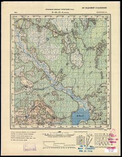
- Description:
- 1936
- Subject:
- Geographic Subject: Ubarok, Topical Subject: Soviet Union, and Topical Subject: Maps
- Publisher:
- Управление военных топографов РККА
- Language:
- Russian
- Date Created:
- 1937
- Identifier:
- VAC9619-000567
- Genre:
- Topographic Maps and Military Maps
- Geographic Location:
- Coordinates: 54.5, 28.25, 54.667, 28.5
- Related URL:
- Catalog URL: http://iucat.iu.edu/catalog/5020131 and Download GeoTIFF: https://drive.google.com/open?id=1yIx-TM28JTWHuBhMdWOWkQ0Os1GV8Y7K
- Abstract:
- Modern area represented: Ubarok, Minsk oblast, Belarus
- Call Number:
- G7000 s50 .S68 sheet N-35-57-B
- Caption:
- Не подлежит оглашению
- City:
- Уборок (Uborok)
- Copyright Holder:
- No Copyright - United States
- Country:
- СССР (USSR)
- State/Province:
- Белорусская ССР (Byelorussian Soviet Socialist Republic)
- Physical Description:
- Scale: 1:50,000
- Persistent URL:
- http://purl.dlib.indiana.edu/iudl/images/VAC9619/VAC9619-000567
- Provenance:
- M. I. Map Library, Justus Perthes Kartensammlung, G000-30
-
- Description:
- 1911
- Subject:
- Geographic Subject: Krasnaya Sloboda, Topical Subject: Soviet Union, and Topical Subject: Maps
- Publisher:
- Генеральный штаб Красной Армии
- Language:
- Russian
- Date Created:
- 1937
- Identifier:
- VAC9619-004119
- Genre:
- Military Maps and Topographic Maps
- Geographic Location:
- Coordinates: 52.667, 27, 53, 27.5
- Related URL:
- Catalog URL: https://iucat.iu.edu/catalog/5020129 and Download GeoTIFF: https://drive.google.com/file/d/1io-MtOMKCDA1XzekP320viXyXSPBm8h7/view?usp=sharing
- Abstract:
- Modern area represented: Krasnaya Sloboda, Belarus
- Call Number:
- G7000 s100 .S7 sheet N-35-115
- Caption:
- Не подлежит оглашению
- City:
- Красная Слобода (Krasnaya Sloboda)
- Copyright Holder:
- No Copyright - United States
- Country:
- СССР (USSR)
- State/Province:
- Пинская область (Pinsk oblast), Барановичская область (Baranavichy oblast), Белорусская ССР (Byelorussian Soviet Socialist Republic), and Минская область (Mi...
- Physical Description:
- Scale: 1:100,000
- Persistent URL:
- http://purl.dlib.indiana.edu/iudl/images/VAC9619/VAC9619-004119
- Provenance:
- DMA Topographic Center, Army Map Service Library
-
- Description:
- 1933
- Subject:
- Topical Subject: Maps, Topical Subject: Soviet Union, and Geographic Subject: Zembin
- Publisher:
- Управление военных топографов РККА
- Language:
- Russian
- Date Created:
- 1937
- Identifier:
- VAC9619-000568
- Genre:
- Military Maps and Topographic Maps
- Geographic Location:
- Coordinates: 54.333, 28, 54.5, 28.25
- Related URL:
- Download GeoTIFF: https://drive.google.com/open?id=1rwwVK0vXb4_ePYGis1SCFQTSj3dLIwd5 and Catalog URL: http://iucat.iu.edu/catalog/5020131
- Abstract:
- Modern area represented: Zembin, Minsk oblast, Belarus
- Call Number:
- G7000 s50 .S68 sheet N-35-57-C
- Caption:
- Не подлежит оглашению
- City:
- Зембин (Zembin)
- Copyright Holder:
- No Copyright - United States
- Country:
- СССР (USSR)
- State/Province:
- Белорусская ССР (Byelorussian Soviet Socialist Republic)
- Physical Description:
- Scale: 1:50,000
- Persistent URL:
- http://purl.dlib.indiana.edu/iudl/images/VAC9619/VAC9619-000568
- Provenance:
- Army Map Service Library, OMAHA, Library of Congress Geography & Map Division
-
- Description:
- 1878
- Subject:
- Geographic Subject: Lipsk, Topical Subject: Maps, and Topical Subject: Soviet Union
- Publisher:
- Генеральный штаб РККА
- Language:
- Russian
- Date Created:
- 1937
- Identifier:
- VAC9619-003950
- Genre:
- Military Maps and Topographic Maps
- Geographic Location:
- Coordinates: 53.667, 23, 54, 23.5
- Related URL:
- Download GeoTIFF: https://drive.google.com/file/d/1Vt1cXy3nrJ2wHeT9LFWcv3wfVkYDaYui/view?usp=sharing and Catalog URL: https://iucat.iu.edu/catalog/5020129
- Abstract:
- Modern area represented: Lipsk, Podlasie, Poland
- Call Number:
- G7000 s100 .S7 sheet N-34-83
- City:
- Липск (Lipsk)
- Copyright Holder:
- No Copyright - United States
- State/Province:
- Литовская ССР (Lithuanian Soviet Socialist Republic), Область государственных интересов Германии (Region of German state interests), and Белорусская ССР (Bye...
- Physical Description:
- Scale: 1:100,000
- Persistent URL:
- http://purl.dlib.indiana.edu/iudl/images/VAC9619/VAC9619-003950
- Provenance:
- DMA Topographic Center, Army Map Service Library
-
- Description:
- 1929
- Subject:
- Geographic Subject: Karpilovka, Topical Subject: Soviet Union, and Topical Subject: Maps
- Publisher:
- Генеральный штаб Красной Армии
- Language:
- Russian
- Date Created:
- 1937
- Identifier:
- VAC9619-004132
- Genre:
- Topographic Maps and Military Maps
- Geographic Location:
- Coordinates: 52.333, 28.5, 52.667, 29
- Related URL:
- Catalog URL: https://iucat.iu.edu/catalog/5020129 and Download GeoTIFF: https://drive.google.com/file/d/1Wha_hzmVIpN3NV2I_NBRQsWiSxiAS0dt/view?usp=sharing
- Abstract:
- Modern area represented: Karpilovka, Belarus
- Call Number:
- G7000 s100 .S7 sheet N-35-130
- Caption:
- Не подлежит оглашению
- City:
- Карпиловка (Karpilovka)
- Copyright Holder:
- No Copyright - United States
- Country:
- СССР (USSR)
- State/Province:
- Белорусская ССР (Byelorussian Soviet Socialist Republic) and Полесская область (Polesia oblast)
- Physical Description:
- Scale: 1:100,000
- Persistent URL:
- http://purl.dlib.indiana.edu/iudl/images/VAC9619/VAC9619-004132
- Provenance:
- DMA Topographic Center, Army Map Service Library, OMAHA
-
- Description:
- 1916
- Subject:
- Topical Subject: Maps, Topical Subject: Soviet Union, and Geographic Subject: Vyerkhnyadzvinsk
- Publisher:
- Генеральный штаб РККА
- Language:
- Russian
- Date Created:
- 1937
- Identifier:
- VAC9619-004010
- Genre:
- Topographic Maps and Military Maps
- Geographic Location:
- Coordinates: 55.667, 27.5, 56, 28
- Related URL:
- Catalog URL: https://iucat.iu.edu/catalog/5020129 and Download GeoTIFF: https://drive.google.com/file/d/11Rz9PelelDvqP7EZOqoXOKtc9OJOKTfD/view?usp=sharing
- Abstract:
- Modern area represented: Vyerkhnyadzvinsk, Vitebsk oblast, Belarus
- Call Number:
- G7000 s100 .S7 sheet N-35-8
- Caption:
- Не подлежит оглашению
- City:
- Дрисса (Drissa)
- Copyright Holder:
- No Copyright - United States
- Country:
- Латвия (Latvia), Польша (Poland), and СССР (USSR)
- State/Province:
- Белорусская ССР (Byelorussian Soviet Socialist Republic) and Витебская область (Vitebsk oblast)
- Physical Description:
- Scale: 1:100,000
- Persistent URL:
- http://purl.dlib.indiana.edu/iudl/images/VAC9619/VAC9619-004010
- Provenance:
- DMA Topographic Center, Army Map Service Library, Geographic Names Branch, Library of Congress Geography & Map Division, OMAHA
-

- Subject:
- Topical Subject: Soviet Union, Geographic Subject: Chystsi Mil’chanskiya, and Topical Subject: Maps
- Publisher:
- Генеральный штаб РККА
- Language:
- Russian
- Date Created:
- 1937
- Identifier:
- VAC9619-000534
- Genre:
- Military Maps and Topographic Maps
- Geographic Location:
- Coordinates: 54.6667, 27.5, 54.8333, 27.75
- Related URL:
- Catalog URL: http://iucat.iu.edu/catalog/5020131 and Download GeoTIFF: https://drive.google.com/open?id=1AUr_pkgmW9fGfP9mV3_Yc9fn7IsZx6eP
- Abstract:
- Modern area represented: Чысці Мільчанскія (Chystsi Mil’chanskiya), Vitebsk Region, Belarus
- Call Number:
- G7000 s50 .S68 sheet N-35-44-C
- Caption:
- Не подлежит оглашению
- City:
- Чисти Мильчинские (Chisti Mil’chinskiye)
- Copyright Holder:
- No Copyright - United States
- Country:
- Польша (Poland) and СССР (USSR)
- State/Province:
- Белорусская ССР (Byelorussian Soviet Socialist Republic) and Минская область (Minsk oblast)
- Physical Description:
- Scale: 1:50,000
- Persistent URL:
- http://purl.dlib.indiana.edu/iudl/images/VAC9619/VAC9619-000534
- Provenance:
- Army Map Service Library, OMAHA, Library of Congress Geography & Map Division
-
- Description:
- 1936
- Subject:
- Topical Subject: Soviet Union, Topical Subject: Maps, and Geographic Subject: Krasnapollye
- Publisher:
- Генеральный штаб РККА
- Language:
- Russian
- Date Created:
- 1937
- Identifier:
- VAC9619-004013
- Genre:
- Topographic Maps and Military Maps
- Geographic Location:
- Coordinates: 55.667, 29, 56, 29.5
- Related URL:
- Catalog URL: https://iucat.iu.edu/catalog/5020129 and Download GeoTIFF: https://drive.google.com/file/d/1ZujOSiMp81Jef6M3fdhroSY_B64ztirn/view?usp=sharing
- Abstract:
- Modern area represented: Krasnapollye, Vitebsk oblast, Belarus
- Call Number:
- G7000 s100 .S7 sheet N-35-11
- Caption:
- Не подлежит оглашению
- City:
- Краснополье (Krasnapollye)
- Copyright Holder:
- No Copyright - United States
- Country:
- СССР (USSR)
- State/Province:
- Калининская область (Kalinin oblast), Витебская область (Vitebsk oblast), Белорусская ССР (Byelorussian Soviet Socialist Republic), and РСФСР (RSFSR)
- Physical Description:
- Scale: 1:100,000
- Persistent URL:
- http://purl.dlib.indiana.edu/iudl/images/VAC9619/VAC9619-004013
- Provenance:
- DMA Topographic Center, Army Map Service Library, OMAHA, Library of Congress Geography & Map Division
-
- Description:
- 1936
- Subject:
- Topical Subject: Maps, Topical Subject: Soviet Union, and Geographic Subject: Orsha
- Publisher:
- Генеральный штаб РККА
- Language:
- Russian
- Date Created:
- 1937
- Identifier:
- VAC9619-004189
- Genre:
- Topographic Maps and Military Maps
- Geographic Location:
- Coordinates: 54.333, 30, 54.667, 30.5
- Related URL:
- Catalog URL: https://iucat.iu.edu/catalog/5020129 and Download GeoTIFF: https://drive.google.com/file/d/14AQLTRmwFVvHzBk2BSmygf6-lgGYf3az/view?usp=sharing
- Abstract:
- Modern area represented: Orsha, Vitebsk oblast, Belarus
- Call Number:
- G7000 s100 .S7 sheet N-36-49
- Caption:
- Не подлежит оглашению
- City:
- Орша (Orsha)
- Copyright Holder:
- No Copyright - United States
- Country:
- СССР (USSR)
- State/Province:
- Могилевская область (Mogilev oblast), Витебская область (Vitebsk oblast), and Белорусская ССР (Byelorussian Soviet Socialist Republic)
- Physical Description:
- Scale: 1:100,000
- Persistent URL:
- http://purl.dlib.indiana.edu/iudl/images/VAC9619/VAC9619-004189
- Provenance:
- DMA Topographic Center, Army Map Service Library, OMAHA
-
- Description:
- 1908
- Subject:
- Topical Subject: Soviet Union, Geographic Subject: Stowbtsy, and Topical Subject: Maps
- Publisher:
- Генеральный штаб Красной Армии
- Language:
- Russian
- Date Created:
- 1937
- Identifier:
- VAC9619-004090
- Genre:
- Military Maps and Topographic Maps
- Geographic Location:
- Coordinates: 53.333, 26.5, 53.667, 27
- Related URL:
- Download GeoTIFF: https://drive.google.com/file/d/1lKkb40IdXvNPT-rvgnQjGd8I-fl7TeAk/view?usp=sharing and Catalog URL: https://iucat.iu.edu/catalog/5020129
- Abstract:
- Modern area represented: Stowbtsy, Belarus
- Call Number:
- G7000 s100 .S7 sheet N-35-90
- Caption:
- Не подлежит оглашению
- City:
- Столпце (Stolpce)
- Copyright Holder:
- No Copyright - United States
- Country:
- СССР (USSR)
- State/Province:
- Белорусская ССР (Byelorussian Soviet Socialist Republic), Минская область (Minsk oblast), and Барановичская область (Baranavichy oblast)
- Physical Description:
- Scale: 1:100,000
- Persistent URL:
- http://purl.dlib.indiana.edu/iudl/images/VAC9619/VAC9619-004090
- Provenance:
- DMA Topographic Center, Army Map Service Library, OMAHA
-
- Description:
- 1916
- Subject:
- Geographic Subject: Janowo, Topical Subject: Maps, and Topical Subject: Soviet Union
- Publisher:
- Генеральный штаб РККА
- Language:
- Russian
- Date Created:
- 1936
- Identifier:
- VAC9619-003959
- Genre:
- Topographic Maps and Military Maps
- Geographic Location:
- Coordinates: 53.333, 21.5, 53.667, 22
- Related URL:
- Catalog URL: https://iucat.iu.edu/catalog/5020129 and Download GeoTIFF: https://drive.google.com/file/d/1V9_BtRhfFGWhUMbvWGMSthlnHu_vi1pv/view?usp=sharing
- Abstract:
- Modern area represented: Janowo, Warmia-Masuria, Poland
- Call Number:
- G7000 s100 .S7 sheet N-34-92
- City:
- Иоганнисбург (Johannisberg)
- Copyright Holder:
- No Copyright - United States
- Country:
- СССР (USSR) and Германия (Germany)
- State/Province:
- Белорусская ССР (Byelorussian Soviet Socialist Republic), Область государственных интересов Германии (Region of German state interests), and Белостокская обл...
- Physical Description:
- Scale: 1:100,000
- Persistent URL:
- http://purl.dlib.indiana.edu/iudl/images/VAC9619/VAC9619-003959
- Provenance:
- DMA Topographic Center, Army Map Service Library
-
- Description:
- 1931
- Subject:
- Topical Subject: Soviet Union, Geographic Subject: Vetchin, and Topical Subject: Maps
- Publisher:
- Генеральный штаб РККА
- Language:
- Russian
- Date Created:
- 1936
- Identifier:
- VAC9619-004131
- Genre:
- Military Maps and Topographic Maps
- Geographic Location:
- Coordinates: 52.333, 28, 52.667, 28.5
- Related URL:
- Download GeoTIFF: https://drive.google.com/file/d/1BObtNuYZnAxZI3mOsfkM-U1WvTF8g2ht/view?usp=sharing and Catalog URL: https://iucat.iu.edu/catalog/5020129
- Abstract:
- Modern area represented: Vetchin, Homyel oblast, Belarus
- Call Number:
- G7000 s100 .S7 sheet N-35-129
- Caption:
- Не подлежит оглашению
- City:
- Витчины (Vetchin)
- Copyright Holder:
- No Copyright - United States
- Country:
- СССР (USSR)
- State/Province:
- Белорусская ССР (Byelorussian Soviet Socialist Republic), Минская область (Minsk oblast), and Полесская область (Polesia oblast)
- Physical Description:
- Scale: 1:100,000
- Persistent URL:
- http://purl.dlib.indiana.edu/iudl/images/VAC9619/VAC9619-004131
- Provenance:
- DMA Topographic Center, Army Map Service Library, OMAHA, Atlasblatt
-
- Description:
- 1933
- Subject:
- Topical Subject: Maps, Geographic Subject: Zembin, and Topical Subject: Soviet Union
- Publisher:
- Генеральный штаб РККА
- Language:
- Russian
- Date Created:
- 1936
- Identifier:
- VAC9619-004059
- Genre:
- Topographic Maps and Military Maps
- Geographic Location:
- Coordinates: 54.333, 28, 54.667, 28.5
- Related URL:
- Download GeoTIFF: https://drive.google.com/file/d/1eyeaCvD_WB_ldiVhTdQEx3lFGbJSMGoz/view?usp=sharing and Catalog URL: https://iucat.iu.edu/catalog/5020129
- Abstract:
- Modern area represented: Zembin, Belarus
- Call Number:
- G7000 s100 .S7 sheet N-35-57
- Caption:
- Не подлежит оглашению
- City:
- Зембин (Zembin)
- Copyright Holder:
- No Copyright - United States
- Country:
- СССР (USSR)
- State/Province:
- Минская область (Minsk oblast) and Белорусская ССР (Byelorussian Soviet Socialist Republic)
- Physical Description:
- Scale: 1:100,000
- Persistent URL:
- http://purl.dlib.indiana.edu/iudl/images/VAC9619/VAC9619-004059
- Provenance:
- DMA Topographic Center, Army Map Service Library, OMAHA
-
- Description:
- 1887
- Subject:
- Topical Subject: Maps, Geographic Subject: Dąbrowa Białostocka, and Topical Subject: Soviet Union
- Publisher:
- Генеральный штаб РККА
- Language:
- Russian
- Date Created:
- 1936
- Identifier:
- VAC9619-003961
- Genre:
- Military Maps and Topographic Maps
- Geographic Location:
- Coordinates: 53.333, 23, 53.667, 23.5
- Related URL:
- Catalog URL: https://iucat.iu.edu/catalog/5020129 and Download GeoTIFF: https://drive.google.com/file/d/1S4yPZX7mnO1ThQsSs1pyq1my1dxl968Q/view?usp=sharing
- Abstract:
- Modern area represented: Dąbrowa Białostocka, Podlasie, Poland
- Call Number:
- G7000 s100 .S7 sheet N-34-95
- City:
- Домброва (Dąbrowa)
- Copyright Holder:
- No Copyright - United States
- Country:
- СССР (USSR)
- State/Province:
- Белостокская область (Belastok oblast) and Белорусская ССР (Byelorussian Soviet Socialist Republic)
- Physical Description:
- Scale: 1:100,000
- Persistent URL:
- http://purl.dlib.indiana.edu/iudl/images/VAC9619/VAC9619-003961
- Provenance:
- DMA Topographic Center, Army Map Service Library
-
- Description:
- 1904
- Subject:
- Topical Subject: Maps, Topical Subject: Soviet Union, and Geographic Subject: Dzyaniskavichy
- Publisher:
- Генеральный штаб РККА
- Language:
- Russian
- Date Created:
- 1936
- Identifier:
- VAC9619-004118
- Genre:
- Topographic Maps and Military Maps
- Geographic Location:
- Coordinates: 52.667, 26.5, 53, 27
- Related URL:
- Download GeoTIFF: https://drive.google.com/file/d/1GVxOrmstQScVR3TCgfspXEaC8y2HGze_/view?usp=sharing and Catalog URL: https://iucat.iu.edu/catalog/5020129
- Abstract:
- Modern area represented: Dzyaniskavichy, Brest oblast, Belarus
- Call Number:
- G7000 s100 .S7 sheet N-35-114
- Caption:
- Не подлежит оглашению
- City:
- Денисковиче (Deniskovichi)
- Copyright Holder:
- No Copyright - United States
- Country:
- Польша (Poland) and СССР (USSR)
- State/Province:
- Белорусская ССР (Byelorussian Soviet Socialist Republic)
- Physical Description:
- Scale: 1:100,000
- Persistent URL:
- http://purl.dlib.indiana.edu/iudl/images/VAC9619/VAC9619-004118
- Provenance:
- DMA Topographic Center, Army Map Service Library, OMAHA
-
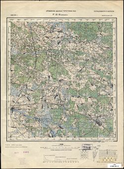
- Description:
- 1933
- Subject:
- Topical Subject: Soviet Union, Geographic Subject: Smilavichy, and Topical Subject: Maps
- Publisher:
- Управление военных топографов РККА
- Language:
- Russian
- Date Created:
- 1936
- Identifier:
- VAC9619-004081
- Genre:
- Military Maps and Topographic Maps
- Geographic Location:
- Coordinates: 53.667, 28, 54, 28.5
- Related URL:
- Download GeoTIFF: https://drive.google.com/file/d/1H8FweVO9LnHfFCQ6pbRGNdMLVVsrPnp4/view?usp=sharing and Catalog URL: https://iucat.iu.edu/catalog/5020129
- Abstract:
- Modern area represented: Smilavichy, Belarus
- Call Number:
- G7000 s100 .S7 sheet N-35-81
- Caption:
- Не подлежит оглашению
- City:
- Смиловичи (Smilavichy)
- Copyright Holder:
- No Copyright - United States
- Country:
- СССР (USSR)
- State/Province:
- Белорусская ССР (Byelorussian Soviet Socialist Republic)
- Physical Description:
- Scale: 1:100,000
- Persistent URL:
- http://purl.dlib.indiana.edu/iudl/images/VAC9619/VAC9619-004081
- Provenance:
- Library of Congress G & M Division
-
- Description:
- 1904
- Subject:
- Topical Subject: Soviet Union, Topical Subject: Maps, and Geographic Subject: Kiyevichi
- Publisher:
- Управление военных топографов РККА
- Language:
- Russian
- Date Created:
- 1936
- Identifier:
- VAC9619-000708
- Genre:
- Military Maps and Topographic Maps
- Geographic Location:
- Coordinates: 52.833, 26.75, 53, 27
- Related URL:
- Catalog URL: http://iucat.iu.edu/catalog/5020131 and Download GeoTIFF: https://drive.google.com/open?id=1tTKI474LW2kDomqmBh1_w15EeaX7m8st
- Abstract:
- Modern area represented: Kiyevichi, Minsk oblast, Belarus
- Call Number:
- GM G7000 s50 .S68 N-35-114-Б
- Caption:
- Не подлежит оглашению
- City:
- Киевичи (Kiyevichi)
- Copyright Holder:
- No Copyright - United States
- Country:
- СССР (USSR) and Польша (Poland)
- State/Province:
- Белорусская ССР (Byelorussian Soviet Socialist Republic)
- Physical Description:
- Scale: 1:50,000
- Persistent URL:
- http://purl.dlib.indiana.edu/iudl/images/VAC9619/VAC9619-000708
- Provenance:
- Army Map Service Library, Auswärtiges Amt. Geographischer Dienst, OMAHA, Library of Congress Geography & Map Division
-
- Description:
- 1933
- Subject:
- Topical Subject: Maps, Geographic Subject: Shatsk, and Topical Subject: Soviet Union
- Publisher:
- Генеральный штаб РККА
- Language:
- Russian
- Date Created:
- 1936
- Identifier:
- VAC9619-004092
- Genre:
- Military Maps and Topographic Maps
- Geographic Location:
- Coordinates: 53.333, 27.5, 53.667, 28
- Related URL:
- Download GeoTIFF: https://drive.google.com/file/d/1W8MNEo5y754eevSB-hwsnv2-f7tD5UaP/view?usp=sharing and Catalog URL: https://iucat.iu.edu/catalog/5020129
- Abstract:
- Modern area represented: Shatsk, Minsk oblast, Belarus
- Call Number:
- G7000 s100 .S7 sheet N-35-92
- Caption:
- Не подлежит оглашению
- City:
- Шацк (Shatsk)
- Copyright Holder:
- No Copyright - United States
- Country:
- СССР (USSR)
- State/Province:
- Белорусская ССР (Byelorussian Soviet Socialist Republic)
- Physical Description:
- Scale: 1:100,000
- Persistent URL:
- http://purl.dlib.indiana.edu/iudl/images/VAC9619/VAC9619-004092
- Provenance:
- DMA Topographic Center, Army Map Service Library, OMAHA
-
- Description:
- 1917
- Subject:
- Topical Subject: Soviet Union, Topical Subject: Maps, and Geographic Subject: Moroch
- Publisher:
- Управление военных топографов РККА
- Language:
- Russian
- Date Created:
- 1936
- Identifier:
- VAC9619-004130
- Genre:
- Topographic Maps and Military Maps
- Geographic Location:
- Coordinates: 52.333, 27.5, 52.667, 28
- Related URL:
- Catalog URL: https://iucat.iu.edu/catalog/5020129 and Download GeoTIFF: https://drive.google.com/file/d/1HUuzBKcEpGGkMff5L63dHETUlsQCusTP/view?usp=sharing
- Abstract:
- Modern area represented: Moroch, Minsk oblast, Belarus
- Call Number:
- G7000 s100 .S7 sheet N-35-128
- Caption:
- Не подлежит оглашению
- City:
- Морочь (Moroch)
- Copyright Holder:
- No Copyright - United States
- Country:
- Польша (Poland) and СССР (USSR)
- State/Province:
- Белорусская ССР (Byelorussian Soviet Socialist Republic)
- Physical Description:
- Scale: 1:100,000
- Persistent URL:
- http://purl.dlib.indiana.edu/iudl/images/VAC9619/VAC9619-004130
- Provenance:
- DMA Topographic Center, Army Map Service Library
-
- Description:
- 1886
- Subject:
- Topical Subject: Soviet Union, Geographic Subject: Volkovysk, and Topical Subject: Maps
- Publisher:
- Генеральный штаб РККА
- Language:
- Russian
- Date Created:
- 1936
- Identifier:
- VAC9619-004097
- Genre:
- Topographic Maps and Military Maps
- Geographic Location:
- Coordinates: 53, 24, 53.333, 24.5
- Related URL:
- Catalog URL: https://iucat.iu.edu/catalog/5020129 and Download GeoTIFF: https://drive.google.com/file/d/18doR2e64Wam1zdT6cb0QWTKb53UexOp_/view?usp=sharing
- Abstract:
- Modern area represented: Volkovysk, Belarus
- Call Number:
- G7000 s100 .S7 sheet N-35-97
- City:
- Волковыск (Volkovysk)
- Copyright Holder:
- No Copyright - United States
- Country:
- СССР (USSR)
- State/Province:
- Белорусская ССР (Byelorussian Soviet Socialist Republic) and Белостокская область (Belastok oblast)
- Physical Description:
- Scale: 1:100,000
- Persistent URL:
- http://purl.dlib.indiana.edu/iudl/images/VAC9619/VAC9619-004097
- Provenance:
- DMA Topographic Center, Army Map Service Library, OMAHA
-
- Description:
- 1884
- Subject:
- Topical Subject: Maps, Geographic Subject: Tykocin, and Topical Subject: Soviet Union
- Publisher:
- Генеральный штаб РККА
- Language:
- Russian
- Date Created:
- 1936
- Identifier:
- VAC9619-003971
- Genre:
- Topographic Maps and Military Maps
- Geographic Location:
- Coordinates: 53, 22.5, 53.333, 23
- Related URL:
- Download GeoTIFF: https://drive.google.com/file/d/13GJbr0iKpG6BZoq83ojCBTGCyocZMb2V/view?usp=sharing and Catalog URL: https://iucat.iu.edu/catalog/5020129
- Abstract:
- Modern area represented: Tykocin, Podlaskie Voivodeship, Poland
- Call Number:
- G7000 s100 .S7 sheet N-34-106
- City:
- Тыкоцин (Tykocin)
- Copyright Holder:
- No Copyright - United States
- Country:
- СССР (USSR)
- State/Province:
- Белорусская ССР (Byelorussian Soviet Socialist Republic) and Белостокская область (Belastok oblast)
- Physical Description:
- Scale: 1:100,000
- Persistent URL:
- http://purl.dlib.indiana.edu/iudl/images/VAC9619/VAC9619-003971
- Provenance:
- DMA Topographic Center, Army Map Service Library, Auswärtiges Amt. Geographischer Dienst
-
- Description:
- 1910
- Subject:
- Geographic Subject: Dokšycy, Topical Subject: Maps, and Topical Subject: Soviet Union
- Publisher:
- Генеральный штаб РККА
- Language:
- Russian
- Date Created:
- 1936
- Identifier:
- VAC9619-004046
- Genre:
- Military Maps and Topographic Maps
- Geographic Location:
- Coordinates: 54.667, 27.5, 55, 28
- Related URL:
- Download GeoTIFF: https://drive.google.com/file/d/1RIhM6v61skSqVLQ5MvoPneKh22kofdkL/view?usp=sharing and Catalog URL: https://iucat.iu.edu/catalog/5020129
- Abstract:
- Modern area represented: Dokšycy, Belarus
- Call Number:
- G7000 s100 .S7 sheet N-35-44
- Caption:
- Не подлежит оглашению
- City:
- Докшыце (Dokšycy)
- Copyright Holder:
- No Copyright - United States
- Country:
- СССР (USSR)
- State/Province:
- Белорусская ССР (Byelorussian Soviet Socialist Republic)
- Physical Description:
- Scale: 1:100,000
- Persistent URL:
- http://purl.dlib.indiana.edu/iudl/images/VAC9619/VAC9619-004046
- Provenance:
- DMA Topographic Center, Army Map Service Library, OMAHA, Library of Congress Geography & Map Division
