
Search Constraints
You searched for:
Publisher
Geological Survey (U.S.)
Remove constraint Publisher: Geological Survey (U.S.)
Search Results
-
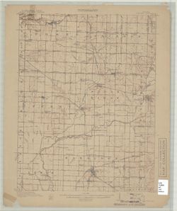
![Kentucky-Indiana Uniontown quadrangle [1917 printing with vegetation]](https://iiif.uits.iu.edu/iiif/2/rn302438g%2Ffiles%2F5ec44016-9965-4124-88f0-d69485cb679f/full/250,/0/default.jpg)
- Subject:
- Topical Subject: Vegetation mapping, Geographic Subject: Henderson County (Ky.), Geographic Subject: Posey County (Ind.), and Geographic Subject: Union Count...
- Creator:
- Kentucky Geological Survey, U.S. Coast and Geodetic Survey, Herron, W. H. (William Harrison), 1865-, United States. Army. Corps of Engineers, Hawkins, Geo. T...
- Publisher:
- Geological Survey (U.S.)
- Date Created:
- 1917
- Identifier:
- VAC3073-M-01334
- Genre:
- Quadrangle maps, Topographic maps, and 15 minute topographic maps
- Geographic Location:
- Coordinates: W0880000 W0874500 N0380000 N0374500
- Related URL:
- Catalog URL: https://iucat.iu.edu/catalog/18415442
- Abstract:
- R.B. Marshall, chief geographer , W.H. Herron, geographer in charge , topography by C.W. Goodlove, R.M. Herrington and W.S. Gehres , control by U.S. Coast an...
- Call Number:
- G4090 s62 .G4 Uniontown 1917
- Caption:
- Imprint: [Washington, D.C.] : U.S. Geological Survey, [1917]
- Physical Description:
- Scale: 1:62,500 and Dimensions: 45 x 42 cm or smaller
- Alternate Identifier:
- Title Control Number: a18415442
- Persistent URL:
- https://purl.dlib.indiana.edu/iudl/images/VAC3073/VAC3073-M-01334
- Provenance:
- Part of Geological Survey (U.S.). Indiana 1:62,500.
-
![Kentucky-Indiana Uniontown quadrangle [1929 without vegetation]](https://iiif.uits.iu.edu/iiif/2/bn99b9304%2Ffiles%2F7d8bdd0e-d8b8-4f23-b50f-402956e1a45a/full/250,/0/default.jpg)
- Subject:
- Geographic Subject: Posey County (Ind.), Geographic Subject: Union County (Ky.), and Geographic Subject: Henderson County (Ky.)
- Creator:
- Herrington, R. M. (Russell McKee), 1890-1977, Ellis, J. R. (Topographer), Geological Survey (U.S.), Herron, W. H. (William Harrison), 1865-, Hawkins, Geo. T....
- Publisher:
- Geological Survey (U.S.)
- Date Created:
- 1929
- Identifier:
- VAC3073-M-01335
- Genre:
- 15 minute topographic maps, Quadrangle maps, and Topographic maps
- Geographic Location:
- Coordinates: W0880000 W0874500 N0380000 N0374500
- Related URL:
- Catalog URL: https://iucat.iu.edu/catalog/18415442
- Abstract:
- R.B. Marshall, chief geographer , W.H. Herron, geographer in charge , topography by C.W. Goodlove, R.M. Herrington and W.S. Gehres , control by U.S. Coast an...
- Call Number:
- G4090 s62 .G4 1917 rep1929
- Caption:
- Imprint: [Washington, D.C.] : U.S. Geological Survey, 1929
- Physical Description:
- Dimensions: 45 x 42 cm or smaller and Scale: 1:62,500
- Alternate Identifier:
- Title Control Number: a18415442
- Persistent URL:
- https://purl.dlib.indiana.edu/iudl/images/VAC3073/VAC3073-M-01335
- Provenance:
- Part of Geological Survey (U.S.). Indiana 1:62,500.
-
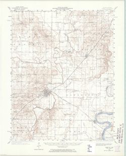
![Vandalia quadrangle, Michigan-Indiana : 15 minute series (topographic) [1959 reprint with vegetation]](https://iiif.uits.iu.edu/iiif/2/9019t543m%2Ffiles%2Fd71ad7ee-44b6-4efe-9cbc-388b2c880604/full/250,/0/default.jpg)
- Subject:
- Geographic Subject: Saint Joseph County (Mich.), Geographic Subject: Cass County (Mich.), Topical Subject: Vegetation mapping, and Geographic Subject: Elkhar...
- Creator:
- Geological Survey (U.S.) and Michigan. State Highway Department
- Publisher:
- Geological Survey (U.S.)
- Date Created:
- 1959
- Identifier:
- VAC3073-M-01337
- Genre:
- 15 minute topographic maps, Topographic maps, and Quadrangle maps
- Geographic Location:
- Coordinates: W0860000 W0854500 N0420000 N0414500
- Related URL:
- Catalog URL: https://iucat.iu.edu/catalog/18415471
- Abstract:
- Mapped, edited, and published by the Geological Survey. Filing title: Vandalia, Mich.-Ind. Standard map series designation: AMS (Series) V762 3867 IV. [Editi...
- Call Number:
- G4090 s62 .G4 Vandalia 1948 rep 1959 V
- Caption:
- Imprint: Washington, D.C. : Interior--U.S. Geological Survey, 1959
- Physical Description:
- Dimensions: 45 x 42 cm or smaller and Scale: 1:62,500
- Alternate Identifier:
- Title Control Number: a18415471
- Persistent URL:
- https://purl.dlib.indiana.edu/iudl/images/VAC3073/VAC3073-M-01337
- Provenance:
- Part of Geological Survey (U.S.). Indiana 1:62,500.
-
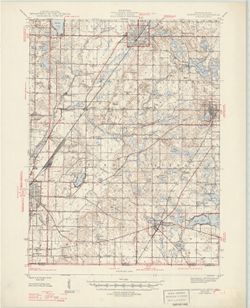
![Indiana (Lake County) Tolleston quadrangle [1951 reprint]](https://iiif.uits.iu.edu/iiif/2/3j334583d%2Ffiles%2Fa1776d9f-5e19-43ed-bce5-a48d4bae75b1/full/250,/0/default.jpg)
- Subject:
- Geographic Subject: Lake County (Ind.)
- Creator:
- McKinney, R. C. (Robert C.), Renshawe, John H., Geological Survey (U.S.), and U.S. Lake Survey
- Publisher:
- Geological Survey (U.S.)
- Date Created:
- 1951
- Identifier:
- VAC3073-M-01333
- Genre:
- Quadrangle maps, 15 minute topographic maps, and Topographic maps
- Geographic Location:
- Coordinates: W0873000 W0871500 N0414500 N0413000
- Related URL:
- Catalog URL: https://iucat.iu.edu/catalog/18406229
- Abstract:
- United States, Department of the Interior, Geological Survey , Jno. H. Renshawe, geographer in charge , control by U.S. Lake Survey , topography by R. C. McK...
- Call Number:
- G4090 s62 .G4 Toleston 1900 rep 1951
- Caption:
- Imprint: Washington, D. C. : United States, Department of the Interior, Geological Survey, 1951
- Physical Description:
- Scale: 1:62,500 and Dimensions: 45 x 42 cm or smaller
- Alternate Identifier:
- Title Control Number: a18406229
- Persistent URL:
- https://purl.dlib.indiana.edu/iudl/images/VAC3073/VAC3073-M-01333
- Provenance:
- Part of Geological Survey (U.S.). Indiana 1:62,500.
-
![Indiana (Lake County) Tolleston quadrangle [1939 reprint]](https://iiif.uits.iu.edu/iiif/2/cf95kf17p%2Ffiles%2F6cfc5093-ccb9-443c-8bd5-426984875407/full/250,/0/default.jpg)
- Subject:
- Geographic Subject: Lake County (Ind.)
- Creator:
- Renshawe, John H., McKinney, R. C. (Robert C.), U.S. Lake Survey, and Geological Survey (U.S.)
- Publisher:
- Geological Survey (U.S.)
- Date Created:
- 1939
- Identifier:
- VAC3073-M-01332
- Genre:
- 15 minute topographic maps, Quadrangle maps, and Topographic maps
- Geographic Location:
- Coordinates: W0873000 W0871500 N0414500 N0413000
- Related URL:
- Catalog URL: https://iucat.iu.edu/catalog/18406229
- Abstract:
- United States, Department of the Interior, Geological Survey , Jno. H. Renshawe, geographer in charge , control by U.S. Lake Survey , topography by R. C. McK...
- Call Number:
- G4090 s62 .G4 Toleston 1900 rep 1939
- Caption:
- Imprint: Washington, D. C. : United States, Department of the Interior, Geological Survey, 1939
- Physical Description:
- Dimensions: 45 x 42 cm or smaller and Scale: 1:62,500
- Alternate Identifier:
- Title Control Number: a18406229
- Persistent URL:
- https://purl.dlib.indiana.edu/iudl/images/VAC3073/VAC3073-M-01332
- Provenance:
- Part of Geological Survey (U.S.). Indiana 1:62,500.
-
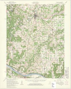
![Franklin Quadrangle Indiana : 15 minute series (topographic) [1950 printing without vegetation]](https://iiif.uits.iu.edu/iiif/2/gq67kv050%2Ffiles%2F1b2dc3c9-fa67-4787-9ad0-8c7dd5aad08b/full/250,/0/default.jpg)
- Subject:
- Geographic Subject: Brown County (Ind.), Geographic Subject: Bartholomew County (Ind.), and Geographic Subject: Johnson County (Ind.)
- Creator:
- Geological Survey (U.S.) and United States. Army. Corps of Engineers
- Publisher:
- Geological Survey (U.S.)
- Date Created:
- 1950
- Identifier:
- VAC3073-M-01330
- Genre:
- Quadrangle maps, Photogrammetric maps, Topographic maps, and 15 minute topographic maps
- Geographic Location:
- Coordinates: W0861500 W0860000 N0393000 N0391500
- Related URL:
- Catalog URL: https://iucat.iu.edu/catalog/18412610
- Abstract:
- Filing title: Franklin, Ind. Mapped, edited, and published by Geological Survey. Edition of 1950. Polyconic projection. Relief shown by contours and spot hei...
- Call Number:
- G4090 s62 .G4 Franklin 1950
- Caption:
- Imprint: Washington, D.C. : Interior--Geological Survey, [1950]
- Physical Description:
- Dimensions: 45 x 42 cm or smaller and Scale: 1:62,500
- Alternate Identifier:
- Title Control Number: a18412610
- Persistent URL:
- https://purl.dlib.indiana.edu/iudl/images/VAC3073/VAC3073-M-01330
- Provenance:
- Part of Geological Survey (U.S.). Indiana 1:62,500.
-
![Franklin Quadrangle Indiana : 15 minute series (topographic) [1950 printing with vegetation]](https://iiif.uits.iu.edu/iiif/2/s1785q21n%2Ffiles%2F2980480d-4dc3-4d46-8d25-f5ccac9e74ef/full/250,/0/default.jpg)
- Subject:
- Geographic Subject: Brown County (Ind.), Geographic Subject: Bartholomew County (Ind.), Geographic Subject: Johnson County (Ind.), and Topical Subject: Veget...
- Creator:
- Geological Survey (U.S.) and United States. Army. Corps of Engineers
- Publisher:
- Geological Survey (U.S.)
- Date Created:
- 1950
- Identifier:
- VAC3073-M-01329
- Genre:
- Topographic maps, Photogrammetric maps, 15 minute topographic maps, and Quadrangle maps
- Geographic Location:
- Coordinates: W0861500 W0860000 N0393000 N0391500
- Related URL:
- Catalog URL: https://iucat.iu.edu/catalog/18412610
- Abstract:
- Filing title: Franklin, Ind. Mapped, edited, and published by Geological Survey. Edition of 1950. Polyconic projection. Relief shown by contours and spot hei...
- Call Number:
- G4090 s62 .G4 Franklin 1950 V
- Caption:
- Imprint: Washington, D.C. : Interior--Geological Survey, [1950]
- Physical Description:
- Scale: 1:62,500 and Dimensions: 45 x 42 cm or smaller
- Alternate Identifier:
- Title Control Number: a18412610
- Persistent URL:
- https://purl.dlib.indiana.edu/iudl/images/VAC3073/VAC3073-M-01329
- Provenance:
- Part of Geological Survey (U.S.). Indiana 1:62,500.
-
- Subject:
- Geographic Subject: Vigo County (Ind.), Geographic Subject: Clay County (Ind.), Geographic Subject: Putnam County (Ind.), and Geographic Subject: Owen County...
- Creator:
- Herron, W. H. (William Harrison), 1865-, Marshall, R. B. (Robert Bradford), 1867-1949, Sadler, C. L., and Geological Survey (U.S.)
- Publisher:
- Geological Survey (U.S.)
- Date Created:
- 1910
- Identifier:
- VAC3073-M-01328
- Genre:
- Quadrangle maps, Topographic maps, and 15 minute topographic maps
- Geographic Location:
- Coordinates: W0871500 W0870000 N0393000 N0391500
- Related URL:
- Catalog URL: https://iucat.iu.edu/catalog/18406394
- Abstract:
- Engraved July 1910 by U.S.G.S. , R. B. Marshall, chief geographer , W. H. Herron, geographer in charge , topography by C. L. Sadler , [and three others]. Rel...
- Call Number:
- G4090 s62 .G4 Clay City 1910
- Caption:
- Imprint: [Washington, D.C.] : U.S. Geological Survey, 1910
- Physical Description:
- Scale: 1:62,500 and Dimensions: 45 x 42 cm or smaller
- Alternate Identifier:
- Title Control Number: a18406394
- Persistent URL:
- https://purl.dlib.indiana.edu/iudl/images/VAC3073/VAC3073-M-01328
- Provenance:
- Part of Geological Survey (U.S.). Indiana 1:62,500.
-
- Subject:
- Geographic Subject: White County (Ill.) and Geographic Subject: Posey County (Ind.)
- Creator:
- United States. Army. Corps of Engineers and Geological Survey (U.S.)
- Publisher:
- Geological Survey (U.S.)
- Date Created:
- 1965
- Identifier:
- VAC3073-M-01327
- Genre:
- 15 minute topographic maps, Quadrangle maps, and Topographic maps
- Geographic Location:
- Coordinates: W0881500 W0880000 N0381500 N0380000
- Related URL:
- Catalog URL: https://iucat.iu.edu/catalog/18408709
- Abstract:
- Topography by H. E. Simmons, J. C. Hilliard, A. T. Munson, E. W. Gouchenour, P. L. Sampson, A. W. Thomas, and F. W. Weber. ... Topography in Indiana from cha...
- Call Number:
- G4090 s62 .G4 Carmi 1940 rep1965
- Caption:
- Imprint: Washington, D.C. : The Survey, 1965.
- Physical Description:
- Scale: 1:62,500 and Dimensions: 45 x 42 cm or smaller
- Alternate Identifier:
- Title Control Number: a18408709
- Persistent URL:
- https://purl.dlib.indiana.edu/iudl/images/VAC3073/VAC3073-M-01327
- Provenance:
- Part of Geological Survey (U.S.). Indiana 1:62,500.
-
![Kentucky-Indiana Cannelton quadrangle [1941 reprint]](https://iiif.uits.iu.edu/iiif/2/8336j442q%2Ffiles%2F47a90ccc-f6f3-4558-aeaf-5356b28b815d/full/250,/0/default.jpg)
- Subject:
- Geographic Subject: Breckinridge County (Ky.) and Geographic Subject: Hancock County (Ind.)
- Creator:
- United States. Army. Corps of Engineers, Tull, L. E. (Lawrence Emerson), 1894-1987, Higginson, W. S. (William Smith Muir), 1894-1984, and Runyan, R. H.
- Publisher:
- Geological Survey (U.S.)
- Date Created:
- 1941
- Identifier:
- VAC3073-M-01326
- Genre:
- Quadrangle maps, Topographic maps, and 15 minute topographic maps
- Geographic Location:
- Coordinates: W0864500 W0863000 N0380000 N0374500
- Related URL:
- Catalog URL: https://iucat.iu.edu/catalog/18415999
- Abstract:
- Topography by R.H. Runyan, W.S. Higginson, and L.E. Tull , Ohio River by Corps of Engineers, U.S. Army. Polyconic projection. Relief shown by contours and sp...
- Call Number:
- G4090 s62 .G4 Cannelton 1934 rep1941
- Caption:
- Imprint: Washington, D.C. : Dept. of the Interior, U.S. Geological Survey, 1941
- Physical Description:
- Dimensions: 45 x 42 cm or smaller and Scale: 1:62,500
- Alternate Identifier:
- Title Control Number: a18415999
- Persistent URL:
- https://purl.dlib.indiana.edu/iudl/images/VAC3073/VAC3073-M-01326
- Provenance:
- Part of Geological Survey (U.S.). Indiana 1:62,500.
-
- Subject:
- Geographic Subject: Cass County (Ind.) and Geographic Subject: Berrien County (Mich.)
- Creator:
- Geological Survey (U.S.)
- Publisher:
- Geological Survey (U.S.)
- Date Created:
- 1947
- Identifier:
- VAC3073-M-01325
- Genre:
- Quadrangle maps, Topographic maps, and 15 minute topographic maps
- Geographic Location:
- Coordinates: W0861500 W0860000 N0420000 N0414500
- Related URL:
- Catalog URL: https://iucat.iu.edu/catalog/18408371
- Abstract:
- Filing title: Cassopolis, Mich.--Ind. Edition of 1947. Polyconic projection. Indiana portion not shown, shown on 1:24,000 scale maps of South Bend West and O...
- Call Number:
- G4090 s62 .G4 Cassopolis 1947
- Caption:
- Imprint: Washington, D.C. : U.S. Geological Survey, 1947.
- Physical Description:
- Dimensions: 45 x 42 cm or smaller and Scale: 1:62,500
- Alternate Identifier:
- Title Control Number: a18408371
- Persistent URL:
- https://purl.dlib.indiana.edu/iudl/images/VAC3073/VAC3073-M-01325
- Provenance:
- Part of Geological Survey (U.S.). Indiana 1:62,500.
-
![Indiana Boonville quadrangle [1946 reprint]](https://iiif.uits.iu.edu/iiif/2/765384187%2Ffiles%2F7c9648cb-7d65-40a1-90c7-0327c2cdfaed/full/250,/0/default.jpg)
- Subject:
- Geographic Subject: Warrick County (Ind.), Geographic Subject: Gibson County (Ind.), Geographic Subject: Pike County (Ind.), and Geographic Subject: Vanderbu...
- Creator:
- Hawkins, Geo. T. (George T.), Blair, H. B. (Herbert Buxton), 1860-1905, Renshawe, John H., and McKinney, R. C. (Robert C.)
- Publisher:
- Geological Survey (U.S.)
- Date Created:
- 1946
- Identifier:
- VAC3073-M-01324
- Genre:
- 15 minute topographic maps, Quadrangle maps, and Topographic maps
- Geographic Location:
- Coordinates: W0873000 W0871500 N0381500 N0380000
- Related URL:
- Catalog URL: https://iucat.iu.edu/catalog/18408288
- Abstract:
- Engraved Oct. 1902 by U.S.G.S. , Jno. H. Renshawe, geographer in charge , control by Geo. T. Hawkins , topography by R.C. McKinney and H.B. Blair. Edition of...
- Call Number:
- G4090 s62 .G4 Boonville 1902 rep1946
- Caption:
- Imprint: [Washington, D.C.] : U.S. Geological Survey, [1946]
- Physical Description:
- Scale: 1:62,500 and Dimensions: 45 x 42 cm or smaller
- Alternate Identifier:
- Title Control Number: a18408288
- Persistent URL:
- https://purl.dlib.indiana.edu/iudl/images/VAC3073/VAC3073-M-01324
-
![Indiana Clay City quadrangle [1936 reprint]](https://iiif.uits.iu.edu/iiif/2/wd376z59h%2Ffiles%2Faa45c1aa-fb05-4809-a96b-7abd27014bc5/full/250,/0/default.jpg)
- Subject:
- Geographic Subject: Vigo County (Ind.), Geographic Subject: Putnam County (Ind.), Geographic Subject: Clay County (Ind.), and Geographic Subject: Owen County...
- Creator:
- Sadler, C. L., Marshall, R. B. (Robert Bradford), 1867-1949, Geological Survey (U.S.), and Herron, W. H. (William Harrison), 1865-
- Publisher:
- Geological Survey (U.S.)
- Date Created:
- 1936
- Identifier:
- VAC3073-M-01323
- Genre:
- Quadrangle maps, 15 minute topographic maps, and Topographic maps
- Geographic Location:
- Coordinates: W0871500 W0870000 N0393000 N0391500
- Related URL:
- Catalog URL: https://iucat.iu.edu/catalog/a18406394
- Abstract:
- Engraved July 1910 by U.S.G.S. , R. B. Marshall, chief geographer , W. H. Herron, geographer in charge , topography by C. L. Sadler , [and three others]. Rel...
- Call Number:
- G4090 s62 .G4 Clay City 1910 rep1936
- Caption:
- Imprint: [Washington, D.C.] : U.S. Geological Survey, 1936
- Physical Description:
- Scale: 1:62,500 and Dimensions: 45 x 42 cm or smaller
- Alternate Identifier:
- Title Control Number: a18406394
- Persistent URL:
- https://purl.dlib.indiana.edu/iudl/images/VAC3073/VAC3073-M-01323
- Provenance:
- Part of Geological Survey (U.S.). Indiana 1:62,500.
-
![Indiana Bloomington quadrangle [1948 reprint]](https://iiif.uits.iu.edu/iiif/2/s4656k458%2Ffiles%2F0ca1adeb-7974-4998-98de-951865ae4e02/full/250,/0/default.jpg)
- Subject:
- Geographic Subject: Monroe County (Ind.), Geographic Subject: Owen County (Ind.), and Geographic Subject: Greene County (Ind.)
- Creator:
- Marshall, R. B. (Robert Bradford), 1867-1949, Sadler, C. L., Griffin, W. H. (William H.), and Herron, W. H. (William Harrison), 1865-
- Publisher:
- Geological Survey (U.S.)
- Date Created:
- 1948
- Identifier:
- VAC3073-M-01322
- Genre:
- Topographic maps, Quadrangle maps, and 15 minute topographic maps
- Geographic Location:
- Coordinates: W0864500 W0863000 N0391500 N0390000
- Related URL:
- Catalog URL: https://iucat.iu.edu/catalog/18406221
- Abstract:
- R. B. Marshall, chief geographer , W. H. Herron, Geographer in charge , topography by W. H. Griffin and C. L. Sandler , Control by J. R. Ellis and C. H. Semp...
- Call Number:
- G4090 s62 .G4 Bloomington 1910 rep1948
- Caption:
- Imprint: [Washington, D.C.] : United States, Department of the Interior, Geological Survey, [1948]
- Physical Description:
- Scale: 1:62,500 and Dimensions: 45 x 42 cm or smaller
- Alternate Identifier:
- Title Control Number: a18406221
- Persistent URL:
- https://purl.dlib.indiana.edu/iudl/images/VAC3073/VAC3073-M-01322
- Provenance:
- Part of Geological Survey (U.S.). Indiana 1:62,500.
-
![Indiana Bloomington quadrangle [1954 reprint]](https://iiif.uits.iu.edu/iiif/2/w0893f30w%2Ffiles%2Fb04f67f3-77f9-4c1d-aeb9-b2462611f557/full/250,/0/default.jpg)
- Subject:
- Geographic Subject: Monroe County (Ind.), Geographic Subject: Owen County (Ind.), and Geographic Subject: Greene County (Ind.)
- Creator:
- Marshall, R. B. (Robert Bradford), 1867-1949, Sadler, C. L., Herron, W. H. (William Harrison), 1865-, and Griffin, W. H. (William H.)
- Publisher:
- Geological Survey (U.S.)
- Date Created:
- 1954
- Identifier:
- VAC3073-M-01320
- Genre:
- Quadrangle maps, 15 minute topographic maps, and Topographic maps
- Geographic Location:
- Coordinates: W0864500 W0863000 N0391500 N0390000
- Related URL:
- Catalog URL: https://iucat.iu.edu/catalog/18406221
- Abstract:
- R. B. Marshall, chief geographer , W. H. Herron, Geographer in charge , topography by W. H. Griffin and C. L. Sandler , Control by J. R. Ellis and C. H. Semp...
- Call Number:
- G4090 s62 .G4 Bloomington 1908 rep1954
- Caption:
- Imprint: [Washington, D.C.] : United States, Department of the Interior, Geological Survey, [1954]
- Physical Description:
- Dimensions: 45 x 42 cm or smaller and Scale: 1:62,500
- Alternate Identifier:
- Title Control Number: a18406221
- Persistent URL:
- https://purl.dlib.indiana.edu/iudl/images/VAC3073/VAC3073-M-01320
- Provenance:
- Part of Geological Survey (U.S.). Indiana 1:62,500.
-
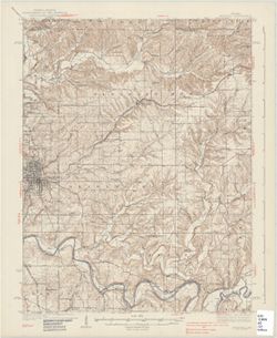
![Indiana-Kentucky Corydon quadrangle [1931 printing]](https://iiif.uits.iu.edu/iiif/2/vq280r404%2Ffiles%2F2b715af8-dded-4de4-a4e3-8e1c86dcc800/full/250,/0/default.jpg)
- Subject:
- Geographic Subject: Meade County (Ky.)
- Creator:
- Kentucky Geological Survey, Higginson, W. S. (William Smith Muir), 1894-1984, United States. Army, and Geological Survey (U.S.)
- Publisher:
- Geological Survey (U.S.)
- Date Created:
- 1931
- Identifier:
- VAC3073-M-01321
- Genre:
- 15 minute topographic maps, Topographic maps, and Quadrangle maps
- Geographic Location:
- Coordinates: W0861500 W0860000 N0381500 N0380000
- Related URL:
- Catalog URL: https://iucat.iu.edu/catalog/18406398
- Abstract:
- Topography by W.S. Higginson , Ohio River by Corps of Engineers, U.S. Army , control by U.S. Geological Survey and Corps of Engineers, U.S. Army. Filing titl...
- Call Number:
- G4090 s62 .G4 Corydon 1931
- Caption:
- Imprint: [Washington, D.C.] : Dept. of the Interior, U.S. Geological Survey, [1931]
- Physical Description:
- Scale: 1:62,500 and Dimensions: 45 x 42 cm or smaller
- Alternate Identifier:
- Title Control Number: a18406398
- Persistent URL:
- https://purl.dlib.indiana.edu/iudl/images/VAC3073/VAC3073-M-01321
- Provenance:
- Part of Geological Survey (U.S.). Indiana 1:62,500.
-
- Subject:
- Topical Subject: Physical geography and Geographic Subject: Corydon (Ind.)
- Creator:
- Geological Survey (U.S.)
- Publisher:
- Geological Survey (U.S.)
- Date Created:
- 1959
- Identifier:
- VAC3073-M-01319
- Genre:
- Quadrangle maps and Topographic maps
- Geographic Location:
- Coordinates: W0861500 W0860000 N0381500 N0380000
- Related URL:
- Catalog URL: https://iucat.iu.edu/catalog/2863930
- Abstract:
- Relief shown by contours and spot heights. Shows portions of Harrison County, Indiana, and Meade County, Kentucky. Compiled in 1956 from 1:25,000-scale maps ...
- Call Number:
- G4090 s62 .G4 Corydon 1950 rep1959
- Caption:
- Imprint: Washington, D.C. : United States, Department of the Interior, Geological Survey, 1959
- Physical Description:
- Scale: 1:62,500 and Dimensions: 45 x 36 cm
- Persistent URL:
- https://purl.dlib.indiana.edu/iudl/images/VAC3073/VAC3073-M-01319
- Provenance:
- USGS 15 minute series (topographic)
-
- Subject:
- Geographic Subject: Birds (Ind.)
- Publisher:
- Geological Survey (U.S.)
- Date Created:
- 1917
- Identifier:
- VAC3073-M-01318
- Genre:
- Topographic maps and 15 minute topographic maps
- Related URL:
- Catalog URL: new.iucat.iu.edu/catalog/2863930
- Call Number:
- G4090 s62 .G4 Birds 1917
- Caption:
- Imprint: Washington, D.C. : The Survey, 1917.
- Physical Description:
- Scale: 1:62,500 and Dimensions: maps : col., 45 x 42 cm., or smaller.
- Persistent URL:
- https://purl.dlib.indiana.edu/iudl/images/VAC3073/VAC3073-M-01318
-
![Illinois-Indiana Birds quadrangle : topography [1943 reprint]](https://iiif.uits.iu.edu/iiif/2/k643c5517%2Ffiles%2F919c9455-6809-440d-bdac-0eaf5779317c/full/250,/0/default.jpg)
- Subject:
- Geographic Subject: Crawford County (Ill.), Geographic Subject: Sullivan County (Ind.), and Geographic Subject: Knox County (Ind.)
- Creator:
- U.S. Coast and Geodetic Survey, United States. Army, Graff, Fred, Jr., Herron, W. H. (William Harrison), 1865-, Marshall, R. B. (Robert Bradford), 1867-1949,...
- Publisher:
- Geological Survey (U.S.)
- Date Created:
- 1943
- Identifier:
- VAC3073-M-01316
- Genre:
- Quadrangle maps, Topographic maps, and 15 minute topographic maps
- Geographic Location:
- Coordinates: W0874500 W0873000 N0390000 N0384500
- Related URL:
- Catalog URL: https://iucat.iu.edu/catalog/18408527
- Abstract:
- R.B. Marshall, Chief Geographer , W.H. Herron, Geographer in charge , topography by F. Graff, Jr. , control by Corps of Engineers U.S. Army, U.S. Coast and G...
- Call Number:
- G4090 s62 .G4 Birds 1917 R1943
- Caption:
- Imprint: [Urbana, Ill.] : Geological Survey Division, [1943] and Imprint: [Washington, D.C.] : U.S. Geological Survey
- Physical Description:
- Dimensions: 45 x 42 cm or smaller and Scale: 1:62,500
- Alternate Identifier:
- Title Control Number: a18408527
- Persistent URL:
- https://purl.dlib.indiana.edu/iudl/images/VAC3073/VAC3073-M-01316
- Provenance:
- Part of Geological Survey (U.S.). Indiana 1:62,500.
-
![Illinois-Indiana Birds quadrangle : topography [1958 reprint]](https://iiif.uits.iu.edu/iiif/2/vt151n461%2Ffiles%2F8d479352-343d-4029-a644-fe61b614fa55/full/250,/0/default.jpg)
- Subject:
- Geographic Subject: Sullivan County (Ind.), Geographic Subject: Crawford County (Ill.), and Geographic Subject: Knox County (Ind.)
- Creator:
- U.S. Coast and Geodetic Survey, Herron, W. H. (William Harrison), 1865-, Marshall, R. B. (Robert Bradford), 1867-1949, Graff, Fred, Jr., United States. Army,...
- Publisher:
- Geological Survey (U.S.)
- Date Created:
- 1958
- Identifier:
- VAC3073-M-01317
- Genre:
- Quadrangle maps, Topographic maps, and 15 minute topographic maps
- Geographic Location:
- Coordinates: W0874500 W0873000 N0390000 N0384500
- Related URL:
- Catalog URL: https://iucat.iu.edu/catalog/18408528
- Abstract:
- R.B. Marshall, Chief Geographer , W.H. Herron, Geographer in charge , topography by F. Graff, Jr. , control by Corps of Engineers U.S. Army, U.S. Coast and G...
- Call Number:
- G4090 s62 .G4 Birds 1942 rep1958
- Caption:
- Imprint: Washington, D.C. : Interior--Geological Survey, 1958. Washington, D.C. : for sale by U.S. Geological Survey and Imprint: Urbana, Illinois : State Ge...
- Physical Description:
- Scale: 1:62,500 and Dimensions: 45 x 42 cm or smaller
- Alternate Identifier:
- Title Control Number: a18408528
- Persistent URL:
- https://purl.dlib.indiana.edu/iudl/images/VAC3073/VAC3073-M-01317
- Provenance:
- Part of Geological Survey (U.S.). Indiana 1:62,500.
