Search Constraints
You searched for:
Date Created
1899
Remove constraint Date Created: 1899
Publisher
Indiana. Department of Geology and Natural Resources
Remove constraint Publisher: Indiana. Department of Geology and Natural Resources
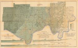
![Township 5 south, range 8 west [Indiana]](https://iiif.uits.iu.edu/iiif/2/df65wb20n%2Ffiles%2F076a45f7-4ea5-41d9-9a65-3d0fbf136b54/full/250,/0/default.jpg)

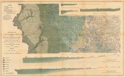
![Township 2 south, range 7 west [Indiana]](https://iiif.uits.iu.edu/iiif/2/2b88rf889%2Ffiles%2F8503c6af-2a95-4ca4-acde-dcd4736a0d0c/full/250,/0/default.jpg)