
Search Constraints
You searched for:
Campus
IUB
Remove constraint Campus: IUB
Pages
0-99 pages
Remove constraint Pages: 0-99 pages
Provenance
Part of Geological Survey (U.S.). Indiana 1:62,500.
Remove constraint Provenance: Part of Geological Survey (U.S.). Indiana 1:62,500.
Search Results
-
![Indiana Bloomington quadrangle [1954 reprint]](https://iiif.uits.iu.edu/iiif/2/w0893f30w%2Ffiles%2Fb04f67f3-77f9-4c1d-aeb9-b2462611f557/full/250,/0/default.jpg)
- Subject:
- Geographic Subject: Monroe County (Ind.), Geographic Subject: Owen County (Ind.), and Geographic Subject: Greene County (Ind.)
- Creator:
- Marshall, R. B. (Robert Bradford), 1867-1949, Sadler, C. L., Herron, W. H. (William Harrison), 1865-, and Griffin, W. H. (William H.)
- Publisher:
- Geological Survey (U.S.)
- Date Created:
- 1954
- Identifier:
- VAC3073-M-01320
- Genre:
- Quadrangle maps, 15 minute topographic maps, and Topographic maps
- Geographic Location:
- Coordinates: W0864500 W0863000 N0391500 N0390000
- Related URL:
- Catalog URL: https://iucat.iu.edu/catalog/18406221
- Abstract:
- R. B. Marshall, chief geographer , W. H. Herron, Geographer in charge , topography by W. H. Griffin and C. L. Sandler , Control by J. R. Ellis and C. H. Semp...
- Call Number:
- G4090 s62 .G4 Bloomington 1908 rep1954
- Caption:
- Imprint: [Washington, D.C.] : United States, Department of the Interior, Geological Survey, [1954]
- Physical Description:
- Dimensions: 45 x 42 cm or smaller and Scale: 1:62,500
- Alternate Identifier:
- Title Control Number: a18406221
- Persistent URL:
- https://purl.dlib.indiana.edu/iudl/images/VAC3073/VAC3073-M-01320
- Provenance:
- Part of Geological Survey (U.S.). Indiana 1:62,500.
-
- Subject:
- Geographic Subject: Warrick County (Ind.), Geographic Subject: Vanderburgh County (Ind.), Geographic Subject: Gibson County (Ind.), and Geographic Subject: P...
- Creator:
- Renshawe, John H., Blair, H. B. (Herbert Buxton), 1860-1905, Hawkins, Geo. T. (George T.), and McKinney, R. C. (Robert C.)
- Publisher:
- Geological Survey (U.S.)
- Date Created:
- 1902
- Identifier:
- VAC3073-M-01296
- Genre:
- Topographic maps, Quadrangle maps, and 15 minute topographic maps
- Geographic Location:
- Coordinates: W0873000 W0871500 N0381500 N0380000
- Related URL:
- Catalog URL: https://iucat.iu.edu/catalog/18408288
- Abstract:
- Engraved Oct. 1902 by U.S.G.S. , Jno. H. Renshawe, geographer in charge , control by Geo. T. Hawkins , topography by R.C. McKinney and H.B. Blair. Edition of...
- Call Number:
- G4090 s62 .G4 Boonville 1902
- Caption:
- Imprint: [Washington, D.C.] : U.S. Geological Survey, 1902
- Physical Description:
- Dimensions: 45 x 42 cm or smaller and Scale: 1:62,500
- Alternate Identifier:
- Title Control Number: a18408288
- Persistent URL:
- https://purl.dlib.indiana.edu/iudl/images/VAC3073/VAC3073-M-01296
- Provenance:
- Part of Geological Survey (U.S.). Indiana 1:62,500.
-
![Indiana Boonville quadrangle [1925 reprint]](https://iiif.uits.iu.edu/iiif/2/1j92hc14j%2Ffiles%2Fb2be9690-7880-4ed7-9803-bf40e2d9f165/full/250,/0/default.jpg)
- Subject:
- Geographic Subject: Warrick County (Ind.), Geographic Subject: Pike County (Ind.), Geographic Subject: Vanderburgh County (Ind.), and Geographic Subject: Gib...
- Creator:
- McKinney, R. C. (Robert C.), Blair, H. B. (Herbert Buxton), 1860-1905, Hawkins, Geo. T. (George T.), and Renshawe, John H.
- Publisher:
- Geological Survey (U.S.)
- Date Created:
- 1925
- Identifier:
- VAC3073-M-01338
- Genre:
- 15 minute topographic maps, Topographic maps, and Quadrangle maps
- Geographic Location:
- Coordinates: W0873000 W0871500 N0381500 N0380000
- Related URL:
- Catalog URL: https://iucat.iu.edu/catalog/18408288
- Abstract:
- Engraved Oct. 1902 by U.S.G.S. , Jno. H. Renshawe, geographer in charge , control by Geo. T. Hawkins , topography by R.C. McKinney and H.B. Blair. Edition of...
- Call Number:
- G4090 s62 .G4 Boonville 1902 rep1925
- Caption:
- Imprint: [Washington, D.C.] : U.S. Geological Survey, [1925]
- Physical Description:
- Dimensions: 45 x 42 cm or smaller and Scale: 1:62,500
- Alternate Identifier:
- Title Control Number: a18408288
- Persistent URL:
- https://purl.dlib.indiana.edu/iudl/images/VAC3073/VAC3073-M-01338
- Provenance:
- Part of Geological Survey (U.S.). Indiana 1:62,500.
-
- Subject:
- Geographic Subject: Vigo County (Ind.), Geographic Subject: Clay County (Ind.), Geographic Subject: Putnam County (Ind.), and Geographic Subject: Owen County...
- Creator:
- Herron, W. H. (William Harrison), 1865-, Marshall, R. B. (Robert Bradford), 1867-1949, Sadler, C. L., and Geological Survey (U.S.)
- Publisher:
- Geological Survey (U.S.)
- Date Created:
- 1910
- Identifier:
- VAC3073-M-01328
- Genre:
- Quadrangle maps, Topographic maps, and 15 minute topographic maps
- Geographic Location:
- Coordinates: W0871500 W0870000 N0393000 N0391500
- Related URL:
- Catalog URL: https://iucat.iu.edu/catalog/18406394
- Abstract:
- Engraved July 1910 by U.S.G.S. , R. B. Marshall, chief geographer , W. H. Herron, geographer in charge , topography by C. L. Sadler , [and three others]. Rel...
- Call Number:
- G4090 s62 .G4 Clay City 1910
- Caption:
- Imprint: [Washington, D.C.] : U.S. Geological Survey, 1910
- Physical Description:
- Scale: 1:62,500 and Dimensions: 45 x 42 cm or smaller
- Alternate Identifier:
- Title Control Number: a18406394
- Persistent URL:
- https://purl.dlib.indiana.edu/iudl/images/VAC3073/VAC3073-M-01328
- Provenance:
- Part of Geological Survey (U.S.). Indiana 1:62,500.
-
![Indiana Clay City quadrangle [1936 reprint]](https://iiif.uits.iu.edu/iiif/2/wd376z59h%2Ffiles%2Faa45c1aa-fb05-4809-a96b-7abd27014bc5/full/250,/0/default.jpg)
- Subject:
- Geographic Subject: Vigo County (Ind.), Geographic Subject: Putnam County (Ind.), Geographic Subject: Clay County (Ind.), and Geographic Subject: Owen County...
- Creator:
- Sadler, C. L., Marshall, R. B. (Robert Bradford), 1867-1949, Geological Survey (U.S.), and Herron, W. H. (William Harrison), 1865-
- Publisher:
- Geological Survey (U.S.)
- Date Created:
- 1936
- Identifier:
- VAC3073-M-01323
- Genre:
- Quadrangle maps, 15 minute topographic maps, and Topographic maps
- Geographic Location:
- Coordinates: W0871500 W0870000 N0393000 N0391500
- Related URL:
- Catalog URL: https://iucat.iu.edu/catalog/a18406394
- Abstract:
- Engraved July 1910 by U.S.G.S. , R. B. Marshall, chief geographer , W. H. Herron, geographer in charge , topography by C. L. Sadler , [and three others]. Rel...
- Call Number:
- G4090 s62 .G4 Clay City 1910 rep1936
- Caption:
- Imprint: [Washington, D.C.] : U.S. Geological Survey, 1936
- Physical Description:
- Scale: 1:62,500 and Dimensions: 45 x 42 cm or smaller
- Alternate Identifier:
- Title Control Number: a18406394
- Persistent URL:
- https://purl.dlib.indiana.edu/iudl/images/VAC3073/VAC3073-M-01323
- Provenance:
- Part of Geological Survey (U.S.). Indiana 1:62,500.
-
- Subject:
- Geographic Subject: Spencer County (Ind.), Geographic Subject: Dubois County (Ind.), Geographic Subject: Warrick County (Ind.), and Geographic Subject: Pike ...
- Creator:
- Renshawe, John H., Geological Survey (U.S.), Hawkins, Geo. T. (George T.), and Goodlove, C. W.
- Publisher:
- Geological Survey (U.S.)
- Date Created:
- 1902
- Identifier:
- VAC3073-M-01301
- Genre:
- 15 minute topographic maps, Topographic maps, and Quadrangle maps
- Geographic Location:
- Coordinates: W0871500 W0870000 N0381500 N0380000
- Related URL:
- Catalog URL: https://iucat.iu.edu/catalog/18408290
- Abstract:
- Engraved Oct. 1902 by U.S.G.S. , Jno. Renshawe, geographer in charge , control by Geo. T. Hawkins , topography by Chas. W. Goodlove. Filing title: Degonia Sp...
- Call Number:
- G4090 s62 .G4 Degonia Springs 1902
- Caption:
- Imprint: Washington, D.C. : The Survey, 1902
- Physical Description:
- Dimensions: 45 x 42 cm or smaller and Scale: 1:62,500
- Alternate Identifier:
- Title Control Number: a18408290
- Persistent URL:
- https://purl.dlib.indiana.edu/iudl/images/VAC3073/VAC3073-M-01301
- Provenance:
- Part of Geological Survey (U.S.). Indiana 1:62,500.
-
![Indiana Degonia Springs quadrangle [1936 reprint]](https://iiif.uits.iu.edu/iiif/2/x346f640t%2Ffiles%2F0b272452-2a1a-4415-897a-e57e4a8c1f70/full/250,/0/default.jpg)
- Subject:
- Geographic Subject: Warrick County (Ind.), Geographic Subject: Dubois County (Ind.), Geographic Subject: Spencer County (Ind.), and Geographic Subject: Pike ...
- Creator:
- Renshawe, John H., Goodlove, C. W., Geological Survey (U.S.), and Hawkins, Geo. T. (George T.)
- Publisher:
- Geological Survey (U.S.)
- Date Created:
- 1936
- Identifier:
- VAC3073-M-01293
- Genre:
- 15 minute topographic maps, Topographic maps, and Quadrangle maps
- Geographic Location:
- Coordinates: W0871500 W0870000 N0381500 N0380000
- Related URL:
- Catalog URL: https://iucat.iu.edu/catalog/18408290
- Abstract:
- Engraved Oct. 1902 by U.S.G.S. , Jno. Renshawe, geographer in charge , control by Geo. T. Hawkins , topography by Chas. W. Goodlove. Filing title: Degonia Sp...
- Call Number:
- G4090 s62 .G4 Degonia Springs 1902 rep1936
- Caption:
- Imprint: [Washington, D.C.] : U.S. Geological Survey, 1936
- Physical Description:
- Scale: 1:62,500 and Dimensions: 45 x 42 cm or smaller
- Alternate Identifier:
- Title Control Number: a18408290
- Persistent URL:
- https://purl.dlib.indiana.edu/iudl/images/VAC3073/VAC3073-M-01293
- Provenance:
- Part of Geological Survey (U.S.). Indiana 1:62,500.
-
![Indiana Haubstadt quadrangle [1903 printing]](https://iiif.uits.iu.edu/iiif/2/mw22w891g%2Ffiles%2F3f2a82be-5754-4703-989d-ede2f3a3b596/full/250,/0/default.jpg)
- Subject:
- Geographic Subject: Posey County (Ind.), Geographic Subject: Gibson County (Ind.), and Geographic Subject: Vanderburgh County (Ind.)
- Creator:
- Renshawe, John H., Goodlove, C. W., Hawkins, Geo. T. (George T.), and Geological Survey (U.S.)
- Publisher:
- Geological Survey (U.S.)
- Date Created:
- 1903
- Identifier:
- VAC3073-M-01342
- Genre:
- Quadrangle maps, 15 minute topographic maps, and Topographic maps
- Geographic Location:
- Coordinates: W0874500 W0873000 N0381500 N0380000
- Related URL:
- Catalog URL: https://iucat.iu.edu/catalog/18408287
- Abstract:
- Engraved Mar. 1903 by U.S.G.S. , Jno. H. Renshawe, geographer in charge , control by Geo. T. Hawkins , topography by Chas. W. Goodlove. Relief shown by conto...
- Call Number:
- G4090 s62 .G4 Haubstadt 1903
- Caption:
- Imprint: [Washington, D.C.] : U.S. Geological Survey, 1903
- Physical Description:
- Dimensions: 45 x 42 cm or smaller and Scale: 1:62,500
- Alternate Identifier:
- Title Control Number: a18408287
- Persistent URL:
- https://purl.dlib.indiana.edu/iudl/images/VAC3073/VAC3073-M-01342
- Provenance:
- Part of Geological Survey (U.S.). Indiana 1:62,500.
-
![Indiana Haubstadt quadrangle [1935 reprint]](https://iiif.uits.iu.edu/iiif/2/1544cr71r%2Ffiles%2F5aabf650-fa83-48d4-bdcd-7579f3c6501a/full/250,/0/default.jpg)
- Subject:
- Geographic Subject: Posey County (Ind.), Geographic Subject: Gibson County (Ind.), and Geographic Subject: Vanderburgh County (Ind.)
- Creator:
- Geological Survey (U.S.)
- Publisher:
- Geological Survey (U.S.)
- Date Created:
- 1903
- Identifier:
- VAC3073-M-01505
- Genre:
- 15 minute topographic maps, Topographic maps, and Quadrangle maps
- Geographic Location:
- Coordinates: W0874500 W0873000 N0381500 N0380000
- Related URL:
- Catalog URL: https://iucat.iu.edu/catalog/18408287
- Abstract:
- Engraved Mar. 1903 by U.S.G.S. , Jno. H. Renshawe, geographer in charge , control by Geo. T. Hawkins , topography by Chas. W. Goodlove. Relief shown by conto...
- Call Number:
- G4090 s62 .G4 Haubstadt 1903 R1935
- Caption:
- Imprint: [Washington, D.C.] : U.S. Geological Survey, 1935
- Physical Description:
- Dimensions: 45 x 42 cm or smaller and Scale: 1:62,500
- Alternate Identifier:
- Title Control Number: a18408287
- Persistent URL:
- https://purl.dlib.indiana.edu/iudl/images/VAC3073/VAC3073-M-01505
- Provenance:
- Part of Geological Survey (U.S.). Indiana 1:62,500.
-
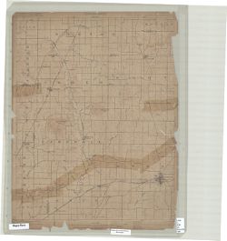
![Indiana Noblesville quadrangle [Advance sheet]](https://iiif.uits.iu.edu/iiif/2/z603s186j%2Ffiles%2Fa45cd3ef-5a89-498d-bd77-0a4e4dea6790/full/250,/0/default.jpg)
- Subject:
- Geographic Subject: Tipton County (Ind.), Geographic Subject: Whitewater River Watershed (Ind. and Ohio), Geographic Subject: Boone County (Ind.), Geographic...
- Creator:
- Klausmann, H. W. (Henry "Harry" W.), 1868-1918
- Publisher:
- Geological Survey (U.S.)
- Date Created:
- 1914
- Identifier:
- VAC3073-M-01447
- Genre:
- Topographic maps, 15 minute topographic maps, and Quadrangle maps
- Geographic Location:
- Coordinates: W0861500 W0860000 N0401500 N0400000
- Related URL:
- Catalog URL: https://iucat.iu.edu/catalog/18413827
- Abstract:
- Surveyed by H.W. Klausmann. Relief shown by contours. Contour interval 10 feet. Shows portion of Hamilton County as well as small portions Tipton and Boone c...
- Call Number:
- G4090 s62 .G4 Noblesville 1914 ADV
- Caption:
- Imprint: [Washington, D.C.?] : [U.S. Geological Survey?], [1914?]
- Physical Description:
- Dimensions: 45 x 42 cm or smaller and Scale: 1:48,000
- Alternate Identifier:
- Title Control Number: a18413827
- Persistent URL:
- https://purl.dlib.indiana.edu/iudl/images/VAC3073/VAC3073-M-01447
- Provenance:
- Part of Geological Survey (U.S.). Indiana 1:62,500.
