
Search Constraints
Search Results
-
- Subject:
- Geographic Subject: Indiana, Topical Subject: Geology, Topical Subject: Geology, Stratigraphic, and Geographic Subject: Ohio
- Creator:
- Indiana. Geological Survey, Burger, Ann M., Wayne, William J. (William John), 1922-, Forsyth, Jane L. (Jane Louise), 1921-, and Nicoll, Robert S.
- Publisher:
- Indiana. Geological Survey
- Date Created:
- 1971
- Identifier:
- VAC3073-M-01256
- Genre:
- Quadrangle maps, Geological maps, and Geological cross-sections
- Geographic Location:
- Coordinates: W0860000 W0840000 N0410000 N0400000
- Related URL:
- Catalog URL: https://iucat.iu.edu/catalog/18455599
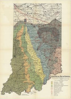
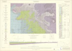
- Abstract:
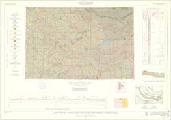
- By Ann M. Burger, Jane L. Forsyth, Robert S. Nicoll, and William J. Wayne , Indiana Geological Survey, Dept. of Natural Resources. Transverse Mercator projec...
- Call Number:
- G4091.C5 s250 .I5 Muncie 1971
- Caption:
- Imprint: [Bloomington, Ind.] : Indiana Geological Survey, 1971
- Physical Description:
- Dimensions: 105 x 73 cm and Scale: 1:250,000. Vertical scale approximately 1:11,500
- Alternate Identifier:
- Title Control Number: a18455599
- Persistent URL:
- https://purl.dlib.indiana.edu/iudl/images/VAC3073/VAC3073-M-01256
- Provenance:
- Indiana. Geological Survey. Regional geologic map , no. 5.
-
- Subject:
- Topical Subject: Geology, Geographic Subject: Indiana, and Topical Subject: Geology, Stratigraphic
- Creator:
- Gray, Henry Hamilton, 1922- and Indiana. Geological Survey
- Publisher:
- Indiana. Geological Survey
- Date Created:
- 1972
- Identifier:
- VAC3073-M-01255
- Genre:
- Geological cross-sections, Quadrangle maps, and Geological maps
- Geographic Location:
- Coordinates: W0860000 W0844500 N0390000 N0380000
- Related URL:
- Catalog URL: https://iucat.iu.edu/catalog/18454601
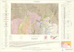
- Abstract:
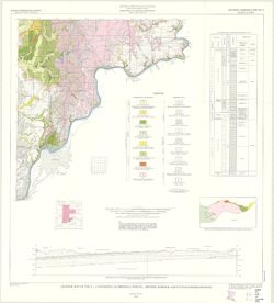
- By Henry H. Gray. Compiled by H. H. Gray and A. M. Burger. Drafted by J. R. Tolen. Base map modified from Army Map Service Map NJ16-6, 1964. Transverse Merca...
- Call Number:
- G4091.C5 s250 .I5 Louisville 1972
- Caption:
- Imprint: [Bloomington, Indiana] : Indiana Geological Survey, 1972
- Physical Description:
- Scale: 1:250,000. Vertical scale approximately 1:11,500 and Dimensions: 66 x 102 cm
- Alternate Identifier:
- Title Control Number: a18454601
- Persistent URL:
- https://purl.dlib.indiana.edu/iudl/images/VAC3073/VAC3073-M-01255
- Provenance:
- Indiana. Geological Survey. Regional geologic map , no. 6.
-
- Subject:
- Topical Subject: Geology, Stratigraphic, Topical Subject: Geology, Geographic Subject: Indiana, and Geographic Subject: Illinois
- Creator:
- Gray, Henry Hamilton, 1922-
- Publisher:
- Indiana. Geological Survey
- Date Created:
- 1910
- Identifier:
- VAC3073-M-01254
- Genre:
- Geological cross-sections, Quadrangle maps, and Geological maps
- Geographic Location:
- Coordinates: W0880000 W0860000 N0390000 N0380000
- Related URL:
- Catalog URL: https://iucat.iu.edu/catalog/18455600
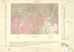
- Abstract:
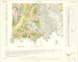
- By Henry H. Gray, William J. Wayne, and Charles E. Wier , Indiana Geological Survey, in cooperation with Illinois State Geological Survey. Transverse Mercato...
- Call Number:
- G4091.C5 s250 .I5 Vincennes
- Caption:
- Imprint: [Bloomington, Ind.] : The Survey, 1970
- Physical Description:
- Dimensions: 76 x 102 cm and Scale: 1:250,000. Vertical scale approximately 1:11,500
- Alternate Identifier:
- Title Control Number: a18455600
- Persistent URL:
- https://purl.dlib.indiana.edu/iudl/images/VAC3073/VAC3073-M-01254
- Provenance:
- Indiana. Geological Survey. Regional geologic map , no. 3.
-
- Subject:
- Topical Subject: IGS Annual Reports, Topical Subject: Petroleum, Topical Subject: Natural gas pipelines, Topical Subject: Gas fields, Topical Subject: Gas we...
- Creator:
- Gorby, S. S. (Sylvester Scott)
- Publisher:
- Indiana. Department of Geology and Natural Resources
- Date Created:
- 1894
- Identifier:
- VAC3073-M-01253
- Genre:
- Geological maps
- Geographic Location:
- Coordinates: W0880700 W0844500 N0414500 N0375200
- Related URL:
- Catalog URL: https://iucat.iu.edu/catalog/18416363
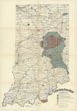
- Abstract:
- Shows natural and man-made gas and petroleum features as well as county seats, townships, towns, post offices, railroads, and creeks. Detached from: Natur...
- Call Number:
- G4091.H8 1893 .G6
- Caption:
- b[Indiana. Department of Geology and Natural Resources], [1894], Imprint: Indianapolis, Ind. : Wm. B. Burford, Lith., [1894], and Imprint: [Indianapolis] :
- Physical Description:
- Dimensions: 89 x 62 cm and Scale: Approximately 1:570,240. 9 miles to the inch
- Alternate Identifier:
- Alternate ID: 390726IP and Title Control Number: a18416363
- Persistent URL:
- https://purl.dlib.indiana.edu/iudl/images/VAC3073/VAC3073-M-01253
- Provenance:
- 18th Annual Report (1893) / Indiana. Department of Geology and Natural Resources.
-
- Subject:
- Topical Subject: IGS Annual Reports, Topical Subject: Geology, and Geographic Subject: Indiana
- Creator:
- Gorby, S. S. (Sylvester Scott)
- Publisher:
- Indiana. Department of Geology and Natural Resources
- Date Created:
- 1894
- Identifier:
- VAC3073-M-01252
- Genre:
- Geological maps
- Related URL:
- Catalog URL: https://iucat.iu.edu/catalog/4022270
- Call Number:
- QE109 .A2
- Caption:
- Imprint: Wm. B. Burford, Lith, Indianapolis
- Physical Description:
- Scale: Approximately 1:570,240. 9 miles to the inch
- Persistent URL:
- https://purl.dlib.indiana.edu/iudl/images/VAC3073/VAC3073-M-01252
- Provenance:
- 18th Annual Report (1893) / Indiana. Department of Geology and Natural Resources.
-
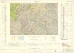
- Subject:
- Geographic Subject: Indiana, Geographic Subject: Illinois, Topical Subject: Geology, Stratigraphic, and Topical Subject: Geology
- Creator:
- Indiana. Geological Survey, Bleuer, N. K. (Ned Kermit), 1943-, Lineback, Jerry A. (Jerry Alvin), Hill, John R,, Gray, Henry Hamilton, 1922-, and Illinois Sta...
- Publisher:
- Indiana. Geological Survey
- Date Created:
- 1979
- Identifier:
- VAC3073-M-01251
- Genre:
- Quadrangle maps, Geological maps, and Geological cross-sections
- Geographic Location:
- Coordinates: W0880000 W0860000 N0400000 N0390000
- Related URL:
- Catalog URL: https://iucat.iu.edu/catalog/18437113
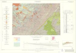
- Abstract:
- Indianapolis sheet. 1979 edition. Transverse Mercator projection. Geology compiled by H. H. Gray (Indiana) and J. A. Lineback (Illinois) from published and o...
- Call Number:
- G4091.C5 s250 .I5 Indianapolis 1979
- Caption:
- Imprint: [Bloomington] : Indiana Geological Survey, 1979
- Physical Description:
- Scale: 1:250,000. Vertical scale approximately 1:3,800 and Dimensions: 66 x 102 cm
- Alternate Identifier:
- Title Control Number: a18437113
- Persistent URL:
- https://purl.dlib.indiana.edu/iudl/images/VAC3073/VAC3073-M-01251
- Provenance:
- Indiana. Geological Survey. Regional geologic map , no. 1.
-
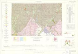
- Subject:
- Topical Subject: Geology, Stratigraphic, Geographic Subject: Illinois, Topical Subject: Geology, and Geographic Subject: Indiana
- Creator:
- Wier, Charles E. (Charles Eugene), 1921-
- Publisher:
- Indiana. Geological Survey
- Date Created:
- 1961
- Identifier:
- VAC3073-M-01250
- Genre:
- Quadrangle maps, Geological maps, and Geological cross-sections
- Geographic Location:
- Coordinates: W0880000 W0860000 N0400000 N0390000
- Related URL:
- Catalog URL: https://iucat.iu.edu/catalog/18422608
- Abstract:
- By Charles E. Wier and Henry H. Gray. Geology by H.H. Gray [and others]. Drafted by R. E. Judah and W. H. Moran. Base modified from Army Map Service map NJ 1...
- Call Number:
- G4091.C5 s250 .I5 Indianapolis 1961
- Caption:
- Imprint: [Indianapolis] : Indiana Geological Survey, 1961
- Physical Description:
- Scale: 1:250,000. Vertical scale approximately 1:1,200 and Dimensions: on sheet 74 x 105 cm
- Alternate Identifier:
- Title Control Number: a18422608
- Persistent URL:
- https://purl.dlib.indiana.edu/iudl/images/VAC3073/VAC3073-M-01250
- Provenance:
- Indiana. Geological Survey. Regional geologic map.
-
- Subject:
- Topical Subject: Geology, Stratigraphic, Geographic Subject: Michigan, Geographic Subject: Ohio, Topical Subject: Geology, and Geographic Subject: Indiana
- Creator:
- Keller, Stanley J., Johnson, Gerald H., Michigan. Geological Survey, and Indiana. Geological Survey
- Publisher:
- Indiana. Geological Survey
- Date Created:
- 1972
- Identifier:
- VAC3073-M-01249
- Genre:
- Geological maps, Geological cross-sections, and Quadrangle maps
- Geographic Location:
- Coordinates: W0860000 W0840000 N0420000 N0410000
- Related URL:
- Catalog URL: https://iucat.iu.edu/catalog/18455585
- Abstract:
- By Gerald H. Johnson and Stanley J. Keller. transverse Mercator projection. Regional geologic map , no. 8. Relief shown by profile. Includes columnar section...
- Call Number:
- G4091.C5 s250 .I5 Fort Wayne 1972
- Caption:
- Imprint: [Bloomington] : Indiana Geological Survey, 1972
- Physical Description:
- Scale: 1:250,000. Vertical scale approximately 1:1,200 and Dimensions: 66 x 101 cm
- Alternate Identifier:
- Title Control Number: a18455585
- Persistent URL:
- https://purl.dlib.indiana.edu/iudl/images/VAC3073/VAC3073-M-01249
- Provenance:
- Indiana. Geological Survey. Regional geologic map , no. 8.
-
- Subject:
- Geographic Subject: Illinois, Topical Subject: Geology, Geographic Subject: Indiana, and Topical Subject: Geology, Stratigraphic
- Creator:
- Keller, Stanley J., Indiana. Geological Survey, Illinois State Geological Survey, Johnson, Gerald H., Wayne, William J. (William John), 1922-, and Atherton, ...
- Publisher:
- Indiana. Geological Survey
- Date Created:
- 1962
- Identifier:
- VAC3073-M-01248
- Genre:
- Geological maps, Quadrangle maps, and Geological cross-sections
- Geographic Location:
- Coordinates: W0880000 W0860000 N0410000 N0400000
- Related URL:
- Catalog URL: https://iucat.iu.edu/catalog/16799905
- Abstract:
- By William J. Wayne, Gerald H. Johnson, and Stanley J. Keller. Indiana Geological Survey in cooperation with Illinois State Geological Survey. Base modified ...
- Call Number:
- G4091.C5 s250 .I5 Danville 1962
- Caption:
- Imprint: [Indianapolis] : Indiana Geological Survey, 1966
- Physical Description:
- Scale: 1:250,000 and Dimensions: 76 x 105 cm
- Alternate Identifier:
- Title Control Number: a16799905
- Persistent URL:
- https://purl.dlib.indiana.edu/iudl/images/VAC3073/VAC3073-M-01248
- Provenance:
- Indiana. Geological Survey. Regional geologic map , no. 2.
-
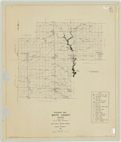
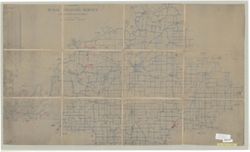
- Subject:
- Geographic Subject: White County (Ind.) and Topical Subject: Drainage
- Creator:
- Joint Highway Research Project (Ind.)
- Publisher:
- Joint Highway Research Project (Ind.)
- Date Created:
- 1954
- Identifier:
- VAC3073-M-01246
- Genre:
- Thematic maps
- Geographic Location:
- Coordinates: W0870500 W0863500 N0405500 N0403400
- Related URL:
- Catalog URL: https://iucat.iu.edu/catalog/9461248
- Abstract:
- Blue line print. "Prepared under the supervision of: P. T. Yeh."
- Call Number:
- G4093.W8C3 1954 .J65
- Caption:
- Imprint: [West Lafayette, Ind.] : The Project, 1954.
- Physical Description:
- Dimensions: 88 x 106 cm and Scale: 1:63,360
- Persistent URL:
- https://purl.dlib.indiana.edu/iudl/images/VAC3073/VAC3073-M-01246
-
- Subject:
- Geographic Subject: Indiana
- Publisher:
- Indiana. Geological Survey
- Date Created:
- 1966
- Identifier:
- VAC3073-M-01247
- Genre:
- Geological maps
- Related URL:
- Catalog URL: https://iucat.iu.edu/catalog/2789347
- Abstract:
- Each sheet includes "Columnar section," "Cross section," "Explanation," "Schematic section," sectionalized township d...
- Call Number:
- G4091.C5 s250 .I5 Danville 1966 Copy 2
- Physical Description:
- Scale: 1:250,000 and Dimensions: col. maps 66 x 102 cm.
- Persistent URL:
- https://purl.dlib.indiana.edu/iudl/images/VAC3073/VAC3073-M-01247
-
- Subject:
- Geographic Subject: Indiana, Topical Subject: Geology, Stratigraphic, Geographic Subject: Ohio, and Topical Subject: Geology
- Creator:
- Schneider, Allan F. (Allan Frank), 1926-, Gooding, Ansel Miller, Forsyth, Jane L. (Jane Louise), 1921-, Gray, Henry Hamilton, 1922-, and Indiana. Geological ...
- Publisher:
- Indiana. Geological Survey
- Date Created:
- 1972
- Identifier:
- VAC3073-M-01245
- Genre:
- Geological maps, Geological cross-sections, and Quadrangle maps
- Geographic Location:
- Coordinates: W0860000 W0840000 N0400000 N0390000
- Related URL:
- Catalog URL: https://iucat.iu.edu/catalog/16799790
- Abstract:
- By Henry H. Gray, Jane L. Forsyth, Allan F. Schneider, and Ansel M. Gooding. Transverse Mercator projection. "Base map modified from Army Map Service, M...
- Call Number:
- G4091 .C5 1972 .G455
- Caption:
- Imprint: [Bloomington, Ind.] : Indiana Geological Survey, 1972
- Physical Description:
- Dimensions: 73 x 66 cm and Scale: 1:250,000
- Alternate Identifier:
- Title Control Number: a16799790
- Persistent URL:
- https://purl.dlib.indiana.edu/iudl/images/VAC3073/VAC3073-M-01245
- Provenance:
- Indiana. Geological Survey. Regional geologic map , no. 7.
-
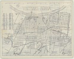
- Subject:
- Geographic Subject: Vincennes (Ind.)
- Creator:
- Vincennes Chamber of Commerce
- Publisher:
- Vincent Print, Co.
- Date Created:
- 1955
- Identifier:
- VAC3073-M-01244
- Genre:
- Pictorial maps
- Geographic Location:
- Coordinates: W0873257 W0872807 N0384335 N0383840
- Related URL:
- Catalog URL: https://iucat.iu.edu/catalog/5991569
- Abstract:
- North oriented toward upper right. Text and ill. on verso.
- Call Number:
- G4094.V5 1955 .V5
- Caption:
- Imprint: Vincennes, Ind. : Vincent Print, Co., [1955?]
- Physical Description:
- Scale: Scale not given. and Dimensions: 41 x 54 cm
- Persistent URL:
- https://purl.dlib.indiana.edu/iudl/images/VAC3073/VAC3073-M-01244
-
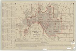
- Subject:
- Geographic Subject: Evansville (Ind.), Topical Subject: Streets, and Geographic Subject: Vanderburgh County (Ind.)
- Creator:
- E.E. Brownell Engineering Co.
- Publisher:
- E.E. Brownell Engineering Co.
- Date Created:
- 1929
- Identifier:
- VAC3073-M-01243
- Genre:
- Maps
- Geographic Location:
- Coordinates: W0873815 W0872700 N0380324 N0375608
- Related URL:
- Catalog URL: https://iucat.iu.edu/catalog/11826697
- Abstract:
- Includes index to streets and "Explanations for street name prefixing." Shows railroads, roads, churches, schools, fire houses, other public buildi...
- Call Number:
- G4094.E9 1929 .E3
- Caption:
- Imprint: Philadelphia, Penna. : E.E. Brownell, [1929]
- Physical Description:
- Dimensions: 45 x 68 cm, on sheet 56 x 86 cm and Scale: 1:18,000
- Persistent URL:
- https://purl.dlib.indiana.edu/iudl/images/VAC3073/VAC3073-M-01243
-
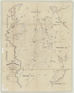
- Subject:
- Topical Subject: Geology, Economic, Topical Subject: Mines and mineral resources, Geographic Subject: Sullivan County (Ind.), and Topical Subject: IGS Annual...
- Creator:
- Levette, G. M. (Gilbert M.), Collett, John, 1828-1899, and Cox, E. T. (Edward Travers), 1821-1907
- Publisher:
- Indiana. Geological Survey
- Date Created:
- 1871
- Identifier:
- VAC3073-M-01242
- Genre:
- Geological maps
- Geographic Location:
- Coordinates: W0873941 W0870603 N0392100 N0384802
- Related URL:
- Catalog URL: https://iucat.iu.edu/catalog/18283359
- Abstract:
- Drawn by G.M. Levette, for the second annual report of Prof. E.T. Cox, state geologist , geology by John Collett. "Braden & Burford, Lith., Indianap...
- Call Number:
- G4093.S8H1 1870 .L4
- Caption:
- Imprint: Indianapolis, Ind. : Geological Survey of Indiana, [1871]
- Physical Description:
- Scale: Approximately 1:85,000 and Dimensions: on sheet 82 x 64 cm
- Alternate Identifier:
- Title Control Number: a18283359 and Alternate ID: 390721IP
- Persistent URL:
- https://purl.dlib.indiana.edu/iudl/images/VAC3073/VAC3073-M-01242
- Provenance:
- 2nd Annual Report (1870) / Indiana. Geological Survey.
-
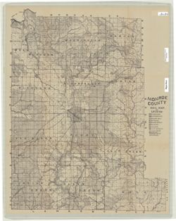
- Subject:
- Geographic Subject: Monroe County (Ind.) and Topical Subject: Soils
- Creator:
- Shannon, C. W. (Charles William), 1879-1934
- Publisher:
- Indiana. Department of Geology and Natural Resources
- Date Created:
- 1908
- Identifier:
- VAC3073-M-01241
- Genre:
- Thematic maps
- Geographic Location:
- Coordinates: W0864108 W0861902 N0392120 N0385926
- Related URL:
- Catalog URL: https://iucat.iu.edu/catalog/16136315
- Abstract:
- Shows roads, earth and improved, railroads, school houses, and churches. Detached from: Soil survey of Monroe, Brown, Lawrence, Martin, Orange, Washington...
- Call Number:
- G4093.M7J3 1907 .S5
- Caption:
- Imprint: [Indianapolis] : [Indiana Department of Geology and Natural Resources], [1908]
- Physical Description:
- Dimensions: 66 x 52 cm and Scale: Approximately 1:63,360
- Alternate Identifier:
- Title Control Number: a16136315 and Alternate ID: 390726IP
- Persistent URL:
- https://purl.dlib.indiana.edu/iudl/images/VAC3073/VAC3073-M-01241
- Provenance:
- 32nd Annual Report (1907) / Indiana. Department of Geology and Natural Resources.
-
- Subject:
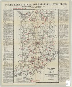
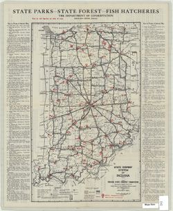
- Topical Subject: Parks, Topical Subject: Roads, and Geographic Subject: Indiana
- Creator:
- Indiana. Department of Conservation
- Publisher:
- Indiana. State Highway Commission (1919-1953)
- Date Created:
- 1924
- Identifier:
- VAC3073-M-01238
- Genre:
- Tourist maps
- Geographic Location:
- Coordinates: W0880500 W0844700 N0414500 N0374600
- Related URL:
- Catalog URL: https://iucat.iu.edu/catalog/4040824
- Abstract:
- Compiled by Chas. G. Sauers. Map title: Map of Indiana showing points of interest and state highways. "Map furnished by Indiana State Highway Commission...
- Call Number:
- G4091 .E635 1924 .I6
- Caption:
- Imprint: [Indianapolis] : The Department of Conservation, 1924
- Physical Description:
- Scale: 1:963,000 and Dimensions: 56 x 36 cm
- Persistent URL:
- https://purl.dlib.indiana.edu/iudl/images/VAC3073/VAC3073-M-01238
-
- Subject:
- Topical Subject: Postal service, Topical Subject: Rural free delivery, and Geographic Subject: Gibson County (Ind.)
- Creator:
- United States. Post Office Department
- Publisher:
- United States. Post Office Department
- Date Created:
- 1900
- Identifier:
- VAC3073-M-01240
- Genre:
- Maps
- Geographic Location:
- Coordinates: W0875917 W0871856 N0383200 N0380955
- Related URL:
- Catalog URL: https://iucat.iu.edu/catalog/6040366
- Abstract:
- Blue line. Map has been trimmed, date, part of title and other information is missing.
- Call Number:
- G4093.G5P8 1900 .U5
- Caption:
- Imprint: [Washington, D.C.] : U.S. Post Office Dept., 1900?
- Physical Description:
- Scale: 1:63,360 and Dimensions: 63 x 107 cm
- Persistent URL:
- https://purl.dlib.indiana.edu/iudl/images/VAC3073/VAC3073-M-01240
-
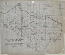
- Subject:
- Geographic Subject: Lawrence County (Ind.), Geographic Subject: Lost River Watershed (Ind.), Topical Subject: Drainage, Geographic Subject: Lost River (Ind. ...
- Creator:
- Malott, Clyde A.
- Publisher:
- [publisher not identified]
- Date Created:
- 1927
- Identifier:
- VAC3073-M-01239
- Genre:
- Manuscript maps and Thematic maps
- Geographic Location:
- Coordinates: W0864059 W0861220 N0384445 N0383053
- Related URL:
- Catalog URL: https://iucat.iu.edu/catalog/7745828
- Abstract:
- Pen, colored ink and colored pencils on drafting cloth. Includes table of drainage areas.
- Call Number:
- G4092.L8C315 1927 .M35
- Caption:
- Imprint: [Place of publication not identified] : [publisher not identified], 1927.
- Physical Description:
- Scale: 1:31,680 and Dimensions: 93 x 111 cm
- Persistent URL:
- https://purl.dlib.indiana.edu/iudl/images/VAC3073/VAC3073-M-01239
-
- Subject:
- Geographic Subject: Indiana, Topical Subject: Parks, and Topical Subject: Roads
- Creator:
- Indiana. Department of Conservation
- Publisher:
- Indiana. State Highway Commission (1919-1953)
- Date Created:
- 1925
- Identifier:
- VAC3073-M-01237
- Genre:
- Tourist maps
- Geographic Location:
- Coordinates: W0880500 W0844700 N0414500 N0374600
- Related URL:
- Catalog URL: https://iucat.iu.edu/catalog/1204523
- Abstract:
- Map title: Map of Indiana showing points of interest and state highways. "Map furnished by Indiana State Highway Commission, R.F. Pickens, del." On...
- Call Number:
- G4091.E635 1925 .I6
- Caption:
- Imprint: [Indianapolis] : The Department of Conservation, [approximately 1925]
- Physical Description:
- Dimensions: 50 x 31 cm and Scale: 1:963,000
- Persistent URL:
- https://purl.dlib.indiana.edu/iudl/images/VAC3073/VAC3073-M-01237
-
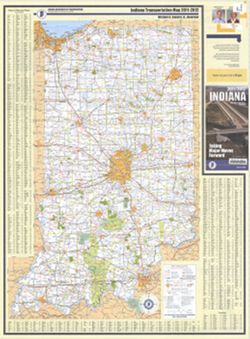
- Subject:
- Geographic Subject: Indianapolis (Ind.), Topical Subject: Roads, Topical Subject: Central business districts, and Geographic Subject: Indiana
- Creator:
- Indiana. Department of Transportation
- Publisher:
- Indiana. Department of Transportation
- Date Created:
- 2011
- Identifier:
- VAC3073-M-01235
- Genre:
- Road maps
- Geographic Location:
- Coordinates: W0880500 W0844700 N0414500 N0374600
- Related URL:
- Catalog URL: https://iucat.iu.edu/catalog/a18406192
- Abstract:
- Panel title: Indiana, 2011/2012, taking major moves forward. Includes indexes, note, and color illustrations. Text, indexed map of "Downtown Indianapoli...
- Call Number:
- G1403 .S7 2011-2012
- Caption:
- Imprint: [Indianapolis] : Indiana Department of Transportation, [2011]
- Physical Description:
- Dimensions: 94 x 59 cm and Scale: Approximately 1:550,000
- Alternate Identifier:
- Title Control Number: a18406192
- Persistent URL:
- https://purl.dlib.indiana.edu/iudl/images/VAC3073/VAC3073-M-01235
- Provenance:
- Indiana state highway system
-
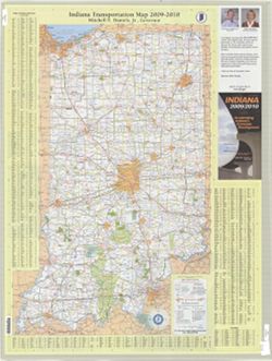
- Subject:
- Topical Subject: Roads, Geographic Subject: Indianapolis (Ind.), Topical Subject: Central business districts, and Geographic Subject: Indiana
- Creator:
- Indiana. Department of Transportation. Graphic Engineering Division
- Publisher:
- Indiana. Department of Transportation
- Date Created:
- 2009
- Identifier:
- VAC3073-M-01234
- Genre:
- Road maps
- Geographic Location:
- Coordinates: W0880500 W0844700 N0414500 N0374600
- Related URL:
- Catalog URL: https://iucat.iu.edu/catalog/18406189
- Abstract:
- Panel title: Indiana, 2009/2010, accelerating Indiana's economic development. Includes indexes, note, and color illustrations. Text, indexed map of "...
- Call Number:
- G1403 .S7 2009-2010
- Caption:
- Imprint: Indianapolis, Ind. : Indiana Department of Transportation, [2009]
- Physical Description:
- Scale: Approximately 1:560,000 and Dimensions: 94 x 59 cm
- Alternate Identifier:
- Title Control Number: a18406189
- Persistent URL:
- https://purl.dlib.indiana.edu/iudl/images/VAC3073/VAC3073-M-01234
- Provenance:
- Indiana state highway system
-
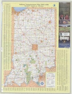
- Subject:
- Topical Subject: Roads, Topical Subject: Central business districts, Geographic Subject: Indianapolis (Ind.), and Geographic Subject: Indiana
- Creator:
- Indiana. Department of Transportation. Graphic Engineering Division
- Publisher:
- Indiana. Department of Transportation
- Date Created:
- 2005
- Identifier:
- VAC3073-M-01233
- Genre:
- Road maps
- Geographic Location:
- Coordinates: W0880500 W0844700 N0414500 N0374600
- Related URL:
- Catalog URL: https://iucat.iu.edu/catalog/18406187
- Abstract:
- Panel title: Indiana 2005-2006. Includes indexes, note, and color illustrations. Text, indexed map of "Downtown Indianapolis," 16 local route maps,...
- Call Number:
- G1403 .S7 2005-2006
- Caption:
- Imprint: [Indianapolis, Ind.] : distributed by State Representative Peggy Welch, District 60, [2005] and Imprint: Indianapolis, Ind. : Indiana Department of ...
- Physical Description:
- Scale: Approximately 1:560,000 and Dimensions: 94 x 59 cm
- Alternate Identifier:
- Title Control Number: a18406187
- Persistent URL:
- https://purl.dlib.indiana.edu/iudl/images/VAC3073/VAC3073-M-01233
- Provenance:
- Indiana state highway system
-
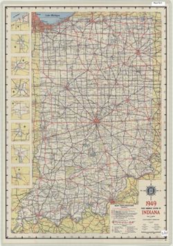
- Subject:
- Geographic Subject: Indiana and Topical Subject: Roads
- Creator:
- Indiana. State Highway Commission (1919-1953)
- Publisher:
- Indiana. State Highway Commission (1919-1953)
- Date Created:
- 1949
- Identifier:
- VAC3073-M-01236
- Genre:
- Road maps
- Geographic Location:
- Coordinates: W0880500 W0844700 N0414500 N0374600
- Related URL:
- Catalog URL: https://iucat.iu.edu/catalog/18406077
- Abstract:
- Panel title: 1949 Indiana official highway map. Relief shown by spot heights. Includes 8 local route maps. Index, distance chart, distance map of the United ...
- Call Number:
- G1403 .S7 1949
- Caption:
- Imprint: [Indianapolis] : State Highway Commission, [1949]
- Physical Description:
- Dimensions: 94 x 59 cm and Scale: Approximately 1:633,600
- Alternate Identifier:
- Title Control Number: a18406077
- Persistent URL:
- https://purl.dlib.indiana.edu/iudl/images/VAC3073/VAC3073-M-01236
- Provenance:
- Indiana state highway system
-
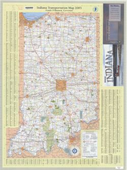
- Subject:
- Topical Subject: Roads, Geographic Subject: Indiana, Geographic Subject: Indianapolis (Ind.), and Topical Subject: Central business districts
- Creator:
- Indiana. Department of Transportation. Graphic Engineering Division
- Publisher:
- Indiana. Department of Transportation
- Date Created:
- 2003
- Identifier:
- VAC3073-M-01230
- Genre:
- Road maps
- Geographic Location:
- Coordinates: W0880500 W0844700 N0414500 N0374600
- Related URL:
- Catalog URL: https://iucat.iu.edu/catalog/18406179
- Abstract:
- Panel title: 2003 Indiana : Lewis & Clark ... a bicentennial celebration 1803-2003. Includes indexes, note, and color illustrations. Text, indexed map of...
- Call Number:
- G1403 .S7 2003
- Caption:
- Imprint: Indianapolis, Ind. : Indiana Department of Transportation, [2003]
- Physical Description:
- Scale: Approximately 1:560,000 and Dimensions: 94 x 59 cm
- Alternate Identifier:
- Title Control Number: a18406179
- Persistent URL:
- https://purl.dlib.indiana.edu/iudl/images/VAC3073/VAC3073-M-01230
- Provenance:
- Indiana state highway system
-
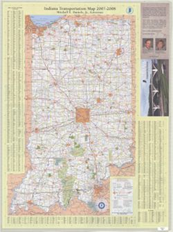
- Subject:
- Geographic Subject: Indiana, Topical Subject: Central business districts, Topical Subject: Roads, and Geographic Subject: Indianapolis (Ind.)
- Creator:
- Indiana. Department of Transportation. Graphic Engineering Division
- Publisher:
- Indiana. Department of Transportation
- Date Created:
- 2007
- Identifier:
- VAC3073-M-01232
- Genre:
- Road maps
- Geographic Location:
- Coordinates: W0880500 W0844700 N0414500 N0374600
- Related URL:
- Catalog URL: https://iucat.iu.edu/catalog/18406186
- Abstract:
- Panel title: 2007/2008 Indiana, accelerate your business. Includes indexes, note, and color illustrations. Text, indexed map of "Downtown Indianapolis,&...
- Call Number:
- G1403 .S7 2007-2008
- Caption:
- Imprint: Indianapolis, Ind. : Indiana Department of Transportation, [2007]
- Physical Description:
- Dimensions: 94 x 59 cm and Scale: Approximately 1:560,000
- Alternate Identifier:
- Title Control Number: a18406186
- Persistent URL:
- https://purl.dlib.indiana.edu/iudl/images/VAC3073/VAC3073-M-01232
- Provenance:
- Indiana state highway system
-
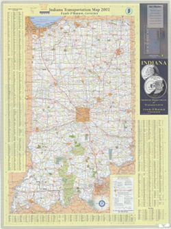
- Subject:
- Geographic Subject: Indiana, Topical Subject: Roads, Geographic Subject: Indianapolis (Ind.), and Topical Subject: Central business districts
- Creator:
- Indiana. Department of Transportation. Graphic Engineering Division
- Publisher:
- Indiana. Department of Transportation
- Date Created:
- 2002
- Identifier:
- VAC3073-M-01229
- Genre:
- Road maps
- Geographic Location:
- Coordinates: W0880500 W0844700 N0414500 N0374600
- Related URL:
- Catalog URL: https://iucat.iu.edu/catalog/18406172
- Abstract:
- Description based on: 1997-1998. Includes indexes and note. Text, indexed map of "Downtown Indianapolis," 16 local route maps, distance table, inde...
- Call Number:
- G1403 .S7 2002
- Caption:
- Imprint: Indianapolis, Ind. : Indiana Department of Transportation, [2002]
- Physical Description:
- Scale: Approximately 1:560,000 and Dimensions: 94 x 59 cm
- Alternate Identifier:
- Title Control Number: a18406172
- Persistent URL:
- https://purl.dlib.indiana.edu/iudl/images/VAC3073/VAC3073-M-01229
- Provenance:
- Indiana state highway system
-
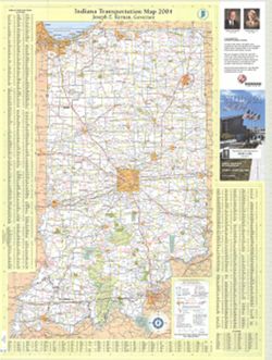
- Subject:
- Geographic Subject: Indiana, Topical Subject: Central business districts, Geographic Subject: Indianapolis (Ind.), and Topical Subject: Roads
- Creator:
- Indiana. Department of Transportation. Graphic Engineering Division
- Publisher:
- Indiana. Department of Transportation
- Date Created:
- 2004
- Identifier:
- VAC3073-M-01231
- Genre:
- Road maps
- Geographic Location:
- Coordinates: W0880500 W0844700 N0414500 N0374600
- Related URL:
- Catalog URL: https://iucat.iu.edu/catalog/18406184
- Abstract:
- Panel title: Indiana 2004. Includes indexes, note, and color illustrations. Text, indexed map of "Downtown Indianapolis," 16 local route maps, dist...
- Call Number:
- G1403 .S7 2004
- Caption:
- Imprint: [Indianapolis, Ind.] : distributed by State Representative Markt Lytle, District 69, [2004] and Imprint: Indianapolis, Ind. : Indiana Department of ...
- Physical Description:
- Scale: Approximately 1:560,000 and Dimensions: 94 x 59 cm
- Alternate Identifier:
- Title Control Number: a18406184
- Persistent URL:
- https://purl.dlib.indiana.edu/iudl/images/VAC3073/VAC3073-M-01231
- Provenance:
- Indiana state highway system
-
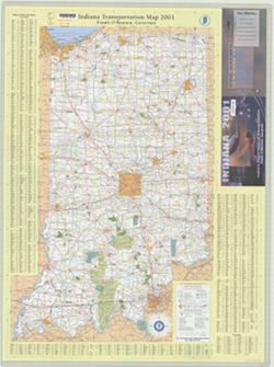
- Subject:
- Geographic Subject: Indiana, Topical Subject: Roads, Topical Subject: Central business districts, and Geographic Subject: Indianapolis (Ind.)
- Creator:
- Indiana. Department of Transportation. Graphic Engineering Division
- Publisher:
- Indiana. Department of Transportation
- Date Created:
- 2001
- Identifier:
- VAC3073-M-01228
- Genre:
- Road maps
- Geographic Location:
- Coordinates: W0880500 W0844700 N0414500 N0374600
- Related URL:
- Catalog URL: https://iucat.iu.edu/catalog/18406168
- Abstract:
- Panel title: Indiana 2001. Includes indexes and note. Text, indexed map of "Downtown Indianapolis," 16 local route maps, distance table, index to p...
- Call Number:
- G1403 .S7 2001
- Caption:
- Imprint: Indianapolis, Ind. : Indiana Dept. of Transportation, [2001]
- Physical Description:
- Dimensions: 94 x 59 cm and Scale: Approximately 1:560,000
- Alternate Identifier:
- Title Control Number: a18406168
- Persistent URL:
- https://purl.dlib.indiana.edu/iudl/images/VAC3073/VAC3073-M-01228
- Provenance:
- Indiana state highway system
-
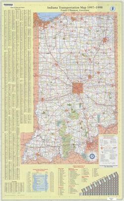
- Subject:
- Geographic Subject: Indiana and Topical Subject: Roads
- Creator:
- Indiana. Department of Transportation. Graphic Engineering Division
- Publisher:
- Indiana. Department of Transportation
- Date Created:
- 1997
- Identifier:
- VAC3073-M-01226
- Genre:
- Road maps
- Geographic Location:
- Coordinates: W0880500 W0844700 N0414500 N0374600
- Related URL:
- Catalog URL: https://iucat.iu.edu/catalog/18406157
- Abstract:
- Includes indexes, indexes to points of interest, distance table, and list of state police phone numbers. Text, indexed map of "Downtown Indianapolis,&qu...
- Call Number:
- G1403 .S7 1997-1998
- Caption:
- Imprint: Indianapolis, Ind. : Indiana Department of Transportation, [1997]
- Physical Description:
- Scale: Approximately 1:633,600 and Dimensions: 94 x 59 cm
- Alternate Identifier:
- Title Control Number: a18406157
- Persistent URL:
- https://purl.dlib.indiana.edu/iudl/images/VAC3073/VAC3073-M-01226
- Provenance:
- Indiana state highway system
-
- Subject:
- Topical Subject: Roads and Geographic Subject: Indiana
- Creator:
- Indiana. Department of Transportation. Graphic Engineering Division
- Publisher:
- Indiana. Department of Transportation
- Date Created:
- 1995
- Identifier:
- VAC3073-M-01225
- Genre:
- Road maps
- Geographic Location:
- Coordinates: W0880500 W0844700 N0414500 N0374600
- Related URL:
- Catalog URL: https://iucat.iu.edu/catalog/18406154
- Abstract:
- Panel title: Indiana 1995-1996 transportation map. Includes indexes, text, color illustrations, distance table, "Map of the United States showing mileag...
- Call Number:
- G1403 .S7 1995-1996
- Caption:
- Imprint: [Indiana] : Indiana Department of Transportation, 1995.
- Physical Description:
- Scale: Approximately 1:633,600 and Dimensions: 94 x 59 cm
- Alternate Identifier:
- Title Control Number: a18406154
- Persistent URL:
- https://purl.dlib.indiana.edu/iudl/images/VAC3073/VAC3073-M-01225
- Provenance:
- Indiana state highway system
-
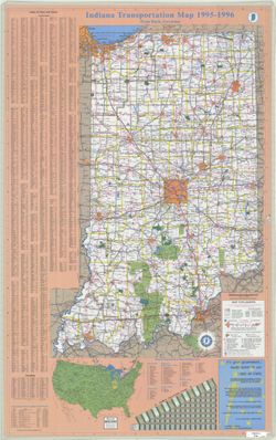
- Subject:
- Geographic Subject: Indiana and Topical Subject: Roads
- Creator:
- Indiana. State Highway Commission (1961-1981)
- Publisher:
- Indiana. State Highway Commission (1961-1981)
- Date Created:
- 1962
- Identifier:
- VAC3073-M-01224
- Genre:
- Road maps
- Geographic Location:
- Coordinates: W0880500 W0844700 N0414500 N0374600
- Related URL:
- Catalog URL: https://iucat.iu.edu/catalog/18406041
- Abstract:
- Panel title: 1962 Indiana official highway map. Relief shown by spot heights. Includes index, distance table, color illustrations, and text. Index, distance ...
- Call Number:
- G1403 .S7 1962
- Caption:
- Imprint: [Indianapolis] : State Highway Commission, [1962]
- Physical Description:
- Scale: Approximately 1:633,600 and Dimensions: 94 x 59 cm
- Alternate Identifier:
- Title Control Number: a18406041
- Persistent URL:
- https://purl.dlib.indiana.edu/iudl/images/VAC3073/VAC3073-M-01224
- Provenance:
- Indiana state highway system
-
- Subject:
- Geographic Subject: Indianapolis (Ind.), Topical Subject: Central business districts, Topical Subject: Roads, and Geographic Subject: Indiana
- Creator:
- Indiana. Department of Transportation. Graphic Engineering Division
- Publisher:
- Indiana. Department of Transportation
- Date Created:
- 2000
- Identifier:
- VAC3073-M-01227
- Genre:
- Road maps
- Geographic Location:
- Coordinates: W0880500 W0844700 N0414500 N0374600
- Related URL:
- Catalog URL: https://iucat.iu.edu/catalog/18406162
- Abstract:
- Panel title: Indiana 2000 : racing into the--millennium! Includes indexes, indexes to points of interest, distance table, and list of state police phone numb...
- Call Number:
- G1403 .S7 2000
- Caption:
- Imprint: Indianapolis, Ind. : Indiana Department of Transportation, [2000]
- Physical Description:
- Dimensions: 94 x 59 cm and Scale: Approximately 1:650,000
- Alternate Identifier:
- Title Control Number: a18406162
- Persistent URL:
- https://purl.dlib.indiana.edu/iudl/images/VAC3073/VAC3073-M-01227
- Provenance:
- Indiana state highway system
-
- Subject:
- Topical Subject: Roads and Geographic Subject: Indiana
- Creator:
- Indiana. State Highway Department
- Publisher:
- Indianapolis, Ind.: The Dept.,
- Date Created:
- 1960
- Identifier:
- VAC3073-M-01223
- Genre:
- Road maps
- Geographic Location:
- Coordinates: W0880500 W0844700 N0414500 N0374600
- Related URL:
- Catalog URL: https://iucat.iu.edu/catalog/18406084
- Abstract:
- Panel title: 1960 Indiana official highway map. Includes 5 local route maps. Includes index, U.S. distance map, mileage chart, color illustrations, index and...
- Call Number:
- G4091.P2 1960 .I53
- Caption:
- Imprint: [Indianapolis] : State Highway Department of Indiana, [1960]
- Physical Description:
- Scale: Approximately 1:633,600 and Dimensions: 94 x 59 cm
- Alternate Identifier:
- Title Control Number: a18406084
- Persistent URL:
- https://purl.dlib.indiana.edu/iudl/images/VAC3073/VAC3073-M-01223
- Provenance:
- Indiana state highway system
-
- Subject:
- Geographic Subject: Indiana and Topical Subject: Roads
- Creator:
- Indiana. State Highway Commission (1919-1953)
- Publisher:
- Indiana. State Highway Commission (1919-1953)
- Date Created:
- 1952
- Identifier:
- VAC3073-M-01222
- Genre:
- Road maps
- Geographic Location:
- Coordinates: W0880500 W0844700 N0414500 N0374600
- Related URL:
- Catalog URL: https://iucat.iu.edu/catalog/18406078
- Abstract:
- Panel title: 1952 Indiana official highway map. Relief shown by spot heights. Includes text, color illustrations, and 5 local route maps. Index, distance cha...
- Call Number:
- G1403 .S7 1952
- Caption:
- Imprint: [Indianapolis] : State Highway Commission, [1952]
- Physical Description:
- Dimensions: 94 x 59 cm and Scale: Approximately 1:633,600
- Alternate Identifier:
- Title Control Number: a18406078
- Persistent URL:
- https://purl.dlib.indiana.edu/iudl/images/VAC3073/VAC3073-M-01222
- Provenance:
- Indiana state highway system
-
- Subject:
- Topical Subject: Roads and Geographic Subject: Indiana
- Creator:
- Indiana. State Highway Department
- Publisher:
- Indiana. State Highway Department
- Date Created:
- 1959
- Identifier:
- VAC3073-M-01221
- Genre:
- Road maps
- Geographic Location:
- Coordinates: W0880500 W0844700 N0414500 N0374600
- Related URL:
- Catalog URL: https://iucat.iu.edu/catalog/18406081
- Abstract:
- Panel title: 1959 Indiana official highway map. Relief shown by spot heights. Includes illustrations and 5 local route maps. Index, distance chart, distance ...
- Call Number:
- G1403 .S7 1959
- Caption:
- Imprint: [Indianapolis] : State Highway Department, [1959]
- Physical Description:
- Scale: Approximately 1:633,600 and Dimensions: 94 x 59 cm
- Alternate Identifier:
- Title Control Number: a18406081
- Persistent URL:
- https://purl.dlib.indiana.edu/iudl/images/VAC3073/VAC3073-M-01221
- Provenance:
- Indiana state highway system
-
- Subject:
- Geographic Subject: Indiana and Topical Subject: Roads
- Creator:
- Indiana. State Highway Department
- Publisher:
- Indiana. State Highway Department
- Date Created:
- 1956
- Identifier:
- VAC3073-M-01220
- Genre:
- Road maps
- Geographic Location:
- Coordinates: W0880500 W0844700 N0414500 N0374600
- Related URL:
- Catalog URL: https://iucat.iu.edu/catalog/18406080
- Abstract:
- Panel title: 1956 Indiana official highway map. Relief shown by spot heights. Includes 5 local route maps and illustrations. Index, distance chart, distance ...
- Call Number:
- G1403 .S7 1956
- Caption:
- Imprint: [Indianapolis] : State Highway Department, [1956]
- Physical Description:
- Scale: Approximately 1:633,600 and Dimensions: 94 x 59 cm
- Alternate Identifier:
- Title Control Number: a18406080
- Persistent URL:
- https://purl.dlib.indiana.edu/iudl/images/VAC3073/VAC3073-M-01220
- Provenance:
- Indiana state highway system
-
![Indiana Bloomington quadrangle [1948 reprint]](https://iiif.uits.iu.edu/iiif/2/2j62t788s%2Ffiles%2F57d817cb-ee47-4ed5-9f38-24d8a93dcb0b/full/250,/0/default.jpg)
- Subject:
- Geographic Subject: Owen County (Ind.), Geographic Subject: Greene County (Ind.), and Geographic Subject: Monroe County (Ind.)
- Creator:
- Marshall, R. B. (Robert Bradford), 1867-1949, Herron, W. H. (William Harrison), 1865-, Griffin, W. H. (William H.), and Sadler, C. L.
- Publisher:
- Geological Survey (U.S.)
- Date Created:
- 1948
- Identifier:
- VAC3073-M-01219
- Genre:
- Topographic maps, 15 minute topographic maps, and Quadrangle maps
- Geographic Location:
- Coordinates: W0880000 W0844500 N0414500 N0375200
- Related URL:
- Catalog URL: https://iucat.iu.edu/catalog/18406221
- Abstract:
- R. B. Marshall, chief geographer , W. H. Herron, Geographer in charge , topography by W. H. Griffin and C. L. Sandler , Control by J. R. Ellis and C. H. Semp...
- Call Number:
- G4090 s62 .G4 Bloomington 1910 R1948
- Caption:
- Imprint: [Washington, D.C.] : United States, Department of the Interior, Geological Survey, [1948]
- Physical Description:
- Dimensions: 45 x 42 cm or smaller and Scale: 1:62,500
- Alternate Identifier:
- Title Control Number: a18406221
- Persistent URL:
- https://purl.dlib.indiana.edu/iudl/images/VAC3073/VAC3073-M-01219
- Provenance:
- Part of Geological Survey (U.S.). Indiana 1:62,500.
-
![Indiana Bloomington quadrangle [1946 reprint with 21 indexed cave locations]](https://iiif.uits.iu.edu/iiif/2/dz011t645%2Ffiles%2Fbb3033b6-3144-4af2-a6c7-a5710771ff06/full/250,/0/default.jpg)
- Subject:
- Geographic Subject: Owen County (Ind.), Geographic Subject: Monroe County (Ind.), Topical Subject: Caves, and Geographic Subject: Greene County (Ind.)
- Creator:
- Griffin, W. H. (William H.), Marshall, R. B. (Robert Bradford), 1867-1949, Sadler, C. L., and Herron, W. H. (William Harrison), 1865-
- Publisher:
- Geological Survey (U.S.)
- Date Created:
- 1946
- Identifier:
- VAC3073-M-01218
- Genre:
- Topographic maps, Quadrangle maps, and 15 minute topographic maps
- Geographic Location:
- Coordinates: W0864500 W0863000 N0391500 N0390000
- Related URL:
- Catalog URL: https://iucat.iu.edu/catalog/18406221
- Abstract:
- R. B. Marshall, chief geographer , W. H. Herron, Geographer in charge , topography by W. H. Griffin and C. L. Sandler , Control by J. R. Ellis and C. H. Semp...
- Call Number:
- G4090 s62 .G4 Bloomington 1910 R1946
- Caption:
- Imprint: [Washington, D.C.] : United States, Department of the Interior, Geological Survey, [1946]
- Physical Description:
- Scale: 1:62,500 and Dimensions: 45 x 42 cm or smaller
- Alternate Identifier:
- Title Control Number: a18406221
- Persistent URL:
- https://purl.dlib.indiana.edu/iudl/images/VAC3073/VAC3073-M-01218
- Provenance:
- Part of Geological Survey (U.S.). Indiana 1:62,500.
-
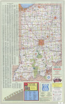
- Subject:
- Topical Subject: Roads and Geographic Subject: Indiana
- Creator:
- Indiana. Department of Transportation. Division of Program Development
- Publisher:
- Indiana. Department of Transportation
- Date Created:
- 1993
- Identifier:
- VAC3073-M-01217
- Genre:
- Road maps
- Geographic Location:
- Coordinates: W0880500 W0844700 N0414500 N0374600
- Related URL:
- Catalog URL: https://iucat.iu.edu/catalog/18406105
- Abstract:
- Panel title: Indiana state highway map, 1993-1994. Includes indexes to cities and towns and counties, mileage chart, state police telephone directory, travel...
- Call Number:
- G1403 .S7 1993-1994
- Caption:
- Imprint: [Indianapolis]. : Indiana Department of Transportation, [1993]
- Physical Description:
- Scale: Approximately 1:633,600 and Dimensions: 94 x 59 cm
- Alternate Identifier:
- Title Control Number: a18406105
- Persistent URL:
- https://purl.dlib.indiana.edu/iudl/images/VAC3073/VAC3073-M-01217
- Provenance:
- Indiana state highway system
-
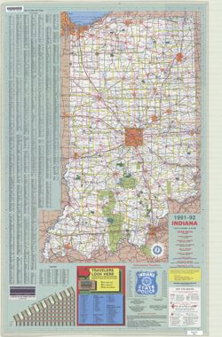
- Subject:
- Topical Subject: Roads and Geographic Subject: Indiana
- Creator:
- Indiana. Department of Transportation. Division of Engineering Services
- Publisher:
- Indiana. Department of Transportation
- Date Created:
- 1991
- Identifier:
- VAC3073-M-01216
- Genre:
- Road maps
- Geographic Location:
- Coordinates: W0880500 W0844700 N0414500 N0374600
- Related URL:
- Catalog URL: https://iucat.iu.edu/catalog/18406103
- Abstract:
- Panel title: Indiana, 1991-1992. Includes indexes, list of points of interest, mileage chart, and directories. Text, illustrations (some color), and 16 local...
- Call Number:
- G1403 .S7 1991-1992
- Caption:
- Imprint: [Indianapolis] : [Indiana Department of Transportation], [1991]
- Physical Description:
- Scale: Approximately 1:633,600 and Dimensions: 94 x 59 cm
- Alternate Identifier:
- Title Control Number: a18406103
- Persistent URL:
- https://purl.dlib.indiana.edu/iudl/images/VAC3073/VAC3073-M-01216
- Provenance:
- Indiana state highway system
-
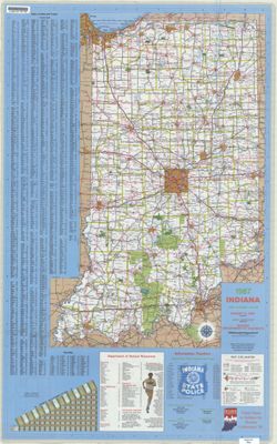
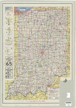
- Subject:
- Geographic Subject: Indiana, Topical Subject: Special Olympics, Inc., and Topical Subject: Roads
- Creator:
- Indiana. Department of Highways. Division of Program Development
- Publisher:
- Indiana. Department of Highways. Division of Program Development
- Date Created:
- 1987
- Identifier:
- VAC3073-M-01212
- Genre:
- Road maps
- Geographic Location:
- Coordinates: W0880500 W0844700 N0414500 N0374600
- Related URL:
- Catalog URL: https://iucat.iu.edu/catalog/18406098
- Abstract:
- Title on verso: Indiana 1987 : America's amateur sports center. Includes indexes, indexed table of recreation areas, information numbers, and distance ch...
- Call Number:
- G1403 .S7 1987
- Caption:
- Imprint: Indianapolis, IN : Department of Highways, Division of Program Development, [1987]
- Physical Description:
- Scale: Approximately 1:633,600 and Dimensions: 94 x 59 cm
- Alternate Identifier:
- Title Control Number: a18406098
- Persistent URL:
- https://purl.dlib.indiana.edu/iudl/images/VAC3073/VAC3073-M-01212
- Provenance:
- Indiana state highway system
-
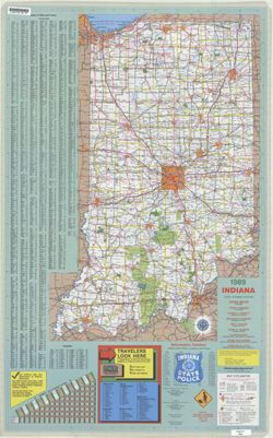
- Subject:
- Geographic Subject: Indiana and Topical Subject: Roads
- Creator:
- Indiana. Department of Highways. Division of Program Development
- Publisher:
- Indiana. Department of Highways
- Date Created:
- 1989
- Identifier:
- VAC3073-M-01214
- Genre:
- Road maps
- Geographic Location:
- Coordinates: W0880500 W0844700 N0414500 N0374600
- Related URL:
- Catalog URL: https://iucat.iu.edu/catalog/18406101
- Abstract:
- Panel title: Indiana, 1989. Relief shown by spot heights. Includes index, distance chart, directory of state police districts, and indexed list of state recr...
- Call Number:
- G1403 .S7 1989
- Caption:
- Imprint: [Indianapolis] : Indiana Department of Highways, [1989]
- Physical Description:
- Scale: Approximately 1:633,600 and Dimensions: 94 x 59 cm
- Alternate Identifier:
- Title Control Number: a18406101
- Persistent URL:
- https://purl.dlib.indiana.edu/iudl/images/VAC3073/VAC3073-M-01214
- Provenance:
- Indiana state highway system
-
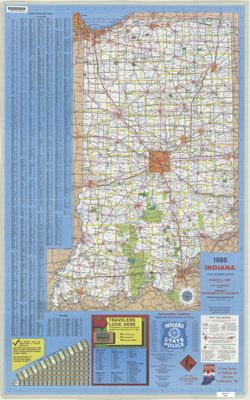
- Subject:
- Geographic Subject: Indiana and Topical Subject: Roads
- Creator:
- Indiana. Department of Highways. Division of Program Development
- Publisher:
- Indiana. Department of Highways.
- Date Created:
- 1988
- Identifier:
- VAC3073-M-01213
- Genre:
- Road maps
- Geographic Location:
- Coordinates: W0880500 W0844700 N0414500 N0374600
- Related URL:
- Catalog URL: https://iucat.iu.edu/catalog/18406100
- Abstract:
- Panel title: Indiana, 1988. Relief shown by spot heights. Includes index, distance chart, directory of state police locations, indexed list of state recreati...
- Call Number:
- G1403 .S7 1988
- Caption:
- Imprint: [Indianapolis] : Indiana Department of Highways, [1988]
- Physical Description:
- Scale: Approximately 1:633,600 and Dimensions: 94 x 59 cm
- Alternate Identifier:
- Title Control Number: a18406100
- Persistent URL:
- https://purl.dlib.indiana.edu/iudl/images/VAC3073/VAC3073-M-01213
- Provenance:
- Indiana state highway system
-
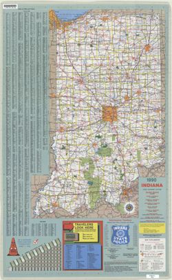
- Subject:
- Topical Subject: Roads and Geographic Subject: Indiana
- Creator:
- Indiana. Department of Highways. Division of Program Development
- Publisher:
- Indiana. Department of Highways
- Date Created:
- 1990
- Identifier:
- VAC3073-M-01215
- Genre:
- Road maps
- Geographic Location:
- Coordinates: W0880500 W0844700 N0414500 N0374600
- Related URL:
- Catalog URL: https://iucat.iu.edu/catalog/18406102
- Abstract:
- Panel title: Indiana, 1990 : crossroads. Relief shown by spot heights. Includes index, distance chart, directory of state police districts, list of scenic by...
- Call Number:
- G1403 .S7 1990
- Caption:
- Imprint: [Indianapolis] : Indiana Department of Highways, [1990]
- Physical Description:
- Scale: Approximately 1:633,600 and Dimensions: 94 x 59 cm
- Alternate Identifier:
- Title Control Number: a18406102
- Persistent URL:
- https://purl.dlib.indiana.edu/iudl/images/VAC3073/VAC3073-M-01215
- Provenance:
- Indiana state highway system
-
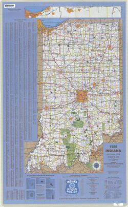
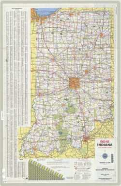
- Subject:
- Topical Subject: Roads and Geographic Subject: Indiana
- Creator:
- Indiana. Department of Highways. Division of Planning
- Publisher:
- Indiana. Department of Highways
- Date Created:
- 1984
- Identifier:
- VAC3073-M-01210
- Genre:
- Road maps
- Geographic Location:
- Coordinates: W0880500 W0844700 N0414500 N0374600
- Related URL:
- Catalog URL: https://iucat.iu.edu/catalog/18406095
- Abstract:
- Panel title: Indiana, 1984. Relief shown by spot heights. Includes index, distance chart, and indexed inset "Indiana toll road." Text, Department o...
- Call Number:
- G1403 .S7 1984
- Caption:
- Imprint: [Indianapolis] : Indiana Department of Highways, [1984]
- Physical Description:
- Scale: Approximately 1:633,600 and Dimensions: 94 x 59 cm
- Alternate Identifier:
- Title Control Number: a18406095
- Persistent URL:
- https://purl.dlib.indiana.edu/iudl/images/VAC3073/VAC3073-M-01210
- Provenance:
- Indiana state highway system
-
- Subject:
- Geographic Subject: Indiana and Topical Subject: Roads
- Creator:
- Indiana. Department of Highways. Division of Planning
- Publisher:
- Indiana. Department of Highways
- Date Created:
- 1986
- Identifier:
- VAC3073-M-01211
- Genre:
- Road maps
- Geographic Location:
- Coordinates: W0880500 W0844700 N0414500 N0374600
- Related URL:
- Catalog URL: https://iucat.iu.edu/catalog/18406097
- Abstract:
- Panel title: Indiana, 1986. Includes Indiana Toll Road map and indexes to cities and towns, counties, and Department of Natural Resources locations. Includes...
- Call Number:
- G1403 .S7 1986
- Caption:
- Imprint: Indianapolis : Indiana Department of Highways, 1986.
- Physical Description:
- Dimensions: 94 x 59 cm and Scale: Approximately 1:633,600
- Alternate Identifier:
- Title Control Number: a18406097
- Persistent URL:
- https://purl.dlib.indiana.edu/iudl/images/VAC3073/VAC3073-M-01211
- Provenance:
- Indiana state highway system
-
- Subject:
- Geographic Subject: Indiana and Topical Subject: Roads
- Creator:
- Indiana. Department of Highways. Division of Planning
- Publisher:
- Indiana. Department of Highways. Division of Planning
- Date Created:
- 1982
- Identifier:
- VAC3073-M-01209
- Genre:
- Road maps
- Geographic Location:
- Coordinates: W0880500 W0844700 N0414500 N0374600
- Related URL:
- Catalog URL: https://iucat.iu.edu/catalog/18406093
- Abstract:
- Panel title: Indiana 1982-83 official highway map. Relief shown by spot heights. Includes index, distance chart, and text. Text, Department of Natural Resour...
- Call Number:
- G1403 .S7 1982-1983
- Caption:
- Imprint: [Indianapolis] : Indiana Department of Highways, [1982]
- Physical Description:
- Scale: Approximately 1:633,600 and Dimensions: 94 x 59 cm
- Alternate Identifier:
- Title Control Number: a18406093
- Persistent URL:
- https://purl.dlib.indiana.edu/iudl/images/VAC3073/VAC3073-M-01209
- Provenance:
- Indiana state highway system
-
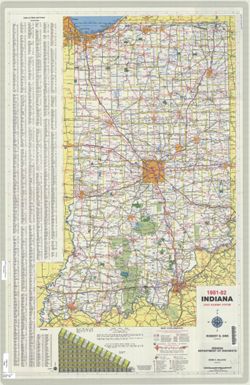
- Subject:
- Topical Subject: Roads and Geographic Subject: Indiana
- Creator:
- Indiana. State Highway Commission (1961-1981)
- Publisher:
- Indiana. State Highway Commission (1961-1981)
- Date Created:
- 1981
- Identifier:
- VAC3073-M-01208
- Genre:
- Road maps
- Geographic Location:
- Coordinates: W0880500 W0844700 N0414500 N0374600
- Related URL:
- Catalog URL: https://iucat.iu.edu/catalog/18406091
- Abstract:
- Panel title: Indiana 1981-82 official highway map. Relief shown by spot heights. Includes index, text and distance chart. Text, Department of Natural Resourc...
- Call Number:
- G1403 .S7 1981-1982
- Caption:
- Imprint: [Indianapolis] : Indiana Department of Highways, [1981]
- Physical Description:
- Scale: Approximately 1:633,600 and Dimensions: 94 x 59 cm
- Alternate Identifier:
- Title Control Number: a18406091
- Persistent URL:
- https://purl.dlib.indiana.edu/iudl/images/VAC3073/VAC3073-M-01208
- Provenance:
- Indiana state highway system
-
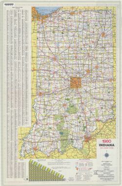
- Subject:
- Geographic Subject: Indiana and Topical Subject: Roads
- Creator:
- Indiana. State Highway Commission (1961-1981). Division of Planning
- Publisher:
- Indiana. State Highway Commission (1961-1981). Division of Planning
- Date Created:
- 1980
- Identifier:
- VAC3073-M-01207
- Genre:
- Road maps
- Geographic Location:
- Coordinates: W0880500 W0844700 N0414500 N0374600
- Related URL:
- Catalog URL: https://iucat.iu.edu/catalog/18406003
- Abstract:
- Panel title: Indiana 1980 official highway map. Relief shown by spot heights. Includes index, distance chart and text. Text, index and directory to Dept. of ...
- Call Number:
- G1403 .S7 1980
- Caption:
- Imprint: Indianapolis : Indiana State Highway Commission, [1980]
- Physical Description:
- Dimensions: 94 x 59 cm and Scale: Approximately 1:633,600
- Alternate Identifier:
- Title Control Number: a18406003
- Persistent URL:
- https://purl.dlib.indiana.edu/iudl/images/VAC3073/VAC3073-M-01207
- Provenance:
- Indiana state highway system
