
Search Constraints
You searched for:
Publisher
Geological Survey (U.S.)
Remove constraint Publisher: Geological Survey (U.S.)
« Previous |
1 - 20 of 159
|
Next »
Search Results
-
- Subject:
- Geographic Subject: Northwest, Old and Geographic Subject: Northeastern States
- Creator:
- Morse, Jedidiah, 1761-1826, Hill, Samuel, approximately 1766-1804, and Thomas & Andrews
- Publisher:
- Geological Survey (U.S.)
- Date Created:
- 1988
- Identifier:
- VAC3073-M-00979
- Genre:
- Early maps
- Geographic Location:
- Coordinates: W1030000 W0800000 N0503000 N0363000
- Related URL:
- Catalog URL: https://iucat.iu.edu/catalog/18454609
- Abstract:
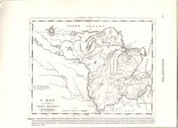
- S. Hill. sc. Map dated 1796. Relief shown by hachures and pictorially. Prime meridians: Philadelphia & London. "The dotted Squares, are the Reservat...
- Call Number:
- QH75 .A4 No. 1200-IN
- Caption:
- Imprint: [Reston, Va.] : [U.S. Gelogical Survey], [1988]
- Physical Description:
- Scale: Scale not given. and Dimensions: xxv, 477 p. : ill., maps, 29 cm.
- Alternate Identifier:
- Title Control Number: a18454609 and Alternate ID: 358171IP
- Persistent URL:
- https://purl.dlib.indiana.edu/iudl/images/VAC3073/VAC3073-M-00979
- Provenance:
- The National gazetteer of the United States of America--Indiana, 1988 / U.S. Geological Survey.
-
- Subject:
- Geographic Subject: Breckinridge County (Ky.), Geographic Subject: Perry County (Ind.), Geographic Subject: Harrison County (Ind.), Geographic Subject: Meade...
- Creator:
- United States. Army Map Service and Geological Survey (U.S.)
- Publisher:
- Geological Survey (U.S.)
- Date Created:
- 1959
- Identifier:
- VAC3073-M-01312
- Genre:
- Topographic maps, Quadrangle maps, and 15 minute topographic maps
- Geographic Location:
- Coordinates: W0863000 W0861500 N0381500 N0380000
- Related URL:
- Catalog URL: https://iucat.iu.edu/catalog/18406357
- Abstract:
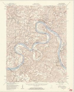
- Mapped by the Geological Survey and the Army Map Service. Filing title: Alton, Ind.--Ky. Polyconic projection. Relief shown by contours and spot heights. Inc...
- Call Number:
- G4090 s62 .G4 Alton 1950 R1959
- Caption:
- Imprint: Washington, D.C. : Interior--Geological Survey, 1959.
- Physical Description:
- Scale: 1:62,500 and Dimensions: 45 x 42 cm or smaller
- Alternate Identifier:
- Title Control Number: a18406357
- Persistent URL:
- https://purl.dlib.indiana.edu/iudl/images/VAC3073/VAC3073-M-01312
- Provenance:
- Part of Geological Survey (U.S.). Indiana 1:62,500.
-
![Alton quadrangle, Indiana--Kentucky : 15 minute series (topographic) [Vegetation version]](https://iiif.uits.iu.edu/iiif/2/ng452m33b%2Ffiles%2F49c9606f-c7c7-4f10-807b-1b5949009698/full/250,/0/default.jpg)
- Subject:
- Geographic Subject: Crawford County (Ind.), Topical Subject: Vegetation mapping, Geographic Subject: Breckinridge County (Ky.), Geographic Subject: Meade Cou...
- Creator:
- Geological Survey (U.S.) and United States. Army Map Service
- Publisher:
- Geological Survey (U.S.)
- Date Created:
- 1959
- Identifier:
- VAC3073-M-01313
- Genre:
- Quadrangle maps, 15 minute topographic maps, and Topographic maps
- Geographic Location:
- Coordinates: W0863000 W0861500 N0381500 N0380000
- Related URL:
- Catalog URL: https://iucat.iu.edu/catalog/18406357
- Abstract:
- Mapped by the Geological Survey and the Army Map Service. Filing title: Alton, Ind.--Ky. Polyconic projection. Relief shown by contours and spot heights. Inc...
- Call Number:
- G4090 s62 .G4 Alton 1950 rep1959 V
- Caption:
- Imprint: Washington, D.C. : Interior--Geological Survey, 1959.
- Physical Description:
- Dimensions: 45 x 42 cm or smaller and Scale: 1:62,500
- Alternate Identifier:
- Title Control Number: a18406357
- Persistent URL:
- https://purl.dlib.indiana.edu/iudl/images/VAC3073/VAC3073-M-01313
- Provenance:
- Part of Geological Survey (U.S.). Indiana 1:62,500.
-
- Subject:
- Geographic Subject: Cass County (Ind.) and Geographic Subject: Berrien County (Mich.)
- Creator:
- Geological Survey (U.S.)
- Publisher:
- Geological Survey (U.S.)
- Date Created:
- 1947
- Identifier:
- VAC3073-M-01325
- Genre:
- Quadrangle maps, Topographic maps, and 15 minute topographic maps
- Geographic Location:
- Coordinates: W0861500 W0860000 N0420000 N0414500
- Related URL:
- Catalog URL: https://iucat.iu.edu/catalog/18408371
- Abstract:
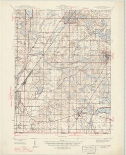
- Filing title: Cassopolis, Mich.--Ind. Edition of 1947. Polyconic projection. Indiana portion not shown, shown on 1:24,000 scale maps of South Bend West and O...
- Call Number:
- G4090 s62 .G4 Cassopolis 1947
- Caption:
- Imprint: Washington, D.C. : U.S. Geological Survey, 1947.
- Physical Description:
- Dimensions: 45 x 42 cm or smaller and Scale: 1:62,500
- Alternate Identifier:
- Title Control Number: a18408371
- Persistent URL:
- https://purl.dlib.indiana.edu/iudl/images/VAC3073/VAC3073-M-01325
- Provenance:
- Part of Geological Survey (U.S.). Indiana 1:62,500.
-
- Subject:
- Topical Subject: Physical geography and Geographic Subject: Corydon (Ind.)
- Creator:
- Geological Survey (U.S.)
- Publisher:
- Geological Survey (U.S.)
- Date Created:
- 1959
- Identifier:
- VAC3073-M-01319
- Genre:
- Quadrangle maps and Topographic maps
- Geographic Location:
- Coordinates: W0861500 W0860000 N0381500 N0380000
- Related URL:
- Catalog URL: https://iucat.iu.edu/catalog/2863930
- Abstract:
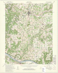
- Relief shown by contours and spot heights. Shows portions of Harrison County, Indiana, and Meade County, Kentucky. Compiled in 1956 from 1:25,000-scale maps ...
- Call Number:
- G4090 s62 .G4 Corydon 1950 rep1959
- Caption:
- Imprint: Washington, D.C. : United States, Department of the Interior, Geological Survey, 1959
- Physical Description:
- Scale: 1:62,500 and Dimensions: 45 x 36 cm
- Persistent URL:
- https://purl.dlib.indiana.edu/iudl/images/VAC3073/VAC3073-M-01319
- Provenance:
- USGS 15 minute series (topographic)
-
![Danville quadrangle, Illinois-Indiana : topographic sheet [1946 reprint]](https://iiif.uits.iu.edu/iiif/2/dz011t65f%2Ffiles%2F0d88511d-4915-434c-875f-219d4a99befe/full/250,/0/default.jpg)
- Subject:
- Geographic Subject: Danville Region (Ill.), Geographic Subject: Vermillion County (Ind.), and Geographic Subject: Vermilion County (Ill.)
- Creator:
- Lloyd, W. J. (Topographer), Illinois. Department of Registration and Education, Geological Survey (U.S.), Illinois State Geological Survey, Hawkins, Geo. T. ...
- Publisher:
- Geological Survey (U.S.)
- Date Created:
- 1946
- Identifier:
- VAC3073-M-01311
- Genre:
- 15 minute topographic maps, Quadrangle maps, and Topographic maps
- Geographic Location:
- Coordinates: W0874500 W0873000 N0401500 N0400000
- Related URL:
- Catalog URL: https://iucat.iu.edu/catalog/18409392
- Abstract:
- Jno. H. Renshawe, geographer in charge , control by U.S. Lake Survey and Geo. T. Hawkins , topography by W. J. Lloyd. Edition of Nov. 1900, reprinted 1946 wi...
- Call Number:
- G4090 s62 .G4 Danville 1900 R1946
- Caption:
- Imprint: [Washington, D.C.] : Geological Survey, [1946]
- Physical Description:
- Scale: 1:62,500 and Dimensions: 45 x 42 cm or smaller
- Alternate Identifier:
- Title Control Number: a18409392
- Persistent URL:
- https://purl.dlib.indiana.edu/iudl/images/VAC3073/VAC3073-M-01311
- Provenance:
- Part of Geological Survey (U.S.). Indiana 1:62,500.
-
![Edinburg Quadrangle Indiana : 15 minute series (topographic) [1950 printing with vegetation]](https://iiif.uits.iu.edu/iiif/2/4b29c880r%2Ffiles%2F58f84ee1-c680-40d2-9a78-baf3613c076f/full/250,/0/default.jpg)
- Subject:
- Geographic Subject: Johnson County (Ind.), Geographic Subject: Shelby County (Ind.), Geographic Subject: Bartholomew County (Ind.), and Topical Subject: Vege...
- Creator:
- Geological Survey (U.S.) and United States. Army. Corps of Engineers
- Publisher:
- Geological Survey (U.S.)
- Date Created:
- 1950
- Identifier:
- VAC3073-M-01291
- Genre:
- Topographic maps, Quadrangle maps, 15 minute topographic maps, and Photogrammetric maps
- Geographic Location:
- Coordinates: W0860000 W0854500 N0393000 N0391500
- Related URL:
- Catalog URL: https://iucat.iu.edu/catalog/18412275
- Abstract:
- Filing title: Edinburg, Ind. Edition of 1950. Polyconic projection. Relief shown by contours and spot heights. Contour interval 20 feet. Shows Shelby County,...
- Call Number:
- G4090 s62 .G4 Edinburg 1950 V
- Caption:
- Imprint: Washington, D.C. : Geological Survey, [1950]
- Physical Description:
- Dimensions: 45 x 42 cm or smaller and Scale: 1:62,500
- Alternate Identifier:
- Title Control Number: a18412275
- Persistent URL:
- https://purl.dlib.indiana.edu/iudl/images/VAC3073/VAC3073-M-01291
- Provenance:
- Part of Geological Survey (U.S.). Indiana 1:62,500.
-
![Edinburg Quadrangle Indiana : 15 minute series (topographic) [1950 printing without vegetation]](https://iiif.uits.iu.edu/iiif/2/3b592c294%2Ffiles%2F06928e89-6508-4c49-a4ff-7f390a205f57/full/250,/0/default.jpg)
- Subject:
- Geographic Subject: Bartholomew County (Ind.), Geographic Subject: Johnson County (Ind.), and Geographic Subject: Shelby County (Ind.)
- Creator:
- United States. Army. Corps of Engineers and Geological Survey (U.S.)
- Publisher:
- Geological Survey (U.S.)
- Date Created:
- 1950
- Identifier:
- VAC3073-M-01280
- Genre:
- Photogrammetric maps, Quadrangle maps, Topographic maps, and 15 minute topographic maps
- Geographic Location:
- Coordinates: W0860000 W0854500 N0393000 N0391500
- Related URL:
- Catalog URL: https://iucat.iu.edu/catalog/18412275
- Abstract:
- Filing title: Edinburg, Ind. Edition of 1950. Polyconic projection. Relief shown by contours and spot heights. Contour interval 20 feet. Shows Shelby County,...
- Call Number:
- G4090 s62 .G4 Edinburg 1950
- Caption:
- Imprint: Washington, D.C. : Geological Survey, [1950]
- Physical Description:
- Scale: 1:62,500 and Dimensions: 45 x 42 cm or smaller
- Alternate Identifier:
- Title Control Number: a18412275
- Persistent URL:
- https://purl.dlib.indiana.edu/iudl/images/VAC3073/VAC3073-M-01280
- Provenance:
- Part of Geological Survey (U.S.). Indiana 1:62,500.
-
![Ekron quadrangle, Kentucky-Indiana : 15 minute series (topographic) [1959 printing with vegetation]](https://iiif.uits.iu.edu/iiif/2/c534gs22s%2Ffiles%2Fb6d7f856-1470-4ba1-a8ae-e16f6e63c025/full/250,/0/default.jpg)
- Subject:
- Geographic Subject: Hardin County (Ky.), Geographic Subject: Harrison County (Ind.), Topical Subject: Vegetation mapping, Geographic Subject: Meade County (K...
- Creator:
- United States. Army Map Service
- Publisher:
- Geological Survey (U.S.)
- Date Created:
- 1959
- Identifier:
- VAC3073-M-01340
- Genre:
- Photogrammetric maps, Topographic maps, Quadrangle maps, and 15 minute topographic maps
- Geographic Location:
- Coordinates: W0861500 W0860000 N0380000 N0374500
- Related URL:
- Catalog URL: https://iucat.iu.edu/catalog/18412286
- Abstract:
- Mapped by the Army Map Service , published for civil use by the Geological Survey. Filing title: Ekron, Ky.-Ind. Polyconic projection. Relief shown by contou...
- Call Number:
- G4090 s62 .G4 Ekron 1947 rep 1959 V
- Caption:
- Imprint: Washington, D.C. : published for civil use by the U.S. Geological Survey, 1959.
- Physical Description:
- Dimensions: 45 x 42 cm or smaller and Scale: 1:62,500
- Alternate Identifier:
- Title Control Number: a18412286
- Persistent URL:
- https://purl.dlib.indiana.edu/iudl/images/VAC3073/VAC3073-M-01340
- Provenance:
- Part of Geological Survey (U.S.). Indiana 1:62,500.
-
![Franklin Quadrangle Indiana : 15 minute series (topographic) [1950 printing with vegetation]](https://iiif.uits.iu.edu/iiif/2/s1785q21n%2Ffiles%2F2980480d-4dc3-4d46-8d25-f5ccac9e74ef/full/250,/0/default.jpg)
- Subject:
- Geographic Subject: Brown County (Ind.), Geographic Subject: Bartholomew County (Ind.), Geographic Subject: Johnson County (Ind.), and Topical Subject: Veget...
- Creator:
- Geological Survey (U.S.) and United States. Army. Corps of Engineers
- Publisher:
- Geological Survey (U.S.)
- Date Created:
- 1950
- Identifier:
- VAC3073-M-01329
- Genre:
- Topographic maps, Photogrammetric maps, 15 minute topographic maps, and Quadrangle maps
- Geographic Location:
- Coordinates: W0861500 W0860000 N0393000 N0391500
- Related URL:
- Catalog URL: https://iucat.iu.edu/catalog/18412610
- Abstract:
- Filing title: Franklin, Ind. Mapped, edited, and published by Geological Survey. Edition of 1950. Polyconic projection. Relief shown by contours and spot hei...
- Call Number:
- G4090 s62 .G4 Franklin 1950 V
- Caption:
- Imprint: Washington, D.C. : Interior--Geological Survey, [1950]
- Physical Description:
- Scale: 1:62,500 and Dimensions: 45 x 42 cm or smaller
- Alternate Identifier:
- Title Control Number: a18412610
- Persistent URL:
- https://purl.dlib.indiana.edu/iudl/images/VAC3073/VAC3073-M-01329
- Provenance:
- Part of Geological Survey (U.S.). Indiana 1:62,500.
-
![Franklin Quadrangle Indiana : 15 minute series (topographic) [1950 printing without vegetation]](https://iiif.uits.iu.edu/iiif/2/gq67kv050%2Ffiles%2F1b2dc3c9-fa67-4787-9ad0-8c7dd5aad08b/full/250,/0/default.jpg)
- Subject:
- Geographic Subject: Brown County (Ind.), Geographic Subject: Bartholomew County (Ind.), and Geographic Subject: Johnson County (Ind.)
- Creator:
- Geological Survey (U.S.) and United States. Army. Corps of Engineers
- Publisher:
- Geological Survey (U.S.)
- Date Created:
- 1950
- Identifier:
- VAC3073-M-01330
- Genre:
- Quadrangle maps, Photogrammetric maps, Topographic maps, and 15 minute topographic maps
- Geographic Location:
- Coordinates: W0861500 W0860000 N0393000 N0391500
- Related URL:
- Catalog URL: https://iucat.iu.edu/catalog/18412610
- Abstract:
- Filing title: Franklin, Ind. Mapped, edited, and published by Geological Survey. Edition of 1950. Polyconic projection. Relief shown by contours and spot hei...
- Call Number:
- G4090 s62 .G4 Franklin 1950
- Caption:
- Imprint: Washington, D.C. : Interior--Geological Survey, [1950]
- Physical Description:
- Dimensions: 45 x 42 cm or smaller and Scale: 1:62,500
- Alternate Identifier:
- Title Control Number: a18412610
- Persistent URL:
- https://purl.dlib.indiana.edu/iudl/images/VAC3073/VAC3073-M-01330
- Provenance:
- Part of Geological Survey (U.S.). Indiana 1:62,500.
-
![Franklin Quadrangle Indiana : 15 minute series (topographic) [1964 reprint with vegetation]](https://iiif.uits.iu.edu/iiif/2/6q183p48p%2Ffiles%2Fc56a46c5-d4c7-4d8d-bc73-62e73b26e4c3/full/250,/0/default.jpg)
- Subject:
- Geographic Subject: Brown County (Ind.), Geographic Subject: Johnson County (Ind.), Geographic Subject: Bartholomew County (Ind.), and Topical Subject: Veget...
- Creator:
- United States. Army. Corps of Engineers and Geological Survey (U.S.)
- Publisher:
- Geological Survey (U.S.)
- Date Created:
- 1964
- Identifier:
- VAC3073-M-01262
- Genre:
- Photogrammetric maps, 15 minute topographic maps, Quadrangle maps, and Topographic maps
- Geographic Location:
- Coordinates: W0861500 W0860000 N0393000 N0391500
- Related URL:
- Catalog URL: https://iucat.iu.edu/catalog/18412610
- Abstract:
- Filing title: Franklin, Ind. Mapped, edited, and published by Geological Survey. Edition of 1950. Polyconic projection. Relief shown by contours and spot hei...
- Call Number:
- G4090 s62 .G4 Franklin 1947 rep1964 V
- Caption:
- Imprint: Washington, D.C. : Interior--Geological Survey, [1964]
- Physical Description:
- Scale: 1:62,500 and Dimensions: 45 x 42 cm or smaller
- Alternate Identifier:
- Title Control Number: a18412610
- Persistent URL:
- https://purl.dlib.indiana.edu/iudl/images/VAC3073/VAC3073-M-01262
- Provenance:
- Part of Geological Survey (U.S.). Indiana 1:62,500.
-
![Franklin Quadrangle Indiana : 15 minute series (topographic) [1964 reprint with vegetation]](https://iiif.uits.iu.edu/iiif/2/73667641k%2Ffiles%2F027698b1-090b-4a4d-a44a-17bb6da9d222/full/250,/0/default.jpg)
- Subject:
- Geographic Subject: Johnson County (Ind.), Geographic Subject: Bartholomew County (Ind.), Geographic Subject: Brown County (Ind.), and Topical Subject: Veget...
- Creator:
- Geological Survey (U.S.) and United States. Army. Corps of Engineers
- Publisher:
- Geological Survey (U.S.)
- Date Created:
- 1964
- Identifier:
- VAC3073-M-01341
- Genre:
- Quadrangle maps, Photogrammetric maps, 15 minute topographic maps, and Topographic maps
- Geographic Location:
- Coordinates: W0861500 W0860000 N0393000 N0391500
- Related URL:
- Catalog URL: https://iucat.iu.edu/catalog/18412610
- Abstract:
- Filing title: Franklin, Ind. Mapped, edited, and published by Geological Survey. Edition of 1950. Polyconic projection. Relief shown by contours and spot hei...
- Call Number:
- G4090 s62 .G4 Franklin 1947 rep 1964 V
- Caption:
- Imprint: Washington, D.C. : Interior--Geological Survey, [1964]
- Physical Description:
- Dimensions: 45 x 42 cm or smaller and Scale: 1:62,500
- Alternate Identifier:
- Title Control Number: a18412610
- Persistent URL:
- https://purl.dlib.indiana.edu/iudl/images/VAC3073/VAC3073-M-01341
- Provenance:
- Part of Geological Survey (U.S.). Indiana 1:62,500.
-
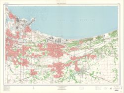
- Subject:
- Geographic Subject: Gary (Ind.)
- Creator:
- Geological Survey (U.S.)
- Publisher:
- Geological Survey (U.S.)
- Date Created:
- 1963
- Identifier:
- VAC3073-M-00008
- Genre:
- Topographic maps
- Geographic Location:
- Coordinates: W0872601 W0871319 N0413903 N0413118
- Related URL:
- Catalog URL: https://iucat.iu.edu/catalog/5591989
- Abstract:
- Relief shown by contours and spot heights. Depths by contours and soundings. "Contour interval 5 and 10 feet." Red tint indicates areas in which on...
- Call Number:
- G4094.G2 1960 .G4
- Caption:
- Imprint: Washington, D.C.: U.S.Geological Survey, 1960.
- Physical Description:
- Dimensions: 101 x 144 cm and Scale: 1:24,000
- Alternate Identifier:
- Title Control Number: a5591989
- Persistent URL:
- https://purl.dlib.indiana.edu/iudl/images/VAC3073/VAC3073-M-00008
-
![Hutsonville quadrangle, Illinois-Indiana : 15 minute series (topographic) [1957 printing with vegetation]](https://iiif.uits.iu.edu/iiif/2/3j334584p%2Ffiles%2F2e66aa9a-552c-48aa-af5a-e5cdae6d7b8f/full/250,/0/default.jpg)
- Subject:
- Geographic Subject: Crawford County (Ill.), Geographic Subject: Sullivan County (Ind.), Topical Subject: Vegetation mapping, and Geographic Subject: Clark Co...
- Creator:
- Geological Survey (U.S.), Indiana. Department of Conservation, and Illinois State Geological Survey
- Publisher:
- Geological Survey (U.S.)
- Date Created:
- 1957
- Identifier:
- VAC3073-M-01346
- Genre:
- 15 minute topographic maps, Topographic maps, and Quadrangle maps
- Geographic Location:
- Coordinates: W0874500 W0873000 N0391500 N0390000
- Related URL:
- Catalog URL: https://iucat.iu.edu/catalog/18408296
- Abstract:
- Mapped, edited, and published by the Geological Survey , control by USGS, USC & GS, and USCE. Filing title: Hutsonville, Ill.-Ind. Standard map series de...
- Call Number:
- G4090 s62 .G4 Hutsonville 1957
- Caption:
- Imprint: Indianapolis, Ind. : Indiana Department of Conservation, [1958], Imprint: Washington, D.C. : for sale by U.S. Geological Survey, Imprint: Urbana, Il...
- Physical Description:
- Dimensions: 45 x 42 cm or smaller and Scale: 1:62,500
- Alternate Identifier:
- Title Control Number: a18408296
- Persistent URL:
- https://purl.dlib.indiana.edu/iudl/images/VAC3073/VAC3073-M-01346
- Provenance:
- Part of Geological Survey (U.S.). Indiana 1:62,500.
-
![Hutsonville quadrangle, Illinois-Indiana : 15 minute series (topographic) [1969 reprint with vegetation]](https://iiif.uits.iu.edu/iiif/2/4x51jm59t%2Ffiles%2F360c0cc0-3a93-4f1f-b295-aecbc7c61661/full/250,/0/default.jpg)
- Subject:
- Geographic Subject: Crawford County (Ill.), Geographic Subject: Sullivan County (Ind.), Geographic Subject: Clark County (Ill.), and Topical Subject: Vegetat...
- Creator:
- Illinois State Geological Survey, Geological Survey (U.S.), and Indiana. Department of Conservation
- Publisher:
- Geological Survey (U.S.)
- Date Created:
- 1969
- Identifier:
- VAC3073-M-01345
- Genre:
- 15 minute topographic maps, Topographic maps, and Quadrangle maps
- Geographic Location:
- Coordinates: W0874500 W0873000 N0391500 N0390000
- Related URL:
- Catalog URL: https://iucat.iu.edu/catalog/18408296
- Abstract:
- Mapped, edited, and published by the Geological Survey , control by USGS, USC & GS, and USCE. Filing title: Hutsonville, Ill.-Ind. Standard map series de...
- Call Number:
- G4090 s62 .G4 Hutsonville 1957 rep 1969 V
- Caption:
- Imprint: Urbana, Illinois : State Geological Survey, Imprint: Indianapolis, Ind. : Indiana Department of Conservation, [1958], Imprint: Washington, D.C. : In...
- Physical Description:
- Dimensions: 45 x 42 cm or smaller and Scale: 1:62,500
- Alternate Identifier:
- Title Control Number: a18408296
- Persistent URL:
- https://purl.dlib.indiana.edu/iudl/images/VAC3073/VAC3073-M-01345
- Provenance:
- Part of Geological Survey (U.S.). Indiana 1:62,500.
-
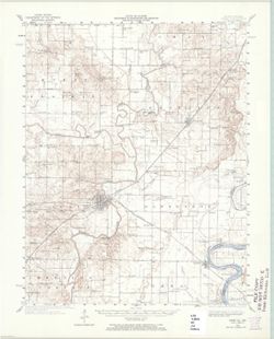
- Subject:
- Geographic Subject: White County (Ill.) and Geographic Subject: Posey County (Ind.)
- Creator:
- United States. Army. Corps of Engineers and Geological Survey (U.S.)
- Publisher:
- Geological Survey (U.S.)
- Date Created:
- 1965
- Identifier:
- VAC3073-M-01327
- Genre:
- 15 minute topographic maps, Quadrangle maps, and Topographic maps
- Geographic Location:
- Coordinates: W0881500 W0880000 N0381500 N0380000
- Related URL:
- Catalog URL: https://iucat.iu.edu/catalog/18408709
- Abstract:
- Topography by H. E. Simmons, J. C. Hilliard, A. T. Munson, E. W. Gouchenour, P. L. Sampson, A. W. Thomas, and F. W. Weber. ... Topography in Indiana from cha...
- Call Number:
- G4090 s62 .G4 Carmi 1940 rep1965
- Caption:
- Imprint: Washington, D.C. : The Survey, 1965.
- Physical Description:
- Scale: 1:62,500 and Dimensions: 45 x 42 cm or smaller
- Alternate Identifier:
- Title Control Number: a18408709
- Persistent URL:
- https://purl.dlib.indiana.edu/iudl/images/VAC3073/VAC3073-M-01327
- Provenance:
- Part of Geological Survey (U.S.). Indiana 1:62,500.
-
![Illinois-Indiana Birds quadrangle : topography [1943 reprint]](https://iiif.uits.iu.edu/iiif/2/k643c5517%2Ffiles%2F919c9455-6809-440d-bdac-0eaf5779317c/full/250,/0/default.jpg)
- Subject:
- Geographic Subject: Crawford County (Ill.), Geographic Subject: Sullivan County (Ind.), and Geographic Subject: Knox County (Ind.)
- Creator:
- U.S. Coast and Geodetic Survey, United States. Army, Graff, Fred, Jr., Herron, W. H. (William Harrison), 1865-, Marshall, R. B. (Robert Bradford), 1867-1949,...
- Publisher:
- Geological Survey (U.S.)
- Date Created:
- 1943
- Identifier:
- VAC3073-M-01316
- Genre:
- Quadrangle maps, Topographic maps, and 15 minute topographic maps
- Geographic Location:
- Coordinates: W0874500 W0873000 N0390000 N0384500
- Related URL:
- Catalog URL: https://iucat.iu.edu/catalog/18408527
- Abstract:
- R.B. Marshall, Chief Geographer , W.H. Herron, Geographer in charge , topography by F. Graff, Jr. , control by Corps of Engineers U.S. Army, U.S. Coast and G...
- Call Number:
- G4090 s62 .G4 Birds 1917 R1943
- Caption:
- Imprint: [Urbana, Ill.] : Geological Survey Division, [1943] and Imprint: [Washington, D.C.] : U.S. Geological Survey
- Physical Description:
- Dimensions: 45 x 42 cm or smaller and Scale: 1:62,500
- Alternate Identifier:
- Title Control Number: a18408527
- Persistent URL:
- https://purl.dlib.indiana.edu/iudl/images/VAC3073/VAC3073-M-01316
- Provenance:
- Part of Geological Survey (U.S.). Indiana 1:62,500.
-
![Illinois-Indiana Birds quadrangle : topography [1958 reprint]](https://iiif.uits.iu.edu/iiif/2/vt151n461%2Ffiles%2F8d479352-343d-4029-a644-fe61b614fa55/full/250,/0/default.jpg)
- Subject:
- Geographic Subject: Sullivan County (Ind.), Geographic Subject: Crawford County (Ill.), and Geographic Subject: Knox County (Ind.)
- Creator:
- U.S. Coast and Geodetic Survey, Herron, W. H. (William Harrison), 1865-, Marshall, R. B. (Robert Bradford), 1867-1949, Graff, Fred, Jr., United States. Army,...
- Publisher:
- Geological Survey (U.S.)
- Date Created:
- 1958
- Identifier:
- VAC3073-M-01317
- Genre:
- Quadrangle maps, Topographic maps, and 15 minute topographic maps
- Geographic Location:
- Coordinates: W0874500 W0873000 N0390000 N0384500
- Related URL:
- Catalog URL: https://iucat.iu.edu/catalog/18408528
- Abstract:
- R.B. Marshall, Chief Geographer , W.H. Herron, Geographer in charge , topography by F. Graff, Jr. , control by Corps of Engineers U.S. Army, U.S. Coast and G...
- Call Number:
- G4090 s62 .G4 Birds 1942 rep1958
- Caption:
- Imprint: Washington, D.C. : Interior--Geological Survey, 1958. Washington, D.C. : for sale by U.S. Geological Survey and Imprint: Urbana, Illinois : State Ge...
- Physical Description:
- Scale: 1:62,500 and Dimensions: 45 x 42 cm or smaller
- Alternate Identifier:
- Title Control Number: a18408528
- Persistent URL:
- https://purl.dlib.indiana.edu/iudl/images/VAC3073/VAC3073-M-01317
- Provenance:
- Part of Geological Survey (U.S.). Indiana 1:62,500.
-
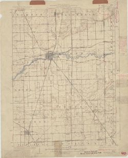
- Subject:
- Geographic Subject: Lake County (Ind.), Geographic Subject: Newton County (Ind.), Geographic Subject: Kanakee County (Ill.), and Geographic Subject: Iroquois...
- Creator:
- Geological Survey (U.S.), U.S. Lake Survey, Illinois State Geological Survey, Jennings, J. H. (James H.), 1864-1927, and Illinois. Department of Registration...
- Publisher:
- Geological Survey (U.S.)
- Date Created:
- 1924
- Identifier:
- VAC3073-M-01350
- Genre:
- Quadrangle maps, Topographic maps, and 15 minute topographic maps
- Geographic Location:
- Coordinates: W0874500 W0873000 N0411500 N0410000
- Related URL:
- Catalog URL: https://iucat.iu.edu/catalog/18408408
- Abstract:
- Filing title: Momence, Ill.-Ind. Polyconic projection. Relief shown by contours and spot heights. Shows Kankakee County, Illinois, as well as small portions ...
- Call Number:
- G4090 s62 .G4 Momence 1924
- Caption:
- Imprint: [Urbana, Ill.] : Geological Survey Division, 1924 and Imprint: [Washington, D.C.] : U.S. Geological Survey
- Physical Description:
- Dimensions: 45 x 42 cm or smaller and Scale: 1:62,500
- Alternate Identifier:
- Title Control Number: a18408408
- Persistent URL:
- https://purl.dlib.indiana.edu/iudl/images/VAC3073/VAC3073-M-01350
- Provenance:
- Part of Geological Survey (U.S.). Indiana 1:62,500.
