
Search Constraints
Search Results
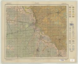
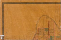
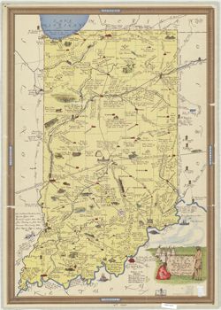
-
- Subject:
- Topical Subject: Names, Topical Subject: Indians of North America, Topical Subject: Names, Geographical, and Geographic Subject: Indiana
- Creator:
- Guernsey, E. Y.
- Publisher:
- [The Dept.?]
- Date Created:
- 2000
- Identifier:
- VAC3073-M-00947
- Genre:
- Thematic maps
- Geographic Location:
- Coordinates: W0880700 W0844500 N0414500 N0375200
- Related URL:
- Catalog URL: https://iucat.iu.edu/catalog/5327631
- Abstract:
- Xerographic copy.
- Call Number:
- G4091.E1 1968 .G8 2000
- Caption:
- Imprint: [Indianapolis?] : [The Dept?], [200-?]
- Physical Description:
- Dimensions: 79 x 58 cm and Scale: Scale not given.
- Alternate Identifier:
- Title Control Number: a5327631
- Persistent URL:
- https://purl.dlib.indiana.edu/iudl/images/VAC3073/VAC3073-M-00947
-
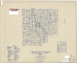
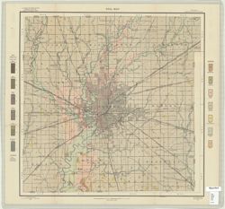
- Subject:
- Topical Subject: Roads and Geographic Subject: Bartholomew County (Ind.)
- Creator:
- Indiana. State Highway Commission (1919-1953)
- Publisher:
- Indiana. State Highway Commission (1919-1953)
- Date Created:
- 1949
- Identifier:
- VAC3073-M-00950
- Genre:
- Road maps
- Geographic Location:
- Coordinates: W0860500 W0844100 N0392100 N0390200
- Related URL:
- Catalog URL: https://iucat.iu.edu/catalog/5359878
- Abstract:
- Blue line print. "State roads revised January 1, 1949." "1937." "Data obtained from State-wide Highway Planning Survey." "...
- Call Number:
- G4093.B3P2 1949 .I53
- Caption:
- Imprint: [Indianapolis?] : State Highway Commission of Indiana, 1949.
- Physical Description:
- Dimensions: 91 x 107 cm and Scale: 1:63,360
- Alternate Identifier:
- Title Control Number: a5359878
- Persistent URL:
- https://purl.dlib.indiana.edu/iudl/images/VAC3073/VAC3073-M-00950
-
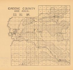
- Subject:
- Geographic Subject: Greene County (Ind.), Topical Subject: Iron ores, and Topical Subject: IGS Annual Reports
- Publisher:
- Indiana. Department of Geology and Natural Resources
- Date Created:
- 1907
- Identifier:
- VAC3073-M-00949
- Genre:
- Geological maps
- Geographic Location:
- Coordinates: W0871431 W0864053 N0391018 N0385418
- Related URL:
- Catalog URL: https://iucat.iu.edu/catalog/18299136
- Abstract:
- Detached from: The iron ore deposits of Indiana / Charles W. Shannon. In Indiana Dept. of Geology and Natural Resources thirty-first annual report, 1906. Ind...
- Call Number:
- G4093.G7H2 1907 .G7
- Caption:
- Imprint: [Indianapolis] : [Indiana Dept. of Geology and Natural Resources], [1907] and Imprint: [Indianapolis] : [Wm. B. Burford], [1907]
- Physical Description:
- Dimensions: on sheet 23 x 24 cm and Scale: Approximately 1:130,000
- Alternate Identifier:
- Alternate ID: 390726IP and Title Control Number: a18299136
- Persistent URL:
- https://purl.dlib.indiana.edu/iudl/images/VAC3073/VAC3073-M-00949
- Provenance:
- 31st Annual Report (1906) / Indiana. Department of Geology and Natural Resources.
-
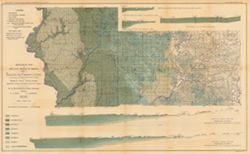
- Subject:
- Geographic Subject: Sullivan County (Ind.), Geographic Subject: Greene County (Ind.), Topical Subject: Geology, Topical Subject: Coal, and Topical Subject: I...
- Creator:
- Ashley, Geo. H. (George Hall), 1866-1951 and Siebenthal, C. E. (Claude Ellsworth), 1869-1930
- Publisher:
- Indiana. Department of Geology and Natural Resources
- Date Created:
- 1899
- Identifier:
- VAC3073-M-00945
- Genre:
- Geological cross-sections and Geological maps
- Geographic Location:
- Coordinates: W0873900 W0864200 N0391530 N0385400
- Related URL:
- Catalog URL: https://iucat.iu.edu/catalog/18265344
- Abstract:
- Relief shown by spot heights. Includes map showing the location of coal locations, coal features, and railroads, as well as geological cross sections for sev...
- Call Number:
- G4093.S8H9 1898 .A84
- Caption:
- Imprint: Indianapolis, Ind. : Wm. B. Burford, [1899]
- Physical Description:
- Scale: Approximately 1:126,720. 2 miles = 1 inch. Vertical scale approximately 1:4,800. 1 inch = 400 feet and Dimensions: 48 x 78 cm
- Alternate Identifier:
- Alternate ID: 390726IP and Title Control Number: a18265344
- Persistent URL:
- https://purl.dlib.indiana.edu/iudl/images/VAC3073/VAC3073-M-00945
- Provenance:
- 23rd Annual Report (1898) / Indiana. Department of Geology and Natural Resources.
-

- Subject:
- Geographic Subject: Crawford County (Ind.), Topical Subject: IGS Annual Reports, Geographic Subject: Dubois County (Ind.), Geographic Subject: Pike County (I...
- Creator:
- Kindle, E. M. (Edward Martin), 1869-1940, Price, J. A., and Ashley, Geo. H. (George Hall), 1866-1951
- Publisher:
- Indiana. Department of Geology and Natural Resources
- Date Created:
- 1899
- Identifier:
- VAC3073-M-00944
- Genre:
- Geological maps and Geological cross-sections
- Geographic Location:
- Coordinates: W0872700 W0862700 N0384200 N0381200
- Related URL:
- Catalog URL: https://iucat.iu.edu/catalog/18175917
- Abstract:
- Relief shown by spot heights. Includes map showing coal locations and features, and quarries as well as vertical cross-sections through center of Township 3 ...
- Call Number:
- G4093.P4H9 1898 .A84
- Caption:
- Imprint: Indianapolis : Burford, [1899]
- Physical Description:
- Dimensions: 48 x 78 cm and Scale: Approximately 1:126,720. 1 inch = 2 miles. Vertical scale approximately 1:4,800. 1 inch = 400 feet
- Alternate Identifier:
- Title Control Number: a18175917 and Alternate ID: 390726IP
- Persistent URL:
- https://purl.dlib.indiana.edu/iudl/images/VAC3073/VAC3073-M-00944
- Provenance:
- 23rd Annual Report (1898) / Indiana. Department of Geology and Natural Resources.
-
- Subject:
- Topical Subject: Classification, Topical Subject: Soils, and Geographic Subject: Clinton County (Ind.)
- Creator:
- Tharp, W. E. (William Edgar)
- Publisher:
- United States. Bureau of Soils
- Date Created:
- 1914
- Identifier:
- VAC3073-M-00943
- Genre:
- Thematic maps
- Geographic Location:
- Coordinates: W0864200 W0861500 N0402600 N0401100
- Related URL:
- Catalog URL: https://iucat.iu.edu/catalog/2864813
- Abstract:
- Shows soil types classification by colors and symbols. "A. Hoen & Co. Lith. Baltimore, Md." "Field operations Bureau of Soils 1914."
- Call Number:
- G4093 .C6J3 1914 .T493
- Caption:
- Imprint: [Washington, D.C.] : The Bureau, 1914
- Physical Description:
- Dimensions: 46 x 62 cm and Scale: 1:63,360
- Alternate Identifier:
- Title Control Number: CAX0562BB
- Persistent URL:
- https://purl.dlib.indiana.edu/iudl/images/VAC3073/VAC3073-M-00943
-
- Subject:
- Topical Subject: Soils, Geographic Subject: Washington County (Ind.), and Topical Subject: Classification
- Creator:
- Miller, J. T. (John T.), 1906-
- Publisher:
- United States. Bureau of Soils
- Date Created:
- 1932
- Identifier:
- VAC3073-M-00942
- Genre:
- Thematic maps
- Geographic Location:
- Coordinates: W0861900 W0855100 N0384700 N0382500
- Related URL:
- Catalog URL: https://iucat.iu.edu/catalog/2874738
- Abstract:
- Shows soil types classification by colors and symbols. "Field Operations, Bureau of Chemistry and Soils." "Litho Eastern Offset Inc., Balto.&q...
- Call Number:
- G4093 .W5J3 1932 .M55
- Caption:
- Imprint: [Washington, D.C.?] : The Bureau of Soils, [1932]
- Physical Description:
- Scale: 1:63,360 and Dimensions: 63 x 64 cm
- Alternate Identifier:
- Title Control Number: CAZ1439BB
- Persistent URL:
- https://purl.dlib.indiana.edu/iudl/images/VAC3073/VAC3073-M-00942
-
- Subject:
- Topical Subject: Roads and Geographic Subject: Indianapolis (Ind.)
- Creator:
- Dessecker, Fred
- Publisher:
- Topographical Map & Survey Co.
- Date Created:
- 1899
- Identifier:
- VAC3073-M-00939
- Genre:
- Road maps
- Geographic Location:
- Coordinates: W0861313 W0860443 N0394943 N0394349
- Related URL:
- Catalog URL: https://iucat.iu.edu/catalog/4682444
- Call Number:
- G4094.I4 1899 .D47
- Caption:
- Imprint: Indianapolis : Topographical Map and Survey Co., [1899]
- Physical Description:
- Scale: 1:20,750 and Dimensions: 52 x 69 cm
- Alternate Identifier:
- Title Control Number: CAU1720BB
- Persistent URL:
- https://purl.dlib.indiana.edu/iudl/images/VAC3073/VAC3073-M-00939
-
- Subject:
- Geographic Subject: Lake County (Ind.), Geographic Subject: Calumet Region (Ill. and Ind.), Topical Subject: Landowners, Topical Subject: Real property, and ...
- Creator:
- F.L. Knight & Sons
- Publisher:
- F.L. Knight & Sons
- Date Created:
- 1906
- Identifier:
- VAC3073-M-00938
- Genre:
- Cadastral maps
- Geographic Location:
- Coordinates: W0873014 W0871640 N0414147 N0413236
- Related URL:
- Catalog URL: https://iucat.iu.edu/catalog/4896961
- Abstract:
- Cadastral map showing landowners.
- Call Number:
- G4093 .L3G46 1906 .F575
- Caption:
- Imprint: Crown Point, Ind. : F. L. Knight & Sons, 1906.
- Physical Description:
- Scale: 1:19,800 and Dimensions: 91 x 136 cm
- Alternate Identifier:
- Title Control Number: a4896961
- Persistent URL:
- https://purl.dlib.indiana.edu/iudl/images/VAC3073/VAC3073-M-00938
-
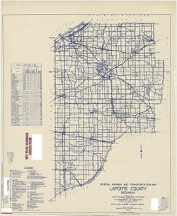
- Subject:
- Geographic Subject: Fishtrap Lake (Ind.), Geographic Subject: Pine Lake (LaPorte County, Ind. : Lake), Geographic Subject: Twin Lakes (LaPorte County, Ind. :...
- Creator:
- Holman, H. B.
- Publisher:
- Indiana. Department of Geology and Natural Resources
- Date Created:
- 1901
- Identifier:
- VAC3073-M-00937
- Genre:
- Thematic maps
- Geographic Location:
- Coordinates: W0864636 W0864251 N0413859 N0413628
- Related URL:
- Catalog URL: https://iucat.iu.edu/catalog/18418273
- Abstract:
- Surveyed and drawn by H. B. Holman. Shows Pine Lake, Fish Trap Lake, Clear Lake, Stone Lake, Horseshoe Lake, Twin Lakes, and future locations of Lily and Low...
- Call Number:
- G4093.L15C3 1900 .H6
- Caption:
- Imprint: [Indianapolis, Ind.] : [Wm. B. Burford], [1901] and Imprint: [Indianapolis, Ind.] : [Indiana, Department of Geology and Natural Resources], [1901]
- Physical Description:
- Scale: Approximately 1:32,000 and Dimensions: 20 x 21 cm
- Alternate Identifier:
- Title Control Number: a18418273 and Alternate ID: 390726IP
- Persistent URL:
- https://purl.dlib.indiana.edu/iudl/images/VAC3073/VAC3073-M-00937
- Provenance:
- 25th Annual Report (1900) / Indiana. Department of Geology and Natural Resources.
-
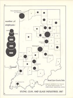
- Subject:
- Geographic Subject: Indiana, Topical Subject: Stone industry and trade, Topical Subject: Labor supply, and Topical Subject: Ceramic industries
- Creator:
- Kingsbury, Robert C. and Hollingsworth, John M.
- Publisher:
- Indiana University, Bloomington. Department of Geography
- Date Created:
- 1970
- Identifier:
- VAC3073-M-00936
- Genre:
- Thematic maps and Statistical maps
- Geographic Location:
- Coordinates: W0880700 W0844500 N0414500 N0374600
- Related URL:
- Catalog URL: https://iucat.iu.edu/catalog/18454460
- Abstract:
- Choropleth map with graduated circles showing the number of employees in each county employed by mineral processing industries in 1967. Detached from: An ...
- Call Number:
- G4091.G8 1967 .K53
- Caption:
- Imprint: [Bloomington, Indiana] : [Department of Geography, Indiana University], [1970]
- Physical Description:
- Scale: Approximately 1:1,950,000 and Dimensions: 26 x 18 cm, on sheet 28 x 21 cm
- Alternate Identifier:
- Alternate ID: 317383IP and Title Control Number: a18454460
- Persistent URL:
- https://purl.dlib.indiana.edu/iudl/images/VAC3073/VAC3073-M-00936
- Provenance:
- An atlas of Indiana / by Robert C. Kingsbury [1970].
-
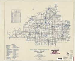
- Subject:
- Geographic Subject: Gibson County (Ind.) and Topical Subject: Roads
- Creator:
- Indiana. State Highway Commission (1919-1953)
- Publisher:
- Indiana. State Highway Commission (1961-1981)
- Date Created:
- 1949
- Identifier:
- VAC3073-M-00935
- Genre:
- Road maps
- Geographic Location:
- Coordinates: W0875900 W0871900 N0383200 N0381000
- Related URL:
- Catalog URL: https://iucat.iu.edu/catalog/5705940
- Abstract:
- Blueline. "State roads revised to January 1, 1949." "1937." "Data obtained from Statewide Highway Planning Survey." Includes lo...
- Call Number:
- G4093.G5P2 1949 .I53
- Caption:
- Imprint: [Indianapolis?] : State Highway Commission of Indiana, 1949.
- Physical Description:
- Dimensions: 44 x 52 cm and Scale: 1:130,000
- Alternate Identifier:
- Title Control Number: a9530630
- Persistent URL:
- https://purl.dlib.indiana.edu/iudl/images/VAC3073/VAC3073-M-00935
-
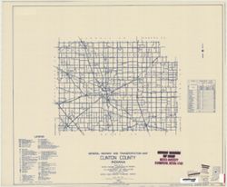
- Subject:
- Topical Subject: Roads and Geographic Subject: Clinton County (Ind.)
- Creator:
- Indiana. State Highway Commission (1919-1953)
- Publisher:
- State Highway Commission of Indiana
- Date Created:
- 1949
- Identifier:
- VAC3073-M-00934
- Genre:
- Road maps
- Geographic Location:
- Coordinates: W0864200 W0861500 N0402600 N0401100
- Related URL:
- Catalog URL: https://iucat.iu.edu/catalog/5703404
- Abstract:
- Blueline. "State roads revised to January 1, 1949." "1937." "Data obtained from State-wide Highway Planning Survey." "12.&...
- Call Number:
- G4093.C6P2 1949 .I53
- Caption:
- Imprint: [Indianapolis?] : State Highway Commission of Indiana, [1949?]
- Physical Description:
- Dimensions: 43 x 52 cm and Scale: 1:130,000
- Alternate Identifier:
- Title Control Number: a5703404
- Persistent URL:
- https://purl.dlib.indiana.edu/iudl/images/VAC3073/VAC3073-M-00934
-
- Subject:
- Geographic Subject: Grant County (Ind.) and Topical Subject: Soils
- Creator:
- Hurst, Lewis A. (Lewis Alexander), 1874-, Middleton, Philip (Soil surveyor), Hertenstein, Earl, Indiana. Department of Geology and Natural Resources, Tharp, ...
- Publisher:
- United States. Bureau of Soils
- Date Created:
- 1915
- Identifier:
- VAC3073-M-00933
- Genre:
- Thematic maps
- Geographic Location:
- Coordinates: W0855200 W0852700 N0403900 N0402300
- Related URL:
- Catalog URL: https://iucat.iu.edu/catalog/16142796
- Abstract:
- U.S. Dept. of Agriculture, Bureau of Soils [and] State of Indiana, Department of Geology , soils surveyed by Lewis A. Hurst, W.I. Watkins, and W.E. Tharp, of...
- Call Number:
- G4093 .G6J3 1915 .H87
- Caption:
- Imprint: [Washington, D.C.?] : Bureau of Soils, [1915]
- Physical Description:
- Scale: 1:63,360. 1 inch = 1 mile and Dimensions: 48 x 57 cm
- Alternate Identifier:
- Title Control Number: a16142796 and Alternate ID: CAY2874BB
- Persistent URL:
- https://purl.dlib.indiana.edu/iudl/images/VAC3073/VAC3073-M-00933
-
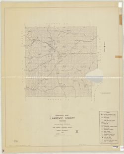
- Subject:
- Geographic Subject: Lawrence County (Ind.) and Topical Subject: Drainage
- Creator:
- Joint Highway Research Project (Ind.)
- Publisher:
- Joint Highway Research Project (Ind.)
- Date Created:
- 1938
- Identifier:
- VAC3073-M-00932
- Genre:
- Thematic maps
- Geographic Location:
- Coordinates: W0864100 W0861700 N0390000 N0384100
- Related URL:
- Catalog URL: https://iucat.iu.edu/catalog/6948863
- Abstract:
- Blue line print. "1953." "Prepared by L.R. Magnusson." "Drawn by R. Aretz."
- Call Number:
- G4093.L5 C3 1938 .J65
- Caption:
- Imprint: [West Lafayette, Ind.] : Joint Highway Research Project, Purdue University, [1953?]
- Physical Description:
- Dimensions: 104 x 87 cm and Scale: 1:63,000
- Alternate Identifier:
- Title Control Number: a6948863
- Persistent URL:
- https://purl.dlib.indiana.edu/iudl/images/VAC3073/VAC3073-M-00932
-
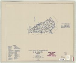
- Subject:
- Topical Subject: Roads and Geographic Subject: Ohio County (Ind.)
- Creator:
- Indiana. State Highway Commission (1919-1953)
- Publisher:
- State Highway Commission of Indiana
- Date Created:
- 1949
- Identifier:
- VAC3073-M-00928
- Genre:
- Road maps
- Geographic Location:
- Coordinates: W0850800 W0845000 N0390200 N0385400
- Related URL:
- Catalog URL: https://iucat.iu.edu/catalog/5708035
- Abstract:
- Blueline. "State roads revised to January 1, 1949." "1927." "Data obtained from State-wide Highway Planning Survey." Includes ...
- Call Number:
- G4093.O3 P2 1949 .I53
- Caption:
- Imprint: [Indianapolis?] : State Highway Commission of Indiana, 1949.
- Physical Description:
- Scale: 1:130,000 and Dimensions: 44 x 52 cm
- Alternate Identifier:
- Title Control Number: a5708035
- Persistent URL:
- https://purl.dlib.indiana.edu/iudl/images/VAC3073/VAC3073-M-00928
-
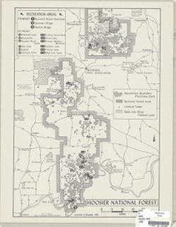
- Subject:
- Topical Subject: Recreational use and Geographic Subject: Hoosier National Forest (Ind.)
- Creator:
- Kingsbury, Robert C.
- Publisher:
- Indiana University. Department of Geography
- Date Created:
- 1965
- Identifier:
- VAC3073-M-00930
- Genre:
- Thematic maps
- Geographic Location:
- Coordinates: W0870300 W0855100 N0391600 N0375300
- Related URL:
- Catalog URL: https://iucat.iu.edu/catalog/4980093
- Abstract:
- Shows recreation areas.
- Call Number:
- G4092.H6 E63 1965 .K56
- Caption:
- Imprint: [Bloomington, Ind.] : Dept. of Geography, Indiana University, [1965]
- Physical Description:
- Scale: 1:370,000 and Dimensions: 43 x 31 cm
- Alternate Identifier:
- Title Control Number: a4980093
- Persistent URL:
- https://purl.dlib.indiana.edu/iudl/images/VAC3073/VAC3073-M-00930
-
- Subject:
- Geographic Subject: Warrick County (Ind.), Geographic Subject: Spencer County (Ind.), Topical Subject: Geology, Topical Subject: IGS Annual Reports, Geograph...
- Creator:
- Ashley, Geo. H. (George Hall), 1866-1951, Price, J. A., and Kindle, E. M. (Edward Martin), 1869-1940
- Publisher:
- Indiana. Department of Geology and Natural Resources
- Date Created:
- 1899
- Identifier:
- VAC3073-M-00931
- Genre:
- Geological cross-sections and Geological maps
- Geographic Location:
- Coordinates: W0872823 W0862942 N0381446 N0374639
- Related URL:
- Catalog URL: https://iucat.iu.edu/catalog/16848969
- Abstract:
- Relief shown by profile. Shows two geological cross-sections. "Based upon Congressional land surveys, field work of Ind. Geol. Survey, county atlases.&q...
- Call Number:
- G4093.W4H9 1898 .A8x
- Caption:
- Imprint: Indianapolis : Burford, [1899] and Imprint: [Indianapolis, Ind.] : Dept. of Geology and Natural Resources of Indiana, [1899]
- Physical Description:
- Scale: Approximately 1:126,720. 2 miles = 1 inch. Vertical scale approximately 1:4,800. 400 feet = 1 inch and Dimensions: 49 x 77 cm
- Alternate Identifier:
- Alternate ID: 390726IP and Title Control Number: a16848969
- Persistent URL:
- https://purl.dlib.indiana.edu/iudl/images/VAC3073/VAC3073-M-00931
- Provenance:
- 23rd Annual Report (1898) / Indiana. Department of Geology and Natural Resources.
-
- Subject:
- Geographic Subject: Indiana and Topical Subject: IGS Annual Reports
- Publisher:
- Indiana. Department of Geology and Natural Resources
- Date Created:
- 1907
- Identifier:
- VAC3073-M-00929
- Genre:
- Charts
- Related URL:
- Catalog URL: https://iucat.iu.edu/catalog/4022271
- Abstract:
- From page 290 of 31st Annual Report.
- Call Number:
- QE109 .A2 1906
- Caption:
- Imprint: Indianapolis : 1907
- Physical Description:
- Dimensions: 19 x 63 cm
- Alternate Identifier:
- Title Control Number: 390726IP
- Persistent URL:
- https://purl.dlib.indiana.edu/iudl/images/VAC3073/VAC3073-M-00929
- Provenance:
- 31st Annual Report (1906) / Indiana. Department of Geology and Natural Resources.
-
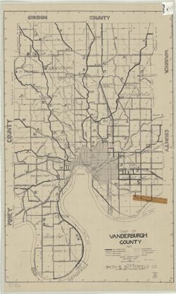
- Subject:
- Geographic Subject: Vanderburgh County (Ind.)
- Creator:
- Smith & Butterfield Co.
- Publisher:
- Smith & Butterfield Co.
- Date Created:
- 1929
- Identifier:
- VAC3073-M-00924
- Genre:
- Maps
- Geographic Location:
- Coordinates: W0874200 W0872700 N0381000 N0375000
- Related URL:
- Catalog URL: https://iucat.iu.edu/catalog/5054593
- Call Number:
- G4093 .V3 1929 .S65
- Caption:
- Imprint: Evansville, Ind.: Smith & Butterfield, [1929]
- Physical Description:
- Dimensions: 94 x 59 cm and Scale: 1:42,240
- Alternate Identifier:
- Title Control Number: a5054593
- Persistent URL:
- https://purl.dlib.indiana.edu/iudl/images/VAC3073/VAC3073-M-00924
-
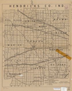
- Subject:
- Geographic Subject: Hendricks County (Ind.)
- Creator:
- Scarborough Company
- Publisher:
- Scarborough Company
- Date Created:
- 1909
- Identifier:
- VAC3073-M-00925
- Genre:
- Maps
- Geographic Location:
- Coordinates: W0864200 W0862000 N0395600 N0393600
- Related URL:
- Catalog URL: https://iucat.iu.edu/catalog/6082128
- Call Number:
- G4093.H5 1909 .S23
- Caption:
- Imprint: Indianapolis, Ind.: Scarborough Co., [1909]
- Physical Description:
- Dimensions: 56 x 46 cm and Scale: 1:65,000
- Alternate Identifier:
- Title Control Number: a6082128
- Persistent URL:
- https://purl.dlib.indiana.edu/iudl/images/VAC3073/VAC3073-M-00925
-
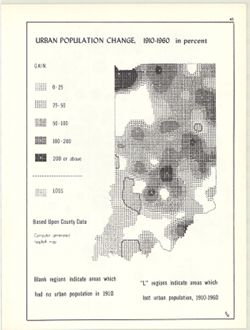
- Subject:
- Topical Subject: Population geography, Topical Subject: Historical geography, Topical Subject: SYMAP (Computer program language), Geographic Subject: Indiana...
- Creator:
- Hollingsworth, John M., Indiana University. Research Computing Center, and Kingsbury, Robert C.
- Publisher:
- Indiana University. Department of Geography
- Date Created:
- 1970
- Identifier:
- VAC3073-M-00926
- Genre:
- Thematic maps
- Geographic Location:
- Coordinates: W0880700 W0844500 N0414500 N0374600
- Related URL:
- Catalog URL: https://iucat.iu.edu/catalog/15948261
- Abstract:
- Computer generated isopleth map obtained through use of the facilities of Indiana University's Research Computer Center. ASCII-art map created using SYMA...
- Call Number:
- G4091.E2 1960 .K52
- Caption:
- Imprint: Bloomington, Indiana : Department of Geography, Indiana University, [1970]
- Physical Description:
- Dimensions: 26 x 18 cm, on sheet 28 x 21 cm and Scale: Approximately 1:2,500,000
- Alternate Identifier:
- Alternate ID: 317383IP and Title Control Number: a15948261
- Persistent URL:
- https://purl.dlib.indiana.edu/iudl/images/VAC3073/VAC3073-M-00926
- Provenance:
- An atlas of Indiana / by Robert C. Kingsbury [1970].
-
- Subject:
- Geographic Subject: Posey County (Ind.), Geographic Subject: Gibson County (Ind.), Geographic Subject: Indiana, Topical Subject: Coal, Topical Subject: Geolo...
- Creator:
- Ashley, Mary Martin and Ashley, Geo. H. (George Hall), 1866-1951
- Publisher:
- Indiana. Department of Geology and Natural Resources
- Date Created:
- 1899
- Identifier:
- VAC3073-M-00927
- Genre:
- Geological maps
- Geographic Location:
- Coordinates: W0880600 W0872700 N0383300 N0374500
- Related URL:
- Catalog URL: https://iucat.iu.edu/catalog/18188198
- Abstract:
- Relief shown by spot heights. "Based upon[:] B. F. & Co.'s Atlas of Indiana, 1876. Lake's Atlas of Gibson and Pike Counties, 1881. F. C. H. ...
- Call Number:
- QE109 .A2 1898 map p1408
- Caption:
- Imprint: Indianapolis, Ind. : Wm. B. Burford, [1899]
- Physical Description:
- Scale: Approximately 1:126,720. 2 miles = 1 inch and Dimensions: 78 x 48 cm
- Alternate Identifier:
- Title Control Number: a18188198 and Alternate ID: 390726IP
- Persistent URL:
- https://purl.dlib.indiana.edu/iudl/images/VAC3073/VAC3073-M-00927
- Provenance:
- 23rd Annual Report (1898) / Indiana. Department of Geology and Natural Resources.
-
- Subject:
- Geographic Subject: Gary (Ind.)
- Creator:
- Cottingham, W. P.
- Publisher:
- [City of Gary?]
- Date Created:
- 1929
- Identifier:
- VAC3073-M-00922
- Genre:
- Maps
- Geographic Location:
- Coordinates: W0872601 W0871319 N0413919 N0413118
- Related URL:
- Catalog URL: https://iucat.iu.edu/catalog/5055143
- Call Number:
- G4094.G2 1929 .C68
- Caption:
- Imprint: [Gary, Ind.?] : [City of Gary?], [1929]
- Physical Description:
- Scale: Scale not given. and Dimensions: 60 x 83 cm
- Alternate Identifier:
- Title Control Number: a5055143
- Persistent URL:
- https://purl.dlib.indiana.edu/iudl/images/VAC3073/VAC3073-M-00922
-
- Subject:
- Geographic Subject: Washington County (Ind.)
- Creator:
- River Hills Regional Planning Commission
- Publisher:
- River Hills Regional Planning Commission
- Date Created:
- 1970
- Identifier:
- VAC3073-M-00921
- Genre:
- Maps
- Geographic Location:
- Coordinates: W0861836 W0855051 N0384700 N0382504
- Related URL:
- Catalog URL: https://iucat.iu.edu/catalog/1342078
- Abstract:
- Includes insets of Campbellsburg, New Pekin , Salem areas.
- Call Number:
- G4093.W5 1970 .R58
- Caption:
- Imprint: Salem, Ind. : River Hills Regional Planning Commission, [197-?]
- Physical Description:
- Scale: 1:126,720 & 1:5,280 and Dimensions: 43 x 59 cm
- Alternate Identifier:
- Title Control Number: ALJ1413BB
- Persistent URL:
- https://purl.dlib.indiana.edu/iudl/images/VAC3073/VAC3073-M-00921
-
- Subject:
- Geographic Subject: Lake County (Ind.)
- Creator:
- Ball, T. H. (Timothy Horton), 1826-1913
- Publisher:
- Ball, T. H. (Timothy Horton), 1826-1913
- Date Created:
- 1890
- Identifier:
- VAC3073-M-00919
- Genre:
- Maps
- Geographic Location:
- Coordinates: W0873136 W0871307 N0414539 N0410943
- Related URL:
- Catalog URL: https://iucat.iu.edu/catalog/7476708
- Abstract:
- Blue line.
- Call Number:
- G4093.L3 1890 .B355
- Caption:
- Imprint: Crown Point, Ind. : T. H. Ball, [1890]
- Physical Description:
- Dimensions: 57 x 40 cm and Scale: 1:126,720
- Alternate Identifier:
- Title Control Number: a7476708
- Persistent URL:
- https://purl.dlib.indiana.edu/iudl/images/VAC3073/VAC3073-M-00919
-
- Subject:
- Geographic Subject: Fort Wayne (Ind.)
- Creator:
- R.L. Polk & Co.
- Publisher:
- R.L. Polk & Co.
- Date Created:
- 1903
- Identifier:
- VAC3073-M-00918
- Genre:
- Maps
- Geographic Location:
- Coordinates: W0851811 W0845955 N0411159 N0405755
- Related URL:
- Catalog URL: https://iucat.iu.edu/catalog/7478810
- Abstract:
- Includes distance circles and street index.
- Call Number:
- G4094.F7 1903 .R2
- Caption:
- Imprint: Fort Wayne, Ind.: R.L. Polk & Co., 1903.
- Physical Description:
- Dimensions: 54 x 60 cm, on sheet 58 x 77 cm and Scale: 1:10,900
- Alternate Identifier:
- Title Control Number: a7478810
- Persistent URL:
- https://purl.dlib.indiana.edu/iudl/images/VAC3073/VAC3073-M-00918
-
- Subject:
- Geographic Subject: Indiana and Topical Subject: Phytogeography
- Creator:
- Hollingsworth, John M. and Kingsbury, Robert C.
- Publisher:
- Indiana University. Department of Geography
- Date Created:
- 1970
- Identifier:
- VAC3073-M-00916
- Genre:
- Thematic maps
- Geographic Location:
- Coordinates: W0880700 W0844500 N0414500 N0374600
- Related URL:
- Catalog URL: https://iucat.iu.edu/catalog/15941617
- Abstract:
- Shows bluestem prairie, oak-hickory forest, beech and maple forest, southern floodplain forest, and elm-ash forest. Detached from: An atlas of Indiana / b...
- Call Number:
- G4091.D2 1970 .K56
- Caption:
- Imprint: Bloomington, Indiana : Department of Geography, Indiana University, [1970
- Physical Description:
- Scale: Approximately 1:1,950,000 and Dimensions: 26 x 18 cm, on sheet 28 x 21 cm
- Alternate Identifier:
- Alternate ID: 317383IP and Title Control Number: a15941617
- Persistent URL:
- https://purl.dlib.indiana.edu/iudl/images/VAC3073/VAC3073-M-00916
- Provenance:
- An atlas of Indiana / by Robert C. Kingsbury [1970].
-
- Subject:
- Topical Subject: Physical geography, Geographic Subject: Indiana, Topical Subject: Glacial landforms, and Topical Subject: Physiographic provinces
- Creator:
- Hollingsworth, John M. and Kingsbury, Robert C.
- Publisher:
- Indiana University. Department of Geography
- Date Created:
- 1970
- Identifier:
- VAC3073-M-00917
- Genre:
- Geological maps and Physical maps
- Geographic Location:
- Coordinates: W0880700 W0844500 N0414500 N0374600
- Related URL:
- Catalog URL: https://iucat.iu.edu/catalog/15938768
- Abstract:
- Also shows Wisconsin glacial boundary and Illinoian glacial boundary. Detached from: An atlas of Indiana / by Robert C. Kingsbury , with contributions fro...
- Call Number:
- G4091.C21 1970 .K56
- Caption:
- Imprint: Bloomington, Indiana : Department of Geography, Indiana University, [1970]
- Physical Description:
- Dimensions: 26 x 18 cm, on sheet 28 x 21 cm and Scale: Approximately 1:2,000,000
- Alternate Identifier:
- Alternate ID: 317383IP and Title Control Number: a15938768
- Persistent URL:
- https://purl.dlib.indiana.edu/iudl/images/VAC3073/VAC3073-M-00917
- Provenance:
- An atlas of Indiana / by Robert C. Kingsbury [1970].
-
- Subject:
- Topical Subject: Landowners, Geographic Subject: Evansville (Ind.), and Topical Subject: Real property
- Publisher:
- J.D. and M.S. Saunders?]
- Date Created:
- 1890
- Identifier:
- VAC3073-M-00915
- Genre:
- Maps and Cadastral maps
- Related URL:
- Catalog URL: https://iucat.iu.edu/catalog/4682303
- Abstract:
- 1 map, hand colored, dissected in 6 pieces and mounted on linen and shellacked. "Compiled from official records and surveys by J.D. and M.S. Saunders, c...
- Call Number:
- G4094 .E9G46 1890 .S28
- Caption:
- Imprint: [Evansville, Ind.? : J.D. and M.S. Saunders?], 1890.
- Physical Description:
- Scale: Scale not given. and Dimensions: 129 x 132 cm, pieces 48 x 71 or smaller
- Alternate Identifier:
- Title Control Number: CAU0767BB
- Persistent URL:
- https://purl.dlib.indiana.edu/iudl/images/VAC3073/VAC3073-M-00915
- Provenance:
- Evansville Indiana 1890.
-
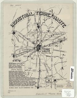
- Subject:
- Geographic Subject: Terre Haute (Ind.) and Topical Subject: Industries
- Creator:
- Paige, Wm. Robert
- Publisher:
- Paige, Wm. Robert
- Date Created:
- 1927
- Identifier:
- VAC3073-M-00914
- Genre:
- Thematic maps
- Geographic Location:
- Coordinates: W0872810 W0871636 N0393142 N0392405
- Related URL:
- Catalog URL: https://iucat.iu.edu/catalog/7322815
- Abstract:
- Includes text, steam and electric interurban railroads, roads, electric power plants, distances to major cities, and 5 mi. distance circles to 25 mi.
- Call Number:
- G4094.T4M1 1927 .P35
- Caption:
- Imprint: [Terre Haute] : Wm. Robert Paige, [1927]
- Physical Description:
- Dimensions: 28 x 22 cm and Scale: 1:65,000
- Alternate Identifier:
- Title Control Number: a7322815
- Persistent URL:
- https://purl.dlib.indiana.edu/iudl/images/VAC3073/VAC3073-M-00914
-
- Subject:
- Topical Subject: Coal mines and mining, Geographic Subject: Indiana, Topical Subject: Geology, Topical Subject: Geology, Stratigraphic, and Topical Subject: ...
- Creator:
- Kindle, E. M. (Edward Martin), 1869-1940, Ashley, Geo. H. (George Hall), 1866-1951, and Blatchley, W. S. (Willis Stanley), 1859-1940
- Publisher:
- Indiana. Department of Geology and Natural Resources
- Date Created:
- 1903
- Identifier:
- VAC3073-M-00912
- Genre:
- Geological cross-sections and Geological maps
- Geographic Location:
- Coordinates: W0864100 W0853730 N0384700 N0382345
- Related URL:
- Catalog URL: https://iucat.iu.edu/catalog/16076838
- Abstract:
- Includes 4 East-West cross-sections through the center of townships 1, 2 and 3 North and 1 South. Vertical scale 1:9,600. Detached from: The geology of th...
- Call Number:
- G4091.C5 1902 .A82
- Caption:
- Imprint: [Indianapolis] : Department of Geology and Natural Resources of Indiana, [1903] and Imprint: Indianapolis, Ind. : Wm. B. Burford, [1903]
- Physical Description:
- Dimensions: 46 x 74 cm, on sheet 50 x 78 cm and Scale: Approximately 1:126,720. 2 miles = 1 in. Vertical scale approximately 1:9,600. 800 feet = 1 in.
- Alternate Identifier:
- Title Control Number: a16076838 and Alternate ID: 390726IP
- Persistent URL:
- https://purl.dlib.indiana.edu/iudl/images/VAC3073/VAC3073-M-00912
- Provenance:
- 27th Annual Report (1902) / Indiana. Department of Geology and Natural Resources.
-
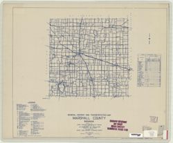
- Subject:
- Topical Subject: Roads and Geographic Subject: Marshall County (Ind.)
- Creator:
- Indiana. State Highway Commission (1919-1953)
- Publisher:
- State Highway Commission of Indiana
- Date Created:
- 1949
- Identifier:
- VAC3073-M-00910
- Genre:
- Road maps
- Geographic Location:
- Coordinates: W0862800 W0860300 N0412900 N0411000
- Related URL:
- Catalog URL: https://iucat.iu.edu/catalog/5706696
- Abstract:
- Blueline. "State roads revised to January 1, 1949." "1937." "Data obtained from State-wide Highway Planning Survey." Includes l...
- Call Number:
- G4093.M4 P2 1949 .I53
- Caption:
- Imprint: [Indianapolis?] : State Highway Commission of Indiana, 1949.
- Physical Description:
- Dimensions: 44 x 52 cm and Scale: 1:130,000
- Alternate Identifier:
- Title Control Number: a5706696
- Persistent URL:
- https://purl.dlib.indiana.edu/iudl/images/VAC3073/VAC3073-M-00910
-
- Subject:
- Geographic Subject: Scott County (Ind.), Geographic Subject: Harrison County (Ind.), Topical Subject: Geology, Topical Subject: IGS Annual Reports, Geographi...
- Publisher:
- Indiana. Department of Geology and Natural Resources
- Date Created:
- 1906
- Identifier:
- VAC3073-M-00911
- Genre:
- Thematic maps
- Geographic Location:
- Coordinates: W0861948 W0852403 N0384955 N0375700
- Related URL:
- Catalog URL: https://iucat.iu.edu/catalog/18299034
- Abstract:
- Shows gravel locations. At head of title: Fig. 49A. Detached from: The roads and road materials of a portion of southwestern Indiana / A.E. Taylor. In Ind...
- Call Number:
- G4093.S3H5 1905 .I4
- Caption:
- Imprint: [Indianapolis] : [Indiana Dept. of Geology and Natural Resources], [1906]
- Physical Description:
- Scale: Approximately 1:371,000 and Dimensions: on sheet 27 x 23 cm
- Alternate Identifier:
- Alternate ID: 390726IP and Title Control Number: a18299034
- Persistent URL:
- https://purl.dlib.indiana.edu/iudl/images/VAC3073/VAC3073-M-00911
- Provenance:
- 30th Annual Report (1905) / Indiana. Department of Geology and Natural Resources.
-
![Township 5 south, range 8 west [Indiana]](https://iiif.uits.iu.edu/iiif/2/df65wb20n%2Ffiles%2F076a45f7-4ea5-41d9-9a65-3d0fbf136b54/full/250,/0/default.jpg)
- Subject:
- Topical Subject: Geology, Stratigraphic, Topical Subject: IGS Annual Reports, Geographic Subject: Warrick County (Ind.), and Topical Subject: Coal reserves
- Publisher:
- Indiana. Department of Geology and Natural Resources
- Date Created:
- 1899
- Identifier:
- VAC3073-M-00913
- Genre:
- Geological cross-sections and Geological maps
- Geographic Location:
- Coordinates: W0872133 W0871442 N0380715 N0380157
- Related URL:
- Catalog URL: https://iucat.iu.edu/catalog/18418184
- Abstract:
- Title from caption. Other title from Bureau of Land Management database: IN T5S R8W. 16 columnar sections showing coal measures and location map for unnamed ...
- Call Number:
- G4093.W4H9 1898 .T6
- Caption:
- Imprint: [Indianapolis] : [Wm. B. Burford], [1899] and Imprint: [Indianapolis] : [Indiana, Dept. of Geology and Natural History], [1899]
- Physical Description:
- Dimensions: 23 x 27 cm and Scale: Approximately 1:63,360
- Alternate Identifier:
- Alternate ID: 390726IP and Title Control Number: a18418184
- Persistent URL:
- https://purl.dlib.indiana.edu/iudl/images/VAC3073/VAC3073-M-00913
- Provenance:
- 23rd Annual Report (1898) / Indiana. Department of Geology and Natural Resources.
-
- Subject:
- Geographic Subject: Indiana and Topical Subject: Electric railroads
- Creator:
- Hollingsworth, John M. and Kingsbury, Robert C.
- Publisher:
- Indiana University. Department of Geography
- Date Created:
- 1970
- Identifier:
- VAC3073-M-00908
- Genre:
- Thematic maps
- Geographic Location:
- Coordinates: W0880700 W0844500 N0414500 N0374600
- Related URL:
- Catalog URL: https://iucat.iu.edu/catalog/15934645
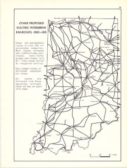
- Abstract:
- Shows approximate routes of over 250 incorporated companies. Detached from: An atlas of Indiana / by Robert C. Kingsbury , with contributions from John M...
- Call Number:
- G4091.P3 1915 .K57
- Caption:
- Imprint: Bloomington, Indiana : Department of Geography, Indiana University, [1970]
- Physical Description:
- Dimensions: 26 x 18 cm, on sheet 28 x 21 cm and Scale: Approximately 1:1,950,000
- Alternate Identifier:
- Alternate ID: 317383IP and Title Control Number: a15934645
- Persistent URL:
- https://purl.dlib.indiana.edu/iudl/images/VAC3073/VAC3073-M-00908
- Provenance:
- An atlas of Indiana / by Robert C. Kingsbury [1970].
-
- Subject:
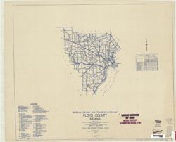
- Geographic Subject: Floyd County (Ind.) and Topical Subject: Roads
- Creator:
- Indiana. State Highway Commission (1919-1953)
- Publisher:
- State Highway Commission of Indiana
- Date Created:
- 1949
- Identifier:
- VAC3073-M-00907
- Genre:
- Road maps
- Geographic Location:
- Coordinates: W0860200 W0854600 N0382500 N0381100
- Related URL:
- Catalog URL: https://iucat.iu.edu/catalog/5705891
- Abstract:
- Blueline. "State road revised to January 1, 1949." "Data obtained from Statewide Highway Planning Survey." Includes chart "Culture i...
- Call Number:
- G4093.F5P2 1949 .I53
- Caption:
- Imprint: [Indianapolis?] : State Highway Commission of Indiana, [1949?]
- Physical Description:
- Scale: 1:130,000 and Dimensions: 44 x 52 cm
- Alternate Identifier:
- Title Control Number: a5705891
- Persistent URL:
- https://purl.dlib.indiana.edu/iudl/images/VAC3073/VAC3073-M-00907
-
![Road map of Monroe County, Indiana [cartographic material] : adopted January 20, 1966](https://iiif.uits.iu.edu/iiif/2/cn69n8374%2Ffiles%2F6cca8b9b-6d94-4804-b65e-3ae6e2fa6cb3/full/250,/0/default.jpg)
- Subject:
- Topical Subject: Roads and Geographic Subject: Monroe County (Ind.)
- Creator:
- Klooz, C. J.
- Publisher:
- [publisher not identified]
- Date Created:
- 1966
- Identifier:
- VAC3073-M-00906
- Genre:
- Road maps
- Geographic Location:
- Coordinates: W0864108 W0861902 N0392120 N0385926
- Related URL:
- Catalog URL: https://iucat.iu.edu/catalog/5304275
- Abstract:
- Blue line print. Includes text and indexes.
- Call Number:
- G4093.M7P2 1966 .K66
- Caption:
- Imprint: [Place of publication not identified] : [publisher not identified], [1966]
- Physical Description:
- Dimensions: 123 x 100 cm and Scale: 1:34,000
- Alternate Identifier:
- Title Control Number: a5304275
- Persistent URL:
- https://purl.dlib.indiana.edu/iudl/images/VAC3073/VAC3073-M-00906
-
- Subject:
- Geographic Subject: Indiana
- Creator:
- Matthews-Northrup Company
- Publisher:
- Matthews-Northrup Company
- Date Created:
- 1894
- Identifier:
- VAC3073-M-00905
- Genre:
- Maps
- Geographic Location:
- Coordinates: W0880700 W0844500 N0414500 N0375200
- Related URL:
- Catalog URL: https://iucat.iu.edu/catalog/2800505
- Abstract:
- "Also published in indexed vest pocket style." Place name index with population on verso. "3.94."
- Call Number:
- G4090 1894 .M3
- Caption:
- Imprint: Buffalo, N.Y. : Matthews-Northrup, [1894]
- Physical Description:
- Dimensions: 50 x 29 cm and Scale: 1:1,077,120
- Alternate Identifier:
- Title Control Number: CAH4025BB
- Persistent URL:
- https://purl.dlib.indiana.edu/iudl/images/VAC3073/VAC3073-M-00905
-
- Subject:
- Geographic Subject: Indiana
- Creator:
- Red Wing Advertising Company
- Publisher:
- Red Wing Advertising Company
- Date Created:
- 1904
- Identifier:
- VAC3073-M-00904
- Genre:
- Maps
- Geographic Location:
- Coordinates: W0880700 W0844500 N0414500 N0375200
- Related URL:
- Catalog URL: https://iucat.iu.edu/catalog/5168064
- Call Number:
- G4090 1904 .R43
- Caption:
- Imprint: Red Wing, Minnn.: Red Wing Advertising, [1904]
- Physical Description:
- Dimensions: 30 x 23 cm and Scale: 1:1,500,000
- Alternate Identifier:
- Title Control Number: a5168064
- Persistent URL:
- https://purl.dlib.indiana.edu/iudl/images/VAC3073/VAC3073-M-00904
-
- Subject:
- Topical Subject: Aerial photographs and Geographic Subject: Monroe County (Ind.)
- Publisher:
- [U.S. Dept. of Agriculture] Aerial Photography Field Office
- Date Created:
- 2001
- Identifier:
- VAC3073-M-00902
- Genre:
- Index maps
- Geographic Location:
- Coordinates: W0864500 W0861500 N0392230 N0385230
- Related URL:
- Catalog URL: http://www.iucat.iu.edu/uhtbin/cgisirsi/x/0/0/57/20/G4093.M7A43+1992+.N38/1/X30000078543158?user_id=WEBSERVER
- Abstract:
- Blue line print. Shows the center point of each photograph.
- Call Number:
- G4093.M7A43 1992 .N38
- Caption:
- Imprint: Salt Lake City, Utah : [U.S. Dept. of Agriculture] Aerial Photography Field Office, [2001]
- Physical Description:
- Scale: 1:100,000 and Dimensions: 59 x 52 cm, on sheet 67 x 107
- Alternate Identifier:
- Title Control Number: a5019407
- Persistent URL:
- https://purl.dlib.indiana.edu/iudl/images/VAC3073/VAC3073-M-00902
- Provenance:
- Monroe County Indiana: line index to aerial photography
-
- Subject:
- Topical Subject: Classification, Geographic Subject: Hamilton County (Ind.), and Topical Subject: Soils
- Publisher:
- United States. Bureau of Soils
- Date Created:
- 1912
- Identifier:
- VAC3073-M-00900
- Genre:
- Thematic maps
- Geographic Location:
- Coordinates: W0861500 W0855100 N0401300 N0395600
- Related URL:
- Catalog URL: https://iucat.iu.edu/catalog/4661973
- Abstract:
- Other contributors E. J. Grimes, R. S. Hesler, H. G. Young. 53 x 53cm. (W 86015'--W 85051'/N 40013'--N 39056'). Includes legend in margins.
- Call Number:
- G4093 .H2J3 1912 .H87
- Caption:
- Imprint: [Washington, D.C.] : U.S. Dept. of Agriculture, Bureau of Soils, 1912.
- Physical Description:
- Scale: 1:63,360 and Dimensions: 53 x 53 cm
- Alternate Identifier:
- Title Control Number: CAG8934BB
- Persistent URL:
- https://purl.dlib.indiana.edu/iudl/images/VAC3073/VAC3073-M-00900
- Provenance:
- Soil map, Indiana, Hamilton County
-
- Subject:
- Topical Subject: IGS Annual Reports, Geographic Subject: Steuben County (Ind.), and Topical Subject: Lakes
- Publisher:
- Indiana. Department of Geology and Natural Resources
- Date Created:
- 1901
- Identifier:
- VAC3073-M-00903
- Genre:
- Thematic maps
- Geographic Location:
- Coordinates: W0851150 W0844817 N0414536 N0413139
- Related URL:
- Catalog URL: https://iucat.iu.edu/catalog/18276218
- Abstract:
- Detached from: The lakes of northern Indiana and their associated marl deposits / W. S. Blatchley and Geo. H. Ashley. In Indiana Department of Geology and N...
- Call Number:
- G4093.S7 1899 .R35
- Caption:
- Imprint: (c)1899, Imprint: [Indianapolis] : [Indiana. Department of Geology and Natural Resources], [1901], and Imprint: [Indianapolis] : [Wm. B. Burford], [...
- Physical Description:
- Dimensions: on sheet 22 x 26 cm and Scale: Approximately 1:135,000
- Alternate Identifier:
- Title Control Number: a18276218 and Alternate ID: 390726IP
- Persistent URL:
- https://purl.dlib.indiana.edu/iudl/images/VAC3073/VAC3073-M-00903
- Provenance:
- 25th Annual Report (1900) / Indiana. Department of Geology and Natural Resources.
-
![Harrison County [Indiana] land use map : preliminary](https://iiif.uits.iu.edu/iiif/2/fb495d293%2Ffiles%2Fa6215f59-e4a8-4559-b192-18779587518f/full/250,/0/default.jpg)
- Subject:
- Topical Subject: Land use and Geographic Subject: Harrison County (Ind.)
- Creator:
- Harrison County (Ind.). Land Use Planning Committee
- Publisher:
- Harrison County (Ind.). Land Use Planning Committee
- Date Created:
- 1940
- Identifier:
- VAC3073-M-00901
- Genre:
- Thematic maps
- Geographic Location:
- Coordinates: W0861947 W0855402 N0382521 N0375728
- Related URL:
- Catalog URL: https://iucat.iu.edu/catalog/5126325
- Abstract:
- Includes chart showing type of land use, acreage, and recommended use.
- Call Number:
- G4093.H4G4 1940 .H37
- Caption:
- Imprint: [Corydon, Ind.?] : The Committee, [1940?]
- Physical Description:
- Scale: Scale not given. and Dimensions: 28 x 21 cm, on sheet 39 x 28 cm
- Alternate Identifier:
- Title Control Number: a5126325
- Persistent URL:
- https://purl.dlib.indiana.edu/iudl/images/VAC3073/VAC3073-M-00901
-

- Subject:
- Geographic Subject: Clay County (Ind.), Topical Subject: Coal, Geographic Subject: Putnam County (Ind.), Topical Subject: IGS Annual Reports, Geographic Subj...
- Creator:
- Ashley, Geo. H. (George Hall), 1866-1951, Siebenthal, C. E. (Claude Ellsworth), 1869-1930, and Scovell, J. T. (Josiah Thomas), 1841-
- Publisher:
- Indiana. Department of Geology and Natural Resources
- Date Created:
- 1899
- Identifier:
- VAC3073-M-00899
- Genre:
- Geological maps and Geological cross-sections
- Geographic Location:
- Coordinates: W0873635 W0864028 N0393634 N0390856
- Related URL:
- Catalog URL: https://iucat.iu.edu/catalog/18259650
- Abstract:
- Relief shown by spot heights. Includes map showing coal locations and features, railroads, and quarries as well as vertical cross sections for Dana to Portla...
- Call Number:
- G4093.V5H9 1898 .A84
- Caption:
- Imprint: Indianapolis, Ind. : Wm. B. Burford, [1899]
- Physical Description:
- Scale: Approximately 1:126,720. 2 miles = 1 inch and Dimensions: 48 x 77 cm
- Alternate Identifier:
- Alternate ID: 390726IP and Title Control Number: a18259650
- Persistent URL:
- https://purl.dlib.indiana.edu/iudl/images/VAC3073/VAC3073-M-00899
- Provenance:
- 23rd Annual Report (1898) / Indiana. Department of Geology and Natural Resources.
-
- Subject:
- Geographic Subject: Martin County (Ind.), Topical Subject: IGS Annual Reports, and Topical Subject: Iron ores
- Publisher:
- Indiana. Department of Geology and Natural Resources
- Date Created:
- 1907
- Identifier:
- VAC3073-M-00898
- Genre:
- Geological maps
- Geographic Location:
- Coordinates: W0865526 W0864056 N0385428 N0382940
- Related URL:
- Catalog URL: https://iucat.iu.edu/catalog/18299172
- Abstract:
- Detached from: The iron ore deposits of Indiana / Charles W. Shannon. In Indiana Dept. of Geology and Natural Resources thirty-first annual report, 1906. Ind...
- Call Number:
- G4093.M5H2 1907 .M3
- Caption:
- Imprint: [Indianapolis] : [Indiana Dept. of Geology and Natural Resources], [1907] and Imprint: [Indianapolis] : [Wm. B. Burford], [1907]
- Physical Description:
- Scale: Approximately 1:59,000 and Dimensions: on sheet 27 x 37 cm
- Alternate Identifier:
- Alternate ID: 390726IP and Title Control Number: a18299172
- Persistent URL:
- https://purl.dlib.indiana.edu/iudl/images/VAC3073/VAC3073-M-00898
- Provenance:
- 31st Annual Report (1906) / Indiana. Department of Geology and Natural Resources.
-
- Subject:
- Geographic Subject: Fort Wayne (Ind.)
- Creator:
- R.L. Polk & Co.
- Publisher:
- R.L. Polk & Co.
- Date Created:
- 1902
- Identifier:
- VAC3073-M-00897
- Genre:
- Maps
- Geographic Location:
- Coordinates: W0851811 W0845955 N0411159 N0405755
- Related URL:
- Catalog URL: https://iucat.iu.edu/catalog/7478796
- Abstract:
- Includes distance circles and street index.
- Call Number:
- G4094.F7 1902 .R2
- Caption:
- Imprint: Fort Wayne, Ind. : R.L. Polk & Co., 1902.
- Physical Description:
- Dimensions: 54 x 60 cm, on sheet 63 x 91 cm and Scale: 1:10,900
- Alternate Identifier:
- Title Control Number: a7478796
- Persistent URL:
- https://purl.dlib.indiana.edu/iudl/images/VAC3073/VAC3073-M-00897
-

- Subject:
- Geographic Subject: Lake County (Ind.), Topical Subject: Soils, and Topical Subject: Classification
- Creator:
- Bushnell, T. M. (Thomas Mark), 1889-1976
- Publisher:
- United States. Bureau of Soils
- Date Created:
- 1917
- Identifier:
- VAC3073-M-00896
- Genre:
- Thematic maps
- Geographic Location:
- Coordinates: W0873100 W0871330 N0374230 N0411000
- Related URL:
- Catalog URL: https://iucat.iu.edu/catalog/2871165
- Abstract:
- Map shows distribution of soil types by color and symbol. Soils surveyed by T.M. Bushnell of the U.S. Department of Agriculture, and Wendell Barret of the In...
- Call Number:
- G4093 .L3J3 1917 .B8
- Caption:
- Imprint: [Washington, D.C.?] : [The Bureau], [1917?]
- Physical Description:
- Scale: 1:63,360 and Dimensions: 99 x 44 cm
- Alternate Identifier:
- Title Control Number: CAY4307BB
- Persistent URL:
- https://purl.dlib.indiana.edu/iudl/images/VAC3073/VAC3073-M-00896
-
- Subject:
- Geographic Subject: Indiana
- Creator:
- Rand McNally and Company
- Publisher:
- Rand McNally and Company
- Date Created:
- 1893
- Identifier:
- VAC3073-M-00894
- Genre:
- Maps
- Geographic Location:
- Coordinates: W0880700 W0844500 N0414500 N0375200
- Related URL:
- Catalog URL: https://iucat.iu.edu/catalog/5164971
- Call Number:
- G4090 1893 .R36
- Caption:
- Imprint: [Chicago] : Rand McNally, [1893]
- Physical Description:
- Dimensions: 31 x 22 cm and Scale: 1:1,500,000
- Alternate Identifier:
- Title Control Number: a5164971
- Persistent URL:
- https://purl.dlib.indiana.edu/iudl/images/VAC3073/VAC3073-M-00894
-
- Subject:
- Geographic Subject: Hartford City Region (Ind.), Topical Subject: Floods, Geographic Subject: Blackford County (Ind.), Topical Subject: Flood forecasting, an...
- Creator:
- Geological Survey (U.S.)
- Publisher:
- Geological Survey (U.S.)
- Date Created:
- 1971
- Identifier:
- VAC3073-M-00895
- Genre:
- Topographic maps, Quadrangle maps, and 7.5 minute topographic maps
- Geographic Location:
- Coordinates: W0852230 W0851500 N0403000 N0402230
- Related URL:
- Catalog URL: https://iucat.iu.edu/catalog/18416323
- Abstract:
- Filing title: Hartford City East, Ind. Relief shown by contours and spot heights. Contour interval 10 feet. Includes quadrangle location map. Shows portion o...
- Call Number:
- G4091.C32 s24 .G4 Hartford City East, In
- Caption:
- Imprint: Washington, D.C. : Interior--Geological Survey, [1971]
- Physical Description:
- Dimensions: 59 x 45 or smaller and Scale: 1:24,000
- Alternate Identifier:
- Title Control Number: a18416323 and Alternate ID: CAW5372BB
- Persistent URL:
- https://purl.dlib.indiana.edu/iudl/images/VAC3073/VAC3073-M-00895
- Provenance:
- United States Department of the Interior, Geological Survey. Map of flood-prone areas : [Indiana]. Washington, D.C. : The Survey, 1969-.
-
- Subject:
- Geographic Subject: Scott County (Ind.), Topical Subject: Limestone, Topical Subject: IGS Annual Reports, Topical Subject: Geology, Geographic Subject: Clark...
- Creator:
- Siebenthal, C. E. (Claude Ellsworth), 1869-1930
- Publisher:
- Indiana. Department of Geology and Natural Resources
- Date Created:
- 1901
- Identifier:
- VAC3073-M-00893
- Genre:
- Geological maps
- Geographic Location:
- Coordinates: W0855100 W0852100 N0384500 N0381530
- Related URL:
- Catalog URL: https://iucat.iu.edu/catalog/18188442
- Abstract:
- "NOTE - The eastern outcrop of the Knobstone is from map by Ind. Univ. Geol. Surv. Eastern outcrop of Devonian surveyed by J. A. Price. Eastern outcrop ...
- Call Number:
- G4091.H5 1900 .S54
- Caption:
- Imprint: Indianapolis, Ind. : Wm. B. Burford, Lith., [1901]
- Physical Description:
- Scale: Approximately 1:126,720. 2 miles = 1 inch and Dimensions: 47 x 38 cm
- Alternate Identifier:
- Title Control Number: a18188442 and Alternate ID: 390726IP
- Persistent URL:
- https://purl.dlib.indiana.edu/iudl/images/VAC3073/VAC3073-M-00893
- Provenance:
- 25th Annual Report (1900) / Indiana. Department of Geology and Natural Resources.
-
- Subject:
- Geographic Subject: Lake County (Ind.)
- Creator:
- Ball, T. H. (Timothy Horton), 1826-1913
- Publisher:
- [T.H. Ball]
- Date Created:
- 1890
- Identifier:
- VAC3073-M-00891
- Genre:
- Maps
- Geographic Location:
- Coordinates: W0873136 W0871307 N0414539 N0410943
- Related URL:
- Catalog URL: https://iucat.iu.edu/catalog/6121973
- Call Number:
- G4093.L3 1890 .B35
- Caption:
- Imprint: [Place of publication not identified] : [T. H. Ball], 1890.
- Physical Description:
- Scale: 1:187,500 and Dimensions: 40 x 28 cm
- Alternate Identifier:
- Title Control Number: a6121973
- Persistent URL:
- https://purl.dlib.indiana.edu/iudl/images/VAC3073/VAC3073-M-00891
-
- Subject:
- Topical Subject: Traffic flow, Topical Subject: Airways, Geographic Subject: Indiana, and Topical Subject: Air travel
- Creator:
- Kingsbury, Robert C. and Hollingsworth, John M.
- Publisher:
- Indiana University. Department of Geography
- Date Created:
- 1970
- Identifier:
- VAC3073-M-00890
- Genre:
- Thematic maps
- Geographic Location:
- Coordinates: W0880700 W0844500 N0414500 N0374600
- Related URL:
- Catalog URL: https://iucat.iu.edu/catalog/15938111
- Abstract:
- Shows average number of flights daily between cities. Data source: Official airline guide, Sept. 15, 1969. Detached from: An atlas of Indiana / by Robert ...
- Call Number:
- G4091.P6 1969 .K56
- Caption:
- Imprint: Bloomington, Indiana : Department of Geography, Indiana University, [1970]
- Physical Description:
- Scale: Approximately 1:5,200,000 and Dimensions: 26 x 18 cm, on sheet 28 x 21 cm
- Alternate Identifier:
- Title Control Number: a15938111 and Alternate ID: 317383IP
- Persistent URL:
- https://purl.dlib.indiana.edu/iudl/images/VAC3073/VAC3073-M-00890
- Provenance:
- An atlas of Indiana / by Robert C. Kingsbury [1970].
-
- Subject:
- Topical Subject: Flood forecasting, Geographic Subject: Knightstown Region (Ind.), Topical Subject: Floodplains, Geographic Subject: Henry County (Ind.), Geo...
- Creator:
- Geological Survey (U.S.)
- Publisher:
- Geological Survey (U.S.)
- Date Created:
- 1970
- Identifier:
- VAC3073-M-00888
- Genre:
- Topographic maps, 7.5 minute topographic maps, and Quadrangle maps
- Geographic Location:
- Coordinates: W0853730 W0853000 N0395230 N0394500
- Related URL:
- Catalog URL: https://iucat.iu.edu/catalog/18416327
- Abstract:
- Filing title: Knightstown, Ind. Relief shown by contours and spot heights. Contour interval 10 feet. Includes quadrangle location map. Shows portion of Henry...
- Call Number:
- G4091.C32 s24 .G4 Knightstown 1970
- Caption:
- Imprint: Washington, D.C. : Interior--Geological Survey, [1970]
- Physical Description:
- Scale: 1:24,000 and Dimensions: 59 x 45 or smaller
- Alternate Identifier:
- Alternate ID: CAW5372BB and Title Control Number: a18416327
- Persistent URL:
- https://purl.dlib.indiana.edu/iudl/images/VAC3073/VAC3073-M-00888
- Provenance:
- United States Department of the Interior, Geological Survey. Map of flood-prone areas : [Indiana]. Washington, D.C. : The Survey, 1969-.
-
- Subject:
- Topical Subject: Land use, Rural, Geographic Subject: Vigo County (Ind.), Topical Subject: Land capability for agriculture, Topical Subject: Agricultural res...
- Creator:
- United States. Soil Conservation Service
- Publisher:
- United States. Soil Conservation Service
- Date Created:
- 1980
- Identifier:
- VAC3073-M-00887
- Genre:
- Thematic maps
- Geographic Location:
- Coordinates: W0873800 W0871300 N0393700 N0391600
- Related URL:
- Catalog URL: https://iucat.iu.edu/catalog/5323339
- Abstract:
- "Interpretations derived from soil map constructed 1974..." "December 1980." Includes location map.
- Call Number:
- G4093 .V5J15 1980 .U5
- Caption:
- Imprint: [Washington, D.C.] : U.S. Dept. of Agriculture, Soil Conservation Service, 1980.
- Physical Description:
- Scale: 1:50,000 and Dimensions: 112 x 92 cm
- Alternate Identifier:
- Title Control Number: a5323339
- Persistent URL:
- https://purl.dlib.indiana.edu/iudl/images/VAC3073/VAC3073-M-00887
-
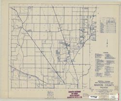
- Subject:
- Topical Subject: Roads and Geographic Subject: Marion County (Ind.)
- Creator:
- Indiana. State Highway Commission (1919-1953)
- Publisher:
- State Highway Commission of Indiana
- Date Created:
- 1949
- Identifier:
- VAC3073-M-00885
- Genre:
- Road maps
- Geographic Location:
- Coordinates: W0862000 W0855700 N0395600 N0393800
- Related URL:
- Catalog URL: https://iucat.iu.edu/catalog/5745742
- Abstract:
- Blueline. "1937." "State revised to January 1, 1949."
- Call Number:
- G4093.M3 P2 1949 .I53 Suppl. sheet 49A
- Caption:
- Imprint: [Indianapolis?] : State Highway Commission of Indiana, [1949]
- Physical Description:
- Dimensions: 52 x 44 cm and Scale: 1:130,000
- Alternate Identifier:
- Title Control Number: a5745742
- Persistent URL:
- https://purl.dlib.indiana.edu/iudl/images/VAC3073/VAC3073-M-00885
-
- Subject:
- Geographic Subject: Indiana, Topical Subject: Erosion, and Topical Subject: Soil erosion
- Creator:
- United States. Soil Conservation Service
- Publisher:
- United States. Soil Conservation Service
- Date Created:
- 1934
- Identifier:
- VAC3073-M-00884
- Genre:
- Thematic maps
- Geographic Location:
- Coordinates: W0880700 W0844500 N0414500 N0375200
- Related URL:
- Catalog URL: https://iucat.iu.edu/catalog/5167326
- Abstract:
- At bottom left: Base map by U. S. Geological Survey, 1930.
- Call Number:
- G4091.J4 1934 .U5
- Caption:
- Imprint: [Washington, D.C.] : U.S. Department of Agriculture Soil Conservation Service, 1934.
- Physical Description:
- Scale: 1:500,000 and Dimensions: 110 x 60 cm
- Alternate Identifier:
- Title Control Number: a5167326
- Persistent URL:
- https://purl.dlib.indiana.edu/iudl/images/VAC3073/VAC3073-M-00884
-
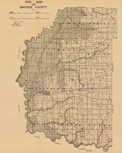
- Subject:
- Geographic Subject: Daviess County (Ind.) and Topical Subject: Soils
- Creator:
- Indiana. Department of Geology and Natural Resources
- Publisher:
- [Indiana Department of Geology and Natural Resources]
- Date Created:
- 1909
- Identifier:
- VAC3073-M-00883
- Genre:
- Thematic maps
- Geographic Location:
- Coordinates: W0871645 W0865414 N0385415 N0382925
- Related URL:
- Catalog URL: https://iucat.iu.edu/catalog/16124707
- Abstract:
- Shows school houses, churches, roads, and railroads. Detached from: A soil survey of four counties of southern Indiana / Chas. W. Shannon and L.C. Snider....
- Call Number:
- G4093.D2J3 1908 .I53
- Caption:
- Imprint: [Indianapolis] : [Indiana Department of Geology and Natural Resources], [1909]
- Physical Description:
- Dimensions: 41 x 33 cm and Scale: Approximately 1:126,720
- Alternate Identifier:
- Alternate ID: 390726IP and Title Control Number: a16124707
- Persistent URL:
- https://purl.dlib.indiana.edu/iudl/images/VAC3073/VAC3073-M-00883
- Provenance:
- 33rd Annual Report (1908) / Indiana. Department of Geology and Natural Resources.
-
- Subject:
- Geographic Subject: Indiana University, Bloomington, Geographic Subject: Ellettsville (Ind.), Geographic Subject: Monroe County (Ind.), Topical Subject: Indi...
- Creator:
- Spectrum Map Publishing, Inc.
- Publisher:
- Spectrum Map Publishing, Inc.
- Date Created:
- 1989
- Identifier:
- VAC3073-M-00882
- Genre:
- Maps
- Geographic Location:
- Coordinates: W0864108 W0861902 N0392120 N0385926
- Related URL:
- Catalog URL: https://iucat.iu.edu/catalog/5288840
- Abstract:
- Includes text, indexes, advertisement, and 10 indexed ancillary subdivision maps.
- Call Number:
- G4094.B5 1989 .S6
- Caption:
- Imprint: Cincinnati, Ohio : Spectrum Map Pub., [1989?]
- Physical Description:
- Scale: Scales differ. and Dimensions: 53 x 46 cm or smaller, sheet 70 x 57 cm
- Alternate Identifier:
- Title Control Number: a5288840
- Persistent URL:
- https://purl.dlib.indiana.edu/iudl/images/VAC3073/VAC3073-M-00882
-
- Subject:
- Topical Subject: Roads and Geographic Subject: Parke County (Ind.)
- Creator:
- Indiana. State Highway Commission (1919-1953)
- Publisher:
- State Highway Commission of Indiana
- Date Created:
- 1949
- Identifier:
- VAC3073-M-00881
- Genre:
- Road maps
- Geographic Location:
- Coordinates: W0872600 W0870100 N0395700 N0393700
- Related URL:
- Catalog URL: https://iucat.iu.edu/catalog/5708068
- Abstract:
- Blueline. "State roads revised to January 1, 1949." "1937." "Data obtained from State-wide Highway Planning Survey." Includes ...
- Call Number:
- G4093.P2 P2 1949 .I53
- Caption:
- Imprint: [Indianapolis?] : State Highway Commission of Indiana, 1949.
- Physical Description:
- Scale: 1:130,000 and Dimensions: 44 x 52 cm
- Alternate Identifier:
- Title Control Number: a5708068
- Persistent URL:
- https://purl.dlib.indiana.edu/iudl/images/VAC3073/VAC3073-M-00881
-
- Subject:
- Geographic Subject: Indiana
- Creator:
- Peale, R. S. (Richard S.)
- Publisher:
- Matthews-Northrup Company , J.N. Matthews Co.
- Date Created:
- 1902
- Identifier:
- VAC3073-M-00880
- Genre:
- Maps
- Geographic Location:
- Coordinates: W0880700 W0844500 N0414500 N0375200
- Related URL:
- Catalog URL: https://iucat.iu.edu/catalog/5166015
- Abstract:
- Shows counties, railroads, and place names. "6.02."
- Call Number:
- G4090 1902 .J586
- Caption:
- Imprint: New York : R.S. Peale, [1902]
- Physical Description:
- Dimensions: 28 x 22 cm and Scale: 1:1,647,369
- Alternate Identifier:
- Title Control Number: a5166015
- Persistent URL:
- https://purl.dlib.indiana.edu/iudl/images/VAC3073/VAC3073-M-00880
-
- Subject:
- Geographic Subject: Indiana and Topical Subject: Roads
- Creator:
- Indiana. State Highway Commission (1961-1981)
- Publisher:
- Indiana. State Highway Commission (1961-1981)
- Date Created:
- 1961
- Identifier:
- VAC3073-M-00879
- Genre:
- Road maps
- Geographic Location:
- Coordinates: W0880500 W0844700 N0414500 N0374600
- Related URL:
- Catalog URL: https://iucat.iu.edu/catalog/18406038
- Abstract:
- Gray on white with "controlled access sections on primary roads where project agreement requires B.P.R. approval before any driveway permits can be gran...
- Call Number:
- G1403 .S7 1961
- Caption:
- Imprint: [Indianapolis] : State Highway Commission, [1961]
- Physical Description:
- Scale: Approximately 1:633,600 and Dimensions: 94 x 59 cm
- Alternate Identifier:
- Title Control Number: a18406038
- Persistent URL:
- https://purl.dlib.indiana.edu/iudl/images/VAC3073/VAC3073-M-00879
- Provenance:
- Indiana state highway system
-
Map of Indiana showing its history, points of interest, and the holdings of the Dept of Conservation
- Subject:
- Topical Subject: History and Geographic Subject: Indiana
- Creator:
- Indiana. Department of Conservation
- Publisher:
- Indiana. Department of Conservation
- Date Created:
- 1954
- Identifier:
- VAC3073-M-00877
- Genre:
- Pictorial maps
- Geographic Location:
- Coordinates: W0880500 W0844700 N0414500 N0374600
- Related URL:
- Catalog URL: https://iucat.iu.edu/catalog/2256179
- Abstract:
- Pictorial map. Cited LC's Trails bibliography, no. 111.
- Call Number:
- G4091 .S1 1954 .I5
- Caption:
- Imprint: [Indianapolis] : Indiana Dept. of Conservation, [1954]
- Physical Description:
- Dimensions: 86 x 61 cm and Scale: 1:600,000
- Alternate Identifier:
- Title Control Number: BGY2458BB
- Persistent URL:
- https://purl.dlib.indiana.edu/iudl/images/VAC3073/VAC3073-M-00877
-
- Subject:
- Topical Subject: Soils, Topical Subject: Classification, and Geographic Subject: Marion County (Ind.)
- Publisher:
- United States. Bureau of Soils
- Date Created:
- 1907
- Identifier:
- VAC3073-M-00876
- Genre:
- Thematic maps
- Geographic Location:
- Coordinates: W0862000 W0855700 N0395600 N0393800
- Related URL:
- Catalog URL: https://iucat.iu.edu/catalog/2872554
- Abstract:
- Soils surveyed by W. J. Geib and Frank C. Schroeder. Shows soil types classification by colors and symbols.
- Call Number:
- G4093 .M3J3 1907 .G45
- Caption:
- Imprint: Washington, D.C.: Bureau of Soils. [1907?]
- Physical Description:
- Dimensions: 51 x 50 cm and Scale: 1:63,360
- Alternate Identifier:
- Title Control Number: CAY7156BB
- Persistent URL:
- https://purl.dlib.indiana.edu/iudl/images/VAC3073/VAC3073-M-00876
- Provenance:
- Soil Map, Indiana, Marion County Sheet.
-
- Subject:
- Geographic Subject: LaPorte County (Ind.) and Topical Subject: Roads
- Creator:
- Indiana. State Highway Commission (1919-1953)
- Publisher:
- State Highway Commission of Indiana
- Date Created:
- 1949
- Identifier:
- VAC3073-M-00875
- Genre:
- Road maps
- Geographic Location:
- Coordinates: W0865600 W0862900 N0414600 N0411400
- Related URL:
- Catalog URL: https://iucat.iu.edu/catalog/5706494
- Abstract:
- Blueline. "State roads revised to January 1, 1949." "1937." "Data obtained from State-wide Highway Planning Agency Survey." Inc...
- Call Number:
- G4093.L15 P2 1949 .I53
- Caption:
- Imprint: [Indianapolis?] : State Highway Commission of Indiana, 1949.
- Physical Description:
- Scale: 1:130,000 and Dimensions: 52 x 44 cm
- Alternate Identifier:
- Title Control Number: a5706494
- Persistent URL:
- https://purl.dlib.indiana.edu/iudl/images/VAC3073/VAC3073-M-00875
-

- Subject:
- Geographic Subject: Indiana, Topical Subject: IGS Annual Reports, and Topical Subject: Geology, Stratigraphic--Ordovician
- Creator:
- Cumings, E. R. (Edgar Roscoe), 1874-1967
- Publisher:
- Indiana. Department of Geology and Natural Resources
- Date Created:
- 1908
- Identifier:
- VAC3073-M-00874
- Genre:
- Geological cross-sections
- Geographic Location:
- Coordinates: W0880500 W0844700 N0414500 N0374600
- Related URL:
- Catalog URL: https://iucat.iu.edu/catalog/18307667
- Abstract:
- 3 sections on one sheet. Title from caption. Shows strategraphic measurements for sections 5.9A, 1.38A, and 1.38B. Detached from: The stratigraphy and pal...
- Call Number:
- G4091.C57 1907 .Z47
- Caption:
- Imprint: [Indianapolis] : [Indiana Department of Geology and Natural Resources], [1908]
- Physical Description:
- Dimensions: 44 x 19 cm
- Alternate Identifier:
- Title Control Number: a18307667 and Alternate ID: 390726IP
- Persistent URL:
- https://purl.dlib.indiana.edu/iudl/images/VAC3073/VAC3073-M-00874
- Provenance:
- 32nd Annual Report (1907) / Indiana. Department of Geology and Natural Resources.
-
- Subject:
- Topical Subject: Sewerage and Geographic Subject: Jeffersonville (Ind.)
- Creator:
- Bruner, J. W.
- Publisher:
- Board of Public Works & Safety
- Date Created:
- 1946
- Identifier:
- VAC3073-M-00873
- Genre:
- Thematic maps
- Geographic Location:
- Coordinates: W0854556 W0854143 N0381820 N0381537
- Related URL:
- Catalog URL: https://iucat.iu.edu/catalog/5382860
- Abstract:
- Shows 1884 and 1937 high water lines and floodwall. Blueprint. Includes diagram of Louisville and Portland Canal gages showing high water on various ...
- Call Number:
- G4094.J4 N46 1946 .B78
- Caption:
- Imprint: [Jeffersonville, Ind.?] : Board of Public Works & Safety, [1946]
- Physical Description:
- Scale: 1:6,000 and Dimensions: 87 x 123 cm
- Alternate Identifier:
- Title Control Number: a5382860
- Persistent URL:
- https://purl.dlib.indiana.edu/iudl/images/VAC3073/VAC3073-M-00873
-
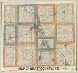
- Subject:
- Geographic Subject: Grant County (Ind.), Topical Subject: Real property, and Topical Subject: Landowners
- Creator:
- Smith, Ansel R.
- Publisher:
- Smith, Ansel R.
- Date Created:
- 1906
- Identifier:
- VAC3073-M-00872
- Genre:
- Cadastral maps
- Geographic Location:
- Coordinates: W0855153 W0852639 N0403913 N0402242
- Related URL:
- Catalog URL: https://iucat.iu.edu/catalog/7065595
- Abstract:
- Cadastral map showing landowners. "F.W. White, draftsman."
- Call Number:
- G4093.G6G46 1906 .S65
- Caption:
- Imprint: Marion, Ind. : Ansel R. Smith, 1906.
- Physical Description:
- Dimensions: 105 x 115 cm and Scale: 1:31,680
- Alternate Identifier:
- Title Control Number: a7065595
- Persistent URL:
- https://purl.dlib.indiana.edu/iudl/images/VAC3073/VAC3073-M-00872
-
- Subject:
- Topical Subject: Hiking, Topical Subject: Trails, Geographic Subject: Knobstone Trail (Ind.), and Geographic Subject: Indiana
- Creator:
- Indiana. Department of Natural Resources
- Publisher:
- Indiana. Department of Natural Resources
- Date Created:
- 2000
- Identifier:
- VAC3073-M-00870
- Genre:
- Maps
- Geographic Location:
- Coordinates: W0860302 W0855053 N0384420 N0383425
- Related URL:
- Catalog URL: https://iucat.iu.edu/catalog/4967263
- Abstract:
- Relief shown by contours and spot heights. Panel title. Base 7.5 minute U.S.G.S. topographic quads. Includes text.
- Call Number:
- G4092.K6E63 2000 .I53
- Caption:
- Imprint: Indianapolis, IN : Dept. of Natural Resources, 2000.
- Physical Description:
- Dimensions: 71 x 44 cm and Scale: 1:31,680
- Alternate Identifier:
- Title Control Number: a4967263
- Persistent URL:
- https://purl.dlib.indiana.edu/iudl/images/VAC3073/VAC3073-M-00870
-
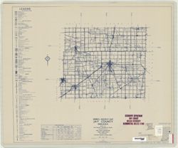
- Subject:
- Topical Subject: Roads and Geographic Subject: Jay County (Ind.)
- Creator:
- Indiana. State Highway Commission (1919-1953)
- Publisher:
- Indiana. State Highway Commission (1919-1953)
- Date Created:
- 1949
- Identifier:
- VAC3073-M-00871
- Genre:
- Road maps
- Geographic Location:
- Coordinates: W0851300 W0844800 N0403400 N0401900
- Related URL:
- Catalog URL: https://iucat.iu.edu/catalog/5706369
- Abstract:
- Blueline. "State roads revised to January 1, 1949." "1942." "Data obtained from State-wide Highway Planning Agency." Includes l...
- Call Number:
- G4093 .J4P2 1949 .I53
- Caption:
- Imprint: [Indianapolis?] : State Highway Commission of Indiana, 1949.
- Physical Description:
- Dimensions: 52 x 44 cm and Scale: 1:130,000
- Persistent URL:
- https://purl.dlib.indiana.edu/iudl/images/VAC3073/VAC3073-M-00871
-
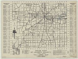
- Subject:
- Geographic Subject: Saint Joseph County (Ind.) and Topical Subject: Roads
- Creator:
- Feldman, Earl R.
- Publisher:
- Peerless Press
- Date Created:
- 1934
- Identifier:
- VAC3073-M-00869
- Genre:
- Road maps
- Geographic Location:
- Coordinates: W0863136 W0860333 N0414538 N0412558
- Related URL:
- Catalog URL: https://iucat.iu.edu/catalog/15187814
- Abstract:
- At foot of title: Approved March 6, 1933, Board of County Commissioners. At bottom right: Copyrighted 1934 by Roy System. Nov 30 1934.
- Call Number:
- G4093.S2P2 1933 .F45
- Caption:
- Imprint: South Bend, Indiana : Peerless Press, [1934]
- Physical Description:
- Dimensions: 46 x 61 cm and Scale: 1:90,000
- Persistent URL:
- https://purl.dlib.indiana.edu/iudl/images/VAC3073/VAC3073-M-00869
-
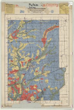
- Subject:
- Topical Subject: Landowners, Geographic Subject: Putnam County (Ind.), Topical Subject: Land use, Rural, and Topical Subject: Real property
- Creator:
- Cockley, John
- Publisher:
- Central National Bank (Greencastle, Ind.)
- Date Created:
- 1944
- Identifier:
- VAC3073-M-00868
- Genre:
- Cadastral maps
- Geographic Location:
- Coordinates: W0870100 W0863800 N0395200 N0392800
- Related URL:
- Catalog URL: https://iucat.iu.edu/catalog/4662056
- Abstract:
- "Coloring shows approximate areas of recommended land use by Putnam County Land Use Planning Committee." Cadastral map showing landowners. Cadastr...
- Call Number:
- G4093 .P8G4 1944 .C6
- Caption:
- Imprint: Greencastle, Ind. : Central National Bank, [1944]
- Physical Description:
- Dimensions: 91 x 65 cm and Scale: 1:55,000
- Alternate Identifier:
- Title Control Number: CAG9550BB
- Persistent URL:
- https://purl.dlib.indiana.edu/iudl/images/VAC3073/VAC3073-M-00868
-
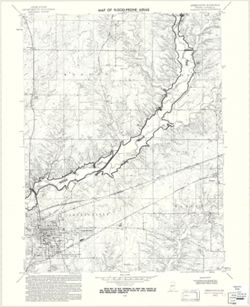
- Subject:
- Geographic Subject: Greencastle (Ind.), Topical Subject: Flood forecasting, Geographic Subject: Putnam County (Ind.), Topical Subject: Floodplains, and Topic...
- Creator:
- Geological Survey (U.S.)
- Publisher:
- Geological Survey (U.S.)
- Date Created:
- 1970
- Identifier:
- VAC3073-M-00867
- Genre:
- 7.5 minute topographic maps, Quadrangle maps, and Topographic maps
- Geographic Location:
- Coordinates: W0865230 W0864500 N0394500 N0393730
- Related URL:
- Catalog URL: https://iucat.iu.edu/catalog/18416317
- Abstract:
- Polyconic projection. Relief shown by contours and spot heights. 7.5 U.S. topographic map with flood-prone areas designated north and northeast of Greencastl...
- Call Number:
- G4091.C32 s24 .G4 Greencastle 1970
- Caption:
- Imprint: Washington, D.C. : United States, Department of the Interior, Geological Survey, 1970.
- Physical Description:
- Dimensions: 58 x 45 cm and Scale: 1:24,000
- Alternate Identifier:
- Title Control Number: a18416317 and Alternate ID: CAW5372BB
- Persistent URL:
- https://purl.dlib.indiana.edu/iudl/images/VAC3073/VAC3073-M-00867
- Provenance:
- United States Department of the Interior, Geological Survey. Map of flood-prone areas : [Indiana]. Washington, D.C. : The Survey, 1969-.
-
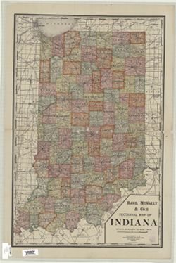
- Subject:
- Geographic Subject: Indiana
- Creator:
- Rand McNally and Company
- Publisher:
- Rand McNally and Company
- Date Created:
- 1908
- Identifier:
- VAC3073-M-00866
- Genre:
- Maps
- Geographic Location:
- Coordinates: W0880700 W0844500 N0414500 N0375200
- Related URL:
- Catalog URL: https://iucat.iu.edu/catalog/5176938
- Abstract:
- Shows county boundaries, sections, railroads, and cities and towns.
- Call Number:
- G4090 1908 .R363
- Caption:
- Imprint: Chicago : Rand, McNally, [1908]
- Physical Description:
- Scale: 1:508,880 and Dimensions: 95 x 61 cm
- Alternate Identifier:
- Title Control Number: a5176938
- Persistent URL:
- https://purl.dlib.indiana.edu/iudl/images/VAC3073/VAC3073-M-00866
-
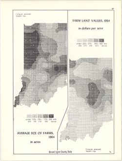
- Subject:
- Topical Subject: Farms, Topical Subject: SYMAP (Computer program language), Geographic Subject: Indiana, and Topical Subject: Agricultural resources
- Creator:
- Indiana University. Research Computing Center, Hollingsworth, John M., and Kingsbury, Robert C.
- Publisher:
- Indiana University. Department of Geography
- Date Created:
- 1970
- Identifier:
- VAC3073-M-00865
- Genre:
- Thematic maps
- Geographic Location:
- Coordinates: W0880700 W0844500 N0414500 N0374600
- Related URL:
- Catalog URL: https://iucat.iu.edu/catalog/15995407
- Abstract:
- 2 maps on 1 sheet, Farm land values, 1964, in dollars per acre and Average size of farms, 1964, in acres. Computer generated isopleth maps obtained through u...
- Call Number:
- G4091.J1 1964 .K57
- Caption:
- Imprint: Bloomington, Indiana : Department of Geography, Indiana University, [1970]
- Physical Description:
- Scale: Approximately 1:3,000,000 and Dimensions: each 26 x 10 cm, on sheet 28 x 21 cm
- Alternate Identifier:
- Alternate ID: 317383IP and Title Control Number: a15995407
- Persistent URL:
- https://purl.dlib.indiana.edu/iudl/images/VAC3073/VAC3073-M-00865
- Provenance:
- An atlas of Indiana / by Robert C. Kingsbury [1970].
-
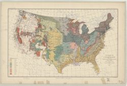
- Subject:
- Geographic Subject: United States and Topical Subject: Geology
- Creator:
- McGee, W J, 1853-1912
- Publisher:
- Geological Survey (U.S.)
- Date Created:
- 1893
- Identifier:
- VAC3073-M-00861
- Genre:
- Geological maps
- Geographic Location:
- Coordinates: W1250000 W0670000 N0490000 N0250000
- Related URL:
- Catalog URL: https://iucat.iu.edu/catalog/8556458
- Abstract:
- Relief shown by contour lines. In upper border: U.S. Geological Survey. Fourteenth annual report, pl. II. Shows Indian reservations. Includes legend.
- Call Number:
- G3701.C51 1893 .G46
- Caption:
- Imprint: [Washington?] : U.S. Geological Survey, 1893.
- Physical Description:
- Dimensions: 43 x 71 cm and Scale: 1:7,000,000
- Alternate Identifier:
- Title Control Number: a8556458
- Persistent URL:
- https://purl.dlib.indiana.edu/iudl/images/VAC3073/VAC3073-M-00861
- Provenance:
- 14th Annual Report (1884) / Indiana. Department of Geology and Natural History.
-
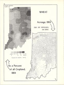
- Subject:
- Topical Subject: SYMAP (Computer program language), Topical Subject: Wheat--Geographical distribution, and Geographic Subject: Indiana
- Creator:
- Indiana University. Research Computing Center, Hollingsworth, John M., and Kingsbury, Robert C.
- Publisher:
- Indiana University. Department of Geography
- Date Created:
- 1970
- Identifier:
- VAC3073-M-00862
- Genre:
- Thematic maps
- Geographic Location:
- Coordinates: W0880700 W0844500 N0414500 N0374600
- Related URL:
- Catalog URL: https://iucat.iu.edu/catalog/15984674
- Abstract:
- Dot distribution map. Includes ancillary computer generated isopleth map Wheat as a percent of all cropland, 1964. ASCII-art map created using SYMAP or simil...
- Call Number:
- G4091.J61 1964 .K57
- Caption:
- Imprint: Bloomington, Indiana : Department of Geography, Indiana University, [1970]
- Physical Description:
- Dimensions: 26 x 18 cm, on sheet 28 x 21 cm and Scale: Approximately 1:2,534,400
- Alternate Identifier:
- Alternate ID: 317383IP and Title Control Number: a15984674
- Persistent URL:
- https://purl.dlib.indiana.edu/iudl/images/VAC3073/VAC3073-M-00862
- Provenance:
- An atlas of Indiana / by Robert C. Kingsbury [1970].
-
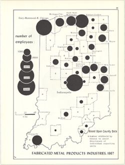
- Subject:
- Topical Subject: Labor supply, Topical Subject: Metal-workers, and Geographic Subject: Indiana
- Creator:
- Kingsbury, Robert C. and Hollingsworth, John M.
- Publisher:
- Indiana University. Department of Geography
- Date Created:
- 1970
- Identifier:
- VAC3073-M-00863
- Genre:
- Thematic maps
- Geographic Location:
- Coordinates: W0880700 W0844500 N0414500 N0374600
- Related URL:
- Catalog URL: https://iucat.iu.edu/catalog/15951237
- Abstract:
- Graduated symbol map. Number of employees shown by county. Detached from: An atlas of Indiana / by Robert C. Kingsbury , with contributions from John M. H...
- Call Number:
- G4091.G8 1967 .K51
- Caption:
- Imprint: Bloomington, Indiana : Department of Geography, Indiana University, [1970]
- Physical Description:
- Dimensions: 26 x 18 cm, on sheet 28 x 21 cm and Scale: Approximately 1:1,950,000
- Alternate Identifier:
- Title Control Number: a15951237 and Alternate ID: 317383IP
- Persistent URL:
- https://purl.dlib.indiana.edu/iudl/images/VAC3073/VAC3073-M-00863
- Provenance:
- An atlas of Indiana / by Robert C. Kingsbury [1970].
-
- Subject:
- Geographic Subject: Brown County State Park (Ind.), Geographic Subject: Indiana, and Topical Subject: Trails
- Creator:
- Indiana. Division of State Parks, Lands, and Waters
- Publisher:
- Indiana. Division of State Parks, Lands, and Waters
- Date Created:
- 1950
- Identifier:
- VAC3073-M-00860
- Genre:
- Tourist maps
- Geographic Location:
- Coordinates: W0861349 W0861339 N0390851 N0390842
- Related URL:
- Catalog URL: https://iucat.iu.edu/catalog/7465323
- Abstract:
- "3-50--120M:--Back panel. Includes ancillary map "Detail map of the trails in the day use area" (scale approximately 12,500), location map and...
- Call Number:
- G4092.B73 1950 .I5
- Caption:
- Imprint: [Indianapolis?] : Indiana Department of Conservation, Division of State Parks, Lands, and Waters, [1950]
- Physical Description:
- Dimensions: 37 x 28 cm, on sheet 41 x 56 cm and Scale: 1:36,000
- Alternate Identifier:
- Title Control Number: a7465323
- Persistent URL:
- https://purl.dlib.indiana.edu/iudl/images/VAC3073/VAC3073-M-00860
-
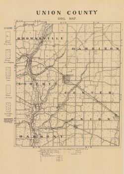
- Subject:
- Topical Subject: Soils and Geographic Subject: Union County (Ind.)
- Creator:
- Indiana. Department of Geology and Natural Resources
- Publisher:
- Indiana. Department of Geology and Natural Resources
- Date Created:
- 1910
- Identifier:
- VAC3073-M-00859
- Genre:
- Thematic maps
- Geographic Location:
- Coordinates: W0850210 W0844851 N0394345 N0393119
- Related URL:
- Catalog URL: https://iucat.iu.edu/catalog/16124317
- Abstract:
- Shows railroads, dirt roads, and gravel roads. Includes notes on general topography. Detached from: A soil survey of Randolph, Wayne, Henry, Rush, Fayette...
- Call Number:
- G4093.U5J3 1909 .I53
- Caption:
- Imprint: [Indianapolis] : [Indiana Department of Geology and Natural Resources], [1910]
- Physical Description:
- Dimensions: 25 x 21 cm and Scale: Approximately 1:95,000
- Alternate Identifier:
- Title Control Number: a16124317 and Alternate ID: 390726IP
- Persistent URL:
- https://purl.dlib.indiana.edu/iudl/images/VAC3073/VAC3073-M-00859
- Provenance:
- 34th Annual Report (1909) / Indiana. Department of Geology and Natural Resources.
-
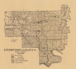
- Subject:
- Topical Subject: IGS Annual Reports, Topical Subject: Soils, and Geographic Subject: Crawford County (Ind.)
- Creator:
- Shannon, C. W. (Charles William), 1879-1934
- Publisher:
- Indiana. Department of Geology and Natural Resources
- Date Created:
- 1909
- Identifier:
- VAC3073-M-00856
- Genre:
- Thematic maps
- Geographic Location:
- Coordinates: W0864052 W0861444 N0382520 N0380617
- Related URL:
- Catalog URL: https://iucat.iu.edu/catalog/16091037
- Abstract:
- Shows school houses, caves, public roads, and railroads. Detached from: A soil survey of four counties of southern Indiana / Chas. W. Shannon and L.C. Sni...
- Call Number:
- G4093.C7J3 1908 .I53
- Caption:
- Imprint: [Indianapolis] : [Wm. B. Burford], [1909] and Imprint: [Indianapolis] : [Indiana Department of Geology and Natural Resources], [1909]
- Physical Description:
- Scale: Approximately 1:130,000 and Dimensions: on sheet 32 x 36 cm
- Alternate Identifier:
- Title Control Number: a16091037 and Alternate ID: 390726IP
- Persistent URL:
- https://purl.dlib.indiana.edu/iudl/images/VAC3073/VAC3073-M-00856
- Provenance:
- 33rd Annual Report (1908) / Indiana. Department of Geology and Natural Resources.
-
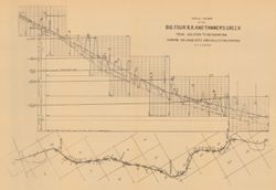
- Subject:
- Geographic Subject: Tanners Creek (Ind. : Creek), Topical Subject: Cleveland, Cinicinnati, Chicago, and St. Louis Railway Company, Topical Subject: Rivers, T...
- Creator:
- Cumings, E. R. (Edgar Roscoe), 1874-1967
- Publisher:
- Indiana. Department of Geology and Natural Resources
- Date Created:
- 1908
- Identifier:
- VAC3073-M-00855
- Genre:
- Thematic maps and Geological cross-sections
- Geographic Location:
- Coordinates: W0850300 W0845200 N0391300 N0390900
- Related URL:
- Catalog URL: https://iucat.iu.edu/catalog/18307543
- Abstract:
- 1 map and 1 section on 1 sheet. Relief shown by profile. Includes map, geological profile, geological time table, and correlation diagram. Detached from: ...
- Call Number:
- G4093.D3P3 1907 .C8
- Caption:
- Imprint: [Indianapolis] : [Indiana Dept. of Geology and Natural Resources], [1908]
- Physical Description:
- Scale: Approximately 1:49,000. Vertical scale approximately 1:950 and Dimensions: on sheet 31 x 44 cm
- Alternate Identifier:
- Title Control Number: a18307543 and Alternate ID: 390726IP
- Persistent URL:
- https://purl.dlib.indiana.edu/iudl/images/VAC3073/VAC3073-M-00855
- Provenance:
- 32nd Annual Report (1907) / Indiana. Department of Geology and Natural Resources.
-
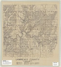
- Subject:
- Geographic Subject: Lawrence County (Ind.) and Topical Subject: Soils
- Creator:
- Indiana. Department of Geology and Natural Resources
- Publisher:
- Indiana. Department of Geology and Natural Resources
- Date Created:
- 1908
- Identifier:
- VAC3073-M-00854
- Genre:
- Thematic maps
- Geographic Location:
- Coordinates: W0864103 W0861635 N0385939 N0384116
- Related URL:
- Catalog URL: http://www.iucat.iu.edu/catalog/16095821
- Abstract:
- Shows railroads, dirt roads and improved roads, school houses, and churches. Detached from: Soil survey of Monroe, Brown, Lawrence, Martin, Orange, Washin...
- Call Number:
- G4093.L5J3 1907 .I53
- Caption:
- Imprint: [Indianapolis] : [Indiana Department of Geology and Natural Resources], [1908]
- Physical Description:
- Dimensions: 40 x 42 cm and Scale: Approximately 1:85,000
- Alternate Identifier:
- Alternate ID: 390726IP and Title Control Number: a16095821
- Persistent URL:
- https://purl.dlib.indiana.edu/iudl/images/VAC3073/VAC3073-M-00854
- Provenance:
- 32nd Annual Report (1907) / Indiana. Department of Geology and Natural Resources.
-
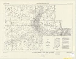
- Subject:
- Topical Subject: Geomagnetism and Geographic Subject: Fulton County (Ind.)
- Creator:
- Dempsey, W. J.
- Publisher:
- Geological Survey (U.S.)
- Date Created:
- 1949
- Identifier:
- VAC3073-M-00853
- Genre:
- Thematic maps
- Geographic Location:
- Coordinates: W0862806 W0855643 N0411022 N0405432
- Related URL:
- Catalog URL: https://iucat.iu.edu/catalog/6942523
- Abstract:
- Includes text and location map.
- Call Number:
- G4093.F8C93 1949 .D4
- Caption:
- Imprint: [Washington, D.C.] : For sale by U.S. Geological Survey, 1949.
- Physical Description:
- Dimensions: 48 x 71 cm and Scale: 1:75,600
- Alternate Identifier:
- Title Control Number: a6942523
- Persistent URL:
- https://purl.dlib.indiana.edu/iudl/images/VAC3073/VAC3073-M-00853
-
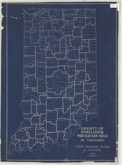
- Subject:
- Geographic Subject: Indiana and Topical Subject: Population density
- Creator:
- Indiana. State Planning Board
- Publisher:
- Indiana. State Planning Board
- Date Created:
- 1936
- Identifier:
- VAC3073-M-00852
- Genre:
- Thematic maps
- Geographic Location:
- Coordinates: W0880700 W0844500 N0414500 N0375200
- Related URL:
- Catalog URL: https://iucat.iu.edu/catalog/4890579
- Abstract:
- Blueprint. "1936."
- Call Number:
- G4091 .E2 1936 .I5
- Caption:
- Imprint: [Indianapolis] : The Board, 1936.
- Physical Description:
- Dimensions: 99 x 70 cm and Scale: 1:500,000
- Alternate Identifier:
- Title Control Number: a4890579
- Persistent URL:
- https://purl.dlib.indiana.edu/iudl/images/VAC3073/VAC3073-M-00852
-
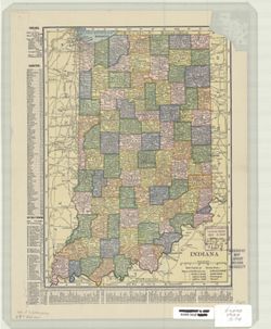
- Subject:
- Geographic Subject: Indiana
- Creator:
- C.S. Hammond & Company
- Publisher:
- C.S. Hammond & Company
- Date Created:
- 1907
- Identifier:
- VAC3073-M-00851
- Genre:
- Maps
- Geographic Location:
- Coordinates: W0880700 W0844500 N0414500 N0375200
- Related URL:
- Catalog URL: https://iucat.iu.edu/catalog/5166890
- Abstract:
- Shows counties, cities and towns by population, and railroads. Includes area and populations statistics and indexes to counties and cities and towns.
- Call Number:
- G4090 1907 .C74
- Caption:
- Imprint: New York : Hammond, [1907]
- Physical Description:
- Dimensions: 27 x 20 cm and Scale: 1:1,600,000
- Alternate Identifier:
- Title Control Number: a5166890
- Persistent URL:
- https://purl.dlib.indiana.edu/iudl/images/VAC3073/VAC3073-M-00851
-
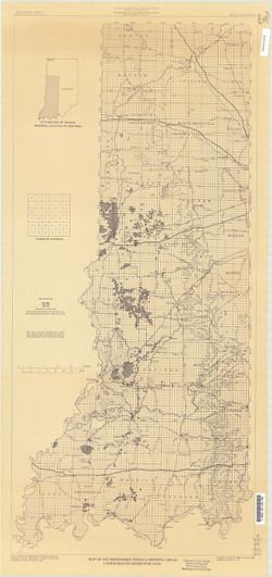
- Subject:
- Topical Subject: Coal mines and mining and Geographic Subject: Indiana
- Creator:
- Weber, Licia
- Publisher:
- Indiana. Geological Survey
- Date Created:
- 1986
- Identifier:
- VAC3073-M-00850
- Genre:
- Mine maps
- Geographic Location:
- Coordinates: W0880500 W0861800 N0404200 N0374600
- Related URL:
- Catalog URL: https://iucat.iu.edu/catalog/4438471
- Abstract:
- Blue line print. Includes location map.
- Call Number:
- G4091.H9 1986 .W4
- Caption:
- Imprint: [Bloomington, IN]: Indiana, Geological Survey, [1986]
- Physical Description:
- Dimensions: 93 x 44 cm and Scale: 1:350,000
- Alternate Identifier:
- Title Control Number: a4438471
- Persistent URL:
- https://purl.dlib.indiana.edu/iudl/images/VAC3073/VAC3073-M-00850
-
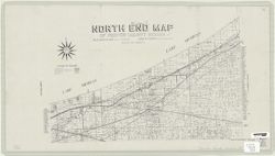
- Subject:
- Topical Subject: Landowners, Topical Subject: Real property, and Geographic Subject: Porter County (Ind.)
- Creator:
- Anderson, K. Russell
- Publisher:
- [Wm. E. Morthland?]
- Date Created:
- 1927
- Identifier:
- VAC3073-M-00849
- Genre:
- Cadastral maps
- Geographic Location:
- Coordinates: W0871322 W0865545 N0414540 N0411310
- Related URL:
- Catalog URL: https://iucat.iu.edu/catalog/6948715
- Abstract:
- Cadastral map showing landowners. "March 1927."
- Call Number:
- G4093.P5 G46 1927 .A53
- Caption:
- Imprint: [Valparaiso, Ind.?] : [Wm. E. Morthland?], [1927]
- Physical Description:
- Dimensions: 35 x 64 cm and Scale: 1:12,000
- Alternate Identifier:
- Title Control Number: a6948715
- Persistent URL:
- https://purl.dlib.indiana.edu/iudl/images/VAC3073/VAC3073-M-00849
-
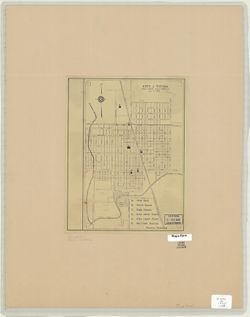
- Subject:
- Geographic Subject: Tipton (Ind.)
- Publisher:
- [publisher not identified]
- Date Created:
- 1945
- Identifier:
- VAC3073-M-00848
- Genre:
- Maps
- Geographic Location:
- Coordinates: W0860411 W0860109 N0401751 N0401602
- Related URL:
- Catalog URL: https://iucat.iu.edu/catalog/7032612
- Abstract:
- Blue line. "Dec. 15, 1945."
- Call Number:
- G4094.T6 1945 .C58
- Caption:
- Imprint: [Place of publication not identified] : [publisher not identified], [1945]
- Physical Description:
- Dimensions: 28 x 19 cm and Scale: 1:12,000
- Alternate Identifier:
- Title Control Number: a7032612
- Persistent URL:
- https://purl.dlib.indiana.edu/iudl/images/VAC3073/VAC3073-M-00848
-
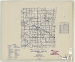
- Subject:
- Topical Subject: Roads and Geographic Subject: Montgomery County (Ind.)
- Creator:
- Indiana. State Highway Commission (1919-1953)
- Publisher:
- State Highway Commission of Indiana
- Date Created:
- 1949
- Identifier:
- VAC3073-M-00847
- Genre:
- Road maps
- Geographic Location:
- Coordinates: W0870600 W0864200 N0401300 N0395200
- Related URL:
- Catalog URL: https://iucat.iu.edu/catalog/5707440
- Abstract:
- Blueline. "State roads revised to January 1, 1949." "1937." "Data obtained from State-wide Highway Planning Agency Survey." Inc...
- Call Number:
- G4093.M8 P2 1949 .I53
- Caption:
- Imprint: [Indianapolis?] : State Highway Commission of Indiana, 1949.
- Physical Description:
- Dimensions: 52 x 44 cm and Scale: 1:130,000
- Alternate Identifier:
- Title Control Number: a5707440
- Persistent URL:
- https://purl.dlib.indiana.edu/iudl/images/VAC3073/VAC3073-M-00847
-
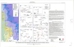
- Subject:
- Topical Subject: Subsurface drainage, Topical Subject: Groundwater, Geographic Subject: Indiana, and Topical Subject: Pollution
- Creator:
- Frushour, Samuel S.
- Publisher:
- Indiana. Geological Survey
- Date Created:
- 2000
- Identifier:
- VAC3073-M-00844
- Genre:
- Thematic maps
- Geographic Location:
- Coordinates: W0865700 W0855900 N0393800 N0375400
- Related URL:
- Catalog URL: https://iucat.iu.edu/catalog/4898418
- Abstract:
- Digital cartogrpahy by Kimberly H. Sowder." Includes index map and text: Abstract and "Sources of subsurface dye trace information."
- Call Number:
- G4091 .C34 2000 .F7
- Caption:
- Imprint: Bloomington, Ind. : Indiana Geological Survey, 2000.
- Physical Description:
- Dimensions: 19 x 19 cm or smaller, on sheet 58 x 92 cm and Scale: 1:500,000
- Alternate Identifier:
- Title Control Number: a4898418
- Persistent URL:
- https://purl.dlib.indiana.edu/iudl/images/VAC3073/VAC3073-M-00844
-
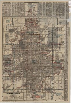
- Subject:
- Geographic Subject: Marion County (Ind.) and Geographic Subject: Indianapolis (Ind.)
- Creator:
- George F. Cram Company
- Publisher:
- George F. Cram Company
- Date Created:
- 1945
- Identifier:
- VAC3073-M-00843
- Genre:
- Maps
- Geographic Location:
- Coordinates: W0861941 W0855614 N0395538 N0393755
- Related URL:
- Catalog URL: https://iucat.iu.edu/catalog/5044759
- Abstract:
- Includes street index and inset of the Nora area (scale [ca. 1:39,000]) On verso: map of "Marion County, Indiana" with indexes to streets and road...
- Call Number:
- G4094 .I4 1945 .G46
- Caption:
- Imprint: Indianapolis : The Company, [1945]
- Physical Description:
- Dimensions: 75 x 56 cm and Scale: 1:28,000
- Alternate Identifier:
- Title Control Number: a5044759
- Persistent URL:
- https://purl.dlib.indiana.edu/iudl/images/VAC3073/VAC3073-M-00843
-
- Subject:
- Topical Subject: Soils, Geographic Subject: Posey County (Ind.), and Topical Subject: Classification
- Creator:
- Marean, Herbert W.
- Publisher:
- United States. Bureau of Soils
- Date Created:
- 1902
- Identifier:
- VAC3073-M-00842
- Genre:
- Thematic maps
- Geographic Location:
- Coordinates: W0880600 W0874100 N0381400 N0374600
- Related URL:
- Catalog URL: https://iucat.iu.edu/catalog/2873607
- Abstract:
- Shows soil types classification by colors and symbols. "Field Operations, Bureau of Soils, 1902." "Julius Bien & Co., Lith. N.Y."
- Call Number:
- G4093 .P6J3 1902 .M37
- Caption:
- Imprint: [Washington, D.C.?] : The Bureau, [1902]
- Physical Description:
- Dimensions: 80 x 52 cm and Scale: 1:63,360
- Alternate Identifier:
- Title Control Number: CAY9487BB
- Persistent URL:
- https://purl.dlib.indiana.edu/iudl/images/VAC3073/VAC3073-M-00842
-
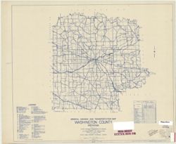
- Subject:
- Geographic Subject: Washington County (Ind.) and Topical Subject: Roads
- Creator:
- Indiana. State Highway Commission (1919-1953)
- Publisher:
- State Highway Commission of Indiana
- Date Created:
- 1949
- Identifier:
- VAC3073-M-00841
- Genre:
- Road maps
- Geographic Location:
- Coordinates: W0861900 W0855100 N0384700 N0382500
- Related URL:
- Catalog URL: https://iucat.iu.edu/catalog/5741674
- Abstract:
- Blueline. "State roads revised to January 1, 1949." "1937." "88." "Data obtained from State-wide Highway Planning Survey.&...
- Call Number:
- G4093.W5 P2 1949 .I53
- Caption:
- Imprint: [Indianapolis?] : State Highway Commission of Indiana, [1949?]
- Physical Description:
- Scale: 1:130,000 and Dimensions: 44 x 52 cm
- Alternate Identifier:
- Title Control Number: a5741674
- Persistent URL:
- https://purl.dlib.indiana.edu/iudl/images/VAC3073/VAC3073-M-00841
-
- Subject:
- Geographic Subject: Indiana and Topical Subject: Administrative and political divisions
- Creator:
- Bourquin, D. L.
- Publisher:
- Higgins Beldin & Co.
- Date Created:
- 1874
- Identifier:
- VAC3073-M-00840
- Genre:
- Maps
- Geographic Location:
- Coordinates: W0880700 W0844500 N0414500 N0375200
- Related URL:
- Catalog URL: https://iucat.iu.edu/catalog/4665301
- Abstract:
- Shows counties, townships, sections, county seats, other towns and post offices, rivers, and railroads. Includes population tables.
- Call Number:
- G4090 1874 .B68
- Caption:
- Imprint: Chicago : Higgins Beldin & Co., 1874.
- Physical Description:
- Dimensions: 67 x 40 cm and Scale: 1:760,320
- Alternate Identifier:
- Title Control Number: CAJ6107BB
- Persistent URL:
- https://purl.dlib.indiana.edu/iudl/images/VAC3073/VAC3073-M-00840
-
- Subject:
- Topical Subject: Real property, Topical Subject: Landowners, Geographic Subject: Muncie (Ind.), and Topical Subject: Natural gas
- Creator:
- Hefel, Toney C.
- Publisher:
- [publisher not identified]
- Date Created:
- 1889
- Identifier:
- VAC3073-M-00839
- Genre:
- Cadastral maps
- Geographic Location:
- Coordinates: W0852716 W0851914 N0401426 N0400856
- Related URL:
- Catalog URL: https://iucat.iu.edu/catalog/7330426
- Abstract:
- Blueprint. Partial cadastral map showing landowners.
- Call Number:
- G4094.M9G46 1889 .H44
- Caption:
- Imprint: [Place of publication not identified] : [publisher not identified], [1889?]
- Physical Description:
- Dimensions: 61 x 85 cm and Scale: 1:10,500
- Alternate Identifier:
- Title Control Number: a7330426
- Persistent URL:
- https://purl.dlib.indiana.edu/iudl/images/VAC3073/VAC3073-M-00839
-
- Subject:
- Topical Subject: Strip mining, Geographic Subject: Indiana, and Topical Subject: Coal mines and mining
- Creator:
- Powell, Richard L.
- Publisher:
- Indiana. Department of Natural Resources
- Date Created:
- 1967
- Identifier:
- VAC3073-M-00838
- Genre:
- Mine maps
- Geographic Location:
- Coordinates: W0880600 W0862800 N0404400 N0374600
- Related URL:
- Catalog URL: https://iucat.iu.edu/catalog/5346264
- Abstract:
- Includes 2 location maps.
- Call Number:
- G4092.S68H9 1967 .P6
- Caption:
- Imprint: [Bloomington, IN] : State of Indiana, Dept. of Natural Resources, 1967.
- Physical Description:
- Scale: 1:380,000 and Dimensions: 88 x 40 cm
- Alternate Identifier:
- Title Control Number: a5346264
- Persistent URL:
- https://purl.dlib.indiana.edu/iudl/images/VAC3073/VAC3073-M-00838
-
- Subject:
- Topical Subject: Roads and Geographic Subject: Elkhart County (Ind.)
- Creator:
- Indiana. State Highway Commission (1919-1953)
- Publisher:
- State Highway Commission of Indiana
- Date Created:
- 1949
- Identifier:
- VAC3073-M-00837
- Genre:
- Road maps
- Geographic Location:
- Coordinates: W0860300 W0854000 N0414600 N0412600
- Related URL:
- Catalog URL: https://iucat.iu.edu/catalog/5704380
- Abstract:
- Blueline. "State roads revised to January 1, 1949." "Data obtained from State-wide Highway Planning Agency." Includes chart "Cultur...
- Call Number:
- G4093.E4P2 1949 .I53
- Caption:
- Imprint: [Indianapolis?] : State Highway Commission of Indiana, 1949.
- Physical Description:
- Dimensions: 44 x 52 cm and Scale: 1:130,000
- Alternate Identifier:
- Title Control Number: a5704380
- Persistent URL:
- https://purl.dlib.indiana.edu/iudl/images/VAC3073/VAC3073-M-00837
-
- Subject:
- Geographic Subject: Indiana, Topical Subject: Coal, and Topical Subject: Mines and mineral resources
- Creator:
- Shaffer, Nelson R.
- Publisher:
- Indiana. Geological Survey
- Date Created:
- 1998
- Identifier:
- VAC3073-M-00836
- Genre:
- Geological maps
- Geographic Location:
- Coordinates: W0880700 W0844500 N0414500 N0375200
- Related URL:
- Catalog URL: https://iucat.iu.edu/catalog/4640205
- Abstract:
- Includes pie chart and list of further reading. "1984 (Modified 1997)."
- Call Number:
- G4091.H5 1997 .S5
- Caption:
- Imprint: [Bloomington, Ind.] : Indiana Geological Survey, 1998.
- Physical Description:
- Scale: 1:500,000 and Dimensions: 97 x 72 cm
- Alternate Identifier:
- Title Control Number: ALN0867BB
- Persistent URL:
- https://purl.dlib.indiana.edu/iudl/images/VAC3073/VAC3073-M-00836
-
- Subject:
- Topical Subject: Geomagnetism and Geographic Subject: Dubois County (Ind.)
- Creator:
- Henderson, John R.
- Publisher:
- Geological Survey (U.S.)
- Date Created:
- 1950
- Identifier:
- VAC3073-M-00835
- Genre:
- Geological maps and Thematic maps
- Geographic Location:
- Coordinates: W0870423 W0864044 N0383135 N0381210
- Related URL:
- Catalog URL: https://iucat.iu.edu/catalog/8174197
- Abstract:
- Includes text and location map.
- Call Number:
- G4093.D8C93 1950 .H46
- Caption:
- Imprint: [Washington, D.C.] : U.S. Geological Survey, 1950.
- Physical Description:
- Scale: 1:63,360 and Dimensions: 57 x 64 cm
- Alternate Identifier:
- Title Control Number: a8174197
- Persistent URL:
- https://purl.dlib.indiana.edu/iudl/images/VAC3073/VAC3073-M-00835
