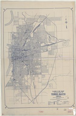
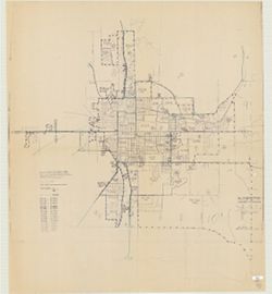
Topical Subject: Land use and Geographic Subject: Terre Haute (Ind.)
Creator:
Indiana. Governor's Commission on Unemployment Relief
Publisher:
Indiana. Governor's Commission on Unemployment Relief
Date Created:
1935
Identifier:
VAC3073-M-00366
Genre:
Thematic maps
Geographic Location:
Coordinates: W0872810 W0871636 N0393142 N0392405
Related URL:
Catalog URL: https://iucat.iu.edu/catalog/7511454
Abstract:
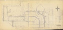
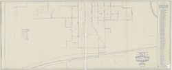
Blueline. "Project 84-F2-79.""This map shows the type of use of all land frontage. The Depth of Structures was disregarded. No attempt was mad...
Call Number:
G4094.T4G4 1935 .I53
Caption:
Imprint: [Indianapolis?] : Governor's Commission on Unemployment Relief, [1935?]
Physical Description:
Dimensions: 121 x 86 cm and Scale: Approximately 1:18,200
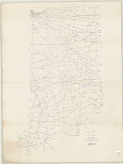
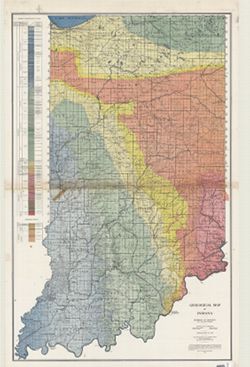
Geographic Subject: Indiana and Topical Subject: Geology
Creator:
Indiana. Division of Geology
Publisher:
Indiana. Department of Conservation
Date Created:
1932
Identifier:
VAC3073-M-00989
Genre:
Geological maps
Geographic Location:
Coordinates: W0870000 W0850000 N0410000 N0380000
Related URL:
Catalog URL: https://iucat.iu.edu/catalog/2849159
Abstract:
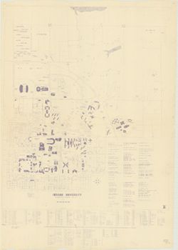
"Conservation Commission, Stanley Coulter, Chairman." "The based used...is the Ryse map, which has been modified." Includes geologic cros...
Call Number:
G4091.C5 1932 .I53
Caption:
Imprint: [Indianapolis] : Dept. of Conservation, State of Indiana, 1932.
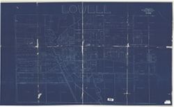
Geographic Subject: Bloomington (Ind.), Geographic Subject: Monroe County (Ind.), and Topical Subject: Census districts
Creator:
United States. Bureau of the Census
Publisher:
United States. Bureau of the Census
Date Created:
1974
Identifier:
VAC3073-M-00892
Genre:
Census data and Thematic maps
Geographic Location:
Coordinates: W0864108 W0861902 N0392120 N0385926
Related URL:
Catalog URL: https://iucat.iu.edu/catalog/5300402
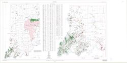
Abstract:
Blue line print. Shows 1970 census enumeration districts and census tracts for Bloomington, Ind. "Traced from map no. 68-A-8776." "70-...
Call Number:
G4094.B5 E25 1970 .U5
Caption:
Imprint: [Jeffersonville, Ind.] : Bureau of the Census, [1974?]