
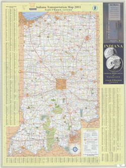
Search Constraints
« Previous |
1 - 100 of 8,218
|
Next »
Search Results
-
- Subject:
- Geographic Subject: Indianapolis (Ind.), Topical Subject: Roads, Topical Subject: Central business districts, and Geographic Subject: Indiana
- Creator:
- Indiana. Department of Transportation
- Publisher:
- Indiana. Department of Transportation
- Date Created:
- 2011
- Identifier:
- VAC3073-M-01235
- Genre:
- Road maps
- Geographic Location:
- Coordinates: W0880500 W0844700 N0414500 N0374600
- Related URL:
- Catalog URL: https://iucat.iu.edu/catalog/a18406192
- Abstract:
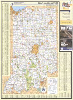
- Panel title: Indiana, 2011/2012, taking major moves forward. Includes indexes, note, and color illustrations. Text, indexed map of "Downtown Indianapoli...
- Call Number:
- G1403 .S7 2011-2012
- Caption:
- Imprint: [Indianapolis] : Indiana Department of Transportation, [2011]
- Physical Description:
- Dimensions: 94 x 59 cm and Scale: Approximately 1:550,000
- Alternate Identifier:
- Title Control Number: a18406192
- Persistent URL:
- https://purl.dlib.indiana.edu/iudl/images/VAC3073/VAC3073-M-01235
- Provenance:
- Indiana state highway system
-
- Subject:
- Topical Subject: Roads, Geographic Subject: Indianapolis (Ind.), Topical Subject: Central business districts, and Geographic Subject: Indiana
- Creator:
- Indiana. Department of Transportation. Graphic Engineering Division
- Publisher:
- Indiana. Department of Transportation
- Date Created:
- 2009
- Identifier:
- VAC3073-M-01234
- Genre:
- Road maps
- Geographic Location:
- Coordinates: W0880500 W0844700 N0414500 N0374600
- Related URL:
- Catalog URL: https://iucat.iu.edu/catalog/18406189
- Abstract:
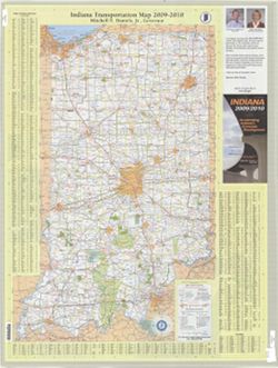
- Panel title: Indiana, 2009/2010, accelerating Indiana's economic development. Includes indexes, note, and color illustrations. Text, indexed map of "...
- Call Number:
- G1403 .S7 2009-2010
- Caption:
- Imprint: Indianapolis, Ind. : Indiana Department of Transportation, [2009]
- Physical Description:
- Scale: Approximately 1:560,000 and Dimensions: 94 x 59 cm
- Alternate Identifier:
- Title Control Number: a18406189
- Persistent URL:
- https://purl.dlib.indiana.edu/iudl/images/VAC3073/VAC3073-M-01234
- Provenance:
- Indiana state highway system
-
- Subject:
- Topical Subject: Roads and Geographic Subject: Indiana
- Publisher:
- Northwood Map Publishers
- Date Created:
- 2009
- Identifier:
- VAC3073-M-01009
- Genre:
- Tourist maps and Road maps
- Related URL:
- Catalog URL: https://iucat.iu.edu/catalog/1241312
- Abstract:
- Color maps on sheet 90 x 56cm. Folded to 23 x 10cm.
- Call Number:
- G4091.E635 .N67 2009
- Caption:
- Imprint: Boulder Junction, WI: Northwood Map Publishers. N.d.
- Physical Description:
- Dimensions: on sheet 90 x 56 cm and Scale: Scales differ.
- Alternate Identifier:
- Title Control Number: AKN4374BB
- Persistent URL:
- https://purl.dlib.indiana.edu/iudl/images/VAC3073/VAC3073-M-01009
- Provenance:
- Indiana Travel Map.
-
- Subject:
- Geographic Subject: Indiana, Topical Subject: Central business districts, Topical Subject: Roads, and Geographic Subject: Indianapolis (Ind.)
- Creator:
- Indiana. Department of Transportation. Graphic Engineering Division
- Publisher:
- Indiana. Department of Transportation
- Date Created:
- 2007
- Identifier:
- VAC3073-M-01232
- Genre:
- Road maps
- Geographic Location:
- Coordinates: W0880500 W0844700 N0414500 N0374600
- Related URL:
- Catalog URL: https://iucat.iu.edu/catalog/18406186
- Abstract:
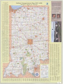
- Panel title: 2007/2008 Indiana, accelerate your business. Includes indexes, note, and color illustrations. Text, indexed map of "Downtown Indianapolis,&...
- Call Number:
- G1403 .S7 2007-2008
- Caption:
- Imprint: Indianapolis, Ind. : Indiana Department of Transportation, [2007]
- Physical Description:
- Dimensions: 94 x 59 cm and Scale: Approximately 1:560,000
- Alternate Identifier:
- Title Control Number: a18406186
- Persistent URL:
- https://purl.dlib.indiana.edu/iudl/images/VAC3073/VAC3073-M-01232
- Provenance:
- Indiana state highway system
-
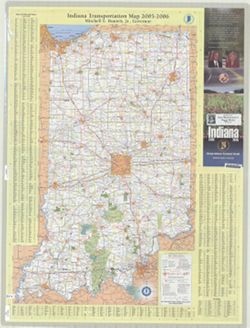
- Subject:
- Topical Subject: Roads, Topical Subject: Central business districts, Geographic Subject: Indianapolis (Ind.), and Geographic Subject: Indiana
- Creator:
- Indiana. Department of Transportation. Graphic Engineering Division
- Publisher:
- Indiana. Department of Transportation
- Date Created:
- 2005
- Identifier:
- VAC3073-M-01233
- Genre:
- Road maps
- Geographic Location:
- Coordinates: W0880500 W0844700 N0414500 N0374600
- Related URL:
- Catalog URL: https://iucat.iu.edu/catalog/18406187
- Abstract:
- Panel title: Indiana 2005-2006. Includes indexes, note, and color illustrations. Text, indexed map of "Downtown Indianapolis," 16 local route maps,...
- Call Number:
- G1403 .S7 2005-2006
- Caption:
- Imprint: [Indianapolis, Ind.] : distributed by State Representative Peggy Welch, District 60, [2005] and Imprint: Indianapolis, Ind. : Indiana Department of ...
- Physical Description:
- Scale: Approximately 1:560,000 and Dimensions: 94 x 59 cm
- Alternate Identifier:
- Title Control Number: a18406187
- Persistent URL:
- https://purl.dlib.indiana.edu/iudl/images/VAC3073/VAC3073-M-01233
- Provenance:
- Indiana state highway system
-
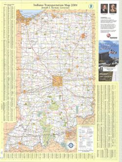
- Subject:
- Geographic Subject: Indiana, Topical Subject: Central business districts, Geographic Subject: Indianapolis (Ind.), and Topical Subject: Roads
- Creator:
- Indiana. Department of Transportation. Graphic Engineering Division
- Publisher:
- Indiana. Department of Transportation
- Date Created:
- 2004
- Identifier:
- VAC3073-M-01231
- Genre:
- Road maps
- Geographic Location:
- Coordinates: W0880500 W0844700 N0414500 N0374600
- Related URL:
- Catalog URL: https://iucat.iu.edu/catalog/18406184
- Abstract:
- Panel title: Indiana 2004. Includes indexes, note, and color illustrations. Text, indexed map of "Downtown Indianapolis," 16 local route maps, dist...
- Call Number:
- G1403 .S7 2004
- Caption:
- Imprint: [Indianapolis, Ind.] : distributed by State Representative Markt Lytle, District 69, [2004] and Imprint: Indianapolis, Ind. : Indiana Department of ...
- Physical Description:
- Scale: Approximately 1:560,000 and Dimensions: 94 x 59 cm
- Alternate Identifier:
- Title Control Number: a18406184
- Persistent URL:
- https://purl.dlib.indiana.edu/iudl/images/VAC3073/VAC3073-M-01231
- Provenance:
- Indiana state highway system
-
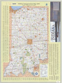
- Subject:
- Topical Subject: Roads, Geographic Subject: Indiana, Geographic Subject: Indianapolis (Ind.), and Topical Subject: Central business districts
- Creator:
- Indiana. Department of Transportation. Graphic Engineering Division
- Publisher:
- Indiana. Department of Transportation
- Date Created:
- 2003
- Identifier:
- VAC3073-M-01230
- Genre:
- Road maps
- Geographic Location:
- Coordinates: W0880500 W0844700 N0414500 N0374600
- Related URL:
- Catalog URL: https://iucat.iu.edu/catalog/18406179
- Abstract:
- Panel title: 2003 Indiana : Lewis & Clark ... a bicentennial celebration 1803-2003. Includes indexes, note, and color illustrations. Text, indexed map of...
- Call Number:
- G1403 .S7 2003
- Caption:
- Imprint: Indianapolis, Ind. : Indiana Department of Transportation, [2003]
- Physical Description:
- Scale: Approximately 1:560,000 and Dimensions: 94 x 59 cm
- Alternate Identifier:
- Title Control Number: a18406179
- Persistent URL:
- https://purl.dlib.indiana.edu/iudl/images/VAC3073/VAC3073-M-01230
- Provenance:
- Indiana state highway system
-
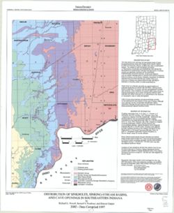
- Subject:
- Topical Subject: Caves, Geographic Subject: Indiana, Topical Subject: Springs, Topical Subject: Sinkholes, and Topical Subject: Karst
- Creator:
- Powell, Richard L.
- Publisher:
- Indiana. Geological Survey
- Date Created:
- 2002
- Identifier:
- VAC3073-M-00135
- Genre:
- Geological maps
- Geographic Location:
- Coordinates: W0870002 W0854608 N0394722 N0375826
- Related URL:
- Catalog URL: https://iucat.iu.edu/catalog/5325676
- Abstract:
- "This map data was compiled in 1997 from information available at the time, but was unpublished until until 2002, the map does not reflect any changes i...
- Call Number:
- G4091.C28 1997 .P69
- Caption:
- Imprint: [Bloomington, Ind.] : Indiana Geological Survey, 2002.
- Physical Description:
- Scale: 1:250,000 and Dimensions: 82 x 42 cm
- Alternate Identifier:
- Title Control Number: a5325676
- Persistent URL:
- https://purl.dlib.indiana.edu/iudl/images/VAC3073/VAC3073-M-00135
-
- Subject:
- Topical Subject: Karst, Topical Subject: Sinkholes, Geographic Subject: Indiana, and Topical Subject: Caves
- Creator:
- Powell, Richard L.
- Publisher:
- Indiana. Geological Survey
- Date Created:
- 2002
- Identifier:
- VAC3073-M-00789
- Genre:
- Geological maps
- Geographic Location:
- Coordinates: W0854940 W0845820 N0392712 N0384033
- Related URL:
- Catalog URL: https://iucat.iu.edu/catalog/5325528
- Abstract:
- "This map data was compiled in 1997 from information available at the time, but was unpublished until until 2002, the map does not reflect any changes i...
- Call Number:
- G4091.C28 1997 .P694
- Caption:
- Imprint: [Bloomington, Ind.] : Indiana Geological Survey, 2002.
- Physical Description:
- Dimensions: 54 x 49 cm and Scale: 1:250,000
- Alternate Identifier:
- Title Control Number: a5325528
- Persistent URL:
- https://purl.dlib.indiana.edu/iudl/images/VAC3073/VAC3073-M-00789
-
- Subject:
- Geographic Subject: Indiana, Topical Subject: Roads, Geographic Subject: Indianapolis (Ind.), and Topical Subject: Central business districts
- Creator:
- Indiana. Department of Transportation. Graphic Engineering Division
- Publisher:
- Indiana. Department of Transportation
- Date Created:
- 2002
- Identifier:
- VAC3073-M-01229
- Genre:
- Road maps
- Geographic Location:
- Coordinates: W0880500 W0844700 N0414500 N0374600
- Related URL:
- Catalog URL: https://iucat.iu.edu/catalog/18406172
- Abstract:
- Description based on: 1997-1998. Includes indexes and note. Text, indexed map of "Downtown Indianapolis," 16 local route maps, distance table, inde...
- Call Number:
- G1403 .S7 2002
- Caption:
- Imprint: Indianapolis, Ind. : Indiana Department of Transportation, [2002]
- Physical Description:
- Scale: Approximately 1:560,000 and Dimensions: 94 x 59 cm
- Alternate Identifier:
- Title Control Number: a18406172
- Persistent URL:
- https://purl.dlib.indiana.edu/iudl/images/VAC3073/VAC3073-M-01229
- Provenance:
- Indiana state highway system
-

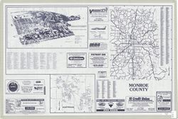
- Subject:
- Geographic Subject: Bloomington (Ind.), Geographic Subject: Indiana University, Bloomington, and Topical Subject: Indiana University, Bloomington
- Publisher:
- Bloomington/Monroe County Convention and Visitors Bureau
- Date Created:
- 2002
- Identifier:
- VAC3073-M-00961
- Genre:
- Tourist maps
- Geographic Location:
- Coordinates: W0863532 W0862816 N0391315 N0390716
- Related URL:
- Catalog URL: https://iucat.iu.edu/catalog/5325502
- Abstract:
- Includes distance map on map panel and indexes for the Bloomington and Indiana University, Bloomington campus maps. "Breakaway to Bloomington, Indian...
- Call Number:
- G4094.B5 E635 2002 .B5
- Caption:
- Imprint: [Bloomington, Ind.] : [Bloomington/Monroe County Convention and Visitors Bureau], [2002?]
- Physical Description:
- Dimensions: 46 x 43 cm and Scale: Scales differ.
- Alternate Identifier:
- Title Control Number: a5325502
- Persistent URL:
- https://purl.dlib.indiana.edu/iudl/images/VAC3073/VAC3073-M-00961
-
- Subject:
- Geographic Subject: Indiana University, Bloomington, Topical Subject: Indiana University, Bloomington, Geographic Subject: Bloomington (Ind.), Geographic Sub...
- Creator:
- Merchant Maps (Firm)
- Publisher:
- Merchant Maps (Firm)
- Date Created:
- 2002
- Identifier:
- VAC3073-M-00984
- Genre:
- Maps
- Geographic Location:
- Coordinates: W0864108 W0861902 N0392120 N0385926
- Related URL:
- Catalog URL: https://iucat.iu.edu/catalog/5106784
- Abstract:
- Includes advertisements and indexes to city and campus maps.
- Call Number:
- G4093.M7 2002 .M4
- Caption:
- Imprint: Cincinnati, Ohio : Mass Marketing Inc., Merchant Maps Division, [2002]
- Physical Description:
- Scale: Scale not given. and Dimensions: 62 x 56 cm or smaller, sheet 59 x 89 cm
- Alternate Identifier:
- Title Control Number: a5106784
- Persistent URL:
- https://purl.dlib.indiana.edu/iudl/images/VAC3073/VAC3073-M-00984
-
- Subject:
- Topical Subject: Aerial photographs and Geographic Subject: Monroe County (Ind.)
- Publisher:
- [U.S. Dept. of Agriculture] Aerial Photography Field Office
- Date Created:
- 2001
- Identifier:
- VAC3073-M-00902
- Genre:
- Index maps
- Geographic Location:
- Coordinates: W0864500 W0861500 N0392230 N0385230
- Related URL:
- Catalog URL: http://www.iucat.iu.edu/uhtbin/cgisirsi/x/0/0/57/20/G4093.M7A43+1992+.N38/1/X30000078543158?user_id=WEBSERVER
- Abstract:
- Blue line print. Shows the center point of each photograph.
- Call Number:
- G4093.M7A43 1992 .N38
- Caption:
- Imprint: Salt Lake City, Utah : [U.S. Dept. of Agriculture] Aerial Photography Field Office, [2001]
- Physical Description:
- Scale: 1:100,000 and Dimensions: 59 x 52 cm, on sheet 67 x 107
- Alternate Identifier:
- Title Control Number: a5019407
- Persistent URL:
- https://purl.dlib.indiana.edu/iudl/images/VAC3073/VAC3073-M-00902
- Provenance:
- Monroe County Indiana: line index to aerial photography
-
- Subject:
- Geographic Subject: Indiana, Topical Subject: Roads, Topical Subject: Central business districts, and Geographic Subject: Indianapolis (Ind.)
- Creator:
- Indiana. Department of Transportation. Graphic Engineering Division
- Publisher:
- Indiana. Department of Transportation
- Date Created:
- 2001
- Identifier:
- VAC3073-M-01228
- Genre:
- Road maps
- Geographic Location:
- Coordinates: W0880500 W0844700 N0414500 N0374600
- Related URL:
- Catalog URL: https://iucat.iu.edu/catalog/18406168
- Abstract:
- Panel title: Indiana 2001. Includes indexes and note. Text, indexed map of "Downtown Indianapolis," 16 local route maps, distance table, index to p...
- Call Number:
- G1403 .S7 2001
- Caption:
- Imprint: Indianapolis, Ind. : Indiana Dept. of Transportation, [2001]
- Physical Description:
- Dimensions: 94 x 59 cm and Scale: Approximately 1:560,000
- Alternate Identifier:
- Title Control Number: a18406168
- Persistent URL:
- https://purl.dlib.indiana.edu/iudl/images/VAC3073/VAC3073-M-01228
- Provenance:
- Indiana state highway system
-

- Subject:
- Topical Subject: Subsurface drainage, Topical Subject: Groundwater, Geographic Subject: Indiana, and Topical Subject: Pollution
- Creator:
- Frushour, Samuel S.
- Publisher:
- Indiana. Geological Survey
- Date Created:
- 2000
- Identifier:
- VAC3073-M-00844
- Genre:
- Thematic maps
- Geographic Location:
- Coordinates: W0865700 W0855900 N0393800 N0375400
- Related URL:
- Catalog URL: https://iucat.iu.edu/catalog/4898418
- Abstract:
- Digital cartogrpahy by Kimberly H. Sowder." Includes index map and text: Abstract and "Sources of subsurface dye trace information."
- Call Number:
- G4091 .C34 2000 .F7
- Caption:
- Imprint: Bloomington, Ind. : Indiana Geological Survey, 2000.
- Physical Description:
- Dimensions: 19 x 19 cm or smaller, on sheet 58 x 92 cm and Scale: 1:500,000
- Alternate Identifier:
- Title Control Number: a4898418
- Persistent URL:
- https://purl.dlib.indiana.edu/iudl/images/VAC3073/VAC3073-M-00844
-
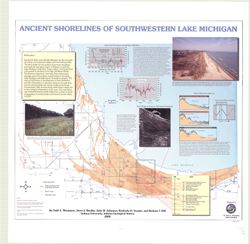
- Subject:
- Geographic Subject: Porter County (Ind.), Geographic Subject: Indiana, Geographic Subject: Michigan, Lake, Coast (Ind.), Topical Subject: Lakes, Topical Subj...
- Creator:
- Thompson, Todd A. (Todd Alan), 1959-
- Publisher:
- Indiana. Geological Survey
- Date Created:
- 2000
- Identifier:
- VAC3073-M-00193
- Genre:
- Thematic maps
- Geographic Location:
- Coordinates: W0873136 W0871307 N0414539 N0410943
- Related URL:
- Catalog URL: https://iucat.iu.edu/catalog/4898581
- Abstract:
- Includes illustrations, text, graphs showing "Lake-level fluctuations over the past 4,700 years" and a timeline showing historical events since 116...
- Call Number:
- G4093 .L3C2 2000 .T486
- Caption:
- Imprint: [Bloomington, Ind.] : Indiana University, Indiana Geological Survey, 2000.
- Physical Description:
- Dimensions: 76 x 87 cm and Scale: 1:59,000
- Alternate Identifier:
- Title Control Number: a4898581
- Persistent URL:
- https://purl.dlib.indiana.edu/iudl/images/VAC3073/VAC3073-M-00193
-
- Subject:
- Topical Subject: Hiking, Topical Subject: Trails, Geographic Subject: Knobstone Trail (Ind.), and Geographic Subject: Indiana
- Creator:
- Indiana. Department of Natural Resources
- Publisher:
- Indiana. Department of Natural Resources
- Date Created:
- 2000
- Identifier:
- VAC3073-M-00870
- Genre:
- Maps
- Geographic Location:
- Coordinates: W0860302 W0855053 N0384420 N0383425
- Related URL:
- Catalog URL: https://iucat.iu.edu/catalog/4967263
- Abstract:
- Relief shown by contours and spot heights. Panel title. Base 7.5 minute U.S.G.S. topographic quads. Includes text.
- Call Number:
- G4092.K6E63 2000 .I53
- Caption:
- Imprint: Indianapolis, IN : Dept. of Natural Resources, 2000.
- Physical Description:
- Dimensions: 71 x 44 cm and Scale: 1:31,680
- Alternate Identifier:
- Title Control Number: a4967263
- Persistent URL:
- https://purl.dlib.indiana.edu/iudl/images/VAC3073/VAC3073-M-00870
-
- Subject:
- Topical Subject: Names, Topical Subject: Indians of North America, Topical Subject: Names, Geographical, and Geographic Subject: Indiana
- Creator:
- Guernsey, E. Y.
- Publisher:
- [The Dept.?]
- Date Created:
- 2000
- Identifier:
- VAC3073-M-00947
- Genre:
- Thematic maps
- Geographic Location:
- Coordinates: W0880700 W0844500 N0414500 N0375200
- Related URL:
- Catalog URL: https://iucat.iu.edu/catalog/5327631
- Abstract:
- Xerographic copy.
- Call Number:
- G4091.E1 1968 .G8 2000
- Caption:
- Imprint: [Indianapolis?] : [The Dept?], [200-?]
- Physical Description:
- Dimensions: 79 x 58 cm and Scale: Scale not given.
- Alternate Identifier:
- Title Control Number: a5327631
- Persistent URL:
- https://purl.dlib.indiana.edu/iudl/images/VAC3073/VAC3073-M-00947
-
- Subject:
- Geographic Subject: Indiana and Topical Subject: Coal mines and mining
- Publisher:
- Indiana. Geological Survey
- Date Created:
- 2000
- Identifier:
- VAC3073-M-00283
- Genre:
- Geological maps
- Related URL:
- Catalog URL: https://iucat.iu.edu/catalog/4898390
- Abstract:
- "Minde data compilation complete through October 1997." "All mine data shown on this map are recompiled by IGS personnel as part of the Co...
- Call Number:
- G4091 .H9 2000 .E386
- Caption:
- Imprint: [Bloomington?] : Indiana Geological Survey, 2000.
- Physical Description:
- Scale: 1:400,000 and Dimensions: 82 x 44 cm
- Alternate Identifier:
- Title Control Number: a4898390
- Persistent URL:
- https://purl.dlib.indiana.edu/iudl/images/VAC3073/VAC3073-M-00283
- Provenance:
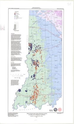
- Map of southwestern Indiana showing locations of surface and underground coal mines
-
- Subject:
- Geographic Subject: Indianapolis (Ind.), Topical Subject: Central business districts, Topical Subject: Roads, and Geographic Subject: Indiana
- Creator:
- Indiana. Department of Transportation. Graphic Engineering Division
- Publisher:
- Indiana. Department of Transportation
- Date Created:
- 2000
- Identifier:
- VAC3073-M-01227
- Genre:
- Road maps
- Geographic Location:
- Coordinates: W0880500 W0844700 N0414500 N0374600
- Related URL:
- Catalog URL: https://iucat.iu.edu/catalog/18406162
- Abstract:
- Panel title: Indiana 2000 : racing into the--millennium! Includes indexes, indexes to points of interest, distance table, and list of state police phone numb...
- Call Number:
- G1403 .S7 2000
- Caption:
- Imprint: Indianapolis, Ind. : Indiana Department of Transportation, [2000]
- Physical Description:
- Dimensions: 94 x 59 cm and Scale: Approximately 1:650,000
- Alternate Identifier:
- Title Control Number: a18406162
- Persistent URL:
- https://purl.dlib.indiana.edu/iudl/images/VAC3073/VAC3073-M-01227
- Provenance:
- Indiana state highway system
-
- Subject:
- Geographic Subject: Indianapolis (Ind.) and Topical Subject: Buildings
- Creator:
- Palmatary, J. T. (James T.)
- Publisher:
- Indiana Historical Society
- Date Created:
- 1998
- Identifier:
- VAC3073-M-00275
- Genre:
- Pictorial maps and Aerial views
- Geographic Location:
- Coordinates: W0861941 W0855614 N0395538 N0393755
- Related URL:
- Catalog URL: https://iucat.iu.edu/catalog/16151789
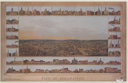
- Abstract:
- Panorama. Shows "view of Indianapolis from the top of the Asylum for the Blind." "Though credited...as being 'drawn from nature' by E....
- Call Number:
- G4094 .I4A35 1854 .P35 1998
- Caption:
- Imprint: Indianapolis : Indiana Historical Society, [1998]
- Physical Description:
- Dimensions: 30 x 65 cm, on sheet 58 x 92 cm and Scale: Not drawn to scale.
- Alternate Identifier:
- Title Control Number: a16151789 and Alternate ID: AE2098BB
- Persistent URL:
- https://purl.dlib.indiana.edu/iudl/images/VAC3073/VAC3073-M-00275
-
- Subject:
- Topical Subject: Oil fields, Geographic Subject: Indiana, and Topical Subject: Gas fields
- Creator:
- Cazee, J. T. (James T.)
- Publisher:
- Indiana. Geological Survey
- Date Created:
- 1998
- Identifier:
- VAC3073-M-00237
- Genre:
- Geological maps
- Geographic Location:
- W0880000 W0860000 N0395000 N0380000 and Coordinates: W0880700 W0844500 N0414500 N0375200
- Related URL:
- Catalog URL: https://iucat.iu.edu/catalog/4995550
- Abstract:
- "Compilation complete to December 1998." "Base map digitized from 1978 U.S. Geological Survey map of Indiana. Scale 1:500,000."
- Call Number:
- G4091.H8 1998 .C3
- Caption:
- Imprint: Bloomington : Indiana Geological Survey, 1998.
- Physical Description:
- Scale: 1:550,000, 1:1:275,000, and Dimensions: 83 x 150 cm
- Alternate Identifier:
- Title Control Number: a4995550
- Persistent URL:
- https://purl.dlib.indiana.edu/iudl/images/VAC3073/VAC3073-M-00237
-
- Subject:
- Geographic Subject: Indiana and Topical Subject: Roads
- Creator:
- Northwood Map Publishers
- Publisher:
- Northwood Map Publishers
- Date Created:
- 1998
- Identifier:
- VAC3073-M-00361
- Genre:
- Road maps and Tourist maps
- Geographic Location:
- Coordinates: W0880700 W0844500 N0414500 N0375200
- Related URL:
- Catalog URL: https://iucat.iu.edu/catalog/1266869
- Abstract:
- Includes index of cities. Advertisements, "Harvest calendar" and descriptive indexes to "Roadside markets and u-pick farms", "Train ...
- Call Number:
- G4091 .E635 1998 .N678
- Caption:
- Imprint: Boulder Junction, WI : Northwood Map Publishers, [1998?]
- Physical Description:
- Scale: 1:530,000 and Dimensions: 84 x 54 cm
- Alternate Identifier:
- Title Control Number: AKT7034BB
- Persistent URL:
- https://purl.dlib.indiana.edu/iudl/images/VAC3073/VAC3073-M-00361
-

- Subject:
- Geographic Subject: Bloomington (Ind.) and Topical Subject: Bicycle trails
- Creator:
- Bloomington Bicycle & Pedestrian Safety Commission (Bloomington, Ind.)
- Publisher:
- Bloomington Bicycle & Pedestrian Safety Commission (Bloomington, Ind.)
- Date Created:
- 1998
- Identifier:
- VAC3073-M-00133
- Genre:
- Thematic maps
- Geographic Location:
- Coordinates: W0863135 W0863135 N0390955 N0390955
- Related URL:
- Catalog URL: https://iucat.iu.edu/catalog/1356301
- Abstract:
- Includes list of agencies to contact for further information and area bicycle shops. On verso: Downtown Bloomington bicycle map. Scale approximately 1:10,...
- Call Number:
- G4094.B5 E63 1998 .B56
- Caption:
- Imprint: [Bloomington, Indiana] : Bicycle and Pedestrian Safety Commission, 1998
- Physical Description:
- Scale: 1:36,000 and Dimensions: 38 x 42 cm, on sheet 44 x 53 cm
- Alternate Identifier:
- Title Control Number: ALM0430BB
- Persistent URL:
- https://purl.dlib.indiana.edu/iudl/images/VAC3073/VAC3073-M-00133
-
- Subject:
- Geographic Subject: Indiana, Topical Subject: Coal, and Topical Subject: Mines and mineral resources
- Creator:
- Shaffer, Nelson R.
- Publisher:
- Indiana. Geological Survey
- Date Created:
- 1998
- Identifier:
- VAC3073-M-00836
- Genre:
- Geological maps
- Geographic Location:
- Coordinates: W0880700 W0844500 N0414500 N0375200
- Related URL:
- Catalog URL: https://iucat.iu.edu/catalog/4640205
- Abstract:
- Includes pie chart and list of further reading. "1984 (Modified 1997)."
- Call Number:
- G4091.H5 1997 .S5
- Caption:
- Imprint: [Bloomington, Ind.] : Indiana Geological Survey, 1998.
- Physical Description:
- Scale: 1:500,000 and Dimensions: 97 x 72 cm
- Alternate Identifier:
- Title Control Number: ALN0867BB
- Persistent URL:
- https://purl.dlib.indiana.edu/iudl/images/VAC3073/VAC3073-M-00836
-
- Subject:
- Geographic Subject: Indiana and Topical Subject: Roads
- Creator:
- Indiana. Department of Transportation. Graphic Engineering Division
- Publisher:
- Indiana. Department of Transportation
- Date Created:
- 1997
- Identifier:
- VAC3073-M-01226
- Genre:
- Road maps
- Geographic Location:
- Coordinates: W0880500 W0844700 N0414500 N0374600
- Related URL:
- Catalog URL: https://iucat.iu.edu/catalog/18406157
- Abstract:
- Includes indexes, indexes to points of interest, distance table, and list of state police phone numbers. Text, indexed map of "Downtown Indianapolis,&qu...
- Call Number:
- G1403 .S7 1997-1998
- Caption:
- Imprint: Indianapolis, Ind. : Indiana Department of Transportation, [1997]
- Physical Description:
- Scale: Approximately 1:633,600 and Dimensions: 94 x 59 cm
- Alternate Identifier:
- Title Control Number: a18406157
- Persistent URL:
- https://purl.dlib.indiana.edu/iudl/images/VAC3073/VAC3073-M-01226
- Provenance:
- Indiana state highway system
-
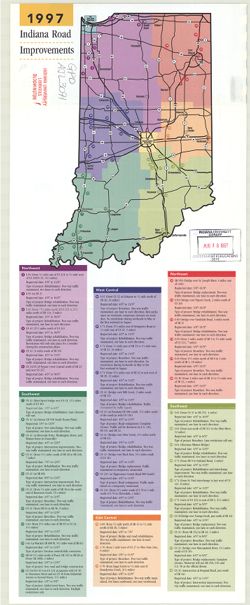
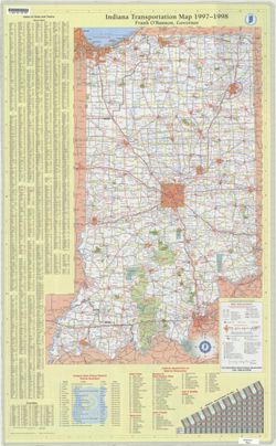
- Subject:
- Geographic Subject: Indiana, Topical Subject: Roads, and Topical Subject: Design and construction
- Creator:
- Indiana. Department of Transportation
- Publisher:
- Indiana. Department of Transportation
- Date Created:
- 1997
- Identifier:
- VAC3073-M-00089
- Genre:
- Road maps
- Geographic Location:
- Coordinates: W0880500 W0844700 N0414500 N0374600
- Related URL:
- Catalog URL: https://iucat.iu.edu/catalog/15973592
- Abstract:
- "Please note ... only major highway and interstate improvement projects are included in this brochure. Information is accurate as of February 1, 1997 a...
- Call Number:
- G4091 .P2 1997 .I5
- Caption:
- Imprint: Indianapolis, Ind. : Indiana Dept. of Transportation, [1997].
- Physical Description:
- Dimensions: 26 x 23 cm or smaller, sheet 59 x 23 cm and Scale: Scale not given.
- Alternate Identifier:
- Title Control Number: AJL3071BB
- Persistent URL:
- https://purl.dlib.indiana.edu/iudl/images/VAC3073/VAC3073-M-00089
-
- Subject:
- Topical Subject: Coal, Topical Subject: Geology, Stratigraphic, Topical Subject: Geology, and Geographic Subject: Posey County (Ind.)
- Creator:
- Ault, Curtis H.
- Publisher:
- Indiana. Geological Survey
- Date Created:
- 1997
- Identifier:
- VAC3073-M-00334
- Genre:
- Mine maps
- Geographic Location:
- Coordinates: W0880600 W0874100 N0381400 N0374600
- Related URL:
- Catalog URL: https://iucat.iu.edu/catalog/4995833
- Abstract:
- Coordinates printed at top and lower margin are incorrect. Includes index map, text, and sectionized township diagram.
- Call Number:
- G4093.P6 H9 1997 .A9
- Caption:
- Imprint: [Bloomington, Ind.] : Indiana University, Indiana Geological Survey, 1997.
- Physical Description:
- Dimensions: 86 x 79 cm and Scale: 1:66,000
- Alternate Identifier:
- Title Control Number: a4995833
- Persistent URL:
- https://purl.dlib.indiana.edu/iudl/images/VAC3073/VAC3073-M-00334
-

- Subject:
- Subject: Portraits and Itinerary: Gender
- Creator:
- Creator: Clark, Gracia and Photographer: Carmen Paz
- Date Created:
- 1995
- Identifier:
- VAB8060-0634
- Abstract:
- Woman at party for Gracia Clark
- Caption:
- Woman at party for Gracia Clark
- City:
- Kumasi
- Country:
- Ghana
- Physical Description:
- Slide
- Persistent URL:
- http://purl.dlib.indiana.edu/iudl/idah/kumasi/VAB8060-0634
-

- Subject:
- Subject: Research assistant and Subject: Portraits
- Creator:
- Creator: Clark, Gracia and Photographer: Carmen Paz
- Date Created:
- 1995
- Identifier:
- VAB8060-0341
- Abstract:
- Clark's research assistant and woman at Clark's party
- Caption:
- Clark's research assistant (left) at Clark's party
- City:
- Kumasi
- Country:
- Ghana
- Physical Description:
- Slide
- Persistent URL:
- http://purl.dlib.indiana.edu/iudl/idah/kumasi/VAB8060-0341
-

- Subject:
- Subject: Market traders and Itinerary: Gender
- Creator:
- Photographer: Carmen Paz and Creator: Clark, Gracia
- Date Created:
- 1995
- Identifier:
- VAB8060-0552
- Abstract:
- Traders at party for Gracia Clark
- Caption:
- Traders at party for Gracia Clark
- City:
- Kumasi
- Country:
- Ghana
- Physical Description:
- Slide
- Persistent URL:
- http://purl.dlib.indiana.edu/iudl/idah/kumasi/VAB8060-0552
-

- Subject:
- Subject: Portraits and Itinerary: Gender
- Creator:
- Creator: Clark, Gracia and Photographer: Carmen Paz
- Date Created:
- 1995
- Identifier:
- VAB8060-0393
- Abstract:
- Gracia with trader at a party for Gracia
- Caption:
- Gracia with trader at a party for Gracia
- City:
- Kumasi
- Country:
- Ghana
- Physical Description:
- Slide
- Persistent URL:
- http://purl.dlib.indiana.edu/iudl/idah/kumasi/VAB8060-0393
-

- Subject:
- Subject: Portraits and Itinerary: Gender
- Creator:
- Photographer: Carmen Paz and Creator: Clark, Gracia
- Date Created:
- 1995
- Identifier:
- VAB8060-0390
- Abstract:
- Clark with two traders at party
- Caption:
- Clark with two traders at party
- City:
- Kumasi
- Country:
- Ghana
- Physical Description:
- Slide
- Persistent URL:
- http://purl.dlib.indiana.edu/iudl/idah/kumasi/VAB8060-0390
-

- Subject:
- Subject: Market traders, Itinerary: Gender, and Subject: Portraits
- Creator:
- Creator: Clark, Gracia and Photographer: Carmen Paz
- Date Created:
- 1995
- Identifier:
- VAB8060-0633
- Abstract:
- Trader at party for Gracia Clark
- Caption:
- Trader at party for Gracia Clark
- City:
- Kumasi
- Country:
- Ghana
- Physical Description:
- Slide
- Persistent URL:
- http://purl.dlib.indiana.edu/iudl/idah/kumasi/VAB8060-0633
-
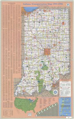
- Subject:
- Topical Subject: Roads and Geographic Subject: Indiana
- Creator:
- Indiana. Department of Transportation. Graphic Engineering Division
- Publisher:
- Indiana. Department of Transportation
- Date Created:
- 1995
- Identifier:
- VAC3073-M-01225
- Genre:
- Road maps
- Geographic Location:
- Coordinates: W0880500 W0844700 N0414500 N0374600
- Related URL:
- Catalog URL: https://iucat.iu.edu/catalog/18406154
- Abstract:
- Panel title: Indiana 1995-1996 transportation map. Includes indexes, text, color illustrations, distance table, "Map of the United States showing mileag...
- Call Number:
- G1403 .S7 1995-1996
- Caption:
- Imprint: [Indiana] : Indiana Department of Transportation, 1995.
- Physical Description:
- Scale: Approximately 1:633,600 and Dimensions: 94 x 59 cm
- Alternate Identifier:
- Title Control Number: a18406154
- Persistent URL:
- https://purl.dlib.indiana.edu/iudl/images/VAC3073/VAC3073-M-01225
- Provenance:
- Indiana state highway system
-
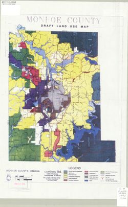
- Subject:
- Geographic Subject: Monroe County (Ind.) and Topical Subject: Land use
- Creator:
- Camiros, Ltd.
- Publisher:
- Camiros, Ltd.
- Date Created:
- 1995
- Identifier:
- VAC3073-M-00245
- Genre:
- Thematic maps
- Geographic Location:
- Coordinates: W0864108 W0861902 N0392120 N0385926
- Related URL:
- Catalog URL: https://iucat.iu.edu/catalog/5305992
- Call Number:
- G4093.M7 G4 1995 .C36
- Caption:
- Imprint: Indianapolis : Camiros Ltd., [1995?]
- Physical Description:
- Dimensions: 31 x 26 cm and Scale: 1:134,400
- Alternate Identifier:
- Title Control Number: a5305992
- Persistent URL:
- https://purl.dlib.indiana.edu/iudl/images/VAC3073/VAC3073-M-00245
-

- Subject:
- Subject: Market trader and Subject: Life histories
- Creator:
- Photographer: Gracia Clark and Creator: Clark, Gracia
- Date Created:
- 1994
- Identifier:
- VAB8060-0532
- Abstract:
- Kumasi trader narrating life history
- Caption:
- Kumasi trader narrating life history
- City:
- Kumasi
- Country:
- Ghana
- Physical Description:
- Slide
- Persistent URL:
- http://purl.dlib.indiana.edu/iudl/idah/kumasi/VAB8060-0532
-

- Subject:
- Subject: Portraits, Subject: Market traders, and Itinerary: Cloth
- Creator:
- Photographer: Carmen Paz and Creator: Clark, Gracia
- Date Created:
- 1994
- Identifier:
- VAB8060-0616
- Abstract:
- Clark with elderly cloth trader
- Caption:
- Clark with elderly cloth trader
- City:
- Kumasi
- Country:
- Ghana
- Physical Description:
- Slide
- Persistent URL:
- http://purl.dlib.indiana.edu/iudl/idah/kumasi/VAB8060-0616
-

- Subject:
- Subject: Yams, Itinerary: Women's groups, Itinerary: Gender, Itinerary: Yams, Subject: Queenmother, and Subject: Women's organizations
- Creator:
- Creator: Clark, Gracia and Photographer: Gracia Clark
- Date Created:
- 1994
- Identifier:
- VAB8060-0624
- Abstract:
- Cedep, Kumasi
- Caption:
- Yam queenmother at women's forum, Cedep, Kumasi
- City:
- Kumasi
- Country:
- Ghana
- Physical Description:
- Slide
- Persistent URL:
- http://purl.dlib.indiana.edu/iudl/idah/kumasi/VAB8060-0624
-
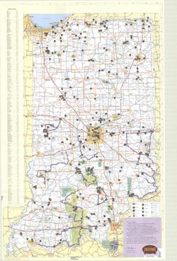
- Subject:
- Topical Subject: Roads, Geographic Subject: Indiana, and Topical Subject: Maintenance and repair
- Creator:
- Indiana. Department of Transportation
- Publisher:
- Indiana. Department of Transportation
- Date Created:
- 1994
- Identifier:
- VAC3073-M-00258
- Genre:
- Road maps and Thematic maps
- Geographic Location:
- Coordinates: W0880500 W0844700 N0414500 N0374600
- Related URL:
- Catalog URL: https://iucat.iu.edu/catalog/16151565
- Abstract:
- "Please note...only major highway and interstate improvement projects are included in this brochure. Information contained is accurate as of February 1,...
- Call Number:
- G4091 .P2 1994 .I5
- Caption:
- Imprint: [Indianapolis] : Indiana Dept. of Transportation, [1994?]
- Physical Description:
- Scale: Scale not given. and Dimensions: 29 x 19 cm, on sheet 44 x 28 cm
- Alternate Identifier:
- Title Control Number: a16151565 and Alternate ID: AHC7671BB
- Persistent URL:
- https://purl.dlib.indiana.edu/iudl/images/VAC3073/VAC3073-M-00258
-
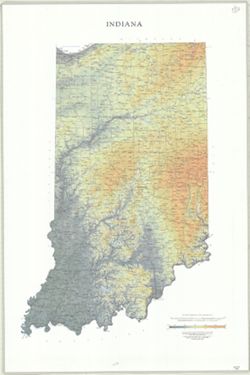
- Subject:
- Geographic Subject: Indiana
- Creator:
- Allan Cartography (Firm)
- Publisher:
- Raven Maps & Images
- Date Created:
- 1994
- Identifier:
- VAC3073-M-00323
- Genre:
- Physical maps
- Geographic Location:
- Coordinates: W0890000 W0840000 N0420000 N0370000
- Related URL:
- Catalog URL: https://iucat.iu.edu/catalog/16178055
- Abstract:
- Relief shown by shading, gradient tints, and spot heights.
- Call Number:
- G4090 1994 .A4
- Caption:
- Imprint: [Medford] : Raven Maps & Images, [1994]
- Physical Description:
- Dimensions: on sheet 111 x 74 cm and Scale: 1:500,000. 1 in. = approximately 8 miles. 1 centimeter = 5 kilometers.
- Alternate Identifier:
- Title Control Number: a16178055 and Alternate ID: AGU5765BB
- Persistent URL:
- https://purl.dlib.indiana.edu/iudl/images/VAC3073/VAC3073-M-00323
-
- Subject:
- Topical Subject: Roads and Geographic Subject: Indiana
- Creator:
- Indiana. Department of Transportation. Division of Program Development
- Publisher:
- Indiana. Department of Transportation
- Date Created:
- 1993
- Identifier:
- VAC3073-M-01217
- Genre:
- Road maps
- Geographic Location:
- Coordinates: W0880500 W0844700 N0414500 N0374600
- Related URL:
- Catalog URL: https://iucat.iu.edu/catalog/18406105
- Abstract:
- Panel title: Indiana state highway map, 1993-1994. Includes indexes to cities and towns and counties, mileage chart, state police telephone directory, travel...
- Call Number:
- G1403 .S7 1993-1994
- Caption:
- Imprint: [Indianapolis]. : Indiana Department of Transportation, [1993]
- Physical Description:
- Scale: Approximately 1:633,600 and Dimensions: 94 x 59 cm
- Alternate Identifier:
- Title Control Number: a18406105
- Persistent URL:
- https://purl.dlib.indiana.edu/iudl/images/VAC3073/VAC3073-M-01217
- Provenance:
- Indiana state highway system
-
- Subject:
- Geographic Subject: Indiana
- Creator:
- Geological Survey (U.S.)
- Publisher:
- The Survey
- Date Created:
- 1992
- Identifier:
- VAC3073-M-01035
- Genre:
- Index maps and Topographic maps
- Geographic Location:
- Coordinates: W0880000 W0850000 N0410000 N0380000
- Related URL:
- Catalog URL: https://iucat.iu.edu/catalog/3789391
- Abstract:
- "This index is designed to inform map users of the various map series, special maps, and map byproducts produced and distributed by the U.S. Geological ...
- Call Number:
- G4091.A2 1992 .G4
- Caption:
- Imprint: Reston, Va. : The Survey and Imprint: Denver, Colo. : Map Distribution, [1992]
- Physical Description:
- Dimensions: 130 x 81 cm and Scale: 1:24,000
- Alternate Identifier:
- Title Control Number: BMX1897NW
- Persistent URL:
- https://purl.dlib.indiana.edu/iudl/images/VAC3073/VAC3073-M-01035
-
- Subject:
- Geographic Subject: Gaston (Ind.), Geographic Subject: Albany (Ind.), Geographic Subject: Eaton (Ind.), Geographic Subject: Royerton (Ind.), Geographic Subje...
- Creator:
- Universal Map Enterprises
- Publisher:
- Universal Map Enterprises
- Date Created:
- 1992
- Identifier:
- VAC3073-M-00090
- Genre:
- Maps
- Geographic Location:
- Coordinates: W0852716 W0851914 N0401426 N0400856
- Related URL:
- Catalog URL: https://iucat.iu.edu/catalog/6438607
- Abstract:
- "12/92." Indexed. Ancillary maps on verso: Delaware County, Indiana -- Ball State University Campus Map -- Yorktown -- Albany -- Selma -- Eaton -- ...
- Call Number:
- G4094.M9 1992 .U5
- Caption:
- Imprint: Muncie, Ind. : [Distributed by] First Merchants Bank, [1992]. and Imprint: E. Lansing, Mich. : Universal Map Enterprises
- Physical Description:
- Dimensions: 61 x 70 cm and Scale: Approximately 1:17,600
- Alternate Identifier:
- Title Control Number: a6438607
- Persistent URL:
- https://purl.dlib.indiana.edu/iudl/images/VAC3073/VAC3073-M-00090
-

- Subject:
- Subject: Portraits
- Creator:
- Photographer: Carmen Paz and Creator: Clark, Gracia
- Date Created:
- 1991
- Identifier:
- VAB8060-0347
- Abstract:
- Clark with Auntie and her extended family
- Caption:
- Clark with Auntie and her extended family
- City:
- Kumasi
- Country:
- Ghana
- Physical Description:
- Slide
- Persistent URL:
- http://purl.dlib.indiana.edu/iudl/idah/kumasi/VAB8060-0347
-

- Subject:
- Subject: Portraits
- Creator:
- Creator: Clark, Gracia and Photographer: Carmen Paz
- Date Created:
- 1991
- Identifier:
- VAB8060-0346
- Abstract:
- Clark with Auntie and her extended family
- Caption:
- Clark with Auntie and her extended family
- City:
- Kumasi
- Country:
- Ghana
- Physical Description:
- Slide
- Persistent URL:
- http://purl.dlib.indiana.edu/iudl/idah/kumasi/VAB8060-0346
-

- Subject:
- Itinerary: Gender, Subject: Yams, Subject: Yam ceremony, and Itinerary: Yams
- Creator:
- Creator: Clark, Gracia and Photographer: Gracia Clark
- Date Created:
- 1991
- Identifier:
- VAB8060-0689
- Abstract:
- A policeman (on left) and Kwansohemma (on right)
- Caption:
- Two elders at yam ceremony
- City:
- Kumasi
- Country:
- Ghana
- Physical Description:
- Slide
- Persistent URL:
- http://purl.dlib.indiana.edu/iudl/idah/kumasi/VAB8060-0689
-

- Subject:
- Subject: Yams, Itinerary: Yams, Itinerary: Gender, and Subject: queenmother
- Creator:
- Photographer: Gracia Clark and Creator: Clark, Gracia
- Date Created:
- 1991
- Identifier:
- VAB8060-0464
- Abstract:
- Yam queenmother at her home, Kumasi
- Caption:
- Yam queenmother at her home, Kumasi
- City:
- Kumasi
- Country:
- Ghana
- Physical Description:
- Slide
- Persistent URL:
- http://purl.dlib.indiana.edu/iudl/idah/kumasi/VAB8060-0464
-

- Subject:
- Subject: Yams, Itinerary: Yams, Subject: Yam ceremony, and Subject: Queenmother
- Creator:
- Photographer: Gracia Clark and Creator: Clark, Gracia
- Date Created:
- 1991
- Identifier:
- VAB8060-0571
- Abstract:
- Yam queenmother pours libation at New Yam ceremony
- Caption:
- Yam queenmother pours libation at New Yam ceremony
- City:
- Kumasi
- Country:
- Ghana
- Physical Description:
- Slide
- Persistent URL:
- http://purl.dlib.indiana.edu/iudl/idah/kumasi/VAB8060-0571
-

- Subject:
- Subject: Yams, Itinerary: Gender, Itinerary: Yams, Subject: Queenmother, and Subject: Yam ceremony
- Creator:
- Photographer: Gracia Clark and Creator: Clark, Gracia
- Date Created:
- 1991
- Identifier:
- VAB8060-0575
- Abstract:
- Yam queenmother pours libation at new yam ceremony
- Caption:
- Yam queenmother pours libation at new yam ceremony
- City:
- Kumasi
- Country:
- Ghana
- Physical Description:
- Slide
- Persistent URL:
- http://purl.dlib.indiana.edu/iudl/idah/kumasi/VAB8060-0575
-

- Subject:
- Subject: Queenmother, Itinerary: Yams, Subject: Yam ceremony, and Subject: Yams
- Creator:
- Creator: Clark, Gracia and Photographer: Gracia clark
- Date Created:
- 1991
- Identifier:
- VAB8060-0572
- Abstract:
- in yam shed, Kumasi Central Market
- Caption:
- Yam queenmother with elders at yam ceremony
- City:
- Kumasi
- Country:
- Ghana
- Physical Description:
- Slide
- Persistent URL:
- http://purl.dlib.indiana.edu/iudl/idah/kumasi/VAB8060-0572
-

- Subject:
- Subject: Queenmother, Subject: Yam ceremony, Itinerary: Yams, Subject: Yams, and Itinerary: Gender
- Creator:
- Photographer: Gracia Clark and Creator: Clark, Gracia
- Date Created:
- 1991
- Identifier:
- VAB8060-0576
- Abstract:
- Yam queenmother pours libation at new yam ceremony
- Caption:
- Yam queenmother pours libation at new yam ceremony
- City:
- Kumasi
- Country:
- Ghana
- Physical Description:
- Slide
- Persistent URL:
- http://purl.dlib.indiana.edu/iudl/idah/kumasi/VAB8060-0576
-

- Subject:
- Itinerary: Kids and Subject: Portraits
- Creator:
- Creator: Clark, Gracia and Photographer: Carmen Paz
- Date Created:
- 1991
- Identifier:
- VAB8060-0391
- Abstract:
- Gracia Clark with her namesake, Gracia
- Caption:
- Gracia Clark with her namesake, Gracia
- City:
- Kumasi
- Country:
- Ghana
- Physical Description:
- Slide
- Persistent URL:
- http://purl.dlib.indiana.edu/iudl/idah/kumasi/VAB8060-0391
-

- Subject:
- Subject: Memorial rites & ceremonies, Itinerary: Gender, and Subject: Memorial service
- Creator:
- Photographer: Gracia Clark and Creator: Clark, Gracia
- Date Created:
- 1991
- Identifier:
- VAB8060-0453
- Abstract:
- Women at memorial service wearing blue and white dresses
- Caption:
- Women at memorial service wearing blue and white dresses
- City:
- Kumasi
- Country:
- Ghana
- Physical Description:
- Slide
- Persistent URL:
- http://purl.dlib.indiana.edu/iudl/idah/kumasi/VAB8060-0453
-

- Subject:
- Subject: Yam ceremony, Itinerary: Yams, Subject: Yams, Subject: Queenmother, and Itinerary: Gender
- Creator:
- Creator: Clark, Gracia and Photographer: Gracia Clark
- Date Created:
- 1991
- Identifier:
- VAB8060-0687
- Abstract:
- Yam queenmother in her regalia at yam ceremony
- Caption:
- Yam queenmother in her regalia at yam ceremony
- City:
- Kumasi
- Country:
- Ghana
- Physical Description:
- Slide
- Persistent URL:
- http://purl.dlib.indiana.edu/iudl/idah/kumasi/VAB8060-0687
-

- Subject:
- Subject: Yam ceremony, Subject: women, Subject: Yams, Itinerary: Gender, and Itinerary: Yams
- Creator:
- Photographer: Gracia Clark and Creator: Clark, Gracia
- Date Created:
- 1991
- Identifier:
- VAB8060-0688
- Abstract:
- Yam elder at new yam ceremony
- Caption:
- Yam elder at new yam ceremony
- City:
- Kumasi
- Country:
- Ghana
- Physical Description:
- Slide
- Persistent URL:
- http://purl.dlib.indiana.edu/iudl/idah/kumasi/VAB8060-0688
-
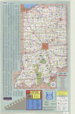
- Subject:
- Topical Subject: Roads and Geographic Subject: Indiana
- Creator:
- Indiana. Department of Transportation. Division of Engineering Services
- Publisher:
- Indiana. Department of Transportation
- Date Created:
- 1991
- Identifier:
- VAC3073-M-01216
- Genre:
- Road maps
- Geographic Location:
- Coordinates: W0880500 W0844700 N0414500 N0374600
- Related URL:
- Catalog URL: https://iucat.iu.edu/catalog/18406103
- Abstract:
- Panel title: Indiana, 1991-1992. Includes indexes, list of points of interest, mileage chart, and directories. Text, illustrations (some color), and 16 local...
- Call Number:
- G1403 .S7 1991-1992
- Caption:
- Imprint: [Indianapolis] : [Indiana Department of Transportation], [1991]
- Physical Description:
- Scale: Approximately 1:633,600 and Dimensions: 94 x 59 cm
- Alternate Identifier:
- Title Control Number: a18406103
- Persistent URL:
- https://purl.dlib.indiana.edu/iudl/images/VAC3073/VAC3073-M-01216
- Provenance:
- Indiana state highway system
-
- Subject:
- Geographic Subject: Indianapolis (Ind.)
- Publisher:
- [publisher not identified]
- Date Created:
- 1990
- Identifier:
- VAC3073-M-00404
- Genre:
- Maps
- Geographic Location:
- Coordinates: W0862046 W0855642 N0395557 N0393918
- Related URL:
- Catalog URL: https://iucat.iu.edu/catalog/4686431
- Abstract:
- Blue line print. _x000d_ Shows major roads and highways. _x000d_ Annotated by stuck-on-lettering indicating recreational points of interest, such as pa...
- Call Number:
- G4094.I4 1990z .I4
- Caption:
- Imprint: [place of publication not identified] : [publisher not identified], [199-?]
- Physical Description:
- Scale: 1:58,000 and Dimensions: 65 x 67 cm
- Alternate Identifier:
- Title Control Number: CAW1968BB
- Persistent URL:
- https://purl.dlib.indiana.edu/iudl/images/VAC3073/VAC3073-M-00404
-
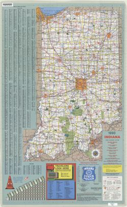
- Subject:
- Topical Subject: Roads and Geographic Subject: Indiana
- Creator:
- Indiana. Department of Highways. Division of Program Development
- Publisher:
- Indiana. Department of Highways
- Date Created:
- 1990
- Identifier:
- VAC3073-M-01215
- Genre:
- Road maps
- Geographic Location:
- Coordinates: W0880500 W0844700 N0414500 N0374600
- Related URL:
- Catalog URL: https://iucat.iu.edu/catalog/18406102
- Abstract:
- Panel title: Indiana, 1990 : crossroads. Relief shown by spot heights. Includes index, distance chart, directory of state police districts, list of scenic by...
- Call Number:
- G1403 .S7 1990
- Caption:
- Imprint: [Indianapolis] : Indiana Department of Highways, [1990]
- Physical Description:
- Scale: Approximately 1:633,600 and Dimensions: 94 x 59 cm
- Alternate Identifier:
- Title Control Number: a18406102
- Persistent URL:
- https://purl.dlib.indiana.edu/iudl/images/VAC3073/VAC3073-M-01215
- Provenance:
- Indiana state highway system
-
- Subject:
- Geographic Subject: Indiana University, Bloomington, Geographic Subject: Ellettsville (Ind.), Geographic Subject: Monroe County (Ind.), Topical Subject: Indi...
- Creator:
- Spectrum Map Publishing, Inc.
- Publisher:
- Spectrum Map Publishing, Inc.
- Date Created:
- 1989
- Identifier:
- VAC3073-M-00882
- Genre:
- Maps
- Geographic Location:
- Coordinates: W0864108 W0861902 N0392120 N0385926
- Related URL:
- Catalog URL: https://iucat.iu.edu/catalog/5288840
- Abstract:
- Includes text, indexes, advertisement, and 10 indexed ancillary subdivision maps.
- Call Number:
- G4094.B5 1989 .S6
- Caption:
- Imprint: Cincinnati, Ohio : Spectrum Map Pub., [1989?]
- Physical Description:
- Scale: Scales differ. and Dimensions: 53 x 46 cm or smaller, sheet 70 x 57 cm
- Alternate Identifier:
- Title Control Number: a5288840
- Persistent URL:
- https://purl.dlib.indiana.edu/iudl/images/VAC3073/VAC3073-M-00882
-
- Subject:
- Geographic Subject: Fort Wayne (Ind.) and Topical Subject: History
- Creator:
- Brainard, Noble E.
- Publisher:
- News-Sentinel
- Date Created:
- 1989
- Identifier:
- VAC3073-M-00115
- Genre:
- Thematic maps and Pictorial maps
- Geographic Location:
- Coordinates: W0851811 W0845955 N0411159 N0405755
- Related URL:
- Catalog URL: https://iucat.iu.edu/catalog/4965612
- Abstract:
- "The area included on the map is about 2 1/2 miles from east to west & 1 7/8 miles north to south." Includes illustrations and text on the map ...
- Call Number:
- G4094 .F7 S4 1989 .B73
- Caption:
- Imprint: [Fort Wayne, Ind. : News-Sentinel], 1989, [1933]
- Physical Description:
- Dimensions: 57 x 40 cm and Scale: 1:7,000
- Alternate Identifier:
- Title Control Number: a4965612
- Persistent URL:
- https://purl.dlib.indiana.edu/iudl/images/VAC3073/VAC3073-M-00115
-
- Subject:
- Geographic Subject: Indiana and Topical Subject: Roads
- Creator:
- Indiana. Department of Highways. Division of Program Development
- Publisher:
- Indiana. Department of Highways
- Date Created:
- 1989
- Identifier:
- VAC3073-M-01214
- Genre:
- Road maps
- Geographic Location:
- Coordinates: W0880500 W0844700 N0414500 N0374600
- Related URL:
- Catalog URL: https://iucat.iu.edu/catalog/18406101
- Abstract:
- Panel title: Indiana, 1989. Relief shown by spot heights. Includes index, distance chart, directory of state police districts, and indexed list of state recr...
- Call Number:
- G1403 .S7 1989
- Caption:
- Imprint: [Indianapolis] : Indiana Department of Highways, [1989]
- Physical Description:
- Scale: Approximately 1:633,600 and Dimensions: 94 x 59 cm
- Alternate Identifier:
- Title Control Number: a18406101
- Persistent URL:
- https://purl.dlib.indiana.edu/iudl/images/VAC3073/VAC3073-M-01214
- Provenance:
- Indiana state highway system
-
- Subject:
- Geographic Subject: Northwest, Old and Geographic Subject: Northeastern States
- Creator:
- Morse, Jedidiah, 1761-1826, Hill, Samuel, approximately 1766-1804, and Thomas & Andrews
- Publisher:
- Geological Survey (U.S.)
- Date Created:
- 1988
- Identifier:
- VAC3073-M-00979
- Genre:
- Early maps
- Geographic Location:
- Coordinates: W1030000 W0800000 N0503000 N0363000
- Related URL:
- Catalog URL: https://iucat.iu.edu/catalog/18454609
- Abstract:
- S. Hill. sc. Map dated 1796. Relief shown by hachures and pictorially. Prime meridians: Philadelphia & London. "The dotted Squares, are the Reservat...
- Call Number:
- QH75 .A4 No. 1200-IN
- Caption:
- Imprint: [Reston, Va.] : [U.S. Gelogical Survey], [1988]
- Physical Description:
- Scale: Scale not given. and Dimensions: xxv, 477 p. : ill., maps, 29 cm.
- Alternate Identifier:
- Title Control Number: a18454609 and Alternate ID: 358171IP
- Persistent URL:
- https://purl.dlib.indiana.edu/iudl/images/VAC3073/VAC3073-M-00979
- Provenance:
- The National gazetteer of the United States of America--Indiana, 1988 / U.S. Geological Survey.
-
- Subject:
- Topical Subject: Potawatomi Tribe, Geographic Subject: Indiana, and Topical Subject: Kickapoo Tribe of Indians
- Creator:
- Tanner, Henry Schenck, 1786-1858
- Publisher:
- Geological Survey (U.S.)
- Date Created:
- 1988
- Identifier:
- VAC3073-M-00296
- Genre:
- Maps
- Geographic Location:
- Coordinates: W0880558 W0842342 N0414540 N0374618
- Related URL:
- Catalog URL: https://iucat.iu.edu/catalog/18454603
- Abstract:
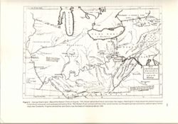
- Title from caption. Statement of responsibility from caption. Shows areas of Indiana held by the Potawatomi and Kickapoo tribes. "Figure 6.--Indiana por...
- Call Number:
- QE75 .A4 No. 1200-IN
- Caption:
- Imprint: [Reston, Va.] : [U.S. Geological Survey], [1988]
- Physical Description:
- Scale: Indeterminable and Dimensions: 29 cm or smaller
- Alternate Identifier:
- Title Control Number: a18454603 and Alternate ID: 358171IP
- Persistent URL:
- https://purl.dlib.indiana.edu/iudl/images/VAC3073/VAC3073-M-00296
- Provenance:
- The National gazetteer of the United States of America--Indiana, 1988 / U.S. Geological Survey.
-
- Subject:
- Geographic Subject: Northwest, Old and Geographic Subject: Ohio
- Creator:
- Barker, W. (William), active 1795-1803 and Carey, Mathew, 1760-1839
- Publisher:
- Geological Survey (U.S.)
- Date Created:
- 1988
- Identifier:
- VAC3073-M-00004
- Genre:
- Early maps and Facsimiles
- Geographic Location:
- Coordinates: W0921900 W0794100 N0490000 N0374200
- Related URL:
- Catalog URL: https://iucat.iu.edu/catalog/18416531
- Abstract:
- Other title: Ohio and Northwest Territory. Prime meridians: London and Philadelphia. Reprint of: Ohio and N. W. Territory. In Carey's minor atlas / Carey...
- Call Number:
- QH75 .A4 No. 1200-IN
- Caption:
- Imprint: [Reston, Va.] : [The Survey], [1988]
- Physical Description:
- Scale: Indeterminable and Dimensions: 29 cm or smaller
- Alternate Identifier:
- Title Control Number: a18416531 and Alternate ID: 358171IP
- Persistent URL:
- https://purl.dlib.indiana.edu/iudl/images/VAC3073/VAC3073-M-00004
- Provenance:
- The National gazetteer of the United States of America--Indiana, 1988 / U.S. Geological Survey.
-
- Subject:
- Geographic Subject: Middle West
- Creator:
- Carey, Mathew, 1760-1839
- Publisher:
- Geological Survey (U.S.)
- Date Created:
- 1988
- Identifier:
- VAC3073-M-00315
- Genre:
- Early maps and Facsimiles
- Geographic Location:
- Coordinates: W0960000 W0810000 N0500000 N0360000
- Related URL:
- Catalog URL: https://iucat.iu.edu/catalog/18416533
- Abstract:
- Relief shown by hachures. Prime meridians: London and Philadelphia. Reprint of: The Upper territories of the United States. In General atlas of the world and...
- Call Number:
- QH75 .A4 No. 1200-IN
- Caption:
- Imprint: [Reston, Va.] : [The Survey], [1988]
- Physical Description:
- Dimensions: 29 cm or less and Scale: Indeterminable
- Alternate Identifier:
- Title Control Number: a18416533 and Alternate ID: 358171IP
- Persistent URL:
- https://purl.dlib.indiana.edu/iudl/images/VAC3073/VAC3073-M-00315
- Provenance:
- The National gazetteer of the United States of America--Indiana, 1988 / U.S. Geological Survey.
-
- Subject:
- Topical Subject: Potawatomi Tribe, Geographic Subject: Indiana, Topical Subject: Miami Tribe, Topical Subject: Transportation, Topical Subject: Rivers, and G...
- Creator:
- Tanner, Henry Schenck, 1786-1858
- Publisher:
- Geological Survey (U.S.)
- Date Created:
- 1988
- Identifier:
- VAC3073-M-00095
- Genre:
- Tourist maps, Geological cross-sections, and Maps
- Geographic Location:
- Coordinates: W0880500 W0834600 N0415000 N0374600
- Related URL:
- Catalog URL: https://iucat.iu.edu/catalog/18437130
- Abstract:
- Variant title: Travellers pocket map of Indiana with its roads and distances. Relief shown by profile. Shows existing and proposed canals and railroads as we...
- Call Number:
- QH75 .A4 No. 1200-IN
- Caption:
- Imprint: ©18 April, 1831, Imprint: Philadelphia : H.S. Tanner, 18 April, 1831, and Imprint: [Reston, Va.] : [U.S. Geological Survey], [1988]
- Physical Description:
- Scale: Indeterminable. Vertical scale indeterminable and Dimensions: 29 cm or smaller
- Alternate Identifier:
- Alternate ID: 358171IP and Title Control Number: a18437130
- Persistent URL:
- https://purl.dlib.indiana.edu/iudl/images/VAC3073/VAC3073-M-00095
- Provenance:
- The National gazetteer of the United States of America--Indiana, 1988 / U.S. Geological Survey.
-
- Subject:
- Topical Subject: Counties, Geographic Subject: Indiana, and Topical Subject: Administrative and political divisions
- Creator:
- Geological Survey (U.S.)
- Publisher:
- Geological Survey (U.S.)
- Date Created:
- 1988
- Identifier:
- VAC3073-M-00025
- Genre:
- Maps
- Geographic Location:
- Coordinates: W0890000 W0840000 N0420000 N0373000
- Related URL:
- Catalog URL: https://iucat.iu.edu/catalog/18428209
- Abstract:
- At head of caption title: "Figure 1." Appears as Figure 1 in Indiana Gazetteer produced by the U.S.G.S. Professional Paper 1200-I. "The Nation...
- Call Number:
- QE75 .A4 No. 1200-IN
- Caption:
- Imprint: [Reston, Va.] : [The Survey], [1988]
- Physical Description:
- Dimensions: 29 cm or smaller and Scale: Approximately 1:3,200,000
- Alternate Identifier:
- Title Control Number: a18428209 and Alternate ID: 358171IP
- Persistent URL:
- https://purl.dlib.indiana.edu/iudl/images/VAC3073/VAC3073-M-00025
- Provenance:
- The National gazetteer of the United States of America--Indiana, 1988 / U.S. Geological Survey.
-
- Subject:
- Geographic Subject: Virginia, Geographic Subject: United States, and Topical Subject: Indians of North America
- Creator:
- Sabin, Joseph, 1821-1881 and Washington, George, 1732-1799
- Publisher:
- Geological Survey (U.S.)
- Date Created:
- 1988
- Identifier:
- VAC3073-M-00372
- Genre:
- Early maps
- Geographic Location:
- Coordinates: W0923500 W0750000 N0440000 N0360000
- Related URL:
- Catalog URL: https://iucat.iu.edu/catalog/18454608
- Abstract:
- Variant tile: Map of the western parts of the colony of Virginia, as far as the Mississippi. Relief shown pictorially. Prime meridians: London and Ferro. &qu...
- Call Number:
- QH75 .A4 No. 1200-IN
- Caption:
- Imprint: [Reston, Va.] : [U.S. Geological Survey], [1988]
- Physical Description:
- Scale: Scale not given. and Dimensions: 29 cm or smaller
- Alternate Identifier:
- Alternate ID: 358171IP and Title Control Number: a18454608
- Persistent URL:
- https://purl.dlib.indiana.edu/iudl/images/VAC3073/VAC3073-M-00372
- Provenance:
- Map of the Western parts of the Colony of Virginia as far as the Mississipi.
-
- Subject:
- Geographic Subject: Indiana and Topical Subject: Roads
- Creator:
- Indiana. Department of Highways. Division of Program Development
- Publisher:
- Indiana. Department of Highways.
- Date Created:
- 1988
- Identifier:
- VAC3073-M-01213
- Genre:
- Road maps
- Geographic Location:
- Coordinates: W0880500 W0844700 N0414500 N0374600
- Related URL:
- Catalog URL: https://iucat.iu.edu/catalog/18406100
- Abstract:
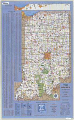
- Panel title: Indiana, 1988. Relief shown by spot heights. Includes index, distance chart, directory of state police locations, indexed list of state recreati...
- Call Number:
- G1403 .S7 1988
- Caption:
- Imprint: [Indianapolis] : Indiana Department of Highways, [1988]
- Physical Description:
- Scale: Approximately 1:633,600 and Dimensions: 94 x 59 cm
- Alternate Identifier:
- Title Control Number: a18406100
- Persistent URL:
- https://purl.dlib.indiana.edu/iudl/images/VAC3073/VAC3073-M-01213
- Provenance:
- Indiana state highway system
-
- Subject:
- Geographic Subject: Monroe County (Ind.), Geographic Subject: Ellettsville (Ind.), Topical Subject: Indiana University, Bloomington, Geographic Subject: Indi...
- Creator:
- Merchant Maps (Firm)
- Publisher:
- Merchant Maps (Firm)
- Date Created:
- 1988
- Identifier:
- VAC3073-M-00130
- Genre:
- Maps
- Geographic Location:
- Coordinates: W0864108 W0861902 N0392120 N0385926
- Related URL:
- Catalog URL: https://iucat.iu.edu/catalog/5298605
- Abstract:
- Includes advertisements and indexes to city and campus maps.
- Call Number:
- G4093.M7 1988 .M4
- Caption:
- Imprint: Cincinnati, Ohio : Mass Marketing Inc., Merchant Maps Division, [1988]
- Physical Description:
- Dimensions: 87 x 56 cm or smaller, sheet 59 x 89 cm and Scale: Scale not given.
- Alternate Identifier:
- Title Control Number: a5298605
- Persistent URL:
- https://purl.dlib.indiana.edu/iudl/images/VAC3073/VAC3073-M-00130
-
- Subject:
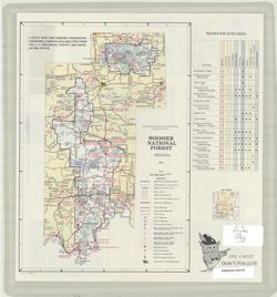
- Geographic Subject: Hoosier National Forest (Ind.)
- Creator:
- United States. Forest Service. Eastern Region
- Publisher:
- United States. Forest Service. Eastern Region
- Date Created:
- 1987
- Identifier:
- VAC3073-M-00978
- Genre:
- Maps
- Geographic Location:
- Coordinates: W0865245 W0860659 N0391010 N0374550
- Related URL:
- Catalog URL: https://iucat.iu.edu/catalog/2657588
- Abstract:
- Shipping list no.: 87-308-P. Includes key map and recreation sites index. Text and color illustrations on verso. "ICCM 5-87."
- Call Number:
- G4092.H6 1987 .U5
- Caption:
- Imprint: [Milwaukee, Wis.?] : [The Region], [1987?]
- Physical Description:
- Dimensions: 28 x 19 cm, on sheet 31 x 28 cm and Scale: 1:570,000
- Alternate Identifier:
- Title Control Number: BKZ3362SE
- Persistent URL:
- https://purl.dlib.indiana.edu/iudl/images/VAC3073/VAC3073-M-00978
-
- Subject:
- Topical Subject: Aerial photographs and Geographic Subject: Monroe County (Ind.)
- Creator:
- National Aerial Photography Program (U.S.)
- Publisher:
- [U.S. Dept. of Agriculture] Aerial Photography Field Office
- Date Created:
- 1987
- Identifier:
- VAC3073-M-00653
- Genre:
- Index maps
- Geographic Location:
- Coordinates: W0864100 W0861900 N0392100 N0390000
- Related URL:
- Catalog URL: https://iucat.iu.edu/catalog/5019349
- Abstract:
- Blue line print. Base maps: USGS 1:100,000-scale quadrangles for Bloomington, Indiana and Bedford, Indiana. "Project: Monroe County, Indiana (18105) , P...
- Call Number:
- G4093.M7A43 1987 .N38
- Caption:
- Imprint: Salt Lake City, Utah : [U.S. Dept. of Agriculture] Aerial Photography Field Office, 1987
- Physical Description:
- Scale: 1:100,000 and Dimensions: 56 x 87 cm
- Alternate Identifier:
- Title Control Number: a5019349
- Persistent URL:
- https://purl.dlib.indiana.edu/iudl/images/VAC3073/VAC3073-M-00653
-
- Subject:
- Geographic Subject: Monroe County (Ind.) and Topical Subject: Roads
- Creator:
- Klooz, C. J.
- Publisher:
- Columbus Reproduction & Supply Co.
- Date Created:
- 1987
- Identifier:
- VAC3073-M-00800
- Genre:
- Road maps
- Geographic Location:
- Coordinates: W0864100 W0861900 N0392100 N0390000
- Related URL:
- Catalog URL: https://iucat.iu.edu/catalog/5297915
- Abstract:
- Includes text and indexes and logo of the Monroe County Department of Highways. Shows "2 mile fringe" and "Ellettsville Corp. Bdry." in...
- Call Number:
- G4093.M7P2 1987 .K6
- Caption:
- Imprint: Columbus, Ind. : The Company, 1987.
- Physical Description:
- Scale: 1:63,360 and Dimensions: 68 x 55 cm
- Alternate Identifier:
- Title Control Number: a5297915
- Persistent URL:
- https://purl.dlib.indiana.edu/iudl/images/VAC3073/VAC3073-M-00800
-
- Subject:
- Geographic Subject: Indiana, Topical Subject: Special Olympics, Inc., and Topical Subject: Roads
- Creator:
- Indiana. Department of Highways. Division of Program Development
- Publisher:
- Indiana. Department of Highways. Division of Program Development
- Date Created:
- 1987
- Identifier:
- VAC3073-M-01212
- Genre:
- Road maps
- Geographic Location:
- Coordinates: W0880500 W0844700 N0414500 N0374600
- Related URL:
- Catalog URL: https://iucat.iu.edu/catalog/18406098
- Abstract:
- Title on verso: Indiana 1987 : America's amateur sports center. Includes indexes, indexed table of recreation areas, information numbers, and distance ch...
- Call Number:
- G1403 .S7 1987
- Caption:
- Imprint: Indianapolis, IN : Department of Highways, Division of Program Development, [1987]
- Physical Description:
- Scale: Approximately 1:633,600 and Dimensions: 94 x 59 cm
- Alternate Identifier:
- Title Control Number: a18406098
- Persistent URL:
- https://purl.dlib.indiana.edu/iudl/images/VAC3073/VAC3073-M-01212
- Provenance:
- Indiana state highway system
-
- Subject:
- Topical Subject: Land capability for agriculture, Geographic Subject: Saint Joseph County (Ind.), and Topical Subject: Agricultural resources
- Creator:
- United States. Soil Conservation Service
- Publisher:
- United States. Soil Conservation Service
- Date Created:
- 1986
- Identifier:
- VAC3073-M-00087
- Genre:
- Thematic maps
- Geographic Location:
- Coordinates: W0862932 W0860333 N0414538 N0412747
- Related URL:
- Catalog URL: https://iucat.iu.edu/catalog/5323398
- Abstract:
- Shows land use. Includes vicinity map, text, and sectionalized township. "March 1986." "Base 4-R-39699."
- Call Number:
- G4093.S2J15 1986 .U5
- Caption:
- Imprint: [Washington, D.C.?] : The Service, [1986]
- Physical Description:
- Scale: 1:50,000 and Dimensions: 95 x 99 cm
- Alternate Identifier:
- Title Control Number: a5323398
- Persistent URL:
- https://purl.dlib.indiana.edu/iudl/images/VAC3073/VAC3073-M-00087
-
- Subject:
- Geographic Subject: Indiana and Topical Subject: Roads
- Creator:
- Indiana. Department of Highways. Division of Planning
- Publisher:
- Indiana. Department of Highways
- Date Created:
- 1986
- Identifier:
- VAC3073-M-01211
- Genre:
- Road maps
- Geographic Location:
- Coordinates: W0880500 W0844700 N0414500 N0374600
- Related URL:
- Catalog URL: https://iucat.iu.edu/catalog/18406097
- Abstract:
- Panel title: Indiana, 1986. Includes Indiana Toll Road map and indexes to cities and towns, counties, and Department of Natural Resources locations. Includes...
- Call Number:
- G1403 .S7 1986
- Caption:
- Imprint: Indianapolis : Indiana Department of Highways, 1986.
- Physical Description:
- Dimensions: 94 x 59 cm and Scale: Approximately 1:633,600
- Alternate Identifier:
- Title Control Number: a18406097
- Persistent URL:
- https://purl.dlib.indiana.edu/iudl/images/VAC3073/VAC3073-M-01211
- Provenance:
- Indiana state highway system
-
- Subject:
- Topical Subject: Lakes, Geographic Subject: Monroe, Lake (Ind.), and Topical Subject: Reservoirs
- Creator:
- Indiana. Department of Natural Resources. Division of Water
- Publisher:
- Indiana. Department of Natural Resources. Division of Water
- Date Created:
- 1986
- Identifier:
- VAC3073-M-00240
- Genre:
- Thematic maps and Bathymetric maps
- Geographic Location:
- Coordinates: W0863228 W0861911 N0390634 N0385928
- Related URL:
- Catalog URL: https://iucat.iu.edu/catalog/5307088
- Abstract:
- Xerographic copy. Relief shown by contours and spot heights. "1986." Map created from US Geological Survey topographic quadrangles for ...
- Call Number:
- G4092.M6 C3 1986 .I53
- Caption:
- Imprint: [Indianapolis] : The Division, [1986]
- Physical Description:
- Scale: 1:24,000 and Dimensions: 59 x 89 cm
- Alternate Identifier:
- Title Control Number: a5307088
- Persistent URL:
- https://purl.dlib.indiana.edu/iudl/images/VAC3073/VAC3073-M-00240
-
- Subject:
- Topical Subject: Coal mines and mining and Geographic Subject: Indiana
- Creator:
- Weber, Licia
- Publisher:
- Indiana. Geological Survey
- Date Created:
- 1986
- Identifier:
- VAC3073-M-00850
- Genre:
- Mine maps
- Geographic Location:
- Coordinates: W0880500 W0861800 N0404200 N0374600
- Related URL:
- Catalog URL: https://iucat.iu.edu/catalog/4438471
- Abstract:
- Blue line print. Includes location map.
- Call Number:
- G4091.H9 1986 .W4
- Caption:
- Imprint: [Bloomington, IN]: Indiana, Geological Survey, [1986]
- Physical Description:
- Dimensions: 93 x 44 cm and Scale: 1:350,000
- Alternate Identifier:
- Title Control Number: a4438471
- Persistent URL:
- https://purl.dlib.indiana.edu/iudl/images/VAC3073/VAC3073-M-00850
-
![Marion County, Indiana [map] : [aerial photographs, 1 inch=100 feet]](https://iiif.uits.iu.edu/iiif/2/8g84np70q%2Ffiles%2F87c92dbf-3c08-4afb-9aa5-654d83642274/full/250,/0/default.jpg)
- Subject:
- Geographic Subject: Marion County (Ind.) and Topical Subject: Aerial photographs
- Creator:
- Clyde E. Williams & Associates
- Publisher:
- [State Land Office]
- Date Created:
- 1985
- Identifier:
- VAC3073-M-00698
- Genre:
- Aerial photographs
- Geographic Location:
- Coordinates: W0862000 W0855700 N0395600 N0393800
- Related URL:
- Catalog URL: https://iucat.iu.edu/catalog/4948281
- Abstract:
- Blue line print. "Date of photography: Spring 1985, Fall 1985"--Index map. Subtitle supplied by cataloger.
- Call Number:
- G4093 .M3 A4 s1 .C559
- Caption:
- Imprint: [Indianapolis] : [State Land Office], [198-?]
- Physical Description:
- Dimensions: 77 x 77 cm and Scale: 1:1,200
- Alternate Identifier:
- Title Control Number: a4948281
- Persistent URL:
- https://purl.dlib.indiana.edu/iudl/images/VAC3073/VAC3073-M-00698
-
- Subject:
- Geographic Subject: Nappanee (Ind.)
- Publisher:
- Napanee Chamber of Commerce
- Date Created:
- 1985
- Identifier:
- VAC3073-M-00214
- Genre:
- Maps
- Geographic Location:
- Coordinates: W0860224 W0855546 N0412758 N0412536
- Related URL:
- Catalog URL: https://iucat.iu.edu/catalog/5021148
- Abstract:
- "7185." Inset: Nappanee Municipal Airport. Text, illustrations and area map on verso. Advertising matter on borders.
- Call Number:
- G4094 .N2 1985 .C576
- Caption:
- Imprint: Nappanee, In. : Napanee Chamber of Commerce, [1985?]
- Physical Description:
- Dimensions: 31 x 43 cm, on sheet 45 x 59 cm and Scale: Scale not given.
- Alternate Identifier:
- Title Control Number: a5021148
- Persistent URL:
- https://purl.dlib.indiana.edu/iudl/images/VAC3073/VAC3073-M-00214
-
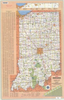
- Subject:
- Topical Subject: Roads and Geographic Subject: Indiana
- Creator:
- Indiana. Department of Highways. Division of Planning
- Publisher:
- Indiana. Department of Highways
- Date Created:
- 1984
- Identifier:
- VAC3073-M-01210
- Genre:
- Road maps
- Geographic Location:
- Coordinates: W0880500 W0844700 N0414500 N0374600
- Related URL:
- Catalog URL: https://iucat.iu.edu/catalog/18406095
- Abstract:
- Panel title: Indiana, 1984. Relief shown by spot heights. Includes index, distance chart, and indexed inset "Indiana toll road." Text, Department o...
- Call Number:
- G1403 .S7 1984
- Caption:
- Imprint: [Indianapolis] : Indiana Department of Highways, [1984]
- Physical Description:
- Scale: Approximately 1:633,600 and Dimensions: 94 x 59 cm
- Alternate Identifier:
- Title Control Number: a18406095
- Persistent URL:
- https://purl.dlib.indiana.edu/iudl/images/VAC3073/VAC3073-M-01210
- Provenance:
- Indiana state highway system
-
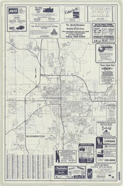
- Subject:
- Geographic Subject: Indiana University, Bloomington, Geographic Subject: Monroe County (Ind.), Geographic Subject: Ellettsville (Ind.), Geographic Subject: B...
- Creator:
- Merchant Maps (Firm)
- Publisher:
- Merchant Maps (Firm)
- Date Created:
- 1984
- Identifier:
- VAC3073-M-00764
- Genre:
- Maps
- Geographic Location:
- Coordinates: W0864108 W0861902 N0392120 N0385926
- Related URL:
- Catalog URL: https://iucat.iu.edu/catalog/2877192
- Abstract:
- Includes advertisements and indexes to city and campus maps.
- Call Number:
- G4093 .M7 1984 .M4
- Caption:
- Imprint: Cincinnati, Ohio : Mass Marketing Inc. Merchant Maps Division, [1984]
- Physical Description:
- Dimensions: 87 x 56 cm or smaller, sheet 59 x 89 cm and Scale: Scale not given.
- Alternate Identifier:
- Title Control Number: CAZ7894BB
- Persistent URL:
- https://purl.dlib.indiana.edu/iudl/images/VAC3073/VAC3073-M-00764
-

- Creator:
- Creator: Clark, Gracia and Photographer: Carmen Paz
- Date Created:
- 1983
- Identifier:
- VAB8060-0433
- Abstract:
- An ethnographer from the UK, taken in Tamale
- Caption:
- Ethnographer from the UK
- City:
- Tamale
- Country:
- Ghana
- Physical Description:
- Slide
- Persistent URL:
- http://purl.dlib.indiana.edu/iudl/idah/kumasi/VAB8060-0433
-

- Subject:
- Subject: Women, Subject: Shea butter, Itinerary: Gender, Itinerary: Agricultural Marketing, Itinerary: Women's groups, and Subject: Women's organizat...
- Creator:
- Creator: Clark, Gracia and Photographer: Gracia Clark
- Date Created:
- 1983
- Identifier:
- VAB8060-0581
- Abstract:
- Women's group producing shea butter
- Caption:
- Women's group producing shea butter
- Country:
- Ghana
- Physical Description:
- Slide
- Persistent URL:
- http://purl.dlib.indiana.edu/iudl/idah/kumasi/VAB8060-0581
-

- Creator:
- Photographer: Carmen Paz and Creator: Clark, Gracia
- Date Created:
- 1983
- Identifier:
- VAB8060-0394
- Abstract:
- at Axim near Takoradi
- Caption:
- Clark with Aximhene and teachers near Takoradi
- City:
- Axim
- Country:
- Ghana
- Physical Description:
- Slide
- Persistent URL:
- http://purl.dlib.indiana.edu/iudl/idah/kumasi/VAB8060-0394
-

- Creator:
- Creator: Clark, Gracia and Photographer: Carmen Paz
- Date Created:
- 1983
- Identifier:
- VAB8060-0683
- Abstract:
- Gracia Clark with Yaw Keteku
- Caption:
- Gracia Clark with Yaw Keteku
- City:
- Kumasi
- Country:
- Ghana
- Physical Description:
- Slide
- Persistent URL:
- http://purl.dlib.indiana.edu/iudl/idah/kumasi/VAB8060-0683
-
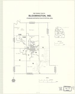
- Subject:
- Geographic Subject: Monroe County (Ind.), Topical Subject: Metropolitan areas, Geographic Subject: Bloomington Metropolitan Area (Ind.), Topical Subject: Cen...
- Publisher:
- United States. Bureau of the Census
- Date Created:
- 1983
- Identifier:
- VAC3073-M-00183
- Genre:
- Maps and Census data
- Geographic Location:
- Coordinates: W0864107 W0861903 N0392122 N0385936
- Related URL:
- Catalog URL: https://iucat.iu.edu/catalog/18454200
- Abstract:
- Variant title: 1980 census tracts, Bloomington, Indiana. Includes inset map of Bloomington with separate scale of approximately 1:64,000. "Issued August...
- Call Number:
- G4093.M7 E25 1980 .C46
- Caption:
- Imprint: [Washington, D. C.] : U.S. Department of Commerce, Bureau for the Census, [1983]
- Physical Description:
- Dimensions: Dimensions unknown and Scale: Approximately 1:125,000
- Alternate Identifier:
- Alternate ID: 359015IP and Title Control Number: a18454200
- Persistent URL:
- https://purl.dlib.indiana.edu/iudl/images/VAC3073/VAC3073-M-00183
- Provenance:
- 1980 census of population and housing. Census tracts. Bloomington, Ind., standard metropolitan statistical area.
-
- Subject:
- Geographic Subject: Indiana Toll Road (Ind.)
- Creator:
- Indiana. Toll Road Division. Engineering Department
- Publisher:
- [Dept.]
- Date Created:
- 1983
- Identifier:
- VAC3073-M-00833
- Genre:
- Road maps
- Geographic Location:
- Coordinates: W0873400 W0844500 N0414700 N0410100
- Related URL:
- Catalog URL: https://iucat.iu.edu/catalog/1204963
- Abstract:
- Includes index to toll plazas, maintenance buildings, auxiliary storage areas, service areas, and fuel supply. Shows facilities and county lines by milepost.
- Call Number:
- G4091 .P2 1983 .I53
- Caption:
- Imprint: [Granger, Ind.] : [Dept.], 1983.
- Physical Description:
- Dimensions: 10 x 25 cm, on sheet 22 x 28 cm and Scale: Scale not given.
- Alternate Identifier:
- Title Control Number: AKH0226BB
- Persistent URL:
- https://purl.dlib.indiana.edu/iudl/images/VAC3073/VAC3073-M-00833
-
- Subject:
- Geographic Subject: Jackson County (Ind.), Geographic Subject: Bartholomew County (Ind.), and Geographic Subject: Jennings County (Ind.)
- Creator:
- Geological Survey (U.S.)
- Publisher:
- United States. Defense Mapping Agency. Topographic Center
- Date Created:
- 1983
- Identifier:
- VAC3073-M-01425
- Genre:
- Quadrangle maps, 15 minute topographic maps, and Topographic maps
- Geographic Location:
- Coordinates: W0860000 W0854500 N0391500 N0390000
- Related URL:
- Catalog URL: https://iucat.iu.edu/catalog/18376110
- Abstract:
- Prepared by the U.S. Geological Survey for publication by the Defense Mapping Agency Hydrographic/Topographic Center. Variant title: Indiana 1:50,000. Standa...
- Call Number:
- G4090 s25 .U5 Columbus 1979 V
- Caption:
- Imprint: Washington, D.C. : Defense Mapping Agency Hydrographic/Topographic Center, [1983] and Imprint: Distributor: Reston, Virgina : Geological Survey, [1983]
- Physical Description:
- Dimensions: 56 x 45 cm or smaller and Scale: 1:50,000
- Alternate Identifier:
- Title Control Number: a18376110
- Persistent URL:
- https://purl.dlib.indiana.edu/iudl/images/VAC3073/VAC3073-M-01425
- Provenance:
- Part of United States. Army Map Service, Indiana 1:50,000.
-
- Subject:
- Geographic Subject: Indiana and Topical Subject: Roads
- Creator:
- Indiana. Department of Highways. Division of Planning
- Publisher:
- Indiana. Department of Highways. Division of Planning
- Date Created:
- 1982
- Identifier:
- VAC3073-M-01209
- Genre:
- Road maps
- Geographic Location:
- Coordinates: W0880500 W0844700 N0414500 N0374600
- Related URL:
- Catalog URL: https://iucat.iu.edu/catalog/18406093
- Abstract:
- Panel title: Indiana 1982-83 official highway map. Relief shown by spot heights. Includes index, distance chart, and text. Text, Department of Natural Resour...
- Call Number:
- G1403 .S7 1982-1983
- Caption:
- Imprint: [Indianapolis] : Indiana Department of Highways, [1982]
- Physical Description:
- Scale: Approximately 1:633,600 and Dimensions: 94 x 59 cm
- Alternate Identifier:
- Title Control Number: a18406093
- Persistent URL:
- https://purl.dlib.indiana.edu/iudl/images/VAC3073/VAC3073-M-01209
- Provenance:
- Indiana state highway system
-
- Subject:
- Topical Subject: Aerial views and Geographic Subject: Fort Wayne (Ind.)
- Creator:
- Palmatary, J. T. (James T.)
- Publisher:
- Allen County-Fort Wayne Historical Society
- Date Created:
- 1981
- Identifier:
- VAC3073-M-00951
- Genre:
- Aerial views and Pictorial maps
- Geographic Location:
- Coordinates: W0851811 W0845955 N0411159 N0405755
- Related URL:
- Catalog URL: https://iucat.iu.edu/catalog/4896240
- Abstract:
- Bird's eye view. Facsimile. Left and right sides of original cut off creating the following texts: "lished by J.T. Palmatary" and "Drawn ...
- Call Number:
- G4094 .F7 A3 1857 .P35 1981
- Caption:
- Imprint: [Fort Wayne, Ind.?] : Allen County-Fort Wayne Historical Society, 1981.
- Physical Description:
- Scale: Scale not given. and Dimensions: 51 x 84 cm, on sheet 59 x 89 cm
- Alternate Identifier:
- Title Control Number: a4896240
- Persistent URL:
- https://purl.dlib.indiana.edu/iudl/images/VAC3073/VAC3073-M-00951
-
- Subject:
- Topical Subject: Geology, Geographic Subject: Posey County (Ind.), and Topical Subject: Geology, Stratigraphic
- Creator:
- Tanner, George F. (George Frederick), 1953-
- Publisher:
- Indiana. Geological Survey
- Date Created:
- 1981
- Identifier:
- VAC3073-M-01182
- Genre:
- Geological maps and Thematic maps
- Geographic Location:
- Coordinates: W0880552 W0874117 N0381349 N0374618
- Related URL:
- Catalog URL: https://iucat.iu.edu/catalog/5337575
- Call Number:
- G4093.P6C57 1981 .T31
- Caption:
- Imprint: [Bloomington] : Indiana Geological Survey, 1981
- Physical Description:
- Dimensions: 82 x 114 cm and Scale: 1:32,000
- Persistent URL:
- https://purl.dlib.indiana.edu/iudl/images/VAC3073/VAC3073-M-01182
-
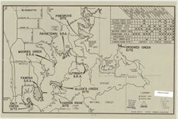
- Subject:
- Topical Subject: Lakes, Geographic Subject: Monroe, Lake (Ind.), and Topical Subject: Reservoirs
- Creator:
- Duthie, Glenn
- Publisher:
- Indiana. Department of Geology and Natural Resources
- Date Created:
- 1981
- Identifier:
- VAC3073-M-00405
- Genre:
- Thematic maps
- Geographic Location:
- Coordinates: W0863112 W0861853 N0390703 N0385942
- Related URL:
- Catalog URL: https://iucat.iu.edu/catalog/5327399
- Abstract:
- "File no. 300-74, 2-23-81." Includes chart showing recreational facilities. Text, illustrations, and location map on verso. "Recreation facili...
- Call Number:
- G4092.M6 1981 .D88
- Caption:
- Imprint: [Indianapolis?] : [Indiana Dept. of Natural Resources?], [1981?]
- Physical Description:
- Dimensions: 26 x 41 cm and Scale: Scale not given.
- Alternate Identifier:
- Title Control Number: a5327399
- Persistent URL:
- https://purl.dlib.indiana.edu/iudl/images/VAC3073/VAC3073-M-00405
-
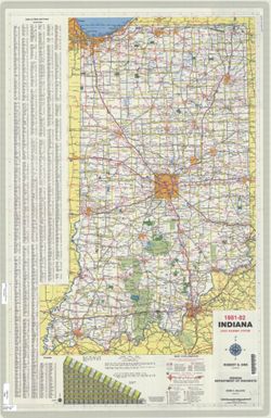
- Subject:
- Topical Subject: Roads and Geographic Subject: Indiana
- Creator:
- Indiana. State Highway Commission (1961-1981)
- Publisher:
- Indiana. State Highway Commission (1961-1981)
- Date Created:
- 1981
- Identifier:
- VAC3073-M-01208
- Genre:
- Road maps
- Geographic Location:
- Coordinates: W0880500 W0844700 N0414500 N0374600
- Related URL:
- Catalog URL: https://iucat.iu.edu/catalog/18406091
- Abstract:
- Panel title: Indiana 1981-82 official highway map. Relief shown by spot heights. Includes index, text and distance chart. Text, Department of Natural Resourc...
- Call Number:
- G1403 .S7 1981-1982
- Caption:
- Imprint: [Indianapolis] : Indiana Department of Highways, [1981]
- Physical Description:
- Scale: Approximately 1:633,600 and Dimensions: 94 x 59 cm
- Alternate Identifier:
- Title Control Number: a18406091
- Persistent URL:
- https://purl.dlib.indiana.edu/iudl/images/VAC3073/VAC3073-M-01208
- Provenance:
- Indiana state highway system
-
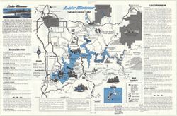
- Subject:
- Topical Subject: Reservoirs, Geographic Subject: Bloomington Region (Ind.), Topical Subject: Lakes, and Geographic Subject: Monroe, Lake (Ind.)
- Creator:
- Guide Art Co. and Skirvin, Jack E.
- Publisher:
- Guide Art Co.
- Date Created:
- 1980
- Identifier:
- VAC3073-M-00012
- Genre:
- Pictorial maps and Tourist maps
- Geographic Location:
- Coordinates: W0863115 W0861826 N0390718 N0385940
- Related URL:
- Catalog URL: https://iucat.iu.edu/catalog/5302210
- Abstract:
- Text, advertisements, and 9 Lake Monroe area maps showing businesses on verso.
- Call Number:
- G4092.M6 E635 1980 .G85
- Caption:
- Imprint: Bloomington, Ind. : Guide Art Co., c1980.
- Physical Description:
- Dimensions: on sheet 28 x 44 cm and Scale: 1:125,000
- Alternate Identifier:
- Title Control Number: a5302210
- Persistent URL:
- https://purl.dlib.indiana.edu/iudl/images/VAC3073/VAC3073-M-00012
-
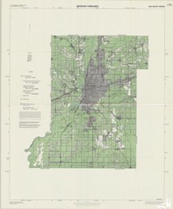
- Subject:
- Topical Subject: Land use, Rural, Geographic Subject: Vigo County (Ind.), Topical Subject: Land capability for agriculture, Topical Subject: Agricultural res...
- Creator:
- United States. Soil Conservation Service
- Publisher:
- United States. Soil Conservation Service
- Date Created:
- 1980
- Identifier:
- VAC3073-M-00887
- Genre:
- Thematic maps
- Geographic Location:
- Coordinates: W0873800 W0871300 N0393700 N0391600
- Related URL:
- Catalog URL: https://iucat.iu.edu/catalog/5323339
- Abstract:
- "Interpretations derived from soil map constructed 1974..." "December 1980." Includes location map.
- Call Number:
- G4093 .V5J15 1980 .U5
- Caption:
- Imprint: [Washington, D.C.] : U.S. Dept. of Agriculture, Soil Conservation Service, 1980.
- Physical Description:
- Scale: 1:50,000 and Dimensions: 112 x 92 cm
- Alternate Identifier:
- Title Control Number: a5323339
- Persistent URL:
- https://purl.dlib.indiana.edu/iudl/images/VAC3073/VAC3073-M-00887
-
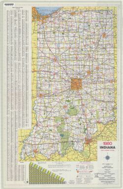
- Subject:
- Geographic Subject: Indiana and Topical Subject: Roads
- Creator:
- Indiana. State Highway Commission (1961-1981). Division of Planning
- Publisher:
- Indiana. State Highway Commission (1961-1981). Division of Planning
- Date Created:
- 1980
- Identifier:
- VAC3073-M-01207
- Genre:
- Road maps
- Geographic Location:
- Coordinates: W0880500 W0844700 N0414500 N0374600
- Related URL:
- Catalog URL: https://iucat.iu.edu/catalog/18406003
- Abstract:
- Panel title: Indiana 1980 official highway map. Relief shown by spot heights. Includes index, distance chart and text. Text, index and directory to Dept. of ...
- Call Number:
- G1403 .S7 1980
- Caption:
- Imprint: Indianapolis : Indiana State Highway Commission, [1980]
- Physical Description:
- Dimensions: 94 x 59 cm and Scale: Approximately 1:633,600
- Alternate Identifier:
- Title Control Number: a18406003
- Persistent URL:
- https://purl.dlib.indiana.edu/iudl/images/VAC3073/VAC3073-M-01207
- Provenance:
- Indiana state highway system
-
![[Bloomington, Indiana, cadastral map]](https://iiif.uits.iu.edu/iiif/2/0r9686792%2Ffiles%2F47529974-267a-4ca2-bcce-8ead7355fbf3/full/250,/0/default.jpg)
- Subject:
- Topical Subject: Real property and Geographic Subject: Bloomington (Ind.)
- Publisher:
- [publisher not identified]
- Date Created:
- 1980
- Identifier:
- VAC3073-M-00306
- Genre:
- Cadastral maps
- Geographic Location:
- Coordinates: W0863532 W0862816 N0391315 N0390716
- Related URL:
- Catalog URL: https://iucat.iu.edu/catalog/5300699
- Abstract:
- Blue line print. Cadastral map. Title supplied by cataloger. Each sheet is 1/4 section.
- Call Number:
- G4094.B5 G46 s1 .B5
- Caption:
- Imprint: [Bloomington, Ind.?] : [publisher not identified], [198-?]
- Physical Description:
- Dimensions: on sheets 84 x 84 cm or smaller. and Scale: 1:1,200
- Alternate Identifier:
- Title Control Number: a5300699
- Persistent URL:
- https://purl.dlib.indiana.edu/iudl/images/VAC3073/VAC3073-M-00306
-
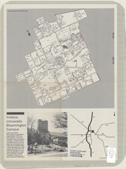
- Subject:
- Geographic Subject: Indiana University, Bloomington, Geographic Subject: Bloomington (Ind.), and Topical Subject: Indiana University, Bloomington
- Creator:
- Indiana University, Bloomington
- Publisher:
- Indiana University
- Date Created:
- 1980
- Identifier:
- VAC3073-M-00027
- Genre:
- Maps
- Geographic Location:
- Coordinates: W0863532 W0862816 N0391315 N0390716
- Related URL:
- Catalog URL: https://iucat.iu.edu/catalog/5294791
- Abstract:
- Folded title. Includes index to buildings. _x000d_ Text, location map and illustrations on verso.
- Call Number:
- G4094.B5:2I6 1980 .I6
- Caption:
- Imprint: [Bloomington : Indiana University, 1980?]
- Physical Description:
- Dimensions: 44 x 32 cm and Scale: Scale not given.
- Alternate Identifier:
- Title Control Number: a5294791
- Persistent URL:
- https://purl.dlib.indiana.edu/iudl/images/VAC3073/VAC3073-M-00027
