
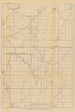
Search Constraints
You searched for:
Publisher
Indiana. Department of Geology and Natural Resources
Remove constraint Publisher: Indiana. Department of Geology and Natural Resources
« Previous |
1 - 50 of 196
|
Next »
Search Results
-
- Subject:
- Topical Subject: Lakes, Geographic Subject: Monroe, Lake (Ind.), and Topical Subject: Reservoirs
- Creator:
- Duthie, Glenn
- Publisher:
- Indiana. Department of Geology and Natural Resources
- Date Created:
- 1981
- Identifier:
- VAC3073-M-00405
- Genre:
- Thematic maps
- Geographic Location:
- Coordinates: W0863112 W0861853 N0390703 N0385942
- Related URL:
- Catalog URL: https://iucat.iu.edu/catalog/5327399
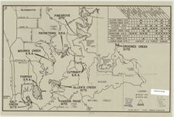
- Abstract:
- "File no. 300-74, 2-23-81." Includes chart showing recreational facilities. Text, illustrations, and location map on verso. "Recreation facili...
- Call Number:
- G4092.M6 1981 .D88
- Caption:
- Imprint: [Indianapolis?] : [Indiana Dept. of Natural Resources?], [1981?]
- Physical Description:
- Dimensions: 26 x 41 cm and Scale: Scale not given.
- Alternate Identifier:
- Title Control Number: a5327399
- Persistent URL:
- https://purl.dlib.indiana.edu/iudl/images/VAC3073/VAC3073-M-00405
-
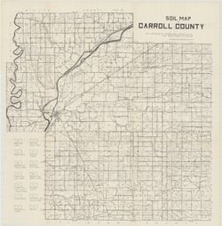
- Subject:
- Topical Subject: Soils and Geographic Subject: Carroll County (Ind.)
- Creator:
- Erni, C. P. (Chester Prall), 1896- and Beals, C. C.
- Publisher:
- Indiana. Department of Geology and Natural Resources
- Date Created:
- 1917
- Identifier:
- VAC3073-M-01476
- Genre:
- Thematic maps
- Geographic Location:
- Coordinates: W0864600 W0862200 N0404400 N0402600
- Related URL:
- Catalog URL: https://iucat.iu.edu/catalog/15734020
- Abstract:
- Detached from: Carroll County / C.P. Erni and C.C. Beals. In Forty-first annual report of Dept. of Geology and Natural Resources, Indiana, 1916. Fort Wayne, ...
- Call Number:
- G4093.C2J3 1916 .E7
- Caption:
- Imprint: [Indianapolis] : Ind. Dept. of Geology, [1917]
- Physical Description:
- Scale: Approximately 1:63,630. 1 in. = 1 mile and Dimensions: 57 x 57 cm
- Alternate Identifier:
- Title Control Number: a15734020
- Persistent URL:
- https://purl.dlib.indiana.edu/iudl/images/VAC3073/VAC3073-M-01476
- Provenance:
- 41st Annual Report (1916) / Indiana. Department of Geology and Natural Resources.
-
- Subject:
- Topical Subject: Geology, Topical Subject: IGS Annual Reports, Topical Subject: Mines and mineral resources, and Geographic Subject: Benton County (Ind.)
- Creator:
- Jones, Grove B., 1877- and Brill, J. Bayard
- Publisher:
- Indiana. Department of Geology and Natural Resources
- Date Created:
- 1917
- Identifier:
- VAC3073-M-01478
- Genre:
- Thematic maps
- Related URL:
- Catalog URL: https://iucat.iu.edu/catalog/4022271
- Abstract:
- From page 29 of the 41st Annual Report.
- Call Number:
- QE109 .A2 1916
- Caption:
- Imprint: Indianapolis : 1917.
- Persistent URL:
- https://purl.dlib.indiana.edu/iudl/images/VAC3073/VAC3073-M-01478
- Provenance:
- 41st Annual Report (1916) / Indiana. Department of Geology and Natural Resources.
-
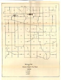
- Subject:
- Geographic Subject: Daviess County (Ind.), Topical Subject: Gas wells, Topical Subject: Oil wells, and Topical Subject: IGS Annual Reports
- Publisher:
- Indiana. Department of Geology and Natural Resources
- Date Created:
- 1917
- Identifier:
- VAC3073-M-01180
- Genre:
- Outline maps
- Geographic Location:
- Coordinates: W0870606 W0865524 N0384112 N0383354
- Related URL:
- Catalog URL: https://iucat.iu.edu/catalog/18418419
- Abstract:
- Shows oil and gas wells. Sheet 5 of 14. Detached from: Oil and gas / Floyd E. Wright. In Forty-first annual report of Department of Geology and Natural Re...
- Call Number:
- G4093.D2H8 1917 .O9
- Caption:
- Imprint: [Fort Wayne, Ind.] : [Fort Wayne Printing Co.], [1917] and Imprint: [Fort Wayne, Ind.] : [Indiana Department of Geology and Natural Resources], [1917]
- Physical Description:
- Dimensions: 43 x 34 cm and Scale: Approximately 1:43,000
- Alternate Identifier:
- Title Control Number: a18418419 and Alternate ID: 390726IP
- Persistent URL:
- https://purl.dlib.indiana.edu/iudl/images/VAC3073/VAC3073-M-01180
- Provenance:
- 41st Annual Report (1916) / Indiana. Department of Geology and Natural Resources.
-
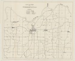
- Subject:
- Topical Subject: Oil wells, Topical Subject: Gas wells, Topical Subject: IGS Annual Reports, Geographic Subject: Petersburg Region (Ind.), and Geographic Sub...
- Creator:
- Indiana. Department of Geology and Natural Resources
- Publisher:
- Indiana. Department of Geology and Natural Resources
- Date Created:
- 1917
- Identifier:
- VAC3073-M-01485
- Genre:
- Geological maps and Outline maps
- Geographic Location:
- Coordinates: W0872226 W0871007 N0383313 N0382504
- Related URL:
- Catalog URL: https://iucat.iu.edu/catalog/18416517
- Abstract:
- Shows oil and gas wells for the Petersburg oil field in Pike County, Indiana. Detached from: Structural geology / Edward Barrett. In Forty-first annual re...
- Call Number:
- G4093.P4H8 1916 .I5
- Caption:
- Imprint: [Fort Wayne, Ind.] : Fort Wayne Printing Co., [1917] and Imprint: [Fort Wayne, Ind.] : [Indiana Dept. of Geology and Natural Resources], [1917]
- Physical Description:
- Scale: Approximately 1:33,000 and Dimensions: 47 x 57 cm
- Alternate Identifier:
- Alternate ID: 390726IP and Title Control Number: a18416517
- Persistent URL:
- https://purl.dlib.indiana.edu/iudl/images/VAC3073/VAC3073-M-01485
- Provenance:
- 41st Annual Report (1916) / Indiana. Department of Geology and Natural Resources.
-

- Subject:
- Geographic Subject: Petersburg Region (Ind.), Geographic Subject: Pike County (Ind.), Topical Subject: IGS Annual Reports, Topical Subject: Gas wells, and To...
- Creator:
- Indiana. Department of Geology and Natural Resources
- Publisher:
- Indiana. Department of Geology and Natural Resources
- Date Created:
- 1917
- Identifier:
- VAC3073-M-01477
- Genre:
- Outline maps and Geological maps
- Geographic Location:
- Coordinates: W0872226 W0871007 N0383313 N0382504
- Related URL:
- Catalog URL: https://iucat.iu.edu/catalog/18416517
- Abstract:
- Shows oil and gas wells for the Petersburg oil field in Pike County, Indiana. Detached from: Structural geology / Edward Barrett. In Forty-first annual re...
- Call Number:
- G4093.P4H8 1916 .I5
- Caption:
- Imprint: [Fort Wayne, Ind.] : [Indiana Dept. of Geology and Natural Resources], [1917] and Imprint: [Fort Wayne, Ind.] : Fort Wayne Printing Co., [1917]
- Physical Description:
- Dimensions: 47 x 57 cm and Scale: Approximately 1:33,000
- Alternate Identifier:
- Alternate ID: 390726IP and Title Control Number: a18416517
- Persistent URL:
- https://purl.dlib.indiana.edu/iudl/images/VAC3073/VAC3073-M-01477
- Provenance:
- 41st Annual Report (1916) / Indiana. Department of Geology and Natural Resources.
-
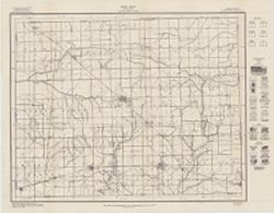
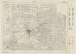
- Subject:
- Topical Subject: Soils and Geographic Subject: Grant County (Ind.)
- Creator:
- Hertenstein, Earl, Hurst, Lewis A. (Lewis Alexander), 1874-, Middleton, Philip (Soil surveyor), Watkins, W. I. (William Isaac), 1888-1973, Tharp, W. E. (Will...
- Publisher:
- Indiana. Department of Geology and Natural Resources
- Date Created:
- 1916
- Identifier:
- VAC3073-M-01510
- Genre:
- Thematic maps
- Geographic Location:
- Coordinates: W0855153 W0852639 N0403913 N0402242
- Related URL:
- Catalog URL: https://iucat.iu.edu/catalog/16142796
- Abstract:
- "Field Operations Bureau of Soils, 1915"--Lower margin. Detached from: Soil survey of Grant County, Indiana / L.A. Hurst [and others]. In 40th A...
- Call Number:
- G4093.G6J3 1915 .H88
- Caption:
- Imprint: [Indianapolis] : Indiana Department of Geology, [1916] and Imprint: [Fort Wayne] : [Fort Wayne Printing Company], [1916]
- Physical Description:
- Scale: Approximately 1:63,360. 1 in. = 1 mile and Dimensions: 46 x 53 cm
- Alternate Identifier:
- Title Control Number: a16142796 and Alternate ID: 390726IP
- Persistent URL:
- https://purl.dlib.indiana.edu/iudl/images/VAC3073/VAC3073-M-01510
- Provenance:
- 40th Annual Report (1915) / Indiana. Department of Geology and Natural Resources.
-
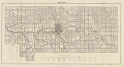
- Subject:
- Geographic Subject: Wells County (Ind.), Topical Subject: IGS Annual Reports, and Topical Subject: Soils
- Creator:
- United States. Bureau of Soils, Tharp, W. E. (William Edgar), and Wiley, W. E. (William Emmett), 1894-1967
- Publisher:
- Indiana. Department of Geology and Natural Resources
- Date Created:
- 1916
- Identifier:
- VAC3073-M-01537
- Genre:
- Thematic maps
- Geographic Location:
- Coordinates: W0852656 W0850406 N0405504 N0403400
- Related URL:
- Catalog URL: https://iucat.iu.edu/catalog/16138560
- Abstract:
- "Field Operations, Bureau of Soils, 1915." Detached from: Soil survey of Wells County / W. E. Tharp and W. E. Wiley. In Fortieth annual report o...
- Call Number:
- G4093.W7J3 1915 .T49
- Caption:
- Imprint: [Fort Wayne]: [Fort Wayne Printing Company], [1916] and Imprint: [Indianapolis] : State of Indiana, Department of Geology, [1916]
- Physical Description:
- Dimensions: 58 x 48 cm and Scale: 1:63,360. 1 in. = 1 mile
- Alternate Identifier:
- Title Control Number: a16138560 and Alternate ID: 390726IP
- Persistent URL:
- https://purl.dlib.indiana.edu/iudl/images/VAC3073/VAC3073-M-01537
- Provenance:
- 40th Annual Report (1915) / Indiana. Department of Geology and Natural Resources.
-
- Subject:
- Geographic Subject: Monroe County (Ind.), Geographic Subject: Greene County (Ind.), Geographic Subject: Indiana, Geographic Subject: Owen County (Ind.), and ...
- Publisher:
- Indiana. Department of Geology and Natural Resources
- Date Created:
- 1915
- Identifier:
- VAC3073-M-01188
- Genre:
- Quadrangle maps, Topographic maps, and Geological maps
- Geographic Location:
- Coordinates: W0864500 W0863000 N0391500 N0390000
- Related URL:
- Catalog URL: https://iucat.iu.edu/catalog/16190483
- Abstract:
- Relief shown by contours and spot heights. Contour interval 20 feet. Shows limestone locations in a portion of Monroe County and small portions of Owen and G...
- Call Number:
- G4093.M7C5 1914 .I6
- Caption:
- Imprint: [Indianapolis] : Indiana Dept. of Geology [and Natural Resources], [1915] and Imprint: [Indianapolis] : [Wm. B. Burford], [1915]
- Physical Description:
- Scale: 1:62,500 and Dimensions: 45 x 35 cm
- Alternate Identifier:
- Title Control Number: a16190483 and Alternate ID: 390726IP
- Persistent URL:
- https://purl.dlib.indiana.edu/iudl/images/VAC3073/VAC3073-M-01188
- Provenance:
- 39th Annual Report (1914) / Indiana. Department of Geology and Natural Resources.
-
- Subject:
- Geographic Subject: Elkhart County (Ind.), Topical Subject: Mines and mineral resources, Topical Subject: Geology, and Topical Subject: IGS Annual Reports
- Creator:
- Jones, Grove B., 1877- and Hesler, R. S.
- Publisher:
- Indiana. Department of Geology and Natural Resources
- Date Created:
- 1915
- Identifier:
- VAC3073-M-01474
- Genre:
- Thematic maps
- Related URL:
- Catalog URL: https://iucat.iu.edu/catalog/4022271
- Call Number:
- QE109 .A2 1914
- Caption:
- Imprint: Indianapolis : 1915
- Persistent URL:
- https://purl.dlib.indiana.edu/iudl/images/VAC3073/VAC3073-M-01474
- Provenance:
- 39th Annual Report (1914) / Indiana. Department of Geology and Natural Resources.
-
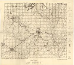
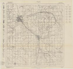
- Subject:
- Topical Subject: Soils and Geographic Subject: Jay County (Ind.)
- Creator:
- Hole, Allen David, 1866-1940
- Publisher:
- Indiana. Department of Geology and Natural Resources
- Date Created:
- 1915
- Identifier:
- VAC3073-M-01184
- Genre:
- Thematic maps
- Geographic Location:
- Coordinates: W0851312 W0844808 N0403419 N0401824
- Related URL:
- Catalog URL: https://iucat.iu.edu/catalog/16152007
- Abstract:
- Detached from: Soil survey of Jay County / Allen David Hole. In 39th Annual report of Department of Geology and Natural Resources, Indiana. From page 54 o...
- Call Number:
- G4093.J4J3 1914 .H6
- Caption:
- Imprint: [Indianapolis] : [Department of Geology and Natural Resources, Indiana], [1915]
- Physical Description:
- Dimensions: 35 x 42 cm and Scale: 1:84,000
- Persistent URL:
- https://purl.dlib.indiana.edu/iudl/images/VAC3073/VAC3073-M-01184
- Provenance:
- 39th Annual Report (1914) / Indiana. Department of Geology and Natural Resources.
-
- Subject:
- Topical Subject: IGS Annual Reports, Geographic Subject: Clinton County (Ind.), Topical Subject: Mines and mineral resources, and Topical Subject: Geology
- Creator:
- Peacock, R. H., Rose, C. M. (Soil surveyor), and Tharp, W. E. (William Edgar)
- Publisher:
- Indiana. Department of Geology and Natural Resources
- Date Created:
- 1915
- Identifier:
- VAC3073-M-01480
- Genre:
- Thematic maps
- Related URL:
- Catalog URL: https://iucat.iu.edu/catalog/4022271
- Abstract:
- From page 89 of the 39th Annual Report.
- Call Number:
- QE109 .A2 1914
- Caption:
- Imprint: Indianapolis : 1915
- Persistent URL:
- https://purl.dlib.indiana.edu/iudl/images/VAC3073/VAC3073-M-01480
- Provenance:
- 39th Annual Report (1914) / Indiana. Department of Geology and Natural Resources.
-
- Subject:
- Topical Subject: IGS Annual Reports, Topical Subject: Mines and mineral resources, Topical Subject: Geology, and Geographic Subject: Howard County (Ind.)
- Creator:
- Rose, C. M. (Soil surveyor) and Coryell, Horace Noble, 1888-1965
- Publisher:
- Indiana. Department of Geology and Natural Resources
- Date Created:
- 1915
- Identifier:
- VAC3073-M-01479
- Genre:
- Thematic maps
- Related URL:
- Catalog URL: https://iucat.iu.edu/catalog/4022271
- Abstract:
- From page 21 of the 39th Annual Report.
- Call Number:
- QE109 .A2 1914
- Caption:
- Imprint: Indianapolis : 1915
- Persistent URL:
- https://purl.dlib.indiana.edu/iudl/images/VAC3073/VAC3073-M-01479
- Provenance:
- 39th Annual Report (1914) / Indiana. Department of Geology and Natural Resources.
-
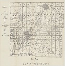
- Subject:
- Topical Subject: Geology, Geographic Subject: Blackford County (Ind.), Topical Subject: IGS Annual Reports, and Topical Subject: Mines and mineral resources
- Creator:
- Quinn, E. J. (Edward J.) and Peacock, R. H.
- Publisher:
- Indiana. Department of Geology and Natural Resources
- Date Created:
- 1914
- Identifier:
- VAC3073-M-01482
- Genre:
- Thematic maps
- Related URL:
- Catalog URL: https://iucat.iu.edu/catalog/4022271
- Call Number:
- QE109 .A2 1913
- Caption:
- Imprint: Indianapolis : 1914
- Persistent URL:
- https://purl.dlib.indiana.edu/iudl/images/VAC3073/VAC3073-M-01482
- Provenance:
- 38th Annual Report (1913) / Indiana. Department of Geology and Natural Resources.
-
- Subject:
- Geographic Subject: Hendricks County (Ind.), Topical Subject: IGS Annual Reports, Topical Subject: Mines and mineral resources, and Topical Subject: Geology
- Publisher:
- Indiana. Department of Geology and Natural Resources
- Date Created:
- 1914
- Identifier:
- VAC3073-M-01481
- Genre:
- Thematic maps
- Related URL:
- Catalog URL: new.iucat.iu.edu/catalog/4022273
- Abstract:
- From page 149 of the 38th Annual Report.
- Call Number:
- QE109 .A2 1913 map p149 Hendricks County
- Caption:
- Imprint: Indianapolis : 1914
- Persistent URL:
- https://purl.dlib.indiana.edu/iudl/images/VAC3073/VAC3073-M-01481
- Provenance:
- 38th Annual Report (1913) / Indiana. Department of Geology and Natural Resources.
-
- Subject:
- Topical Subject: Mines and mineral resources, Geographic Subject: Delaware County (Ind.), Topical Subject: IGS Annual Reports, and Topical Subject: Geology
- Publisher:
- Indiana. Department of Geology and Natural Resources
- Date Created:
- 1914
- Identifier:
- VAC3073-M-01484
- Genre:
- Thematic maps
- Related URL:
- Catalog URL: new.iucat.iu.edu/catalog/4022273
- Call Number:
- QE109 .A2 1913 Map p190 Delaware County
- Caption:
- Imprint: Indianapolis : 1914
- Persistent URL:
- https://purl.dlib.indiana.edu/iudl/images/VAC3073/VAC3073-M-01484
- Provenance:
- 38th Annual Report (1913) / Indiana. Department of Geology and Natural Resources.
-
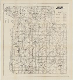
- Subject:
- Geographic Subject: Parke County (Ind.) and Topical Subject: Soils
- Creator:
- Orahood, C. H. (Charley Harold), 1882-
- Publisher:
- Indiana. Department of Geology and Natural Resources
- Date Created:
- 1914
- Identifier:
- VAC3073-M-01500
- Genre:
- Thematic maps
- Geographic Location:
- Coordinates: W0872602 W0870034 N0395712 N0393617
- Related URL:
- Catalog URL: https://iucat.iu.edu/catalog/16142627
- Abstract:
- Detached from: Soil Survey of Parke County / Harold Orahood. In 38th Annual report of Department of Geology and Natural Resources, Indiana. "State surve...
- Call Number:
- G4093.P2J3 1913 .O7
- Caption:
- Imprint: [Indianapolis] : [Department of Geology and Natural Resources, Indiana], [1914]
- Physical Description:
- Scale: 1:63,360 and Dimensions: 61 x 55 cm
- Persistent URL:
- https://purl.dlib.indiana.edu/iudl/images/VAC3073/VAC3073-M-01500
- Provenance:
- 38th Annual Report (1913) / Indiana. Department of Geology and Natural Resources.
-

- Subject:
- Topical Subject: Limestone, Geographic Subject: Owen County (Ind.), Geographic Subject: Bloomington Region (Ind.), Geographic Subject: Greene County (Ind.), ...
- Creator:
- Indiana. Department of Geology and Natural Resources
- Publisher:
- Indiana. Department of Geology and Natural Resources
- Date Created:
- 1914
- Identifier:
- VAC3073-M-00351
- Genre:
- Topographic maps, Quadrangle maps, and Geological maps
- Geographic Location:
- Coordinates: W0864500 W0863000 N0391500 N0390000
- Related URL:
- Catalog URL: https://iucat.iu.edu/catalog/4896690
- Abstract:
- Relief shown by contours and spot heights. Contour interval 20 feet. Shows limestone locations in a portion of Monroe County and small portions of Owen and G...
- Call Number:
- G4093 .M7C5 1914 .I6
- Caption:
- Imprint: [Indianapolis] : Indiana Dept. of Geology [and Natural Resources], [1915] and Imprint: [Indianapolis] : [Wm. B. Burford], [1915]
- Physical Description:
- Dimensions: 45 x 35 cm and Scale: 1:62,500
- Alternate Identifier:
- Title Control Number: a4896690 and Alternate ID: 390726IP
- Persistent URL:
- https://purl.dlib.indiana.edu/iudl/images/VAC3073/VAC3073-M-00351
- Provenance:
- 39th Annual Report (1914) / Indiana. Department of Geology and Natural Resources.
-
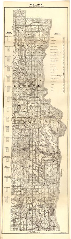
- Subject:
- Topical Subject: Soils and Geographic Subject: Vermillion County (Ind.)
- Creator:
- Coryell, Horace Noble, 1888-1965
- Publisher:
- Indiana. Department of Geology and Natural Resources
- Date Created:
- 1914
- Identifier:
- VAC3073-M-01157
- Genre:
- Thematic maps
- Geographic Location:
- Coordinates: W0873159 W0872113 N0400854 N0393626
- Related URL:
- Catalog URL: https://iucat.iu.edu/catalog/16151794
- Abstract:
- Detached from: Soil survey and Vermillion County / H.N. Coryell. In Indiana Department of Geology and Natural Resources thirty-eighth annual report ... 1913....
- Call Number:
- G4093.V4J3 1913 .C6
- Caption:
- Imprint: [Indianapolis] : State of Indiana, Department of Geology, [1914] [Indianapolis] : [Wm. B. Burford], [1914]
- Physical Description:
- Scale: Approximately 1:84,480 and Dimensions: 73 x 21 cm
- Alternate Identifier:
- Title Control Number: a16151794 and Alternate ID: 390726IP
- Persistent URL:
- https://purl.dlib.indiana.edu/iudl/images/VAC3073/VAC3073-M-01157
- Provenance:
- 38th Annual Report (1913) / Indiana. Department of Geology and Natural Resources.
-
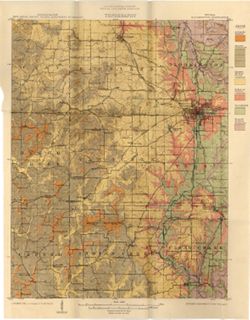
- Subject:
- Geographic Subject: Indiana and Topical Subject: IGS Annual Reports
- Creator:
- Hesler, R. S.
- Publisher:
- Indiana. Department of Geology and Natural Resources
- Date Created:
- 1913
- Identifier:
- VAC3073-M-01536
- Genre:
- Topographic maps
- Geographic Location:
- Coordinates: W0880500 W0844700 N0414500 N0374600
- Related URL:
- Catalog URL: https://iucat.iu.edu/catalog/18466085
- Abstract:
- Relief shown by choropleth methods. "Note: Data--railroad elevations, Plan--after Leverett." Detached from: Topography of Indiana--Map / Edward ...
- Call Number:
- G4091.C2 1913 .H4
- Caption:
- Imprint: [Indianapolis] : [Indiana Department of Geology and Natural Resources], [1913]
- Physical Description:
- Dimensions: on sheet 73 x 46 cm and Scale: Scale not given.
- Alternate Identifier:
- Alternate ID: 390726IP and Title Control Number: a18466085
- Persistent URL:
- https://purl.dlib.indiana.edu/iudl/images/VAC3073/VAC3073-M-01536
- Provenance:
- 37th Annual Report (1912) / Indiana. Department of Geology and Natural Resources.
-
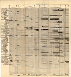
- Subject:
- Topical Subject: Stratigraphic correlation, Topical Subject: Geology, Stratigraphic--Ordovician, Topical Subject: Bilateria, Fossil, Topical Subject: IGS Ann...
- Creator:
- Cumings, E. R. (Edgar Roscoe), 1874-1967 and Galloway, J. J. (Jesse James), 1882-1962
- Publisher:
- Indiana. Department of Geology and Natural Resources
- Date Created:
- 1913
- Identifier:
- VAC3073-M-01183
- Genre:
- Cartographic materials and Graphs
- Geographic Location:
- Coordinates: W0880500 W0844700 N0414500 N0374600
- Related URL:
- Catalog URL: https://iucat.iu.edu/catalog/18416521
- Abstract:
- Sections on one sheet. Title from caption. Diagram showing stratagraphic measurements for bilateria fossils in the Tanner's Creek Formation from the Cinc...
- Call Number:
- G4091.C57 1912 .C8
- Caption:
- Imprint: [Indianapolis] : [Department of Geology and Natural Resources], [1913] and Imprint: [Indianapolis] : [Wm. B. Burford, contractor for state printing ...
- Physical Description:
- Scale: Scale not given. Vertical scale approximately 1:550 and Dimensions: 38 x 41 cm
- Alternate Identifier:
- Title Control Number: a18416521 and Alternate ID: 390726IP
- Persistent URL:
- https://purl.dlib.indiana.edu/iudl/images/VAC3073/VAC3073-M-01183
- Provenance:
- 37th Annual Report (1912) / Indiana. Department of Geology and Natural Resources.
-
- Subject:
- Geographic Subject: Greene County (Ind.) and Topical Subject: Soils
- Creator:
- Tharp, W. E. (William Edgar)
- Publisher:
- Indiana. Department of Geology and Natural Resources
- Date Created:
- 1912
- Identifier:
- VAC3073-M-01159
- Genre:
- Thematic maps
- Geographic Location:
- Coordinates: W0871427 W0864055 N0391018 N0385408
- Related URL:
- Catalog URL: https://iucat.iu.edu/catalog/16151513
- Abstract:
- Detached from: Soil survey of Greene County (1901) / by W. E. Tharp and Charles J. Mann, of the U. S. Bureau of Soils. In Thirty-sixth annual report of Depar...
- Call Number:
- G4093.G7J3 1906 .T5
- Caption:
- Imprint: [Indianapolis] : State of Indiana, Department of Geology, [1912] [Indianapolis] : [Wm. B. Burford], [1912]
- Physical Description:
- Dimensions: 35 x 52 cm and Scale: 1:80,000
- Alternate Identifier:
- Title Control Number: a16151513 and Alternate ID: 390726IP
- Persistent URL:
- https://purl.dlib.indiana.edu/iudl/images/VAC3073/VAC3073-M-01159
- Provenance:
- 36th Annual Report (1911) / Indiana. Department of Geology and Natural Resources.
-
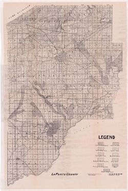
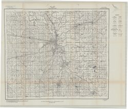
- Subject:
- Topical Subject: IGS Annual Reports, Topical Subject: Soils, Geographic Subject: LaPorte County (Ind.), and Topical Subject: Soil surveys
- Publisher:
- Indiana. Department of Geology and Natural Resources
- Date Created:
- 1912
- Identifier:
- VAC3073-M-01082
- Genre:
- Thematic maps
- Geographic Location:
- Coordinates: W0865600 W0862910 N0414539 N0411412
- Related URL:
- Catalog URL: https://iucat.iu.edu/catalog/16131280
- Abstract:
- Variant title: La Porte County. Shows soil types, dirt roads, improved roads, and railroads. Detached from: Soil survey of Laporte County / E.J. Quinn. In...
- Call Number:
- G4093.L15J3 1911 .L37
- Caption:
- Imprint: [Indianapolis] : [Wm. B. Burford], [1912] and Imprint: [Indianapolis] : [Department of Geology and Natural Resources, Indiana], [1912]
- Physical Description:
- Dimensions: on sheet 70 x 46 cm
- Alternate Identifier:
- Title Control Number: a16131280 and Alternate ID: 390726IP
- Persistent URL:
- https://purl.dlib.indiana.edu/iudl/images/VAC3073/VAC3073-M-01082
- Provenance:
- 36th Annual Report (1911) / Indiana. Geological Survey.
-
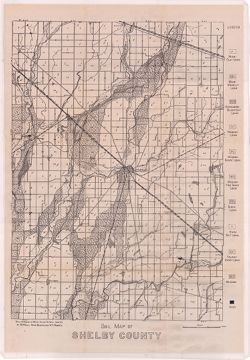
- Subject:
- Topical Subject: Geology, Topical Subject: Soils, Topical Subject: Mines and mineral resources, and Geographic Subject: Shelby County (Ind.)
- Creator:
- Hole, Allen David, 1866-1940
- Publisher:
- Indiana. Department of Geology and Natural Resources
- Date Created:
- 1912
- Identifier:
- VAC3073-M-01072
- Genre:
- Thematic maps
- Geographic Location:
- Coordinates: W0855711 W0853744 N0394156 N0392050
- Related URL:
- Catalog URL: https://iucat.iu.edu/catalog/16124745
- Abstract:
- Soils surveyed in 1911 by Allen D. Hole, assisted by B.W. Kelly, Mark Baldwin, and W.A. Roberts. Detached from: Soil survey of Hancock, Shelby, and Johnso...
- Call Number:
- G4093.S4.J3 1911 .H6
- Caption:
- Imprint: [Indianapolis] : [Department of Geology and Natural Resources, Indiana], [1912] and Imprint: [Indianapolis] : [Wm. B. Burford], [1912]
- Physical Description:
- Scale: Approximately 1:86,000 and Dimensions: 46 x 32 cm
- Alternate Identifier:
- Alternate ID: 390726IP and Title Control Number: a16124745
- Persistent URL:
- https://purl.dlib.indiana.edu/iudl/images/VAC3073/VAC3073-M-01072
- Provenance:
- 36th Annual Report (1911) / Indiana. Department of Geology and Natural Resources.
-
- Subject:
- Topical Subject: Soils and Geographic Subject: Marion County (Ind.)
- Creator:
- Geib, W. J. (Warren Jacob), 1880- and Schroeder, Frank C.
- Publisher:
- Indiana. Department of Geology and Natural Resources
- Date Created:
- 1912
- Identifier:
- VAC3073-M-01090
- Genre:
- Thematic maps
- Geographic Location:
- Coordinates: W0861941 W0855614 N0395538 N0393755
- Related URL:
- Catalog URL: https://iucat.iu.edu/catalog/16151623
- Abstract:
- Detached from: Soil survey of Marion County, Indiana / W.J. Geib and Frank C. Schroeder. In Thirty-sixth annual report of Department of Geology and Natural R...
- Call Number:
- G4093.M3J3 1911 .G4
- Caption:
- Imprint: [Indianapolis] : [Wm. B. Burford], [1912] and Imprint: [Indianapolis] : [Department of Geology and Natural Resources], [1912]
- Physical Description:
- Scale: Approximately 1:63,360 and Dimensions: 53 x 53 cm
- Alternate Identifier:
- Alternate ID: 390726IP and Title Control Number: a16151623
- Persistent URL:
- https://purl.dlib.indiana.edu/iudl/images/VAC3073/VAC3073-M-01090
- Provenance:
- 36th Annual Report (1911) / Indiana. Department of Geology and Natural Resources.
-
- Subject:
- Topical Subject: Soils and Geographic Subject: Posey County (Ind.)
- Creator:
- Marean, Herbert W.
- Publisher:
- Indiana. Department of Geology and Natural Resources
- Date Created:
- 1912
- Identifier:
- VAC3073-M-01091
- Genre:
- Thematic maps
- Geographic Location:
- Coordinates: W0880557 W0874117 N0381349 N0374618
- Related URL:
- Catalog URL: https://iucat.iu.edu/catalog/16135740
- Abstract:
- Soils surveyed by Herbert W. Marean, 1902, U.S. Bureau of Soils. Detached from: Soil survey of Posey County, Indiana / Herbert W. Marean. In Thirty-sixth ...
- Call Number:
- G4093.P6J3 1902 .M3
- Caption:
- Imprint: [Indianapolis] : [Department of Geology and Natural Resources], [1912] and Imprint: [Indianapolis] : [Wm. B. Burford], [1912]
- Physical Description:
- Dimensions: 79 x 55 cm and Scale: Approximately 1:66,000
- Alternate Identifier:
- Alternate ID: 390726IP and Title Control Number: a16135740
- Persistent URL:
- https://purl.dlib.indiana.edu/iudl/images/VAC3073/VAC3073-M-01091
- Provenance:
- 36th Annual Report (1911) / Indiana. Department of Geology and Natural Resources.
-
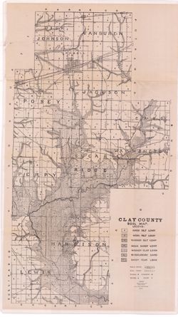
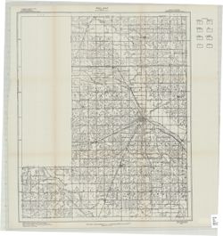
- Subject:
- Topical Subject: IGS Annual Reports, Geographic Subject: Clay County (Ind.), and Topical Subject: Soils
- Creator:
- Shannon, M. E. and Shannon, C. W. (Charles William), 1879-1934
- Publisher:
- Indiana. Department of Geology and Natural Resources
- Date Created:
- 1912
- Identifier:
- VAC3073-M-01093
- Genre:
- Thematic maps
- Related URL:
- Catalog URL: https://iucat.iu.edu/catalog/4022271
- Abstract:
- Detached from: Soil survey of Clay, Knox, Sullivan and Vigo counties / by Charles W. Shannon. In Thirty-sixth annual report of Department of Geology and Natu...
- Call Number:
- QE109 .A2 1911 map p170
- Caption:
- Imprint: [Indianapolis] : [Department of Geology and Natural Resources, Indiana], [1912] [Indianapolis] : [Wm. B. Burford], [1912]
- Physical Description:
- Scale: Approximately 1:63,360 and Dimensions: 80 x 45 cm
- Alternate Identifier:
- Title Control Number: 390726IP
- Persistent URL:
- https://purl.dlib.indiana.edu/iudl/images/VAC3073/VAC3073-M-01093
- Provenance:
- 36th Annual Report (1911) / Indiana. Department of Geology and Natural Resources.
-
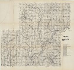
- Subject:
- Topical Subject: Soils and Geographic Subject: Owen County (Ind.)
- Creator:
- Indiana. Department of Geology and Natural Resources
- Publisher:
- Indiana. Department of Geology and Natural Resources
- Date Created:
- 1912
- Identifier:
- VAC3073-M-01070
- Genre:
- Thematic maps
- Geographic Location:
- Coordinates: W0870317 W0863750 N0392824 N0390956
- Related URL:
- Catalog URL: https://iucat.iu.edu/catalog/16096159
- Abstract:
- Shows soil types. Also shows roads and railroads. Detached from: Soil survey of Owen County / J.B. Edmondson. In Thirty-sixth annual report of Department ...
- Call Number:
- G4093.O8J3 1911 .I53
- Caption:
- Imprint: [Indianapolis] : [Wm. B. Burford], [1912] and Imprint: [Indianapolis] : [Department of Geology and Natural Resources, Indiana], [1912]
- Physical Description:
- Scale: Approximately 1:63,360 and Dimensions: 59 x 65 cm
- Alternate Identifier:
- Title Control Number: a16096159 and Alternate ID: 390726IP
- Persistent URL:
- https://purl.dlib.indiana.edu/iudl/images/VAC3073/VAC3073-M-01070
- Provenance:
- 36th Annual Report (1911) / Indiana. Department of Geology and Natural Resources.
-
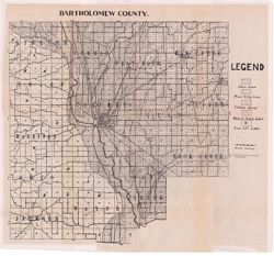
- Subject:
- Geographic Subject: Bartholomew County (Ind.) and Topical Subject: Soils
- Creator:
- Indiana. Department of Geology and Natural Resources
- Publisher:
- Indiana. Department of Geology and Natural Resources
- Date Created:
- 1912
- Identifier:
- VAC3073-M-01088
- Genre:
- Thematic maps
- Geographic Location:
- Coordinates: W0860508 W0854104 N0392100 N0390209
- Related URL:
- Catalog URL: https://iucat.iu.edu/catalog/16136919
- Abstract:
- Shows roads and railroads. Detached from: Soil survey of Bartholomew County / E.J. Quinn. In Thirty-sixth annual report of Department of Geology and Natur...
- Call Number:
- G4093.B3J3 1911 .I53
- Caption:
- Imprint: [Indianapolis] : [Department of Geology and Natural Resources], [1912] and Imprint: [Indianapolis] : [Wm. B. Burford], [1912]
- Physical Description:
- Dimensions: 40 x 41 cm, on sheet 44 x 49 cm and Scale: Approximately 1:85,000
- Alternate Identifier:
- Alternate ID: 390726IP and Title Control Number: a16136919
- Persistent URL:
- https://purl.dlib.indiana.edu/iudl/images/VAC3073/VAC3073-M-01088
- Provenance:
- 36th Annual Report (1911) / Indiana. Department of Geology and Natural Resources.
-
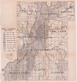
- Subject:
- Geographic Subject: Vigo County (Ind.), Topical Subject: Soils, Topical Subject: Geology, and Topical Subject: Mines and mineral resources
- Creator:
- Shannon, M. E., Shannon, C. W. (Charles William), 1879-1934, and United States. Bureau of Soils
- Publisher:
- Indiana. Department of Geology and Natural Resources
- Date Created:
- 1912
- Identifier:
- VAC3073-M-01092
- Genre:
- Thematic maps
- Geographic Location:
- Coordinates: W0873635 W0871156 N0393629 N0391532
- Related URL:
- Catalog URL: https://iucat.iu.edu/catalog/16131306
- Abstract:
- Shows dirt roads and improved public roads, railroads, school houses, cemeteries, and churches. Detached from: Soil survey of Clay, Knox, Sullivan, and Vi...
- Call Number:
- G4093.V5J3 1911 .S5
- Caption:
- Imprint: [Indianapolis] : [Department of Geology and Natural Resources, Indiana], [1912] [Indianapolis] : [Wm. B. Burford], [1912]
- Physical Description:
- Dimensions: 64 x 59 cm and Scale: Approximately 1:63,360
- Alternate Identifier:
- Title Control Number: a16131306 and Alternate ID: 390726IP
- Persistent URL:
- https://purl.dlib.indiana.edu/iudl/images/VAC3073/VAC3073-M-01092
- Provenance:
- 36th Annual Report (1911) / Indiana. Department of Geology and Natural Resources.
-
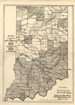
- Subject:
- Topical Subject: Soil surveys, Geographic Subject: Indiana, Topical Subject: IGS Annual Reports, Topical Subject: Moraines, and Topical Subject: Glacial epoch
- Publisher:
- Indiana. Department of Geology and Natural Resources
- Date Created:
- 1912
- Identifier:
- VAC3073-M-01144
- Genre:
- Thematic maps and Index maps
- Geographic Location:
- Coordinates: W0880500 W0844700 N0414500 N0374600
- Related URL:
- Catalog URL: https://iucat.iu.edu/catalog/18307837
- Abstract:
- Shows counties covered by a U.S. soil survey or a state soil survey. Detached from: Glaciation and soils / Edward Barrett. In Thirty-sixth annual report o...
- Call Number:
- G4091.C38 1911 .I5
- Caption:
- Imprint: [Indianapolis] : [Department of Geology and Natural Resources, Indiana], [1912]
- Physical Description:
- Scale: Approximately 1:1,750,000 and Dimensions: 24 x 18 cm
- Alternate Identifier:
- Alternate ID: 390726IP and Title Control Number: a18307837
- Persistent URL:
- https://purl.dlib.indiana.edu/iudl/images/VAC3073/VAC3073-M-01144
- Provenance:
- 36th Annual Report (1911) / Indiana. Department of Geology and Natural Resources.
-
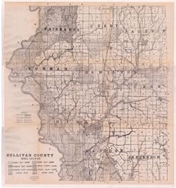
- Subject:
- Topical Subject: Soils, Geographic Subject: Sullivan County (Ind.), Topical Subject: IGS Annual Reports, and Topical Subject: Soil surveys
- Creator:
- Shannon, C. W. (Charles William), 1879-1934 and Shannon, M. E.
- Publisher:
- Indiana. Department of Geology and Natural Resources
- Date Created:
- 1912
- Identifier:
- VAC3073-M-01483
- Genre:
- Thematic maps
- Geographic Location:
- Coordinates: W0873845 W0871422 N0391540 N0385413
- Related URL:
- Catalog URL: https://iucat.iu.edu/catalog/18307850
- Abstract:
- Shows soil types, earth and improved public roads, railroads, schools, cemeteries, churches, and coal mines. Detached from: Soil survey of Clay, Knox, Sul...
- Call Number:
- G4093.S8J3 1911 .S5
- Caption:
- Imprint: [Indianapolis] : [Department of Geology and Natural Resources, Indiana], [1912]
- Physical Description:
- Scale: Approximately 1:63,360 and Dimensions: on sheet 64 x 59 cm
- Alternate Identifier:
- Alternate ID: 390726IP and Title Control Number: a18307850
- Persistent URL:
- https://purl.dlib.indiana.edu/iudl/images/VAC3073/VAC3073-M-01483
- Provenance:
- 36th Annual Report (1911) / Indiana. Department of Geology and Natural Resources.
-
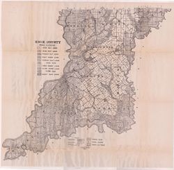
- Subject:
- Topical Subject: Mines and mineral resources, Topical Subject: Soils, Geographic Subject: Knox County (Ind.), and Topical Subject: Geology
- Creator:
- Shannon, M. E. and Shannon, C. W. (Charles William), 1879-1934
- Publisher:
- Indiana. Department of Geology and Natural Resources
- Date Created:
- 1912
- Identifier:
- VAC3073-M-01089
- Genre:
- Thematic maps
- Geographic Location:
- Coordinates: W0874524 W0870526 N0385428 N0382451
- Related URL:
- Catalog URL: https://iucat.iu.edu/catalog/16929613
- Abstract:
- Shows soil types, dirt roads, improved roads, railroads, schools, cemeteries, and churches. Detached from: Soil survey of Clay, Knox, Sullivan, and Vigo c...
- Call Number:
- G4093.K5J3 1911 .S5
- Caption:
- Imprint: [Indianapolis] : [Wm. B. Burford], [1912] and Imprint: [Indianapolis] : [Department of Geology and Natural Resources], [1912]
- Physical Description:
- Dimensions: 67 x 70 cm and Scale: Approximately 1:86,000
- Alternate Identifier:
- Title Control Number: a16929613 and Alternate ID: 390726IP
- Persistent URL:
- https://purl.dlib.indiana.edu/iudl/images/VAC3073/VAC3073-M-01089
- Provenance:
- 36th Annual Report (1911) / Indiana. Department of Geology and Natural Resources.
-
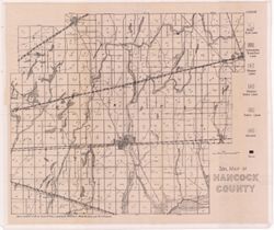
- Subject:
- Geographic Subject: Hancock County (Ind.) and Topical Subject: Soils
- Creator:
- Hole, Allen David, 1866-1940
- Publisher:
- Indiana. Department of Geology and Natural Resources
- Date Created:
- 1912
- Identifier:
- VAC3073-M-01073
- Genre:
- Thematic maps
- Geographic Location:
- Coordinates: W0855714 W0853434 N0395645 N0394149
- Related URL:
- Catalog URL: https://iucat.iu.edu/catalog/16124751
- Abstract:
- Soils surveyed in 1911 by Allen D. Hole, assisted by B.W. Kelly, Mark Baldwin, and W.A. Roberts. Detached from: Soil survey of Hancock, Shelby, and Johnso...
- Call Number:
- G4093.H3J3 1911 .H6
- Caption:
- Imprint: [Indianapolis] : [Wm. B. Burford], [1912] and Imprint: [Indianapolis] : [Department of Geology and Natural Resources, Indiana], [1912]
- Physical Description:
- Scale: Approximately 1:86,000 and Dimensions: 36 x 42 cm
- Alternate Identifier:
- Title Control Number: a16124751 and Alternate ID: 390726IP
- Persistent URL:
- https://purl.dlib.indiana.edu/iudl/images/VAC3073/VAC3073-M-01073
- Provenance:
- 36th Annual Report (1911) / Indiana. Department of Geology and Natural Resources.
-
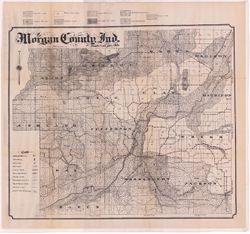
- Subject:
- Topical Subject: Soils and Geographic Subject: Morgan County (Ind.)
- Creator:
- Edmonson, James Bartlett, 1882-1954
- Publisher:
- Indiana. Department of Geology and Natural Resources
- Date Created:
- 1912
- Identifier:
- VAC3073-M-01094
- Genre:
- Thematic maps
- Geographic Location:
- Coordinates: W0864115 W0861459 N0393801 N0392017
- Related URL:
- Catalog URL: https://iucat.iu.edu/catalog/16096234
- Abstract:
- Shows soil types, school houses, cemeteries, churches, railroads, county roads and township roads. Detached from: Soil survey of Morgan County / J.B. Edmo...
- Call Number:
- G4093.M9J3 1911 .E3
- Caption:
- Imprint: [Indianapolis] : [Department of Geology and Natural Resources, Indiana], [1912] [Indianapolis] : [Wm. B. Burford], [1912]
- Physical Description:
- Scale: Approximately 1:63,360 and Dimensions: 52 x 61 cm
- Alternate Identifier:
- Alternate ID: 390726IP and Title Control Number: a16096234
- Persistent URL:
- https://purl.dlib.indiana.edu/iudl/images/VAC3073/VAC3073-M-01094
- Provenance:
- 36th Annual Report (1911) / Indiana. Department of Geology and Natural Resources.
-
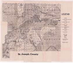
- Subject:
- Geographic Subject: Saint Joseph County (Ind.) and Topical Subject: Soils
- Creator:
- Indiana. Department of Geology and Natural Resources
- Publisher:
- Indiana. Department of Geology and Natural Resources
- Date Created:
- 1912
- Identifier:
- VAC3073-M-01087
- Genre:
- Thematic maps
- Geographic Location:
- Coordinates: W0863136 W0860333 N0414538 N0412558
- Related URL:
- Catalog URL: https://iucat.iu.edu/catalog/16137081
- Abstract:
- Shows dirt roads, improved roads, and railroads. Detached from: Soil survey of St. Joseph County / E.J. Quinn. In Thirty-sixth annual report of Department...
- Call Number:
- G4093.S2J3 1911 .I53
- Caption:
- Imprint: [Indianapolis] : [Department of Geology and Natural Resources], [1912] and Imprint: [Indianapolis] : [Wm. B. Burford], [1912]
- Physical Description:
- Dimensions: 43 x 45 cm, on sheet 46 x 56 cm and Scale: Approximately 1:90,000
- Alternate Identifier:
- Title Control Number: a16137081 and Alternate ID: 390726IP
- Persistent URL:
- https://purl.dlib.indiana.edu/iudl/images/VAC3073/VAC3073-M-01087
- Provenance:
- 36th Annual Report (1911) / Indiana. Department of Geology and Natural Resources.
-
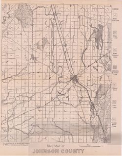
- Subject:
- Geographic Subject: Johnson County (Ind.) and Topical Subject: Soils
- Creator:
- Hole, Allen David, 1866-1940
- Publisher:
- Indiana. Department of Geology and Natural Resources
- Date Created:
- 1912
- Identifier:
- VAC3073-M-01071
- Genre:
- Thematic maps
- Geographic Location:
- Coordinates: W0861506 W0855702 N0393818 N0392030
- Related URL:
- Catalog URL: https://iucat.iu.edu/catalog/16124859
- Abstract:
- Detached from: Soil survey of Hancock, Shelby, and Johnson counties / Allen David Hole. In Thirty-sixth annual report of Department of Geology and Natural Re...
- Call Number:
- G4093.J7J3 1911 .H6
- Caption:
- Imprint: [Indianapolis] : [Department of Geology and Natural Resources, Indiana], [1912] and Imprint: [Indianapolis] : [Wm. B. Burford], [1912]
- Physical Description:
- Scale: Approximately 1:86,000 and Dimensions: 38 x 30 cm
- Alternate Identifier:
- Alternate ID: 390726IP and Title Control Number: a16124859
- Persistent URL:
- https://purl.dlib.indiana.edu/iudl/images/VAC3073/VAC3073-M-01071
- Provenance:
- 36th Annual Report (1911) / Indiana. Department of Geology and Natural Resources.
-
- Subject:
- Geographic Subject: Sullivan County (Ind.) and Topical Subject: Soils
- Creator:
- Shannon, M. E. and Shannon, C. W. (Charles William), 1879-1934
- Publisher:
- Indiana. Department of Geology and Natural Resources
- Date Created:
- 1912
- Identifier:
- VAC3073-M-01095
- Genre:
- Thematic maps
- Geographic Location:
- Coordinates: W0873933 W0871425 N0391534 N0385405
- Related URL:
- Catalog URL: https://iucat.iu.edu/catalog/16137467
- Abstract:
- Shows dirt roads and improved public roads, railroads, schools, cemeteries, churches, and coal mines. Detached from: Soil survey of Clay, Knox, Sullivan, ...
- Call Number:
- G4093.S8J3 1911 .S5
- Caption:
- Imprint: [Indianapolis] : [Department of Geology and Natural Resources, Indiana], [1912] [Indianapolis] : [Wm. B. Burford], [1912]
- Physical Description:
- Scale: Approximately 1:63,360 and Dimensions: 64 x 59 cm
- Alternate Identifier:
- Title Control Number: a16137467 and Alternate ID: 390726IP
- Persistent URL:
- https://purl.dlib.indiana.edu/iudl/images/VAC3073/VAC3073-M-01095
- Provenance:
- 36th Annual Report (1911) / Indiana. Department of Geology and Natural Resources.
-
- Subject:
- Geographic Subject: Owen County (Ind.), Geographic Subject: Eel River Valley (Ind. : Valley), Topical Subject: IGS Annual Reports, and Topical Subject: Valleys
- Publisher:
- Indiana. Department of Geology and Natural Resources
- Date Created:
- 1911
- Identifier:
- VAC3073-M-00830
- Genre:
- Topographic maps
- Geographic Location:
- Coordinates: W0865003 W0864726 N0392725 N0392513
- Related URL:
- Catalog URL: https://iucat.iu.edu/catalog/18418393
- Abstract:
- Relief shown by contours. Contour interval 20 feet. Shows upper falls dam and proposed lower falls dams now located within the Cataract Falls State Recreatio...
- Call Number:
- G4092.O8C2 1910 .T6
- Caption:
- Imprint: [Indianapolis] : [Wm. B. Burford], [1911] and Imprint: [Indianapolis] : [Indiana Department of Geology and Natural Resources], [1911]
- Physical Description:
- Scale: Approximately 1:7,650 and Dimensions: 31 x 25 cm
- Alternate Identifier:
- Title Control Number: a18418393 and Alternate ID: 390726IP
- Persistent URL:
- https://purl.dlib.indiana.edu/iudl/images/VAC3073/VAC3073-M-00830
- Provenance:
- 35th Annual Report (1910) / Indiana. Department of Geology and Natural Resources.
-
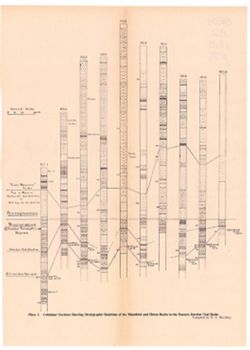
- Subject:
- Geographic Subject: Indiana, Topical Subject: Mines and mineral resources, Topical Subject: IGS Annual Reports, Topical Subject: Geology, Stratigraphic--Penn...
- Creator:
- Blatchley, Raymond S. (Raymond Sillliman)
- Publisher:
- Indiana. Department of Geology and Natural Resources
- Date Created:
- 1911
- Identifier:
- VAC3073-M-01084
- Genre:
- Geological cross-sections
- Geographic Location:
- Coordinates: W0880500 W0844700 N0414500 N0374600
- Related URL:
- Catalog URL: https://iucat.iu.edu/catalog/18418391
- Abstract:
- Title from caption. At head of title: "Plate I." Compiled by R.S. Blatchley. 10 sections on one sheet. Geologic columns showing stratigraphic layer...
- Call Number:
- G4091.C57 1910 .B53
- Caption:
- Imprint: [Indianapolis] : [Indiana Department of Geology and Natural Resources], [1911] and Imprint: [Indianapolis] : [Wm. B. Burford], [1911]
- Physical Description:
- Scale: Scale not given. Vertical scale approximately 1:2,100 and Dimensions: on sheet 37 x 26 cm
- Alternate Identifier:
- Title Control Number: a18418391 and Alternate ID: 390726IP
- Persistent URL:
- https://purl.dlib.indiana.edu/iudl/images/VAC3073/VAC3073-M-01084
- Provenance:
- 35th Annual Report (1910) / Indiana. Department of Geology and Natural Resources.
-
- Subject:
- Geographic Subject: Pike County (Ind.), Geographic Subject: Oakland City (Ind.), Geographic Subject: Gibson County (Ind.), Topical Subject: Gas wells, Topica...
- Publisher:
- Indiana. Department of Geology and Natural Resources
- Date Created:
- 1911
- Identifier:
- VAC3073-M-00671
- Genre:
- Geological maps
- Geographic Location:
- Coordinates: W0872300 W0871300 N0382200 N0381200
- Related URL:
- Catalog URL: https://iucat.iu.edu/catalog/18307759
- Abstract:
- Shows oil and gas wells. "Structure contours above sea level showing coal V or its position before erosion."--Legend. Detached from: The Oakland...
- Call Number:
- G4094.O2H8 1910 .M3
- Caption:
- Imprint: [Indianapolis] : [Indiana Dept. of Geology and Natural Resources], [1911]
- Physical Description:
- Scale: Approximately 1:21,500 and Dimensions: 57 x 40 cm
- Alternate Identifier:
- Title Control Number: a18307759 and Alternate ID: 390726IP
- Persistent URL:
- https://purl.dlib.indiana.edu/iudl/images/VAC3073/VAC3073-M-00671
- Provenance:
- 35th Annual Report (1910) / Indiana. Department of Geology and Natural Resources.
-
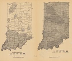
- Subject:
- Geographic Subject: Indiana, Topical Subject: Precipitation (Meteorology), and Topical Subject: IGS Annual Reports
- Publisher:
- Indiana. Department of Geology and Natural Resources
- Date Created:
- 1911
- Identifier:
- VAC3073-M-00072
- Genre:
- Thematic maps
- Geographic Location:
- Coordinates: W0880500 W0844700 N0414500 N0374600
- Related URL:
- Catalog URL: https://iucat.iu.edu/catalog/18307828
- Abstract:
- 2 maps on one sheet. Shows rainfall over the state of Indiana in inches. "Fig. 2." Detached from: Water power of Indiana / W.M. Tucker. In India...
- Call Number:
- G4091.C88 1909 .T6
- Caption:
- Imprint: [Indianapolis] : [Indiana Department of Geology and Natural Resources], [1911]
- Physical Description:
- Scale: Scale not given. and Dimensions: on sheet 23 x 27 cm
- Alternate Identifier:
- Alternate ID: 390726IP and Title Control Number: a18307828
- Persistent URL:
- https://purl.dlib.indiana.edu/iudl/images/VAC3073/VAC3073-M-00072
- Provenance:
- 35th Annual Report (1910) / Indiana. Department of Geology and Natural Resources.
-
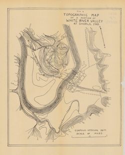
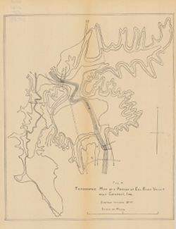
- Subject:
- Topical Subject: IGS Annual Reports, Topical Subject: Rivers, Geographic Subject: White River Valley (Ind.), Geographic Subject: Shoals (Ind.), Topical Subje...
- Publisher:
- Indiana. Department of Geology and Natural Resources
- Date Created:
- 1911
- Identifier:
- VAC3073-M-00393
- Genre:
- Topographic maps
- Geographic Location:
- Coordinates: W0864835 W0864633 N0384050 N0383903
- Related URL:
- Catalog URL: https://iucat.iu.edu/catalog/18418396
- Abstract:
- Relief shown by contours. Contour interval 10 feet. Shows proposed canal routes, proposed dam location, and power house. At head of title: "Fig. 4."...
- Call Number:
- G4093.M5C2 1910 .T6
- Caption:
- Imprint: [Indianapolis] : [Indiana Department of Geology and Natural Resources], [1911] and Imprint: [Indianapolis] : [Wm. B. Burford], [1911]
- Physical Description:
- Scale: Approximately 1:11,750 and Dimensions: 28 x 23 cm
- Alternate Identifier:
- Title Control Number: a18418396 and Alternate ID: 390726IP
- Persistent URL:
- https://purl.dlib.indiana.edu/iudl/images/VAC3073/VAC3073-M-00393
- Provenance:
- 35th Annual Report (1910) / Indiana. Department of Geology and Natural Resources.
-
- Subject:
- Geographic Subject: Pike County (Ind.) and Topical Subject: Soils
- Creator:
- Shannon, M. E. and Shannon, C. W. (Charles William), 1879-1934
- Publisher:
- Indiana. Department of Geology and Natural Resources
- Date Created:
- 1910
- Identifier:
- VAC3073-M-00173
- Genre:
- Thematic maps
- Geographic Location:
- Coordinates: W0872746 W0870419 N0383308 N0381351
- Related URL:
- Catalog URL: https://iucat.iu.edu/catalog/16123837
- Abstract:
- Shows railroads and 3 classes of roads. "U.S. topographic sheets, state geological maps, field work 1909." Detached from: A soil survey of Vande...
- Call Number:
- G4093.P4J3 1909 .S5
- Caption:
- Imprint: [Indianapolis] : [Indiana Department of Geology and Natural Resources], [1910]
- Physical Description:
- Scale: Approximately 1:126,720 and Dimensions: 37 x 32 cm
- Alternate Identifier:
- Title Control Number: a16123837 and Alternate ID: 390726IP
- Persistent URL:
- https://purl.dlib.indiana.edu/iudl/images/VAC3073/VAC3073-M-00173
- Provenance:
- 34th Annual Report (1909) / Indiana. Department of Geology and Natural Resources.
-
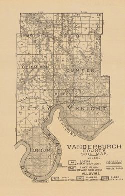
- Subject:
- Topical Subject: Soils and Geographic Subject: Vanderburgh County (Ind.)
- Creator:
- Shannon, C. W. (Charles William), 1879-1934
- Publisher:
- Indiana. Department of Geology and Natural Resources
- Date Created:
- 1910
- Identifier:
- VAC3073-M-00292
- Genre:
- Thematic maps
- Geographic Location:
- Coordinates: W0874202 W0872657 N0381006 N0374932
- Related URL:
- Catalog URL: https://iucat.iu.edu/catalog/16123565
- Abstract:
- Shows railroads and public roads. Detached from: A soil survey of Vanderburgh, Gibson, and Pike, and parts of Warrick and Spencer counties / Chas. W. Shan...
- Call Number:
- G4093.V3J3 1909 .S5
- Caption:
- Imprint: [Indianapolis] : [Indiana Department of Geology and Natural Resources], [1910]
- Physical Description:
- Dimensions: 37 x 24 cm and Scale: Approximately 1:126,720
- Alternate Identifier:
- Alternate ID: 390726IP and Title Control Number: a16123565
- Persistent URL:
- https://purl.dlib.indiana.edu/iudl/images/VAC3073/VAC3073-M-00292
- Provenance:
- 34th Annual Report (1909) / Indiana. Department of Geology and Natural Resources.
-
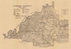
- Subject:
- Topical Subject: Soils and Geographic Subject: Gibson County (Ind.)
- Creator:
- Shannon, M. E. and Shannon, C. W. (Charles William), 1879-1934
- Publisher:
- Indiana. Department of Geology and Natural Resources
- Date Created:
- 1910
- Identifier:
- VAC3073-M-00029
- Genre:
- Thematic maps
- Geographic Location:
- Coordinates: W0875912 W0871858 N0383155 N0380956
- Related URL:
- Catalog URL: https://iucat.iu.edu/catalog/16091035
- Abstract:
- Shows public roads and railroads. Detached from: A soil survey of Randolph, Wayne, Henry, Rush, Fayette, Union and Franklin counties / Arthur E. Taylor. I...
- Call Number:
- G4093.G5J3 1909 .S5
- Caption:
- Imprint: [Indianapolis] : [Indiana Department of Geology and Natural Resources], [1910]
- Physical Description:
- Dimensions: 37 x 54 cm and Scale: Approximately 1:126,720
- Alternate Identifier:
- Title Control Number: a16091035 and Alternate ID: 390726IP
- Persistent URL:
- https://purl.dlib.indiana.edu/iudl/images/VAC3073/VAC3073-M-00029
- Provenance:
- 34th Annual Report (1909) / Indiana. Department of Geology and Natural Resources.
-
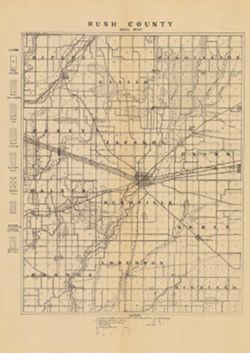
- Subject:
- Topical Subject: Soils and Geographic Subject: Rush County (Ind.)
- Creator:
- Indiana. Department of Geology and Natural Resources
- Publisher:
- Indiana. Department of Geology and Natural Resources
- Date Created:
- 1910
- Identifier:
- VAC3073-M-00995
- Genre:
- Thematic maps
- Geographic Location:
- Coordinates: W0853800 W0851751 N0394715 N0392708
- Related URL:
- Catalog URL: https://iucat.iu.edu/catalog/16124399
- Abstract:
- Shows railroads, dirt roads, and gravel roads. Includes notes on general topography. Detached from: A soil survey of Randolph, Wayne, Henry, Rush, Fayette...
- Call Number:
- G4093.R8J3 1909 .I53
- Caption:
- Imprint: [Indianapolis] : [Indiana Department of Geology and Natural Resources], [1910]
- Physical Description:
- Scale: 1:126,720 and Dimensions: 30 x 23 cm
- Alternate Identifier:
- Alternate ID: 390726IP and Title Control Number: a16124399
- Persistent URL:
- https://purl.dlib.indiana.edu/iudl/images/VAC3073/VAC3073-M-00995
- Provenance:
- 34th Annual Report (1909) / Indiana. Department of Geology and Natural Resources.
-
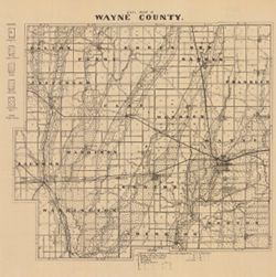
- Subject:
- Topical Subject: Soils and Geographic Subject: Wayne County (Ind.)
- Creator:
- Indiana. Department of Geology and Natural Resources
- Publisher:
- Indiana. Department of Geology and Natural Resources
- Date Created:
- 1910
- Identifier:
- VAC3073-M-00002
- Genre:
- Thematic maps
- Geographic Location:
- Coordinates: W0851316 W0844838 N0400022 N0394253
- Related URL:
- Catalog URL: https://iucat.iu.edu/catalog/16124401
- Abstract:
- Shows roads and railroads. Includes notes on general topography. Detached from: A soil survey of Randolph, Wayne, Henry, Rush, Fayette, Union and Franklin...
- Call Number:
- G4093.W6J3 1909 .I53
- Caption:
- Imprint: [Indianapolis] : [Indiana Department of Geology and Natural Resources], [1910]
- Physical Description:
- Scale: Approximately 1:126,720 and Dimensions: 26 x 29 cm
- Alternate Identifier:
- Title Control Number: a16124401 and Alternate ID: 390726IP
- Persistent URL:
- https://purl.dlib.indiana.edu/iudl/images/VAC3073/VAC3073-M-00002
- Provenance:
- 34th Annual Report (1909) / Indiana. Department of Geology and Natural Resources.
-
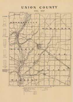
- Subject:
- Topical Subject: Soils and Geographic Subject: Union County (Ind.)
- Creator:
- Indiana. Department of Geology and Natural Resources
- Publisher:
- Indiana. Department of Geology and Natural Resources
- Date Created:
- 1910
- Identifier:
- VAC3073-M-00859
- Genre:
- Thematic maps
- Geographic Location:
- Coordinates: W0850210 W0844851 N0394345 N0393119
- Related URL:
- Catalog URL: https://iucat.iu.edu/catalog/16124317
- Abstract:
- Shows railroads, dirt roads, and gravel roads. Includes notes on general topography. Detached from: A soil survey of Randolph, Wayne, Henry, Rush, Fayette...
- Call Number:
- G4093.U5J3 1909 .I53
- Caption:
- Imprint: [Indianapolis] : [Indiana Department of Geology and Natural Resources], [1910]
- Physical Description:
- Dimensions: 25 x 21 cm and Scale: Approximately 1:95,000
- Alternate Identifier:
- Title Control Number: a16124317 and Alternate ID: 390726IP
- Persistent URL:
- https://purl.dlib.indiana.edu/iudl/images/VAC3073/VAC3073-M-00859
- Provenance:
- 34th Annual Report (1909) / Indiana. Department of Geology and Natural Resources.
-
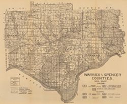
- Subject:
- Geographic Subject: Spencer County (Ind.), Geographic Subject: Warrick County (Ind.), and Topical Subject: Soils
- Creator:
- Shannon, C. W. (Charles William), 1879-1934
- Publisher:
- Indiana. Department of Geology and Natural Resources
- Date Created:
- 1910
- Identifier:
- VAC3073-M-00654
- Genre:
- Thematic maps
- Geographic Location:
- Coordinates: W0872823 W0864559 N0381446 N0374653
- Related URL:
- Catalog URL: https://iucat.iu.edu/catalog/16123910
- Abstract:
- Shows public roads and railroads. Detached from: A soil survey of Vanderburgh, Gibson, and Pike, and parts of Warrick and Spencer counties / Chas. W. Shan...
- Call Number:
- G4093.S5J3 1909 .S5
- Caption:
- Imprint: [Indianapolis] : [Indiana Department of Geology and Natural Resources], [1910]
- Physical Description:
- Dimensions: 44 x 52 cm and Scale: Approximately 1:126,720
- Alternate Identifier:
- Title Control Number: a16123910 and Alternate ID: 390726IP
- Persistent URL:
- https://purl.dlib.indiana.edu/iudl/images/VAC3073/VAC3073-M-00654
- Provenance:
- 34th Annual Report (1909) / Indiana. Department of Geology and Natural Resources.

- « Previous
- Next »
- 1
- 2
- 3
- 4