
Search Constraints
You searched for:
Publisher
Geological Survey (U.S.)
Remove constraint Publisher: Geological Survey (U.S.)
« Previous |
1 - 50 of 159
|
Next »
Search Results
-
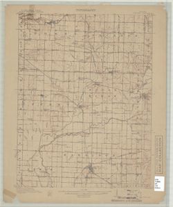
![Indiana-Ohio, Winchester quadrangle [1918 printing]](https://iiif.uits.iu.edu/iiif/2/qv33t053b%2Ffiles%2F7be0c967-f78e-4d33-9858-3a9858958bdd/full/250,/0/default.jpg)
- Subject:
- Geographic Subject: Wayne County (Ind.), Geographic Subject: Randolph County (Ind.), and Geographic Subject: Darke County (Ohio)
- Creator:
- Geological Survey (U.S.), Harrison, R. L. (Topographer), Herron, W. H. (William Harrison), 1865-, Miller, W. L. (Topographer), Ellis, J. R. (Topographer), Sm...
- Publisher:
- Geological Survey (U.S.)
- Identifier:
- VAC3073-M-01414
- Genre:
- Topographic maps, Quadrangle maps, and 15 minute topographic maps
- Geographic Location:
- Coordinates: W0850000 W0844500 N0401500 N0400000
- Related URL:
- Catalog URL: https://iucat.iu.edu/catalog/18416004
- Abstract:
- W.H. Herron, acting chief geogrpher , Glenn S. Smith, topographic engineer in charge , topography by R.L. Harrison and W.L. Miller , control by J.R. Ellis, J...
- Call Number:
- G4090 s62 .G4 Winchester
- Caption:
- Imprint: [Washington, D.C.] : U.S. Geological Survey, [1918]
- Physical Description:
- Dimensions: 45 x 42 cm or smaller and Scale: 1:62,500
- Alternate Identifier:
- Title Control Number: a18416004
- Persistent URL:
- https://purl.dlib.indiana.edu/iudl/images/VAC3073/VAC3073-M-01414
- Provenance:
- Part of Geological Survey (U.S.). Indiana 1:62,500.
-
![Indiana Petersburg quadrangle [1903 printing]](https://iiif.uits.iu.edu/iiif/2/kh04fs60m%2Ffiles%2Fe9278477-8060-4cc8-9b43-6722c928737e/full/250,/0/default.jpg)
- Subject:
- Geographic Subject: Pike County (Ind.) and Geographic Subject: Gibson County (Ind.)
- Creator:
- Blair, H. B. (Herbert Buxton), 1860-1905, Geological Survey (U.S.), Renshawe, John H., McKinney, R. C. (Robert C.), and Hawkins, Geo. T. (George T.)
- Publisher:
- Geological Survey (U.S.)
- Identifier:
- VAC3073-M-01298
- Genre:
- Topographic maps, Quadrangle maps, and 15 minute topographic maps
- Geographic Location:
- Coordinates: W0873000 W0871500 N0383000 N0381500
- Related URL:
- Catalog URL: https://iucat.iu.edu/catalog/18408289
- Abstract:
- Engraved Nov. 1902 by U.S.G.S , Jno. H. Renshawe, geographer in charge, control by Geo. T. Hawkins, topography by R.C. McKinney and H.B. Blair. Relief shown ...
- Call Number:
- G4090 s62 .G4 Petersburg 1903
- Caption:
- Imprint: Washington, D.C. : U.S. Geological Survey, 1903
- Physical Description:
- Scale: 1:62,500 and Dimensions: 45 x 42 cm or smaller
- Alternate Identifier:
- Title Control Number: a18408289
- Persistent URL:
- https://purl.dlib.indiana.edu/iudl/images/VAC3073/VAC3073-M-01298
- Provenance:
- Part of Geological Survey (U.S.). Indiana 1:62,500.
-
![Indiana-Illinois Princeton quadrangle [1922 reprint without vegetation]](https://iiif.uits.iu.edu/iiif/2/6h441w77c%2Ffiles%2F986f1cc4-da3e-4f00-892e-f811ead944f8/full/250,/0/default.jpg)
- Subject:
- Geographic Subject: Gibson County (Ind.), Geographic Subject: Knox County (Ind.), and Geographic Subject: Wabash County (Ill.)
- Creator:
- Renshawe, John H., Hawkins, Geo. T. (George T.), Geological Survey (U.S.), and Goodlove, C. W.
- Publisher:
- Geological Survey (U.S.)
- Identifier:
- VAC3073-M-01302
- Genre:
- 15 minute topographic maps, Quadrangle maps, and Topographic maps
- Geographic Location:
- Coordinates: W0874500 W0873000 N0383000 N0381500
- Related URL:
- Catalog URL: https://iucat.iu.edu/catalog/a18413584
- Abstract:
- Jno. H. Renshawe, geographer in charge , control by Geo. T. Hawkins , topography by Chas. W. Goodlove. Filing title: Princeton, Ind.-Ill. Edition of 1903. Re...
- Call Number:
- G4090 s62 .G4 Princeton 1903 R1922
- Caption:
- Imprint: Washington, D.C. : U.S. Geological Survey, 1922
- Physical Description:
- Dimensions: 45 x 42 cm or smaller and Scale: 1:62,500
- Alternate Identifier:
- Title Control Number: a18413584
- Persistent URL:
- https://purl.dlib.indiana.edu/iudl/images/VAC3073/VAC3073-M-01302
- Provenance:
- Part of Geological Survey (U.S.). Indiana 1:62,500.
-
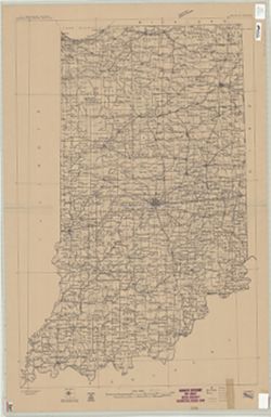
- Subject:
- Geographic Subject: Indiana
- Creator:
- Geological Survey (U.S.)
- Publisher:
- Geological Survey (U.S.)
- Date Created:
- Circa 1912
- Identifier:
- VAC3073-M-01292
- Genre:
- Maps
- Geographic Location:
- Coordinates: W0880700 W0844500 N0414500 N0375200
- Related URL:
- Catalog URL: https://iucat.iu.edu/catalog/6087422
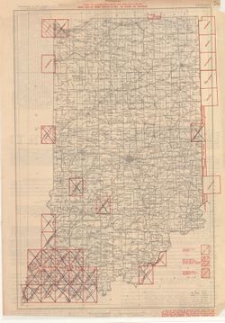
- Abstract:
- "Compiled in 1909-1910." Stamped in upper margin: "Advance sheet. Subject to correction." Includes diagram showing the "Re...
- Call Number:
- G4090 1910 .G4
- Caption:
- Imprint: [Washington, D.C.] : U.S. Geological Survey, [1912?]
- Physical Description:
- Dimensions: 92 x 60 cm and Scale: 1:500,000
- Persistent URL:
- https://purl.dlib.indiana.edu/iudl/images/VAC3073/VAC3073-M-01292
-
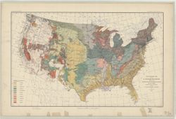
- Subject:
- Geographic Subject: United States and Topical Subject: Geology
- Creator:
- McGee, W J, 1853-1912
- Publisher:
- Geological Survey (U.S.)
- Date Created:
- 1893
- Identifier:
- VAC3073-M-00861
- Genre:
- Geological maps
- Geographic Location:
- Coordinates: W1250000 W0670000 N0490000 N0250000
- Related URL:
- Catalog URL: https://iucat.iu.edu/catalog/8556458
- Abstract:
- Relief shown by contour lines. In upper border: U.S. Geological Survey. Fourteenth annual report, pl. II. Shows Indian reservations. Includes legend.
- Call Number:
- G3701.C51 1893 .G46
- Caption:
- Imprint: [Washington?] : U.S. Geological Survey, 1893.
- Physical Description:
- Dimensions: 43 x 71 cm and Scale: 1:7,000,000
- Alternate Identifier:
- Title Control Number: a8556458
- Persistent URL:
- https://purl.dlib.indiana.edu/iudl/images/VAC3073/VAC3073-M-00861
- Provenance:
- 14th Annual Report (1884) / Indiana. Department of Geology and Natural History.
-
- Subject:
- Geographic Subject: Warrick County (Ind.), Geographic Subject: Vanderburgh County (Ind.), Geographic Subject: Gibson County (Ind.), and Geographic Subject: P...
- Creator:
- Renshawe, John H., Blair, H. B. (Herbert Buxton), 1860-1905, Hawkins, Geo. T. (George T.), and McKinney, R. C. (Robert C.)
- Publisher:
- Geological Survey (U.S.)
- Date Created:
- 1902
- Identifier:
- VAC3073-M-01296
- Genre:
- Topographic maps, Quadrangle maps, and 15 minute topographic maps
- Geographic Location:
- Coordinates: W0873000 W0871500 N0381500 N0380000
- Related URL:
- Catalog URL: https://iucat.iu.edu/catalog/18408288
- Abstract:
- Engraved Oct. 1902 by U.S.G.S. , Jno. H. Renshawe, geographer in charge , control by Geo. T. Hawkins , topography by R.C. McKinney and H.B. Blair. Edition of...
- Call Number:
- G4090 s62 .G4 Boonville 1902
- Caption:
- Imprint: [Washington, D.C.] : U.S. Geological Survey, 1902
- Physical Description:
- Dimensions: 45 x 42 cm or smaller and Scale: 1:62,500
- Alternate Identifier:
- Title Control Number: a18408288
- Persistent URL:
- https://purl.dlib.indiana.edu/iudl/images/VAC3073/VAC3073-M-01296
- Provenance:
- Part of Geological Survey (U.S.). Indiana 1:62,500.
-
- Subject:
- Geographic Subject: Spencer County (Ind.), Geographic Subject: Dubois County (Ind.), Geographic Subject: Warrick County (Ind.), and Geographic Subject: Pike ...
- Creator:
- Renshawe, John H., Geological Survey (U.S.), Hawkins, Geo. T. (George T.), and Goodlove, C. W.
- Publisher:
- Geological Survey (U.S.)
- Date Created:
- 1902
- Identifier:
- VAC3073-M-01301
- Genre:
- 15 minute topographic maps, Topographic maps, and Quadrangle maps
- Geographic Location:
- Coordinates: W0871500 W0870000 N0381500 N0380000
- Related URL:
- Catalog URL: https://iucat.iu.edu/catalog/18408290
- Abstract:
- Engraved Oct. 1902 by U.S.G.S. , Jno. Renshawe, geographer in charge , control by Geo. T. Hawkins , topography by Chas. W. Goodlove. Filing title: Degonia Sp...
- Call Number:
- G4090 s62 .G4 Degonia Springs 1902
- Caption:
- Imprint: Washington, D.C. : The Survey, 1902
- Physical Description:
- Dimensions: 45 x 42 cm or smaller and Scale: 1:62,500
- Alternate Identifier:
- Title Control Number: a18408290
- Persistent URL:
- https://purl.dlib.indiana.edu/iudl/images/VAC3073/VAC3073-M-01301
- Provenance:
- Part of Geological Survey (U.S.). Indiana 1:62,500.
-
![Indiana, Ditney quadrangle [1902 printing]](https://iiif.uits.iu.edu/iiif/2/pr76g7157%2Ffiles%2F6b2150ed-f127-4bd5-ab33-87b0e9707424/full/250,/0/default.jpg)
- Subject:
- Geographic Subject: Dubois County (Ind.), Geographic Subject: Warrick County (Ind.), Geographic Subject: Vanderburgh County (Ind.), Geographic Subject: Gibso...
- Creator:
- McKinney, R. C. (Robert C.), Geological Survey (U.S.), Blair, H. B. (Herbert Buxton), 1860-1905, Renshawe, John H., and Goodlove, C. W.
- Publisher:
- Geological Survey (U.S.)
- Date Created:
- 1902
- Identifier:
- VAC3073-M-01416
- Genre:
- Quadrangle maps, 30 minute topographic maps, and Topographic maps
- Geographic Location:
- Coordinates: W0873000 W0870000 N0383000 N0380000
- Related URL:
- Catalog URL: https://iucat.iu.edu/catalog/18416043
- Abstract:
- Indiana, 30 minute series (topographic). Filing title: Ditney, Ind. Jno. H. Renshawe, geographer in charge , topography by H.B. Blair, R.C. McKinney, and Cha...
- Call Number:
- G4090 s125 .G4 Ditney 1902
- Caption:
- Imprint: [United States] : Geological Survey, [1902]
- Physical Description:
- Dimensions: 45 x 36 cm and Scale: 1:125,000
- Alternate Identifier:
- Title Control Number: a18416043
- Persistent URL:
- https://purl.dlib.indiana.edu/iudl/images/VAC3073/VAC3073-M-01416
- Provenance:
- Part of Geological Survey (U.S.). Indiana 1:125,000.
-
![Indiana Velpen quadrangle [1903 printing]](https://iiif.uits.iu.edu/iiif/2/70796d46b%2Ffiles%2F57edc4e0-ddd1-4ff6-ab07-25dd93b93b50/full/250,/0/default.jpg)
- Subject:
- Geographic Subject: Dubois County (Ind.) and Geographic Subject: Pike County (Ind.)
- Creator:
- Geological Survey (U.S.), Renshawe, John H., Goodlove, C. W., and Hawkins, Geo. T. (George T.)
- Publisher:
- Geological Survey (U.S.)
- Date Created:
- 1903
- Identifier:
- VAC3073-M-01309
- Genre:
- 15 minute topographic maps, Quadrangle maps, and Topographic maps
- Geographic Location:
- Coordinates: W0871500 W0870000 N0383000 N0381500
- Related URL:
- Catalog URL: https://iucat.iu.edu/catalog/18415495
- Abstract:
- Jno. H. Renshawe, geographer in charge , control by Geo. T. Hawkins , topography by Chas. W. Goodlove , engraved Oct. 1902 by U.S.G.S. Edition of Feb. 1903. ...
- Call Number:
- G4090 s62 .G4 Velpen 1903
- Caption:
- Imprint: Washington, D.C. : U.S. Geological Survey, [1903]
- Physical Description:
- Scale: 1:62,500 and Dimensions: 45 x 42 cm or smaller
- Alternate Identifier:
- Title Control Number: a18415495
- Persistent URL:
- https://purl.dlib.indiana.edu/iudl/images/VAC3073/VAC3073-M-01309
- Provenance:
- Part of Geological Survey (U.S.). Indiana 1:62,500.
-
![Indiana Haubstadt quadrangle [1903 printing]](https://iiif.uits.iu.edu/iiif/2/mw22w891g%2Ffiles%2F3f2a82be-5754-4703-989d-ede2f3a3b596/full/250,/0/default.jpg)
- Subject:
- Geographic Subject: Posey County (Ind.), Geographic Subject: Gibson County (Ind.), and Geographic Subject: Vanderburgh County (Ind.)
- Creator:
- Renshawe, John H., Goodlove, C. W., Hawkins, Geo. T. (George T.), and Geological Survey (U.S.)
- Publisher:
- Geological Survey (U.S.)
- Date Created:
- 1903
- Identifier:
- VAC3073-M-01342
- Genre:
- Quadrangle maps, 15 minute topographic maps, and Topographic maps
- Geographic Location:
- Coordinates: W0874500 W0873000 N0381500 N0380000
- Related URL:
- Catalog URL: https://iucat.iu.edu/catalog/18408287
- Abstract:
- Engraved Mar. 1903 by U.S.G.S. , Jno. H. Renshawe, geographer in charge , control by Geo. T. Hawkins , topography by Chas. W. Goodlove. Relief shown by conto...
- Call Number:
- G4090 s62 .G4 Haubstadt 1903
- Caption:
- Imprint: [Washington, D.C.] : U.S. Geological Survey, 1903
- Physical Description:
- Dimensions: 45 x 42 cm or smaller and Scale: 1:62,500
- Alternate Identifier:
- Title Control Number: a18408287
- Persistent URL:
- https://purl.dlib.indiana.edu/iudl/images/VAC3073/VAC3073-M-01342
- Provenance:
- Part of Geological Survey (U.S.). Indiana 1:62,500.
-
![Indiana-Illinois Patoka quadrangle [1903 print]](https://iiif.uits.iu.edu/iiif/2/697004346%2Ffiles%2Fa8ce9ba2-6345-47f5-8aa5-e6adddaad8fd/full/250,/0/default.jpg)
- Subject:
- Geographic Subject: White County (Ill.), Geographic Subject: Edwards County (Ill.), Geographic Subject: Knox County (Ind.), Geographic Subject: Posey County ...
- Creator:
- Goodlove, C. W., Hawkins, Geo. T. (George T.), Geological Survey (U.S.), and Renshawe, John H.
- Publisher:
- Geological Survey (U.S.)
- Date Created:
- 1903
- Identifier:
- VAC3073-M-01418
- Genre:
- 30 minute topographic maps, Quadrangle maps, and Topographic maps
- Geographic Location:
- Coordinates: W0880000 W0873000 N0383000 N0380000
- Related URL:
- Catalog URL: https://iucat.iu.edu/catalog/18416043
- Abstract:
- Jno. H. Renshawe, geographer in charge , control by Geo. T. Hawkins , topography by Chas. W. Goodlove , engraved June 1903 by U.S.G.S. Relief shown by contou...
- Call Number:
- G4090 s125 .G4 Patoka 1903
- Caption:
- Imprint: [Washington, D.C.] : U.S. Geological Survey, [1903]
- Physical Description:
- Dimensions: 45 x 36 cm and Scale: 1:125,000
- Alternate Identifier:
- Title Control Number: a18416043
- Persistent URL:
- https://purl.dlib.indiana.edu/iudl/images/VAC3073/VAC3073-M-01418
- Provenance:
- Part of Geological Survey (U.S.). Indiana 1:125,000.
-
![Indiana St. Meinrad quadrangle [1903 printing]](https://iiif.uits.iu.edu/iiif/2/nk323h76c%2Ffiles%2Fe917d3f1-9cbd-4705-9a9a-2617f0dbde44/full/250,/0/default.jpg)
- Subject:
- Geographic Subject: Perry County (Ind.), Geographic Subject: Dubois County (Ind.), and Geographic Subject: Spencer County (Ind.)
- Creator:
- Goodlove, C. W., Renshawe, John H., Hawkins, Geo. T. (George T.), and Geological Survey (U.S.)
- Publisher:
- Geological Survey (U.S.)
- Date Created:
- 1903
- Identifier:
- VAC3073-M-01392
- Genre:
- Quadrangle maps, Topographic maps, and 15 minute topographic maps
- Geographic Location:
- Coordinates: W0870000 W0864500 N0381500 N0380000
- Related URL:
- Catalog URL: https://iucat.iu.edu/catalog/18413973
- Abstract:
- Jno. H. Renshawe, geographer in charge , control by Geo. T. Hawkins , topography by Chas. W. Goodlove , engraved Jan. 1903 by U.S.G.S. Edition of 1903. Poly...
- Call Number:
- G4090 s62 .G4 St. Meinrad 1903
- Caption:
- Imprint: Washington, D.C. : U.S. Geological Survey, 1903
- Physical Description:
- Dimensions: 45 x 42 cm or smaller and Scale: 1:62,500
- Alternate Identifier:
- Title Control Number: a18413973
- Persistent URL:
- https://purl.dlib.indiana.edu/iudl/images/VAC3073/VAC3073-M-01392
- Provenance:
- Part of Geological Survey (U.S.). Indiana 1:62,500.
-
![Indiana St. Meinrad quadrangle [1903 printing]](https://iiif.uits.iu.edu/iiif/2/9s1629486%2Ffiles%2Fc57731db-f713-427e-8c16-3f38d7e6a078/full/250,/0/default.jpg)
- Subject:
- Geographic Subject: Dubois County (Ind.), Geographic Subject: Spencer County (Ind.), and Geographic Subject: Perry County (Ind.)
- Creator:
- Goodlove, C. W., Renshawe, John H., Geological Survey (U.S.), and Hawkins, Geo. T. (George T.)
- Publisher:
- Geological Survey (U.S.)
- Date Created:
- 1903
- Identifier:
- VAC3073-M-01305
- Genre:
- Quadrangle maps, 15 minute topographic maps, and Topographic maps
- Geographic Location:
- Coordinates: W0870000 W0864500 N0381500 N0380000
- Related URL:
- Catalog URL: https://iucat.iu.edu/catalog/18413973
- Abstract:
- Jno. H. Renshawe, geographer in charge , control by Geo. T. Hawkins , topography by Chas. W. Goodlove , engraved Jan. 1903 by U.S.G.S. Edition of 1903. Poly...
- Call Number:
- G4090 s62 .G4 St. Meinrad 1903
- Caption:
- Imprint: Washington, D.C. : U.S. Geological Survey, 1903
- Physical Description:
- Dimensions: 45 x 42 cm or smaller and Scale: 1:62,500
- Alternate Identifier:
- Title Control Number: a18413973
- Persistent URL:
- https://purl.dlib.indiana.edu/iudl/images/VAC3073/VAC3073-M-01305
- Provenance:
- Part of Geological Survey (U.S.). Indiana 1:62,500.
-
![Indiana Petersburg quadrangle [1903 printing]](https://iiif.uits.iu.edu/iiif/2/j0990g23x%2Ffiles%2F2149234c-dd09-4f2b-b183-b824c7ca4138/full/250,/0/default.jpg)
- Subject:
- Geographic Subject: Gibson County (Ind.) and Geographic Subject: Pike County (Ind.)
- Creator:
- Geological Survey (U.S.), Renshawe, John H., McKinney, R. C. (Robert C.), Blair, H. B. (Herbert Buxton), 1860-1905, and Hawkins, Geo. T. (George T.)
- Publisher:
- Geological Survey (U.S.)
- Date Created:
- 1903
- Identifier:
- VAC3073-M-01378
- Genre:
- 15 minute topographic maps, Topographic maps, and Quadrangle maps
- Geographic Location:
- Coordinates: W0873000 W0871500 N0383000 N0381500
- Related URL:
- Catalog URL: https://iucat.iu.edu/catalog/18408289
- Abstract:
- Engraved Nov. 1902 by U.S.G.S , Jno. H. Renshawe, geographer in charge, control by Geo. T. Hawkins, topography by R.C. McKinney and H.B. Blair. Relief shown ...
- Call Number:
- G4090 s62 .G4 Petersburg 1903
- Caption:
- Imprint: Washington, D.C. : U.S. Geological Survey, 1903
- Physical Description:
- Scale: 1:62,500 and Dimensions: 45 x 42 cm or smaller
- Alternate Identifier:
- Title Control Number: a18408289
- Persistent URL:
- https://purl.dlib.indiana.edu/iudl/images/VAC3073/VAC3073-M-01378
- Provenance:
- Part of Geological Survey (U.S.). Indiana 1:62,500.
-
![Indiana Haubstadt quadrangle [1935 reprint]](https://iiif.uits.iu.edu/iiif/2/1544cr71r%2Ffiles%2F5aabf650-fa83-48d4-bdcd-7579f3c6501a/full/250,/0/default.jpg)
- Subject:
- Geographic Subject: Posey County (Ind.), Geographic Subject: Gibson County (Ind.), and Geographic Subject: Vanderburgh County (Ind.)
- Creator:
- Geological Survey (U.S.)
- Publisher:
- Geological Survey (U.S.)
- Date Created:
- 1903
- Identifier:
- VAC3073-M-01505
- Genre:
- 15 minute topographic maps, Topographic maps, and Quadrangle maps
- Geographic Location:
- Coordinates: W0874500 W0873000 N0381500 N0380000
- Related URL:
- Catalog URL: https://iucat.iu.edu/catalog/18408287
- Abstract:
- Engraved Mar. 1903 by U.S.G.S. , Jno. H. Renshawe, geographer in charge , control by Geo. T. Hawkins , topography by Chas. W. Goodlove. Relief shown by conto...
- Call Number:
- G4090 s62 .G4 Haubstadt 1903 R1935
- Caption:
- Imprint: [Washington, D.C.] : U.S. Geological Survey, 1935
- Physical Description:
- Dimensions: 45 x 42 cm or smaller and Scale: 1:62,500
- Alternate Identifier:
- Title Control Number: a18408287
- Persistent URL:
- https://purl.dlib.indiana.edu/iudl/images/VAC3073/VAC3073-M-01505
- Provenance:
- Part of Geological Survey (U.S.). Indiana 1:62,500.
-
![Indiana (Lake County) Toleston quadrangle [sic] [1909 reprint]](https://iiif.uits.iu.edu/iiif/2/9306v273k%2Ffiles%2Fb7dfe6ef-8abd-4000-8209-b517b9c9fc42/full/250,/0/default.jpg)
- Subject:
- Geographic Subject: Lake County (Ind.)
- Creator:
- U.S. Lake Survey, Geological Survey (U.S.), Renshawe, John H., and McKinney, R. C. (Robert C.)
- Publisher:
- Geological Survey (U.S.)
- Date Created:
- 1909
- Identifier:
- VAC3073-M-01306
- Genre:
- Quadrangle maps, Topographic maps, and 15 minute topographic maps
- Geographic Location:
- Coordinates: W0873000 W0871500 N0414500 N0413000
- Related URL:
- Catalog URL: https://iucat.iu.edu/catalog/18406229
- Abstract:
- United States, Department of the Interior, Geological Survey , Jno. H. Renshawe, geographer in charge , control by U.S. Lake Survey , topography by R. C. McK...
- Call Number:
- G4090 s62 .G4 Toleston 1900 R1909
- Caption:
- Imprint: Washington, D. C. : United States, Department of the Interior, Geological Survey, 1909
- Physical Description:
- Scale: 1:62,500 and Dimensions: 45 x 42 cm or smaller
- Alternate Identifier:
- Title Control Number: a18406229
- Persistent URL:
- https://purl.dlib.indiana.edu/iudl/images/VAC3073/VAC3073-M-01306
- Provenance:
- Part of Geological Survey (U.S.). Indiana 1:62,500.
-
![Indiana (Lake County) Toleston quadrangle [sic] [1909 reprint]](https://iiif.uits.iu.edu/iiif/2/kw52kc32n%2Ffiles%2F6730048e-8506-41de-a049-ea31d562429b/full/250,/0/default.jpg)
- Subject:
- Geographic Subject: Lake County (Ind.)
- Creator:
- McKinney, R. C. (Robert C.), Geological Survey (U.S.), Renshawe, John H., and U.S. Lake Survey
- Publisher:
- Geological Survey (U.S.)
- Date Created:
- 1909
- Identifier:
- VAC3073-M-01397
- Genre:
- Quadrangle maps, Topographic maps, and 15 minute topographic maps
- Geographic Location:
- Coordinates: W0873000 W0871500 N0414500 N0413000
- Related URL:
- Catalog URL: https://iucat.iu.edu/catalog/a18406229
- Abstract:
- United States, Department of the Interior, Geological Survey , Jno. H. Renshawe, geographer in charge , control by U.S. Lake Survey , topography by R. C. McK...
- Call Number:
- G4090 s62 .G4 Toleston 1900 rep1909
- Caption:
- Imprint: Washington, D. C. : United States, Department of the Interior, Geological Survey, 1909
- Physical Description:
- Dimensions: 45 x 42 cm or smaller and Scale: 1:62,500
- Alternate Identifier:
- Title Control Number: a18406229
- Persistent URL:
- https://purl.dlib.indiana.edu/iudl/images/VAC3073/VAC3073-M-01397
- Provenance:
- Part of Geological Survey (U.S.). Indiana 1:62,500.
-
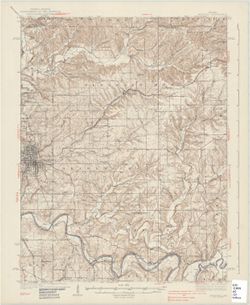
- Subject:
- Geographic Subject: Vigo County (Ind.), Geographic Subject: Clay County (Ind.), Geographic Subject: Putnam County (Ind.), and Geographic Subject: Owen County...
- Creator:
- Herron, W. H. (William Harrison), 1865-, Marshall, R. B. (Robert Bradford), 1867-1949, Sadler, C. L., and Geological Survey (U.S.)
- Publisher:
- Geological Survey (U.S.)
- Date Created:
- 1910
- Identifier:
- VAC3073-M-01328
- Genre:
- Quadrangle maps, Topographic maps, and 15 minute topographic maps
- Geographic Location:
- Coordinates: W0871500 W0870000 N0393000 N0391500
- Related URL:
- Catalog URL: https://iucat.iu.edu/catalog/18406394
- Abstract:
- Engraved July 1910 by U.S.G.S. , R. B. Marshall, chief geographer , W. H. Herron, geographer in charge , topography by C. L. Sadler , [and three others]. Rel...
- Call Number:
- G4090 s62 .G4 Clay City 1910
- Caption:
- Imprint: [Washington, D.C.] : U.S. Geological Survey, 1910
- Physical Description:
- Scale: 1:62,500 and Dimensions: 45 x 42 cm or smaller
- Alternate Identifier:
- Title Control Number: a18406394
- Persistent URL:
- https://purl.dlib.indiana.edu/iudl/images/VAC3073/VAC3073-M-01328
- Provenance:
- Part of Geological Survey (U.S.). Indiana 1:62,500.
-
![Indiana-Kentucky Owensboro quadrangle [1912 reprint]](https://iiif.uits.iu.edu/iiif/2/6d571071n%2Ffiles%2Fe60c13e2-5bbf-4e54-9481-ed8c9ad1c038/full/250,/0/default.jpg)
- Subject:
- Geographic Subject: Spencer County (Ind.), Geographic Subject: Daviess County (Ky.), and Geographic Subject: Warrick County (Ind.)
- Creator:
- Geological Survey (U.S.), Cooke, Chas. E. (Charles E.), Renshawe, John H., and Hawkins, Geo. T. (George T.)
- Publisher:
- Geological Survey (U.S.)
- Date Created:
- 1912
- Identifier:
- VAC3073-M-01373
- Genre:
- 15 minute topographic maps, Topographic maps, and Quadrangle maps
- Geographic Location:
- Coordinates: W0871500 W0870000 N0380000 N0374500
- Related URL:
- Catalog URL: https://iucat.iu.edu/catalog/18413576
- Abstract:
- John H. Renshaw, geographer in charge , control by George T. Hawkins , topography by Chas. E. Cooke. Filing title: Owensboro, Ind.-Ky. Edition of Nov. 1901. ...
- Call Number:
- G4090 s62 .G4 Owensboro 1901 rep 1912
- Caption:
- Imprint: Washington, D.C. : The Survey, 1912.
- Physical Description:
- Scale: 1:62,500 and Dimensions: 45 x 42 cm or smaller
- Alternate Identifier:
- Title Control Number: a18413576
- Persistent URL:
- https://purl.dlib.indiana.edu/iudl/images/VAC3073/VAC3073-M-01373
- Provenance:
- Part of Geological Survey (U.S.). Indiana 1:62,500.
-
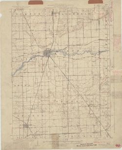
![Indiana Noblesville quadrangle [Advance sheet]](https://iiif.uits.iu.edu/iiif/2/z603s186j%2Ffiles%2Fa45cd3ef-5a89-498d-bd77-0a4e4dea6790/full/250,/0/default.jpg)
- Subject:
- Geographic Subject: Tipton County (Ind.), Geographic Subject: Whitewater River Watershed (Ind. and Ohio), Geographic Subject: Boone County (Ind.), Geographic...
- Creator:
- Klausmann, H. W. (Henry "Harry" W.), 1868-1918
- Publisher:
- Geological Survey (U.S.)
- Date Created:
- 1914
- Identifier:
- VAC3073-M-01447
- Genre:
- Topographic maps, 15 minute topographic maps, and Quadrangle maps
- Geographic Location:
- Coordinates: W0861500 W0860000 N0401500 N0400000
- Related URL:
- Catalog URL: https://iucat.iu.edu/catalog/18413827
- Abstract:
- Surveyed by H.W. Klausmann. Relief shown by contours. Contour interval 10 feet. Shows portion of Hamilton County as well as small portions Tipton and Boone c...
- Call Number:
- G4090 s62 .G4 Noblesville 1914 ADV
- Caption:
- Imprint: [Washington, D.C.?] : [U.S. Geological Survey?], [1914?]
- Physical Description:
- Dimensions: 45 x 42 cm or smaller and Scale: 1:48,000
- Alternate Identifier:
- Title Control Number: a18413827
- Persistent URL:
- https://purl.dlib.indiana.edu/iudl/images/VAC3073/VAC3073-M-01447
- Provenance:
- Part of Geological Survey (U.S.). Indiana 1:62,500.
-
- Subject:
- Geographic Subject: Indiana
- Creator:
- Geological Survey (U.S.)
- Publisher:
- Geological Survey (U.S.)
- Date Created:
- 1914
- Identifier:
- VAC3073-M-01290
- Genre:
- Topographic maps
- Geographic Location:
- Coordinates: W0880700 W0844500 N0414500 N0375200
- Related URL:
- Catalog URL: https://iucat.iu.edu/catalog/11839670
- Abstract:
- Relief shown by contours. Contour interval 100 feet. "Base from U.S. Geological Survey 1:1,000,000 scale map of the United States now in prep...
- Call Number:
- G4090 1914 .G4
- Caption:
- Imprint: [Washington, D.C.] : U.S. Geological Survey, 1914
- Physical Description:
- Dimensions: 46 x 31 cm and Scale: 1:1,000,000
- Persistent URL:
- https://purl.dlib.indiana.edu/iudl/images/VAC3073/VAC3073-M-01290
-
![Indiana, 15 minute series (topographic), Vincennes quadrangle. [1915 printing with vegetation]](https://iiif.uits.iu.edu/iiif/2/d791tm29s%2Ffiles%2F3ba9ccbe-8be1-48ce-9aac-c0c3b1eb0e6b/full/250,/0/default.jpg)
- Subject:
- Geographic Subject: Lawrence County (Ill.), Topical Subject: Vegetation mapping, Geographic Subject: Knox County (Ind.), Geographic Subject: Gibson County (I...
- Creator:
- Tweedy, Frank, 1854-1937, Geological Survey (U.S.), Marshall, R. B. (Robert Bradford), 1867-1949, United States. Army. Corps of Engineers, Herron, W. H. (Wil...
- Publisher:
- Geological Survey (U.S.)
- Date Created:
- 1915
- Identifier:
- VAC3073-M-01411
- Genre:
- 15 minute topographic maps, Topographic maps, and Quadrangle maps
- Geographic Location:
- Coordinates: W0874500 W0873000 N0384500 N0383000
- Related URL:
- Catalog URL: https://iucat.iu.edu/catalog/18415508
- Abstract:
- R.B. Marshall, chief geographer , W.H. Herron, geographer in charge , topography by Frank Tweedy, C.L. Sadler, Chas. Hartmann, Jr., L.L. Lee, W.S. Gehres, an...
- Call Number:
- G4090 s62 .G4 Vincennes 1915
- Caption:
- Imprint: [Washington, D.C.] : U.S. Geological Survey, [1915]
- Physical Description:
- Dimensions: 45 x 42 cm or smaller and Scale: 1:62,500
- Alternate Identifier:
- Title Control Number: a18415508
- Persistent URL:
- https://purl.dlib.indiana.edu/iudl/images/VAC3073/VAC3073-M-01411
- Provenance:
- Part of Geological Survey (U.S.). Indiana 1:62,500.
-
![Indiana (Lake County) Toleston quadrangle [sic] [1916 reprint]](https://iiif.uits.iu.edu/iiif/2/rn3024376%2Ffiles%2F849a8877-161b-4be6-9e9a-4918080787df/full/250,/0/default.jpg)
- Subject:
- Geographic Subject: Lake County (Ind.)
- Creator:
- Geological Survey (U.S.), U.S. Lake Survey, McKinney, R. C. (Robert C.), and Renshawe, John H.
- Publisher:
- Geological Survey (U.S.)
- Date Created:
- 1916
- Identifier:
- VAC3073-M-01307
- Genre:
- Quadrangle maps, 15 minute topographic maps, and Topographic maps
- Geographic Location:
- Coordinates: W0873000 W0871500 N0414500 N0413000
- Related URL:
- Catalog URL: https://iucat.iu.edu/catalog/18406229
- Abstract:
- United States, Department of the Interior, Geological Survey , Jno. H. Renshawe, geographer in charge , control by U.S. Lake Survey , topography by R. C. McK...
- Call Number:
- G4090 s62 .G4 Toleston 1900 R1916
- Caption:
- Imprint: Washington, D. C. : United States, Department of the Interior, Geological Survey, 1916
- Physical Description:
- Scale: 1:62,500 and Dimensions: 45 x 42 cm or smaller
- Alternate Identifier:
- Title Control Number: a18406229
- Persistent URL:
- https://purl.dlib.indiana.edu/iudl/images/VAC3073/VAC3073-M-01307
- Provenance:
- Part of Geological Survey (U.S.). Indiana 1:62,500.
-
![Indiana (Lake County) Toleston quadrangle [sic] [1916 reprint]](https://iiif.uits.iu.edu/iiif/2/jq086p521%2Ffiles%2Ffca34003-c067-4ace-a355-1b209c1a014f/full/250,/0/default.jpg)
- Subject:
- Geographic Subject: Lake County (Ind.)
- Creator:
- U.S. Lake Survey, Geological Survey (U.S.), Renshawe, John H., and McKinney, R. C. (Robert C.)
- Publisher:
- Geological Survey (U.S.)
- Date Created:
- 1916
- Identifier:
- VAC3073-M-01398
- Genre:
- Topographic maps, 15 minute topographic maps, and Quadrangle maps
- Geographic Location:
- Coordinates: W0873000 W0871500 N0414500 N0413000
- Related URL:
- Catalog URL: https://iucat.iu.edu/catalog/18406229
- Abstract:
- United States, Department of the Interior, Geological Survey , Jno. H. Renshawe, geographer in charge , control by U.S. Lake Survey , topography by R. C. McK...
- Call Number:
- G4090 s62 .G4 Toleston 1900 rep1916
- Caption:
- Imprint: Washington, D. C. : United States, Department of the Interior, Geological Survey, 1916.
- Physical Description:
- Dimensions: 45 x 42 cm and Scale: 1:62,500
- Alternate Identifier:
- Title Control Number: a18406229
- Persistent URL:
- https://purl.dlib.indiana.edu/iudl/images/VAC3073/VAC3073-M-01398
- Provenance:
- Part of Geological Survey (U.S.). Indiana 1:62,500.
-
![Kentucky-Indiana Henderson quadrangle [1916 printing]](https://iiif.uits.iu.edu/iiif/2/3t946v40d%2Ffiles%2F831c2385-8d1a-40d7-a1d6-fa14e229fd25/full/250,/0/default.jpg)
- Subject:
- Geographic Subject: Henderson County (Ky.), Geographic Subject: Posey County (Ind.), and Geographic Subject: Vanderburgh County (Ind.)
- Creator:
- U.S. Coast and Geodetic Survey, Herron, W. H. (William Harrison), 1865-, United States. Army, Gehres, W. S. (Wilmer Sherman), 1887-1963, Marshall, R. B. (Rob...
- Publisher:
- Geological Survey (U.S.)
- Date Created:
- 1916
- Identifier:
- VAC3073-M-01343
- Genre:
- Topographic maps, 15 minute topographic maps, and Quadrangle maps
- Geographic Location:
- Coordinates: W0874500 W0873000 N0380000 N0374500
- Related URL:
- Catalog URL: https://iucat.iu.edu/catalog/18408409
- Abstract:
- Filing title: Henderson, Ky.-Ind. Edition of 1916. Relief shown by contours and spot heights. Shows Henderson and Vandergurgh counties in Kentucky and Posey ...
- Call Number:
- G4090 s62 .G4 Henderson 1916
- Caption:
- Imprint: [Washington, D.C.] : Department of the Interior, U.S. Geological Survey, [1916]
- Physical Description:
- Dimensions: 45 x 42 cm or smaller and Scale: 1:62,500
- Alternate Identifier:
- Title Control Number: a18408409
- Persistent URL:
- https://purl.dlib.indiana.edu/iudl/images/VAC3073/VAC3073-M-01343
- Provenance:
- Part of Geological Survey (U.S.). Indiana 1:62,500.
-
![Kentucky-Indiana Uniontown quadrangle [1917 printing with vegetation]](https://iiif.uits.iu.edu/iiif/2/q811mp029%2Ffiles%2Fff48018f-d5c5-47dc-915f-7a5f1bfd279c/full/250,/0/default.jpg)
- Subject:
- Geographic Subject: Posey County (Ind.), Geographic Subject: Union County (Ky.), Geographic Subject: Henderson County (Ky.), and Topical Subject: Vegetation ...
- Creator:
- U.S. Coast and Geodetic Survey, Goodlove, C. W., Geological Survey (U.S.), Herron, W. H. (William Harrison), 1865-, Marshall, R. B. (Robert Bradford), 1867-1...
- Publisher:
- Geological Survey (U.S.)
- Date Created:
- 1917
- Identifier:
- VAC3073-M-01402
- Genre:
- Topographic maps, 15 minute topographic maps, and Quadrangle maps
- Geographic Location:
- Coordinates: W0880000 W0874500 N0380000 N0374500
- Related URL:
- Catalog URL: https://iucat.iu.edu/catalog/18415442
- Abstract:
- R.B. Marshall, chief geographer , W.H. Herron, geographer in charge , topography by C.W. Goodlove, R.M. Herrington and W.S. Gehres , control by U.S. Coast an...
- Call Number:
- G4090 s62 .G4 Uniontown 1917
- Caption:
- Imprint: [Washington, D.C.] : U.S. Geological Survey, [1917]
- Physical Description:
- Dimensions: 45 x 42 cm or smaller and Scale: 1:62,500
- Alternate Identifier:
- Title Control Number: a18415442
- Persistent URL:
- https://purl.dlib.indiana.edu/iudl/images/VAC3073/VAC3073-M-01402
- Provenance:
- Part of Geological Survey (U.S.). Indiana 1:62,500.
-
- Subject:
- Geographic Subject: Birds (Ind.)
- Publisher:
- Geological Survey (U.S.)
- Date Created:
- 1917
- Identifier:
- VAC3073-M-01318
- Genre:
- Topographic maps and 15 minute topographic maps
- Related URL:
- Catalog URL: new.iucat.iu.edu/catalog/2863930
- Call Number:
- G4090 s62 .G4 Birds 1917
- Caption:
- Imprint: Washington, D.C. : The Survey, 1917.
- Physical Description:
- Scale: 1:62,500 and Dimensions: maps : col., 45 x 42 cm., or smaller.
- Persistent URL:
- https://purl.dlib.indiana.edu/iudl/images/VAC3073/VAC3073-M-01318
-
![Kentucky-Indiana Uniontown quadrangle [1917 printing with vegetation]](https://iiif.uits.iu.edu/iiif/2/rn302438g%2Ffiles%2F5ec44016-9965-4124-88f0-d69485cb679f/full/250,/0/default.jpg)
- Subject:
- Topical Subject: Vegetation mapping, Geographic Subject: Henderson County (Ky.), Geographic Subject: Posey County (Ind.), and Geographic Subject: Union Count...
- Creator:
- Kentucky Geological Survey, U.S. Coast and Geodetic Survey, Herron, W. H. (William Harrison), 1865-, United States. Army. Corps of Engineers, Hawkins, Geo. T...
- Publisher:
- Geological Survey (U.S.)
- Date Created:
- 1917
- Identifier:
- VAC3073-M-01334
- Genre:
- Quadrangle maps, Topographic maps, and 15 minute topographic maps
- Geographic Location:
- Coordinates: W0880000 W0874500 N0380000 N0374500
- Related URL:
- Catalog URL: https://iucat.iu.edu/catalog/18415442
- Abstract:
- R.B. Marshall, chief geographer , W.H. Herron, geographer in charge , topography by C.W. Goodlove, R.M. Herrington and W.S. Gehres , control by U.S. Coast an...
- Call Number:
- G4090 s62 .G4 Uniontown 1917
- Caption:
- Imprint: [Washington, D.C.] : U.S. Geological Survey, [1917]
- Physical Description:
- Scale: 1:62,500 and Dimensions: 45 x 42 cm or smaller
- Alternate Identifier:
- Title Control Number: a18415442
- Persistent URL:
- https://purl.dlib.indiana.edu/iudl/images/VAC3073/VAC3073-M-01334
- Provenance:
- Part of Geological Survey (U.S.). Indiana 1:62,500.
-
![Indiana-Illinois Princeton quadrangle [1918 reprint without vegetation]](https://iiif.uits.iu.edu/iiif/2/4j03f204d%2Ffiles%2Ff6858e73-7524-45b9-95f0-84b35f918de9/full/250,/0/default.jpg)
- Subject:
- Geographic Subject: Gibson County (Ind.), Geographic Subject: Knox County (Ind.), and Geographic Subject: Wabash County (Ill.)
- Creator:
- Goodlove, C. W., Hawkins, Geo. T. (George T.), Renshawe, John H., and Geological Survey (U.S.)
- Publisher:
- Geological Survey (U.S.)
- Date Created:
- 1918
- Identifier:
- VAC3073-M-01300
- Genre:
- Quadrangle maps, Topographic maps, and 15 minute topographic maps
- Geographic Location:
- Coordinates: W0874500 W0873000 N0383000 N0381500
- Related URL:
- Catalog URL: https://iucat.iu.edu/catalog/18413584
- Abstract:
- Jno. H. Renshawe, geographer in charge , control by Geo. T. Hawkins , topography by Chas. W. Goodlove. Filing title: Princeton, Ind.-Ill. Edition of 1903. Re...
- Call Number:
- G4090 s62 .G4 Princeton 1903 R1918
- Caption:
- Imprint: Washington, D.C. : U.S. Geological Survey, 1918
- Physical Description:
- Dimensions: 45 x 42 cm or smaller and Scale: 1:62,500
- Alternate Identifier:
- Title Control Number: a18413584
- Persistent URL:
- https://purl.dlib.indiana.edu/iudl/images/VAC3073/VAC3073-M-01300
- Provenance:
- Part of Geological Survey (U.S.). Indiana 1:62,500.
-
![Indiana-Illinois Princeton quadrangle [1918 reprint without vegetation]](https://iiif.uits.iu.edu/iiif/2/k356b654d%2Ffiles%2Fb7ecfd4f-f49f-4665-bea2-c519898beb43/full/250,/0/default.jpg)
- Subject:
- Geographic Subject: Gibson County (Ind.), Geographic Subject: Knox County (Ind.), and Geographic Subject: Wabash County (Ill.)
- Creator:
- Hawkins, Geo. T. (George T.), Geological Survey (U.S.), Renshawe, John H., and Goodlove, C. W.
- Publisher:
- Geological Survey (U.S.)
- Date Created:
- 1918
- Identifier:
- VAC3073-M-01383
- Genre:
- 15 minute topographic maps, Topographic maps, and Quadrangle maps
- Geographic Location:
- Coordinates: W0874500 W0873000 N0383000 N0381500
- Related URL:
- Catalog URL: https://iucat.iu.edu/catalog/18413584
- Abstract:
- Jno. H. Renshawe, geographer in charge , control by Geo. T. Hawkins , topography by Chas. W. Goodlove. Filing title: Princeton, Ind.-Ill. Edition of 1903. Re...
- Call Number:
- G4090 s62 .G4 Princeton 1903 rep1918
- Caption:
- Imprint: Washington, D.C. : U.S. Geological Survey, 1918.
- Physical Description:
- Dimensions: 45 x 42 cm or smaller and Scale: 1:62,500
- Alternate Identifier:
- Title Control Number: a18413584
- Persistent URL:
- https://purl.dlib.indiana.edu/iudl/images/VAC3073/VAC3073-M-01383
- Provenance:
- Part of Geological Survey (U.S.). Indiana 1:62,500.
-
![Indiana-Ohio, Winchester quadrangle [1918 printing]](https://iiif.uits.iu.edu/iiif/2/xw42pc314%2Ffiles%2F87f0e842-bedb-4ab3-a0e6-270a4e9f7c9a/full/250,/0/default.jpg)
- Subject:
- Geographic Subject: Darke County (Ohio), Geographic Subject: Randolph County (Ind.), and Geographic Subject: Wayne County (Ind.)
- Creator:
- Smith, Glenn S. (Glenn Shepard), Herron, W. H. (William Harrison), 1865-, Geological Survey (U.S.), Ohio. Division of Geological Survey, Harrison, R. L. (Top...
- Publisher:
- Geological Survey (U.S.)
- Date Created:
- 1918
- Identifier:
- VAC3073-M-01310
- Genre:
- 15 minute topographic maps, Quadrangle maps, and Topographic maps
- Geographic Location:
- Coordinates: W0850000 W0844500 N0401500 N0400000
- Related URL:
- Catalog URL: https://iucat.iu.edu/catalog/18416004
- Abstract:
- W.H. Herron, acting chief geogrpher , Glenn S. Smith, topographic engineer in charge , topography by R.L. Harrison and W.L. Miller , control by J.R. Ellis, J...
- Call Number:
- G4090 s62 .G4 Winchester 1918
- Caption:
- Imprint: [Washington, D.C.] : U.S. Geological Survey, [1918]
- Physical Description:
- Scale: 1:62,500 and Dimensions: 45 x 42 cm or smaller
- Alternate Identifier:
- Title Control Number: a18416004
- Persistent URL:
- https://purl.dlib.indiana.edu/iudl/images/VAC3073/VAC3073-M-01310
- Provenance:
- Part of Geological Survey (U.S.). Indiana 1:62,500.
-
![Illinois-Indiana-Kentucky, New Haven quadrangle : topography [1920 reprint without vegetation]](https://iiif.uits.iu.edu/iiif/2/pz50hz88n%2Ffiles%2Ff9ee1b77-e188-458e-ba78-5dd112ba1556/full/250,/0/default.jpg)
- Subject:
- Geographic Subject: Posey County (Ind.), Geographic Subject: White County (Ill.), and Geographic Subject: Gallatin County (Ill.)
- Creator:
- Lloyd, W. J. (Topographer), Kentucky Geological Survey, Smith, L. Scott, Ellis, J. R. (Topographer), Cooke, Chas. E. (Charles E.), Illinois State Geological ...
- Publisher:
- Geological Survey (U.S.)
- Date Created:
- 1920
- Identifier:
- VAC3073-M-01358
- Genre:
- Topographic maps, 15 minute topographic maps, and Quadrangle maps
- Geographic Location:
- Coordinates: W0881500 W0880000 N0380000 N0374500
- Related URL:
- Catalog URL: https://iucat.iu.edu/catalog/18413857
- Abstract:
- H. M. Wilson, chief geographer , Chas. E. Cooke, in charge of section , topography by W. J. Lloyd and L. Scott Smith , control by J. R. Ellis , engraved Aug....
- Call Number:
- G4090 s62 .G4 New Haven 1906 rep 1920
- Caption:
- Imprint: [Lexington, Ky.] : Geological Survey, 1920, Imprint: [Urbana, Ill.] : Geological Survey Division, and Imprint: [Washington, D.C.] : U.S. Geological ...
- Physical Description:
- Dimensions: 45 x 42 cm or smaller and Scale: 1:62,500
- Alternate Identifier:
- Title Control Number: a18413857
- Persistent URL:
- https://purl.dlib.indiana.edu/iudl/images/VAC3073/VAC3073-M-01358
- Provenance:
- Part of Geological Survey (U.S.). Indiana 1:62,500.
-
![Kentucky-Indiana Newburg quadrangle [1921 reprint]](https://iiif.uits.iu.edu/iiif/2/xd07hx325%2Ffiles%2F7f7773e3-968f-4af7-8c0f-2cfd86527969/full/250,/0/default.jpg)
- Subject:
- Geographic Subject: Warrick County (Ind.), Geographic Subject: Daviess County (Ind.), Geographic Subject: Henderson County (Ky.), Geographic Subject: Vanderb...
- Creator:
- Wilson, Herbert M. (Herbert Michael), 1860-1920, Renshawe, John H., Lovell, W. H. (William H.), Goodlove, C. W., and Geological Survey (U.S.)
- Publisher:
- Geological Survey (U.S.)
- Date Created:
- 1921
- Identifier:
- VAC3073-M-01361
- Genre:
- Topographic maps, Quadrangle maps, and 15 minute topographic maps
- Geographic Location:
- Coordinates: W0873000 W0871500 N0380000 N0374500
- Related URL:
- Catalog URL: https://iucat.iu.edu/catalog/18413843
- Abstract:
- H.M. Wilson and Jno. H. Renshawe, geographers in charge, topography by W.H. Lovell and Chas. W. Goodlove , control by Geo. T. Hawkins , engraved Mar. 1905 by...
- Call Number:
- G4090 s62 .G4 1905 rep 1921
- Caption:
- Imprint: [Washington, D.C.] : U.S. Geological Survey, 1921.
- Physical Description:
- Scale: 1:62,500 and Dimensions: 45 x 42 cm or smaller
- Alternate Identifier:
- Title Control Number: a18413843
- Persistent URL:
- https://purl.dlib.indiana.edu/iudl/images/VAC3073/VAC3073-M-01361
- Provenance:
- Part of Geological Survey (U.S.). Indiana 1:62,500.
-
![Indiana-Illinois Patoka quadrangle [1921 reprint]](https://iiif.uits.iu.edu/iiif/2/t435hg288%2Ffiles%2F74c3c556-9b7b-4cea-8524-77cc4573da67/full/250,/0/default.jpg)
- Subject:
- Geographic Subject: Posey County (Ind.), Geographic Subject: Gibson County (Ind.), Geographic Subject: White County (Ill.), Geographic Subject: Vanderburgh C...
- Creator:
- Hawkins, Geo. T. (George T.), Geological Survey (U.S.), Renshawe, John H., and Goodlove, C. W.
- Publisher:
- Geological Survey (U.S.)
- Date Created:
- 1921
- Identifier:
- VAC3073-M-01419
- Genre:
- 30 minute topographic maps, Topographic maps, and Quadrangle maps
- Geographic Location:
- Coordinates: W0880000 W0873000 N0383000 N0380000
- Related URL:
- Catalog URL: https://iucat.iu.edu/catalog/18416043
- Abstract:
- Jno. H. Renshawe, geographer in charge , control by Geo. T. Hawkins , topography by Chas. W. Goodlove , engraved June 1903 by U.S.G.S. Relief shown by contou...
- Call Number:
- G4090 s125 .G4 Patoka 1903 rep1921
- Caption:
- Imprint: [Washington, D.C.] : U.S. Geological Survey, 1921
- Physical Description:
- Dimensions: 45 x 36 cm and Scale: 1:125,000
- Alternate Identifier:
- Title Control Number: a18416043
- Persistent URL:
- https://purl.dlib.indiana.edu/iudl/images/VAC3073/VAC3073-M-01419
- Provenance:
- Part of Geological Survey (U.S.). Indiana 1:125,000.
-
![Indiana-Illinois Princeton quadrangle [1922 reprint without vegetation]](https://iiif.uits.iu.edu/iiif/2/0r968719t%2Ffiles%2F75ec17c9-3877-4a76-8f1a-579970db193c/full/250,/0/default.jpg)
- Subject:
- Geographic Subject: Knox County (Ind.), Geographic Subject: Wabash County (Ill.), and Geographic Subject: Gibson County (Ind.)
- Creator:
- Goodlove, C. W., Geological Survey (U.S.), Renshawe, John H., and Hawkins, Geo. T. (George T.)
- Publisher:
- Geological Survey (U.S.)
- Date Created:
- 1922
- Identifier:
- VAC3073-M-01384
- Genre:
- 15 minute topographic maps, Topographic maps, and Quadrangle maps
- Geographic Location:
- Coordinates: W0874500 W0873000 N0383000 N0381500
- Related URL:
- Catalog URL: https://iucat.iu.edu/catalog/18413584
- Abstract:
- Jno. H. Renshawe, geographer in charge , control by Geo. T. Hawkins , topography by Chas. W. Goodlove. Filing title: Princeton, Ind.-Ill. Edition of 1903. Re...
- Call Number:
- G4090 s62 .G4 Princeton 1903 rep1922
- Caption:
- Imprint: Washington, D.C. : U.S. Geological Survey, 1922
- Physical Description:
- Scale: 1:62,500 and Dimensions: 45 x 42 cm or smaller
- Alternate Identifier:
- Title Control Number: a18413584
- Persistent URL:
- https://purl.dlib.indiana.edu/iudl/images/VAC3073/VAC3073-M-01384
- Provenance:
- Part of Geological Survey (U.S.). Indiana 1:62,500.
-
- Subject:
- Geographic Subject: Lake County (Ind.), Geographic Subject: Newton County (Ind.), Geographic Subject: Kanakee County (Ill.), and Geographic Subject: Iroquois...
- Creator:
- Geological Survey (U.S.), U.S. Lake Survey, Illinois State Geological Survey, Jennings, J. H. (James H.), 1864-1927, and Illinois. Department of Registration...
- Publisher:
- Geological Survey (U.S.)
- Date Created:
- 1924
- Identifier:
- VAC3073-M-01350
- Genre:
- Quadrangle maps, Topographic maps, and 15 minute topographic maps
- Geographic Location:
- Coordinates: W0874500 W0873000 N0411500 N0410000
- Related URL:
- Catalog URL: https://iucat.iu.edu/catalog/18408408
- Abstract:
- Filing title: Momence, Ill.-Ind. Polyconic projection. Relief shown by contours and spot heights. Shows Kankakee County, Illinois, as well as small portions ...
- Call Number:
- G4090 s62 .G4 Momence 1924
- Caption:
- Imprint: [Urbana, Ill.] : Geological Survey Division, 1924 and Imprint: [Washington, D.C.] : U.S. Geological Survey
- Physical Description:
- Dimensions: 45 x 42 cm or smaller and Scale: 1:62,500
- Alternate Identifier:
- Title Control Number: a18408408
- Persistent URL:
- https://purl.dlib.indiana.edu/iudl/images/VAC3073/VAC3073-M-01350
- Provenance:
- Part of Geological Survey (U.S.). Indiana 1:62,500.
-
![Indiana (Lake County) Toleston quadrangle [sic] [1925 reprint]](https://iiif.uits.iu.edu/iiif/2/nv9366132%2Ffiles%2Fc74627e7-5593-47de-975f-832790864c3e/full/250,/0/default.jpg)
- Subject:
- Geographic Subject: Lake County (Ind.)
- Creator:
- Renshawe, John H., U.S. Lake Survey, McKinney, R. C. (Robert C.), and Geological Survey (U.S.)
- Publisher:
- Geological Survey (U.S.)
- Date Created:
- 1925
- Identifier:
- VAC3073-M-01308
- Genre:
- 15 minute topographic maps, Topographic maps, and Quadrangle maps
- Geographic Location:
- Coordinates: W0873000 W0871500 N0414500 N0413000
- Related URL:
- Catalog URL: https://iucat.iu.edu/catalog/18406229
- Abstract:
- United States, Department of the Interior, Geological Survey , Jno. H. Renshawe, geographer in charge , control by U.S. Lake Survey , topography by R. C. McK...
- Call Number:
- G4090 s62 .G4 Toleston 1900 R1925
- Caption:
- Imprint: Washington, D. C. : United States, Department of the Interior, Geological Survey, 1925
- Physical Description:
- Scale: 1:62,500 and Dimensions: 45 x 42 cm or smaller
- Alternate Identifier:
- Title Control Number: a18406229
- Persistent URL:
- https://purl.dlib.indiana.edu/iudl/images/VAC3073/VAC3073-M-01308
-
![Indiana Boonville quadrangle [1925 reprint]](https://iiif.uits.iu.edu/iiif/2/1j92hc14j%2Ffiles%2Fb2be9690-7880-4ed7-9803-bf40e2d9f165/full/250,/0/default.jpg)
- Subject:
- Geographic Subject: Warrick County (Ind.), Geographic Subject: Pike County (Ind.), Geographic Subject: Vanderburgh County (Ind.), and Geographic Subject: Gib...
- Creator:
- McKinney, R. C. (Robert C.), Blair, H. B. (Herbert Buxton), 1860-1905, Hawkins, Geo. T. (George T.), and Renshawe, John H.
- Publisher:
- Geological Survey (U.S.)
- Date Created:
- 1925
- Identifier:
- VAC3073-M-01338
- Genre:
- 15 minute topographic maps, Topographic maps, and Quadrangle maps
- Geographic Location:
- Coordinates: W0873000 W0871500 N0381500 N0380000
- Related URL:
- Catalog URL: https://iucat.iu.edu/catalog/18408288
- Abstract:
- Engraved Oct. 1902 by U.S.G.S. , Jno. H. Renshawe, geographer in charge , control by Geo. T. Hawkins , topography by R.C. McKinney and H.B. Blair. Edition of...
- Call Number:
- G4090 s62 .G4 Boonville 1902 rep1925
- Caption:
- Imprint: [Washington, D.C.] : U.S. Geological Survey, [1925]
- Physical Description:
- Dimensions: 45 x 42 cm or smaller and Scale: 1:62,500
- Alternate Identifier:
- Title Control Number: a18408288
- Persistent URL:
- https://purl.dlib.indiana.edu/iudl/images/VAC3073/VAC3073-M-01338
- Provenance:
- Part of Geological Survey (U.S.). Indiana 1:62,500.
-
![Indiana-Illinois, New Harmony quadrangle [1925 reprint without vegetation]](https://iiif.uits.iu.edu/iiif/2/s4656k46j%2Ffiles%2F298a4b2a-341d-4dde-b5f8-f3216aba32b4/full/250,/0/default.jpg)
- Subject:
- Geographic Subject: White County (Ill.), Geographic Subject: Wabash County (Ill.), Geographic Subject: Posey County (Ind.), and Geographic Subject: Gibson Co...
- Creator:
- Renshawe, John H., Goodlove, C. W., Geological Survey (U.S.), and Hawkins, Geo. T. (George T.)
- Publisher:
- Geological Survey (U.S.)
- Date Created:
- 1925
- Identifier:
- VAC3073-M-01354
- Genre:
- Topographic maps, 15 minute topographic maps, and Quadrangle maps
- Geographic Location:
- Coordinates: W0880000 W0874500 N0381500 N0380000
- Related URL:
- Catalog URL: https://iucat.iu.edu/catalog/18412806
- Abstract:
- John. H. Renshawe, geographer in charge , control by Geo. T. Hawkins , topography by Chas. W. Goodlove , engraved April 1903 by U.S.G.S. Filing title: New Ha...
- Call Number:
- G4090 s62 .G4 1903 rep 1925
- Caption:
- Imprint: [Washington, D.C.] : U.S. Geological Survey, 1925
- Physical Description:
- Scale: 1:62,500 and Dimensions: 45 x 42 cm or smaller
- Alternate Identifier:
- Title Control Number: a18412806
- Persistent URL:
- https://purl.dlib.indiana.edu/iudl/images/VAC3073/VAC3073-M-01354
- Provenance:
- Part of Geological Survey (U.S.). Indiana 1:62,500.
-
- Subject:
- Topical Subject: Geology and Geographic Subject: Indiana
- Creator:
- Geological Survey (U.S.)
- Publisher:
- Geological Survey (U.S.)
- Date Created:
- 1925
- Identifier:
- VAC3073-M-00756
- Genre:
- Index maps
- Geographic Location:
- Coordinates: W0880000 W0850000 N0413000 N0374500
- Related URL:
- Catalog URL: No Record at this time
- Abstract:
- "April 1, 1925." "Order maps by names printed in red. No others are published." Text on verso
- Call Number:
- G4091.A2 1925 .G46
- Caption:
- Imprint: Washington, D.C. : U.S. Geological Survey, [1925]
- Physical Description:
- Scale: 1:1,000,000 and Dimensions: 47 x 41 cm
- Persistent URL:
- https://purl.dlib.indiana.edu/iudl/images/VAC3073/VAC3073-M-00756
-
![Indiana (Lake County) Toleston quadrangle [sic] [1925 reprint]](https://iiif.uits.iu.edu/iiif/2/zp38xh78d%2Ffiles%2F8ba2e12d-7f0d-46a9-9d81-b4cd2e27d2f2/full/250,/0/default.jpg)
- Subject:
- Geographic Subject: Lake County (Ind.)
- Creator:
- Geological Survey (U.S.), U.S. Lake Survey, Renshawe, John H., and McKinney, R. C. (Robert C.)
- Publisher:
- Geological Survey (U.S.)
- Date Created:
- 1925
- Identifier:
- VAC3073-M-01399
- Genre:
- Quadrangle maps, 15 minute topographic maps, and Topographic maps
- Geographic Location:
- Coordinates: W0873000 W0871500 N0414500 N0413000
- Related URL:
- Catalog URL: https://iucat.iu.edu/catalog/18406229
- Abstract:
- United States, Department of the Interior, Geological Survey , Jno. H. Renshawe, geographer in charge , control by U.S. Lake Survey , topography by R. C. McK...
- Call Number:
- G4090 s62 .G4 Toleston 1900 rep1925
- Caption:
- Imprint: Washington, D. C. : United States, Department of the Interior, Geological Survey, 1925
- Physical Description:
- Scale: 1:62,500 and Dimensions: 45 x 42 cm or smaller
- Alternate Identifier:
- Title Control Number: a18406229
- Persistent URL:
- https://purl.dlib.indiana.edu/iudl/images/VAC3073/VAC3073-M-01399
- Provenance:
- Part of Geological Survey (U.S.). Indiana 1:62,500.
-
![Indiana-Kentucky Owensboro quadrangle [1925 reprint]](https://iiif.uits.iu.edu/iiif/2/nv936614b%2Ffiles%2F0065ee42-8514-4b9d-b077-6414175ea378/full/250,/0/default.jpg)
- Subject:
- Geographic Subject: Warrick County (Ind.), Geographic Subject: Daviess County (Ky.), and Geographic Subject: Spencer County (Ind.)
- Creator:
- Cooke, Chas. E. (Charles E.), Hawkins, Geo. T. (George T.), Renshawe, John H., and Geological Survey (U.S.)
- Publisher:
- Geological Survey (U.S.)
- Date Created:
- 1925
- Identifier:
- VAC3073-M-01374
- Genre:
- Topographic maps, Quadrangle maps, and 15 minute topographic maps
- Geographic Location:
- Coordinates: W0871500 W0870000 N0380000 N0374500
- Related URL:
- Catalog URL: https://iucat.iu.edu/catalog/18413576
- Abstract:
- John H. Renshaw, geographer in charge , control by George T. Hawkins , topography by Chas. E. Cooke. Filing title: Owensboro, Ind.-Ky. Edition of Nov. 1901. ...
- Call Number:
- G4090 s62 .G4 Owensboro 1901 rep 1925
- Caption:
- Imprint: Washington, D.C. : U.S. Geological Survey, 1925
- Physical Description:
- Dimensions: 45 x 42 cm or smaller and Scale: 1:62,500
- Alternate Identifier:
- Title Control Number: a18413576
- Persistent URL:
- https://purl.dlib.indiana.edu/iudl/images/VAC3073/VAC3073-M-01374
- Provenance:
- Part of Geological Survey (U.S.). Indiana 1:62,500.
-
![Kentucky-Indiana Uniontown quadrangle [1929 without vegetation]](https://iiif.uits.iu.edu/iiif/2/bn99b9304%2Ffiles%2F7d8bdd0e-d8b8-4f23-b50f-402956e1a45a/full/250,/0/default.jpg)
- Subject:
- Geographic Subject: Posey County (Ind.), Geographic Subject: Union County (Ky.), and Geographic Subject: Henderson County (Ky.)
- Creator:
- Herrington, R. M. (Russell McKee), 1890-1977, Ellis, J. R. (Topographer), Geological Survey (U.S.), Herron, W. H. (William Harrison), 1865-, Hawkins, Geo. T....
- Publisher:
- Geological Survey (U.S.)
- Date Created:
- 1929
- Identifier:
- VAC3073-M-01335
- Genre:
- 15 minute topographic maps, Quadrangle maps, and Topographic maps
- Geographic Location:
- Coordinates: W0880000 W0874500 N0380000 N0374500
- Related URL:
- Catalog URL: https://iucat.iu.edu/catalog/18415442
- Abstract:
- R.B. Marshall, chief geographer , W.H. Herron, geographer in charge , topography by C.W. Goodlove, R.M. Herrington and W.S. Gehres , control by U.S. Coast an...
- Call Number:
- G4090 s62 .G4 1917 rep1929
- Caption:
- Imprint: [Washington, D.C.] : U.S. Geological Survey, 1929
- Physical Description:
- Dimensions: 45 x 42 cm or smaller and Scale: 1:62,500
- Alternate Identifier:
- Title Control Number: a18415442
- Persistent URL:
- https://purl.dlib.indiana.edu/iudl/images/VAC3073/VAC3073-M-01335
- Provenance:
- Part of Geological Survey (U.S.). Indiana 1:62,500.
-
- Subject:
- Geographic Subject: Berrien County (Mich.) and Geographic Subject: Saint Joseph County (Ind.)
- Creator:
- Gehres, W. S. (Wilmer Sherman), 1887-1963, Geological Survey (U.S.), Plushnick, A. W. (Andrew Winfield), 1898-1980, U.S. Lake Survey, Michigan. Geological Su...
- Publisher:
- Geological Survey (U.S.)
- Date Created:
- 1930
- Identifier:
- VAC3073-M-01363
- Genre:
- 15 minute topographic maps, Quadrangle maps, and Topographic maps
- Geographic Location:
- Coordinates: W0863000 W0861500 N0420000 N0414500
- Related URL:
- Catalog URL: https://iucat.iu.edu/catalog/18413855
- Abstract:
- Topography by W.S. Gehres and A.W. Plushnick. Filing title: Niles, Mich.-Ind. Edition of 1930. Polyconic projection. Relief shown by contours and spot height...
- Call Number:
- G4090 s62 .G4 Niles 1930
- Caption:
- Imprint: Washington, D.C. : Dept. of the Interior, U.S. Geological Survey, 1930
- Physical Description:
- Dimensions: 45 x 42 cm or smaller and Scale: 1:62,500
- Alternate Identifier:
- Title Control Number: a18413855
- Persistent URL:
- https://purl.dlib.indiana.edu/iudl/images/VAC3073/VAC3073-M-01363
- Provenance:
- Part of Geological Survey (U.S.). Indiana 1:62,500.
-
![Michigan-Indiana Three Oaks quadrangle [1930 printing]](https://iiif.uits.iu.edu/iiif/2/s1785q22x%2Ffiles%2Fdf050288-4fd9-4056-bb9e-e2b44d32511e/full/250,/0/default.jpg)
- Subject:
- Geographic Subject: Saint Joseph County (Ind.), Geographic Subject: Berrien County (Mich.), and Geographic Subject: LaPorte County (Ind.)
- Creator:
- Geological Survey (U.S.), Michigan. Geological Survey Division, Plushnick, A. W. (Andrew Winfield), 1898-1980, Gehres, W. S. (Wilmer Sherman), 1887-1963, and...
- Publisher:
- Geological Survey (U.S.)
- Date Created:
- 1930
- Identifier:
- VAC3073-M-01395
- Genre:
- Topographic maps, 15 minute topographic maps, and Quadrangle maps
- Geographic Location:
- Coordinates: W0865000 W0863000 N0420000 N0414500
- Related URL:
- Catalog URL: https://iucat.iu.edu/catalog/18413989
- Abstract:
- Topography by W.S. Gehres and A.W. Plushnick , culture and drainage in part compiled from aerial photographs taken by Air Corps, U.S. Army , control by U.S. ...
- Call Number:
- G4090 s62 .G4 Three Oaks 1930
- Caption:
- Imprint: Washington, D.C. : U.S. Geological Survey, [1930]
- Physical Description:
- Scale: 1:62,500 and Dimensions: 45 x 42 cm or smaller
- Alternate Identifier:
- Title Control Number: a18413989
- Persistent URL:
- https://purl.dlib.indiana.edu/iudl/images/VAC3073/VAC3073-M-01395
- Provenance:
- Part of Geological Survey (U.S.). Indiana 1:62,500.
-
![Indiana-Kentucky Corydon quadrangle [1931 printing]](https://iiif.uits.iu.edu/iiif/2/vq280r404%2Ffiles%2F2b715af8-dded-4de4-a4e3-8e1c86dcc800/full/250,/0/default.jpg)
- Subject:
- Geographic Subject: Meade County (Ky.)
- Creator:
- Kentucky Geological Survey, Higginson, W. S. (William Smith Muir), 1894-1984, United States. Army, and Geological Survey (U.S.)
- Publisher:
- Geological Survey (U.S.)
- Date Created:
- 1931
- Identifier:
- VAC3073-M-01321
- Genre:
- 15 minute topographic maps, Topographic maps, and Quadrangle maps
- Geographic Location:
- Coordinates: W0861500 W0860000 N0381500 N0380000
- Related URL:
- Catalog URL: https://iucat.iu.edu/catalog/18406398
- Abstract:
- Topography by W.S. Higginson , Ohio River by Corps of Engineers, U.S. Army , control by U.S. Geological Survey and Corps of Engineers, U.S. Army. Filing titl...
- Call Number:
- G4090 s62 .G4 Corydon 1931
- Caption:
- Imprint: [Washington, D.C.] : Dept. of the Interior, U.S. Geological Survey, [1931]
- Physical Description:
- Scale: 1:62,500 and Dimensions: 45 x 42 cm or smaller
- Alternate Identifier:
- Title Control Number: a18406398
- Persistent URL:
- https://purl.dlib.indiana.edu/iudl/images/VAC3073/VAC3073-M-01321
- Provenance:
- Part of Geological Survey (U.S.). Indiana 1:62,500.
-
![Indiana Bloomington quadrangle [1931 reprint]](https://iiif.uits.iu.edu/iiif/2/k356b6534%2Ffiles%2F0825088b-bc9a-4258-b21f-7c4300529747/full/250,/0/default.jpg)
- Subject:
- Geographic Subject: Greene County (Ind.), Geographic Subject: Owen County (Ind.), and Geographic Subject: Monroe County (Ind.)
- Creator:
- Sadler, C. L., Herron, W. H. (William Harrison), 1865-, Griffin, W. H. (William H.), and Marshall, R. B. (Robert Bradford), 1867-1949
- Publisher:
- Geological Survey (U.S.)
- Date Created:
- 1931
- Identifier:
- VAC3073-M-01294
- Genre:
- Quadrangle maps, 15 minute topographic maps, and Topographic maps
- Geographic Location:
- Coordinates: W0864500 W0863000 N0391500 N0390000
- Related URL:
- Catalog URL: https://iucat.iu.edu/catalog/18406221
- Abstract:
- R. B. Marshall, chief geographer , W. H. Herron, Geographer in charge , topography by W. H. Griffin and C. L. Sandler , Control by J. R. Ellis and C. H. Semp...
- Call Number:
- G4090 s62 .G4 Bloomington 1910 R1931
- Caption:
- Imprint: [Washington, D.C.] : United States, Department of the Interior, Geological Survey, [1931]
- Physical Description:
- Scale: 1:62,500 and Dimensions: 45 x 42 cm or smaller
- Alternate Identifier:
- Title Control Number: a18406221
- Persistent URL:
- https://purl.dlib.indiana.edu/iudl/images/VAC3073/VAC3073-M-01294
- Provenance:
- Part of Geological Survey (U.S.). Indiana 1:62,500.
-
![Indiana Petersburg quadrangle [1932 reprint]](https://iiif.uits.iu.edu/iiif/2/1544cr675%2Ffiles%2F72561c8b-ac5e-45ad-a7cf-e47423b0d336/full/250,/0/default.jpg)
- Subject:
- Geographic Subject: Pike County (Ind.) and Geographic Subject: Gibson County (Ind.)
- Creator:
- Hawkins, Geo. T. (George T.), Geological Survey (U.S.), Blair, H. B. (Herbert Buxton), 1860-1905, McKinney, R. C. (Robert C.), and Renshawe, John H.
- Publisher:
- Geological Survey (U.S.)
- Date Created:
- 1932
- Identifier:
- VAC3073-M-01377
- Genre:
- Quadrangle maps, Topographic maps, and 15 minute topographic maps
- Geographic Location:
- Coordinates: W0873000 W0871500 N0383000 N0381500
- Related URL:
- Catalog URL: https://iucat.iu.edu/catalog/18408289
- Abstract:
- Engraved Nov. 1902 by U.S.G.S , Jno. H. Renshawe, geographer in charge, control by Geo. T. Hawkins, topography by R.C. McKinney and H.B. Blair. Relief shown ...
- Call Number:
- G4090 s62 .G4 Petersburg 1903 rep 1932
- Caption:
- Imprint: Washington, D.C. : U.S. Geological Survey, 1932
- Physical Description:
- Dimensions: 45 x 42 cm or smaller and Scale: 1:62,500
- Alternate Identifier:
- Title Control Number: a18408289
- Persistent URL:
- https://purl.dlib.indiana.edu/iudl/images/VAC3073/VAC3073-M-01377
- Provenance:
- Part of Geological Survey (U.S.). Indiana 1:62,500.
-
![Michigan-Indiana Three Rivers quadrangle [1932 reprint]](https://iiif.uits.iu.edu/iiif/2/qb98nk04b%2Ffiles%2F296eac80-9a56-4522-add9-e4bc7783d601/full/250,/0/default.jpg)
- Subject:
- Geographic Subject: LaGrange County (Ind.), Geographic Subject: Saint Joseph County (Mich.), and Geographic Subject: Elkhart County (Ind.)
- Creator:
- Lee, L. L. (Luria Lyons), 1882-1962, Burney, H. E., U.S. Lake Survey, Herron, W. H. (William Harrison), 1865-, Geological Survey (U.S.), Marshall, R. B. (Rob...
- Publisher:
- Geological Survey (U.S.)
- Date Created:
- 1932
- Identifier:
- VAC3073-M-01396
- Genre:
- 15 minute topographic maps, Topographic maps, and Quadrangle maps
- Geographic Location:
- Coordinates: W0854500 W0853000 N0420000 N0414500
- Related URL:
- Catalog URL: https://iucat.iu.edu/catalog/18416001
- Abstract:
- R.B. Marshall, chief geographer , W.H. Herron, geographer in charge , topography by L.L. Lee and H.E. Burney , control by U.S. Lake Survey, J.R. Ellis, J.H. ...
- Call Number:
- G4090 s62 .G4 Three Rivers 1916 rep1932
- Caption:
- Imprint: Washington, D.C. : Dept. of the Interior, U.S. Geological Survey, 1932
- Physical Description:
- Scale: 1:62,500 and Dimensions: 45 x 42 cm or smaller
- Alternate Identifier:
- Title Control Number: a18416001
- Persistent URL:
- https://purl.dlib.indiana.edu/iudl/images/VAC3073/VAC3073-M-01396
- Provenance:
- Part of Geological Survey (U.S.). Indiana 1:62,500.
-
![Indiana, 15 minute series (topographic), Vincennes quadrangle. [1934 reprint without vegetation]](https://iiif.uits.iu.edu/iiif/2/h702rb42n%2Ffiles%2Ff1e13118-9dbf-4ee1-a0ac-56cd2eb3a880/full/250,/0/default.jpg)
- Subject:
- Geographic Subject: Gibson County (Ind.), Geographic Subject: Knox County (Ind.), Geographic Subject: Lawrence County (Ill.), and Geographic Subject: Wabash ...
- Creator:
- Tweedy, Frank, 1854-1937, U.S. Coast and Geodetic Survey, Herron, W. H. (William Harrison), 1865-, United States. Army. Corps of Engineers, Geological Survey...
- Publisher:
- Geological Survey (U.S.)
- Date Created:
- 1934
- Identifier:
- VAC3073-M-01409
- Genre:
- Topographic maps, Quadrangle maps, and 15 minute topographic maps
- Geographic Location:
- Coordinates: W0874500 W0873000 N0384500 N0383000
- Related URL:
- Catalog URL: https://iucat.iu.edu/catalog/18415508
- Abstract:
- R.B. Marshall, chief geographer , W.H. Herron, geographer in charge , topography by Frank Tweedy, C.L. Sadler, Chas. Hartmann, Jr., L.L. Lee, W.S. Gehres, an...
- Call Number:
- G4090 s62 .G4 Vincennes 1915 rep1934
- Caption:
- Imprint: [Washington, D.C.] : U.S. Geological Survey, 1934
- Physical Description:
- Scale: 1:62,500 and Dimensions: 45 x 42 cm or smaller
- Alternate Identifier:
- Title Control Number: a18415508
- Persistent URL:
- https://purl.dlib.indiana.edu/iudl/images/VAC3073/VAC3073-M-01409
- Provenance:
- Part of Geological Survey (U.S.). Indiana 1:62,500.

- « Previous
- Next »
- 1
- 2
- 3
- 4