
Search Constraints
You searched for:
Type
Image
Remove constraint Type: Image
Collections
Indiana Historic Maps
Remove constraint Collections: Indiana Historic Maps
« Previous |
1 - 20 of 1,237
|
Next »
Search Results
-
- Subject:
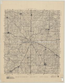
- Topical Subject: Landowners, Topical Subject: Real property, and Geographic Subject: Montgomery County (Ind.)
- Creator:
- Donica, Roy E.
- Publisher:
- Roy E. Donica and Karl M. Laurimore
- Date Created:
- 1941
- Identifier:
- VAC3073-M-00217
- Genre:
- Cadastral maps
- Geographic Location:
- Coordinates: W0870600 W0864200 N0401300 N0395200
- Related URL:
- Catalog URL: https://iucat.iu.edu/catalog/5383100
- Abstract:
- Cadastral map showing landowners. "1940-1941."
- Call Number:
- G4093.M8 G46 1941 .D66
- Caption:
- Imprint: [Crawfordsville, Ind.] : Roy E. Donica and Karl M. Laurimore, [1941].
- Physical Description:
- Dimensions: 125 x 125 cm and Scale: 1:31,680
- Alternate Identifier:
- Title Control Number: a5383100
- Persistent URL:
- https://purl.dlib.indiana.edu/iudl/images/VAC3073/VAC3073-M-00217
-
- Subject:
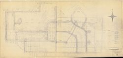
- Geographic Subject: Bloomington (Ind.) and Topical Subject: Urban renewal
- Creator:
- Bloomington (Ind.). Department of Redevelopment
- Publisher:
- Bloomington (Ind.). Department of Redevelopment
- Date Created:
- 1964
- Identifier:
- VAC3073-M-00223
- Genre:
- Thematic maps
- Geographic Location:
- Coordinates: W0861450 W0861206 N0391319 N0391131
- Related URL:
- Catalog URL: https://iucat.iu.edu/catalog/5299416
- Abstract:
- Blue line print. y D.A.H., approved by C.M.C." "Revised Aug. 1964."
- Call Number:
- G4094.B5 G455 1964 .B5
- Caption:
- Imprint: [Bloomington, Ind.?] : [The Dept.?], [1964?]
- Physical Description:
- Scale: 1:600 and Dimensions: 191 x 88 cm
- Alternate Identifier:
- Title Control Number: a5299416
- Persistent URL:
- https://purl.dlib.indiana.edu/iudl/images/VAC3073/VAC3073-M-00223
-
- Subject:
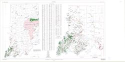
- Topical Subject: Oil fields, Geographic Subject: Indiana, and Topical Subject: Gas fields
- Creator:
- Cazee, J. T. (James T.)
- Publisher:
- Indiana. Geological Survey
- Date Created:
- 1998
- Identifier:
- VAC3073-M-00237
- Genre:
- Geological maps
- Geographic Location:
- W0880000 W0860000 N0395000 N0380000 and Coordinates: W0880700 W0844500 N0414500 N0375200
- Related URL:
- Catalog URL: https://iucat.iu.edu/catalog/4995550
- Abstract:
- "Compilation complete to December 1998." "Base map digitized from 1978 U.S. Geological Survey map of Indiana. Scale 1:500,000."
- Call Number:
- G4091.H8 1998 .C3
- Caption:
- Imprint: Bloomington : Indiana Geological Survey, 1998.
- Physical Description:
- Scale: 1:550,000, 1:1:275,000, and Dimensions: 83 x 150 cm
- Alternate Identifier:
- Title Control Number: a4995550
- Persistent URL:
- https://purl.dlib.indiana.edu/iudl/images/VAC3073/VAC3073-M-00237
-
- Subject:
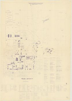
- Geographic Subject: Indiana University, Bloomington, Geographic Subject: Bloomington (Ind.), and Topical Subject: Indiana University, Bloomington
- Publisher:
- Indiana University?
- Date Created:
- 1969
- Identifier:
- VAC3073-M-00308
- Genre:
- Maps
- Geographic Location:
- Coordinates: W0863143 W0862959 N0391153 N0390939
- Related URL:
- Catalog URL: http://.iucat.iu.edu/catalog/5295258
- Abstract:
- Blue line print. Includes index to buildings. "12/1/69 B.W."
- Call Number:
- G4094.B5:2I6 1969 .I6
- Caption:
- Imprint: [Bloomington, Ind.? : Indiana University?, 1969?]
- Physical Description:
- Scale: 1:3,600 and Dimensions: 122 x 101 cm
- Alternate Identifier:
- Title Control Number: a5295258
- Persistent URL:
- https://purl.dlib.indiana.edu/iudl/images/VAC3073/VAC3073-M-00308
-
- Subject:
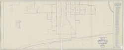
- Topical Subject: Water utilities and Geographic Subject: Danville (Ind.)
- Creator:
- Shartle, Stanley Musgrave
- Publisher:
- Stanley M. Shartle?]
- Date Created:
- 1947
- Identifier:
- VAC3073-M-00611
- Genre:
- Thematic maps
- Geographic Location:
- Coordinates: W0863309 W0862726 N0394705 N0394353
- Related URL:
- Catalog URL: https://iucat.iu.edu/catalog/5359312
- Abstract:
- Blue line print. Includes index of "References and descriptions of the location of gate valves."
- Call Number:
- G4094 .D3 N44 1947 .S53
- Caption:
- Imprint: [Danville, Ind.?] : [Stanley M. Shartle?], [1947]
- Physical Description:
- Scale: 1:1,200 and Dimensions: 87 x 198 cm
- Alternate Identifier:
- Title Control Number: a5359312
- Persistent URL:
- https://purl.dlib.indiana.edu/iudl/images/VAC3073/VAC3073-M-00611
-
- Subject:
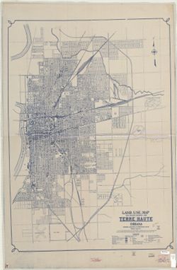
- Topical Subject: Land use and Geographic Subject: Terre Haute (Ind.)
- Creator:
- Indiana. Governor's Commission on Unemployment Relief
- Publisher:
- Indiana. Governor's Commission on Unemployment Relief
- Date Created:
- 1935
- Identifier:
- VAC3073-M-00366
- Genre:
- Thematic maps
- Geographic Location:
- Coordinates: W0872810 W0871636 N0393142 N0392405
- Related URL:
- Catalog URL: https://iucat.iu.edu/catalog/7511454
- Abstract:
- Blueline. "Project 84-F2-79.""This map shows the type of use of all land frontage. The Depth of Structures was disregarded. No attempt was mad...
- Call Number:
- G4094.T4G4 1935 .I53
- Caption:
- Imprint: [Indianapolis?] : Governor's Commission on Unemployment Relief, [1935?]
- Physical Description:
- Dimensions: 121 x 86 cm and Scale: Approximately 1:18,200
- Alternate Identifier:
- Title Control Number: a7511454
- Persistent URL:
- https://purl.dlib.indiana.edu/iudl/images/VAC3073/VAC3073-M-00366
-
- Subject:
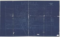
- Geographic Subject: Lowell (Lake County, Ind.), Topical Subject: Real property, and Topical Subject: Landowners
- Creator:
- F.L. Knight & Sons
- Publisher:
- F.L. Knight & Sons
- Date Created:
- 1909
- Identifier:
- VAC3073-M-00384
- Genre:
- Cadastral maps
- Geographic Location:
- Coordinates: W0872641 W0872302 N0411857 N0411638
- Related URL:
- Catalog URL: https://iucat.iu.edu/catalog/4681792
- Abstract:
- Blueprint. Cadastral map showing landowners.
- Call Number:
- G4094 .L8G46 1909 .F575
- Caption:
- Imprint: Crown Point, Ind. : F. L. Knight & Sons, 1909.
- Physical Description:
- Scale: Approximately 1:1,200. 1 inch = 100 feet and Dimensions: 118 x 203 cm
- Alternate Identifier:
- Title Control Number: CAT7779BB
- Persistent URL:
- https://purl.dlib.indiana.edu/iudl/images/VAC3073/VAC3073-M-00384
-
- Subject:
- Topical Subject: Railroads and Geographic Subject: Indiana
- Creator:
- Indiana University. Center for Urban and Regional Analysis.
- Publisher:
- [publisher not identified]
- Date Created:
- 1976
- Identifier:
- VAC3073-M-00346
- Genre:
- Thematic maps
- Geographic Location:
- Coordinates: W0880500 W0844700 N0414500 N0374600
- Related URL:
- Catalog URL: https://iucat.iu.edu/catalog/4942831
- Call Number:
- G4091 .P3 1976 .I6
- Caption:
- Imprint: [Bloomington] : [publisher not identified], 1976.
- Physical Description:
- Dimensions: 127 x 97 cm and Scale: 1:375,000
- Alternate Identifier:
- Title Control Number: a4942831
- Persistent URL:
- https://purl.dlib.indiana.edu/iudl/images/VAC3073/VAC3073-M-00346
-
- Subject:
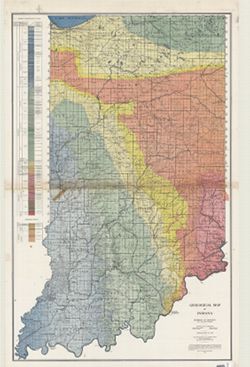
- Geographic Subject: Indiana and Topical Subject: Geology
- Creator:
- Indiana. Division of Geology
- Publisher:
- Indiana. Department of Conservation
- Date Created:
- 1932
- Identifier:
- VAC3073-M-00989
- Genre:
- Geological maps
- Geographic Location:
- Coordinates: W0870000 W0850000 N0410000 N0380000
- Related URL:
- Catalog URL: https://iucat.iu.edu/catalog/2849159
- Abstract:
- "Conservation Commission, Stanley Coulter, Chairman." "The based used...is the Ryse map, which has been modified." Includes geologic cros...
- Call Number:
- G4091.C5 1932 .I53
- Caption:
- Imprint: [Indianapolis] : Dept. of Conservation, State of Indiana, 1932.
- Physical Description:
- Dimensions: 177 x 112 cm and Scale: 1:253,440
- Alternate Identifier:
- Title Control Number: CAT7760BB
- Persistent URL:
- https://purl.dlib.indiana.edu/iudl/images/VAC3073/VAC3073-M-00989
-
- Subject:
- Geographic Subject: Bloomington (Ind.), Geographic Subject: Monroe County (Ind.), and Topical Subject: Census districts
- Creator:
- United States. Bureau of the Census
- Publisher:
- United States. Bureau of the Census
- Date Created:
- 1974
- Identifier:
- VAC3073-M-00892
- Genre:
- Census data and Thematic maps
- Geographic Location:
- Coordinates: W0864108 W0861902 N0392120 N0385926
- Related URL:
- Catalog URL: https://iucat.iu.edu/catalog/5300402
- Abstract:
- Blue line print. Shows 1970 census enumeration districts and census tracts for Bloomington, Ind. "Traced from map no. 68-A-8776." "70-...
- Call Number:
- G4094.B5 E25 1970 .U5
- Caption:
- Imprint: [Jeffersonville, Ind.] : Bureau of the Census, [1974?]
- Physical Description:
- Dimensions: 120 x 107 cm and Scale: 1:1,500
- Alternate Identifier:
- Title Control Number: a5300402
- Persistent URL:
- https://purl.dlib.indiana.edu/iudl/images/VAC3073/VAC3073-M-00892
-
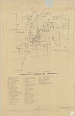
- Subject:
- Topical Subject: Boundaries, Topical Subject: Neighborhoods, Topical Subject: Community organization, Geographic Subject: Indianapolis (Ind.), and Geographic...
- Creator:
- Indianapolis (Ind.). Division of Planning & Zoning
- Publisher:
- [Dept. of Metropolitan Development, Division of Planning and Zoning?]
- Date Created:
- 1972
- Identifier:
- VAC3073-M-00889
- Genre:
- Thematic maps
- Geographic Location:
- Coordinates: W0861941 W0855614 N0395538 N0393755
- Related URL:
- Catalog URL: https://iucat.iu.edu/catalog/6289116
- Abstract:
- Blueline. Includes indexed list of neighborhood organizations.
- Call Number:
- G4093.M3 E6 1972 .I5
- Caption:
- Imprint: [Indianapolis?]: [Dept. of Metropolitan Development, Division of Planning and Zoning?], [1972?]
- Physical Description:
- Dimensions: 151 x 101 cm and Scale: 1:36,000
- Alternate Identifier:
- Title Control Number: a6289116
- Persistent URL:
- https://purl.dlib.indiana.edu/iudl/images/VAC3073/VAC3073-M-00889
-
- Subject:
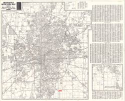
- Geographic Subject: Indianapolis Metropolitan Area (Ind.) and Geographic Subject: Indianapolis (Ind.)
- Creator:
- Metro Graphic Arts
- Publisher:
- [publisher not identified]
- Date Created:
- 1975
- Identifier:
- VAC3073-M-00864
- Genre:
- Maps
- Geographic Location:
- Coordinates: W0861941 W0855614 N0395538 N0393755
- Related URL:
- Catalog URL: https://iucat.iu.edu/catalog/5322622
- Abstract:
- Plastic index device in pocket. Includes indexes, A-C of street index on attached sheet and "Inset map of adjacent areas in Johnson County."
- Call Number:
- G4094 .I4 1975 .M4
- Caption:
- Imprint: Grand Rapids, Mich. : [publisher not identified], 1975.
- Physical Description:
- Dimensions: 128 x 119 cm and Scale: 1:29,000
- Alternate Identifier:
- Title Control Number: a5322622
- Persistent URL:
- https://purl.dlib.indiana.edu/iudl/images/VAC3073/VAC3073-M-00864
-
- Subject:
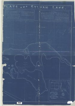
- Geographic Subject: Noble County (Ind.), Geographic Subject: Rome City (Ind.), Geographic Subject: Sylvan Lake (Ind.), Topical Subject: Real property, and To...
- Creator:
- Owen, M. F. (Millard Fillmore), 1851-1932
- Publisher:
- [M.F. Owen]
- Date Created:
- 1909
- Identifier:
- VAC3073-M-00846
- Genre:
- Cadastral maps
- Geographic Location:
- Coordinates: W0852308 W0851939 N0413011 N0412827
- Related URL:
- Catalog URL: https://iucat.iu.edu/catalog/4676408
- Abstract:
- Blueprint. Originally copied on 4 sheets. Includes text and insets: "Map of bluffs, bridges, wagon road and banks upon which Northport Feeder Dam was...
- Call Number:
- G4094 .R85G46 1909 .O94
- Caption:
- Imprint: [Rome City (Ind.)?] : [M.F. Owen], 1909.
- Physical Description:
- Dimensions: 125 x 177 cm, on sheets 133 x 93 and 129 x 93 cm and Scale: 1:2,700
- Alternate Identifier:
- Title Control Number: CAQ5632BB
- Persistent URL:
- https://purl.dlib.indiana.edu/iudl/images/VAC3073/VAC3073-M-00846
-
- Subject:
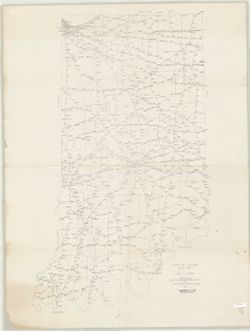
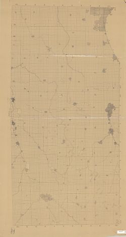
- Geographic Subject: Indiana
- Publisher:
- s.n.
- Identifier:
- VAC3073-M-00828
- Genre:
- Outline maps
- Related URL:
- Catalog URL: https://iucat.iu.edu/catalog/5044512
- Abstract:
- Blue line print. Title supplied by cataloger. Includes Indiana north of a line that includes Logansport and Peru, north from Township 27 North. Shows cou...
- Call Number:
- G4091 .A1 1900 .N67
- Caption:
- Imprint: [S.l. : s.n., 19--?]
- Physical Description:
- Dimensions: 178 x 91 cm and Scale: 1:126,720
- Alternate Identifier:
- Title Control Number: a5044512
- Persistent URL:
- https://purl.dlib.indiana.edu/iudl/images/VAC3073/VAC3073-M-00828
- Provenance:
- Northern Indiana base map
-
- Subject:
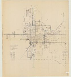
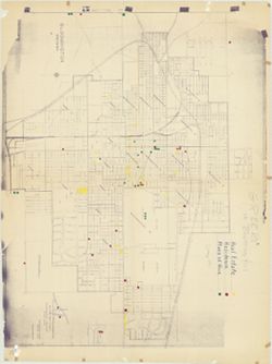
- Topical Subject: Election districts and Geographic Subject: Bloomington (Ind.)
- Creator:
- C.-M. Engineering
- Publisher:
- C.-M. Engineering
- Date Created:
- 1955
- Identifier:
- VAC3073-M-00795
- Genre:
- Thematic maps
- Geographic Location:
- Coordinates: W0863323 W0862823 N0391046 N0390854
- Related URL:
- Catalog URL: https://iucat.iu.edu/catalog/5300319
- Abstract:
- Blue line print. Appears to show election precincts within the Bloomington corporation limits. B-GEOMAP: Hand annotated in the spring of 1961 to show locat...
- Call Number:
- G4094.B5 F7 1955 .C175
- Caption:
- Imprint: Bloomington, Ind. : C.-M. Engineering, 1955.
- Physical Description:
- Scale: 1:3,500 and Dimensions: 103 x 132 cm
- Alternate Identifier:
- Title Control Number: a5300319
- Persistent URL:
- https://purl.dlib.indiana.edu/iudl/images/VAC3073/VAC3073-M-00795
-

- Subject:
- Topical Subject: Sewerage and Geographic Subject: Bloomington (Ind.)
- Creator:
- Bloomington (Ind.). Office of City Civil Engineer
- Publisher:
- [City of Bloomington?]
- Date Created:
- 1946
- Identifier:
- VAC3073-M-00706
- Genre:
- Thematic maps
- Geographic Location:
- Coordinates: W0863532 W0862816 N0391315 N0390716
- Related URL:
- Catalog URL: https://iucat.iu.edu/catalog/6946203
- Abstract:
- Blueprint. At head of title: Bloomington, Indiana.
- Call Number:
- G4094.B5N46 1946 .B56
- Caption:
- Imprint: [Bloomington, Ind.?] : [City of Bloomington?], [1946?]
- Physical Description:
- Scale: 1:3,900 and Dimensions: 105 x 131 cm
- Alternate Identifier:
- Title Control Number: a6946203
- Persistent URL:
- https://purl.dlib.indiana.edu/iudl/images/VAC3073/VAC3073-M-00706
-
- Subject:
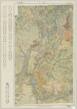
- Topical Subject: Classification, Geographic Subject: Morgan County (Ind.), and Topical Subject: Soils
- Creator:
- Ulrich, H. P. (Herbert Paul), 1904-
- Publisher:
- United States. Bureau of Soils
- Date Created:
- 1937
- Identifier:
- VAC3073-M-00635
- Genre:
- Thematic maps
- Geographic Location:
- Coordinates: W0864100 W0861500 N0393800 N0392100
- Related URL:
- Catalog URL: https://iucat.iu.edu/catalog/4693743
- Abstract:
- Shows soils types classification by colors and symbols. "Surveyed in 1937. Series 1937." "Lith. a. Hoen & Co., Inc."
- Call Number:
- G4093 .M9J3 1937 .U47
- Caption:
- Imprint: [Washington, D.C.?] : The Bureau, [1937?]
- Physical Description:
- Scale: 1:63,360 and Dimensions: 137 x 161 cm, sheets 146 x 103 cm and 132 x 87 cm
- Alternate Identifier:
- Title Control Number: CAY8983BB
- Persistent URL:
- https://purl.dlib.indiana.edu/iudl/images/VAC3073/VAC3073-M-00635
-
- Subject:
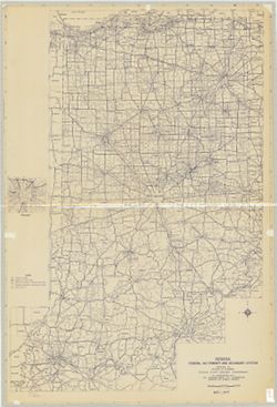
- Topical Subject: Roads and Geographic Subject: Indiana
- Creator:
- Indiana. State Highway Commission (1961-1981). Division of Planning
- Publisher:
- Indiana. State Highway Commission (1961-1981). Division of Planning
- Date Created:
- 1971
- Identifier:
- VAC3073-M-00638
- Genre:
- Road maps
- Geographic Location:
- Coordinates: W0880700 W0844500 N0414500 N0375200
- Related URL:
- Catalog URL: https://iucat.iu.edu/catalog/5335907
- Abstract:
- Blue line print. "May 1, 1971." Includes inset of Indianapolis.
- Call Number:
- G4091.P2 1971 .I53
- Caption:
- Imprint: [Indianapolis?] : [The Division?], [1971?]
- Physical Description:
- Dimensions: 133 x 89 cm and Scale: 1:360,000
- Alternate Identifier:
- Title Control Number: a5335907
- Persistent URL:
- https://purl.dlib.indiana.edu/iudl/images/VAC3073/VAC3073-M-00638
-
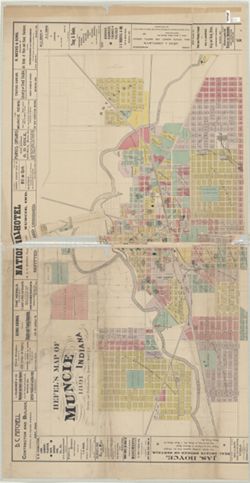
- Subject:
- Geographic Subject: Muncie (Ind.)
- Creator:
- Hefel, Toney C.
- Publisher:
- E.P. Noll & Co.
- Date Created:
- 1891
- Identifier:
- VAC3073-M-00701
- Genre:
- Maps
- Geographic Location:
- Coordinates: W0852716 W0851914 N0401426 N0400856
- Related URL:
- Catalog URL: https://iucat.iu.edu/catalog/2789504
- Abstract:
- Includes advertisements from local businesses. Includes "Fire alarm boxes" locations.
- Call Number:
- G4094 .M9 1891 .H44
- Caption:
- Imprint: Philadelphia [Pa.] : E. P. Noll & Co., 1891.
- Physical Description:
- Dimensions: 107 x 137 cm, on sheet 128 x 166 cm and Scale: 1:4,800
- Alternate Identifier:
- Title Control Number: CAF2474BB
- Persistent URL:
- https://purl.dlib.indiana.edu/iudl/images/VAC3073/VAC3073-M-00701
-
- Subject:
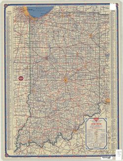
- Topical Subject: Roads and Geographic Subject: Indiana
- Creator:
- H.M. Gousha Company
- Publisher:
- H.M. Gousha Company
- Date Created:
- 1946
- Identifier:
- VAC3073-M-00413
- Genre:
- Road maps
- Geographic Location:
- Coordinates: W0880500 W0844700 N0414500 N0374600
- Related URL:
- Catalog URL: https://iucat.iu.edu/catalog/5266639
- Abstract:
- Includes index to cities and towns. Text and ancillary maps of Chicago and vicinity, Hammond, Gary, Michigan City Region, South Bend, Indiana, Indianapolis...
- Call Number:
- G4091.P2 1946 .H2
- Caption:
- Imprint: Chicago : H.M. Gousha, [1946]
- Physical Description:
- Dimensions: 58 x 38 cm and Scale: 1:800,000
- Alternate Identifier:
- Title Control Number: a5266639
- Persistent URL:
- https://purl.dlib.indiana.edu/iudl/images/VAC3073/VAC3073-M-00413
