
Search Constraints
« Previous |
1 - 100 of 8,218
|
Next »
Search Results
-
- Subject:
- Topical Subject: Rivers, Geographic Subject: Ohio River, and Topical Subject: Navigation
- Creator:
- United States. Army. Corps of Engineers
- Publisher:
- U.S. Lake Survey
- Date Created:
- 1911
- Identifier:
- VAC3073-M-01499
- Genre:
- Nautical charts
- Geographic Location:
- Coordinates: W0891200 W0800000 N0404300 N0365700
- Related URL:
- Catalog URL: https://iucat.iu.edu/catalog/10895418
- Abstract:
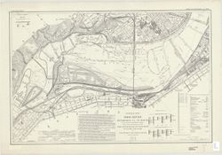
- Some charts have imprint: Fort Belvoir, Va.: 30th Engineers by reproduction plant, 1943, or Washington, D.C.: Engineer reproduction plant, U.S. Army, 1929.
- Call Number:
- G3707.O5 1911 .U55
- Caption:
- Imprint: Detroit, Michigan : U.S. Lake Survey Office, 1911-1914.
- Physical Description:
- Scale: 1:7,200 and Dimensions: size varies
- Persistent URL:
- https://purl.dlib.indiana.edu/iudl/images/VAC3073/VAC3073-M-01499
-
- Subject:
- Geographic Subject: Ohio River, Topical Subject: Navigation, and Topical Subject: Rivers
- Creator:
- Merrill, W. E. (William Emery), 1837-1891 and Moser, C.
- Publisher:
- United States. Army. Corps of Engineers
- Date Created:
- 1881
- Identifier:
- VAC3073-M-00751
- Genre:
- Nautical charts
- Geographic Location:
- Coordinates: W0891100 W0800200 N0404100 N0365900
- Related URL:
- Catalog URL: new.iucat.iu.edu/catalog/11738878
- Abstract:
- Relief shown by hachures. Publication date of Sept. 14, 1881 supplied by U.S. Army, Corps of Engineers. 52 maps on 38 sheets. Maps made under the directi...
- Caption:
- Imprint: [Washington, D.C. , 1881]
- Physical Description:
- Scale: Approximately 1:47,639 . 1 1/3 in. = 1 mile and Dimensions: on sheets 49 x 73 cm
- Alternate Identifier:
- Title Control Number: a5054975
- Persistent URL:
- https://purl.dlib.indiana.edu/iudl/images/VAC3073/VAC3073-M-00751
-
- Subject:
- Topical Subject: Valleys, Topical Subject: Rivers, Geographic Subject: Wabash River, and Geographic Subject: Wabash River Valley
- Creator:
- United States. Army. Corps of Engineers. Louisville District
- Publisher:
- United States. Army. Engineer Reproduction Plant
- Date Created:
- 1929
- Identifier:
- VAC3073-M-01486
- Genre:
- Bathymetric maps
- Geographic Location:
- Coordinates: W0872800 W0861900 N0404800 N0392500
- Related URL:
- Catalog URL: https://iucat.iu.edu/catalog/6799394
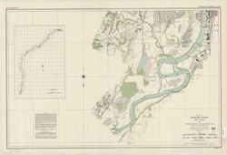
- Abstract:
- Relief shown by contours and spot heights. Depths shown by soundings. Includes index map on chart 14. "The aerial photography was begun July 29...
- Call Number:
- G4072.W3 1929 U5
- Caption:
- Imprint: Washington, D.C. : Engineer Reproduction Plant, 1930.
- Physical Description:
- Scale: 1:24,000 and Dimensions: 63 x 101 cm, on sheets 72 x 107 cm
- Persistent URL:
- https://purl.dlib.indiana.edu/iudl/images/VAC3073/VAC3073-M-01486
-
- Subject:
- Topical Subject: Rivers, Topical Subject: Navigation, and Geographic Subject: White River (Ind. : River)
- Creator:
- United States. Army. Corps of Engineers. Louisville District
- Publisher:
- [United States Engineer Office]
- Date Created:
- 1931
- Identifier:
- VAC3073-M-01494
- Genre:
- Nautical charts
- Geographic Location:
- Coordinates: W0872200 W0860800 N0394400 N0383600
- Related URL:
- Catalog URL: https://iucat.iu.edu/catalog/6493899
- Abstract:
- Surveyed and mapped under the direction of The United States Engineer Office, Louisville, Ky. Relief shown by contours and spot heights. Depths shown by s...
- Call Number:
- G4092.W5 P53 1931 .U53
- Caption:
- Imprint: [Louisville, Ky.] : [United States Engineer Office], [1931]
- Physical Description:
- Dimensions: 92 x 97 cm or smaller and Scale: 1:12,000
- Persistent URL:
- https://purl.dlib.indiana.edu/iudl/images/VAC3073/VAC3073-M-01494
-
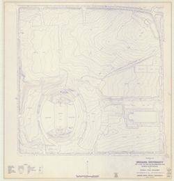
- Subject:
- Geographic Subject: Indiana University, Bloomington, Geographic Subject: Bloomington (Ind.), and Topical Subject: Indiana University, Bloomington
- Creator:
- Abrams Aerial Survey Corporation
- Publisher:
- Indiana University, Bloomington. Physical Plant
- Date Created:
- 1967
- Identifier:
- VAC3073-M-00622
- Genre:
- Topographic maps
- Geographic Location:
- Coordinates: W0863148 W0863108 N0390953 N0390942
- Related URL:
- Catalog URL: https://iucat.iu.edu/catalog/4939714
- Abstract:
- Blue line print. "Date of photography May 1966." "Date of mapping March 1967."
- Call Number:
- G4094.B5:2I6C2 s1 .A273
- Caption:
- Imprint: [Bloomington, Ind.] : [Indiana Univ. Physical Plant], [1967?]
- Physical Description:
- Scale: 1:1,200 and Dimensions: 80 x 82 cm or smaller
- Alternate Identifier:
- Title Control Number: a4939714
- Persistent URL:
- https://purl.dlib.indiana.edu/iudl/images/VAC3073/VAC3073-M-00622
-
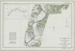
- Subject:
- Geographic Subject: Indiana, Topical Subject: Rivers, and Geographic Subject: Wabash River
- Creator:
- United States
- Publisher:
- United States. Army. Corps of Engineers. Louisville District
- Date Created:
- 1931
- Identifier:
- VAC3073-M-01258
- Genre:
- Nautical charts
- Related URL:
- Catalog URL: https://iucat.iu.edu/catalog/5485820
- Abstract:
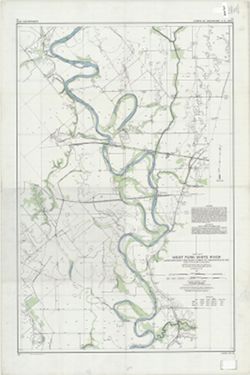
- "The survey of the river proper was begun July 25, and completed December 31, 1911. The valley survey began January 15, and was completed September 10, ...
- Call Number:
- G4072.W3 C315 1931 .U55 no. 1
- Physical Description:
- Scale: Approximately 1:24,000 and Dimensions: sheets 92 x 122 cm
- Persistent URL:
- https://purl.dlib.indiana.edu/iudl/images/VAC3073/VAC3073-M-01258
- Provenance:
- United States. Army. Corps of Engineers. Louisville District.
-
- Subject:
- Geographic Subject: Indiana, Topical Subject: Rivers, and Geographic Subject: Wabash River
- Creator:
- United States. Army. Corps of Engineers
- Publisher:
- United States. Army. Corps of Engineers. Louisville District
- Date Created:
- Circa 1931
- Identifier:
- VAC3073-M-01487
- Genre:
- Nautical charts
- Geographic Location:
- Coordinates: W0881100 W0872000 N0392900 N0374700
- Related URL:
- Catalog URL: https://iucat.iu.edu/catalog/5485820
- Abstract:
- Surveyed and mapped under the direction of the United States engineer officer, Louisville, Ky. Relief shown by contours and spot heights. Depths shown by s...
- Call Number:
- G4072.W3 C315 1931 .U55
- Caption:
- Imprint: [Louisville, Ky.? , 1931?]
- Physical Description:
- Dimensions: sheets 92 x 122 cm and Scale: Approximately 1:24,000
- Persistent URL:
- https://purl.dlib.indiana.edu/iudl/images/VAC3073/VAC3073-M-01487
-
- Subject:
- Topical Subject: Navigation, Geographic Subject: White River (Ind. : River), and Topical Subject: Rivers
- Creator:
- United States. Army. Corps of Engineers. Louisville District
- Publisher:
- [United States Engineer Office]
- Date Created:
- 1931
- Identifier:
- VAC3073-M-01492
- Genre:
- Nautical charts
- Geographic Location:
- Coordinates: W0861500 W0864900 N0391200 N0384500
- Related URL:
- Catalog URL: https://iucat.iu.edu/catalog/6799804
- Abstract:
- Surveyed and mapped under the direction of The United States Engineer Office, Louisville, Ky. Relief shown by contours and spot heights. Depths shown by so...
- Call Number:
- G4092.W5P53 1931 .U52
- Caption:
- Imprint: [Louisville, Ky.] : [United States Engineer Office], [1931]
- Physical Description:
- Dimensions: 92 x 97 cm or smaller and Scale: 1:12,000
- Persistent URL:
- https://purl.dlib.indiana.edu/iudl/images/VAC3073/VAC3073-M-01492
-
![Bloomington, [Indiana] metropolitan map series](https://iiif.uits.iu.edu/iiif/2/vd66x2473%2Ffiles%2F73a8eae4-4788-4585-b937-b6e45ec91e24/full/250,/0/default.jpg)
- Subject:
- Geographic Subject: Bloomington Metropolitan Area (Ind.), Geographic Subject: Ellettsville (Ind.), Geographic Subject: Monroe County (Ind.), Geographic Subje...
- Creator:
- United States. Bureau of the Census. Geography Division
- Publisher:
- [publisher not identified]
- Date Created:
- 1967
- Identifier:
- VAC3073-M-00170
- Genre:
- Statistical maps, Thematic maps, and Census data
- Geographic Location:
- Coordinates: W0863904 W0860450 N0391839 N0390254
- Related URL:
- Catalog URL: https://iucat.iu.edu/catalog/5326785
- Abstract:
- Blue line print. "1020." "1980 census map." Shows census blocks for portions of Monroe County, Indiana, including Bloomington, Ellettsvi...
- Call Number:
- G4094.B5 E25 s19 .U5
- Caption:
- Imprint: [place of publication not identified : publisher not identified, 198-?]
- Physical Description:
- Scale: 1:19,000 and Dimensions: 37 x 57 cm
- Alternate Identifier:
- Title Control Number: a5326785
- Persistent URL:
- https://purl.dlib.indiana.edu/iudl/images/VAC3073/VAC3073-M-00170
-
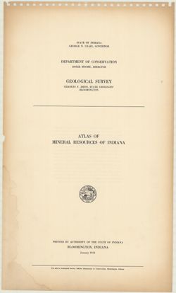
- Subject:
- Geographic Subject: Indiana and Topical Subject: Mines and mineral resources
- Creator:
- Indiana. Geological Survey
- Publisher:
- Indiana. Geological Survey
- Date Created:
- 1953
- Identifier:
- VAC3073-M-01193
- Genre:
- Atlases and Mine maps
- Geographic Location:
- Coordinates: W0880500 W0844700 N0414500 N0374600
- Related URL:
- Catalog URL: https://iucat.iu.edu/catalog/22238
- Abstract:
- Letter inserted indicating map no. 10 last in series,, map dated 1958, letter dated 1962.
- Call Number:
- G1401.H1 A! 1953
- Caption:
- Imprint: Bloomington, Indiana : Indiana Geological Survey, 1953
- Physical Description:
- Dimensions: 56 cm and Scale: Scales differ.
- Persistent URL:
- https://purl.dlib.indiana.edu/iudl/images/VAC3073/VAC3073-M-01193
-
- Subject:
- Geographic Subject: Eel River (Putnam County-Greene County, Ind.), Topical Subject: Navigation, and Topical Subject: Rivers
- Creator:
- United States. Army. Corps of Engineers. Louisville District
- Publisher:
- [United States Engineer Office]
- Date Created:
- 1931
- Identifier:
- VAC3073-M-01502
- Genre:
- Nautical charts
- Geographic Location:
- Coordinates: W0871900 W0865600 N0393000 N0390600
- Related URL:
- Catalog URL: https://iucat.iu.edu/catalog/6468587
- Abstract:
- Surveyed and mapped under the direction of The United States Engineer Office, Louisville, Ky. Relief shown by contours and spot heights. Depths shown by so...
- Call Number:
- G4092.E37 P53 1931 .U5
- Caption:
- Imprint: [Louisville, Ky.] : [United States Engineer Office], [1931]
- Physical Description:
- Scale: 1:12,000 and Dimensions: 93 x 96 cm or smaller
- Persistent URL:
- https://purl.dlib.indiana.edu/iudl/images/VAC3073/VAC3073-M-01502
-
- Subject:
- Geographic Subject: Mapleton (Indianapolis, Ind.), Geographic Subject: Indianapolis (Ind.), Topical Subject: Landowners, and Geographic Subject: Marion Count...
- Creator:
- Carpenter, H. C.
- Publisher:
- Baker & Randolph
- Date Created:
- 1889
- Identifier:
- VAC3073-M-00656
- Genre:
- Cadastral maps
- Geographic Location:
- Coordinates: W0861941 W0855614 N0395538 N0393755
- Related URL:
- Catalog URL: https://iucat.iu.edu/catalog/4665173
- Abstract:
- Cadastral map showing landowners. Shows ward and school district boundaries. Originally issued in 6 sheets, mounted on linen, shellacked, and dissected in 8 ...
- Call Number:
- G4094.I4 G46 1889 .C37
- Caption:
- Imprint: Indianapolis : Baker & Randolph, [1889].
- Physical Description:
- Scale: 1:7,150 and Dimensions: 159 x 206 cm, on sheets 89 x 57 cm or smaller
- Alternate Identifier:
- Title Control Number: CAJ5369BB
- Persistent URL:
- https://purl.dlib.indiana.edu/iudl/images/VAC3073/VAC3073-M-00656
-
- Subject:
- Geographic Subject: Madison (Ind.), Geographic Subject: Logansport (Ind.), Geographic Subject: Indianapolis (Ind.), Geographic Subject: Indiana, Geographic S...
- Creator:
- King, S. D.
- Publisher:
- J.H. Colton & Co.
- Date Created:
- 1838
- Identifier:
- VAC3073-M-00747
- Genre:
- Maps
- Geographic Location:
- Coordinates: W0880500 W0844700 N0414500 N0374600
- Related URL:
- Catalog URL: https://iucat.iu.edu/catalog/2847566
- Abstract:
- Insets: Michigan City--LaFayette--Logansport & West Logan--Terre Haute--Indianapolis--New Albany, Jeffersonville, Louisville and the Falls of Ohio--Evans...
- Call Number:
- G4090 1838 .K5
- Caption:
- Imprint: New York : J.H. Colton, 1838.
- Physical Description:
- Scale: 1:316,800 and Dimensions: 158 x 118 cm
- Alternate Identifier:
- Title Control Number: CAT4675BB
- Persistent URL:
- https://purl.dlib.indiana.edu/iudl/images/VAC3073/VAC3073-M-00747
-
![Map of the City of Indianapolis and its suburbs [map]](https://iiif.uits.iu.edu/iiif/2/v692v943f%2Ffiles%2Fcb6898c0-54f1-4245-b5e2-96cd8bf1b867/full/250,/0/default.jpg)
- Subject:
- Geographic Subject: Indianapolis Metropolitan Area (Ind.), Topical Subject: Schools, Topical Subject: Administrative and political divisions, Geographic Subj...
- Creator:
- Palmer, Thos. W. (Thomas W.) and Carpenter, H. C.
- Publisher:
- Baker & Randolph
- Date Created:
- 1889
- Identifier:
- VAC3073-M-01274
- Genre:
- Maps and Cadastral maps
- Geographic Location:
- Coordinates: W0860929 W0860929 N0394606 N0394606
- Related URL:
- Catalog URL: new.iucat.iu.edu/catalog/4665173
- Abstract:
- Surveyed and compiled from official records by H.C Carpenter , Thos. W. Palmer, draughtsman. Cadastral map showing landowners. Shows ward and school district...
- Call Number:
- G4094.I4G46 1889 .C37
- Caption:
- Imprint: Indianapolis : Baker & Randolph, [c1889]
- Physical Description:
- Scale: Approximately 1:7,150 and Dimensions: 159 x 206 cm, on sheets 89 x 57 cm or smaller
- Persistent URL:
- https://purl.dlib.indiana.edu/iudl/images/VAC3073/VAC3073-M-01274
- Provenance:
- H.C Carpenter
-
- Subject:
- Geographic Subject: Bloomington (Ind.), Geographic Subject: Indiana University, Bloomington, and Topical Subject: Indiana University, Bloomington
- Creator:
- Abrams Aerial Survey Corporation
- Publisher:
- Indiana University, Bloomington. Physical Plant
- Date Created:
- 1961
- Identifier:
- VAC3073-M-00178
- Genre:
- Topographic maps
- Geographic Location:
- Coordinates: W0863532 W0862816 N0391315 N0390716
- Related URL:
- Catalog URL: https://iucat.iu.edu/catalog/4937678
- Abstract:
- Blue line print. "Date of photography March 1961." "Date of mapping May 1961."
- Call Number:
- G4094.B5:2I6 C2 s1 .A27
- Caption:
- Imprint: [Bloomington, Ind. : Indiana Univ. Physical Plant, 1961?]
- Physical Description:
- Dimensions: 146 x 80 cm or smaller and Scale: 1:1,200
- Alternate Identifier:
- Title Control Number: a4937678
- Persistent URL:
- https://purl.dlib.indiana.edu/iudl/images/VAC3073/VAC3073-M-00178
-
- Subject:
- Topical Subject: Rivers, Topical Subject: Valleys, Geographic Subject: Wabash River, and Geographic Subject: Wabash River Valley
- Creator:
- Williams & Heintz Co.
- Publisher:
- United States. Army. Corps of Engineers. Louisville District.
- Date Created:
- 1930
- Identifier:
- VAC3073-M-01501
- Genre:
- Nautical charts
- Geographic Location:
- Coordinates: W0880700 W0843300 N0405700 N0374700
- Related URL:
- Catalog URL: https://iucat.iu.edu/catalog/6799690
- Abstract:
- Surveyed and mapped under the direction of the United States engineer officer, Louisville, Ky. 1930. Relief shown by contours and spot heights. Depths sho...
- Call Number:
- G4072.W3 1930 .U5
- Caption:
- Imprint: Washington, D.C. : Williams & Heintz Co., 1931.
- Physical Description:
- Scale: 1:24,000 and Dimensions: 64 x 96 cm, on sheets 72 x 107 cm
- Persistent URL:
- https://purl.dlib.indiana.edu/iudl/images/VAC3073/VAC3073-M-01501
-
![[Bloomington, Indiana, cadastral map]](https://iiif.uits.iu.edu/iiif/2/0r9686792%2Ffiles%2F47529974-267a-4ca2-bcce-8ead7355fbf3/full/250,/0/default.jpg)
- Subject:
- Topical Subject: Real property and Geographic Subject: Bloomington (Ind.)
- Publisher:
- [publisher not identified]
- Date Created:
- 1980
- Identifier:
- VAC3073-M-00306
- Genre:
- Cadastral maps
- Geographic Location:
- Coordinates: W0863532 W0862816 N0391315 N0390716
- Related URL:
- Catalog URL: https://iucat.iu.edu/catalog/5300699
- Abstract:
- Blue line print. Cadastral map. Title supplied by cataloger. Each sheet is 1/4 section.
- Call Number:
- G4094.B5 G46 s1 .B5
- Caption:
- Imprint: [Bloomington, Ind.?] : [publisher not identified], [198-?]
- Physical Description:
- Dimensions: on sheets 84 x 84 cm or smaller. and Scale: 1:1,200
- Alternate Identifier:
- Title Control Number: a5300699
- Persistent URL:
- https://purl.dlib.indiana.edu/iudl/images/VAC3073/VAC3073-M-00306
-
- Subject:
- Geographic Subject: White River (Ind. : River), Topical Subject: Navigation, and Topical Subject: Rivers
- Creator:
- United States. Army. Corps of Engineers. Louisville District
- Publisher:
- [United States Engineer Office]
- Date Created:
- 1931
- Identifier:
- VAC3073-M-01491
- Genre:
- Nautical charts
- Geographic Location:
- Coordinates: W0865100 W0861300 N0385300 N0383900
- Related URL:
- Catalog URL: https://iucat.iu.edu/catalog/6799725
- Abstract:
- Surveyed and mapped under the direction of The United States Engineer Office, Louisville, Ky. Relief shown by contours and spot heights. Depths shown by so...
- Call Number:
- G4092.W5P53 1929 .U52
- Caption:
- Imprint: [Louisville, Ky.] : [United States Engineer Office], [1931]
- Physical Description:
- Scale: 1:12,000 and Dimensions: 92 x 97 cm or smaller
- Persistent URL:
- https://purl.dlib.indiana.edu/iudl/images/VAC3073/VAC3073-M-01491
-
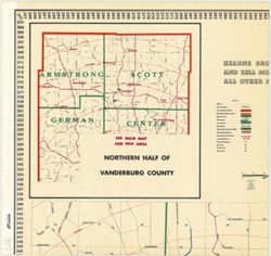
- Subject:
- Geographic Subject: Henderson (Ky.), Geographic Subject: Evansville (Ind.), and Geographic Subject: Vanderburgh County (Ind.)
- Creator:
- Hearne Brothers
- Publisher:
- Hearne Brothers
- Date Created:
- 1946
- Identifier:
- VAC3073-M-00129
- Genre:
- Maps
- Geographic Location:
- Coordinates: W0873815 W0872700 N0380324 N0375608
- Related URL:
- Catalog URL: https://iucat.iu.edu/catalog/5054975
- Abstract:
- Shows radial distances. Includes insets of "Northern half of Vanderburg County" and "Southern half of Vanderburg County" that includes He...
- Call Number:
- G4094.E9 1946 .H4
- Caption:
- Imprint: Detroit : Hearne Bros., [1946]
- Physical Description:
- Scale: 1:17,350 and Dimensions: 156 x 107 cm
- Alternate Identifier:
- Title Control Number: a5054975
- Persistent URL:
- https://purl.dlib.indiana.edu/iudl/images/VAC3073/VAC3073-M-00129
-
- Subject:
- Topical Subject: Real property, Topical Subject: Landowners, and Geographic Subject: Clark County (Ind.)
- Creator:
- Davis, George W. (Civil Engineer)
- Publisher:
- Chas. A. McCann & David S. Koons
- Date Created:
- 1875
- Identifier:
- VAC3073-M-00695
- Genre:
- Cadastral maps
- Geographic Location:
- Coordinates: W0860000 W0852500 N0383600 N0381600
- Related URL:
- Catalog URL: https://iucat.iu.edu/catalog/4685772
- Abstract:
- Cadastral map showing landowners. Originally printed in 3 sheets. Insets: Geological map of Clark County, Indiana -- Map of Indiana. Includes statistical tab...
- Call Number:
- G4093 .C4G46 1875 .D38
- Caption:
- Imprint: [Indianapolis] : Chas. A. McCann & David S. Koons, 1875
- Physical Description:
- Dimensions: 133 x 170 cm, pieces 48 x 89 cm and Scale: 1:31,680
- Alternate Identifier:
- Title Control Number: CAV9350BB
- Persistent URL:
- https://purl.dlib.indiana.edu/iudl/images/VAC3073/VAC3073-M-00695
-
- Subject:
- Topical Subject: Landowners, Geographic Subject: Evansville (Ind.), and Topical Subject: Real property
- Publisher:
- J.D. and M.S. Saunders?]
- Date Created:
- 1890
- Identifier:
- VAC3073-M-00915
- Genre:
- Maps and Cadastral maps
- Related URL:
- Catalog URL: https://iucat.iu.edu/catalog/4682303
- Abstract:
- 1 map, hand colored, dissected in 6 pieces and mounted on linen and shellacked. "Compiled from official records and surveys by J.D. and M.S. Saunders, c...
- Call Number:
- G4094 .E9G46 1890 .S28
- Caption:
- Imprint: [Evansville, Ind.? : J.D. and M.S. Saunders?], 1890.
- Physical Description:
- Scale: Scale not given. and Dimensions: 129 x 132 cm, pieces 48 x 71 or smaller
- Alternate Identifier:
- Title Control Number: CAU0767BB
- Persistent URL:
- https://purl.dlib.indiana.edu/iudl/images/VAC3073/VAC3073-M-00915
- Provenance:
- Evansville Indiana 1890.
-
- Subject:
- Geographic Subject: Indiana
- Creator:
- Bridgman, E. C.
- Publisher:
- Bridgman, E. C.
- Date Created:
- 1894
- Identifier:
- VAC3073-M-00696
- Genre:
- Maps
- Geographic Location:
- Coordinates: W0880700 W0844500 N0414500 N0375200
- Related URL:
- Catalog URL: https://iucat.iu.edu/catalog/4659467
- Abstract:
- Shows counties, townships, sections and railroads. Prime meridians: Greenwich and Washington. Includes "Geological map of Indiana" , List of territ...
- Call Number:
- G4090 1894 .B75
- Caption:
- Imprint: New York : E. C. Bridgman, [1894]
- Physical Description:
- Dimensions: 181 x 137 cm, on sheets 71 x 92 cm and Scale: 1:264,000
- Alternate Identifier:
- Title Control Number: CAF4140BB
- Persistent URL:
- https://purl.dlib.indiana.edu/iudl/images/VAC3073/VAC3073-M-00696
-
- Subject:
- Geographic Subject: Kokomo (Ind.), Topical Subject: Real property, and Topical Subject: Landowners
- Creator:
- Morrow, Jackson, 1849-
- Publisher:
- M.J. Clancy
- Date Created:
- 1889
- Identifier:
- VAC3073-M-00644
- Genre:
- Cadastral maps
- Geographic Location:
- Coordinates: W0861103 W0860528 N0403204 N0402507
- Related URL:
- Catalog URL: https://iucat.iu.edu/catalog/2790623
- Abstract:
- Originally printed in 2 sheets. Cadastral map. "Vawter-Stout Co. printer, Kokomo, Ind., agent for Baker & Randolph, Lithographers, Indianapolis,...
- Call Number:
- G4094 .K7G46 1889 .M67
- Caption:
- Imprint: Kokomo, Ind.? : M.J. Clancy, 1889.
- Physical Description:
- Scale: 1:3,600 and Dimensions: 156 x 112 cm, on sheets 57 x 59 cm or smaller
- Alternate Identifier:
- Title Control Number: CAF4568BB
- Persistent URL:
- https://purl.dlib.indiana.edu/iudl/images/VAC3073/VAC3073-M-00644
-
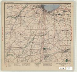
- Subject:
- Topical Subject: Military bases and Geographic Subject: United States
- Creator:
- United States. Army Service Forces. Service Command, 5th
- Publisher:
- United States. Army Service Forces. Service Command, 5th
- Date Created:
- 1943
- Identifier:
- VAC3073-M-00672
- Genre:
- Military maps
- Geographic Location:
- Coordinates: W0900000 W0770000 N0410000 N0360000
- Related URL:
- Catalog URL: https://iucat.iu.edu/catalog/2877722
- Abstract:
- 1 map on 6 sheets. Map extends from Springfield, Ill. on the west to Martinsburg, W. Va. on the east and Chicago on the north to the Kentucky-Tennessee borde...
- Call Number:
- G3706 .R2 1943 .U5 sheets 1-6
- Caption:
- Imprint: Columbus, Ohio : Fifth Service Command, 1943
- Physical Description:
- Dimensions: 82 x 140 cm, on sheets 49 x 51 cm and Scale: 1:750,000
- Alternate Identifier:
- Title Control Number: CAZ9511BB
- Persistent URL:
- https://purl.dlib.indiana.edu/iudl/images/VAC3073/VAC3073-M-00672
-
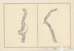
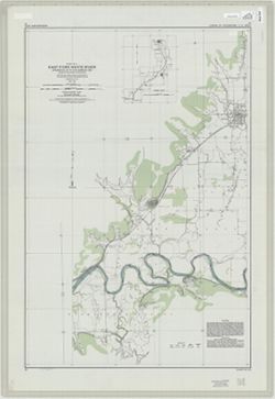
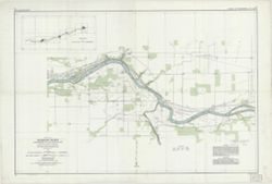
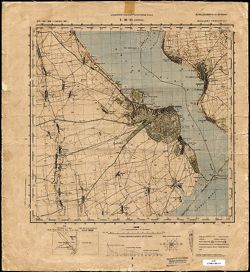
East Fork White River : junction East and West Forks to Shoals, Ind. : chart 7 to chart 12 inclusive
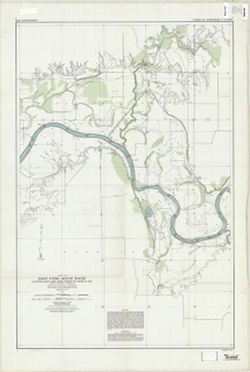
- Subject:
- Geographic Subject: White River (Ind. : River), Topical Subject: Rivers, and Topical Subject: Navigation
- Creator:
- United States. Army. Corps of Engineers. Louisville District
- Publisher:
- [United States Engineer Office]
- Date Created:
- 1931
- Identifier:
- VAC3073-M-01490
- Genre:
- Nautical charts
- Geographic Location:
- Coordinates: W0871300 W0864600 N0384200 N0382800
- Related URL:
- Catalog URL: https://iucat.iu.edu/catalog/6451606
- Abstract:
- Surveyed and mapped under the direction of The United States Engineer Office, Louisville, Ky. Relief shown by contours and spot heights. Depths shown by so...
- Call Number:
- G4092.W5 P53 1931 .U52
- Caption:
- Imprint: [Louisville, Ky.] : [United States Engineer Office], [1931]
- Physical Description:
- Dimensions: 92 x 97 cm or smaller and Scale: 1:12,000
- Persistent URL:
- https://purl.dlib.indiana.edu/iudl/images/VAC3073/VAC3073-M-01490
-
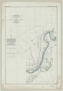
- Subject:
- Geographic Subject: White River (Ind. : River) and Topical Subject: Navigation
- Creator:
- United States. Army. Corps of Engineers. Louisville District
- Publisher:
- [United States Engineer Office]
- Date Created:
- 1931
- Identifier:
- VAC3073-M-01489
- Genre:
- Nautical charts
- Geographic Location:
- Coordinates: W0874500 W0871300 N0383600 N0382400
- Related URL:
- Catalog URL: https://iucat.iu.edu/catalog/6289176
- Abstract:
- Surveyed and mapped under the direction of The United States Engineer Office, Louisville, Ky. Relief shown by contours and spot heights. Depths shown by so...
- Call Number:
- G4092.W5 P53 1931 .U5
- Caption:
- Imprint: [Louisville, Ky.] : [United States Engineer Office], [1931]
- Physical Description:
- Scale: 1:12,000 and Dimensions: 93 x 97 cm or smaller
- Persistent URL:
- https://purl.dlib.indiana.edu/iudl/images/VAC3073/VAC3073-M-01489
-
![Marion County, Indiana [map] : [aerial photographs, 1 inch=100 feet]](https://iiif.uits.iu.edu/iiif/2/8g84np70q%2Ffiles%2F87c92dbf-3c08-4afb-9aa5-654d83642274/full/250,/0/default.jpg)
- Subject:
- Geographic Subject: Marion County (Ind.) and Topical Subject: Aerial photographs
- Creator:
- Clyde E. Williams & Associates
- Publisher:
- [State Land Office]
- Date Created:
- 1985
- Identifier:
- VAC3073-M-00698
- Genre:
- Aerial photographs
- Geographic Location:
- Coordinates: W0862000 W0855700 N0395600 N0393800
- Related URL:
- Catalog URL: https://iucat.iu.edu/catalog/4948281
- Abstract:
- Blue line print. "Date of photography: Spring 1985, Fall 1985"--Index map. Subtitle supplied by cataloger.
- Call Number:
- G4093 .M3 A4 s1 .C559
- Caption:
- Imprint: [Indianapolis] : [State Land Office], [198-?]
- Physical Description:
- Dimensions: 77 x 77 cm and Scale: 1:1,200
- Alternate Identifier:
- Title Control Number: a4948281
- Persistent URL:
- https://purl.dlib.indiana.edu/iudl/images/VAC3073/VAC3073-M-00698
-
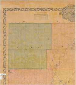
- Subject:
- Geographic Subject: Marion County (Ind.), Topical Subject: Landowners, and Topical Subject: Real property
- Creator:
- Condit, Wright, & Hayden
- Publisher:
- [Condit, Wright & Hayden?]
- Date Created:
- 1855
- Identifier:
- VAC3073-M-00149
- Genre:
- Cadastral maps
- Geographic Location:
- Coordinates: W0862000 W0855700 N0395600 N0393800
- Related URL:
- Catalog URL: https://iucat.iu.edu/catalog/2850575
- Abstract:
- Cadastral map showing landowners. Originally printed in 2 sheets.
- Call Number:
- G4093 .M3G46 1855 .C66 sheets 1-4
- Caption:
- Imprint: [Indianapolis?] : [Condit, Wright & Hayden?], 1855.
- Physical Description:
- Dimensions: 116 x 106 cm and Scale: 1:32,500
- Alternate Identifier:
- Title Control Number: CAU1022BB
- Persistent URL:
- https://purl.dlib.indiana.edu/iudl/images/VAC3073/VAC3073-M-00149
-
- Subject:
- Topical Subject: Real property, Geographic Subject: Dearborn County (Ind.), and Topical Subject: Landowners
- Creator:
- Pattison, Thomas (Civil Engineer)
- Publisher:
- Middleton, Strobridge & Co.
- Date Created:
- 1860
- Identifier:
- VAC3073-M-00096
- Genre:
- Cadastral maps
- Geographic Location:
- Coordinates: W0850800 W0844900 N0391900 N0384200
- Related URL:
- Catalog URL: https://iucat.iu.edu/catalog/6081287
- Abstract:
- Cadastral map showing landowners. Includes table of "Valuation of Dearborn Count for the year 1859" and historical note. Insets: Cochran, Aurora, L...
- Call Number:
- G4093.D3 G46 1860 .P38
- Caption:
- Imprint: Cin. O. : Middleton Strobridge & Co., 1860.
- Physical Description:
- Dimensions: 131 x 91 cm and Scale: Approximately 1:32,000
- Alternate Identifier:
- Title Control Number: a6081287
- Persistent URL:
- https://purl.dlib.indiana.edu/iudl/images/VAC3073/VAC3073-M-00096
-
- Subject:
- Geographic Subject: Clinton (Ind.), Geographic Subject: Eugene (Ind.), Topical Subject: Railroads, Topical Subject: Landowners, Geographic Subject: Newport (...
- Creator:
- Tarrance, James
- Publisher:
- [publisher not identified]
- Date Created:
- 1872
- Identifier:
- VAC3073-M-00785
- Genre:
- Cadastral maps
- Geographic Location:
- Coordinates: W0873200 W0872300 N0400900 N0393700
- Related URL:
- Catalog URL: https://iucat.iu.edu/catalog/4685613
- Abstract:
- Cadastral map showing landowners. Shows Commissioners Districts. Includes maps of Perrysville, Eugene, Newport, railroads of Indiana, and Clinton and drawing...
- Call Number:
- G4093 .V4G46 1872 .T37
- Caption:
- Imprint: [Place of publication not identified] : [publisher not identified], 1872.
- Physical Description:
- Scale: 1:42,240 and Dimensions: 148 x 61 cm, pieces 51 x 65 and 52 x 65 cm
- Alternate Identifier:
- Title Control Number: CAV8552BB
- Persistent URL:
- https://purl.dlib.indiana.edu/iudl/images/VAC3073/VAC3073-M-00785
-
- Subject:
- Topical Subject: Roads and Geographic Subject: Marion County (Ind.)
- Creator:
- Indiana. State Highway Commission (1919-1953)
- Publisher:
- State Highway Commission of Indiana
- Date Created:
- 1949
- Identifier:
- VAC3073-M-00885
- Genre:
- Road maps
- Geographic Location:
- Coordinates: W0862000 W0855700 N0395600 N0393800
- Related URL:
- Catalog URL: https://iucat.iu.edu/catalog/5745742
- Abstract:
- Blueline. "1937." "State revised to January 1, 1949."
- Call Number:
- G4093.M3 P2 1949 .I53 Suppl. sheet 49A
- Caption:
- Imprint: [Indianapolis?] : State Highway Commission of Indiana, [1949]
- Physical Description:
- Dimensions: 52 x 44 cm and Scale: 1:130,000
- Alternate Identifier:
- Title Control Number: a5745742
- Persistent URL:
- https://purl.dlib.indiana.edu/iudl/images/VAC3073/VAC3073-M-00885
-
- Subject:
- Geographic Subject: Monroe County (Ind.), Topical Subject: Roads, and Topical Subject: Quarries and quarrying
- Creator:
- Siebenthal, C. E. (Claude Ellsworth), 1869-1930
- Publisher:
- Julius Bien & Co.
- Date Created:
- 1895
- Identifier:
- VAC3073-M-00084
- Genre:
- Road maps and Thematic maps
- Geographic Location:
- Coordinates: W0864108 W0862436 N0392120 N0385926
- Related URL:
- Catalog URL: https://iucat.iu.edu/catalog/5101345
- Abstract:
- Shows townships, sections, drainage, roads, schools, post offices, quarries, and stone mills. Includes "Stone directory" listing quarries and the c...
- Call Number:
- G4093 .M7P2 1895 .S54
- Caption:
- Imprint: [New York] : Julius Bien & Co., 1895.
- Physical Description:
- Scale: 1:31,680 and Dimensions: 129 x 103 cm
- Alternate Identifier:
- Title Control Number: a5101345
- Persistent URL:
- https://purl.dlib.indiana.edu/iudl/images/VAC3073/VAC3073-M-00084
-
- Subject:
- Topical Subject: Landowners, Geographic Subject: Perry County (Ind.), and Topical Subject: Real property
- Creator:
- Minto, George
- Publisher:
- Minto, George
- Date Created:
- 1894
- Identifier:
- VAC3073-M-00801
- Genre:
- Cadastral maps
- Geographic Location:
- Coordinates: W0864900 W0862600 N0382600 N0375000
- Related URL:
- Catalog URL: https://iucat.iu.edu/catalog/4681682
- Abstract:
- Cadastral map showing landowners. Includes statistical chart for Perry County.
- Call Number:
- G4093 .P3G46 1894 .M56
- Caption:
- Imprint: Cannelton, Ind. : George Minto, 1894.
- Physical Description:
- Dimensions: 115 x 84 cm, pieces 61 x 44 cm and Scale: 1:42,240
- Alternate Identifier:
- Title Control Number: CAT6625BB
- Persistent URL:
- https://purl.dlib.indiana.edu/iudl/images/VAC3073/VAC3073-M-00801
-
- Subject:
- Topical Subject: Geology and Geographic Subject: Indiana
- Creator:
- Patton, John B. (John Barratt), 1915-
- Publisher:
- Indiana. Geological Survey
- Date Created:
- 1956
- Identifier:
- VAC3073-M-00212
- Genre:
- Geological maps
- Geographic Location:
- Coordinates: W0880000 W0844500 N0414500 N0375200
- Related URL:
- Catalog URL: https://iucat.iu.edu/catalog/5888483
- Abstract:
- "Base from Map of Indiana, 1950 edition, published by the U.S. Geological Survey. Minor revisions and additions made from Indiana Department of Conserva...
- Call Number:
- G4091 .C5 1956 .P3
- Caption:
- Imprint: [Bloomington] : Indiana Geological Survey, 1956.
- Physical Description:
- Dimensions: 59 x 31 cm and Scale: 1:1,000,000
- Alternate Identifier:
- Title Control Number: a5888483
- Persistent URL:
- https://purl.dlib.indiana.edu/iudl/images/VAC3073/VAC3073-M-00212
-
- Subject:
- Topical Subject: Real property and Geographic Subject: Hammond (Ind.)
- Creator:
- Roehrig, C. Wm.
- Publisher:
- Roehrig, C. Wm.
- Date Created:
- 1888
- Identifier:
- VAC3073-M-00079
- Genre:
- Cadastral maps
- Geographic Location:
- Coordinates: W0873131 W0872556 N0414307 N0413358
- Related URL:
- Catalog URL: https://iucat.iu.edu/catalog/4675858
- Abstract:
- Cadastral map.
- Call Number:
- G4094 .H2G46 1888 .R64
- Caption:
- Imprint: [place of publication not identified] : C. Wm. Roehrig, 1888.
- Physical Description:
- Dimensions: 142 x 69 cm and Scale: 1:4,800
- Alternate Identifier:
- Title Control Number: CAQ2575BB
- Persistent URL:
- https://purl.dlib.indiana.edu/iudl/images/VAC3073/VAC3073-M-00079
-
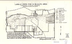
- Subject:
- Topical Subject: Game laws, Topical Subject: Wildlife management areas, Geographic Subject: LaSalle Fish and Wildlife Area (Ind.), Geographic Subject: Newton...
- Creator:
- Indiana. Division of Fish and Wildlife
- Publisher:
- Indiana. Division of Fish and Wildlife
- Date Created:
- 1971
- Identifier:
- VAC3073-M-01261
- Genre:
- Thematic maps
- Geographic Location:
- Coordinates: W0873136 W0872652 N0411057 N0410840
- Related URL:
- Catalog URL: https://iucat.iu.edu/catalog/18405983
- Abstract:
- Title on verso: Rules and regulations : LaSalle Fish and Wildlife Area. Shows hunting, water, and waterfowl resting areas, as well as marshes, railroads, par...
- Call Number:
- G4091.E63 svar .I5 LeSalle 1
- Caption:
- Imprint: [Indianapolis?] : [The Division], 1971.
- Physical Description:
- Dimensions: 36 x 22 cm or smaller and Scale: Approximately 1:28,000
- Alternate Identifier:
- Title Control Number: a18405983
- Persistent URL:
- https://purl.dlib.indiana.edu/iudl/images/VAC3073/VAC3073-M-01261
- Provenance:
- Indiana state fish and wildlife areas. Department of Natural Resources. Division of Fish and Wildlife. [Indianapolis?] : The Division, 1971-.
-
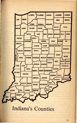
- Subject:
- Topical Subject: Counties, Geographic Subject: Indiana, and Topical Subject: Administrative and political divisions
- Publisher:
- Ed Leary & Associates
- Date Created:
- 1967
- Identifier:
- VAC3073-M-00055
- Genre:
- Maps
- Geographic Location:
- Coordinates: W0880500 W0844700 N0414500 N0374600
- Related URL:
- Catalog URL: https://iucat.iu.edu/catalog/18428218
- Abstract:
- Title from accompanying county list: Indiana's 92 counties. Accompanied by list of Indiana counties showing their location, year organized, county seat, ...
- Call Number:
- F526 .I675 1967
- Caption:
- Imprint: [Indianapolis] : [Ed Leary & Associates], [1967]
- Physical Description:
- Dimensions: 22 cm or smaller and Scale: Scale not given.
- Alternate Identifier:
- Title Control Number: a18428218 and Alternate ID: BGH2655BB
- Persistent URL:
- https://purl.dlib.indiana.edu/iudl/images/VAC3073/VAC3073-M-00055
- Provenance:
- Indiana almanac and fact book (1967-)
-
- Subject:
- Geographic Subject: Fort Wayne (Ind.), Topical Subject: Real property, and Topical Subject: Landowners
- Creator:
- Huntoon, L. P.
- Publisher:
- Huntoon, L. P.
- Date Created:
- 1889
- Identifier:
- VAC3073-M-00330
- Genre:
- Cadastral maps
- Geographic Location:
- Coordinates: W0851811 W0845955 N0411159 N0405755
- Related URL:
- Catalog URL: https://iucat.iu.edu/catalog/7479038
- Abstract:
- Partial cadastral map showing landowners.
- Call Number:
- G4094.F7G46 1889 .H86
- Caption:
- Imprint: Fort Wayne, Ind. : L.P. Huntoon, 1889.
- Physical Description:
- Scale: Approximately 1:4,800. 400 feet to 1 inch and Dimensions: 120 x 129 cm, on sheets 129 x 72 cm
- Alternate Identifier:
- Title Control Number: a7479038
- Persistent URL:
- https://purl.dlib.indiana.edu/iudl/images/VAC3073/VAC3073-M-00330
-
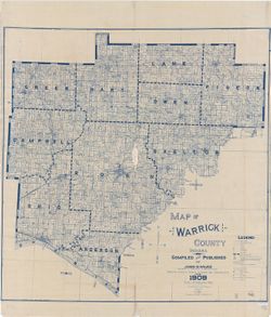
- Subject:
- Geographic Subject: Warrick County (Ind.), Topical Subject: Real property, and Topical Subject: Landowners
- Creator:
- Wilke, John H.
- Publisher:
- Wilke, John H.
- Date Created:
- 1909
- Identifier:
- VAC3073-M-00157
- Genre:
- Cadastral maps
- Geographic Location:
- Coordinates: W0873200 W0870100 N0381400 N0375200
- Related URL:
- Catalog URL: https://iucat.iu.edu/catalog/5382911
- Abstract:
- Cadastral map showing landowners. "Based on public and private surveys and records, etc." Blue line print. "Entered according to A...
- Call Number:
- G4093.W4 G46 1909 .W55
- Caption:
- Imprint: [Boonville, Ind.] : John H. Wilke, 1909
- Physical Description:
- Dimensions: 135 x 132 cm and Scale: 1:31,680
- Alternate Identifier:
- Title Control Number: a5382911
- Persistent URL:
- https://purl.dlib.indiana.edu/iudl/images/VAC3073/VAC3073-M-00157
-
- Subject:
- Geographic Subject: Indiana, Geographic Subject: Illinois, Topical Subject: Geology, Stratigraphic, and Topical Subject: Geology
- Creator:
- Indiana. Geological Survey, Bleuer, N. K. (Ned Kermit), 1943-, Lineback, Jerry A. (Jerry Alvin), Hill, John R,, Gray, Henry Hamilton, 1922-, and Illinois Sta...
- Publisher:
- Indiana. Geological Survey
- Date Created:
- 1979
- Identifier:
- VAC3073-M-01251
- Genre:
- Quadrangle maps, Geological maps, and Geological cross-sections
- Geographic Location:
- Coordinates: W0880000 W0860000 N0400000 N0390000
- Related URL:
- Catalog URL: https://iucat.iu.edu/catalog/18437113
- Abstract:
- Indianapolis sheet. 1979 edition. Transverse Mercator projection. Geology compiled by H. H. Gray (Indiana) and J. A. Lineback (Illinois) from published and o...
- Call Number:
- G4091.C5 s250 .I5 Indianapolis 1979
- Caption:
- Imprint: [Bloomington] : Indiana Geological Survey, 1979
- Physical Description:
- Scale: 1:250,000. Vertical scale approximately 1:3,800 and Dimensions: 66 x 102 cm
- Alternate Identifier:
- Title Control Number: a18437113
- Persistent URL:
- https://purl.dlib.indiana.edu/iudl/images/VAC3073/VAC3073-M-01251
- Provenance:
- Indiana. Geological Survey. Regional geologic map , no. 1.
-
- Subject:
- Topical Subject: Roads and Geographic Subject: Indiana
- Creator:
- H.M. Gousha Company
- Publisher:
- H.M. Gousha Company
- Date Created:
- 1947
- Identifier:
- VAC3073-M-00427
- Genre:
- Road maps
- Geographic Location:
- Coordinates: W0880500 W0844700 N0414500 N0374600
- Related URL:
- Catalog URL: https://iucat.iu.edu/catalog/5272374
- Abstract:
- Includes index to counties, cities and towns. Text, illustrations, Transcontinental mileage chart, and ancillary maps of Indianapolis, Indiana, and Standard ...
- Call Number:
- G4091.P2 1947 .H2
- Caption:
- Imprint: Chicago : H.M. Gousha Company, [1947]
- Physical Description:
- Scale: 1:760,000 and Dimensions: 66 x 41 cm
- Alternate Identifier:
- Title Control Number: a5272374
- Persistent URL:
- https://purl.dlib.indiana.edu/iudl/images/VAC3073/VAC3073-M-00427
-
- Subject:
- Topical Subject: Administrative and political divisions, Topical Subject: Population, and Geographic Subject: Indiana
- Creator:
- Scarborough Company
- Publisher:
- Scarborough Company
- Date Created:
- 1904
- Identifier:
- VAC3073-M-01286
- Genre:
- Maps
- Related URL:
- Catalog URL: https://iucat.iu.edu/catalog/5277869
- Abstract:
- In two sheets, Sheet 1 and Sheet 2 Multiple inset maps, table of population data based on 1900 census.
- Call Number:
- G4090 .S28
- Caption:
- Imprint: Boston, Scarborough Co., c1904.
- Physical Description:
- Scale: 1:380,160
- Persistent URL:
- https://purl.dlib.indiana.edu/iudl/images/VAC3073/VAC3073-M-01286
-
- Subject:
- Geographic Subject: Putnam County (Ind.), Topical Subject: Real property, Topical Subject: Landowners, and Geographic Subject: Greencastle (Ind.)
- Publisher:
- Central National Bank (Greencastle, Ind.)
- Date Created:
- 1956
- Identifier:
- VAC3073-M-00431
- Genre:
- Cadastral maps
- Geographic Location:
- Coordinates: W0865246 W0864752 N0393930 N0393728
- Related URL:
- Catalog URL: https://iucat.iu.edu/catalog/4675439
- Abstract:
- Map of Greencastle, Ind.: Cadastral map , "Original map prepared by Wm. P. Koehler, 1925 - revised by John Howard R.E..., 1946 - Revised by Granville ...
- Call Number:
- G4094.G5G46 1956 .M37
- Caption:
- Imprint: Greencastle, Ind. : Central National Bank of Greencastle, Indiana, [1957]
- Physical Description:
- Dimensions: 55 x 64 cm and 77 x 54 cm and Scale: 1:3,600
- Alternate Identifier:
- Title Control Number: CAP8871BB
- Persistent URL:
- https://purl.dlib.indiana.edu/iudl/images/VAC3073/VAC3073-M-00431
-
- Description:
- 1890
- Subject:
- Topical Subject: Maps, Geographic Subject: Kersleti, and Topical Subject: Soviet Union
- Publisher:
- Управление военных топографов
- Language:
- Russian
- Date Created:
- 1900
- Identifier:
- VAC9619-001670
- Genre:
- Topographic Maps and Military Maps
- Geographic Location:
- Coordinates: 59, 23, 59.167, 23.25
- Related URL:
- Catalog URL: http://iucat.iu.edu/catalog/5020131 and Download GeoTIFF: https://drive.google.com/open?id=1hbDmzQAiMfBU_L1SZkfcXjJgwchyfKjV
- Abstract:
- Modern area represented: Kersleti, Lääne county, Estonia
- Call Number:
- G7000 s50 .S68 sheet O-34-35-B
- City:
- Керслет (Kersleti)
- Copyright Holder:
- No Copyright - United States
- Country:
- Эстония (Estonia)
- Physical Description:
- Scale: 1:50,000
- Persistent URL:
- http://purl.dlib.indiana.edu/iudl/images/VAC9619/VAC9619-001670
- Provenance:
- DMA Topographic Center, OMAHA, Geographic Names Branch, Army Map Service Library, Library of Congress Geography & Map Division
-

- Description:
- 1914
- Subject:
- Topical Subject: Soviet Union, Topical Subject: Maps, and Geographic Subject: Zakhonye
- Publisher:
- Управление военных топографов
- Language:
- Russian
- Date Created:
- 1925
- Identifier:
- VAC9619-001851
- Genre:
- Military Maps and Topographic Maps
- Geographic Location:
- Coordinates: 58.833, 29.25, 59, 29.5
- Related URL:
- Download GeoTIFF: https://drive.google.com/open?id=13eq_cnnXj2y4sziLGe95t8EKFYpjTMdS and Catalog URL: http://iucat.iu.edu/catalog/5020131
- Abstract:
- Modern area represented: Zakhonye, Russia
- Call Number:
- G7000 s50 .S68 sheet O-35-47-B
- Caption:
- Не подлежит оглашению,Captured map
- City:
- Захоноье (Zakhonye)
- Copyright Holder:
- No Copyright - United States
- Country:
- СССР (USSR)
- State/Province:
- РСФСР (RSFSR) and Ленинградская область (Leningrad oblast)
- Physical Description:
- Scale: 1:50,000
- Persistent URL:
- http://purl.dlib.indiana.edu/iudl/images/VAC9619/VAC9619-001851
- Provenance:
- Army Map Service Library, OMAHA, Library of Congress Geography & Map Division
-
- Description:
- 1936
- Subject:
- Geographic Subject: Ozero Vadozero, Topical Subject: Soviet Union, and Topical Subject: Maps
- Publisher:
- Управление военных топографов РККА
- Language:
- Russian
- Identifier:
- VAC9619-002568
- Genre:
- Topographic Maps and Military Maps
- Geographic Location:
- Coordinates: 67, 31, 67.333, 32
- Related URL:
- Download GeoTIFF: https://drive.google.com/file/d/1tQnrCvTr4D-7FlG7pcuATUnFg3cTE22e/view?usp=sharing and Catalog URL: https://iucat.iu.edu/catalog/5020129
- Abstract:
- Modern area represented: Ozero Vadozero, Murmansk oblast, Russia
- Call Number:
- G7000 s100 .S7 sheet Q-36-27
- Caption:
- Не подлежит оглашению,Captured map
- City:
- Вад-озеро (Ozero Vadozero)
- Copyright Holder:
- No Copyright - United States
- Country:
- СССР (USSR)
- State/Province:
- Ленинградская область (Leningrad oblast), РСФСР (RSFSR), and Карельская АССР (Karelian Autonomous Soviet Socialist Republic)
- Physical Description:
- Scale: 1:100,000
- Persistent URL:
- http://purl.dlib.indiana.edu/iudl/images/VAC9619/VAC9619-002568
- Provenance:
- DMA Topographic Center, Army Map Service Library, OMAHA
-
- Description:
- 1928
- Subject:
- Topical Subject: Soviet Union, Topical Subject: Maps, and Geographic Subject: Maryanovka
- Publisher:
- Управление военных топографов РККА
- Language:
- Russian
- Date Created:
- 1930
- Identifier:
- VAC9619-001170
- Genre:
- Military Maps and Topographic Maps
- Geographic Location:
- Coordinates: 48.167, 33.5, 48.333, 33.75
- Related URL:
- Catalog URL: http://iucat.iu.edu/catalog/5020131 and Download GeoTIFF: https://drive.google.com/open?id=1TcoQgF6oEgeExR6LG-eMJlucz0cQ0qyl
- Abstract:
- Modern area represented: Maryanovka, Dnipropetrovsk oblast, Ukraine
- Call Number:
- GM G7000 S50 .S68 M-36-140-A
- Caption:
- Не подлежит оглашению
- City:
- Марьяновка (Maryanovka)
- Copyright Holder:
- No Copyright - United States
- Country:
- СССР (USSR)
- State/Province:
- Днепропетровская область (Dnipropetrovsk oblast) and Украинская ССР (Ukrainian Soviet Socialist Republic)
- Physical Description:
- Scale: 1:50,000
- Persistent URL:
- http://purl.dlib.indiana.edu/iudl/images/VAC9619/VAC9619-001170
- Provenance:
- DMA Topographic Center, Army Map Service Library, OMAHA, Library of Congress Geography & Map Division
-
- Subject:
- Topical Subject: Soviet Union, Topical Subject: Maps, and Geographic Subject: Ruza
- Publisher:
- Главное Управление Геодезии и Картографии при СНК СССР
- Language:
- Russian
- Date Created:
- 1941
- Identifier:
- VAC9619-001988
- Genre:
- Military Maps and Topographic Maps
- Geographic Location:
- Coordinates: 55.6667, 36, 56, 36.5
- Related URL:
- Download GeoTIFF: https://drive.google.com/open?id=183z014zc6Fo65VnpwC5QfH0wkSz1d_qH and Catalog URL: https://iucat.iu.edu/catalog/5020129
- Abstract:
- Modern area represented: Ruza, Moscow oblast, Russia
- Call Number:
- G7000 s100 .S7 sheet N-37-1
- Caption:
- Для служебного пользования
- City:
- Руза (Ruza)
- Copyright Holder:
- No Copyright - United States
- Country:
- СССР (USSR)
- State/Province:
- Московская область (Moscow oblast) and РСФСР (RSFSR)
- Physical Description:
- Scale: 1:100,000
- Persistent URL:
- http://purl.dlib.indiana.edu/iudl/images/VAC9619/VAC9619-001988
- Provenance:
- DMA Topographic Center, Army Map Service Library, Geographic Names Branch, OMAHA
-
- Description:
- 1936
- Subject:
- Topical Subject: Maps, Topical Subject: Soviet Union, and Geographic Subject: Dubrova
- Publisher:
- Управление военных топографов РККА
- Language:
- Russian
- Identifier:
- VAC9619-000787
- Genre:
- Military Maps and Topographic Maps
- Geographic Location:
- Coordinates: 52.5, 29.25, 52.667, 29.5
- Related URL:
- Download GeoTIFF: https://drive.google.com/open?id=1exPyUC6LvIjyDpQjacJC9PC4HKAjtEPc and Catalog URL: http://iucat.iu.edu/catalog/5020131
- Abstract:
- Modern area represented: Dubrova, Homyel oblast, Belarus
- Call Number:
- G7000 s50 .s68 sheet N-35-131-B
- Caption:
- Не подлежит оглашению
- City:
- Дуброва (Dubrova)
- Copyright Holder:
- No Copyright - United States
- Country:
- СССР (USSR)
- State/Province:
- Белорусская ССР (Byelorussian Soviet Socialist Republic)
- Physical Description:
- Scale: 1:50,000
- Persistent URL:
- http://purl.dlib.indiana.edu/iudl/images/VAC9619/VAC9619-000787
- Provenance:
- M. I. Map Library, G000-30, GS, RA, OMAHA, Library of Congress Geography & Map Division, Army Map Service Library
-
- Description:
- 1936
- Subject:
- Topical Subject: Soviet Union, Geographic Subject: Pukhavichy, and Topical Subject: Maps
- Publisher:
- Управление военных топографов РККА
- Language:
- Russian
- Identifier:
- VAC9619-000652
- Genre:
- Topographic Maps and Military Maps
- Geographic Location:
- Coordinates: 53.5, 28.25, 53.667, 28.5
- Related URL:
- Download GeoTIFF: https://drive.google.com/open?id=1tc9WqkzkXMe1W75jNrY4b1YDitDO7sZs and Catalog URL: http://iucat.iu.edu/catalog/5020131
- Abstract:
- Modern area represented: Pukhavichy, Minsk oblast, Belarus
- Call Number:
- G7000 s50 .S68 sheet N-35-93-B
- Caption:
- Не подлежит оглашению,Captured map
- City:
- Пуховичи (Puhovichi)
- Copyright Holder:
- No Copyright - United States
- Country:
- СССР (USSR)
- State/Province:
- Белорусская ССР (Byelorussian Soviet Socialist Republic)
- Physical Description:
- Scale: 1:50,000
- Persistent URL:
- http://purl.dlib.indiana.edu/iudl/images/VAC9619/VAC9619-000652
- Provenance:
- Army Map Service Library, OMAHA, Library of Congress Geography & Map Division
-
- Description:
- 1936
- Subject:
- Topical Subject: Soviet Union, Geographic Subject: Zhitkovitsy, and Topical Subject: Maps
- Publisher:
- Управление военных топографов РККА
- Language:
- Russian
- Identifier:
- VAC9619-000024
- Genre:
- Military Maps and Topographic Maps
- Geographic Location:
- Coordinates: 58.667, 28.75, 58.833, 29
- Related URL:
- Catalog URL: http://iucat.iu.edu/catalog/5020131 and Download GeoTIFF: https://drive.google.com/open?id=1gAuIgkJWW_VNrb5GinG0F75CBMhYwjCr
- Abstract:
- Modern area represented: Zhitkovitsy, Russia
- Call Number:
- G7000 s50 .S68 sheet O-35-46-D
- Caption:
- Не подлежит оглашению ,Captured map,Duplicate
- City:
- Житковичи (Zhitkovitsy)
- Copyright Holder:
- No Copyright - United States
- Country:
- СССР (USSR)
- State/Province:
- РСФСР (RSFSR) and Ленинградская область (Leningrad oblast)
- Physical Description:
- Scale: 1:50,000
- Persistent URL:
- http://purl.dlib.indiana.edu/iudl/images/VAC9619/VAC9619-000024
- Provenance:
- Army Map Service Library, OMAHA, Library of Congress Geography & Map Division
-
- Subject:
- Topical Subject: Soviet Union, Topical Subject: Maps, and Geographic Subject: Suur-Selänpää
- Publisher:
- Генеральный штаб РККА
- Language:
- Russian
- Date Created:
- 1940
- Identifier:
- VAC9619-002379
- Genre:
- Military Maps and Topographic Maps
- Geographic Location:
- Coordinates: 61.0, 26.5, 61.333333, 27.0
- Related URL:
- Catalog URL: https://iucat.iu.edu/catalog/5020129 and Download GeoTIFF: https://drive.google.com/file/d/1IphV-fyNP5DuxyjjFppqeaSfcSPZJMh5/view?usp=sharing
- Abstract:
- Modern area represented: Suur-Selänpää, Kymenlaakso, Finland
- Call Number:
- G7000 s100 .S7 sheet P-35-102
- City:
- Селянпяя (Selänpää)
- Copyright Holder:
- No Copyright - United States
- Country:
- Финляндия (Finland)
- Physical Description:
- Scale: 1:100,000
- Persistent URL:
- http://purl.dlib.indiana.edu/iudl/images/VAC9619/VAC9619-002379
- Provenance:
- DMA Topographic Center, Army Map Service Library, OMAHA
-
- Description:
- 1936
- Subject:
- Topical Subject: Soviet Union, Topical Subject: Maps, and Geographic Subject: Valosavіchy
- Publisher:
- Управление военных топографов РККА
- Language:
- Russian
- Identifier:
- VAC9619-000785
- Genre:
- Military Maps and Topographic Maps
- Geographic Location:
- Coordinates: 52.5, 29, 52.667, 29.25
- Related URL:
- Download GeoTIFF: https://drive.google.com/open?id=1-0JtGuoRcAQOMue9zKRY1H90BFVHsJ9M and Catalog URL: http://iucat.iu.edu/catalog/5020131
- Abstract:
- Modern area represented: Valosavіchy, Homyel oblast, Belarus
- Call Number:
- G7000 s50 .s68 sheet N-35-131-A
- Caption:
- Не подлежит оглашению
- City:
- Волосовичи (Volosovichi)
- Copyright Holder:
- No Copyright - United States
- Country:
- СССР (USSR)
- State/Province:
- Белорусская ССР (Byelorussian Soviet Socialist Republic)
- Physical Description:
- Scale: 1:50,000
- Persistent URL:
- http://purl.dlib.indiana.edu/iudl/images/VAC9619/VAC9619-000785
- Provenance:
- M. I. Map Library, G000-30, GS, RA, Library of Congress Geography & Map Division
-
- Description:
- 1924
- Subject:
- Geographic Subject: Usvyatye, Topical Subject: Maps, and Topical Subject: Soviet Union
- Publisher:
- Военно-топографическое управление
- Language:
- Russian
- Identifier:
- VAC9619-001311
- Genre:
- Topographic Maps and Military Maps
- Geographic Location:
- Coordinates: 54.833, 33, 55, 33.25
- Related URL:
- Download GeoTIFF: https://drive.google.com/open?id=1AaD9cb-yeLx9Q9q3fqX2yj9TKMto0b91 and Catalog URL: http://iucat.iu.edu/catalog/5020131
- Abstract:
- Modern area represented: Usvyatye, Smolensk oblast, Russia
- Call Number:
- GM G7000 S50 .S68 N-36-43-A
- Caption:
- Секретно
- City:
- Усвятье (Usvyatye)
- Copyright Holder:
- No Copyright - United States
- Country:
- СССР (USSR)
- State/Province:
- РСФСР (RSFSR) and Западная область (Western oblast)
- Physical Description:
- Scale: 1:50,000
- Persistent URL:
- http://purl.dlib.indiana.edu/iudl/images/VAC9619/VAC9619-001311
- Provenance:
- Army Map Service Library, Library of Congress G & M Division, OMAHA
-
- Description:
- 1909
- Subject:
- Topical Subject: Soviet Union, Geographic Subject: Yarun, and Topical Subject: Maps
- Publisher:
- Управление военных топографов РККА
- Language:
- Russian
- Identifier:
- VAC9619-000223
- Genre:
- Topographic Maps and Military Maps
- Geographic Location:
- Coordinates: 50.5, 27.25, 50.667, 27.5
- Related URL:
- Download GeoTIFF: https://drive.google.com/open?id=17KmDaXN8x05zM3z-hw5VoHIxZVWjOqXH and Catalog URL: http://iucat.iu.edu/catalog/5020131
- Abstract:
- Modern area represented: Yarun, Zhytomyr oblast, Ukraine
- Call Number:
- G7000 s50 .S68 sheet M-35-55-B
- Caption:
- Не подлежит оглашению
- City:
- Ярунь (Yarun)
- Copyright Holder:
- No Copyright - United States
- Country:
- СССР (USSR)
- State/Province:
- Украинская ССР (Ukrainian Soviet Socialist Republic) and Киевская область (Kyiv oblast)
- Physical Description:
- Scale: 1:50,000
- Persistent URL:
- http://purl.dlib.indiana.edu/iudl/images/VAC9619/VAC9619-000223
- Provenance:
- DMA Topographic Center, Army Map Service Library, OMAHA, Library of Congress Geography & Map Division
-

- Description:
- 1928
- Subject:
- Geographic Subject: Surazh, Topical Subject: Soviet Union, and Topical Subject: Maps
- Publisher:
- Генеральный штаб Красной Армии
- Language:
- Russian
- Date Created:
- 1941
- Identifier:
- VAC9619-001977
- Genre:
- Topographic Maps and Military Maps
- Geographic Location:
- Coordinates: 53, 32, 53.3333, 32.5
- Related URL:
- Catalog URL: https://iucat.iu.edu/catalog/5020129 and Download GeoTIFF: https://drive.google.com/open?id=1beMyaj-VgbNaVBKPEMNn15PuoGtx7M9s
- Abstract:
- Modern area represented: Surazh, Bryansk oblast, Russia
- Call Number:
- G7000 s100 .S7 sheet N-36-101
- City:
- Сураж (Surazh)
- Copyright Holder:
- No Copyright - United States
- Country:
- СССР (USSR)
- State/Province:
- Могилевская область (Mogilev oblast), Белорусская ССР (Byelorussian Soviet Socialist Republic), РСФСР (RSFSR), and Орловская область (Oryol oblast)
- Physical Description:
- Scale: 1:100,000
- Persistent URL:
- http://purl.dlib.indiana.edu/iudl/images/VAC9619/VAC9619-001977
- Provenance:
- DMA Topographic Center, Army Map Service Library
-
- Description:
- 1936
- Subject:
- Geographic Subject: Voloshovo, Topical Subject: Maps, and Topical Subject: Soviet Union
- Publisher:
- Генеральный штаб РККА
- Language:
- Russian
- Date Created:
- 1937
- Identifier:
- VAC9619-001852
- Genre:
- Topographic Maps and Military Maps
- Geographic Location:
- Coordinates: 58.667, 29.25, 58.833, 29.5
- Related URL:
- Catalog URL: http://iucat.iu.edu/catalog/5020131 and Download GeoTIFF: https://drive.google.com/open?id=1pHva-PGBr0hpKzHfPowYax7ILfiz6wiD
- Abstract:
- Modern area represented: Voloshovo, Russia
- Call Number:
- G7000 s50 .S68 sheet O-35-47-D
- Caption:
- Не подлежит оглашению
- City:
- Волошово (Voloshovo)
- Copyright Holder:
- No Copyright - United States
- Country:
- СССР (USSR)
- State/Province:
- РСФСР (RSFSR) and Ленинградская область (Leningrad oblast)
- Physical Description:
- Scale: 1:50,000
- Persistent URL:
- http://purl.dlib.indiana.edu/iudl/images/VAC9619/VAC9619-001852
- Provenance:
- Army Map Service Library, OMAHA, Library of Congress Geography & Map Division
-
- Description:
- 1875
- Subject:
- Geographic Subject: Belgorod-Dnestrovskiy, Topical Subject: Soviet Union, and Topical Subject: Maps
- Publisher:
- Управление военных топографов РККА
- Language:
- Russian
- Date Created:
- 1929
- Identifier:
- VAC9619-001915
- Genre:
- Topographic Maps and Military Maps
- Geographic Location:
- Coordinates: 46, 30, 46.3333, 30.5
- Related URL:
- Catalog URL: https://iucat.iu.edu/catalog/5020129 and Download GeoTIFF: https://drive.google.com/file/d/1xTaeC4RlvKqjCHGORBzShnm74gH5QF17/view?usp=sharing
- Abstract:
- Modern area represented: Belgorod-Dnestrovskiy, Odessa oblast, Ukraine
- Call Number:
- G7000 s100 .S7 sheet L-36-61
- Caption:
- Не подлежит оглашению
- City:
- Аккерман (Akkerman)
- Copyright Holder:
- No Copyright - United States
- Country:
- СССР (USSR)
- State/Province:
- Бессарабия (Bessarabia) and Украинская ССР (Ukrainian Soviet Socialist Republic)
- Physical Description:
- Scale: 1:100,000
- Persistent URL:
- http://purl.dlib.indiana.edu/iudl/images/VAC9619/VAC9619-001915
- Provenance:
- DMA Topographic Center, Army Map Service Library, OMAHA
-
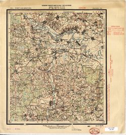
- Subject:
- Geographic Subject: Vanderburgh County (Ind.), Topical Subject: Coal mines and mining, Topical Subject: Mines and mineral resources, Topical Subject: Geology...
- Creator:
- Collett, John, 1828-1899
- Publisher:
- Indiana. Geological Survey
- Date Created:
- 1876
- Identifier:
- VAC3073-M-01146
- Genre:
- Geological maps
- Geographic Location:
- Coordinates: W0874203 W0872658 N0381006 N0374933
- Related URL:
- Catalog URL: https://iucat.iu.edu/catalog/18349316
- Abstract:
- Compiled for the 7th annual report of E.T. Cox, State Geologist , geology by Prof. John Collett, 1875. Relief shown by hachures. Shows cities and towns, rail...
- Call Number:
- G4093.V3C5 1875 .C6
- Caption:
- Imprint: [Indianapolis] : [Geological Survey of Indiana], [1876] and Imprint: [Indianapolis] : [Sentinel Company, printers], [1876]
- Physical Description:
- Scale: Approximately 1:130,000 and Dimensions: on sheet 41 x 31 cm
- Alternate Identifier:
- Alternate ID: 390723IP and Title Control Number: a18349316
- Persistent URL:
- https://purl.dlib.indiana.edu/iudl/images/VAC3073/VAC3073-M-01146
- Provenance:
- 7th Annual Report (1875) / Indiana. Geological Survey.
-
- Subject:
- Topical Subject: Mines and mineral resources, Geographic Subject: Greene County (Ind.), and Topical Subject: IGS Annual Reports
- Creator:
- Levette, G. M. (Gilbert M.)
- Publisher:
- Indiana. Geological Survey
- Date Created:
- 1869
- Identifier:
- VAC3073-M-01449
- Genre:
- Thematic maps
- Geographic Location:
- Coordinates: W0871431 W0864053 N0391018 N0385418
- Related URL:
- Catalog URL: https://iucat.iu.edu/catalog/18189063
- Abstract:
- Shows towns, railroads, coal and iron ore, mills, furnaces, and stone quarries. "For the first annual report of Prof. E.T. Cox, State Geologist." ...
- Call Number:
- G4093.G7H1 1869 .L3
- Caption:
- Imprint: [Indianapolis] : [Alexander M. Conner], [1869]
- Physical Description:
- Dimensions: 61 x 71 cm and Scale: Approximately 1:85,000
- Alternate Identifier:
- Title Control Number: a18189063
- Persistent URL:
- https://purl.dlib.indiana.edu/iudl/images/VAC3073/VAC3073-M-01449
- Provenance:
- 1st Annual Report (1869) / Indiana. Geological Survey
-
- Subject:
- Topical Subject: Roads and Geographic Subject: Indiana
- Creator:
- Rand McNally and Company
- Publisher:
- Rand McNally and Company
- Date Created:
- 1937
- Identifier:
- VAC3073-M-00192
- Genre:
- Road maps
- Geographic Location:
- Coordinates: W0880500 W0844700 N0414500 N0374600
- Related URL:
- Catalog URL: https://iucat.iu.edu/catalog/5273381
- Abstract:
- Includes "Indiana Index" to cities & towns with populations. "Standard Oil Company (Indiana) 1937 road map United States" and ancilla...
- Call Number:
- G4091.P2 1937 .R3
- Caption:
- Imprint: Chicago : Rand McNally, 1937.
- Physical Description:
- Dimensions: 58 x 38 cm and Scale: 1:850,000
- Alternate Identifier:
- Title Control Number: a5273381
- Persistent URL:
- https://purl.dlib.indiana.edu/iudl/images/VAC3073/VAC3073-M-00192
-
- Subject:
- Topical Subject: Election districts, Topical Subject: Administrative and political divisions, Geographic Subject: Indiana, Topical Subject: Railroads, Topica...
- Creator:
- Colton, J. H. (Joseph Hutchins), 1800-1893
- Publisher:
- J.H. Colton & Co.
- Date Created:
- 1854
- Identifier:
- VAC3073-M-01277
- Genre:
- Thematic maps
- Geographic Location:
- Coordinates: W0880700 W0844500 N0414500 N0375200
- Related URL:
- Catalog URL: https://iucat.iu.edu/catalog/7738188
- Abstract:
- "Entered according to act of Congress in the year 1852 ..." Also shows congressional districts. Includes inset tables "Statistics of populatio...
- Call Number:
- G4090 1854 .C6
- Caption:
- Imprint: New York : J.H. Colton, 1854
- Physical Description:
- Dimensions: 91 x 63 cm and Scale: Scale not given.
- Persistent URL:
- https://purl.dlib.indiana.edu/iudl/images/VAC3073/VAC3073-M-01277
-
- Subject:
- Geographic Subject: Marion County (Ind.) and Geographic Subject: Indianapolis (Ind.)
- Publisher:
- George F. Cram Company
- Date Created:
- 1945
- Identifier:
- VAC3073-M-00971
- Genre:
- Tourist maps and Road maps
- Geographic Location:
- Coordinates: W0860929 W0860929 N0394606 N0394606
- Related URL:
- Catalog URL: https://iucat.iu.edu/catalog/5044759
- Abstract:
- 89 x 57 cm. Color map with illustrations. Includes street index. On reverse, "Map of the Central Business District of Indianapolis showing hotels, theat...
- Call Number:
- G4094 .I4 1945 .G46
- Caption:
- Imprint: Indianapolis, In.: George F. Cram Company, Inc. 1945.
- Physical Description:
- Dimensions: 75 x 56 cm and Scale: 1:28,000
- Alternate Identifier:
- Title Control Number: a5044759
- Persistent URL:
- https://purl.dlib.indiana.edu/iudl/images/VAC3073/VAC3073-M-00971
- Provenance:
- Official Indexed Indianapolis Street Map and Road map of Marion County.
-
- Subject:
- Geographic Subject: Hoosier National Forest (Ind.)
- Creator:
- United States. Forest Service. Eastern Region
- Publisher:
- United States. Forest Service. Eastern Region
- Date Created:
- 1987
- Identifier:
- VAC3073-M-00978
- Genre:
- Maps
- Geographic Location:
- Coordinates: W0865245 W0860659 N0391010 N0374550
- Related URL:
- Catalog URL: https://iucat.iu.edu/catalog/2657588
- Abstract:
- Shipping list no.: 87-308-P. Includes key map and recreation sites index. Text and color illustrations on verso. "ICCM 5-87."
- Call Number:
- G4092.H6 1987 .U5
- Caption:
- Imprint: [Milwaukee, Wis.?] : [The Region], [1987?]
- Physical Description:
- Dimensions: 28 x 19 cm, on sheet 31 x 28 cm and Scale: 1:570,000
- Alternate Identifier:
- Title Control Number: BKZ3362SE
- Persistent URL:
- https://purl.dlib.indiana.edu/iudl/images/VAC3073/VAC3073-M-00978
-
- Subject:
- Geographic Subject: Indiana and Topical Subject: Roads
- Creator:
- Indiana. State Highway Commission (1961-1981)
- Publisher:
- Indiana. State Highway Commission (1961-1981)
- Date Created:
- 1961
- Identifier:
- VAC3073-M-00879
- Genre:
- Road maps
- Geographic Location:
- Coordinates: W0880500 W0844700 N0414500 N0374600
- Related URL:
- Catalog URL: https://iucat.iu.edu/catalog/18406038
- Abstract:
- Gray on white with "controlled access sections on primary roads where project agreement requires B.P.R. approval before any driveway permits can be gran...
- Call Number:
- G1403 .S7 1961
- Caption:
- Imprint: [Indianapolis] : State Highway Commission, [1961]
- Physical Description:
- Scale: Approximately 1:633,600 and Dimensions: 94 x 59 cm
- Alternate Identifier:
- Title Control Number: a18406038
- Persistent URL:
- https://purl.dlib.indiana.edu/iudl/images/VAC3073/VAC3073-M-00879
- Provenance:
- Indiana state highway system
-

- Subject:
- Geographic Subject: Muncie (Ind.)
- Creator:
- Hefel, Toney C.
- Publisher:
- E.P. Noll & Co.
- Date Created:
- 1891
- Identifier:
- VAC3073-M-01538
- Genre:
- Thematic maps
- Related URL:
- Catalog URL: new.iucat.iu.edu/catalog/2789504
- Abstract:
- Includes advertisements for city businesses. Includes "Fire alarm boxes" locations.
- Call Number:
- G4094.M9 1891 .H44
- Caption:
- Imprint: Philadelphia [Pa.] : 1891.
- Physical Description:
- Dimensions: 107 x 137 cm, on sheet 128 x 166 cm and Scale: Approximately 1:4,800. 400 feet to 1 inch
- Persistent URL:
- https://purl.dlib.indiana.edu/iudl/images/VAC3073/VAC3073-M-01538
-
- Subject:
- Geographic Subject: Indiana, Topical Subject: Recreation areas, and Topical Subject: Historic sites
- Creator:
- Indiana. Tourist Division
- Publisher:
- Indiana. Tourist Division
- Date Created:
- 1968
- Identifier:
- VAC3073-M-00203
- Genre:
- Tourist maps
- Geographic Location:
- Coordinates: W0880500 W0844700 N0414500 N0374600
- Related URL:
- Catalog URL: https://iucat.iu.edu/catalog/853660
- Abstract:
- Includes index to points of interest on recto and color illustrations on verso.
- Call Number:
- G4091 .E635 1968 .I53
- Caption:
- Imprint: Indianapolis : Indiana Tourist Division, [1968?]
- Physical Description:
- Scale: Scale not given. and Dimensions: 27 x 19 cm, on sheet 44 x 30 cm
- Alternate Identifier:
- Alternate ID: AHB1162BB and Title Control Number: a16089664
- Persistent URL:
- https://purl.dlib.indiana.edu/iudl/images/VAC3073/VAC3073-M-00203
-
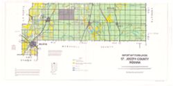
- Subject:
- Topical Subject: Land capability for agriculture, Geographic Subject: Saint Joseph County (Ind.), and Topical Subject: Agricultural resources
- Creator:
- United States. Soil Conservation Service
- Publisher:
- United States. Soil Conservation Service
- Date Created:
- 1986
- Identifier:
- VAC3073-M-00087
- Genre:
- Thematic maps
- Geographic Location:
- Coordinates: W0862932 W0860333 N0414538 N0412747
- Related URL:
- Catalog URL: https://iucat.iu.edu/catalog/5323398
- Abstract:
- Shows land use. Includes vicinity map, text, and sectionalized township. "March 1986." "Base 4-R-39699."
- Call Number:
- G4093.S2J15 1986 .U5
- Caption:
- Imprint: [Washington, D.C.?] : The Service, [1986]
- Physical Description:
- Scale: 1:50,000 and Dimensions: 95 x 99 cm
- Alternate Identifier:
- Title Control Number: a5323398
- Persistent URL:
- https://purl.dlib.indiana.edu/iudl/images/VAC3073/VAC3073-M-00087
-
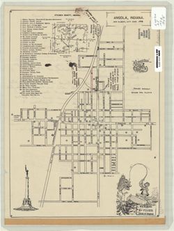
- Subject:
- Geographic Subject: Angola (Ind.)
- Creator:
- Gilbert, Don, City Engr.
- Publisher:
- [City Engr.?]
- Date Created:
- 1946
- Identifier:
- VAC3073-M-01003
- Genre:
- Maps
- Geographic Location:
- Coordinates: W0850214 W0845812 N0414044 N0413701
- Related URL:
- Catalog URL: https://iucat.iu.edu/catalog/7476633
- Abstract:
- Includes indexed list of points of interest, map of Steuben County, Indiana and illustrations.
- Call Number:
- G4094.A5 1946 .G55
- Caption:
- Imprint: [Angola, Ind.?] : [City Engr.?], [1946]
- Physical Description:
- Dimensions: 36 x 26 cm and Scale: Scale not given.
- Alternate Identifier:
- Title Control Number: a7476633
- Persistent URL:
- https://purl.dlib.indiana.edu/iudl/images/VAC3073/VAC3073-M-01003
-
![[Monroe County, Indiana, existing use of land.] Sheet 14. Unincorporated communities, Monroe County, Indiana, existing use of land](https://iiif.uits.iu.edu/iiif/2/zk51wj270%2Ffiles%2F62b7ef2f-84c1-4e40-a5e2-39ef248cf3ce/full/250,/0/default.jpg)
- Subject:
- Geographic Subject: Monroe County (Ind.), Topical Subject: Unincorporated areas, Topical Subject: Land use, Geographic Subject: Smithville (Monroe County, In...
- Creator:
- Schellie Associates
- Publisher:
- Schellie Associates
- Date Created:
- 1961
- Identifier:
- VAC3073-M-01111
- Genre:
- Thematic maps
- Geographic Location:
- Coordinates: W0864108 W0861902 N0392120 N0385926
- Related URL:
- Catalog URL: https://iucat.iu.edu/catalog/18409361
- Abstract:
- Prepared for the Monroe County Plan Commission by Kenneth L. Schellie & Associates. Shows land use. Includes locator and index maps. 4 maps on 1 sheet: S...
- Call Number:
- G4093.M7G4 1961 .S34 sheet 14
- Caption:
- Imprint: [Bloomington, Indiana] : Monroe County Plan Commission, 1961
- Physical Description:
- Dimensions: 32 x 31 cm or smaller, on sheet 144 x 105 cm and Scale: Approximately 1:6,038
- Alternate Identifier:
- Title Control Number: a18409361
- Persistent URL:
- https://purl.dlib.indiana.edu/iudl/images/VAC3073/VAC3073-M-01111
- Provenance:
- Schellie Associates. Monroe County Indiana, Existing Use of Land. [Bloomington, Indiana] : Monroe County Plan Commission, 1961.
-
![Indiana Bloomington quadrangle [1946 reprint with 21 indexed cave locations]](https://iiif.uits.iu.edu/iiif/2/dz011t645%2Ffiles%2Fbb3033b6-3144-4af2-a6c7-a5710771ff06/full/250,/0/default.jpg)
- Subject:
- Geographic Subject: Owen County (Ind.), Geographic Subject: Monroe County (Ind.), Topical Subject: Caves, and Geographic Subject: Greene County (Ind.)
- Creator:
- Griffin, W. H. (William H.), Marshall, R. B. (Robert Bradford), 1867-1949, Sadler, C. L., and Herron, W. H. (William Harrison), 1865-
- Publisher:
- Geological Survey (U.S.)
- Date Created:
- 1946
- Identifier:
- VAC3073-M-01218
- Genre:
- Topographic maps, Quadrangle maps, and 15 minute topographic maps
- Geographic Location:
- Coordinates: W0864500 W0863000 N0391500 N0390000
- Related URL:
- Catalog URL: https://iucat.iu.edu/catalog/18406221
- Abstract:
- R. B. Marshall, chief geographer , W. H. Herron, Geographer in charge , topography by W. H. Griffin and C. L. Sandler , Control by J. R. Ellis and C. H. Semp...
- Call Number:
- G4090 s62 .G4 Bloomington 1910 R1946
- Caption:
- Imprint: [Washington, D.C.] : United States, Department of the Interior, Geological Survey, [1946]
- Physical Description:
- Scale: 1:62,500 and Dimensions: 45 x 42 cm or smaller
- Alternate Identifier:
- Title Control Number: a18406221
- Persistent URL:
- https://purl.dlib.indiana.edu/iudl/images/VAC3073/VAC3073-M-01218
- Provenance:
- Part of Geological Survey (U.S.). Indiana 1:62,500.
-
- Subject:
- Geographic Subject: Warren County (Ind.), Topical Subject: Coal mines and mining, Geographic Subject: Vermillion County (Ind.), and Geographic Subject: Fount...
- Creator:
- Hutchison, Harold C. (Harold Christy), 1925-
- Publisher:
- Indiana. Geological Survey
- Date Created:
- 1961
- Identifier:
- VAC3073-M-00418
- Genre:
- Mine maps
- Geographic Location:
- Coordinates: W0873200 W0870533 N0402800 N0395645
- Related URL:
- Catalog URL: https://iucat.iu.edu/catalog/4898738
- Abstract:
- "Preliminary coal map no. 9"--Margin. Includes 1 ancillary map, 1 diagram showing township enumeration, 1 index map, 1 stratigraphic column, and 1 ...
- Call Number:
- G4093.F6H9 1961 .H88
- Caption:
- Imprint: Bloomington : Indiana Dept. of Conservation, Geological Survey, 1961.
- Physical Description:
- Scale: Scales differ. and Dimensions: 61 x 72 cm
- Alternate Identifier:
- Title Control Number: a4898738
- Persistent URL:
- https://purl.dlib.indiana.edu/iudl/images/VAC3073/VAC3073-M-00418
-
- Subject:
- Topical Subject: Industries and Geographic Subject: Indiana
- Creator:
- Indiana. Employment Security Division
- Publisher:
- Indiana. Employment Security Division
- Date Created:
- 1953
- Identifier:
- VAC3073-M-00099
- Genre:
- Pictorial maps and Thematic maps
- Geographic Location:
- Coordinates: W0880500 W0844700 N0414500 N0374600
- Related URL:
- Catalog URL: https://iucat.iu.edu/catalog/1309301
- Abstract:
- Lists industries in each local office area in map margin. Shows Employment Security Division offices and local office area boundaries. "July, 1953."...
- Call Number:
- G4091 .M1 1952 .I53
- Caption:
- Imprint: [Indianapolis?] : Indiana Employment Security Division, 1953.
- Physical Description:
- Scale: Scale not given. and Dimensions: 27 x 20 cm
- Alternate Identifier:
- Title Control Number: ALB7501BB
- Persistent URL:
- https://purl.dlib.indiana.edu/iudl/images/VAC3073/VAC3073-M-00099
-
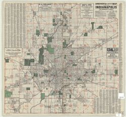
- Subject:
- Topical Subject: Roads, Geographic Subject: Indianapolis (Ind.), and Geographic Subject: Indianapolis Region (Ind.)
- Creator:
- Swinehart, C. V.
- Publisher:
- Dreher, D. Frank
- Date Created:
- 1931
- Identifier:
- VAC3073-M-00147
- Genre:
- Road maps
- Geographic Location:
- Coordinates: W0861941 W0855614 N0395538 N0393755
- Related URL:
- Catalog URL: https://iucat.iu.edu/catalog/7201971
- Abstract:
- "The crossroads of America." Includes one mile distance circles centered on Monument Circle, street index and advertisements. Includes "Dreher...
- Call Number:
- G4094.I4 1931 .S95
- Caption:
- Imprint: [United States] : D. Frank Dreher, [1931]
- Physical Description:
- Scale: 1:31,000 and Dimensions: 75 x 79 cm
- Alternate Identifier:
- Title Control Number: a7201971
- Persistent URL:
- https://purl.dlib.indiana.edu/iudl/images/VAC3073/VAC3073-M-00147
-
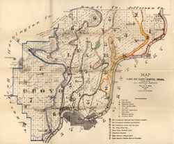
- Subject:
- Topical Subject: Geology, Geographic Subject: Clark County (Ind.), Topical Subject: Mines and mineral resources, Geographic Subject: Floyd County (Ind.), and...
- Creator:
- Cox, E. T. (Edward Travers), 1821-1907 and Borden, W. W. (William Wesley), 1823-1906
- Publisher:
- Indiana. Geological Survey
- Date Created:
- 1874
- Identifier:
- VAC3073-M-01155
- Genre:
- Geological maps
- Geographic Location:
- Coordinates: W0860258 W0852426 N0383636 N0380900
- Related URL:
- Catalog URL: https://iucat.iu.edu/catalog/18318611
- Abstract:
- Prepared for the 5th annual report of Prof. E.T. Cox, State Geologist, 1873 , geology by W.W. Borden. Relief shown by hachures. Shows cities and towns, railr...
- Call Number:
- G4093.C4C5 1873 .B6
- Caption:
- Imprint: [Indianapolis] : [Geological Survey of Indiana], [1874] and Imprint: [Indianapolis] : [Sentinel Co., printers], [1874]
- Physical Description:
- Dimensions: on sheet 41 x 49 cm and Scale: Approximately 1:130,000
- Alternate Identifier:
- Alternate ID: 390723IP and Title Control Number: a18318611
- Persistent URL:
- https://purl.dlib.indiana.edu/iudl/images/VAC3073/VAC3073-M-01155
- Provenance:
- 5th Annual Report (1873) / Indiana. Geological Survey.
-
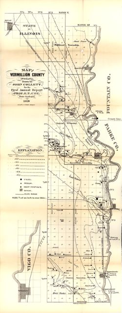
- Subject:
- Topical Subject: IGS Annual Reports, Topical Subject: Coal mines and mining, Topical Subject: Lumber trade, Geographic Subject: Vigo County (Ind.), Topical S...
- Creator:
- Collett, John, 1828-1899
- Publisher:
- Indiana. Geological Survey
- Date Created:
- 1869
- Identifier:
- VAC3073-M-01158
- Genre:
- Geological maps
- Geographic Location:
- Coordinates: W0873159 W0872113 N0400854 N0393626
- Related URL:
- Catalog URL: https://iucat.iu.edu/catalog/16799192
- Abstract:
- Drawn by John Collett for the 1st annual report of Prof. E.T. Cox, State Geologist, 1869 , lith. by W & J. Braden. Shows towns, railroads, coal, mills...
- Call Number:
- G4093.V4 1869 .C6
- Caption:
- Imprint: [Indianapolis] : [Alexander H. Conner, State Printer], [1869] and Imprint: [Indianapolis] : [Geological Survey of Indiana], [1869]
- Physical Description:
- Dimensions: on sheet 77 x 32 cm and Scale: Approximately 1:85,000. 3/4 of an inch to one mile
- Alternate Identifier:
- Title Control Number: a16799192 and Alternate ID: 390720IP
- Persistent URL:
- https://purl.dlib.indiana.edu/iudl/images/VAC3073/VAC3073-M-01158
- Provenance:
- 1st Annual Report (1869) / Indiana. Geological Survey
-
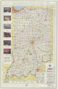
- Subject:
- Geographic Subject: Indiana and Topical Subject: Roads
- Creator:
- Indiana. State Highway Commission (1961-1981). Division of Planning
- Publisher:
- Indiana. State Highway Commission (1919-1953)
- Date Created:
- 1964
- Identifier:
- VAC3073-M-01191
- Genre:
- Road maps
- Geographic Location:
- Coordinates: W0880500 W0844700 N0414500 N0374600
- Related URL:
- Catalog URL: https://iucat.iu.edu/catalog/18406046
- Abstract:
- Panel title: 1964 Indiana official highway map. Relief shown by spot heights. Includes text, list of state highway garages, and color illustrations. Index, d...
- Call Number:
- G1403.S7 1964
- Caption:
- Imprint: [Indianapolis] : State Highway Commission, [1964]
- Physical Description:
- Dimensions: 94 x 59 cm and Scale: Approximately 1:633,600
- Alternate Identifier:
- Title Control Number: a18406046
- Persistent URL:
- https://purl.dlib.indiana.edu/iudl/images/VAC3073/VAC3073-M-01191
- Provenance:
- Indiana state highway system
-
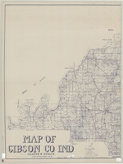
- Subject:
- Geographic Subject: Gibson County (Ind.), Topical Subject: Real property, and Topical Subject: Landowners
- Creator:
- Noble, Claude E.
- Publisher:
- Noble, Claude E.
- Date Created:
- 1939
- Identifier:
- VAC3073-M-00091
- Genre:
- Cadastral maps
- Geographic Location:
- Coordinates: W0875900 W0871900 N0383200 N0381000
- Related URL:
- Catalog URL: https://iucat.iu.edu/catalog/6260010
- Abstract:
- Cadastral map showing landowners. Blueline. "March 7, 1939."
- Call Number:
- G4093.G5 G46 1939 .N63
- Caption:
- Imprint: Princeton, Ind. : Claude E. Noble, [1939]
- Physical Description:
- Scale: 1:31,680 and Dimensions: 121 x 184 cm
- Alternate Identifier:
- Title Control Number: a6260010
- Persistent URL:
- https://purl.dlib.indiana.edu/iudl/images/VAC3073/VAC3073-M-00091
-
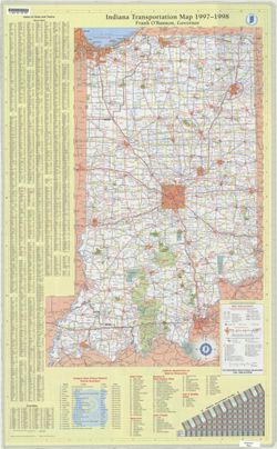
- Subject:
- Geographic Subject: Indiana and Topical Subject: Roads
- Creator:
- Indiana. Department of Transportation. Graphic Engineering Division
- Publisher:
- Indiana. Department of Transportation
- Date Created:
- 1997
- Identifier:
- VAC3073-M-01226
- Genre:
- Road maps
- Geographic Location:
- Coordinates: W0880500 W0844700 N0414500 N0374600
- Related URL:
- Catalog URL: https://iucat.iu.edu/catalog/18406157
- Abstract:
- Includes indexes, indexes to points of interest, distance table, and list of state police phone numbers. Text, indexed map of "Downtown Indianapolis,&qu...
- Call Number:
- G1403 .S7 1997-1998
- Caption:
- Imprint: Indianapolis, Ind. : Indiana Department of Transportation, [1997]
- Physical Description:
- Scale: Approximately 1:633,600 and Dimensions: 94 x 59 cm
- Alternate Identifier:
- Title Control Number: a18406157
- Persistent URL:
- https://purl.dlib.indiana.edu/iudl/images/VAC3073/VAC3073-M-01226
- Provenance:
- Indiana state highway system
-
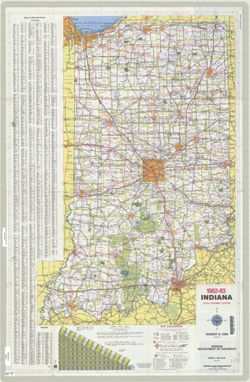
- Subject:
- Geographic Subject: Indiana and Topical Subject: Roads
- Creator:
- Indiana. Department of Highways. Division of Planning
- Publisher:
- Indiana. Department of Highways. Division of Planning
- Date Created:
- 1982
- Identifier:
- VAC3073-M-01209
- Genre:
- Road maps
- Geographic Location:
- Coordinates: W0880500 W0844700 N0414500 N0374600
- Related URL:
- Catalog URL: https://iucat.iu.edu/catalog/18406093
- Abstract:
- Panel title: Indiana 1982-83 official highway map. Relief shown by spot heights. Includes index, distance chart, and text. Text, Department of Natural Resour...
- Call Number:
- G1403 .S7 1982-1983
- Caption:
- Imprint: [Indianapolis] : Indiana Department of Highways, [1982]
- Physical Description:
- Scale: Approximately 1:633,600 and Dimensions: 94 x 59 cm
- Alternate Identifier:
- Title Control Number: a18406093
- Persistent URL:
- https://purl.dlib.indiana.edu/iudl/images/VAC3073/VAC3073-M-01209
- Provenance:
- Indiana state highway system
-
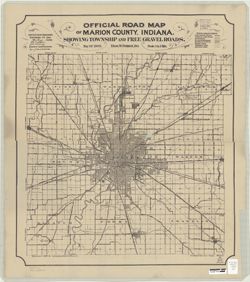
- Subject:
- Geographic Subject: Indianapolis (Ind.), Topical Subject: Roads, and Geographic Subject: Marion County (Ind.)
- Creator:
- Palmer, Thos. W. (Thomas W.)
- Publisher:
- Indianapolis Map & Platting Co.
- Date Created:
- 1905
- Identifier:
- VAC3073-M-00652
- Genre:
- Road maps
- Geographic Location:
- Coordinates: W0861941 W0855614 N0395538 N0393755
- Related URL:
- Catalog URL: https://iucat.iu.edu/catalog/6082201
- Abstract:
- "H.C. Bauer Eng. Co." Copy 1 has red annotations.
- Call Number:
- G4093.M3 P2 1905 .P3
- Caption:
- Imprint: Indianapolis, Ind. : Indianapolis Map & Platting Co., [1905]
- Physical Description:
- Scale: 1:64,000 and Dimensions: 63 x 55 cm, on sheet 69 x 61 cm
- Alternate Identifier:
- Title Control Number: a6082201
- Persistent URL:
- https://purl.dlib.indiana.edu/iudl/images/VAC3073/VAC3073-M-00652
-
- Subject:
- Geographic Subject: Indiana
- Creator:
- Mendenhall, Edward
- Publisher:
- Mendenhall, Edward
- Date Created:
- 1854
- Identifier:
- VAC3073-M-00641
- Genre:
- Maps
- Geographic Location:
- Coordinates: W0880500 W0844700 N0414500 N0374600
- Related URL:
- Catalog URL: https://iucat.iu.edu/catalog/5176337
- Abstract:
- Prime meridian: Washington. Includes table of population by county.
- Call Number:
- G4090 1854 .M46
- Caption:
- Imprint: Cincinnati, O. : E. Mendelhall, 1854.
- Physical Description:
- Dimensions: 47 x 33 cm and Scale: 1:1,013,760
- Alternate Identifier:
- Title Control Number: a5176337
- Persistent URL:
- https://purl.dlib.indiana.edu/iudl/images/VAC3073/VAC3073-M-00641
-

- Subject:
- Topical Subject: Roads, Topical Subject: Railroads, and Geographic Subject: Indiana
- Creator:
- American Map Company (New York, N.Y.)
- Publisher:
- American Map Company (New York, N.Y.)
- Date Created:
- 1946
- Identifier:
- VAC3073-M-00389
- Genre:
- Road maps and Thematic maps
- Geographic Location:
- Coordinates: W0880500 W0844700 N0414500 N0374600
- Related URL:
- Catalog URL: https://iucat.iu.edu/catalog/5277993
- Abstract:
- Includes indexes to counties and cities and town with populations.
- Call Number:
- G4091.P2 1946 .A4
- Caption:
- Imprint: New York : American Map, [1946]
- Physical Description:
- Scale: 1:650,000 and Dimensions: 74 x 48 cm
- Alternate Identifier:
- Title Control Number: a5277993
- Persistent URL:
- https://purl.dlib.indiana.edu/iudl/images/VAC3073/VAC3073-M-00389
-
- Subject:
- Topical Subject: IGS Annual Reports, Topical Subject: Real property, Geographic Subject: Jefferson County (Ind.), and Topical Subject: Landowners
- Creator:
- Borden, W. W. (William Wesley), 1823-1906
- Publisher:
- Indiana. Geological Survey
- Date Created:
- 1875
- Identifier:
- VAC3073-M-01172
- Genre:
- Cadastral maps
- Geographic Location:
- Coordinates: W0853944 W0851048 N0385447 N0383436
- Related URL:
- Catalog URL: https://iucat.iu.edu/catalog/18318691
- Abstract:
- Prepared for the sixth annual report of E.T. Cox, State Geologist, geology by W.W. Borden. Relief shown by hachures. Shows cities and towns, railroads, and l...
- Call Number:
- G4093.J5C5 1874 .B6
- Caption:
- Imprint: [Indianapolis, Indiana] : [Sentinel Co., printers], [1875] and Imprint: [Indianapolis] : [Geological Survey of Indiana], [1875]
- Physical Description:
- Dimensions: 40 x 35 cm, on sheet 39 x 47 cm and Scale: Approximately 1:130,000
- Alternate Identifier:
- Alternate ID: 390723IP and Title Control Number: a18318691
- Persistent URL:
- https://purl.dlib.indiana.edu/iudl/images/VAC3073/VAC3073-M-01172
- Provenance:
- 6th Annual Report (1874) / Indiana. Geological Survey.
-
![[Monroe County, Indiana, existing use of land.] Sheet 4. Bean Blossom Township, Monroe County, Indiana, existing use of land](https://iiif.uits.iu.edu/iiif/2/f4753k30w%2Ffiles%2F29aed0b2-c53e-484c-98d7-132971e3ecce/full/250,/0/default.jpg)
- Subject:
- Topical Subject: Land use and Geographic Subject: Bean Blossom (Monroe County, Ind. : Township)
- Creator:
- Schellie Associates
- Publisher:
- Schellie Associates
- Date Created:
- 1961
- Identifier:
- VAC3073-M-01096
- Genre:
- Thematic maps
- Geographic Location:
- Coordinates: W0864108 W0863425 N0392120 N0391506
- Related URL:
- Catalog URL: https://iucat.iu.edu/catalog/18409342
- Abstract:
- Prepared for the Monroe County Plan Commission by Kenneth L. Schellie & Associates. "Land use survey taken June 1961". Includes locator and ind...
- Call Number:
- G4093.M7G4 1961 .S34 sheet 4
- Caption:
- Imprint: [Bloomington, Indiana] : Monroe County Plan Commission, 1961
- Physical Description:
- Scale: Approximately 1:12,152 and Dimensions: 96 x 81 cm, on sheet 144 x 105 cm
- Alternate Identifier:
- Title Control Number: a18409342
- Persistent URL:
- https://purl.dlib.indiana.edu/iudl/images/VAC3073/VAC3073-M-01096
- Provenance:
- Schellie Associates. Monroe County Indiana, Existing Use of Land. [Bloomington, Indiana] : Monroe County Plan Commission, 1961.
-
![[Monroe County, Indiana, existing use of land.] Sheet 2. Bloomington Township, Monroe County, Indiana, existing use of land](https://iiif.uits.iu.edu/iiif/2/cr56p471g%2Ffiles%2F05a45fb1-c37c-4705-9f7e-ec975807ea66/full/250,/0/default.jpg)
- Subject:
- Geographic Subject: Bloomington (Monroe County, Ind. : Township) and Topical Subject: Land use
- Creator:
- Schellie Associates
- Publisher:
- Schellie Associates
- Date Created:
- 1961
- Identifier:
- VAC3073-M-01099
- Genre:
- Thematic maps
- Geographic Location:
- Coordinates: W0863426 W0862744 N0391636 N0390951
- Related URL:
- Catalog URL: https://iucat.iu.edu/catalog/18409345
- Abstract:
- Prepared for the Monroe County Plan Commission by Kenneth L. Schellie & Associates. "Land use survey taken June 1961". Includes locator and ind...
- Call Number:
- G4093.M7G4 1961 .S34 sheet 2
- Caption:
- Imprint: [Bloomington, Indiana] : Monroe County Plan Commission, 1961
- Physical Description:
- Dimensions: 104 x 82 cm, on sheet 144 x 105 cm and Scale: Approximately 1:12,152
- Alternate Identifier:
- Title Control Number: a18409345
- Persistent URL:
- https://purl.dlib.indiana.edu/iudl/images/VAC3073/VAC3073-M-01099
- Provenance:
- Schellie Associates. Monroe County Indiana, Existing Use of Land. [Bloomington, Indiana] : Monroe County Plan Commission, 1961.
-
- Subject:
- Topical Subject: Roads, Geographic Subject: Indianapolis (Ind.), Topical Subject: Central business districts, and Geographic Subject: Indiana
- Creator:
- Indiana. Department of Transportation. Graphic Engineering Division
- Publisher:
- Indiana. Department of Transportation
- Date Created:
- 2009
- Identifier:
- VAC3073-M-01234
- Genre:
- Road maps
- Geographic Location:
- Coordinates: W0880500 W0844700 N0414500 N0374600
- Related URL:
- Catalog URL: https://iucat.iu.edu/catalog/18406189
- Abstract:
- Panel title: Indiana, 2009/2010, accelerating Indiana's economic development. Includes indexes, note, and color illustrations. Text, indexed map of "...
- Call Number:
- G1403 .S7 2009-2010
- Caption:
- Imprint: Indianapolis, Ind. : Indiana Department of Transportation, [2009]
- Physical Description:
- Scale: Approximately 1:560,000 and Dimensions: 94 x 59 cm
- Alternate Identifier:
- Title Control Number: a18406189
- Persistent URL:
- https://purl.dlib.indiana.edu/iudl/images/VAC3073/VAC3073-M-01234
- Provenance:
- Indiana state highway system
-
- Subject:
- Geographic Subject: Noble County (Ind.), Geographic Subject: Rome City (Ind.), Geographic Subject: Sylvan Lake (Ind.), Topical Subject: Real property, and To...
- Creator:
- Owen, M. F. (Millard Fillmore), 1851-1932
- Publisher:
- [M.F. Owen]
- Date Created:
- 1909
- Identifier:
- VAC3073-M-00846
- Genre:
- Cadastral maps
- Geographic Location:
- Coordinates: W0852308 W0851939 N0413011 N0412827
- Related URL:
- Catalog URL: https://iucat.iu.edu/catalog/4676408
- Abstract:
- Blueprint. Originally copied on 4 sheets. Includes text and insets: "Map of bluffs, bridges, wagon road and banks upon which Northport Feeder Dam was...
- Call Number:
- G4094 .R85G46 1909 .O94
- Caption:
- Imprint: [Rome City (Ind.)?] : [M.F. Owen], 1909.
- Physical Description:
- Dimensions: 125 x 177 cm, on sheets 133 x 93 and 129 x 93 cm and Scale: 1:2,700
- Alternate Identifier:
- Title Control Number: CAQ5632BB
- Persistent URL:
- https://purl.dlib.indiana.edu/iudl/images/VAC3073/VAC3073-M-00846
-
- Subject:
- Geographic Subject: Indianapolis Metropolitan Area (Ind.) and Geographic Subject: Indianapolis (Ind.)
- Creator:
- Metro Graphic Arts
- Publisher:
- [publisher not identified]
- Date Created:
- 1975
- Identifier:
- VAC3073-M-00864
- Genre:
- Maps
- Geographic Location:
- Coordinates: W0861941 W0855614 N0395538 N0393755
- Related URL:
- Catalog URL: https://iucat.iu.edu/catalog/5322622
- Abstract:
- Plastic index device in pocket. Includes indexes, A-C of street index on attached sheet and "Inset map of adjacent areas in Johnson County."
- Call Number:
- G4094 .I4 1975 .M4
- Caption:
- Imprint: Grand Rapids, Mich. : [publisher not identified], 1975.
- Physical Description:
- Dimensions: 128 x 119 cm and Scale: 1:29,000
- Alternate Identifier:
- Title Control Number: a5322622
- Persistent URL:
- https://purl.dlib.indiana.edu/iudl/images/VAC3073/VAC3073-M-00864
-
- Subject:
- Geographic Subject: Jackson County (Ind.), Topical Subject: Geology, and Topical Subject: IGS Annual Reports
- Creator:
- Cox, E. T. (Edward Travers), 1821-1907
- Publisher:
- Indiana. Geological Survey
- Date Created:
- 1875
- Identifier:
- VAC3073-M-01177
- Genre:
- Geological maps
- Geographic Location:
- Coordinates: W0861905 W0854741 N0390414 N0384329
- Related URL:
- Catalog URL: https://iucat.iu.edu/catalog/18318685
- Abstract:
- Prepared for the sixth annual report of E[.]T. Cox, State Geologist, 1874. Relief shown by hachures. Shows cities and towns, railroads, geology of the region...
- Call Number:
- G4093.J2C5 1874 .C6
- Caption:
- Imprint: [Indianapolis] : [Geological Survey of Indiana], [1875] and Imprint: [Indianapolis] : [Sentinel Co., printers], [1875]
- Physical Description:
- Scale: Approximately 1:130,000 and Dimensions: on sheet 40 x 47 cm
- Alternate Identifier:
- Title Control Number: a18318685 and Alternate ID: 390723IP
- Persistent URL:
- https://purl.dlib.indiana.edu/iudl/images/VAC3073/VAC3073-M-01177
- Provenance:
- 6th Annual Report (1874) / Indiana. Geological Survey.
-
- Subject:
- Geographic Subject: Indiana and Topical Subject: Roads
- Creator:
- Indiana. State Highway Commission (1961-1981). Division of Planning
- Publisher:
- Indiana. State Highway Commission (1961-1981). Division of Planning
- Date Created:
- 1973
- Identifier:
- VAC3073-M-01203
- Genre:
- Road maps
- Geographic Location:
- Coordinates: W0880500 W0844700 N0414500 N0374600
- Related URL:
- Catalog URL: https://iucat.iu.edu/catalog/18405994
- Abstract:
- Panel title: 1973-74 Indiana official highway map. Relief shown by spot heights. Includes index of cities and towns, mileage chart, and text. On verso: index...
- Call Number:
- G1403 .S7 1973-1974
- Caption:
- Imprint: [Indianapolis] : State Highway Commission, [1973]
- Physical Description:
- Scale: Approximately 1:633,600 and Dimensions: 94 x 59 cm
- Alternate Identifier:
- Title Control Number: a18405994
- Persistent URL:
- https://purl.dlib.indiana.edu/iudl/images/VAC3073/VAC3073-M-01203
- Provenance:
- Indiana state highway system
-
- Subject:
- Geographic Subject: Fort Wayne (Ind.)
- Publisher:
- Shockney & Kain
- Date Created:
- 1946
- Identifier:
- VAC3073-M-01018
- Genre:
- Tourist maps
- Related URL:
- Catalog URL: https://iucat.iu.edu/catalog/7479384
- Abstract:
- Basically black and white but with parks indicated in blue, city transportation lines in blue, highways in broad red lines, city limits in dashed red lines. ...
- Call Number:
- G4094.F7 1946 .S5
- Caption:
- Imprint: Fort Wayne, Indiana: Shockney & Kain. 1946.
- Physical Description:
- Dimensions: 65 x 55 cm, on sheet 67 x 56 cm and Scale: Scale not given.
- Alternate Identifier:
- Title Control Number: a7479384
- Persistent URL:
- https://purl.dlib.indiana.edu/iudl/images/VAC3073/VAC3073-M-01018
- Provenance:
- Guide Map Ft. Wayne Indiana. (front)
-
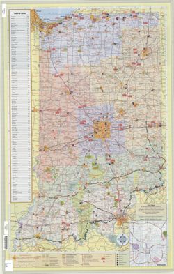
- Subject:
- Topical Subject: Roads and Geographic Subject: Indiana
- Publisher:
- Northwood Map Publishers
- Date Created:
- 2009
- Identifier:
- VAC3073-M-01009
- Genre:
- Tourist maps and Road maps
- Related URL:
- Catalog URL: https://iucat.iu.edu/catalog/1241312
- Abstract:
- Color maps on sheet 90 x 56cm. Folded to 23 x 10cm.
- Call Number:
- G4091.E635 .N67 2009
- Caption:
- Imprint: Boulder Junction, WI: Northwood Map Publishers. N.d.
- Physical Description:
- Dimensions: on sheet 90 x 56 cm and Scale: Scales differ.
- Alternate Identifier:
- Title Control Number: AKN4374BB
- Persistent URL:
- https://purl.dlib.indiana.edu/iudl/images/VAC3073/VAC3073-M-01009
- Provenance:
- Indiana Travel Map.
-
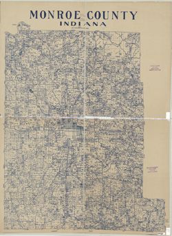
- Subject:
- Topical Subject: Landowners, Topical Subject: Real property, and Geographic Subject: Monroe County (Ind.)
- Creator:
- Stapleton, John T. (John Tracy)
- Publisher:
- [publisher not identified]
- Date Created:
- 1950
- Identifier:
- VAC3073-M-00331
- Genre:
- Cadastral maps
- Geographic Location:
- Coordinates: W0864100 W0861900 N0392100 N0390000
- Related URL:
- Catalog URL: https://iucat.iu.edu/catalog/5044576
- Abstract:
- Blue line print. Cadastral map showing landowners. "1950."
- Call Number:
- G4093.M7 G46 1950 .S73
- Caption:
- Imprint: [Bloomington, Ind.?] : [publisher not identified], 1950.
- Physical Description:
- Dimensions: 127 x 99 cm and Scale: 1:63,360
- Alternate Identifier:
- Title Control Number: a5044576
- Persistent URL:
- https://purl.dlib.indiana.edu/iudl/images/VAC3073/VAC3073-M-00331
-
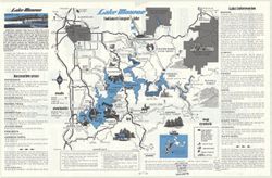
- Subject:
- Topical Subject: Reservoirs, Geographic Subject: Bloomington Region (Ind.), Topical Subject: Lakes, and Geographic Subject: Monroe, Lake (Ind.)
- Creator:
- Guide Art Co. and Skirvin, Jack E.
- Publisher:
- Guide Art Co.
- Date Created:
- 1980
- Identifier:
- VAC3073-M-00012
- Genre:
- Pictorial maps and Tourist maps
- Geographic Location:
- Coordinates: W0863115 W0861826 N0390718 N0385940
- Related URL:
- Catalog URL: https://iucat.iu.edu/catalog/5302210
- Abstract:
- Text, advertisements, and 9 Lake Monroe area maps showing businesses on verso.
- Call Number:
- G4092.M6 E635 1980 .G85
- Caption:
- Imprint: Bloomington, Ind. : Guide Art Co., c1980.
- Physical Description:
- Dimensions: on sheet 28 x 44 cm and Scale: 1:125,000
- Alternate Identifier:
- Title Control Number: a5302210
- Persistent URL:
- https://purl.dlib.indiana.edu/iudl/images/VAC3073/VAC3073-M-00012
-
Map of Indiana showing its history, points of interest, and the holdings of the Dept of Conservation
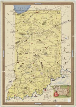
- Subject:
- Topical Subject: History and Geographic Subject: Indiana
- Creator:
- Indiana. Department of Conservation
- Publisher:
- Indiana. Department of Conservation
- Date Created:
- 1954
- Identifier:
- VAC3073-M-00877
- Genre:
- Pictorial maps
- Geographic Location:
- Coordinates: W0880500 W0844700 N0414500 N0374600
- Related URL:
- Catalog URL: https://iucat.iu.edu/catalog/2256179
- Abstract:
- Pictorial map. Cited LC's Trails bibliography, no. 111.
- Call Number:
- G4091 .S1 1954 .I5
- Caption:
- Imprint: [Indianapolis] : Indiana Dept. of Conservation, [1954]
- Physical Description:
- Dimensions: 86 x 61 cm and Scale: 1:600,000
- Alternate Identifier:
- Title Control Number: BGY2458BB
- Persistent URL:
- https://purl.dlib.indiana.edu/iudl/images/VAC3073/VAC3073-M-00877
-
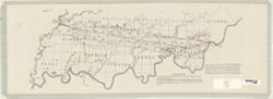
- Subject:
- Topical Subject: Railroads and Geographic Subject: Indiana
- Creator:
- United States. General Land Office
- Publisher:
- [U.S. Cong.]
- Date Created:
- 1838
- Identifier:
- VAC3073-M-00744
- Genre:
- Thematic maps
- Geographic Location:
- Coordinates: W0880244 W0854344 N0382227 N0374210
- Related URL:
- Catalog URL: https://iucat.iu.edu/catalog/4663661
- Abstract:
- Detached from U.S. 24th Cong., 3rd Sess., 1838-1839, S. Doc. No. 49. "the red shaded lines show the exterior six miles limits on each side of straight l...
- Call Number:
- G4091 .P3 1838 .U5
- Caption:
- Imprint: [Washington, D.C.] : [U.S. Cong.], 1838.
- Physical Description:
- Scale: Scale not given. and Dimensions: 21 x 54 cm, on sheet 23 x 66 cm
- Alternate Identifier:
- Title Control Number: CAH6430BB
- Persistent URL:
- https://purl.dlib.indiana.edu/iudl/images/VAC3073/VAC3073-M-00744
-
![A new map of Indiana [cartographic material] : exhibiting the counties, townships, cities, villages, and post offices, rail roads, canals, and common roads.](https://iiif.uits.iu.edu/iiif/2/rf560b15p%2Ffiles%2F277d357a-ee84-4cfa-987c-4c52a6d19c25/full/250,/0/default.jpg)
- Subject:
- Topical Subject: Administrative and political divisions and Geographic Subject: Indiana
- Creator:
- Mendenhall, Edward
- Publisher:
- Mendenhall, Edward
- Date Created:
- 1854
- Identifier:
- VAC3073-M-01281
- Genre:
- Maps
- Geographic Location:
- Coordinates: W0880700 W0844500 N0414500 N0375200
- Related URL:
- Catalog URL: https://iucat.iu.edu/catalog/5176337
- Abstract:
- Cover title: Township map of Indiana Prime meridian: Washington. Folded in covers 15 x 10 cm. "Transfer'd from copper & printed from sto...
- Call Number:
- G4090 1854 .M46
- Caption:
- Imprint: Cincinnati, O. : E. Mendenhall, 1854.
- Physical Description:
- Scale: Approximately 1:1,013,760 and Dimensions: 46 x 33 cm
- Persistent URL:
- https://purl.dlib.indiana.edu/iudl/images/VAC3073/VAC3073-M-01281
-
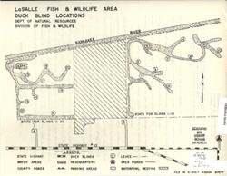
- Subject:
- Geographic Subject: Lake County (Ind.), Geographic Subject: Newton County (Ind.), Topical Subject: Blinds (Hunting), Topical Subject: Waterfowl shooting--Law...
- Creator:
- Indiana. Division of Fish and Wildlife
- Publisher:
- Indiana. Division of Fish and Wildlife
- Date Created:
- 1971
- Identifier:
- VAC3073-M-01270
- Genre:
- Thematic maps
- Geographic Location:
- Coordinates: W0873136 W0872652 N0411057 N0410840
- Related URL:
- Catalog URL: https://iucat.iu.edu/catalog/18405988
- Abstract:
- Title on verso: Migratory waterfowl hunting rules and regulations : LaSalle Fish and Wildlife Area. Shows roads, water areas, duck blinds, headquarters, park...
- Call Number:
- G4091.E63 svar .I5 LaSalle 2
- Caption:
- Imprint: [Indianapolis?] : [The Division], 1971.
- Physical Description:
- Dimensions: 36 x 22 cm or smaller and Scale: Scale not given.
- Alternate Identifier:
- Title Control Number: a18405988
- Persistent URL:
- https://purl.dlib.indiana.edu/iudl/images/VAC3073/VAC3073-M-01270
- Provenance:
- Indiana state fish and wildlife areas. Department of Natural Resources. Division of Fish and Wildlife. [Indianapolis?] : The Division, 1971-.
-
- Subject:
- Topical Subject: Roads, Geographic Subject: Indiana, and Topical Subject: Maintenance and repair
- Creator:
- Indiana. Department of Transportation
- Publisher:
- Indiana. Department of Transportation
- Date Created:
- 1994
- Identifier:
- VAC3073-M-00258
- Genre:
- Road maps and Thematic maps
- Geographic Location:
- Coordinates: W0880500 W0844700 N0414500 N0374600
- Related URL:
- Catalog URL: https://iucat.iu.edu/catalog/16151565
- Abstract:
- "Please note...only major highway and interstate improvement projects are included in this brochure. Information contained is accurate as of February 1,...
- Call Number:
- G4091 .P2 1994 .I5
- Caption:
- Imprint: [Indianapolis] : Indiana Dept. of Transportation, [1994?]
- Physical Description:
- Scale: Scale not given. and Dimensions: 29 x 19 cm, on sheet 44 x 28 cm
- Alternate Identifier:
- Title Control Number: a16151565 and Alternate ID: AHC7671BB
- Persistent URL:
- https://purl.dlib.indiana.edu/iudl/images/VAC3073/VAC3073-M-00258
