Indiana University
Indiana University
IU
Skip to Content
Digital Collections
Toggle navigation
Digital
Collections
Switch language
English
Switch language
Deutsch
English
Español
Français
Italiano
Português do Brasil
中文
Login
Home
About
Contact
Search Digital Collections
Go
×
Search Constraints
Start Over
You searched for:
Publisher
Geological Survey (U.S.)
Remove constraint Publisher: Geological Survey (U.S.)
« Previous |
1
-
100
of
159
|
Next »
Sort by collection size ▲
relevance ▼
recently updated
title ▲
title ▼
date created ▲
date created ▼
pages ▲
pages ▼
collection size ▲
collection size ▼
Number of results to display per page
100 per page
10
per page
20
per page
50
per page
100
per page
View results as:
List
Gallery
Masonry
Search Results
Illinois-Indiana-Kentucky, New Haven quadrangle [1966 reprint with vegetation]
Indiana Oolitic quadrangle : 15-minute series [1960 reprint with vegetation]
Illinois-Indiana-Kentucky, New Haven quadrangle [1939 reprint without vegetation]
Kentucky-Indiana Cannelton quadrangle [1941 reprint]
Cassopolis quadrangle, Michigan--Indiana : 15-minute series
Indiana-Kentucky Owensboro quadrangle [1950 reprint]
Indiana Clay City quadrangle
Indiana Boonville quadrangle [1946 reprint]
Indiana-Illinois, Vincennes quadrangle : topography [1946 reprint with corrections and...
Princeton quadrangle, Indiana-Illinois : 15 minute series (topographic) [1965 reprint ...
Illinois-Indiana Birds quadrangle : topography [1943 reprint]
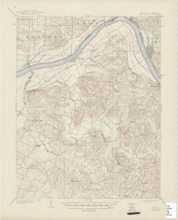
Indiana Bloomington quadrangle [1954 reprint]
Indiana Bloomington quadrangle [1948 reprint]
Indiana Boonville quadrangle
Indiana Velpen quadrangle [1903 printing]
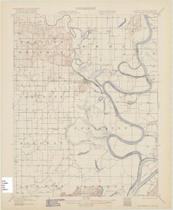
Indiana (Lake County) Toleston quadrangle [sic] [1925 reprint]
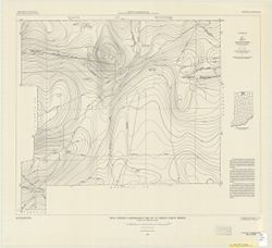
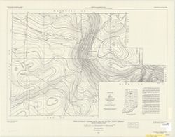
Total intensity aeromagnetic map of St. Joseph County, Indiana relative to arbitrary d...
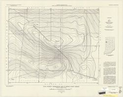
Total intensity aeromagnetic map of Benton County, Indiana relative to arbitrary datum
Indiana Bloomington quadrangle [1946 reprint with 21 indexed cave locations]
Kentucky-Indiana Henderson quadrangle [1947 reprint]
Total intensity aeromagnetic map of Fulton County, Indiana relative to arbitrary datum
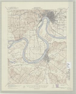
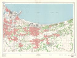
Gary and vicinity, Indiana
Illinois-Indiana-Kentucky, New Haven quadrangle : topography [1920 reprint without veg...
Indiana Clay City quadrangle [1936 reprint]
Indiana Degonia Springs quadrangle [1936 reprint]
Indiana Bedford quadrangle
Indiana-Kentucky Corydon quadrangle [1931 printing]
Indiana Haubstadt quadrangle [1903 printing]
Hutsonville quadrangle, Illinois-Indiana : 15 minute series (topographic) [1957 printi...
Map of flood-prone areas, Alexandria quadrangle, Indiana-Madison Co. : 7.5 minute seri...
Princeton quadrangle, Indiana-Illinois : 15 minute series (topographic) [1964 printing...
Indiana-Illinois, Vincennes quadrangle : topography [1958 reprint with vegetation]
Indiana-Ohio, Winchester Quadrangle [1958 reprint]
Indiana-Ohio, Winchester quadrangle [1918 printing]
Indiana-Illinois Patoka quadrangle [1903 print]
Indiana St. Meinrad quadrangle [1903 printing]
Indiana Boonville quadrangle [1925 reprint]
Indiana Velpen quadrangle [1936 reprint]
State of Indiana
Map of flood-prone areas, Gilman quadrangle, Indiana : 7.5 minute series (topographic)
Indiana Porter quadrangle [1940 printing]
Indiana Degonia Springs quadrangle
Indiana Petersburg quadrangle [1903 printing]
A map of the North Western Territory
Danville quadrangle, Illinois-Indiana : topographic sheet [1946 reprint]
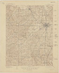
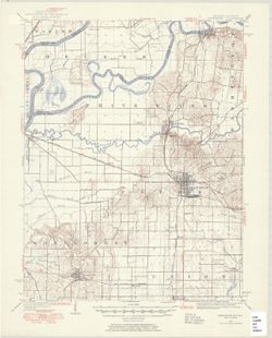
Indiana Noblesville quadrangle [Advance sheet]
Indiana, Ditney quadrangle [1936 reprint]
Kentucky-Indiana Kosmosdale quadrangle [1942 reprint]
New Harmony quadrangle, Indiana--Illinois, 1959 : 15 minute series (topographic) [1963...
Mount Carmel quadrangle, Illinois-Indiana : 15 minute series (topographic)
Indiana-Illinois, New Harmony quadrangle [1942 reprint without vegetation]
Indiana-Illinois, New Harmony quadrangle [1925 reprint without vegetation]
Illinois-Indiana, Mount Carmel quadrangle : topography
Indiana, 15 minute series (topographic), Vincennes quadrangle. [1915 printing with veg...
Indiana, 15 minute series (topographic), New Haven quadrangle [1958 printing with vege...
Michigan-Indiana Niles quadrangle
Kentucky-Indiana Newburg quadrangle [1944 reprint]
Kentucky-Indiana Newburg quadrangle [1921 reprint]
Niles quadrangle : 15 minute series
Indiana Petersburg quadrangle [1932 reprint]
Indiana Porter quadrangle [1940 printing]
Indiana, Ditney quadrangle [1902 printing]
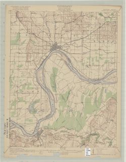
Index to topographic maps and geologic folios : Indiana
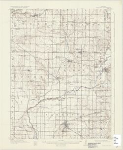
Edinburg Quadrangle Indiana : 15 minute series (topographic) [1950 printing with veget...
Ohio and Indiana
Kentucky-Indiana Uniontown quadrangle [1917 printing with vegetation]
Michigan-Indiana Three Rivers quadrangle [1932 reprint]
Total intensity aeromagnetic map of DuBois County, Indiana relative to arbitrary datum
Indiana-Kentucky Owensboro quadrangle [1939 reprint]
Indiana-Kentucky Owensboro quadrangle [1912 reprint]
Indiana, 15 minute series (topographic), Birds quadrangle
Illinois-Indiana, Watseka quadrangle [1939 printing]
Map of flood-prone areas, Elwood quadrangle, Indiana : 7.5 minute series (topographic)
Ohio and N.W. Territory
The upper territories of the United States
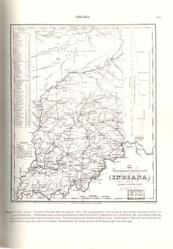
The Traveller's Pocket map of Indiana
Kentucky-Indiana Uniontown quadrangle [1941 reprint without vegetation]
Indiana, 15 minute series (topographic), Vincennes quadrangle. [1934 reprint without v...
Kosmosdale quadrangle, Kentucky-Indiana : 15 minute series (topographic) [1959 reprint...
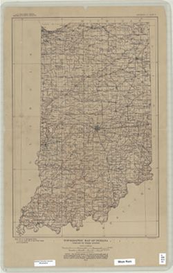
Topographic map of Indiana
Kentucky-Indiana Uniontown quadrangle [1941 reprint without vegetation]
Kentucky-Indiana Uniontown quadrangle [1917 printing with vegetation]
Indiana-Illinois Princeton quadrangle [1949 printing with minor corrections]
Kentucky-Indiana Tell City quadrangle [1945 reprint]
Franklin Quadrangle Indiana : 15 minute series (topographic) [1950 printing without ve...
Indiana Bloomington quadrangle [1931 reprint]
Indiana (Lake County) Toleston quadrangle [sic] [1909 reprint]
Indiana (Lake County) Toleston quadrangle [sic] [1916 reprint]
Indiana-Illinois Princeton quadrangle [1942 print with corrections]
Indiana St. Meinrad quadrangle [1903 printing]
Indiana-Illinois Princeton quadrangle [1922 reprint without vegetation]
Reconnoissance map of the United States showing the distribution of the geologic syste...
Indiana Bloomington quadrangle [1948 reprint]
Indiana Petersburg quadrangle [1903 printing]
Indiana Oolitic quadrangle : 15-minute series [1942 printing]
Total intensity aeromagnetic map of Elkhart County, Indiana relative to arbitrary datum
Princeton quadrangle, Indiana-Illinois : 15 minute series (topographic) [1964 printing...
Indiana Oolitic quadrangle : 15-minute series [1968 reprint with vegetation]
Indiana (Lake County) Tolleston quadrangle [1939 reprint]
Indiana (Lake County) Tolleston quadrangle [1951 reprint]
« Previous
Next »
1
2
Toggle facets
Limit your search
Type
Image
159
Creator
Geological Survey (U.S.)
131
Renshawe, John H.
45
Hawkins, Geo. T. (George T.)
37
Goodlove, C. W.
31
Herron, W. H. (William Harrison), 1865-
27
Marshall, R. B. (Robert Bradford), 1867-1949
24
Illinois State Geological Survey
20
McKinney, R. C. (Robert C.)
18
United States. Army. Corps of Engineers
18
U.S. Coast and Geodetic Survey
14
more
Creators
»
Subject
Geographic Subject: Gibson County (Ind.)
35
Topical Subject: Vegetation mapping
30
Geographic Subject: Knox County (Ind.)
23
Geographic Subject: Wabash County (Ill.)
22
Geographic Subject: Posey County (Ind.)
20
Geographic Subject: Lake County (Ind.)
14
Geographic Subject: Monroe County (Ind.)
14
Geographic Subject: Spencer County (Ind.)
14
Geographic Subject: Vanderburgh County (Ind.)
13
Geographic Subject: Warrick County (Ind.)
13
more
Subjects
»
Publisher
Geological Survey (U.S.)
[remove]
159
Date Created
1950
9
1903
7
1959
7
1970
7
1988
7
1925
6
1946
6
1964
6
1936
5
1939
5
more
Date Createds
»
Pages
0-99 pages
159
Collections
Indiana Historic Maps
159
State
deposited
159
Campus
IUB
159
Holding Location
B-WELLS
159
Provenance
Part of Geological Survey (U.S.). Indiana 1:62,500.
119
United States Department of the Interior, Geological Survey. Map of flood-prone areas : [Indiana]. Washington, D.C. : The Survey, 1969-.
12
The National gazetteer of the United States of America--Indiana, 1988 / U.S. Geological Survey.
6
Part of Geological Survey (U.S.). Indiana 1:125,000.
4
14th Annual Report (1884) / Indiana. Department of Geology and Natural History.
1
Map of Flood-Prone Areas: Middletown Quadrangle, Indiana.
1
Map of the Western parts of the Colony of Virginia as far as the Mississipi.
1
USGS 15 minute series (topographic)
1