Indiana University
Indiana University
IU
Skip to Content
Digital Collections
Toggle navigation
Digital
Collections
Switch language
English
Switch language
Deutsch
English
Español
Français
Italiano
Português do Brasil
中文
Login
Home
About
Contact
Search Digital Collections
Go
×
Search Constraints
Start Over
You searched for:
Publisher
Indiana. Department of Geology and Natural Resources
Remove constraint Publisher: Indiana. Department of Geology and Natural Resources
« Previous |
1
-
100
of
196
|
Next »
Sort by relevance ▼
relevance ▼
recently updated
title ▲
title ▼
date created ▲
date created ▼
pages ▲
pages ▼
collection size ▲
collection size ▼
Number of results to display per page
100 per page
10
per page
20
per page
50
per page
100
per page
View results as:
List
Gallery
Masonry
Search Results
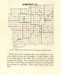
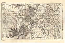
Illustrating the distribution of road materials in Morgan County
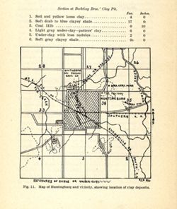
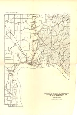
Map of Huntingburg and vicinity, showing the location of clay deposits
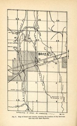
Map of Brazil and vicinity, showing the location of clay factories and clay and shale ...
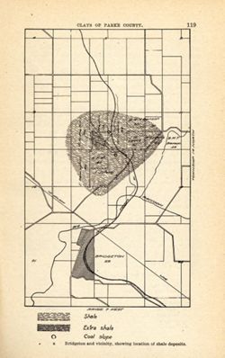
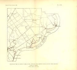
Bridgeton and vicinity, showing location of shale deposits
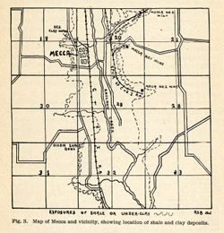
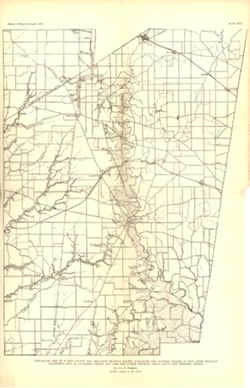
Map of Mecca and Vicinity, showing location of shale and clay deposits
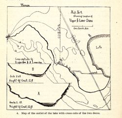
Map No. 4 showing locations of upper & lower dams [Winona Lake Region, Indiana]
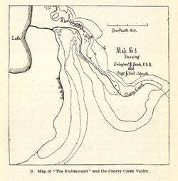
Map No. 3 showing embayment & beach, A + B and bogs & shell deposits
Map of the Wabash-Erie Region
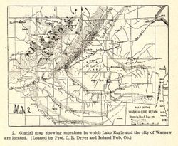
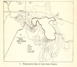
Topographic map of Lake Eagle Region
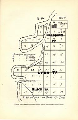
Map of Part of Posey Co. Ind. / Showing distribution of certain species of Mollusca in...
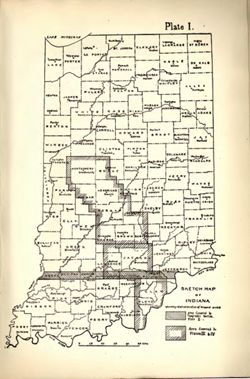
Sketch map of Indiana showing relative location of mapped areas
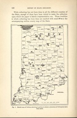
Sketch map of Indiana showing localities in which collections of Orthoptera have been ...
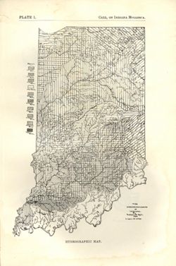
The hydrographic basins of Indiana
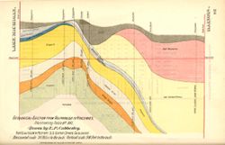
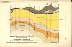
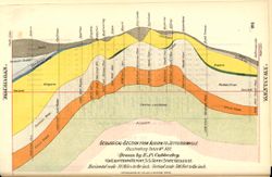
Geological section from Valparaiso to Vincennes, illustrating table no. XVI
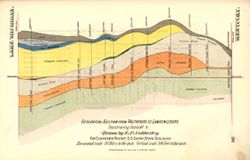
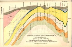
Geological section from Valparaiso to Tobacco Landing, illustrating table no. XV
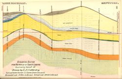
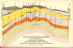
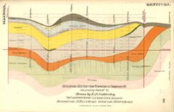
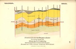
Geological section from Valparaiso to Lawrenceburg, illustrating table no. V
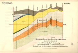
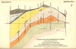
Geological section from South Bend to Winchester, illustrating table no. IV
Geological section from South Bend to New Albany, illustrating table no. XIV
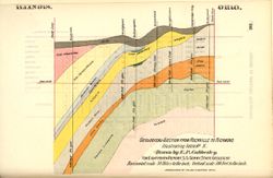
Geological section from Rockville to Richmond, illustrating table no. X
Geological section from Richmond to Salem, illustrating table no. III
Geological section from Remington to Frankfort, KY., Illustrating Table No. VI
Geological section from Oxford to Union City, illustrating table no. IX
Geological section from Olney, Ill., to Cincinnati, Ohio, illustrating table no. XI
Geological section from Lawrenceburg to Auburn, illustrating table no. XII
Geological section from Kentland to Delta, Ohio, illustrating table no. VII
Geological section from Kentland to Decatur, illustrating table no. VIII
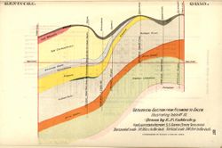
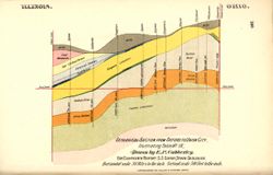
Geological section from Delta, Ohio, to Terre Haute, Ind., illustrating table no. I
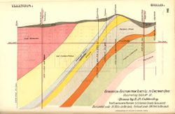
Geological section from Decatur to Vincennes, illustrating Table No. II
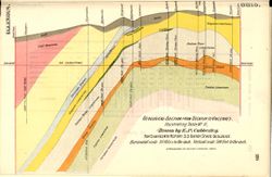
Geological section from Auburn to Jeffersonville, illustrating Table No. XIII
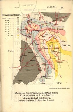
Map showing lines of geological sections and the relation of Trenton rock to sea level
Soil map, Indiana, Wells County sheet
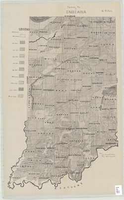
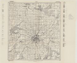
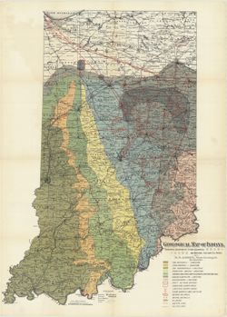
Topographic map of Indiana
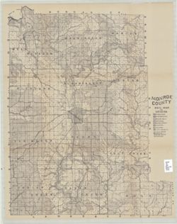
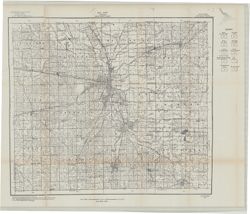
Monroe County soil map
Soil map, Indiana, Grant County sheet
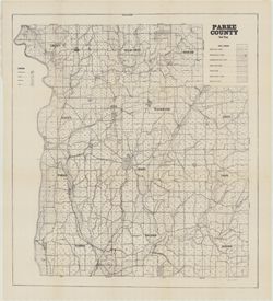
Parke County soil map
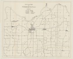
Outline map of Petersburg oil field
Soil map Indiana Delaware County
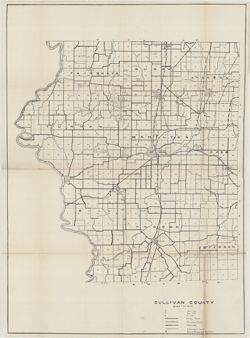
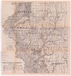
Sullivan County
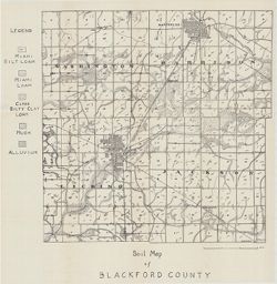
Soil map of Blackford County
Soil map of Indiana Hendricks County sheet
Soil Mmap of Indiana Clinton County sheet
Soil map Howard County sheet
Soil map of Indiana Benton County sheet
Outline map of Petersburg oil field
Soil map of Carroll County
Soil map Elkhart County sheet
Chart of the Indiana coal field : to accompany the supplementary report on the coal of...
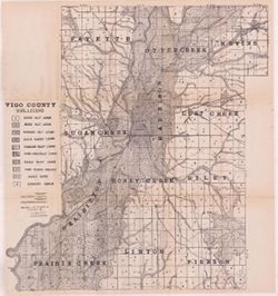
Map of Vigo County, Indiana
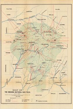
Natural gas map of Indiana
Geological map of Indiana showing locations of stone quarries and natural gas and oil ...
Monroe County soil map
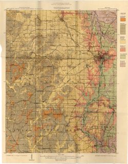
Geological map : Bloomington quadrangle Indiana
Geological map of the coal region of Indiana. Sheet F, Warrick, Spencer, and Perry cou...
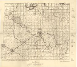
Soil map of Jay County
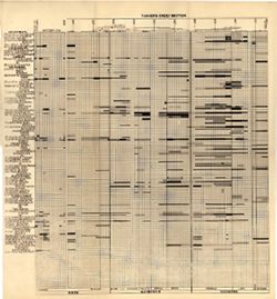
Tanner's Creek section
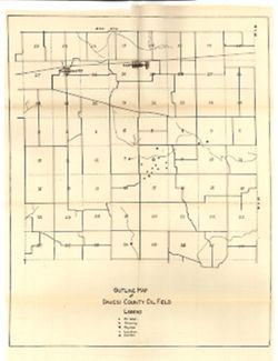
Outline map of Daviess County oil field
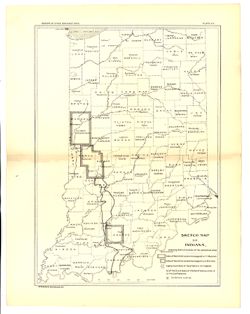
Sketch map of Indiana, showing relative location of the sandstone area
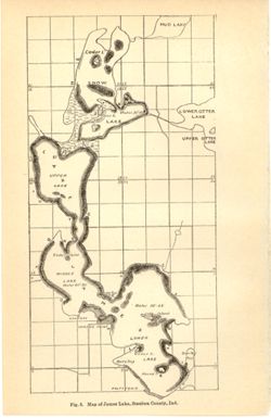
Map of James Lake, Steuben County, Ind.
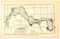
Lake Tippecanoe
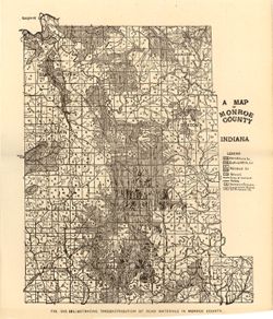
A map of Monroe County, Indiana
Soil map, Greene County sheet
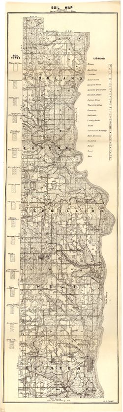
Soil map Indiana Vermillion County sheet
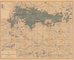
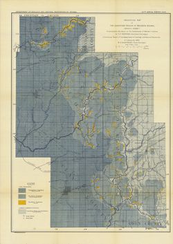
Map of the productive oil area of northeastern Indiana
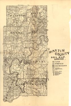
Martin County soil map
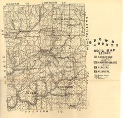
Brown County Soil Map
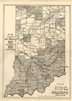
Indiana showing the general types, glacial boundary and moraines after F. Leverett
Geological map of middle and eastern Jefferson County, outlining the eastern border of...
Geological map of eastern Clark County, outlining the eastern border of the upper Silu...
Geological map of Ripley County and adjacent Decatur County, outlining the eastern bor...
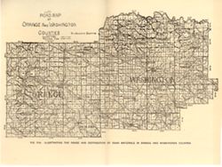
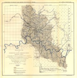
Road map of Orange and Washington counties
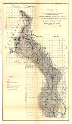
Geological map of the Bedford oölitic limestone region (Bloomington sheet)
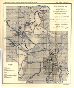
Detail geological map of the vicinity of Bedford, Indiana
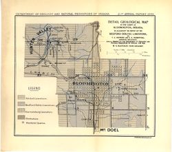
Detail geological map of the vicinity of Bloomington, Indiana
Geological map of the Bedford ooÃàlitic limestone region (Bedford sheet)
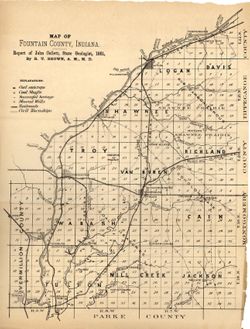
Map of Fountain County, Indiana
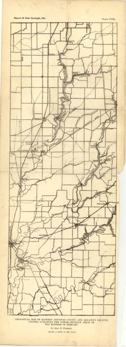
Geological map of eastern Jennings County and adjacent Decatur County, outlining the l...
Sullivan County
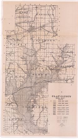
Clay County soil map
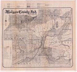
Morgan County, Ind.
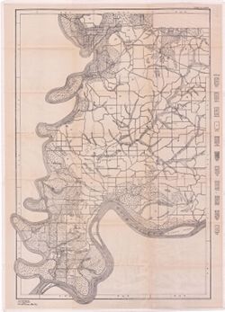
Posey County sheet
Vigo County
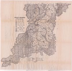
Knox County
Soil map, Marion County sheet
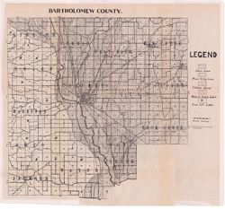
Bartholomew County
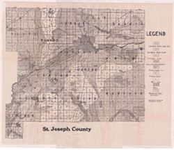
St. Joseph County
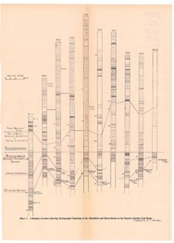
Columnar sections showing stratigraphic relationships of the Mansfield and Huron rocks...
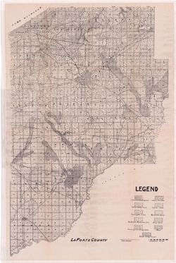
La Porte County
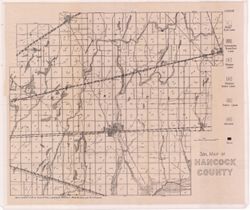
Soil map of Hancock County
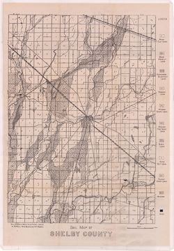
Soil map of Shelby County
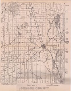
Soil map of Johnson County
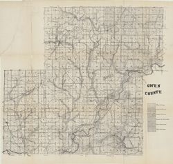
Owen County
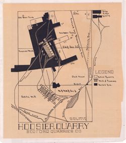
Hoosier Quarry : Bedford Quarries Co.
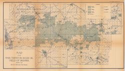
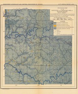
Map of the main Trenton rock oil field of Indiana
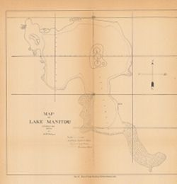
Map of Lake Manitou
Map of the main Trenton Rock oil field of Indiana
Map of the Indiana natural gas field
Geological map of the sandstone region of western Indiana (Attica sheet) : to accompan...
Geological map of the sandstone region of western Indiana (Brazil sheet) : to accompan...
Geological map of the whetstone and sandstone area of western Indiana (Paoli sheet) : ...
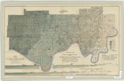
A map of the counties of Dearborn, Ohio, Switzerland, Jefferson and Ripley showing the...
« Previous
Next »
1
2
Toggle facets
Limit your search
Type
Image
196
Creator
Indiana. Department of Geology and Natural Resources
18
Ashley, Geo. H. (George Hall), 1866-1951
17
Cubberley, Ellwood P., 1868-1941
17
Shannon, C. W. (Charles William), 1879-1934
12
Blatchley, Raymond S. (Raymond Sillliman)
8
Kindle, E. M. (Edward Martin), 1869-1940
8
Foerste, Aug. F. (Aug. Frederic), 1862-1936
7
Shannon, M. E.
7
Blatchley, W. S. (Willis Stanley), 1859-1940
6
Cumings, E. R. (Edgar Roscoe), 1874-1967
6
more
Creators
»
Subject
Topical Subject: IGS Annual Reports
143
Geographic Subject: Indiana
69
Topical Subject: Geology
53
Topical Subject: Mines and mineral resources
46
Topical Subject: Soils
42
Topical Subject: Geology, Stratigraphic
36
Topical Subject: Coal
15
Topical Subject: Limestone
12
Topical Subject: Road materials
12
Topical Subject: Lakes
11
more
Subjects
»
Publisher
Indiana. Department of Geology and Natural Resources
[remove]
196
Date Created
1908
25
1894
19
1912
17
1899
16
1906
14
1901
11
1897
9
1909
8
1898
7
1905
7
more
Date Createds
»
Pages
0-99 pages
196
Collections
Indiana Historic Maps
196
State
deposited
196
Campus
IUB
196
Holding Location
B-WELLS
196
Provenance
32nd Annual Report (1907) / Indiana. Department of Geology and Natural Resources.
24
18th Annual Report (1893) / Indiana. Department of Geology and Natural Resources.
19
23rd Annual Report (1898) / Indiana. Department of Geology and Natural Resources.
18
36th Annual Report (1911) / Indiana. Department of Geology and Natural Resources.
16
30th Annual Report (1905) / Indiana. Department of Geology and Natural Resources.
14
25th Annual Report (1900) / Indiana. Department of Geology and Natural Resources.
11
21st Annual Report (1896) / Indiana. Department of Geology and Natural Resources.
10
33rd Annual Report (1908) / Indiana. Department of Geology and Natural Resources.
8
29th Annual Report (1904) / Indiana. Department of Geology and Natural Resources.
7
34th Annual Report (1909) / Indiana. Department of Geology and Natural Resources.
7