
Search Constraints
You searched for:
Campus
IUB
Remove constraint Campus: IUB
Type
Image
Remove constraint Type: Image
Collections
Indiana Historic Maps
Remove constraint Collections: Indiana Historic Maps
Pages
0-99 pages
Remove constraint Pages: 0-99 pages
« Previous |
1 - 100 of 1,237
|
Next »
Search Results
-
- Subject:
- Topical Subject: Administrative and political divisions, Topical Subject: Roads, Topical Subject: Road materials, and Geographic Subject: Indiana
- Creator:
- Indiana. State Highway Commission (1919-1953) and Bodine, H. D. (Harry D.), 1894-1942
- Publisher:
- Indiana. Legislative Bureau
- Date Created:
- 1928
- Identifier:
- VAC3073-M-01039
- Genre:
- Road maps
- Geographic Location:
- Coordinates: W0880500 W0844700 N0414500 N0374600
- Related URL:
- Catalog URL: https://iucat.iu.edu/catalog/18455609
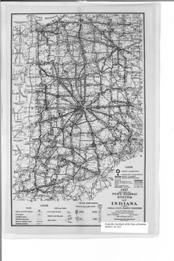
- Abstract:
- Shows roads by surface and composition type as well as official highway markers, boundaries and headquarters for districts and sub-districts, and constructio...
- Call Number:
- G4091.P2 1927 .I5
- Caption:
- Imprint: [Indianapolis] : [Wm. B. Burford, contractor for state printing and binding], [1928] and Imprint: [Indianapolis] : [The Legislative Bureau], [1928]
- Physical Description:
- Scale: Approximately 1:1,370,000 and Dimensions: 36 x 23 cm, on sheet 41 x 26 cm
- Alternate Identifier:
- Alternate ID: 397754IP and Title Control Number: a18455609
- Persistent URL:
- https://purl.dlib.indiana.edu/iudl/images/VAC3073/VAC3073-M-01039
- Provenance:
- Year book of the state of Indiana (1927)
-
- Subject:
- Geographic Subject: Indiana, Topical Subject: Administrative and political divisions, Topical Subject: Roads, and Topical Subject: Road materials
- Creator:
- Indiana. State Highway Commission (1919-1953)
- Publisher:
- Indiana. Legislative Bureau
- Date Created:
- 1929
- Identifier:
- VAC3073-M-01040
- Genre:
- Road maps
- Geographic Location:
- Coordinates: W0880500 W0844700 N0414500 N0374600
- Related URL:
- Catalog URL: https://iucat.iu.edu/catalog/18455614
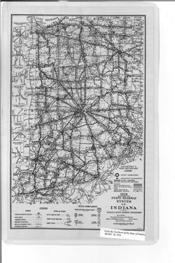
- Abstract:
- Caption title: Sub-district & road section map. Shows roads by surface and composition type as well as official highway markers, boundaries and headquart...
- Call Number:
- G4091.P2 1928 .I5
- Caption:
- Imprint: [Indianapolis] : [Wm. B. Burford, contractor for state printing and binding], [1929] and Imprint: [Indianapolis] : [The Legislative Bureau], [1929]
- Physical Description:
- Scale: Approximately 1:1,370,000 and Dimensions: 36 x 23 cm, on sheet 41 x 26 cm
- Alternate Identifier:
- Title Control Number: a18455614 and Alternate ID: 397754IP
- Persistent URL:
- https://purl.dlib.indiana.edu/iudl/images/VAC3073/VAC3073-M-01040
- Provenance:
- Year book of the state of Indiana (1928)
-
- Subject:
- Geographic Subject: Indiana and Topical Subject: Roads
- Creator:
- George F. Cram Company
- Publisher:
- George F. Cram Company
- Date Created:
- 1929
- Identifier:
- VAC3073-M-00794
- Genre:
- Road maps
- Geographic Location:
- Coordinates: W0880700 W0844500 N0414500 N0375200
- Related URL:
- Catalog URL: https://iucat.iu.edu/catalog/5051245
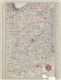
- Abstract:
- Issued by the State Automobile Insurance Association. Includes place name index on recto. Advertisements and "Section of transcontinental highway map&...
- Call Number:
- G4091.P2 1929 .G46
- Caption:
- Imprint: Indianapolis : Cram, 1929.
- Physical Description:
- Scale: 1:860,000 and Dimensions: 58 x 38 cm
- Alternate Identifier:
- Title Control Number: a5051245
- Persistent URL:
- https://purl.dlib.indiana.edu/iudl/images/VAC3073/VAC3073-M-00794
-
- Subject:
- Topical Subject: Road materials, Geographic Subject: Indiana, Topical Subject: Roads, and Topical Subject: Administrative and political divisions
- Creator:
- Indiana. State Highway Commission (1919-1953)
- Publisher:
- Indiana. Legislative Bureau
- Date Created:
- 1930
- Identifier:
- VAC3073-M-01041
- Genre:
- Road maps
- Geographic Location:
- Coordinates: W0880500 W0844700 N0414500 N0374600
- Related URL:
- Catalog URL: https://iucat.iu.edu/catalog/18455618
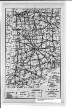
- Abstract:
- Caption title: Sub-district & road section map. Shows roads by surface and composition type as well as official highway markers, boundaries and headquart...
- Call Number:
- G4091.P2 1929 .I5
- Caption:
- Imprint: [Indianapolis] : [Wm. B. Burford, contractor for state printing and binding], [1930] and Imprint: [Indianapolis] : [The Legislative Bureau], [1930]
- Physical Description:
- Scale: Approximately 1:1,370,000 and Dimensions: 38 x 23 cm, on sheet 43 x 26 cm
- Alternate Identifier:
- Alternate ID: 397754IP and Title Control Number: a18455618
- Persistent URL:
- https://purl.dlib.indiana.edu/iudl/images/VAC3073/VAC3073-M-01041
- Provenance:
- State Highway System of Indiana.
-
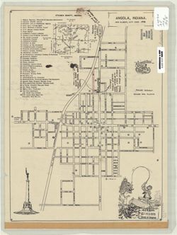
![1936-37 map and business directory of Angola [cartographic material] / presented by The News cooperating with C.W. Chadwick ... and Angola's many business firms](https://iiif.uits.iu.edu/iiif/2/bv73d330m%2Ffiles%2F6e02a868-a625-4ffb-813d-a29eee846987/full/250,/0/default.jpg)
- Subject:
- Topical Subject: Central business districts and Geographic Subject: Angola (Ind.)
- Creator:
- Chad Maps, Inc.
- Publisher:
- Chad Maps, Inc.
- Date Created:
- 1936
- Identifier:
- VAC3073-M-00593
- Genre:
- Thematic maps
- Geographic Location:
- Coordinates: W0850214 W0845812 N0414044 N0413701
- Related URL:
- Catalog URL: https://iucat.iu.edu/catalog/7476651
- Abstract:
- Includes street index and business directory of Angola, Ind. around the maps.
- Call Number:
- G4094.A5 1936 .C53
- Caption:
- Imprint: Angola, Ind. : C. W. Chadwick, 1936.
- Physical Description:
- Scale: Scale not given. and Dimensions: 26 x 22 cm and 17 x 22 cm, on sheet 65 x 87 cm
- Alternate Identifier:
- Title Control Number: a7476651
- Persistent URL:
- https://purl.dlib.indiana.edu/iudl/images/VAC3073/VAC3073-M-00593
-
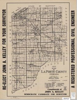
- Subject:
- Geographic Subject: LaPorte County (Ind.)
- Creator:
- Kelley, John A., C.E.
- Publisher:
- [John A. Kelley?]
- Date Created:
- 1936
- Identifier:
- VAC3073-M-00566
- Genre:
- Maps
- Geographic Location:
- Coordinates: W0865600 W0862910 N0414539 N0411412
- Related URL:
- Catalog URL: https://iucat.iu.edu/catalog/6083265
- Abstract:
- "Compliments of John A. Kelley, Democratic Candidate for Surveyor."
- Call Number:
- G4093.L15 1936 .K45
- Caption:
- Imprint: [Michigan City, Ind.] : [John A. Kelley?], 1936.
- Physical Description:
- Scale: 1:120,000 and Dimensions: 53 x 36 cm
- Alternate Identifier:
- Title Control Number: a6083265
- Persistent URL:
- https://purl.dlib.indiana.edu/iudl/images/VAC3073/VAC3073-M-00566
-
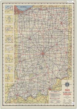
- Subject:
- Geographic Subject: Indiana and Topical Subject: Roads
- Creator:
- Indiana. State Highway Commission (1919-1953)
- Publisher:
- Indiana. State Highway Commission (1919-1953)
- Date Created:
- 1949
- Identifier:
- VAC3073-M-01236
- Genre:
- Road maps
- Geographic Location:
- Coordinates: W0880500 W0844700 N0414500 N0374600
- Related URL:
- Catalog URL: https://iucat.iu.edu/catalog/18406077
- Abstract:
- Panel title: 1949 Indiana official highway map. Relief shown by spot heights. Includes 8 local route maps. Index, distance chart, distance map of the United ...
- Call Number:
- G1403 .S7 1949
- Caption:
- Imprint: [Indianapolis] : State Highway Commission, [1949]
- Physical Description:
- Dimensions: 94 x 59 cm and Scale: Approximately 1:633,600
- Alternate Identifier:
- Title Control Number: a18406077
- Persistent URL:
- https://purl.dlib.indiana.edu/iudl/images/VAC3073/VAC3073-M-01236
- Provenance:
- Indiana state highway system
-
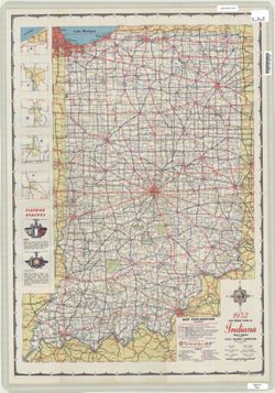
- Subject:
- Geographic Subject: Indiana and Topical Subject: Roads
- Creator:
- Indiana. State Highway Commission (1919-1953)
- Publisher:
- Indiana. State Highway Commission (1919-1953)
- Date Created:
- 1952
- Identifier:
- VAC3073-M-01222
- Genre:
- Road maps
- Geographic Location:
- Coordinates: W0880500 W0844700 N0414500 N0374600
- Related URL:
- Catalog URL: https://iucat.iu.edu/catalog/18406078
- Abstract:
- Panel title: 1952 Indiana official highway map. Relief shown by spot heights. Includes text, color illustrations, and 5 local route maps. Index, distance cha...
- Call Number:
- G1403 .S7 1952
- Caption:
- Imprint: [Indianapolis] : State Highway Commission, [1952]
- Physical Description:
- Dimensions: 94 x 59 cm and Scale: Approximately 1:633,600
- Alternate Identifier:
- Title Control Number: a18406078
- Persistent URL:
- https://purl.dlib.indiana.edu/iudl/images/VAC3073/VAC3073-M-01222
- Provenance:
- Indiana state highway system
-
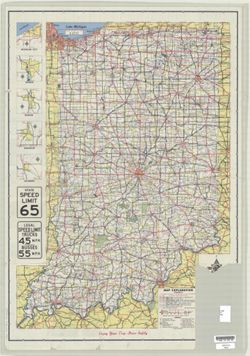
- Subject:
- Geographic Subject: Indiana and Topical Subject: Roads
- Creator:
- Indiana. State Highway Department
- Publisher:
- Indiana. State Highway Department
- Date Created:
- 1956
- Identifier:
- VAC3073-M-01220
- Genre:
- Road maps
- Geographic Location:
- Coordinates: W0880500 W0844700 N0414500 N0374600
- Related URL:
- Catalog URL: https://iucat.iu.edu/catalog/18406080
- Abstract:
- Panel title: 1956 Indiana official highway map. Relief shown by spot heights. Includes 5 local route maps and illustrations. Index, distance chart, distance ...
- Call Number:
- G1403 .S7 1956
- Caption:
- Imprint: [Indianapolis] : State Highway Department, [1956]
- Physical Description:
- Scale: Approximately 1:633,600 and Dimensions: 94 x 59 cm
- Alternate Identifier:
- Title Control Number: a18406080
- Persistent URL:
- https://purl.dlib.indiana.edu/iudl/images/VAC3073/VAC3073-M-01220
- Provenance:
- Indiana state highway system
-
- Subject:
- Topical Subject: Roads and Geographic Subject: Indiana
- Creator:
- Indiana. State Highway Department
- Publisher:
- Indiana. State Highway Department
- Date Created:
- 1959
- Identifier:
- VAC3073-M-01221
- Genre:
- Road maps
- Geographic Location:
- Coordinates: W0880500 W0844700 N0414500 N0374600
- Related URL:
- Catalog URL: https://iucat.iu.edu/catalog/18406081
- Abstract:
- Panel title: 1959 Indiana official highway map. Relief shown by spot heights. Includes illustrations and 5 local route maps. Index, distance chart, distance ...
- Call Number:
- G1403 .S7 1959
- Caption:
- Imprint: [Indianapolis] : State Highway Department, [1959]
- Physical Description:
- Scale: Approximately 1:633,600 and Dimensions: 94 x 59 cm
- Alternate Identifier:
- Title Control Number: a18406081
- Persistent URL:
- https://purl.dlib.indiana.edu/iudl/images/VAC3073/VAC3073-M-01221
- Provenance:
- Indiana state highway system
-
- Subject:
- Topical Subject: Roads and Geographic Subject: Indiana
- Creator:
- Indiana. State Highway Department
- Publisher:
- Indianapolis, Ind.: The Dept.,
- Date Created:
- 1960
- Identifier:
- VAC3073-M-01223
- Genre:
- Road maps
- Geographic Location:
- Coordinates: W0880500 W0844700 N0414500 N0374600
- Related URL:
- Catalog URL: https://iucat.iu.edu/catalog/18406084
- Abstract:
- Panel title: 1960 Indiana official highway map. Includes 5 local route maps. Includes index, U.S. distance map, mileage chart, color illustrations, index and...
- Call Number:
- G4091.P2 1960 .I53
- Caption:
- Imprint: [Indianapolis] : State Highway Department of Indiana, [1960]
- Physical Description:
- Scale: Approximately 1:633,600 and Dimensions: 94 x 59 cm
- Alternate Identifier:
- Title Control Number: a18406084
- Persistent URL:
- https://purl.dlib.indiana.edu/iudl/images/VAC3073/VAC3073-M-01223
- Provenance:
- Indiana state highway system
-
- Subject:
- Geographic Subject: Indiana and Topical Subject: Roads
- Creator:
- Indiana. State Highway Commission (1961-1981)
- Publisher:
- Indiana. State Highway Commission (1961-1981)
- Date Created:
- 1961
- Identifier:
- VAC3073-M-00879
- Genre:
- Road maps
- Geographic Location:
- Coordinates: W0880500 W0844700 N0414500 N0374600
- Related URL:
- Catalog URL: https://iucat.iu.edu/catalog/18406038
- Abstract:
- Gray on white with "controlled access sections on primary roads where project agreement requires B.P.R. approval before any driveway permits can be gran...
- Call Number:
- G1403 .S7 1961
- Caption:
- Imprint: [Indianapolis] : State Highway Commission, [1961]
- Physical Description:
- Scale: Approximately 1:633,600 and Dimensions: 94 x 59 cm
- Alternate Identifier:
- Title Control Number: a18406038
- Persistent URL:
- https://purl.dlib.indiana.edu/iudl/images/VAC3073/VAC3073-M-00879
- Provenance:
- Indiana state highway system
-
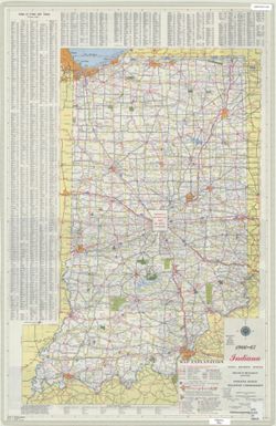
- Subject:
- Geographic Subject: Indiana and Topical Subject: Roads
- Creator:
- Indiana. State Highway Commission (1961-1981)
- Publisher:
- Indiana. State Highway Commission (1961-1981)
- Date Created:
- 1962
- Identifier:
- VAC3073-M-01224
- Genre:
- Road maps
- Geographic Location:
- Coordinates: W0880500 W0844700 N0414500 N0374600
- Related URL:
- Catalog URL: https://iucat.iu.edu/catalog/18406041
- Abstract:
- Panel title: 1962 Indiana official highway map. Relief shown by spot heights. Includes index, distance table, color illustrations, and text. Index, distance ...
- Call Number:
- G1403 .S7 1962
- Caption:
- Imprint: [Indianapolis] : State Highway Commission, [1962]
- Physical Description:
- Scale: Approximately 1:633,600 and Dimensions: 94 x 59 cm
- Alternate Identifier:
- Title Control Number: a18406041
- Persistent URL:
- https://purl.dlib.indiana.edu/iudl/images/VAC3073/VAC3073-M-01224
- Provenance:
- Indiana state highway system
-
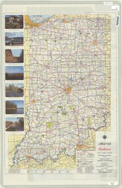
- Subject:
- Geographic Subject: Indiana and Topical Subject: Roads
- Creator:
- Indiana. State Highway Commission (1961-1981)
- Publisher:
- Indiana. State Highway Commission (1961-1981)
- Date Created:
- 1963
- Identifier:
- VAC3073-M-01187
- Genre:
- Road maps
- Geographic Location:
- Coordinates: W0880500 W0844700 N0414500 N0374600
- Related URL:
- Catalog URL: https://iucat.iu.edu/catalog/18406044
- Abstract:
- Panel title: 1963-64 Indiana official highway map. Includes index, distance chart, color illustrations, and text. Index, distance chart, index and chart of s...
- Call Number:
- G1403.S7 1963-64
- Caption:
- Imprint: Indianapolis, Ind. : Indiana State Highway Commission, [1963?]
- Physical Description:
- Dimensions: 94 x 59 cm and Scale: Approximately 1:633,600
- Alternate Identifier:
- Title Control Number: a18406044
- Persistent URL:
- https://purl.dlib.indiana.edu/iudl/images/VAC3073/VAC3073-M-01187
- Provenance:
- Indiana state highway system
-
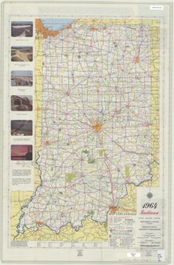
- Subject:
- Geographic Subject: Indiana and Topical Subject: Roads
- Creator:
- Indiana. State Highway Commission (1961-1981). Division of Planning
- Publisher:
- Indiana. State Highway Commission (1919-1953)
- Date Created:
- 1964
- Identifier:
- VAC3073-M-01191
- Genre:
- Road maps
- Geographic Location:
- Coordinates: W0880500 W0844700 N0414500 N0374600
- Related URL:
- Catalog URL: https://iucat.iu.edu/catalog/18406046
- Abstract:
- Panel title: 1964 Indiana official highway map. Relief shown by spot heights. Includes text, list of state highway garages, and color illustrations. Index, d...
- Call Number:
- G1403.S7 1964
- Caption:
- Imprint: [Indianapolis] : State Highway Commission, [1964]
- Physical Description:
- Dimensions: 94 x 59 cm and Scale: Approximately 1:633,600
- Alternate Identifier:
- Title Control Number: a18406046
- Persistent URL:
- https://purl.dlib.indiana.edu/iudl/images/VAC3073/VAC3073-M-01191
- Provenance:
- Indiana state highway system
-
- Subject:
- Topical Subject: Roads and Geographic Subject: Indiana
- Creator:
- Indiana. State Highway Commission (1961-1981). Division of Planning
- Publisher:
- Indiana. State Highway Commission (1961-1981). Division of Planning
- Date Created:
- 1966
- Identifier:
- VAC3073-M-01194
- Genre:
- Road maps
- Geographic Location:
- Coordinates: W0880500 W0844700 N0414500 N0374600
- Related URL:
- Catalog URL: https://iucat.iu.edu/catalog/18406064
- Abstract:
- Panel title: 1966-1967 Indiana official highway map. Relief shown by spot heights. Includes index of cities and towns, text, and list of state highway garage...
- Call Number:
- G1403.S7 1966-67
- Caption:
- Imprint: [Indianapolis] : State Highway Commission, [1966]
- Physical Description:
- Dimensions: 94 x 59 cm and Scale: Approximately 1:633,600
- Alternate Identifier:
- Title Control Number: a18406064
- Persistent URL:
- https://purl.dlib.indiana.edu/iudl/images/VAC3073/VAC3073-M-01194
- Provenance:
- Indiana state highway system
-
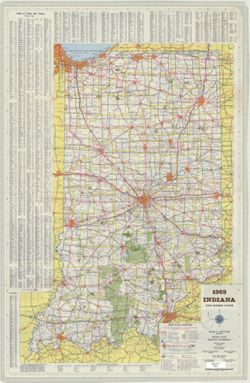
- Subject:
- Geographic Subject: Indiana and Topical Subject: Roads
- Creator:
- Indiana. State Highway Commission (1961-1981). Division of Planning
- Publisher:
- Indiana. State Highway Commission (1961-1981)
- Date Created:
- 1969
- Identifier:
- VAC3073-M-01198
- Genre:
- Road maps
- Geographic Location:
- Coordinates: W0880500 W0844700 N0414500 N0374600
- Related URL:
- Catalog URL: https://iucat.iu.edu/catalog/18406068
- Abstract:
- Panel title: 1969 Indiana official highway map : 50th anniversary 1919-1969. Relief shown by spot heights. Includes index, text, and list of state highway ga...
- Call Number:
- G1403.S7 1969
- Caption:
- Imprint: [Indianapolis] : State Highway Commission, [1969]
- Physical Description:
- Scale: 1:633,600 and Dimensions: 94 x 59 cm
- Alternate Identifier:
- Title Control Number: a18406068
- Persistent URL:
- https://purl.dlib.indiana.edu/iudl/images/VAC3073/VAC3073-M-01198
- Provenance:
- Indiana state highway system
-
- Subject:
- Topical Subject: Traffic flow and Geographic Subject: Indiana
- Creator:
- Indiana. State Highway Commission (1961-1981). Division of Planning
- Publisher:
- Indiana. State Highway Commission (1961-1981)
- Date Created:
- 1969
- Identifier:
- VAC3073-M-00754
- Genre:
- Thematic maps
- Geographic Location:
- Coordinates: W0880500 W0844700 N0414500 N0374600
- Related URL:
- Catalog URL: https://iucat.iu.edu/catalog/6083372
- Abstract:
- Insets: Indianapolis--[New Albany area].
- Call Number:
- G4091.P21 1969 .I5
- Caption:
- Imprint: [Indianapolis] : Indiana State Highway Commission, [1969]
- Physical Description:
- Scale: 1:650,000 and Dimensions: 94 x 61 cm
- Alternate Identifier:
- Title Control Number: a6083372
- Persistent URL:
- https://purl.dlib.indiana.edu/iudl/images/VAC3073/VAC3073-M-00754
-
- Subject:
- Geographic Subject: Burns Waterway Harbor (Ind.), Topical Subject: Roads, and Geographic Subject: Indiana
- Creator:
- Indiana. State Highway Commission (1961-1981). Division of Planning
- Publisher:
- Indiana. State Highway Commission (1961-1981). Division of Planning
- Date Created:
- 1971
- Identifier:
- VAC3073-M-01201
- Genre:
- Road maps
- Geographic Location:
- Coordinates: W0880500 W0844700 N0414500 N0374600
- Related URL:
- Catalog URL: https://iucat.iu.edu/catalog/18405991
- Abstract:
- Relief shown by spot heights. Includes index, distance table, and text. Indexed table of state recreation sites and facilities, directory of state police pos...
- Call Number:
- G1403 .S7 1971-1972
- Caption:
- Imprint: [Indianapolis] : State Highway Commission, [1971]
- Physical Description:
- Dimensions: 94 x 59 cm and Scale: Approximately 1:633,600
- Alternate Identifier:
- Title Control Number: a18405991
- Persistent URL:
- https://purl.dlib.indiana.edu/iudl/images/VAC3073/VAC3073-M-01201
- Provenance:
- Indiana state highway system
-
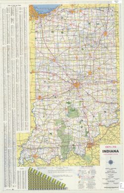
- Subject:
- Geographic Subject: Indiana and Topical Subject: Roads
- Creator:
- Indiana. State Highway Commission (1961-1981). Division of Planning
- Publisher:
- Indiana. State Highway Commission (1961-1981). Division of Planning
- Date Created:
- 1972
- Identifier:
- VAC3073-M-01202
- Genre:
- Road maps
- Geographic Location:
- Coordinates: W0880500 W0844700 N0414500 N0374600
- Related URL:
- Catalog URL: https://iucat.iu.edu/catalog/18405992
- Abstract:
- Panel title: 1972-73 Indiana official highway map. Relief shown by spot heights. Includes index, distance chart, and text. Indexed chart of state recreation ...
- Call Number:
- G1403 .S7 1972-1973
- Caption:
- Imprint: [Indianapolis] : State Highway Commission, [1972]
- Physical Description:
- Dimensions: 94 x 59 cm and Scale: Approximately 1:633,600
- Alternate Identifier:
- Title Control Number: a18405992
- Persistent URL:
- https://purl.dlib.indiana.edu/iudl/images/VAC3073/VAC3073-M-01202
- Provenance:
- Indiana state highway system
-
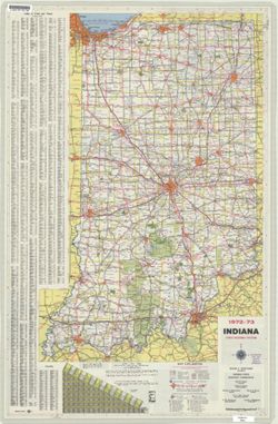
- Subject:
- Geographic Subject: Indiana and Topical Subject: Roads
- Creator:
- Indiana. State Highway Commission (1961-1981). Division of Planning
- Publisher:
- Indiana. State Highway Commission (1961-1981). Division of Planning
- Date Created:
- 1973
- Identifier:
- VAC3073-M-01203
- Genre:
- Road maps
- Geographic Location:
- Coordinates: W0880500 W0844700 N0414500 N0374600
- Related URL:
- Catalog URL: https://iucat.iu.edu/catalog/18405994
- Abstract:
- Panel title: 1973-74 Indiana official highway map. Relief shown by spot heights. Includes index of cities and towns, mileage chart, and text. On verso: index...
- Call Number:
- G1403 .S7 1973-1974
- Caption:
- Imprint: [Indianapolis] : State Highway Commission, [1973]
- Physical Description:
- Scale: Approximately 1:633,600 and Dimensions: 94 x 59 cm
- Alternate Identifier:
- Title Control Number: a18405994
- Persistent URL:
- https://purl.dlib.indiana.edu/iudl/images/VAC3073/VAC3073-M-01203
- Provenance:
- Indiana state highway system
-
- Subject:
- Geographic Subject: Indiana and Topical Subject: Roads
- Creator:
- Indiana. Division of Planning
- Publisher:
- Indiana. Division of Planning
- Date Created:
- 1977
- Identifier:
- VAC3073-M-00421
- Genre:
- Road maps
- Geographic Location:
- Coordinates: W0880700 W0844500 N0414500 N0375200
- Related URL:
- Catalog URL: https://iucat.iu.edu/catalog/4937814
- Abstract:
- Panel title: Indiana official highway map 1977. Includes legend, mileage chart, and index. Insets on verso: Calumet area -- Michigan City -- South Bend -- La...
- Call Number:
- G1403 .S7 1977
- Caption:
- Imprint: Indianapolis : Indiana State Highway Commission, 1977
- Physical Description:
- Scale: Approximately 1:633,600 and Dimensions: 94 x 59 cm
- Alternate Identifier:
- Title Control Number: a4937814
- Persistent URL:
- https://purl.dlib.indiana.edu/iudl/images/VAC3073/VAC3073-M-00421
- Provenance:
- Indiana state highway system
-
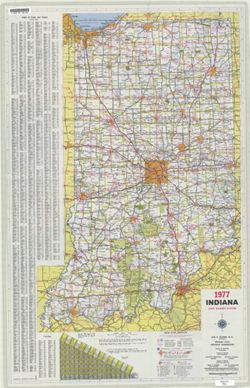
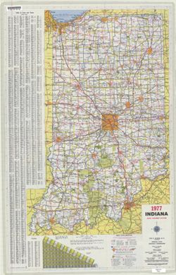
- Subject:
- Geographic Subject: Indiana and Topical Subject: Roads
- Creator:
- Indiana. Division of Planning
- Publisher:
- Indiana. Division of Planning
- Date Created:
- 1977
- Identifier:
- VAC3073-M-01204
- Genre:
- Road maps
- Geographic Location:
- Coordinates: W0880700 W0844500 N0414500 N0375200
- Related URL:
- Catalog URL: https://iucat.iu.edu/catalog/18405996
- Abstract:
- Panel title: Indiana official highway map 1977. Includes legend, mileage chart, and index. Insets on verso: Calumet area -- Michigan City -- South Bend -- La...
- Call Number:
- G1403 .S7 1977
- Caption:
- Imprint: Indianapolis : Indiana State Highway Commission, 1977.
- Physical Description:
- Scale: Approximately 1:633,600 and Dimensions: 94 x 59 cm
- Alternate Identifier:
- Title Control Number: a18405996
- Persistent URL:
- https://purl.dlib.indiana.edu/iudl/images/VAC3073/VAC3073-M-01204
- Provenance:
- Indiana state highway system
-
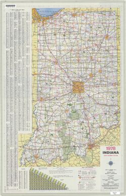
- Subject:
- Topical Subject: Roads and Geographic Subject: Indiana
- Creator:
- Indiana. State Highway Commission (1961-1981). Division of Planning
- Publisher:
- Indiana. State Highway Commission (1961-1981). Division of Planning
- Date Created:
- 1978
- Identifier:
- VAC3073-M-01205
- Genre:
- Road maps
- Geographic Location:
- Coordinates: W0880500 W0844700 N0414500 N0374600
- Related URL:
- Catalog URL: https://iucat.iu.edu/catalog/18405999
- Abstract:
- Panel title: Indiana 1978 official highway map. Includes index and mileage chart. Insets on verso: Falls City area -- Columbus -- Bloomington -- Evansville -...
- Call Number:
- G1403 .S7 1978
- Caption:
- Imprint: [Indianapolis] : Indiana State Highway Commission, 1978.
- Physical Description:
- Dimensions: 94 x 59 cm and Scale: Approximately 1:633,600
- Alternate Identifier:
- Title Control Number: a18405999
- Persistent URL:
- https://purl.dlib.indiana.edu/iudl/images/VAC3073/VAC3073-M-01205
- Provenance:
- Indiana state highway system
-
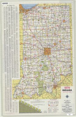
- Subject:
- Geographic Subject: Indiana and Topical Subject: Roads
- Creator:
- Indiana. State Highway Commission (1961-1981). Division of Planning
- Publisher:
- Indiana. State Highway Commission (1961-1981). Division of Planning
- Date Created:
- 1979
- Identifier:
- VAC3073-M-01206
- Genre:
- Road maps
- Geographic Location:
- Coordinates: W0880500 W0844700 N0414500 N0374600
- Related URL:
- Catalog URL: https://iucat.iu.edu/catalog/18406001
- Abstract:
- Panel title: Indiana 1979 official highway map. Relief shown by spot heights. Includes index, distance chart, and text. Text, indexed chart of state recreati...
- Call Number:
- G1403 .S7 1979
- Caption:
- Imprint: Indianapolis : Indiana State Highway Commission, [1979]
- Physical Description:
- Scale: Approximately 1:633,600 and Dimensions: 94 x 59 cm
- Alternate Identifier:
- Title Control Number: a18406001
- Persistent URL:
- https://purl.dlib.indiana.edu/iudl/images/VAC3073/VAC3073-M-01206
- Provenance:
- Indiana state highway system
-
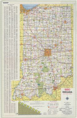
- Subject:
- Geographic Subject: Indiana and Topical Subject: Roads
- Creator:
- Indiana. State Highway Commission (1961-1981). Division of Planning
- Publisher:
- Indiana. State Highway Commission (1961-1981). Division of Planning
- Date Created:
- 1980
- Identifier:
- VAC3073-M-01207
- Genre:
- Road maps
- Geographic Location:
- Coordinates: W0880500 W0844700 N0414500 N0374600
- Related URL:
- Catalog URL: https://iucat.iu.edu/catalog/18406003
- Abstract:
- Panel title: Indiana 1980 official highway map. Relief shown by spot heights. Includes index, distance chart and text. Text, index and directory to Dept. of ...
- Call Number:
- G1403 .S7 1980
- Caption:
- Imprint: Indianapolis : Indiana State Highway Commission, [1980]
- Physical Description:
- Dimensions: 94 x 59 cm and Scale: Approximately 1:633,600
- Alternate Identifier:
- Title Control Number: a18406003
- Persistent URL:
- https://purl.dlib.indiana.edu/iudl/images/VAC3073/VAC3073-M-01207
- Provenance:
- Indiana state highway system
-
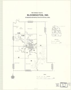
- Subject:
- Geographic Subject: Monroe County (Ind.), Topical Subject: Metropolitan areas, Geographic Subject: Bloomington Metropolitan Area (Ind.), Topical Subject: Cen...
- Publisher:
- United States. Bureau of the Census
- Date Created:
- 1983
- Identifier:
- VAC3073-M-00183
- Genre:
- Maps and Census data
- Geographic Location:
- Coordinates: W0864107 W0861903 N0392122 N0385936
- Related URL:
- Catalog URL: https://iucat.iu.edu/catalog/18454200
- Abstract:
- Variant title: 1980 census tracts, Bloomington, Indiana. Includes inset map of Bloomington with separate scale of approximately 1:64,000. "Issued August...
- Call Number:
- G4093.M7 E25 1980 .C46
- Caption:
- Imprint: [Washington, D. C.] : U.S. Department of Commerce, Bureau for the Census, [1983]
- Physical Description:
- Dimensions: Dimensions unknown and Scale: Approximately 1:125,000
- Alternate Identifier:
- Alternate ID: 359015IP and Title Control Number: a18454200
- Persistent URL:
- https://purl.dlib.indiana.edu/iudl/images/VAC3073/VAC3073-M-00183
- Provenance:
- 1980 census of population and housing. Census tracts. Bloomington, Ind., standard metropolitan statistical area.
-
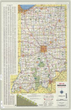
- Subject:
- Topical Subject: Roads and Geographic Subject: Indiana
- Creator:
- Indiana. State Highway Commission (1961-1981)
- Publisher:
- Indiana. State Highway Commission (1961-1981)
- Date Created:
- 1981
- Identifier:
- VAC3073-M-01208
- Genre:
- Road maps
- Geographic Location:
- Coordinates: W0880500 W0844700 N0414500 N0374600
- Related URL:
- Catalog URL: https://iucat.iu.edu/catalog/18406091
- Abstract:
- Panel title: Indiana 1981-82 official highway map. Relief shown by spot heights. Includes index, text and distance chart. Text, Department of Natural Resourc...
- Call Number:
- G1403 .S7 1981-1982
- Caption:
- Imprint: [Indianapolis] : Indiana Department of Highways, [1981]
- Physical Description:
- Scale: Approximately 1:633,600 and Dimensions: 94 x 59 cm
- Alternate Identifier:
- Title Control Number: a18406091
- Persistent URL:
- https://purl.dlib.indiana.edu/iudl/images/VAC3073/VAC3073-M-01208
- Provenance:
- Indiana state highway system
-
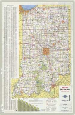
- Subject:
- Geographic Subject: Indiana and Topical Subject: Roads
- Creator:
- Indiana. Department of Highways. Division of Planning
- Publisher:
- Indiana. Department of Highways. Division of Planning
- Date Created:
- 1982
- Identifier:
- VAC3073-M-01209
- Genre:
- Road maps
- Geographic Location:
- Coordinates: W0880500 W0844700 N0414500 N0374600
- Related URL:
- Catalog URL: https://iucat.iu.edu/catalog/18406093
- Abstract:
- Panel title: Indiana 1982-83 official highway map. Relief shown by spot heights. Includes index, distance chart, and text. Text, Department of Natural Resour...
- Call Number:
- G1403 .S7 1982-1983
- Caption:
- Imprint: [Indianapolis] : Indiana Department of Highways, [1982]
- Physical Description:
- Scale: Approximately 1:633,600 and Dimensions: 94 x 59 cm
- Alternate Identifier:
- Title Control Number: a18406093
- Persistent URL:
- https://purl.dlib.indiana.edu/iudl/images/VAC3073/VAC3073-M-01209
- Provenance:
- Indiana state highway system
-
- Subject:
- Topical Subject: Roads and Geographic Subject: Indiana
- Creator:
- Indiana. Department of Highways. Division of Planning
- Publisher:
- Indiana. Department of Highways
- Date Created:
- 1984
- Identifier:
- VAC3073-M-01210
- Genre:
- Road maps
- Geographic Location:
- Coordinates: W0880500 W0844700 N0414500 N0374600
- Related URL:
- Catalog URL: https://iucat.iu.edu/catalog/18406095
- Abstract:
- Panel title: Indiana, 1984. Relief shown by spot heights. Includes index, distance chart, and indexed inset "Indiana toll road." Text, Department o...
- Call Number:
- G1403 .S7 1984
- Caption:
- Imprint: [Indianapolis] : Indiana Department of Highways, [1984]
- Physical Description:
- Scale: Approximately 1:633,600 and Dimensions: 94 x 59 cm
- Alternate Identifier:
- Title Control Number: a18406095
- Persistent URL:
- https://purl.dlib.indiana.edu/iudl/images/VAC3073/VAC3073-M-01210
- Provenance:
- Indiana state highway system
-
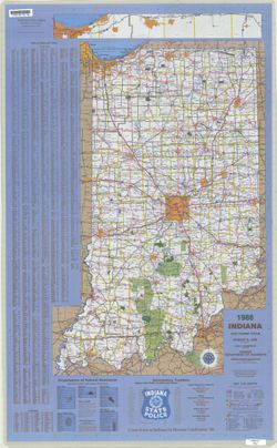
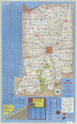
- Subject:
- Geographic Subject: Indiana and Topical Subject: Roads
- Creator:
- Indiana. Department of Highways. Division of Planning
- Publisher:
- Indiana. Department of Highways
- Date Created:
- 1986
- Identifier:
- VAC3073-M-01211
- Genre:
- Road maps
- Geographic Location:
- Coordinates: W0880500 W0844700 N0414500 N0374600
- Related URL:
- Catalog URL: https://iucat.iu.edu/catalog/18406097
- Abstract:
- Panel title: Indiana, 1986. Includes Indiana Toll Road map and indexes to cities and towns, counties, and Department of Natural Resources locations. Includes...
- Call Number:
- G1403 .S7 1986
- Caption:
- Imprint: Indianapolis : Indiana Department of Highways, 1986.
- Physical Description:
- Dimensions: 94 x 59 cm and Scale: Approximately 1:633,600
- Alternate Identifier:
- Title Control Number: a18406097
- Persistent URL:
- https://purl.dlib.indiana.edu/iudl/images/VAC3073/VAC3073-M-01211
- Provenance:
- Indiana state highway system
-
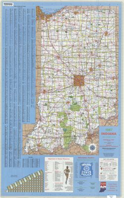
- Subject:
- Geographic Subject: Indiana, Topical Subject: Special Olympics, Inc., and Topical Subject: Roads
- Creator:
- Indiana. Department of Highways. Division of Program Development
- Publisher:
- Indiana. Department of Highways. Division of Program Development
- Date Created:
- 1987
- Identifier:
- VAC3073-M-01212
- Genre:
- Road maps
- Geographic Location:
- Coordinates: W0880500 W0844700 N0414500 N0374600
- Related URL:
- Catalog URL: https://iucat.iu.edu/catalog/18406098
- Abstract:
- Title on verso: Indiana 1987 : America's amateur sports center. Includes indexes, indexed table of recreation areas, information numbers, and distance ch...
- Call Number:
- G1403 .S7 1987
- Caption:
- Imprint: Indianapolis, IN : Department of Highways, Division of Program Development, [1987]
- Physical Description:
- Scale: Approximately 1:633,600 and Dimensions: 94 x 59 cm
- Alternate Identifier:
- Title Control Number: a18406098
- Persistent URL:
- https://purl.dlib.indiana.edu/iudl/images/VAC3073/VAC3073-M-01212
- Provenance:
- Indiana state highway system
-
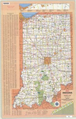
- Subject:
- Geographic Subject: Indiana and Topical Subject: Roads
- Creator:
- Indiana. Department of Highways. Division of Program Development
- Publisher:
- Indiana. Department of Highways.
- Date Created:
- 1988
- Identifier:
- VAC3073-M-01213
- Genre:
- Road maps
- Geographic Location:
- Coordinates: W0880500 W0844700 N0414500 N0374600
- Related URL:
- Catalog URL: https://iucat.iu.edu/catalog/18406100
- Abstract:
- Panel title: Indiana, 1988. Relief shown by spot heights. Includes index, distance chart, directory of state police locations, indexed list of state recreati...
- Call Number:
- G1403 .S7 1988
- Caption:
- Imprint: [Indianapolis] : Indiana Department of Highways, [1988]
- Physical Description:
- Scale: Approximately 1:633,600 and Dimensions: 94 x 59 cm
- Alternate Identifier:
- Title Control Number: a18406100
- Persistent URL:
- https://purl.dlib.indiana.edu/iudl/images/VAC3073/VAC3073-M-01213
- Provenance:
- Indiana state highway system
-
- Subject:
- Geographic Subject: Indiana and Topical Subject: Roads
- Creator:
- Indiana. Department of Highways. Division of Program Development
- Publisher:
- Indiana. Department of Highways
- Date Created:
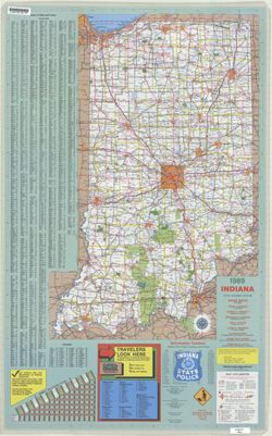
- 1989
- Identifier:
- VAC3073-M-01214
- Genre:
- Road maps
- Geographic Location:
- Coordinates: W0880500 W0844700 N0414500 N0374600
- Related URL:
- Catalog URL: https://iucat.iu.edu/catalog/18406101
- Abstract:
- Panel title: Indiana, 1989. Relief shown by spot heights. Includes index, distance chart, directory of state police districts, and indexed list of state recr...
- Call Number:
- G1403 .S7 1989
- Caption:
- Imprint: [Indianapolis] : Indiana Department of Highways, [1989]
- Physical Description:
- Scale: Approximately 1:633,600 and Dimensions: 94 x 59 cm
- Alternate Identifier:
- Title Control Number: a18406101
- Persistent URL:
- https://purl.dlib.indiana.edu/iudl/images/VAC3073/VAC3073-M-01214
- Provenance:
- Indiana state highway system
-
- Subject:
- Topical Subject: Roads and Geographic Subject: Indiana
- Creator:
- Indiana. Department of Highways. Division of Program Development
- Publisher:
- Indiana. Department of Highways
- Date Created:
- 1990
- Identifier:
- VAC3073-M-01215
- Genre:
- Road maps
- Geographic Location:
- Coordinates: W0880500 W0844700 N0414500 N0374600
- Related URL:
- Catalog URL: https://iucat.iu.edu/catalog/18406102
- Abstract:
- Panel title: Indiana, 1990 : crossroads. Relief shown by spot heights. Includes index, distance chart, directory of state police districts, list of scenic by...
- Call Number:
- G1403 .S7 1990
- Caption:
- Imprint: [Indianapolis] : Indiana Department of Highways, [1990]
- Physical Description:
- Scale: Approximately 1:633,600 and Dimensions: 94 x 59 cm
- Alternate Identifier:
- Title Control Number: a18406102
- Persistent URL:
- https://purl.dlib.indiana.edu/iudl/images/VAC3073/VAC3073-M-01215
- Provenance:
- Indiana state highway system
-
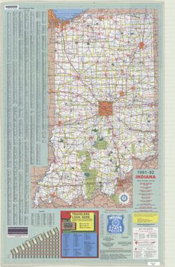
- Subject:
- Topical Subject: Roads and Geographic Subject: Indiana
- Creator:
- Indiana. Department of Transportation. Division of Engineering Services
- Publisher:
- Indiana. Department of Transportation
- Date Created:
- 1991
- Identifier:
- VAC3073-M-01216
- Genre:
- Road maps
- Geographic Location:
- Coordinates: W0880500 W0844700 N0414500 N0374600
- Related URL:
- Catalog URL: https://iucat.iu.edu/catalog/18406103
- Abstract:
- Panel title: Indiana, 1991-1992. Includes indexes, list of points of interest, mileage chart, and directories. Text, illustrations (some color), and 16 local...
- Call Number:
- G1403 .S7 1991-1992
- Caption:
- Imprint: [Indianapolis] : [Indiana Department of Transportation], [1991]
- Physical Description:
- Scale: Approximately 1:633,600 and Dimensions: 94 x 59 cm
- Alternate Identifier:
- Title Control Number: a18406103
- Persistent URL:
- https://purl.dlib.indiana.edu/iudl/images/VAC3073/VAC3073-M-01216
- Provenance:
- Indiana state highway system
-
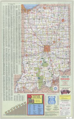
- Subject:
- Topical Subject: Roads and Geographic Subject: Indiana
- Creator:
- Indiana. Department of Transportation. Division of Program Development
- Publisher:
- Indiana. Department of Transportation
- Date Created:
- 1993
- Identifier:
- VAC3073-M-01217
- Genre:
- Road maps
- Geographic Location:
- Coordinates: W0880500 W0844700 N0414500 N0374600
- Related URL:
- Catalog URL: https://iucat.iu.edu/catalog/18406105
- Abstract:
- Panel title: Indiana state highway map, 1993-1994. Includes indexes to cities and towns and counties, mileage chart, state police telephone directory, travel...
- Call Number:
- G1403 .S7 1993-1994
- Caption:
- Imprint: [Indianapolis]. : Indiana Department of Transportation, [1993]
- Physical Description:
- Scale: Approximately 1:633,600 and Dimensions: 94 x 59 cm
- Alternate Identifier:
- Title Control Number: a18406105
- Persistent URL:
- https://purl.dlib.indiana.edu/iudl/images/VAC3073/VAC3073-M-01217
- Provenance:
- Indiana state highway system
-
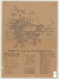
- Subject:
- Geographic Subject: Bloomington (Ind.) and Topical Subject: Election districts
- Publisher:
- Daily Herald-Telephone (Bloomington, Ind.)
- Date Created:
- 1966
- Identifier:
- VAC3073-M-00032
- Genre:
- Thematic maps
- Geographic Location:
- Coordinates: W0863532 W0862816 N0391315 N0390716
- Related URL:
- Catalog URL: https://iucat.iu.edu/catalog/4897032
- Abstract:
- From Daily Herald-Telephone, Bloomington, Indiana, November 4, 1966. Map shows voting precincts inside the city of Bloomington, Indiana and includes listing ...
- Call Number:
- G4094 .B5 F7 1966 .A14
- Caption:
- Imprint: Bloomington, Ind. : Daily Herald-Telephone, 1966.
- Physical Description:
- Scale: Scale not given. and Dimensions: 33 x 39 cm, on sheet 59 x 43 cm
- Alternate Identifier:
- Title Control Number: a4897032
- Persistent URL:
- https://purl.dlib.indiana.edu/iudl/images/VAC3073/VAC3073-M-00032
-
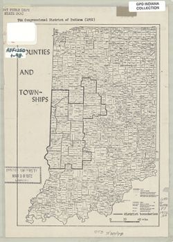
- Subject:
- Geographic Subject: Indianapolis Region (Ind.), Geographic Subject: Marion County (Ind.), Geographic Subject: Indiana, and Topical Subject: Election districts
- Publisher:
- Indiana University, Bloomington. Department of Geography
- Date Created:
- 1972
- Identifier:
- VAC3073-M-00314
- Genre:
- Thematic maps
- Geographic Location:
- Coordinates: W0880500 W0844700 N0414500 N0374600
- Related URL:
- Catalog URL: https://iucat.iu.edu/catalog/1025068
- Abstract:
- Boundaries of 7th Congressional District of Indiana in 1972 drawn on a copy of "Counties and townships" map, p. 10 of Kingsbury, Robert C., An atla...
- Call Number:
- G4091 .F7 1972 .S4
- Caption:
- Imprint: [Indiana] : [Department of Geography, Indiana University], [1970]
- Physical Description:
- Scale: Approximately 1:825,000 and Dimensions: 25 x 18 cm
- Alternate Identifier:
- Title Control Number: a16178039 and Alternate ID: AJF1250BB
- Persistent URL:
- https://purl.dlib.indiana.edu/iudl/images/VAC3073/VAC3073-M-00314
-
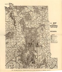
- Subject:
- Topical Subject: IGS Annual Reports, Topical Subject: Mines and mineral resources, Topical Subject: Road materials, and Geographic Subject: Monroe County (Ind.)
- Publisher:
- Indiana. Department of Geology and Natural Resources
- Date Created:
- 1906
- Identifier:
- VAC3073-M-01160
- Genre:
- Geological maps
- Geographic Location:
- Coordinates: W0864107 W0861903 N0392122 N0385936
- Related URL:
- Catalog URL: https://iucat.iu.edu/catalog/18299087
- Abstract:
- Alternate title: Illustrating the distribution of road materials in Monroe County. At head of alternate title: Fig. 53B. Shows roads, limestone, gravel, sand...
- Call Number:
- G4093.M7H5 1905 .M3
- Caption:
- Imprint: [Indianapolis] : [Indiana Dept. of Geology and Natural Resources], [1906]
- Physical Description:
- Scale: Approximately 1:171,000 and Dimensions: 26 x 22 cm
- Alternate Identifier:
- Alternate ID: 390726IP and Title Control Number: a18299087
- Persistent URL:
- https://purl.dlib.indiana.edu/iudl/images/VAC3073/VAC3073-M-01160
- Provenance:
- 30th Annual Report (1905) / Indiana. Department of Geology and Natural Resources.
-
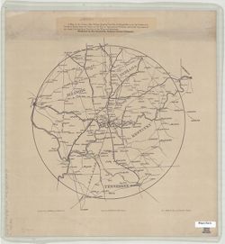
- Subject:
- Geographic Subject: Ohio River Valley, Topical Subject: Railroads, and Geographic Subject: Evansville (Ind.)
- Creator:
- D.J. Lake & Company
- Publisher:
- Courier Company
- Date Created:
- 1879
- Identifier:
- VAC3073-M-01493
- Genre:
- Thematic maps
- Geographic Location:
- Coordinates: W0901300 W0842700 N0400700 N0354600
- Related URL:
- Catalog URL: https://iucat.iu.edu/catalog/12878087
- Abstract:
- D.J. Lake & Co., published by the Evansville, Indiana Courier Company. Shows portions of Illinois, Indiana, Kentucky, and Tennessee. Includes location ...
- Call Number:
- G3707.O5P3 1879 .L32
- Caption:
- Imprint: Evansville, Indiana : Courier Company, [1879]
- Physical Description:
- Dimensions: 36 x 36 cm, on sheet 49 x 46 cm and Scale: Scale not given.
- Persistent URL:
- https://purl.dlib.indiana.edu/iudl/images/VAC3073/VAC3073-M-01493
-
- Subject:
- Geographic Subject: Northwest, Old and Geographic Subject: Northeastern States
- Creator:
- Morse, Jedidiah, 1761-1826, Hill, Samuel, approximately 1766-1804, and Thomas & Andrews
- Publisher:
- Geological Survey (U.S.)
- Date Created:
- 1988
- Identifier:
- VAC3073-M-00979
- Genre:
- Early maps
- Geographic Location:
- Coordinates: W1030000 W0800000 N0503000 N0363000
- Related URL:
- Catalog URL: https://iucat.iu.edu/catalog/18454609
- Abstract:
- S. Hill. sc. Map dated 1796. Relief shown by hachures and pictorially. Prime meridians: Philadelphia & London. "The dotted Squares, are the Reservat...
- Call Number:
- QH75 .A4 No. 1200-IN
- Caption:
- Imprint: [Reston, Va.] : [U.S. Gelogical Survey], [1988]
- Physical Description:
- Scale: Scale not given. and Dimensions: xxv, 477 p. : ill., maps, 29 cm.
- Alternate Identifier:
- Title Control Number: a18454609 and Alternate ID: 358171IP
- Persistent URL:
- https://purl.dlib.indiana.edu/iudl/images/VAC3073/VAC3073-M-00979
- Provenance:
- The National gazetteer of the United States of America--Indiana, 1988 / U.S. Geological Survey.
-

- Subject:
- Geographic Subject: Indiana, Geographic Subject: Ripley County (Ind.), Topical Subject: IGS Annual Reports, Geographic Subject: Jefferson County (Ind.), Topi...
- Creator:
- Cumings, E. R. (Edgar Roscoe), 1874-1967 and Foerste, Aug. F. (Aug. Frederic), 1862-1936
- Publisher:
- Indiana. Department of Geology and Natural Resources
- Date Created:
- 1908
- Identifier:
- VAC3073-M-01028
- Genre:
- Geological maps
- Geographic Location:
- Coordinates: W0854100 W0844600 N0391800 N0383300
- Related URL:
- Catalog URL: https://iucat.iu.edu/catalog/18307520
- Abstract:
- "Boundary after Foerste." Detached from: The stratigraphy and paleontology of the Cincinnati series of Indiana / E.R. Cumings. In Indiana Dept. ...
- Call Number:
- G4091.C57 1908 .M3
- Caption:
- Imprint: [Indianapolis] : [Indiana Dept. of Geology and Natural Resources], [1908]
- Physical Description:
- Dimensions: on sheet 60 x 51 cm and Scale: Approximately 1:126,720. 2 miles to the 1 inch
- Alternate Identifier:
- Title Control Number: a18307520 and Alternate ID: 390726IP
- Persistent URL:
- https://purl.dlib.indiana.edu/iudl/images/VAC3073/VAC3073-M-01028
- Provenance:
- 32nd Annual Report (1907) / Indiana. Department of Geology and Natural Resources.
-
- Subject:
- Geographic Subject: Union County (Ind.), Geographic Subject: Franklin County (Ind.), Topical Subject: IGS Annual Reports, Geographic Subject: Indiana, Topica...
- Publisher:
- Indiana. Department of Geology and Natural Resources
- Date Created:
- 1908
- Identifier:
- VAC3073-M-00272
- Genre:
- Geological maps
- Related URL:
- Catalog URL: https://iucat.iu.edu/catalog/9676901
- Abstract:
- Showing the Location of sections and collecting localities and the boundary between the Ordovician and Silurian Systems. Detached from: The stratigraphy a...
- Call Number:
- QE109 .A2 1907 map p605
- Caption:
- Imprint: Indianapolis : 1908
- Physical Description:
- Dimensions: 67 x 37 cm and Scale: Approximately 1:126,720. 2 miles = 1 inch
- Alternate Identifier:
- Title Control Number: 390726IP
- Persistent URL:
- https://purl.dlib.indiana.edu/iudl/images/VAC3073/VAC3073-M-00272
- Provenance:
- 32nd Annual Report (1907) / Indiana. Department of Geology and Natural Resources.
-
![A new map of Indiana [cartographic material] : exhibiting the counties, townships, cities, villages, and post offices, rail roads, canals, and common roads.](https://iiif.uits.iu.edu/iiif/2/rf560b15p%2Ffiles%2F277d357a-ee84-4cfa-987c-4c52a6d19c25/full/250,/0/default.jpg)
- Subject:
- Topical Subject: Administrative and political divisions and Geographic Subject: Indiana
- Creator:
- Mendenhall, Edward
- Publisher:
- Mendenhall, Edward
- Date Created:
- 1854
- Identifier:
- VAC3073-M-01281
- Genre:
- Maps
- Geographic Location:
- Coordinates: W0880700 W0844500 N0414500 N0375200
- Related URL:
- Catalog URL: https://iucat.iu.edu/catalog/5176337
- Abstract:
- Cover title: Township map of Indiana Prime meridian: Washington. Folded in covers 15 x 10 cm. "Transfer'd from copper & printed from sto...
- Call Number:
- G4090 1854 .M46
- Caption:
- Imprint: Cincinnati, O. : E. Mendenhall, 1854.
- Physical Description:
- Scale: Approximately 1:1,013,760 and Dimensions: 46 x 33 cm
- Persistent URL:
- https://purl.dlib.indiana.edu/iudl/images/VAC3073/VAC3073-M-01281
-
- Subject:
- Geographic Subject: Indiana
- Creator:
- Mitchell, S. Augustus (Samuel Augustus), 1792-1868
- Publisher:
- Mitchell, S. Augustus (Samuel Augustus), 1792-1868
- Date Created:
- 1846
- Identifier:
- VAC3073-M-01278
- Genre:
- Maps
- Related URL:
- Catalog URL: https://iucat.iu.edu/catalog/5045140
- Abstract:
- No. 30 from : A new universal atlas / S.A. Mitchell. Philadelphia , 1847. Prime meridian: Washington. Hand coloured. Decorative border. Includes &quo...
- Call Number:
- G4090 1846 .N49
- Caption:
- Imprint: Philadelphia : S. Augustus Mitchell, c1846.
- Physical Description:
- Scale: Approximately 1:1,400,000 and Dimensions: 32 x 26 cm
- Persistent URL:
- https://purl.dlib.indiana.edu/iudl/images/VAC3073/VAC3073-M-01278
-
- Subject:
- Topical Subject: Roads, Topical Subject: IGS Annual Reports, and Geographic Subject: Monroe County (Ind.)
- Publisher:
- Indiana. Department of Geology and Natural Resources
- Date Created:
- 1906
- Identifier:
- VAC3073-M-00037
- Genre:
- Road maps
- Geographic Location:
- Coordinates: W0864107 W0861811 N0392126 N0385936
- Related URL:
- Catalog URL: https://iucat.iu.edu/catalog/18298783
- Abstract:
- Shows roads, improved roads, rural routes, rail roads, and road metal quarries. Alternate title: Illustrating the roads of Monroe County. At head of alternat...
- Call Number:
- G4093.M7P2 1905 .R6
- Caption:
- Imprint: Indianapolis : 1906
- Physical Description:
- Scale: Approximately 1:130,000 and Dimensions: 36 x 27 cm
- Alternate Identifier:
- Alternate ID: 390726IP and Title Control Number: a18298783
- Persistent URL:
- https://purl.dlib.indiana.edu/iudl/images/VAC3073/VAC3073-M-00037
- Provenance:
- 30th Annual Report (1905) / Indiana. Department of Geology and Natural Resources.
-
- Subject:
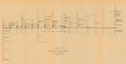
- Geographic Subject: Richmond (Ind.), Topical Subject: IGS Annual Reports, Geographic Subject: Madison (Ind.), Topical Subject: Stratigraphic correlation, Top...
- Creator:
- Cumings, E. R. (Edgar Roscoe), 1874-1967
- Publisher:
- Indiana. Department of Geology and Natural Resources
- Date Created:
- 1908
- Identifier:
- VAC3073-M-00056
- Genre:
- Charts and Geological cross-sections
- Geographic Location:
- Coordinates: W0852400 W0844800 N0395000 N0384000
- Related URL:
- Catalog URL: https://iucat.iu.edu/catalog/18298808
- Abstract:
- Includes 17 stratigraphic columns and correlation lines. Detached from: The stratigraphy and paleontology of the Cincinnati series of Indiana / E.R. Cumin...
- Call Number:
- G4091.C57 1908 .C86
- Caption:
- Imprint: [Indianapolis] : [Wm. B. Burford], [1908] and Imprint: [Indianapolis] : [Indiana Department of Geology and Natural Resources], [1908]
- Physical Description:
- Dimensions: on sheet 32 x 60 cm and Scale: Scale not given.
- Alternate Identifier:
- Title Control Number: a18298808 and Alternate ID: 390726IP
- Persistent URL:
- https://purl.dlib.indiana.edu/iudl/images/VAC3073/VAC3073-M-00056
- Provenance:
- 32nd Annual Report (1907) / Indiana. Department of Geology and Natural Resources.
-
- Subject:
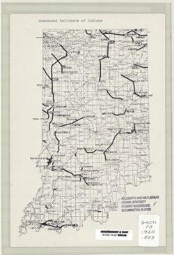
- Geographic Subject: Indiana, Topical Subject: Abandonment, and Topical Subject: Railroads
- Publisher:
- [Place of publication not identified]
- Date Created:
- 1960
- Identifier:
- VAC3073-M-00636
- Genre:
- Thematic maps
- Geographic Location:
- Coordinates: W0880500 W0844700 N0414500 N0374600
- Related URL:
- Catalog URL: https://iucat.iu.edu/catalog/7330576
- Abstract:
- Pen and ink. Base map: Geological Survey (U.S.). State of Indiana, Scale 1:500,000, Washington, D.C., 1950.
- Call Number:
- G4091.P3 1960 .A23
- Caption:
- Imprint: [Place of publication not identified] : [publisher not identified], [1960?]
- Physical Description:
- Scale: 1:2,027,520 and Dimensions: 28 x 19 cm
- Alternate Identifier:
- Title Control Number: a7330576
- Persistent URL:
- https://purl.dlib.indiana.edu/iudl/images/VAC3073/VAC3073-M-00636
-
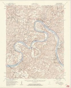
- Subject:
- Geographic Subject: Breckinridge County (Ky.), Geographic Subject: Perry County (Ind.), Geographic Subject: Harrison County (Ind.), Geographic Subject: Meade...
- Creator:
- United States. Army Map Service and Geological Survey (U.S.)
- Publisher:
- Geological Survey (U.S.)
- Date Created:
- 1959
- Identifier:
- VAC3073-M-01312
- Genre:
- Topographic maps, Quadrangle maps, and 15 minute topographic maps
- Geographic Location:
- Coordinates: W0863000 W0861500 N0381500 N0380000
- Related URL:
- Catalog URL: https://iucat.iu.edu/catalog/18406357
- Abstract:
- Mapped by the Geological Survey and the Army Map Service. Filing title: Alton, Ind.--Ky. Polyconic projection. Relief shown by contours and spot heights. Inc...
- Call Number:
- G4090 s62 .G4 Alton 1950 R1959
- Caption:
- Imprint: Washington, D.C. : Interior--Geological Survey, 1959.
- Physical Description:
- Scale: 1:62,500 and Dimensions: 45 x 42 cm or smaller
- Alternate Identifier:
- Title Control Number: a18406357
- Persistent URL:
- https://purl.dlib.indiana.edu/iudl/images/VAC3073/VAC3073-M-01312
- Provenance:
- Part of Geological Survey (U.S.). Indiana 1:62,500.
-
![Alton quadrangle, Indiana--Kentucky : 15 minute series (topographic) [Vegetation version]](https://iiif.uits.iu.edu/iiif/2/ng452m33b%2Ffiles%2F49c9606f-c7c7-4f10-807b-1b5949009698/full/250,/0/default.jpg)
- Subject:
- Geographic Subject: Crawford County (Ind.), Topical Subject: Vegetation mapping, Geographic Subject: Breckinridge County (Ky.), Geographic Subject: Meade Cou...
- Creator:
- Geological Survey (U.S.) and United States. Army Map Service
- Publisher:
- Geological Survey (U.S.)
- Date Created:
- 1959
- Identifier:
- VAC3073-M-01313
- Genre:
- Quadrangle maps, 15 minute topographic maps, and Topographic maps
- Geographic Location:
- Coordinates: W0863000 W0861500 N0381500 N0380000
- Related URL:
- Catalog URL: https://iucat.iu.edu/catalog/18406357
- Abstract:
- Mapped by the Geological Survey and the Army Map Service. Filing title: Alton, Ind.--Ky. Polyconic projection. Relief shown by contours and spot heights. Inc...
- Call Number:
- G4090 s62 .G4 Alton 1950 rep1959 V
- Caption:
- Imprint: Washington, D.C. : Interior--Geological Survey, 1959.
- Physical Description:
- Dimensions: 45 x 42 cm or smaller and Scale: 1:62,500
- Alternate Identifier:
- Title Control Number: a18406357
- Persistent URL:
- https://purl.dlib.indiana.edu/iudl/images/VAC3073/VAC3073-M-01313
- Provenance:
- Part of Geological Survey (U.S.). Indiana 1:62,500.
-
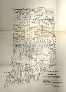
- Subject:
- Topical Subject: IGS Annual Reports, Topical Subject: Land use surveys, and Geographic Subject: Indiana
- Creator:
- Collett, John, 1828-1899
- Publisher:
- Indiana. Department of Geology and Natural History
- Date Created:
- 1883
- Identifier:
- VAC3073-M-01145
- Genre:
- Outline maps and Thematic maps
- Geographic Location:
- Coordinates: W0880500 W0844700 N0414500 N0364600
- Related URL:
- Catalog URL: https://iucat.iu.edu/catalog/18174045
- Abstract:
- Showing the Districts as subdivided by the U.S. Surveys, together with each name and date of survey. The dotted lines are boundaries of Districts. Ebenezer ...
- Call Number:
- G4091.G46 1882 .C655
- Caption:
- Imprint: [Indianapolis] :, b[Indiana Dept. of Geology and Natural History],, and c[1882]
- Physical Description:
- Scale: Scale not given. and Dimensions: 35 x 27 cm
- Alternate Identifier:
- Alternate ID: 390725IP and Title Control Number: a18174045
- Persistent URL:
- https://purl.dlib.indiana.edu/iudl/images/VAC3073/VAC3073-M-01145
- Provenance:
- 12th Annual Report (1882) / Indiana. Department of Geology and Natural History.
-
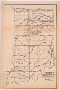
An outline map of Indiana showing dates and places where treaties were held, ceding land to the U.S.
- Subject:
- Geographic Subject: Indiana, Topical Subject: Treaties, Topical Subject: Indian land transfers, and Topical Subject: IGS Annual Reports
- Creator:
- Collett, John, 1828-1899
- Publisher:
- Indiana. Department of Geology and Natural History
- Date Created:
- 1883
- Identifier:
- VAC3073-M-01104
- Genre:
- Outline maps and Thematic maps
- Geographic Location:
- Coordinates: W0850500 W0844700 N0414500 N0374600
- Related URL:
- Catalog URL: https://iucat.iu.edu/catalog/18173762
- Abstract:
- Showing dates and places where Treaties were held, Ceding Land to the U.S. This dotted line denotes boundaries of the different Treaties.
- Call Number:
- G4091.G46 1882 .C65
- Caption:
- Imprint: [Indianapolis] : [Indiana Dept. of Geology and Natural History], [1883]
- Physical Description:
- Dimensions: 32 x 21 cm and Scale: Approximately 1:1,680,000
- Alternate Identifier:
- Alternate ID: 390725IP and Title Control Number: a18173762
- Persistent URL:
- https://purl.dlib.indiana.edu/iudl/images/VAC3073/VAC3073-M-01104
- Provenance:
- 12th Annual Report (1882) / Indiana. Department of Geology and Natural History.
-
- Subject:
- Geographic Subject: New Garden (Ind. : Township), Topical Subject: Earthworks (Archaeology), and Topical Subject: IGS Annual Reports
- Creator:
- Macpherson, J. C. (John C.)
- Publisher:
- Indiana. Geological Survey
- Date Created:
- 1879
- Identifier:
- VAC3073-M-01550
- Genre:
- Pictorial maps
- Geographic Location:
- Coordinates: W0845400 W0845300 N0395800 N0395700
- Related URL:
- Catalog URL: https://iucat.iu.edu/catalog/18387636
- Abstract:
- At head of title: Plate C. Shows streams, pits, and earthwork [Indiana Adena Square?] with measurements. Detached from: Eighth, ninth, and tenth annual re...
- Call Number:
- G4094.N438 1978 .M33
- Caption:
- Imprint: [Indianapolis] : [Indianapolis Journal Company, State printers], [1879] and Imprint: [Indianapolis] : [Geological Survey of Indiana], [1879]
- Physical Description:
- Dimensions: on sheet 14 x 21 cm and Scale: Approximately 1:6,000. 1 inch = 500 ft.
- Alternate Identifier:
- Alternate ID: 390723IP and Title Control Number: a18387636
- Persistent URL:
- https://purl.dlib.indiana.edu/iudl/images/VAC3073/VAC3073-M-01550
- Provenance:
- 8th, 9th, and 10th Annual Reports (1876, 1877, 1878) / Indiana. Geological Survey.
-
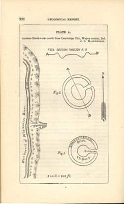
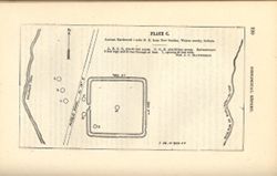
- Subject:
- Geographic Subject: Cambridge City (Ind.), Topical Subject: Henges, and Topical Subject: IGS Annual Reports
- Creator:
- Macpherson, J. C. (John C.)
- Publisher:
- Indiana. Geological Survey
- Date Created:
- 1879
- Identifier:
- VAC3073-M-01551
- Genre:
- Pictorial maps
- Geographic Location:
- Coordinates: W0851016 W0851004 N0395012 N0395001
- Related URL:
- Catalog URL: https://iucat.iu.edu/catalog/18387638
- Abstract:
- At head of title: Plate A. Relief shown by profile and spot heights. Includes pictorial map of west branch of Whitewater River and three figures showing heig...
- Call Number:
- G4094.C15E15 1878 .M33
- Caption:
- Imprint: [Indianapolis] : [Indianapolis Journal Company, State printers], [1879] and Imprint: [Indianapolis] : [Geological Survey of Indiana], [1879]
- Physical Description:
- Dimensions: on sheet 22 x 13 cm and Scale: Approximately 1:2,400. 1 inch = 200 ft.
- Alternate Identifier:
- Alternate ID: 390723IP and Title Control Number: a18387638
- Persistent URL:
- https://purl.dlib.indiana.edu/iudl/images/VAC3073/VAC3073-M-01551
- Provenance:
- 8th, 9th, and 10th Annual Reports (1876, 1877, 1878) / Indiana. Geological Survey.
-
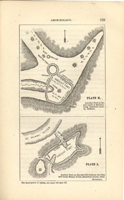
- Subject:
- Topical Subject: IGS Annual Reports, Topical Subject: Mounds, Topical Subject: Fortification, Prehistoric, Topical Subject: Indians of North America, Geograp...
- Creator:
- Morrison, Samuel (Civil engineer)
- Publisher:
- Indiana. Geological Survey
- Date Created:
- 1879
- Identifier:
- VAC3073-M-01548
- Genre:
- Pictorial maps
- Geographic Location:
- Coordinates: W0850758 W0844909 N0391829 N0385607
- Related URL:
- Catalog URL: https://iucat.iu.edu/catalog/18387663
- Abstract:
- At head of first title: Plate H , At head of second title: Plate I. Relief shown by hachures and spot heights. Shows prehistoric forts [Miami Fort and Oberti...
- Call Number:
- QE109 .A2
- Caption:
- Imprint: [Indianapolis] : [Geological Survey of Indiana], [1879] and Imprint: [Indianapolis] : [Indianapolis Journal Company, State printers], [1879]
- Physical Description:
- Dimensions: 22 x 14 cm and Scale: Scale not given.
- Alternate Identifier:
- Title Control Number: a18387663 and Alternate ID: 390723IP
- Persistent URL:
- https://purl.dlib.indiana.edu/iudl/images/VAC3073/VAC3073-M-01548
- Provenance:
- 8th, 9th, and 10th Annual Reports (1876, 1877, 1878) / Indiana. Geological Survey.
-
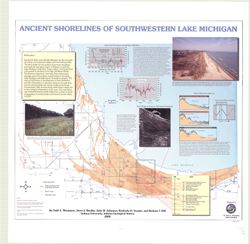
- Subject:
- Geographic Subject: Porter County (Ind.), Geographic Subject: Indiana, Geographic Subject: Michigan, Lake, Coast (Ind.), Topical Subject: Lakes, Topical Subj...
- Creator:
- Thompson, Todd A. (Todd Alan), 1959-
- Publisher:
- Indiana. Geological Survey
- Date Created:
- 2000
- Identifier:
- VAC3073-M-00193
- Genre:
- Thematic maps
- Geographic Location:
- Coordinates: W0873136 W0871307 N0414539 N0410943
- Related URL:
- Catalog URL: https://iucat.iu.edu/catalog/4898581
- Abstract:
- Includes illustrations, text, graphs showing "Lake-level fluctuations over the past 4,700 years" and a timeline showing historical events since 116...
- Call Number:
- G4093 .L3C2 2000 .T486
- Caption:
- Imprint: [Bloomington, Ind.] : Indiana University, Indiana Geological Survey, 2000.
- Physical Description:
- Dimensions: 76 x 87 cm and Scale: 1:59,000
- Alternate Identifier:
- Title Control Number: a4898581
- Persistent URL:
- https://purl.dlib.indiana.edu/iudl/images/VAC3073/VAC3073-M-00193
-
- Subject:
- Geographic Subject: Angola (Ind.)
- Creator:
- Gilbert, Don, City Engr.
- Publisher:
- [City Engr.?]
- Date Created:
- 1946
- Identifier:
- VAC3073-M-01003
- Genre:
- Maps
- Geographic Location:
- Coordinates: W0850214 W0845812 N0414044 N0413701
- Related URL:
- Catalog URL: https://iucat.iu.edu/catalog/7476633
- Abstract:
- Includes indexed list of points of interest, map of Steuben County, Indiana and illustrations.
- Call Number:
- G4094.A5 1946 .G55
- Caption:
- Imprint: [Angola, Ind.?] : [City Engr.?], [1946]
- Physical Description:
- Dimensions: 36 x 26 cm and Scale: Scale not given.
- Alternate Identifier:
- Title Control Number: a7476633
- Persistent URL:
- https://purl.dlib.indiana.edu/iudl/images/VAC3073/VAC3073-M-01003
-
![Area map [map] : Nashville and park entrance](https://iiif.uits.iu.edu/iiif/2/cf95kd75c%2Ffiles%2F50f0a63b-dc6d-4bda-a229-140148a2252e/full/250,/0/default.jpg)
- Subject:
- Geographic Subject: Brown County State Park (Ind.) and Geographic Subject: Nashville (Ind.)
- Publisher:
- [publisher not identified]
- Date Created:
- 1970
- Identifier:
- VAC3073-M-00225
- Genre:
- Maps
- Geographic Location:
- Coordinates: W0861450 W0861220 N0391229 N0391130
- Related URL:
- Catalog URL: https://iucat.iu.edu/catalog/4896982
- Abstract:
- Blue line print. Shows corporate limits of Nashville Indiana, roads, some buildings, Salt Creek, the north entrance to Brown County State Park and distances...
- Call Number:
- G4094 .N25 1970 .A74
- Caption:
- Imprint: [place of publication not identified] : [publisher not identified], [1970?]
- Physical Description:
- Dimensions: 42 x 66 cm and Scale: Scale not given.
- Alternate Identifier:
- Title Control Number: a4896982
- Persistent URL:
- https://purl.dlib.indiana.edu/iudl/images/VAC3073/VAC3073-M-00225
-
- Subject:
- Topical Subject: Caves, Geographic Subject: Indiana, Topical Subject: Springs, Topical Subject: Sinkholes, and Topical Subject: Karst
- Creator:
- Powell, Richard L.
- Publisher:
- Indiana. Geological Survey
- Date Created:
- 2002
- Identifier:
- VAC3073-M-00135
- Genre:
- Geological maps
- Geographic Location:
- Coordinates: W0870002 W0854608 N0394722 N0375826
- Related URL:
- Catalog URL: https://iucat.iu.edu/catalog/5325676
- Abstract:
- "This map data was compiled in 1997 from information available at the time, but was unpublished until until 2002, the map does not reflect any changes i...
- Call Number:
- G4091.C28 1997 .P69
- Caption:
- Imprint: [Bloomington, Ind.] : Indiana Geological Survey, 2002.
- Physical Description:
- Scale: 1:250,000 and Dimensions: 82 x 42 cm
- Alternate Identifier:
- Title Control Number: a5325676
- Persistent URL:
- https://purl.dlib.indiana.edu/iudl/images/VAC3073/VAC3073-M-00135
-
- Subject:
- Geographic Subject: Indiana and Geographic Subject: Ohio
- Creator:
- Asher & Adams
- Publisher:
- Asher & Adams
- Date Created:
- 1872
- Identifier:
- VAC3073-M-00312
- Genre:
- Maps
- Geographic Location:
- Coordinates: W0880000 W0790000 N0420000 N0370000
- Related URL:
- Catalog URL: https://iucat.iu.edu/catalog/5167753
- Abstract:
- Detached from an atlas, no. 59-60.
- Call Number:
- G4080 1872 .A84
- Caption:
- Imprint: [New York] : Asher & Adams, [1872]
- Physical Description:
- Dimensions: 40 x 56 cm, on sheet 45 x 63 cm and Scale: 1:1,267,200
- Alternate Identifier:
- Title Control Number: a5167753
- Persistent URL:
- https://purl.dlib.indiana.edu/iudl/images/VAC3073/VAC3073-M-00312
-
- Subject:
- Geographic Subject: Indiana and Topical Subject: Mines and mineral resources
- Creator:
- Indiana. Geological Survey
- Publisher:
- Indiana. Geological Survey
- Date Created:
- 1953
- Identifier:
- VAC3073-M-01193
- Genre:
- Atlases and Mine maps
- Geographic Location:
- Coordinates: W0880500 W0844700 N0414500 N0374600
- Related URL:
- Catalog URL: https://iucat.iu.edu/catalog/22238
- Abstract:
- Letter inserted indicating map no. 10 last in series,, map dated 1958, letter dated 1962.
- Call Number:
- G1401.H1 A! 1953
- Caption:
- Imprint: Bloomington, Indiana : Indiana Geological Survey, 1953
- Physical Description:
- Dimensions: 56 cm and Scale: Scales differ.
- Persistent URL:
- https://purl.dlib.indiana.edu/iudl/images/VAC3073/VAC3073-M-01193
-
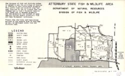
- Subject:
- Topical Subject: Hunting, Topical Subject: Wildlife conservation--Law and legislation, Geographic Subject: Atterbury State Fish and Wildlife Area (Ind.), Top...
- Creator:
- Indiana. Division of Fish and Wildlife
- Publisher:
- Indiana. Division of Fish and Wildlife
- Date Created:
- 1971
- Identifier:
- VAC3073-M-01264
- Genre:
- Thematic maps
- Geographic Location:
- Coordinates: W0860542 W0855904 N0392249 N0392059
- Related URL:
- Catalog URL: https://iucat.iu.edu/catalog/18388147
- Abstract:
- Title on verso: Rules and regulations : Atterbury fish and wildlife area. Shows hunting area, shooting and archery ranges, parking lots, cemeteries, lakes an...
- Call Number:
- G4091.E63 svar .I5 Atterbury
- Caption:
- Imprint: [Indianapolis?] : [The Division], 1971.
- Physical Description:
- Dimensions: 36 x 22 cm or smaller and Scale: Approximately 1:50,000
- Alternate Identifier:
- Title Control Number: a18388147
- Persistent URL:
- https://purl.dlib.indiana.edu/iudl/images/VAC3073/VAC3073-M-01264
- Provenance:
- Indiana state fish and wildlife areas. Department of Natural Resources. Division of Fish and Wildlife. [Indianapolis?] : The Division, 1971-.
-
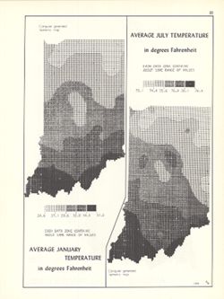
- Subject:
- Topical Subject: SYMAP (Computer program language), Topical Subject: Atmospheric temperature, and Geographic Subject: Indiana
- Creator:
- Kingsbury, Robert C.
- Publisher:
- Indiana University. Department of Geography
- Date Created:
- 1970
- Identifier:
- VAC3073-M-01021
- Genre:
- Thematic maps
- Geographic Location:
- Coordinates: W0880700 W0844500 N0414500 N0374600
- Related URL:
- Catalog URL: https://iucat.iu.edu/catalog/15995455
- Abstract:
- 2 maps on 1 sheet, Average January temperature in degrees Fahrenheit and Average July temperature in degrees Fahrenheit. Computer generated isometric maps ob...
- Call Number:
- G4091.C82 1970 .K57
- Caption:
- Imprint: Bloomington, Indiana : Department of Geography, Indiana University, [1970]
- Physical Description:
- Dimensions: each 26 x 10 cm, on sheet 28 x 21 cm and Scale: Approximately 1:3,000,000
- Alternate Identifier:
- Title Control Number: a15995455 and Alternate ID: 317383IP
- Persistent URL:
- https://purl.dlib.indiana.edu/iudl/images/VAC3073/VAC3073-M-01021
- Provenance:
- An atlas of Indiana / by Robert C. Kingsbury [1970].
-
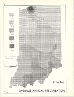
- Subject:
- Topical Subject: Rain and rainfall, Topical Subject: SYMAP (Computer program language), and Geographic Subject: Indiana
- Creator:
- Kingsbury, Robert C. and Indiana University. Research Computing Center
- Publisher:
- Indiana University. Department of Geography
- Date Created:
- 1970
- Identifier:
- VAC3073-M-00141
- Genre:
- Thematic maps
- Geographic Location:
- Coordinates: W0880700 W0844500 N0414500 N0374600
- Related URL:
- Catalog URL: https://iucat.iu.edu/catalog/15995731
- Abstract:
- Computer generated isometric map obtained through use of the facilities of Indiana University's Research Computer Center. ASCII-art map created using SYM...
- Call Number:
- G4091.C883 1970 .K56
- Caption:
- Imprint: Bloomington, Indiana : Department of Geography, Indiana University, [1970]
- Physical Description:
- Dimensions: 26 x 18 cm and Scale: Approximately 1:1,950,000
- Alternate Identifier:
- Title Control Number: a15995731 and Alternate ID: 317383IP
- Persistent URL:
- https://purl.dlib.indiana.edu/iudl/images/VAC3073/VAC3073-M-00141
- Provenance:
- An atlas of Indiana / by Robert C. Kingsbury [1970].
-
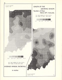
- Subject:
- Geographic Subject: Indiana, Topical Subject: SYMAP (Computer program language), Topical Subject: Phytogeography, and Topical Subject: Snow
- Creator:
- Kingsbury, Robert C. and Indiana University. Research Computing Center
- Publisher:
- Indiana University. Department of Geography
- Date Created:
- 1970
- Identifier:
- VAC3073-M-00043
- Genre:
- Thematic maps
- Geographic Location:
- Coordinates: W0880700 W0844500 N0414500 N0374600
- Related URL:
- Catalog URL: https://iucat.iu.edu/catalog/15998435
- Abstract:
- 2 maps on 1 sheet, Average annual snowfall in inches and Length of the growing season: number of days above 32°F. annually. Computer generated isometric ...
- Call Number:
- G4091.C884 1970 .K56
- Caption:
- Imprint: Bloomington, Indiana : Department of Geography, Indiana University, [1970]
- Physical Description:
- Scale: Approximately 1:3,000,000 and Dimensions: each 26 x 10 cm, on sheet 28 x 21 cm
- Alternate Identifier:
- Alternate ID: 317383IP and Title Control Number: a15998435
- Persistent URL:
- https://purl.dlib.indiana.edu/iudl/images/VAC3073/VAC3073-M-00043
- Provenance:
- An atlas of Indiana / by Robert C. Kingsbury [1970].
-
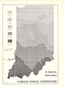
- Subject:
- Topical Subject: SYMAP (Computer program language), Geographic Subject: Indiana, and Topical Subject: Atmospheric temperature
- Creator:
- Indiana University. Research Computing Center and Kingsbury, Robert C.
- Publisher:
- Indiana University. Department of Geography
- Date Created:
- 1970
- Identifier:
- VAC3073-M-00805
- Genre:
- Thematic maps
- Geographic Location:
- Coordinates: W0880700 W0844500 N0414500 N0374600
- Related URL:
- Catalog URL: https://iucat.iu.edu/catalog/15995471
- Abstract:
- Computer generated isometric map obtained through use of the facilities of Indiana University's Research Computer Center. ASCII-art map created using SYM...
- Call Number:
- G4091.C82 1970 .K56
- Caption:
- Imprint: Bloomington, Indiana : Department of Geography, Indiana University, [1970]
- Physical Description:
- Dimensions: 26 x 18 cm and Scale: Approximately 1:1,950,000
- Alternate Identifier:
- Alternate ID: 317383IP and Title Control Number: a15995471
- Persistent URL:
- https://purl.dlib.indiana.edu/iudl/images/VAC3073/VAC3073-M-00805
- Provenance:
- An atlas of Indiana / by Robert C. Kingsbury [1970].
-
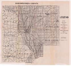
- Subject:
- Geographic Subject: Bartholomew County (Ind.) and Topical Subject: Soils
- Creator:
- Indiana. Department of Geology and Natural Resources
- Publisher:
- Indiana. Department of Geology and Natural Resources
- Date Created:
- 1912
- Identifier:
- VAC3073-M-01088
- Genre:
- Thematic maps
- Geographic Location:
- Coordinates: W0860508 W0854104 N0392100 N0390209
- Related URL:
- Catalog URL: https://iucat.iu.edu/catalog/16136919
- Abstract:
- Shows roads and railroads. Detached from: Soil survey of Bartholomew County / E.J. Quinn. In Thirty-sixth annual report of Department of Geology and Natur...
- Call Number:
- G4093.B3J3 1911 .I53
- Caption:
- Imprint: [Indianapolis] : [Department of Geology and Natural Resources], [1912] and Imprint: [Indianapolis] : [Wm. B. Burford], [1912]
- Physical Description:
- Dimensions: 40 x 41 cm, on sheet 44 x 49 cm and Scale: Approximately 1:85,000
- Alternate Identifier:
- Alternate ID: 390726IP and Title Control Number: a16136919
- Persistent URL:
- https://purl.dlib.indiana.edu/iudl/images/VAC3073/VAC3073-M-01088
- Provenance:
- 36th Annual Report (1911) / Indiana. Department of Geology and Natural Resources.
-
![Bartholomew County [Indiana] preliminary land use map](https://iiif.uits.iu.edu/iiif/2/05742t46j%2Ffiles%2Fd91da533-b380-4311-a36b-84729f4dd8f8/full/250,/0/default.jpg)
- Subject:
- Topical Subject: Land use and Geographic Subject: Bartholomew County (Ind.)
- Creator:
- Bartholomew County (Ind.). Land Use Planning Committee
- Publisher:
- Bartholomew County (Ind.). Land Use Planning Committee
- Date Created:
- 1941
- Identifier:
- VAC3073-M-00100
- Genre:
- Maps
- Geographic Location:
- Coordinates: W0860009 W0854554 N0391818 N0390254
- Related URL:
- Catalog URL: https://iucat.iu.edu/catalog/4989660
- Abstract:
- Includes chart showing type of land use, acreage, and recommended use.
- Call Number:
- G4093.B3G4 1941 .B37
- Caption:
- Imprint: [Columbus, Ind.?] : The Committee, [between 1941-1946?]
- Physical Description:
- Scale: Scale not given. and Dimensions: 20 x 21 cm, on sheet 39 x 28 cm
- Alternate Identifier:
- Title Control Number: a4989660
- Persistent URL:
- https://purl.dlib.indiana.edu/iudl/images/VAC3073/VAC3073-M-00100
-
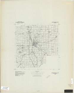
- Subject:
- Geographic Subject: Bartholomew County (Ind.)
- Creator:
- Geological Survey (U.S.)
- Publisher:
- The Survey
- Date Created:
- 1978
- Identifier:
- VAC3073-M-00963
- Genre:
- Maps
- Geographic Location:
- Coordinates: W0860530 W0854030 N0392130 N0390130
- Related URL:
- Catalog URL: https://iucat.iu.edu/catalog/5359792
- Abstract:
- Black line print. "Advance composite, subject to correction." "1978."
- Call Number:
- G4093.B3 1978 .G4
- Caption:
- Imprint: [Reston, Va.] : The Survey, [1978?]
- Physical Description:
- Dimensions: 37 x 37 cm and Scale: 1:100,000
- Alternate Identifier:
- Title Control Number: a5359792
- Persistent URL:
- https://purl.dlib.indiana.edu/iudl/images/VAC3073/VAC3073-M-00963
-
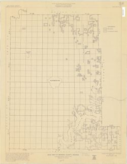
- Subject:
- Geographic Subject: Monroe County (Ind.)
- Creator:
- Moran, W. H. (William H.)
- Publisher:
- The Survey
- Date Created:
- 1968
- Identifier:
- VAC3073-M-00999
- Genre:
- Outline maps
- Geographic Location:
- Coordinates: W0864100 W0861900 N0392100 N0390000
- Related URL:
- Catalog URL: https://iucat.iu.edu/catalog/5303538
- Abstract:
- Blue line map. "May 1, 1951, revised January 1, 1968." Shows township and range numbers, section boundaries without numbers, State and National Fo...
- Call Number:
- G4093.M7A1 1968 .M67
- Caption:
- Imprint: [Bloomington, Ind.?] : The Survey, 1968.
- Physical Description:
- Dimensions: 67 x 53 cm and Scale: 1:63,360
- Alternate Identifier:
- Title Control Number: a5303538
- Persistent URL:
- https://purl.dlib.indiana.edu/iudl/images/VAC3073/VAC3073-M-00999
-
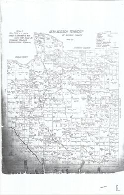
- Subject:
- Topical Subject: Real property, Topical Subject: Landowners, and Geographic Subject: Bean Blossom (Monroe County, Ind. : Township)
- Creator:
- Stevens, Katherine (Mapmaker)
- Publisher:
- Stevens, Katherine (Mapmaker)
- Date Created:
- 1939
- Identifier:
- VAC3073-M-01520
- Genre:
- Cadastral maps
- Geographic Location:
- Coordinates: W0864107 W0863429 N0392125 N0391505
- Related URL:
- Catalog URL: https://iucat.iu.edu/catalog/18408228
- Abstract:
- Made by Katherine Stevens. Title in lower right corner: Plat #1, Bean Blossom Twp. Shows roads, creeks, railroads, churches, cemeteries, schools, and owner n...
- Call Number:
- G4093.M7G46 1939 .S74 Bean Blossom
- Caption:
- Imprint: Bloomington, Indiana : Katherine Stevens, [1939]
- Physical Description:
- Scale: Approximately 1:18,000. 1,500 feet = 1 inch and Dimensions: on sheet 92 x 59 cm
- Alternate Identifier:
- Title Control Number: a18408228
- Persistent URL:
- https://purl.dlib.indiana.edu/iudl/images/VAC3073/VAC3073-M-01520
- Provenance:
- Katherine Stevens. Township maps of Monroe County, Indiana, [1939]
-
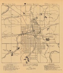
- Subject:
- Geographic Subject: Lawrence County (Ind.), Topical Subject: Stone-cutting, Topical Subject: Limestone industry, Geographic Subject: Bedford (Ind.), and Topi...
- Creator:
- Blatchley, Raymond S. (Raymond Sillliman)
- Publisher:
- Indiana. Department of Geology and Natural Resources
- Date Created:
- 1908
- Identifier:
- VAC3073-M-00628
- Genre:
- Road maps and Thematic maps
- Geographic Location:
- Coordinates: W0863134 W0862736 N0385324 N0385042
- Related URL:
- Catalog URL: https://iucat.iu.edu/catalog/18299189
- Abstract:
- "The 15 etching maps of the individual quarries or quarry districts, have been written and prepared by Raymond S. Blatchley from data gathered by him pe...
- Call Number:
- G4094.B3M2 1907 .B53
- Caption:
- Imprint: [Indianapolis] : [Indiana Department of Geology and Natural Resources], [1908]
- Physical Description:
- Dimensions: 23 x 20 cm and Scale: Scale not given.
- Alternate Identifier:
- Alternate ID: 390726IP and Title Control Number: a18299189
- Persistent URL:
- https://purl.dlib.indiana.edu/iudl/images/VAC3073/VAC3073-M-00628
- Provenance:
- 32nd Annual Report (1907) / Indiana. Department of Geology and Natural Resources.
-
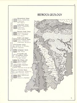
- Subject:
- Topical Subject: Geology, Geographic Subject: Indiana, and Topical Subject: Geology, Structural
- Creator:
- Hollingsworth, John M. and Kingsbury, Robert C.
- Publisher:
- Indiana University. Department of Geography
- Date Created:
- 1970
- Identifier:
- VAC3073-M-00305
- Genre:
- Geological maps
- Geographic Location:
- Coordinates: W0880700 W0844500 N0414500 N0374600
- Related URL:
- Catalog URL: https://iucat.iu.edu/catalog/15939159
- Abstract:
- Includes geological time table. Detached from: An atlas of Indiana / by Robert C. Kingsbury , with contributions from John M. Hollingsworth and others. Bl...
- Call Number:
- G4091.C5 1970 .K57
- Caption:
- Imprint: Bloomington, Indiana : Department of Geography, Indiana University, [1970]
- Physical Description:
- Dimensions: 26 x 18 cm, on sheet 28 x 21 cm and Scale: Approximately 1:2,150,000
- Alternate Identifier:
- Title Control Number: a15939159 and Alternate ID: 317383IP
- Persistent URL:
- https://purl.dlib.indiana.edu/iudl/images/VAC3073/VAC3073-M-00305
- Provenance:
- An atlas of Indiana / by Robert C. Kingsbury [1970].
-
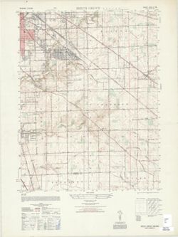
- Subject:
- Geographic Subject: Marion County (Ind.) and Geographic Subject: Beech Grove (Marion County, Ind.)
- Creator:
- Geological Survey (U.S.) and United States. Army Map Service
- Publisher:
- United States. Army Map Service
- Date Created:
- 1948
- Identifier:
- VAC3073-M-01421
- Genre:
- 7.5 minute topographic maps, Quadrangle maps, and Topographic maps
- Geographic Location:
- Coordinates: W0860730 W0860000 N0394500 N0393730
- Related URL:
- Catalog URL: https://iucat.iu.edu/catalog/18375873
- Abstract:
- Prepared under the direction of the Chief of Engineers by the Army Map Service (AM), Corps of Engineers, Department of the Army , original map compiled by US...
- Call Number:
- G4090 s25 .U5 Beech Grove 1948 V
- Caption:
- Imprint: Washington, D.C. : Army Map Service, Corps of Engineers, Department of the Army, 1948.
- Physical Description:
- Dimensions: 56 x 45 cm or smaller and Scale: 1:25,000
- Alternate Identifier:
- Title Control Number: a18375873
- Persistent URL:
- https://purl.dlib.indiana.edu/iudl/images/VAC3073/VAC3073-M-01421
- Provenance:
- Part of United States. Army Map Service, Indiana 1:25,000.
-
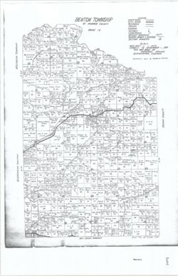
- Subject:
- Geographic Subject: Benton (Monroe County, Ind. : Township), Topical Subject: Real property, and Topical Subject: Landowners
- Creator:
- Stevens, Katherine (Mapmaker)
- Publisher:
- Stevens, Katherine (Mapmaker)
- Date Created:
- 1939
- Identifier:
- VAC3073-M-01522
- Genre:
- Cadastral maps
- Geographic Location:
- Coordinates: W0862745 W0862213 N0392024 N0391624
- Related URL:
- Catalog URL: https://iucat.iu.edu/catalog/18409337
- Abstract:
- Made by Katherine Stevens. Title in lower right corner: Plat #6, Benton Twp. Shows roads, creeks, railroads, churches, cemeteries, schools, and owner names w...
- Call Number:
- G4093.M7G46 1939 .S74 Benton
- Caption:
- Imprint: Bloomington, Indiana : Katherine Stevens, [1939]
- Physical Description:
- Dimensions: on sheet 92 x 59 cm and Scale: Approximately 1:18,000. 1,500 feet = 1 inch
- Alternate Identifier:
- Title Control Number: a18409337
- Persistent URL:
- https://purl.dlib.indiana.edu/iudl/images/VAC3073/VAC3073-M-01522
- Provenance:
- Katherine Stevens. Township maps of Monroe County, Indiana, [1939]
-
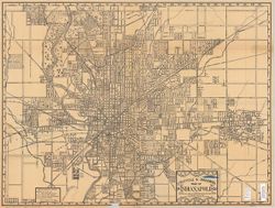
- Subject:
- Topical Subject: Roads and Geographic Subject: Indianapolis (Ind.)
- Creator:
- Dessecker, Fred
- Publisher:
- Topographical Map & Survey Co.
- Date Created:
- 1899
- Identifier:
- VAC3073-M-00939
- Genre:
- Road maps
- Geographic Location:
- Coordinates: W0861313 W0860443 N0394943 N0394349
- Related URL:
- Catalog URL: https://iucat.iu.edu/catalog/4682444
- Call Number:
- G4094.I4 1899 .D47
- Caption:
- Imprint: Indianapolis : Topographical Map and Survey Co., [1899]
- Physical Description:
- Scale: 1:20,750 and Dimensions: 52 x 69 cm
- Alternate Identifier:
- Title Control Number: CAU1720BB
- Persistent URL:
- https://purl.dlib.indiana.edu/iudl/images/VAC3073/VAC3073-M-00939
-
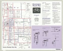
- Subject:
- Geographic Subject: Bloomington (Ind.) and Topical Subject: Bicycle trails
- Creator:
- Bloomington Bicycle & Pedestrian Safety Commission (Bloomington, Ind.)
- Publisher:
- Bloomington Bicycle & Pedestrian Safety Commission (Bloomington, Ind.)
- Date Created:
- 1998
- Identifier:
- VAC3073-M-00133
- Genre:
- Thematic maps
- Geographic Location:
- Coordinates: W0863135 W0863135 N0390955 N0390955
- Related URL:
- Catalog URL: https://iucat.iu.edu/catalog/1356301
- Abstract:
- Includes list of agencies to contact for further information and area bicycle shops. On verso: Downtown Bloomington bicycle map. Scale approximately 1:10,...
- Call Number:
- G4094.B5 E63 1998 .B56
- Caption:
- Imprint: [Bloomington, Indiana] : Bicycle and Pedestrian Safety Commission, 1998
- Physical Description:
- Scale: 1:36,000 and Dimensions: 38 x 42 cm, on sheet 44 x 53 cm
- Alternate Identifier:
- Title Control Number: ALM0430BB
- Persistent URL:
- https://purl.dlib.indiana.edu/iudl/images/VAC3073/VAC3073-M-00133
-
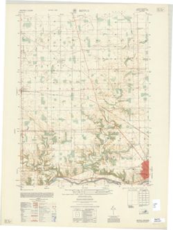
- Subject:
- Geographic Subject: Huntington County (Ind.)
- Creator:
- Geological Survey (U.S.) and United States. Army Map Service
- Publisher:
- United States. Army Map Service
- Date Created:
- 1959
- Identifier:
- VAC3073-M-01422
- Genre:
- 7.5 minute topographic maps, Quadrangle maps, and Topographic maps
- Geographic Location:
- Coordinates: W0853730 W0853000 N0410000 N0405230
- Related URL:
- Catalog URL: https://iucat.iu.edu/catalog/18375875
- Abstract:
- Prepared by the Army Map Service (GE), Corps of Engineers, U. S. Army, Washington D.C. , original map compiled by US Geological Survey. Alternate title: Ind...
- Call Number:
- G4090 s25 .U5 Bippus 1959 V
- Caption:
- Imprint: Washington, D.C. : Army Map Service, Corps of Engineers, 1959.
- Physical Description:
- Dimensions: 56 x 45 cm or smaller and Scale: 1:25,000
- Alternate Identifier:
- Title Control Number: a18375875
- Persistent URL:
- https://purl.dlib.indiana.edu/iudl/images/VAC3073/VAC3073-M-01422
- Provenance:
- Part of United States. Army Map Service, Indiana 1:25,000.
-
- Subject:
- Geographic Subject: New Harmony (Ind.)
- Creator:
- Whitwell, Stedman
- Publisher:
- Historic Urban Plans (Firm)
- Date Created:
- 1968
- Identifier:
- VAC3073-M-00297
- Genre:
- Thematic maps, Pictorial maps, and Aerial views
- Geographic Location:
- Coordinates: W0875635 W0875517 N0380804 N0380718
- Related URL:
- Catalog URL: https://iucat.iu.edu/catalog/7032359
- Abstract:
- Facsimile. "Reproduced...from the original in the Library of Congress." "This is number 15 of an edition limited to 500 copies." Perspect...
- Call Number:
- G4094.N45 A3 1825 .W5 1968
- Caption:
- Imprint: Ithaca, N.Y. : Ingrey & Madeley, 1825. and Imprint: [London]
- Physical Description:
- Dimensions: 29 x 60 cm and Scale: Not drawn to scale.
- Alternate Identifier:
- Title Control Number: a7032359
- Persistent URL:
- https://purl.dlib.indiana.edu/iudl/images/VAC3073/VAC3073-M-00297
-
- Subject:
- Geographic Subject: Fort Wayne (Ind.)
- Creator:
- Ruger, A.
- Publisher:
- Allen County-Fort Wayne Historical Society
- Date Created:
- 1868
- Identifier:
- VAC3073-M-00014
- Genre:
- Aerial views
- Geographic Location:
- Coordinates: W0851811 W0845955 N0411159 N0405755
- Related URL:
- Catalog URL: https://iucat.iu.edu/catalog/4891035
- Abstract:
- Bird's-eye view. Facsimile. Includes illustrations and index to points of interest.
- Call Number:
- G4094 .F7 A3 1868 .R8 1981
- Caption:
- Imprint: [Fort Wayne, Ind.?] : Allen County-Fort Wayne Historical Society, c1981.
- Physical Description:
- Dimensions: on sheet 59 x 89 cm and Scale: Scale not given.
- Alternate Identifier:
- Title Control Number: a4891035
- Persistent URL:
- https://purl.dlib.indiana.edu/iudl/images/VAC3073/VAC3073-M-00014
-
- Subject:
- Topical Subject: Election districts and Geographic Subject: Bloomington (Ind.)
- Creator:
- C.-M. Engineering
- Publisher:
- C.-M. Engineering
- Date Created:
- 1955
- Identifier:
- VAC3073-M-00795
- Genre:
- Thematic maps
- Geographic Location:
- Coordinates: W0863323 W0862823 N0391046 N0390854
- Related URL:
- Catalog URL: https://iucat.iu.edu/catalog/5300319
- Abstract:
- Blue line print. Appears to show election precincts within the Bloomington corporation limits. B-GEOMAP: Hand annotated in the spring of 1961 to show locat...
- Call Number:
- G4094.B5 F7 1955 .C175
- Caption:
- Imprint: Bloomington, Ind. : C.-M. Engineering, 1955.
- Physical Description:
- Scale: 1:3,500 and Dimensions: 103 x 132 cm
- Alternate Identifier:
- Title Control Number: a5300319
- Persistent URL:
- https://purl.dlib.indiana.edu/iudl/images/VAC3073/VAC3073-M-00795
-
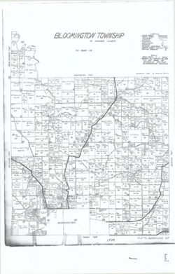
- Subject:
- Topical Subject: Real property, Topical Subject: Landowners, and Geographic Subject: Bloomington (Monroe County, Ind. : Township)
- Creator:
- Stevens, Katherine (Mapmaker)
- Publisher:
- Stevens, Katherine (Mapmaker)
- Date Created:
- 1939
- Identifier:
- VAC3073-M-01524
- Genre:
- Cadastral maps
- Geographic Location:
- Coordinates: W0863425 W0862735 N0391636 N0390950
- Related URL:
- Catalog URL: https://iucat.iu.edu/catalog/18408240
- Abstract:
- Made by Katherine Stevens. Title in lower right corner: Plat #5, Bloomington Twp. Shows roads, creeks, railroads, churches, cemeteries, schools, and owner na...
- Call Number:
- G4093.M7G46 1939 .S74 Bloomington
- Caption:
- Imprint: Bloomington, Indiana : Katherine Stevens, [1939]
- Physical Description:
- Dimensions: on sheet 92 x 59 cm and Scale: Approximately 1:18,000. 1,500 feet = 1 inch
- Alternate Identifier:
- Title Control Number: a18408240
- Persistent URL:
- https://purl.dlib.indiana.edu/iudl/images/VAC3073/VAC3073-M-01524
- Provenance:
- Katherine Stevens. Township maps of Monroe County, Indiana, [1939]
-
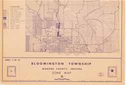
- Subject:
- Geographic Subject: Bloomington (Monroe County, Ind. : Township) and Topical Subject: Land use
- Creator:
- Schellie Associates
- Publisher:
- Schellie Associates
- Date Created:
- 1963
- Identifier:
- VAC3073-M-01100
- Genre:
- Thematic maps
- Geographic Location:
- Coordinates: W0863426 W0862744 N0391636 N0390951
- Related URL:
- Catalog URL: https://iucat.iu.edu/catalog/18409388
- Abstract:
- Prepared for the Monroe County Plan Commission by Kenneth L. Schellie & Associates. Includes locator and index maps. Sheet 2 of 14.
- Call Number:
- G4094.B52G4 1963 .S34
- Caption:
- Imprint: [Bloomington, Indiana] : Monroe County Plan Commission, 1963
- Physical Description:
- Dimensions: 107 x 80 cm, on sheet 144 x 105 cm and Scale: Approximately 1:12,152
- Alternate Identifier:
- Title Control Number: a18409388
- Persistent URL:
- https://purl.dlib.indiana.edu/iudl/images/VAC3073/VAC3073-M-01100
- Provenance:
- Schellie Associates. Monroe County Indiana, zone map. [Bloomington, Indiana] : Monroe County Plan Commission, 1963.
-
![Bloomington [stone mills and quarries]](https://iiif.uits.iu.edu/iiif/2/2z10xt541%2Ffiles%2Fe56b5fe6-690b-41df-b566-a4f36f32b932/full/250,/0/default.jpg)
- Subject:
- Topical Subject: IGS Annual Reports, Topical Subject: Abandoned quarries, Topical Subject: Limestone industry, Geographic Subject: Bloomington (Ind.), and To...
- Creator:
- Blatchley, Raymond S. (Raymond Sillliman)
- Publisher:
- Indiana. Department of Geology and Natural Resources
- Date Created:
- 1908
- Identifier:
- VAC3073-M-01006
- Genre:
- Thematic maps
- Geographic Location:
- Coordinates: W0863336 W0863018 N0391047 N0390805
- Related URL:
- Catalog URL: https://iucat.iu.edu/catalog/18298788
- Abstract:
- "The 15 etching maps of the individual quarries or quarry districts, have been written and prepared by Raymond S. Blatchley from data gathered by him pe...
- Call Number:
- G4094.B5 1907 .B53
- Caption:
- Imprint: [Indianapolis] : [Wm. B. Burford], [1908] and Imprint: [Indianapolis] : [Indiana Department of Geology and Natural Resources], [1908]
- Physical Description:
- Scale: Approximately 1:17,000 and Dimensions: 23 x 21 cm
- Alternate Identifier:
- Alternate ID: 390726IP and Title Control Number: a18298788
- Persistent URL:
- https://purl.dlib.indiana.edu/iudl/images/VAC3073/VAC3073-M-01006
- Provenance:
- 32nd Annual Report (1907) / Indiana. Department of Geology and Natural Resources.
-
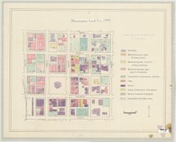
- Subject:
- Geographic Subject: Bloomington (Ind.) and Topical Subject: Land use
- Publisher:
- [publisher not identified}
- Date Created:
- 1978
- Identifier:
- VAC3073-M-00067
- Genre:
- Maps
- Geographic Location:
- Coordinates: W0863214 W0863151 N0391011 N0390955
- Related URL:
- Catalog URL: https://iucat.iu.edu/catalog/5300360
- Abstract:
- Shows the area from Morton Street on the west to Lincoln Street on the east, and Eighth Street on the north and Fourth Street on the South. Pen-and-ink ...
- Call Number:
- G4094.B5 G4 1978 .B5
- Caption:
- Imprint: [place of publication not identified] : [publisher not identified], [1978?]
- Physical Description:
- Dimensions: 52 x 68 cm and Scale: Approximately 1:1,200
- Alternate Identifier:
- Title Control Number: a5300360
- Persistent URL:
- https://purl.dlib.indiana.edu/iudl/images/VAC3073/VAC3073-M-00067
-
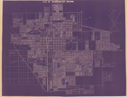
- Subject:
- Geographic Subject: Bloomington (Ind.)
- Date Created:
- 1948
- Identifier:
- VAC3073-M-01420
- Genre:
- Cadastral maps
- Persistent URL:
- https://purl.dlib.indiana.edu/iudl/images/VAC3073/VAC3073-M-01420
-
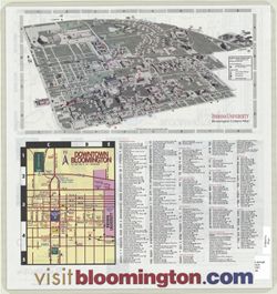
- Subject:
- Geographic Subject: Bloomington (Ind.), Geographic Subject: Indiana University, Bloomington, and Topical Subject: Indiana University, Bloomington
- Publisher:
- Bloomington/Monroe County Convention and Visitors Bureau
- Date Created:
- 2002
- Identifier:
- VAC3073-M-00961
- Genre:
- Tourist maps
- Geographic Location:
- Coordinates: W0863532 W0862816 N0391315 N0390716
- Related URL:
- Catalog URL: https://iucat.iu.edu/catalog/5325502
- Abstract:
- Includes distance map on map panel and indexes for the Bloomington and Indiana University, Bloomington campus maps. "Breakaway to Bloomington, Indian...
- Call Number:
- G4094.B5 E635 2002 .B5
- Caption:
- Imprint: [Bloomington, Ind.] : [Bloomington/Monroe County Convention and Visitors Bureau], [2002?]
- Physical Description:
- Dimensions: 46 x 43 cm and Scale: Scales differ.
- Alternate Identifier:
- Title Control Number: a5325502
- Persistent URL:
- https://purl.dlib.indiana.edu/iudl/images/VAC3073/VAC3073-M-00961
-
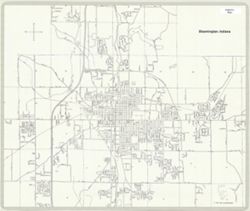
- Subject:
- Geographic Subject: Bloomington (Ind.)
- Creator:
- Bloomington (Ind.)
- Publisher:
- City of Bloomington
- Date Created:
- 1977
- Identifier:
- VAC3073-M-00261
- Genre:
- Maps
- Geographic Location:
- Coordinates: W0863534 W0862755 N0391256 N0390722
- Related URL:
- Catalog URL: https://iucat.iu.edu/catalog/5300465
- Call Number:
- G4094.B5 1977 .B5
- Caption:
- Imprint: [Bloomington, Ind.] : City of Bloomington, [1977]
- Physical Description:
- Dimensions: 42 x 51 cm and Scale: 1:24,000
- Alternate Identifier:
- Title Control Number: a5300465
- Persistent URL:
- https://purl.dlib.indiana.edu/iudl/images/VAC3073/VAC3073-M-00261
-
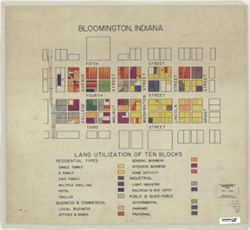
- Subject:
- Topical Subject: Land use and Geographic Subject: Bloomington (Ind.)
- Publisher:
- [publisher not identified]
- Date Created:
- 1950
- Identifier:
- VAC3073-M-00589
- Genre:
- Thematic maps
- Geographic Location:
- Coordinates: W0863206 W0863146 N0391000 N0390950
- Related URL:
- Catalog URL: https://iucat.iu.edu/catalog/5299843
- Abstract:
- Shows the area from the Monon Railroad on the west to Grant Street on the east, and from Fifth Street on the north to Third Street on the South. Pen-and-ink...
- Call Number:
- G4094.B5 G4 1950 .B5
- Caption:
- Imprint: [Place of publication not identified] : [publisher not identified], [195-?]
- Physical Description:
- Scale: Scale not given. and Dimensions: 47 x 52 cm
- Alternate Identifier:
- Title Control Number: a5299843
- Persistent URL:
- https://purl.dlib.indiana.edu/iudl/images/VAC3073/VAC3073-M-00589
-
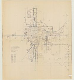
- Subject:
- Geographic Subject: Bloomington (Ind.), Geographic Subject: Monroe County (Ind.), and Topical Subject: Census districts
- Creator:
- United States. Bureau of the Census
- Publisher:
- United States. Bureau of the Census
- Date Created:
- 1974
- Identifier:
- VAC3073-M-00892
- Genre:
- Census data and Thematic maps
- Geographic Location:
- Coordinates: W0864108 W0861902 N0392120 N0385926
- Related URL:
- Catalog URL: https://iucat.iu.edu/catalog/5300402
- Abstract:
- Blue line print. Shows 1970 census enumeration districts and census tracts for Bloomington, Ind. "Traced from map no. 68-A-8776." "70-...
- Call Number:
- G4094.B5 E25 1970 .U5
- Caption:
- Imprint: [Jeffersonville, Ind.] : Bureau of the Census, [1974?]
- Physical Description:
- Dimensions: 120 x 107 cm and Scale: 1:1,500
- Alternate Identifier:
- Title Control Number: a5300402
- Persistent URL:
- https://purl.dlib.indiana.edu/iudl/images/VAC3073/VAC3073-M-00892
-
![Bloomington, [Indiana]](https://iiif.uits.iu.edu/iiif/2/6h441w28f%2Ffiles%2F9597588f-8e0d-4667-a5ed-dab455743986/full/250,/0/default.jpg)
- Subject:
- Geographic Subject: Bloomington (Ind.)
- Date Created:
- 1980
- Identifier:
- VAC3073-M-00038
- Genre:
- Maps
- Geographic Location:
- Coordinates: W0863532 W0862816 N0391315 N0390716
- Related URL:
- Catalog URL: https://iucat.iu.edu/catalog/5296319
- Abstract:
- Blue line map. Shows main roads and corporate boundaries.
- Call Number:
- G4094 .B5 1980 .B5
- Caption:
- Imprint: [Place of publication not identified] : [Publisher not identified], 198-?]
- Physical Description:
- Dimensions: 32 x 33 cm and Scale: Approximately 1:40,000
- Alternate Identifier:
- Title Control Number: a5296319
- Persistent URL:
- https://purl.dlib.indiana.edu/iudl/images/VAC3073/VAC3073-M-00038
-
![Bloomington, [Indiana] metropolitan map series](https://iiif.uits.iu.edu/iiif/2/vd66x2473%2Ffiles%2F73a8eae4-4788-4585-b937-b6e45ec91e24/full/250,/0/default.jpg)
- Subject:
- Geographic Subject: Bloomington Metropolitan Area (Ind.), Geographic Subject: Ellettsville (Ind.), Geographic Subject: Monroe County (Ind.), Geographic Subje...
- Creator:
- United States. Bureau of the Census. Geography Division
- Publisher:
- [publisher not identified]
- Date Created:
- 1967
- Identifier:
- VAC3073-M-00170
- Genre:
- Statistical maps, Thematic maps, and Census data
- Geographic Location:
- Coordinates: W0863904 W0860450 N0391839 N0390254
- Related URL:
- Catalog URL: https://iucat.iu.edu/catalog/5326785
- Abstract:
- Blue line print. "1020." "1980 census map." Shows census blocks for portions of Monroe County, Indiana, including Bloomington, Ellettsvi...
- Call Number:
- G4094.B5 E25 s19 .U5
- Caption:
- Imprint: [place of publication not identified : publisher not identified, 198-?]
- Physical Description:
- Scale: 1:19,000 and Dimensions: 37 x 57 cm
- Alternate Identifier:
- Title Control Number: a5326785
- Persistent URL:
- https://purl.dlib.indiana.edu/iudl/images/VAC3073/VAC3073-M-00170
-
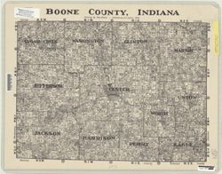
- Subject:
- Geographic Subject: Boone County (Ind.), Topical Subject: Landowners, and Topical Subject: Real property
- Creator:
- Martin, Chas.
- Publisher:
- E.C. Gullion
- Date Created:
- 1936
- Identifier:
- VAC3073-M-00796
- Genre:
- Maps and Cadastral maps
- Geographic Location:
- Coordinates: W0864144 W0861423 N0401050 N0395521
- Related URL:
- Catalog URL: https://iucat.iu.edu/catalog/5541235
- Abstract:
- Cadastral map showing landowners.
- Call Number:
- G4093.B6G46 1936 .M37
- Caption:
- Imprint: [Indiana?] : E.C. Gullion, 1936.
- Physical Description:
- Scale: Scale not given. and Dimensions: 43 x 56 cm
- Alternate Identifier:
- Title Control Number: a5541235
- Persistent URL:
- https://purl.dlib.indiana.edu/iudl/images/VAC3073/VAC3073-M-00796
-
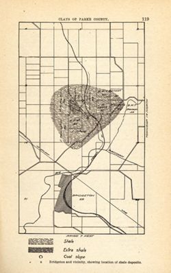
- Subject:
- Geographic Subject: Bridgeton Region (Ind.), Topical Subject: Mines and mineral resources, Geographic Subject: Parke County (Ind.), Topical Subject: IGS Annu...
- Publisher:
- Indiana. Department of Geology and Natural Resources
- Date Created:
- 1905
- Identifier:
- VAC3073-M-01585
- Genre:
- Geological maps
- Geographic Location:
- Coordinates: W0871115 W0870900 N0394130 N0393800
- Related URL:
- Catalog URL: https://iucat.iu.edu/catalog/18279221
- Abstract:
- Shows location of shale, extra shale, and coal slope. "Clays of Parke County." Detached from: The clays and clay industries of Indiana / W. S. B...
- Call Number:
- G4093.P2H5 1904 .B75
- Caption:
- Imprint: [Indianapolis] : [Indiana Department of Geology and Natural Resources], [1905] and Imprint: [Indianapolis] : [Wm. B. Burford], [1905]
- Physical Description:
- Scale: Scale not given. and Dimensions: on sheet 22 x 14 cm
- Alternate Identifier:
- Alternate ID: 390726IP and Title Control Number: a18279221
- Persistent URL:
- https://purl.dlib.indiana.edu/iudl/images/VAC3073/VAC3073-M-01585
- Provenance:
- 29th Annual Report (1904) / Indiana. Department of Geology and Natural Resources.
-
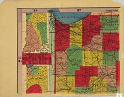
- Subject:
- Geographic Subject: Indiana
- Creator:
- Bridgman, E. C.
- Publisher:
- Bridgman, E. C.
- Date Created:
- 1894
- Identifier:
- VAC3073-M-00696
- Genre:
- Maps
- Geographic Location:
- Coordinates: W0880700 W0844500 N0414500 N0375200
- Related URL:
- Catalog URL: https://iucat.iu.edu/catalog/4659467
- Abstract:
- Shows counties, townships, sections and railroads. Prime meridians: Greenwich and Washington. Includes "Geological map of Indiana" , List of territ...
- Call Number:
- G4090 1894 .B75
- Caption:
- Imprint: New York : E. C. Bridgman, [1894]
- Physical Description:
- Dimensions: 181 x 137 cm, on sheets 71 x 92 cm and Scale: 1:264,000
- Alternate Identifier:
- Title Control Number: CAF4140BB
- Persistent URL:
- https://purl.dlib.indiana.edu/iudl/images/VAC3073/VAC3073-M-00696
-
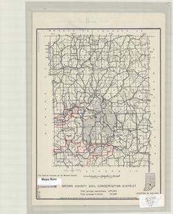
- Subject:
- Geographic Subject: Brown County (Ind.)
- Creator:
- United States. Soil Conservation Service. Region 3. Cartographic Division
- Publisher:
- United States. Soil Conservation Service
- Date Created:
- 1953
- Identifier:
- VAC3073-M-00108
- Genre:
- Maps
- Geographic Location:
- Coordinates: W0862300 W0860500 N0392100 N0390300
- Related URL:
- Catalog URL: https://iucat.iu.edu/catalog/4991440
- Abstract:
- "The District includes all of Brown County.", "6-1-53, 3-N-34,465."
- Call Number:
- G4093.B7 1953 .U5
- Caption:
- Imprint: Milwaukee : Soil Conservation Service, 1953.
- Physical Description:
- Dimensions: 32 x 24 cm and Scale: 1:140,000
- Alternate Identifier:
- Title Control Number: a4991440
- Persistent URL:
- https://purl.dlib.indiana.edu/iudl/images/VAC3073/VAC3073-M-00108
-
- Subject:
- Topical Subject: Soils and Geographic Subject: Brown County (Ind.)
- Creator:
- Indiana. Department of Geology and Natural Resources
- Publisher:
- Indiana. Department of Geology and Natural Resources
- Date Created:
- 1908
- Identifier:
- VAC3073-M-01149
- Genre:
- Thematic maps
- Geographic Location:
- Coordinates: W0862253 W0860444 N0392039 N0390254
- Related URL:
- Catalog URL: https://iucat.iu.edu/catalog/16095832
- Abstract:
- Shows railroads, dirt roads, improved roads, and schools. Detached from: Soil survey of Monroe, Brown, Lawrence, Martin, Orange, Washington, and Jackson c...
- Call Number:
- G4093.B6J3 1907 .I53
- Caption:
- Imprint: [Indianapolis] : [Indiana Dept. of Geology and Natural Resources], [1908]
- Physical Description:
- Dimensions: 26 x 20 cm and Scale: Approximately 1:126,720
- Alternate Identifier:
- Alternate ID: 390726IP and Title Control Number: a16095832
- Persistent URL:
- https://purl.dlib.indiana.edu/iudl/images/VAC3073/VAC3073-M-01149
- Provenance:
- 32nd Annual Report (1907) / Indiana. Department of Geology and Natural Resources.
-
![Brownstown, Ind. [Advance printing]](https://iiif.uits.iu.edu/iiif/2/fq978z86j%2Ffiles%2F6b5e8117-5baf-46e5-8738-ef13b3b78fc6/full/250,/0/default.jpg)
- Subject:
- Geographic Subject: Jackson County (Ind.) and Geographic Subject: Washington County (Ind.)
- Creator:
- EROS Data Center and Mannello, L. R. (Leonard R.)
- Publisher:
- EROS Data Center
- Date Created:
- 1958
- Identifier:
- VAC3073-M-01446
- Genre:
- Topographic maps, 7.5 minute topographic maps, and Quadrangle maps
- Geographic Location:
- Coordinates: W0860730 W0860000 N0385230 N0384500
- Related URL:
- Catalog URL: https://iucat.iu.edu/catalog/18422458
- Abstract:
- EDC , 461 edge worked by L. R. Mannello , 461 [and] 441 edge joined by L. R. Mannello. "EDC, C. Dickey 1958-09-15. ... Scribed by R. Mills." Topogr...
- Call Number:
- G4090 s24 .G4 Indiana 1958 ADV
- Caption:
- Imprint: [Indiana] : EDC, 1958-09-15
- Physical Description:
- Dimensions: on sheet 69 x 56 cm and Scale: 1:24,000
- Alternate Identifier:
- Title Control Number: a18422458
- Persistent URL:
- https://purl.dlib.indiana.edu/iudl/images/VAC3073/VAC3073-M-01446
-
- Subject:
- Geographic Subject: Lake County (Ind.), Geographic Subject: Calumet Region (Ill. and Ind.), Topical Subject: Landowners, Topical Subject: Real property, and ...
- Creator:
- F.L. Knight & Sons
- Publisher:
- F.L. Knight & Sons
- Date Created:
- 1906
- Identifier:
- VAC3073-M-00938
- Genre:
- Cadastral maps
- Geographic Location:
- Coordinates: W0873014 W0871640 N0414147 N0413236
- Related URL:
- Catalog URL: https://iucat.iu.edu/catalog/4896961
- Abstract:
- Cadastral map showing landowners.
- Call Number:
- G4093 .L3G46 1906 .F575
- Caption:
- Imprint: Crown Point, Ind. : F. L. Knight & Sons, 1906.
- Physical Description:
- Scale: 1:19,800 and Dimensions: 91 x 136 cm
- Alternate Identifier:
- Title Control Number: a4896961
- Persistent URL:
- https://purl.dlib.indiana.edu/iudl/images/VAC3073/VAC3073-M-00938
